|
| Exit 27 leaves Interstate 85 south just west of the Catawba River. An 18.7 mile route, NC 273 travels north from NC 279 at Lake Wylie through Belmont and Mount Holly to NC 16 Business at Lucia. 08/06/13 |
|
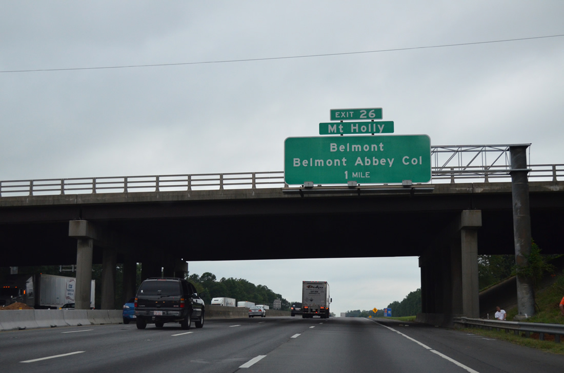
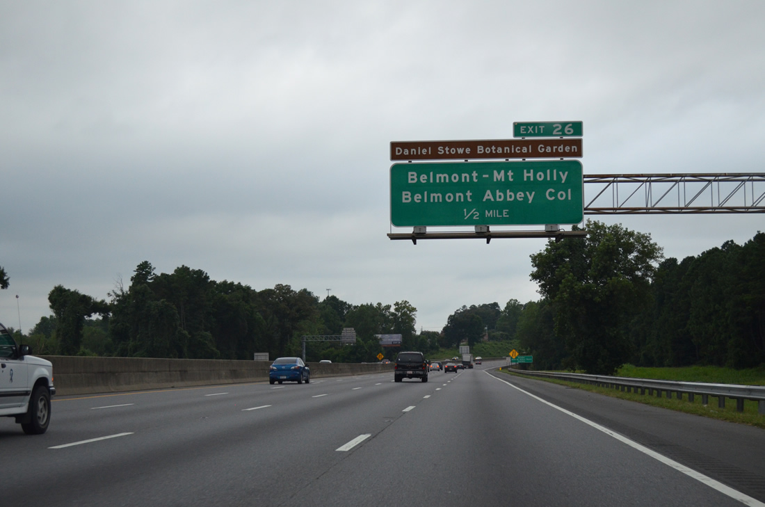
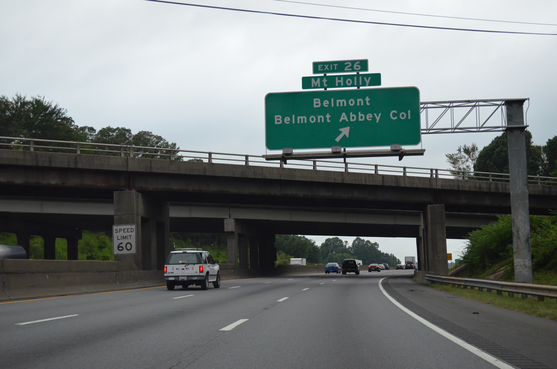
| Main Street branches southwest from NC 273 (Beatty Drive) to become Belmont-Mt. Holly Road (SR 2093) en route to Belmont-Abbey College and a folded diamond interchange (Exit 26) with I-85. 08/06/13 |
|
| NC 7, a former alignment of U.S. 74 through McAdenville, Lowell, Ranlo and Gastonia, ties into the south side of Exit 26 from N Main Street to McAdenville Road west. 08/06/13 |
|
| Exit 26 departs Interstate 85 south for Belmont-Mt. Holly Road (SR 2093) north and Main Street (NC 7) south. NC 7 follows Main Street south to Catawba Street east, with Main Street continuing south through Cramerton as Armstrong Ford Road (SR 2519) to NC 279 near Daniel Stowe Botanical Garden. 08/06/13 |
|
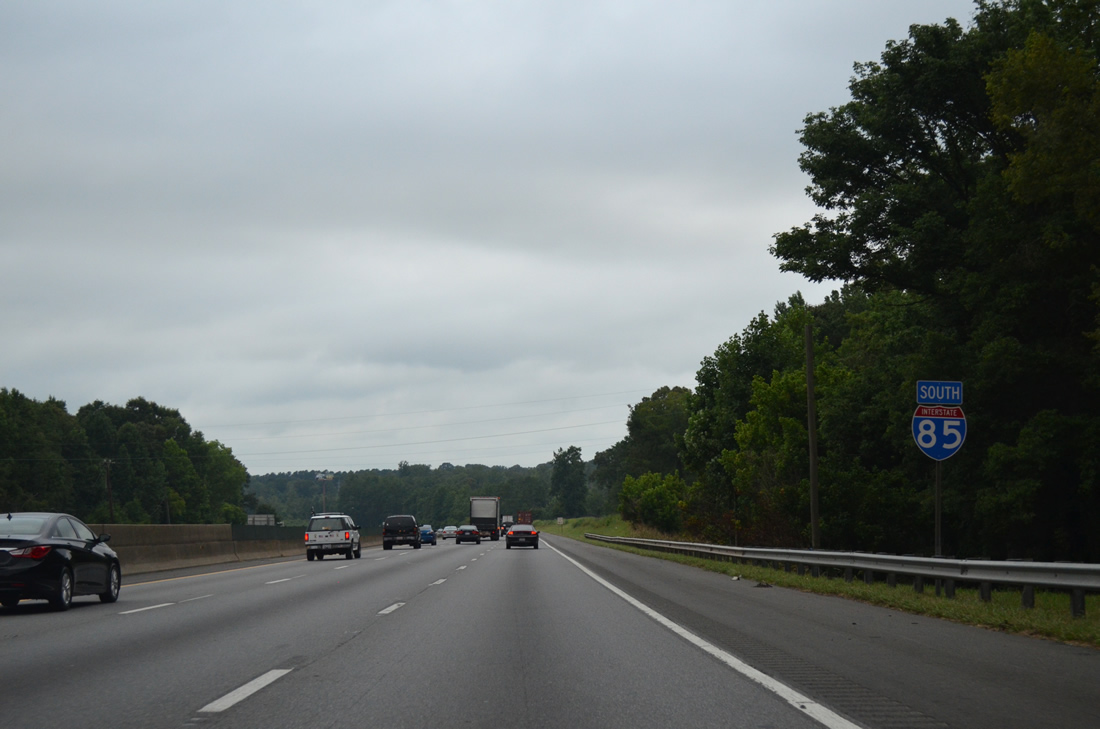
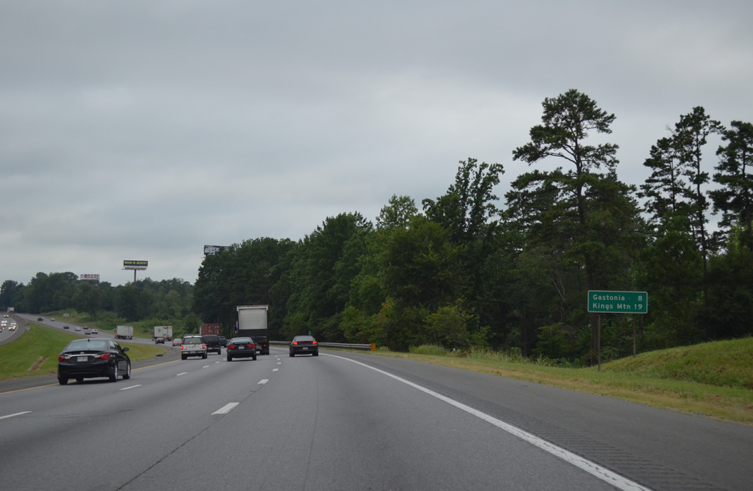
| Interstate 85 arcs northwest to northern reaches of McAdenville parallel to NC 7 (Riverside Drive). 08/06/12 |
|
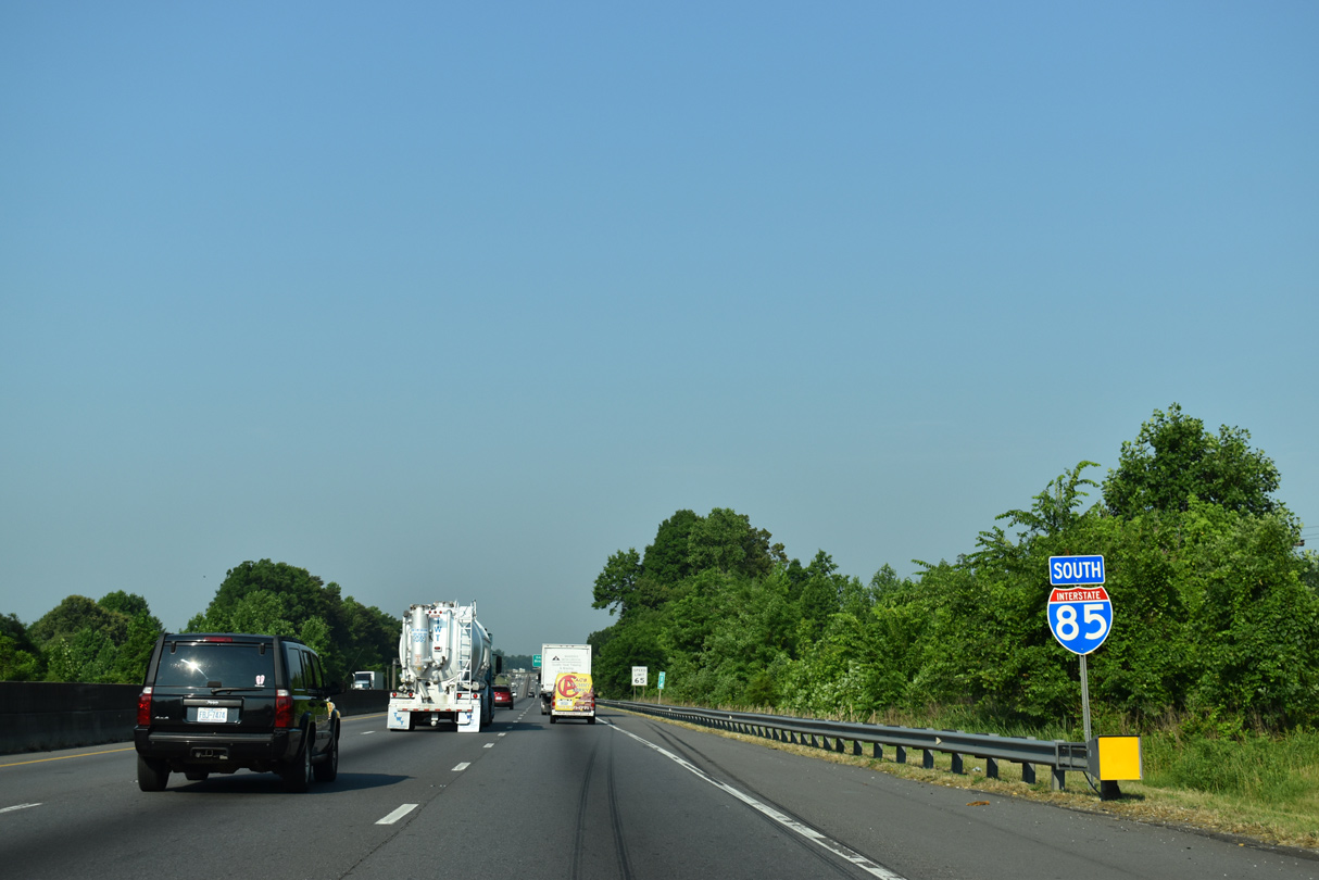
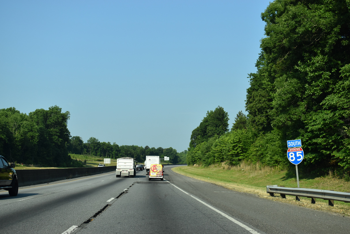
| Gastonia and Kings Mountain represent the final control cities along Interstate 85 southbound in North Carolina. 08/06/12 |
|
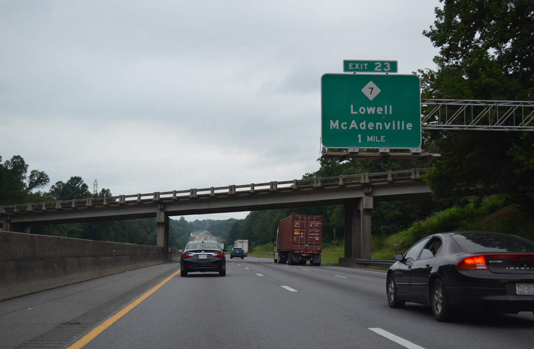
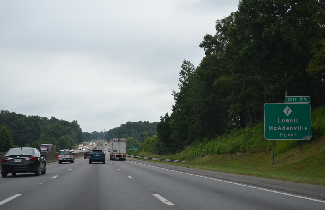
| Hickory Grove Road (SR 2000) passes over I-85 one mile east of the diamond interchange (Exit 23) with NC 7 (Main Street east / McAdenville Road west). 08/06/12 |
|
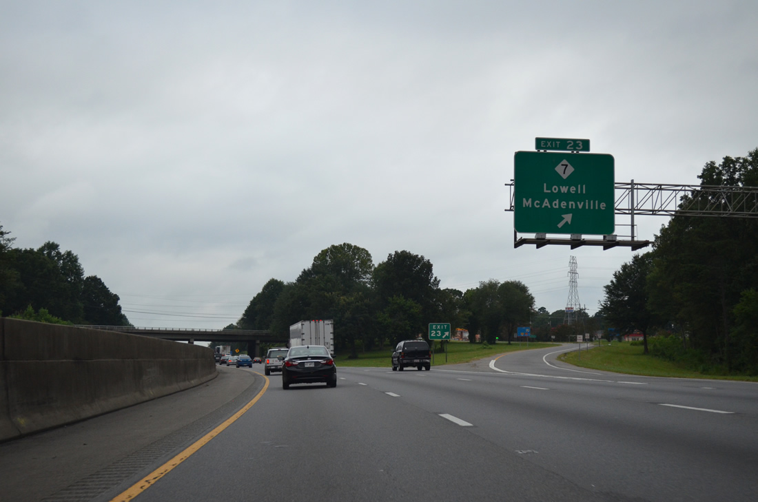
| I-85 spans the Catawba River South Fork a half mile from Exit 23. NC 7 meanders east along Main Street through the town of McAdenville and west to the Lowell city center. 08/06/13 |
|
| Southbound Interstate 85 at Exit 23 for NC 7 (McAdenville Road). NC 7 loops northward from Lowell to Ranlo before returning to I-85 at Exit 19. 08/06/13 |
|
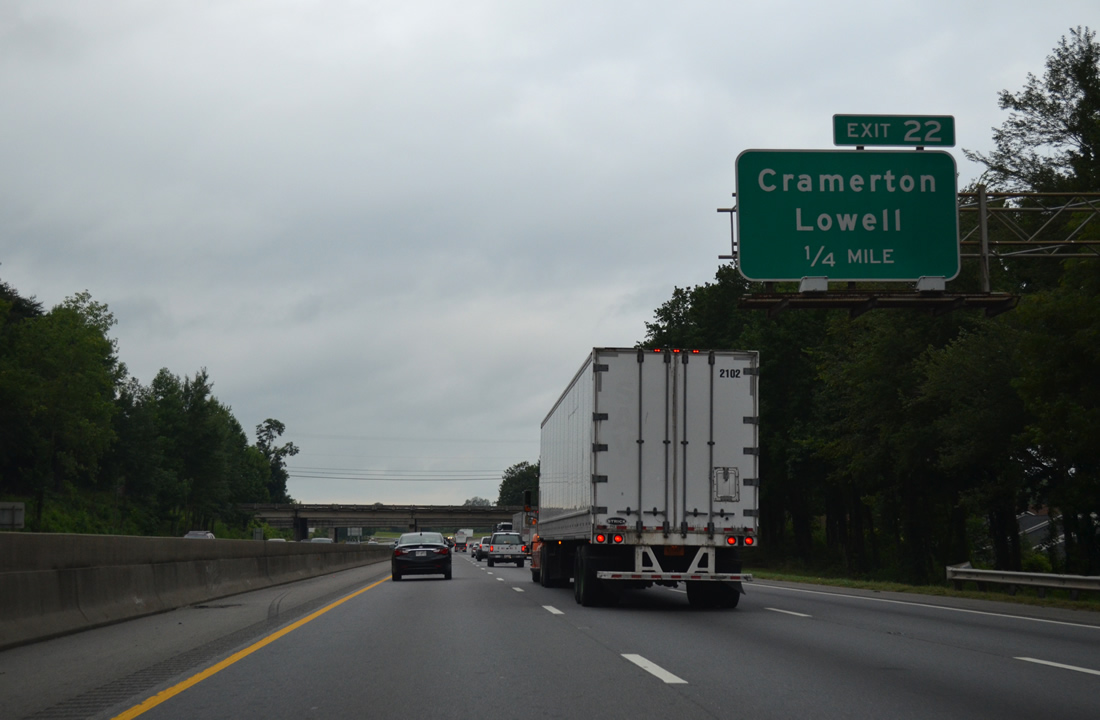
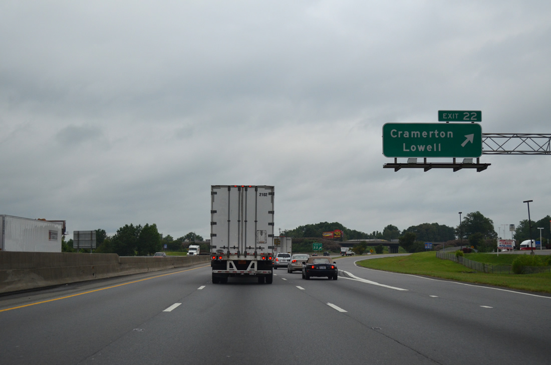
| Main Street (SR 2329) heads south from NC 7 (1st Street) to a folded diamond interchange (Exit 22) with Interstate 85. 08/06/13 |
|
| South from Exit 22, Main Street (SR 2329) becomes Redbud Drive at U.S. 29/74 (Franklin Boulevard). Redbud Drive continues through east Gastonia to NC 279 (New Hope Road) while U.S. 29/74 east connect I-85 with the town of Cramerton. 08/06/13 |
|
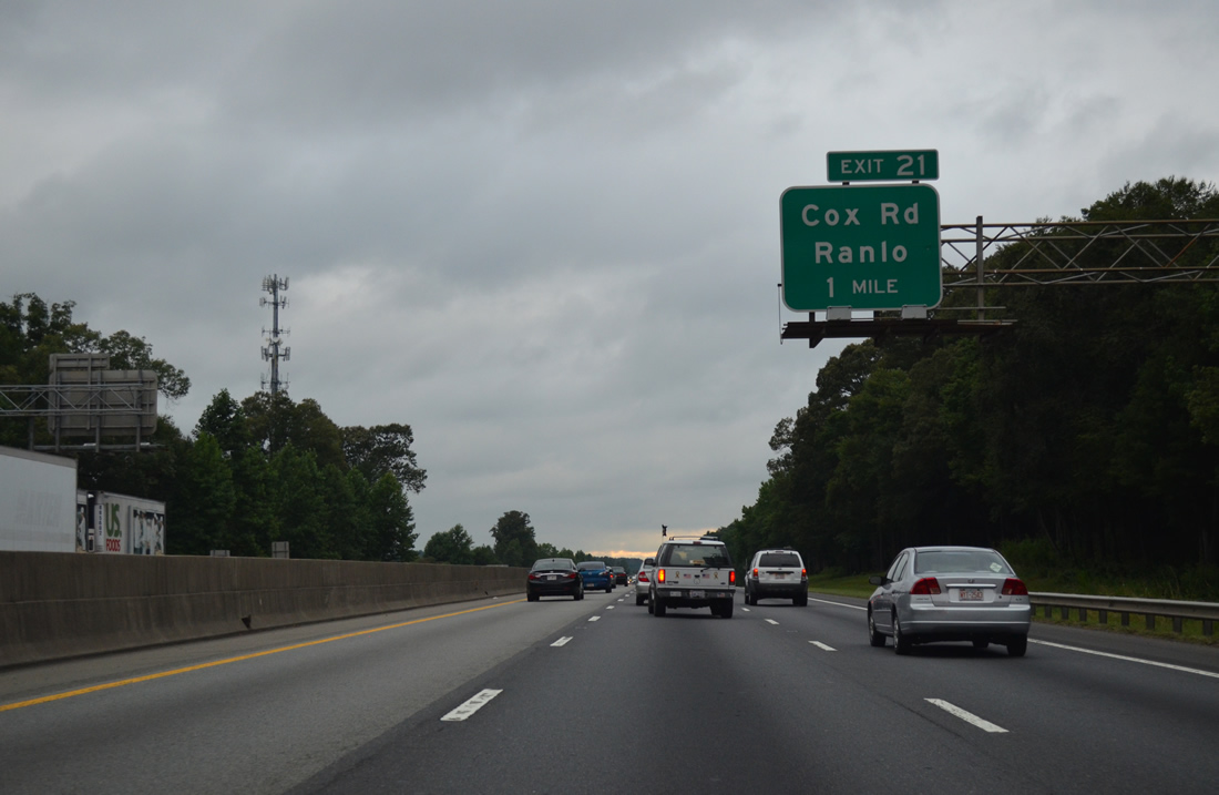
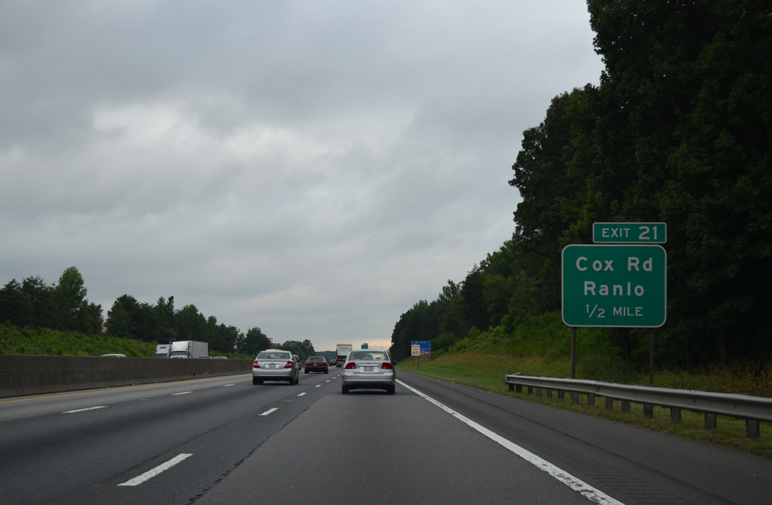
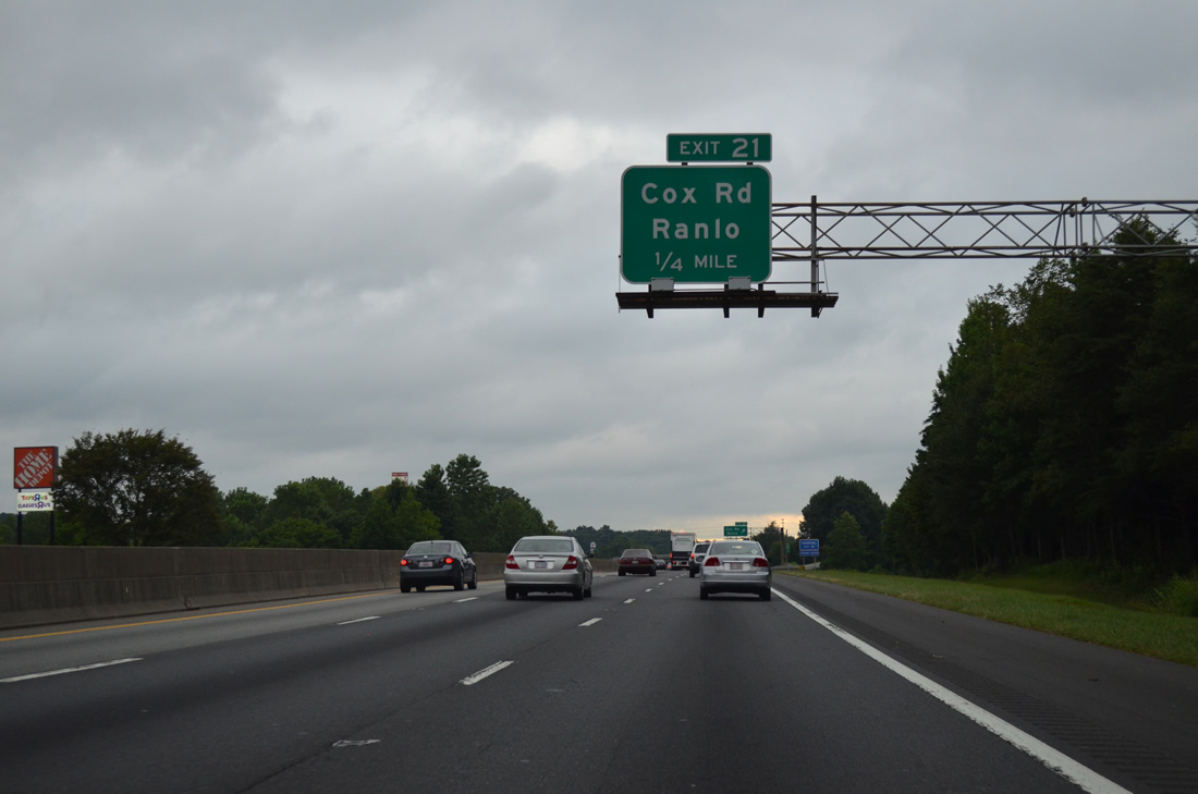
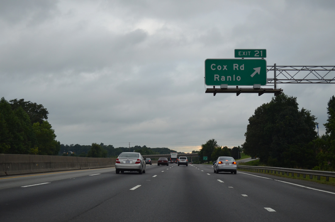
| The first of five interchanges within the city of Gastonia along Interstate 85 is Exit 21 with Cox Road (SR 2200). 08/06/13 |
|
| A diamond interchange joins I-85 with Cox Road at Exit 21. Cox Road (SR 2200) ventures north by Gaston Memorial Hospital to become Spencer Mountain Road through the adjacent city of Ranlo. 08/06/13 |
|
| Big box stores and other retail spread between parallel I-85 and U.S. 29/74 (Franklin Boulevard) to Cox Road (SR 2200) and Exit 21. 08/06/13 |
|
| Exit 21 leaves Interstate 85 south for Cox Road south to Armstrong Park Road (SR 2200) for Gardner Park and NC 279 (New Hope Road). 08/06/13 |
|
| Preceding Exit 20 to NC 279 (New Hope Road) is a former wye interchange that once served as a temporary end point for I-85 south onto parallel U.S. 29/74 (Franklin Boulevard). The old southbound ramp is part of Aberdeen Boulevard west from Cox Road to Eastgate Mall and Franklin Boulevard. 08/06/13 |
|
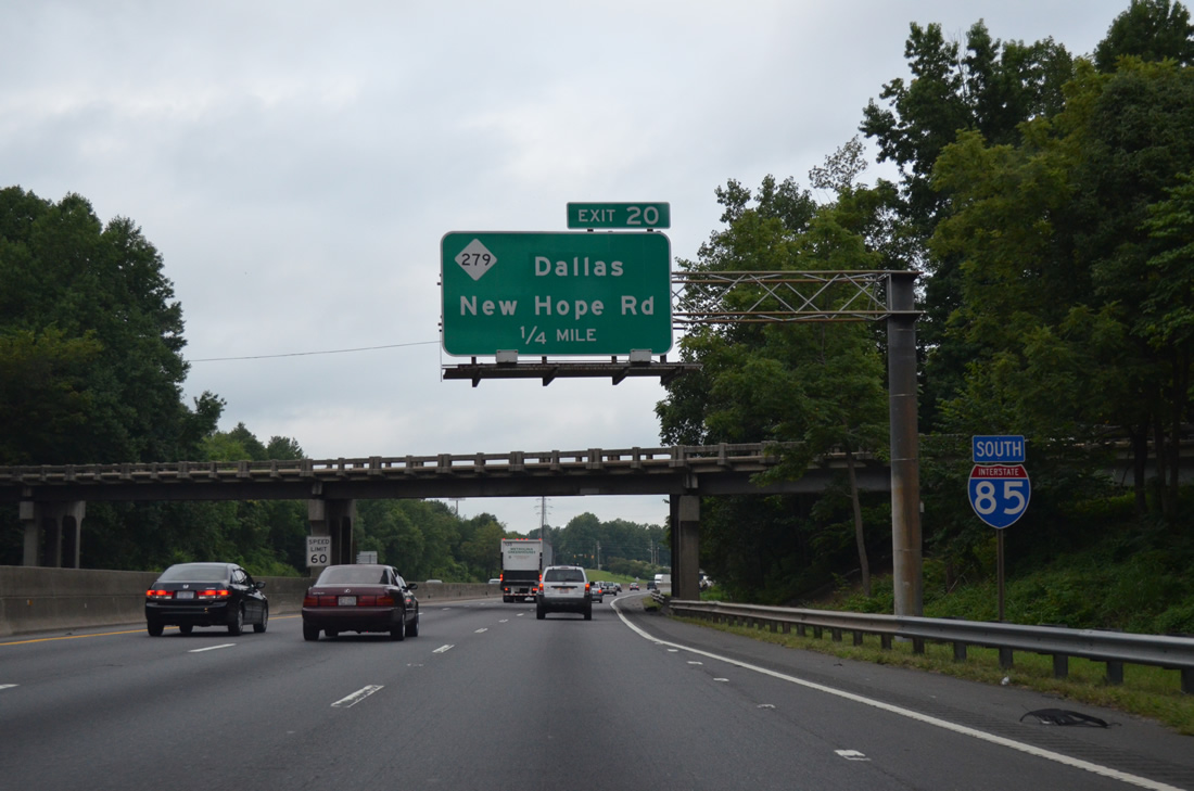
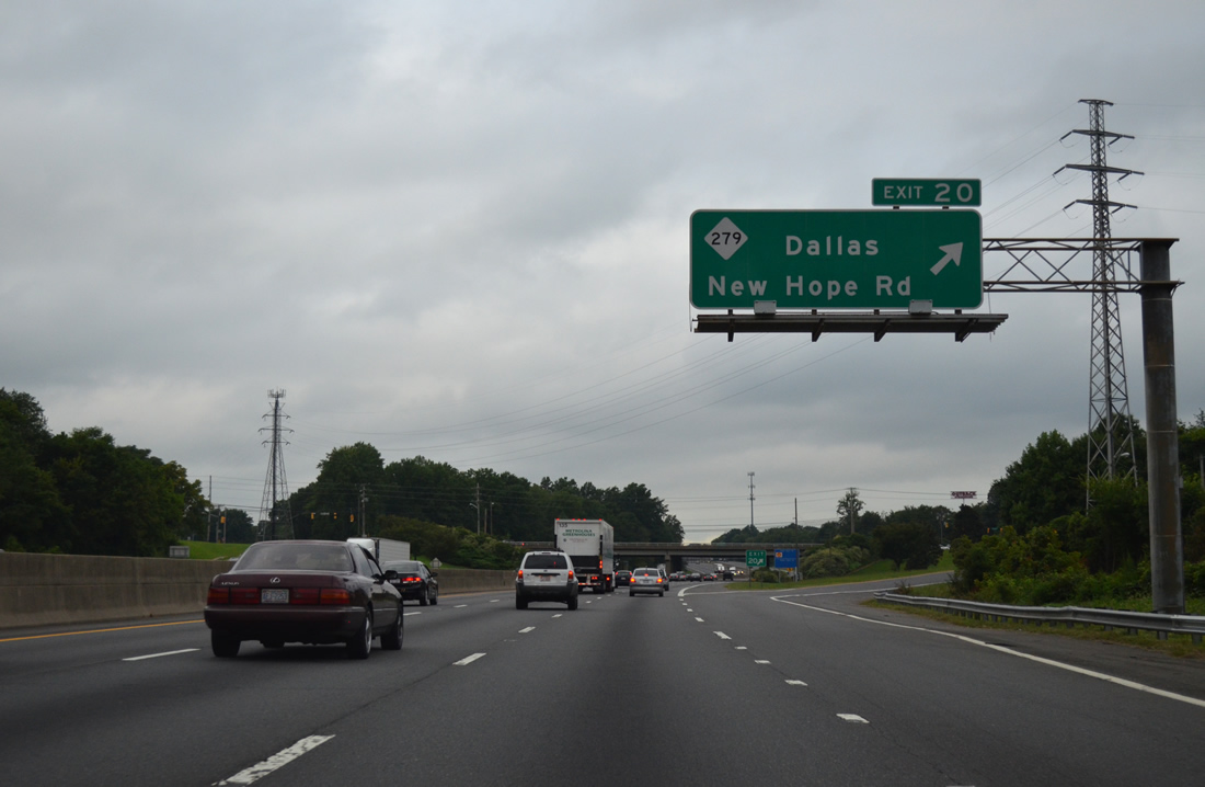
| Exit 20 leaves Interstate 85 south for NC 279 (New Hope Road). NC 279 travels 4.5 miles north to the town of Dallas and 11.4 miles south to S.C. 177 at Lake Wylie. 08/06/13 |
|
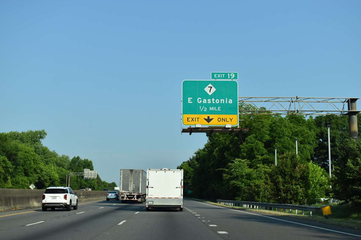
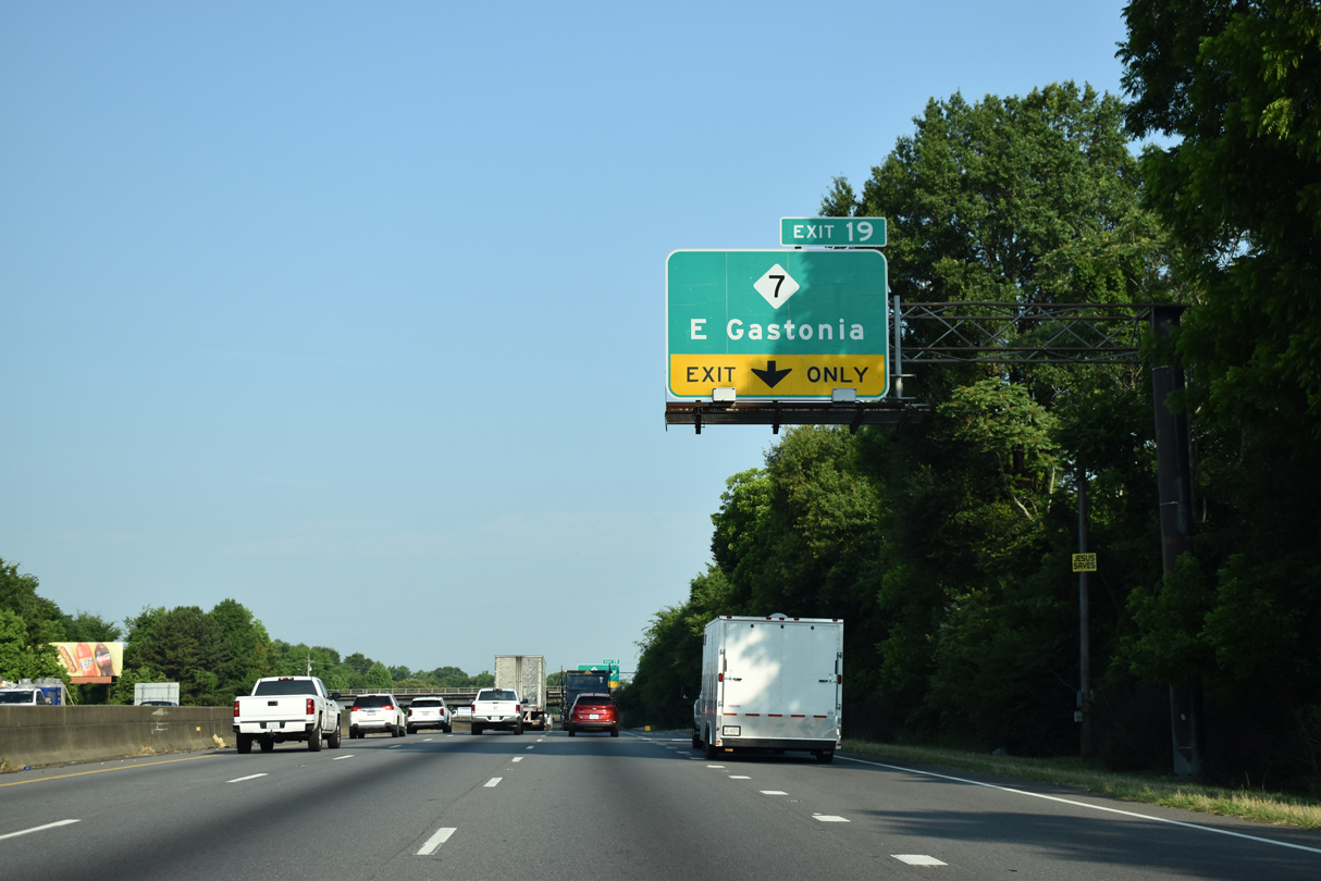
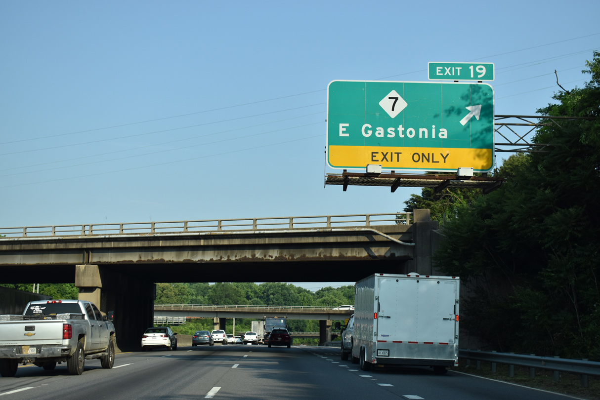
| NC 7 (Ozark Avenue) meets Interstate 85 for the third and final time at Exit 19. NC 7 meanders west from NC 279 (New Hope Road) to end at U.S. 321 (Chester Street) in Gastonia. 05/26/21 |
|
| Exit 19 joins Interstate 85 with NC 7 (Ozark Avenue) at a parclo B2 interchange in East Gastonia. NC 7 parallels a Norfolk Southern Railroad west into Downtown Gastonia along Long Avenue. 05/26/21 |
|
| Exit 19 leaves Interstate 85 south beyond the Norfolk-Southern Railroad and Ozark Avenue overpasses. NC 7 travels 12.1 miles overall. This stretch of I-85 was expanded from four to six lanes between 1999 and 2001. 05/26/21 |
|
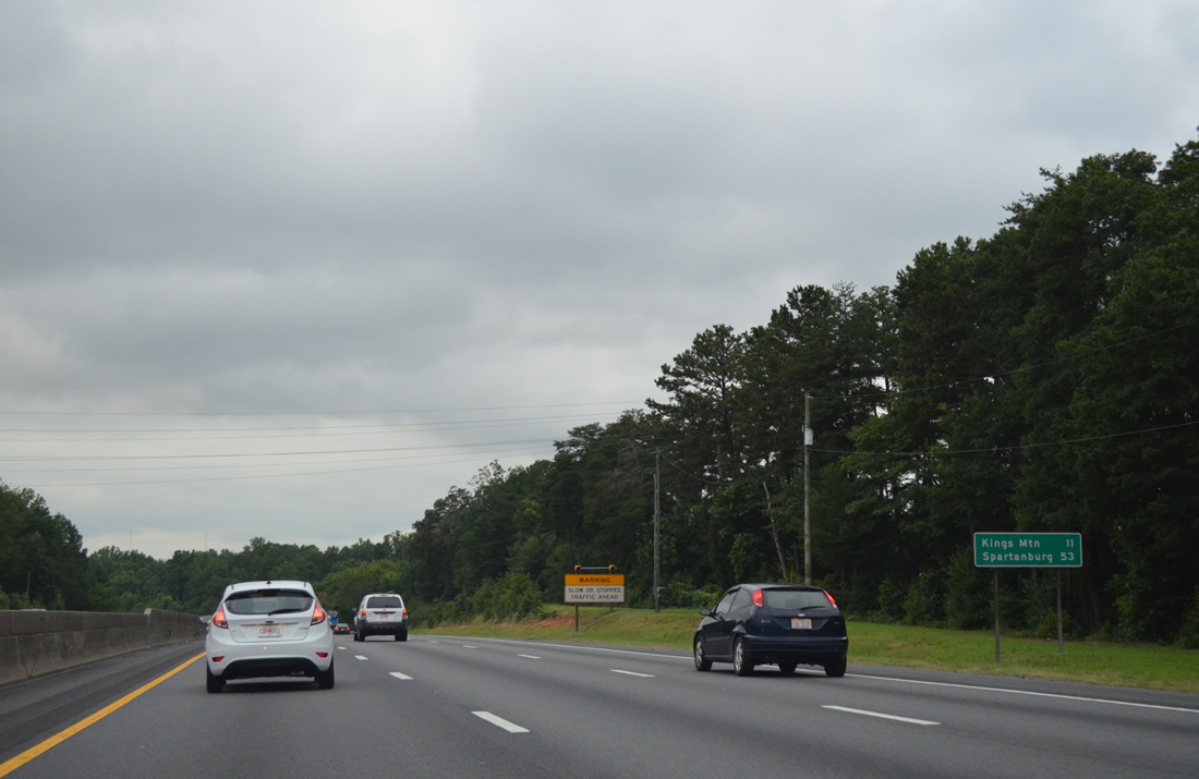
| West from Gastonia, Interstate 85 travels 11 miles to Kings Mountain. Spartanburg, South Carolina is 53 miles away. 08/06/13 |
|
| Forthcoming U.S. 321 (Chester Street) constitutes a major highway through Gastonia along a combination of Chester and York Streets. 03/12/22 |
|
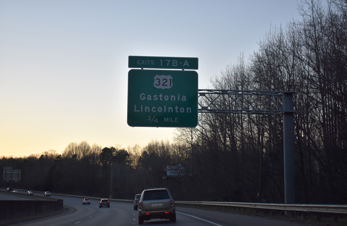
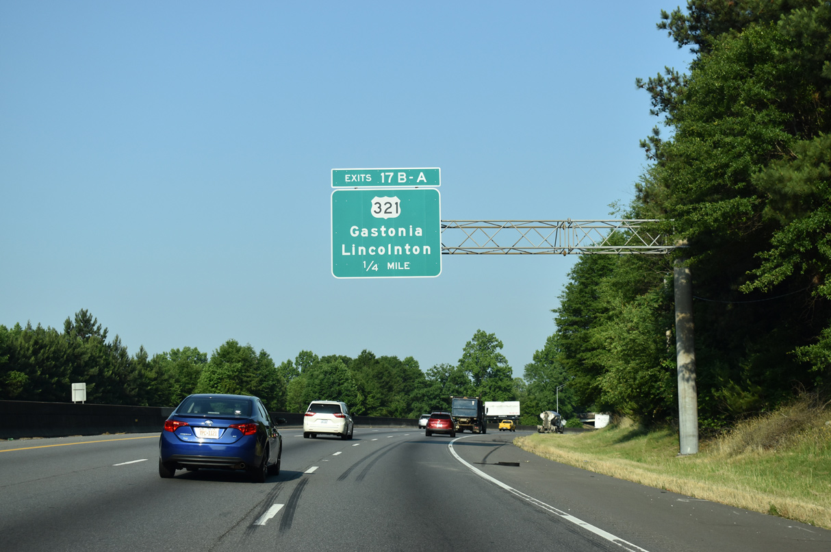
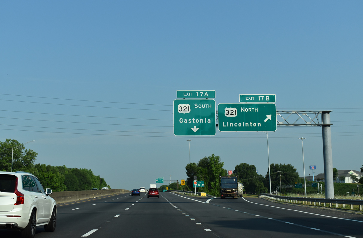
| U.S. 321 is mostly a freeway between Gastonia, Lincolnton and Hickory to the north. The freeway begins 1.25 miles north from I-85 after a series of at-grade intersections. 05/26/21 |
|
| Exit 17 B serves both the Gaston County Museum and Gaston College in the nearby town of Dallas. 05/26/21 |
|
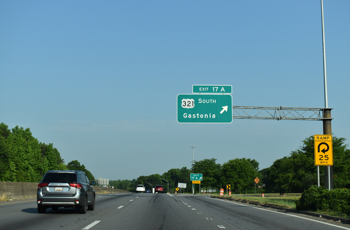
| Opened on November 16, 2021, improvements to the folded diamond interchange with U.S. 321 near Rankin Lake Park included the addition of a new ramp (Exit 17 B) from I-85 south to U.S. 321 north.1 03/12/22 |
|
| A separate ramp at Exit 17 built links U.S. 321 south to I-85 north. It opened on February 26, 2021.1 03/12/22 |
|
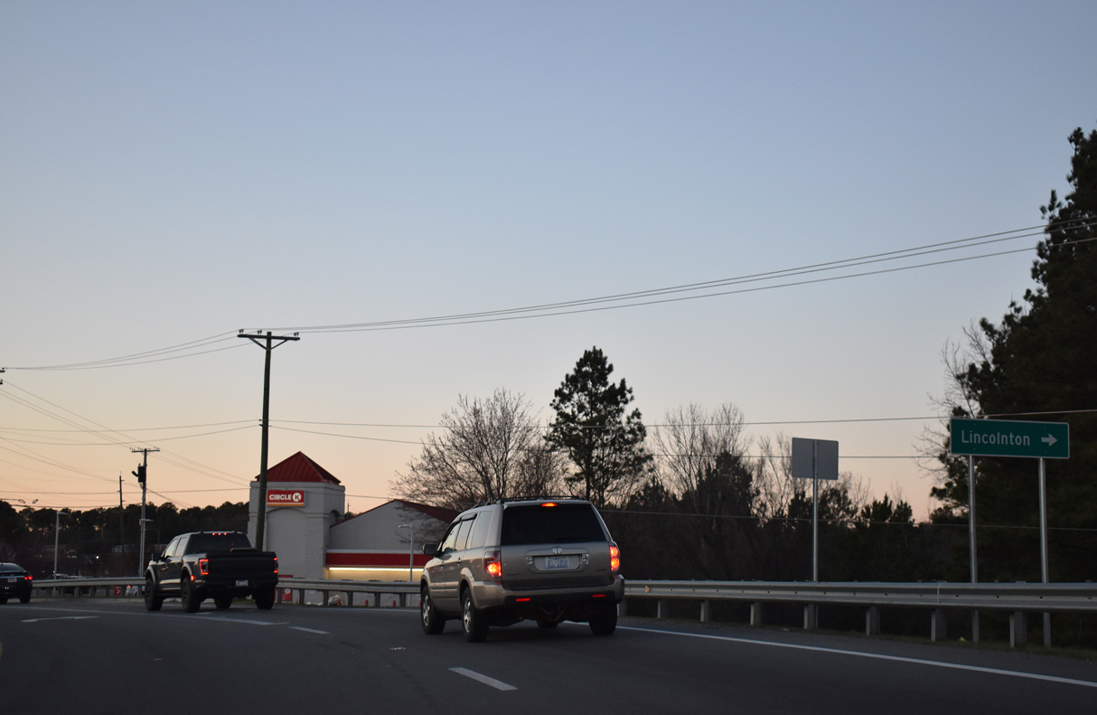
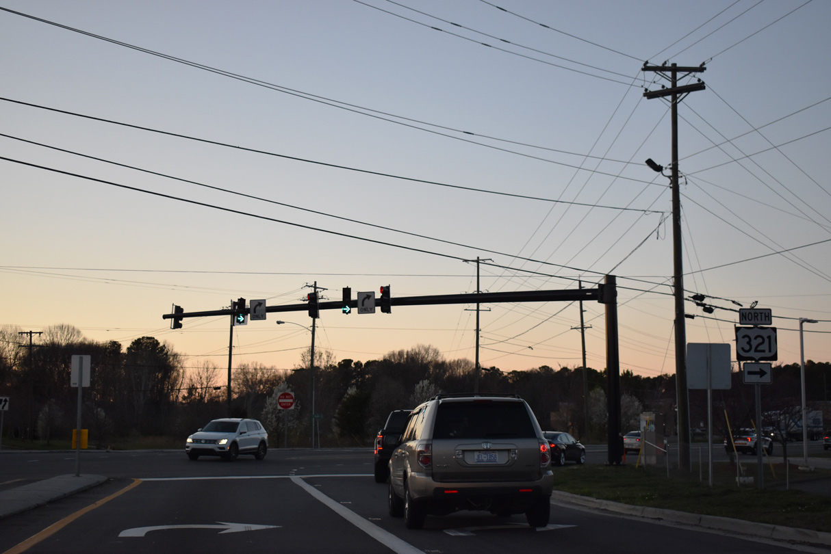
| Southward from Exit 17, U.S. 321 follows Chester Street 1.1 miles into Downtown Gastonia. There U.S. 321 splits into the one way couplet of York Street (northbound) and Chester Street (southbound). Beyond Downtown, U.S. 321 continues another 20 miles to York, South Carolina. 05/26/21 |
|
| Interstate 85 crosses Kaglor Branch alongside an industrial park by this reassurance shield. 05/26/21 |
|
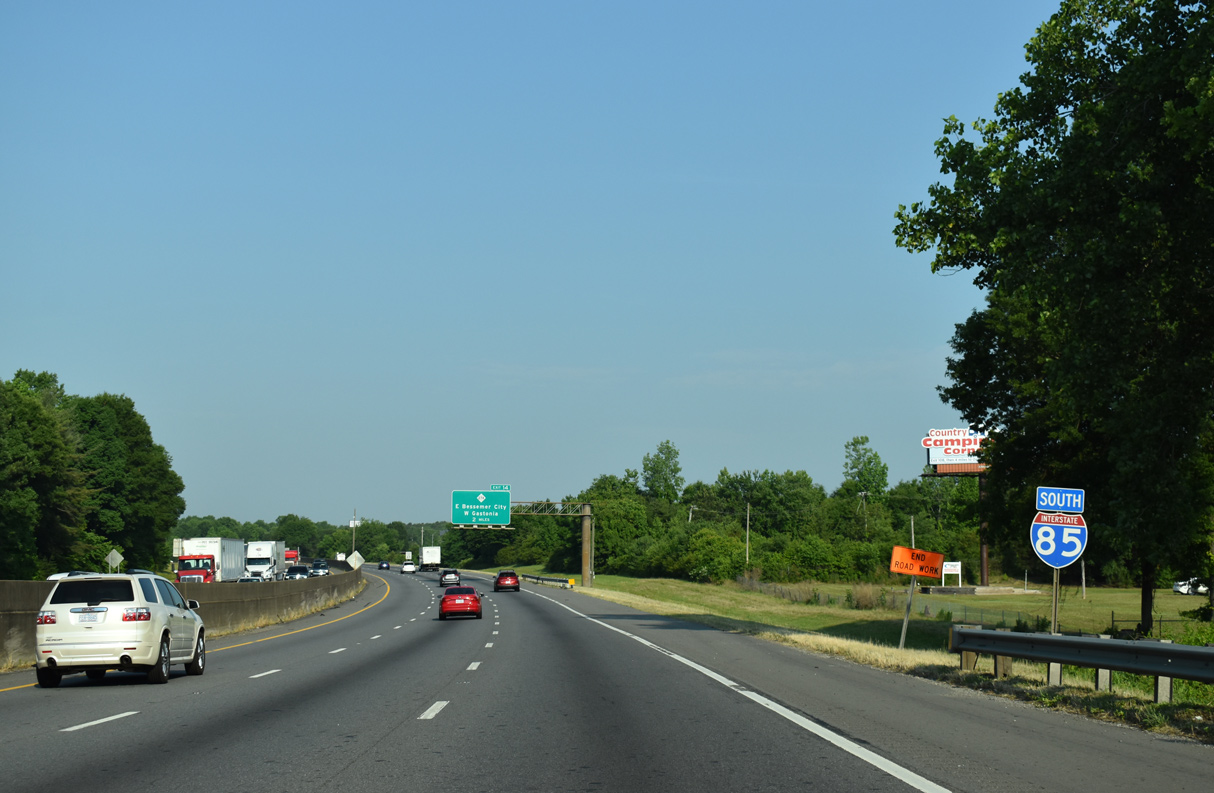
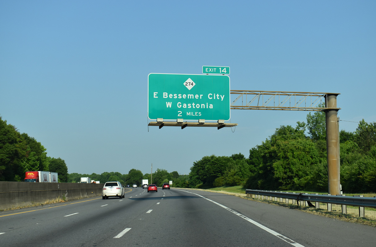
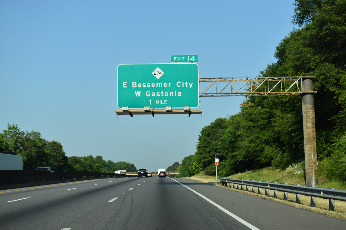
| Meeting Interstate 85 next is NC 274 (Bessemer City Road) to West Gastonia and East Bessemer City. 05/26/21 |
|
| A folded diamond interchange (Exit 14) connects I-85 with NC 274 (Bessemer City Road). Bessemer City Road carries the state route 1.1 miles northwest to West Gastonia and NC 275 (Dallas-Bessemer City Highway). 05/26/21 |
|
| A Norfolk Southern Railroad line parallels NC 274 ahead of Exit 14 to Bessemer City Road. NC 274 travels 35 miles between S.C. 274 near Lake Wylie and NC 27 in western Lincoln County. 05/26/21 |
|
| The west end of the cancelled Garden Parkway was proposed to connect with I-85 along this stretch. Planned as an alternate route to I-485, the 21.9 mile long toll road would have encircled both Gastonia and Belmont to I-485 at Exit 6 and NC 160. 05/26/21 |
|
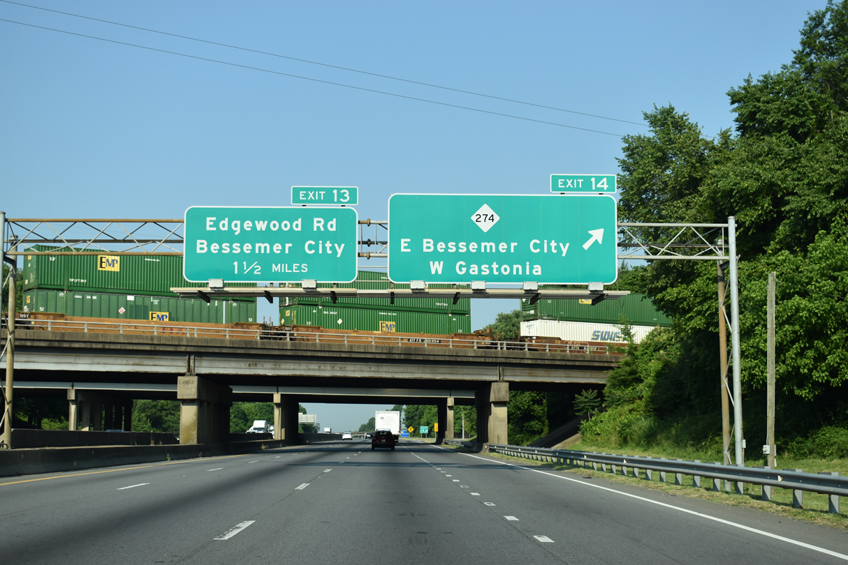
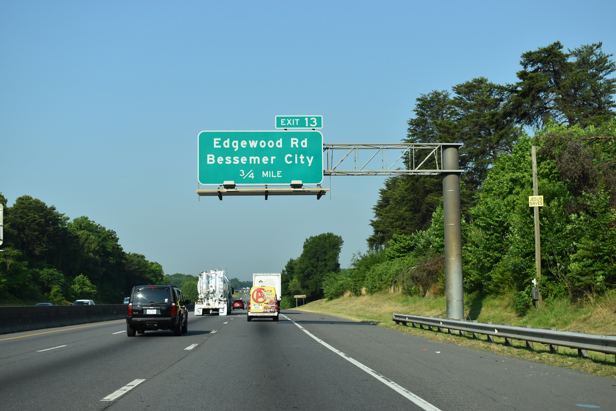
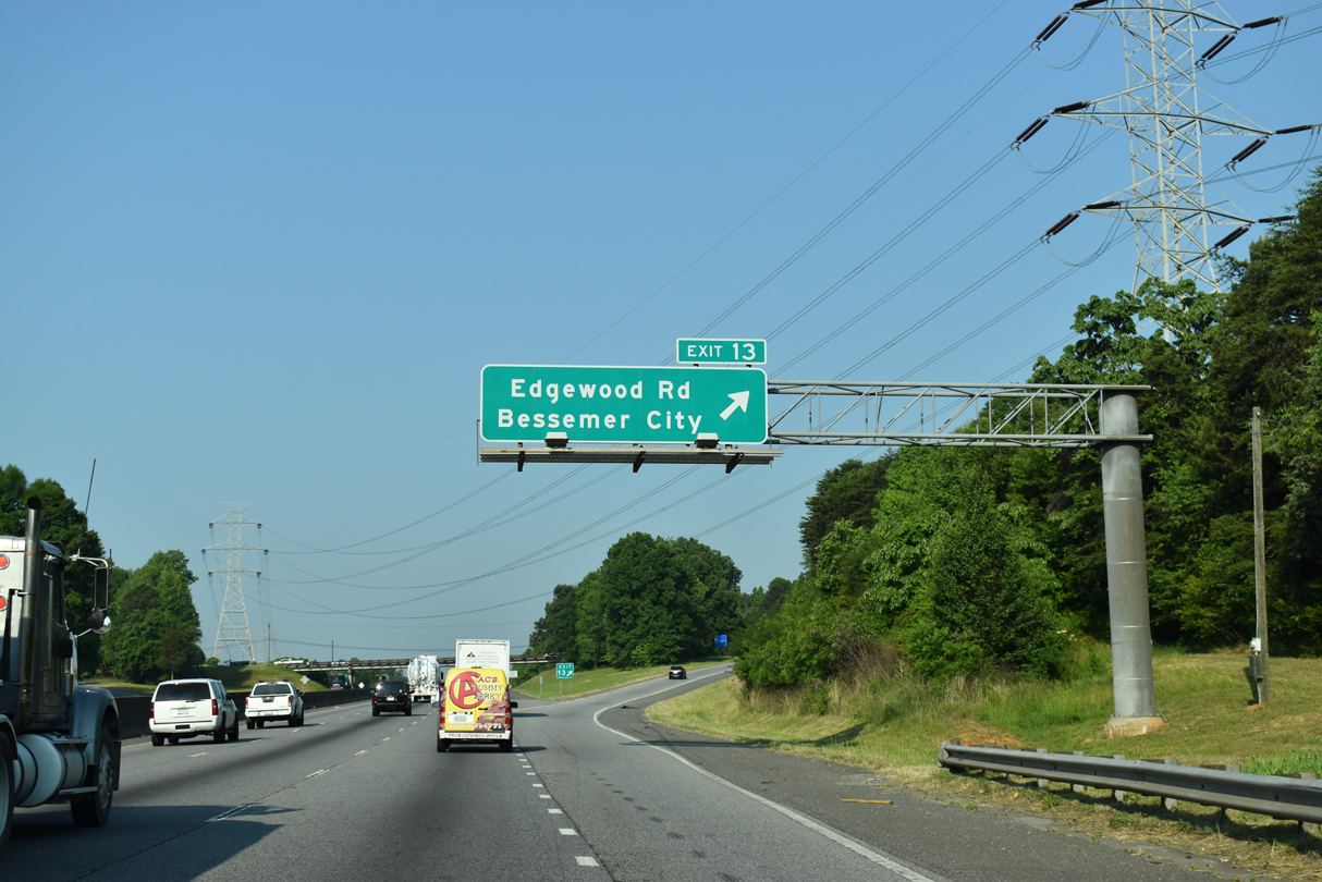
| I-85 meets Edgewood Road (SR 1307) at a diamond interchange (Exit 13) next. 05/26/21 |
|
| Edgewood Road (SR 1307) arcs northwest from Exit 13 into Bessemer City, becoming Athenia Place and Alabama Avenue to Downtown. SR 1307 south links with U.S. 29/74 (Franklin Boulevard) and Archie Whiteside Road (SR 1122) in west Gastonia. 05/26/21 |
|
| Interstate 85 south reduces from three to two lanes at the confluence with U.S. 29/74. U.S. 74 briefly parallels the freeway outside Kings Mountain. 05/26/21 |
|
| U.S. 74 travels nine miles west to the Cleveland County seat of Shelby. 05/26/21 |
|
| An 18.5 mile long freeway bypass for U.S. 74 around Shelby is under construction. Work on the first 2.2 mile segment east of Mooresboro started on May 21, 2013. 05/26/21 |
|
| U.S. 74 provides a direct route to Interstate 26 northwest to Hendersonville and Asheville. 05/26/21 |
|
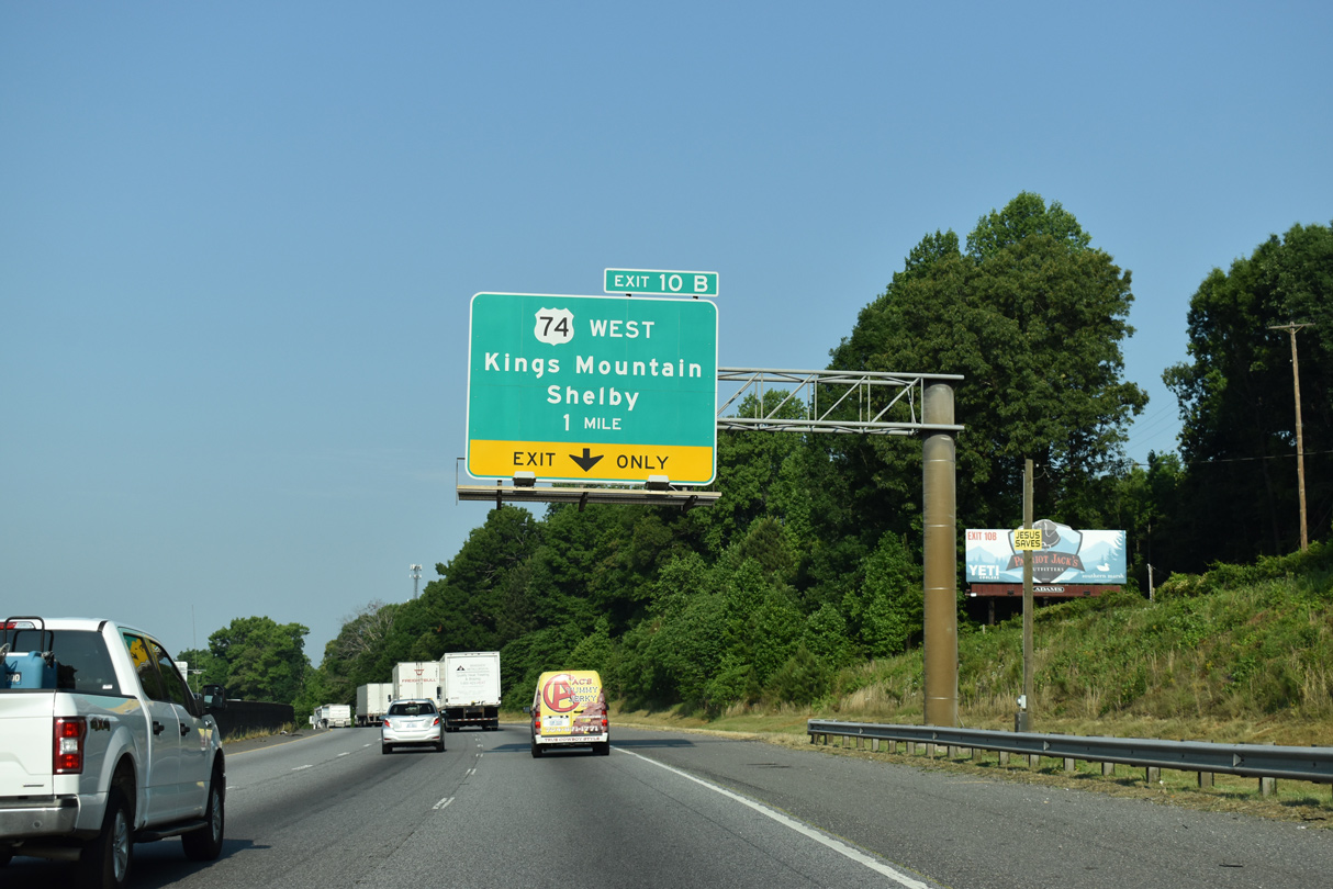
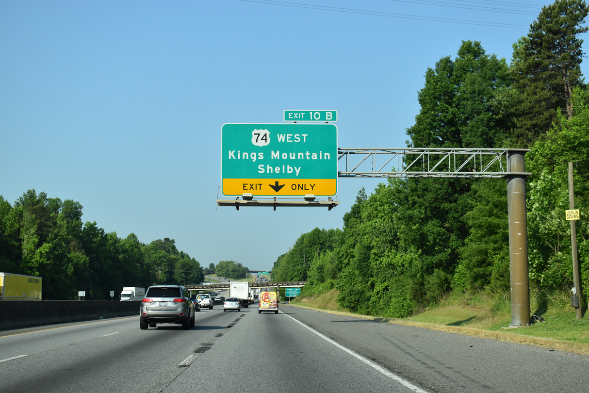
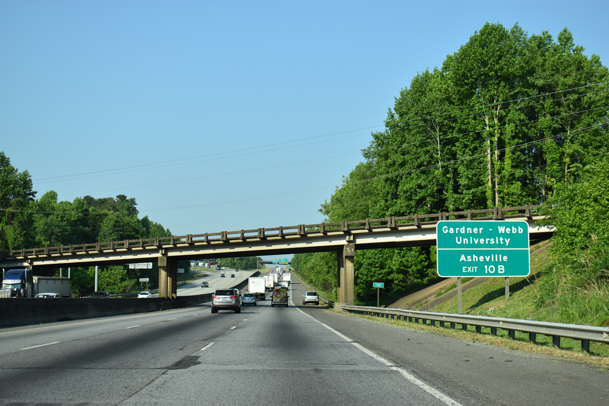
| Exit 10B departs Interstate 85 south for adjacent U.S. 74 west to Shelby. U.S. 74 bypasses Kings Mountain along a freeway for seven miles while U.S. 74 Business follows King Street and Shelby Road through the heart of the city. 05/26/21 |
|
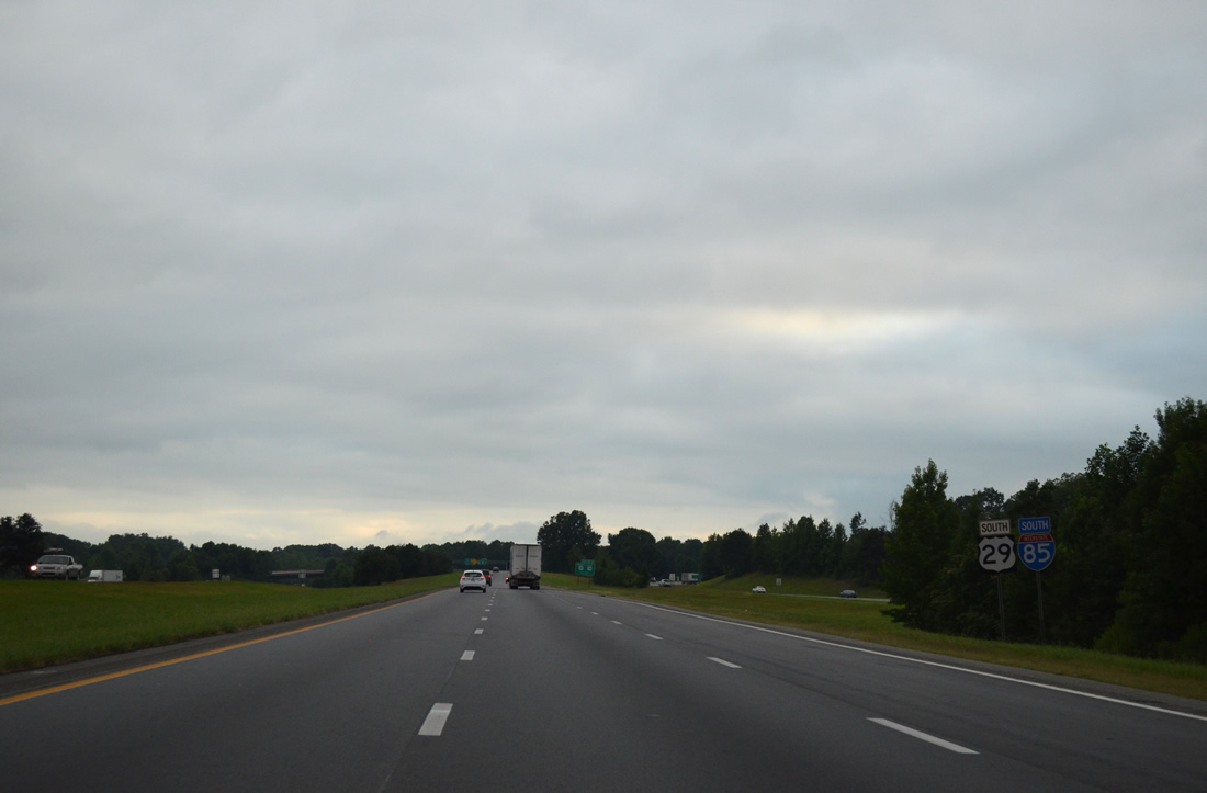
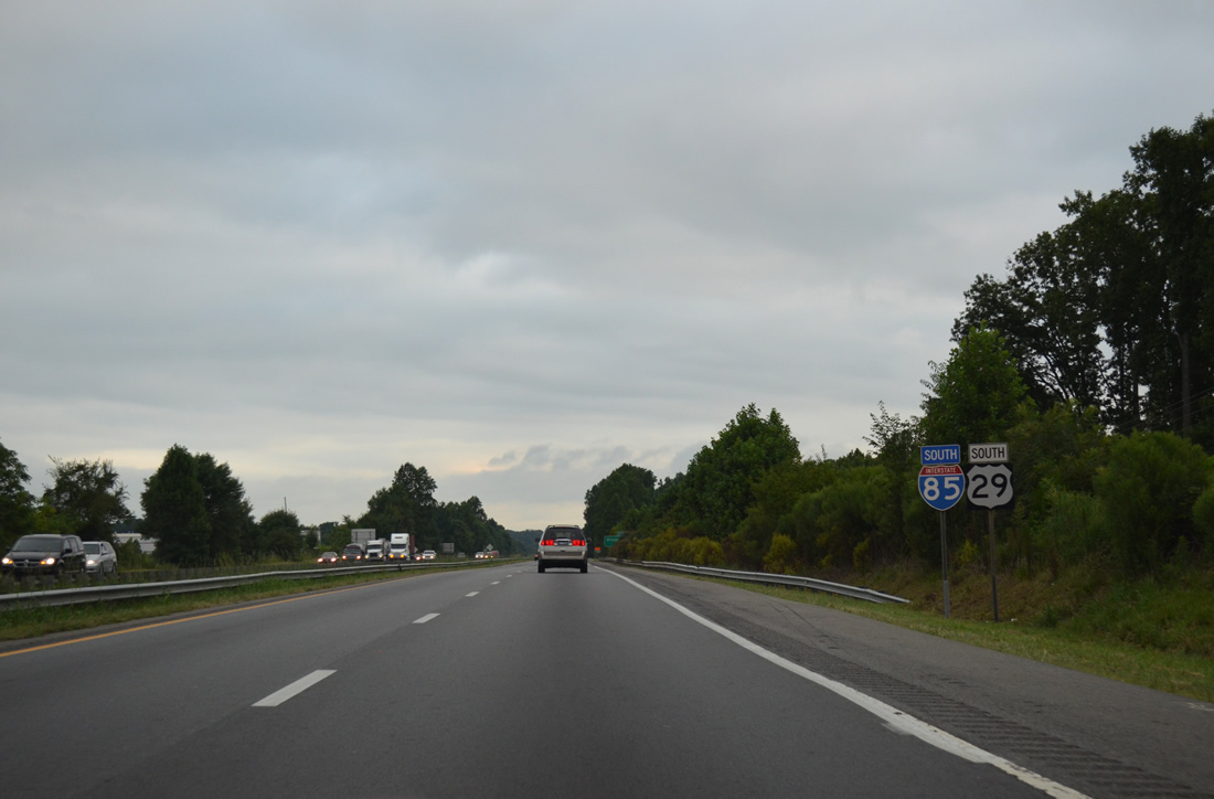
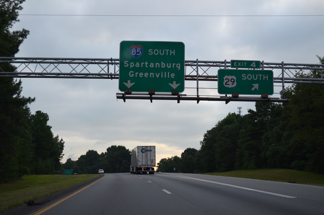
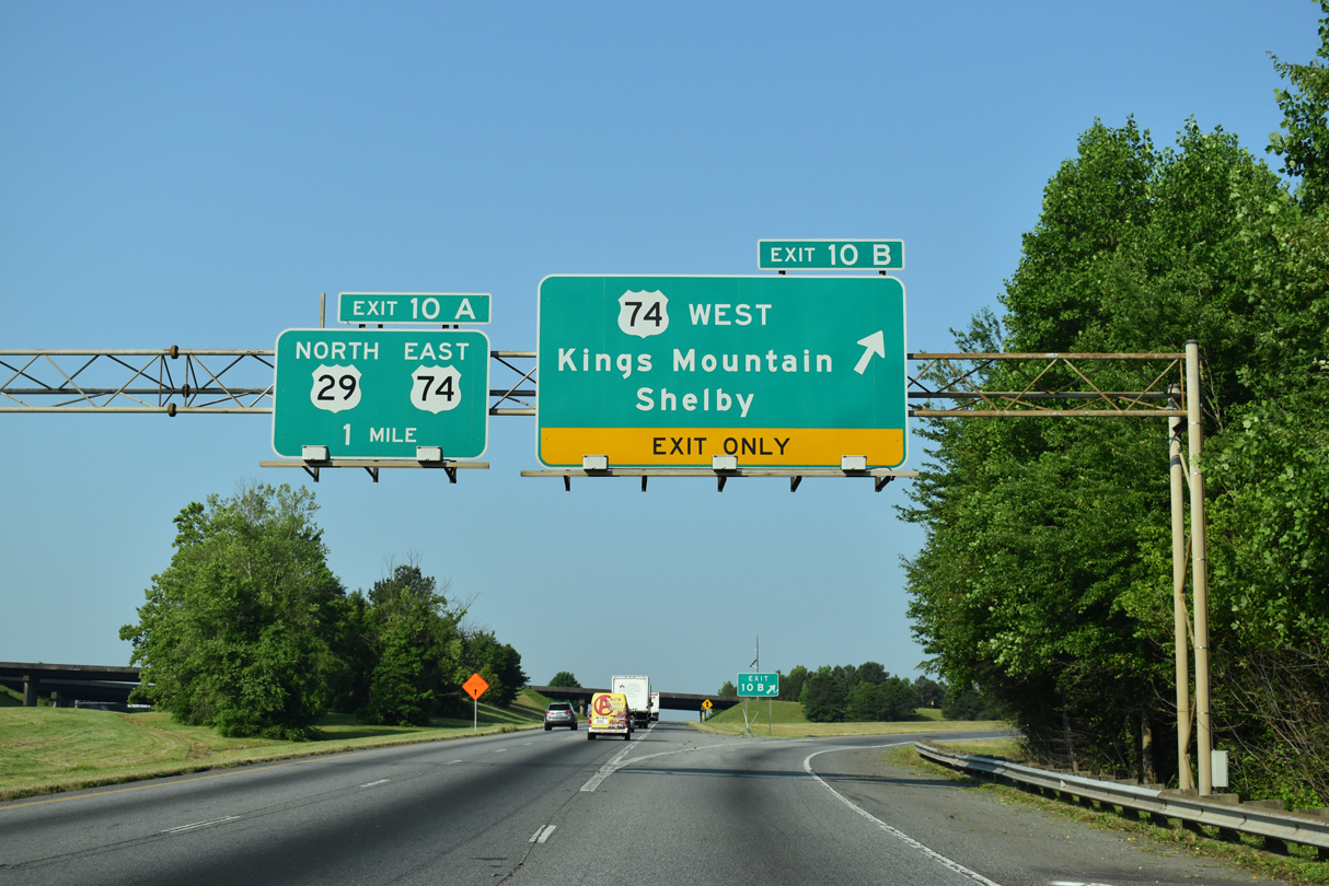
| A loop ramp brings U.S. 29 onto Interstate 85 south as U.S. 74 west parallels the freeway nearby. I-85/U.S. 29 overlap six miles southwest through Kings Mountain to Archdale. 08/06/13 |
|
| Exit 10A follows in one quarter mile for U.S. 74 east from Kings Mountain back into Gastonia. 08/06/13 |
|
| U.S. 29 north joins U.S. 74 east for 25 miles from Exit 10A through Gastonia, Belmont and Westover Hills in Charlotte. 08/06/13 |
|
| Canterbury Road (SR 1118) spans I-85/U.S. 29 south from U.S. 74 Business (King Street) onto nearby Yellow Ridge in east Kings Mountain. 08/06/13 |
|
| NC 161 follows York Road south out of Kings Mountain to Bethany, South Carolina. S.C. 161 continues ten miles from the state line to Filbert and York at U.S. 321. 08/06/13 |
|
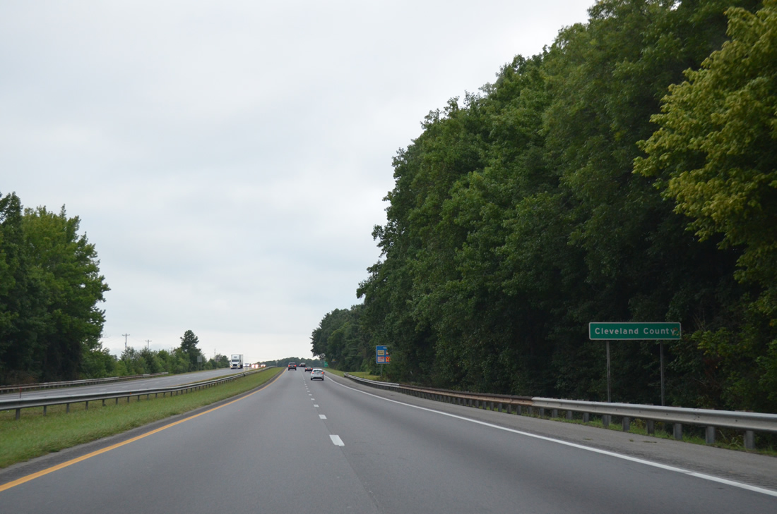
| The final 8.23 miles of Interstate 85 in North Carolina traverse southeastern Cleveland County. 08/06/13 |
|
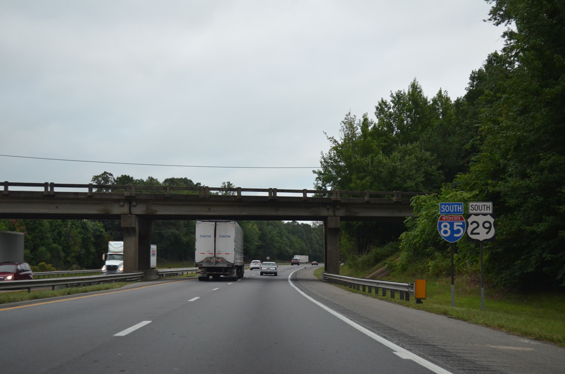
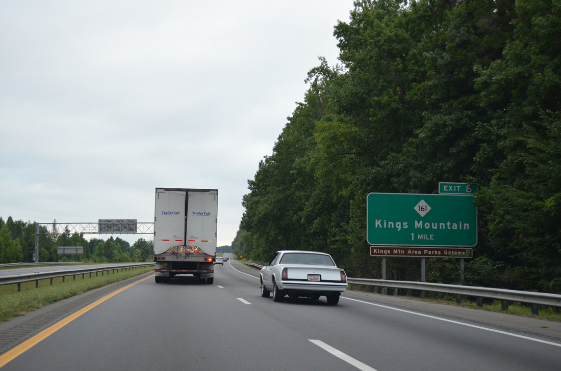
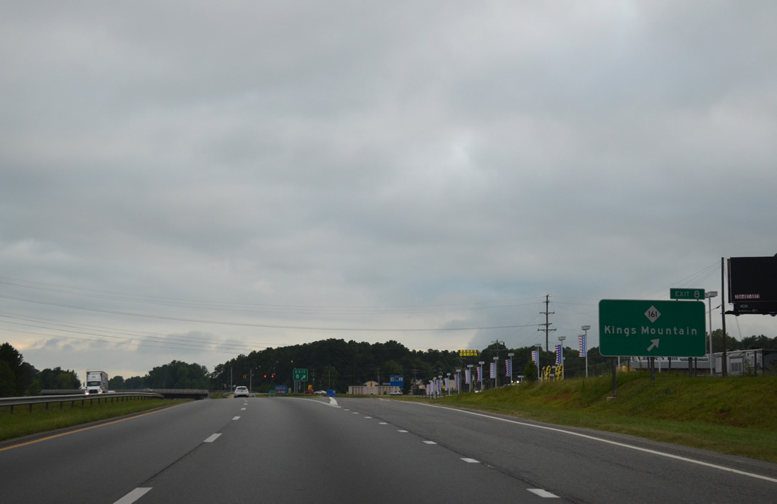
| Entering the parclo interchange (Exit 8) with NC 161 (York Road) on I-85/U.S. 29 south. NC 161 leads north to Downtown Kings Mountain and south to both Kings Mountain State Park and Kings Mountain National Military Park. 08/06/13 |
|
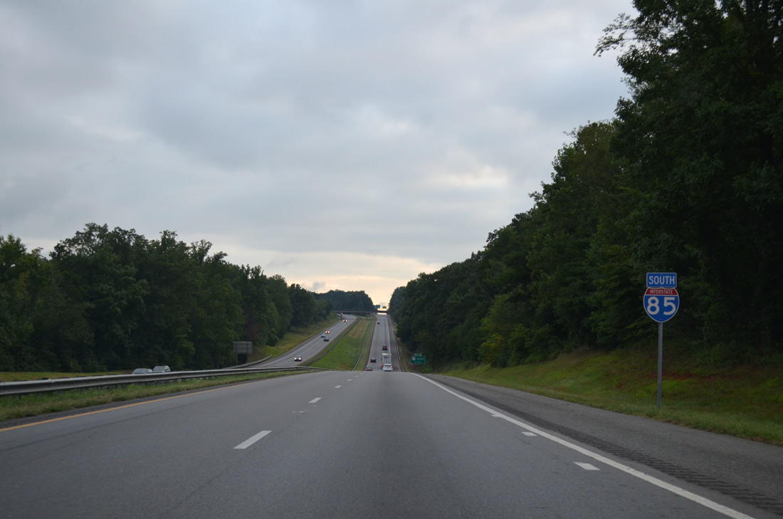
| I-85/U.S. 29 south pass by a large quarry and an industrial park area as they leave the city of Kings Mountain. 08/06/13 |
|
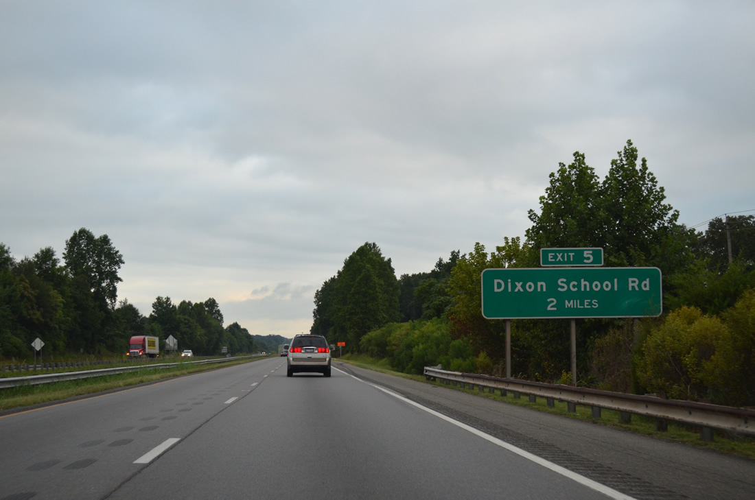
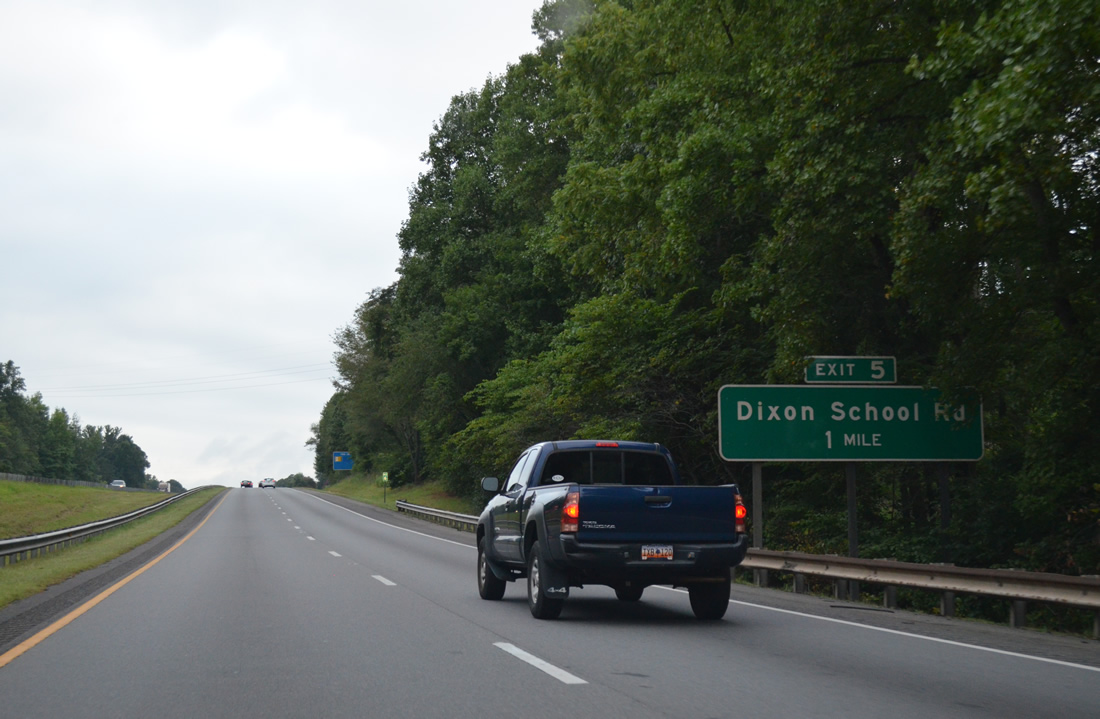
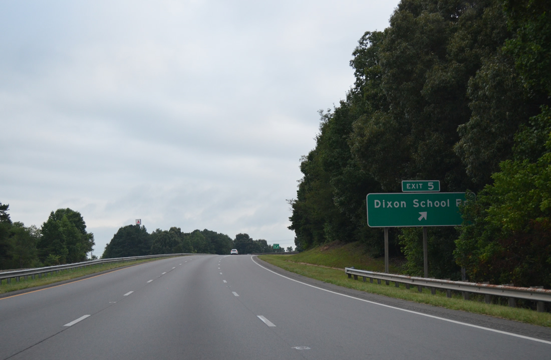
| A diamond interchange (Exit 5) joins I-85/U.S. 29 with Dixon School Road (SR 2283) in two miles. 08/06/13 |
|
| Dropping into a valley at Kings Creek along I-85/U.S. 29 south. A former rest area followed this industrial road overpass. 08/06/13 |
|
| Dixon School Road (SR 2283) loops southwest from NC 216 (Battleground Avenue) to Exit 5 and NC 216 (Battleground Road) again near the state line. 08/06/13 |
|
| Exit 5 departs I-85/U.S. 29 south for Dixon School Road (SR 2283). Kings Mountain Boulevard (SR 2705 / SR 2487) overtakes Dixon School Road nearby on a newer alignment northward to U.S. 74 Business (Shelby Road). 08/06/13 |
|
| Interstate 85 southbound lowers to cross Dixon Branch. 08/06/13 |
|
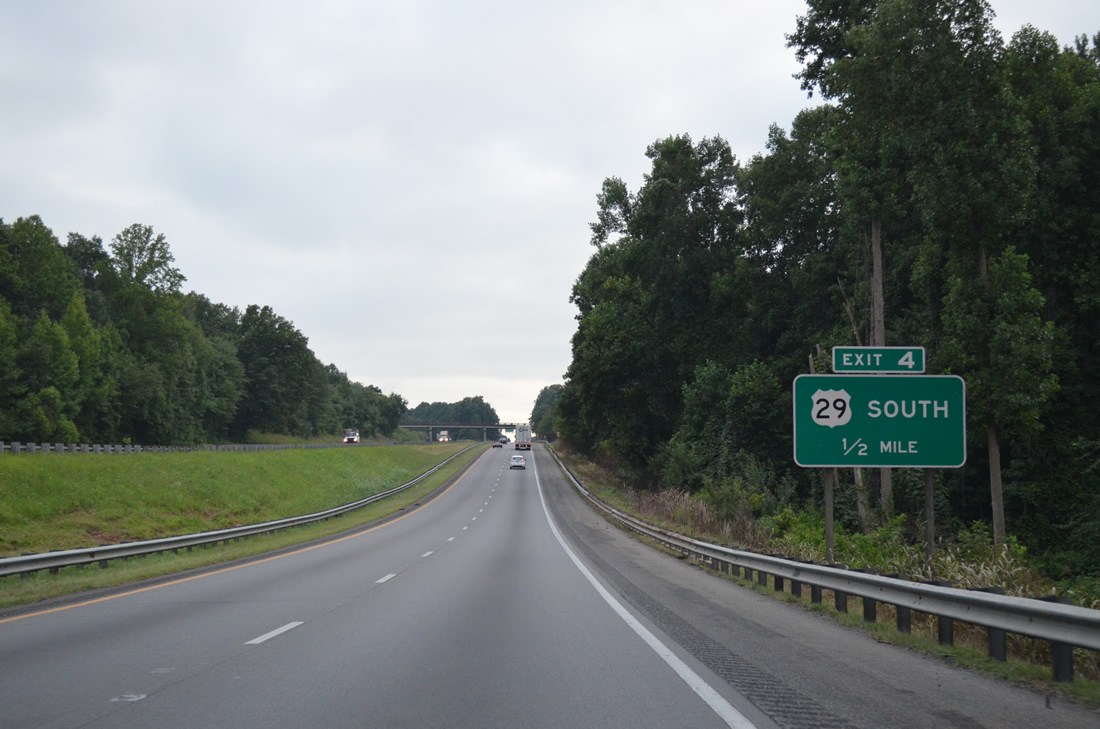
| U.S. 29 leaves the freeway via a wye interchange (Exit 4) next. NC 216 (Battleground Avenue), the original U.S. 29 alignment, merges with the route nearby at Archdale. 08/06/13 |
|
| Following Battleground Avenue, U.S. 29 travels to the town of Grover along a four lane highway, meeting Interstate 85 again south of the state line. 08/06/13 |
|
| NC 216 splits with U.S. 29 (Battleground Avenue) south along Battleground Road to cross paths with Interstate 85 in 1.5 miles at Exit 2. 08/06/13 |
|
| NC 216 (Battleground Road) travels southeast to the west entrance of Kings Mountain National Military Park as S.C. 216 (Antioch Road). 08/06/13 |
|
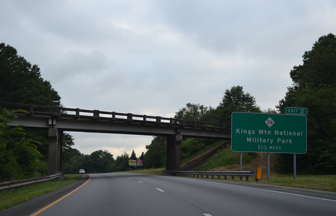
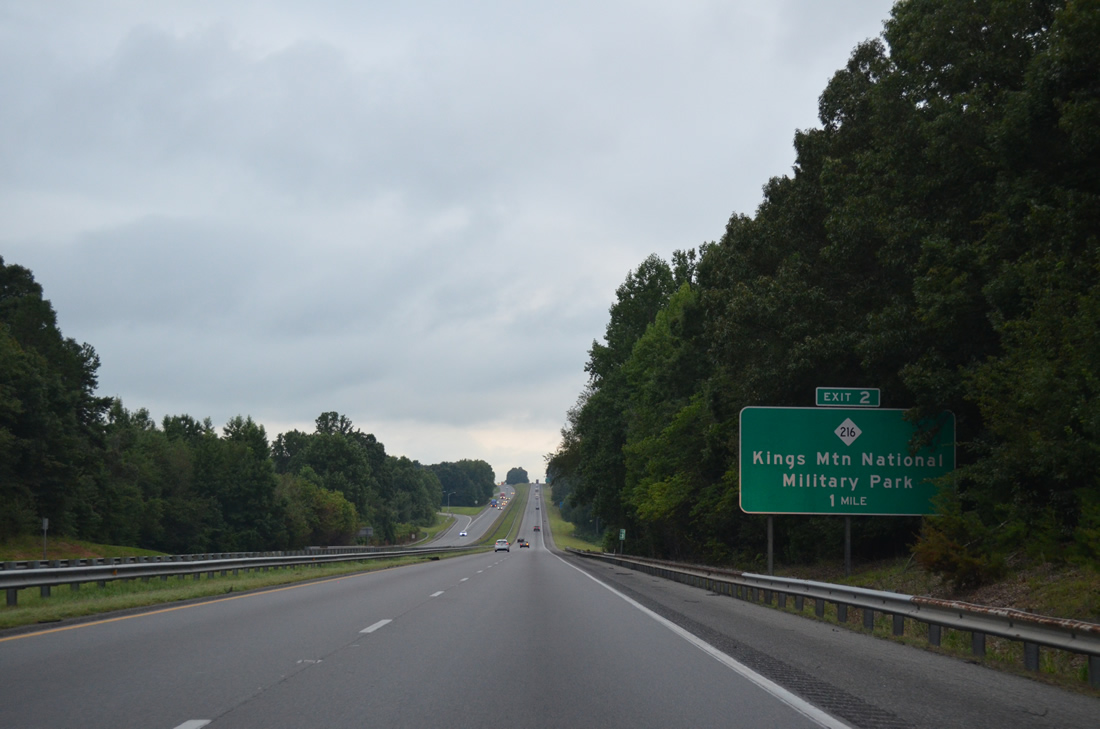
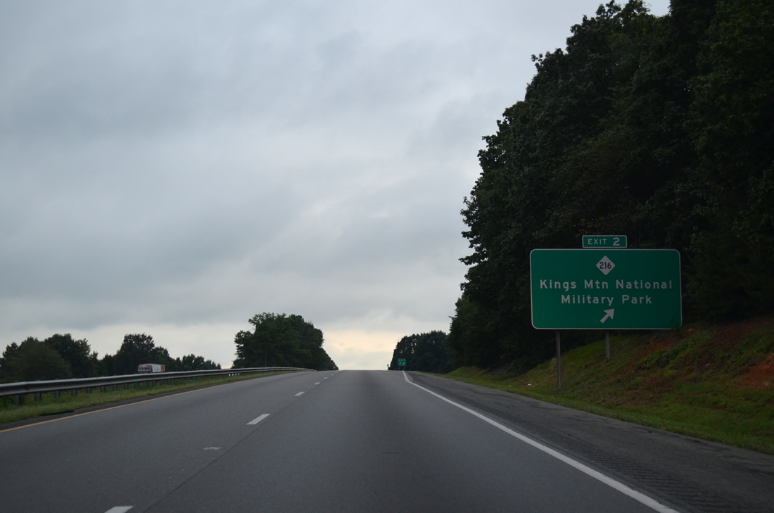
| Interstate 85 south reaches the diamond interchange (Exit 2) with NC 216 (Battleground Road). NC 216 runs 15.7 miles from the state line to NC 274 near Cherryville. S.C. 216 extends the route south 1.2 miles to the National Military Park. 08/06/13 |
|
| Interstate 85 straddles a bluff below U.S. 29 to the Grover town line and South Carolina border. 08/06/13 |
|
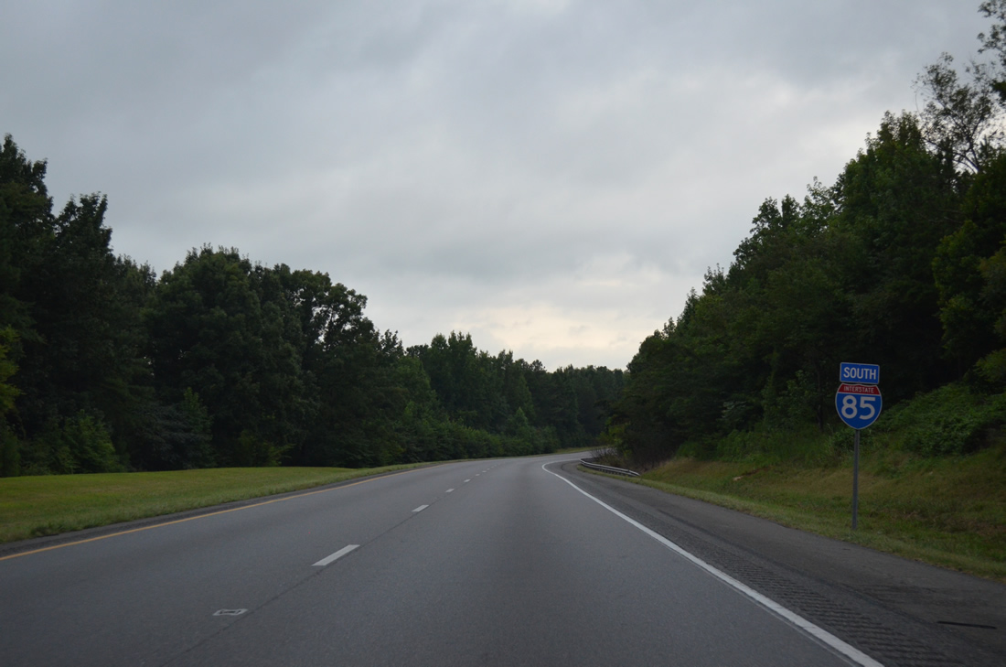
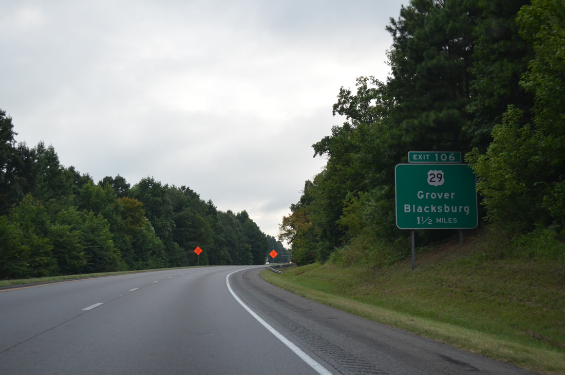
| Exit 106 with U.S. 29 (Cherokee Street) lies 1.5 miles ahead across the state line outside Grover. 08/06/13 |
|
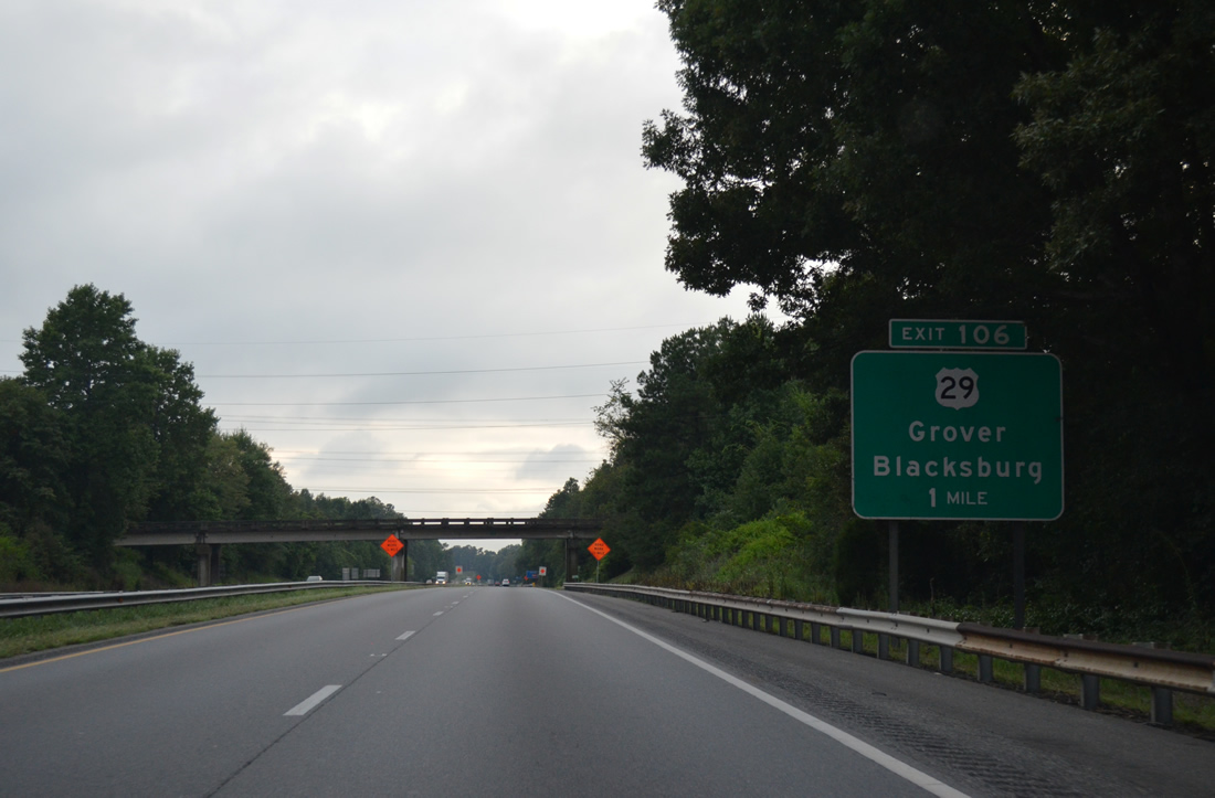
| Elm Road (SR 2278) passes over Interstate 85 on the one mile approach to Exit 106. U.S. 29 follows M.H. Camp Highway through Grover to exit the town for Blacksburg, South Carolina. 08/06/13 |
Page Updated 02-02-2023.

 South
South
 South
South