|
| Installed in 2004, this reassurance shield stood along I-85 southbound just beyond the Enoree River. 08/29/04 |
|
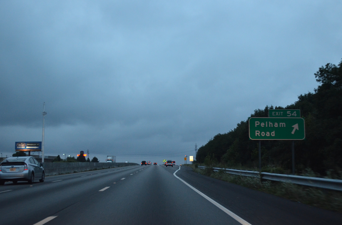
| Interstate 85 southbound at the six-ramp parclo interchange (Exit 54) with Pelham Road. Pelham Road is a four lane arterial heading west from S.C. 14 at Batesville to E North Street in Greenville. 08/06/13 |
|
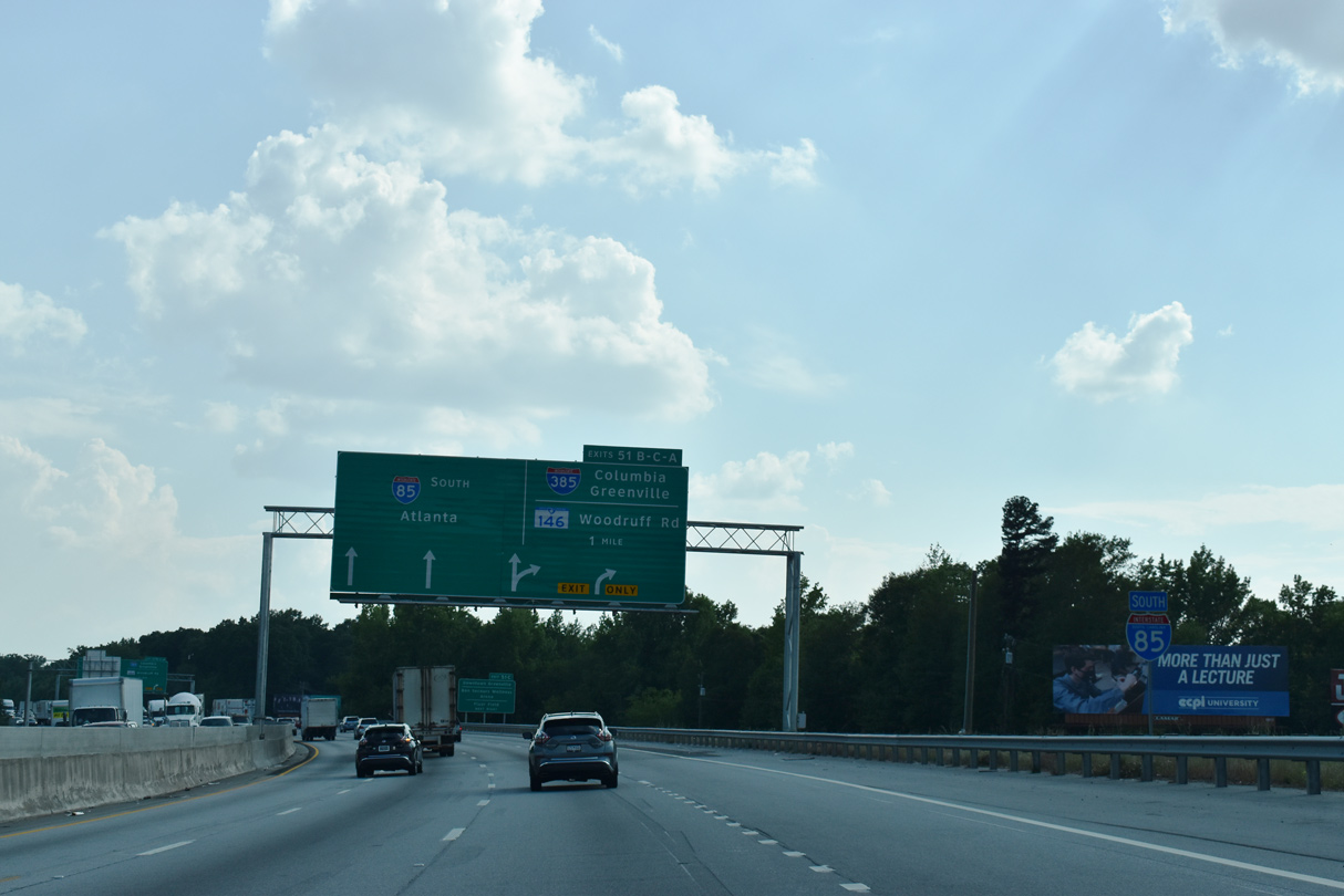
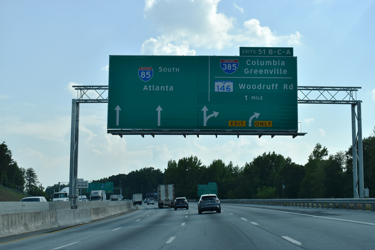
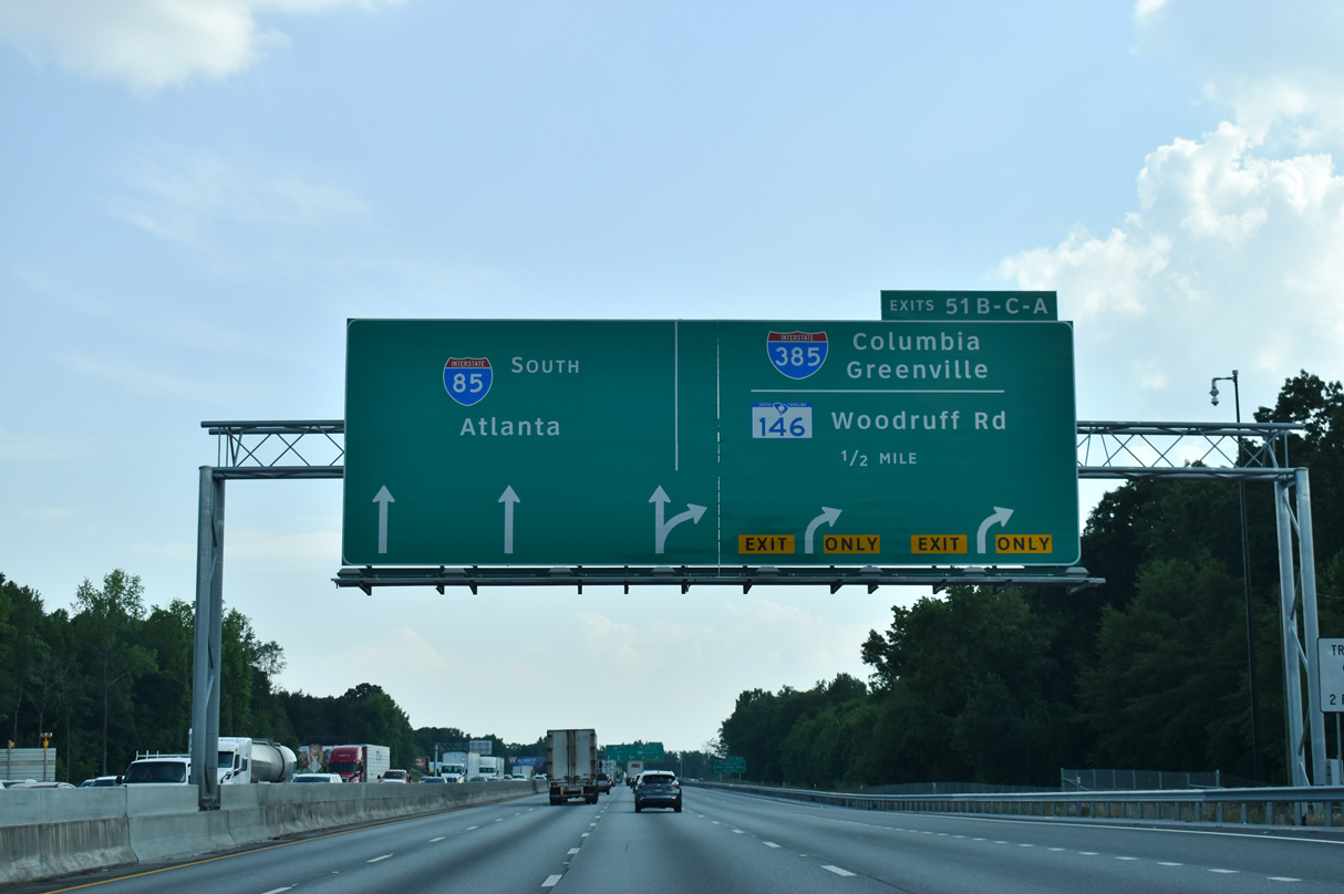
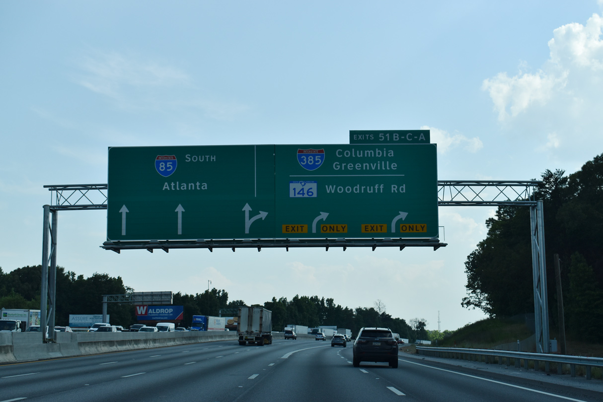
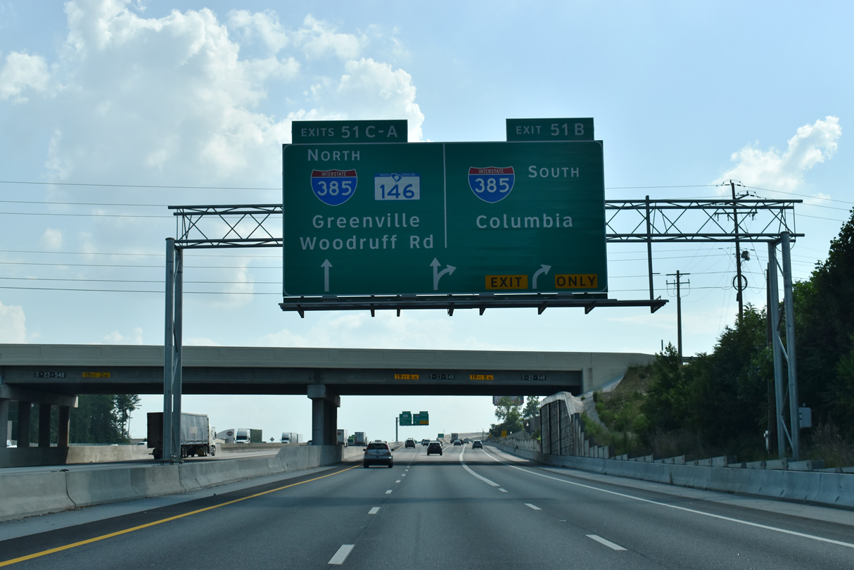
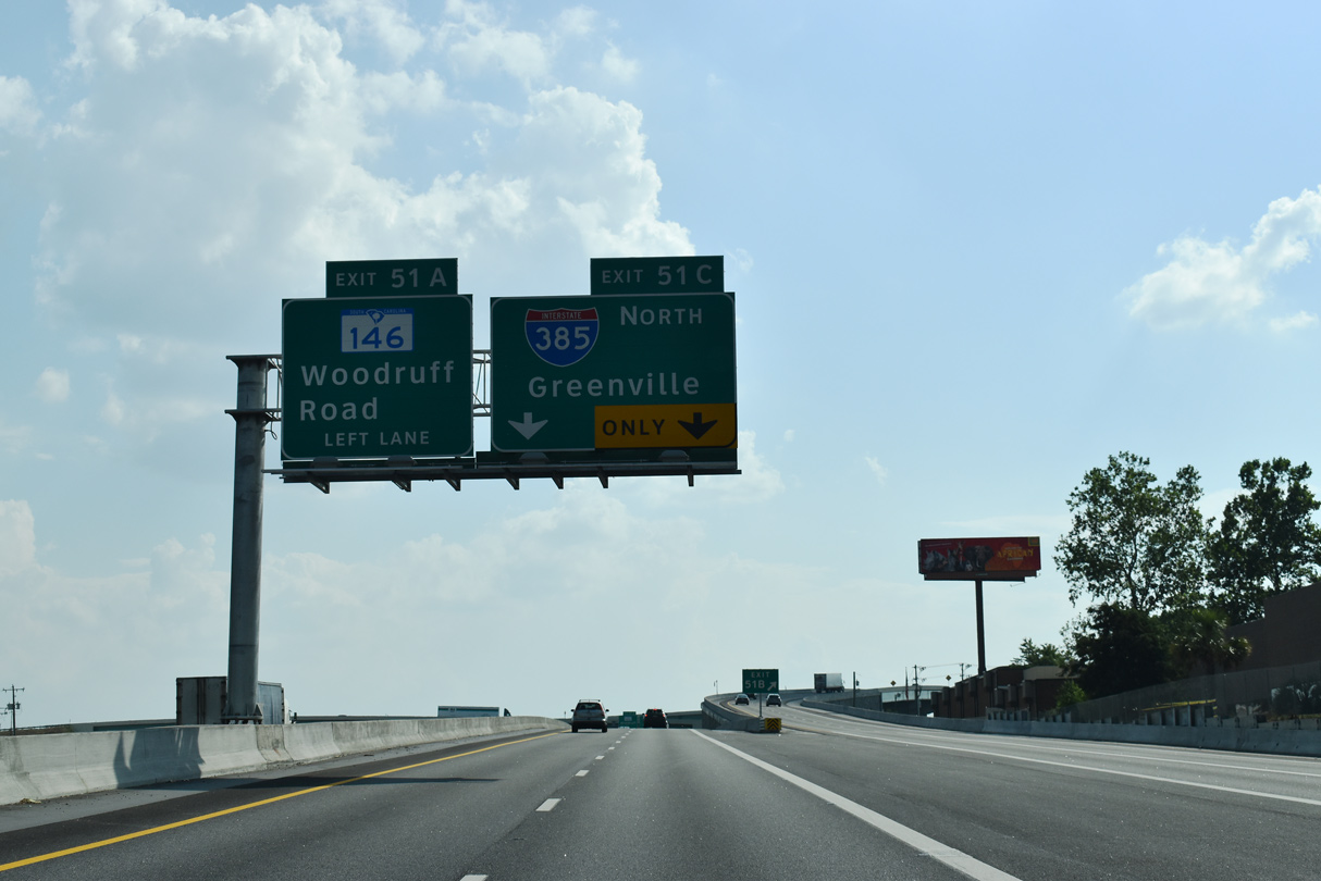
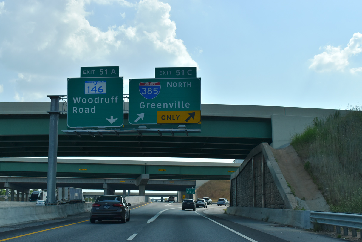
| Two of the three interchanges along I-85 within the Greenville city limits connect with Interstate 385 at Exits 51 C/B and S.C. 146 (Woodruff Road) at Exit 51A. 05/25/21 |
|
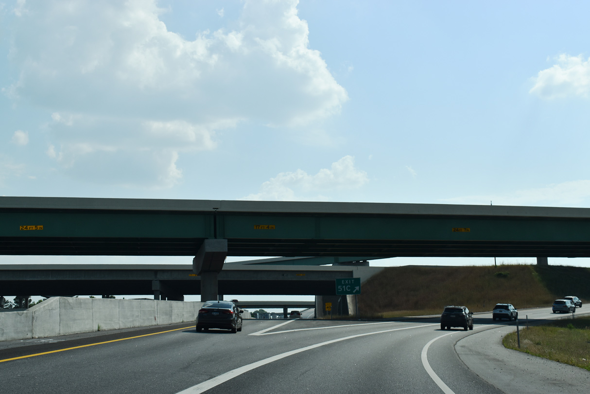
| A collector distributor roadway partitions from I-85 south ahead of the systems exchange with Interstate 385 and parclo interchange with S.C. 146. 05/25/21 |
|
| A 42.16 mile long route, Interstate 385 spurs northwest from I-85 to Downtown Greenville and travels southeast from Mauldin to I-26 at Clinton. 05/25/21 |
|
| The I-85/I-385 Gateway Project rebuilt the directional cloverleaf at Exit 51 into a multi level exchange. Costing $300 million, work commence in February 2016 and was completed in mid 2020. 05/25/21 |
|
| Suburban growth along the I-385 corridor southward from Mauldin to Simpsonville and Fountain Inn resulted in six lane expansion of the freeway to a point just north of Exit 24 in Fountain Inn. The extension of I-385 southeast to Gray Court, Laurens and Clinton replaced U.S. 276 in 1984. 05/25/21 |
|
| The spur taking Interstate 385 north onto North Street (Business Spur I-385) was completed in 1962. The Golden Strip Freeway encircling Mauldin south to U.S. 276 at Old Stage Road fully opened to traffic in 1985. 05/25/21 |
|
| I-385 arcs 5.9 miles northwest around Greenville Downtown Airport (GMU) and Arcadia Hills into Downtown Greenville west of Overbrook. Business Spur I-385 extends 0.49 miles west along North Street to Bon Secours Wellness Arena, S.C. 183 (Beattie Place) and U.S. 29 (Church Street). 05/25/21 |
|
| Ten bridges were built during the I-85/385 Gateway Project. The last opened to traffic on December 6, 2019. 05/25/21 |
|
| Anchored by the corporate offices of TD Bank, development along the south side of Interstate 85 west from Woodruff Road got underway in earnest after 2005. 08/07/13 |
|
| Located one mile ahead of Exit 48 to U.S. 276, the overpass for Old Sulphur Springs Road was replaced during the I-85/I-385 Gateway Project in 2016/17. 08/07/13 |
|
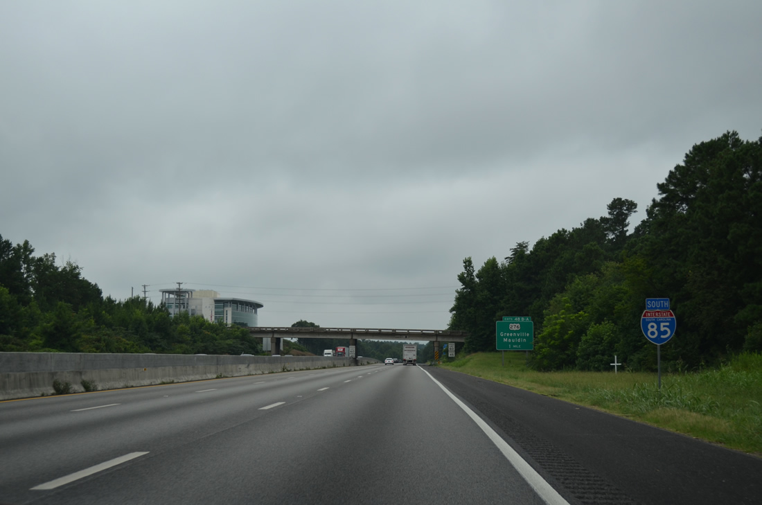
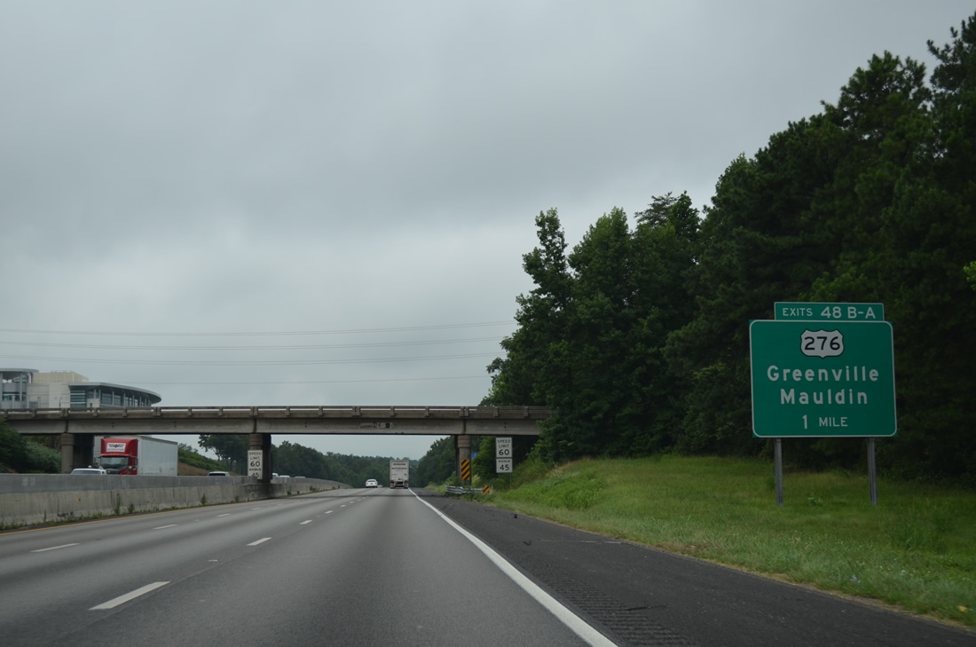
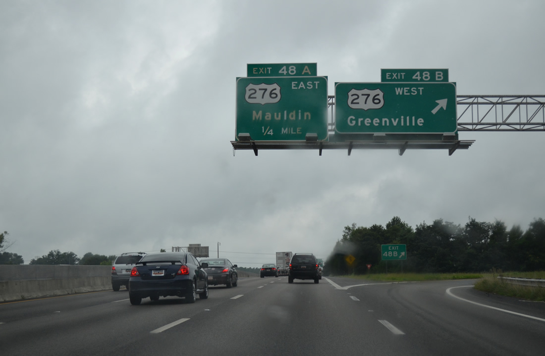
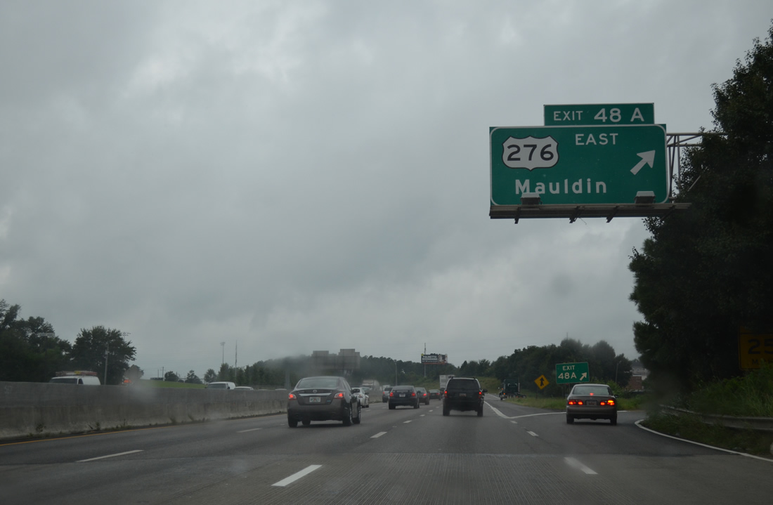
| Interstate 85 crosses Laurel Creek and the SCL Railway ahead of the cloverleaf interchange (Exit 48) with U.S. 276. U.S. 276 (Laurens Road) comprises a commercial boulevard north to Stone Avenue, which bypasses Downtown Greenville west to Rutherford Street. 08/07/13 |
|
| U.S. 276 (Laurens Road) concludes 5.70 miles south of the loop ramp at Exit 48A at the exchange joining I-185 (Southern Connector) and I-385 in Mauldin. U.S. 276 travels 106 miles overall north from the Greenville area to I-40 at Cove Creek, North Carolina. 08/07/13 |
|
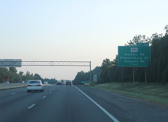
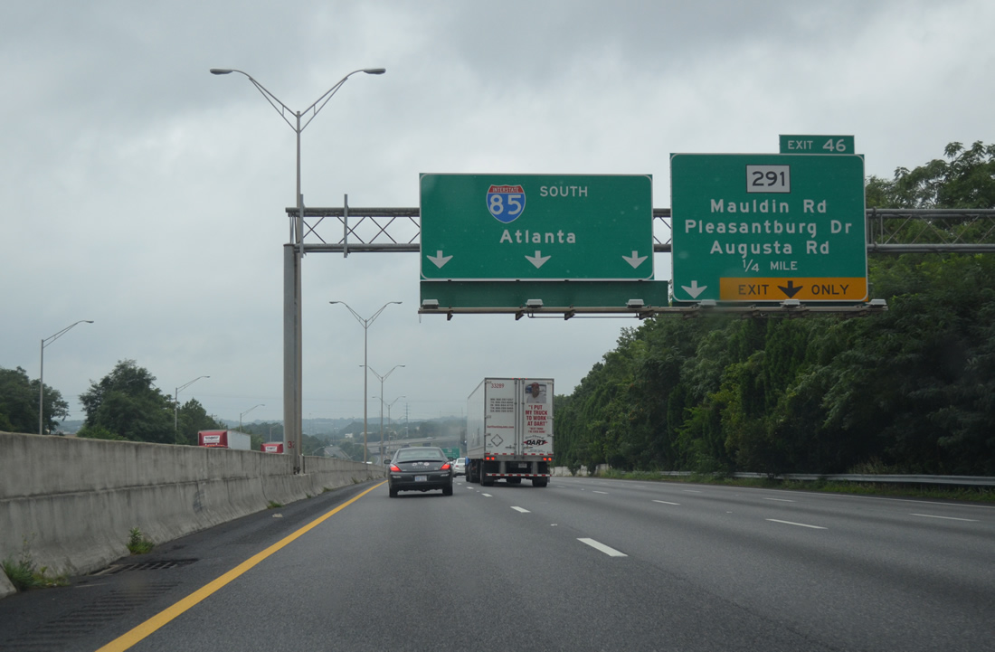
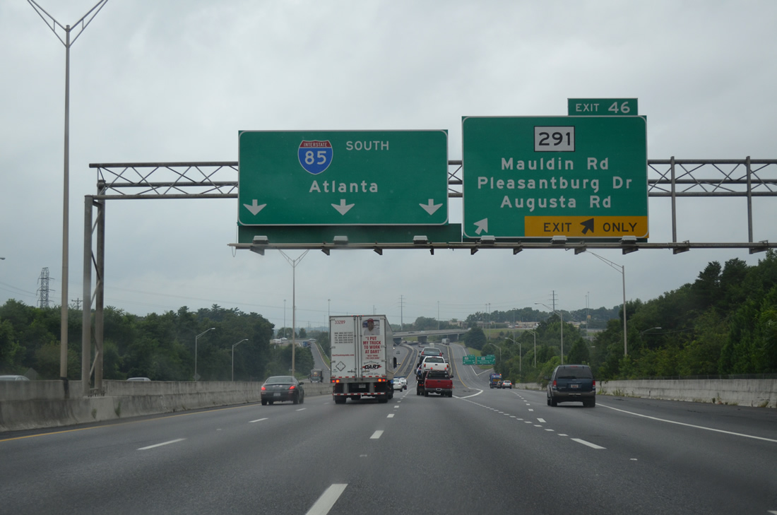
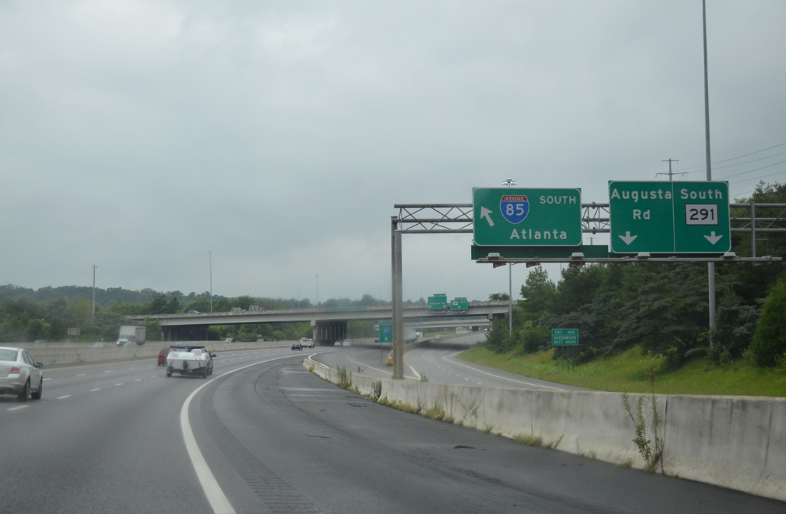
| Late 1990s reconstruction of Interstate 85 added c/d roadways linking the exchanges with Mauldin Road, S.C. 291 (Pleasantburg Drive), and Augusta Road. 07/23/04 |
|
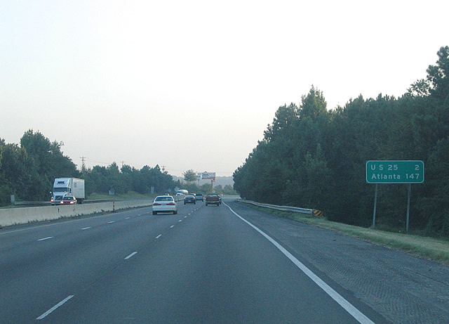
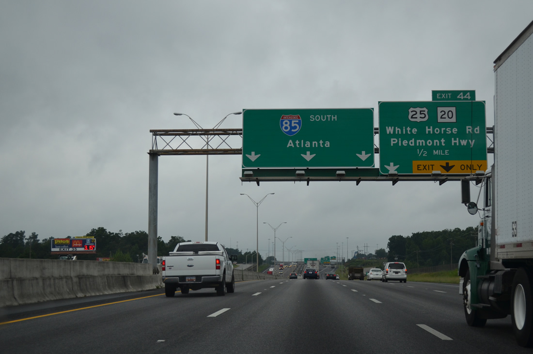
| U.S. 25 (White Horse Road) meets I-85 at the last in a series of parclo interchanges in two miles. Atlanta, Georgia is 147 miles to the southwest. 07/23/04 |
|
| The c/d roadway at Exit 46 separates from southbound Interstate 85 ahead of the Reedy River and Parkins Mill Road (Road 218) under crossing. 08/07/13 |
|
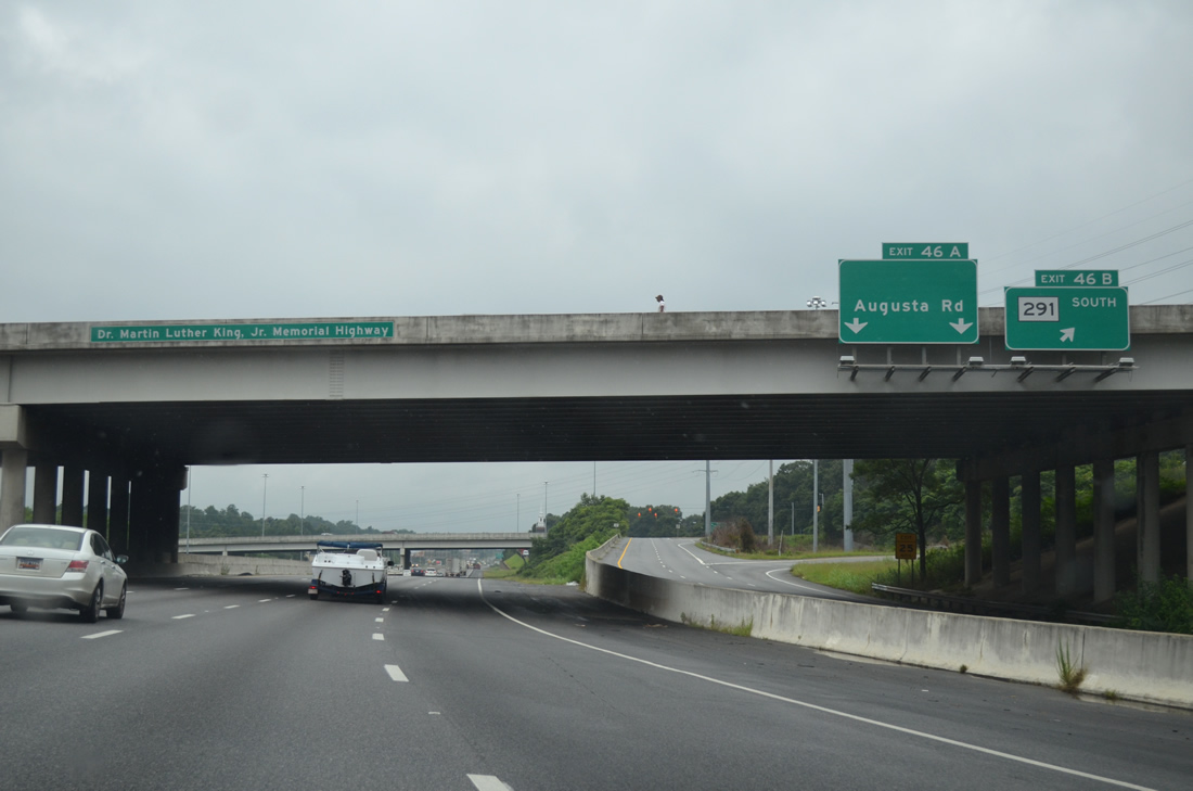
| Mauldin Road connects I-85 south with S.C. 291 (Pleasantburg Drive) and Augusta Street north through Greenville. The arterial parallels the Reedy River southeast onto Butler Road east into Mauldin. 08/07/13 |
|
| West of Mauldin Road, the c/d roadway at Exit 46 partitions with a slip ramp onto I-85 southbound and a distributor roadway to the ramps with S.C. 291 (Pleasantburg Drive) south and Augusta Road (old U.S. 25 Business). 08/07/13 |
|
| A loop ramp departs next for S.C. 291 (Pleasantburg Drive) south. Overtaking Augusta Road, S.C. 291 runs 2.13 miles southwest to U.S. 25 (White Horse Road) at East Gantt. 08/07/13 |
|
| Augusta Road branches west from S.C. 291 (Pleasantburg Drive) to Exit 46A. Augusta Road was formerly U.S. 25 Business until 1995. U.S. 25 follows the arterial south to Donaldson Center Airport (GYH). 08/07/13 |
|
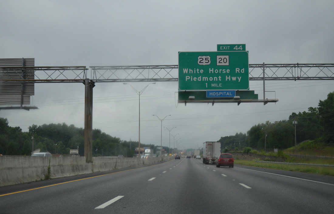
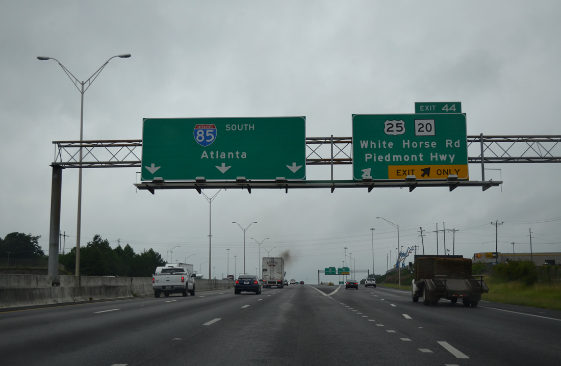
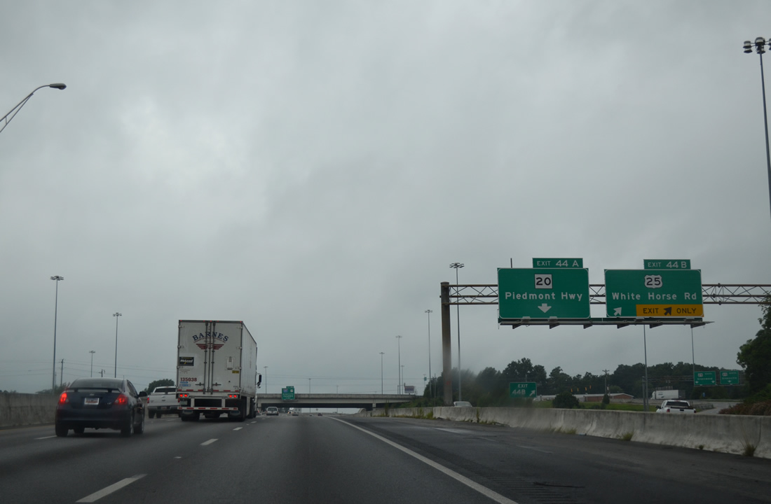
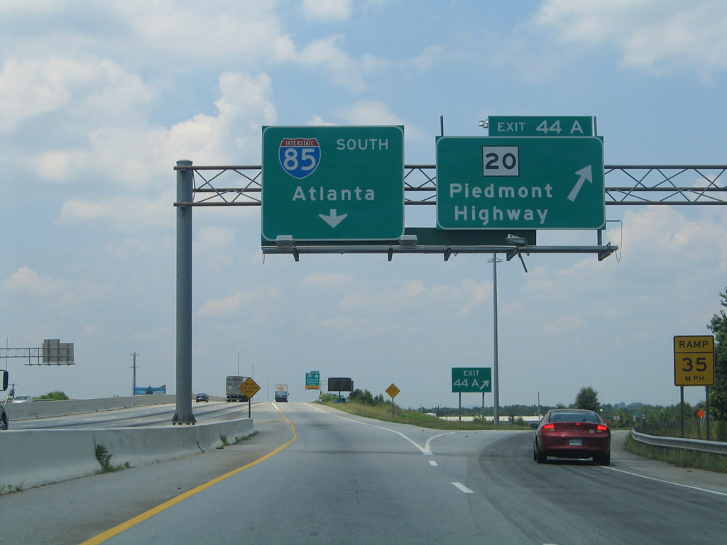
| Widening of I-85 in the late 1990s included the addition of c/d roadways for Exit 44B to U.S. 25 (White Horse Road) and Exit 44A to S.C. 20 (Piedmont Highway). 08/07/13 |
|
| U.S. 25 (White Horse Road) angles northwest from Augusta Road through the community of Gantt to a six-ramp parclo interchange with Interstate 85. 08/07/13 |
|
| The c/d roadway at Exit 44 parts ways from I-85 south with two lanes ahead of U.S. 25. S.C. 20 represents the pre-1959 alignment of U.S. 29 between Greenville and Williamston. 08/07/13 |
|
| White Horse Road is an arterial bypass taking U.S. 25 west of Greenville through Parker, Welcome and Berea. 08/07/13 |
|
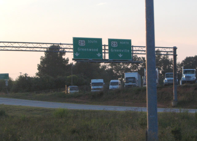
| U.S. 25 (White Horse Road) represents the main route joining Greenville with Greenwood, 47 miles to the south and Hendersonville, North Carolina north of Travelers Rest. 07/23/04 |
|
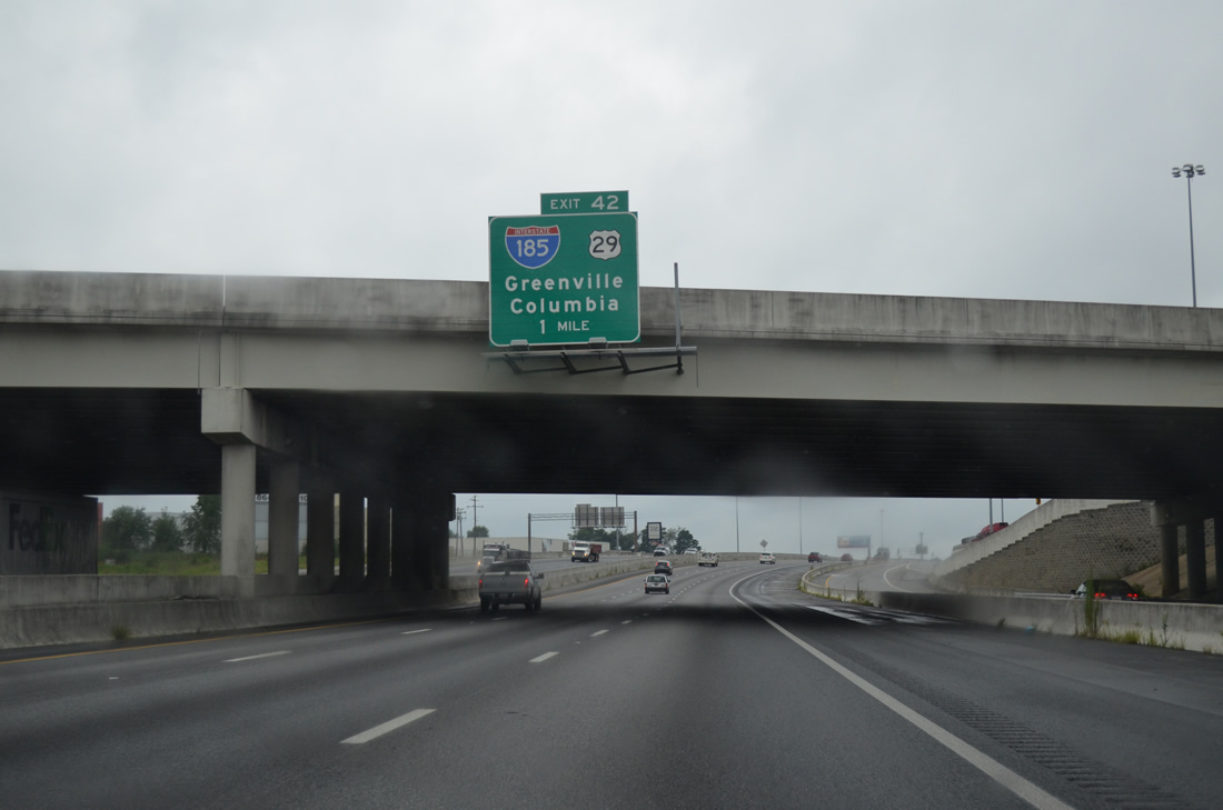
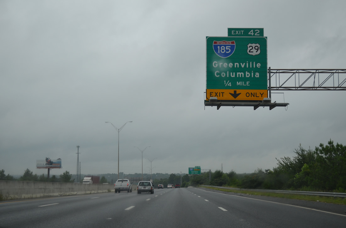
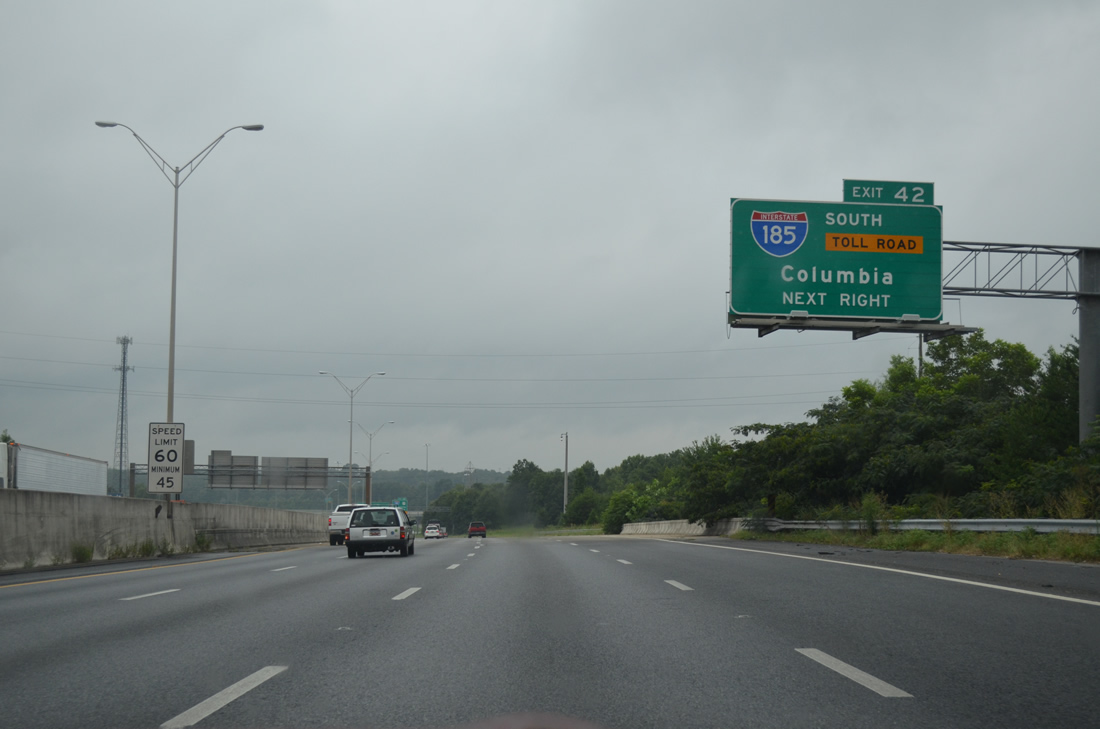
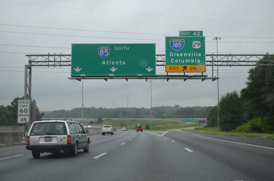
| Interstate 85 advances one mile west from U.S. 25 (White Horse Road) to the directional cloverleaf interchange (Exit 42) with I-185/U.S. 29 north and the tolled Southern Connector south. 08/07/13 |
|
| The c/d roadway merges back onto I-85 south at the half diamond interchange (Exit 44A) with S.C. 20 (Piedmont Highway). S.C. 20 runs south from Greenville to Piedmont, West Pelzer, Williamstown, and Belton in eastern Anderson County. 06/18/05 |
|
| I-185/U.S. 29 combine northeast 2.71 miles from I-85 to Mills Avenue at Dunean. U.S. 29 extends from there toward Downtown Greenville. 08/07/13 |
|
| The Southern Connector is a 13.69 mile long loop south from Exit 42 to Golden Grove and east to I-385 and U.S. 276 at Mauldin. The toll road opened to traffic on February 27, 2001. 08/07/13 |
|
| Interstate 185 provides a bypass of Greenville east to I-385 for Simpsonville and Columbia. Prior to the addition of the Southern Connector, there was no access to I-185/U.S. 29 north from I-85 south. 08/07/13 |
|
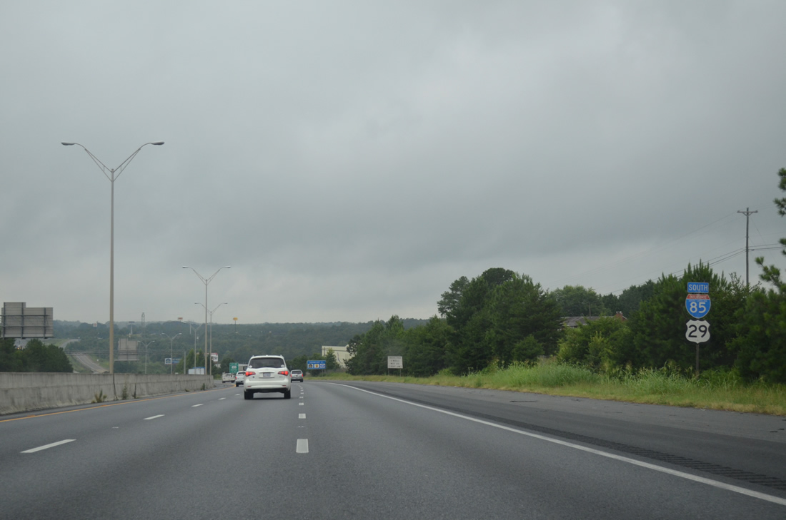
| U.S. 29 combines with Interstate 85 south from I-185 for 7.60 miles 08/07/13 |
|
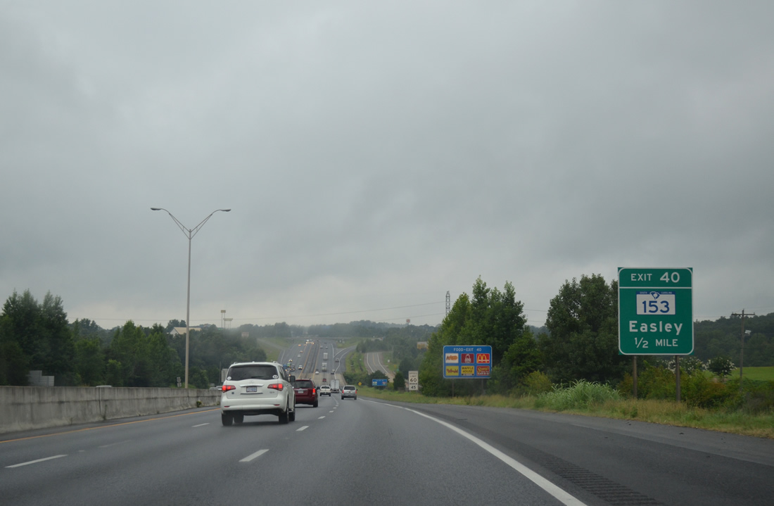
| S.C. 153 heads 1.1 miles northwest from I-185 (Southern Connector) to a parclo interchange (Exit 40) with I-85/U.S. 29. 08/07/13 |
|
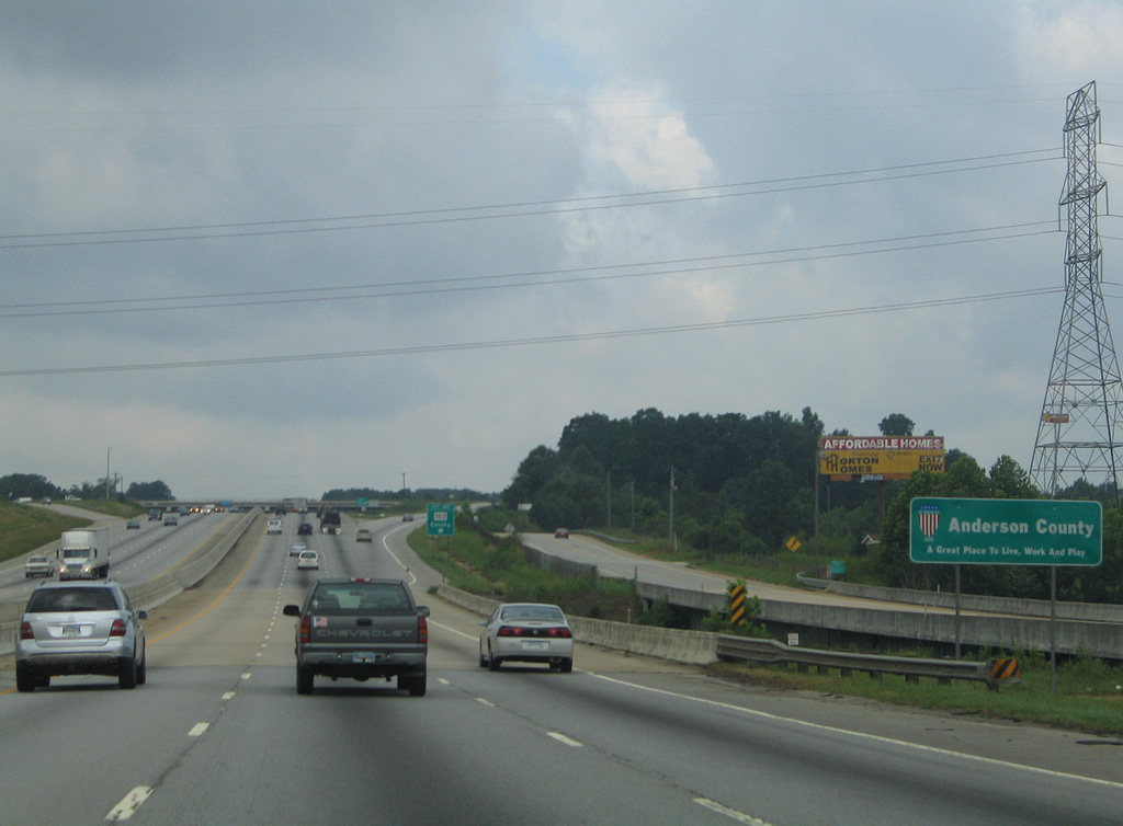
| A north side frontage road accompanies I-85/U.S. 29 southwest across the Saluda River and Anderson County line. 07/12/05 |
Page Updated 06-17-2021.

 South
South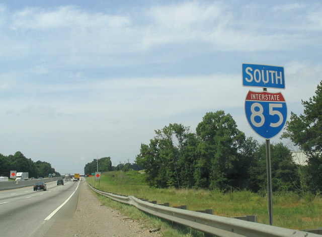

 South
South