|
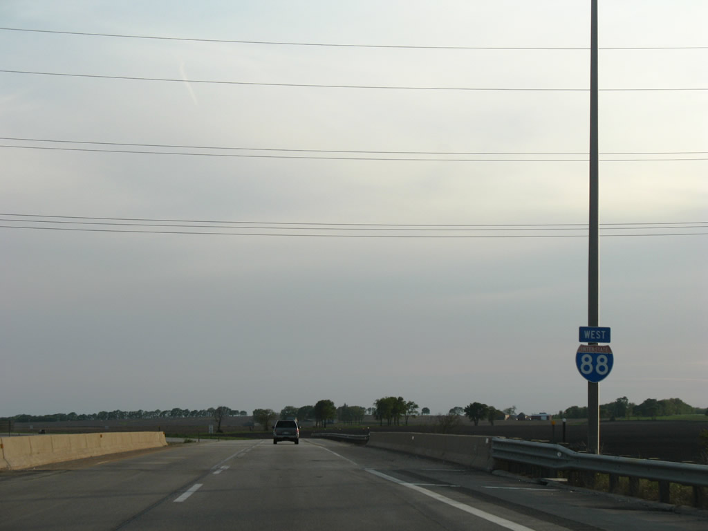
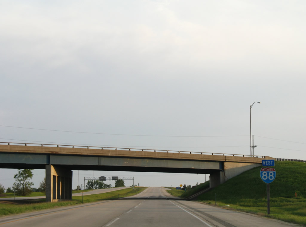
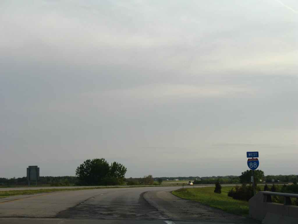
| This westbound reassurance shield for I-88 stands at the IL 26 underpass. 05/24/08 |
|
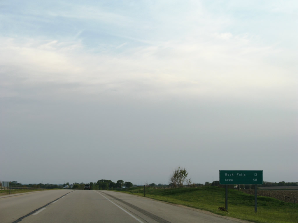
| Rock Falls lies 13 miles westward; Iowa is a 58 mile drive via Interstate 88 west to I-80 west. 05/24/08 |
|
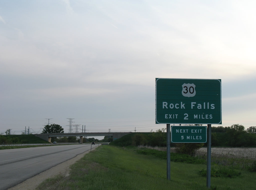
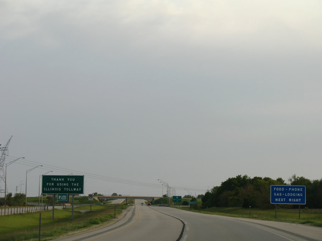
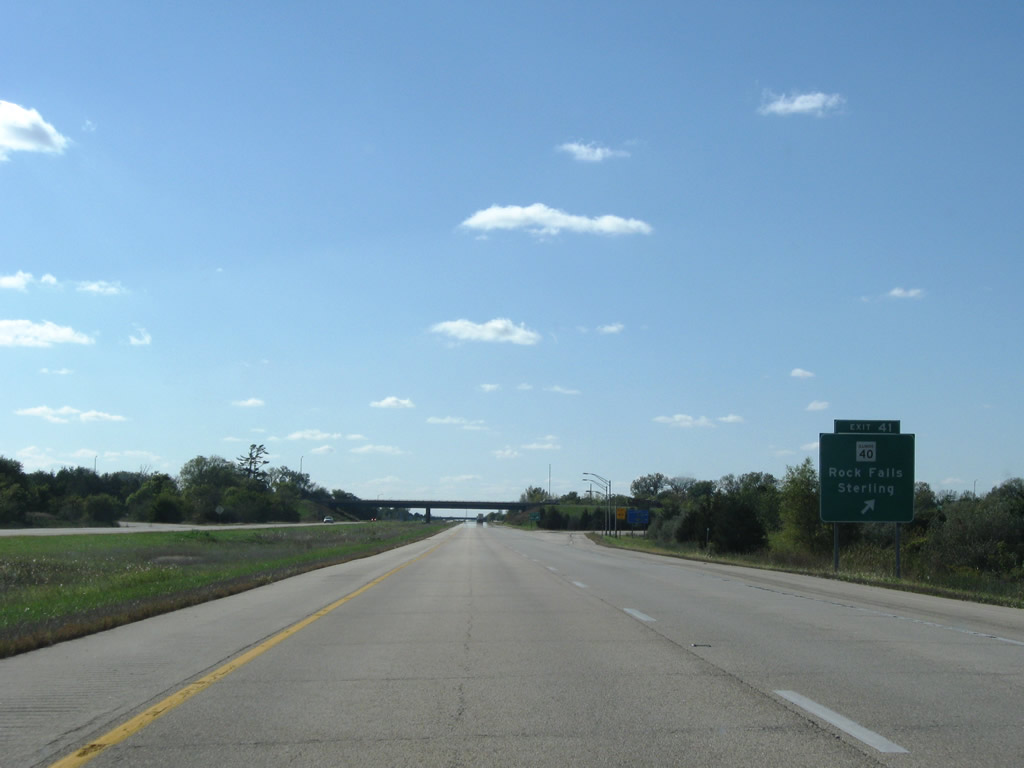
| Button copy guide sign posted for the last exit of Ronald Reagan Memorial Tollway westbound. U.S. 30 parallels Interstate 88 west from Aurora and crosses paths with the freeway just beyond the Whiteside County line. 05/24/08 |
|
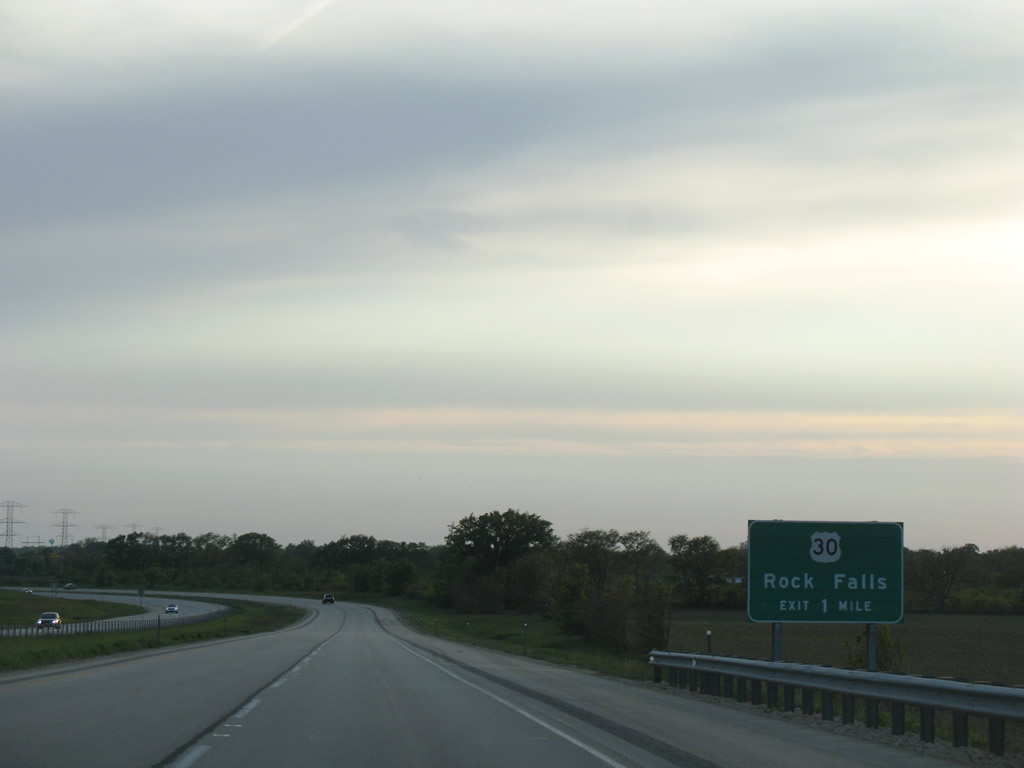
| Interstate 88 kinks southwest and bypasses Rock Falls and adjacent Sterling. U.S. 30 follows Rock Falls Road west from the diamond interchange at Exit 44 to IL 40 (1st Avenue) south of Downtown. 05/24/08 |
|
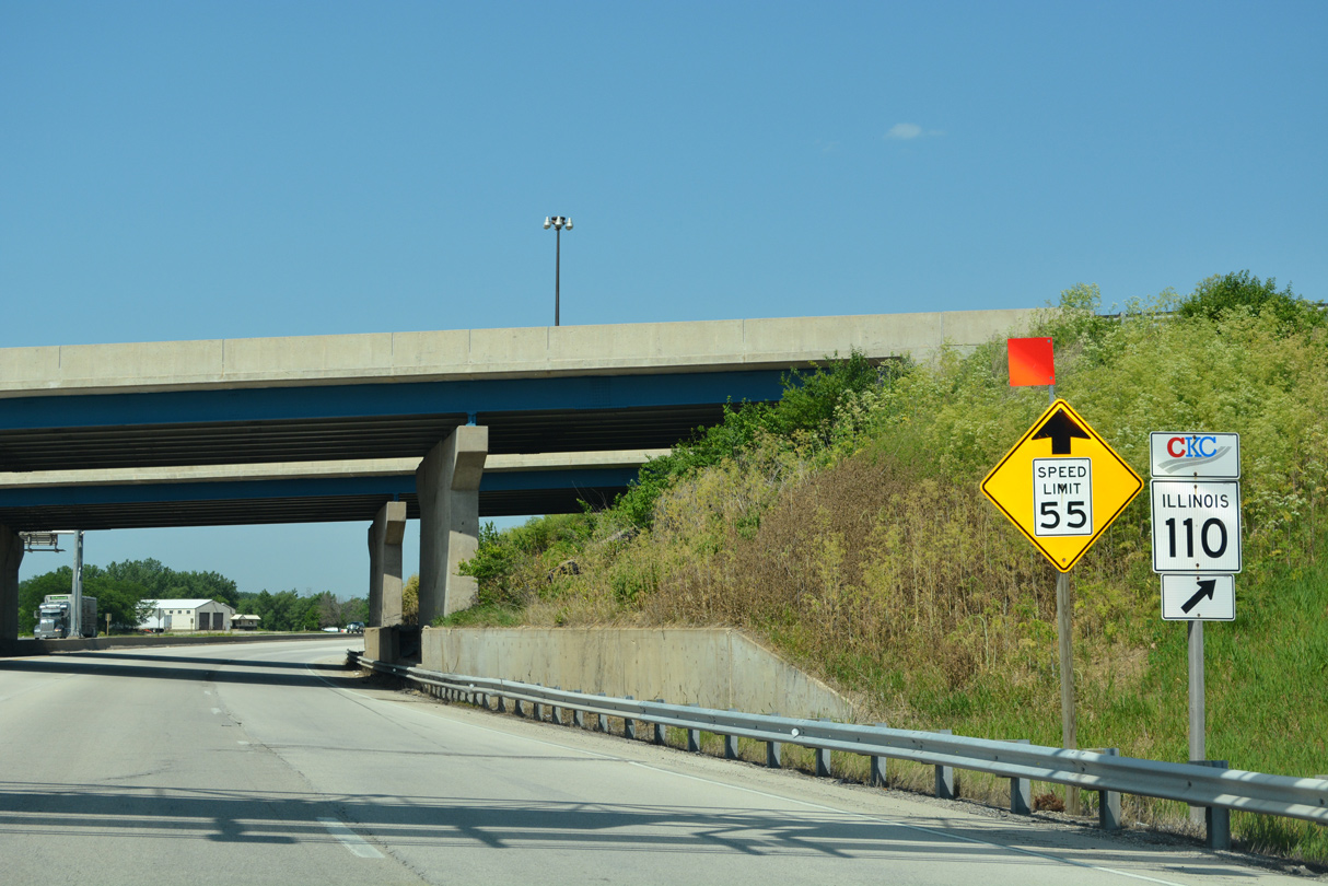
| Interstate 88 is a toll free route beyond U.S. 30 / Exit 44. 05/24/08 |
|
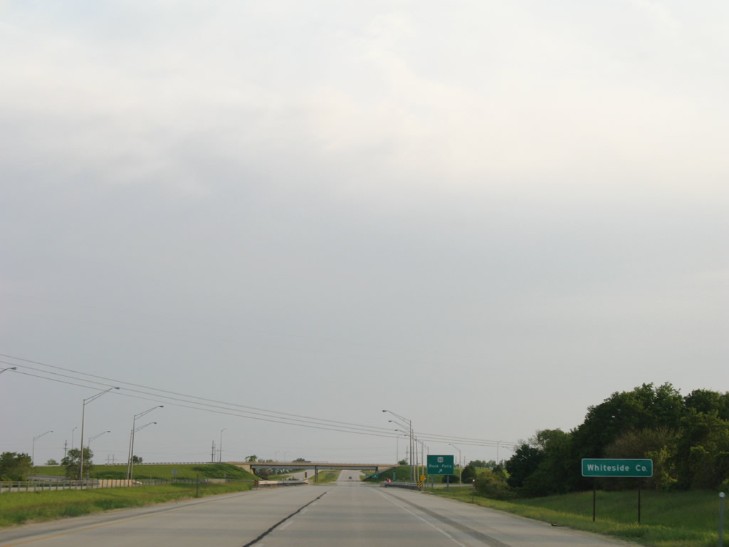
| Crossing into Whiteside County ahead of Howland Creek and Exit 44 to U.S. 30 on I-88/IL 110 west. U.S. 30 enters the Rock Falls area from a rural stretch in Lee County and departs the city for Unionville. 05/24/08 |
|
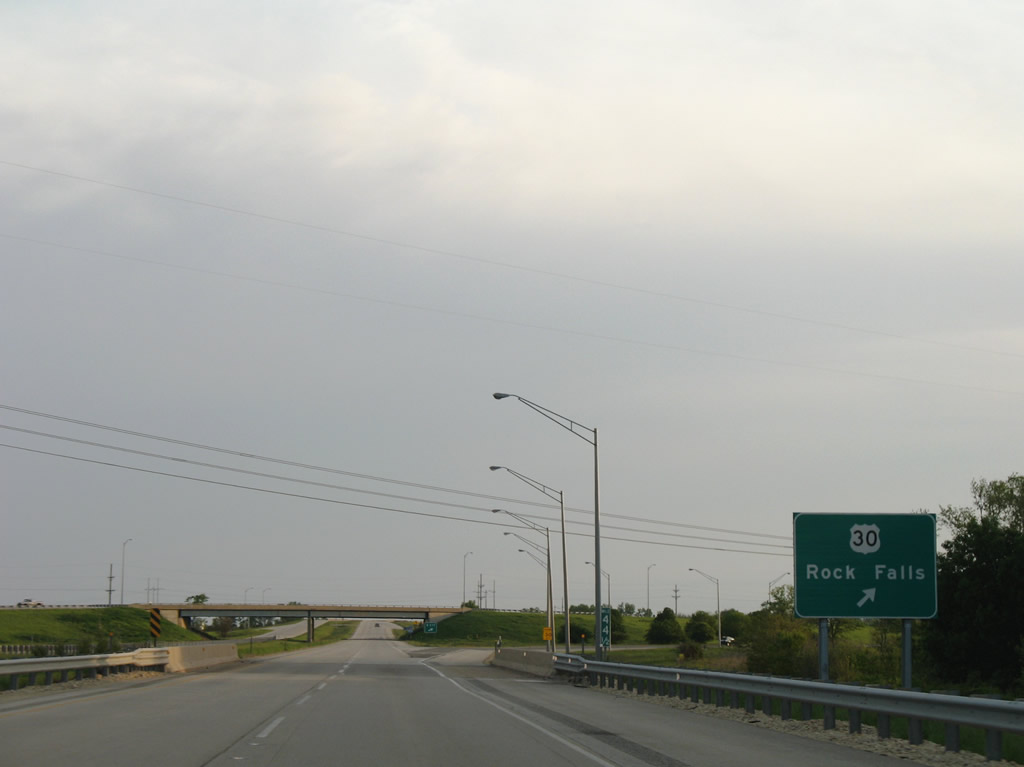
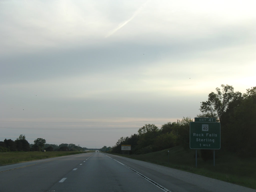
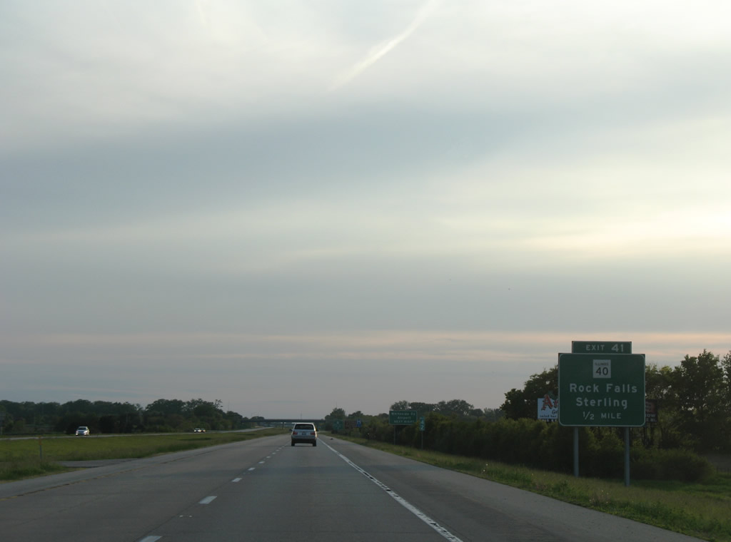
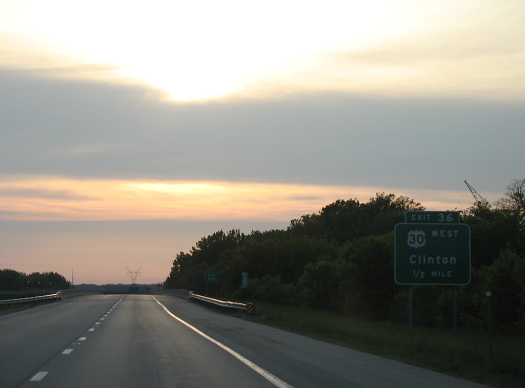
| Westbound Interstate 88/IL 110 at Exit 44 to U.S. 30 (Rock Falls Road). Rock Falls Road comprises a five lane commercial boulevard through southern reaches of Dixon to Como and Lincoln Road. Overall U.S. 30 travels 152 miles between Clinton, Iowa and Lynwood at the Indiana state line. 05/24/08 |
|
| Interstate 88 westbound reassurance marker posted at the U.S. 30 (Rock Falls Road) overpass. The East-West Tollway between Aurora and IL 40 / Exit 41 opened in 1974. The remainder of I-88 between Rock Falls and I-80 was constructed by the Illinois Department of Transportation as a toll free route. 05/24/08 |
|
| Curving westward again after the entrance ramp from Exit 44, a second westbound shield appears where the freeway passes over an abandoned Burlington Northern Railroad line. 05/24/08 |
|
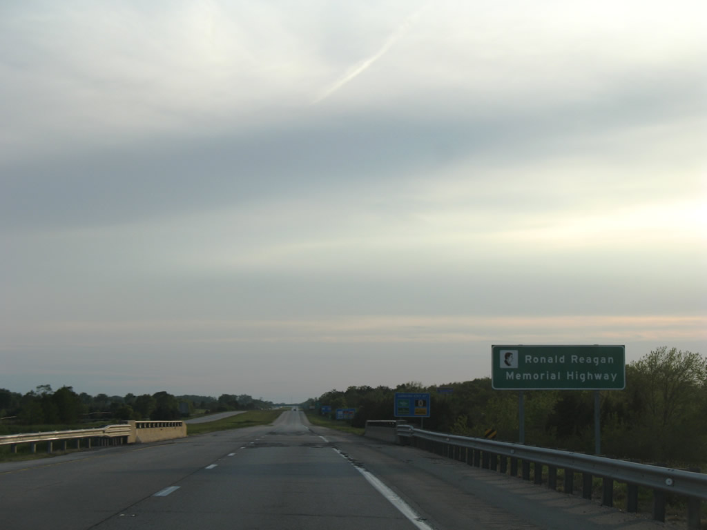
| Interstate 88 is designated the Ronald Reagan Memorial Highway on the non-tolled section between Rock Falls and East Moline. This sign acknowledges the designation at the Polo Road underpass. 05/24/08 |
|
| I-88/IL 110 advance west one mile to a diamond interchange (Exit 41) with IL 40 (Hoover Road / 1st Avenue). IL 40 crosses the freeway near Whiteside County Airport (SQI). 05/24/08 |
|
| IL 40 travels north to south 108 miles between East Peoria and Mt. Carroll. The designation replaced IL 88, which was renumbered to avoid confusion with the signing of Interstate 88. 05/24/08 |
|
| Exit 41 departs Interstate 88 west for IL 40 (Hoover Road south / 1st Avenue north) at Rock Falls. Spanning the Rock River along 1st Avenue, IL 41 joins Downtown Rock Falls with Downtown Sterling. The state route also serves interests to the birthplace of President Ronald Reagan. Southward, IL 40 continues five miles to IL 172 and ten miles to Deer Grove. 10/03/08 |
|
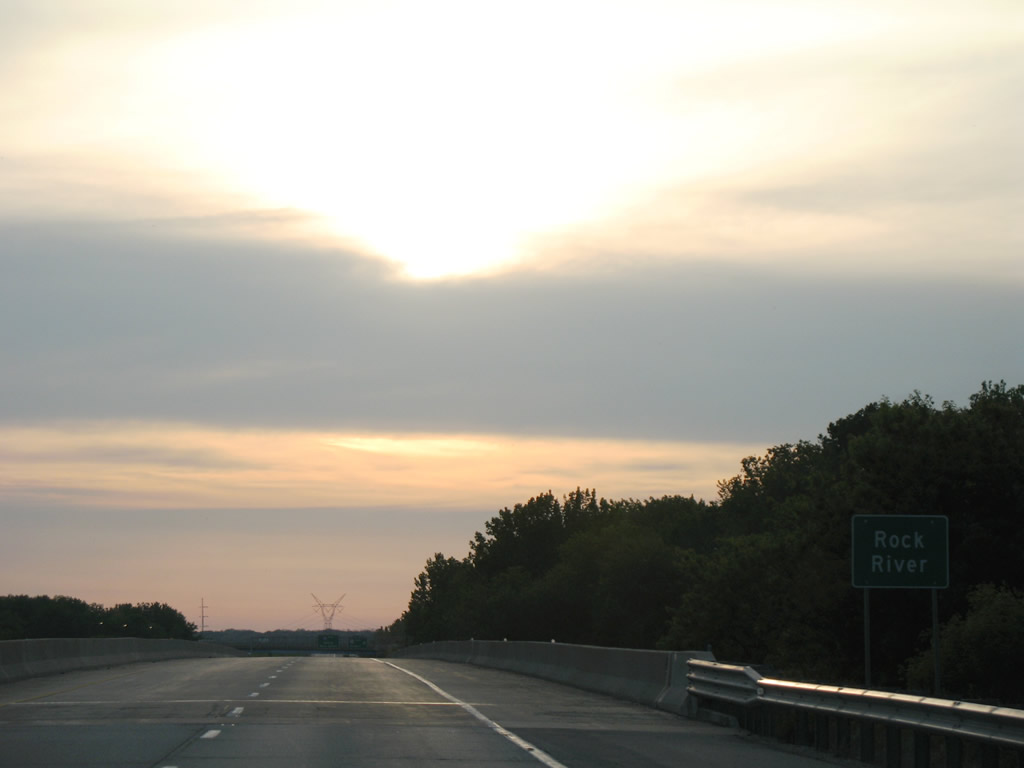
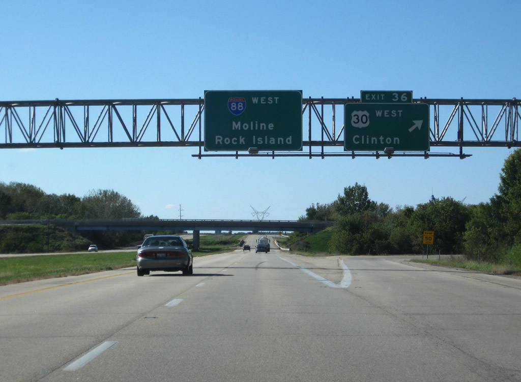
| Leaving the Rock Falls area, I-88/IL 110 span the Rock River ahead of a trumpet interchange (Exit 36) with Lincoln Road north to U.S. 30 (Rock Falls Road) and Moline Road (former IL 2). 05/24/08 |
|
| The Rock River flows southward from the Janesville, Wisconsin area through Rockford to Dixon, Sterling and the Quad Cities. 05/24/08 |
|
| U.S. 30 (Lincoln Road) branches northward from the I-88 corridor near Como to Unionville, Morrison, Fulton, and Clinton, Iowa. Moline Road (old IL 2) stems west from Lincoln Road to the village of Lyndon. 10/03/08 |
|
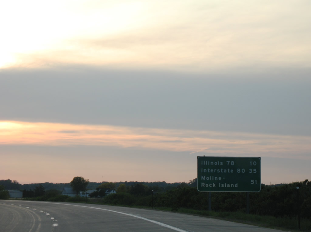
| Continuing west, I-88/IL 110 meet IL 78 in ten miles near Lyndon, and I-80 at East Moline in 35 miles. 05/24/08 |
|
| A diamond interchange joins IL 78 (Crosby Road) with I-88/IL 110 at Exit 26. Forming a multi state route with Wis 78, IL 78 measures 210 miles between Jacksonville and the state line near Warren. 05/24/08 |
|
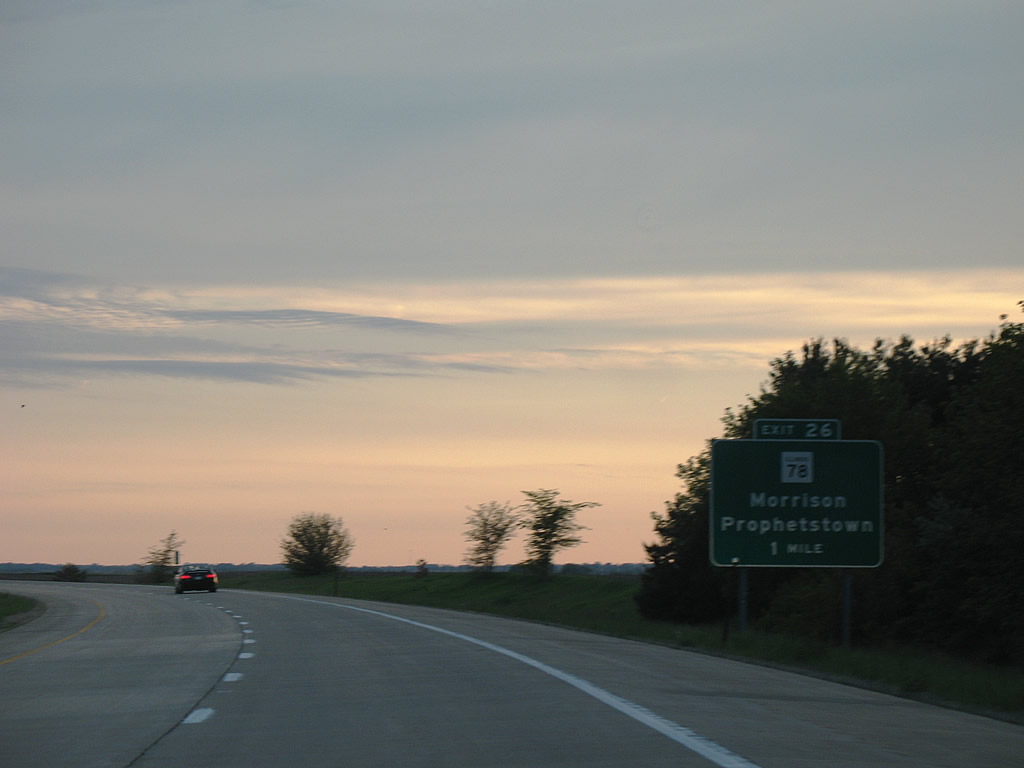
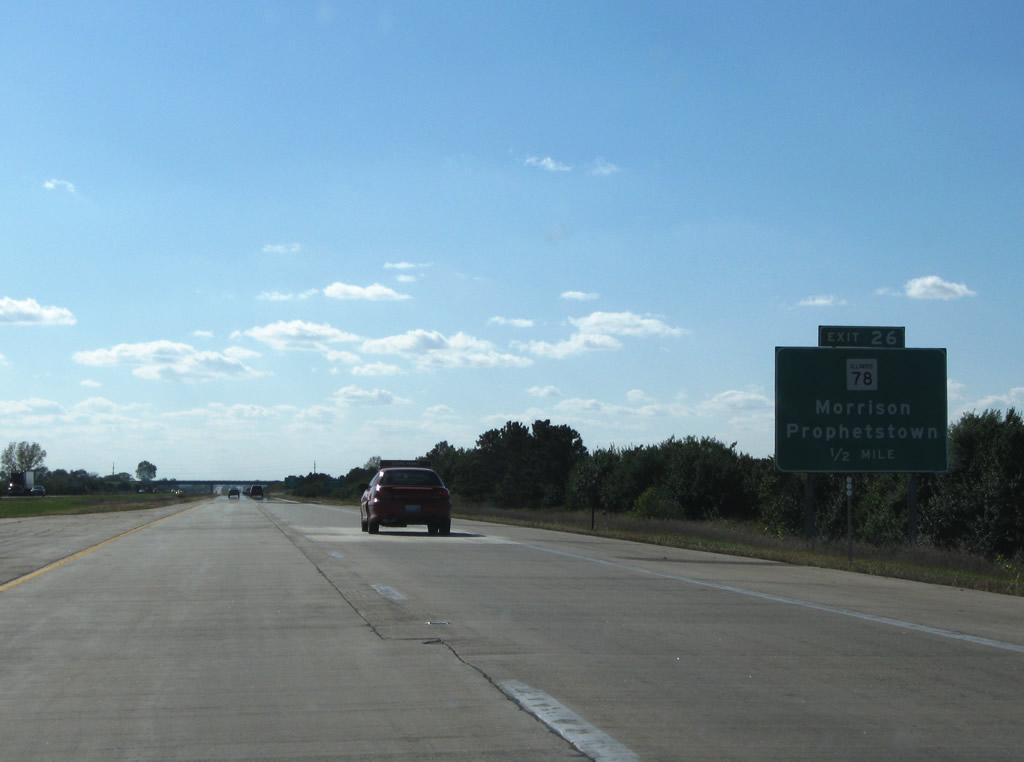
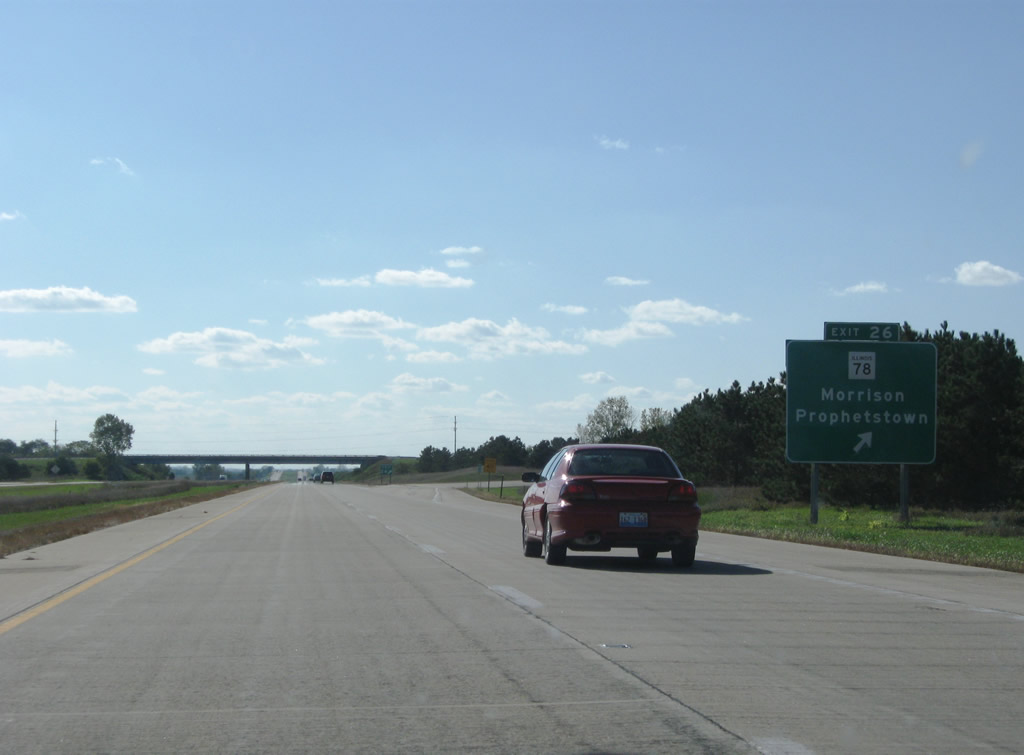
| Passing north of Lyndon, I-88/IL 110 advance to within one half mile of IL 78 (Crosby Road). South from Exit 26, IL 78 dog legs east from Moline Road (old IL 2) to Bishop Road on the west side of Lyndon. 10/03/08 |
|
| Exit 26 leaves I-88/IL 110 (CKC) west for IL 78 (Crosby Road). IL 78 leads north from Exit 26 to Unionville, Morrison, and Morrison-Rockwood State Park and south to Prophetstown State Park, Prophetstown and I-80 at Annawan. 10/03/08 |
|
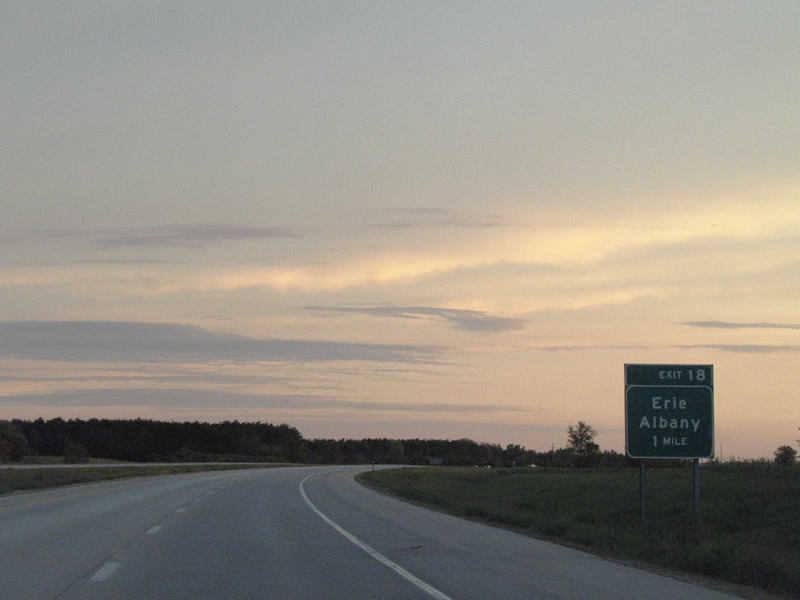
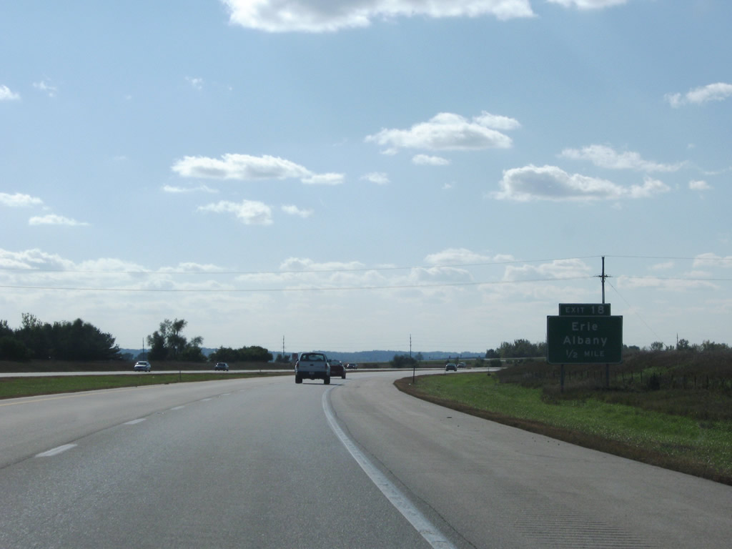
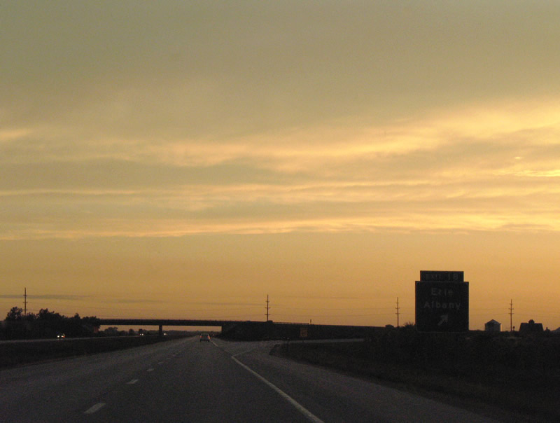
| Albany Road meets Interstate 88 at a diamond interchange (Exit 18) in western Whiteside County. 05/24/08 |
|
| Albany Road (County Route 13) leads southeast from I-88/IL 110 to the community of Erie. CR 13 resumes south from Erie to CR 3 at Spring Hill. 10/03/08 |
|
| (CR 13) Albany Road heads 9.5 miles northwest from Exit 18 to 5th Avenue S at the Albany village line. Albany lies along the Mississippi River on IL 84. 05/24/08 |
|
| A 7.7 mile exit less stretch ensues where I-88/IL 110 curve southwest across open farm land to Hillside. 05/24/08 |
|
| Crossing over Meredosia Ditch, I-88/IL 110 west enter Rock Island County. 122nd Avenue N / Fargo Road passes over the freeway ahead. 05/24/08 |
|
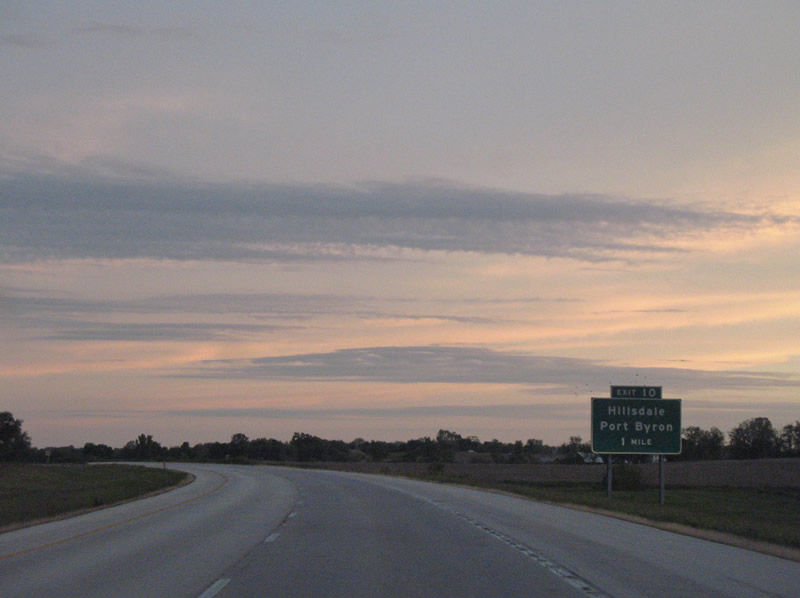
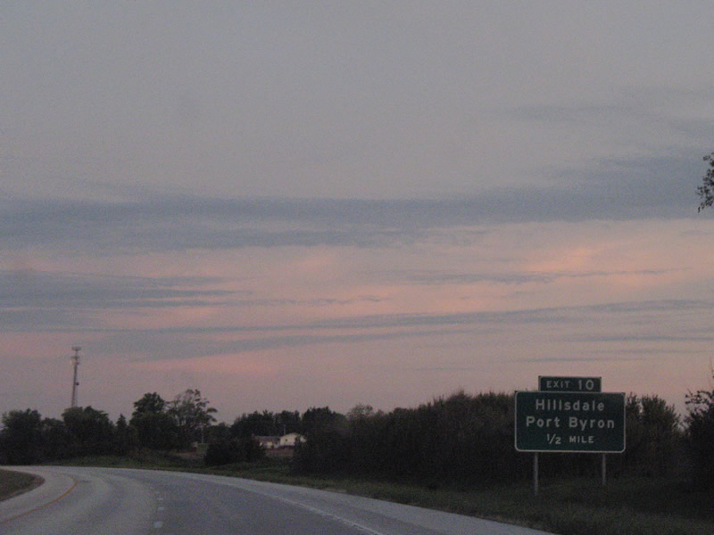
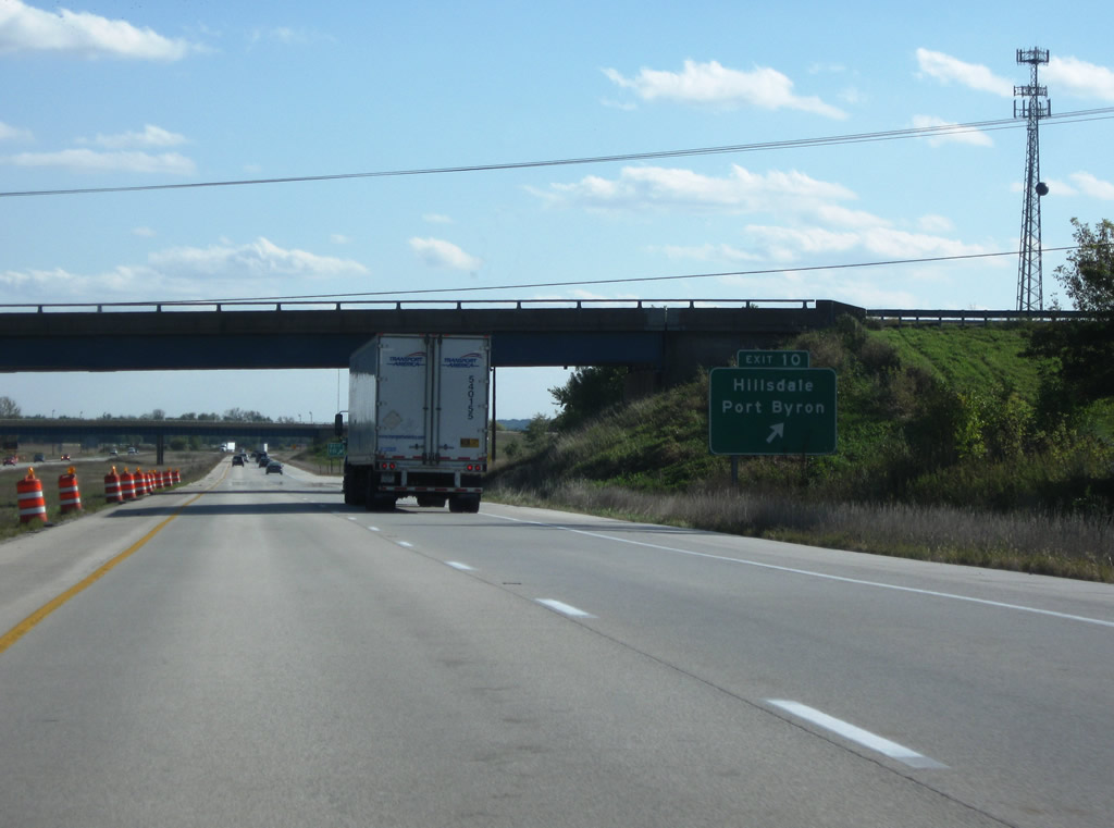
| Moline Road (former IL 2) meets I-88/IL 110 (CKC) at a diamond interchange (Exit 10) outside Hillsdale. 05/24/08 |
|
| Moline Road angles northeast to Hillsdale, where it meets County Road 2 (94th Avenue North) west to Port Byron and Main Street east to the village center. 05/24/08 |
|
| Passing under CR 2 (94th Avenue North), Interstate 88 reaches the off-ramp (Exit 10) to Moline Road (old IL 2). Moline Road shifts sides with I-88, traversing farm land along a bluff line southwest to Zuma township and Exit 2. 10/03/08 |
|
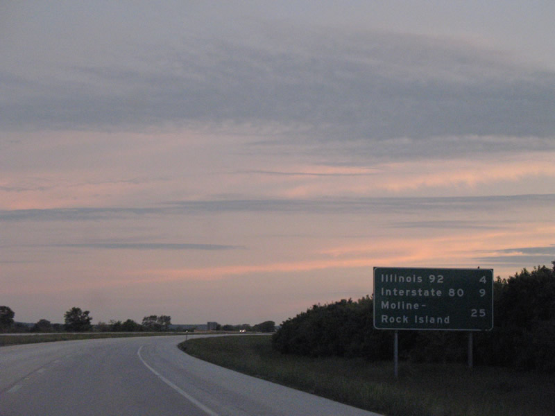
| Leading away from Hillsdale, I-88/IL 110 continue four miles southwest to Exit 6 for IL 92. I-80 follows in nine miles, with Moline and Rock Island located 19 and 23 miles to the west respectively via the continuation of IL 92 from I-88. 05/24/08 |
|
| Forthcoming IL 92 travels 100 miles within the Prairie State, beginning at U.S. 34 west of Mendota and ending at the Iowa state line near Muscatine. 10/03/08 |
|
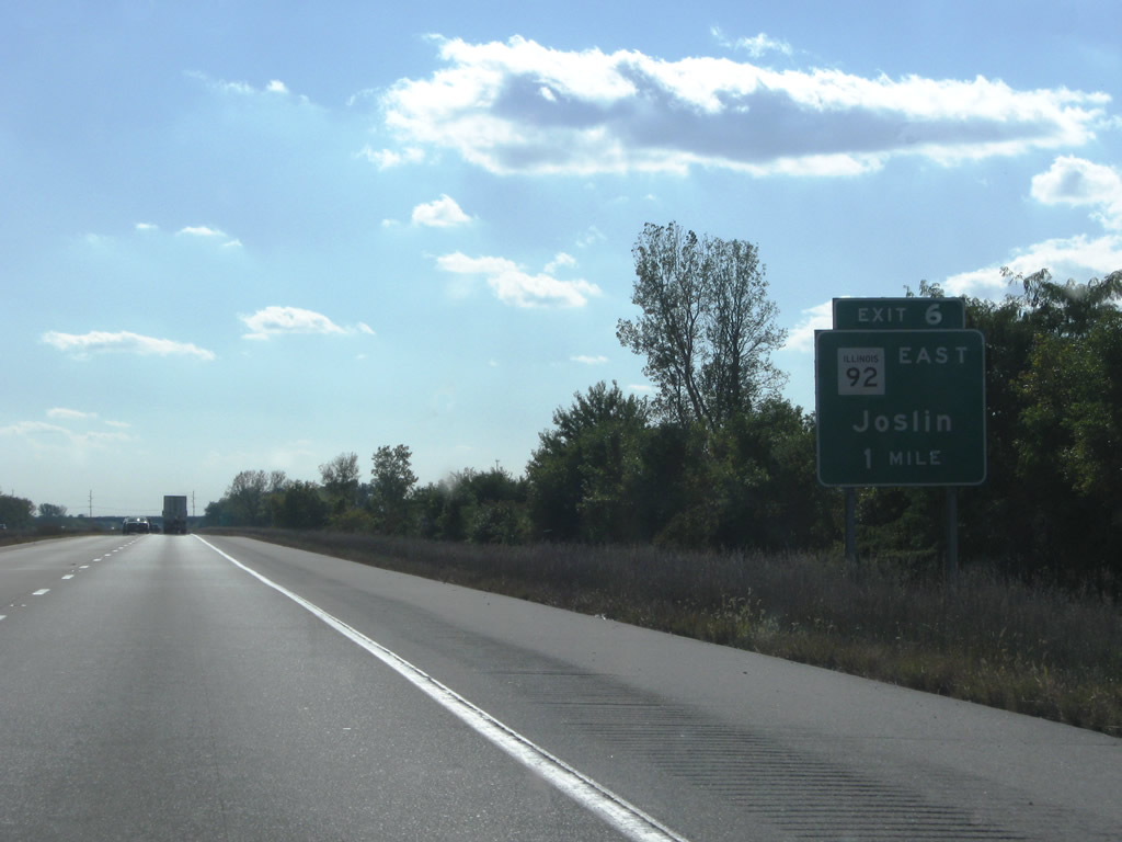
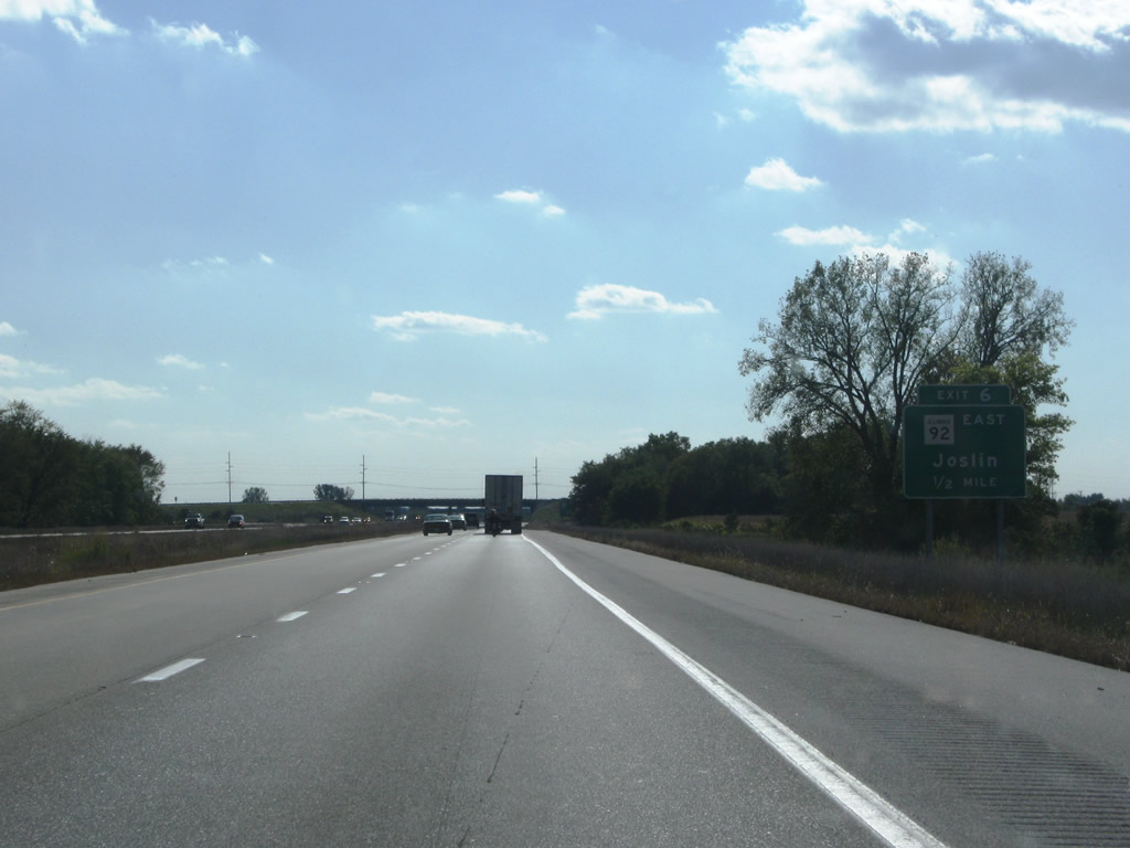
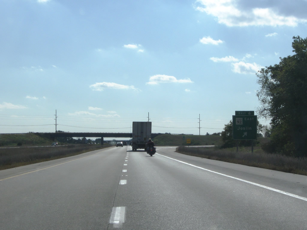
| IL 92 crosses the Rock River west from IL 82 in Henry County and converges with I-88/IL 110 west of Joslin. 10/03/08 |
|
| Entering the diamond interchange (Exit 6) with IL 92 east to Joslin and 38th Avenue N west to Old IL 2/92. 10/03/08 |
|
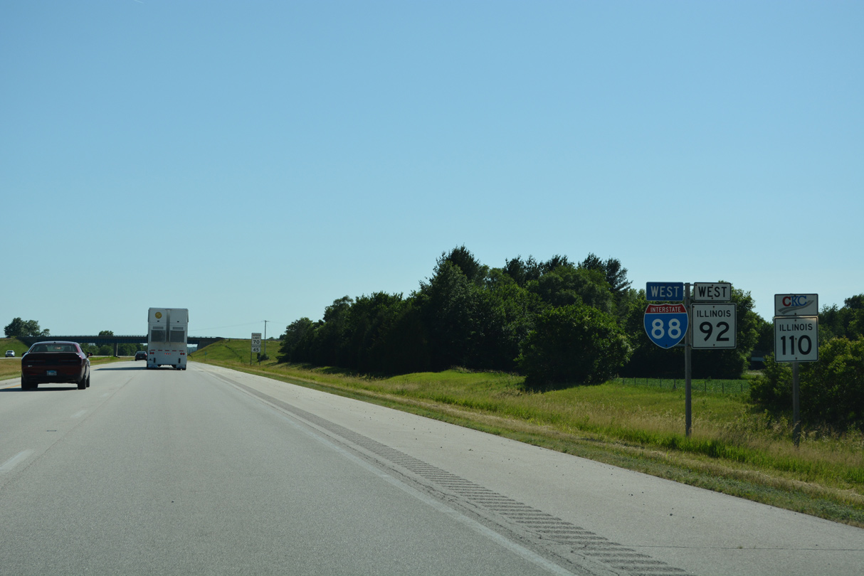
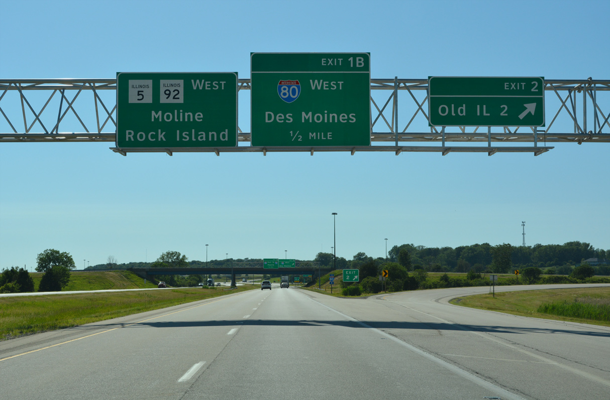
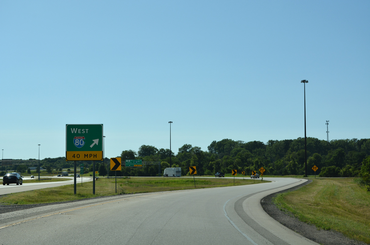
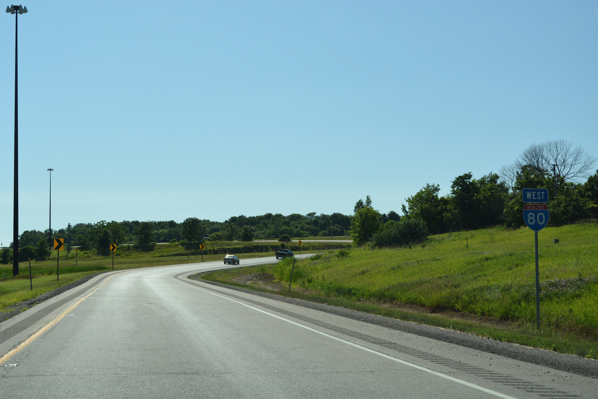
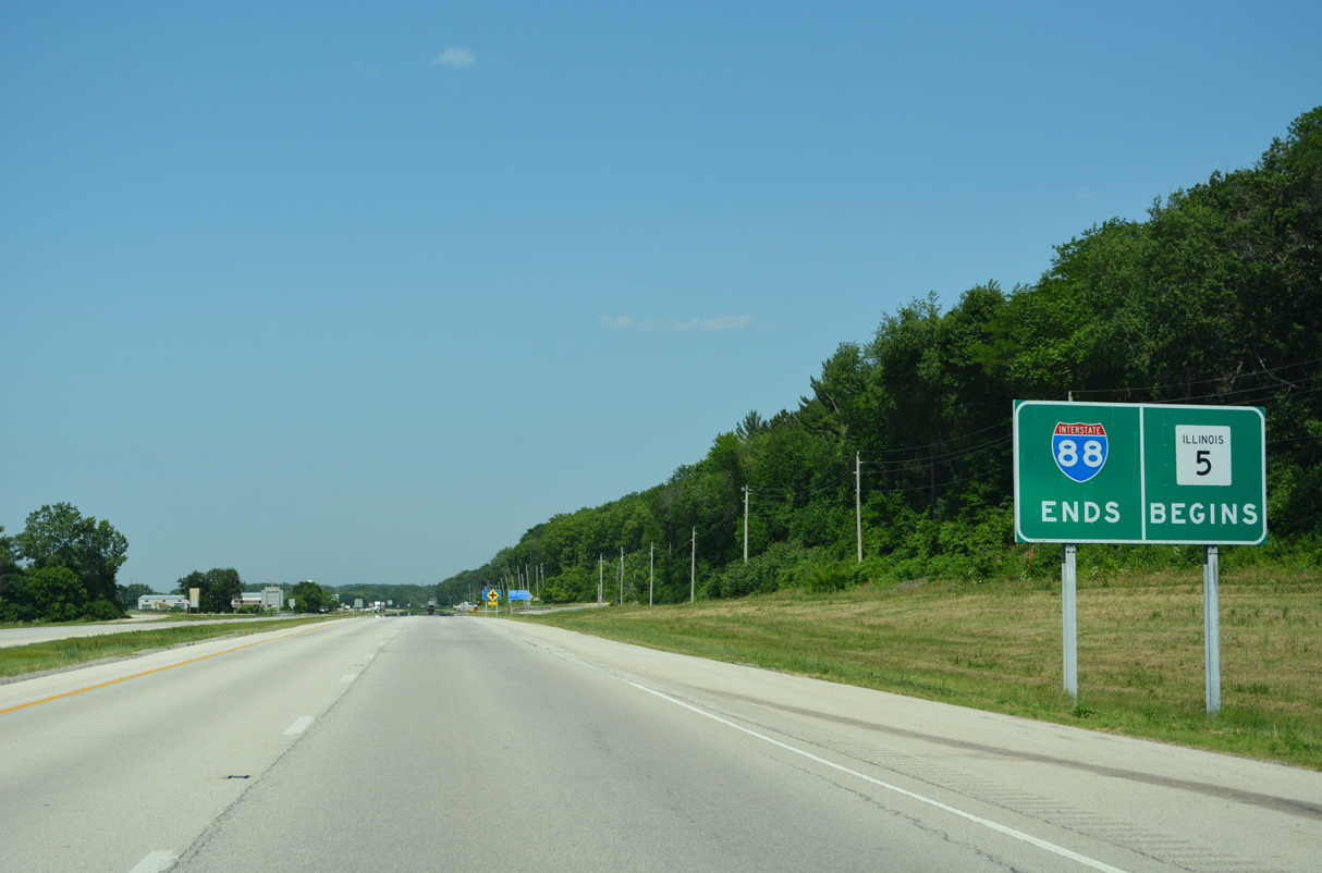
| IL 92 combines with the final 5.69 miles of Interstate 88 west to I-80/IL 5. These confirming markers for I-88/IL 92-110 precede the 265th Street overpass. 06/20/22 |
|
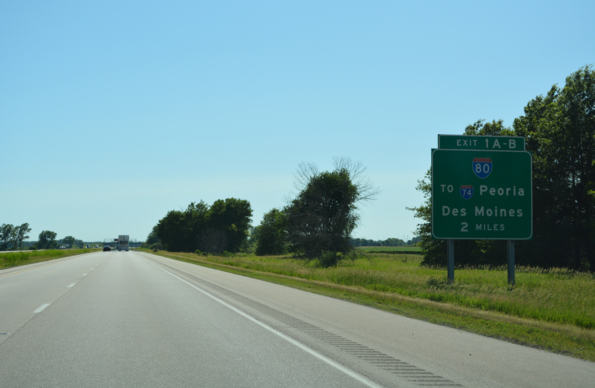
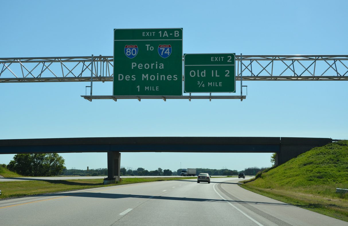
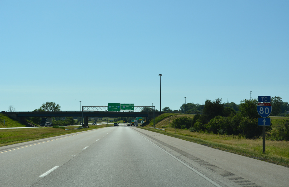
| A cloverleaf interchange (Exits 1 B/A) joins I-88/IL 92-110 west with Interstate 80 in two miles. 06/20/22 |
|
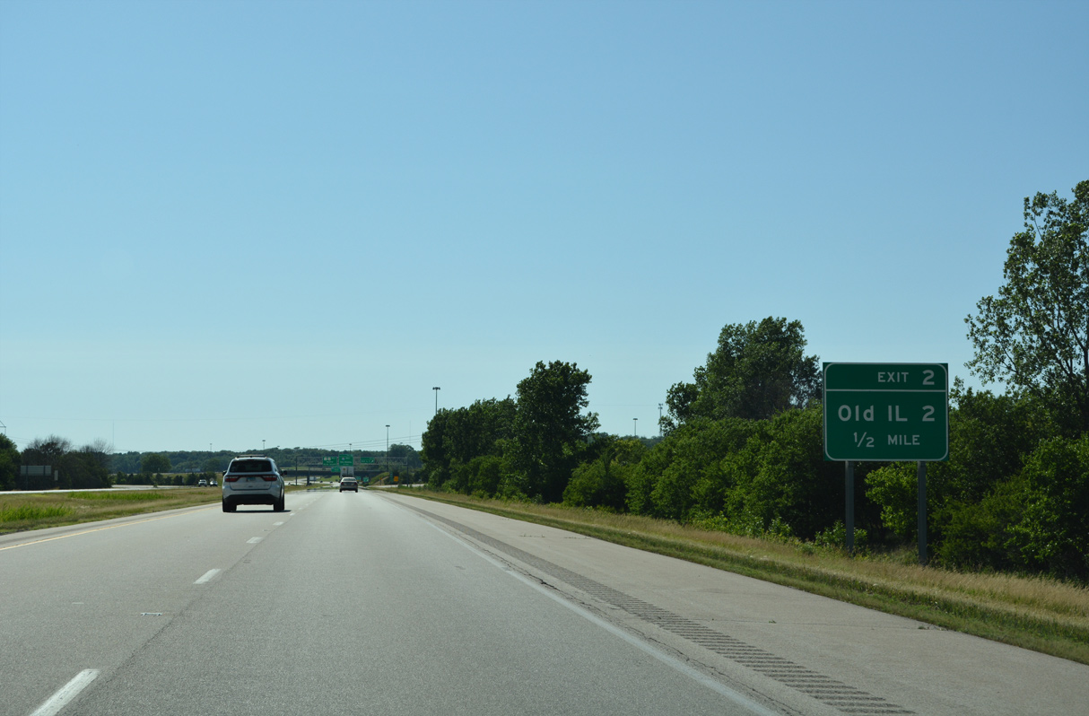
| The succeeding exit from I-88/IL 92-110 is with Old IL 2 (Moline Road). IL 2 was decommissioned from Sterling west to East Moline when the East-West Tollway (IL 5) opened to traffic in 1974. 06/20/22 |
|
| Moline Road (Old IL 2) leads north to Falcon Farms mobile home park along a rural route to 38th Avenue N and County Route P/15 (221st Street) north to Rapids City. 06/20/22 |
|
| Exit 2 departs I-88/IL 92-110 west for Old IL 2. Freidens Road and 207th Street spur west from Moline Road as frontage roads adjacent to the exchange joining I-80 and I-88. 06/20/22 |
|
| Future road work included in the I-80 Mississippi River Bridge project reconfigures the exchange joining I-88 and I-80 with a new directional ramp from I-80 east to I-88 east and ramp realignments for all others to improve geometry.1 06/20/22 |
|
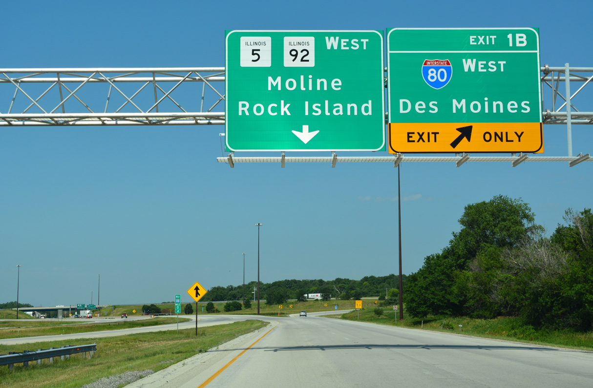
| Exit 1 B separates from I-88 west within the diamond interchange at Moline Road (Old IL 2) for Interstate 80 west to Rapids City, Le Claire, Bettendorf and Davenport, Iowa. 06/20/22 |
|
| Exit 1 B forms a collector distributor roadway that connects both I-88 and Moline Road with Interstate 80 west to Des Moines, Iowa. 06/20/22, 06/21/22 |
|
| Interstate 80 crosses the Iowa state line into Le Claire, Iowa 3.49 miles north of I-88/IL 5-92. 06/21/22 |
|
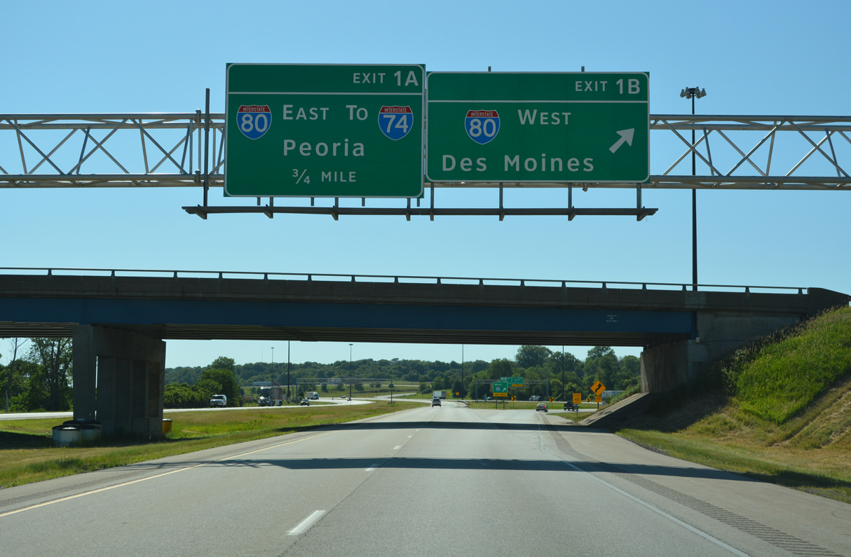
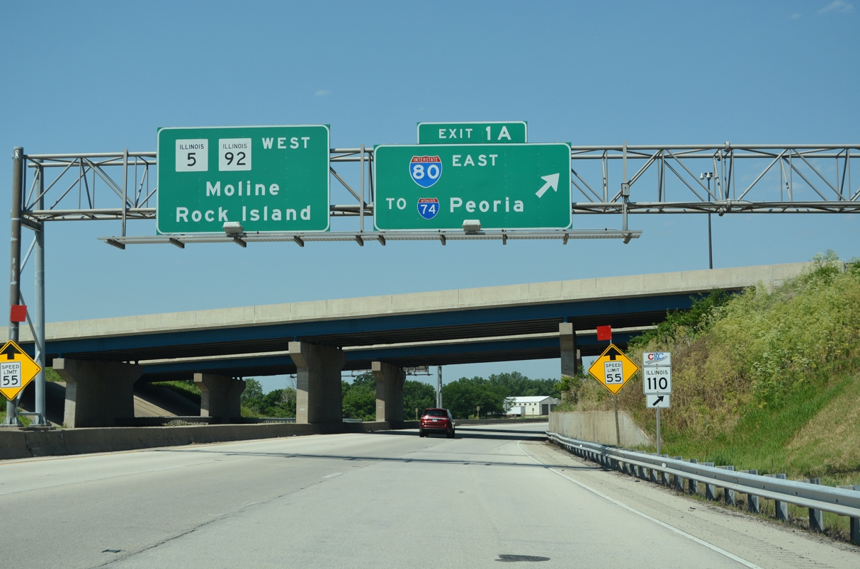
| Exit 1 A loops onto I-80 east and IL 110 (Chicago Kansas City Expressway) west to Colona and the Big X Interchange with I-74/280. 06/21/22 |
|
| IL 110 (CKC) accompanies I-74 south from the Quad Cities to Galesburg while Interstate 80 turns east to Geneseo and Chicago. 06/21/22 |
|
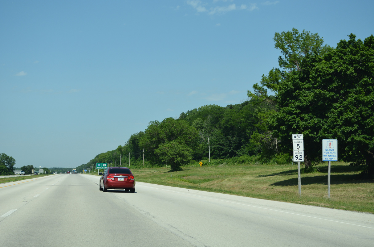
| IL 5 overlaps with IL 92 for 3.95 miles to a parclo interchange with IL 84 at Carbon Cliff and Silvis. IL 5 runs 15.73 miles west from East Moline to U.S. 67 in Rock Island. 06/21/22 |
|
| IL 5/92 extend west from the end of I-88 along an at-grade expressway. A previous Quad Cities transportation plan outlined a westward extension of Interstate 88 into Downtown Moline.2 06/21/22 |
Page Updated 12-09-2023.


 West
West