|
| MT 200 combines with I-90/U.S. 12 west from Bonner and West Riverside. The state highway overlaps with the freeway for 13.5 miles. 09/01/06 |
|
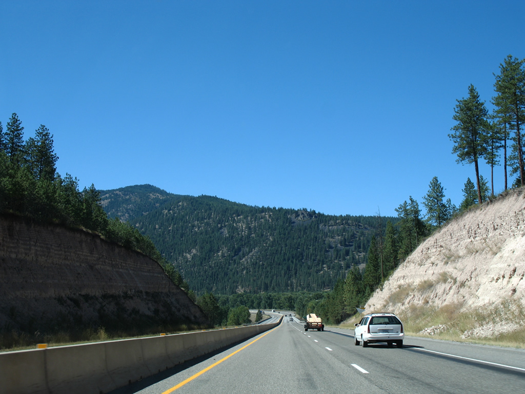
| I-90/U.S. 12-MT 200 span the Clark Fork river west near Pinegrove. The city center of Missoula is five miles away. 09/01/06 |
|
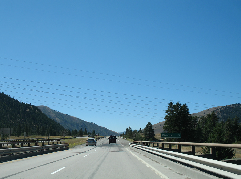
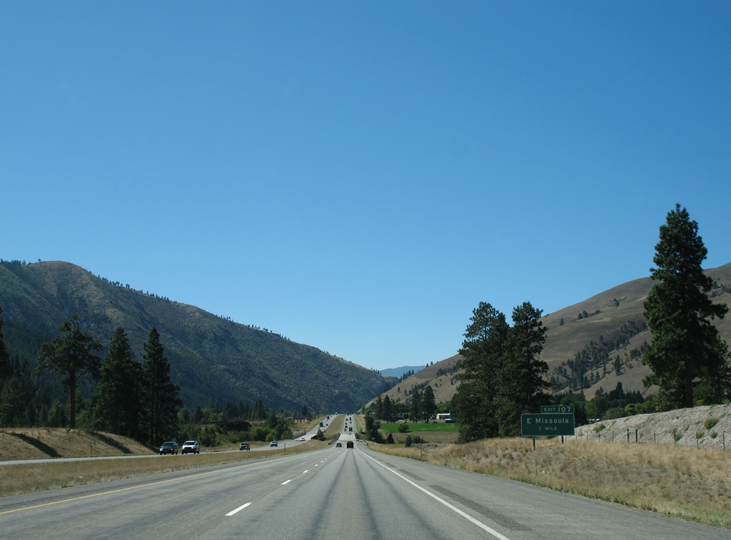
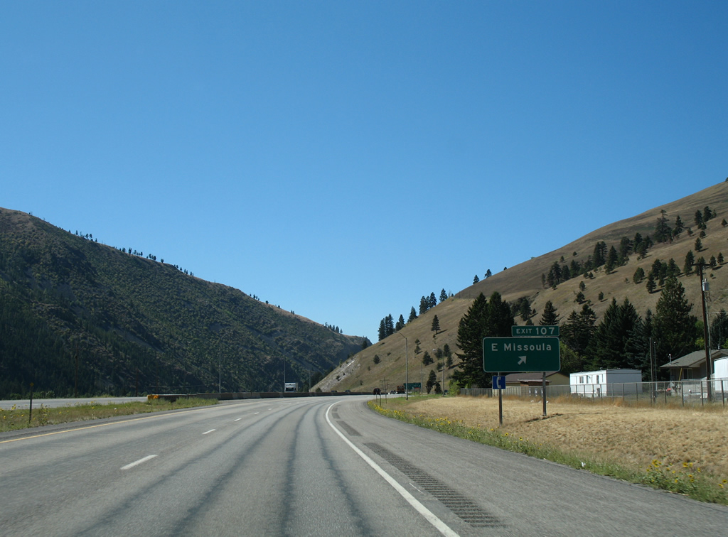
| One mile east of the diamond interchange (Exit 107) for East Missoula. The slopes of University Mountain and Mount Jumbo form a valley where Interstate 90 and the Clark Fork river pass through into Missoula. 09/01/06 |
|
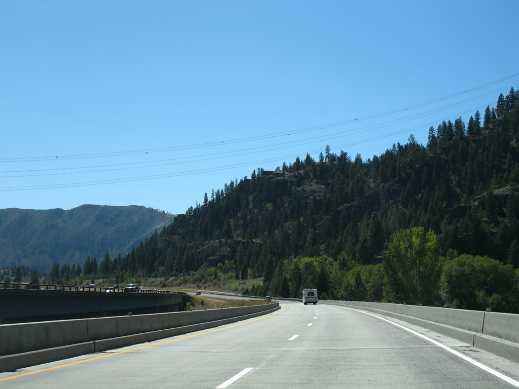
| Leaving the Bandmann Flats area, I-90/U.S. 12-MT 200 again cross the Clark Fork river. A Montana Rail Link line spans the river to the immediate south and parallels I-90 into Missoula. 09/01/06 |
|
| Highway 200 (former U.S. 10-12 and MT 200) loops west from West River through unincorporated East Missoula to meet Interstate 90 at Exit 107. Broadway Street extends the former U.S. 10/12 west alongside the Montana Rail Link tracks into the city of Missoula. 09/01/06 |
|
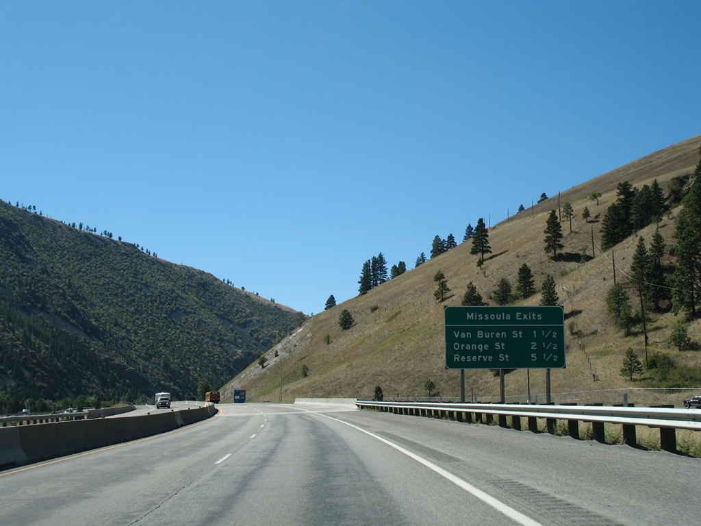
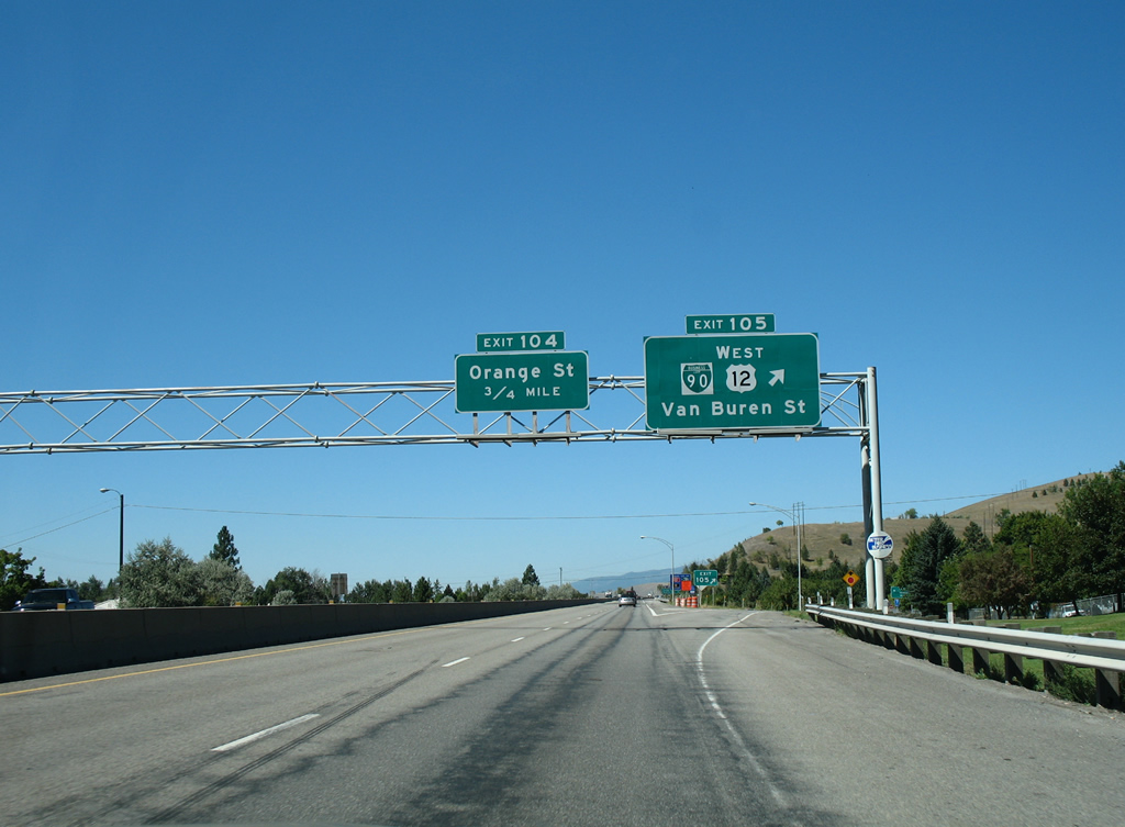
| Three Interstate 90 interchanges lie within the Missoula city limits over the course of 5.5 miles. The first sees U.S. 12 depart the freeway for Van Buren Street in 1.5 miles. 09/01/06 |
|
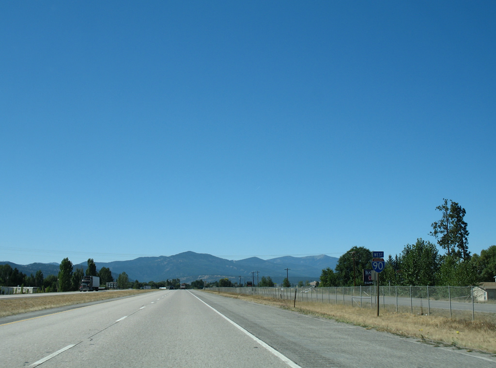
| The final shield assembly for the overlap with U.S. 12 precedes Hellgate Canyon along I-90/MT 200 west. U.S. 12 runs concurrent with I-90 for 67 miles from Garrison westward. 09/01/06 |
|
| Business Loop II-90 coincides with U.S. 12 west along Van Buren Street south to Broadway Street (old U.S. 10) west. The business route constitutes a 4.755 mile loop using Van Buren Street, Broadway Street through Downtown and U.S. 93 (Reserve Street) to I-90 at Exit 101. 09/01/06 |
|
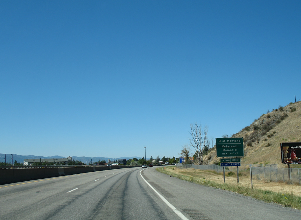
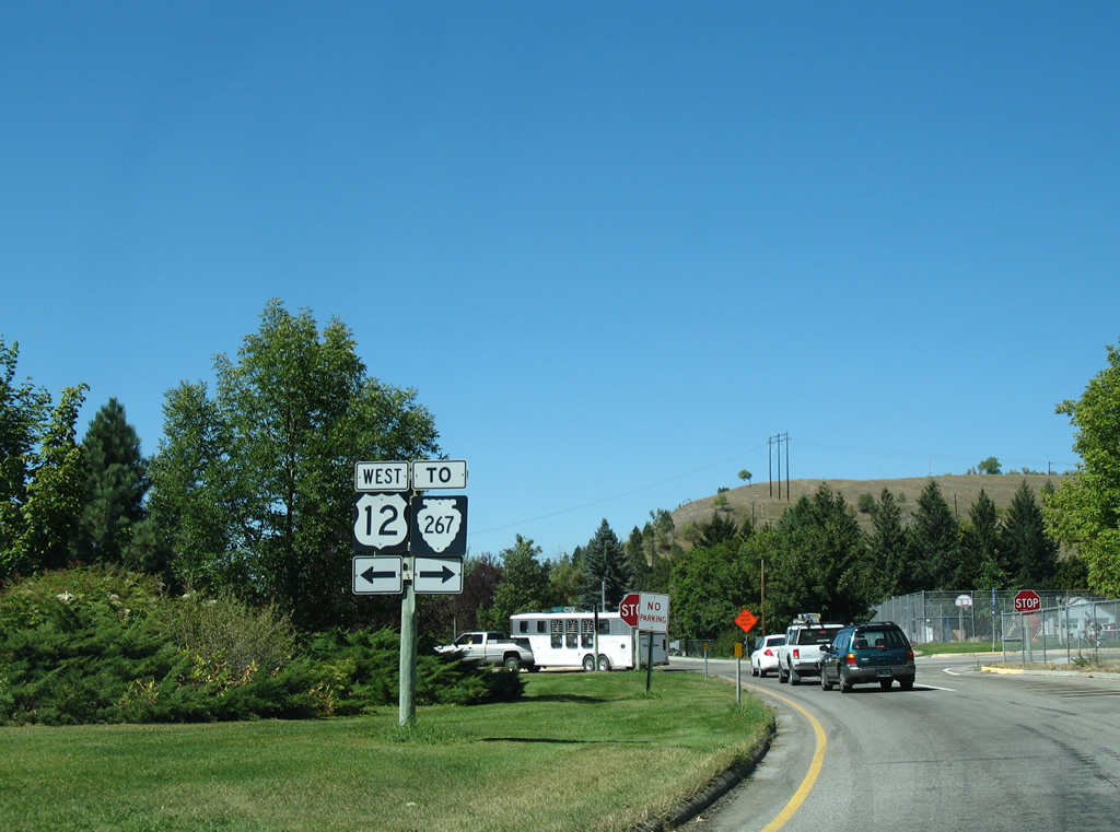
| U.S. 12 follows Madison Street south from Business Loop I-90 and Broadway Street to the University of Montana campus. 09/01/06 |
|
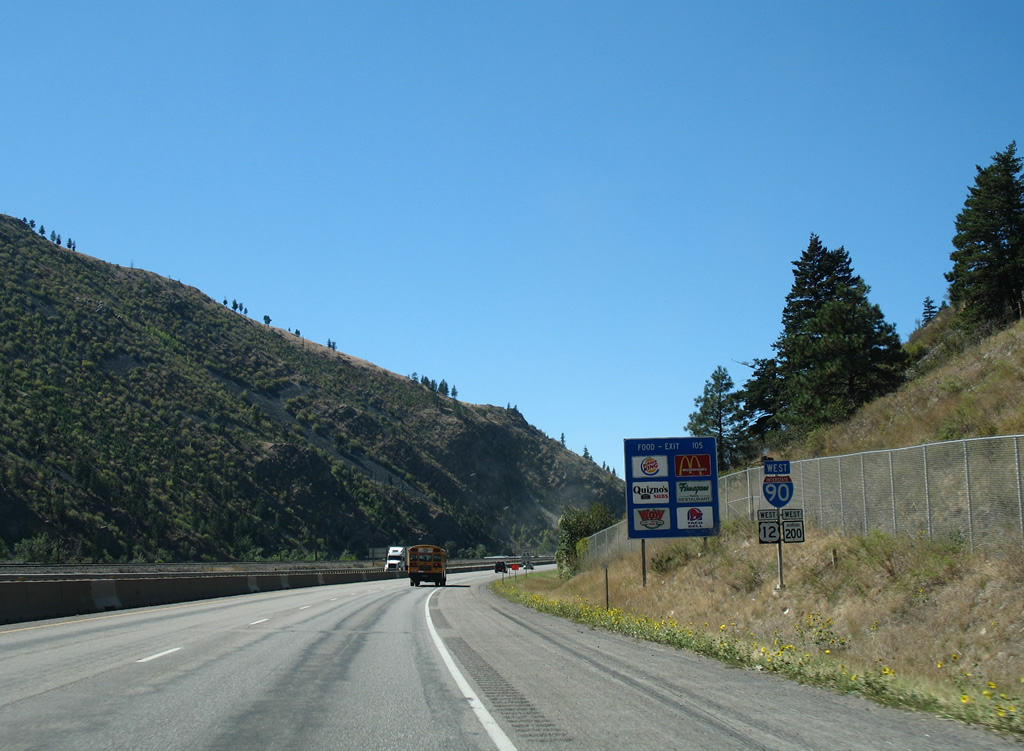
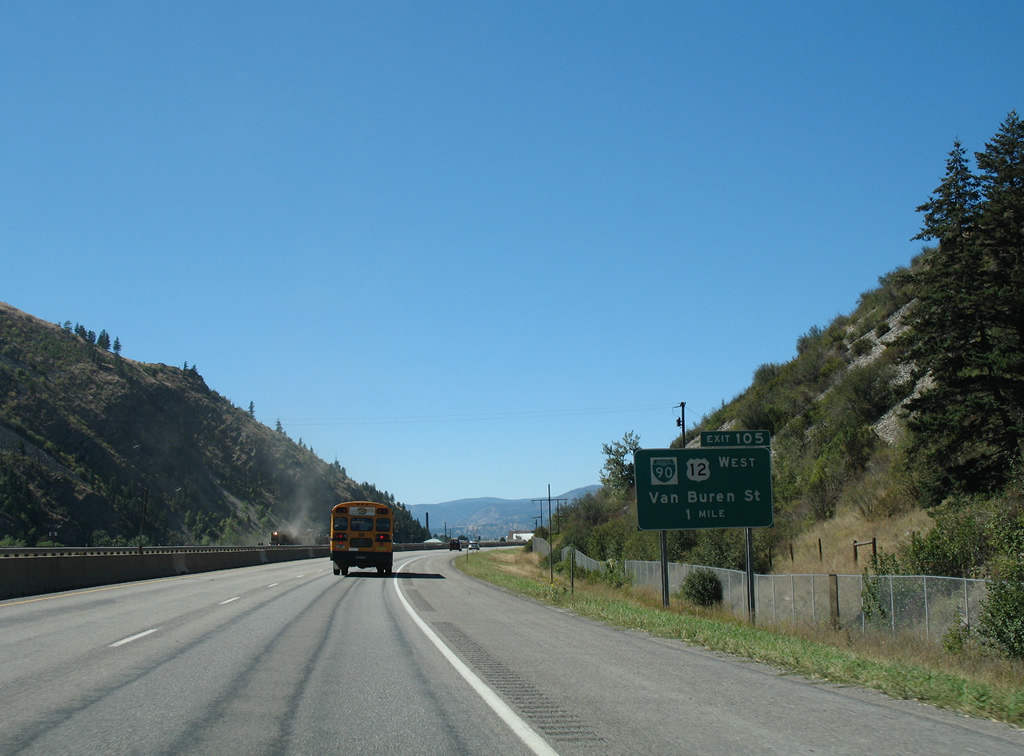
| Entering the diamond interchange at Exit 105 with Business Loop I-90/U.S. 12 west. U.S. 12 travels south from Missoula with U.S. 93 to Lolo and west from there to Lolo Pass and Kooskia, Idaho. Through traffic to Lolo Pass is directed onto U.S. 93 to bypass Downtown Missoula via Exit 101. 09/01/06 |
|
| Van Buren Street extends northeast from Interstate 90 to become Rattlesnake Drive through the Lower and Upper Rattlesnake communities west of Mount Jumbo. The local road exits the city limits to Rattlesnake National Recreation Area. SSR 267 does not appear in the 2011 MDT Montana Road Log. 09/01/06 |
|
| West of the diamond interchange (Exit 104) with Orange Street (U.S. 93 Business), I-90/MT 200 turn more northerly along the hillside abutting the Missoula street grid. U.S. 93 Business follows an implied overlap with the freeway back to U.S. 93 at forthcoming Exit 101. 09/01/06 |
|
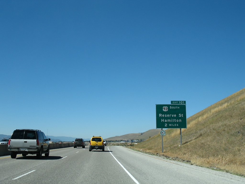
| U.S. 93 bypasses the west side of Missoula along a commercialized arterial leading south from the diamond interchange at Exit 101 to Orchard Homes and U.S. 12 (Brooks Street) near the Fort Missoula Historic District. 09/01/06 |
|
| South from Missoula, U.S. 12/93 combine for 7.5 miles to Lolo, where U.S. 12 breaks west for Lolo Pass. U.S. 93 continues nine miles south from there to Florence, 17 miles to Stevensville and 37 miles to the Ravalli County seat of Hamilton. 09/01/06 |
|
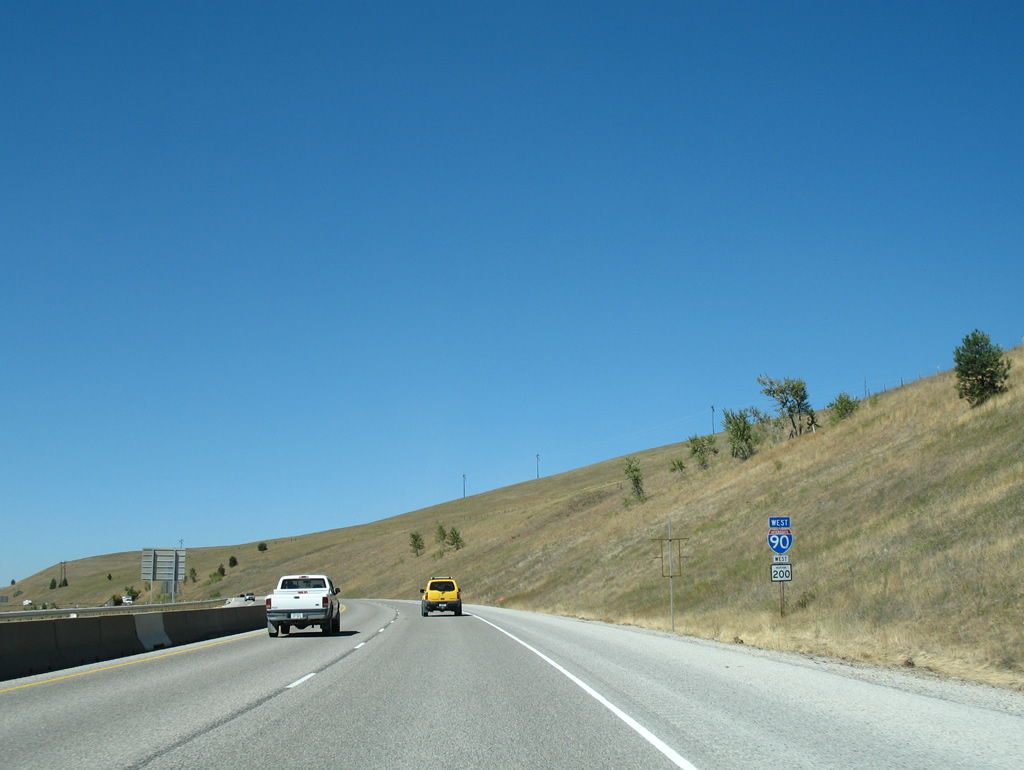
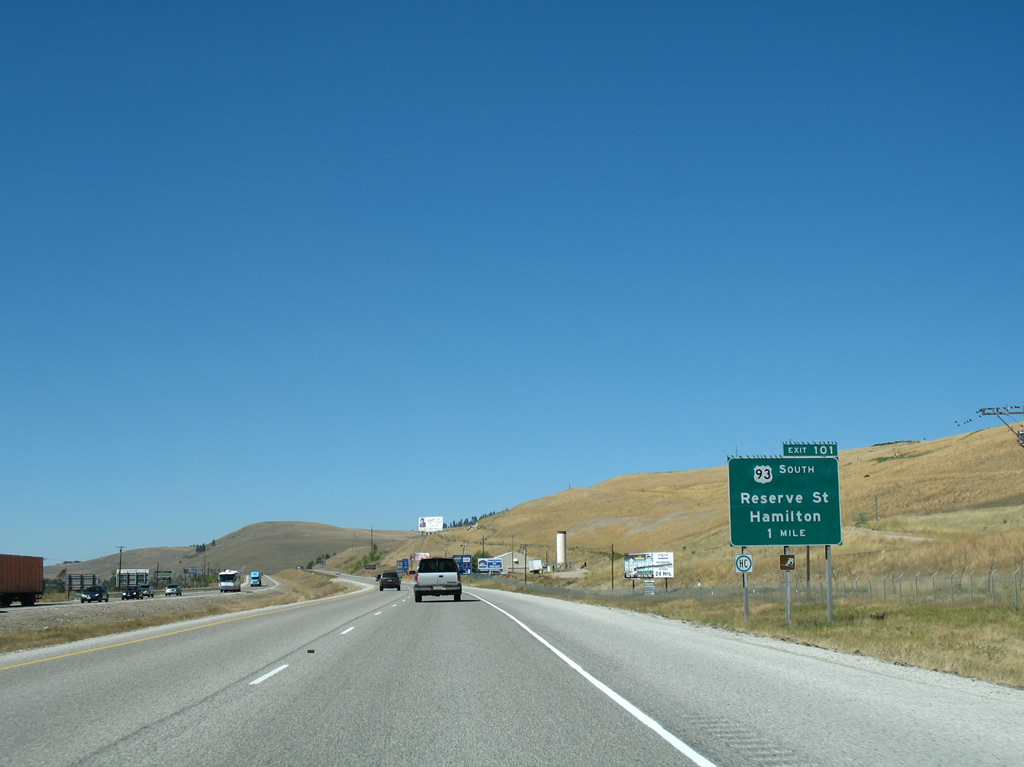
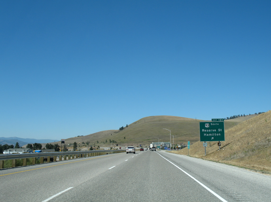
| Exit 101 departs I-90/MT 200 west for U.S. 93 (Reserve Street) south and Grant Creek Road north. Business Loop I-90 returns to I-90 via U.S. 93 north from a folded diamond interchange at Broadway Street. 09/01/06 |
|
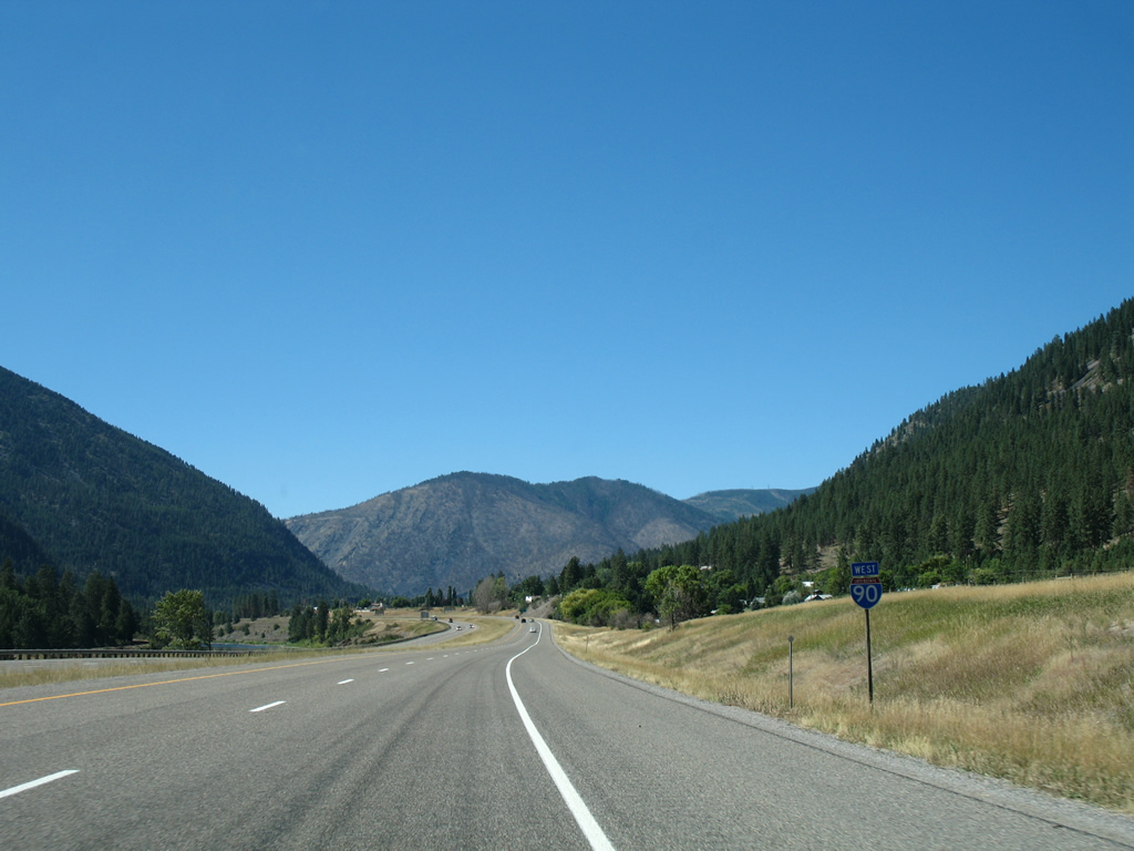
| U.S. 93 north joins I-90/MT 200 west for a 5.4 mile overlap to Wye. 09/01/06 |
|
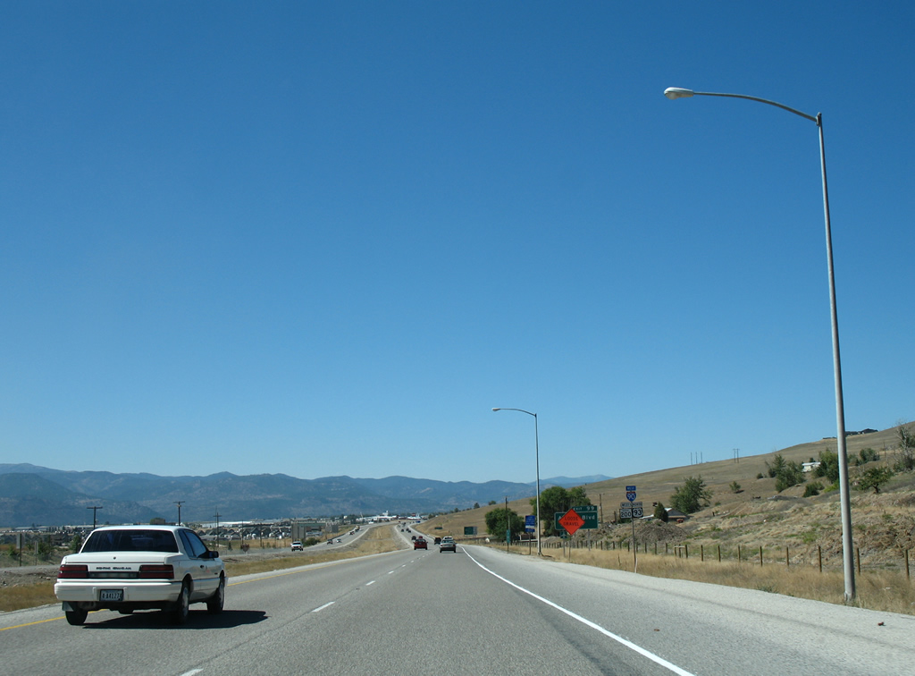
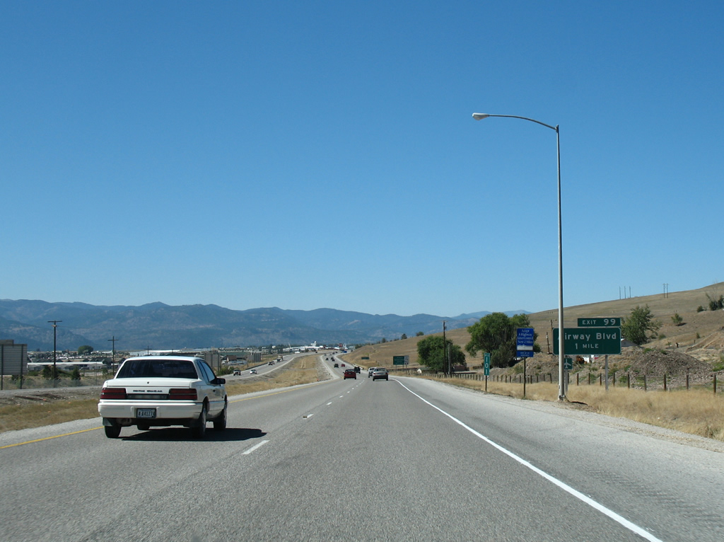
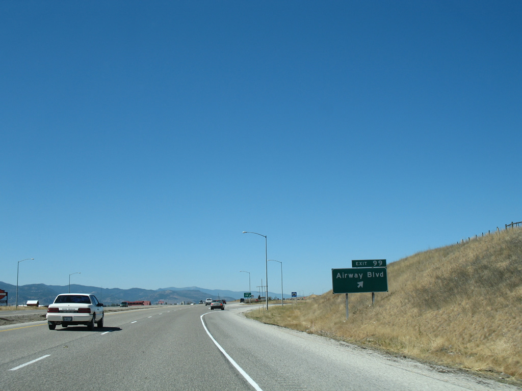
| The final Missoula area exit leaves Interstate 90 west in one mile for Airway Boulevard south to Broadway Street (old U.S. 10/93). 09/01/06 |
|
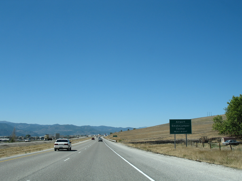
| Missoula International Airport (MSO) lies along the west side of Broadway Street at Airway Boulevard. The airport is home to the Smokejumper Center, a training facility for firefighters that parachute into remote areas of national forests to fight the spread of wildfires. The Aerial Fire Depot at the center includes a visitors center with guided tours between Memorial and Labor Days.1 09/01/06 |
|
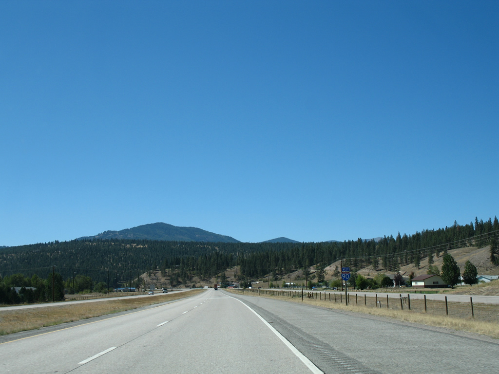
| The split with U.S. 93 north is highlighted on this distance sign posted 164 miles of Coeur d'Alene. Remote mountain areas and small towns line Interstate 90 from Missoula west to the Panhandle of Idaho's largest city. 09/01/06 |
|
| A diamond interchange joins I-90/U.S. 93-MT 200 with Airway Boulevard south to MSO Airport and north to Keil Loop Road, a local residential road. Numerous new homes were added between I-90 and parallel Broadway Street since 2006. Expressway, a parallel arterial, bisects the area as the main feeder road to the new development. The intersection between it and Airway Boulevard was converted into a roundabout during summer 2011. 09/01/06 |
|
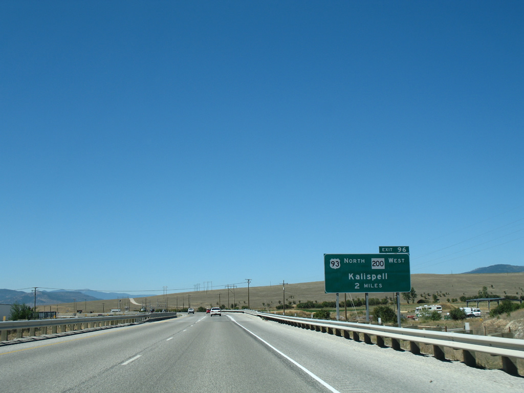
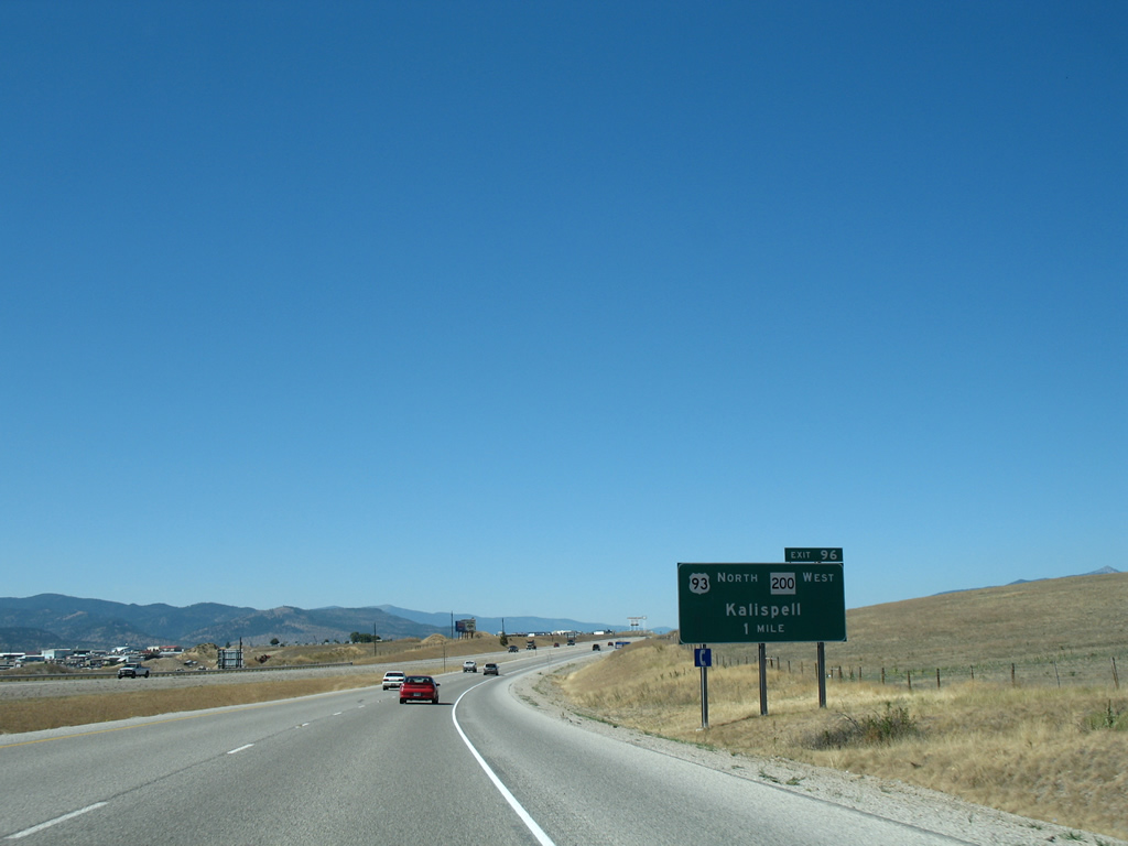
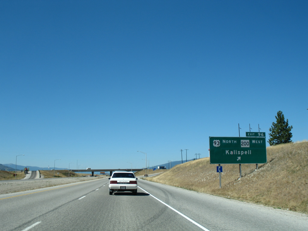
| I-90/U.S. 93-MT 200 proceed northwest to their separation at the parclo interchange (Exit 96) with Highway 10 West (former U.S. 10/93). 09/01/06 |
|
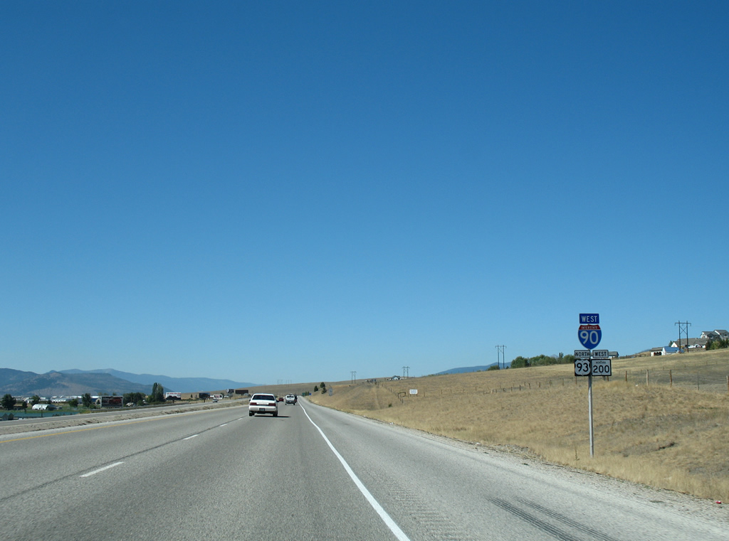
| U.S. 93/MT 200 branch north from Exit 96 for a 28 mile long overlap to Ravalli within Flathead Indian Reservation. 09/01/06 |
|
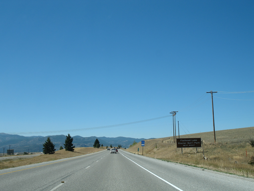
| Travelers bound for Flathead Lake and Glacier National Park should remain along U.S. 93 north to Polson and take either U.S. 93 to U.S. 2 at Kalispell or MT 35 north to Montana Secondary 206 through Bigfork and Creston to U.S. 2 for West Glacier. 09/01/06 |
|
| Kalispell, the Flathead County seat, is the commercial center for northwestern Montana. The city anchors a wide valley west of Swan Grange and east of the Salish Mountains at the crossroads of U.S. 2 and U.S. 93. Growth of the area resulted in the construction of a new bypass for U.S. 93 around the west side of Kalispell. 09/01/06 |
|
| Multi State Route 200 continues west from U.S. 93 at Ravalli for Perma, Plains, Thompson Falls and ultimately Sandpoint, Idaho. U.S. 93 ends at the Canadian border, seven miles north of Eureka. 09/01/06 |
|
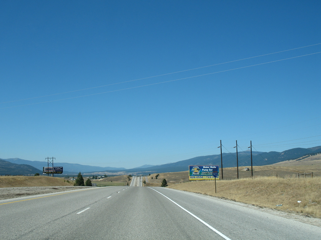
| Interstate 90 travels solo for the first time since Exit 174 and remains alone to Spokane, Washington (where U.S. 2/395 join). 09/01/06 |
|
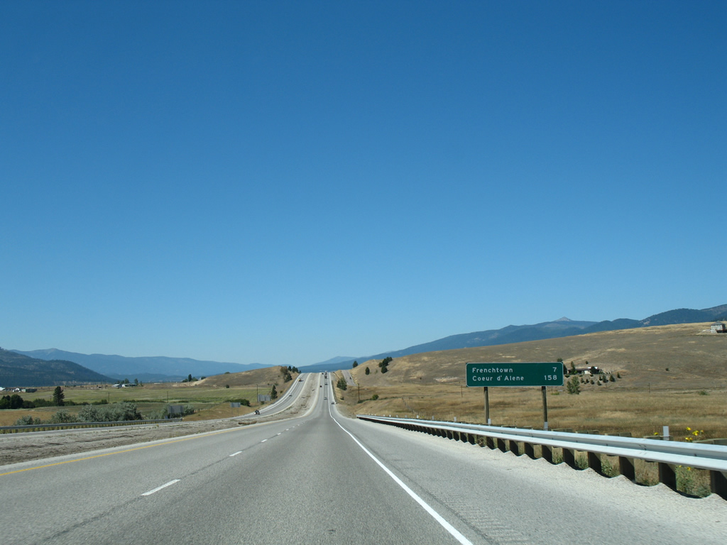
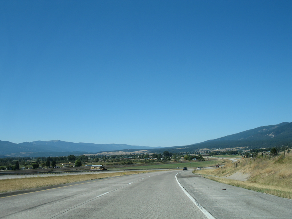
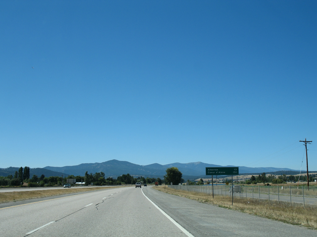
| Leaving the Missoula area behind, Interstate 90 becomes vastly more rural with the settlement of Frenchtown next in seven miles. Coeur d'Alene is 158 miles away. 09/01/06 |
|
| S-574 (Frenchtown Frontage Road) lines the north side of Interstate 90 from Waldo Road to Exit 89. 09/01/06 |
|
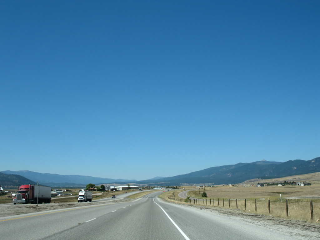
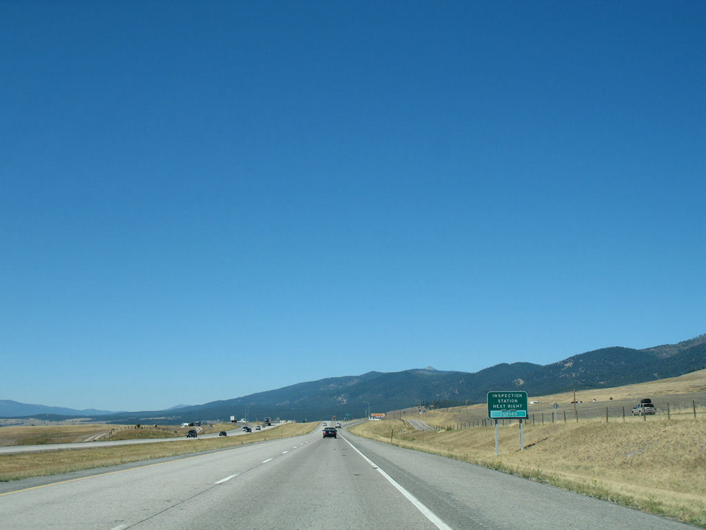
| An inspection station (truck weigh station) lines both sides of Interstate 90 on the three mile approach to Frenchtown. All commercial trucks are required to enter during times of operation. 09/01/06 |
|
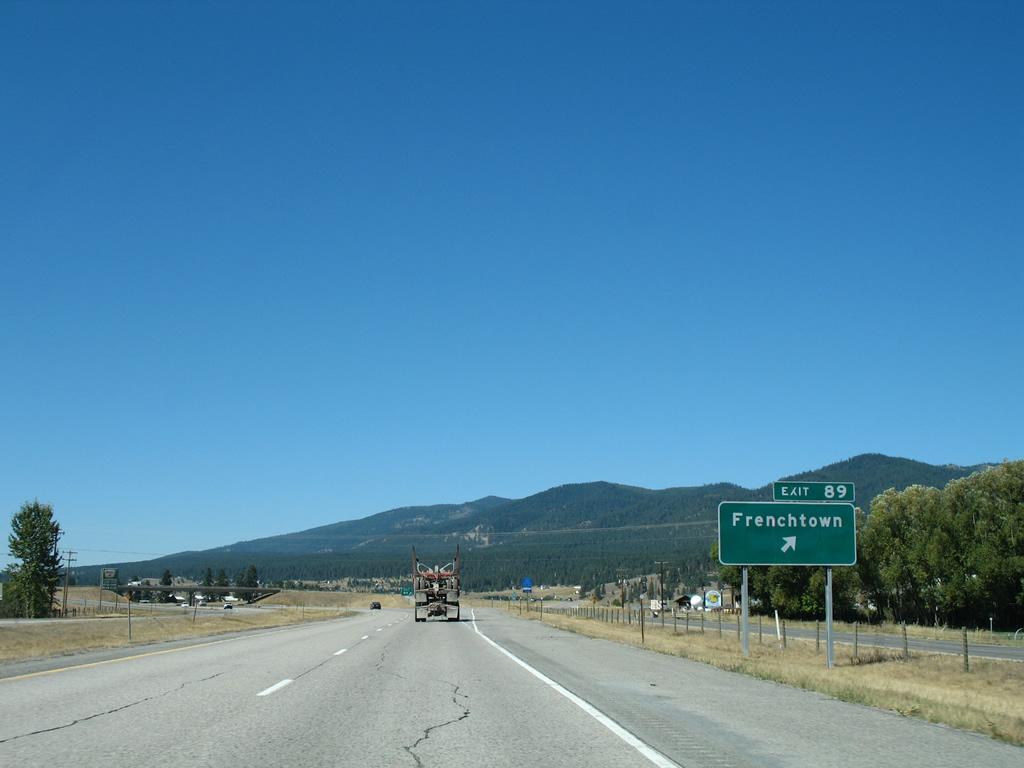
| Nearing Frenchtown, the historic Mullan Road (Montana Secondary 263) and the Montana Rail Link come into view as Interstate 90 winds toward the Exit 89 diamond interchange. 09/01/06 |
|
| Exit 89 joins Interstate 90 with the north end of Montana Secondary 263, which follows a portion of Beckwith Street (old U.S. 10) through Frenchtown and Mullan Road south to Schilling. Construction of Interstate 90 between Exits 96 and 89 directly overlaid old U.S. 10 except for a bypass at Frenchtown. 09/01/06 |
|
| Interstate 90 west at the Exit 89 off-ramp for SSR 263 south to Frenchtown and adjacent SSR 574 (Frenchtown Frontage Road) for Frenchtown Pond State Park. Interstate 90 was completed around Frenchtown in 1971. 09/01/06 |
|
| Montana Secondary 574 remains alongside Interstate 90 west to Frenchtown Pond and Exit 85. 09/01/06 |
|
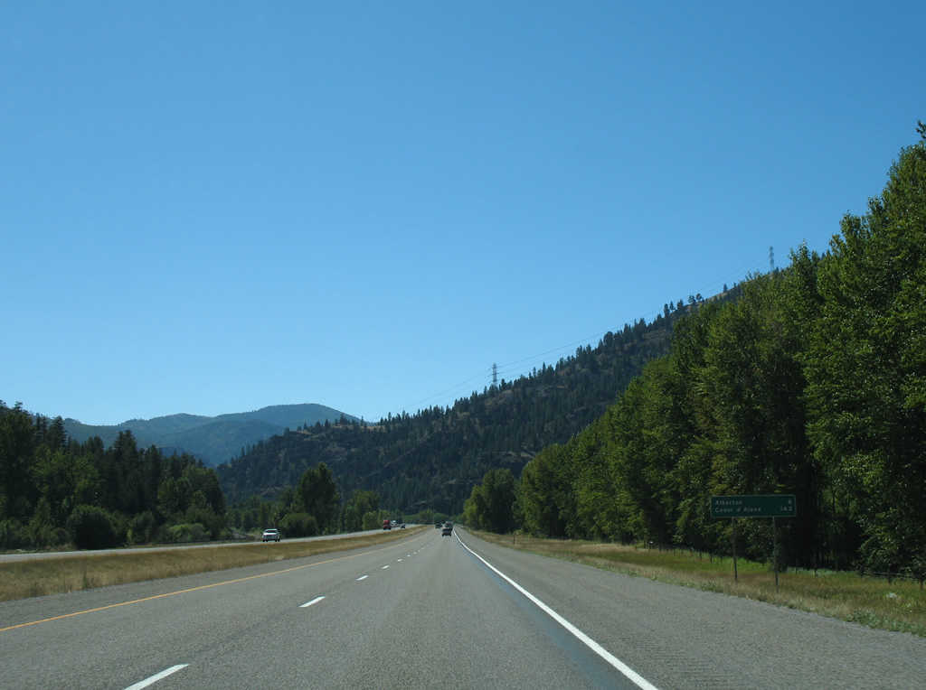
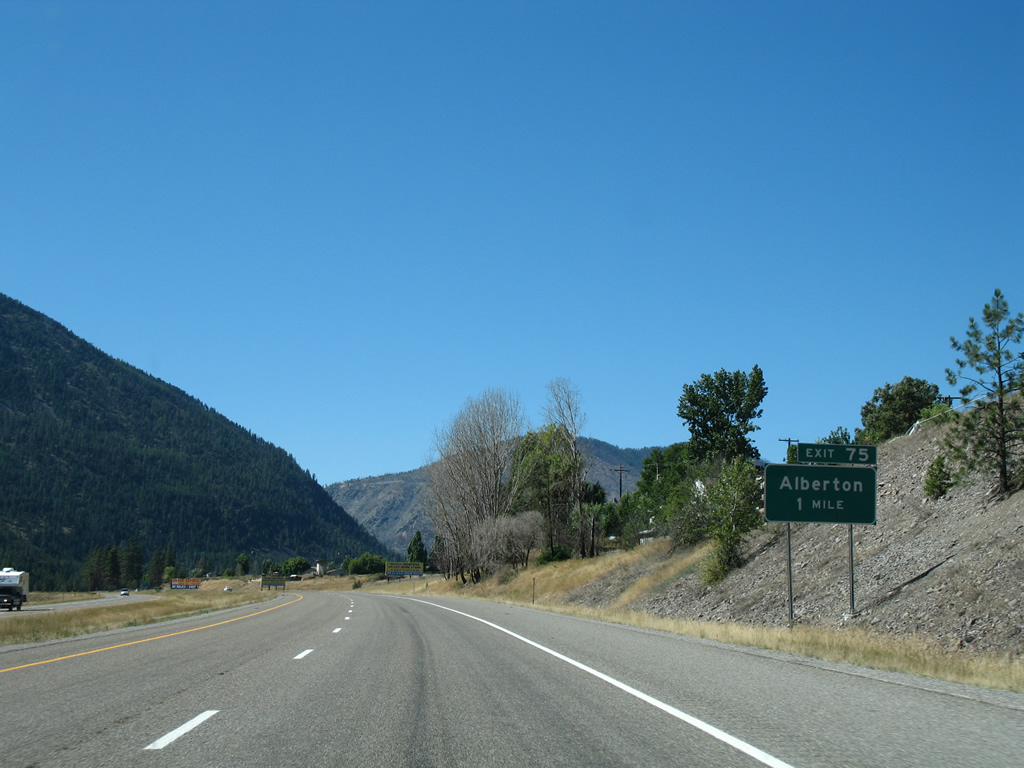
| The town of Alberton (population 420 - 2010 census) is next along Interstate 90 in 13 miles. Coeur d'Alene is 151 miles to the west. 09/01/06 |
|
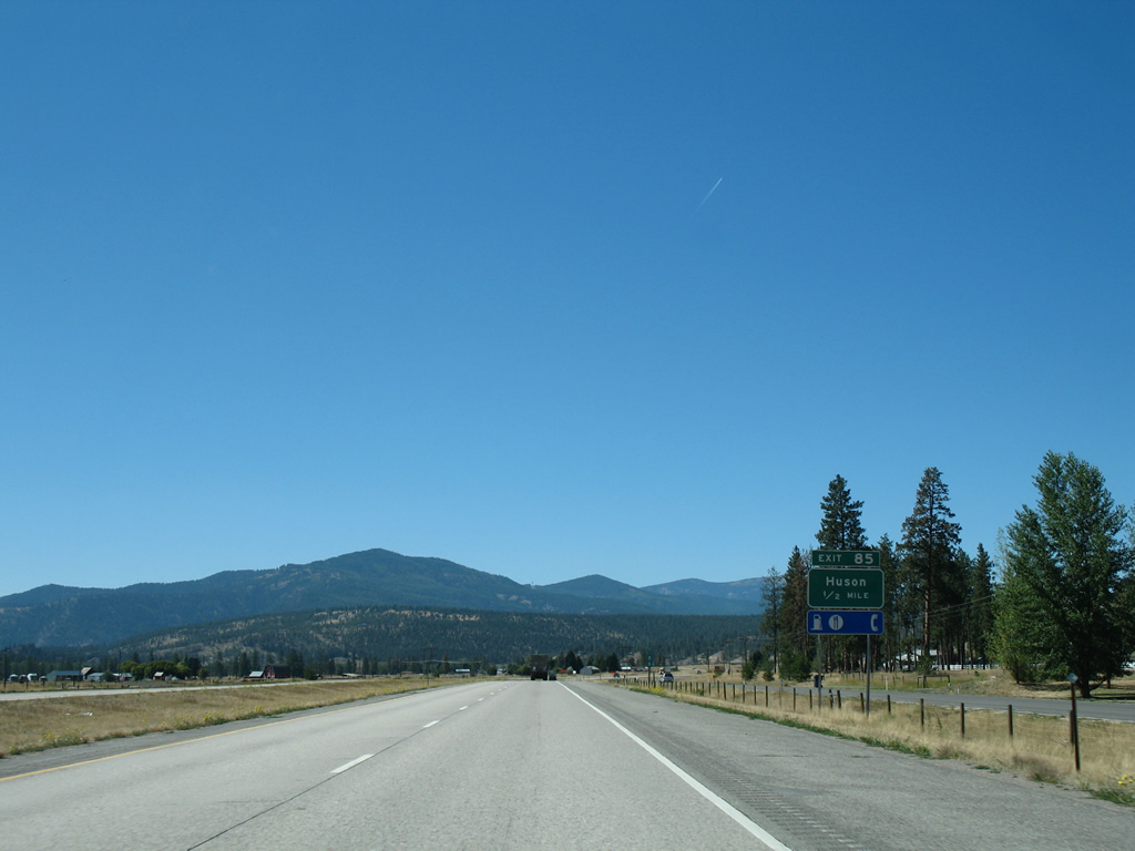
| One mile east of the Exit 85 diamond interchange with the settlement of Huson on I-90 west. SSR 574 concludes a 10.97 mile trek at this exit. 09/01/06 |
|
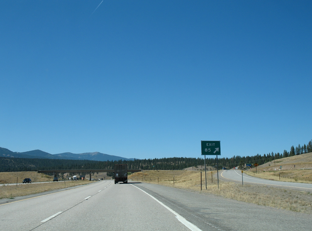
| Exit 85 partitions from the Interstate 90 mainline for Huson Road, which consists of an access road south to old U.S. 10 through Huson and north to Frenchtown Frontage Road and SSR 574 east. 09/01/06 |
|
| Frenchtown Frontage Road continues a short distance further west alongside Interstate 90 from Huson Road and SSR 574 to become Six Mile Road (National Forest Road 457) north to Lolo National Forest. 09/01/06 |
|
| Alberton lies just west of the Mineral County line in nine miles. 09/01/06 |
|
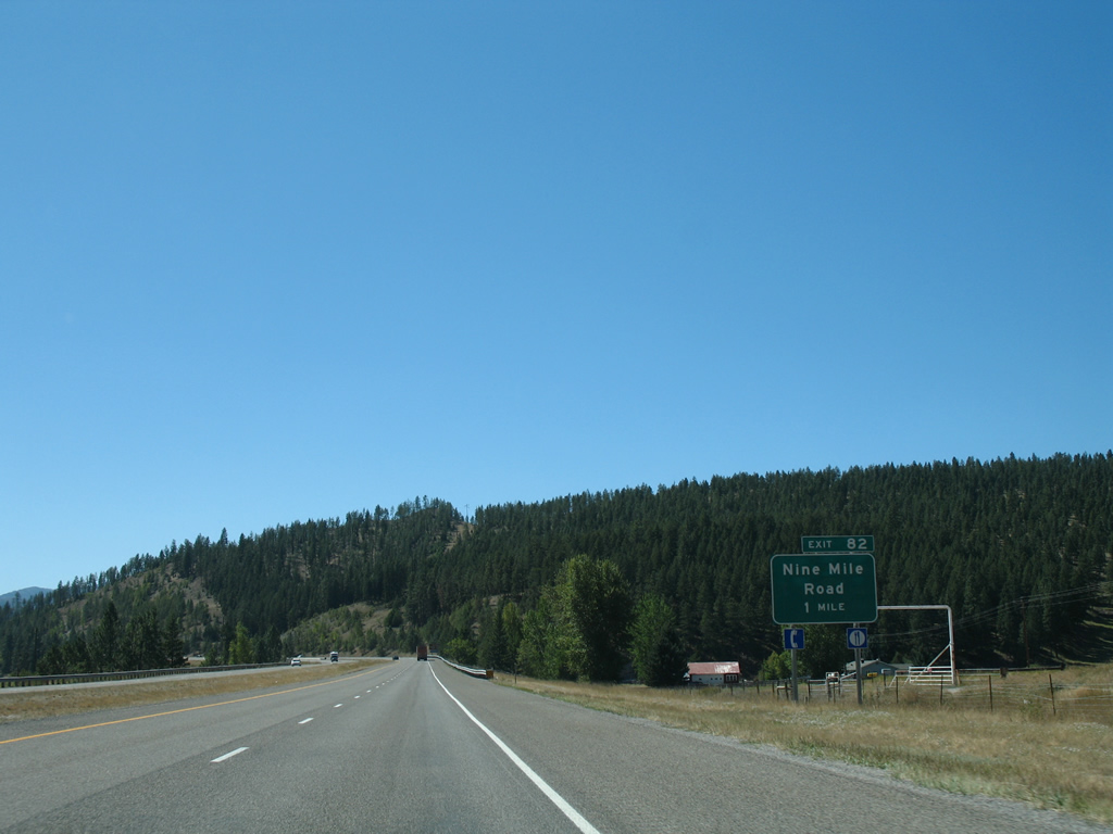
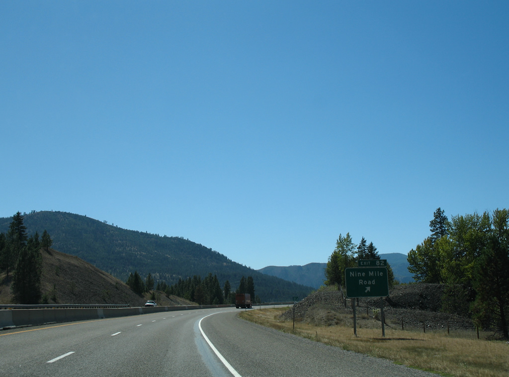
| Curving southward to pass Cayuse Hill, Interstate 90 next meets Highway 10 West to Nine Mile Road at Exit 82. 09/01/06 |
|
| Remount Road branches northward from Highway 10 West to the Historic Ninemile Ranger Station at Nine Mile Road. 09/01/06 |
|
| Big Horn Road ties into the diamond interchange at Exit 82 from the south while Highway 10W follows an extent of old U.S. 10 west into Mineral County. 09/01/06 |
|
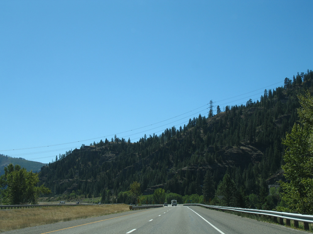
| Continuing west, Interstate 90 lowers from a rock cut to cross the Clark Fork river again ahead of the Ninemile siding of the Montana Rail Link. 09/01/06 |
|
| A second crossing of the Clark Fork river lies beyond this distance sign posted six miles out from Alberton and 143 miles east of Coeur d'Alene. 09/01/06 |
|
| Interstate 90 spans Clark Fork river on a pair of bridges built in 1964 (westbound) and 1979 (eastbound). Rock outcroppings from Ninemile Divide appear as the freeway turns southward alongside Highway 10 West. 09/01/06 |
|
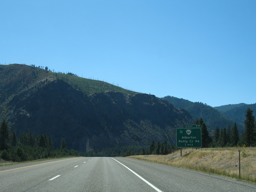
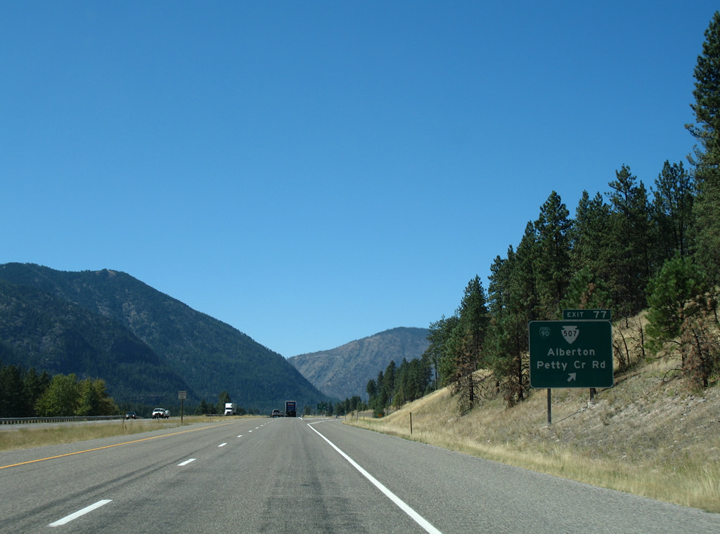
| Forthcoming Exit 77 connects Interstate 90 west with the east end of both Business Loop I-90 /S-507. The pair overlap for 2.533 miles through Alberton. 09/01/06 |
|
| Business Loop I-90 through Alberton was designated by 2006. The loop coincides with all of SSR 507 along Adams Street west to Railroad Avenue (old U.S. 10) through Alberton. 09/01/06 |
|
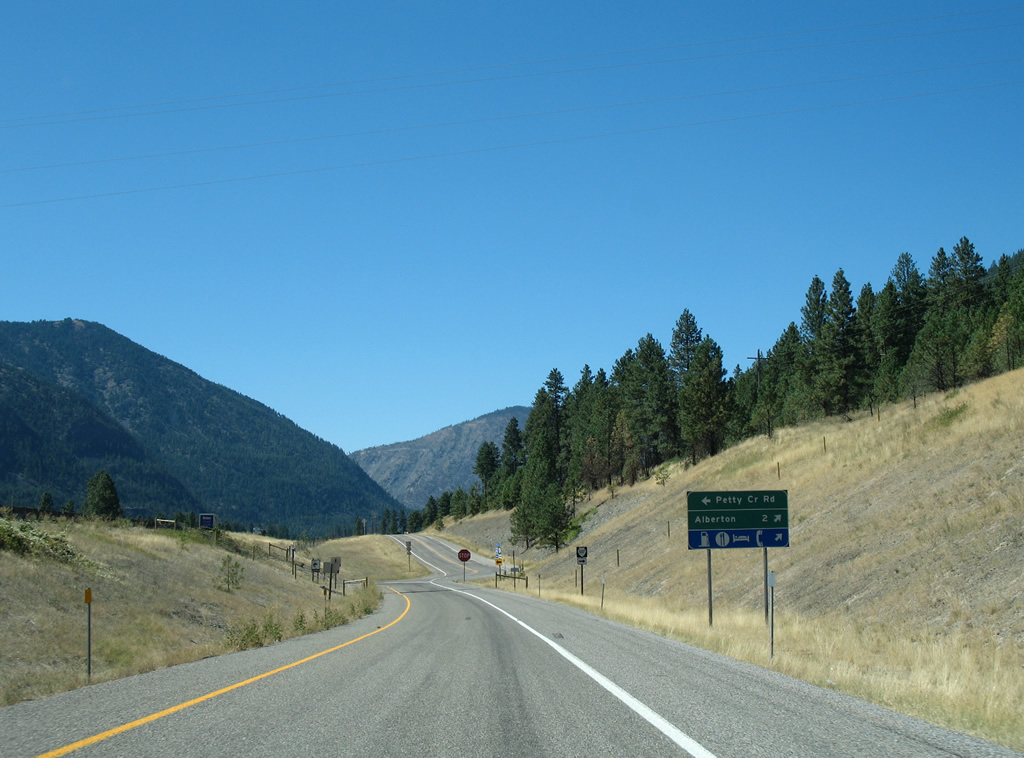
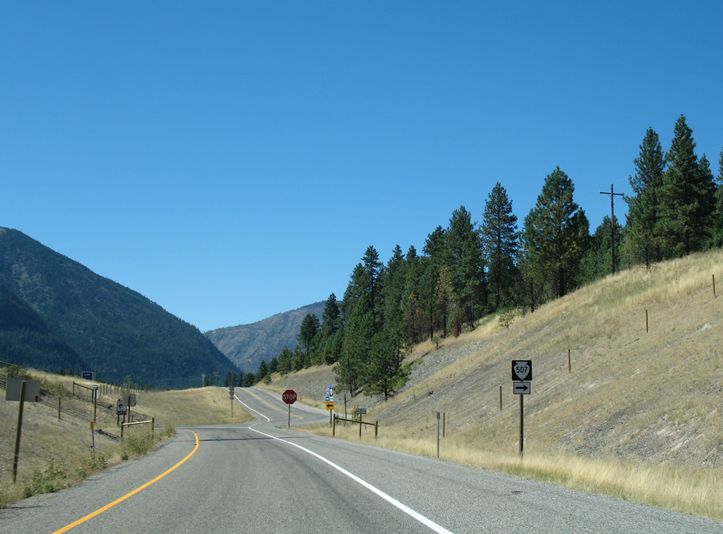
| Taking the Exit 77 off-ramp from Interstate 90 west, drivers lower to intersect the north end of Petty Creek Road and SSR 507 west. Petty Creek Road spans the Clark Fork river southward to Lothrop. The road becomes National Forest Road 489 to areas west of Petty Mountain (elevation 7,270 feet). 09/01/06 |
|
| An on-ramp joins Interstate 90 west from adjacent Business Loop I-90 & Montana Secondary 507 as the freeway enters Mineral County. 09/01/06 |
|
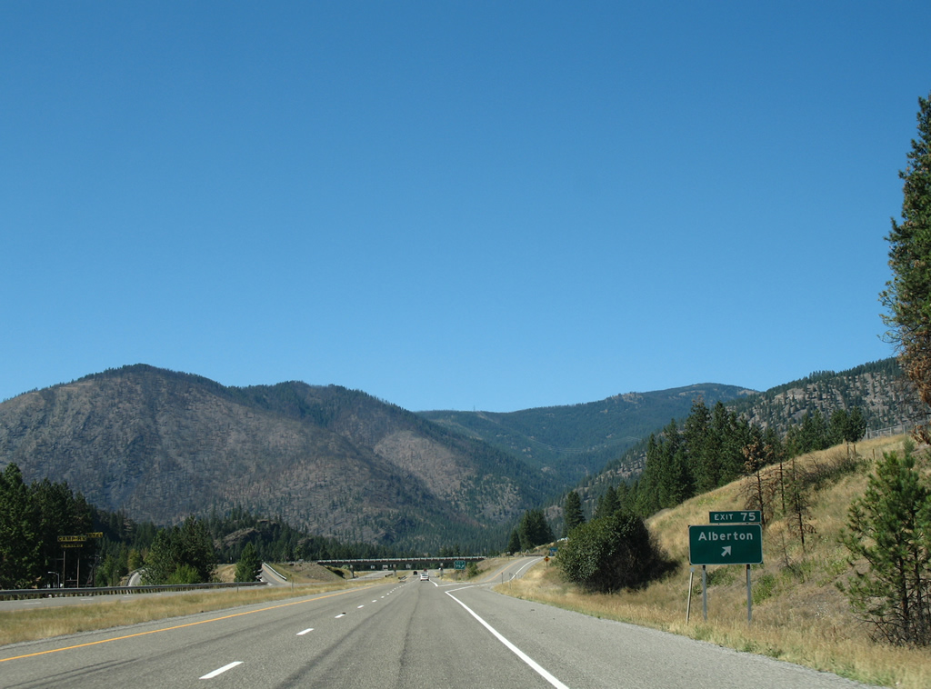
| SSR 507 and Business Loop I-90 return to Interstate 90 via Railroad Avenue and the Exit 75 diamond interchange. 09/01/06 |
|
| Exit 75 departs for return access to Alberton via Montana Secondary 507 south. Frontage roads parallel I-90 westward to Natural Pier Bridge and Fishing Access area and Mountain Creek Road north into the Ninemile Divide mountains. 09/01/06 |
Page Updated 07-14-2013.


 West
West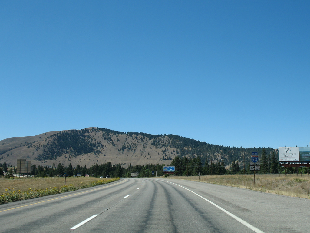
 North
North