|
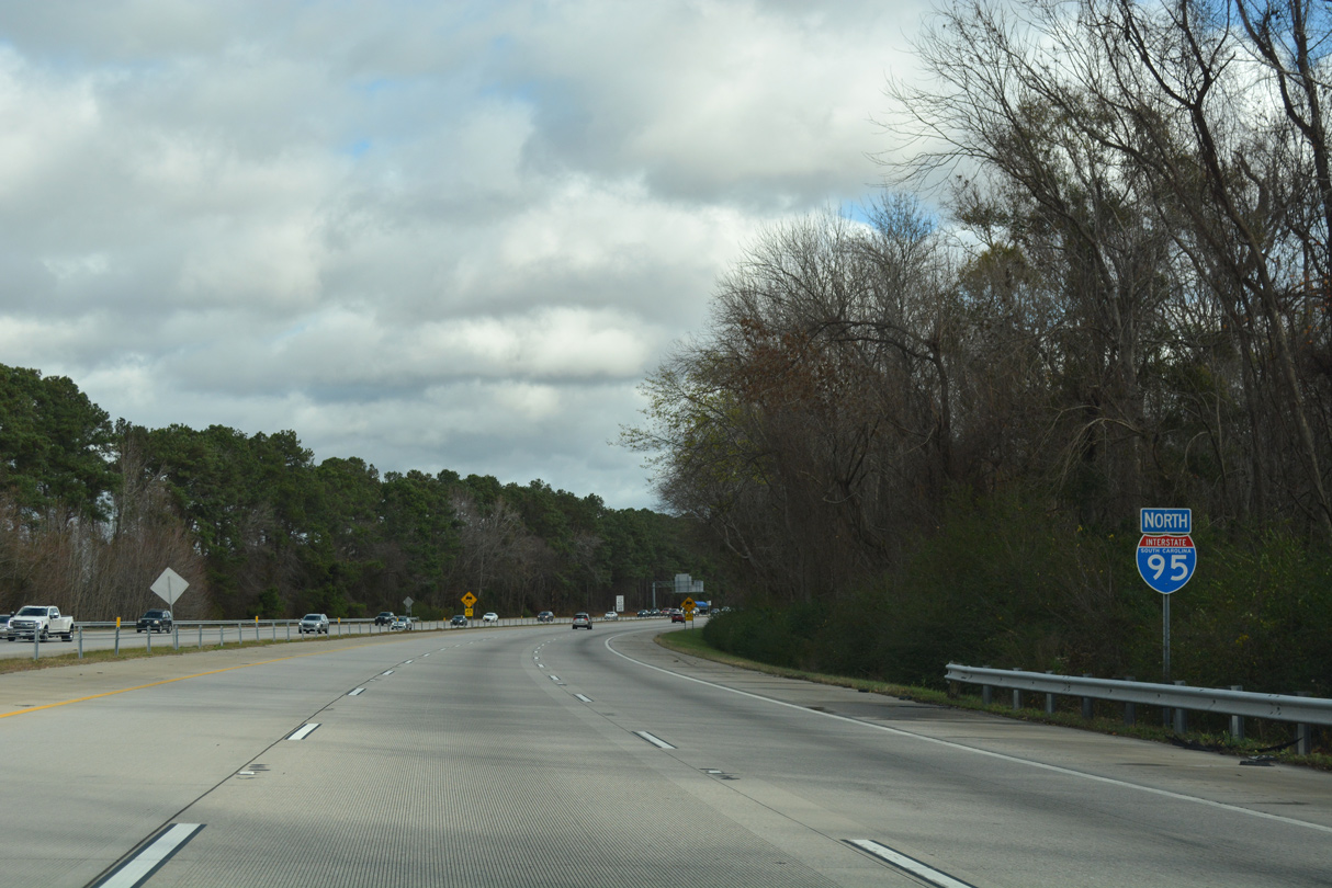
| Interstate 95 expands to six lanes with the advent of traffic from I-20 east. This stretch was widened during 2002-04 construction. 12/21/18 |
|
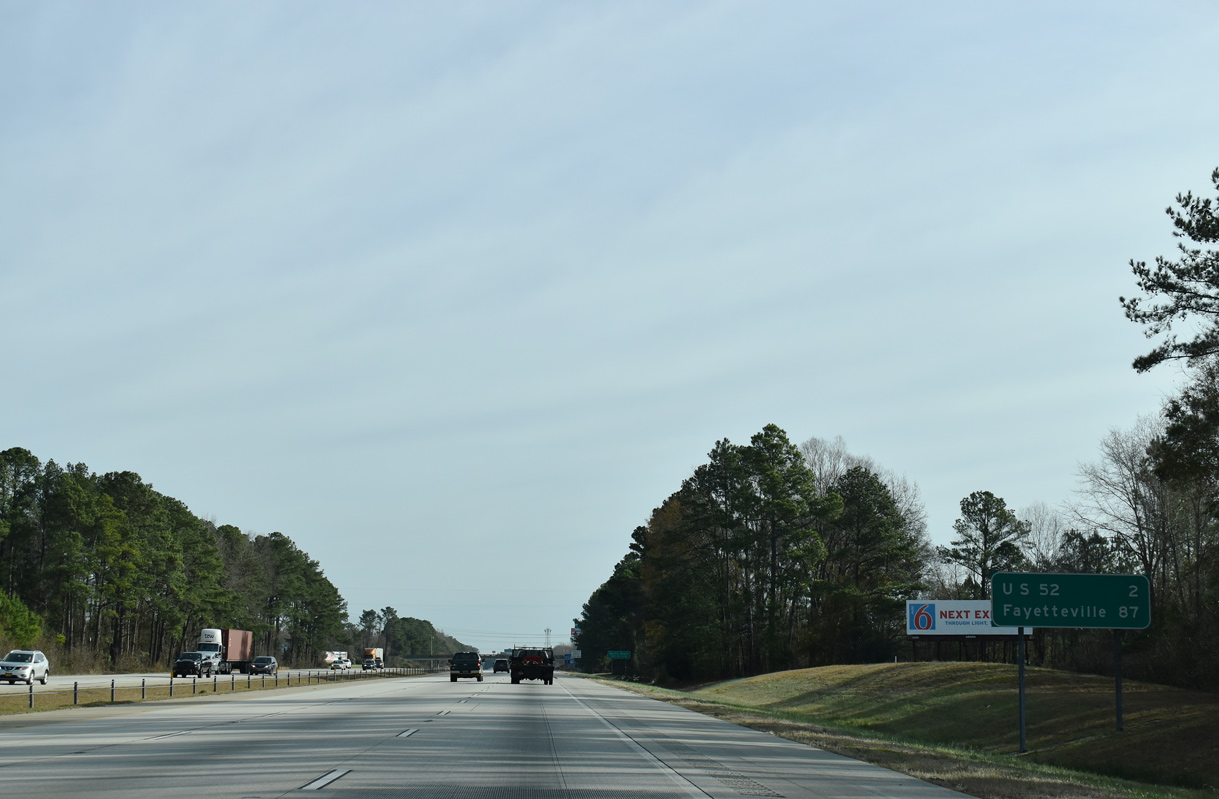
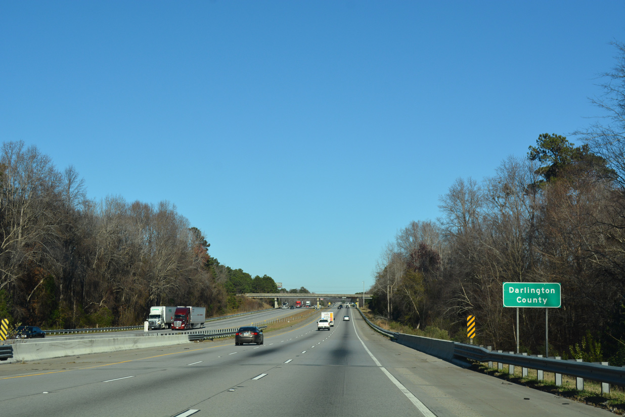
| The freeway encircles the north side of Florence two miles to U.S. 52 (Lucas Street). Fayetteville, North Carolina lies 87 miles to the northeast. 02/15/19 |
|
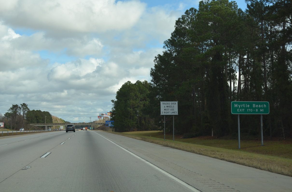
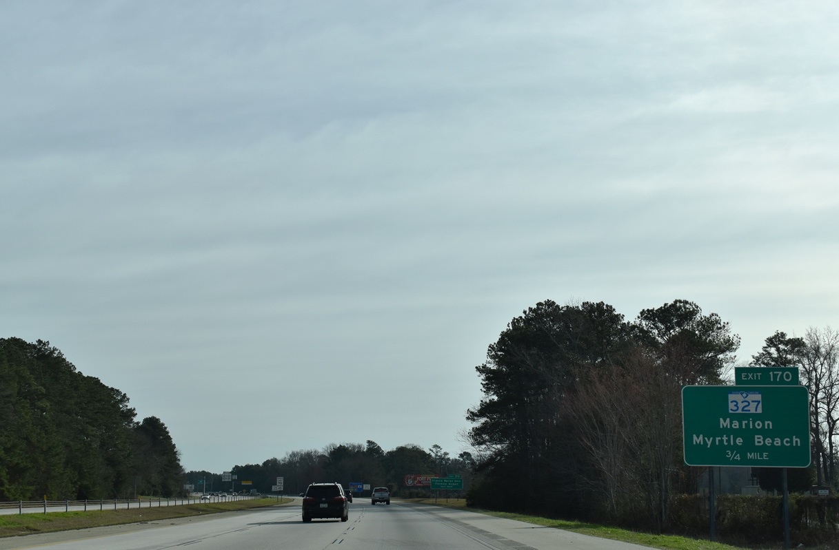
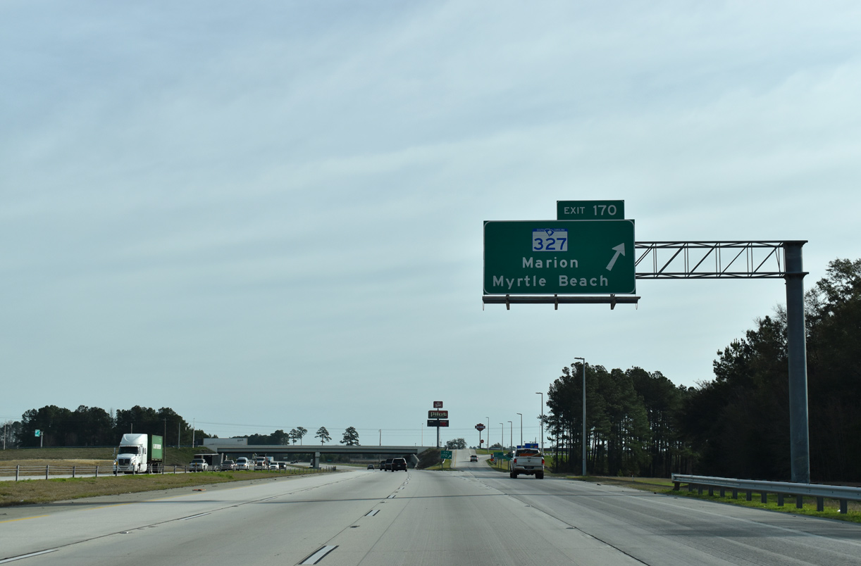
| Tourists bound for Myrtle Beach are advised to remain along Interstate 95 north to Exit 170 for S.C. 327 south to bypass Florence. 12/21/18 |
|
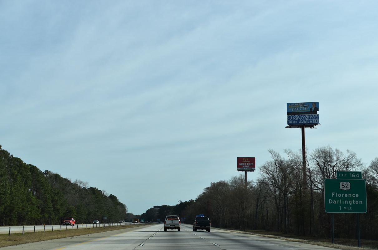
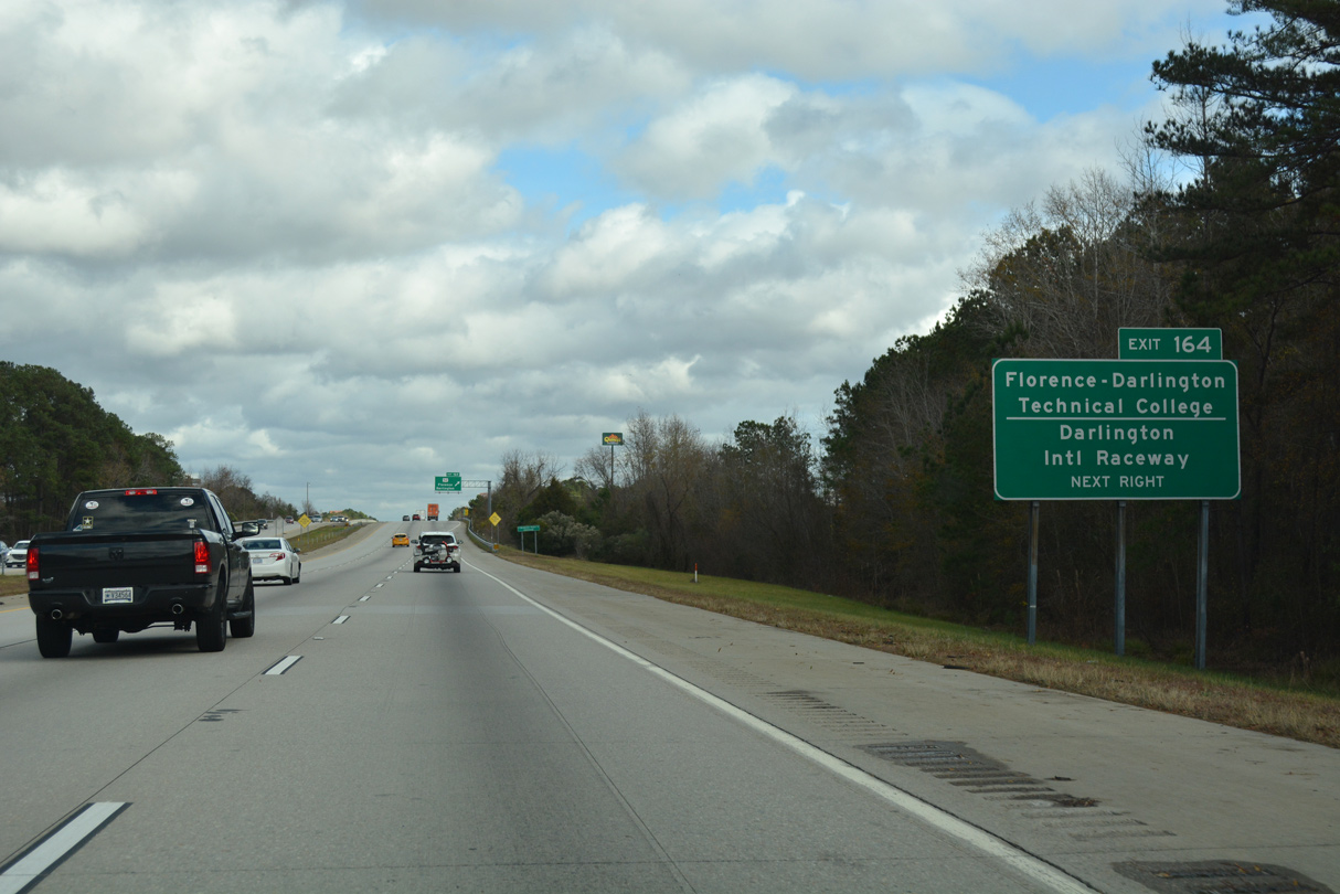
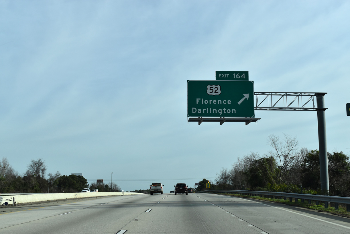
| U.S. 52 branches northwest from Irby Street and Downtown Florence along Lucas Street two miles to a folded diamond interchange (Exit 164) with Interstate 95. Continuing northwest, U.S. 52 parallels a CSX Railroad line to the city of Darlington. 02/15/19 |
|
| U.S. 52 travels seven miles northwest to S.C. 151 by Darlington Raceway. The campus of Florence-Darlington Technical College is located a short distance north of Exit 164. 12/21/18 |
|
| Exit 164 loops away from I-95 north to U.S. 52 (Lucas Street). U.S. 52 combines with U.S. 401 along a bypass of the Darlington County seat 11 miles to the north en route to Society Hill and U.S. 15.
South from U.S. 76 and Downtown Florence, U.S. 52 travels to Lake City, Kingstree, St. Stephen and Moncks Corner outside the Charleston area. 02/15/19 |
|
| Interstate 95 curves eastward around the Brook Green Park community and below Mechanicsville Road. 12/13/17 |
|
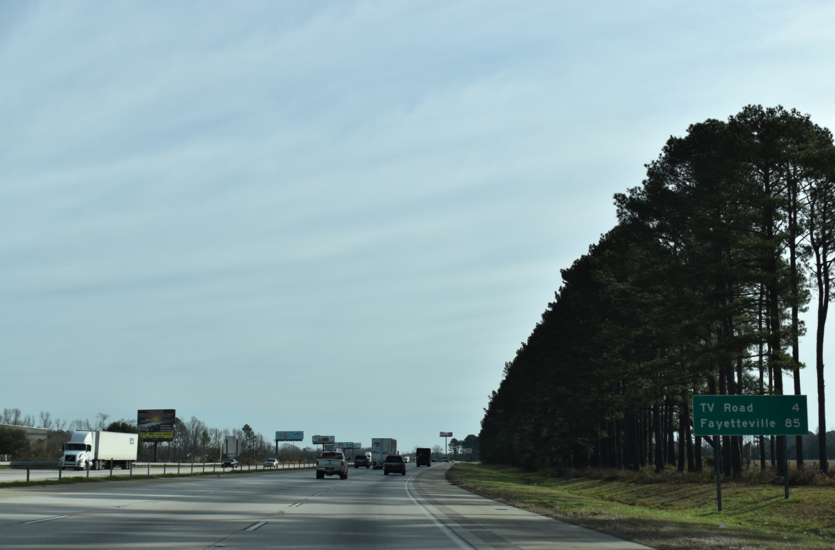
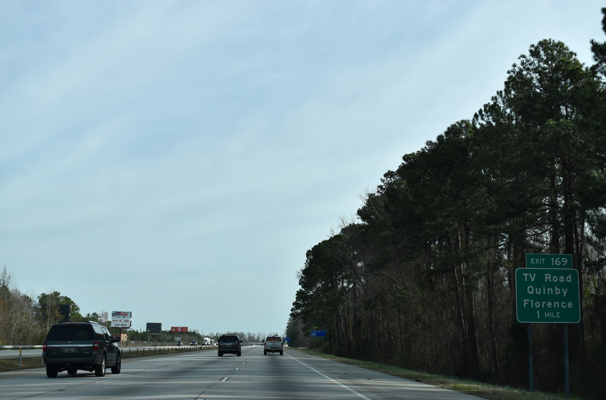
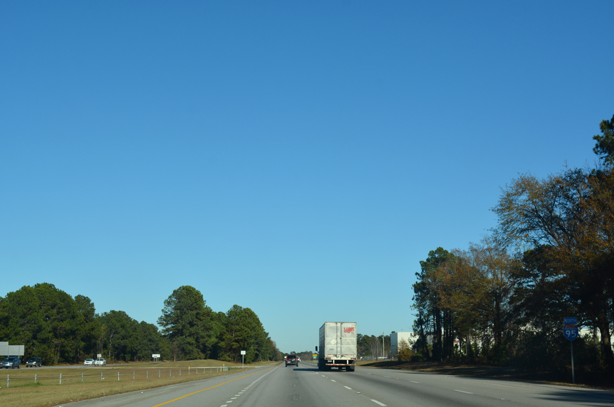
| Staying beyond the Florence city limits, Interstate 95 next meets TV Road (Road 26) at Exit 169. Lumberton is 51 miles to the northeast, followed by Fayetteville in 85 miles. 02/15/19 |
|
| Interstate 95 crosses High Hill Creek into a notch of Darlington County 12/13/17 |
|
| Crossing Black Creek, travelers along I-95 north advance to within one mile of Exit 169 for TV Road (Road 26). TV Road extends north from Irby Street in Florence and passes west of the town of Quinby to Pocket Road at Back Swamp. 02/15/19 |
|
| Northbound Interstate 95 reenters Florence County just ahead of Exit 169. 12/13/17 |
|
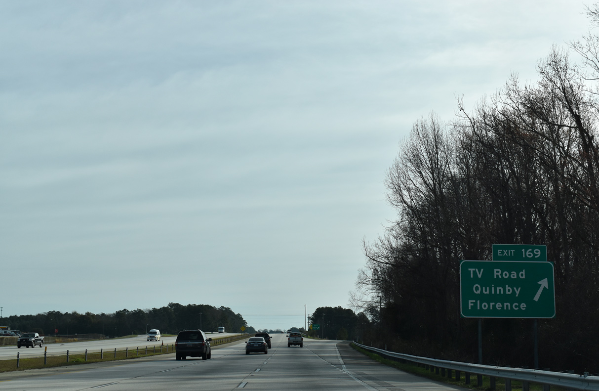
| Entering the diamond interchange (Exit 169) with TV Road (Road 26) on Interstate 95 north. 02/15/19 |
|
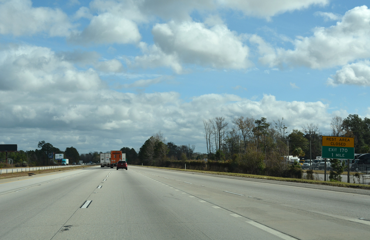
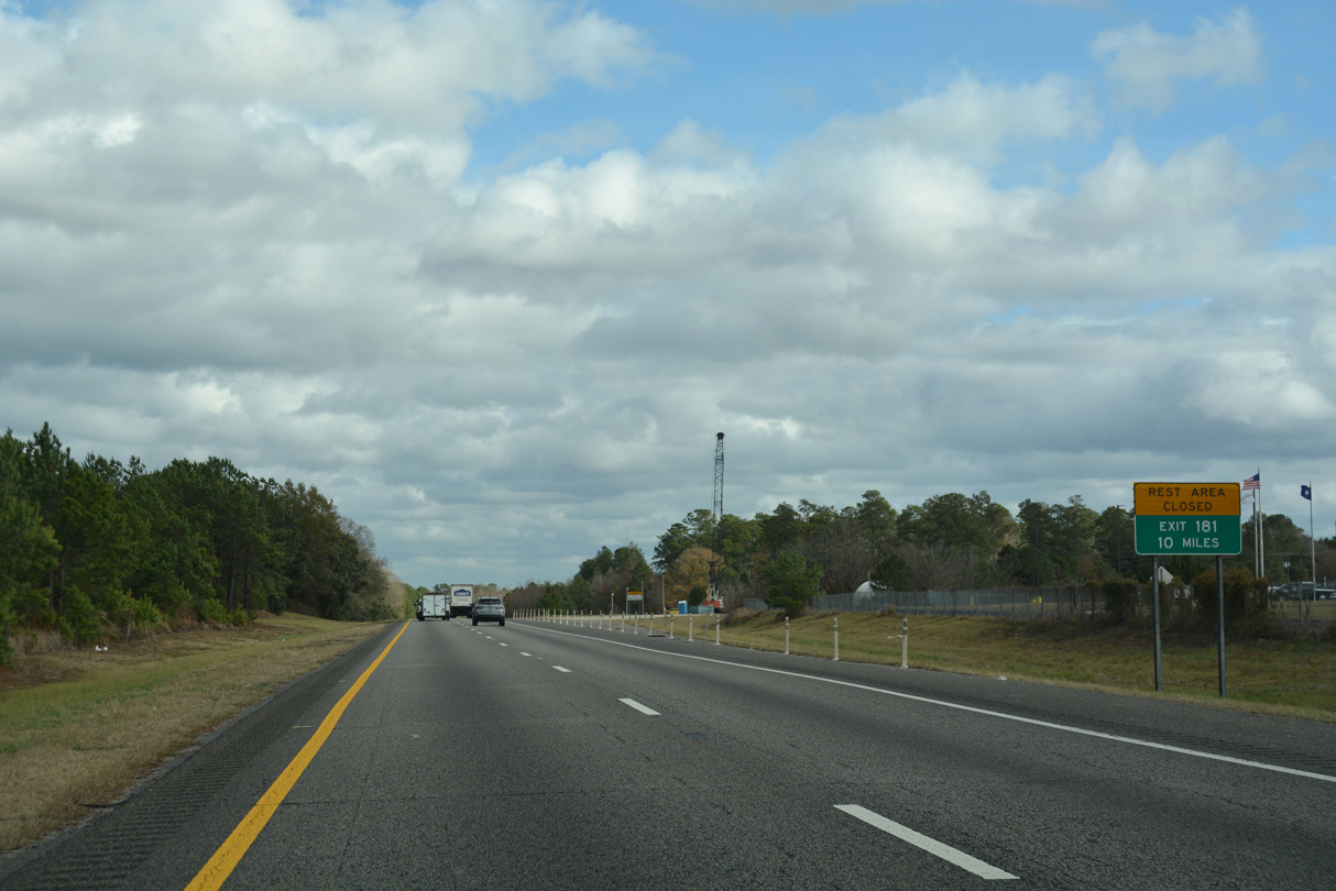
| Located beyond forthcoming Exit 170, a set of rest areas were shuttered in 2010. 12/21/18 |
|
| S.C. 327 begins at Exit 170 opposite Williston Road and heads south five miles to U.S. 76/301 east of Florence. Forming part of a four lane bypass around the east side of Florence with U.S. 301 south of U.S. 76, S.C. 327 connects I-95 with U.S. 76/301 east to Francis Marion University and U.S. 76 west to Florence Regional Airport (FLO). 02/15/19 |
|
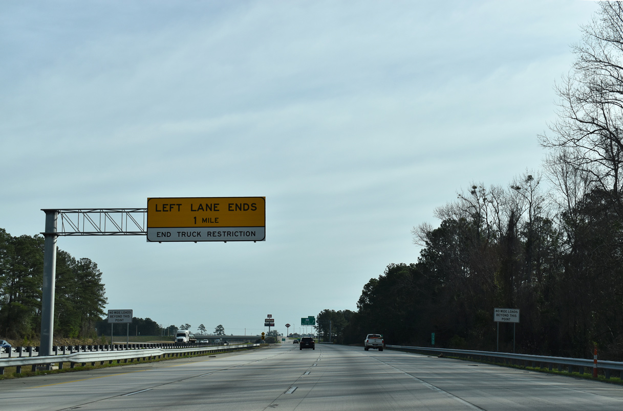
| The left lane truck restriction lifts as the freeway reduces back to four overall lanes beyond Exit 170. 02/15/19 |
|
| Construction in 2012-13 reconfigured the exchange at Exit 170 from a parclo B2 interchange and replaced the S.C. 327 / Williston Road overpass. S.C. 327, in conjunction with U.S. 76 east / U.S. 301 north, leads motorists 22 miles to the Marion County seat of Marion. Myrtle Beach lies 68 miles to the southeast beyond Marion via U.S. 501. 02/15/19 |
|
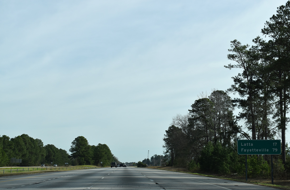
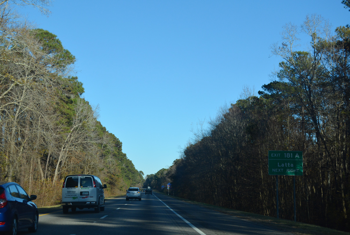
| The succeeding northbound interchange serves the town of Latta, 17 miles to the east. Fayetteville is 79 miles away. 02/15/19 |
|
| Visible beyond this confirming marker, Pee Dee Touchstone Energy Commerce Park, a 705 acre site, spreads to the southeast of I-95 and S.C. 327. 12/13/17 |
|
| Built in 1975, the South Carolina Department of Transportation (SCDOT) closed the northern Florence County rest areas due to low usage because of nearby commercial facilities, and to save renovation costs.1 12/21/18 |
|
| Interstate 95 lowers through an expansive area of wetlands surrounding the Great Pee Dee River over an eight mile stretch. 12/17/20 |
|
| While crossing the Great Pee Dee River, I-95 briefly enters the southern tip of Marlboro County before formally entering Dillon County. 12/17/20 |
|
| Remaining heavily forested, Interstate 95 curves more easterly ahead of Brownsville Creek and Poccosin Swamp. 12/17/20 |
|
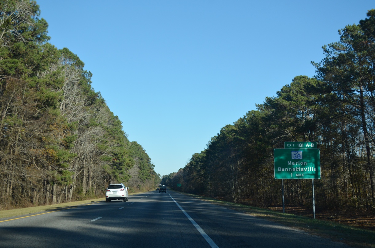
| S.C. 38 forms a leg of the four lane corridor linking North Carolina with Myrtle Beach. The 43 mile long multi state route angles southeast from Hamlet, NC to U.S. 501 outside Marion. U.S. 501 continues the expressway southward around Marion to Conway and the S.C. 22 (Conway Bypass) freeway to the Grand Strand. 12/13/17 |
|
| S.C. 38 ends at U.S. 501 in six miles; Latta lies five miles east via S.C. 917. 12/13/17 |
|
| Completed in 2005, a construction project upgraded the exchange at Exit 181 for S.C. 38 into a six-ramp parclo interchange. 12/13/17 |
|
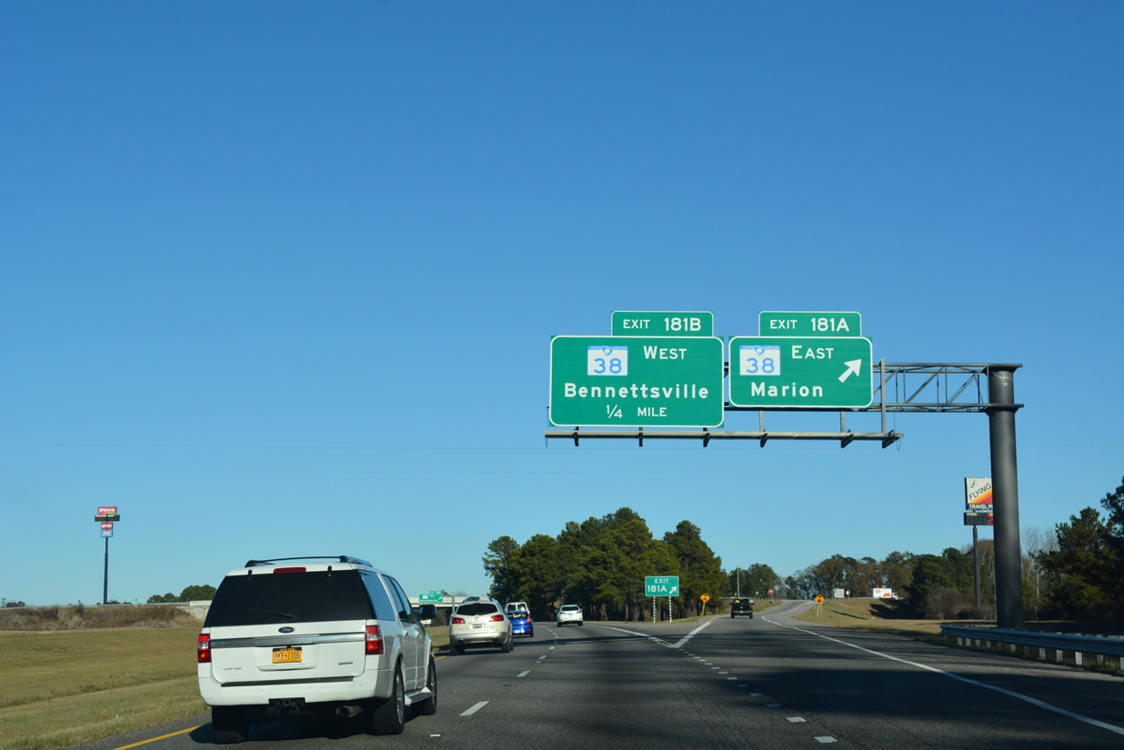
| Taking Exit 181A to S.C. 38 east for Sellers, Latta and Marion. 06/24/10 |
|
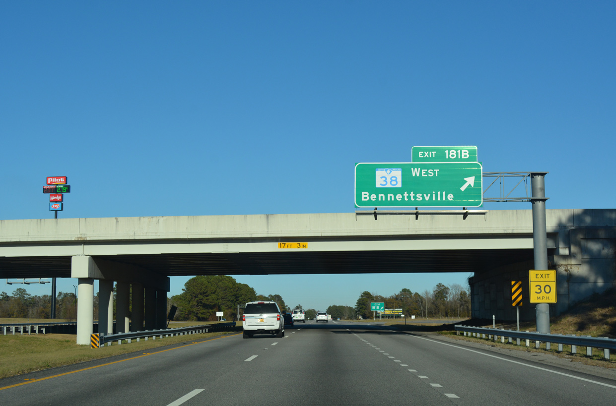
| Exit 181B leaves Interstate 95 northbound for S.C. 38 west. S.C. 38 meets S.C. 34 in five miles at Brownsville and U.S. 15/401 in 21 miles at the Marlboro County seat of Bennettsville. 12/13/17 |
|
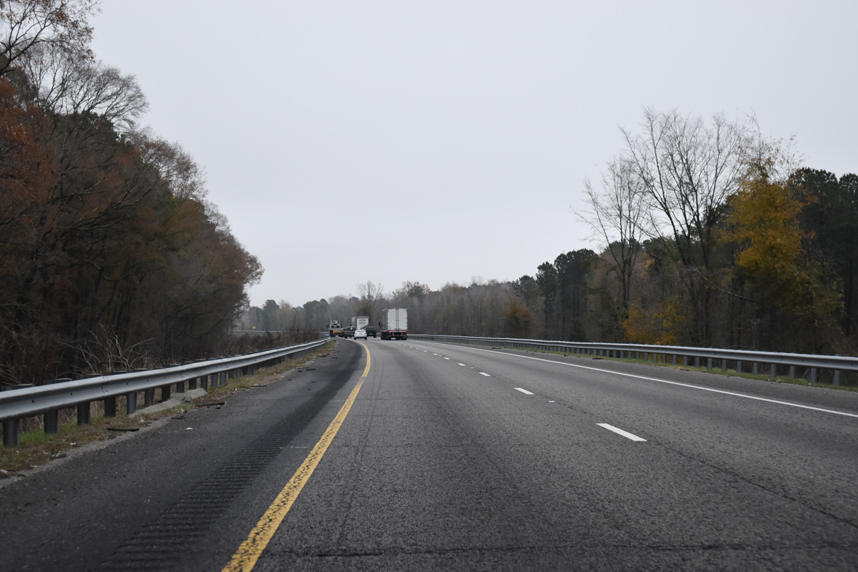
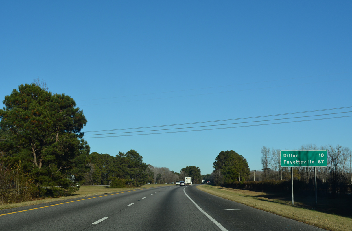
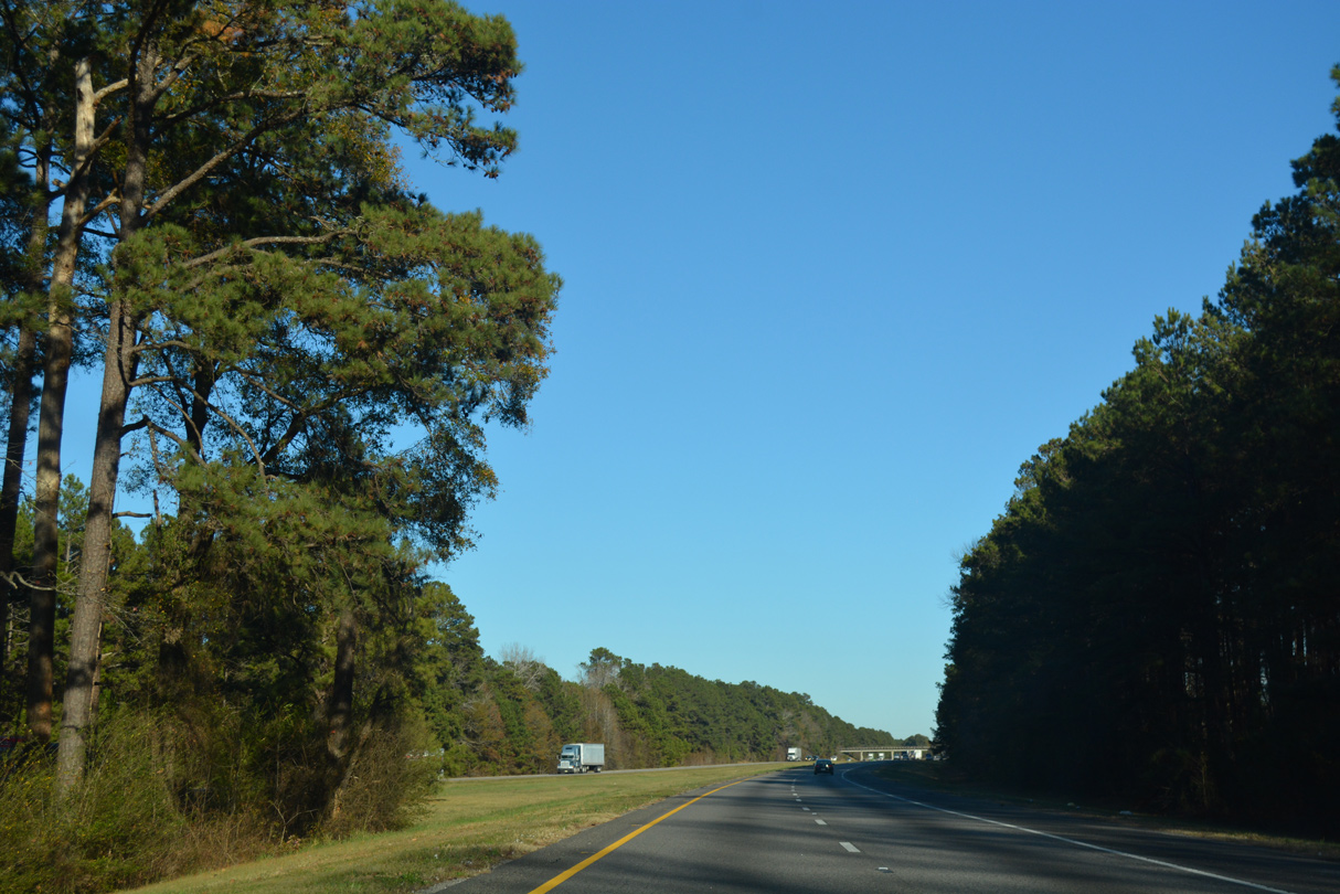
| Interstate 95 traverses a mixture of timberland, agricultural areas and wetlands over the next ten miles leading to Dillon. 12/21/18, 12/13/17 |
|
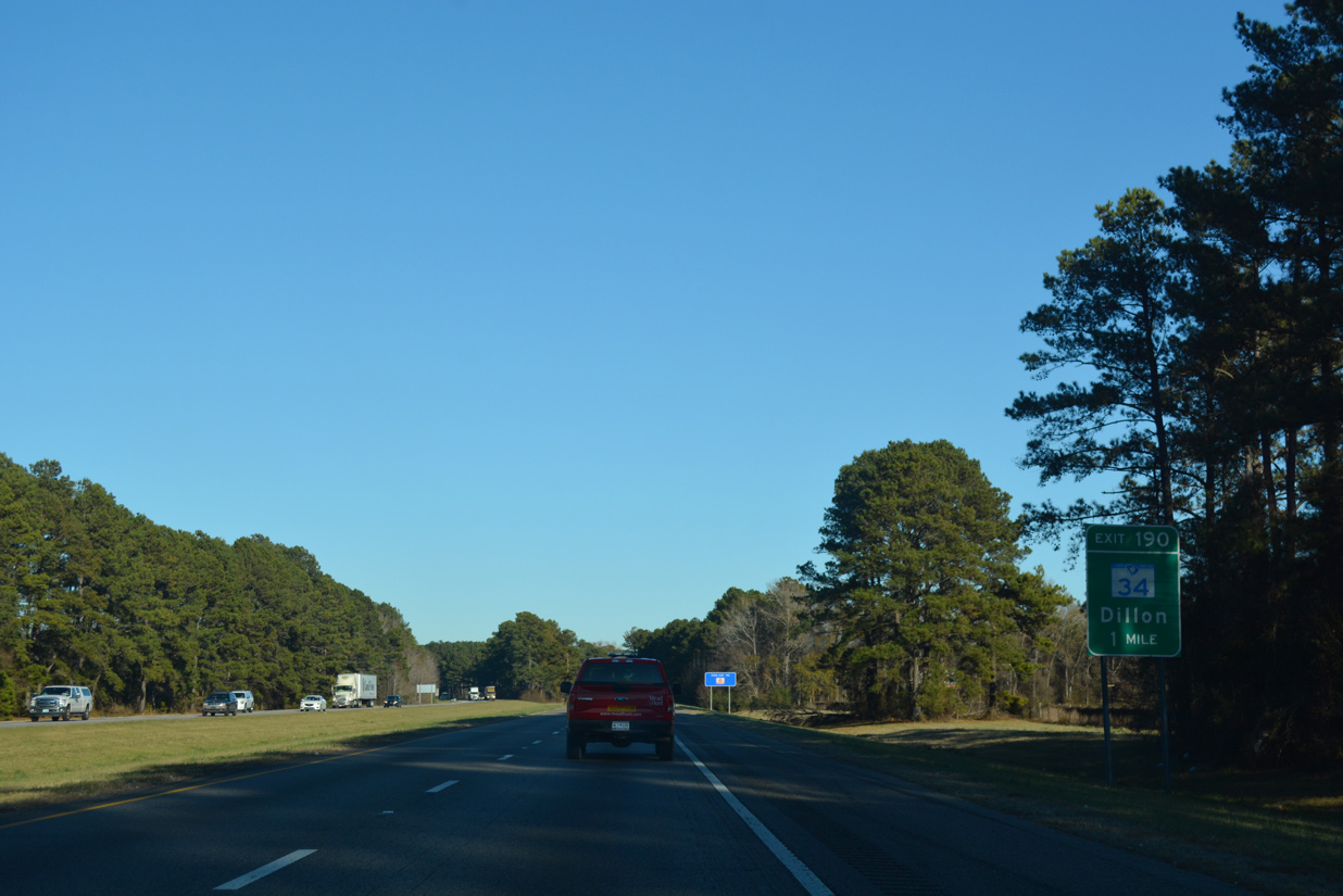
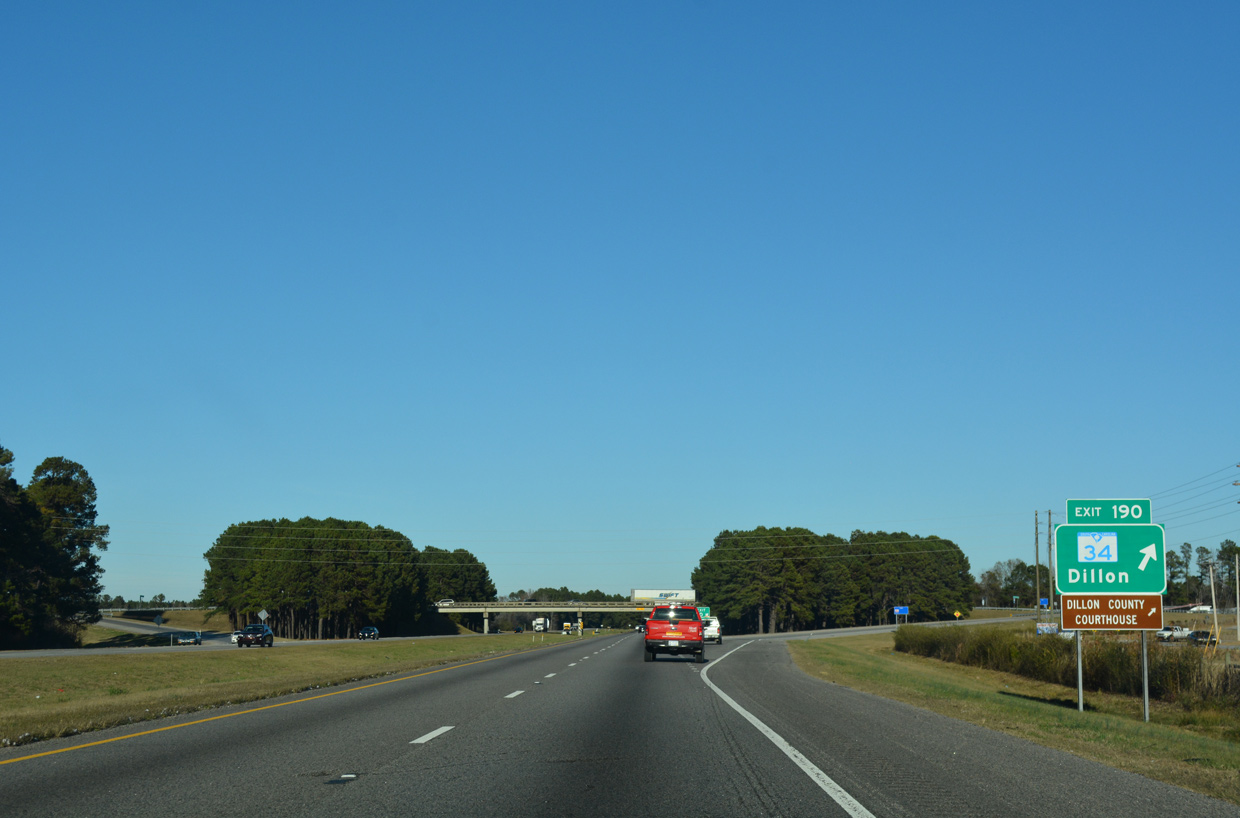
| The last city along Interstate 95 within the Palmetto State is Dillon. Exits 190 and 193 provide access to the Dillon County seat. 12/13/17 |
|
| S.C. 34 travels 31 miles east from Darlington to Interstate 95 at a diamond interchange (Exit 190). The state highway extends 2.4 miles east to conclude at S.C. 9/57 (Main Street) and U.S. 301/501 (2nd Avenue) in Downtown Dillon. 12/13/17 |
|
| Interstate 95 traverses wetlands across Betsy Jackson Bay ahead of northern reaches of the Dillon city limits. 12/13/17 |
|
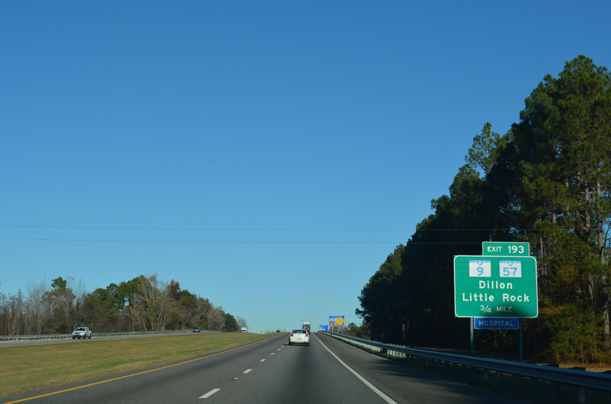
| S.C. 9 and S.C. 57 combine through Dillon from East Main Street to Downtown, and alongside North 2nd Avenue (U.S. 301/501) to Radford Boulevard. The pair meet Interstate 95 at a diamond interchange (Exit 193) in two miles. 12/13/17 |
|
| S.C. 9 straddles the border region with North Carolina southeast from Dillon to Little River, North Myrtle Beach and the Atlantic Coast. The state highway reaches Lake View in 13 miles and Nichols in 21 miles. S.C. 57 branches 11 miles south from S.C. 9 to end in Fork. 12/13/17 |
|
| S.C. 9/57 (Radford Boulevard) split three miles north of Exit 193 at Little Rock. S.C. 57 continues nine miles from there into North Carolina while S.C. 9 travels through Clio, Bennettsville, Cheraw and eventually the Upstate. 12/21/18 |
|
| North from Exit 193, Interstate 95 lowers into an area of wetlands surrounding Little Pee Dee River. 12/16/07 |
|
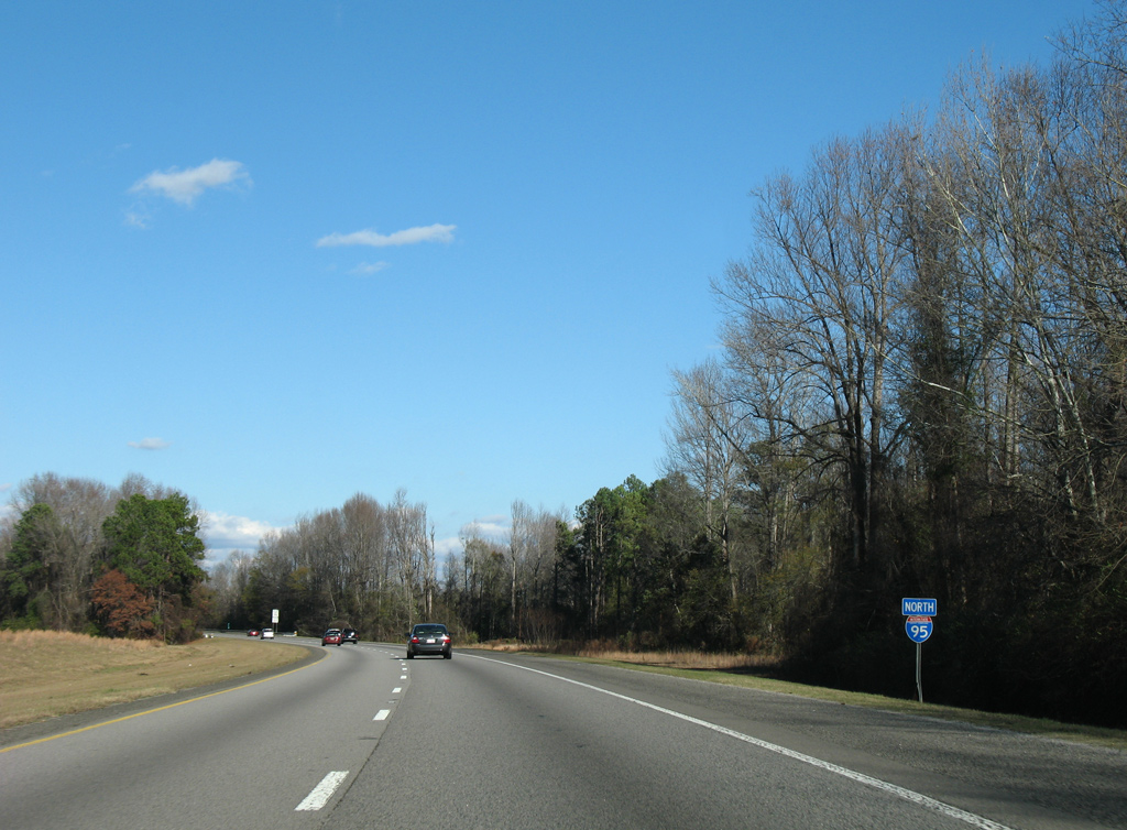
| Rowland, North Carolina lies seven miles to the north while Fayetteville is less than an hour away. 12/13/17 |
|
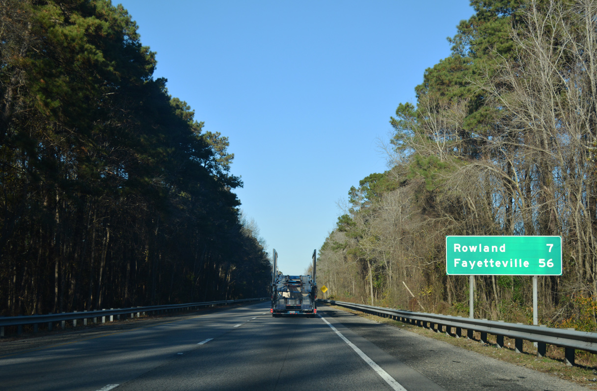
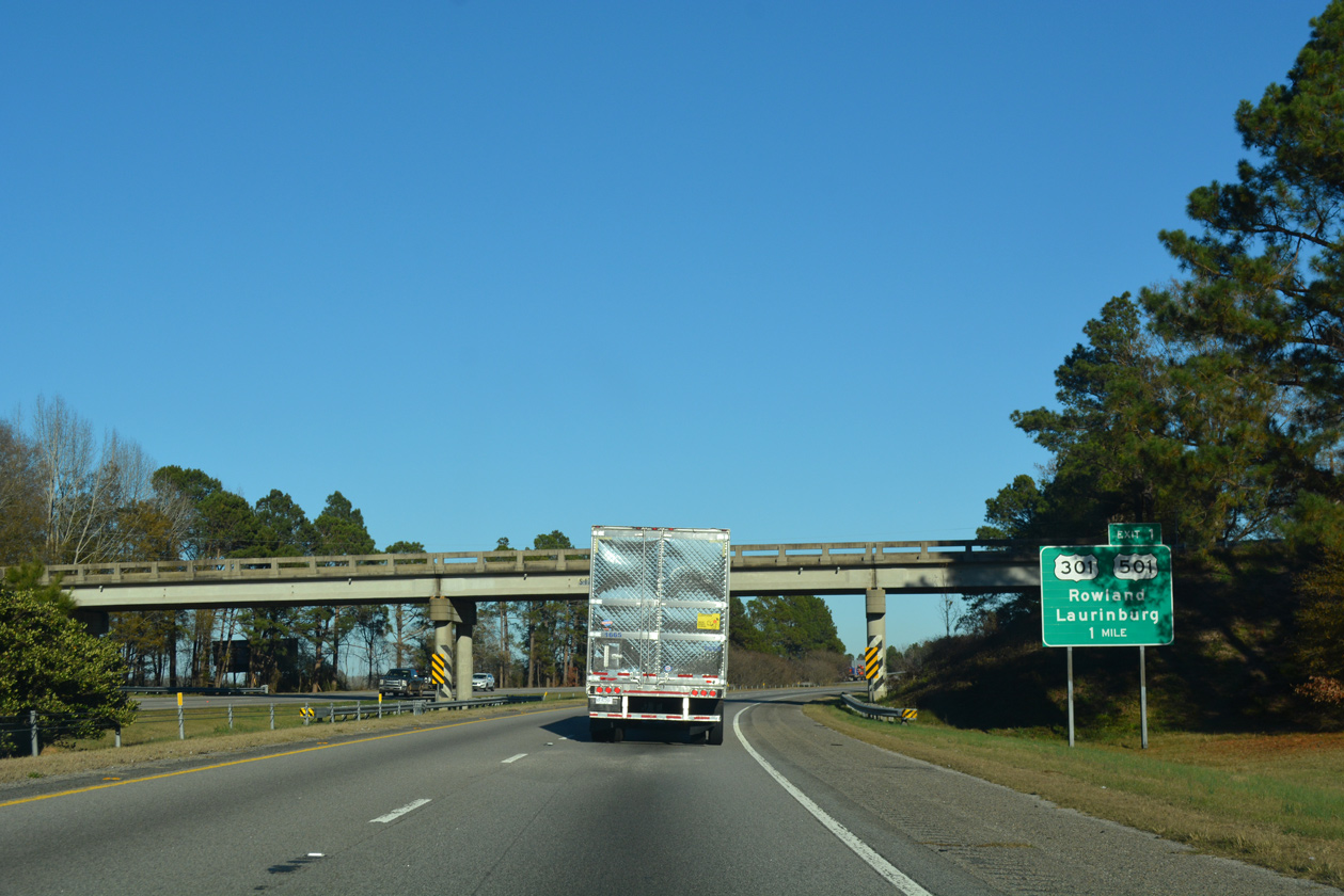
| U.S. 301/501 combine for 16 miles through Latta, Dillon, Hamer and Rowland, North Carolina. The US routes cross paths with Interstate 95 at a parclo interchange (Exit 1) by South of the Border. 12/13/17 |
|
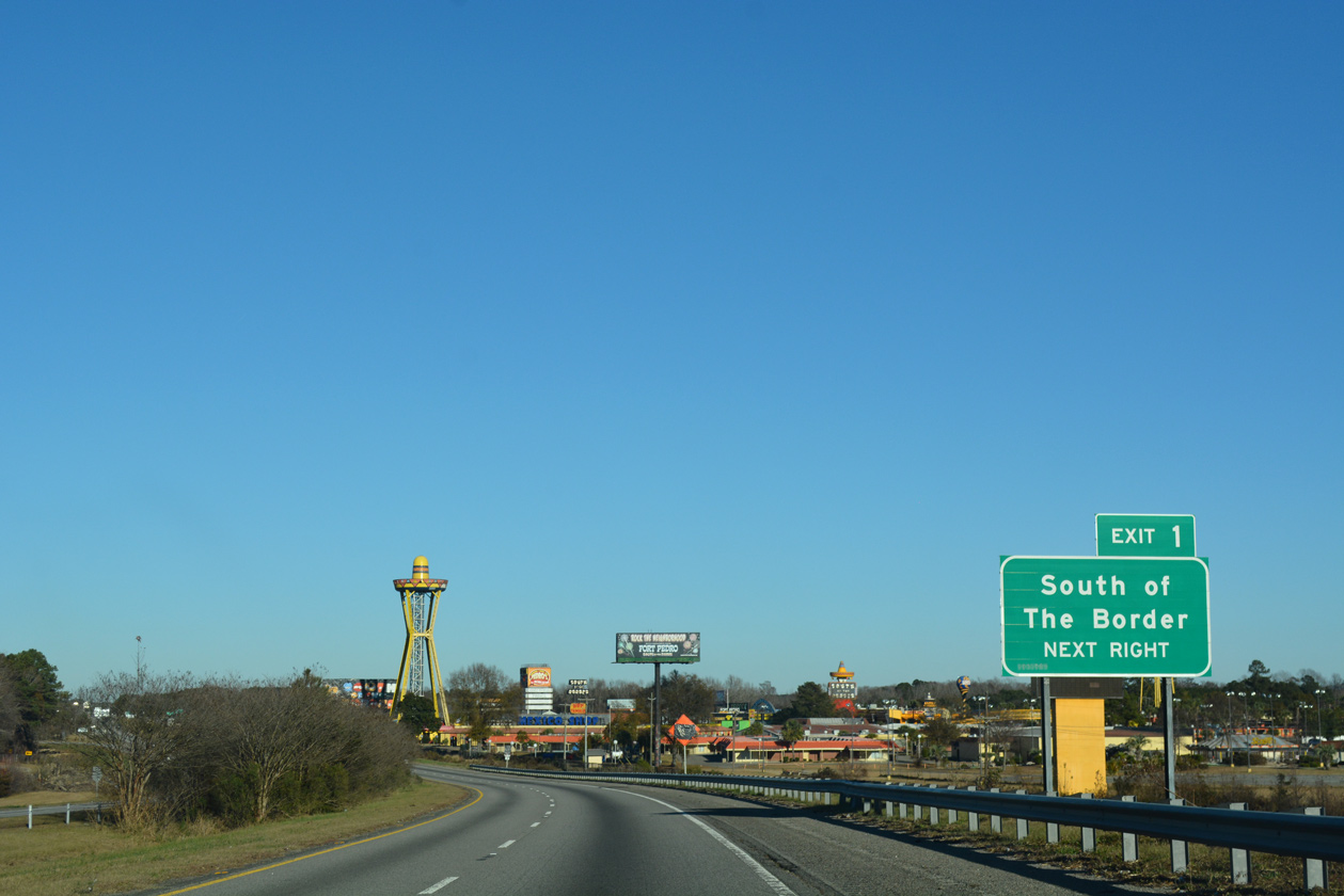
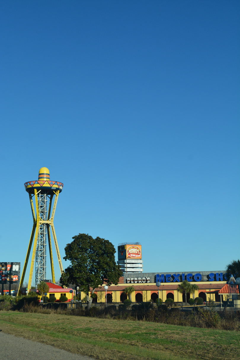
| South of the Border derives its name from its location just south of the North Carolina state line. Established in 1950,2 the tourist attraction has amused and entertained weary drivers for decades with catchy and animated billboards along Interstate 95 in locations as far north as Philadelphia. 12/13/17 |
|
| South of the Border offers lodging, RV parking, food, fireworks and various entertainment. Thousands of neon lights and the 165 foot high Sombrero Tower provide a brief respite from the generally monotonous drive along Interstate 95 between Jacksonville, Florida and Petersburg, Virginia. 12/13/17 |
|
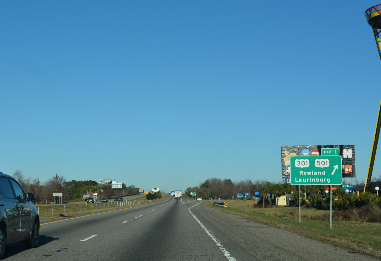
| Exit 1 departs Interstate 95 northbound for U.S. 301/501 at the state line. U.S. 301 splits from U.S. 501 nearby at the town of Rowland. U.S. 501 turns northwest from there to Interstate 74 at Laurinburg. U.S. 301 remains along the I-95 corridor northeast to Lumberton. 12/13/17 |
|
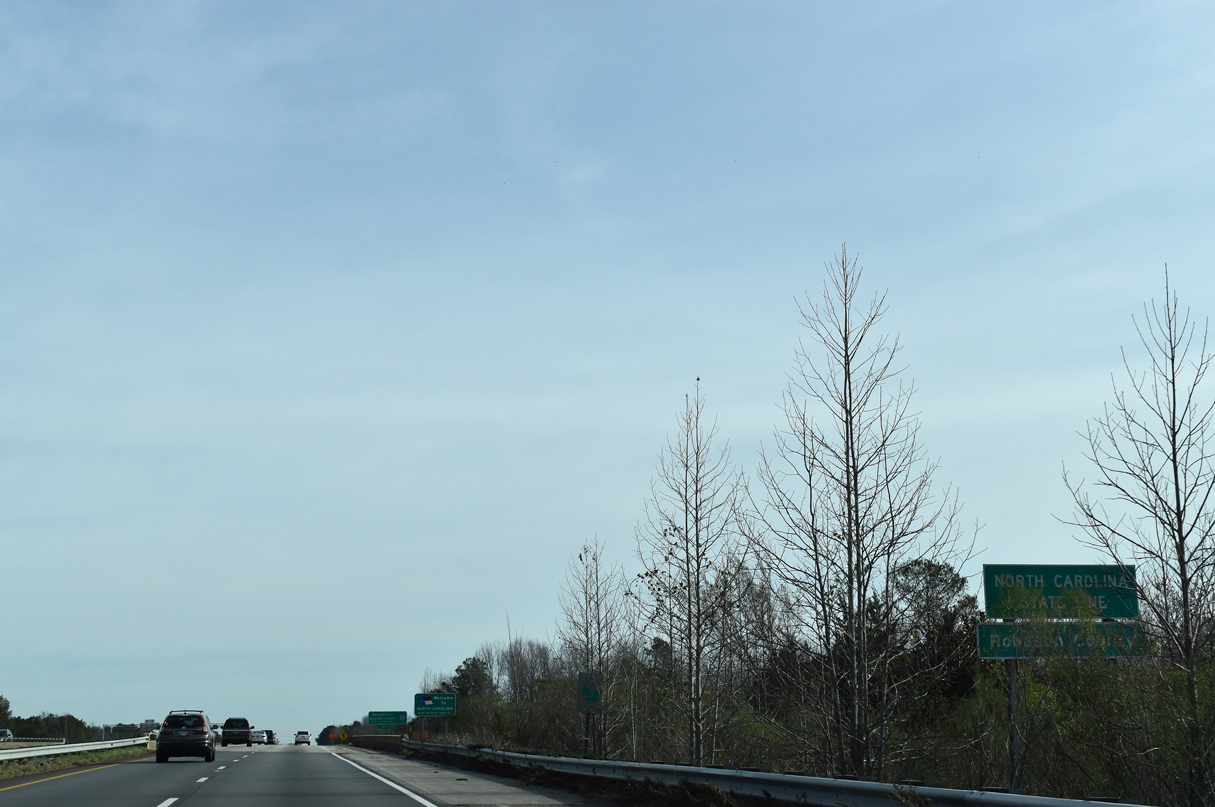
| Interstate 95 leaves South Carolina at milepost 198.76 and enters Robeson County, North Carolina. 02/15/19 |
Page Updated 02-08-2021.

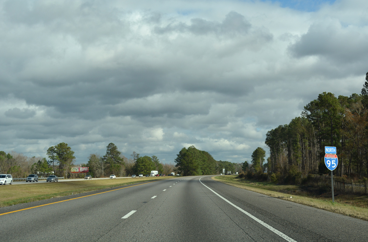
 North
North