|
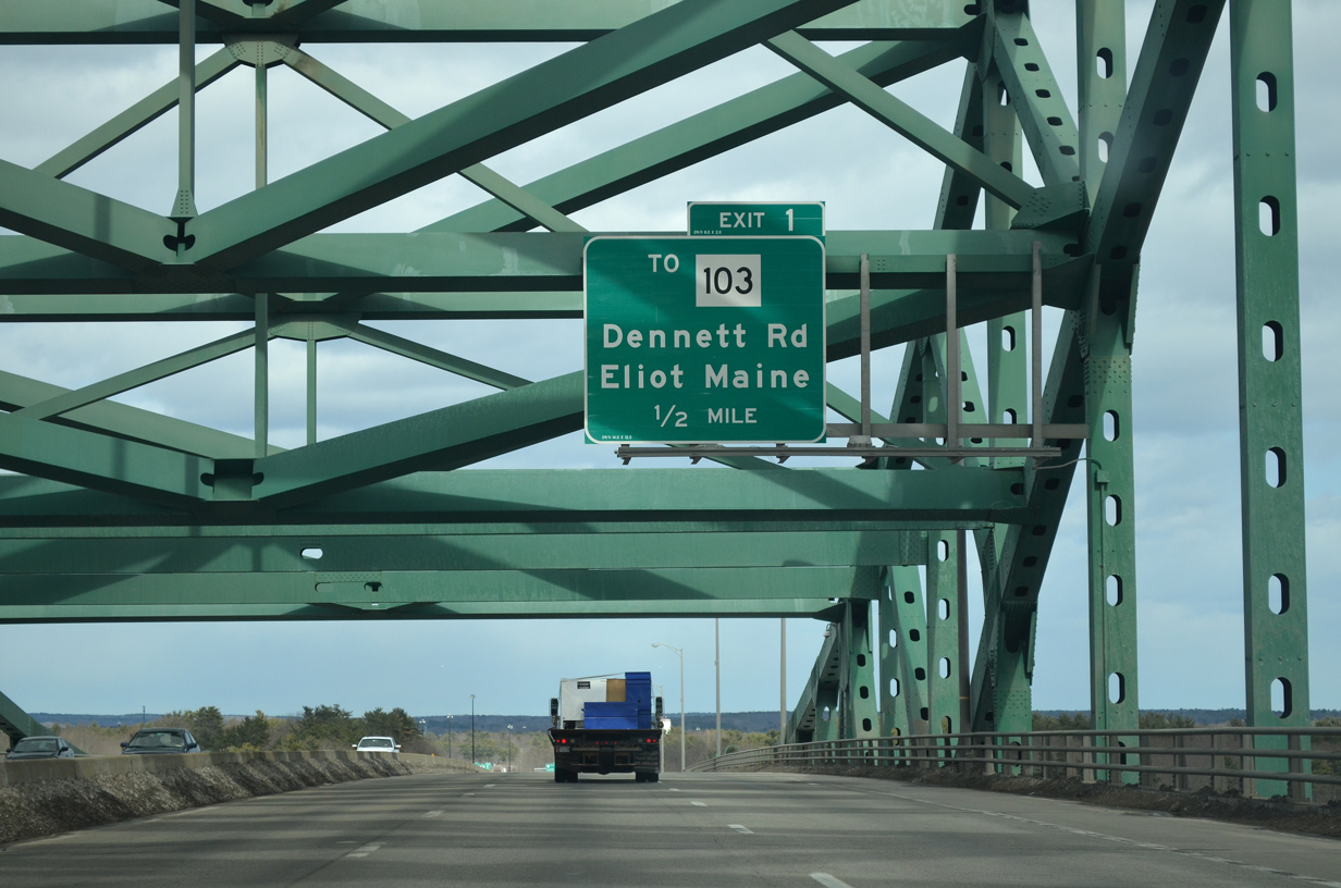
| Interstate 95 spans the Piscataqua River between Portsmouth, New Hampshire and Kittery, Maine. Dennett Road meets the freeway in one half mile at a partial interchange (Exit 1) north of Maine 103 (Eliot Road). Maine 103 passes under the bridge on its parallel alignment to the river from Kittery northwest to South Eliot. 03/23/13 |
|
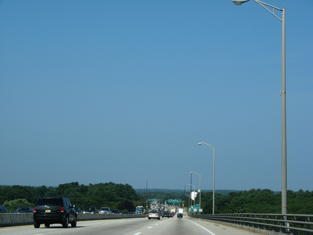
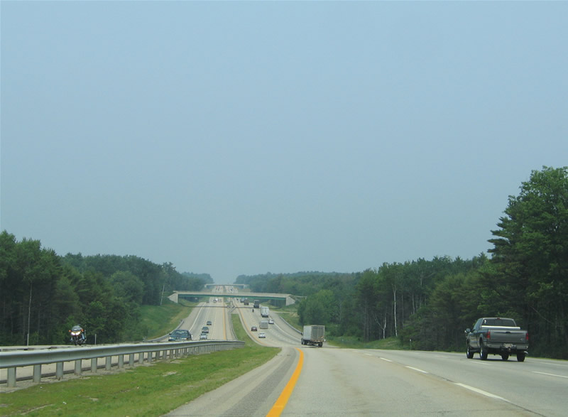
| Descending into York County, Maine from the Piscataqua River Bridge on Interstate 95 north. The span carries six overall lanes on a free section of Interstate 95 between the tolled Maine and Blue Star Turnpikes. 07/29/07 |
|
| Interstate 95 touches down just one-quarter mile south of the loop ramp (Exit 1) onto Dennett Road. Dennett Road travels northward from Maine 103 (Eliot Road) to the town of Eliot. Dennett Road south leads to U.S. 1 Bypass via Maine 103, with the state route continuing east to U.S. 1 (State Road), Kittery Foreside and Portsmouth Naval Shipyard on Seavey Island. 03/23/13 |
|
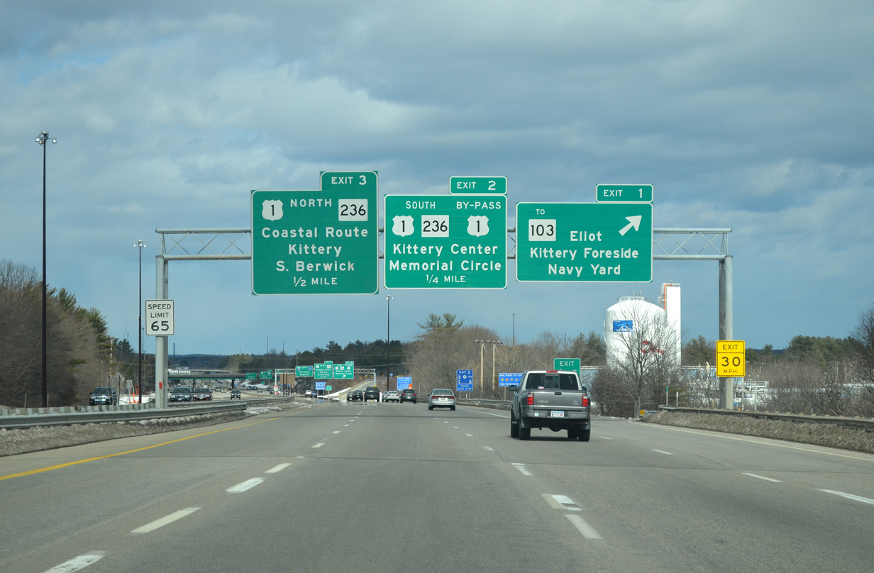
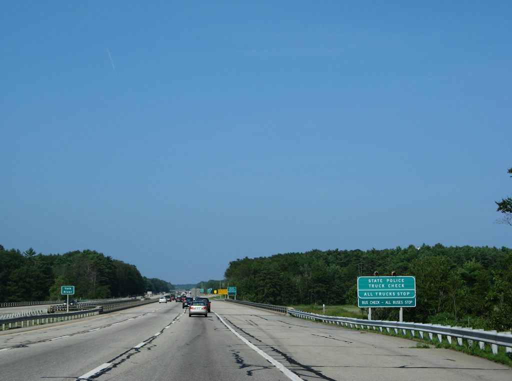
| Exit 1 leaves Interstate 95 northbound for Dennett Road, Eliot and Kittery. Maine 103 travels a curved path between York (U.S. 1A) and Maine 263 at Eliot. Next is the directional cloverleaf interchange complex (Exits 2 and 3) with Maine 263 (Harold L. Dow Highway), U.S. 1 Bypass (Blue Star Memorial Highway) and U.S. 1 (State Road). The three highways come together nearby at Remick Corners. 03/23/13 |
|
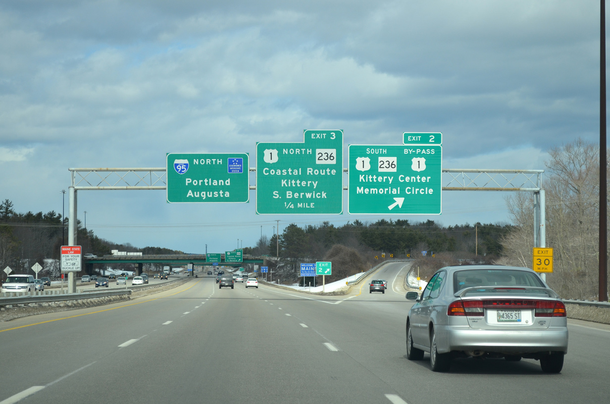
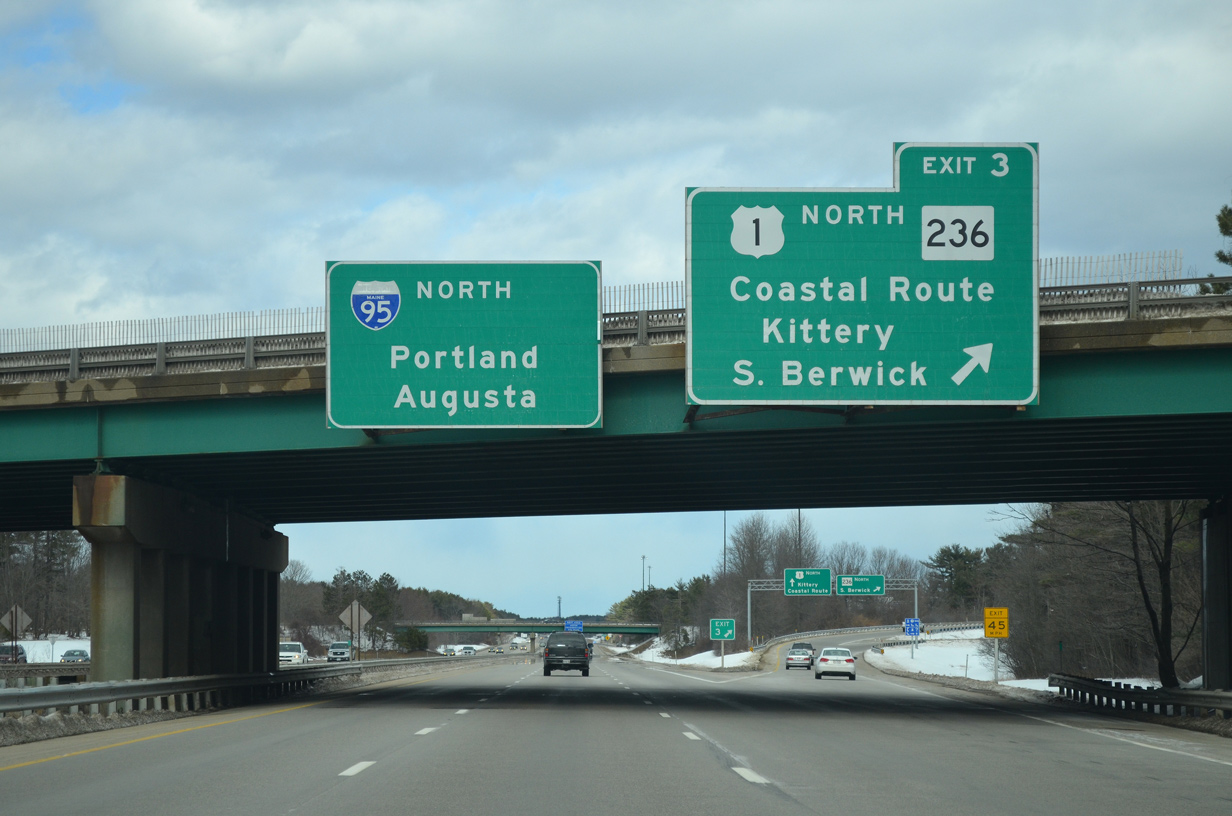
| Exit 2 connects with Maine 236 (Harold L. Dow Highway) to U.S. 1 Bypass south and a rotary with U.S. 1 (State Road) south toward Portsmouth and Rogers Road (Maine 236) southeast to the Kittery town center. Maine 236 ends at Maine 103 (Whipple Road).
Exit 3 follows onto U.S. 1 north beyond its merge with U.S. 1 Bypass. 03/23/13 |
|
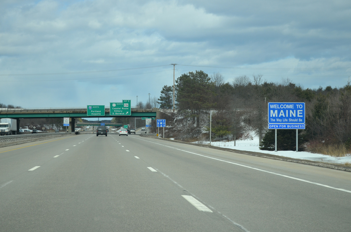
| Welcome to Maine sign posted ahead of the Exit 3 separation to Maine 236 (Harold L. Dow Highway) north to Eliot and U.S. 1 (Blue Star Memorial Highway) north to York Village. 03/23/13 |
|
| Maine 236 passes over Interstate 95 north at the ramp departure (Exit 3) to U.S. 1 (Blue Star Memorial Highway) north. U.S. 1 parallels Interstate 95 northward along the coast from Kittery north to Wells. Maine 236 meanwhile travels north from Eliot to South Berwick and its end at Maine 9 in Berwick. 03/23/13 |
|
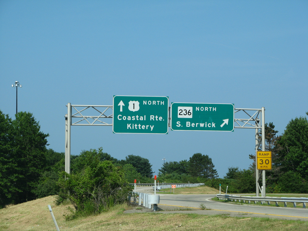
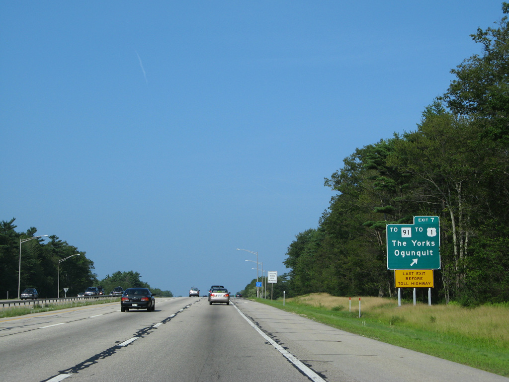
| Exit 3 splits with a loop ramp for SR 236 north to Eliot and U.S. 1 north to Kittery Outlet Mall, York Village and Cape Neddick. SR 101 (Wilson Road) stems north from U.S. 1 near Exit 3 to Eliot as well. 07/29/07 |
|
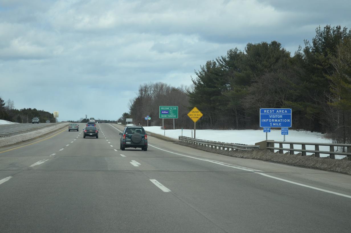
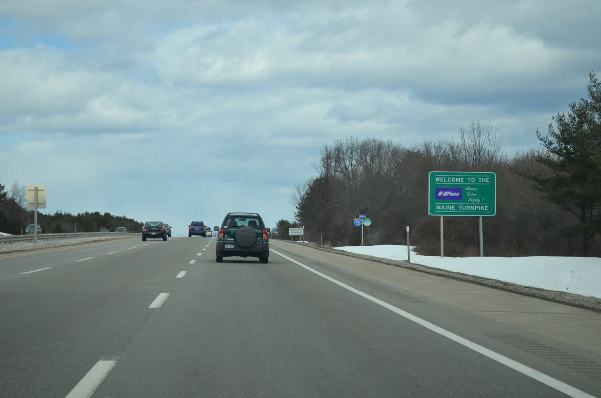
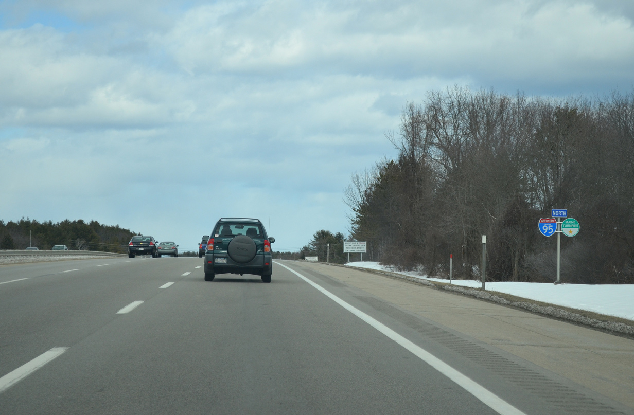
| The Maine Welcome Center lies along Interstate 95 northbound at the transition to the tolled Maine Turnpike. The toll road entails all of the Interstate 95 mainline between Exits 3 and 103. 07/29/07 |
|
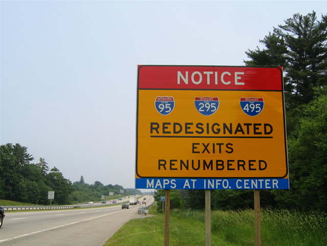
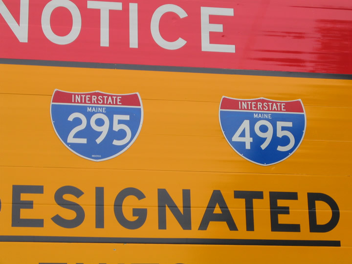
| The last remaining sign in Maine that referenced Interstate 495 was posted along I-95 north at the transition to the Maine Turnpike; this sign was removed by 2007. Interstates 95, 295 and 495 changed paths in 2004 during a grand realignment scheme. That plan moved Interstate 95 wholly onto the Maine Turnpike, extended Interstate 295 north from its end at the Falmouth Spur to Gardiner, and reassigned Interstate 495 to the 5.2 mile long Falmouth Spur as an unsigned route between I-95 and I-295. 06/27/05 |
|
| Interstate 95 spans Spruce Creek on the one mile approach to the Maine welcome center and rest area. 03/23/13 |
|
| The Maine Turnpike and E-ZPass welcomes motorists to the Maine Turnpike system on Interstate 95 north. 03/23/13 |
|
| Maine Turnpike trailblazers appear alongside reassurance markers for Interstate 95 north. 03/23/13 |
|
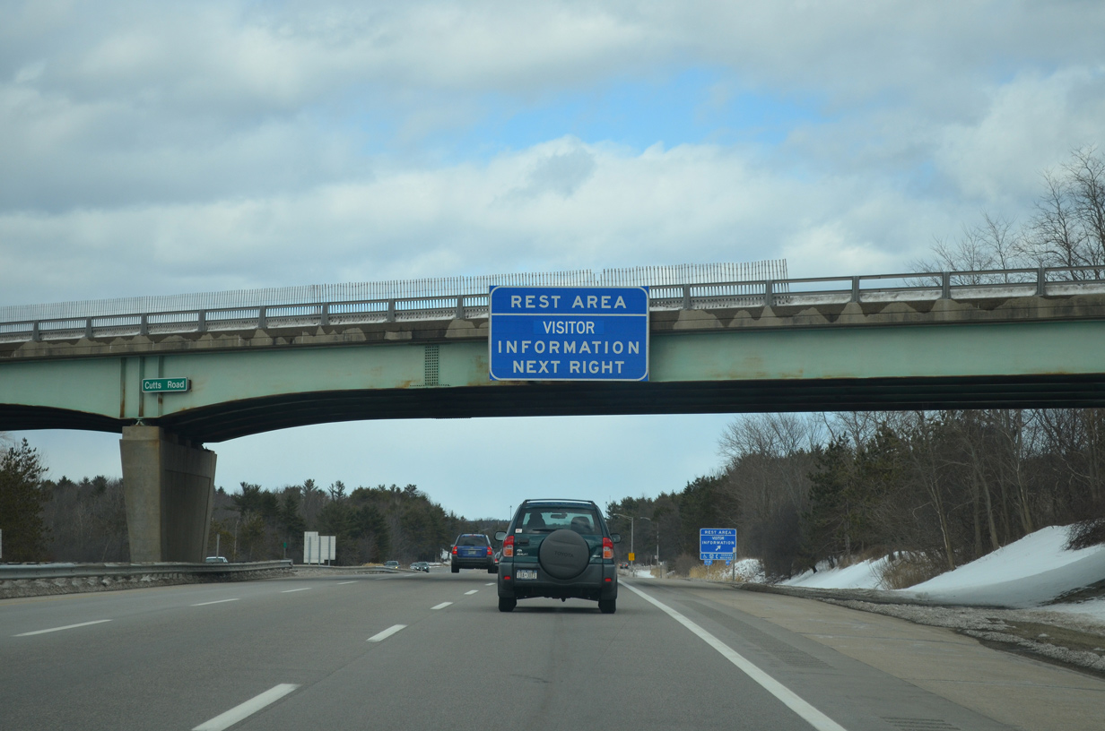
| Interstate 95 northbound at the Cutts Road over crossing ahead of the Maine Welcome Center. 07/29/07 |
|
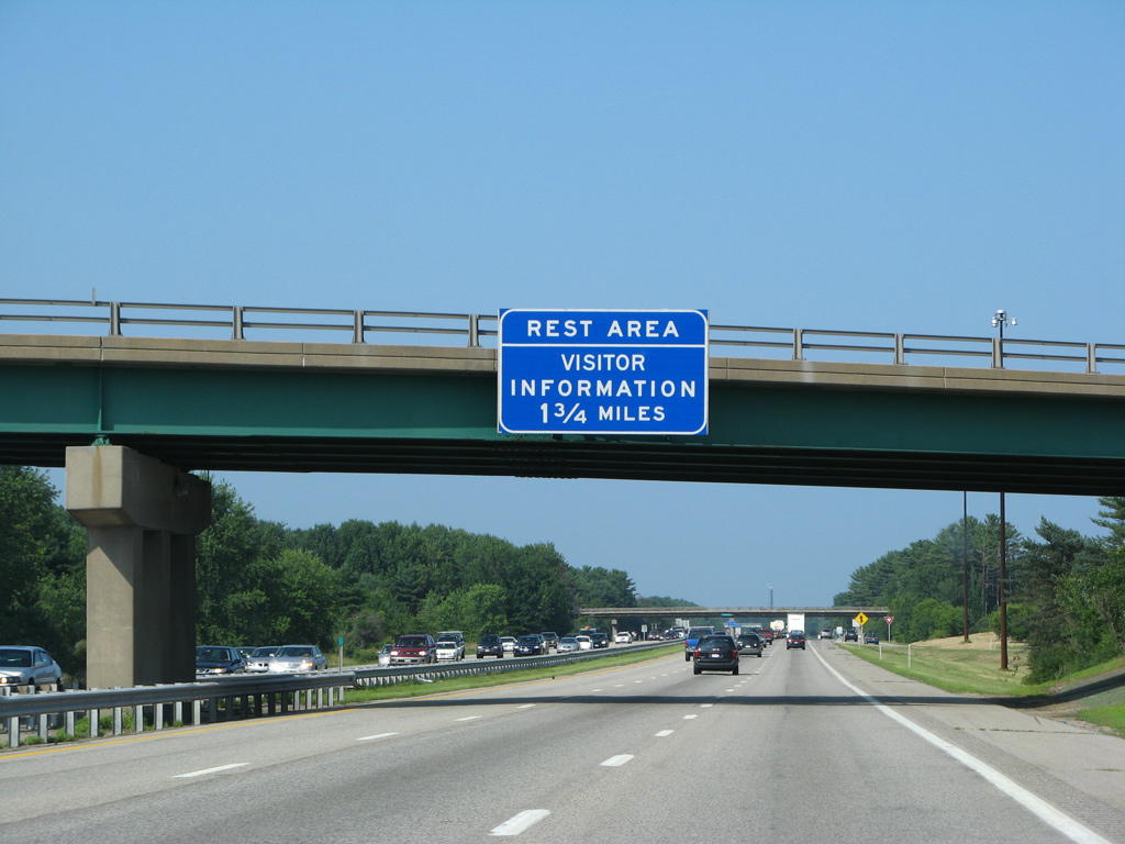
| The Maine welcome center resides between Interstate 95 and U.S. 1. It services both routes. 03/23/13 |
|
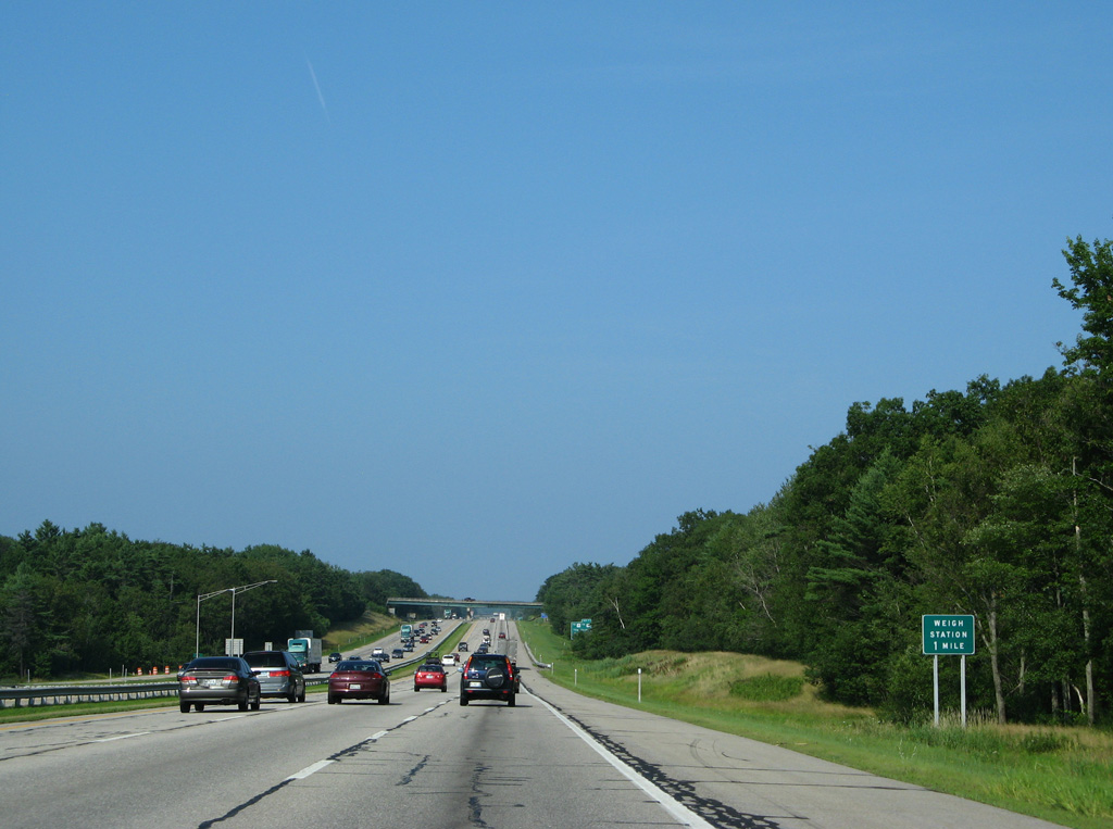
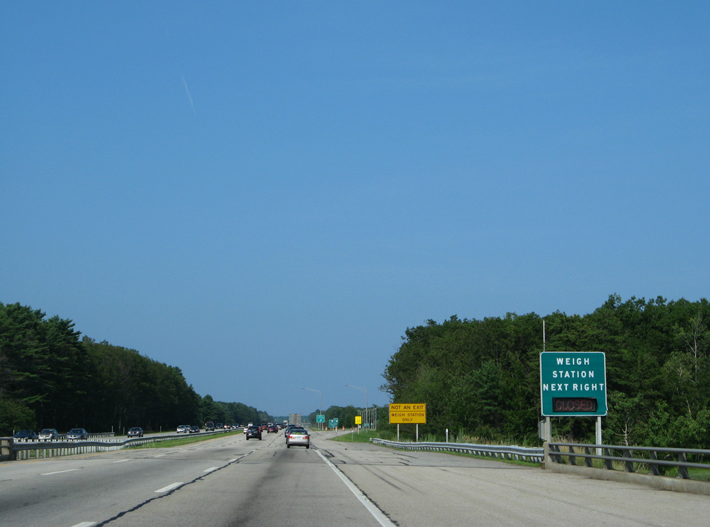
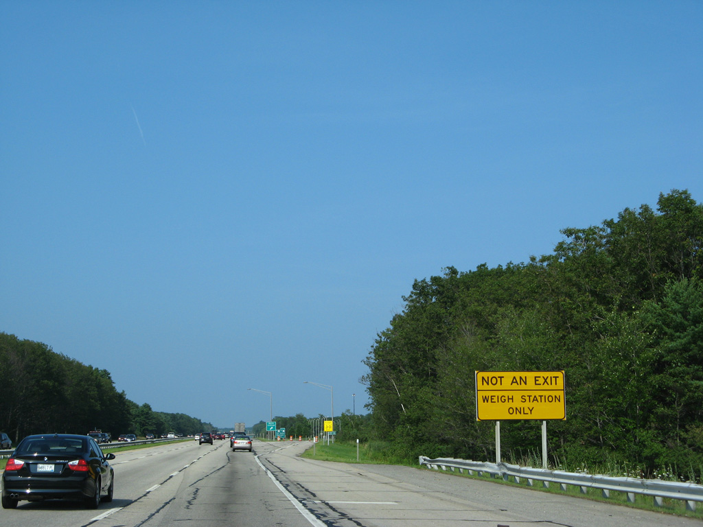
| Interstate 95 north next meets a truck weigh station in one mile. 07/29/07 |
|
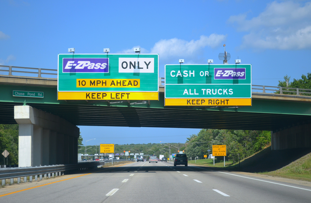
| Two miles south of the diamond interchange (Exit 7) for U.S. 1 (Blue Star Memorial Highway) and Maine 91 (Cider Hill Road) on Interstate 95 (Maine Turnpike) north. A short access road joins the freeway with parallel U.S. 1 to the south and Chases Pond Road to the north. U.S. 1 passes through York Corner nearby. 07/29/07 |
|
| Northbound truckers along I-95 reach the weigh and check station just beyond the bridge over the York River. 07/29/07 |
|
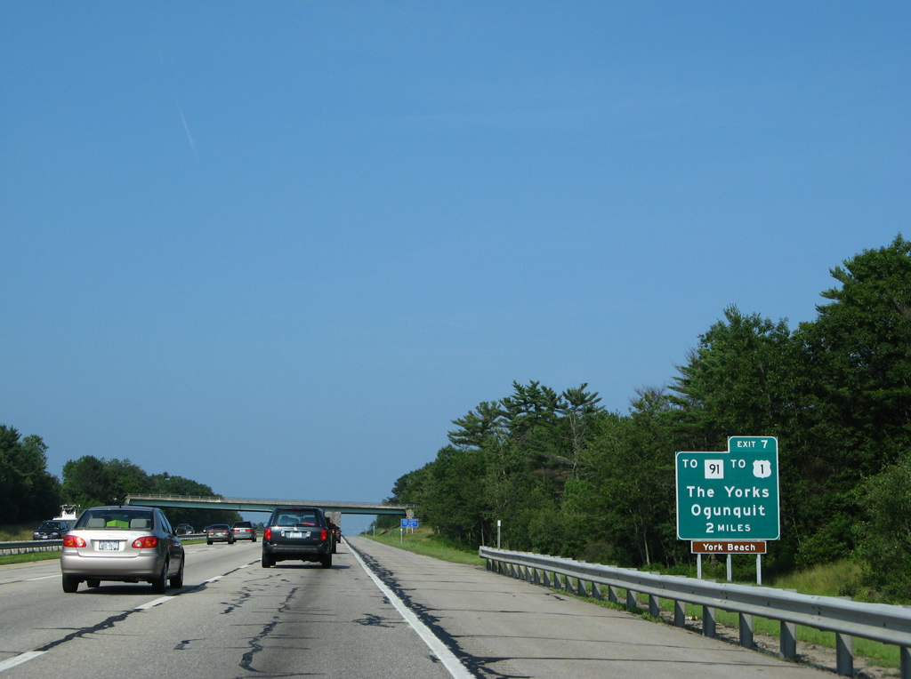
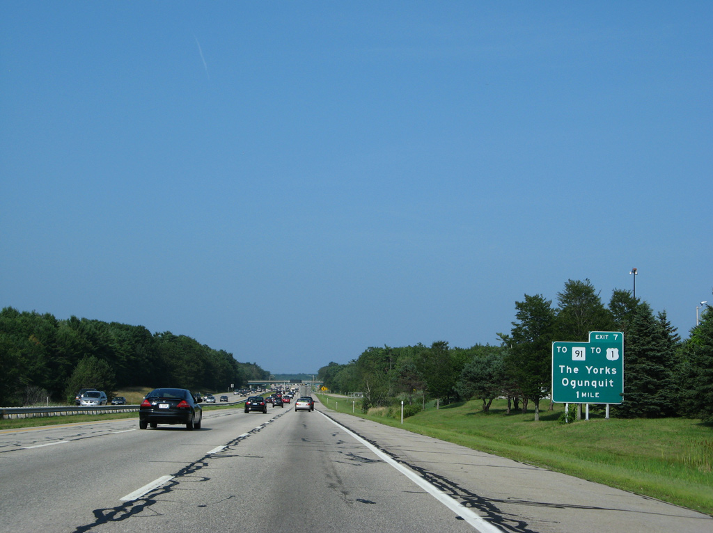
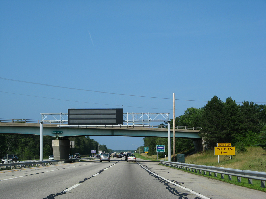
| One mile south of Exit 7 to U.S. 1 and Maine 91 in York. Meeting U.S. 1 (Blue Star Memorial Highway) nearby is U.S. 1A (York Street), the coastal road to York Village, York Harbor and York Beach. Maine 91 (Cider Hill Road) ties into U.S. 1 just south of the intersection with U.S. 1A. 07/29/07 |
|
| Maine 91 (Cider Hill Road) spans Interstate 95 north one mile south of the York Toll Plaza. 07/29/07 |
|
| Exit 7 provides the last departure point before tolls take effect along Interstate 95 northbound. U.S. 1 parallels the toll road northward to Cape Neddick, Ogunquit, Moody and Wells between Exits 7 and 19.Maine 91 meanwhile ventures northwest from the US highway to Maine 236 at South Berwick. 07/29/07 |
|
| Taking Exit 11, drivers approach the access road connecting Interstate 95 with U.S. 1 and Maine 91. Chases Pond Road stems north from the access road to Chases Pond and Mountain Road parallel to the Maine Turnpike. 07/29/07 |
|
| Interstate 95 passes under Chase Pond Road (Exit 7) just south of the Maine Turnpike mainline toll plaza. There are no high-speed E-ZPass lanes, rather E-ZPass-dedicated toll booth lanes are used instead. This is typical of older toll roads that adopted electronic toll collection in the early and mid 2000s. 08/27/14 |
|
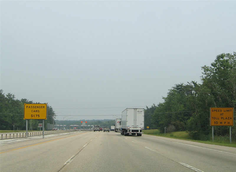
| All passenger vehicles are levied a $3.00 toll (2015 rates) as they enter the Maine Turnpike. This is the first of three mainline toll plazas along the 100 mile Turnpike mainline. 06/27/05 |
|
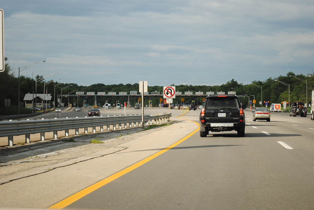
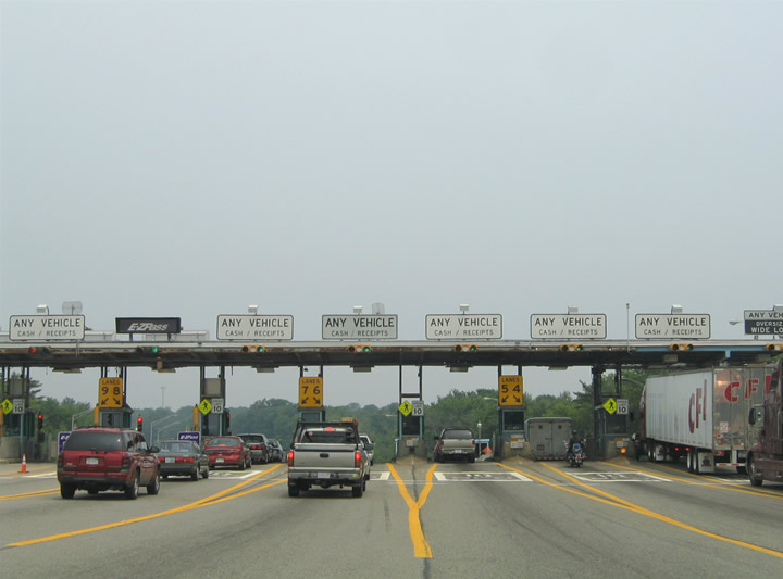
| Views of the York Toll Plaza from Interstate 95 northbound. 06/30/11, 06/27/05 |
|
| Interstate 95 (Maine Turnpike) turns more northerly from the York Toll Plaza to pass between Chases Pond and Cat Mountain. 06/27/05 |
|
| An 11 mile exit less stretch ensues along Interstate 95 north through Wells. The capital city lies 100 miles ahead. 06/27/05 |
|
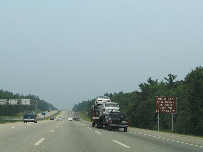
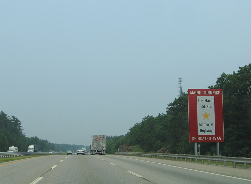
| A series of signs posted beyond the York Toll Plaza proclaim significant dates in Maine Turnpike history, such as the 1947 opening of the roadway and 1965 dedication as the Gold Star Memorial Highway. Additional guide signs inform motorists of connections to various points of interest statewide from Interstate 95 north including the Moosehead Lake and Bar Harbor Regions. 06/27/05 |
|
| Slow rolling hills and small rock outcroppings appear along Interstate 95 north as the Maine Turnpike enters the town of Wells in this scene near Captain Thomas Road and the Ogunquit River. 06/27/05 |
|
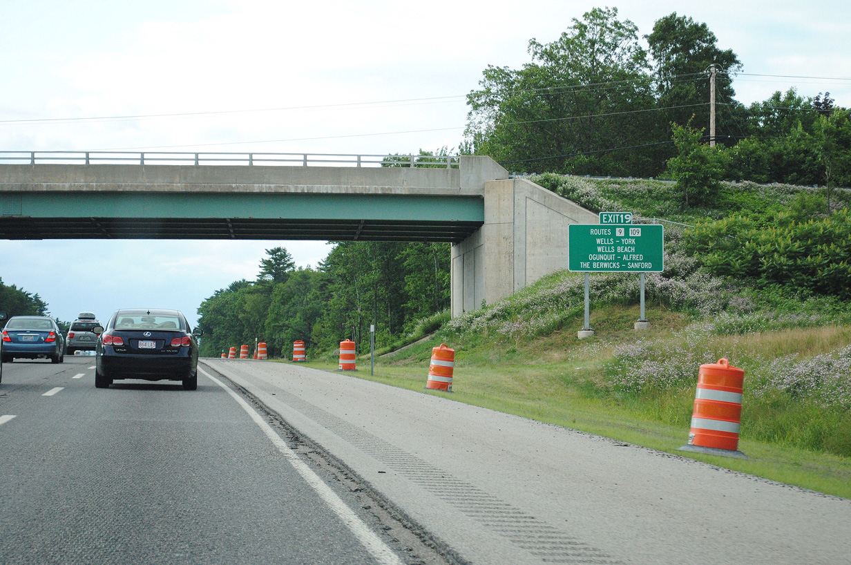
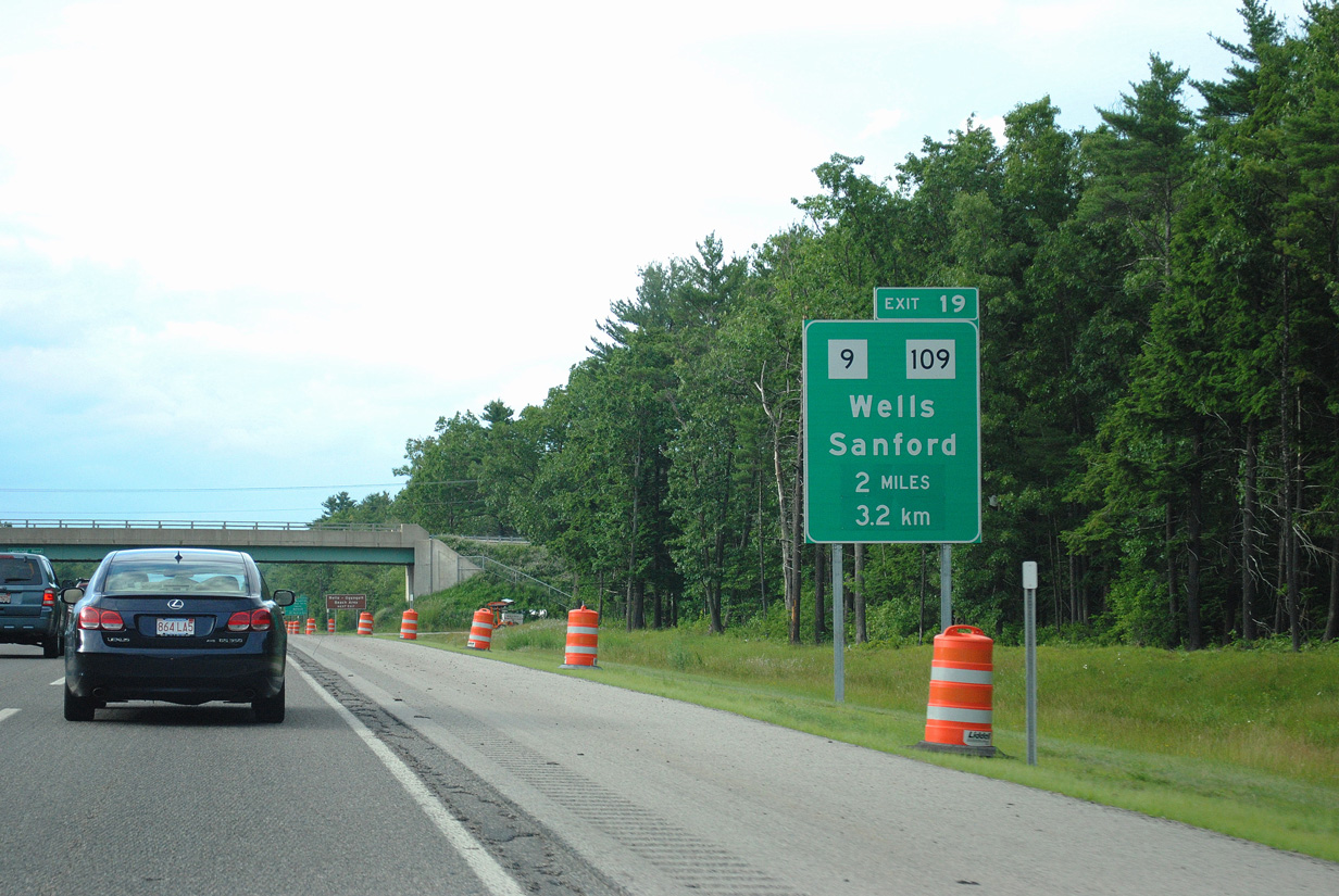
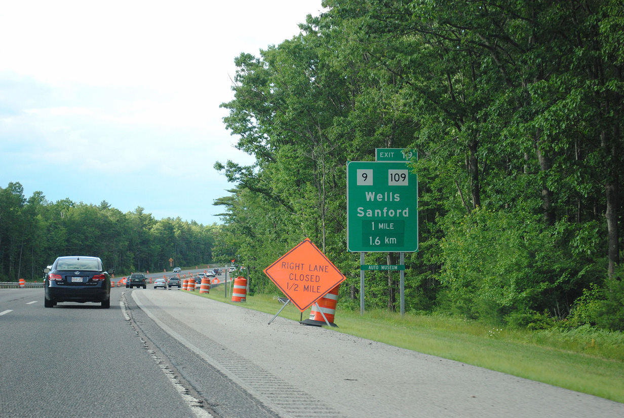
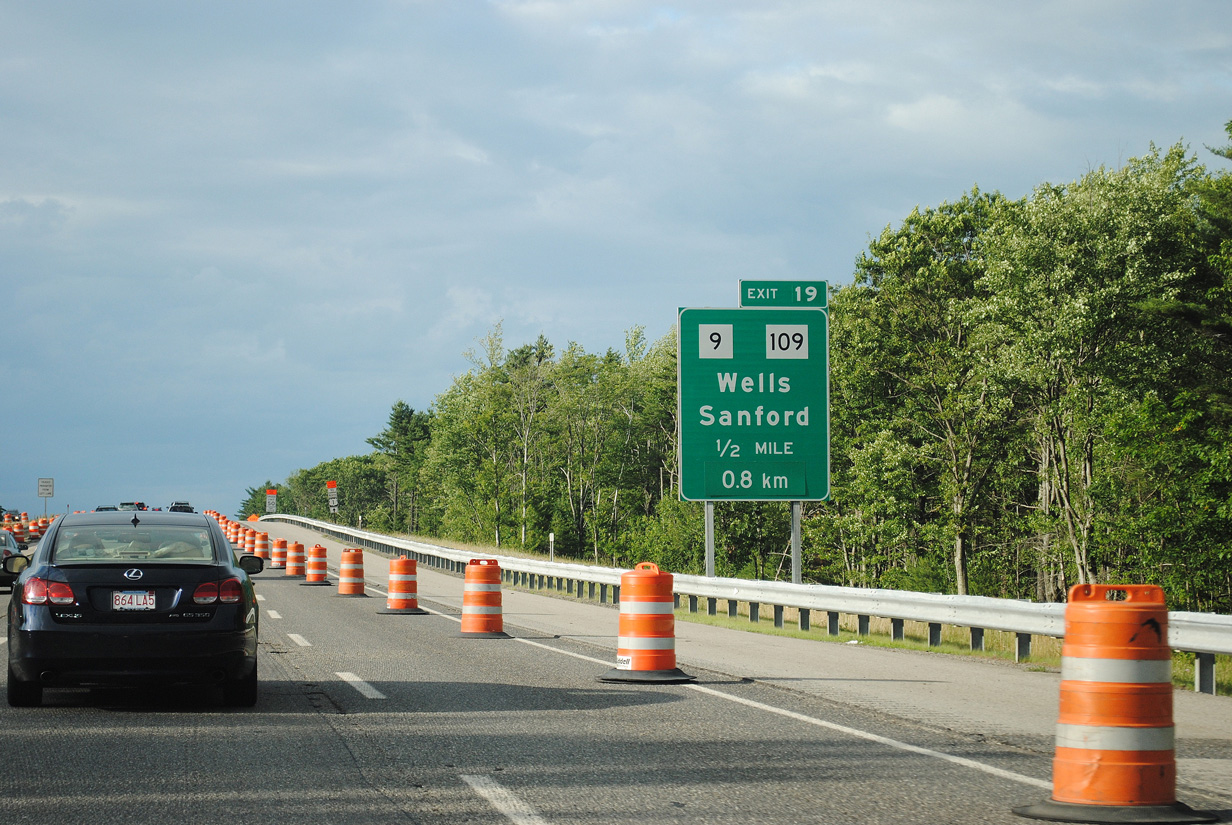
| A rather temporary looking sign posted at the Tatnic Road overpass gives I-95 travelers the first indication of Exit 19 with Maine 9 & 109 (Sanford Road) at Wells. Maine 9 & 109 follow Sanford Road west from U.S. 1 (Post Road) to Berwick Road just west of Interstate 95. Connections with U.S. 1 south serve Wells Beach (via Mile Road east), Ogunquit and York. U.S. 1 north combines with Maine 9 from Wells to Elms while Maine 109 ends at their merge. 06/30/11 |
|
| Maine 9 & 109 split for respective paths to North Berwick and Sanford west of Exit 19 at Merriland Ridge. SR 9 follows North Berwick Road while SR 109 remains on Sanford Road. SR 9 eventually becomes New Hampshire 9 at Somersworth; SR 109 also becomes a New Hampshire route between Acton and Sanbornville, NH. 06/30/11 |
|
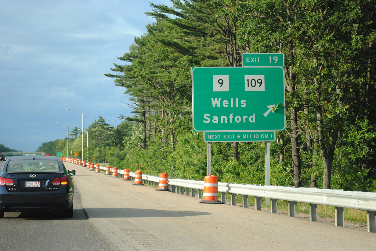
| A typical trumpet interchange and access road join Maine 9 & 109 (Sanford Road) with Interstate 95 at Exit 19. Maine 9A (Branch Road) ties into the state route pair just west from Kennebunk to the northwest. 06/30/11 |
|
| One half mile south of Exit 19 to SR 9 & 109 (Sanford Road). SR 9 continues east from U.S. 1 (Post Road) at Elms toward Kennebunk Beach and Kennebunkport along the coast. The state route travels the width of Maine between New Hampshire and the bridge to Calais, New Brunswick. SR 9 meets I-95 several more times. 06/30/11 |
|
| Northbound I-95 at Exit 19 to Maine 9 & 109 (Sanford Road) in Wells. North Berwick lies seven miles west via SR 9; an 11 mile drive takes motorists to Sanford via SR 109 north. 06/30/11 |
|
| Interstate 95 & Maine Turnpike reassurance markers posted along northbound at the Burnt Mill Road overpass. 06/27/05 |
|
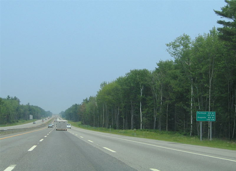
| Distance signs posted along the Maine Turnpike feature English and Metric units for motorists originating from Canada. Portland (Interstate 295) and Augusta (U.S. 202) are featured here. 06/27/05 |
|
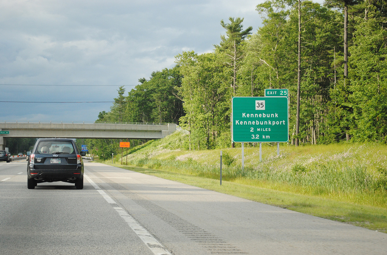
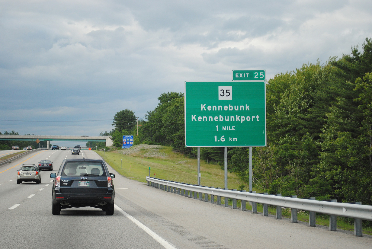
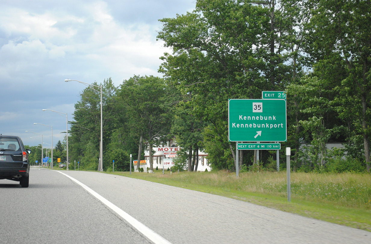
| Maine 35 (Fletcher Street / Alewive Road) crosses paths with the Maine Turnpike at Exit 25 on the outskirts of Kennebunk. The state route travels north-south from Kennebunkport to Days Mills and Lyman. 06/30/11 |
|
| One mile south of the folded diamond interchange (Exit 25) with SR 35 on Interstate 95 north. SR 35 travels overall between Kennebunkport (Maine 9) and SR 26 at Bethel. Locally the state route follows Fletcher Street south to U.S. 1 & SR 9A (Main Street / Portland Road) through Kennebunk. SR 9A accompanies SR 35 for the 3.5 mile drive to the coastal town. 06/30/11 |
|
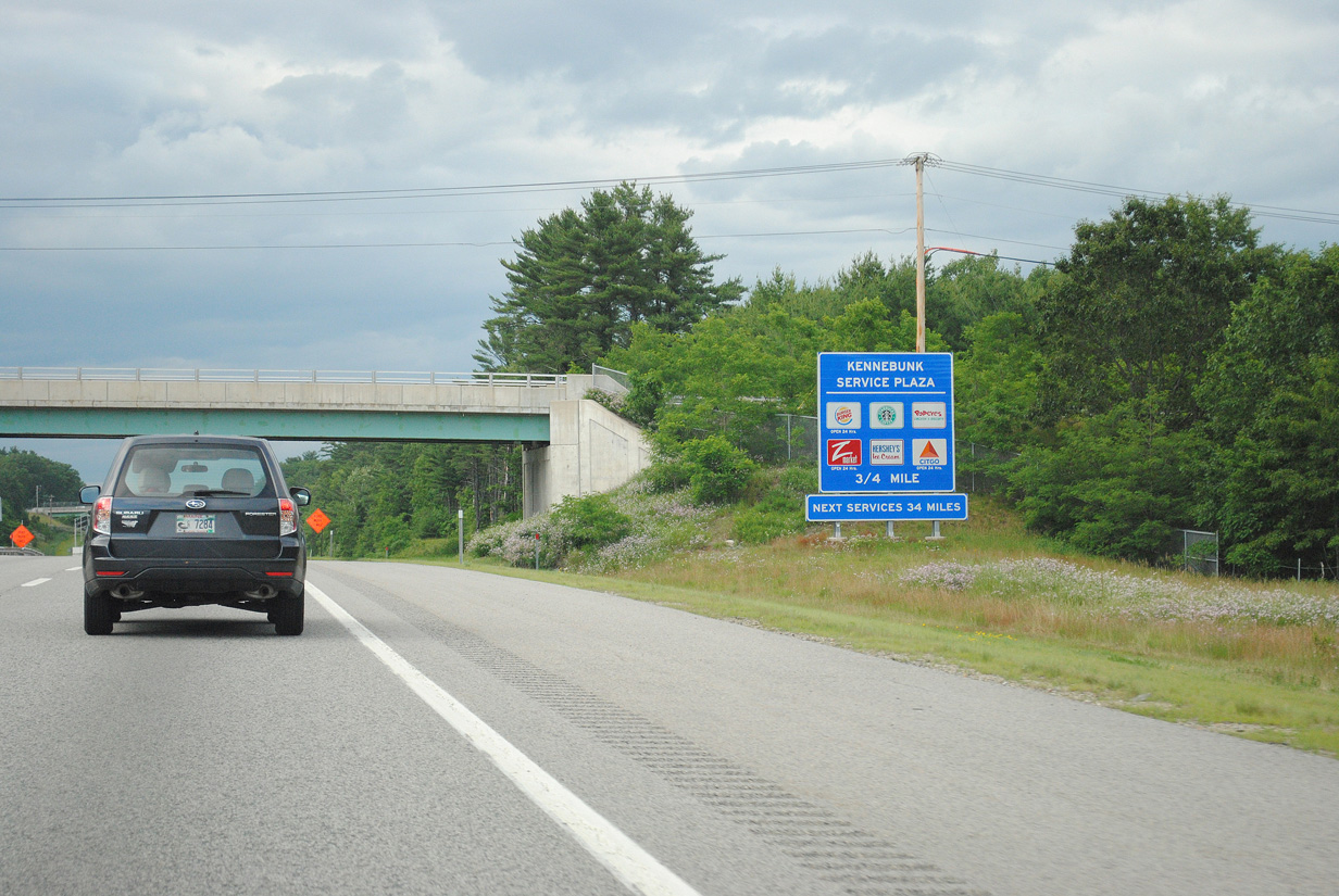
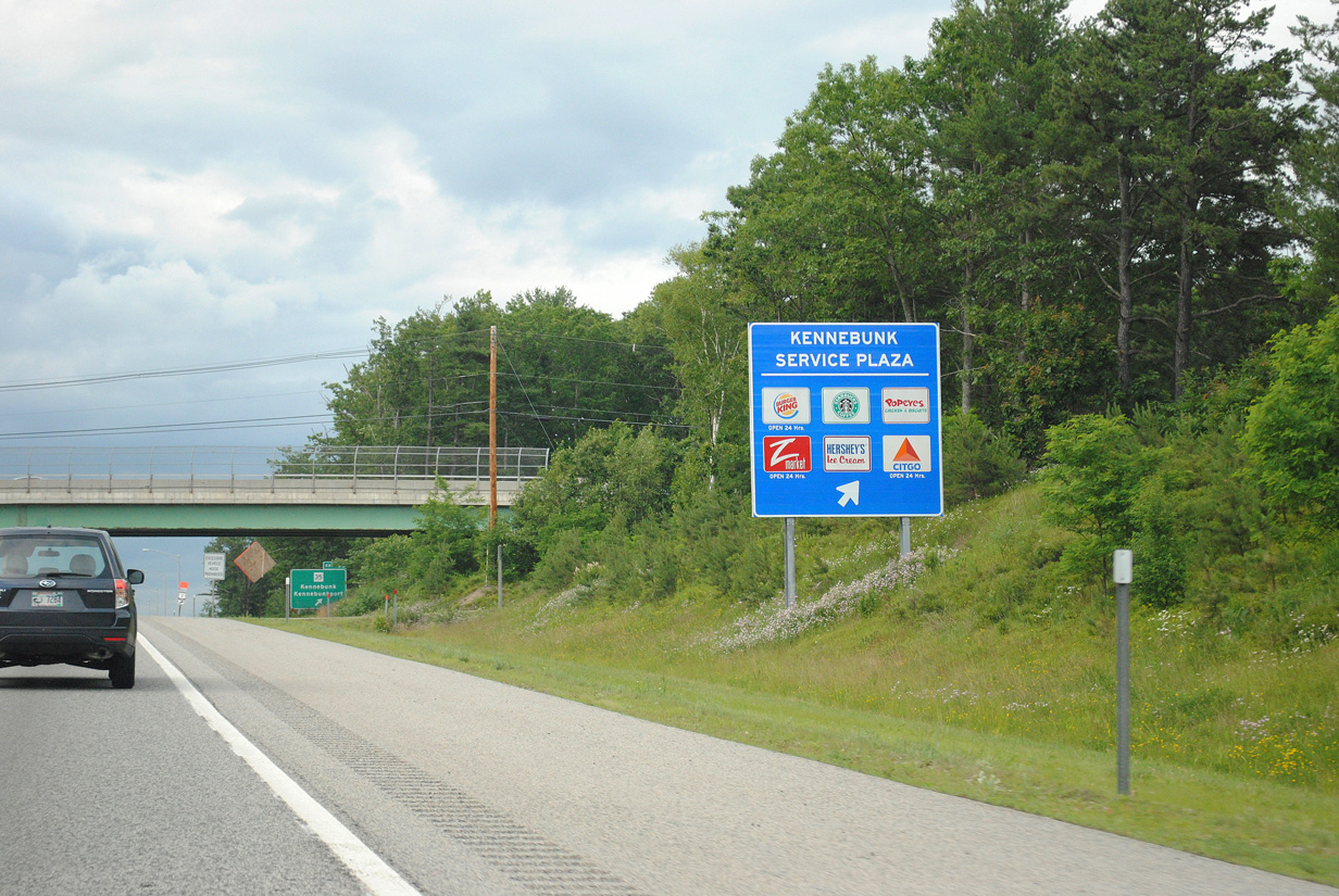
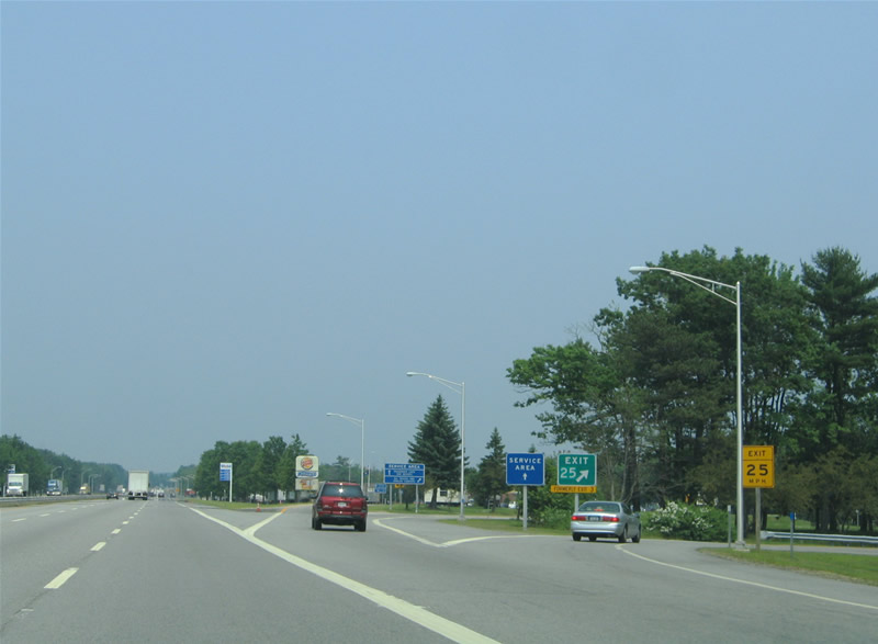
| Situated just north of the Exit 25 off-ramp is the first Maine Turnpike service area. Like other toll road service plazas, food, tourist information and fuel is available to travelers. 06/30/11 |
|
| Interstate 95 crosses the Mousam River one half mile south of Exit 25 and the Kennebunk Service Plaza. Maine 9 from Maine 35 and Kennebunkport serves the coastal communities of Kennebunk Beach, Cape Porpoise, Goose Rocks Beach and Biddeford Pool. Kennebunkport is well known as the summer home of former President George H.W. Bush. 06/30/11 |
|
| Maine 35 passes over Interstate 95 ahead of the entrance to Kennebunk Service Plaza. A companion area serves southbound motorists. 06/30/11 |
|
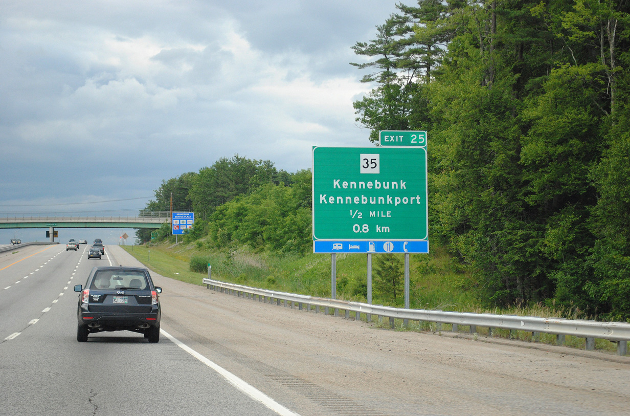
| Drivers bound for Kennebunk and Kennebunkport depart Interstate 95 northbound via Exit 25. Maine 35 (Fletcher Street) reaches U.S. 1 & Maine 9A (Maine Street) in 1.6 miles. The two routes travel south together through the Kennebunk town center. 06/30/11 |
|
| The Kennebunk Service Area off-ramp partitions with the Exit 25 loop ramp to Maine 35. Oncoming traffic from Kennebunk joins the Service Plaza on-ramp ahead. 06/27/05 |
|
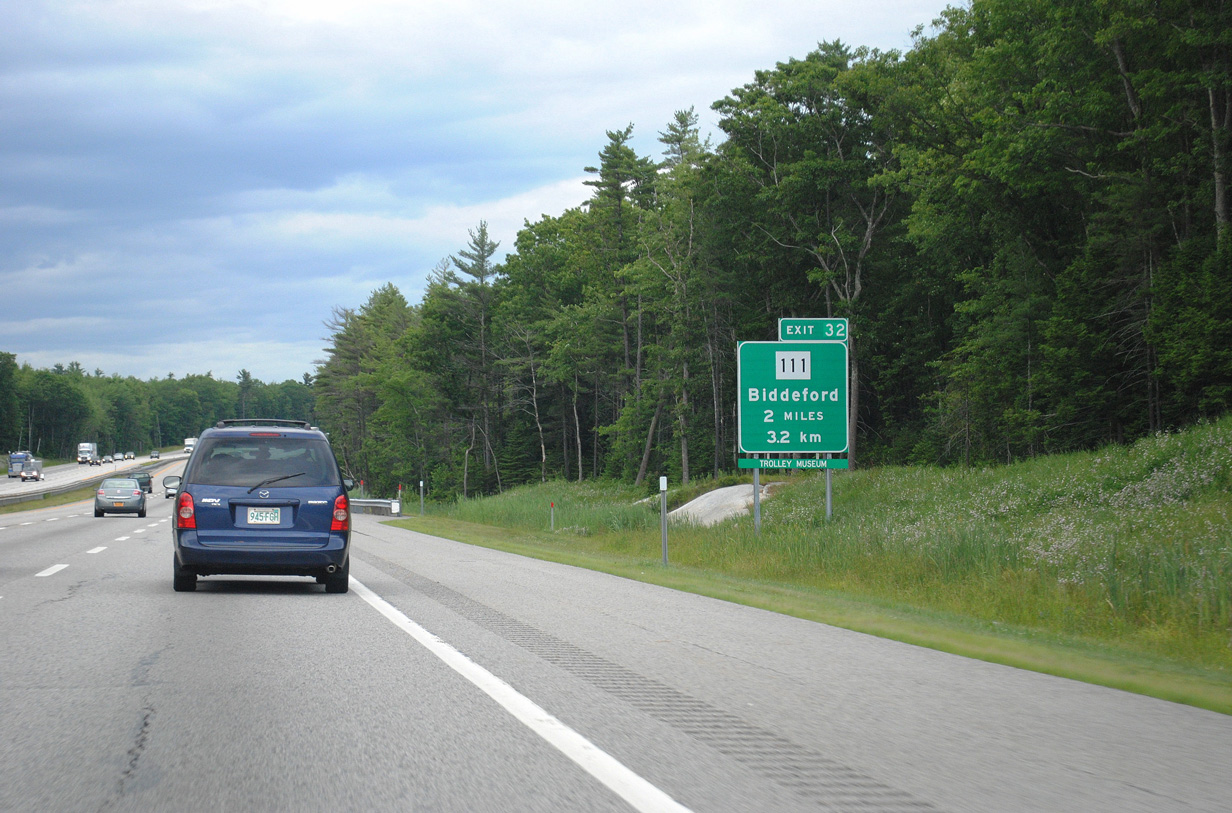
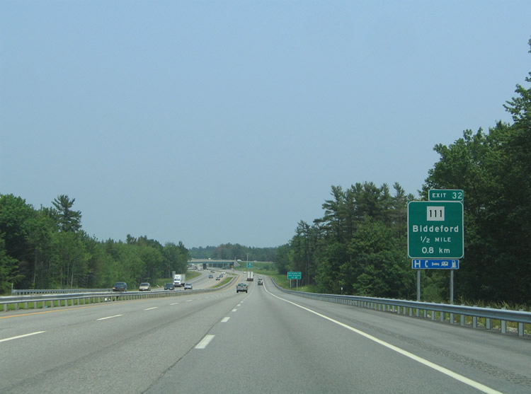
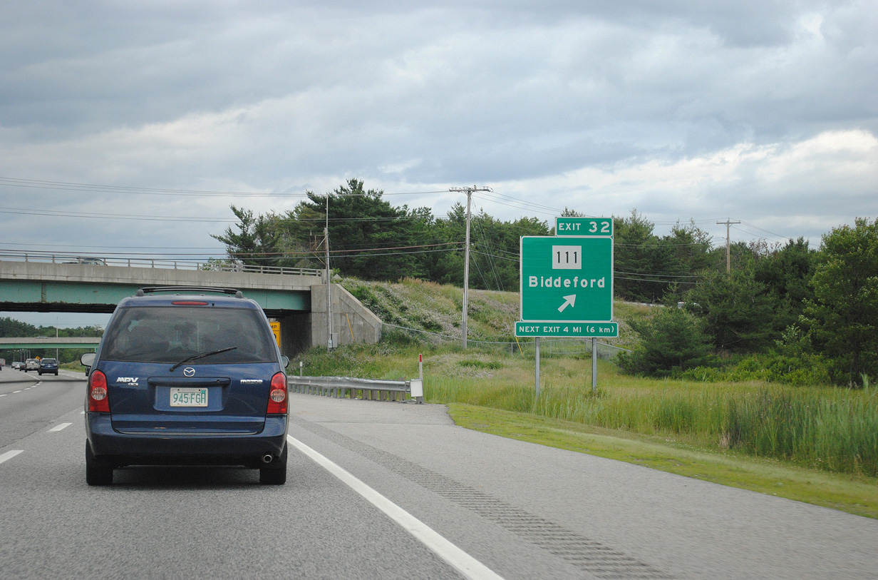
| Next in line for northbound travelers is the trumpet interchange and associated access road at Exit 32 to Maine 111 (Carl Broggi Highway / Alfred Street). Pictured here is the two mile guide sign for the east-west highway. 06/30/11 |
|
| Exit 32 serves the city of Biddeford via SR 111 (Alfred Street) east. SR 111 meets U.S. 1 (Elm Street) at West Street in Five Points. Alfred Street continues the state route east into Downtown where it merges with SR 9 briefly at Maine 208 (Pool Street). SR 9 & 111 share two blocks before SR 111 ends at the intersection of Alfred and Main Streets. SR 9 continues from there across the Saco River into Saco. 06/30/11 |
|
| Maine 111 (Alfred Road) continues west from Exit 32 another 11.4 miles to its end at U.S. 202 & Maine 4 in Alfred. Alfred Road intersects Maine 35 in 5.5 miles at Lyman. 06/27/05 |
|
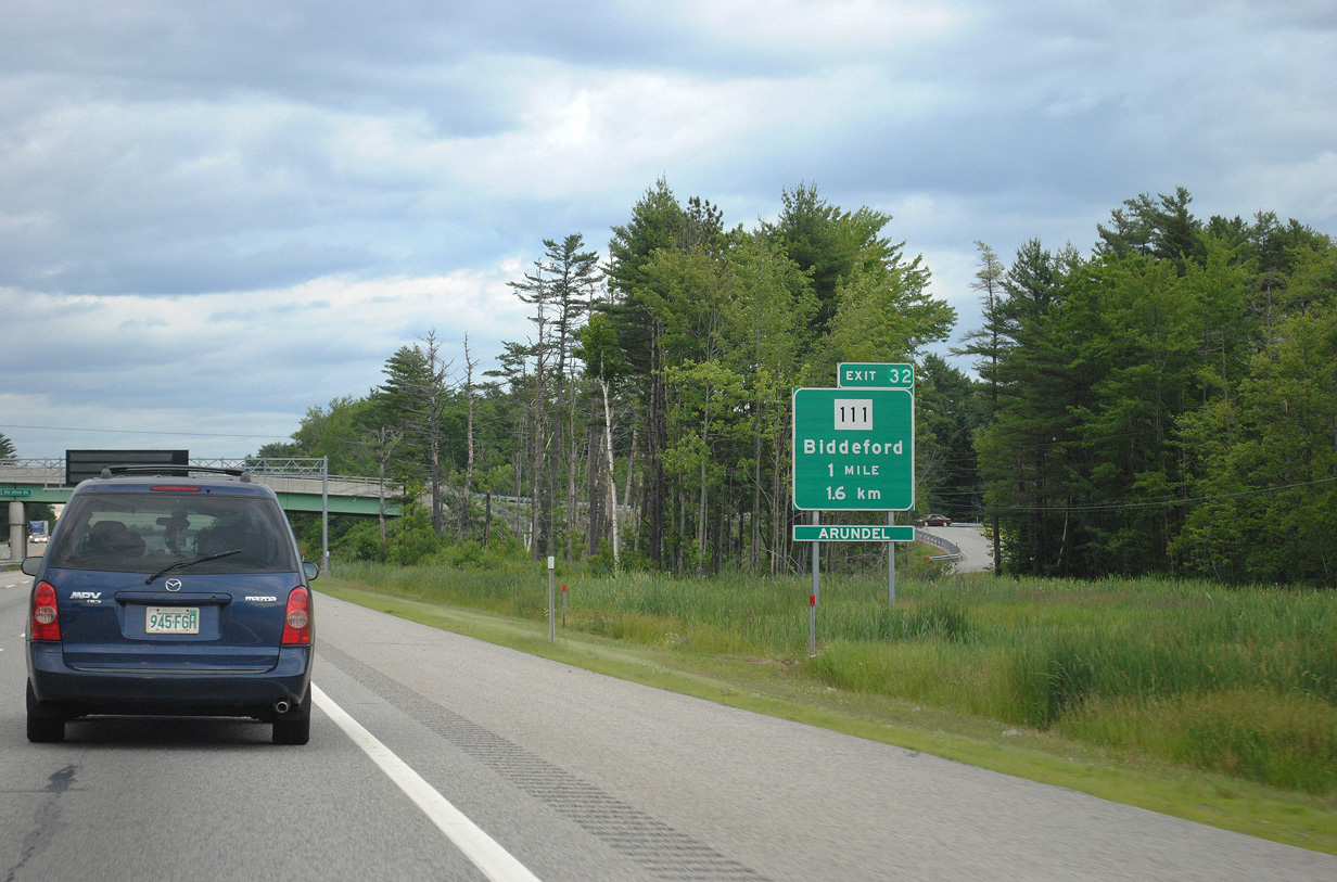
| Maine 111 (Carl Broggi Highway) passes over Interstate 95 ahead of the off-ramp at Exit 32. The Exit 32 access road ties into Maine 111 at Biddeford Spur, a 0.8 mile connector linking the state route and freeway with U.S. 1 and Biddeford Municipal Airport (B19). 06/30/11 |
|
| Interstate 95 (Maine Turnpike) skims western reaches of Biddeford and Saco between Exits 32 and 36. The freeway spans the Saco River near milepost 33. 06/27/05 |
|
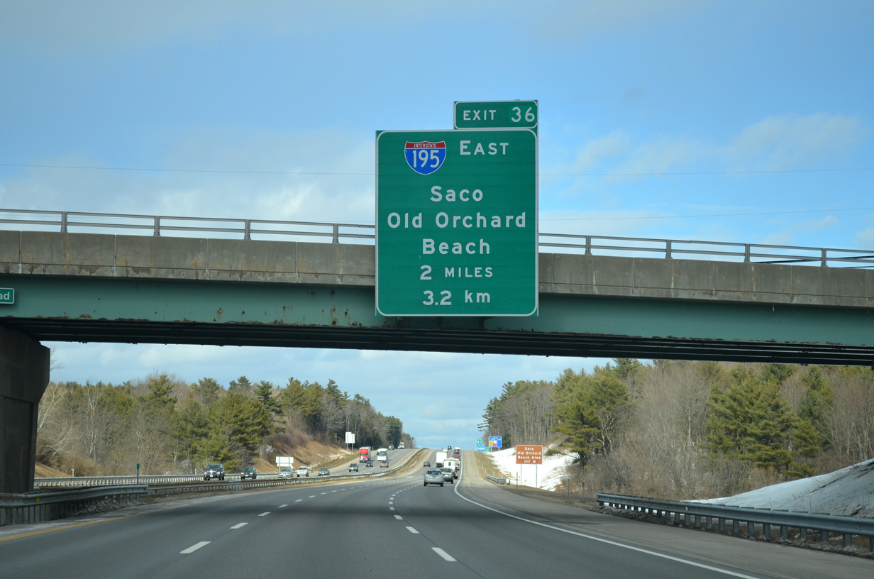
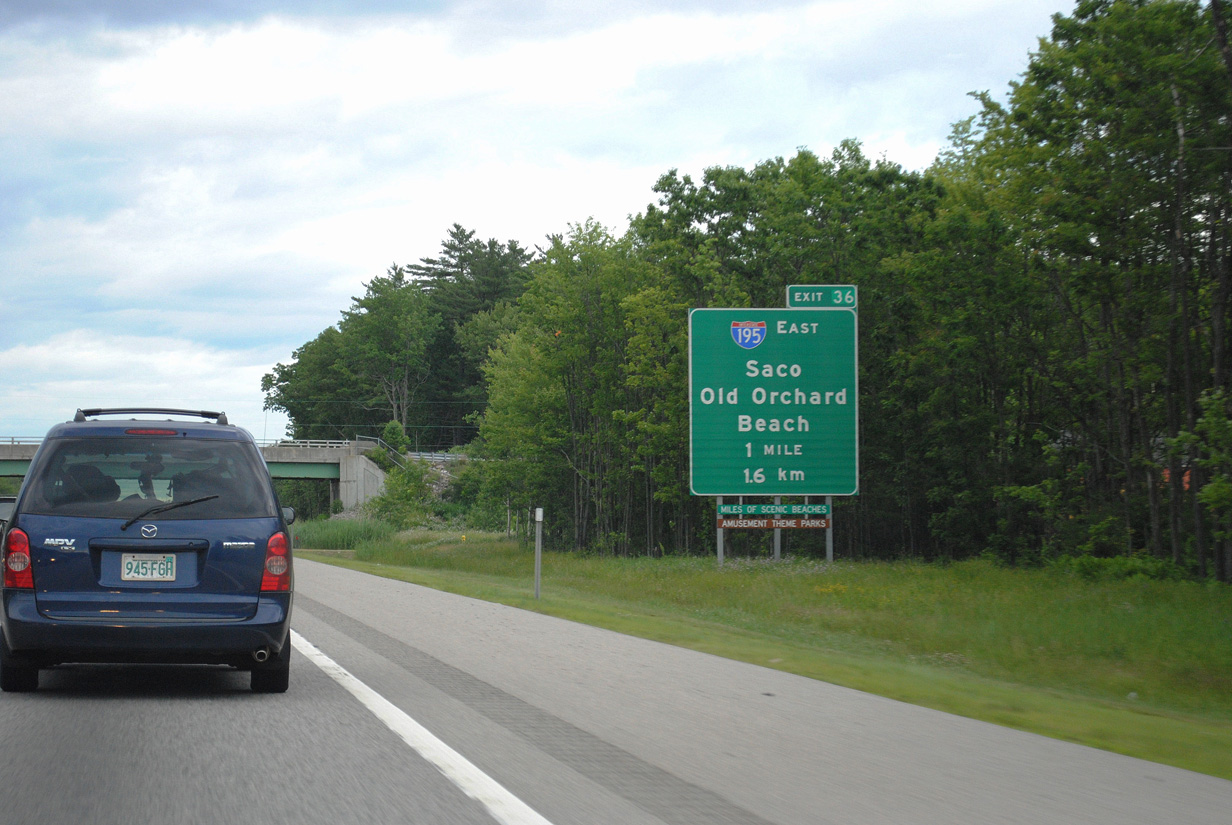
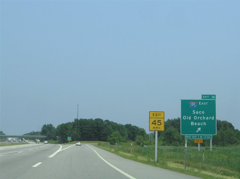
| Interstate 195 provides a freeway spur east from Exit 36 of I-95 through the city of Saco toward Old Orchard Beach. The 1.55 mile route opened in two stages between 1982 and 1983.1 03/23/13 |
|
| Maine 5 (New County Road) spans Interstate 95 one mile south of the trumpet interchange (Exit 36) with Interstate 195. I-195 merges onto Maine 5 (Ocean Park Road) at its east end. SR 5 continues from there northeast via Saco Avenue to Old Orchard Beach. Temple Avenue branches east from near the freeway end to SR 9 (Grand Avenue) at Ocean Park. 06/30/11 |
|
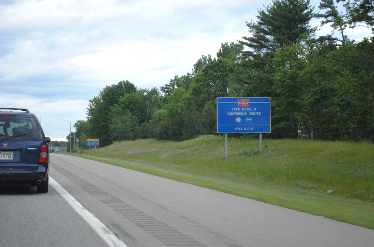
| What was once the trumpet interchange to Maine 112 (Buxton Road) now serves northbound Interstate 95 movements to a Saco area hotel and conference center. Completion of Interstate 195 and its interchange allowed for the removal of the Maine 112 off-ramps, however two were retained for the hotel built at the site of the former Exit 4A toll plaza. Southbound ramps were removed due to the Turnpike widening.2 06/30/11 |
|
| The eastbound beginning of Interstate 195 (Saco Industrial Spur) departs Interstate 95 (Maine Turnpike) northbound at Exit 36. I-195 meets U.S. 1 (Blue Star Memorial Highway), 1.25 miles to the east. U.S. 1 joins Maine 5 (Ocean Park Road) just south of Exit 2 toward Downtown Saco. 06/27/05 |
|
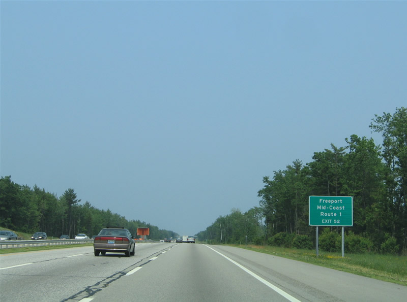
| Continuing northward toward Portland, long distance travelers bound for U.S. 1 to the Mid-Coast region and Freeport are directed to remain along the Maine Turnpike north to the Falmouth Spur (Exit 52) to bypass The Forest City. 06/27/05 |
|
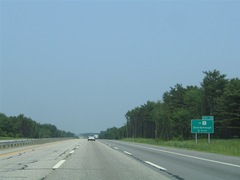
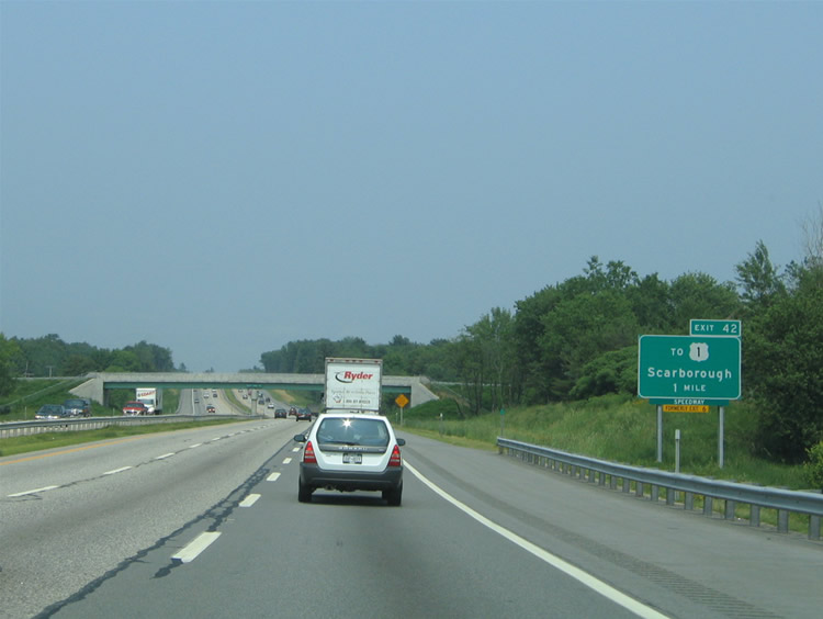
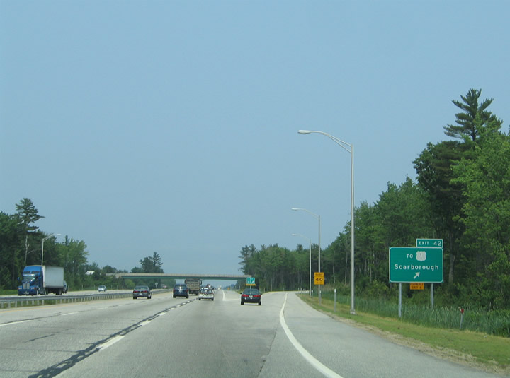
| Now in Cumberland County and the town of Scarborough, Interstate 95 next approaches the trumpet interchange (Exit 42) to Haigis Parkway at Payne Road. 06/27/05 |
|
| Beech Ridge Road passes over Interstate 95 one mile south of Exit 42 to Scarborough. Haigis Parkway arcs south 1.6 miles from the Maine Turnpike to U.S. 1 & Maine 9 between West Scarborough and Oak Hill. 06/27/05 |
|
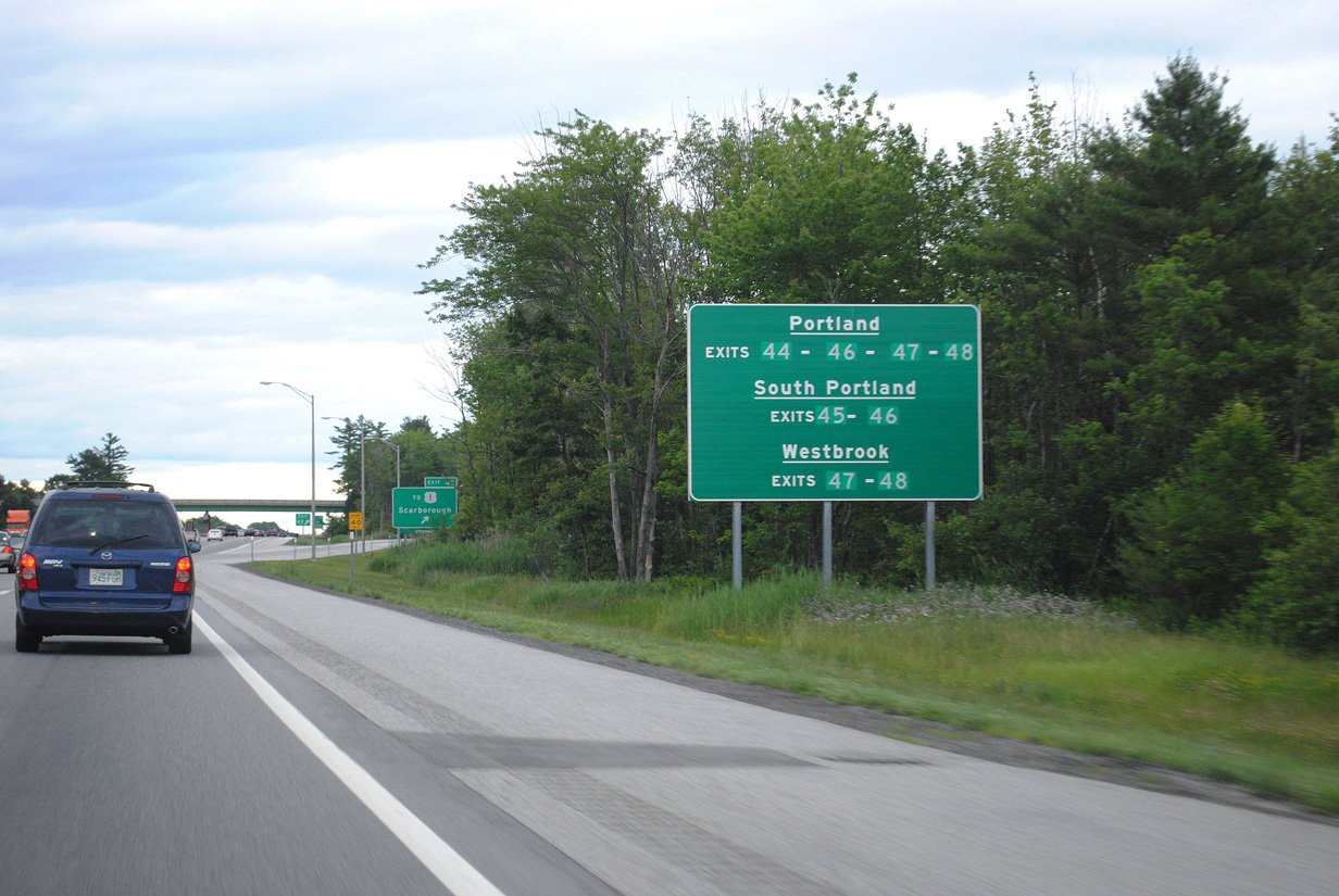
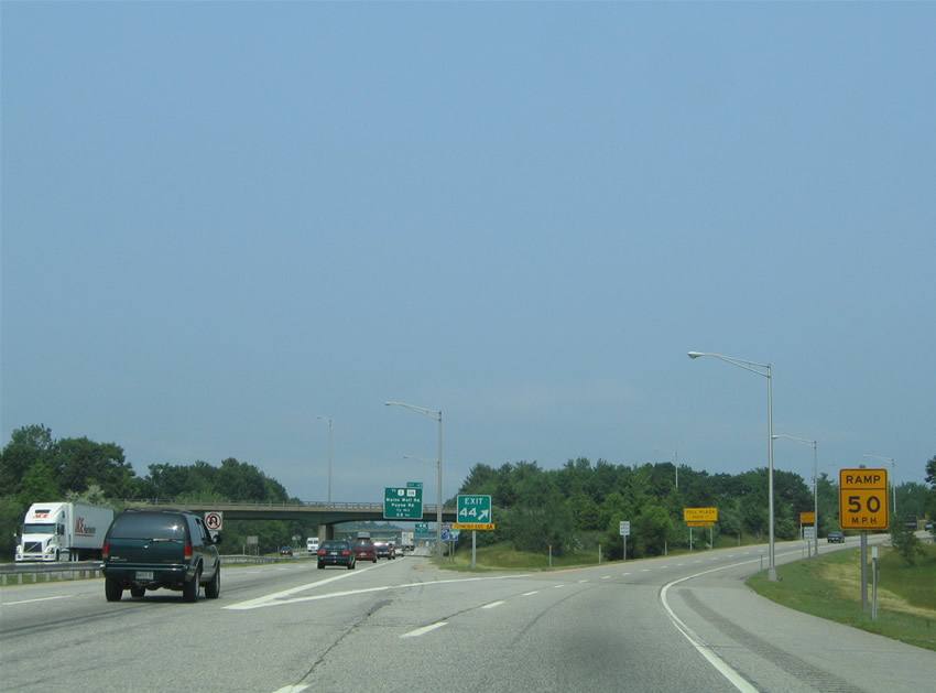
| Beyond Exit 42, Interstate 95 enters the greater Portland area. This guide sign outlines the exits to take for The Forest City, South Portland and Westbrook from the Maine Turnpike mainline. I-295 travels through the heart of Portland from Exit 44. 06/30/11 |
|
| The trumpet interchange with Haigis Parkway replaced a folded diamond interchange situated nearby at Holmes Road. Holmes Road leads west to Beech Ridge Motor Speedway and east to Scarborough Downs harness race track from Payne Road. 06/27/05 |
|
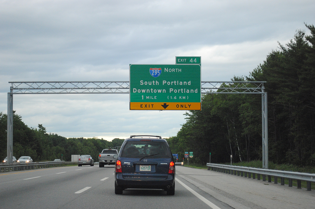
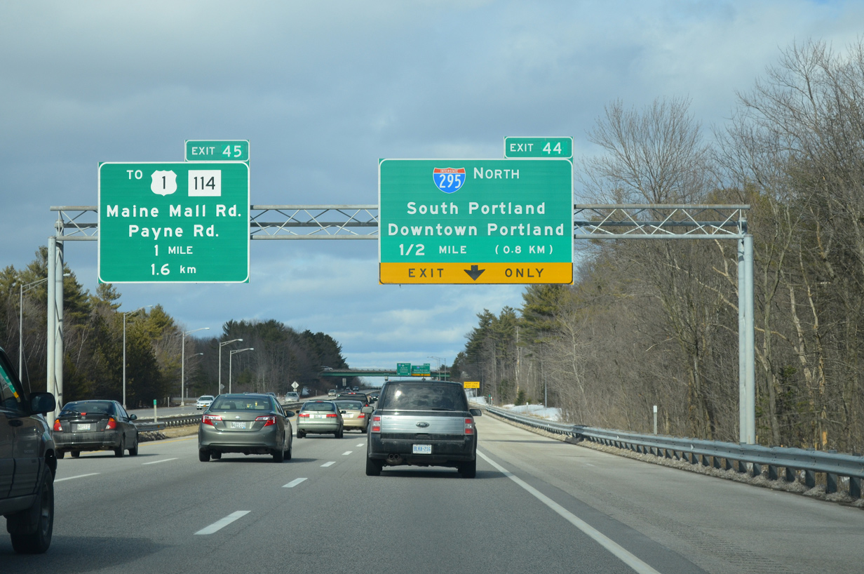
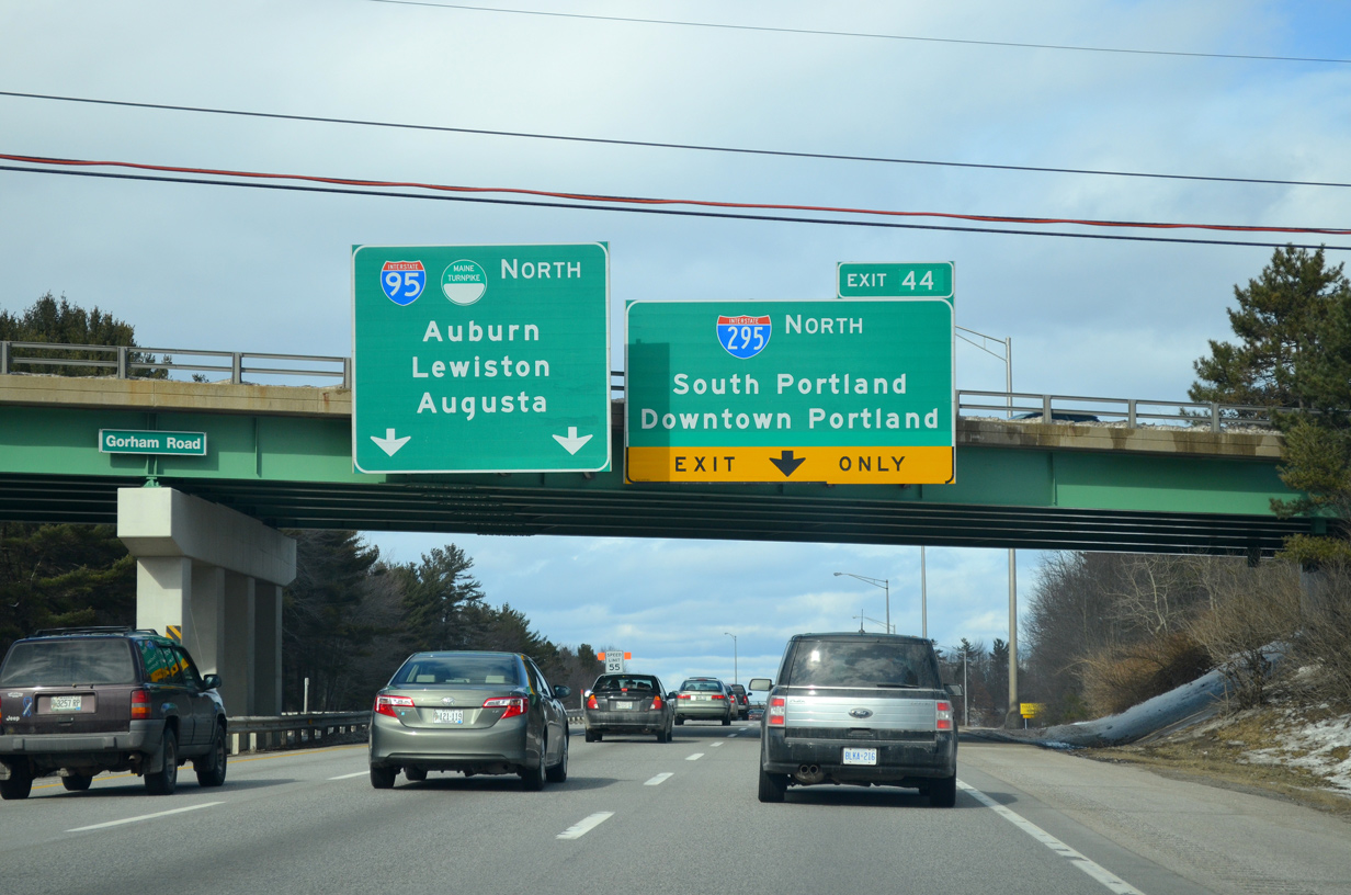
| Interstate 95 reduces to four overall lanes beyond the upcoming wye interchange (Exit 44) with Interstate 295 to Downtown Portland. 06/30/11 |
|
| Reassurance markers posted ahead of Exit 44 and the Nonesuch River. 06/27/05 |
|
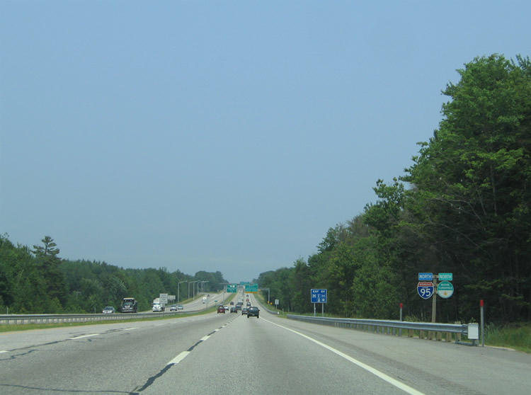
| Interstate 295 comprises an 11 mile urban loop through Portland to the Falmouth Spur (I-495). The freeway extends north to the Maine Turnpike at Gardiner along the pre-2004 route of I-95. 03/23/13 |
|
| Maine 114 (Gorham Road) spans I-95 just ahead of Exit 44 at a sprawling retail area east of the turnpike. Interstate 295 meanwhile veers east through a toll plaza to South Portland. 03/23/13 |
|
| Two lanes branch away from Interstate 95 north to Interstate 295 at Exit 44. I-295 returns to I-95 at Exit 103. 06/27/05 |
Page Updated 01-29-2015.


 North
North