|
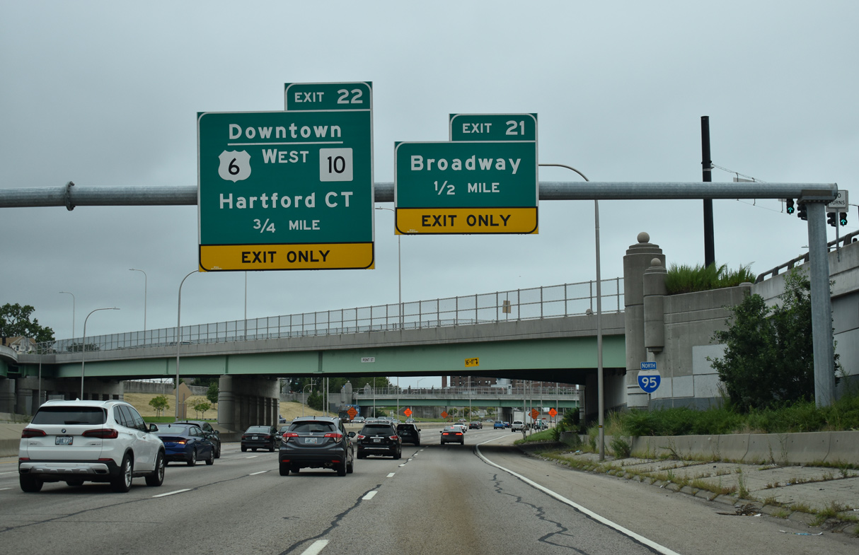
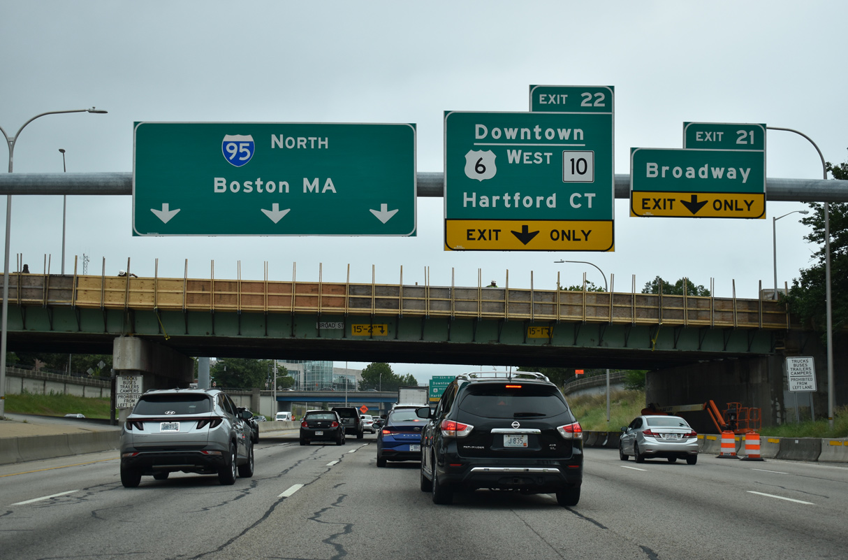
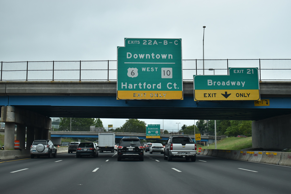
| U.S. 6 westbound combines with Interstate 95 north to Exit 37 B and Route 10 (Huntington Expressway) south. Exit 37 A is next for U.S. 1 (Franklin Street) north to Broadway. 08/20/21 |
|
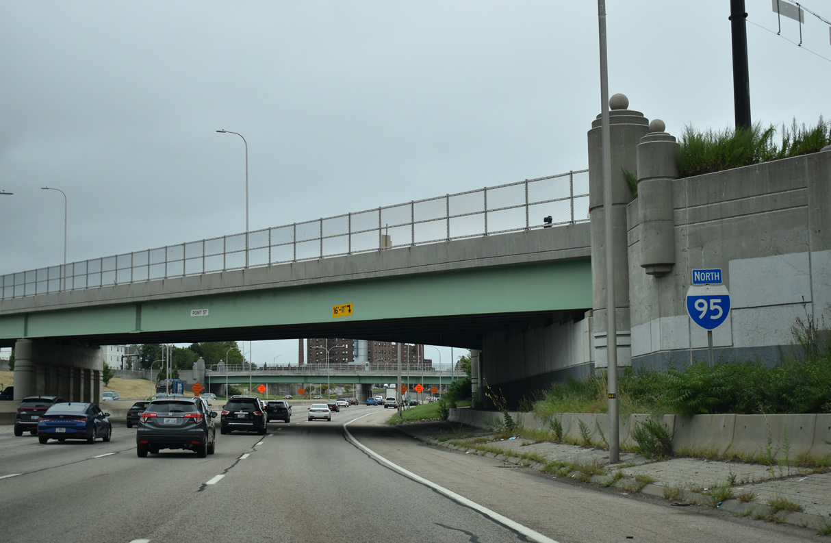
| A reassurance marker for Interstate 95 north was added by the Point Street overpass by 2014. Absent from the assembly, U.S. 6 west overlaps with the freeway for 0.5 miles. 08/20/21 |
|
| Broadway links I-95 with Amica Mutual Pavilion and the Rhode Island Convention Center via the one way couplet of Fountain and Sabin Streets. This stretch of street doubles as U.S. 1, but signage is not posted. 08/20/21 |
|
| Broadway extends west from I-95/U.S. 6 to the Federal Hill neighborhood. U.S. 6/Route 10 (Huntington Expressway) encircle Federal Hill to the north from Exit 37 B / Memorial Boulevard to the West End neighborhood. 08/20/21 |
|
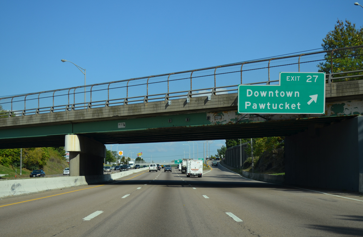
| Exit 37 C connects I-95/U.S. 6 with Memorial Boulevard east to Waterplace Park and the Providence Riverfront while Exit 37 B links with Dean Street north to Providence Place Mall. 08/20/21 |
|
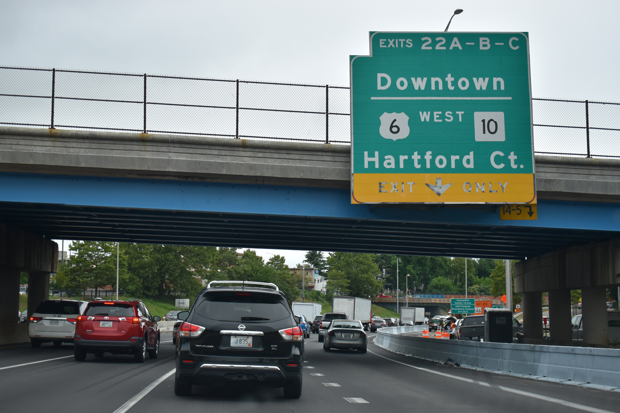
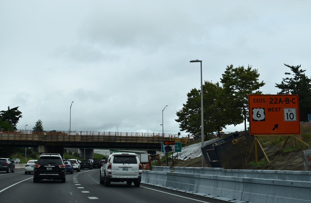
| U.S. 6 west separates from I-95 north at a turbine interchange (Exit 37 B/C) with Memorial Boulevard and Route 10 (Huntington Expressway) south. Construction for the Providence Viaduct Bridge runs from 2020 to 2025. 08/20/21 |
|
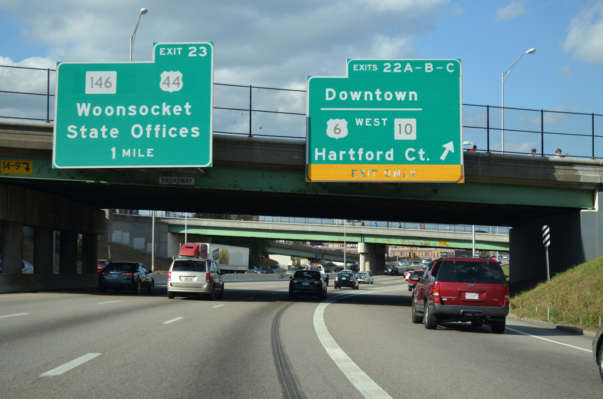
| Memorial Boulevard arcs east around the north side of Downtown Providence to the Crawford Street Bridge across the Providence River. U.S. 44 follows Memorial Boulevard from Steeple Street to Dyer Street. 10/06/14 |
|
| U.S. 6/Route 10 overlap for 1.2 miles before partitioning to Johnston and Cranston respectively. U.S. 6 travels west from Providence to Hartford, Connecticut. 08/20/21 |
|
| Interstate 95 elevates above Exchange Street, Memorial Boulevard, AMTRAK and the Woonasquatucket River on the Providence Viaduct. 10/06/14 |
|
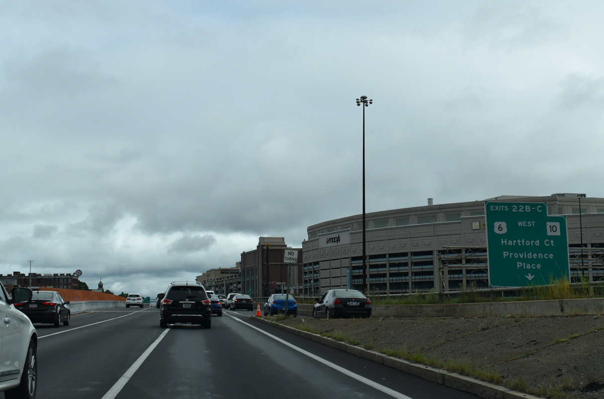
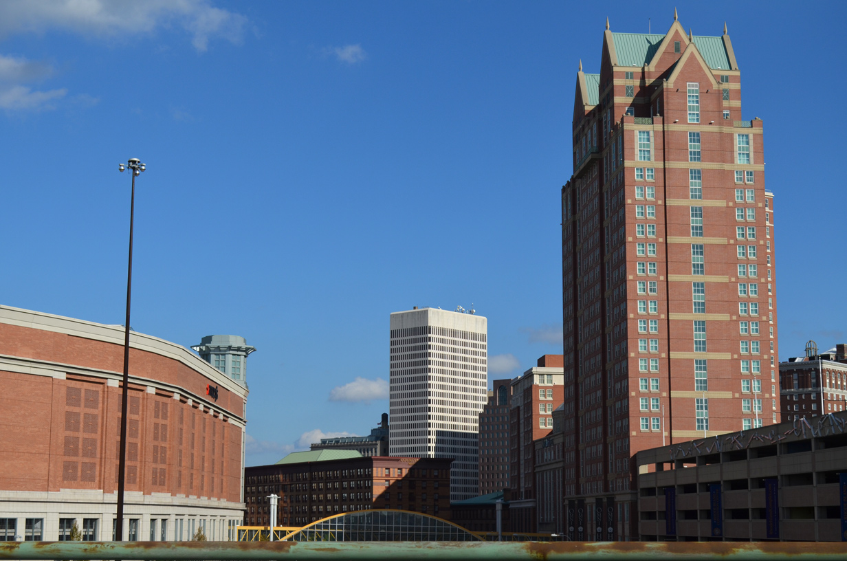
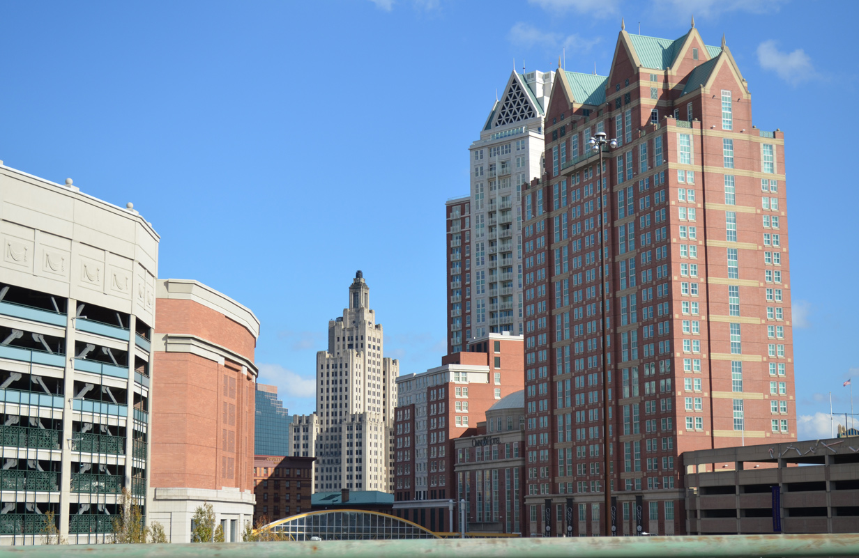
| Providence Place Mall and high rises in Downtown Providence to the east. 10/06/14 |
|
| Stretching across the Woonasquatucket River, Providence Place Mall lies just south of the Rhode Island State House between I-95 and U.S. 1 (Francis Avenue). 08/20/21 |
|
| Forthcoming Exit 38 joins I-95 north with both Route 7 (Orms Street) at State Street and the freeway along Route 146 (Louisquisset Pike) north. Route 7 angles 15.7 miles northwest from Route 246 (Charles Street) nearby to Joslin Road in Burrillville. 10/06/14 |
|
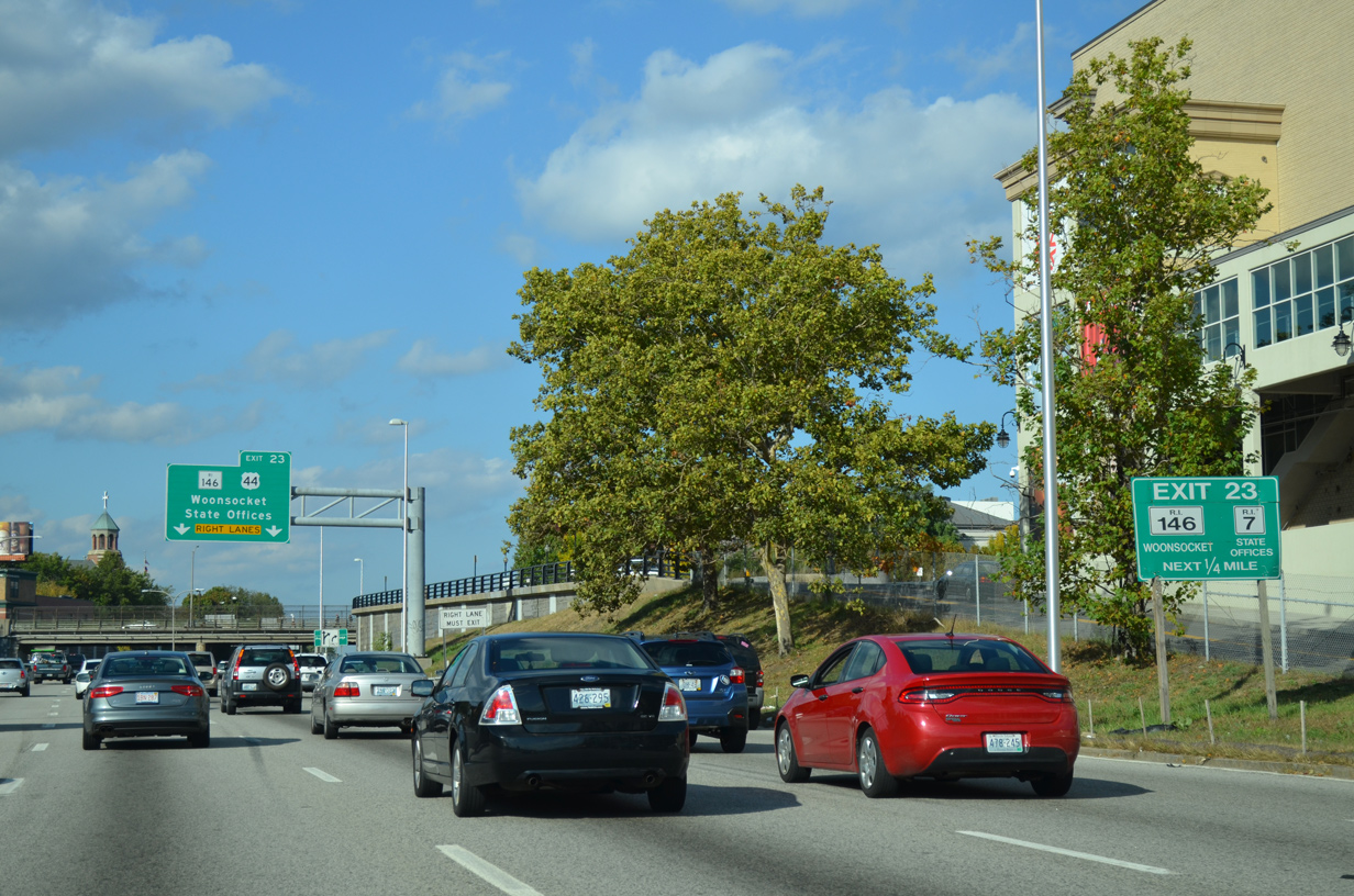
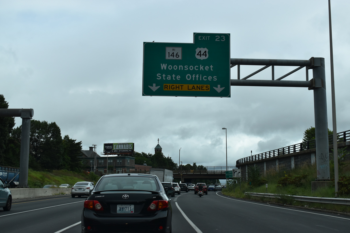
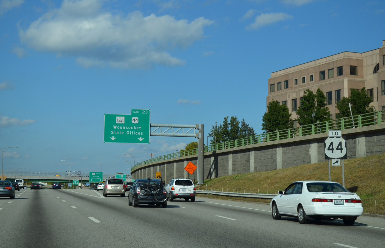
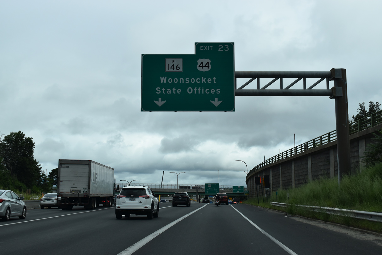
| Route 146 branches northwest from Interstate 95 at a wye interchange (Exit 38). 08/20/21 |
|
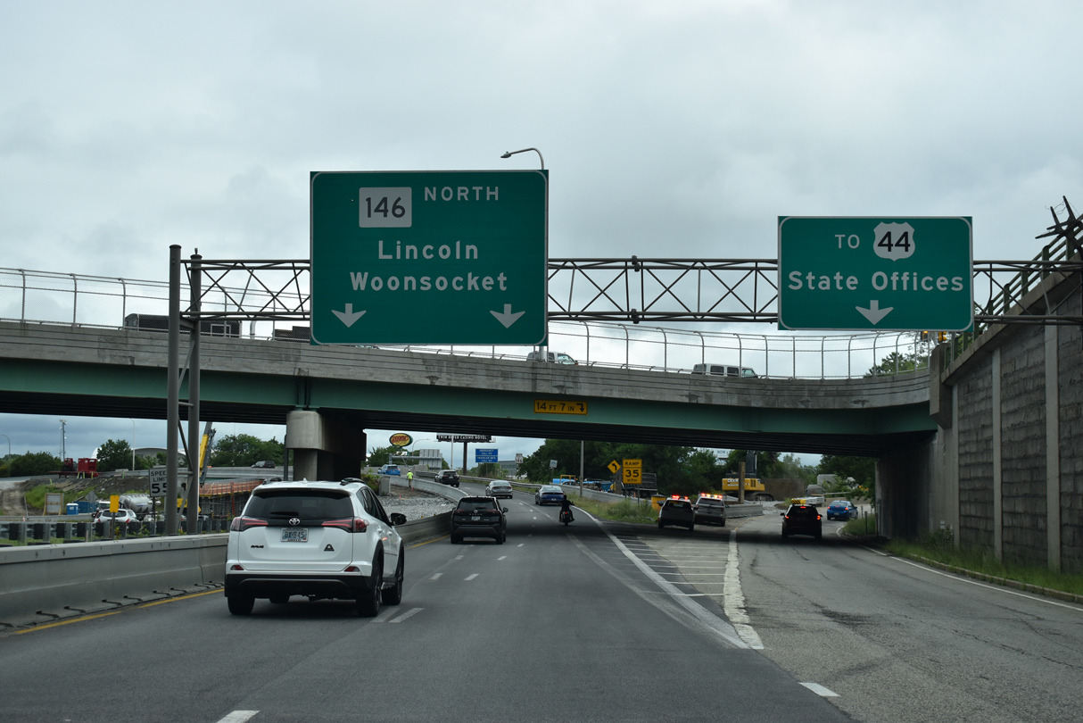
| Route 146 comprises an expressway northward to North Providence, Lincoln and North Smithfield. Massachusetts Route 146 continues the expressway north to Worcester. 08/20/21 |
|
| State Street extends south from the loop ramp for Route 7 (Orms Street) to U.S. 1/44 at Smith and Gaspee Streets by the Rhode Island State House. U.S. 44 follows Smith Street northwest to Centredale and Greenville in the Providence suburbs. 10/06/14 |
|
| Collectively Rhdde Island Route 146 and Massachusetts Route 146 travel 37.2 miles between I-95 in Providence and Interstate 290 in Worcester. 08/20/21 |
|
| Route 7 (Orms Street) passes over I-95 at the Exit 38. Route 7 turns northwest along Douglas Avenue to North Providence and Smithfield. U.S. 1/44 overlap east along Smith Street to the couplet of N Main/Canal Streets. 08/20/21 |
|
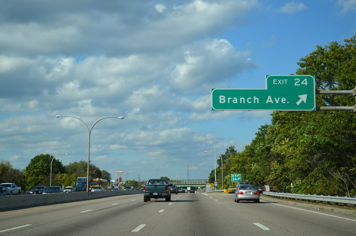
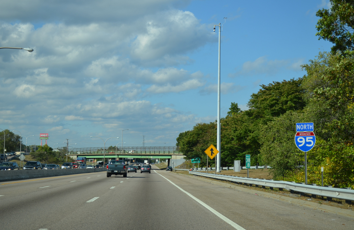
| Continuing north from Route 146, I-95 next meets Branch Avenue at a parclo interchange (Exit 39 A). 10/06/14 |
|
| A half diamond interchange (Exit 39 A on southbound) joins Route 246 (Charles Street) with I-95 northbound ahead of this reassurance marker. 10/06/14 |
|
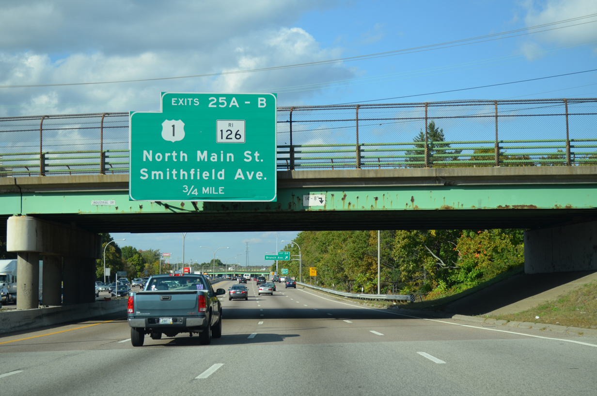
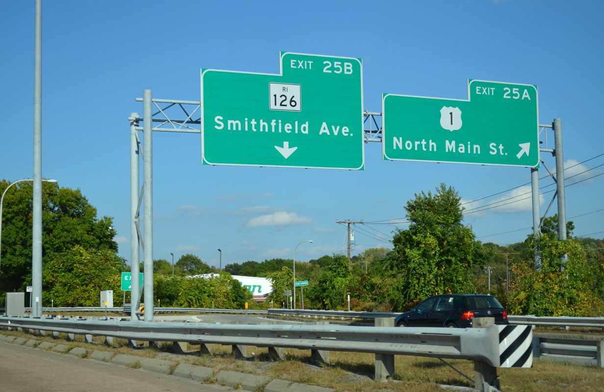
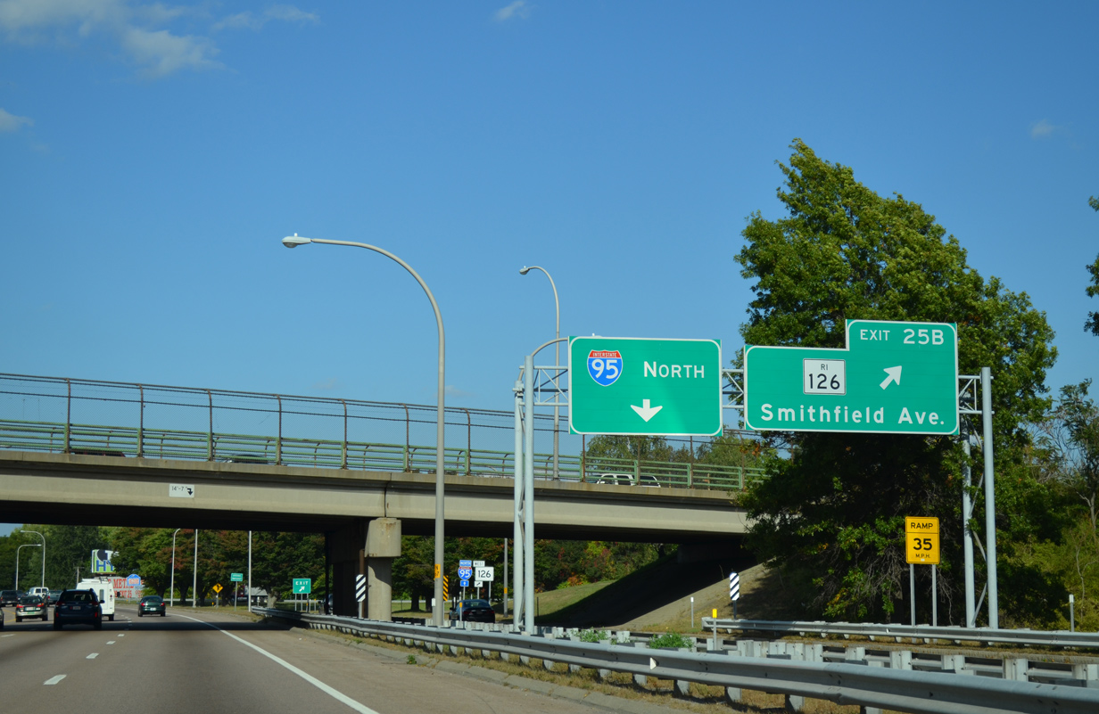
| Exits 39 B/C join I-95 with Cemetery Street east to U.S. 1 and Route 126 (Smithfield Avenue) 0.75 miles beyond the Barbara Leonard Way overpass. 10/06/14 |
|
| Branch Avenue run northwest from U.S. 1 (N Main Street) to Route 146 at the Charles neighborhood and Route 7 (Douglas Avenue) at the Wanskuck neighborhood in north Providence. 10/06/14 |
|
| An I-95 shield stands within the exchange for Branch Avenue adjacent to the Moshassuck River. 10/06/14 |
|
| The entrance ramp from Branch Avenue forms a collector distributor roadway for Exit 39 B to Cemetery Street and Exit 38 C to Route 126 (Smithfield Avenue). Cemetery Street east to Frost Street leads to parallel U.S. 1 (N Main Street). 10/06/14 |
|
| Staying east of I-95, U.S. 1 (N Main Street) heads north from Providence into Pawtucket. Route 126 (Smithfield Avenue) stems west from U.S. 1 to Exit 39 C en route to west Pawtucket and Saylesville. 10/06/14 |
|
| Route 126 travels 14.1 miles north through Lincoln, Cumberland and Woonsocket to become Massachusetts Route 126 at the town of Bellingham. 10/06/14 |
|
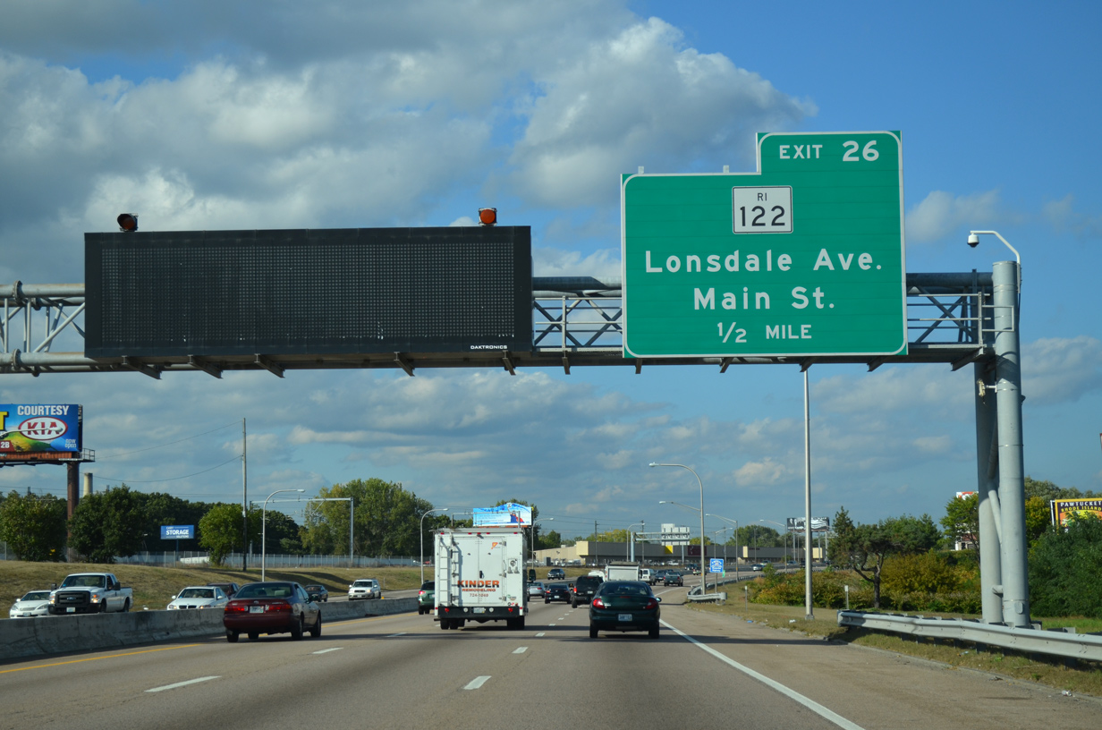
| Interstate 95 enters the city of Pawtucket ahead of Exit 40 to Thurston Street and Route 122 (Lonsdale Avenue). Route 122 branches north from U.S. 1 (Pawtucket Avenue) to the town of Lincoln and Lonsdale. 10/06/14 |
|
| Exit 40 ties into Thurston Street at Newell Avenue in the Woodlawn community, just west of Route 122 at Main Street. Multi State Route 122 travels 81.4 miles north to Orange, Massachusetts. 10/06/14 |
|
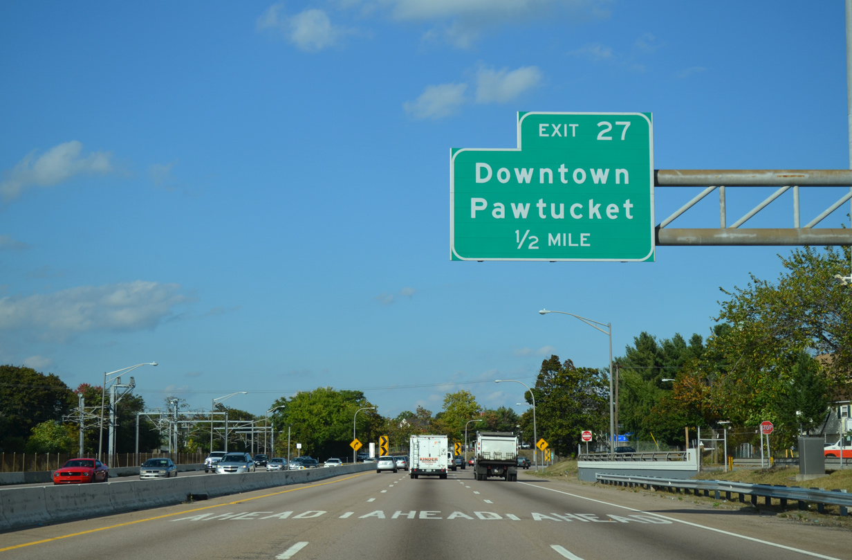
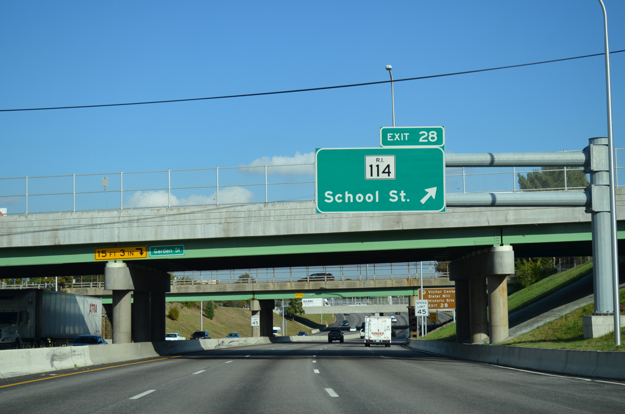
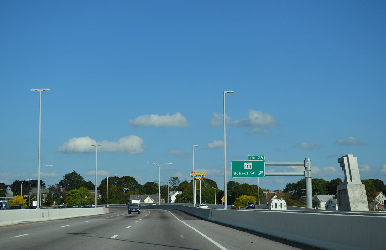
| The split diamond interchange at Exit 41 A links Interstate 95 with Garden Street south, Pine Street north, and George Street (U.S. 1) outside Downtown Pawtucket. 10/06/14 |
|
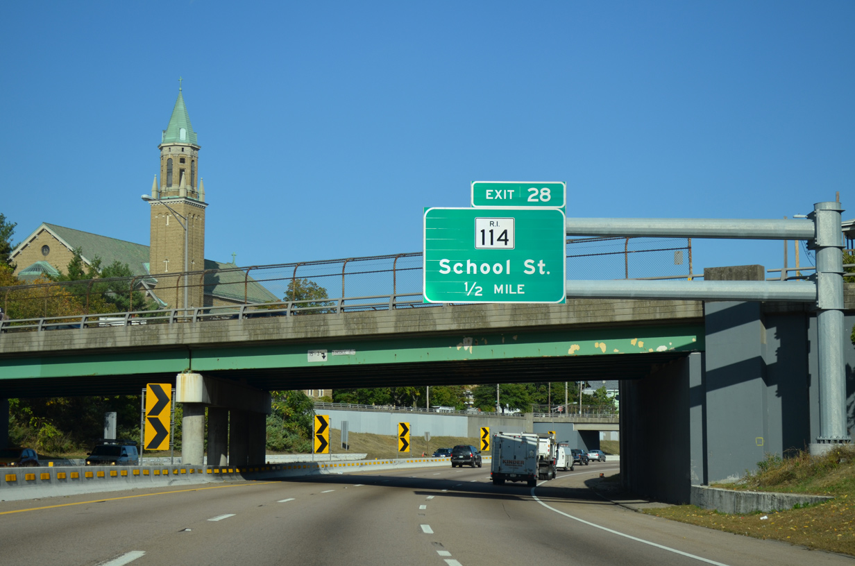
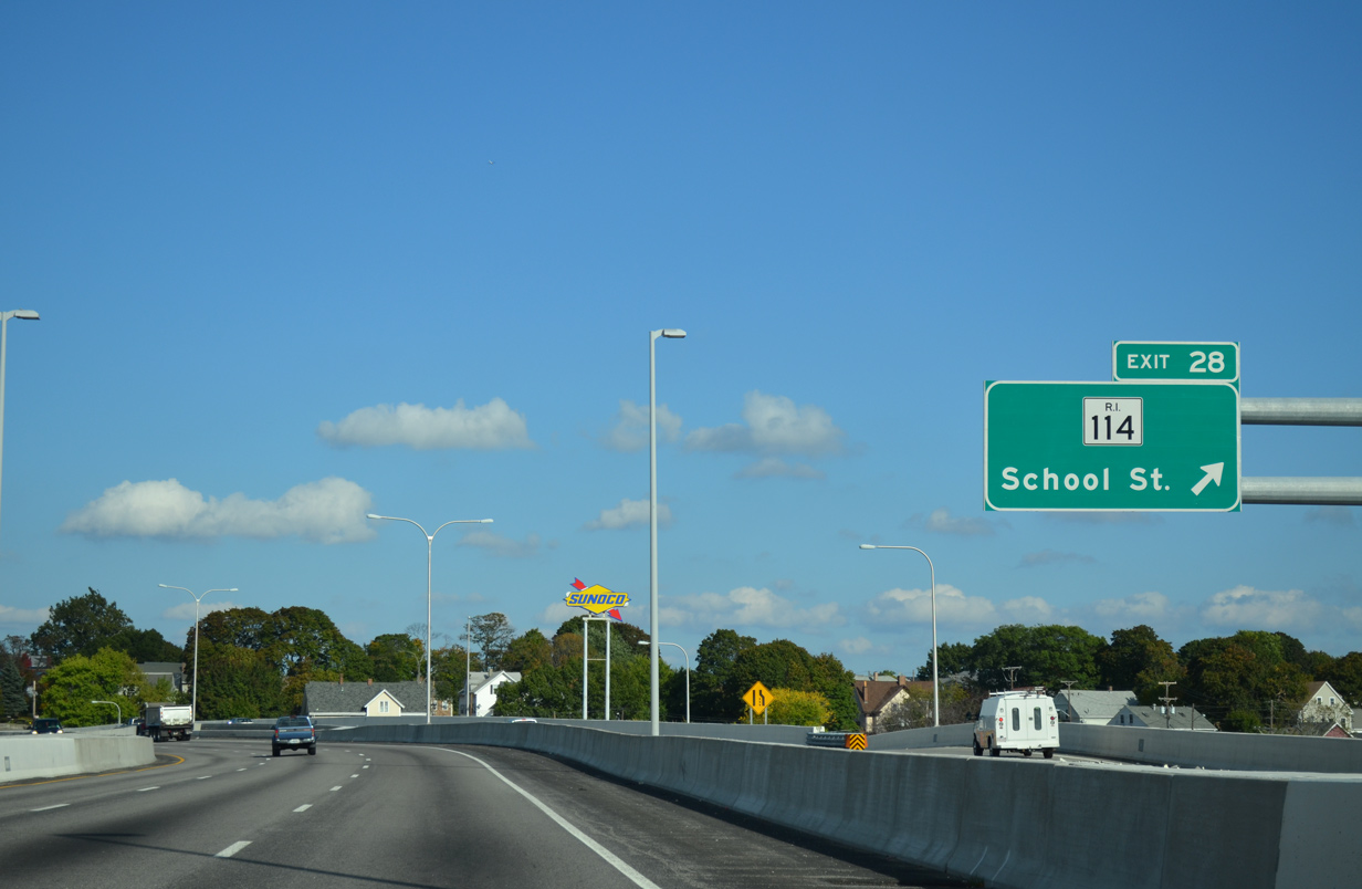
| Curving east, I-95 travels below grade to the Pawtucket River Bridge just ahead of Exit 41 B to Route 114. The ensuing stretch was reconstructed during the 2010-13 Pawtucket River Bridge project. 10/06/14 |
|
| Exit 41 A ascends onto Pearl Street east at Garden Street. Garden and Pine Streets form a couplet between U.S. 1 (Pawtucket Avenue) and Route 15 (Main / Church Streets) in Downtown Pawtucket. 10/06/14 |
|
| Originating in Newport, Route 114 travels north into Pawtucket from East Providence and concludes at Route 122 in Woonsocket. 10/06/14 |
|
| $81 million in construction at the Pawtucket River Bridge replaced both 1958 bridges for Interstate 95 across the Seekonk River and the overpass for George Street. 10/06/14 |
|
| The c/d roadway bridge for I-95 north temporarily carried northbound traffic until the new southbound bridge opened to traffic on September 5, 2013. 10/06/14 |
|
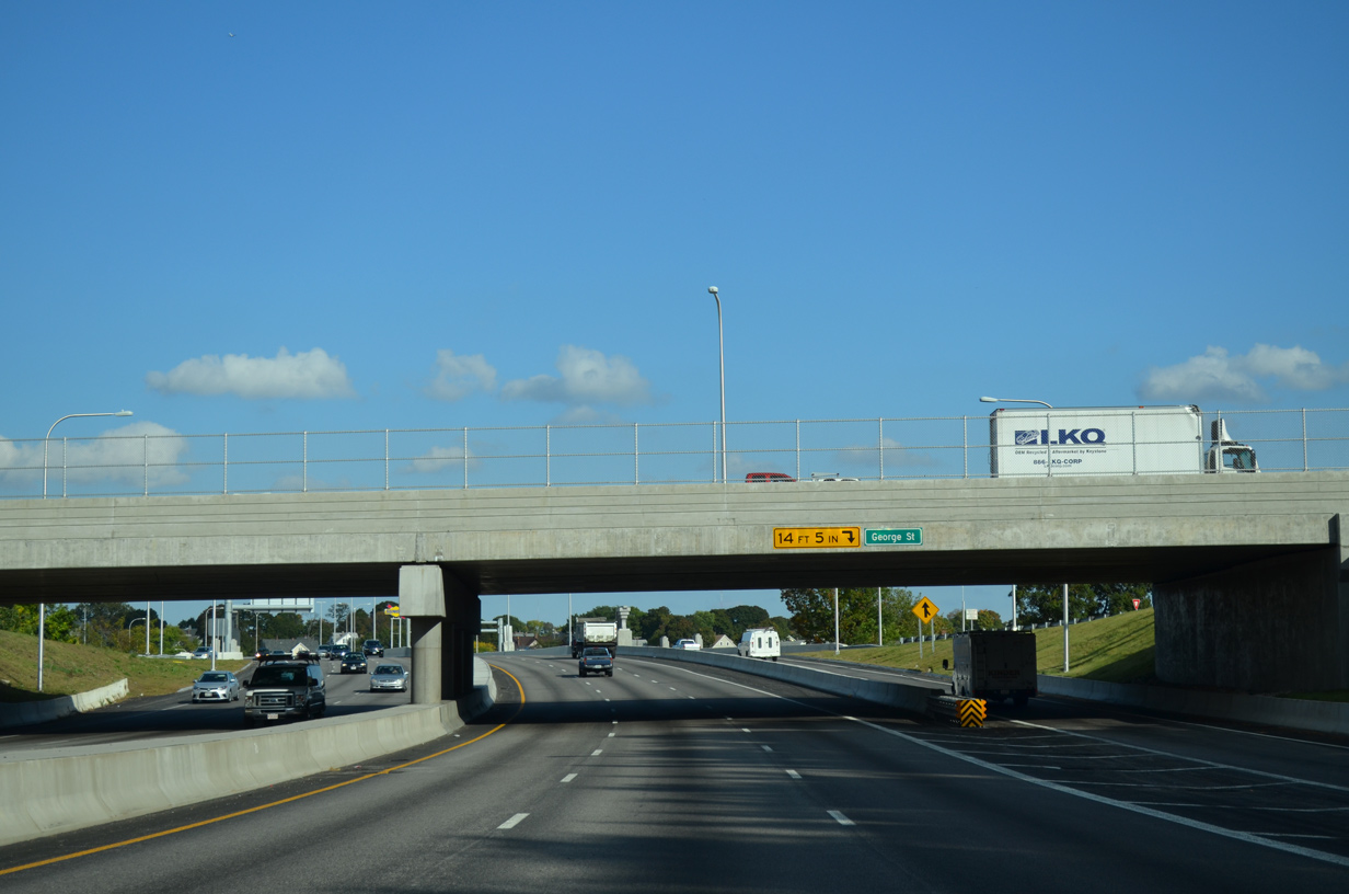
| Exit 41 B separates from the c/d roadway over the Seekonk River to the couplet of School Street south to Route 114 and Prospect Street north to U.S. 1 (Main Street / Broadway). 10/06/14 |
|
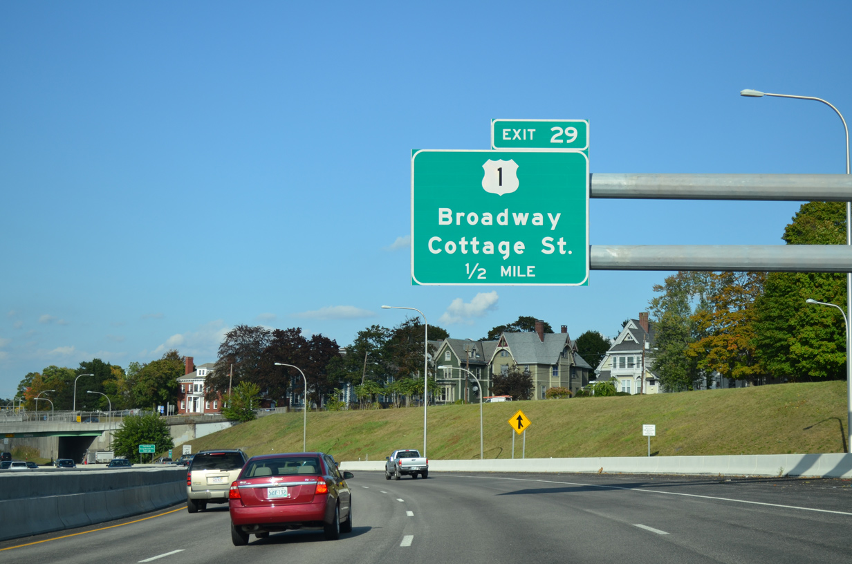
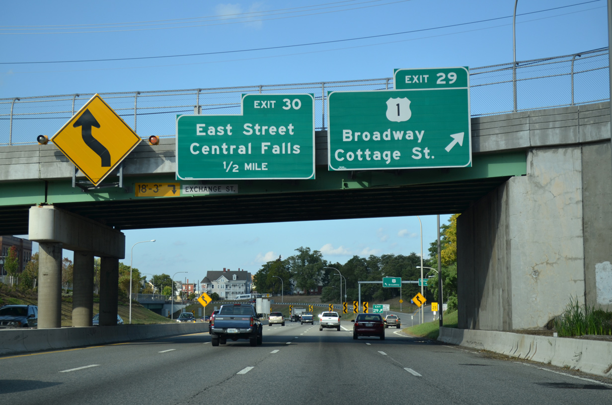
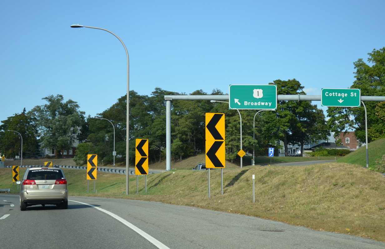
| Curving northward, Interstate 95 drops below grade ahead of Exit 42 to U.S. 1 (Broadway) and Cottage Street. 10/06/14 |
|
| U.S. 1 follows Broadway southwest to the Main Street Bridge into Downtown Pawtucket and northeast onto Washington Street through Attleboro, Massachusetts. 10/06/14 |
|
| Exit 41 separates into ramps for both U.S. 1 (Broadway) and Cottage Street. Cottage Street branches northeast from Route 15/144 (Exchange Street) through the Darlington neighborhood to the Massachusetts state line. 10/06/14 |
|
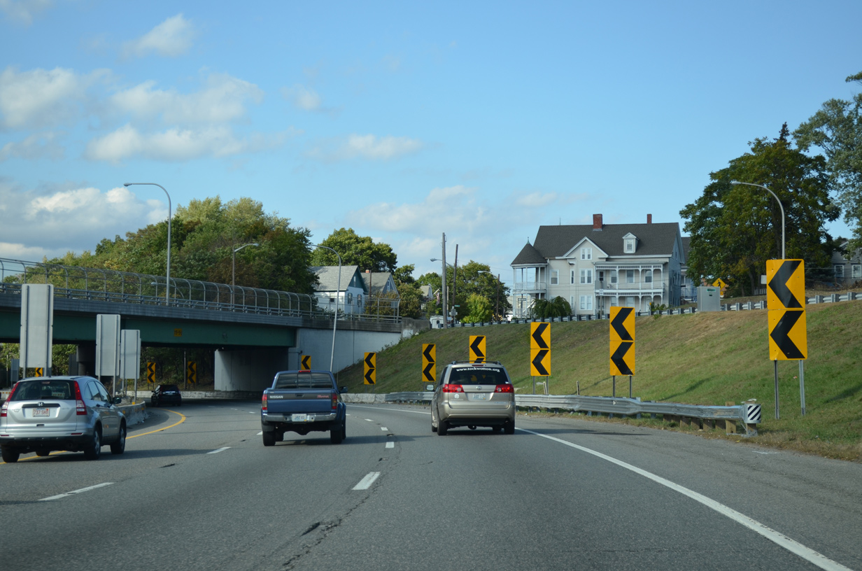
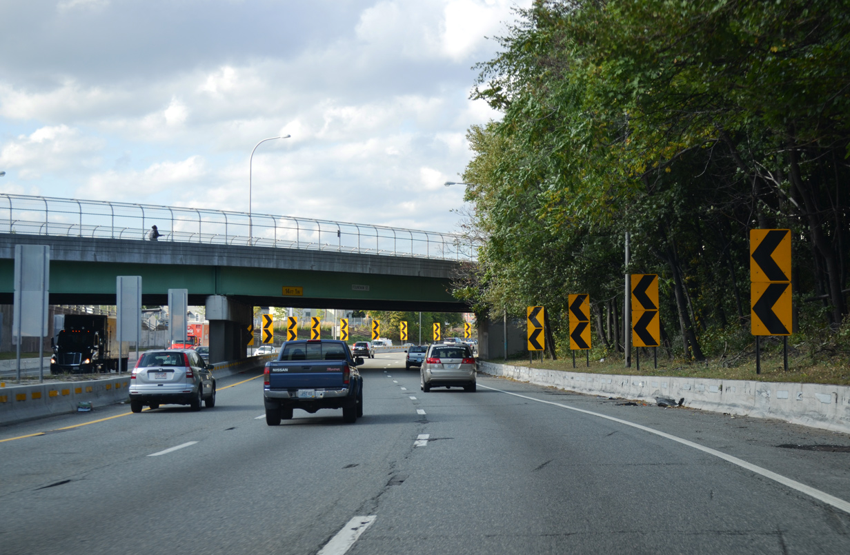
| Interstate 95 navigates through an S-curve below Broadway (U.S. 1), Fountain Street and Central Avenue. 10/06/14 |
|
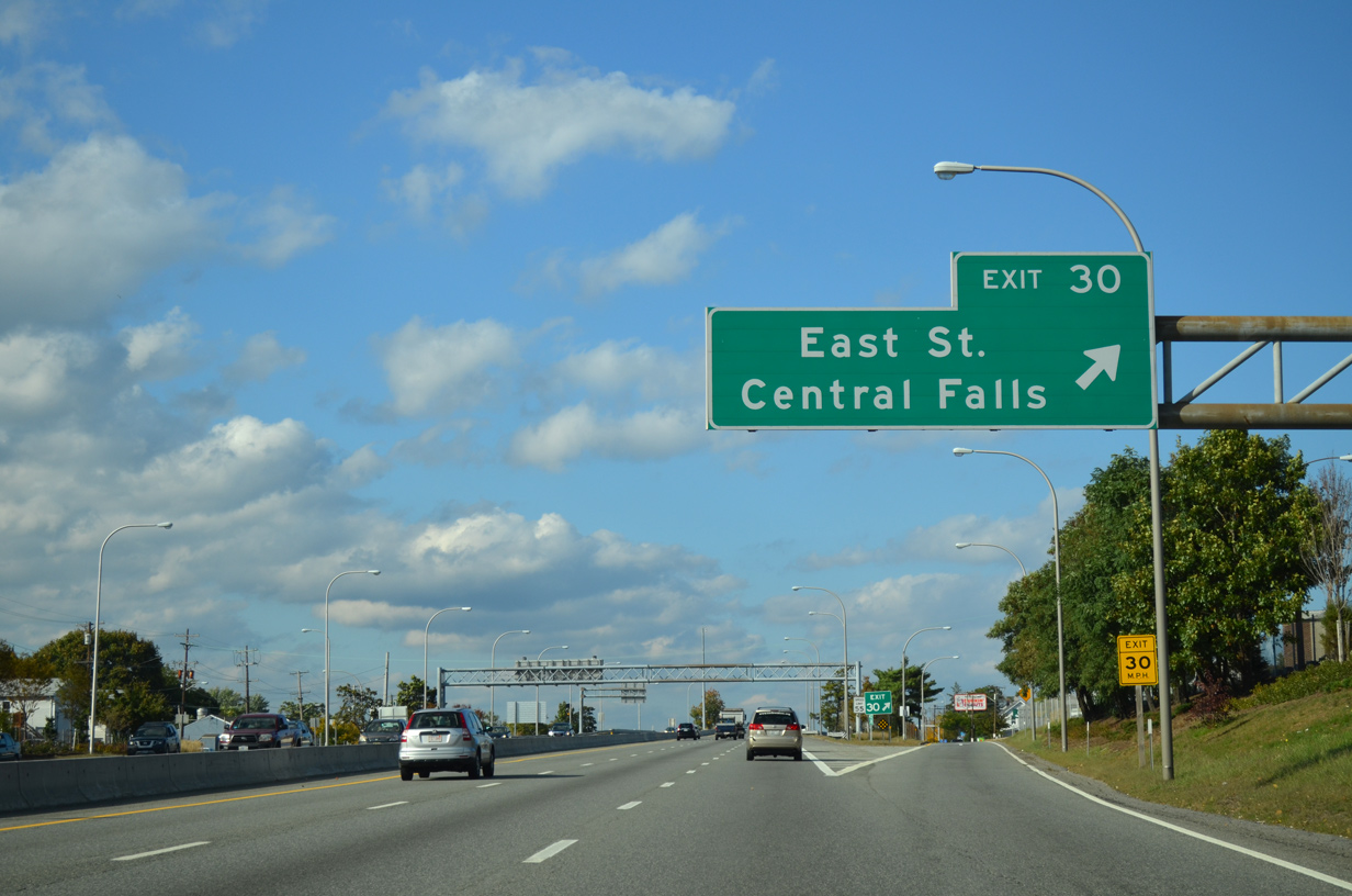
| Exit 43 joins Fountain Street north ahead of East Street. East Street heads west to Roosevelt Avenue south across the Blackstone River and east to U.S. 1 at Webster Street. 10/06/14 |
|
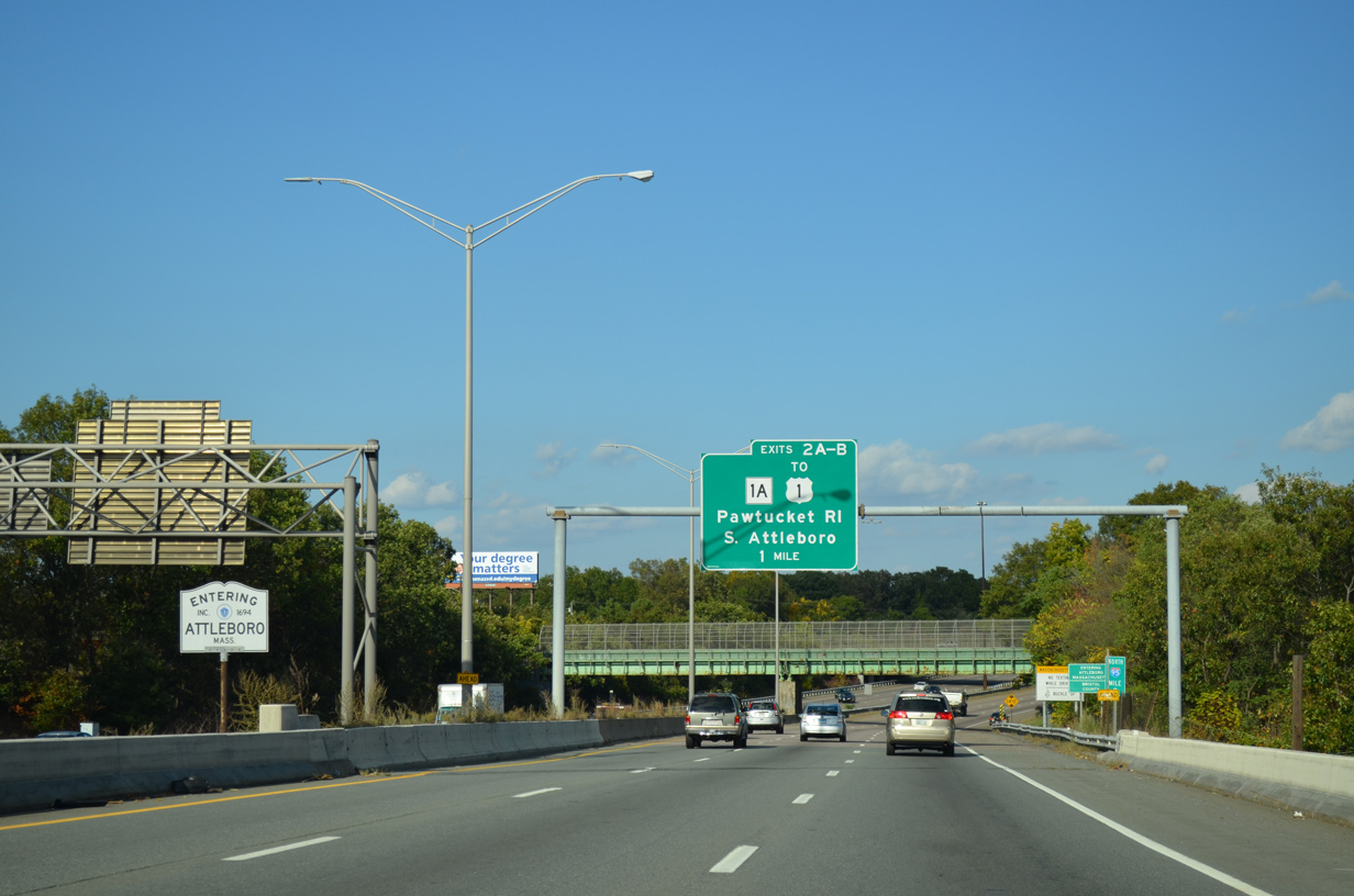
| Interstate 95 crosses the Massachusetts state line north into the city of Attleboro beyond the Roosevelt Avenue overpass. 10/06/14 |
|
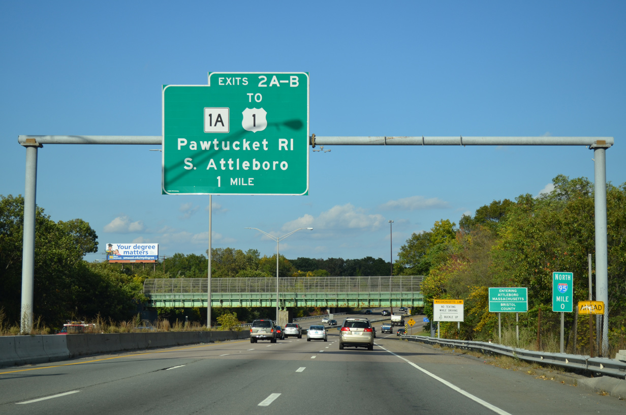
| Interstate 95 turns eastward ahead of an entrance ramp from U.S. 1 (Washington Street) at South Attleboro. Exit 2 follows for Massachusetts Route 1A (Newport Avenue). 10/06/14 |
Page Updated 03-20-2023.

 North
North  West
West