|
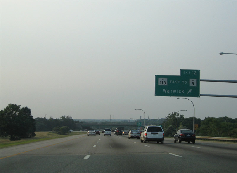
| Exit 28 B is part of a three quarter cloverleaf interchange with Route 113 (East Avenue). Route 113 stems east from Route 2 (Bald Hill Road) at East Natick to Route 117 (West Shore Road) in Warwick. 06/26/05 |
|
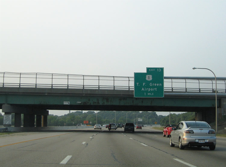
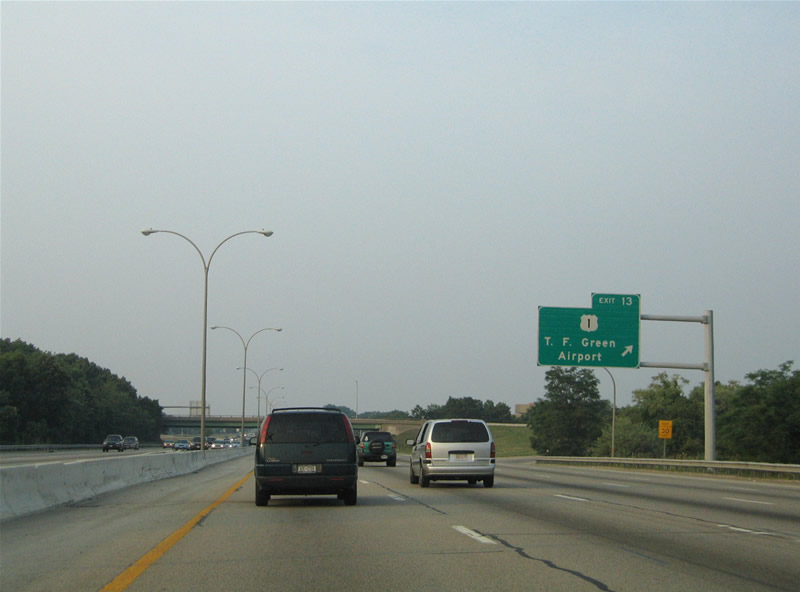
| U.S. 1 straddles coastal areas of the Ocean State from Westerly and the Connecticut state line to Greenwich Bay and Warwick. Airport Connector Road links I-95 with U.S. 1 at the ensuing exit. 06/26/05 |
|
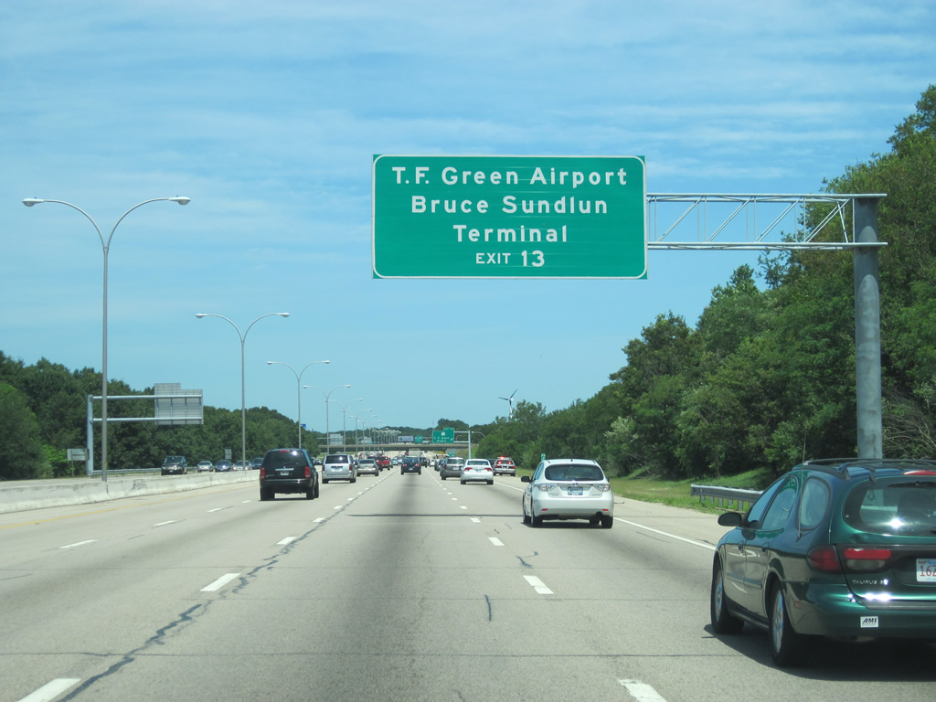
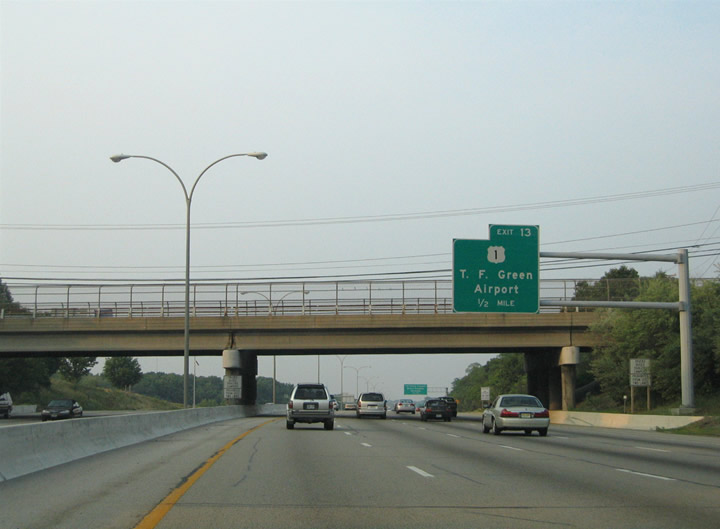
| Airport Connector Road constitutes a freeway spur east from I-95 to U.S. 1 (Post Road) and the passenger terminal at T.F. Green Airport (PVD) in Warwick. 07/03/10 |
|
| Route 5 (Greenwich Avenue) spans Interstate 95 a half mile south of the trumpet interchange (Exit 29) with Airport Connector Road. 06/26/05 |
|
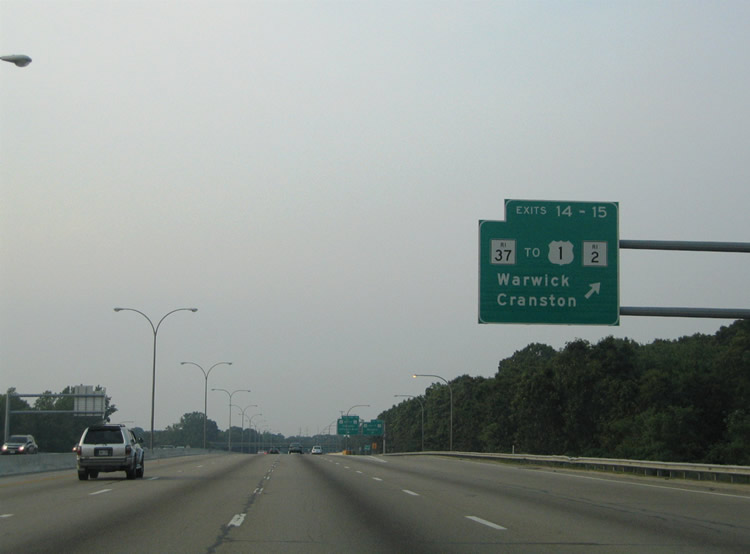
| Airport Connector Road links I-95 with Jefferson Boulevard and U.S. 1 (Post Road) before entering T.F. Green Airport. U.S. 1 stays east of I-95 through Apponaug, Hillsgrove, Lincoln Park, Norwood and Auburn. 06/26/05 |
|
| Paralleling the Pawtuxet River, I-95 advances north to a directional cloverleaf interchange (Exits 31 A/B) with the freeway along Route 37. 07/03/10 |
|
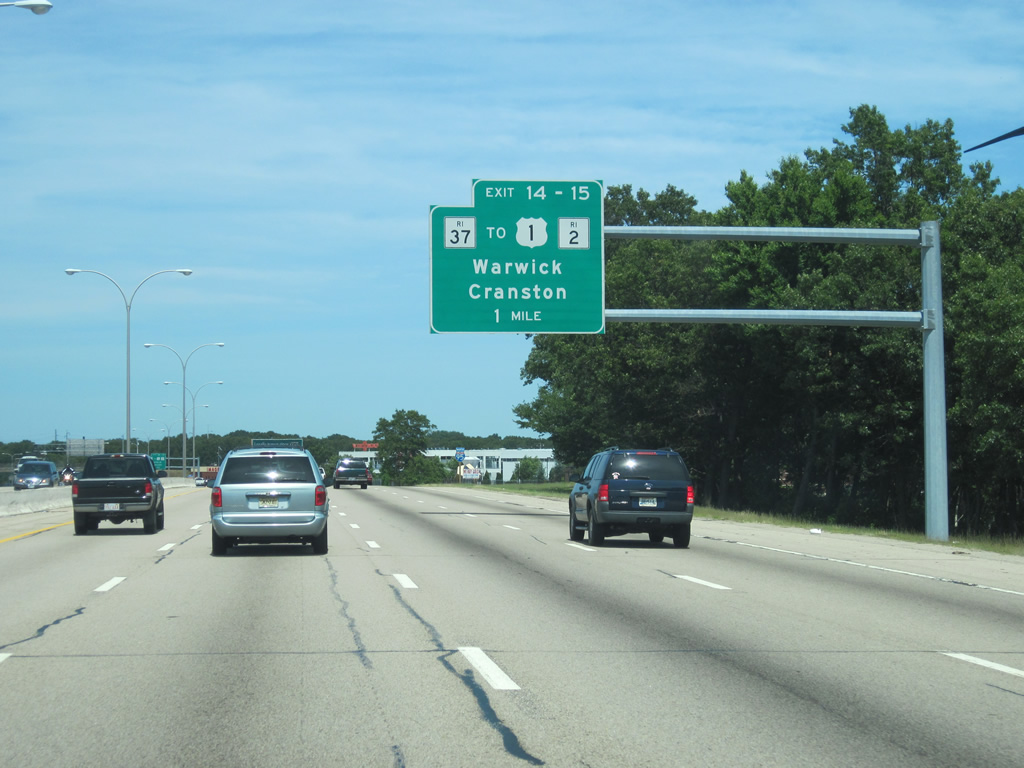
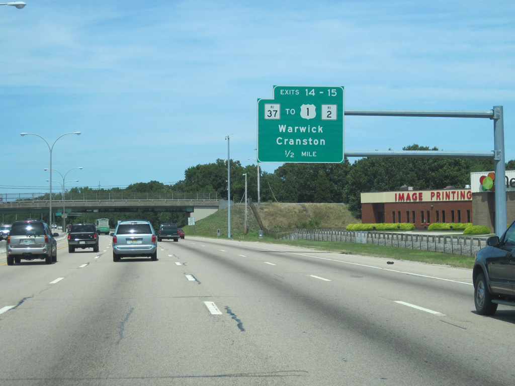
| Route 37, once considered for possible inclusion into the defunct alignments for I-84 and I-895, joins I-95 with Interstate 295 in Cranston to the west and U.S. 1 (Post Road) in Warwick to the east. 07/03/10 |
|
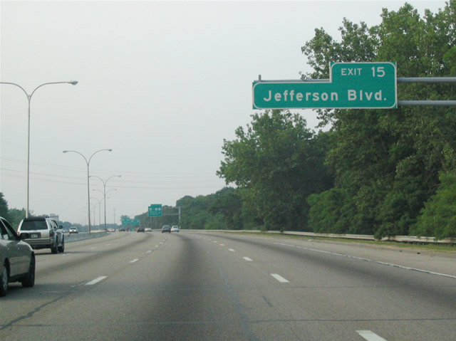
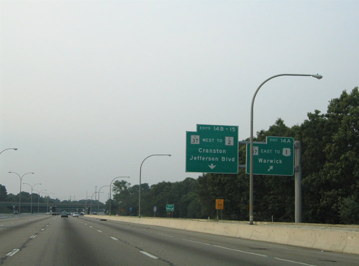
| Extending north to Exit 31 C for Jefferson Boulevard, a collector distributor roadway system separates from I-95 north ahead of the exchange with Route 37. 06/26/05 |
|
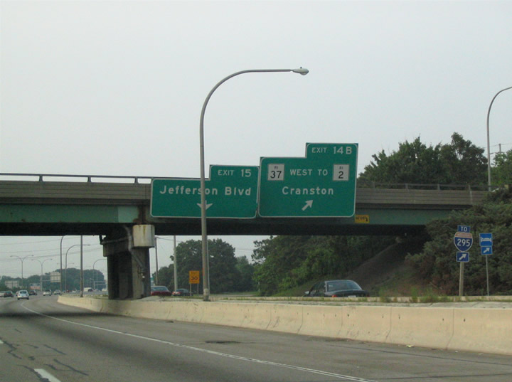
| Route 37 connects with Pontiac Avenue and Route 2 (New London Avenue) in the town of Cranston, west across the Providence County line. 06/26/05 |
|
| Exit 31 A departs I-95 north for Route 37 east to U.S. 1 (Post Road) in north Warwick. A trumpet interchange joins the two routes midway between Lincoln Park and Norwood. 06/26/05 |
|
| The freeway along Route 37 to Cranston ends just west of the cloverleaf interchange with Interstate 295 at Natick Avenue. 06/26/05 |
|
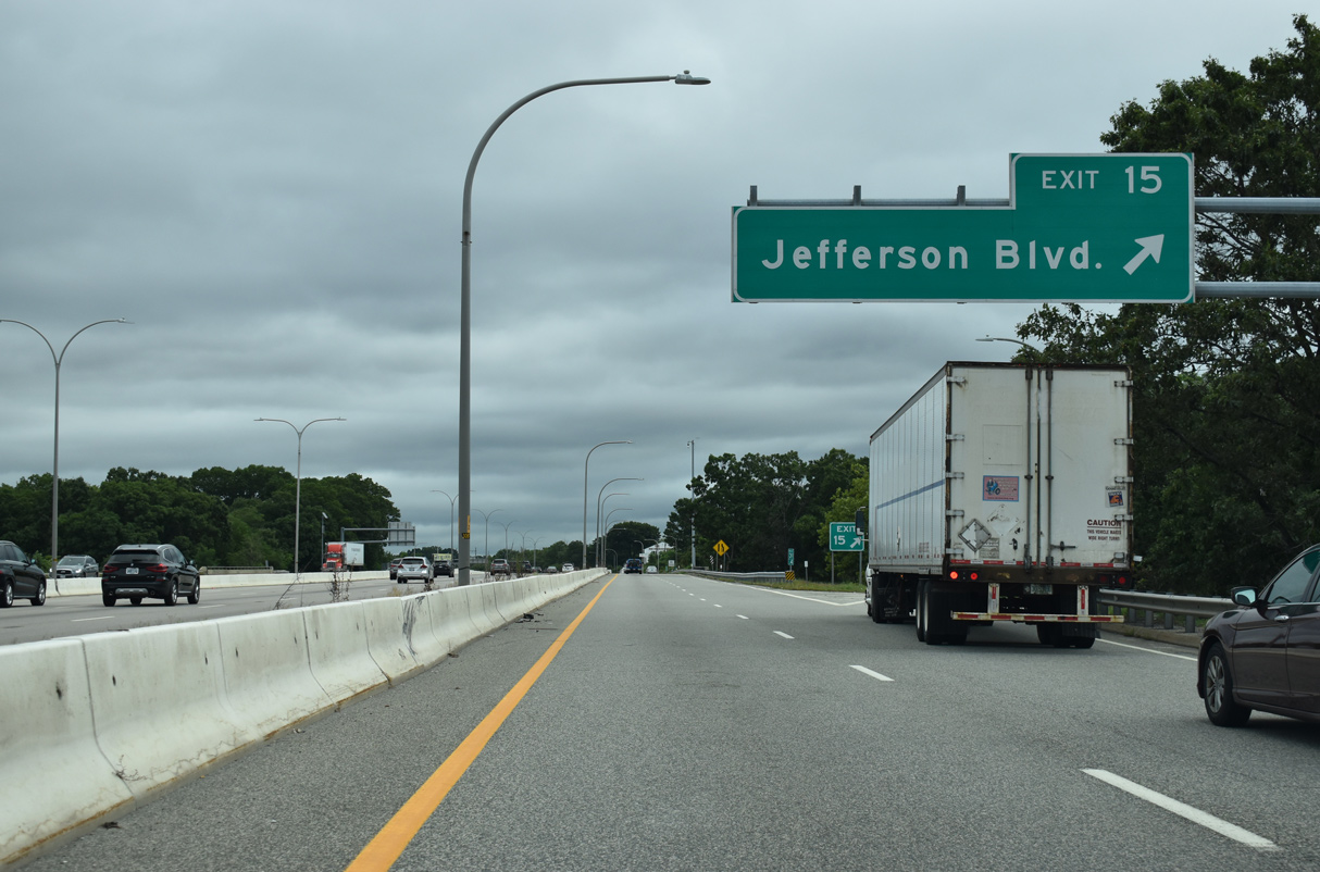
| The parclo interchange at Exit 31 C links with the north end of Jefferson Boulevard at Norwood near the Pawtuxet River. 08/20/21 |
|
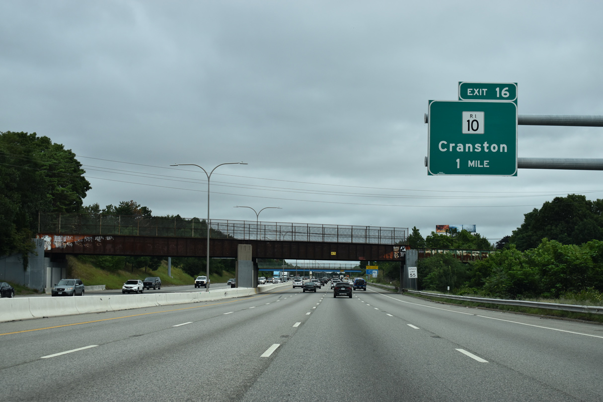
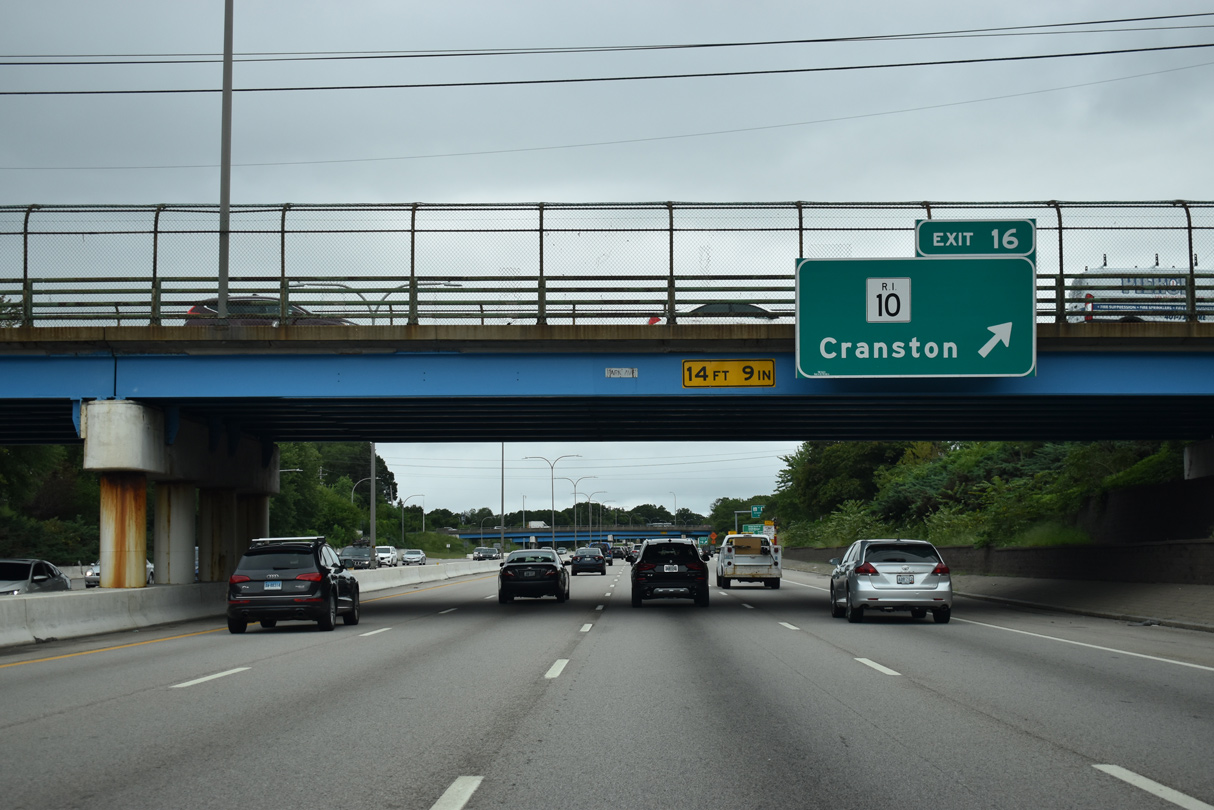
| Interstate 95 crosses the Pawtuxet River into Providence County and the town of Cranston ahead of Exit 33 to Route 10 (Huntington Expressway). 08/20/21 |
|
| Route 10 constitutes an inner belt freeway around Providence between Route 12 (Park Avenue) in Cranston and I-95/U.S. 6 near Downtown. One of the oldest freeways in the state, Route 10 was once considered as a possible I-184 had I-84 been built between Providence and Hartford.1 08/20/21 |
|
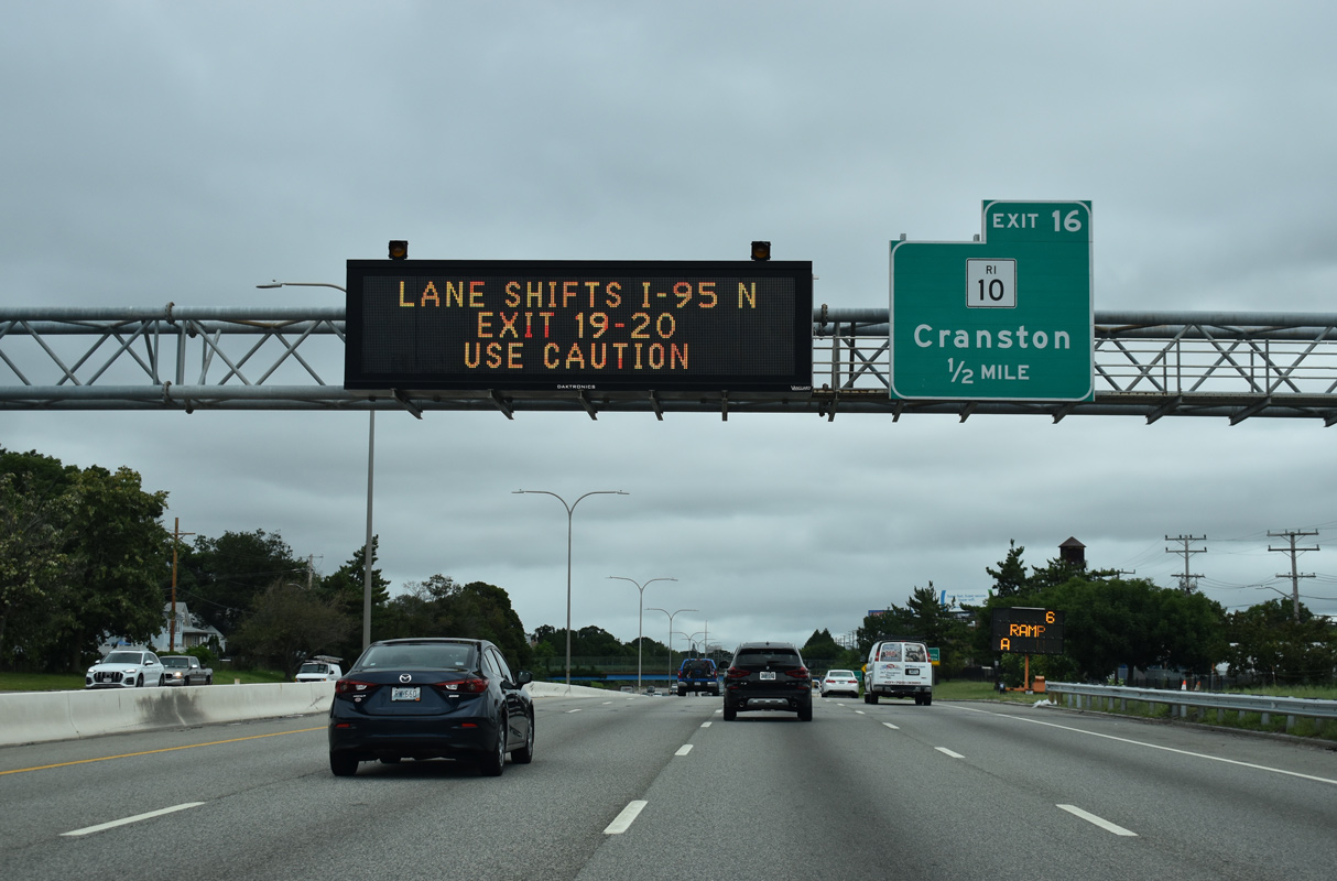
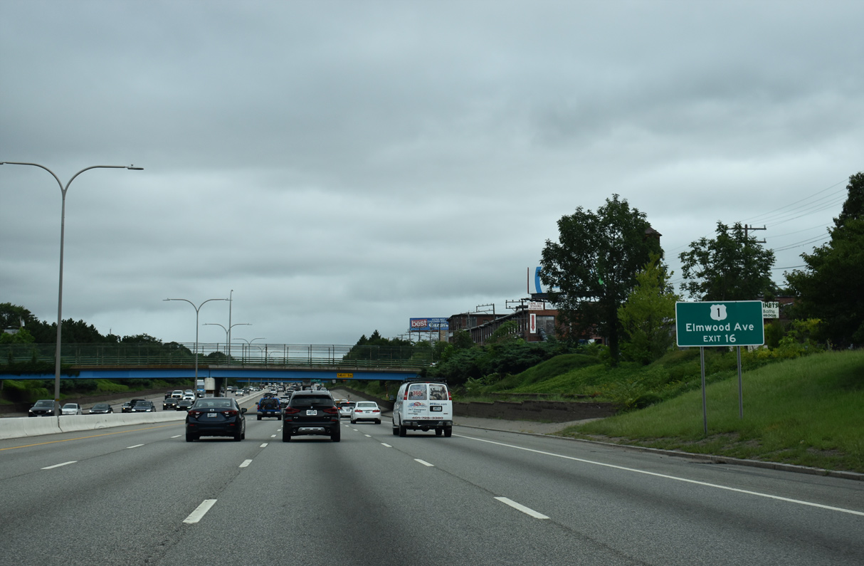
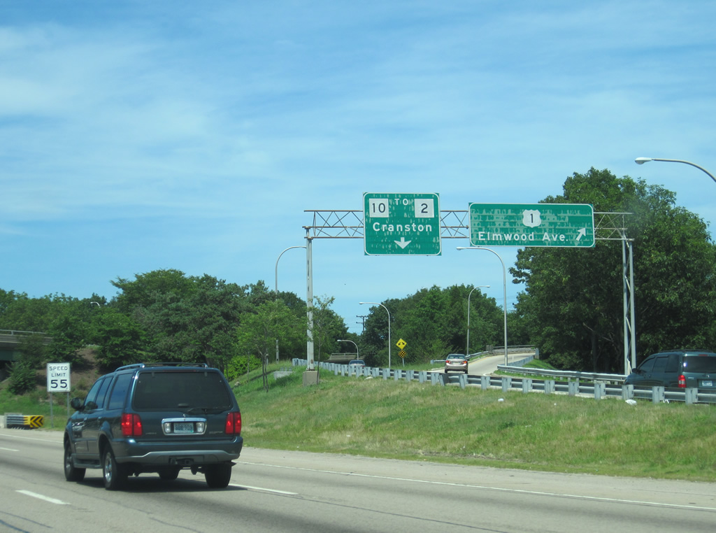
| Exit 33 from Interstate 95 northbound joins Route 10 north and adjacent U.S. 1 (Elmwood Avenue) south of Rogers Williams Park and Zoo. 08/20/21 |
|
| Route 10 northbound combines with U.S. 6 three miles to the north between the Silver Lake and West End neighborhoods in Providence. 08/20/21 |
|
| Although inaccessible from Exit 33, Route 10 arcs southward to Route 12 (Park Avenue) by Deep Spring Lake. Route 10 (Huntington Expressway) north enters Providence at the nearby exchange with Route 2 (Reservoir Avenue). 07/03/10 |
|
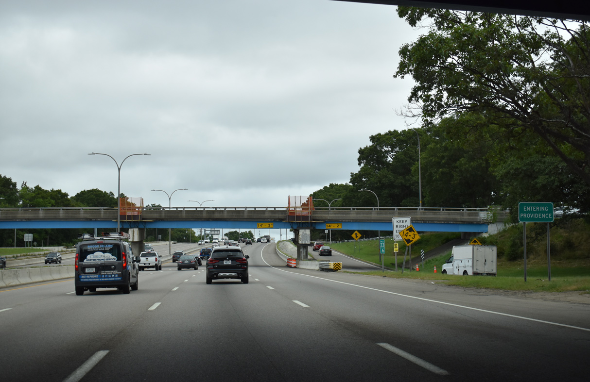
| Interstate 95 north enters the capital city of Providence at the partial turbine interchange with Route 10 (Huntington Expressway). 08/20/21 |
|
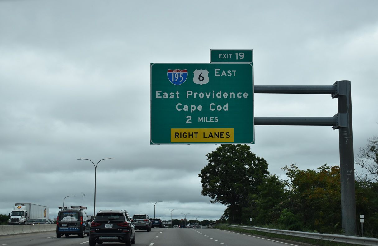
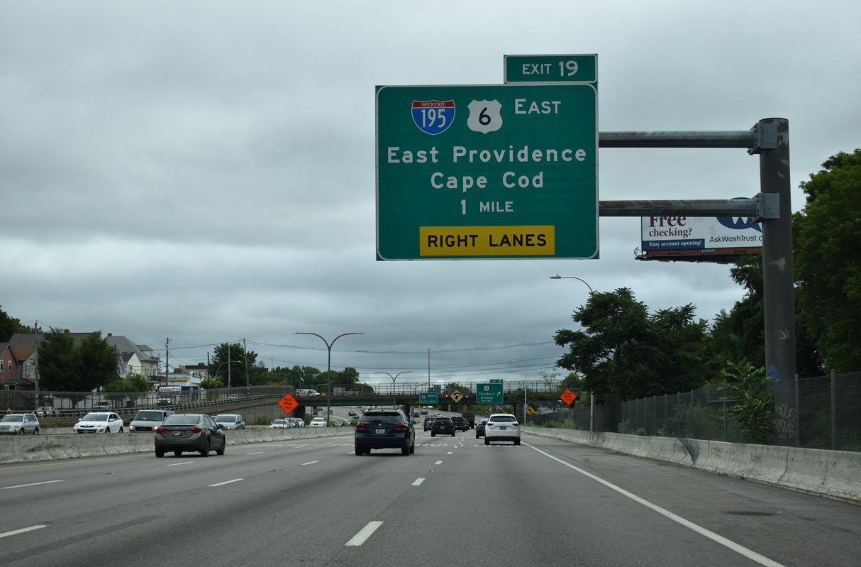
| Interstate 195 commences east from I-95 in two miles at Exit 36 A. 08/20/21 |
|
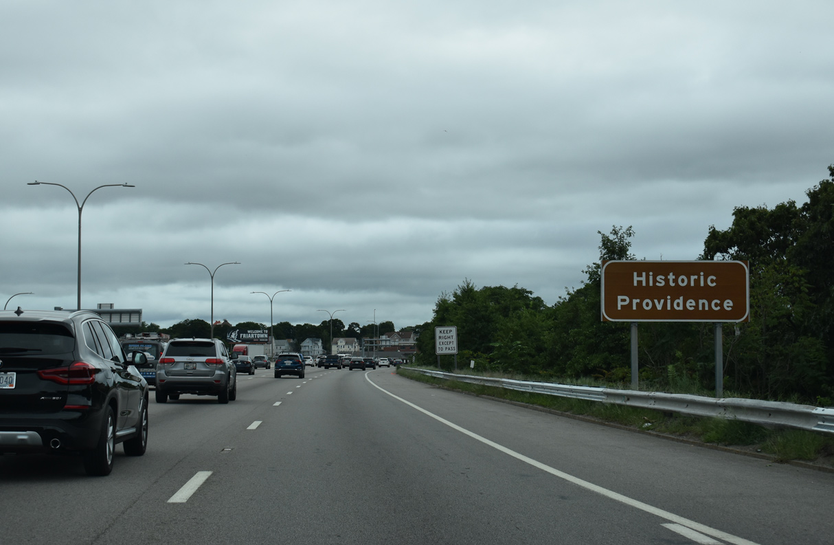
| Interstate 95 angles northeast between the Elmwood and Washington Park neighborhoods in Providence. 08/20/21 |
|
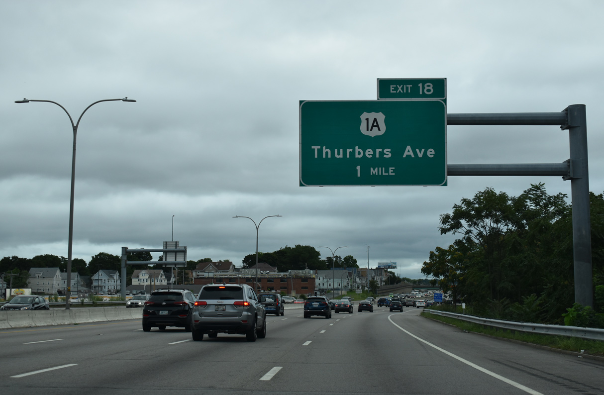
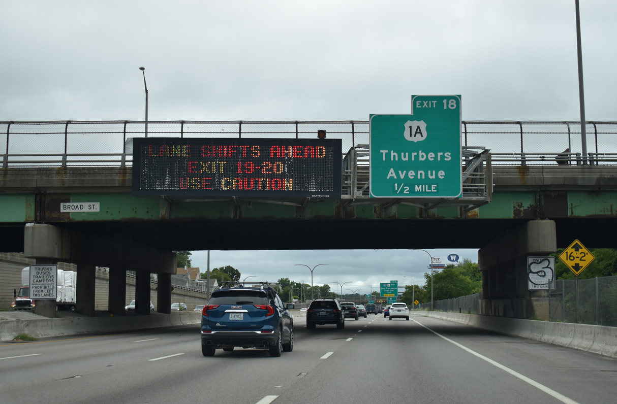
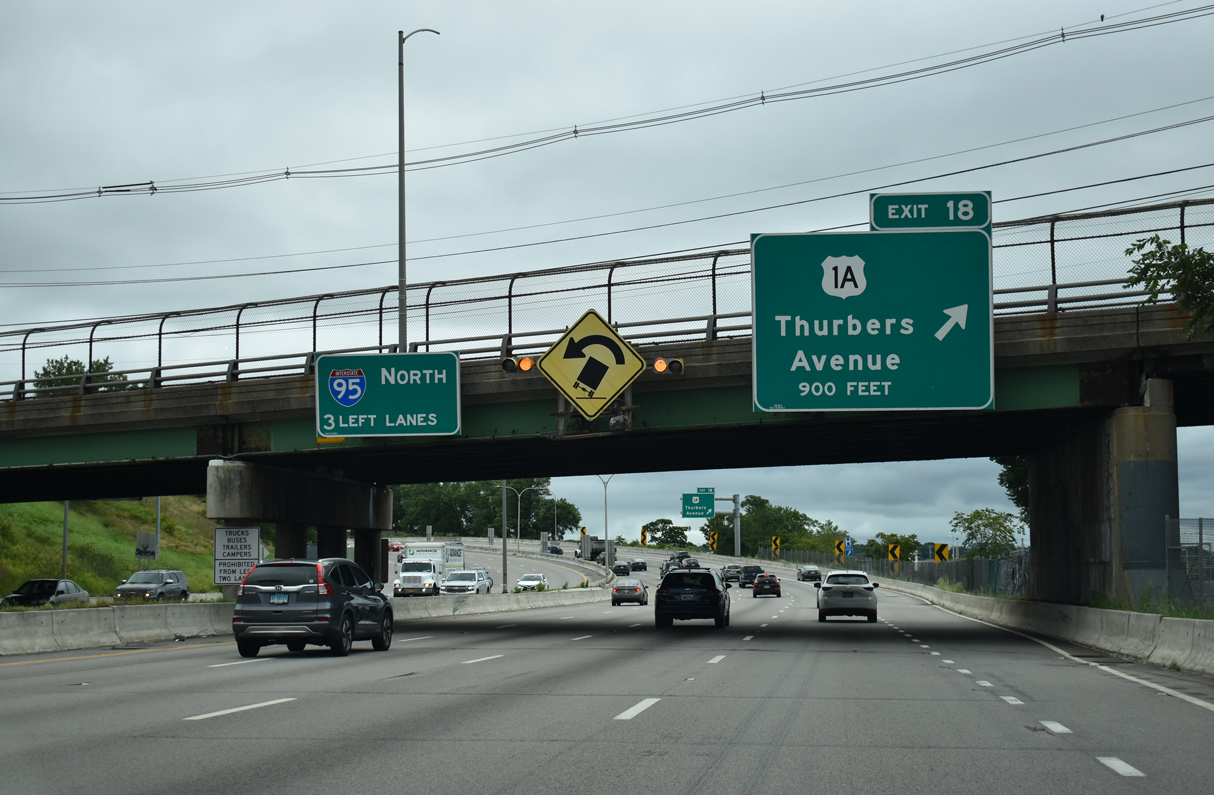
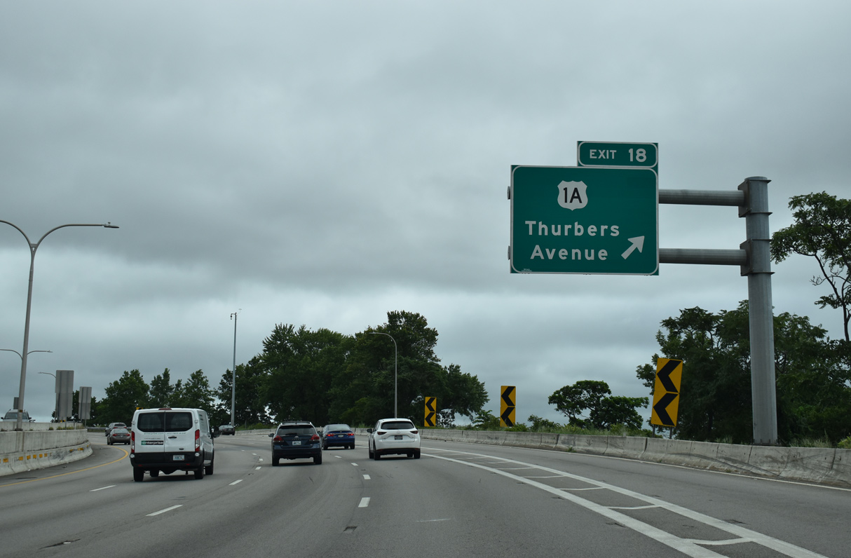
| The succeeding exit from I-95 north is for Thurbers Avenue to the Lower South Side neighborhood and U.S. 1A (Allens Avenue). 08/20/21 |
|
| Route 117 (Broad Street) passes over I-95 a half mile from the partial DDI (Exit 35) at Thurbers Avenue. Thurbers Avenue stems east from Route 117 to U.S. 1A (Allens Avenue) along the industrial waterfront along the Providence River. 08/20/21 |
|
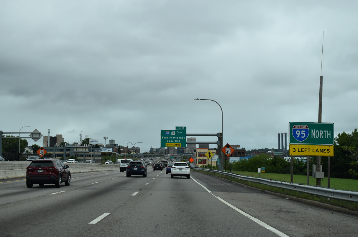
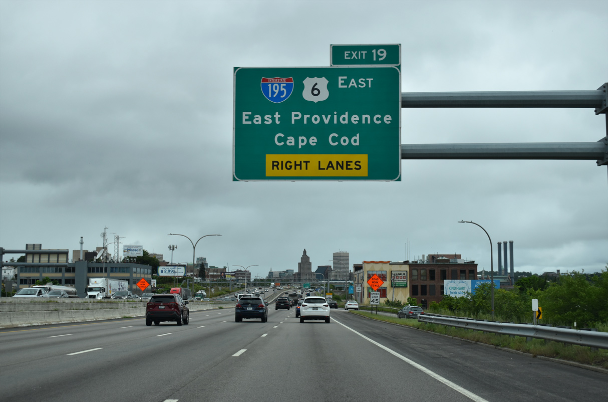
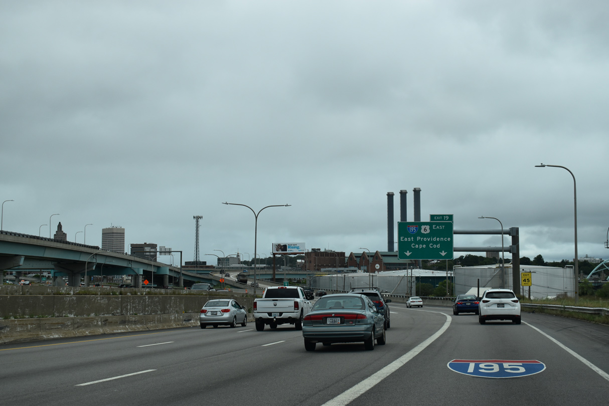
| A three-wye interchange joins Interstate 95 with I-195/U.S. 6 east at Exit 36 A. I-195/U.S. 6 overlap east across the Iway Bridge to India Point Park and over the Seekonk River into East Providence. 08/20/21 |
|
| Interstate 95 curves northward from Eddy Street to parallel U.S. 1 (Allens Avenue) and Providence Harbor to the Upper South Providence neighborhood in the South Side of Providence. 08/20/21 |
|
| U.S. 1A (Allens Avenue) heads south from Thurbers Avenue adjacent to Exit 35 onto Narragansett Boulevard and Norwood Avenue at Edgewood in south Providence. 08/20/21 |
|
| Commencing in 2003 at a cost of $623 million, the Iway project relocated the westernmost stretch of I-195 from a new exchange with I-95 onto a signature arch bridge across the Providence River.2 08/20/21 |
|
| Separating at East Providence, Interstate 195 parallels U.S. 6 east to Fall River, New Bedford and Wareham in southeastern Massachusetts. U.S. 6 crosses the Sagamore Bridge over Cape Cod Canal to Cape Cod. 08/20/21 |
|
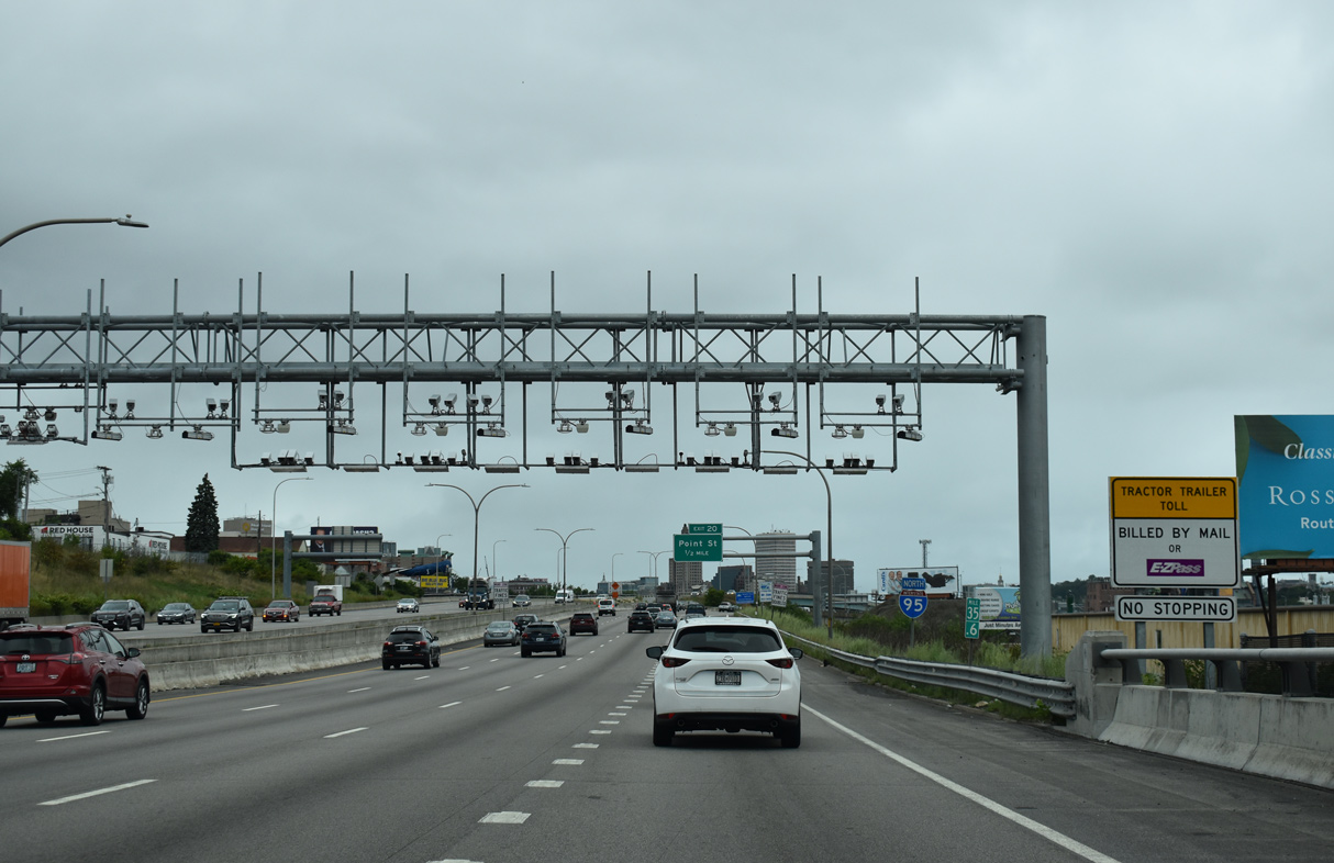
| The second toll collection point for tractor trailers along Interstate 95 northbound in Rhode Island. 08/20/21 |
|
| A lane drop occurs at Exit 36 A with three lanes continuing north along Interstate 95 to Downtown Providence. 08/20/21 |
|
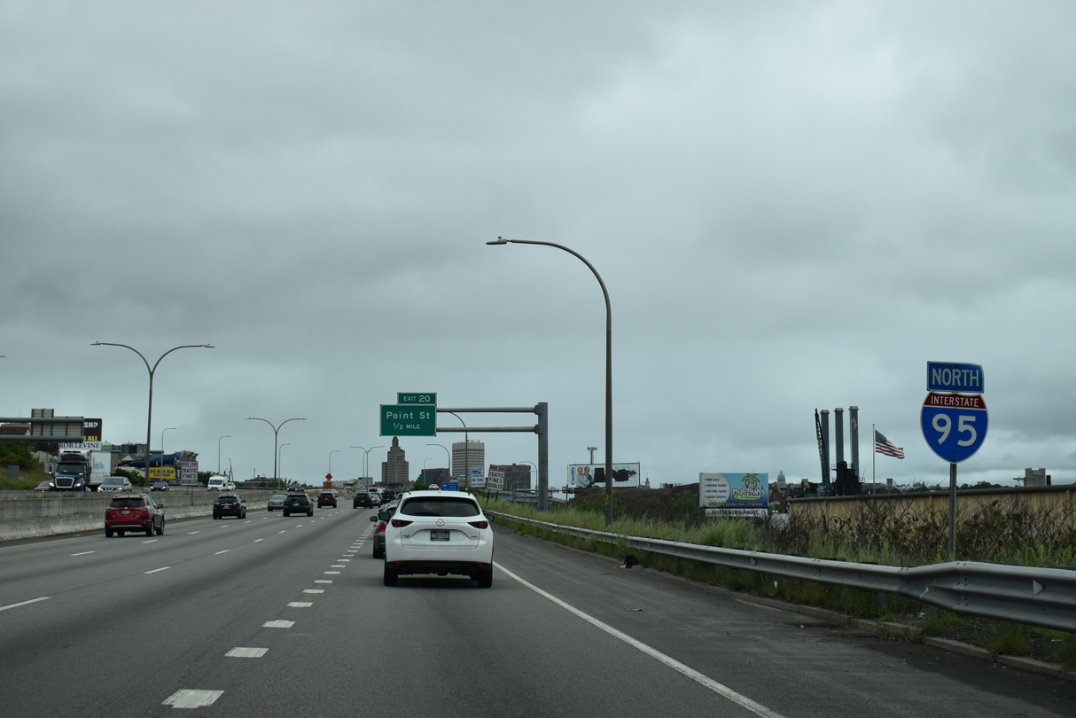
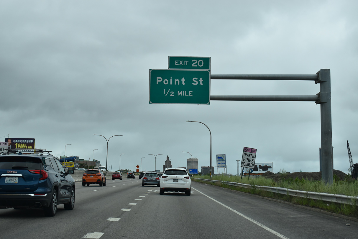
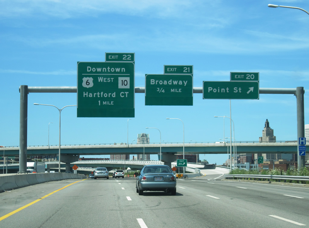
| Exit 36 B departs from within the exchange at I-195/U.S. 6 for Point Street at Upper South Providence. 08/20/21 |
|
| The new Iway bridge opened along eastbound I-195 on November 4, 2007 and westbound on June 18, 2009. The remainder of old I-195 to the north permanently closed by October 22, 2009.2 08/20/21 |
|
| Interstate 195 travels 44 miles east from Providence to I-495 and Massachusetts Route 25 at Wareham. U.S. 6 extends east to Provincetown at the north end of Cape Code. 08/20/21 |
|
| Added during the Iway project, Exit 36 B departs from I-95 north to Point Street at E Franklin Street. Point Street connects the freeway with Rhode Island Hospital and the Point Street Bridge (U.S. 1A) across the Providence River. 07/03/10 |
Page Updated 03-20-2023.

 North
North