|
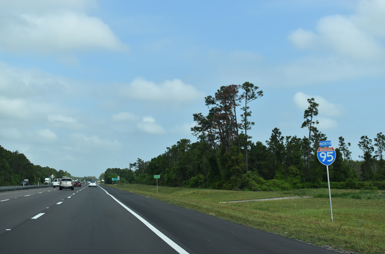
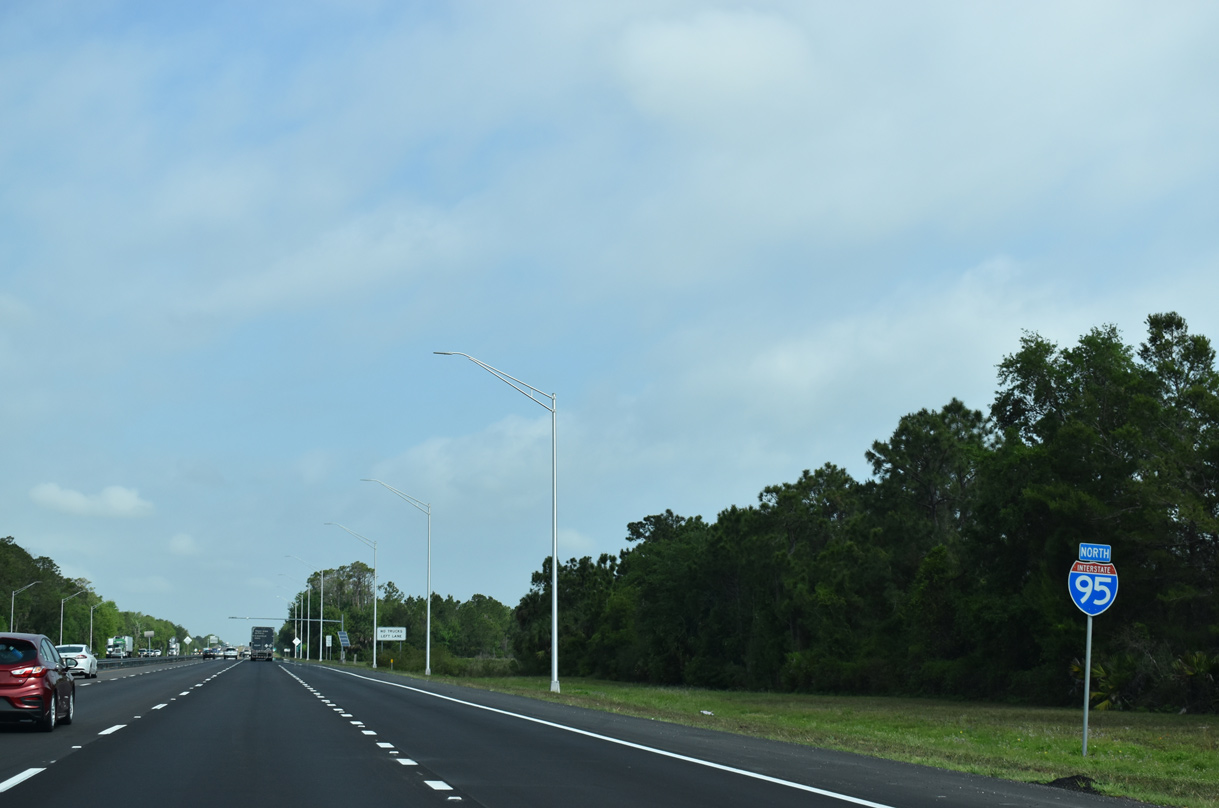
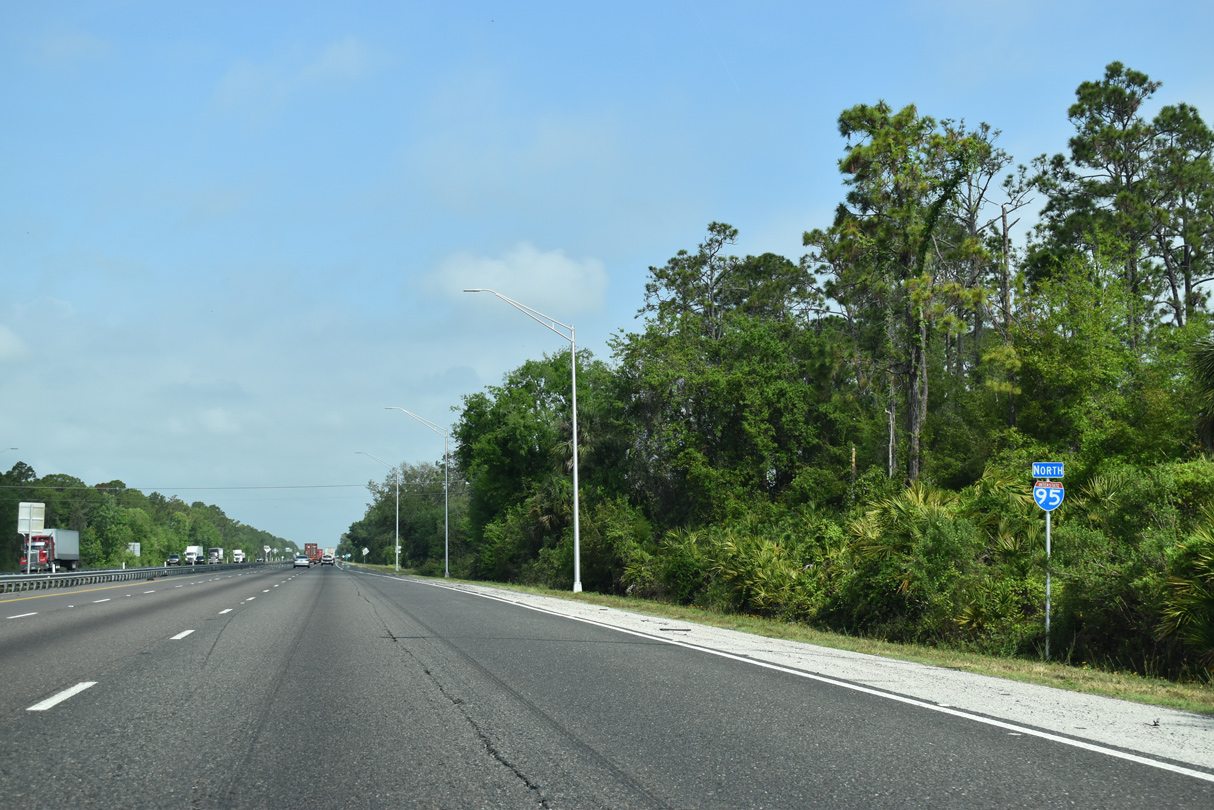
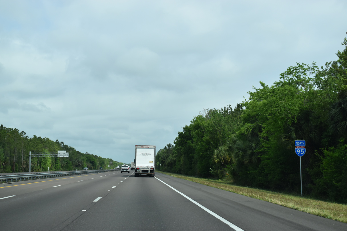
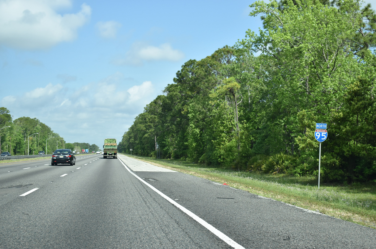
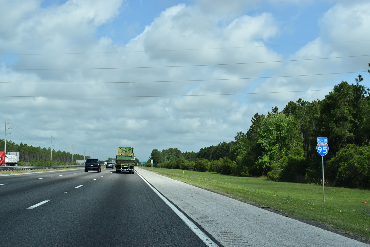
| Interstate 95 reassurance shield posted beyond the Volusia County line. I-95 was expanded to six lanes overall throughout Flagler County during a $81.2 million widening project completed in 2009. 03/26/20 |
|
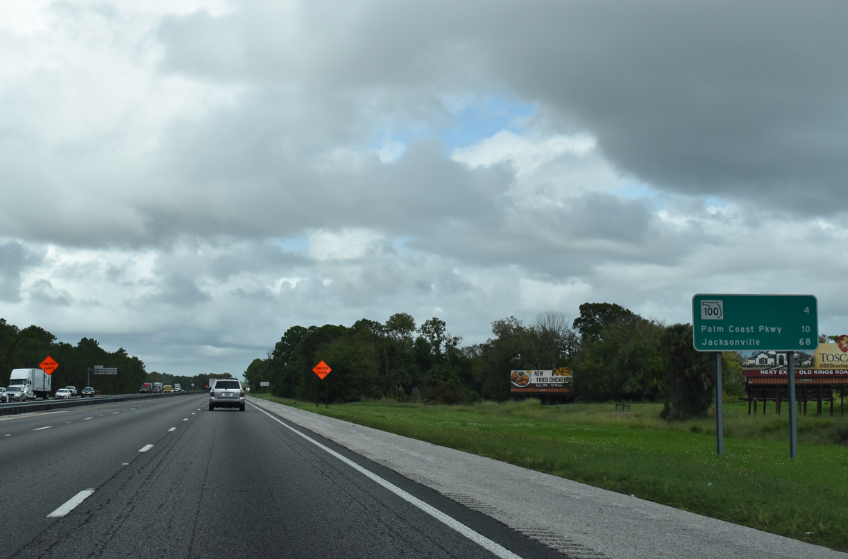
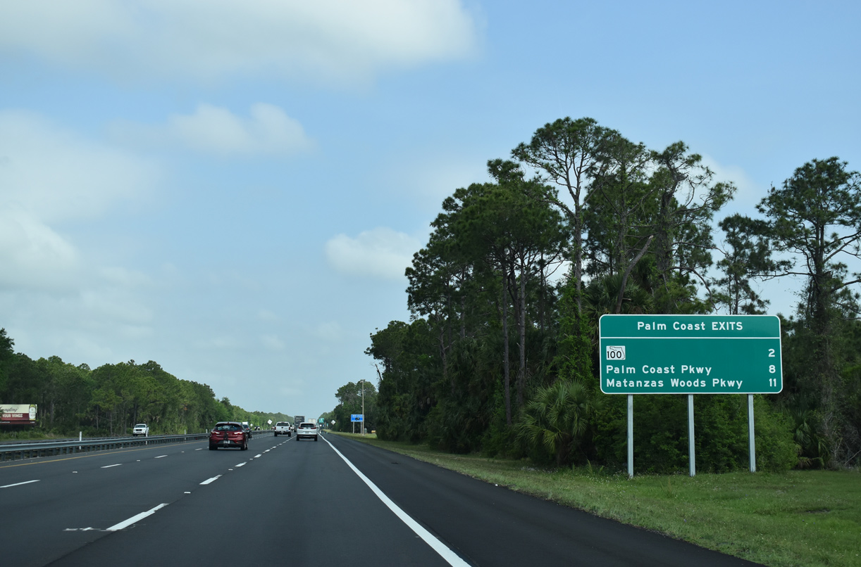
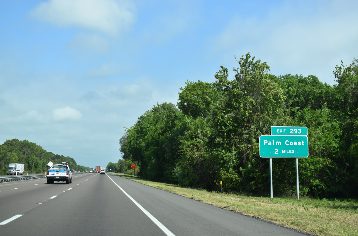
| Three interchanges serve the city of Palm Coast over the course of 11 miles along Interstate 95 north. 11/06/19, 03/26/20 |
|
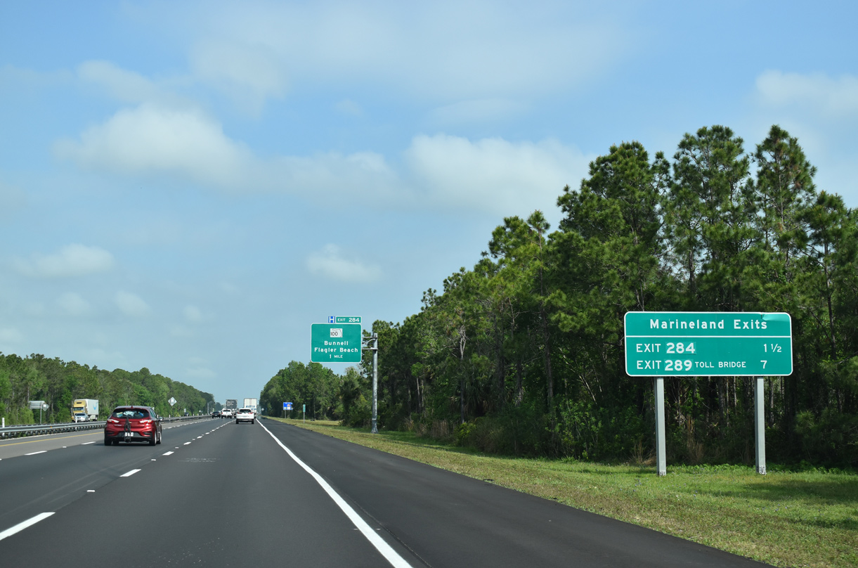
| Marineland and its Dolphin Conversation Center lies along the coast (SR A1A) near the Flagler and St. Johns County line. The facility may be reached via SR 100 east to SR A1A (Ocean Shore Boulevard) or the Palm Coast Parkway toll bridge. 03/26/20 |
|
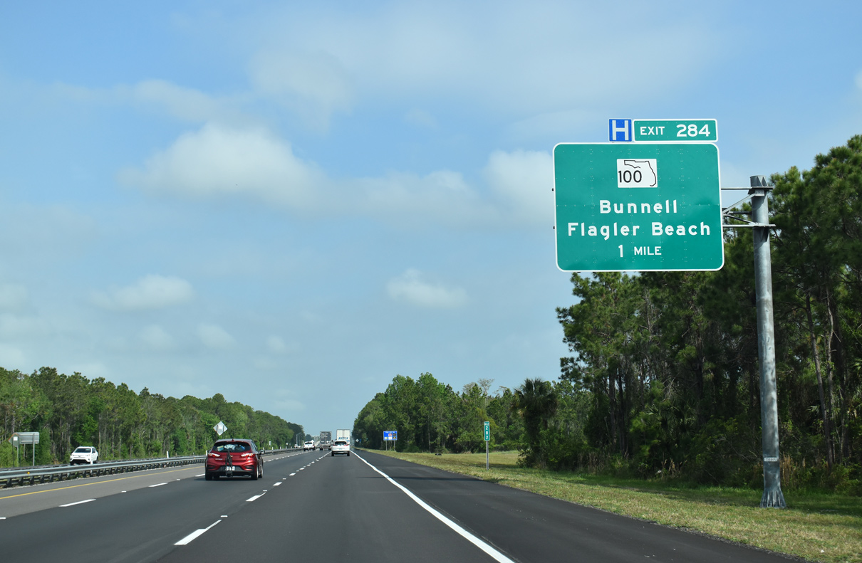
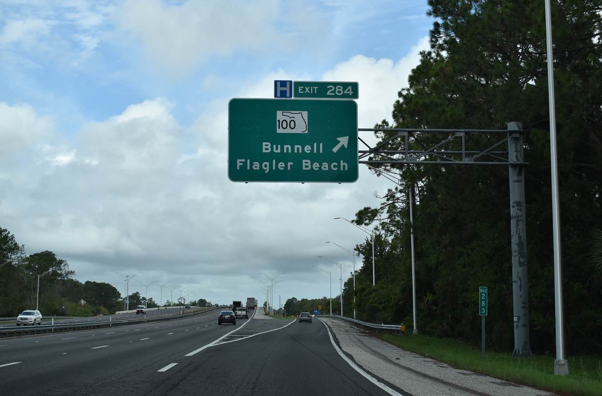
| SR 100 (Moody Boulevard) meets Interstate 95 at Exit 284, a single point urban interchange (SPUI), in the city of Palm Coast. The state road joins the freeway with Flagler Beach to the east and Bunnell to the west. 03/26/20 |
|
| SR 100 (Moody Boulevard) constitutes a four lane corridor east across Graham Swamp and the Matanzas River to SR A1A (Ocean Shore Boulevard) south of the town of Marineland. 11/06/19 |
|
| 2006-09 widening of I-95 included the conversion of Exit 284 from a diamond to a SPUI. 11/06/19 |
|
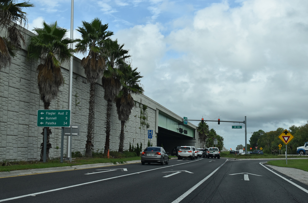
| Five miles west from I-95, SR 100 combines with U.S. 1 through Bunnell before branching northwest to U.S. 17 and the Putnam County seat of Palatka. 11/06/19 |
|
| Old Kings Road parallels the north side of Interstate 95 to the Town Center Boulevard underpass, foreshadowing future development along the east side of the freeway. 03/26/20 |
|
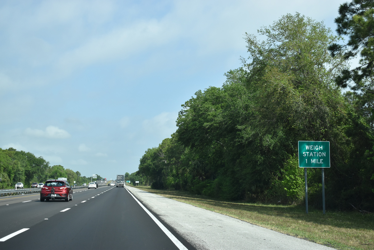
| A set of weigh stations operate along Interstate 95 in both directions north of Town Center Boulevard and the Royal Palms Waterway. 03/26/20 |
|
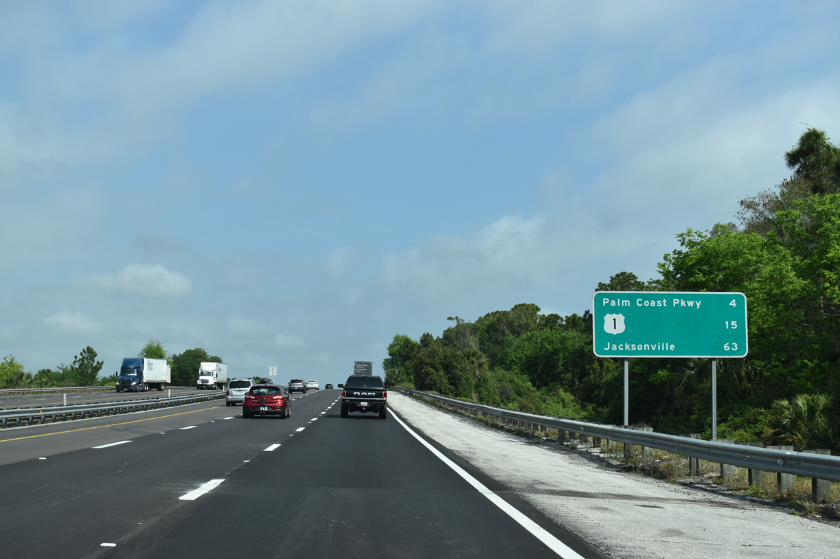
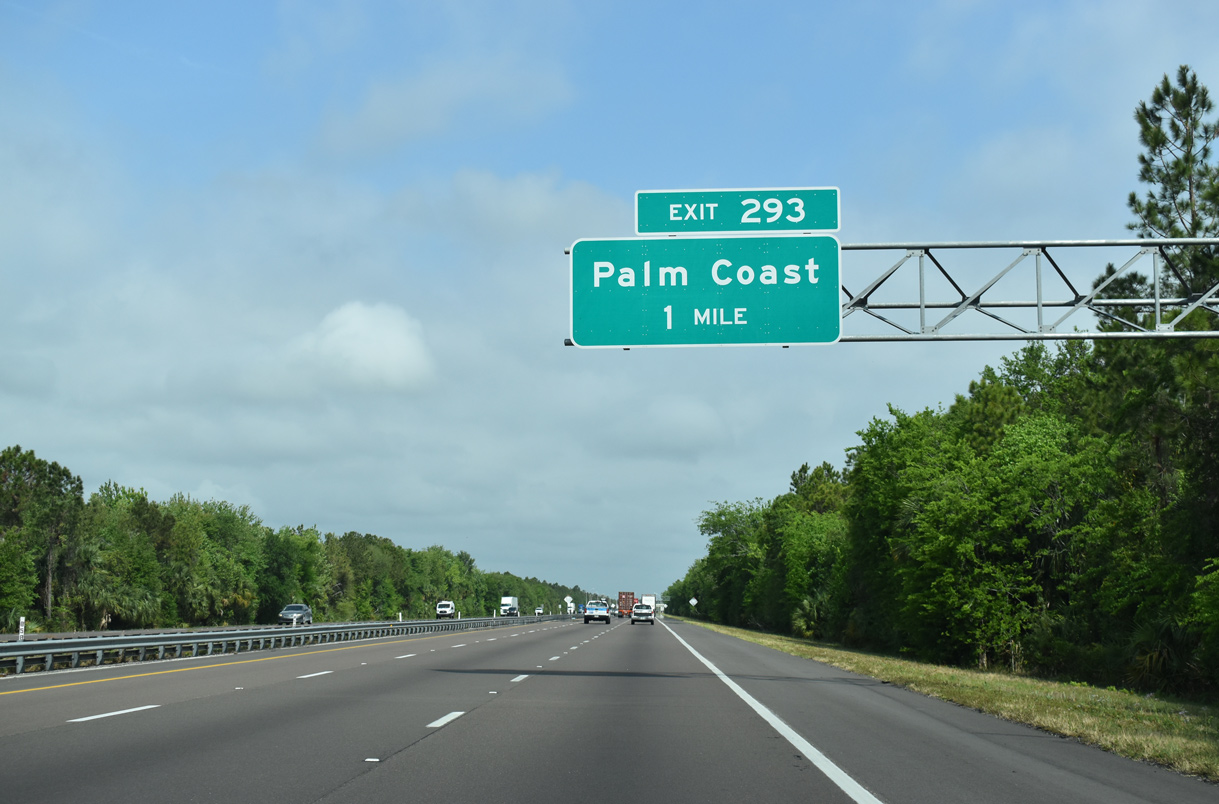
| Interstate 95 continues through the city of Palm Coast for four miles to Exit 289 (Palm Coast Parkway). The majority of the incorporated city consists of subdivisions west and east of the freeway north of SR 100. 03/26/20 |
|
| Northbound truckers reach the I-95 weigh station situated west o Graham Swamp. 03/26/20 |
|
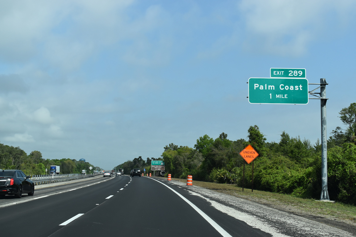
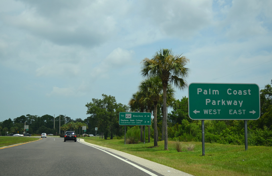
| Palm Coast Parkway provides the main access point to Palm Coast via Exit 289 in one mile. 03/26/20 |
|
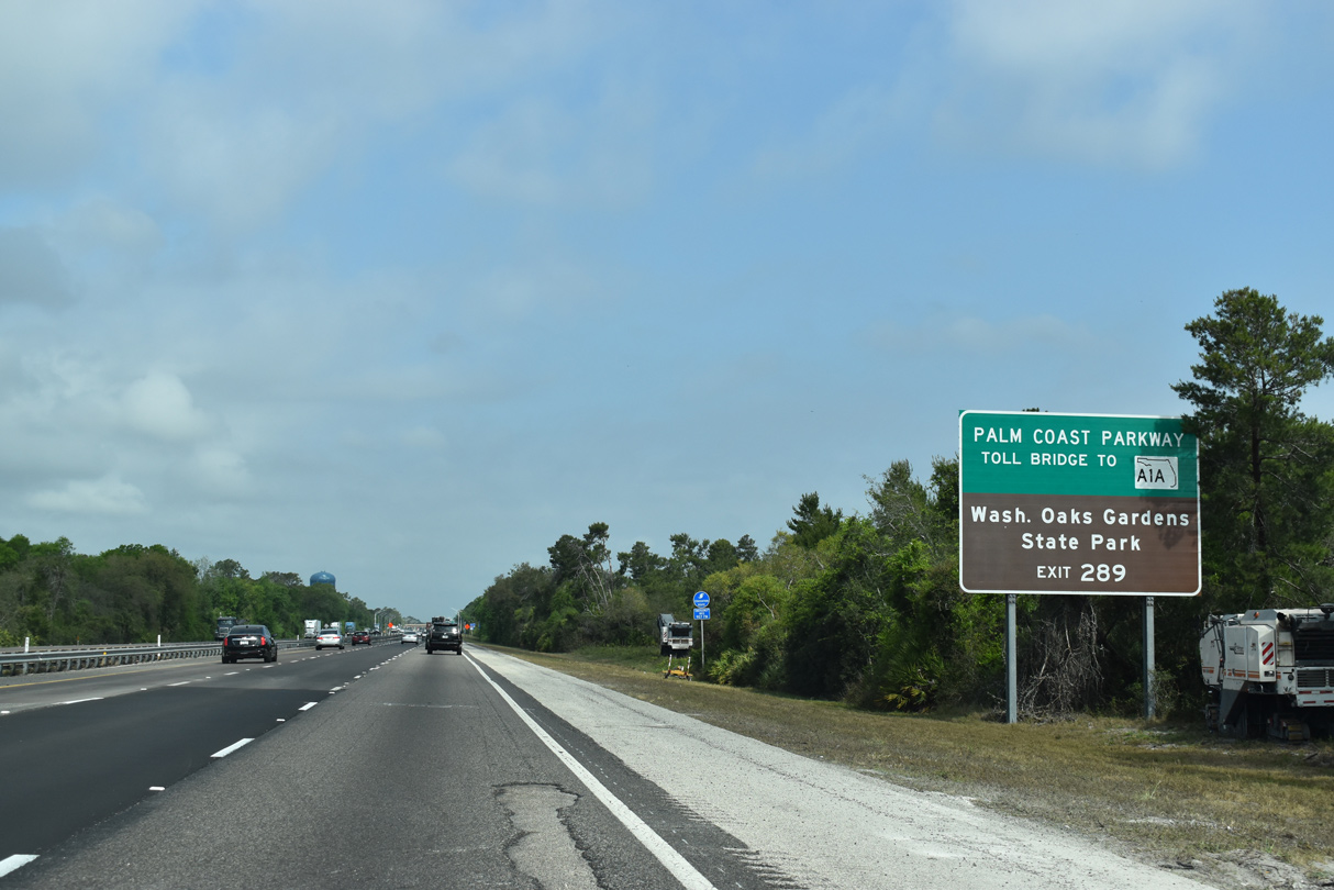
| The Hammock Dunes Bridge spans the Intracoastal Waterway east as tolled facility to SR A1A at Bon Terra. SR A1A leads north to Marineland and Washington Oaks Gardens State Park and south to Beverly Beach. 03/26/20 |
|
| Palm Coast Parkway consists of a locally maintained roadway west to U.S. 1 and east to Hammock Dunes Parkway. The parkway splits into one way couplets through the commercial center of Palm Coast. 03/26/20 |
|
| Taking Exit 289 to Palm Coast Parkway, traffic partitions into the parkway east to the unincorporated communities of Ocean Hammock and Hammock Dunes on the coast and west to U.S. 1 along western reaches of the city. 07/23/13 |
|
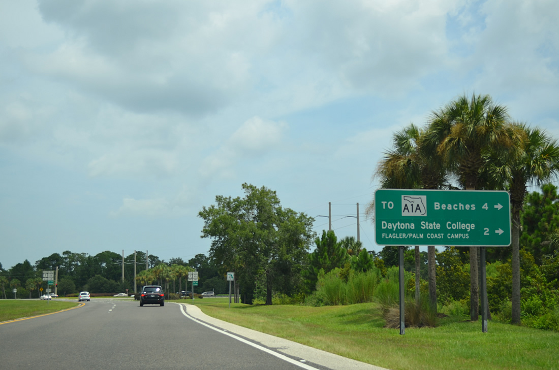
| The Hammock Dunes Bridge ties into Camino del Mar, which links with SR A1A (Ocean Shore Boulevard). The Flagler/Palm Coast Campus of Daytona State College lies along the roadway, 1.3 miles to the east. 07/23/13 |
|
| Trailblazers for U.S. 1, SR A1A and the Hammock Dunes Bridge posted at the end of the off-ramp at Exit 289. The 65 foot high toll bridge opened in 1988 at a cost of $16.3 million. 07/23/13 |
|
| A street grid abuts the western side of Interstate 95 over the next several miles as the freeway pushes northward to vacate Palm Coast. 03/26/20 |
|
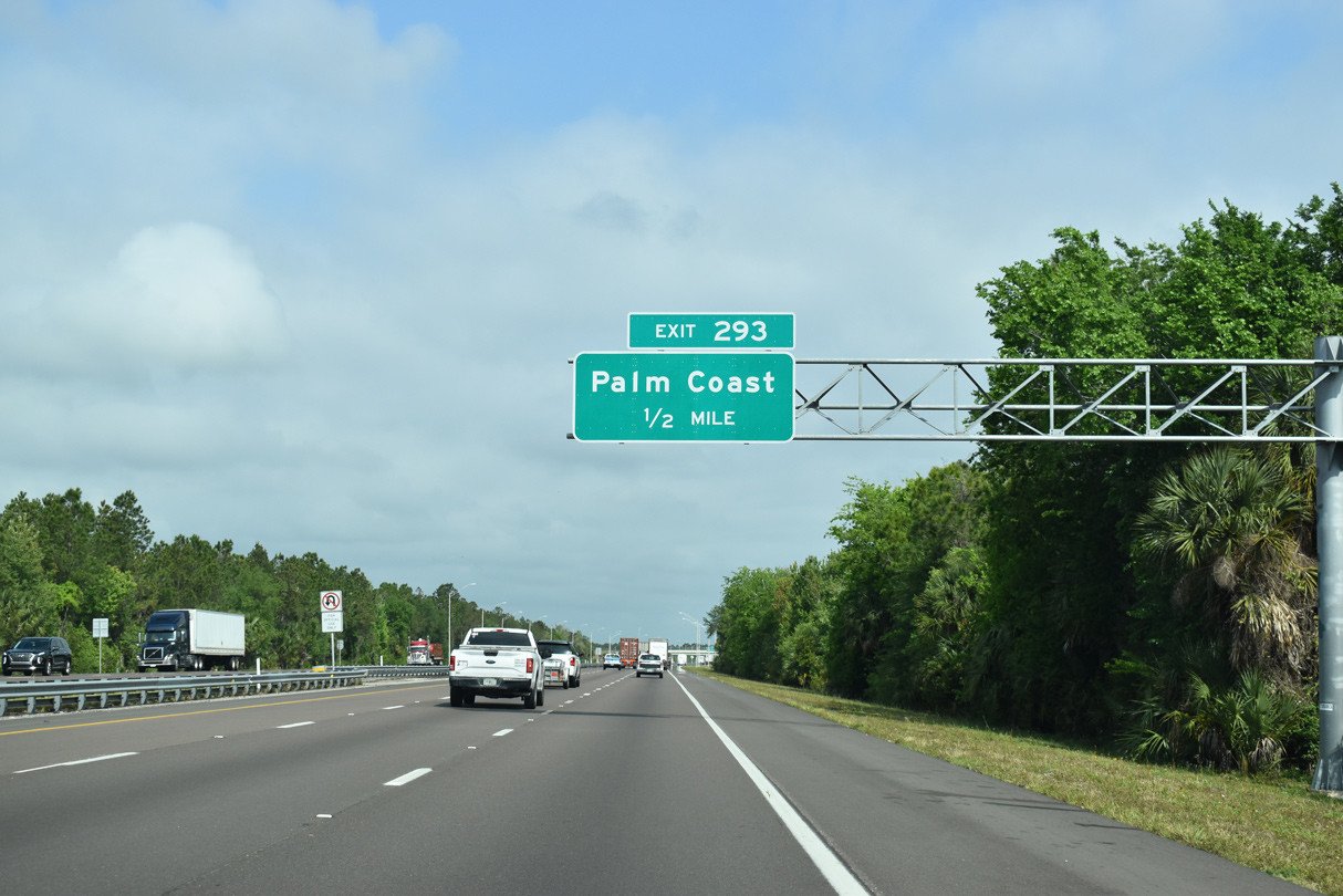
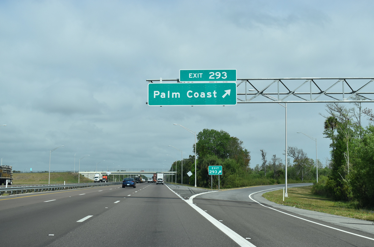
| Opened to traffic on March 28, 2016, the third Palm Coast interchange (Exit 293) along Interstate 95 north was constructed at a cost of $12.4 million.1 03/26/20 |
|
| Matanzas Woods Parkway connects Interstate 95 at Exit 293 with U.S. 1 to the west and Matanzas High School to the east. 03/26/20 |
|
| Entering the diamond interchange (Exit 293) with Matanzas Woods Parkway on I-95 northbound. 03/26/20 |
|
| Leaving north reaches of Palm Coast, Interstate 95 crosses paths with N Old Kings Road in 2.5 miles. 03/26/20 |
|
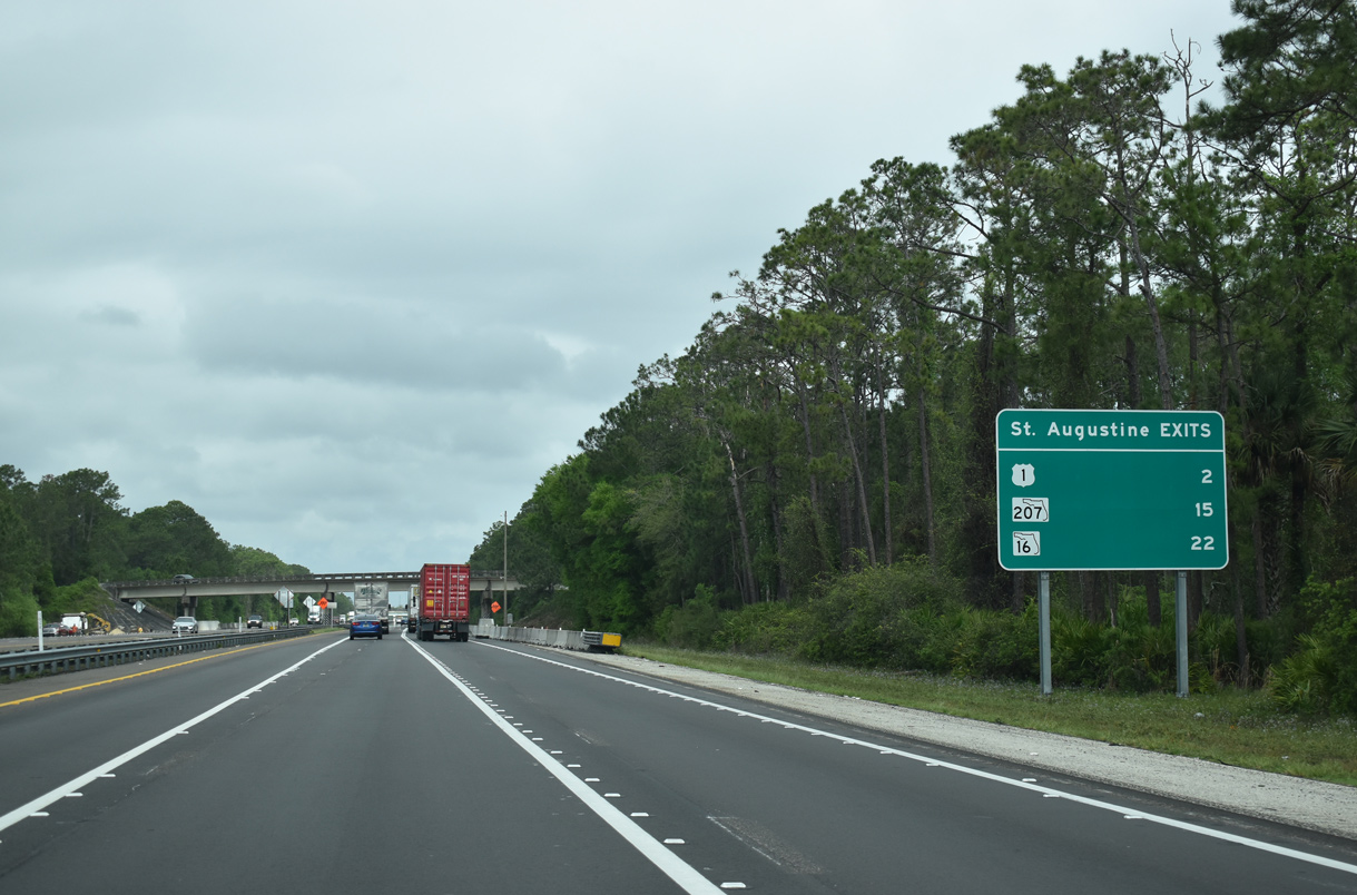
| Continuing north, Interstate 95 passes well west of St. Augustine, with U.S. 1, SR 207 and SR 16 leading to the St. Johns County seat. 03/26/20 |
|
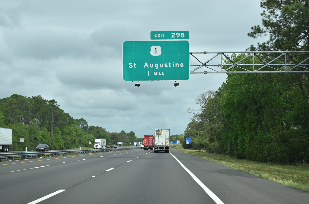
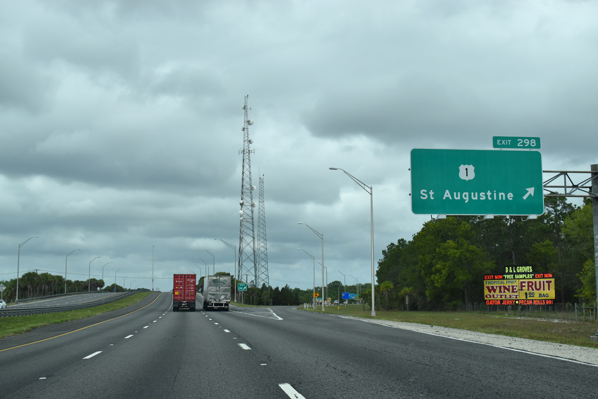
| U.S. 1 straddles the western reaches of Palm Coast along a four lane divided highway from Bunnell northward to a diamond interchange (Exit 298) with I-95. 03/26/20 |
|
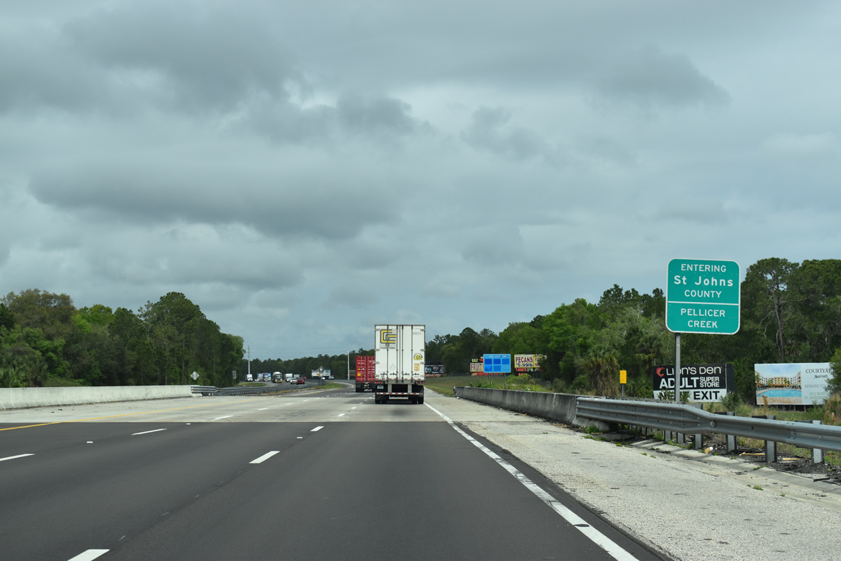
| Spanning Pellicer Creek, Interstate 95 leaves Flagler County and enters St. Johns County. The freeway exits Palm Coast through a swath of Pellicer Creek Conservation Area. 03/26/20 |
|
| Interstate 95 shifts more inland as U.S. 1 once again trends toward the coast. The US highway continues as a rural four lane divided highway to Dupont Center and St. Augustine. 03/26/20 |
|
| Interstate 95 stays rural to Exit 318 in St. Johns County. 03/26/20 |
|
| The next two exits of St. Johns County join Interstate 95 with SR 206 and 207, two state roads leading southwest toward Palatka. 03/26/20 |
|
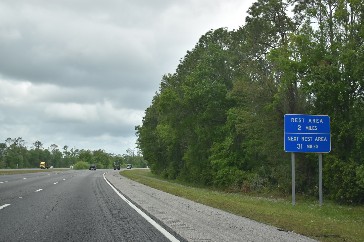
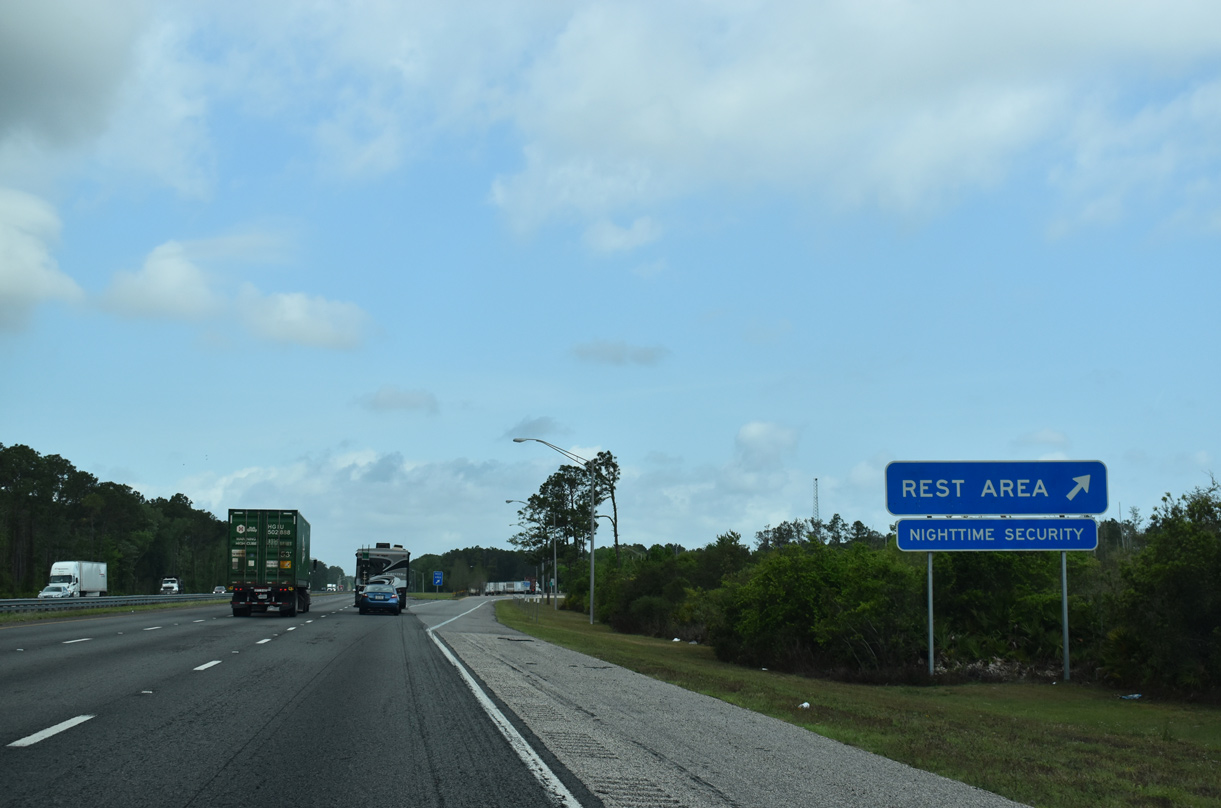
| A pair of offset rest areas, the first of two sets in St. Johns County, are found along Interstate 95 between Exits 298 and 305. 03/26/20 |
|
| One mile south of the rest area east of Fish Swamp. 03/26/20 |
|
| Interstate 95 north reaches the south St. Johns County rest area north of milepost 301. 03/26/20 |
|
| Interstate 95 bee lines north from the rest area between wooded areas of wetlands. 03/26/20 |
|
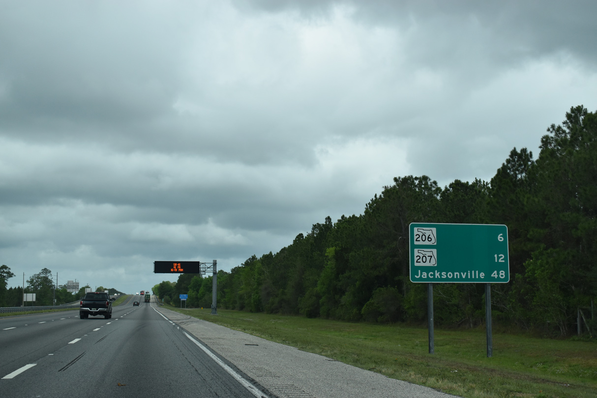
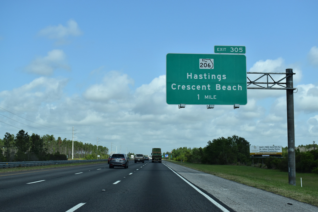
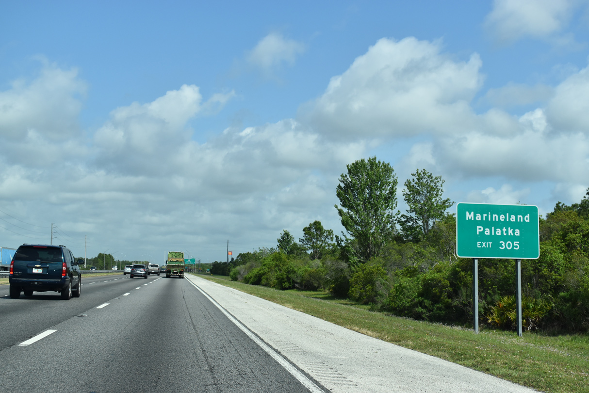
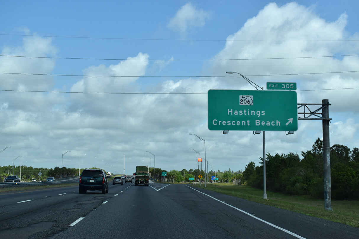
| SR 206 travels across Interstate 95 at a diamond interchange (Exit 305) west from Crescent Beach and the Matanzas River. 03/26/20 |
|
| SR 206 east to SR A1A south leads to Marineland. SR 206 west to SR 207 south connects with U.S. 17 across the St. Johns River to Palatka. 03/26/20 |
|
| West of Exit 305, SR 206 continues to SR 207 outside the town of Hastings. The state road runs 14.49 miles overall. 03/26/20 |
|
| The landscape alongside I-95 north of SR 206 remains unchanged with a mixture of forest and wetland areas. 03/26/20 |
|
| Northbound distance sign posted 41 miles south of Jacksonville. 03/26/20 |
|
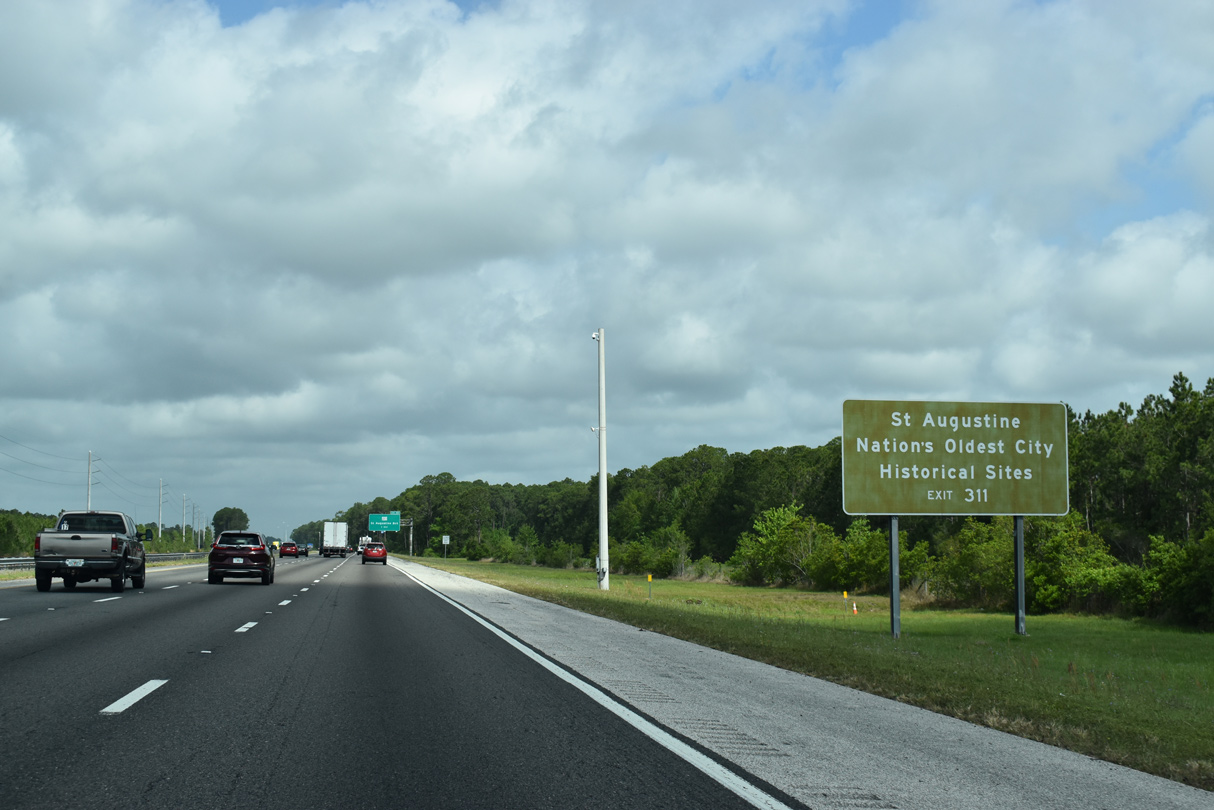
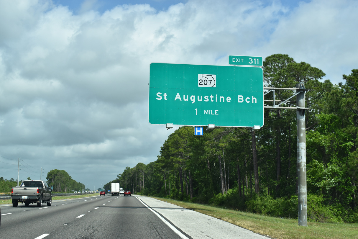
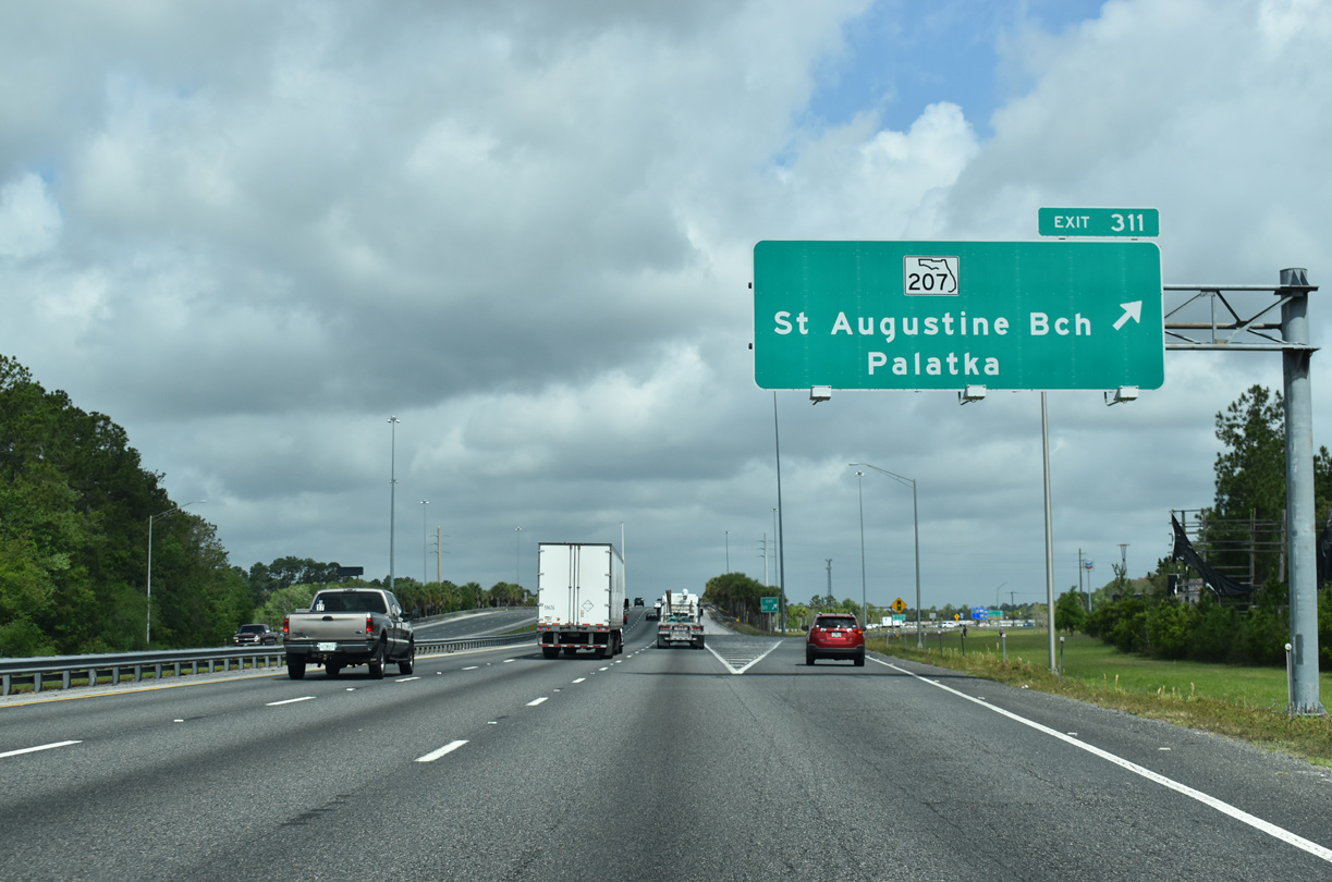
| Exit 311 provides the most direct route to St. Augustine from I-95 north via SR 207 north to U.S. 1 (Ponce de Leon Boulevard) north. Founded in 1565, St. Augustine is home to a bevy of historical sites including Fort Matanzas National Monument, Flagler College, Castillo de San Marcos National Monument, and the Bridge of Lions among other points of interests. Anastasia State Park lies east of the city via SR 312 east. 03/26/20 |
|
| SR 207 bends northeast from Hastings to Spuds, Elkton, Vermont Heights to a rural diamond interchange (Exit 311) with Interstate 95. 03/26/20 |
|
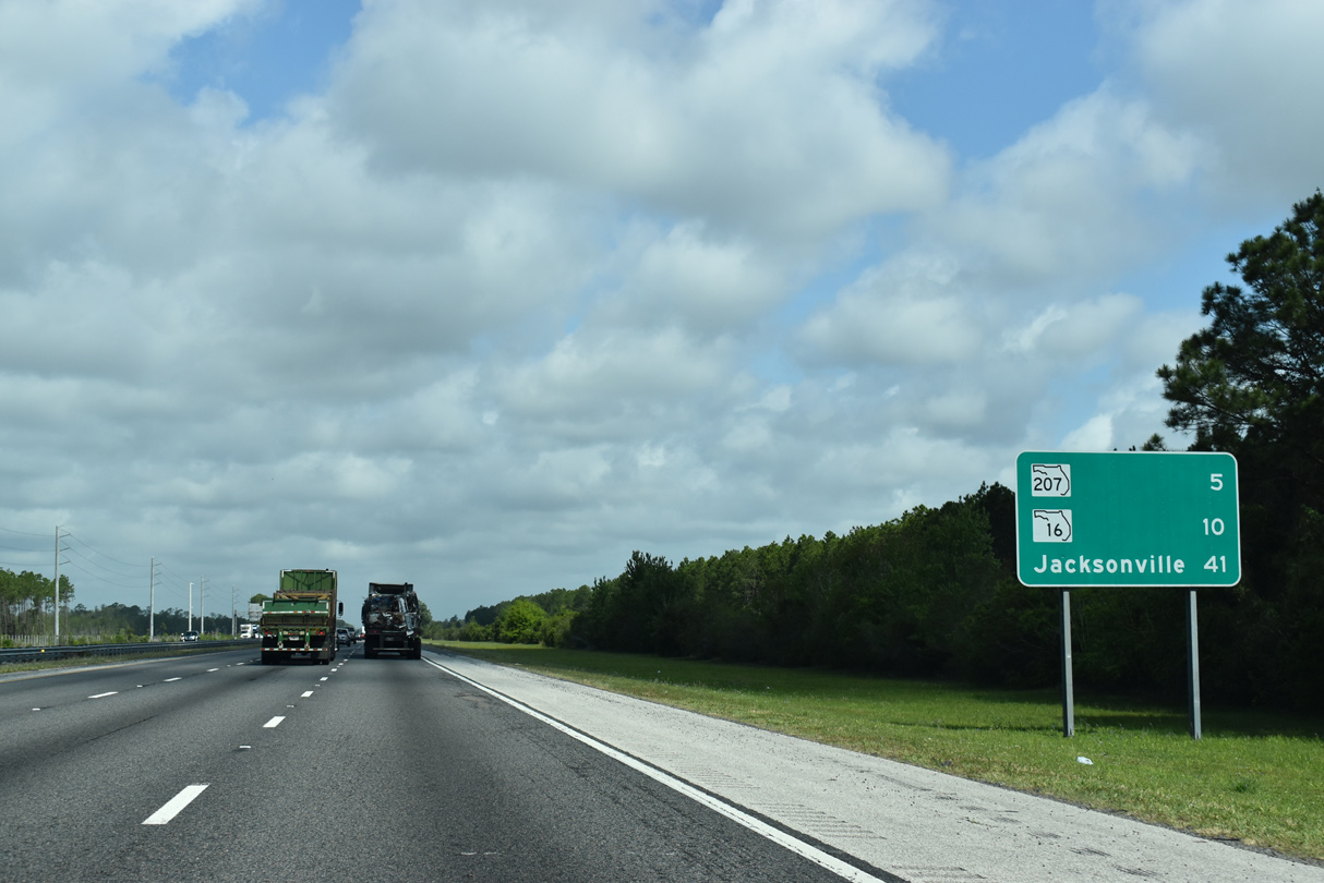
| A 24.43 mile route, State Road 207 follows a mostly four lane divided highway southwest from Exit 311 to U.S. 17/SR 100 outside Palatka and northeast to U.S. 1 in south St. Augustine. 03/26/20 |
|
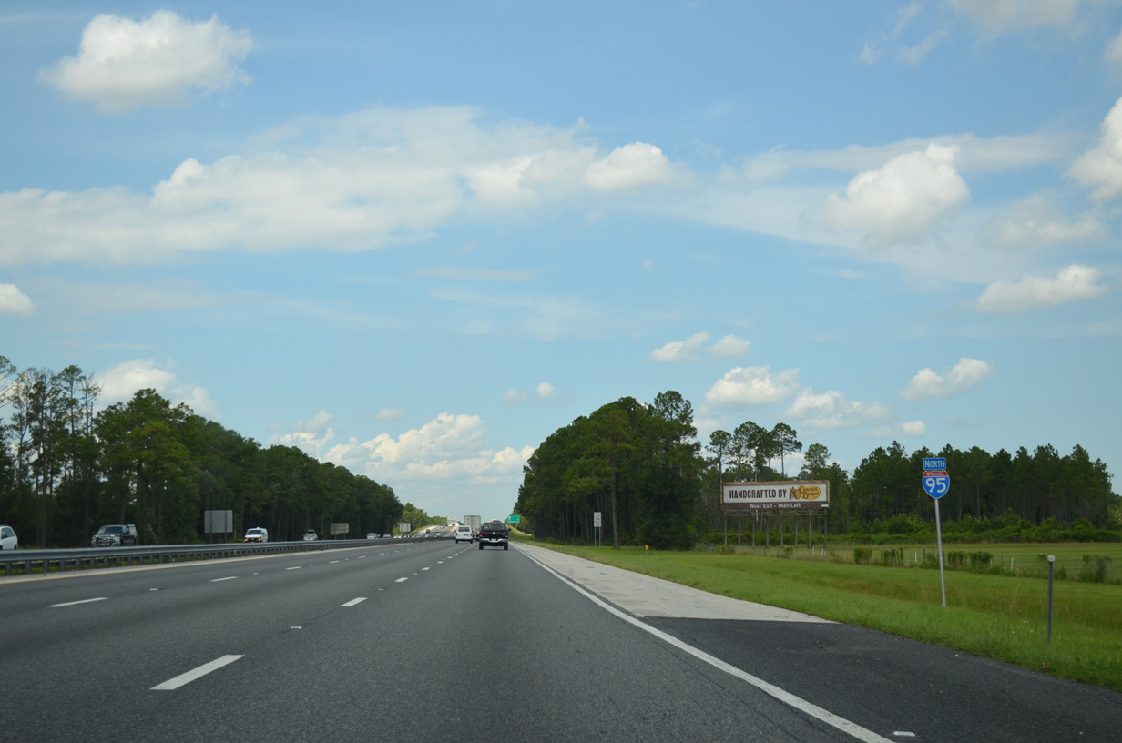
| Interstate 95 stays well west of St. Augustine through rural areas on the five mile drive to SR 16. 09/22/14 |
|
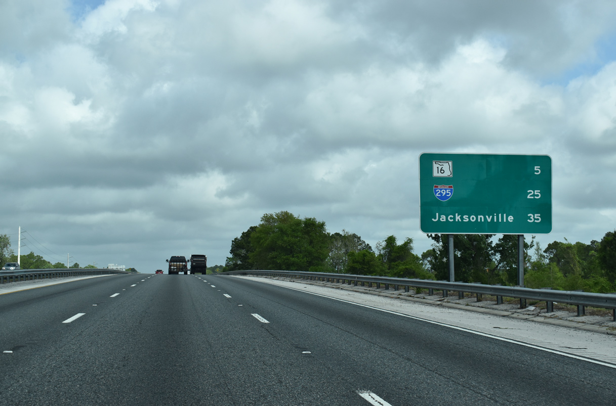
| Interstate 295, the Jacksonville Beltway, debuts on distance signs to northbound traffic at 25 miles away. The freeway elevates to pass over a Florida East Coast Railway (FEC) beyond this panel. 03/26/20 |
|
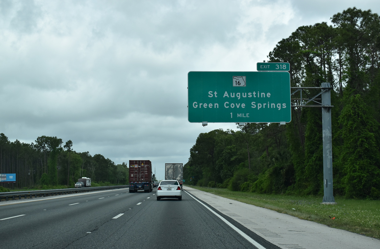
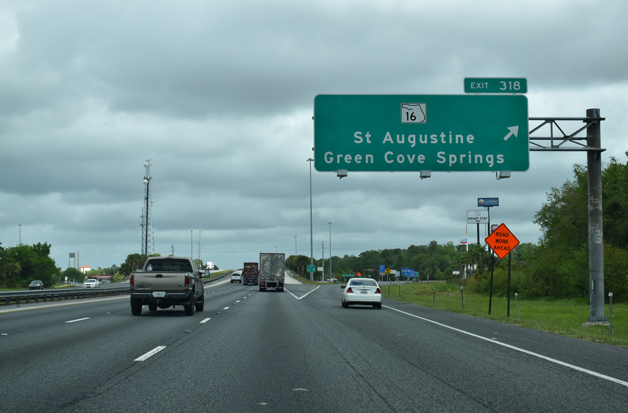
| SR 16 stems west from U.S. 1 Business (San Marco Avenue) in St. Augustine to a diamond interchange (Exit 318) with Interstate 95. The exchange serves interests to St. Johns River State College, First Coast Technical College and Fort Mose Historic State Park. 03/26/20 |
|
| West of Interstate 95, SR 16 partitions with CR 208 just outside of Exit 318. SR 16 meanders northwest to the Shands Bridge across the St. Johns River, and Green Cove Springs, the Clay County seat. CR 208 spurs west to Bakersville and CR 13 at Picolata. 03/26/20 |
|
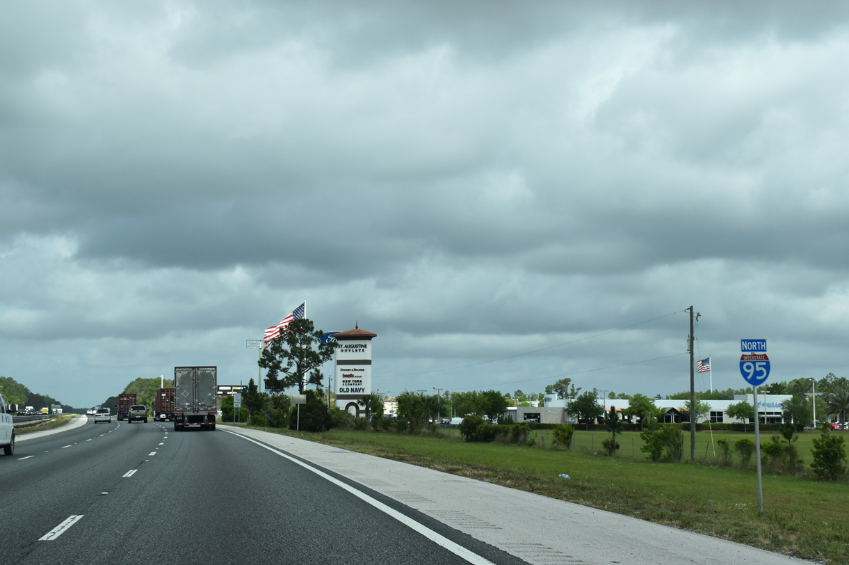
| The St. Augustine Outlets anchor the retail at the crossroads of Interstate 95 and State Road 16. 03/26/20 |
|
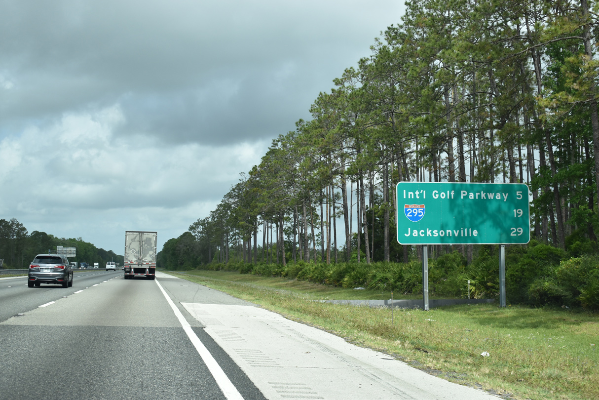
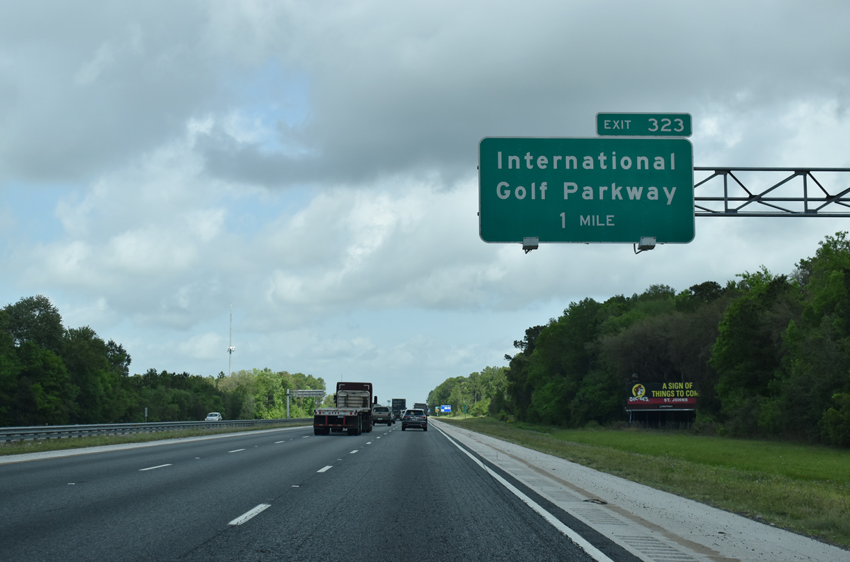
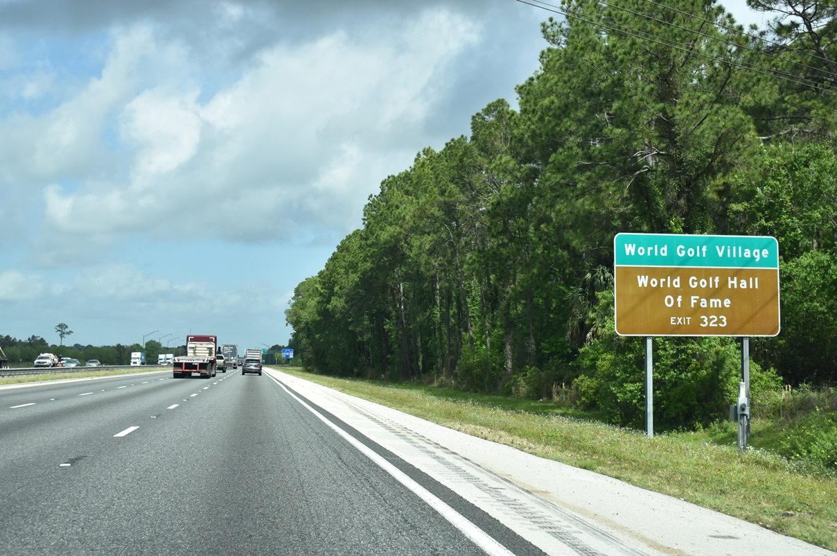
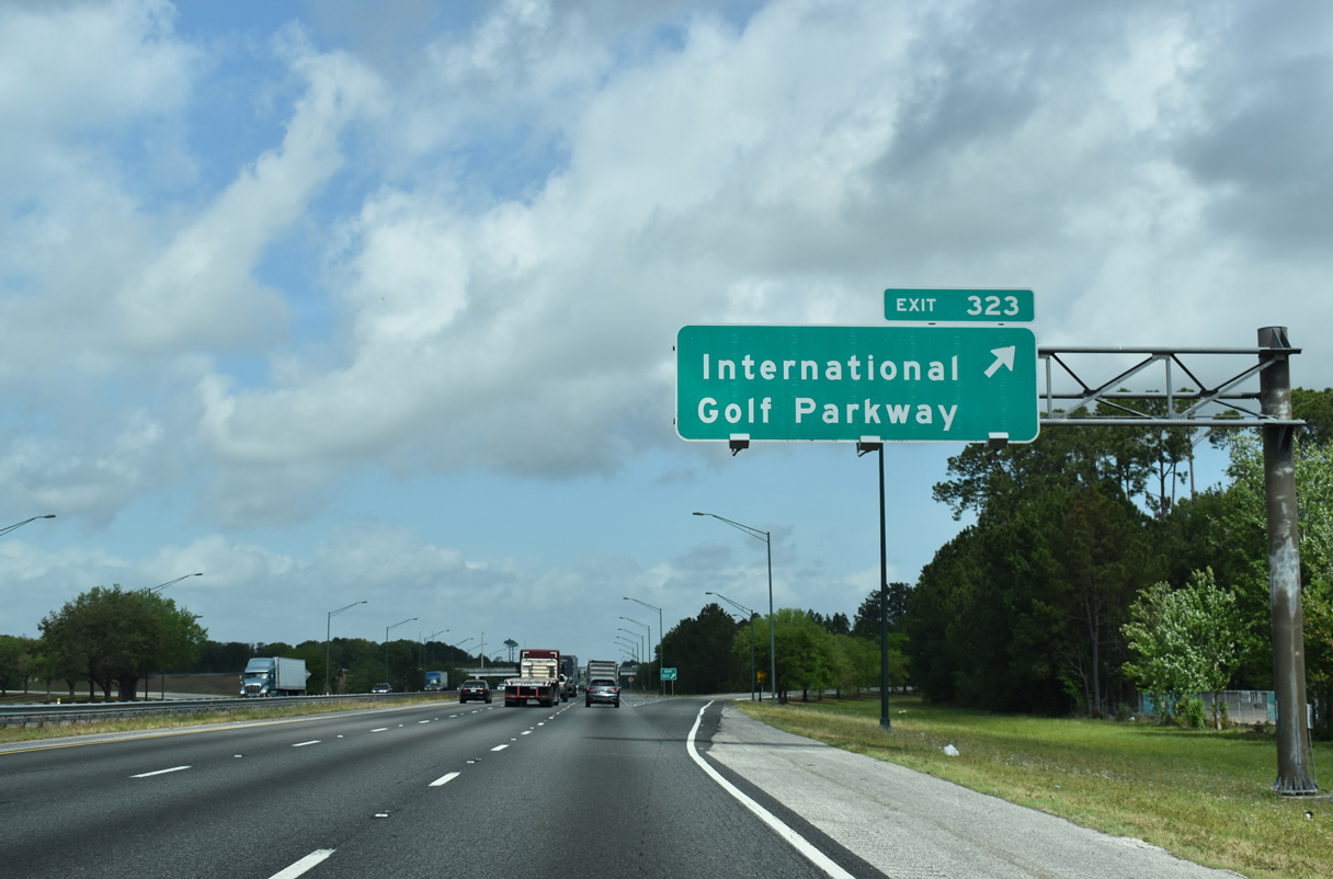
| Interstate 295 is 19 miles to the north of SR 16 while I-95 next meets International Golf Parkway at a parclo interchange (Exit 323) in five miles. 03/26/20 |
|
| International Golf Parkway connects Interstate 95 with World Golf Village, World Golf Hall of Fame, and SR 16 at CR 13A (Pacetti Road) to the west of forthcoming Exit 323. 03/26/20 |
|
| Exit 323 departs Interstate 95 north for International Golf Parkway. International Golf Parkway continues east to U.S. 1 at Palencia. 03/26/20 |
|
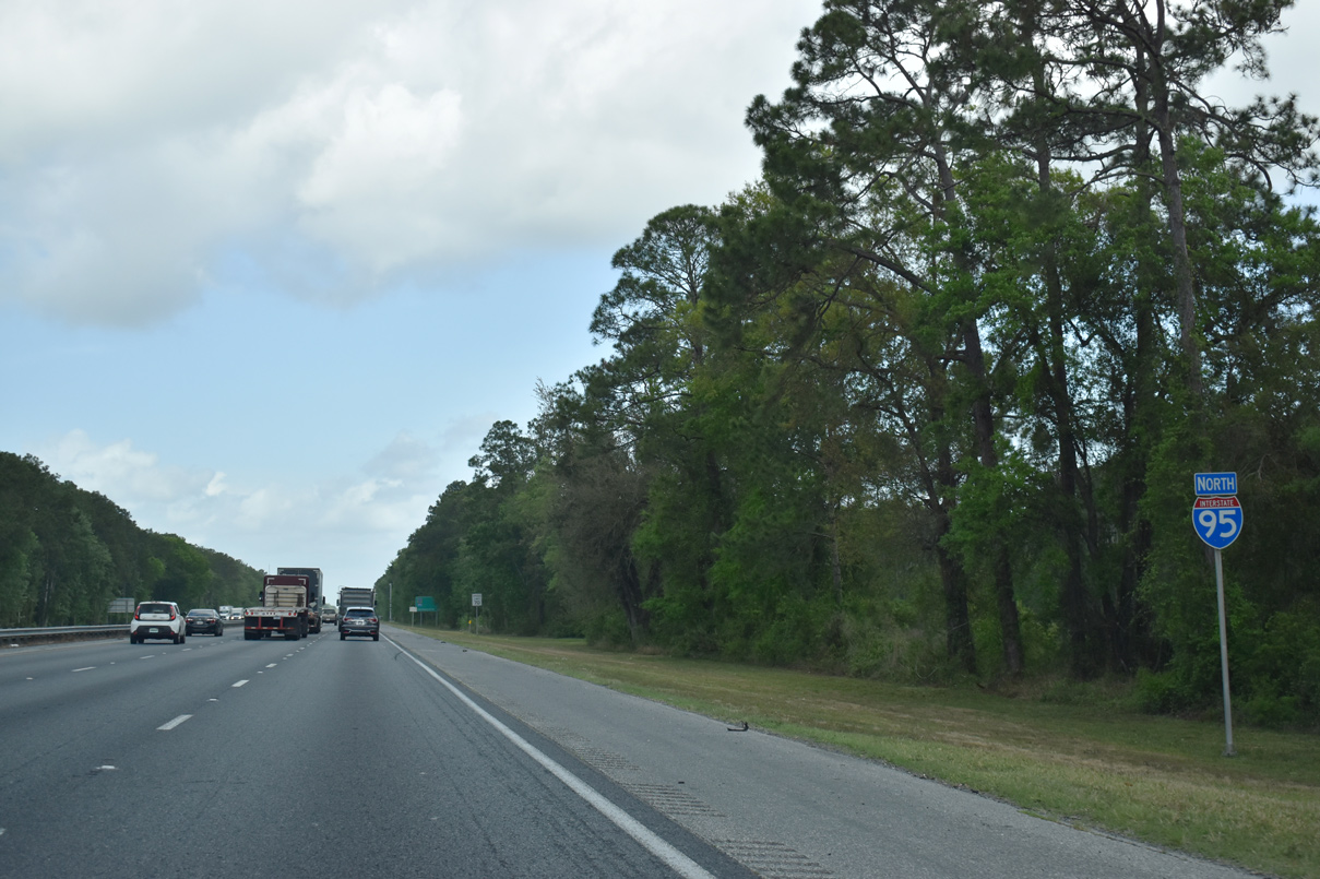
| Interstate 95 straddles western reaches of Twelve Mile Swamp Conservation Area over the next several miles. Big Island Swamp lies to the west. 03/26/20 |
|
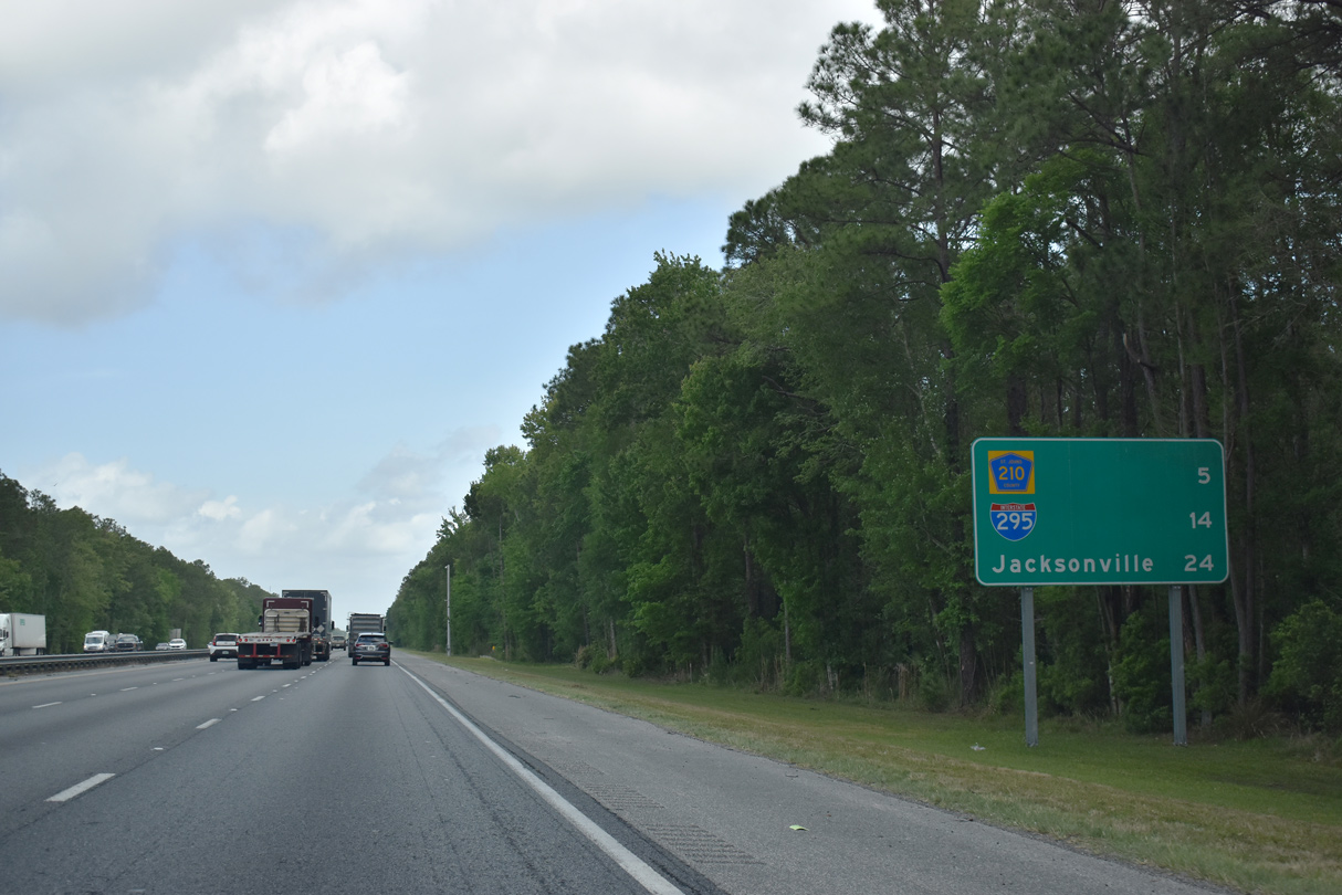
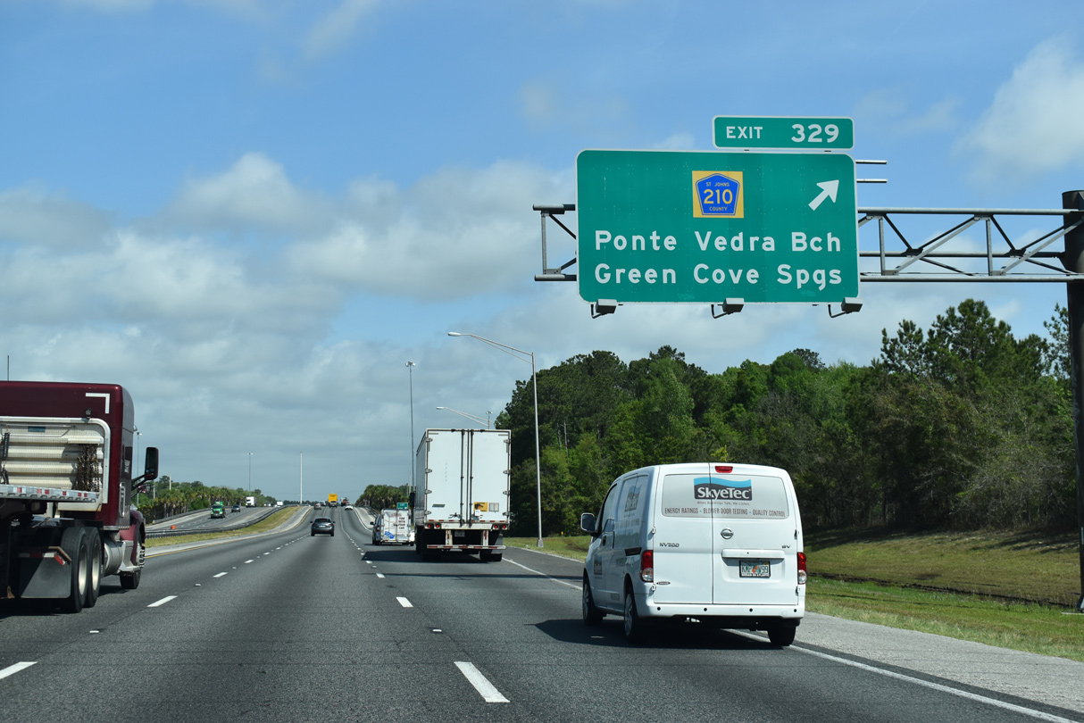
| Continuing north, Interstate 95 next meets the final exit within St. Johns County, CR 210 at Sampson. Downtown Jacksonville is 24 miles to the north. 03/26/20 |
|
| County Road 210 travels west from Exit 329 and Sampson to County Road 16A at Longleaf Pine Parkway near Orangedale. Eastward the rural highway continues to Valley Ridge Boulevard and U.S. 1 at Durbin. 03/26/20 |
|
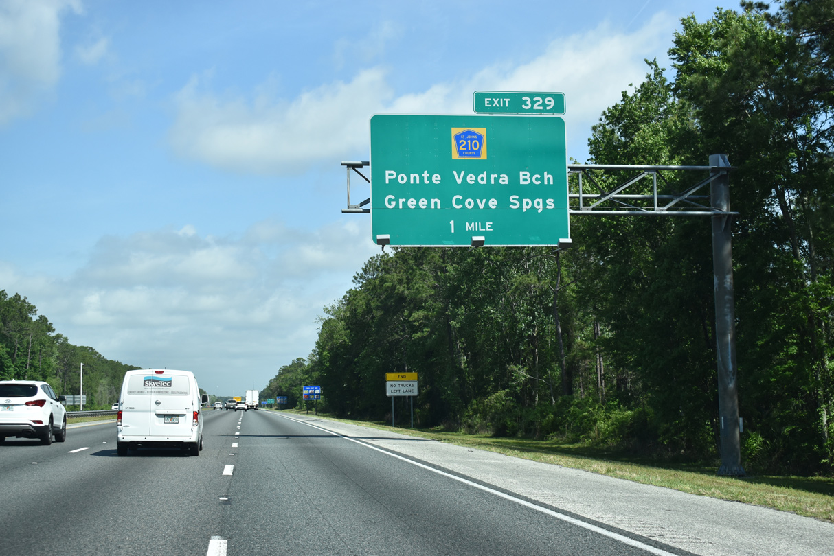
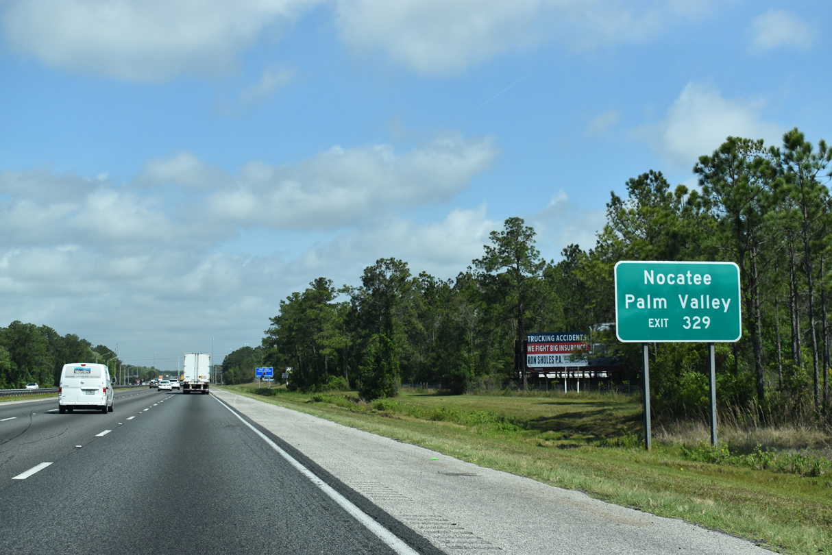
| Beyond U.S. 1, County Road 210 joins Valley Ridge Boulevard through the master planned community of Nocatee. The route bypasses a portion of the town via Nocatee Parkway en route to Palm Valley. 03/26/20 |
|
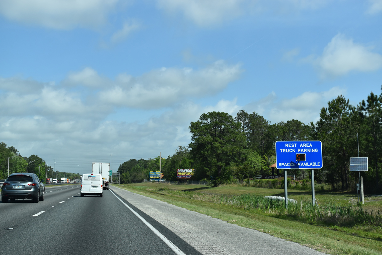
| A rest area truck parking sign precedes the diamond interchange (Exit 329) with County Road 210. 03/26/20 |
|
| County Road 210 meets I-95 southwest of the Crystal Lagoon at Beachwalk development started in 2016 and east of sprawling areas of South Hampton. Nocatee Parkway takes CR 210 northeast to the 2002-opened Tolomato River bridge south of Palm Valley, Ponte Vedra Beach and Jacksonville Beach. 03/26/20 |
|
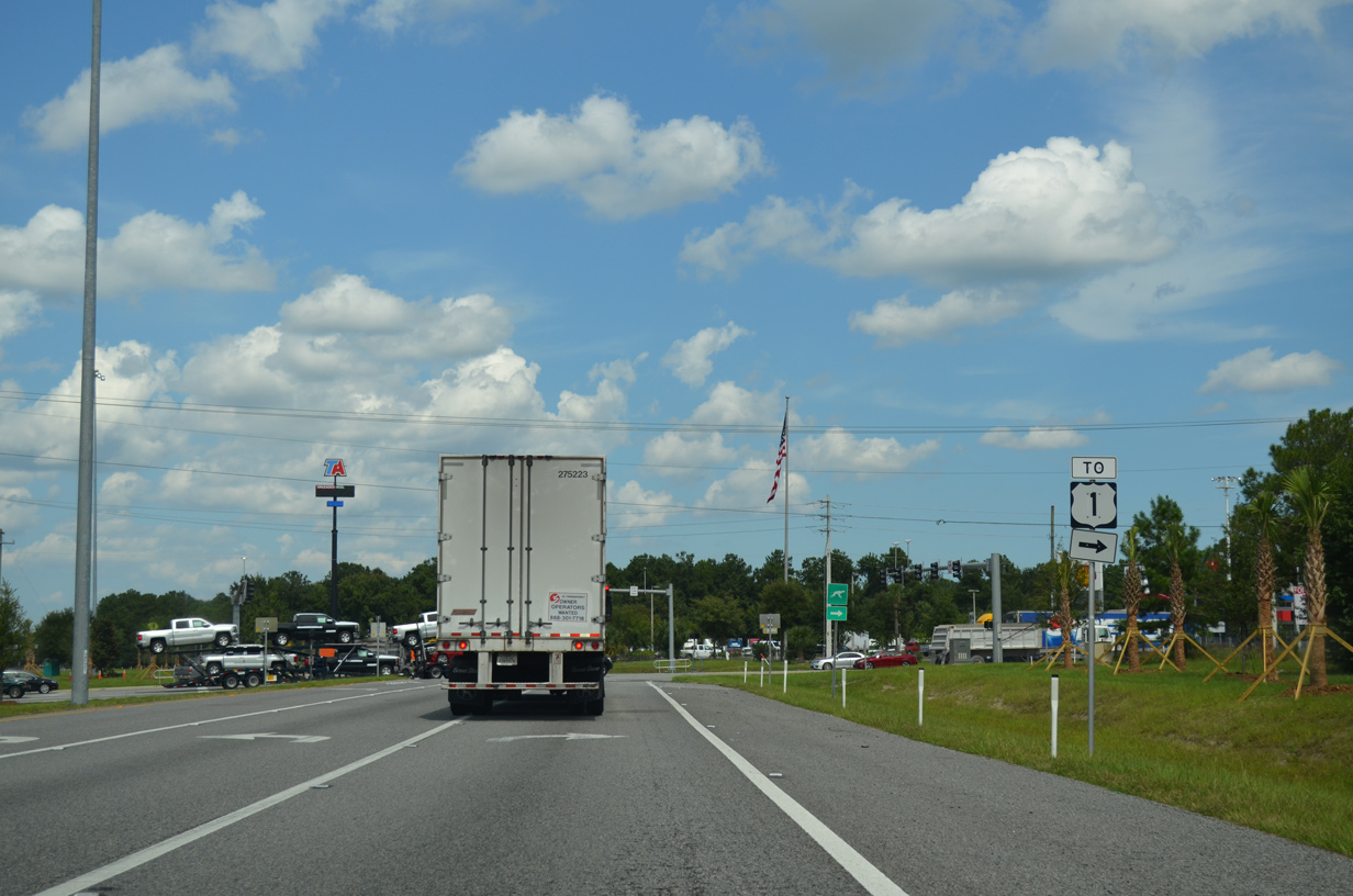
| CR 210 east travels 3.3 miles to U.S. 1. A $9.9 million project added an overpass for Valley Ridge Boulevard, joining the two separate segments of CR 210 west and east of U.S. 1 and the adjacent FEC Railway. The $9.9 million project ran from March 2013 to October 2014.1 09/22/14 |
|
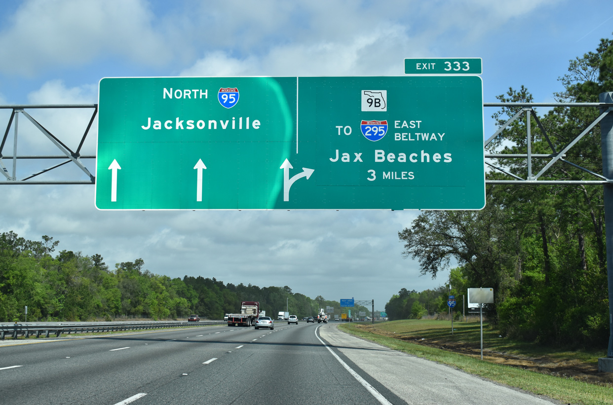
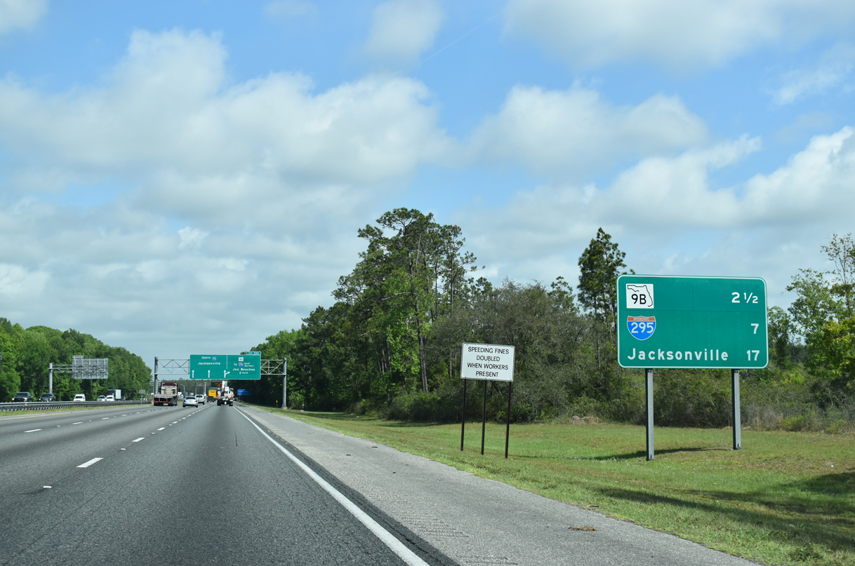
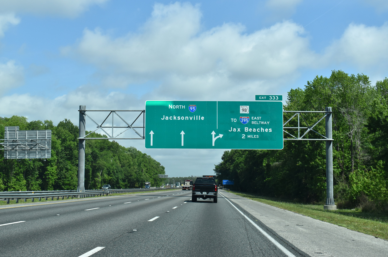
| Advancing north through the outer suburbs of Jacksonville, I-95 north next meets SR 9B in three miles. 03/26/20 |
|
| Paralleling Sampson Creek, Interstate 95 initially traverses an area of wetlands to Durbin Creek. 03/26/20 |
|
| North and southbound rest areas line Interstate 95 south of the Race Track Road overpass. 03/26/20 |
|
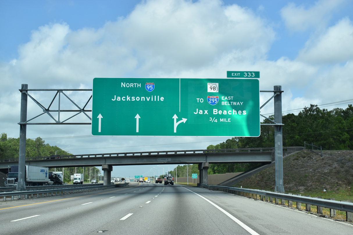
| A directional cloverleaf interchange joins I-95 with SR 9B in 2.5 miles. The freeway provides a cutoff to the East Beltway of Interstate 295 north to the N.B. Broward Bridge and Oceanway. 03/26/20 |
|
| SR 9B opened between U.S. 1 (Philips Highway) and Interstate 295 on September 19, 2013. The second phase of the freeway, linking it with I-95 at Exit 333, was completed on June 13, 2016. 03/26/20 |
|
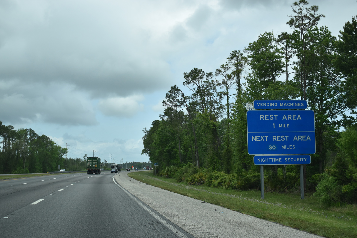
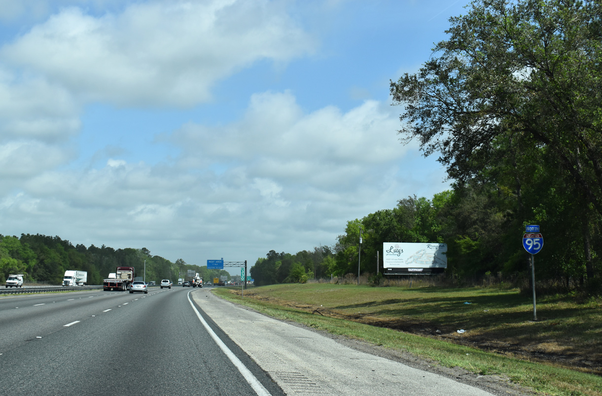
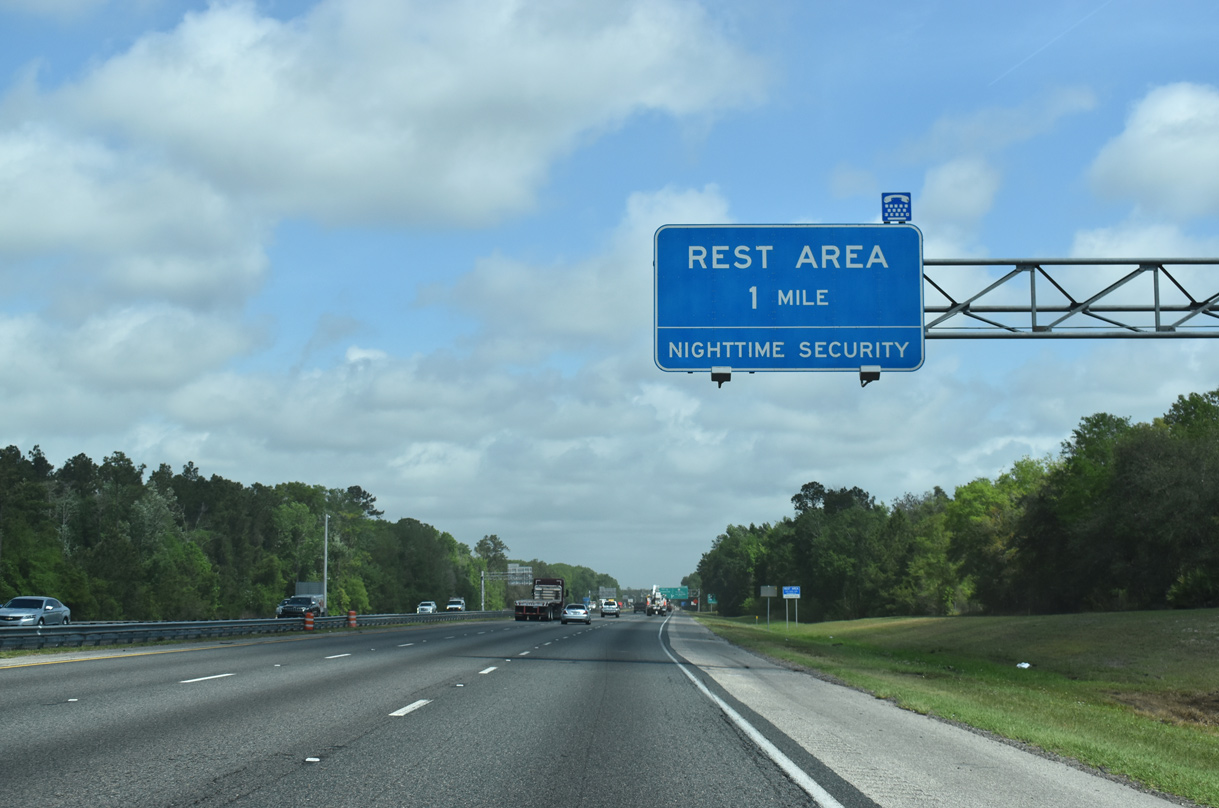
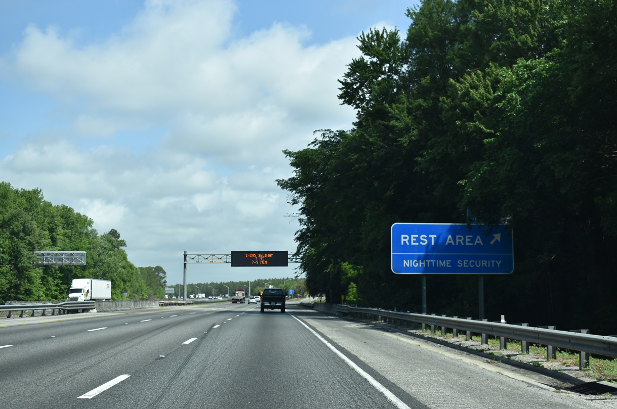
| Interstate 95 reaches its final rest area in Florida. The next facility is the Georgia Welcome Center, 52 miles to the north. 03/26/20 |
|
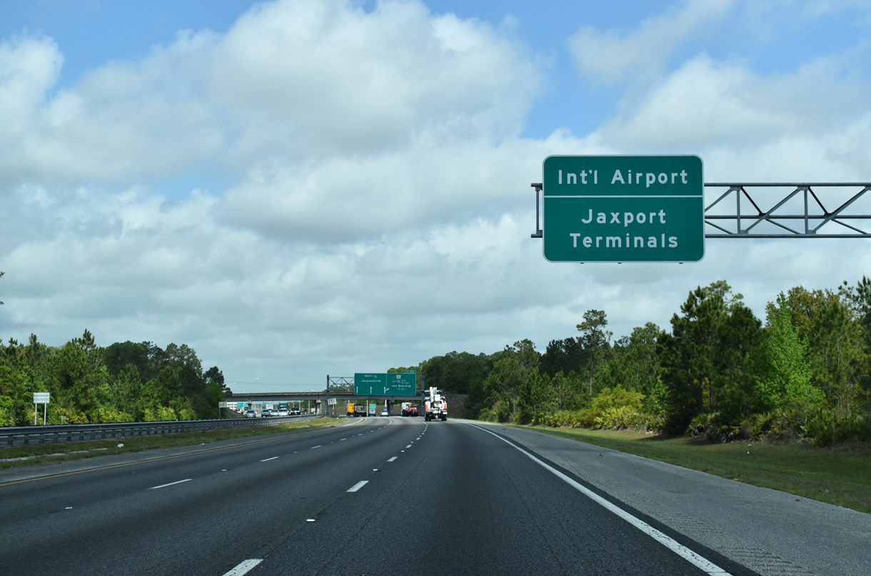
| SR 9B north to Interstate 295 north provides a truck route to the Jaxport Terminals at New Berlin and Blount Island and a bypass to JAX International Airport on the Northside of the city. 03/26/20 |
|
| Extending 2.3 miles south from Exit 333 to County Road 2209 (St. Johns Parkway), Phase 3 of SR 9B opened to traffic between August 9-11, 2018. 03/26/20 |
|
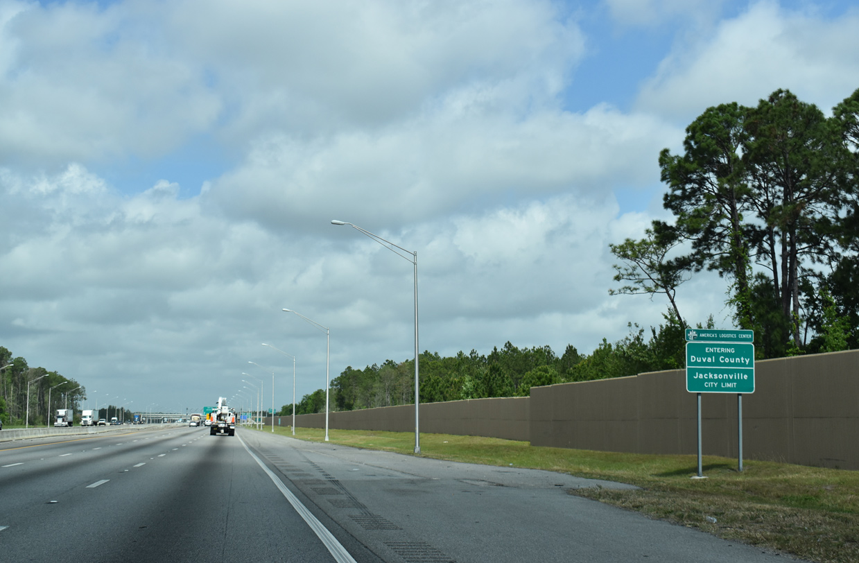
| Entering Jacksonville and Duval County along I-95 north by the Bartram Springs community. The Jacksonville city limits encompass all of Duval County except for Baldwin, Jacksonville Beach, Neptune Beach and Atlantic Beach, 03/26/20 |
Page Updated 03-29-2020.

 North
North