|
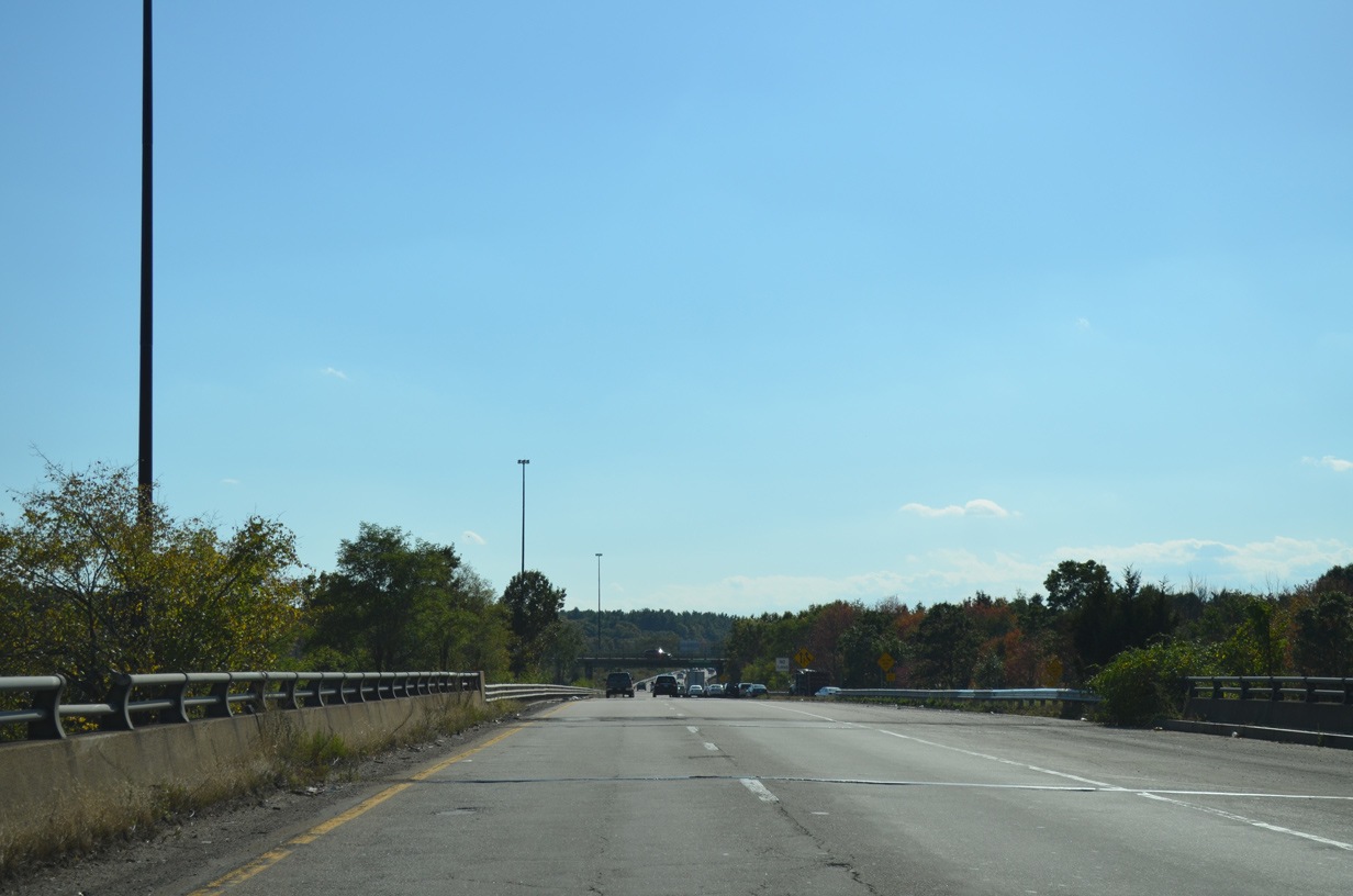
| The off-ramp from I-93 south to I-95 south joins a wide overpass built for the Southwest Expressway above Route 128. The southbound mainline from Interstate 95 enters from the right just ahead. 10/06/14 |
|
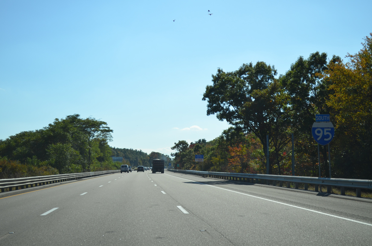
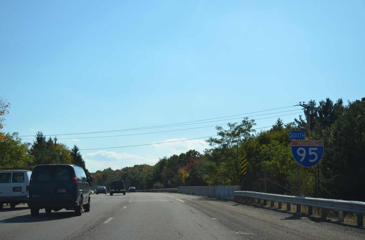
| Three lanes of I-95 south pass by this reassurance marker posted alongside an area of wetlands associated with the adjacent Neponset River. 10/06/14 |
|
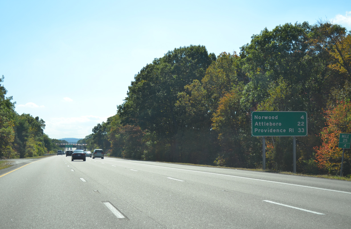
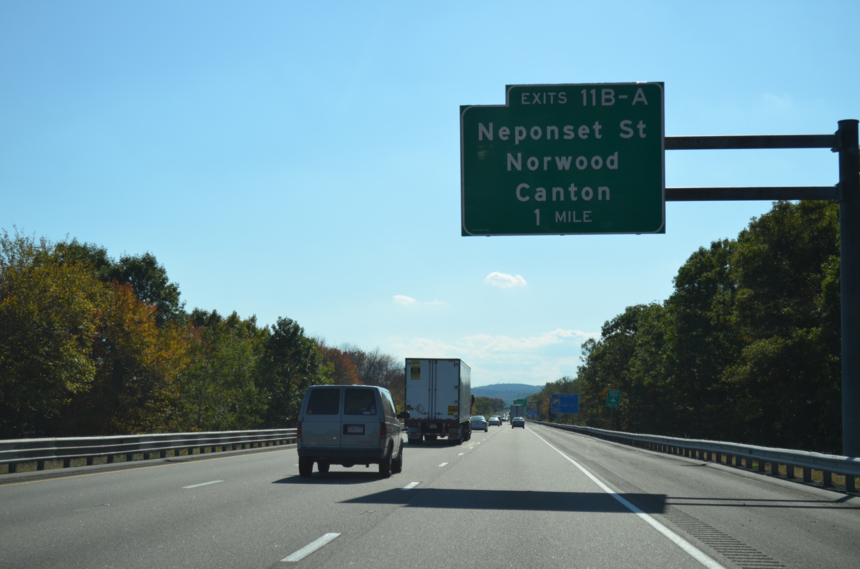
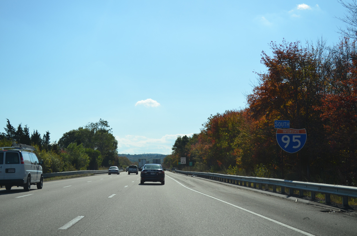
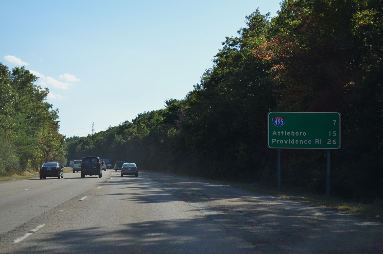
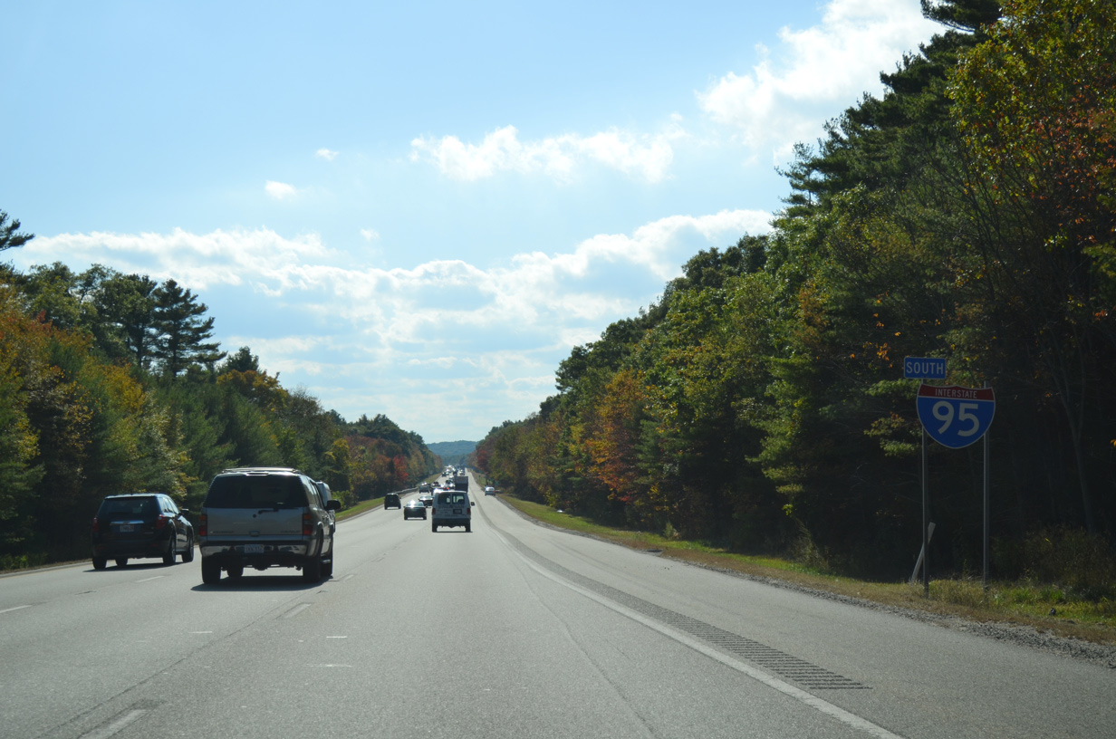
| Interstate 95 straddles eastern reaches of the town of Norwood through the next exit. Attleboro lies 22 miles to the south near the junction with I-295 while Providence is another 11 miles further. 10/06/14 |
|
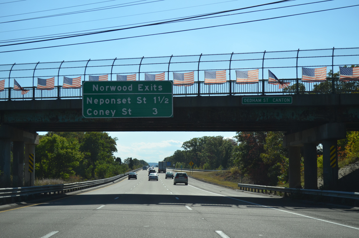
| Dedham Street spans I-295 south, 1.5 miles north of the cloverleaf interchange (Exits 11B/A) with Neponset Street. Coney Street (Exit 10) follows in three miles to the south of Norwood. 10/06/14 |
|
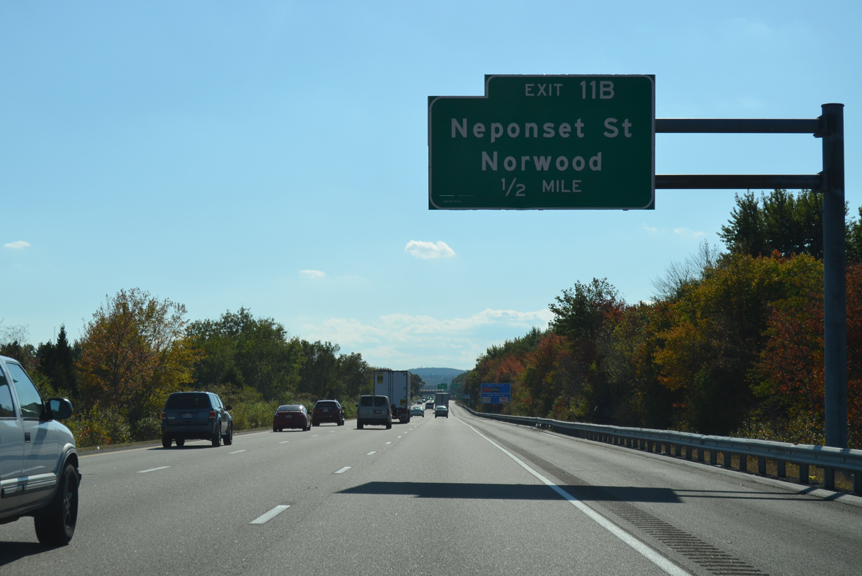
| Neponset Street connects Interstate 95 with Canton to the south at Washington Street. 10/06/14 |
|
| Neponset Street heads north from Exit 11B to Norwood Memorial Airport (OWD) and the Norwood town center. 10/06/14 |
|
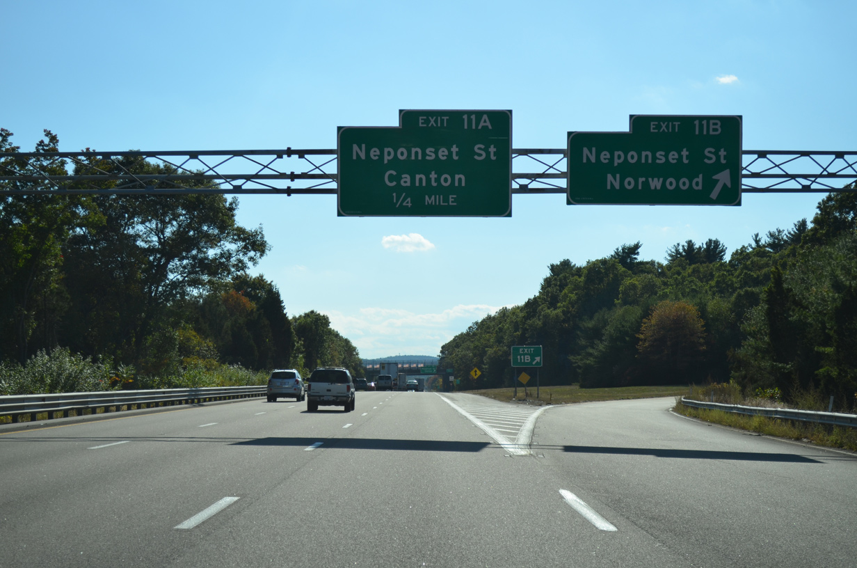
| Interstate 95 south at the off-ramp (Exit 11B) to Neponset Street north. 10/06/14 |
|
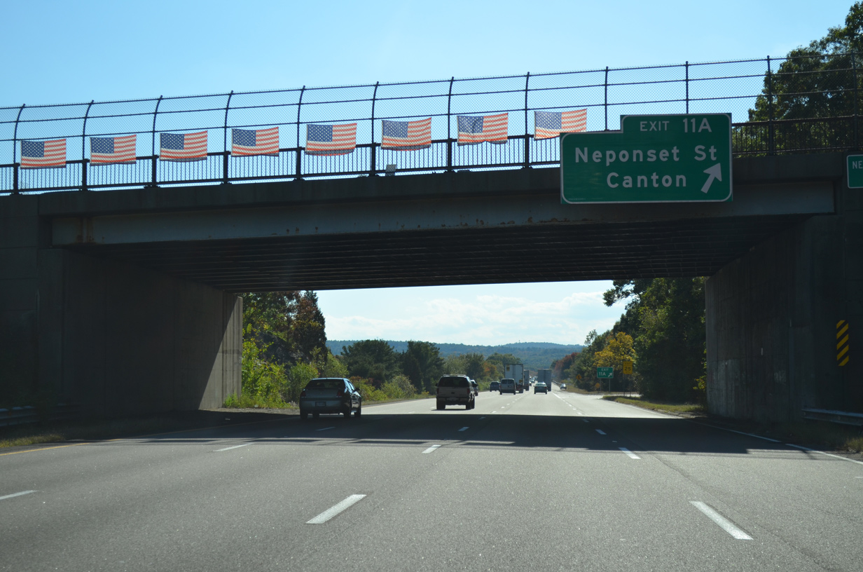
| Exit 11A loops away from I-95 south onto Neponset Street south. Neponset Street traverses Fowl Meadow east to Chapman Street near Canton Junction. 10/06/14 |
|
| Interstate 95 crosses the Neponset River again south of Exit 10. 10/06/14 |
|
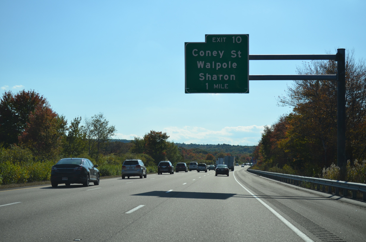
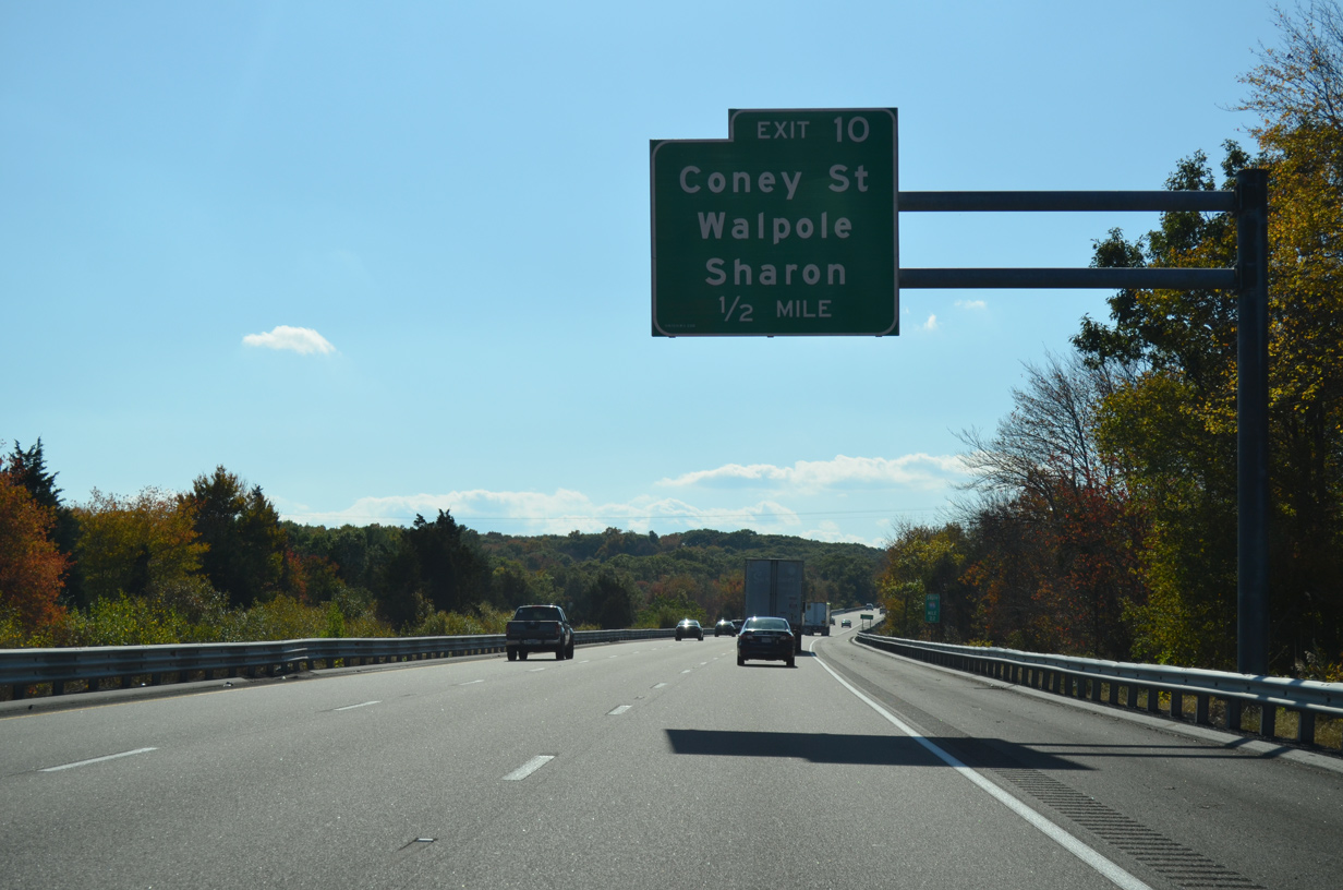
| Curving westward, Interstate 95 plies across more wetland areas ahead of a half diamond interchange (Exit 10) with Coney Street at East Wapole. 10/06/14 |
|
| Coney Street leads north to U.S. 1 and Pleasant Street in the town of Walpole. 10/06/14 |
|
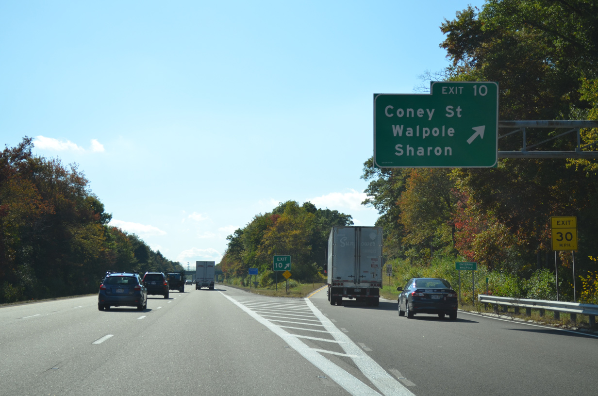
| Just south of Exit 10, Coney Street crosses the Sharon town line and changes to Norwood Street. Norwood Street becomes a part of Route 27 east to the town center. There is no direct access to Route 27 as it follows High Plain Street across I-95. 10/06/14 |
|
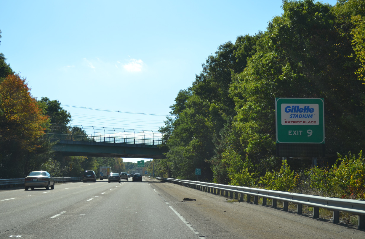
| Interstate 95 and U.S. 1 come together again at Exit 9 in the town of Sharon. 10/06/14 |
|
| Beyond Exit 9, U.S. 1 angles southwest to Gillette Stadium, home of the NFL New England Patriots. 10/06/14 |
|
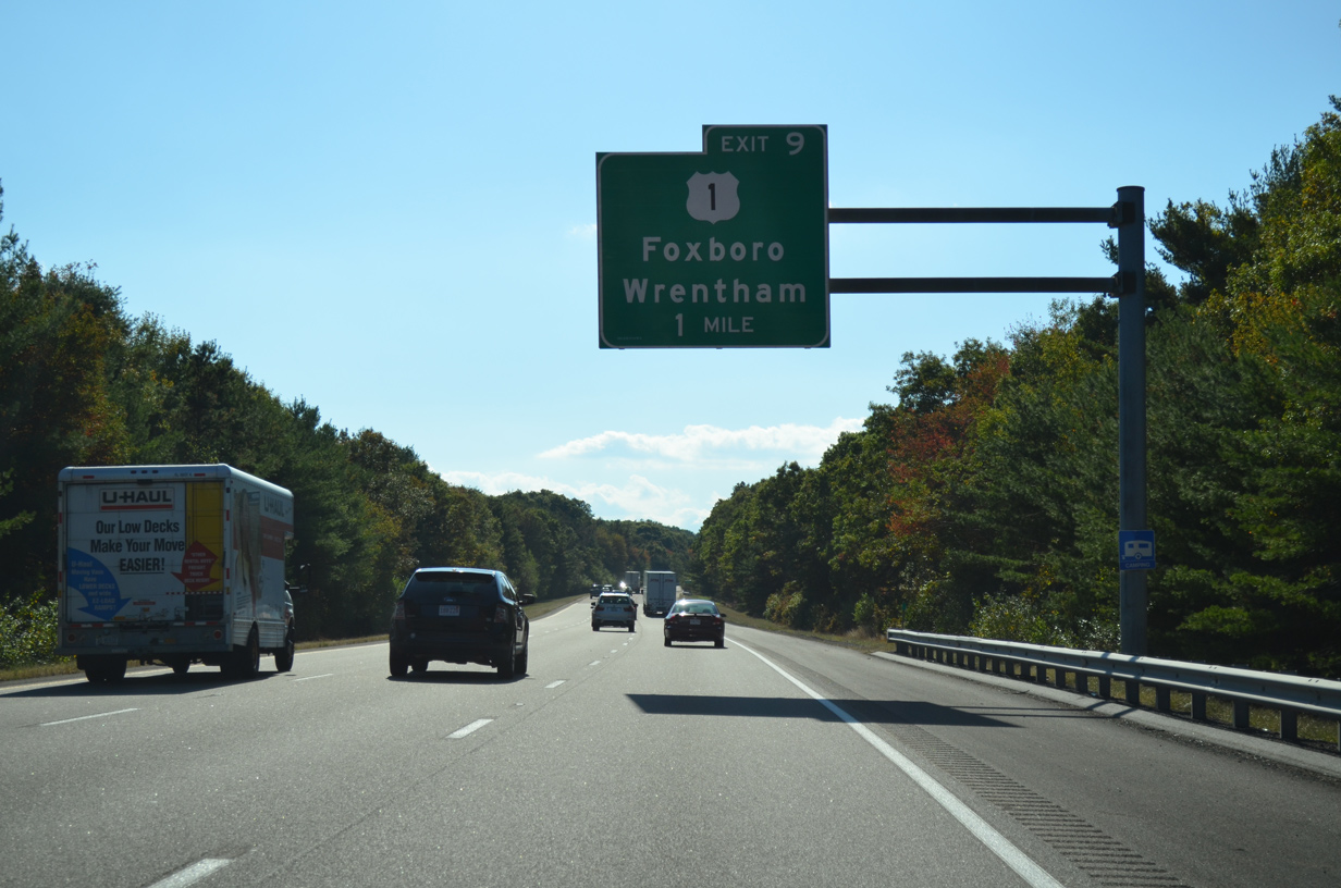
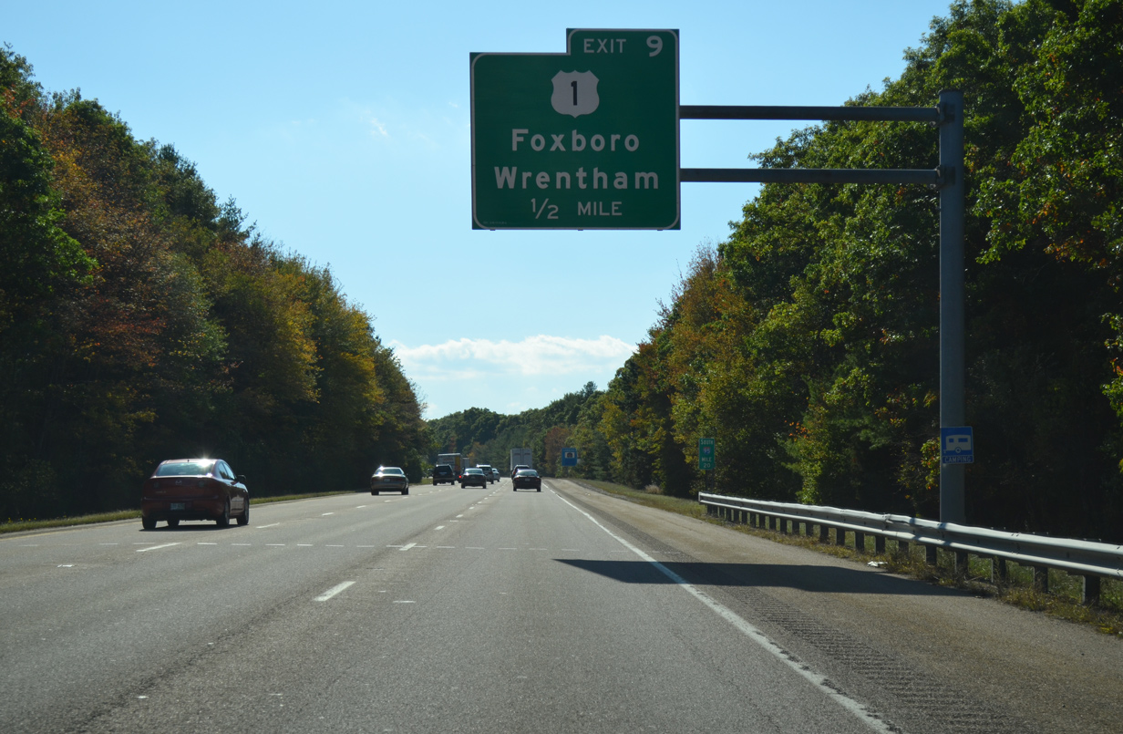
| One half mile north of the split diamond interchange (Exit 9) with U.S. 1 near Moose Hill. U.S. 1 splits into separate roadways at Exit 9 before reconvening to the west of I-95 to south Wapole, west Foxboro and east Wrentham. 10/06/14 |
|
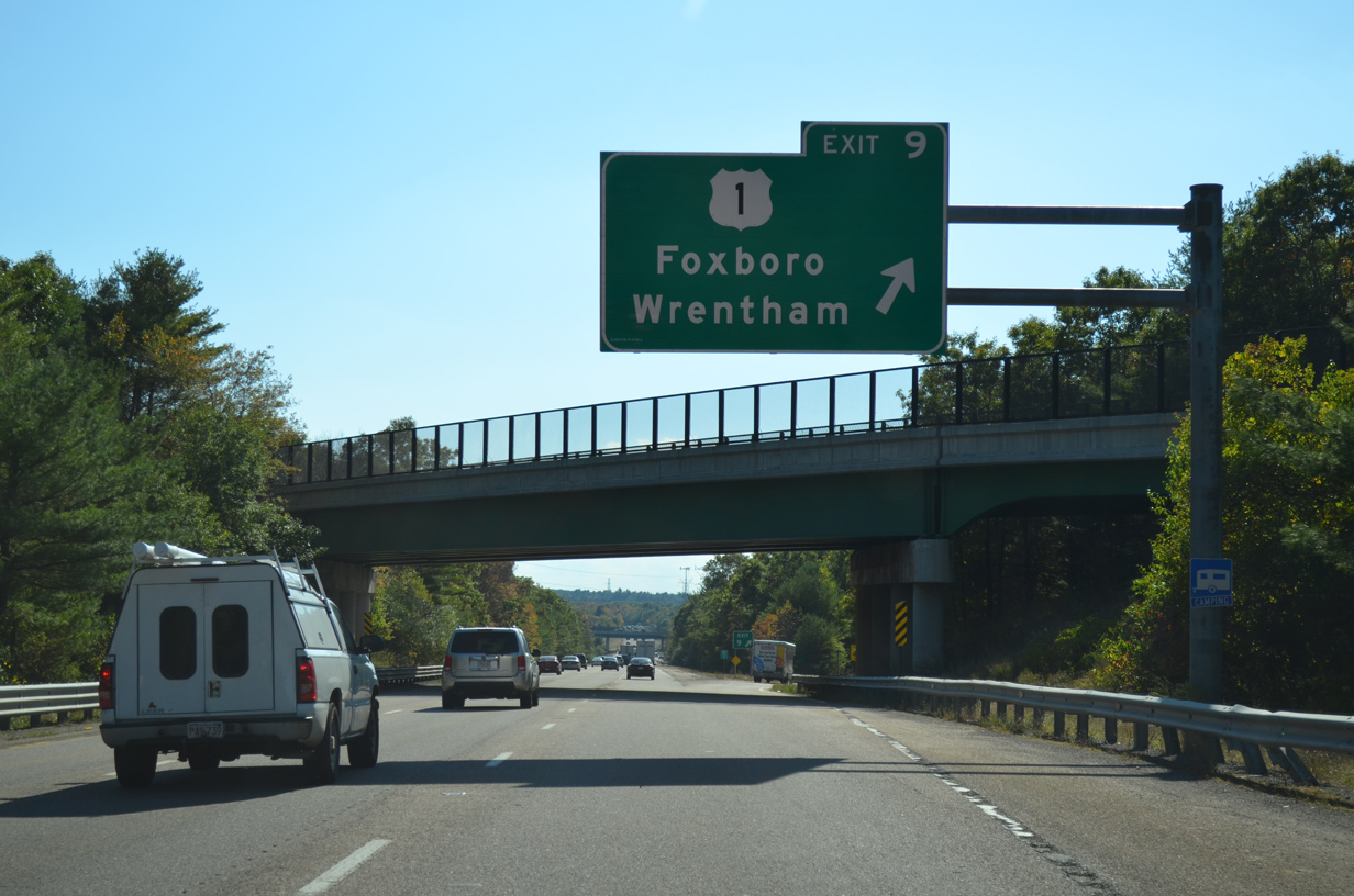
| Exit 9 leaves I-95 south after the U.S. 1 northbound overpass. U.S. 1 and I-95 come together again at Exit 1 by Pawtucket, Rhode Island. 10/06/14 |
|
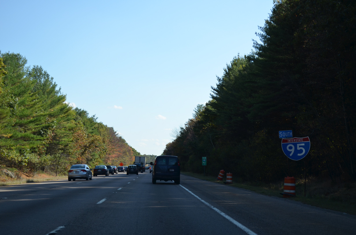
| This reassurance shield assembly for I-95 south stands at the Old Post Road underpass north of Pierce Hill. 10/06/14 |
|
| The exchange with Interstate 495 is in seven miles, with Attleboro just 15 minutes away. 10/06/14 |
|
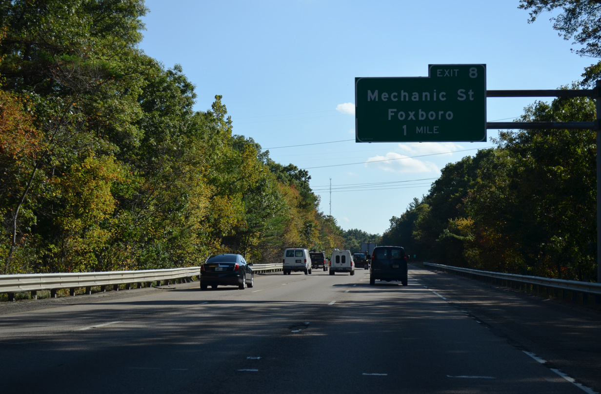
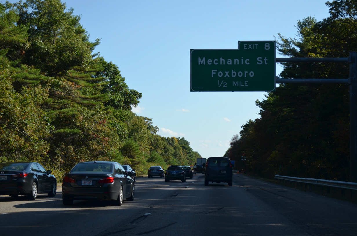
| Interstate 95 south advances to the parclo A2 interchange (Exit 8) with Mechanic Street. 10/06/14 |
|
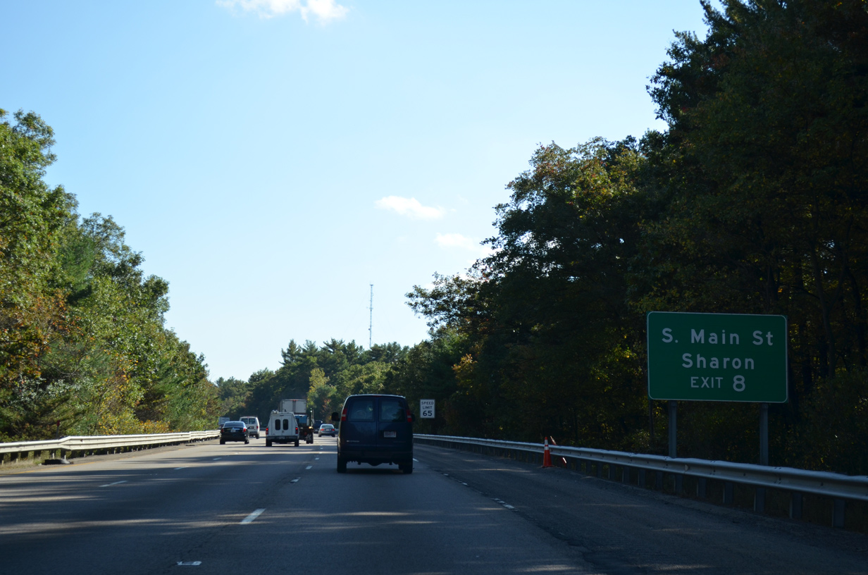
| Mechanic Street in Foxboro becomes South Main Street through Sharon east from forthcoming Exit 8. 10/06/14 |
|
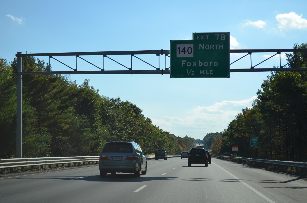
| Mechanic Street angles southwest from I-95 to Neponset Reservoir and the Foxboro town center at Route 140. 10/06/14 |
|
| Interstate 95 south abuts the east slopes of Dudley Hill at this reassurance marker. 10/06/14 |
|
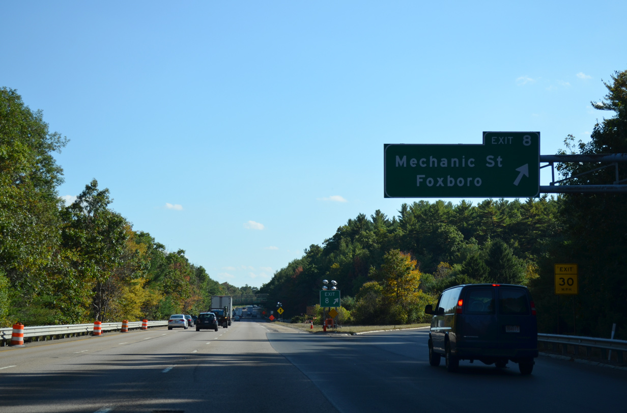
| Exit 8 parts ways with I-95 south for Mechanic Street south and Main Street east on the Foxboro / Sharon town line. 10/06/14 |
|
| Southbound motorists formally enter the town of Foxboro after Exit 8. 10/06/14 |
|
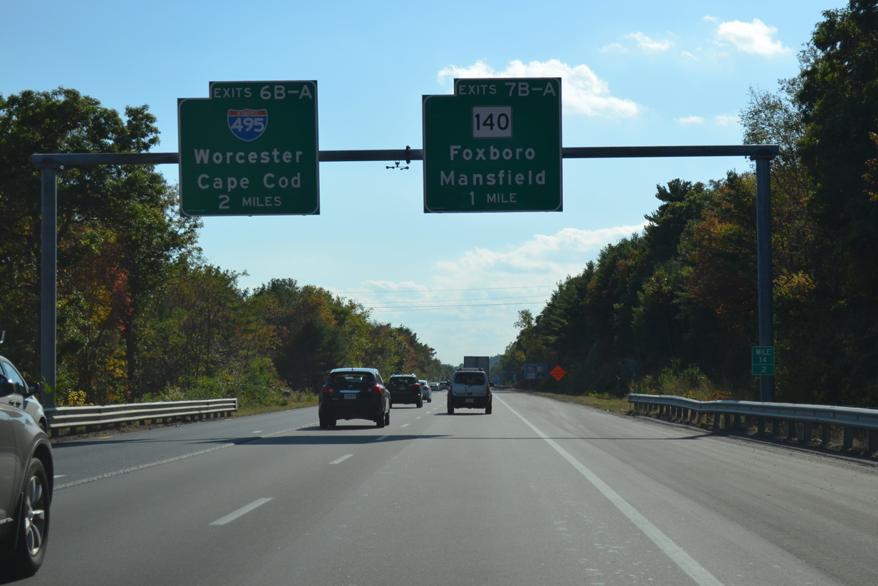
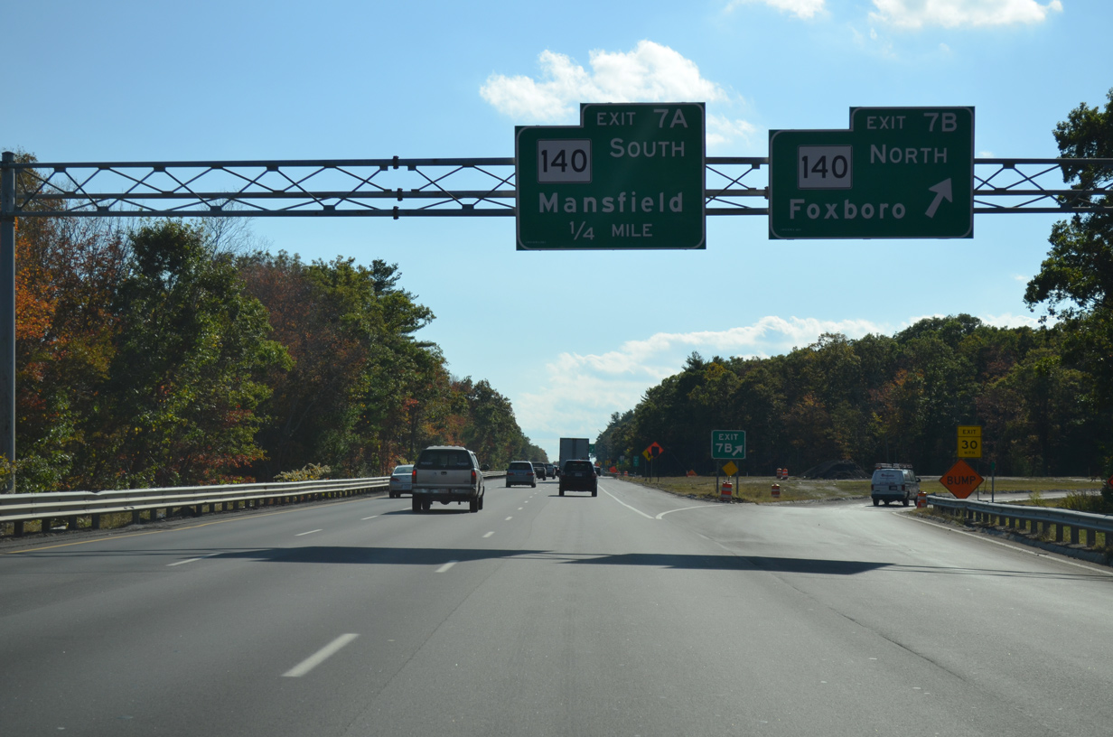
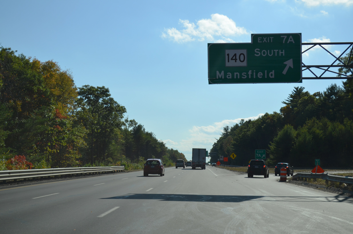
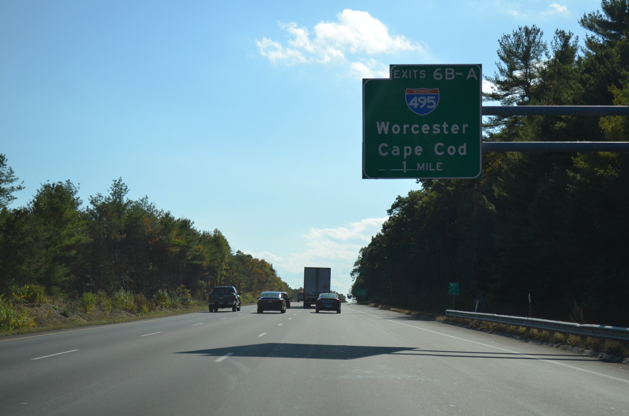
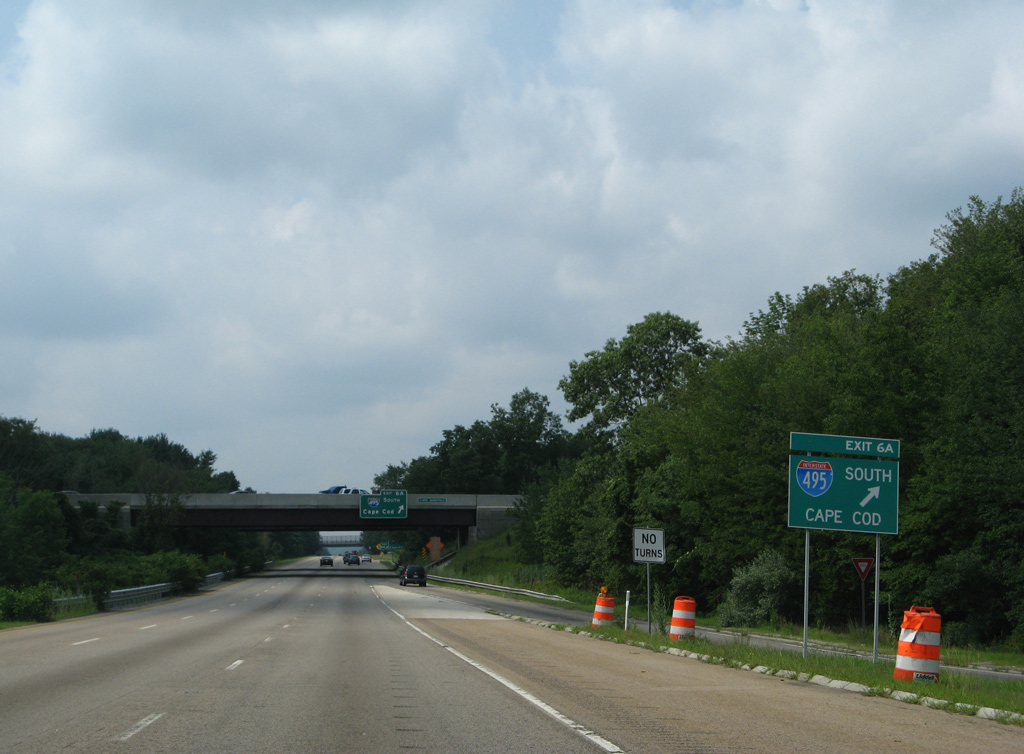
| One mile north of the cloverleaf interchange (Exits 7B/A) with Route 140 (Commercial Street) on I-95 south by Foolish Hill. A second cloverleaf interchange (Exits 6B/A) follows with Interstate 495. 10/06/14 |
|
| Route 107 constitutes a 107.86 mile route from U.S. 6 in Bedford to Route 12 in the town of Winchendon. Locally the route follows Commercial Street north to Central Street into Downtown Foxboro. 10/06/14 |
|
| Southbound at Exit 7B for Route 107 (Commercial Street) north. The state route expands into a divided four lane highway south from Exit 7A by a large industrial park area to Interstate 495 (Exit 12). 10/06/14 |
|
| Route 140 travels through western reaches of Mansfield, with Route 106 (Chauncy Street) providing a direct route to the town center. Route 106 passes below I-95 ahead of forthcoming I-495. 10/06/14 |
|
| Interstate 495 travels a 120.95 mile long circuitous route well outside of Boston between Haverhill, Lowell, Westborough and Mansfield. 10/06/14 |
|
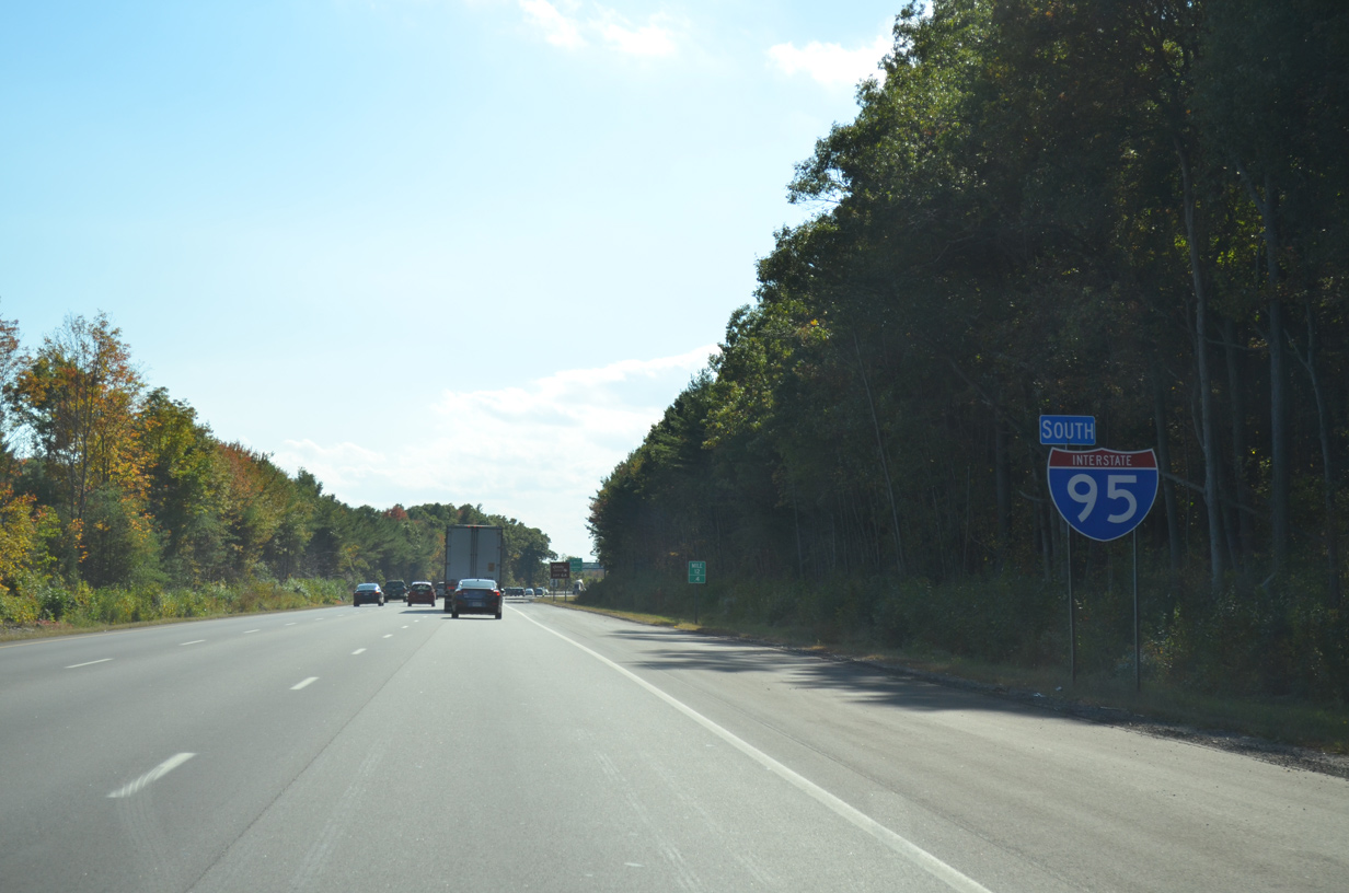
| Interstate 95 southbound at milepost 12.4. 10/06/14 |
|
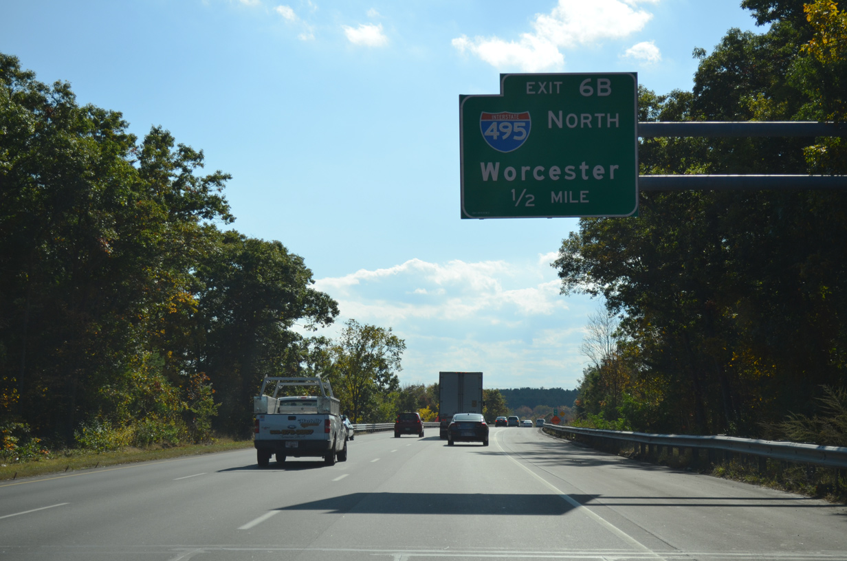
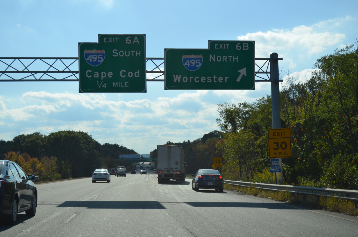
| One half mile from Exit 6B onto I-495 north. Worcester is the control city for I-495 at both junctions with I-95. 10/06/14 |
|
| Interstate 495 began at Exit 6 until 1975, when the designation was applied to the 1982-completed Route 25 freeway leading south to Wareham. The portion north from Foxboro to Westborough, including the junction with I-90 (Mass Pike), was completed in 1969. 10/06/14 |
|
| A temporary style guide sign for Exit 6A was posted at the on-ramp from I-495 north. It was removed after 2009. 07/29/07 |
|
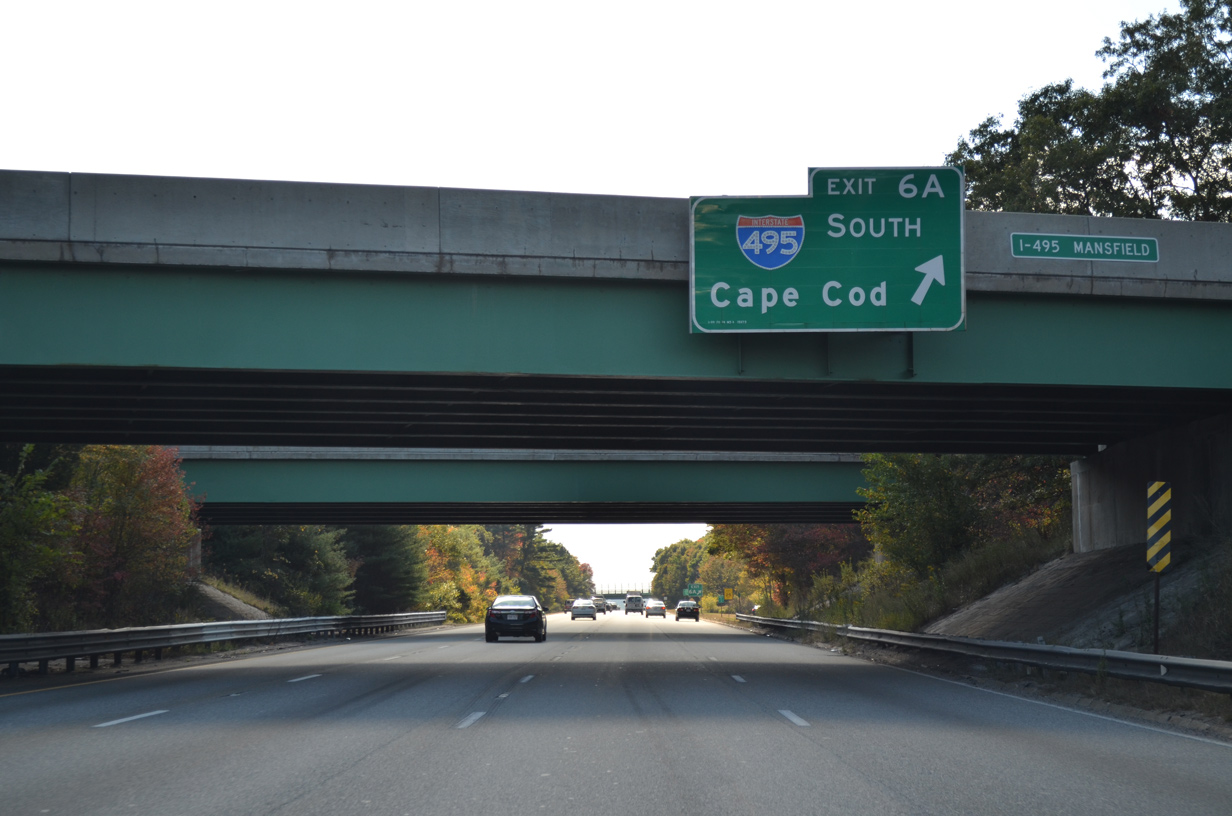
| I-495 angles southeast from Exit 6 A toward Taunton and Cape Cod. The beltway ends at Route 25, eight miles west of U.S. 6 at Buzzards Bay.
Long distance travelers to the resort areas of Cape Cod and Chatham are directed on I-495 south to Route 25 and U.S. 6 east, most of which are freeways. Chatham lies 83 miles east of I-95 here. I-495 connections with Route 24 serves interests south to Fall River and New Bedford as well. 10/06/14 |
|
| A ground level sign accompanied the Exit 6A gore point until 2011 when it was removed. I-495 merges with Route 140 between the next two exits in Mansfield. 07/29/07 |
|
| The Bristol County and Mansfield town lines cut across Interstate 95 at the cloverleaf interchange with I-495. 10/06/14 |
|
| Interstate 95 maintains six overall lanes through the western corner of Mansfield at the Wading River. 10/06/14 |
|
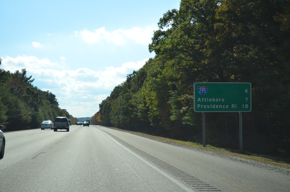
| Six miles south of I-495 is the north end of Interstate 295 (Exit 5) outside Attleboro while Providence is 18 miles away. 10/06/14 |
|
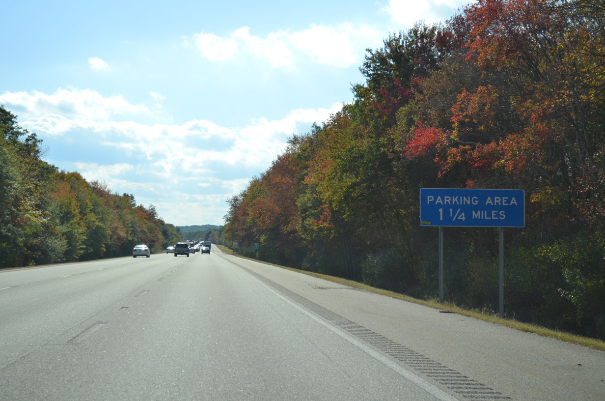
| Interstate 95 traverses a forested area by Witch Pond Swamp ahead of the North Attleborough town line and a south side parking area. 10/06/14 |
|
| Turning more south, I-95 passes west of Greenwood Lake to reach the parking area in North Attleborough. 10/06/14 |
|
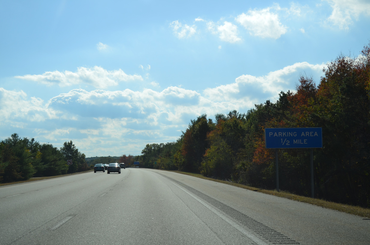
| This sign posted at the Plain Street underpass references the upcoming parking area as a rest area, despite the lack of restroom facilities. 10/06/14 |
|
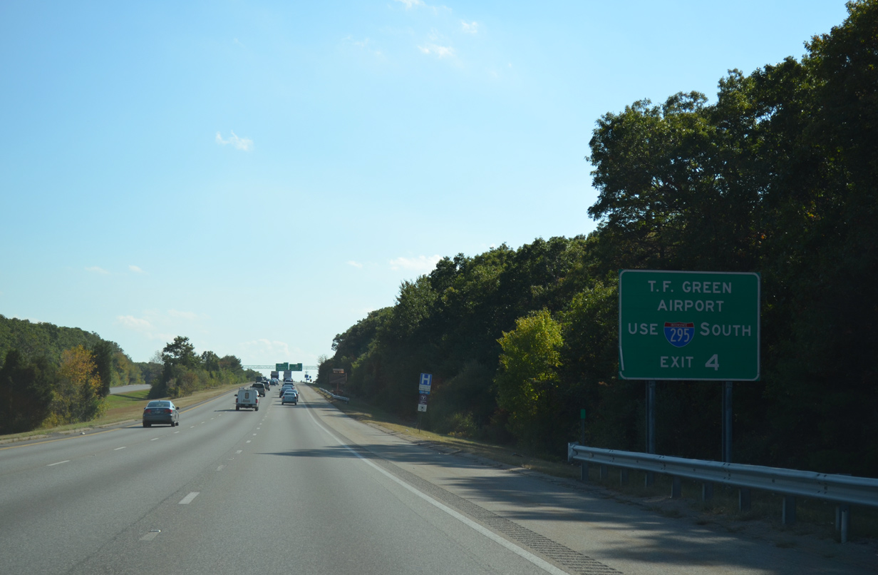
| Two miles north of Exit 4 with Interstate 295 south on I-95 south. I-295 constitutes a western bypass of the Providence and Pawtucket urban centers of Rhode Island. 10/06/14 |
|
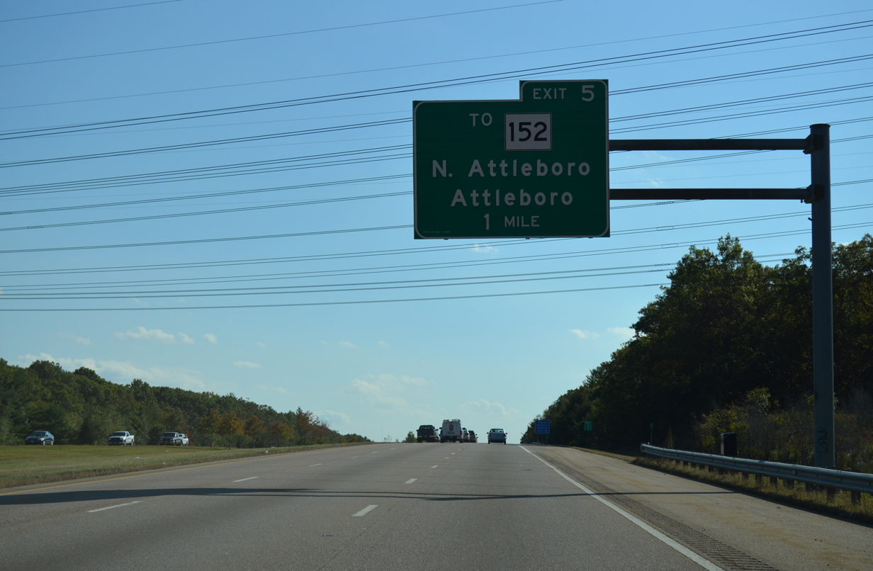
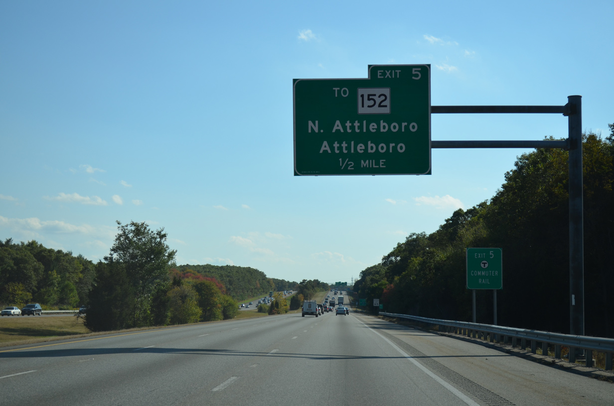
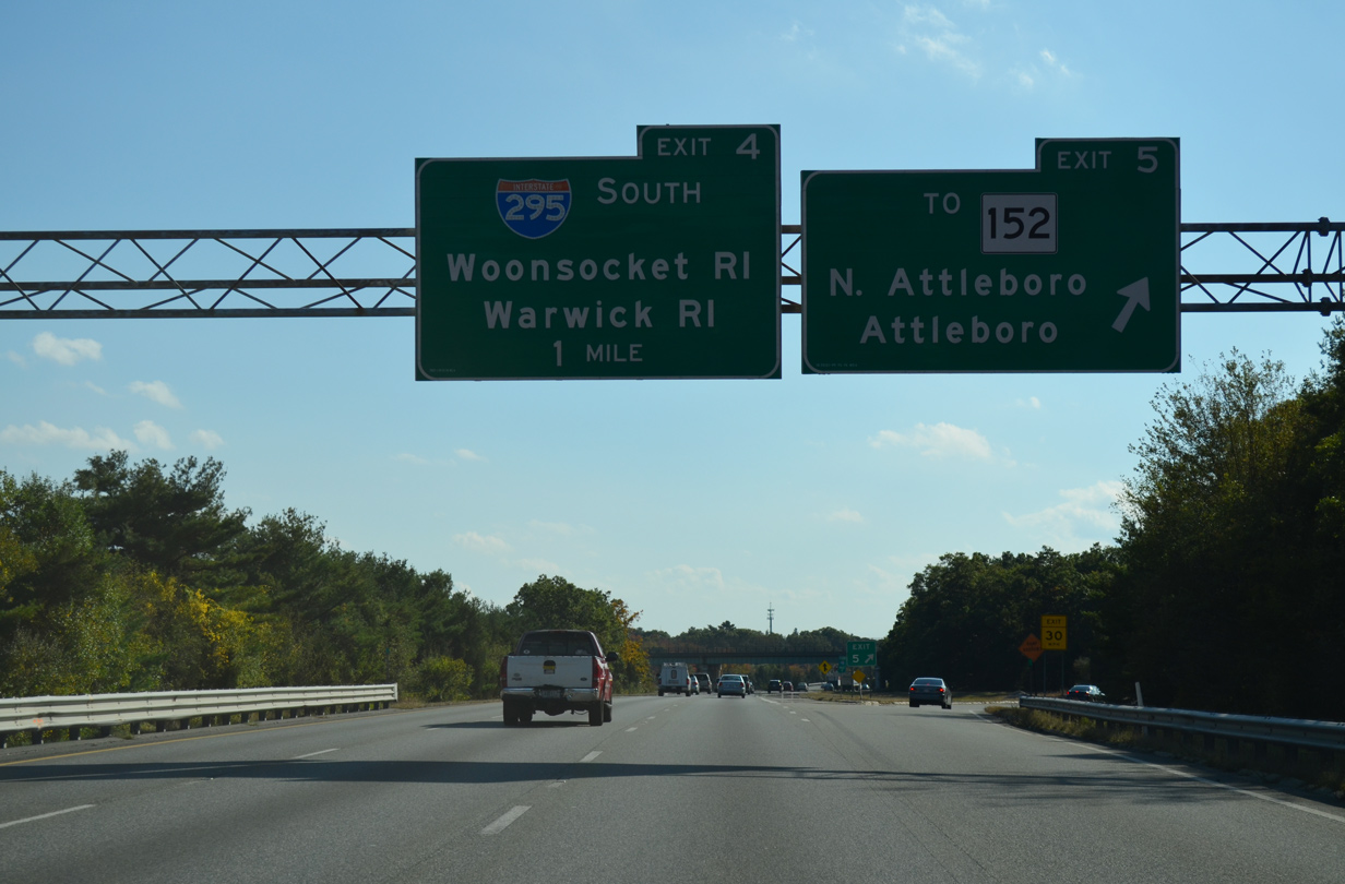
| Exit 5 precedes the I-95 junction with I-295 at Robert F. Toner Boulevard on the North Attleborough and Attleboro town line. Route 152 travels along North Main Street parallel to the freeway southward to the Attleboro town center. Robert F. Toner Boulevard connects the state route and freeway. 10/06/14 |
|
| Route 152 winds southward from U.S. 1 and Shephardville onto Kelley Boulevard through North Attleborough. The state route passes over I-95 near this southbound reassurance marker. 10/06/14 |
|
| One half mile north of the folded diamond interchange (Exit 5) with Robert F. Toner Boulevard on I-95 south. Robert F. Toner Boulevard travels west from Route 152 (North Main Street) to become Commonwealth Boulevard at Attleborough Falls en route to Elm Street and the North Attleborough town center. 10/06/14 |
|
| Travelers bound for T.F. Green Airport (PDV) in Warwick, Rhode Island are directed onto Interstate 295 south to RI 37 east to bypass Providence. RI 37 was initially planned as part of Interstate 895, an east beltway of the Rhode Island capital city. 10/06/14 |
|
| Exit 5 leaves Interstate 95 south for Robert F. Toner Boulevard to Route 152 (North Main Street). Route 152 continues south to Downtown Attleboro and Route 123. The 14.89 mile state route meanders from there to Lebanon Mills in Seekonk. 10/06/14 |
|
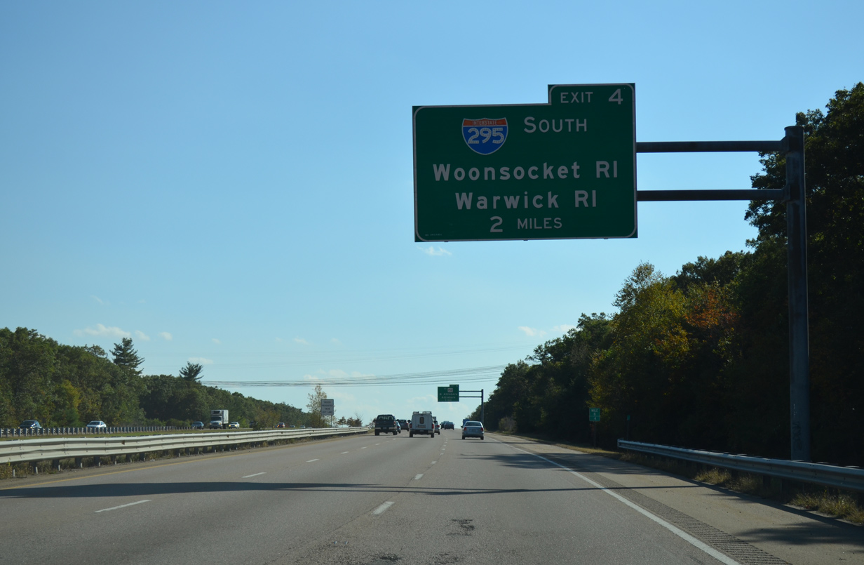
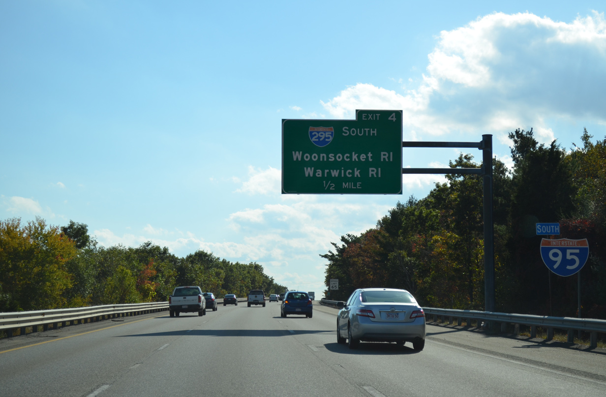
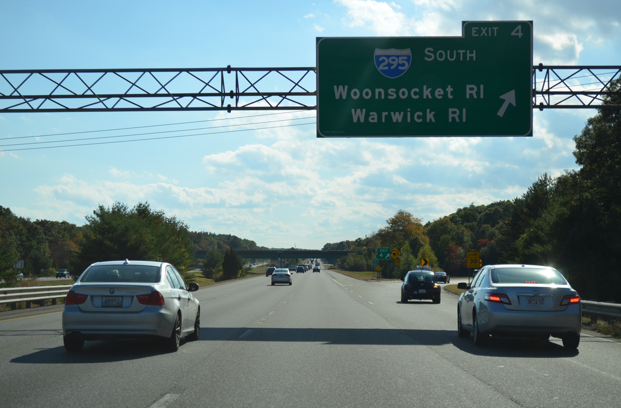
| One half mile ahead of the half cloverleaf interchange (Exit 4) with Interstate 295 south on I-95 south. I-295 ventures west toward Cumberland and Woonsocket, Rhode Island and south to Cranston and Warwick for its return to I-95. 10/06/14 |
|
| I-295 meets U.S. 1 (Washington Street) two miles to the west near Old Town. The beltway travels 26.58 miles back to I-95 south of Cranston and T.F. Green Airport (PVD). The interchange between the two freeways here includes provisions for unconstructed I-895, the planned east bypass of Providence through Seekonk and Barrington, Rhode Island. 10/06/14 |
|
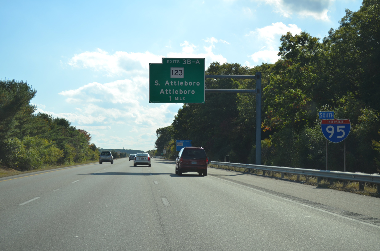
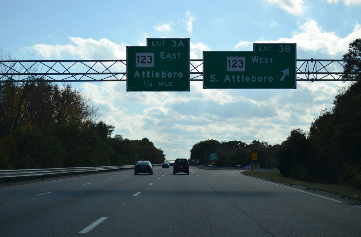
| Interstate 95 runs south along Manchester Pond to next meet Route 123 at a three quarter cloverleaf interchange (Exits 3B/A). 10/06/14 |
|
| Route 123 (South Avenue), a 41.91 mile route from Route 3A at Scituate, leads west from Exit 3B to U.S. 1 near the community of South Attleborough. 10/06/14 |
|
| Exit 3B departs I-95 south for MSR 123 (South Avenue) west through Valley Falls, Rhode Island. 10/06/14 |
|
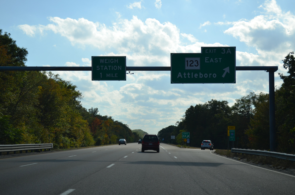
| East from Exit 3A, Route 123 (South Avenue) takes County Street northeast to the Attleboro town center. 10/06/14 |
|
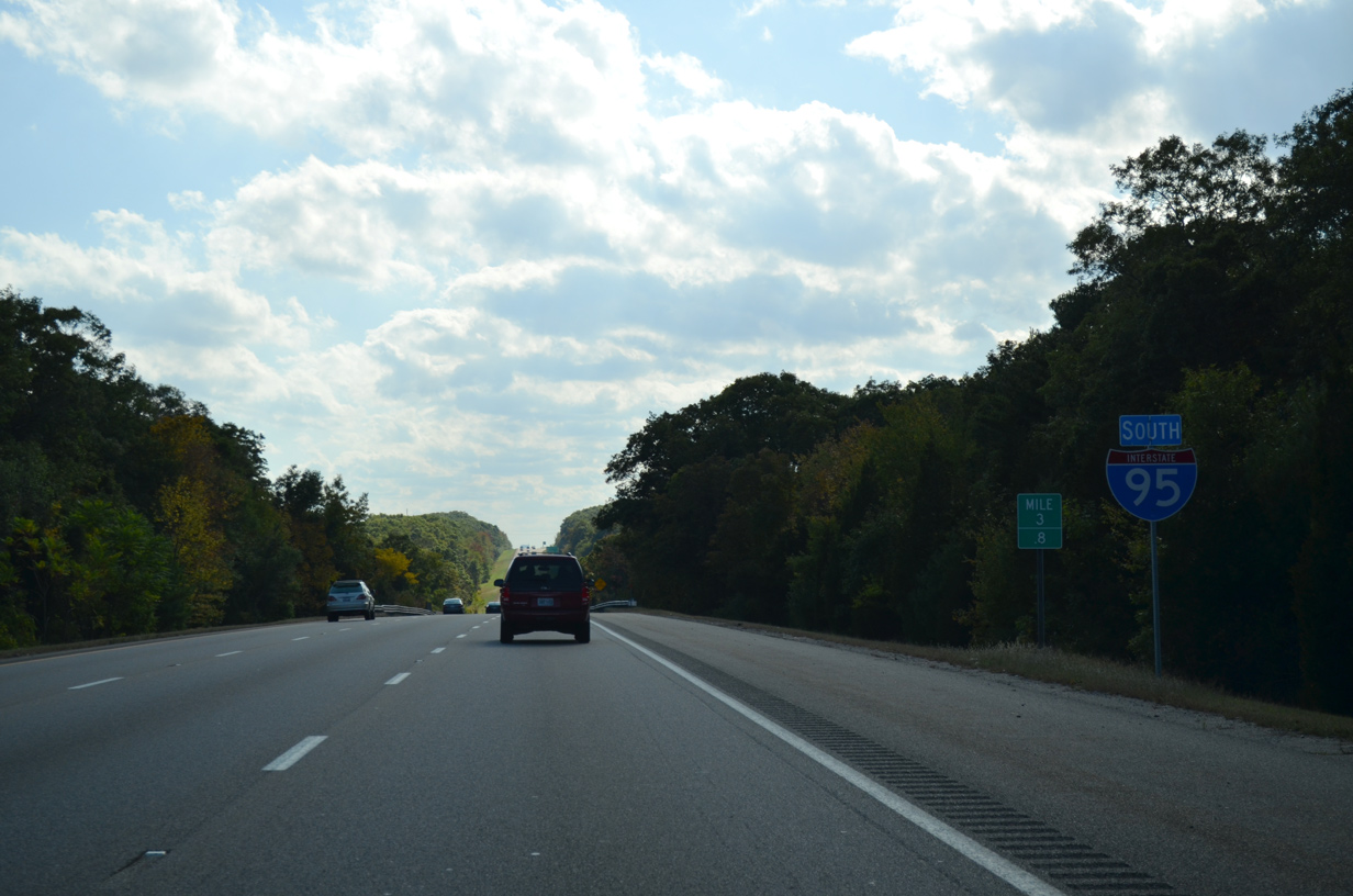
| Interstate 95 passes between Orrs Pond to the west and Ides Hill to the east just south of Exit 3. 10/06/14 |
|
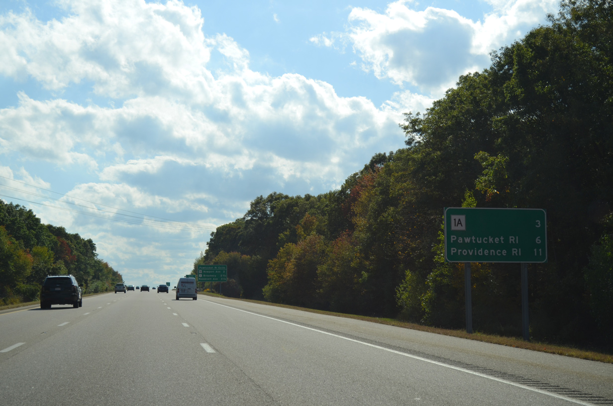
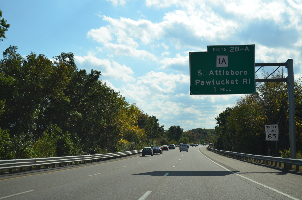
| Route 1A (Newport Avenue) crosses paths with Interstate 95 in three miles at Exits 2B/A. The state route leads south into east Pawtucket while the city center is six miles ahead via I-95 south. 10/06/14 |
|
| Pawtucket is a city of over 70,000 that was founded in 1671. The city grew as a textile center with the development of the spinning cotton yard in 1793. Other industries followed centering around iron works and machinery through the 1800s.1 10/06/14 |
|
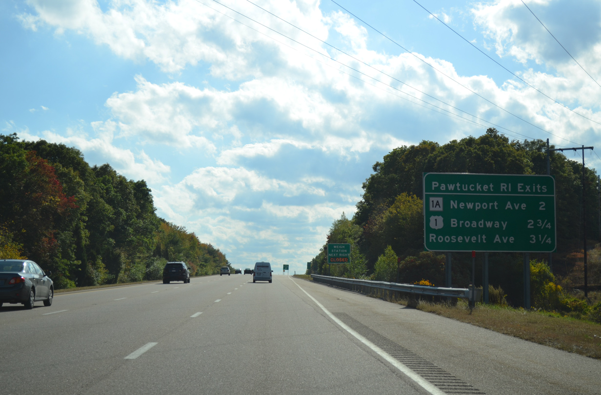
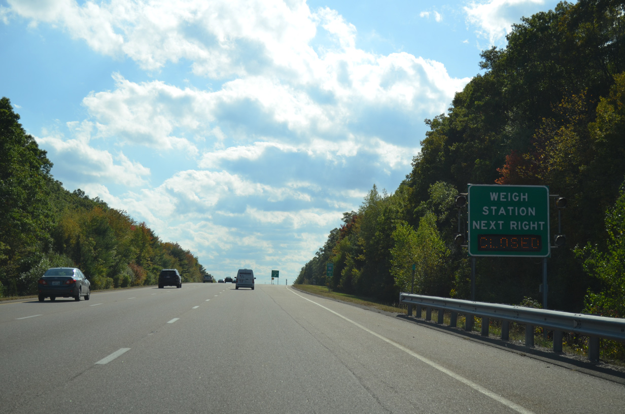
| A south side weigh station lies along Interstate 95 at milepost three. 10/06/14 |
|
| Curving westward toward the cloverleaf interchange (Exits 2B/A) with Route 1A (Newport Avenue) along Interstate 95 south. Route 1A forms a multi-state route with RI 1A south through East Providence and I-195 west into Downtown Providence. 10/06/14 |
|
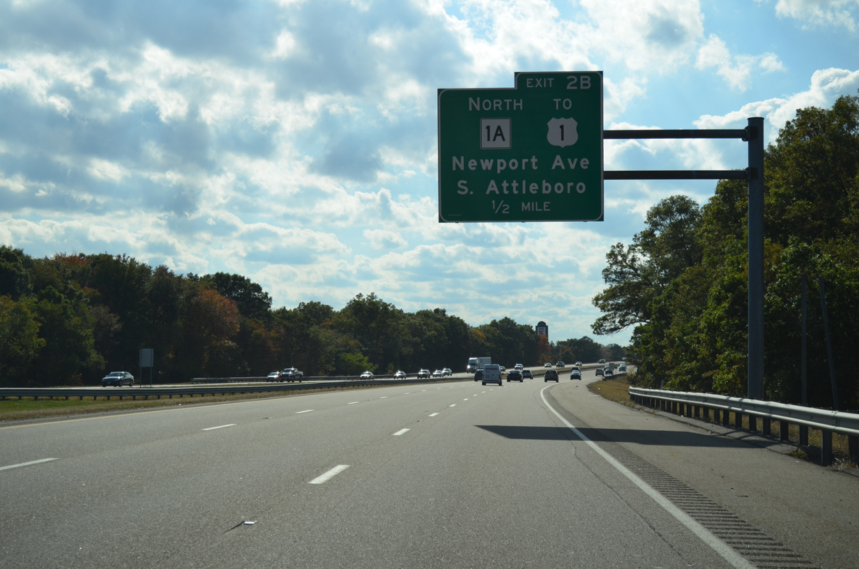
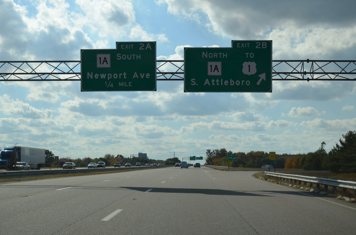
| Interstate 95 south crosses the Sevenmile River ahead of Exit 2B onto Route 1A (Newport Avenue) north. The state route ends just 1.2 miles to the north at U.S. 1 (Washington Street) ahead of North Attleborough. 10/06/14 |
|
| Exit 2B leaves I-95 south for Route 1A (Newport Avenue) north. Route 1A south crosses into Pawtucket, Rhode Island just south of Exit 2A. 10/06/14 |
|
| Route 1A follows Newport Avenue south to the Rumford community of East Providence. U.S. 1 stays to the west, taking Broadway south from the state line to Downtown Pawtucket. 10/06/14 |
|
| What was the final shield for Interstate 95 south in Massachusetts was knocked down and removed by 2013. 07/28/07 |
|
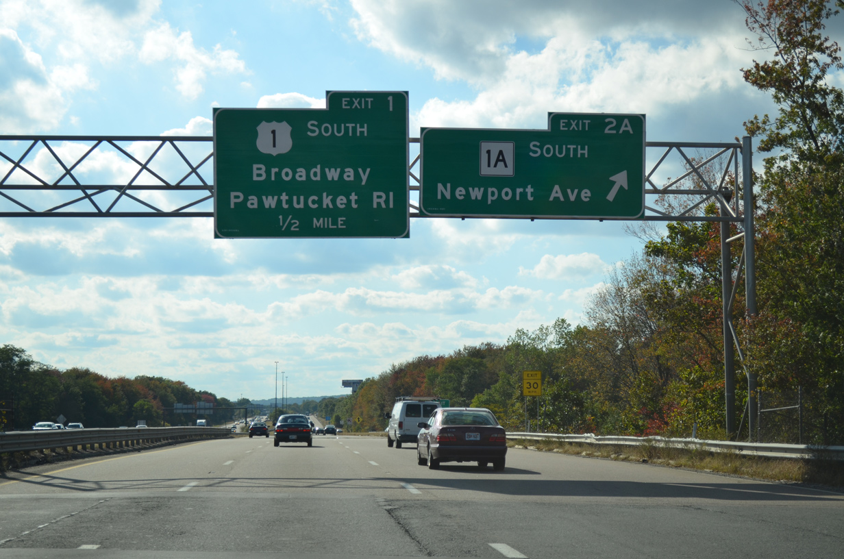
| A loop ramp (Exit 1) joins Interstate 95 south with U.S. 1 (Washington Street) south into Pawtucket. The exit has been unmarked outside of this gore point sign from 2007 to 2014. 10/06/14 |
|
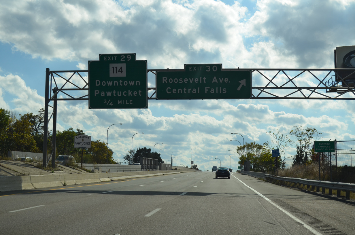
| Spanning a CSX Railroad line, Interstate 95 enters Pawtucket, Rhode Island as Exit 30 quickly departs for Roosevelt Avenue at Middle Street. 10/06/14 |
Page Updated 01-27-2015.

 South
South