|
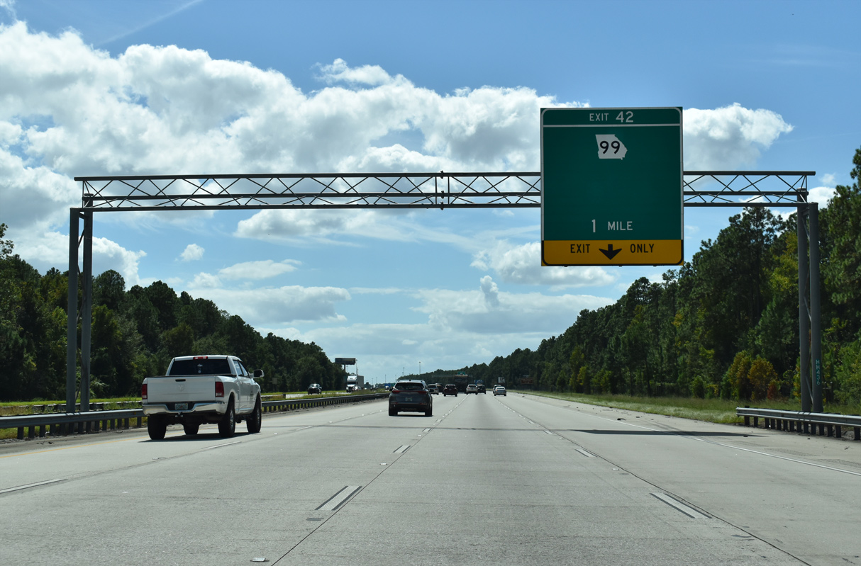
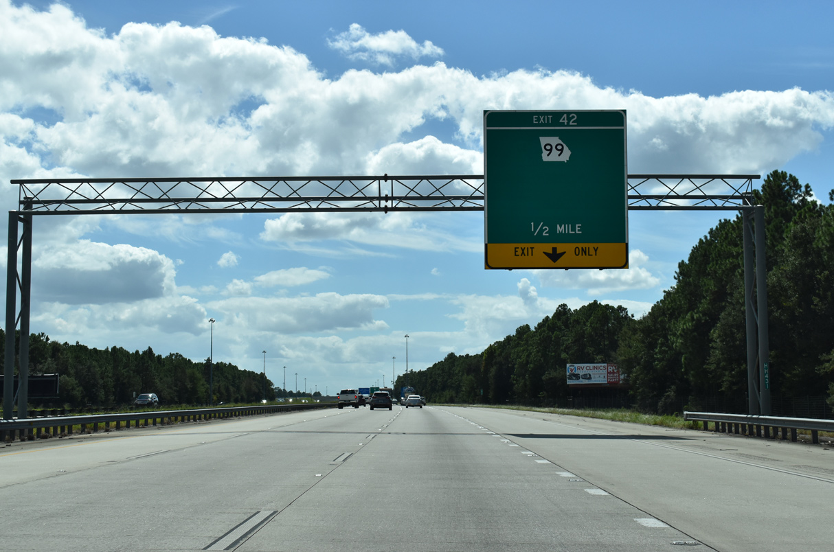
| I-95 south rises to 30 feet above sea level from the Altamaha State Wildlife Management Area to a diamond interchange (Exit 42) with SR 99 (Grants Ferry Road). SR 99 branches west from parallel U.S. 17/SR 25 at Broadfield 6.98 miles to Sterling. 09/25/22 |
|
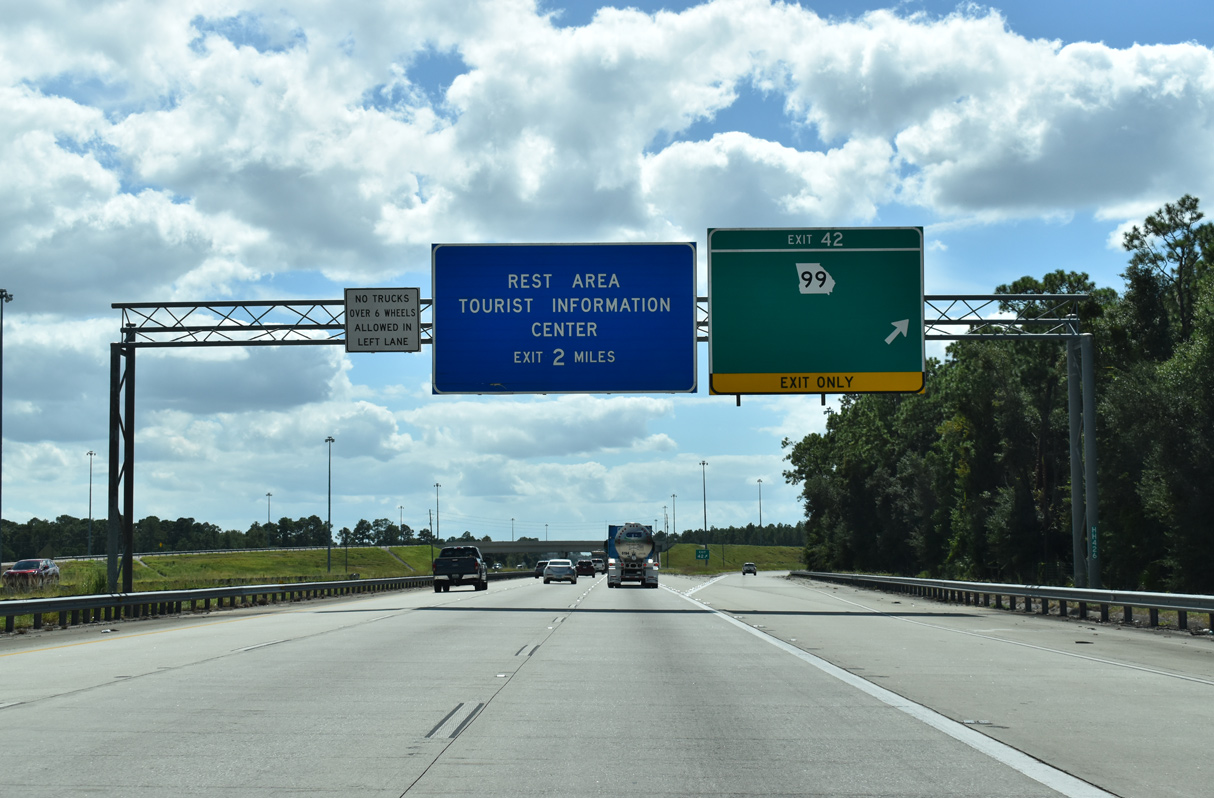
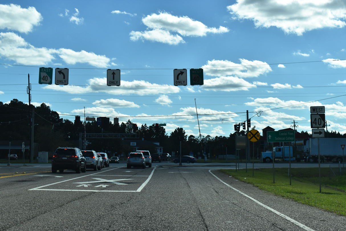
| Blank space on Exit 42 guide signs was intended for displaying Grants Ferry Road, the name of SR 99 west to U.S. 25/341 at Sterling. Exit 42 represents the former south end of Business Loop I-95 from Darien as well. 09/25/22 |
|
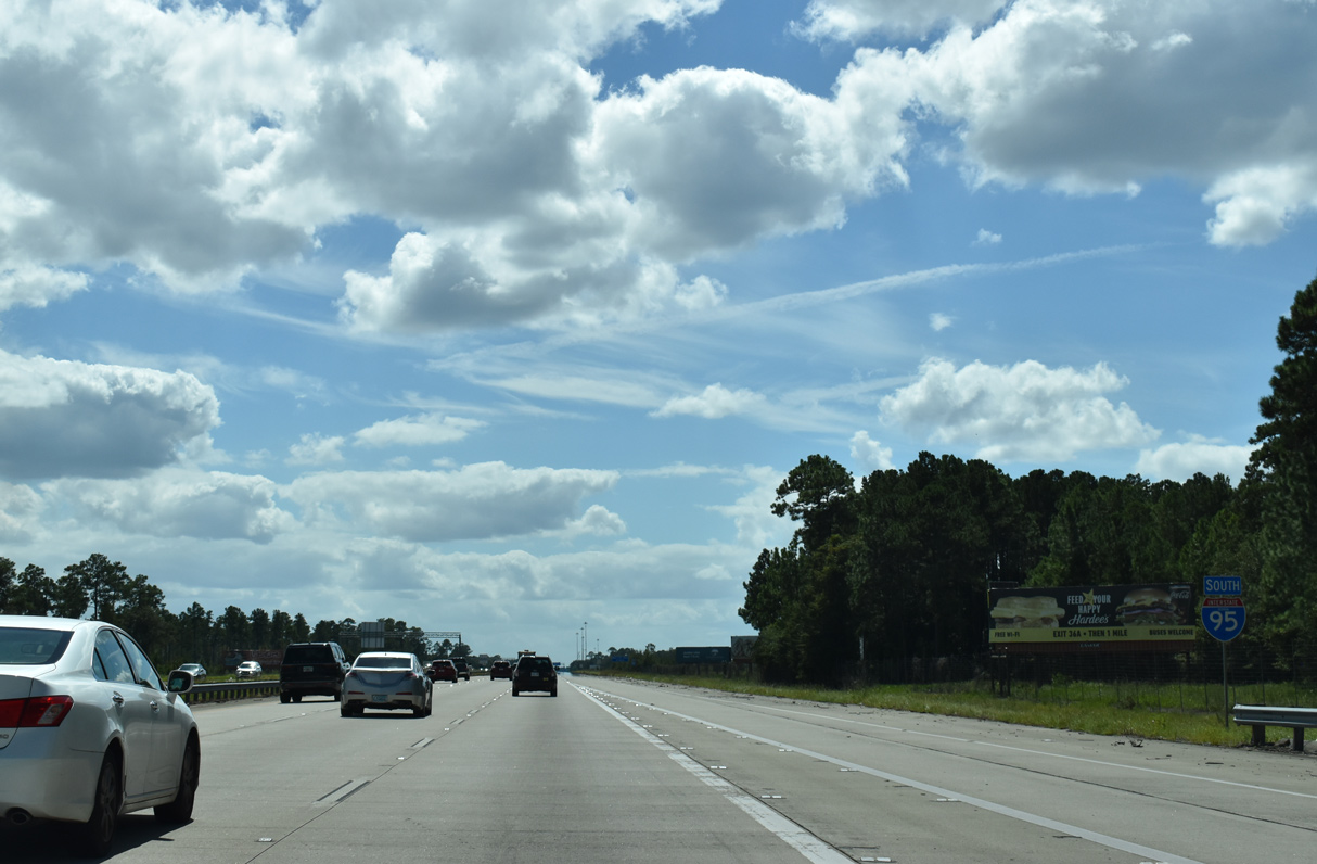
| SR 99 constitutes a 38.81 mile long route from I-95 at Exit 58 to U.S. 82/SR 520, 9.32 miles west of Sterling. SR 99 provides a cut-off for U.S. 82/SR 520 west to Hahunta and Waycross. 09/25/22 |
|
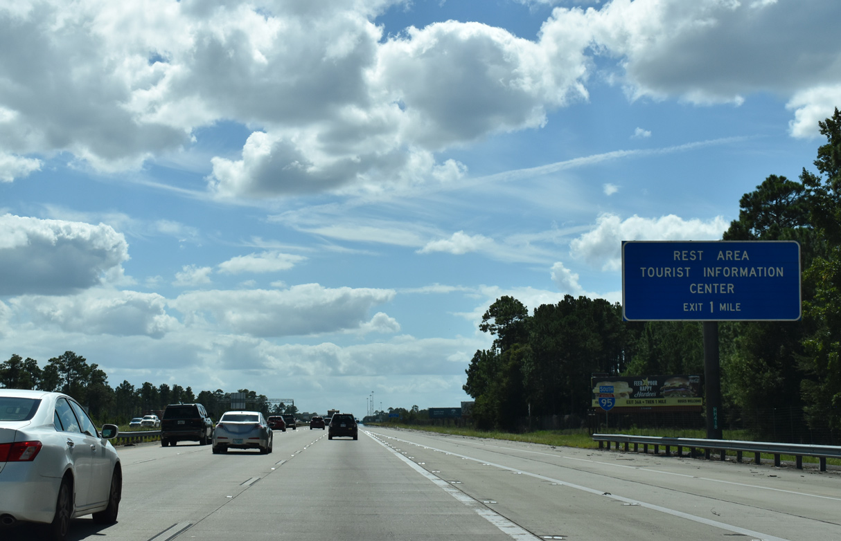
| A southbound side rest area and tourist information center lies one mile beyond the exchange with SR 99. 09/25/22 |
|
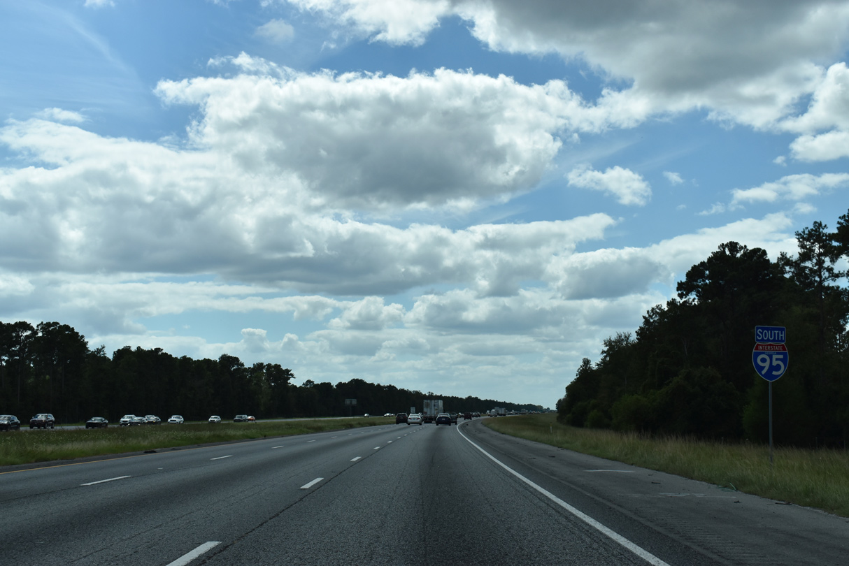
| Construction in 2013-14 replaced the overpass for SR 99 and the ramps at Exit 42. A second confirming marker for I-95 south was also added. 09/25/22, 10/15/23 |
|
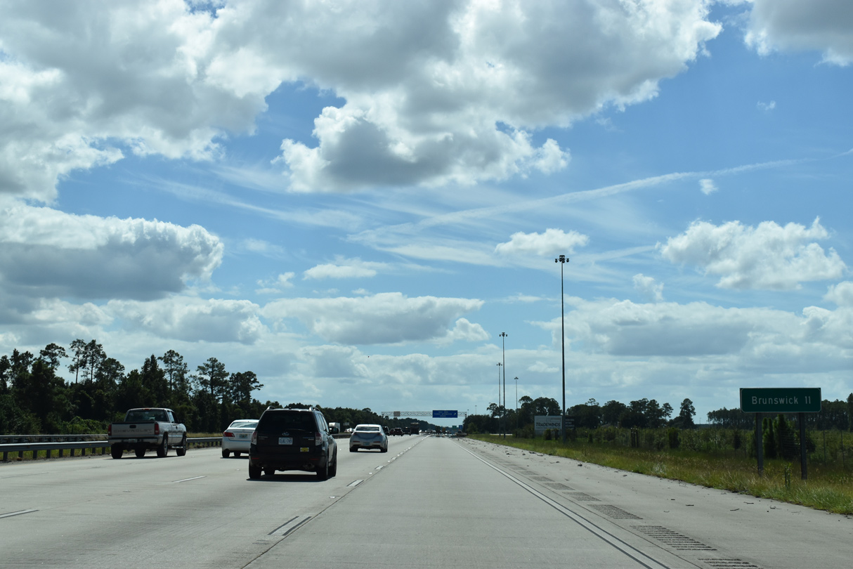
| Widening of I-95 through Glynn County brought the majority of the freeway south to Brunswick from four to eight lanes. 09/25/22 |
|
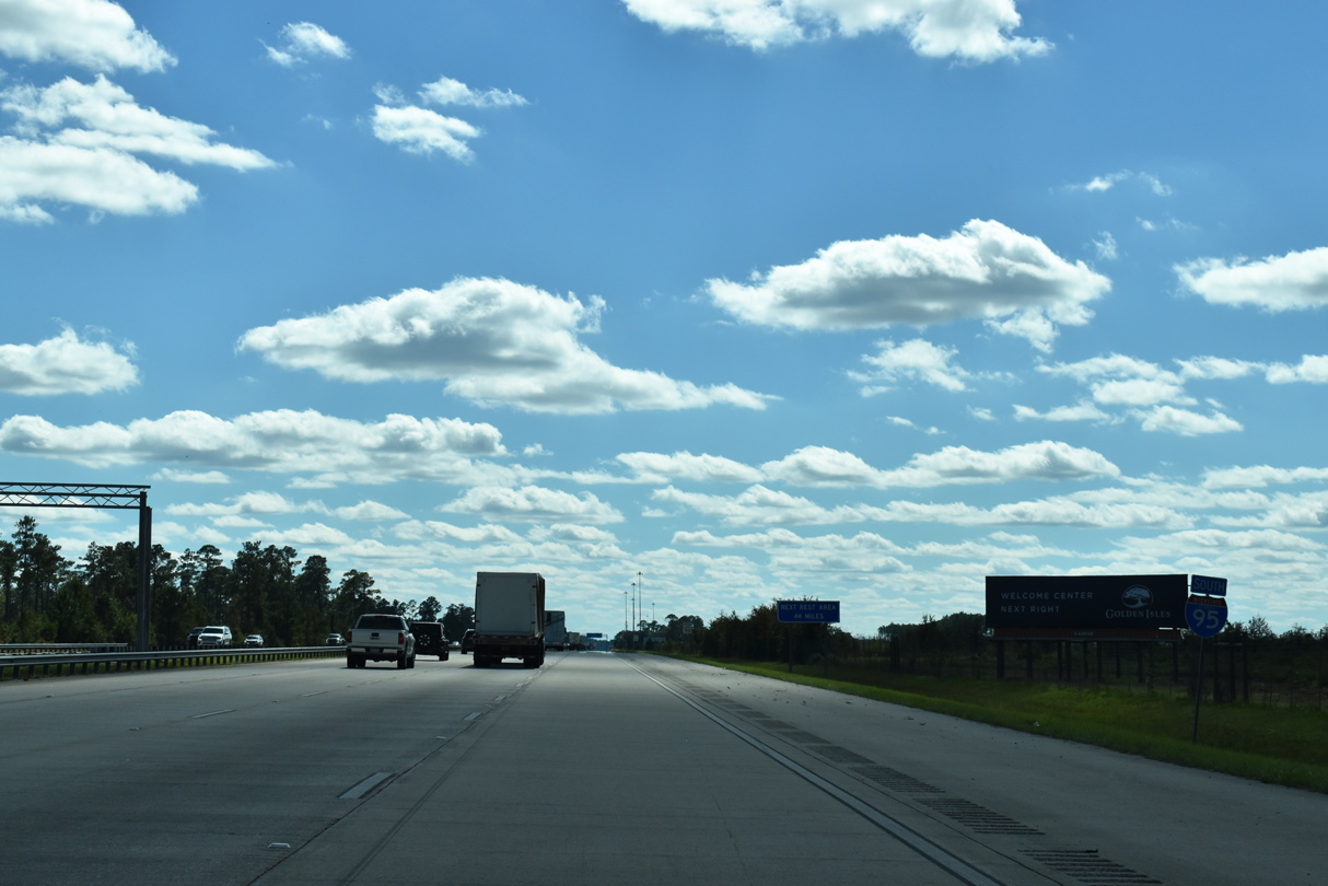
| Southbound I-95 at the Brunswick area rest area and tourist information center. The next facility is the Florida welcome center in 44 miles. 12/30/20, 09/25/22 |
|
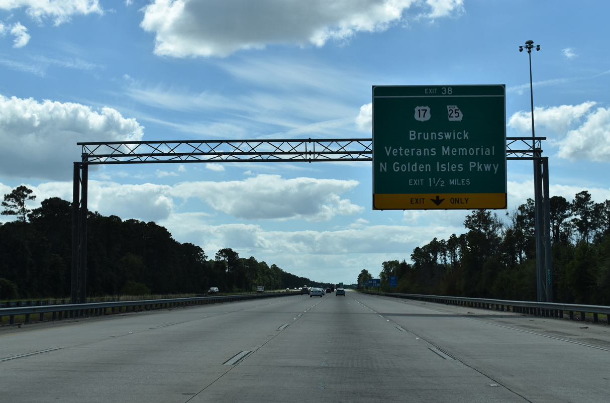
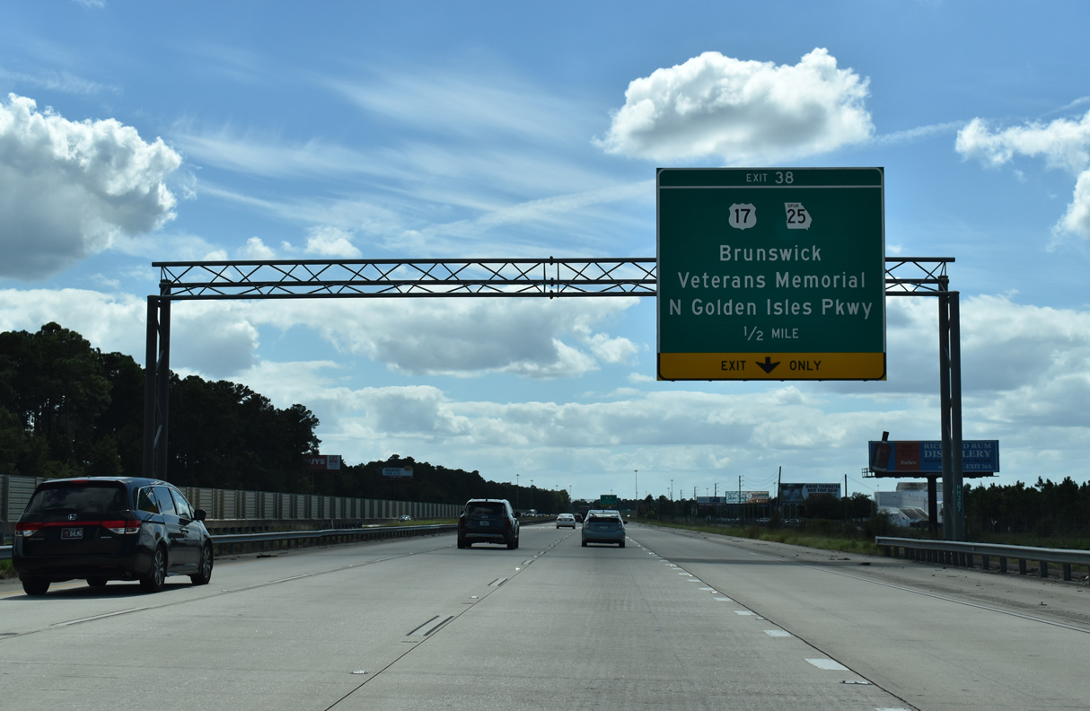
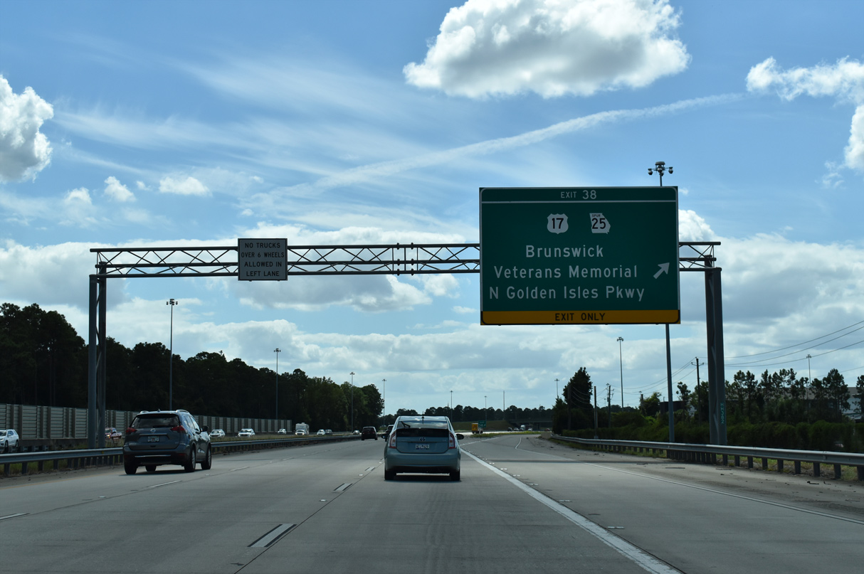
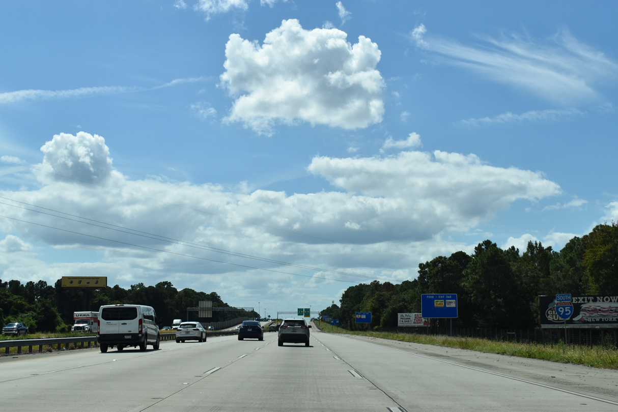
| Exit 38 joins Interstate 95 south next with Golden Isles Parkway and SR 25 Spur south to U.S. 17 (Glynn Avenue) in the city of Brunswick. 09/25/22 |
|
| SR 25SP (Golden Isles Parkway) leads 4.41 miles south from the diamond interchange at Exit 38 as a controlled access arterial by Glynn Mall and a number of other shopping centers directly to U.S. 17. U.S. 17 proceeds south from there to SR 25 Spur East (F.J. Torras Causeway) 4.11 miles to St. Simons Island, Fort Frederica National Monument and Sea Island. 09/25/22 |
|
| SR 25SP (Golden Isles Parkway) continues 2.87 miles north from I-95 to additional suburban development and SR 99 (Grants Ferry Road). Golden Isles Parkway south to U.S. 17 (Glynn Avenue) was once also designated as Business Spur I-95. 09/25/22 |
|
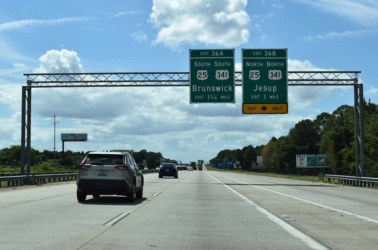
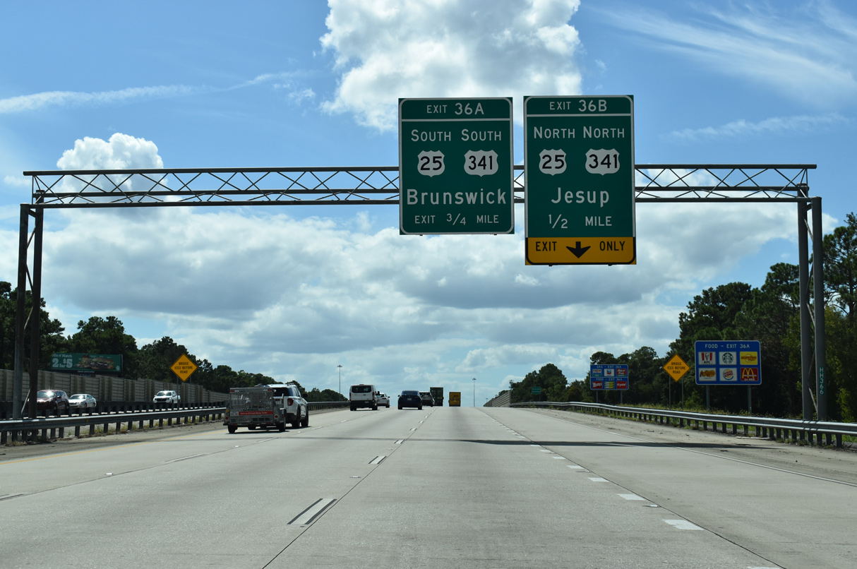
| Angling southwest, Interstate 95 continues one mile to a six-ramp parclo interchange (Exits 36B/A) with U.S. 25/341 (New Jesup Highway). 09/25/22 |
|
| Interstate 95 again carries eight overall lanes of traffic. 09/25/22 |
|
| Elevating to pass over CSX and Norfolk Southern Railroad lines and Old Jesup Road, I-95 advances to within a half mile of Exit 36 B to U.S. 2/341. U.S. 25/341 run concurrent for 38.8 miles from outside Downtown Brunswick to the Wayne County seat Jesup. 09/25/22 |
|
| Exit 36 B departs I-95 south for U.S. 25/341 (New Jesup Highway) north. U.S. 25 combines with U.S. 84 east from Jesup to Ludowici, and U.S. 301 from there to Statesboro and U.S. 80. U.S. 25 finally travels solo from Hopeulikit to Augusta. U.S. 341 extends northwest along Golden Isles Parkway from Brunswick and Jesup to Perry. 09/25/22 |
|
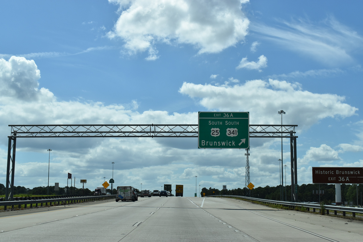
| U.S. 25/341 continue 5.25 miles south to Bay and Gloucester Streets in Brunswick. There U.S. 25 turns east through Downtown Brunswick to end at U.S. 17 while U.S. 341 navigates along the street grid to conclude at U.S. 17, just north of the Sidney Lanier Bridge. 09/25/22 |
|
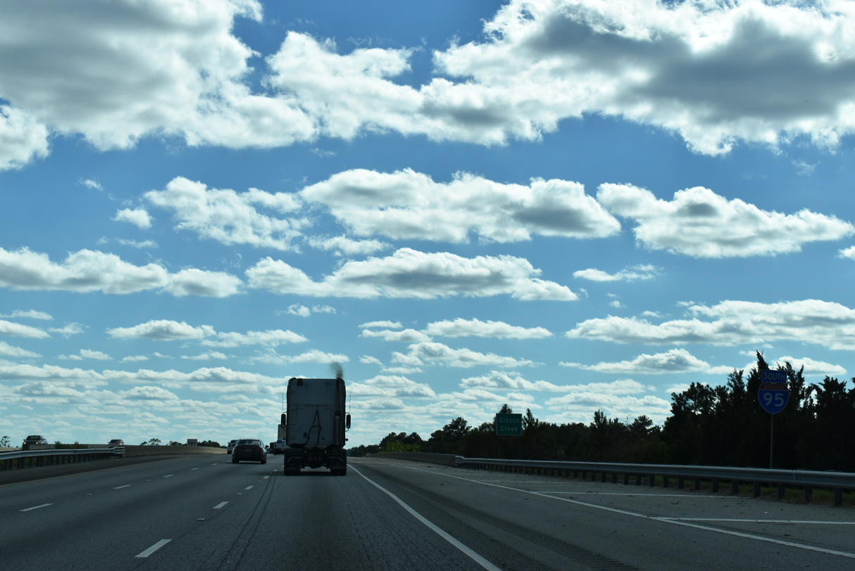
| Interstate 95 traverses a swath of wetlands, waterways and islands as it stays west of Brunswick. Spanning Gibson Creek, the freeway reaches Little Crispen Island beyond this shield assembly. 10/15/23 |
|
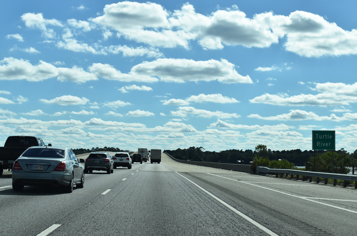
| Leaving Little Crispen Island, Interstate 95 crosses the Turtle River onto Blythe Island. Widening of I-95 through here joined the two separate spans with six overall lanes and the capacity to expand to eight lanes. 10/15/23 |
|
| A second Interstate 95 marker appears along southbound ahead of the Blythe Island Drive overpass. Blythe Island is accessible from adjacent SR 303 (Old Jacksonville Highway). 09/25/22 |
|
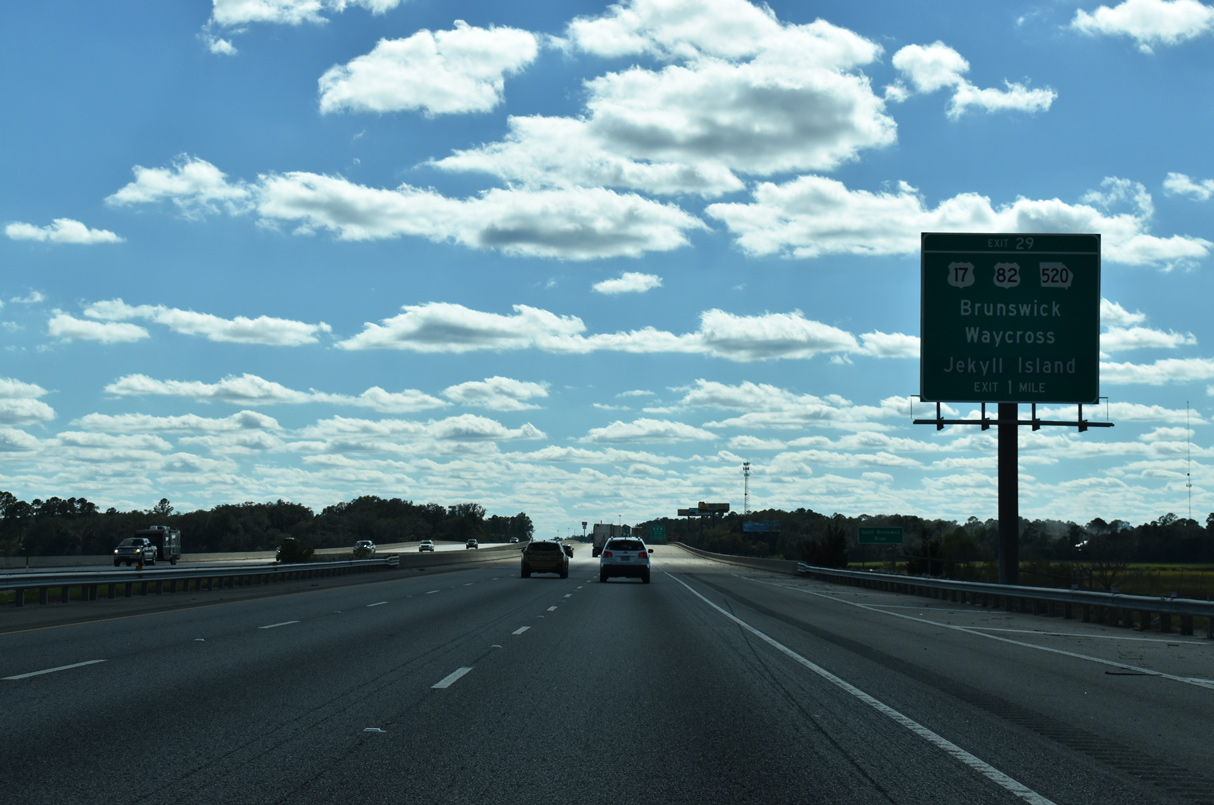
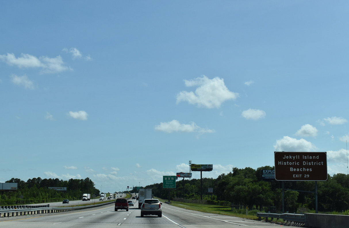
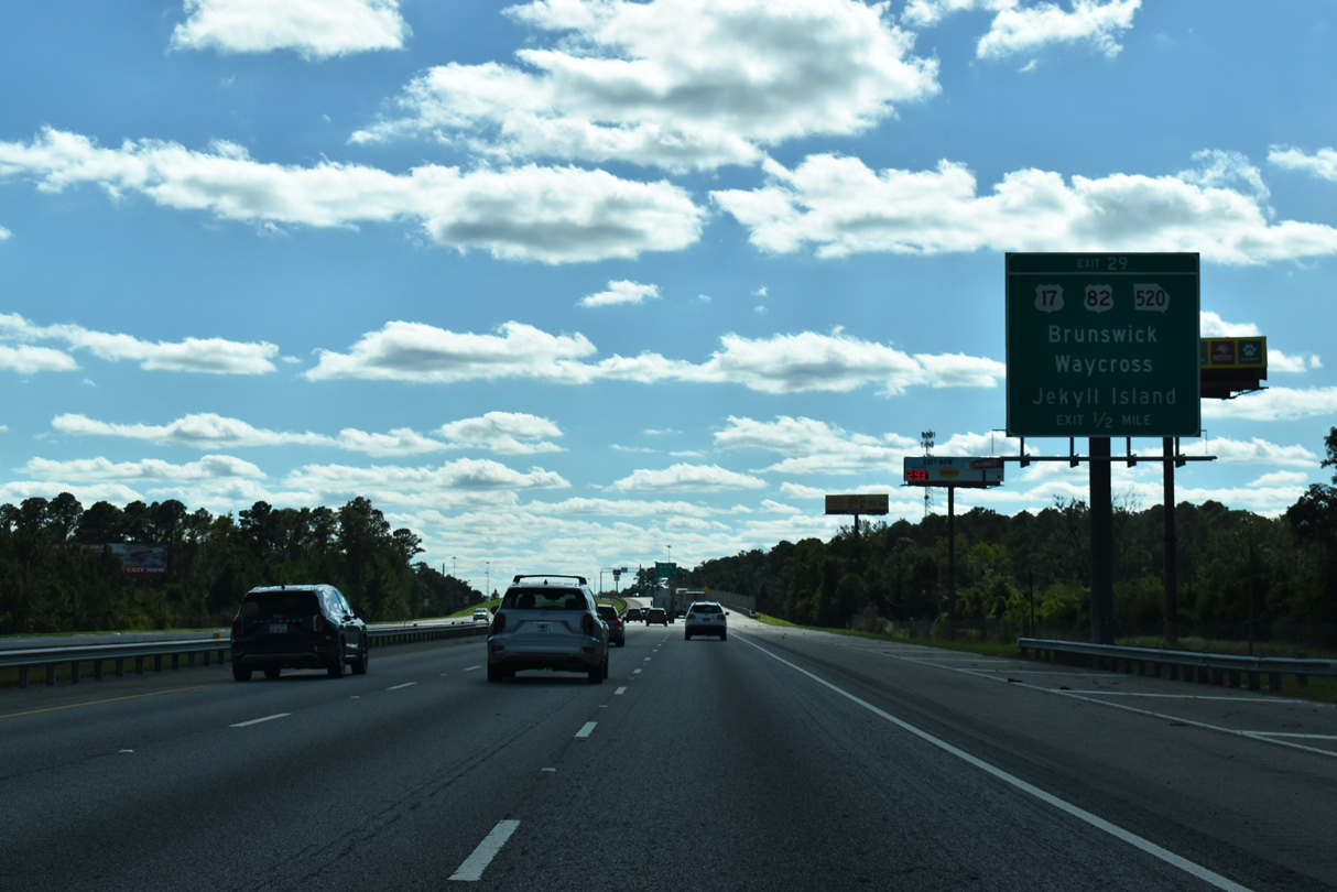
| I-95 spans the South Brunswick River from Blythe Island ahead of Exit 29 with U.S. 17-82 and SR 25-520. U.S. 17 branches west from U.S. 82 nearby to Spring Bluff, Waverly and Woodbine. 10/15/23 |
|
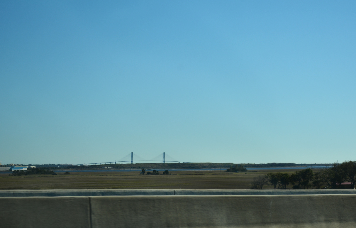
| East of I-95, U.S. 17/SR 25 overlap 5.6 miles with SR 520 to Jeckyl Island Causeway before turning north across the Sidney Lanier Bridge into Brunswick. The cable stay bridge spans the Brunswick River. 01/05/19, 06/01/21 |
|
| Beginning at the parclo interchange (Exit 29) with I-95, U.S. 82 travels west alongside SR 520 (South Georgia Parkway) 50 miles to Waycross. This portion of the U.S. 82 was originally apart of U.S. 84. U.S. 84 shifted northward to Jesup and Hinesville in 1988, switching places with U.S. 82. 10/15/23 |
|
| U.S. 82/SR 520 combine 185.94 miles west from Exit 29 to Dawson in southwest Georgia. SR 520 ventures northwest from there to U.S. 27/280 and Columbus while U.S. 82 maintains a westward heading to Cuthbert, Georgetown and Eufaula, Alabama. U.S. 82 stretches 1,609 miles across the country to Alamogordo, New Mexico. 10/15/23 |
|
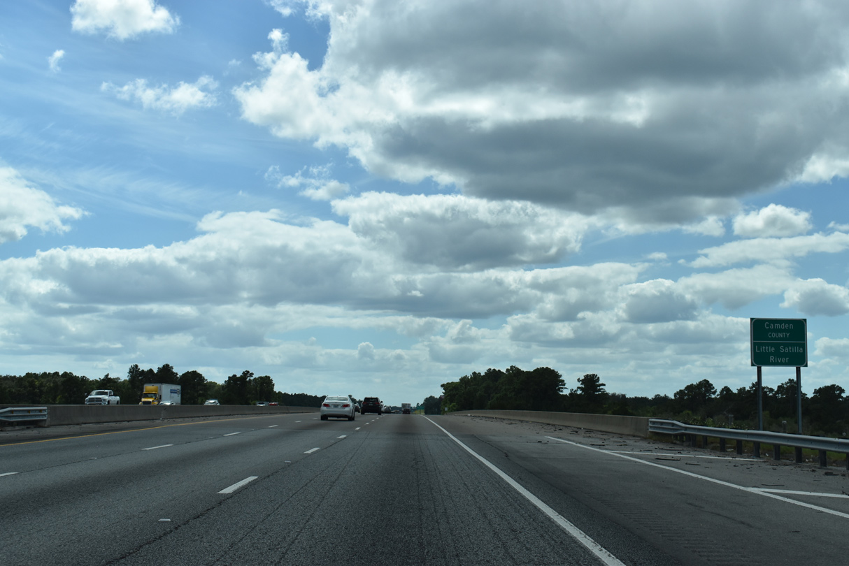
| Angling southwest, Interstate 95 again traverses an area of wetlands to the Little Satilla River. 09/25/22 |
|
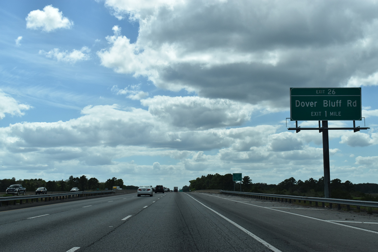
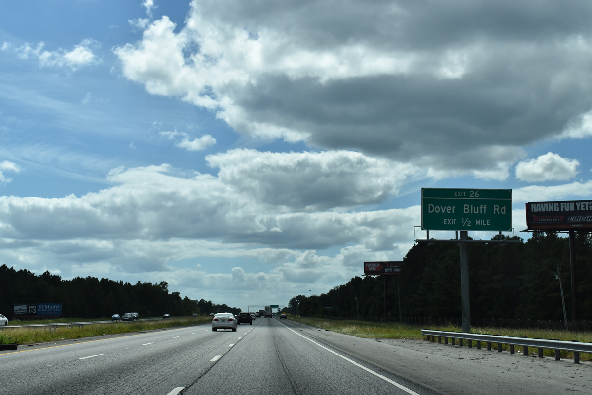
| The first of seven Camden County interchanges joins Interstate 95 with Dover Bluff Road by the Sanctuary Cove golf course community in one mile. 09/25/22 |
|
| Bridging the Little Satilla River, Interstate 95 enters Camden County, the final of seven along the freeway in Georgia. 09/25/22 |
|
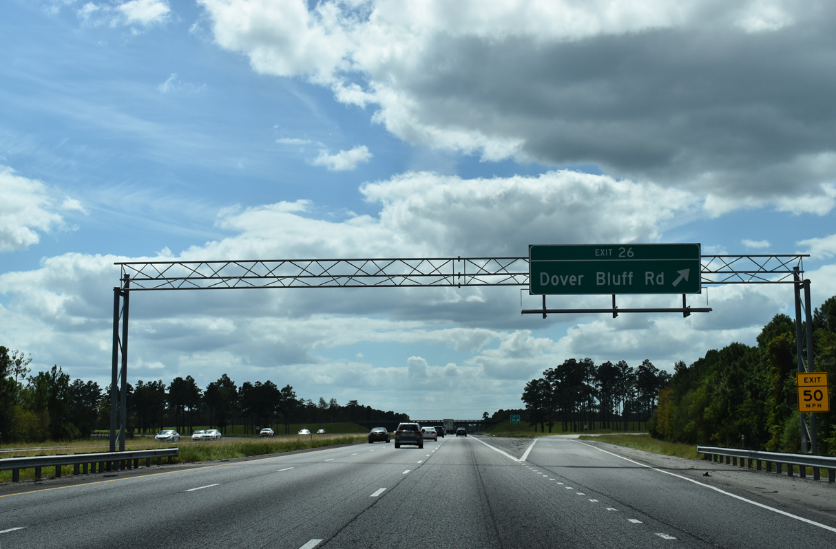
| Dover Bluff Road links Interstate 95 south with U.S. 17/SR 25 at the community of Spring Bluff 2.06 miles to the west. 09/25/22 |
|
| Southeast from the diamond interchange at Exit 26, Dover Bluff Road spurs 7.39 miles along Hazards Neck to Dover Bluff off Umbrella Creek. 09/25/22 |
|
| Further separating from the Atlantic coast, Interstate 95 turns westward across Hazzards Neck to White Oak Creek. 09/25/22 |
|
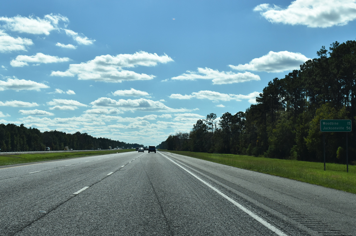
| The Camden County seat of Woodbine is 15 miles to the southwest while Jacksonville reappears on distance signs for I-95 at 56 miles out. 10/15/23 |
|
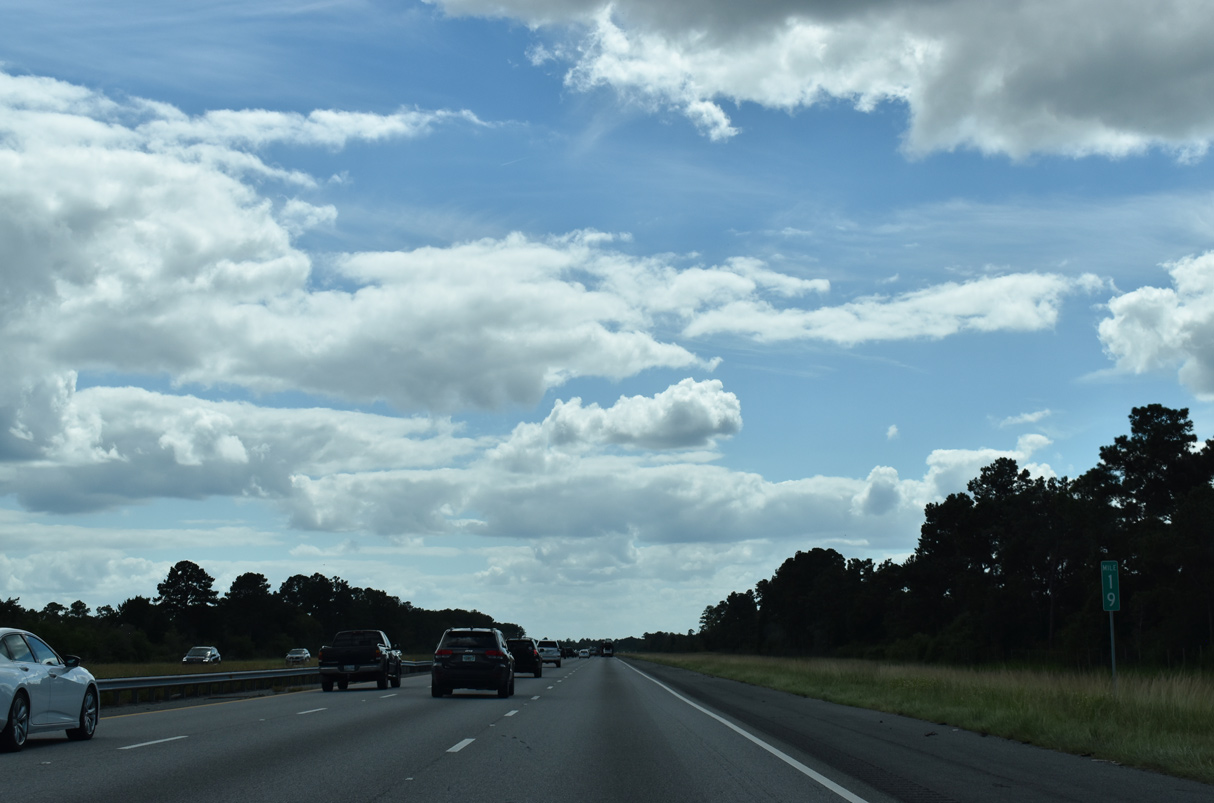
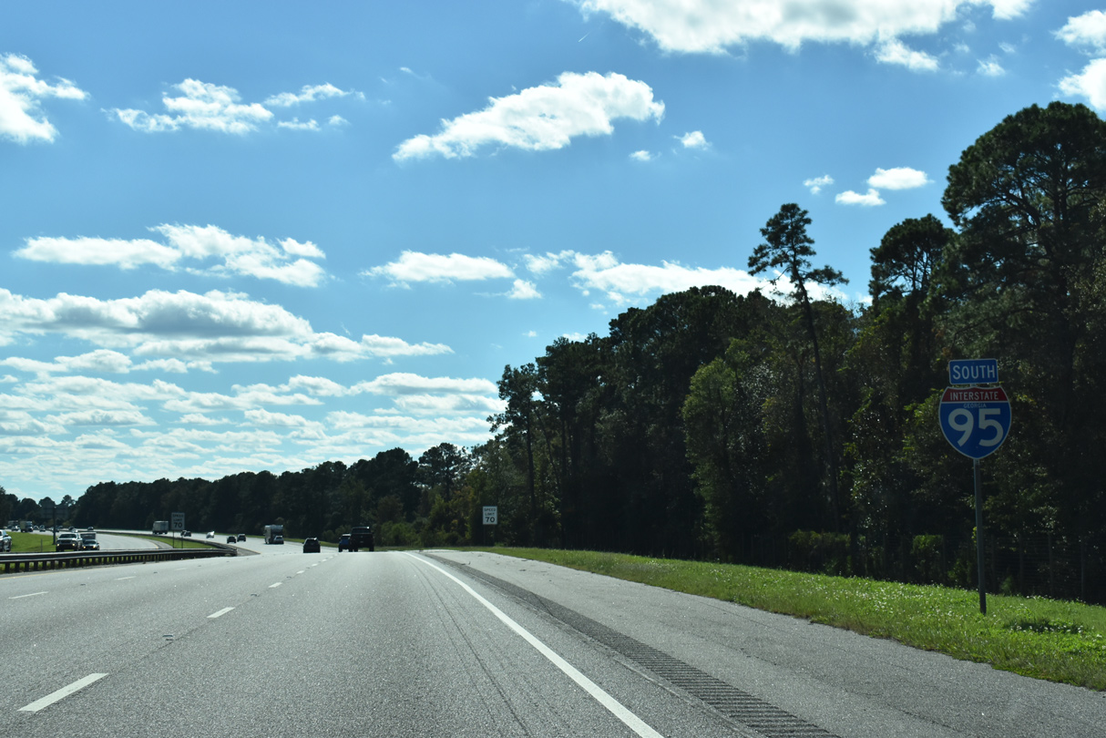
| GDOT recorded 59,400 vehicles per day (vpd) along Interstate 95 south between Exit 26 and 22 in 2021. 09/25/22 |
|
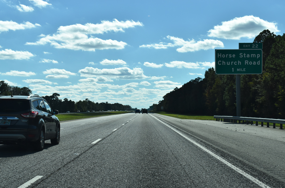
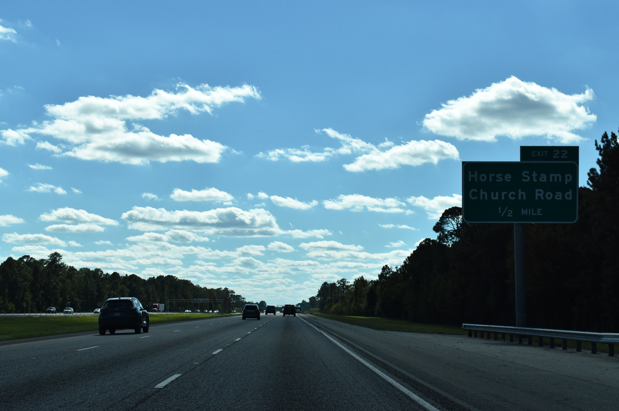
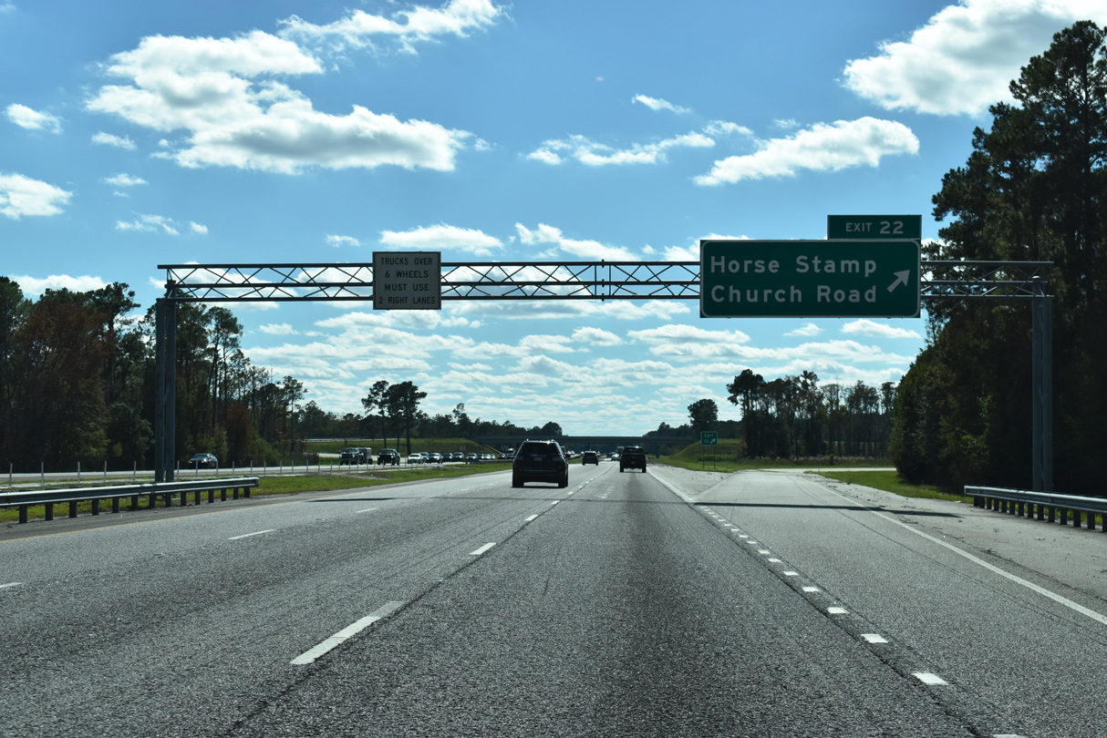
| Opened to traffic in April 2012, the diamond interchange with Horse Stamp Church Road removed a 12 mile long exit less stretch. 10/15/23 |
|
| The Horse Stamp Church Road exit provides additional access to Dover Bluff and Waverly from Interstate 95. 10/15/23 |
|
| Horse Stamp Church Road heads six miles northwest from Exit 22 to U.S. 17/SR 25 at SR 110 in Waverly. East from I-95, the rural road becomes Ella Park Church Road en route to Dover Bluff Road near Hickory Bluff. 10/15/23 |
|
| Interstate 95 bends southward ahead White Oak Creek and Wild Neck, east of White Oak. 10/15/23 |
|
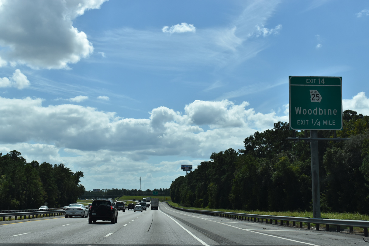
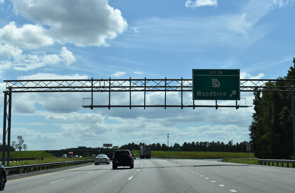
| Advancing south across the Satilla River, southbound Interstate 95 next meets SR 25 Spur west 2.77 miles into the city of Woodbine. 09/25/22 |
|
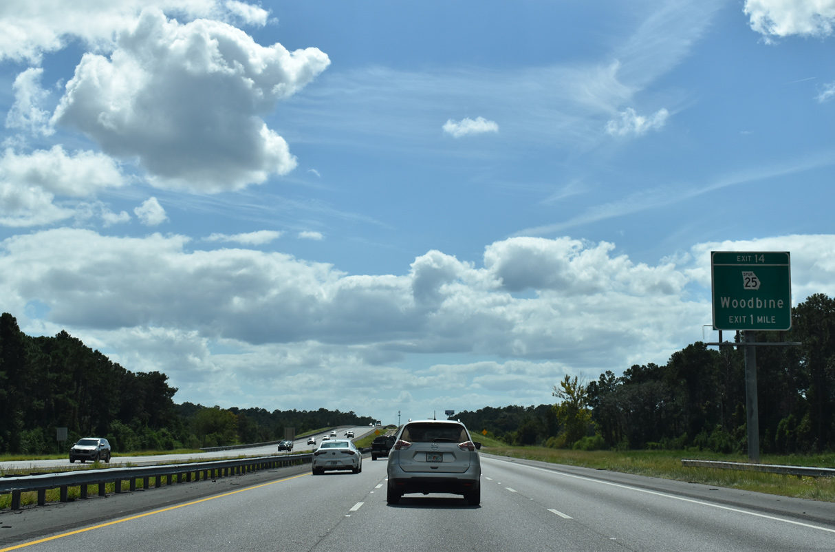
| One half mile ahead of the diamond interchange (Exit 14) with SR 25SP west and Lane Lane east. 09/25/22 |
|
| Exit 14 leaves I-95 south for SR 25 Spur west to U.S. 17/SR 25 (Bedell Avenue) and Lane Lane east toward Ceylon. U.S. 17/SR 25 parallel I-95 southward from Woodbine to Colesburg and Kingsland while nearby SR 110 angles 14.39 miles southwest to SR 40 near Folkston. 09/25/22 |
|
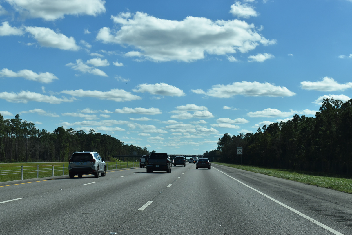
| Trees lining the median of Interstate 95 southward from Woodbine to Grassy Island and Shingle Island Swamp were cleared as part of a longer project throughout Camden County underway from Fall 2017 into 2018. 10/15/23 |
|
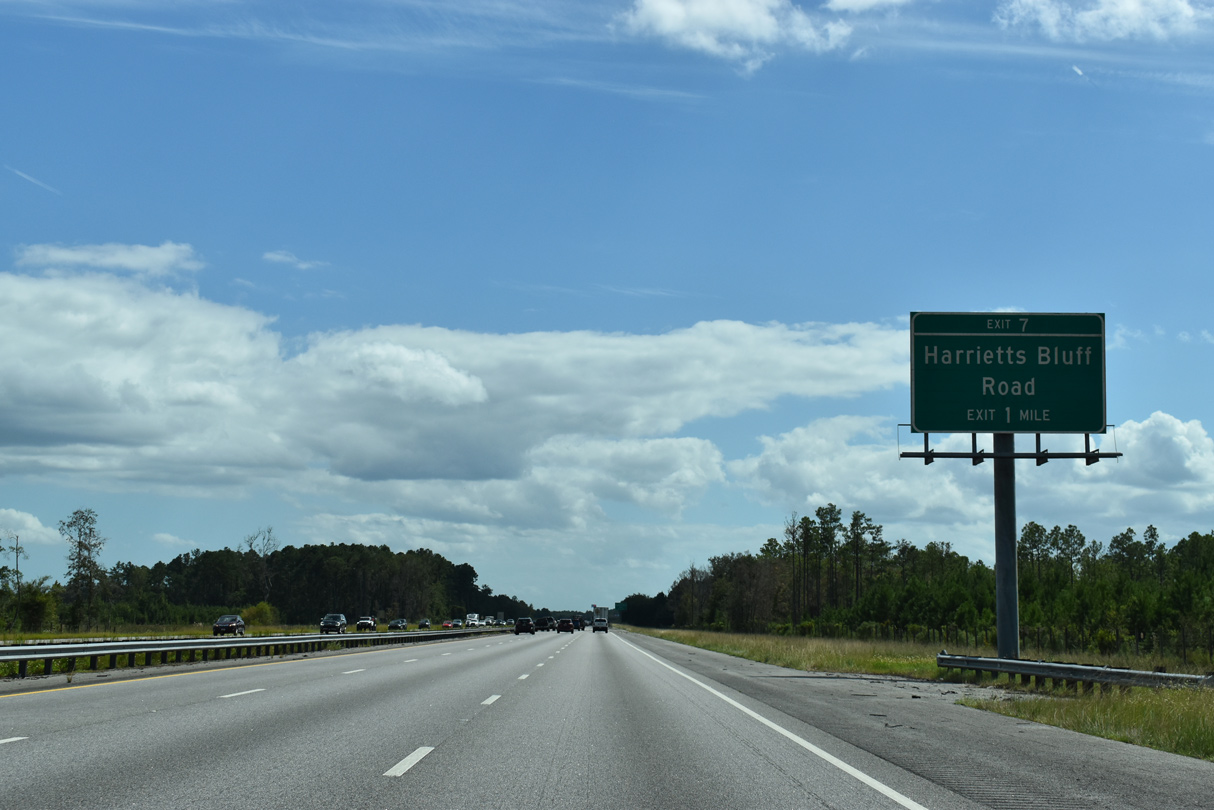
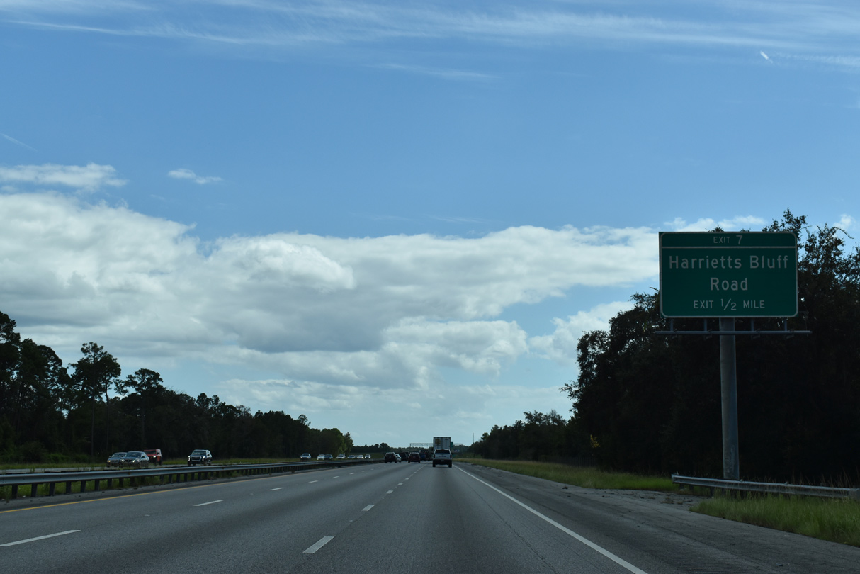
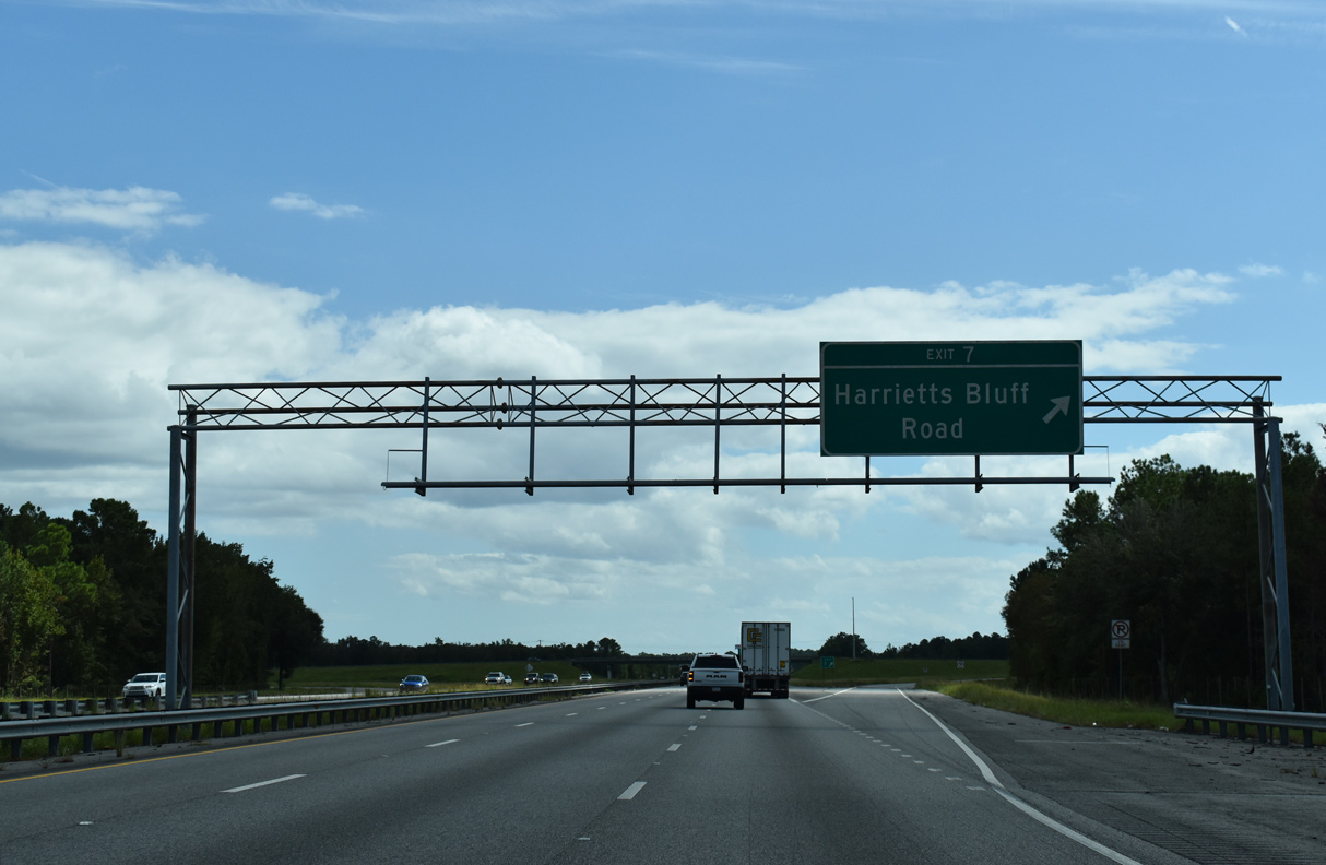
| Interstate 95 continues south from Shingle Island Swamp to meet Harrietts Bluff Road at a diamond interchange (Exit 7). 09/25/22 |
|
| Harrietts Bluff Road meanders miles east from I-95 along the Crooked River to Sadlers Landing and the community of Harrietts Bluff. Union Carbide Road branches east from Harrietts Bluff Road onto Floyds Neck. 09/25/22 |
|
| West from Exit 7, Harrietts Bluff Road ties into U.S. 17/SR 25 in 1.49 miles. This is the first of four interchanges for the city of Kingsland. 09/25/22 |
|
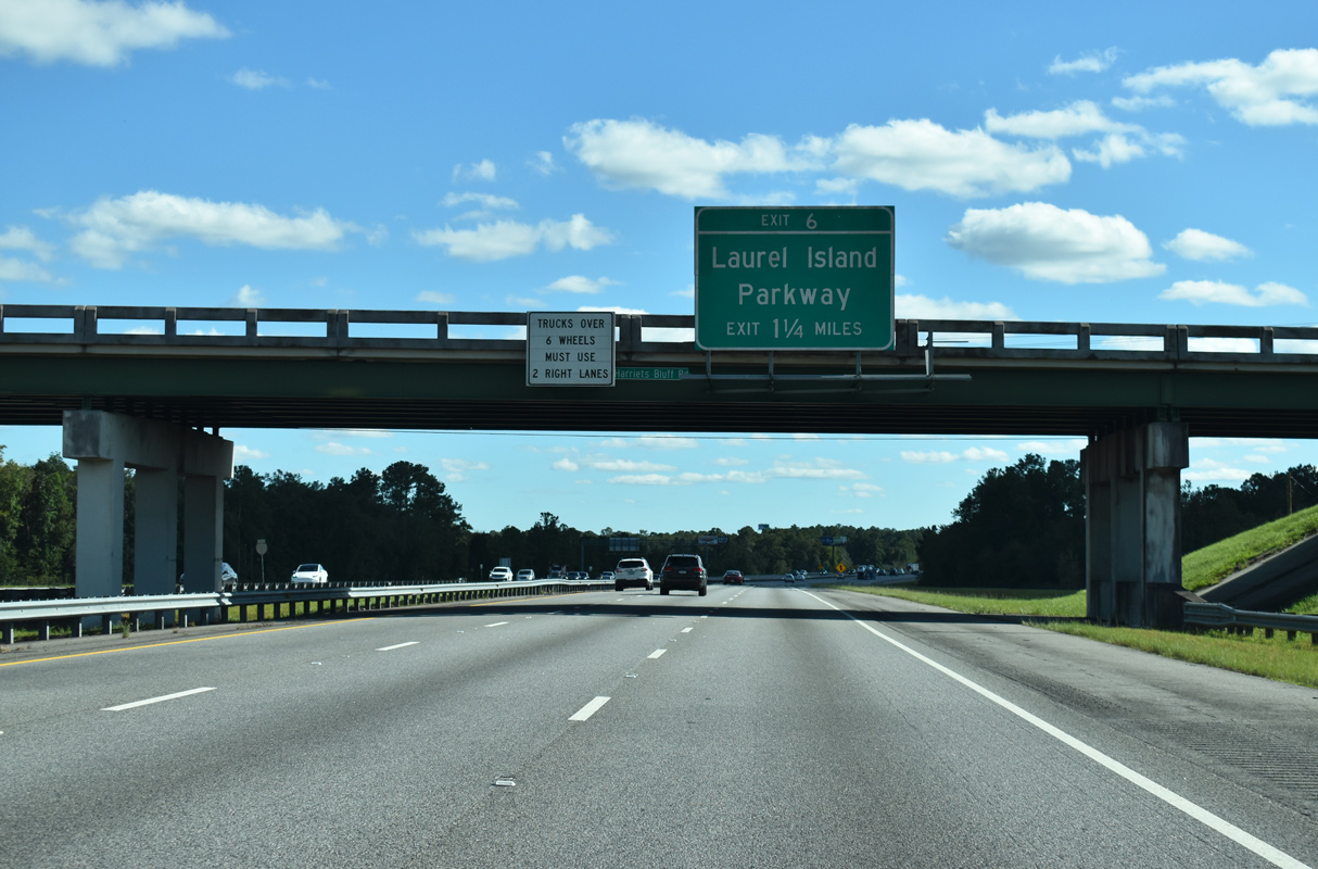
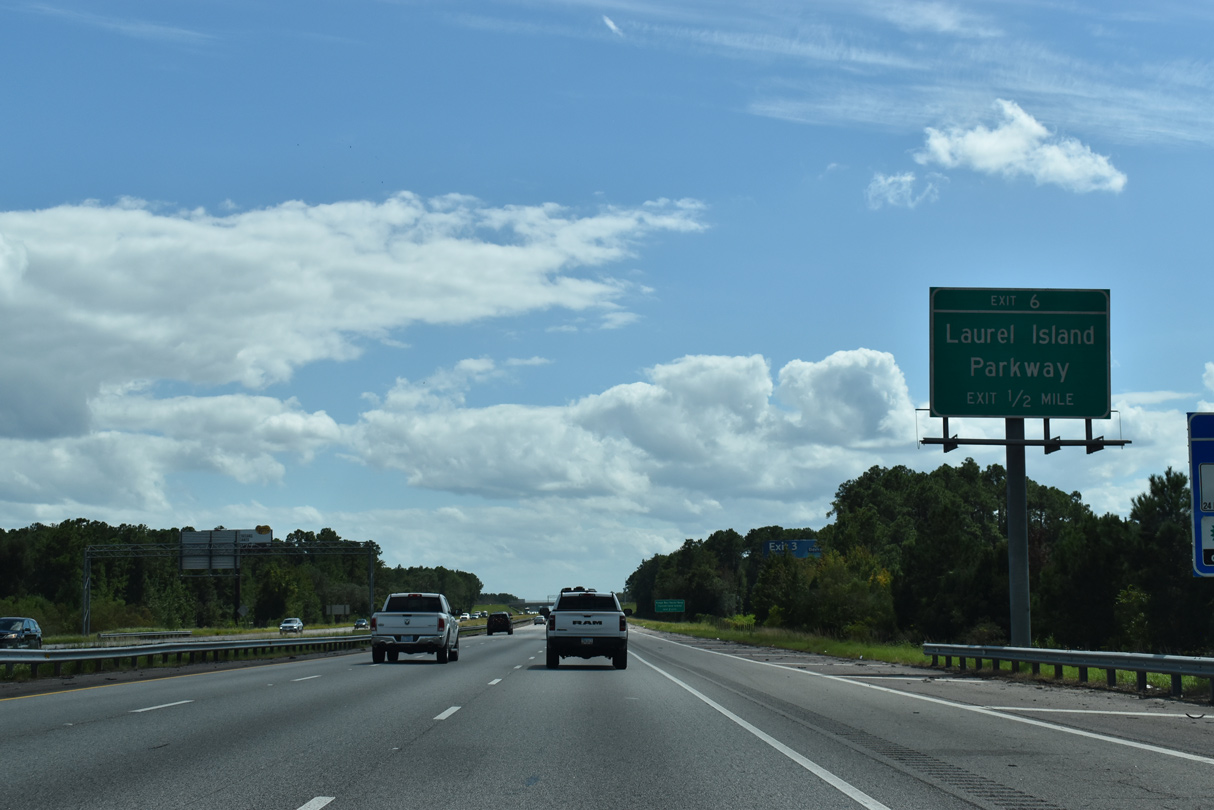
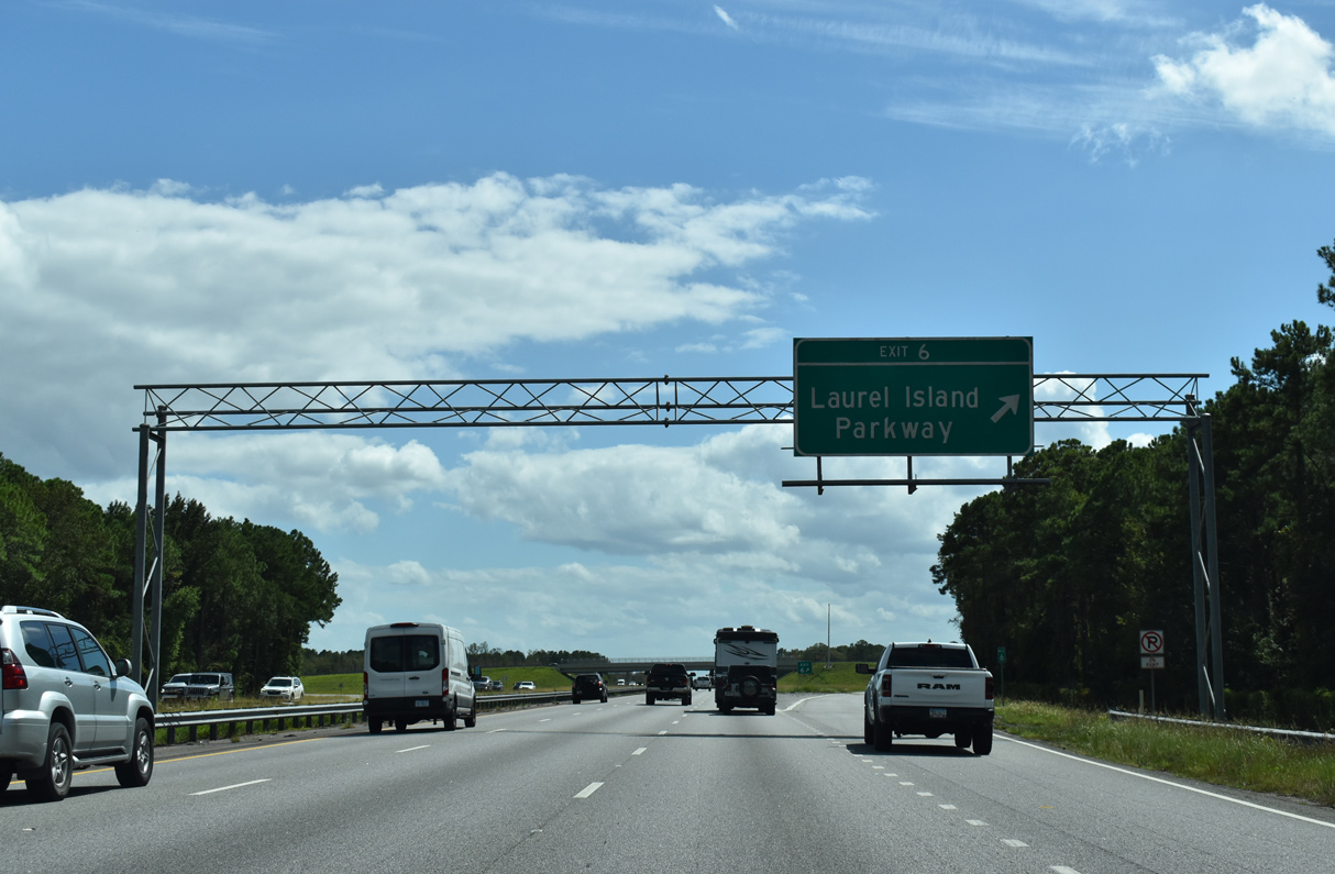
| Interstate 95 plies across wetlands and the Crooked River south toward Exit 6 with Laurel Island Parkway. 10/15/23 |
|
| Laurel Island Parkway transitions into Colerain Road west of Exit 6, connecting I-95 with both U.S. 17/SR 25 and Martin Luther King Boulevard south into Kingsland. 09/25/22 |
|
| East from the diamond interchange (Exit 6) with Interstate 95, Laurel Island Parkway continues into the city of St. Marys as Colerain Road to SR 40 Spur (Charlies Smith, Sr. Highway) and Kings Bay Naval Submarine Base. 09/25/22 |
|
| I-95 advances south by Caney Swamp along the ensuing stretch. 10/15/23 |
|
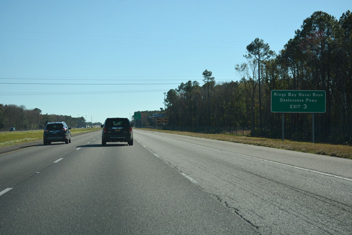
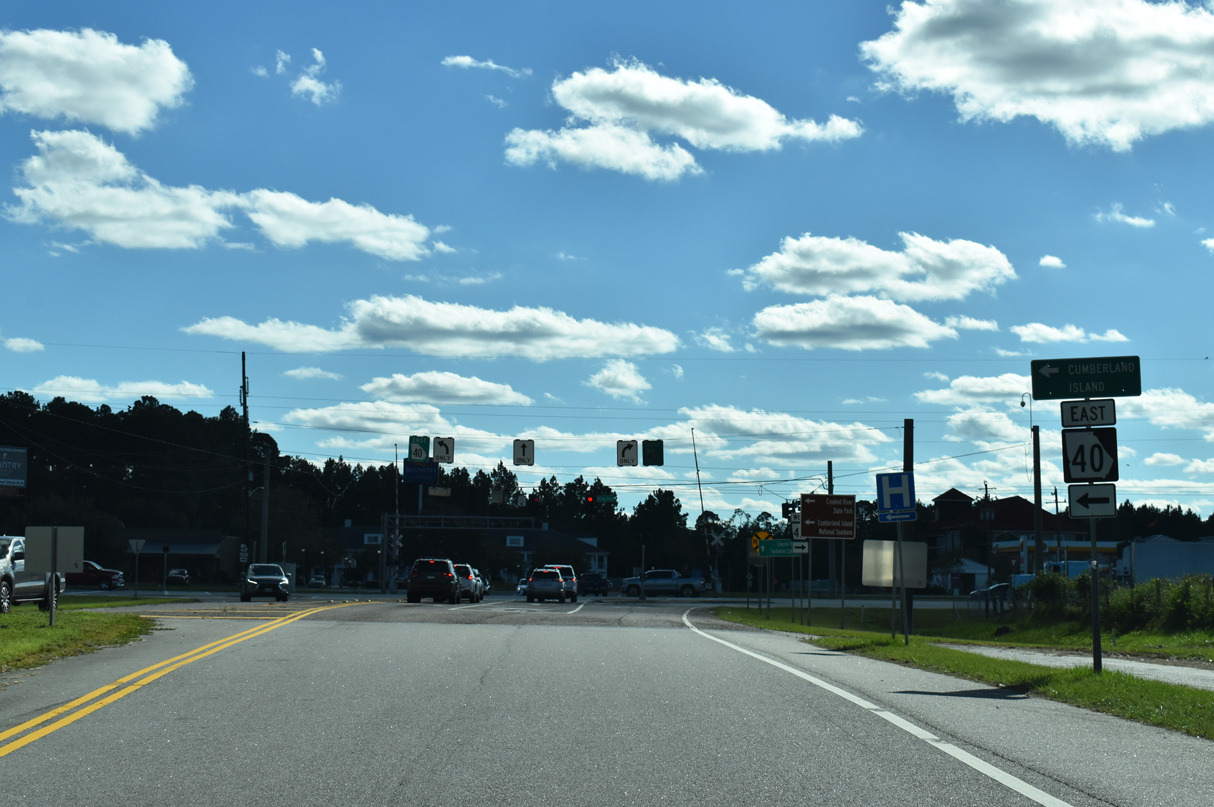
| SR 40 east provides the main route to Kings Bay Naval Submarine Base from I-95 south along with Kings Bay Road east. Okefenokee Parkway doubles as SR 23/121 south from Folkston through Charlton County. 01/05/19 |
|
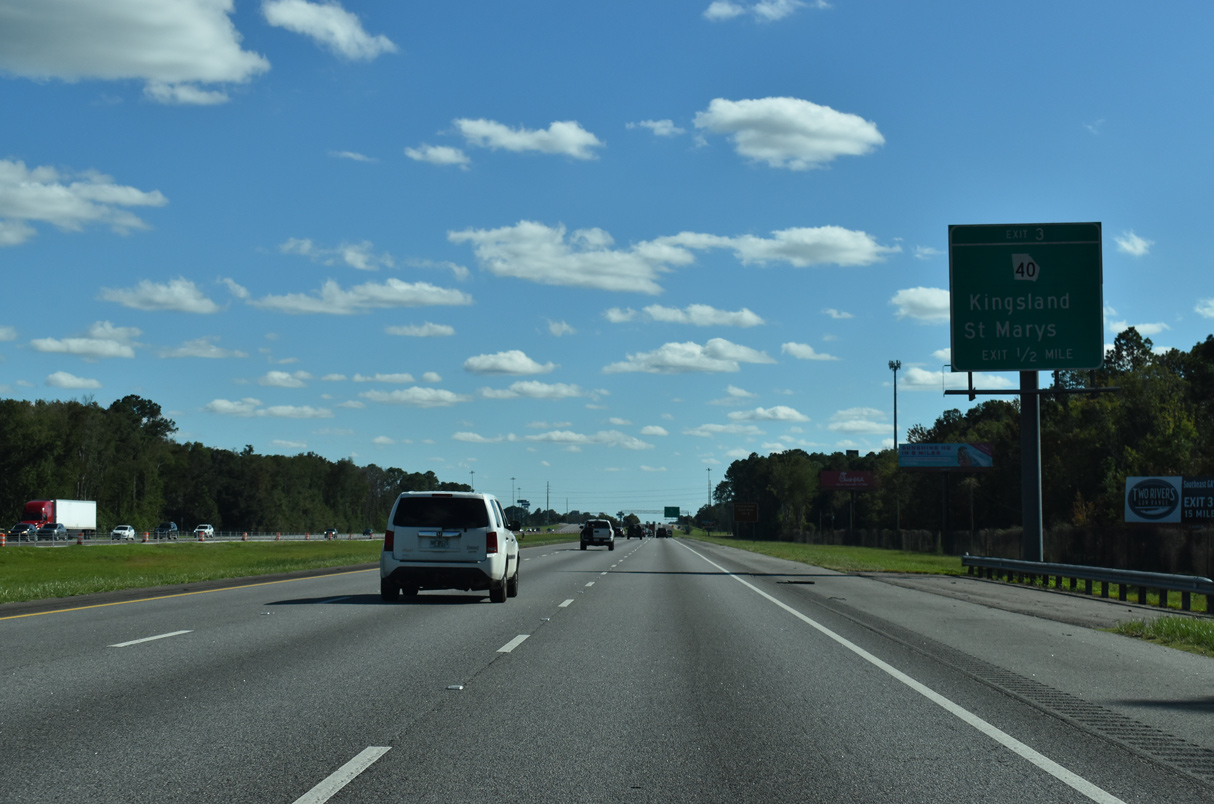
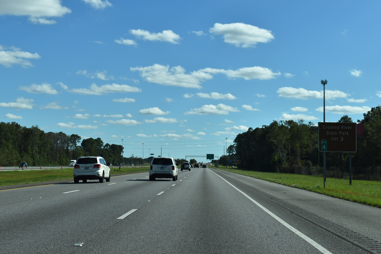
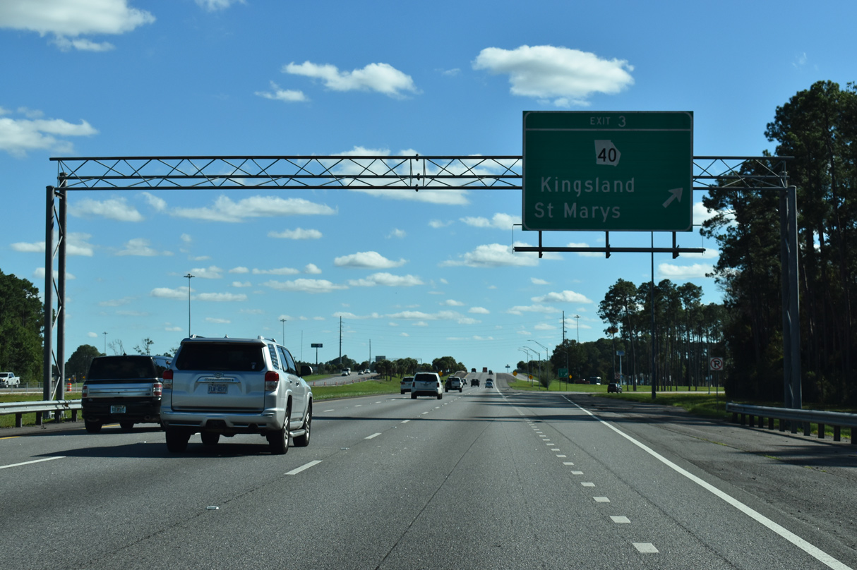
| Paralleling the St. Marys Railroad, SR 40 (King Avenue) leads east from the Kingsland city center to a folded diamond interchange at Exit 3. 10/15/23 |
|
| Crooked River State Park lies at the north end of SR 40 Spur beside the East River. SR 40 meets SR 40SP in the city of St. Marys. 10/15/23 |
|
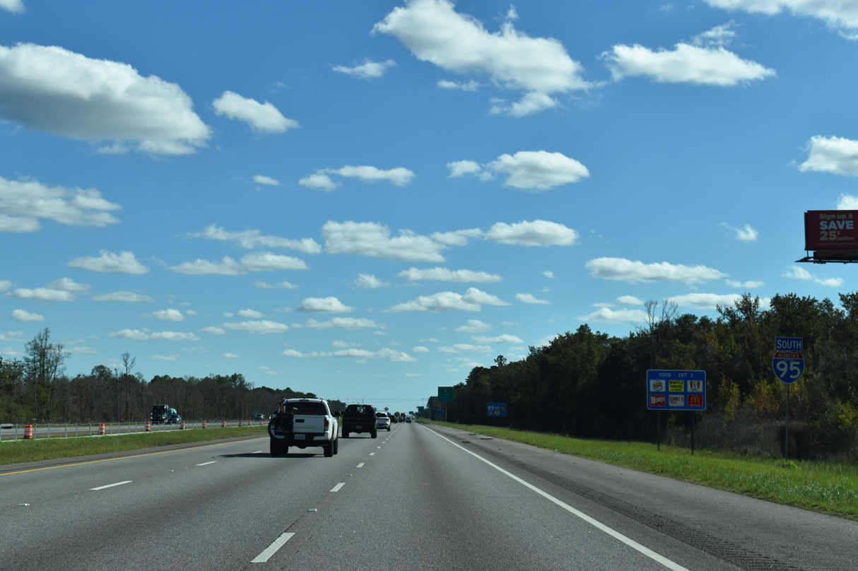
| Exit 3 leaves Interstate 95 south for SR 40 (King Avenue) in Kingsland. SR 40 concludes 21 miles to the west at U.S. 1-23-301 in Folkston. 10/15/23 |
|
| A 30.48 mile long route, SR 40 concludes nines miles to the east at Church Street in St. Marys. 10/15/23 |
|
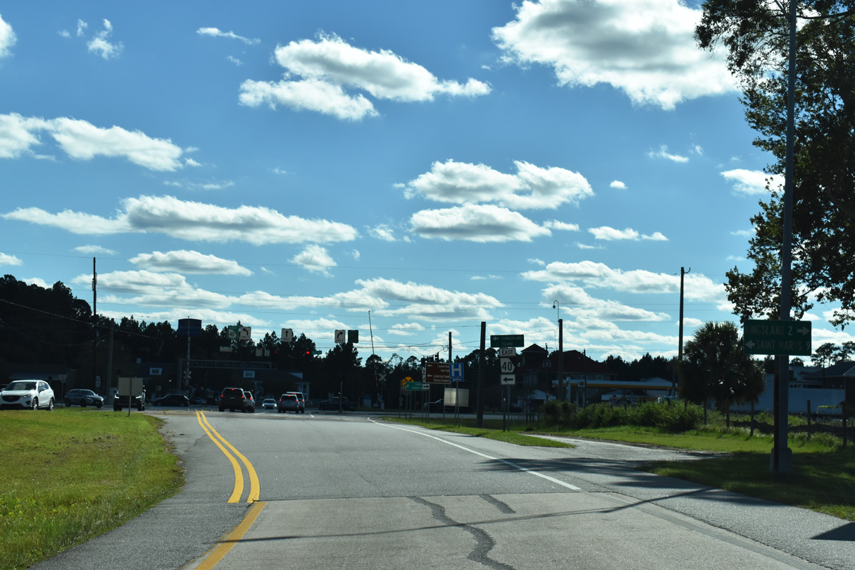
| SR 40 leads 1.9 miles west from Interstate 95 to U.S. 17 (Lee Street) in the central business district of Kingsland. 10/15/23 |
|
| The final reassurance marker posted for Interstate 95 south in Georgia. 09/25/22 |
|
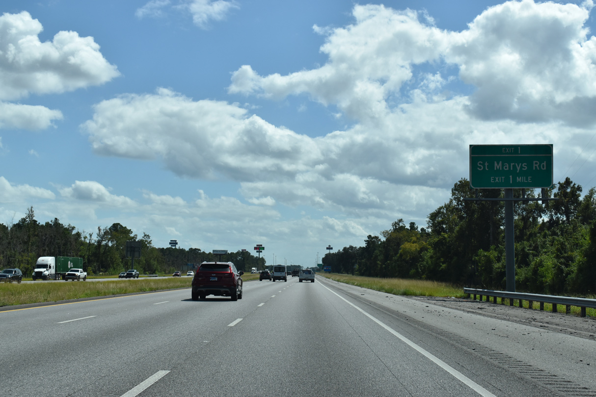
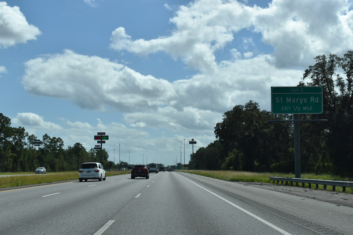
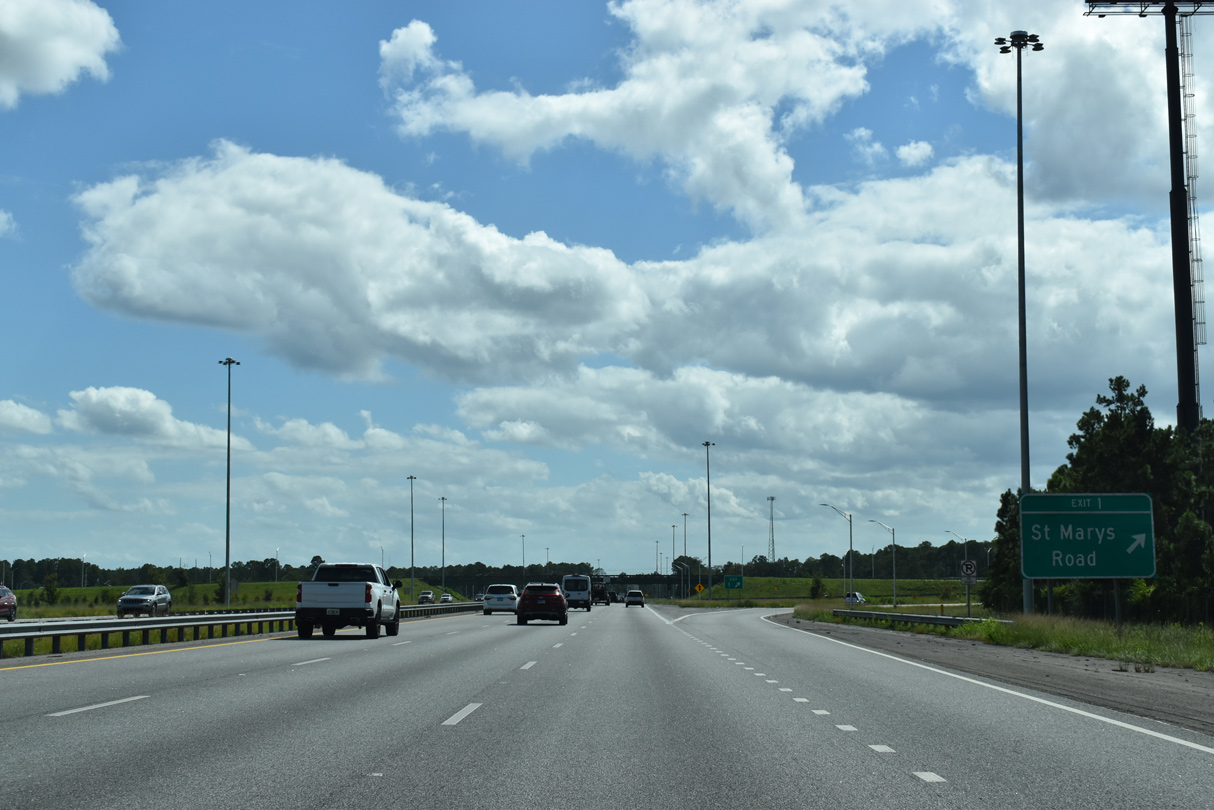
| A parclo interchange (Exit 1) joins Interstate 95 with St. Marys Road in one mile. The exit includes northbound access to a welcome center. 09/25/22 |
|
| St. Marys Road winds 5.64 miles east along a four lane parkway to SR 40 Spur and a gate into Kings Bay Naval Submarine Base. 09/25/22 |
|
| St. Marys Road becomes Scrubby Bluff Road west of Exit 1. Scrubby Bluff Road runs 2.65 miles north from Scrubby Bluff on the St. Marys River to U.S. 17 in south Kingsland. 09/25/22 |
|
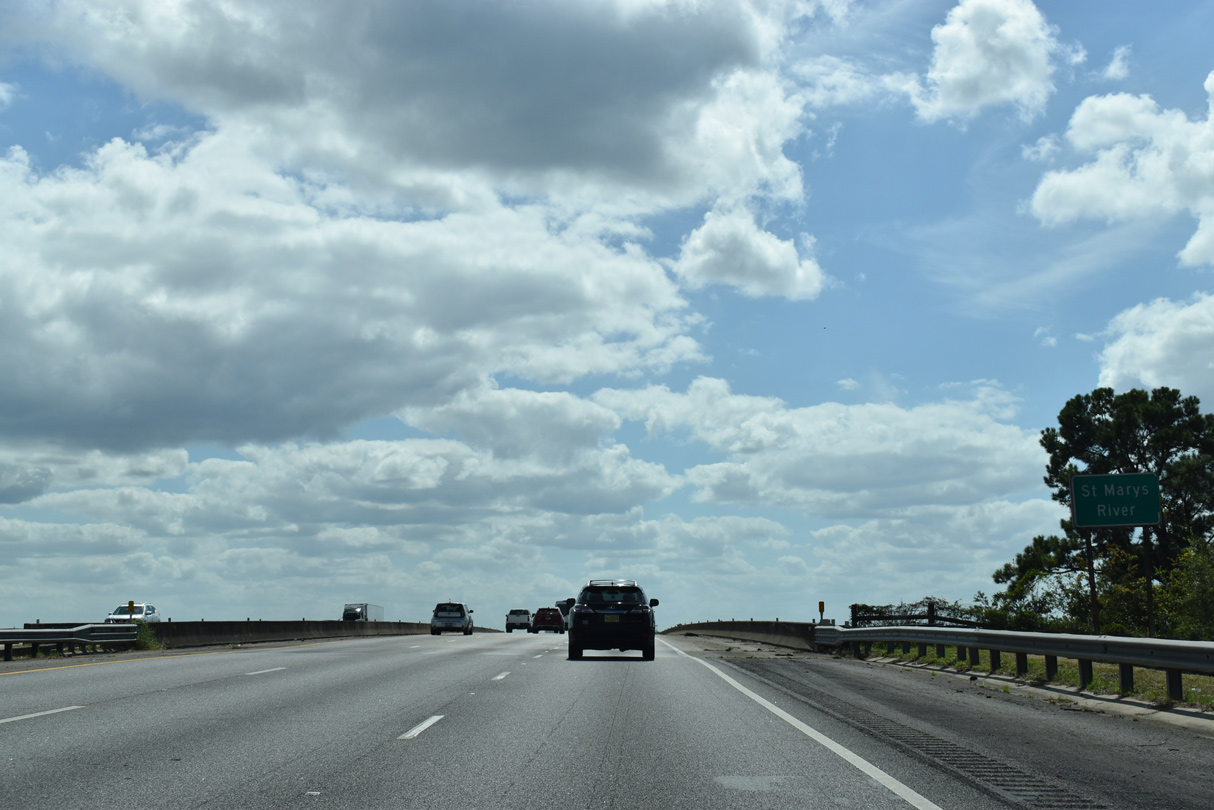
| Flowing 126 miles east from Okefenokee Swamp, the St. Marys River marks the state border between Georgia and Florida from near Moniac, around Trail Ridge to Folkston, and east to Cumberland Island and the Atlantic Ocean. 09/25/22 |
Page Updated 10-21-2023.

 South
South