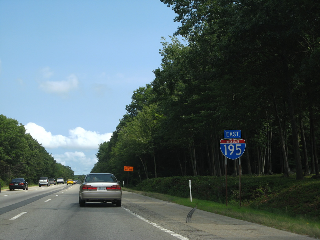
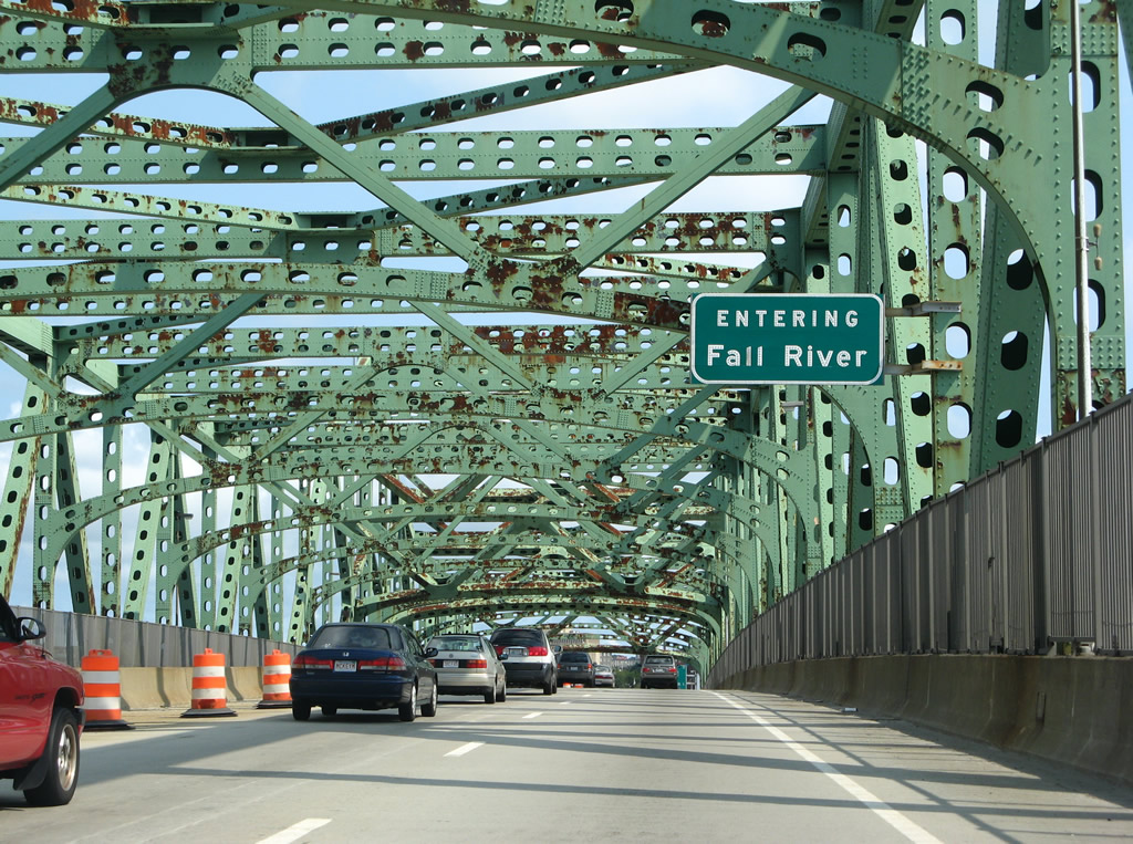
Interstate 195 crosses the city of Fall River east from the Charles M. Braga, Jr. Memorial Bridge over the Taunton River. Fall River derives its name from the Native American word Quequechan (the Quequechan River flows through the city), which translates to Falling Water. Fall River began as a Plymouth colonist settlement in 1659 after the purchase of land from the Native American Wampanoag tribe. The city later played a role in the Revolutionary War Battle of Fall River in 1778. The city was renamed to Troy in the early 1800s. The city reverted back to Fall River in 1934.2
|
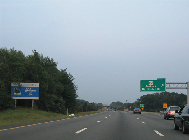
| A Massachusetts welcome sign stands within the median of Interstate 195 just beyond the Runnins River. 06/27/05 |
|
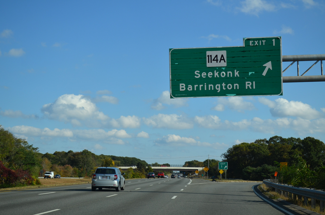
| A parclo A2 interchange joins I-195 east with Route 114A (Fall River Avenue) 0.69 miles beyond the state line. Connecting I-195 with U.S. 44 (Taunton Avenue) and U.S. 6 (Highland Avenue), Route 114A runs 3.04 miles through the town of Seekonk. 10/06/14 |
|
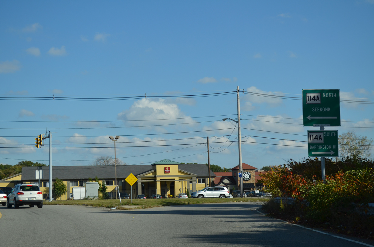
| Route 114A is part of a multi state highway from north to East Providence and south to Barrington. 10/06/14 |
|
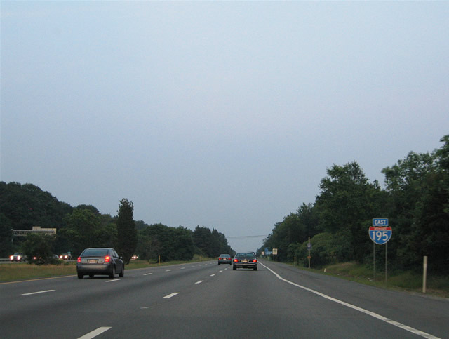
| The first reassurance shield posted for Interstate 195 east within Massachusetts. Anthony Street spans the split roadways of the freeway ahead. 06/27/05 |
|
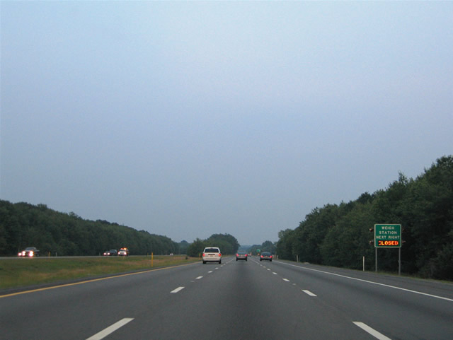
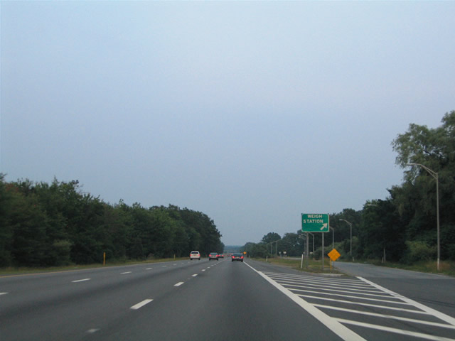
| A set of truck weigh stations line both sides of Interstate 195 just to the north of Seekonk Speedway. 06/27/05 |
|
| I-195 east at the truck weigh station in southeast Seekonk. I-195 crosses southwestern reaches of the Rehoboth next. 06/27/05 |
|
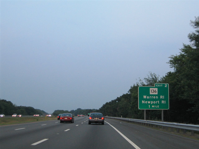
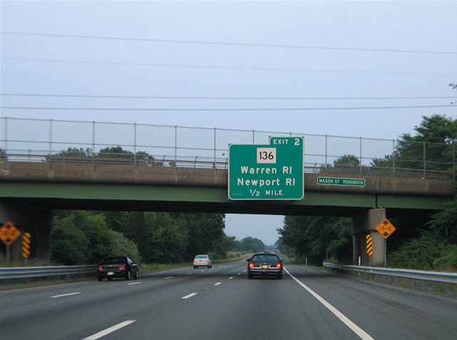
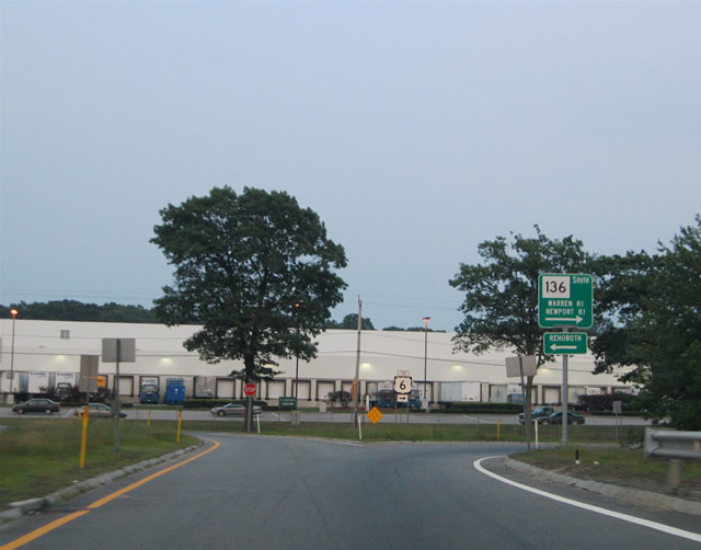
| Route 136 (James Reynolds Road) meets Interstate 195 at a parclo A2 interchange (Exit 2) in one mile. The multi state highway extends south to the towns of Warren and Bristol in Rhode Island. 06/27/05 |
|
| Route 136 (James Reynolds Road) enters Warren, Rhode Island 1.25 miles south of Exit 5 and ties into Route 114 in 8.75 miles near the Mt. Hope Bridge across Mt. Hope Bay. 06/27/05 |
|
| Route 136 spurs 1.73 miles north from the state line to Davis Street in the town of Rehoboth. 06/27/05 |
|
| Route 136 (James Reynolds Road) intersects U.S. 6 (Grand Army of the Republic Highway) just south of Exit 5 at North Swansea. 06/27/05 |
|
| Interstate 195 curves southeast from North Swansea to Gardners Neck at Ocean Grove over the ensuing stretch. 07/28/07 |
|
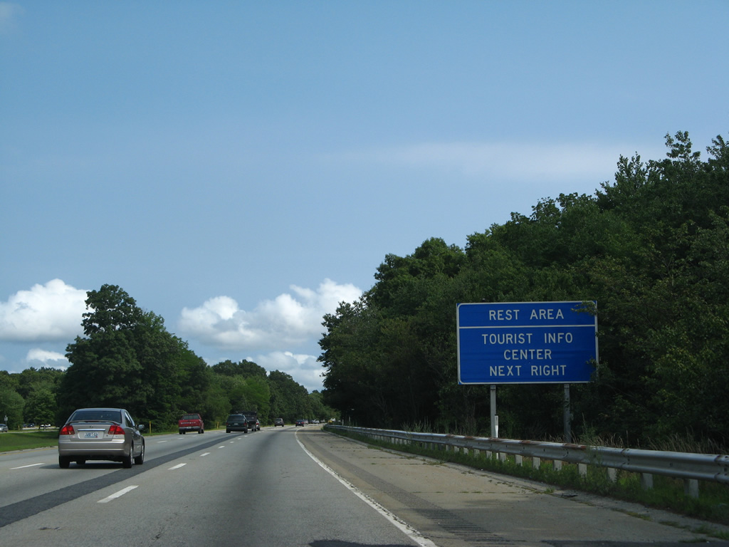
| Closed by 2011, a set of rest areas were formally located along Interstate 195 just west of Warren Reservoir and the Kickamuit River. The eastbound facility housed a tourist information center. 07/28/07 |
|
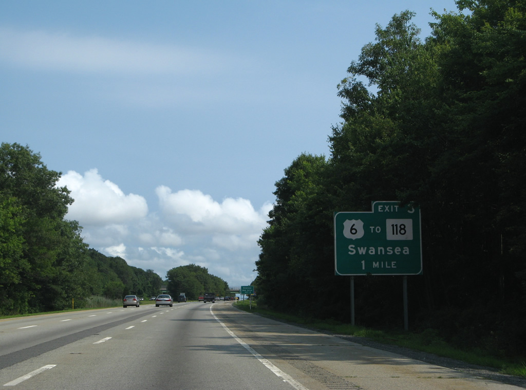
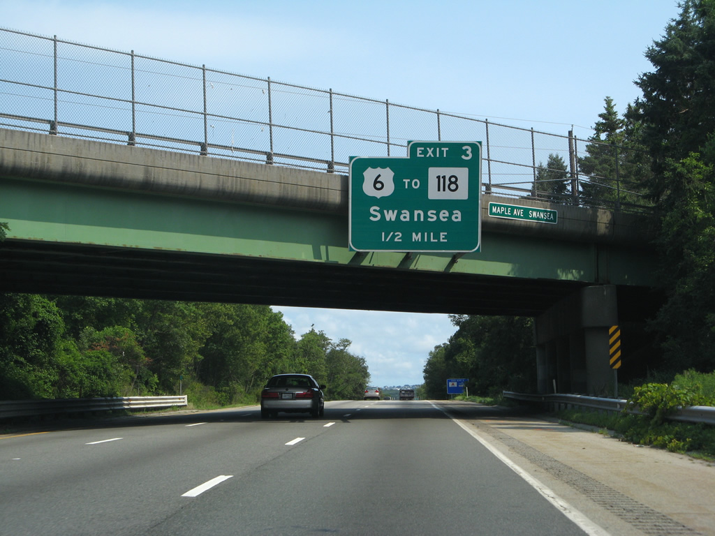
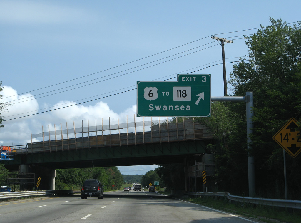
| U.S. 6 meets Interstate 195 again at parclo B2 interchange (Exit 3) near Luther Corner in one mile. 07/28/07 |
|
| Route 118 (Swansea Mall Drive) ties into U.S. 6 just east of Exit 8 by the former Swansea Mall. Route 118 stems northward four miles to Rehoboth and 11 miles to North Rehoboth. 07/28/07 |
|
| U.S. 6 travels east from Exit 8 toward the Swansea town center and Somerset, a town along the Taunton River. I-195 crosses U.S. 6 again in Fall River. 07/28/07 |
|
| Continuing southeast, Interstate 195 next crosses the Cole River onto Gardners Neck. 07/28/07 |
|
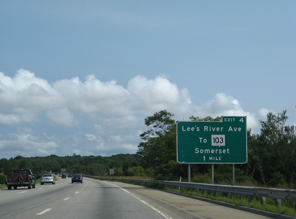
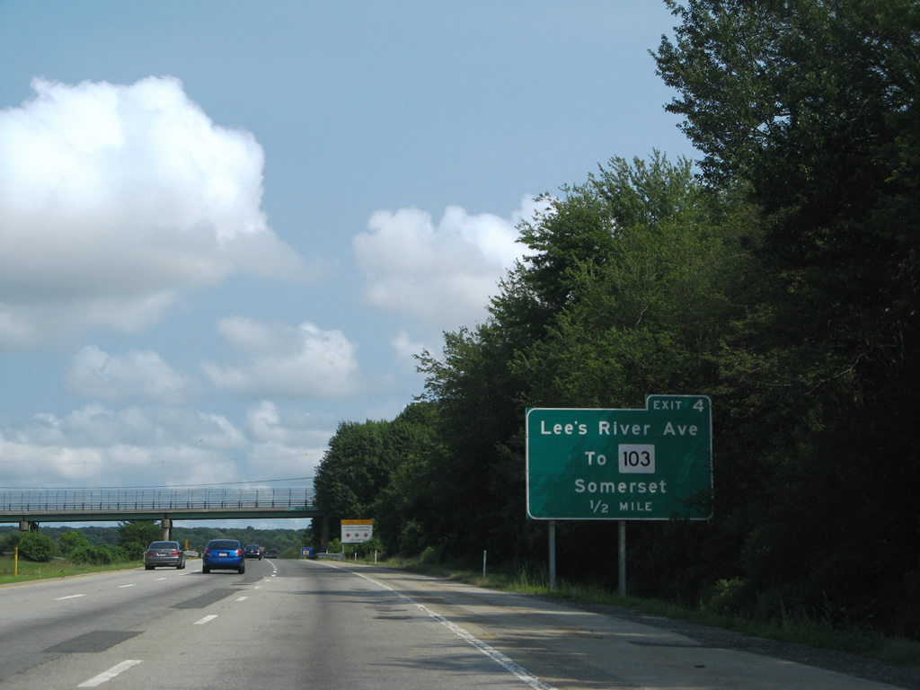
| A half diamond interchange (Exit 10) joins I-195 with Lee's River Avenue in one mile. 07/28/07 |
|
| Lee's River Avenue links Interstate 195 with adjacent Route 103 (Wilbur Avenue) east of Ocean Grove and South Swansea. 07/28/07 |
|
| Interstate 195 east spans Lee's River just north of Fox Hill Cove along the Somerset and Swansea town line. 07/28/07 |
|
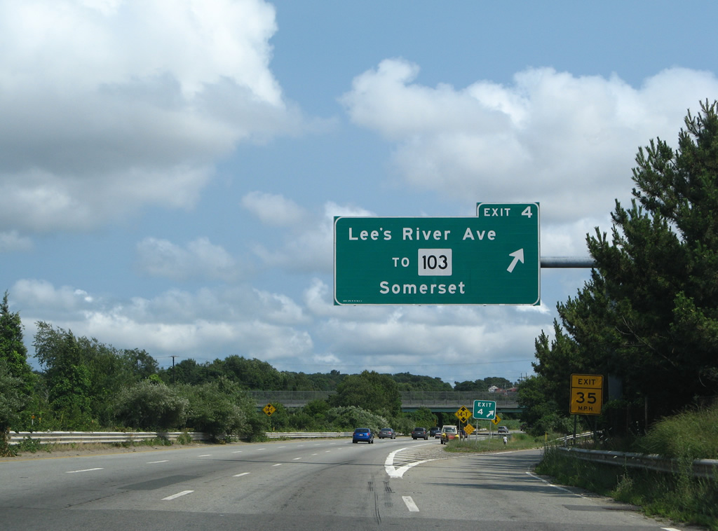
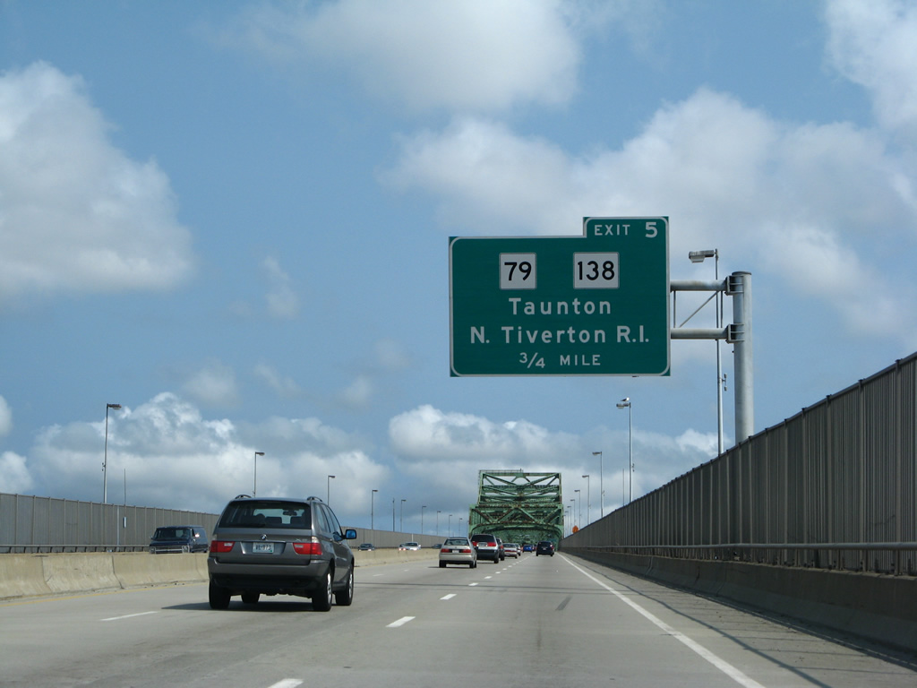
| Exit 4 departs I-195 east for Route 103 (Wilbur Avenue). 4.92 miles long, Route 103 runs east to U.S. 6 and Route 138 at the 2011 completed Veterans Memorial Bridge across the Taunton River. MSR 103 west continues to Warren, Rhode Island. 07/28/07 |
|
| Entrance ramps join Route 103 (Wilber Avenue) directly with Interstate 195 ahead of Sewammock Neck and Brayton Point. 07/28/07 |
|
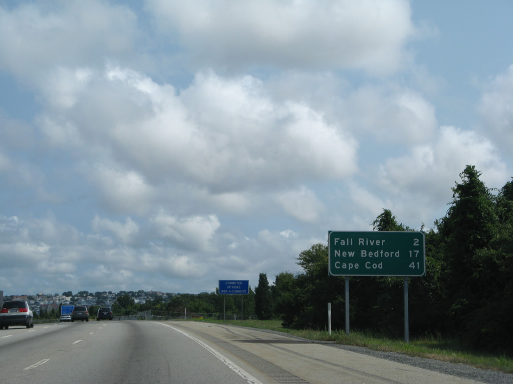
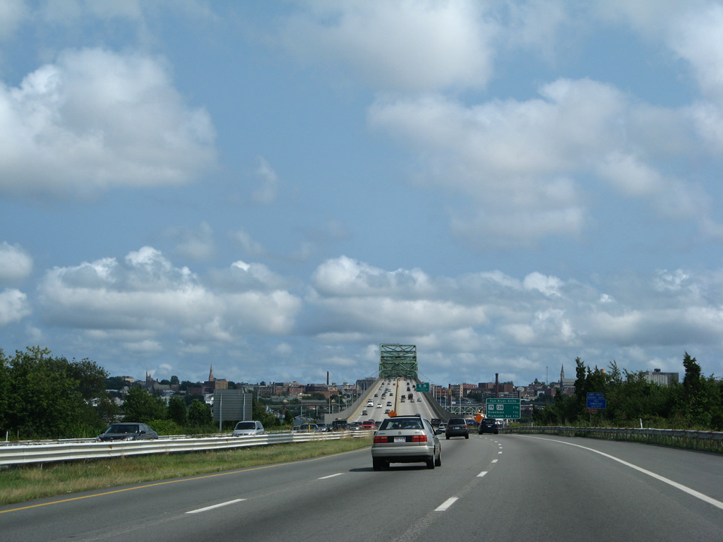
| Downtown Fall River lies two miles ahead, followed by New Bedford in 17 miles. Connections with U.S. 6 lead motorists 41 miles out to Cape Cod. 07/28/07 |
|
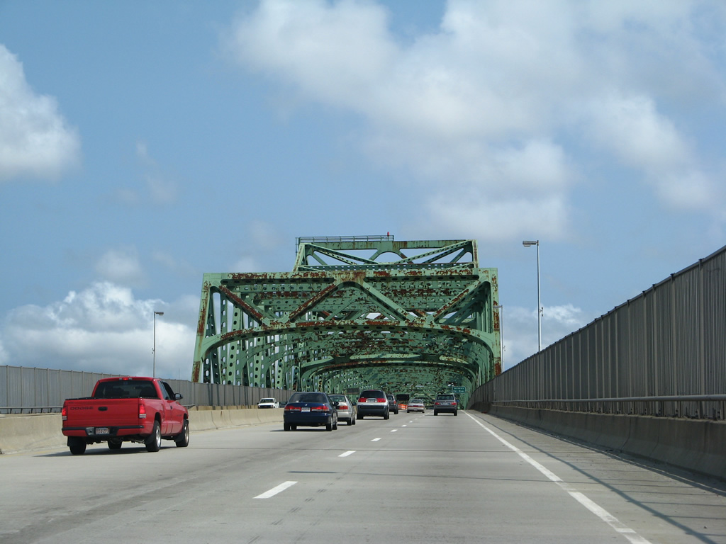
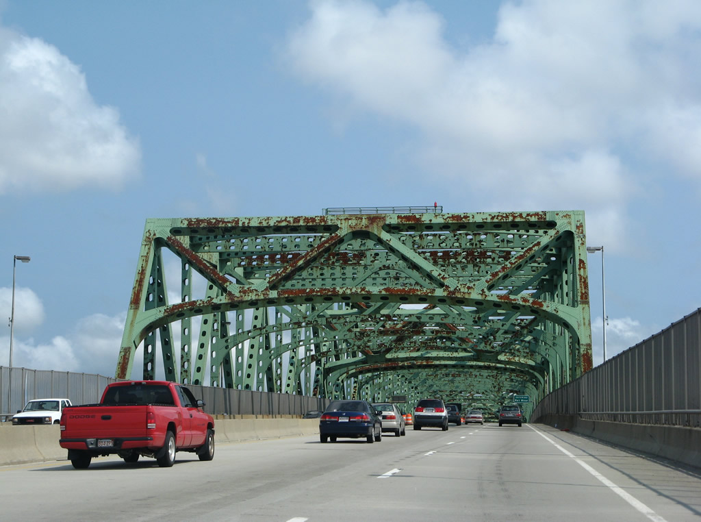
| The Charles M. Braga, Jr. Memorial Bridge is a through-truss bridge taking I-195 across the Taunton River from near Brayton Point Beach. The bridge was built in conjunction with the freeway between Exits 8 and 16 during 1960-65.1 07/28/07 |
|
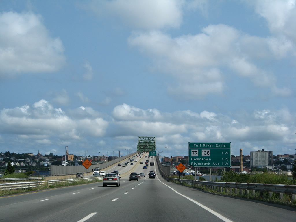
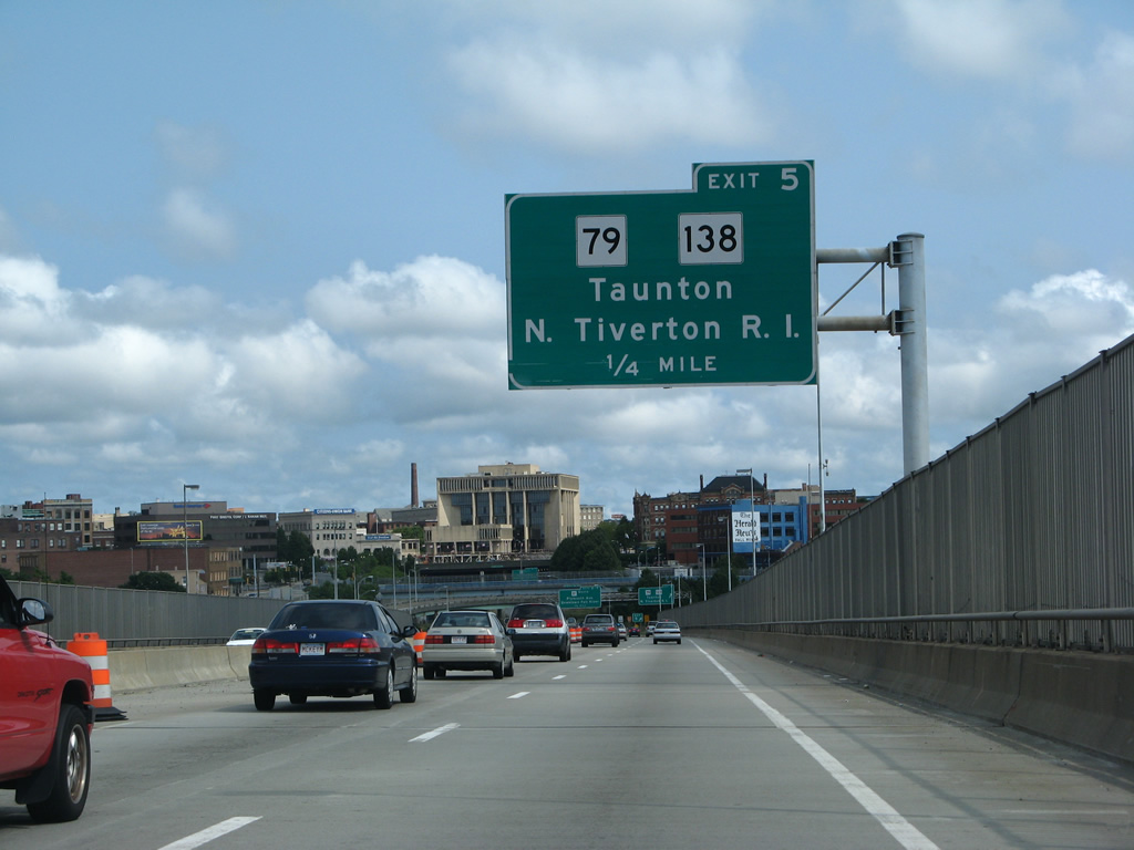
| Ramps at the eastern end of the Charles Braga Bridge tie into Route 79/138 and Milliken Boulevard near Downtown Fall River. 07/28/07 |
|
| Spanning the Taunton at a total length of 5,780 feet, the Braga Bridge ascends to a height of 135 feet above mean high water. The 101.3 foot wide bridge accommodates six lanes of traffic with partial outside shoulders.3 07/28/07 |
|
| Route 79 straddles the Taunton River northward to Route 24 (Fall River Expressway) to Taunton, Brockton and Boston. Route 138 follows the Western Fall River Expressway frontage street system (Davol Street) north to U.S. 6 and the Veterans Memorial Bridge. 07/28/07 |
|
| The Braga Bridge was repainted from lime green to deep blue during a 2010-12 project. 07/28/07 |
|
| The Braga Bridge was previously reconstructed in 1989.1 07/28/07 |
|
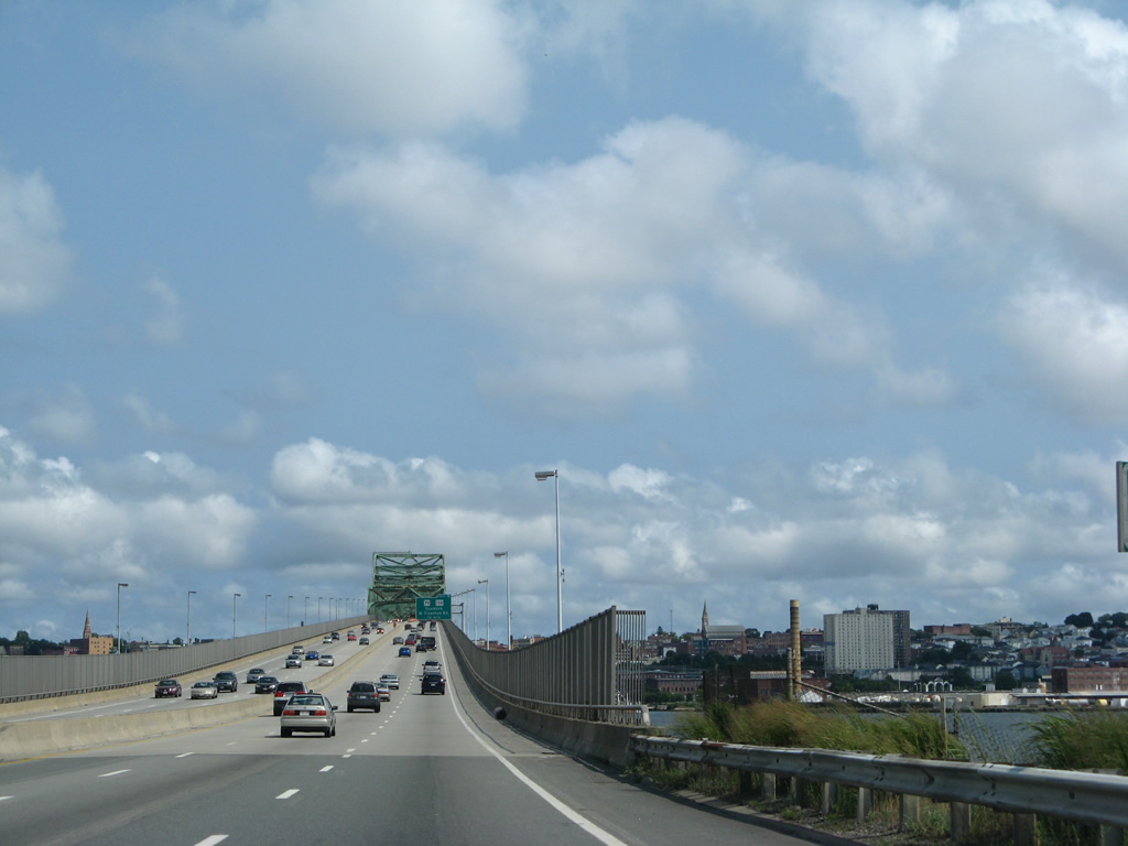
| A button copy sign marks the Fall River city line above the 400 foot wide shipping channel of the Taunton River. The city limits extend southward to the Rhode Island state line. 07/28/07 |
|
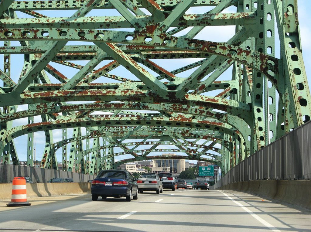
| The Downtown Fall River skyline comes into view as Interstate 195 lowers from the Braga Bridge to Exit 11 and Route 79. A number of attractions are located nearby including Battleship Cove, Fall River Heritage State Park and the Maritime Museum at Fall River. 07/28/07 |
|
| Davol Street N/S were rebuilt into the main travel lanes of both Route 79/138 northward to the truncated freeway beginning west of Cedar Street as part of the Route 79/Braga Bridge Improvements Project. The two-deck viaduct for Route 79/138 running north from Anawan Street to a point west of Maple Street was subsequently demolished. 07/28/07 |
|
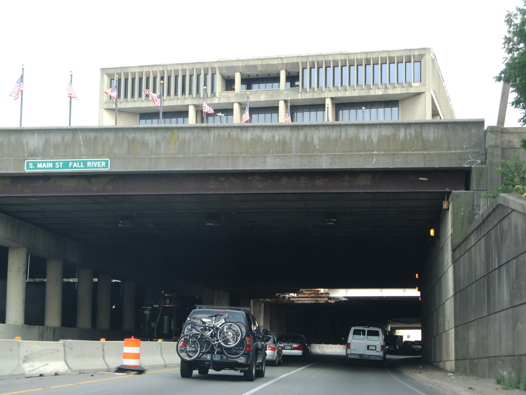
| Located above a cut and cover tunnel built in 1965, the Fall River Government Center appears beyond the flyovers at Exit 11.
Costing $197 million and underway through 2017, the Route 79/Braga Bridge Improvements Project replaced the elevated structure along the Taunton River with a four lane boulevard (Davol Street) in conjunction with area street improvements and ramp changes. 07/28/07 |
|
| Ramp changes made at Exit 11 as part of the Route 79/Braga Bridge Improvements Project eliminated direct access to Millken Boulevard while realigning Exit 11 to a signalized intersection with Davol Street (Route 79/138) across from the new Water Street Connector. 07/28/07 |
|
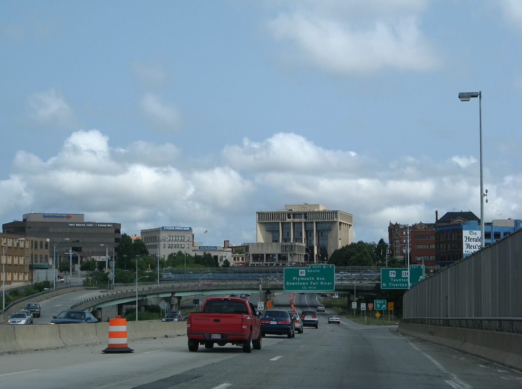
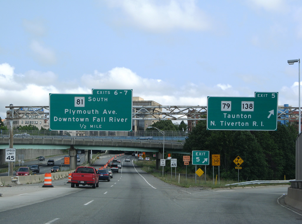
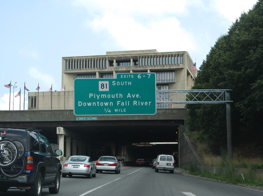
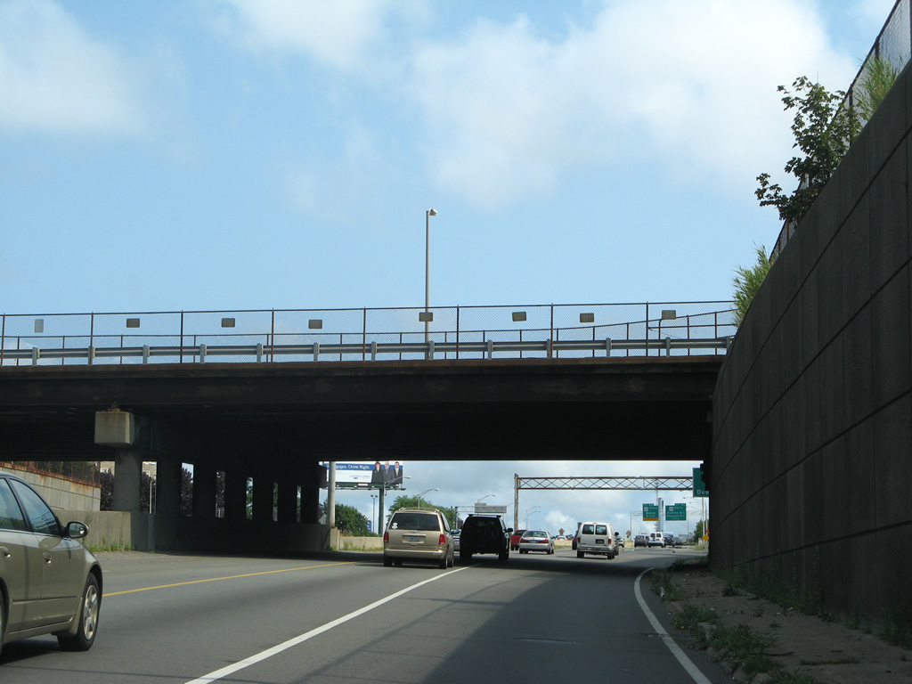
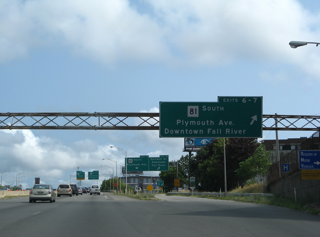
| Back to back ramps depart Interstate 195 east beyond the Government Tunnel in a quarter mile for Hartwell Street west to Downtown and Route 81 (Plymouth Avenue). 07/28/07 |
|
| More of a bridge structure supporting a large deck, the Government Tunnel was built in 1965. Located between Main and Third Streets above is the Fall River Government Center opened in 1976.1 The tunnel was rehabilitated with new ceiling panels while structural repairs were made as part of a $14.3 million project between January 2006 and April 30, 2010.4 07/28/07 |
|
| Interstate 195 emerges from the Government Tunnel ahead of 4th Street. 07/28/07 |
|
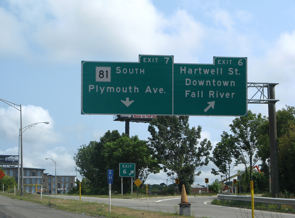
| Exits 12 and 13 quickly depart I-195 east beyond 4th Street. Route 81 commences a 2.62 mile long course southward to Tiverton, Rhode Island here. 07/28/07 |
|
| Exit 12 provides a ramp onto adjacent Hartwell Street toward the Government Center while Exit 13 links with Route 81 (Plymouth Avenue) to south Fall River and Tiverton, Rhode Island. 07/28/07 |
|
| Leaving the diamond interchange (Exit 13) with Plymouth Avenue, I-195 east next converges with Route 24 along the Fall River Expressway at Exits 14 A/B. 07/28/07 |
|
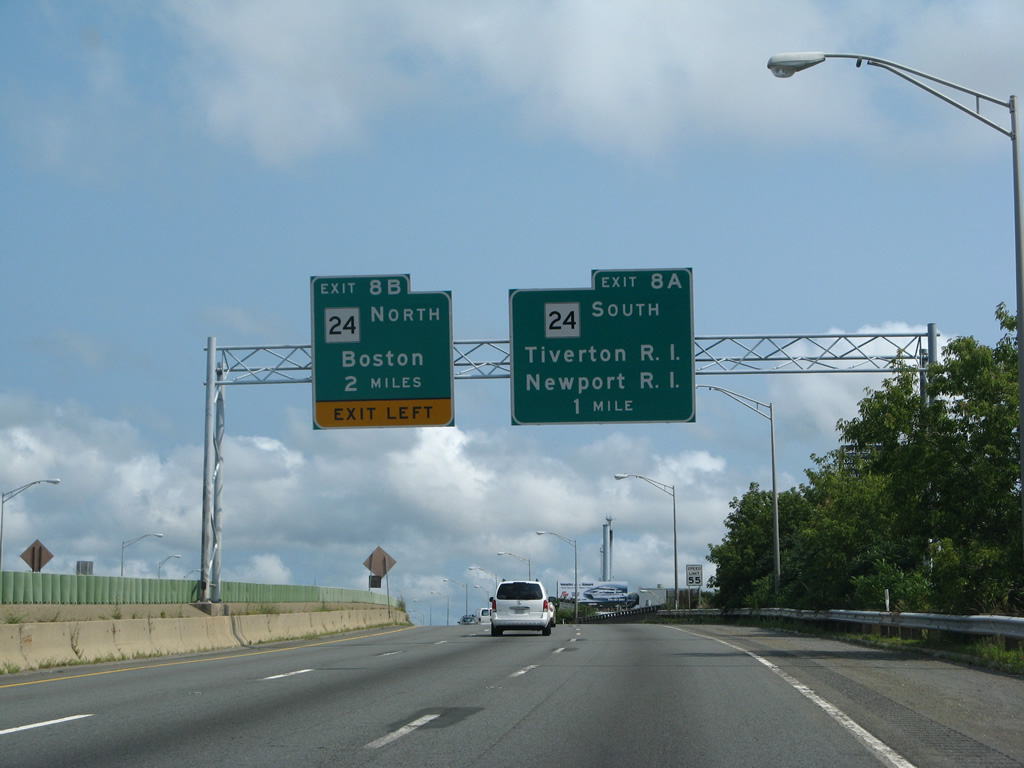
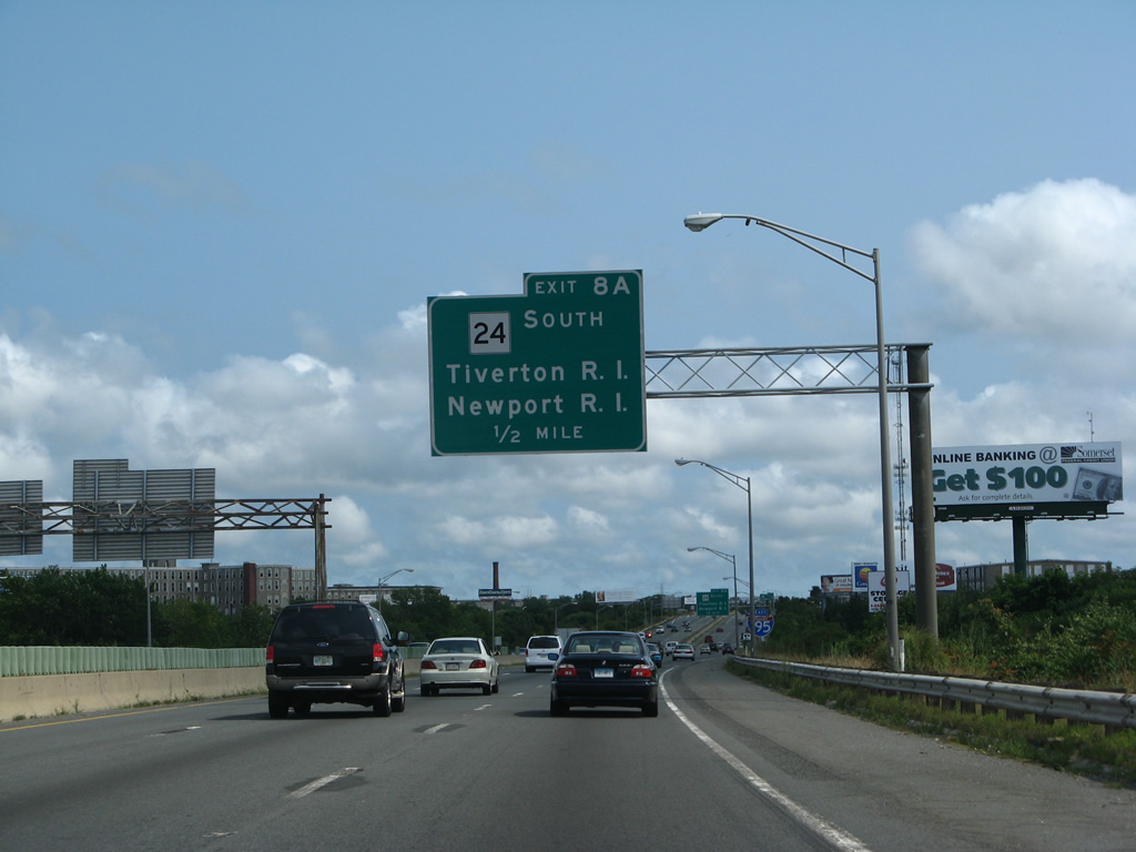
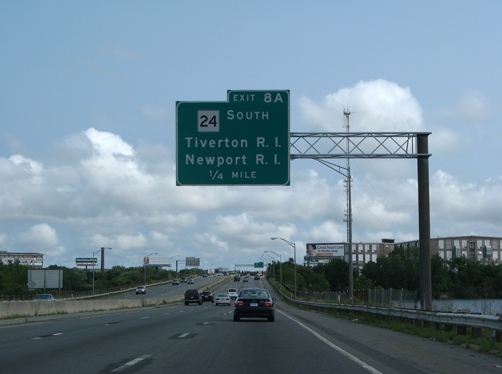
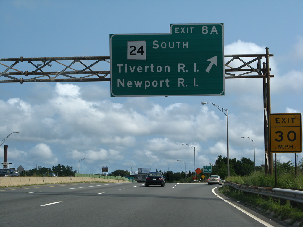
| Route 24 leads south from Exit 14 A to Newport, Rhode Island. MSR 24 comprises a 48 mile freeway between Portsmouth, Rhode Island and Canton, Massachusetts. 07/28/07 |
|
| Interstate 195 lines a causeway across the Quequechan River to the trumpet interchange (Exit 14 A) with Route 24 south. 07/28/07 |
|
| Route 24 north combines with Interstate 195 east for 0.35 miles between Exits 14 A and 14 B. Route 24 (Fall River Expressway) south enters Tiverton, Rhode Island in 2.03 miles. 07/28/07 |
|
| Route 24 turns southwest from the west side of South Watuppa Pond and connects with Route 114 at Portsmouth, Rhode Island in 9.6 miles. 07/28/07 |
|
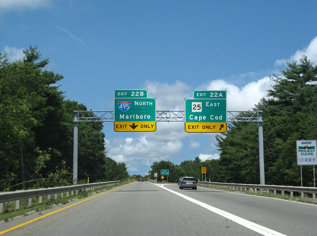
| A pair of end shields precede the trumpet interchange joining I-195 with Interstate 495 north and Route 25 south at Wareham. 07/28/07 |
|
| Single lane ramps (Exits 40 A/B) partition for the freeway along Route 25 east to Bourne and Buzzards Bay and I-495 northwest to Middleborough, Franklin and Marlborough. 07/28/07 |
Page Updated 01-23-2015.

 East
East