|
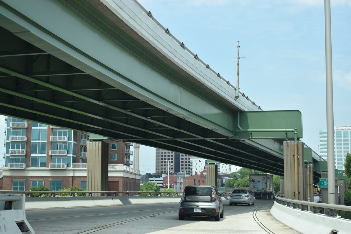
| Leading west from I-95, SR 195 (Downtown Expressway) runs along a double decked viaduct spanning U.S. 360 (S 14th Street). 05/28/21 |
|
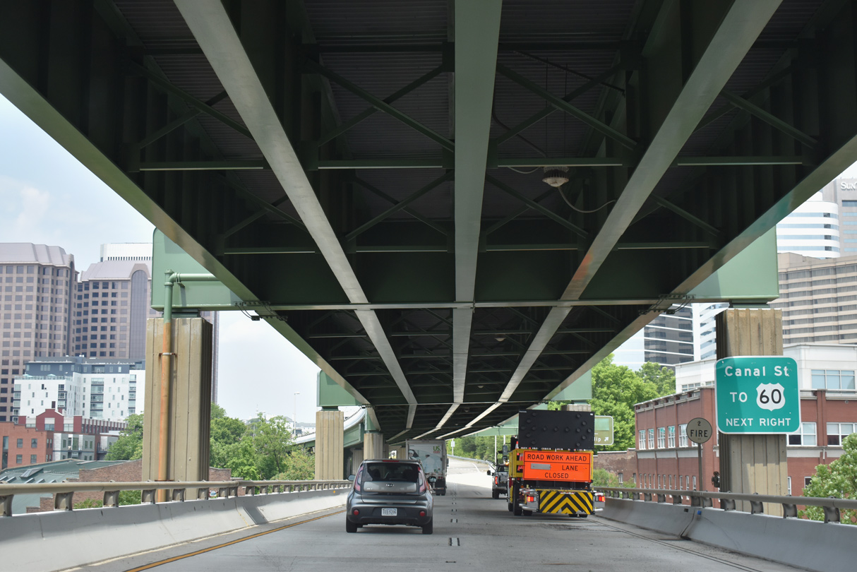
| The exit for Canal Street departs beyond double deck section of SR 195 to U.S. 60 (9th Street) and the Virginia State Capitol. 05/28/21 |
|
| U.S. 60 crosses the James River over the Manchester Bridge south from Canal Street and the couplet along 8th/9th Streets. 05/28/21 |
|
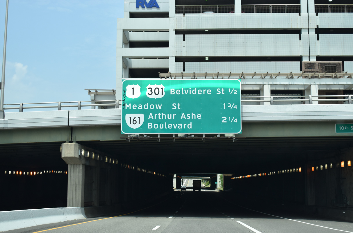
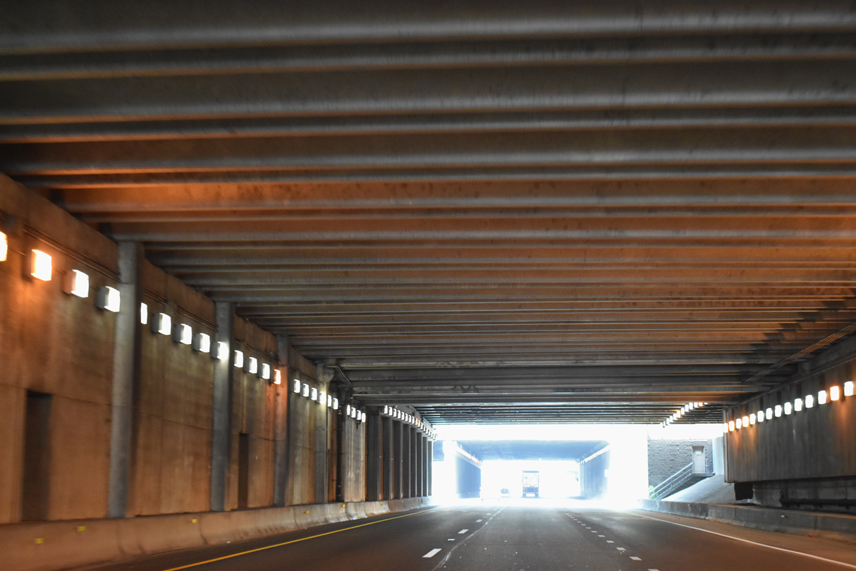
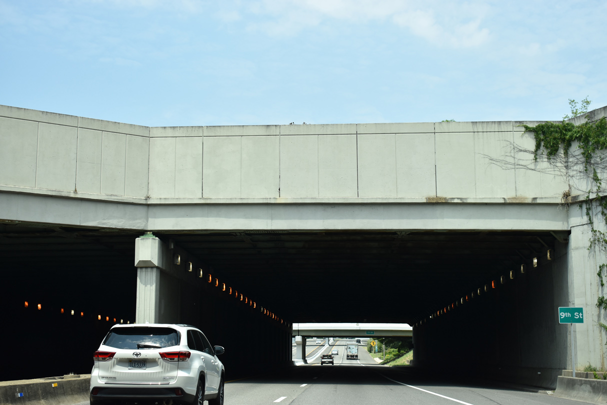
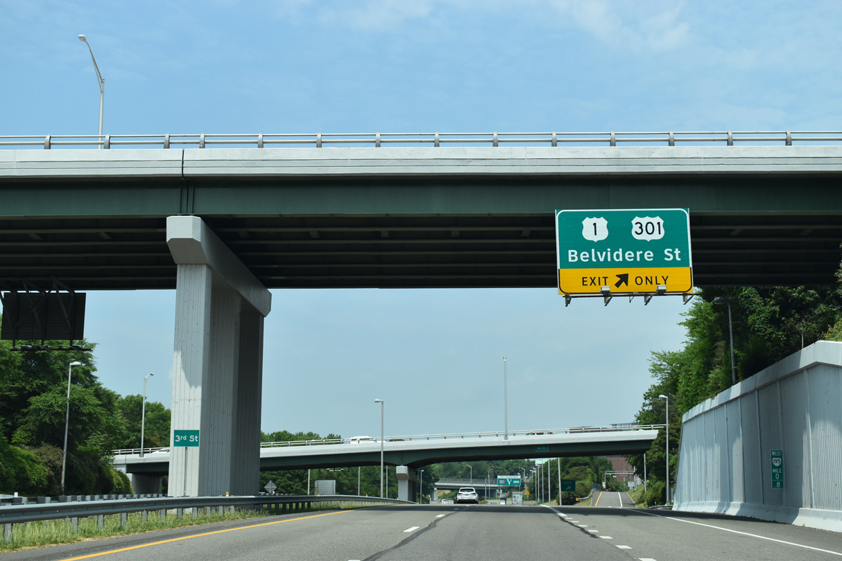
| SR 195 (Downtown Expressway) drops below grade through a pair of cut and cover tunnels at 10th Street and U.S. 60 (9th Street). The succeeding exit links with U.S. 1/301 (Belvidere Street) at Monroe Ward. 05/28/21 |
|
| SR 195 emerges from the tunnel below Kanawha Plaza at the entrance ramp from 7th and Canal Streets. 05/28/21 |
|
| U.S. 1/301 (Belvidere Street) overlap south across the Robert E. Lee Bridge to Manchester in south Richmond. 05/28/21 |
|
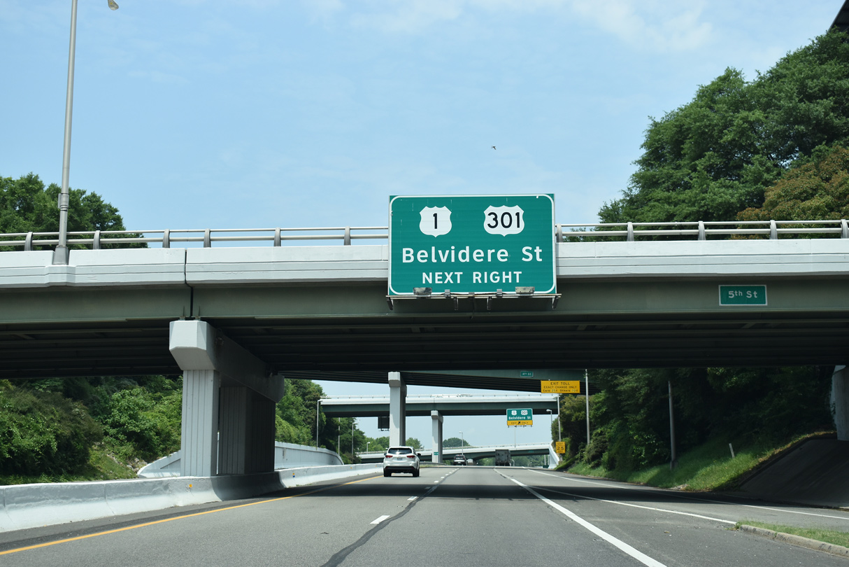
| Northward from SR 195, U.S. 1/301 (Belvidere Street) continue to Virginia Commonwealth University (VCU) at Monroe Park and U.S. 250 (Broad Street) at the Carver neighborhood. 05/28/21 |
|
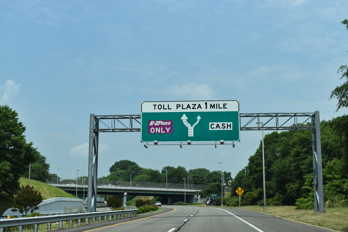
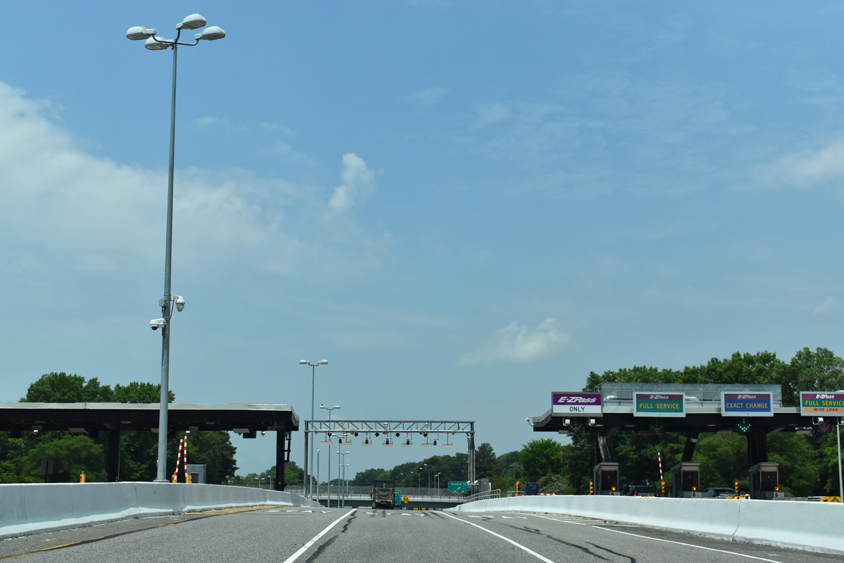
| The Downtown Toll Plaza follows the exchange with U.S. 1/301 (Belvidere Street) along SR 195 west. 05/28/21 |
|
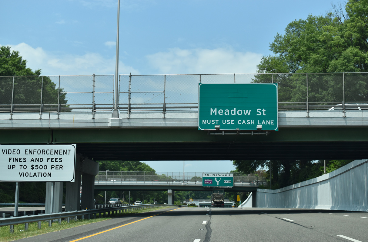
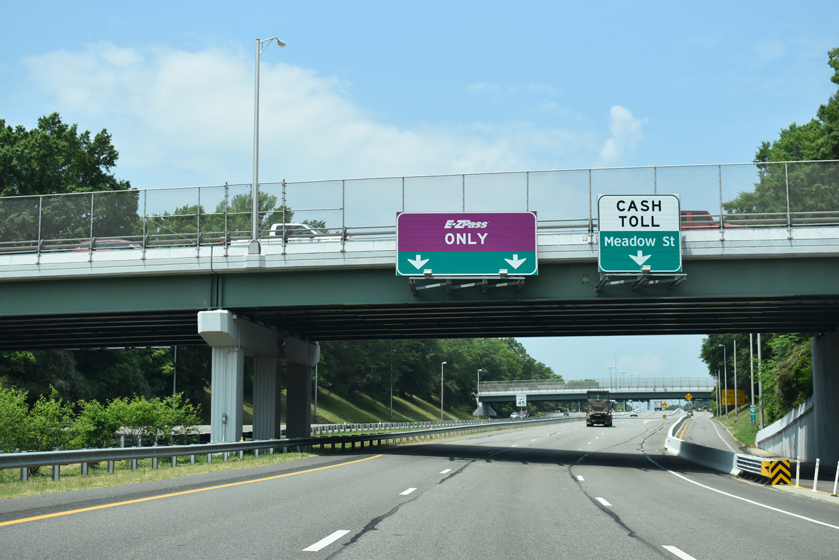
| The Downtown Expressway stays below grade west between The Fan District and Randolph neighborhoods to Meadow Street. 05/28/21 |
|
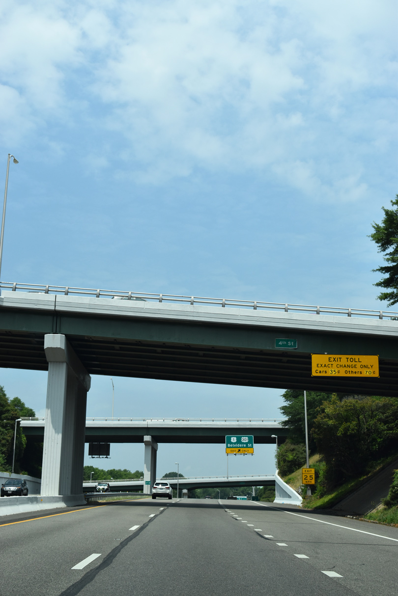
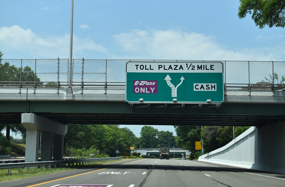
| Located west of Randolph Street, the Downtown Toll Plaza precedes the Meadow Street off-ramp. 05/28/21 |
|
| Three high speed E-ZPass lanes continue through the Downtown Toll Plaza in the westbound direction. None are available eastbound. 05/28/21 |
|
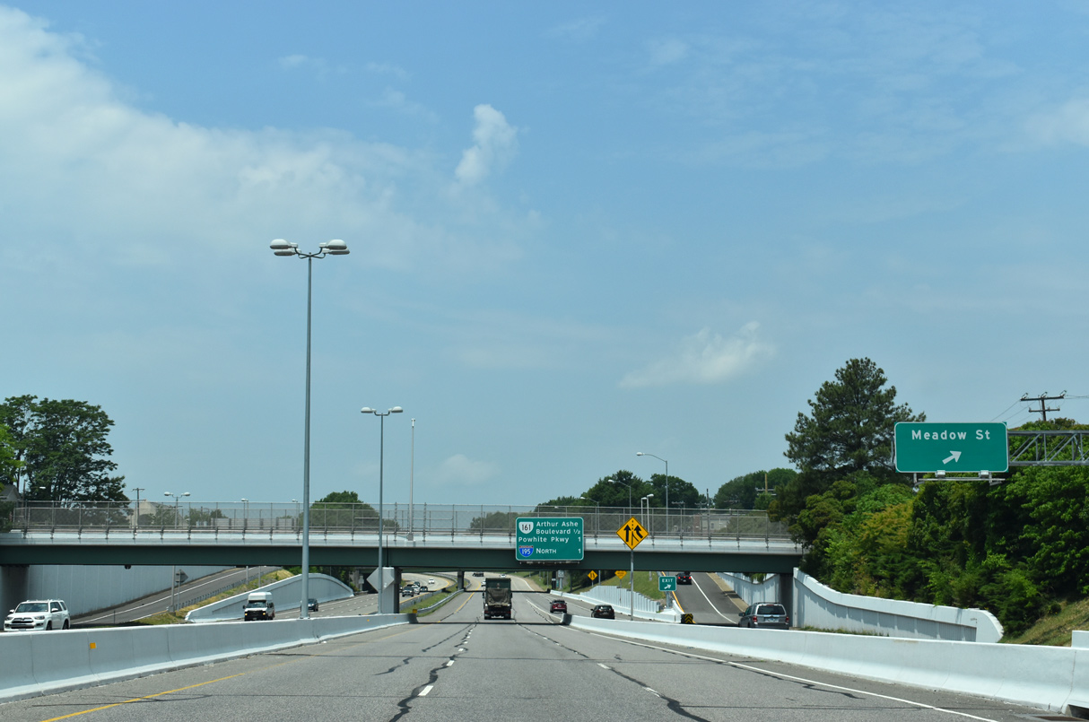
| A half diamond interchange joins SR 195 (Downtown Expressway) west with Meadow Street. 05/28/21 |
|
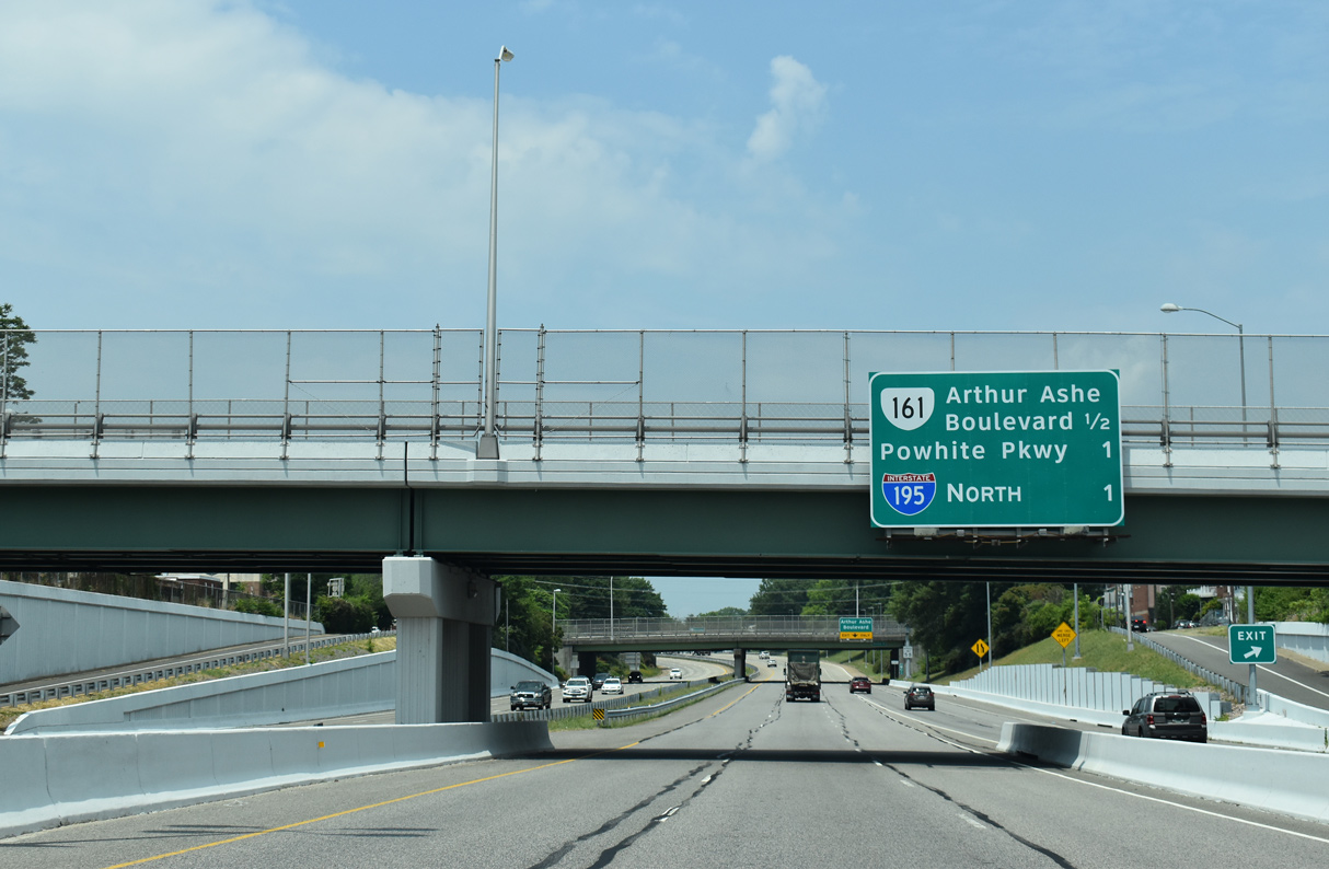
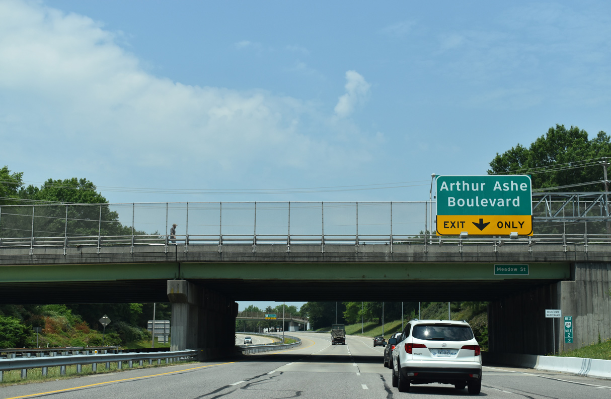
| SR 195 (Downtown Expressway) continues a half mile from the Allen Avenue overpass to the exit ramp for SR 161 (Arthur Ashe Boulevard). 05/28/21 |
|
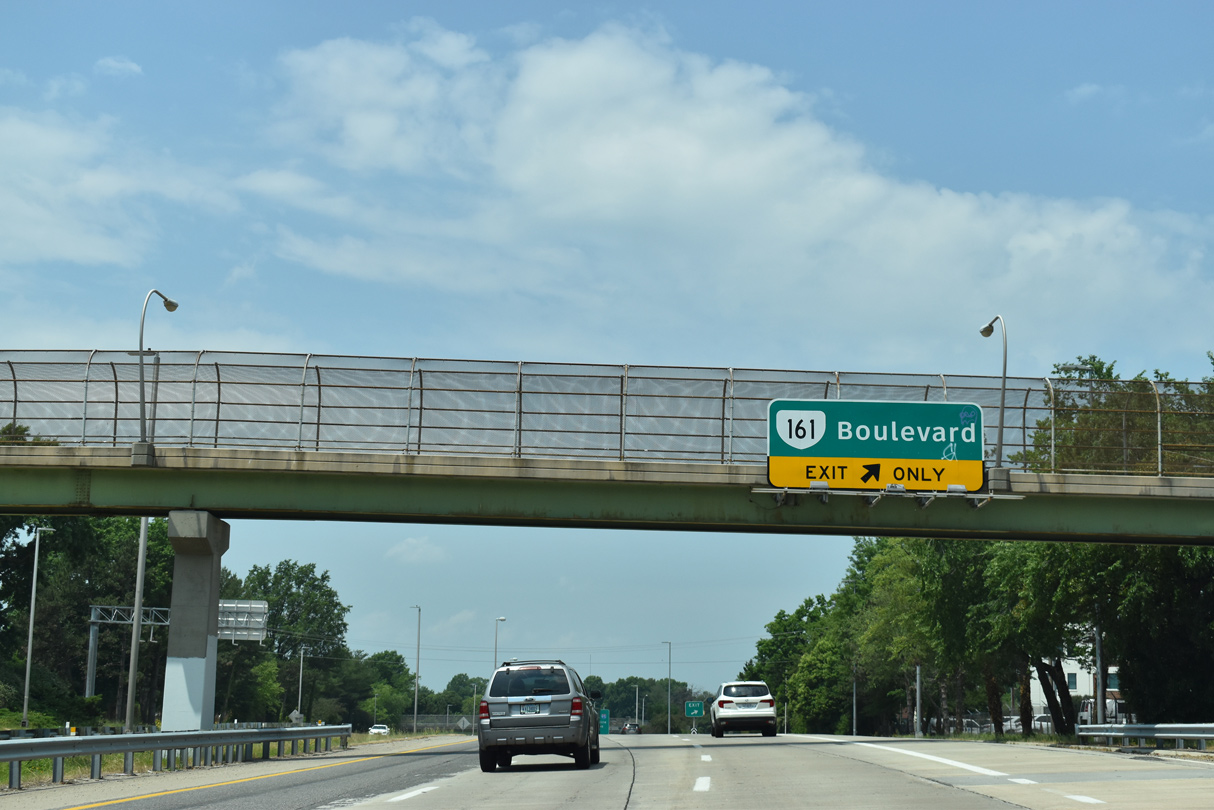
| A begin shield for I-195 was previously posted at the Meadow Street overpass ahead of the off-ramp to Idlewood Avenue at Robinson Street for SR 161. 05/28/21 |
|
| SR 161 (Arthur Ashe Boulevard) is a major corridor through Richmond. The state route heads south through Maymont Park to the Boulevard Toll Bridge spanning the James River to Forest Hill and Westover Hills. Northward, SR 161 runs through the Museum District to Scott's Addition. 05/28/21 |
|
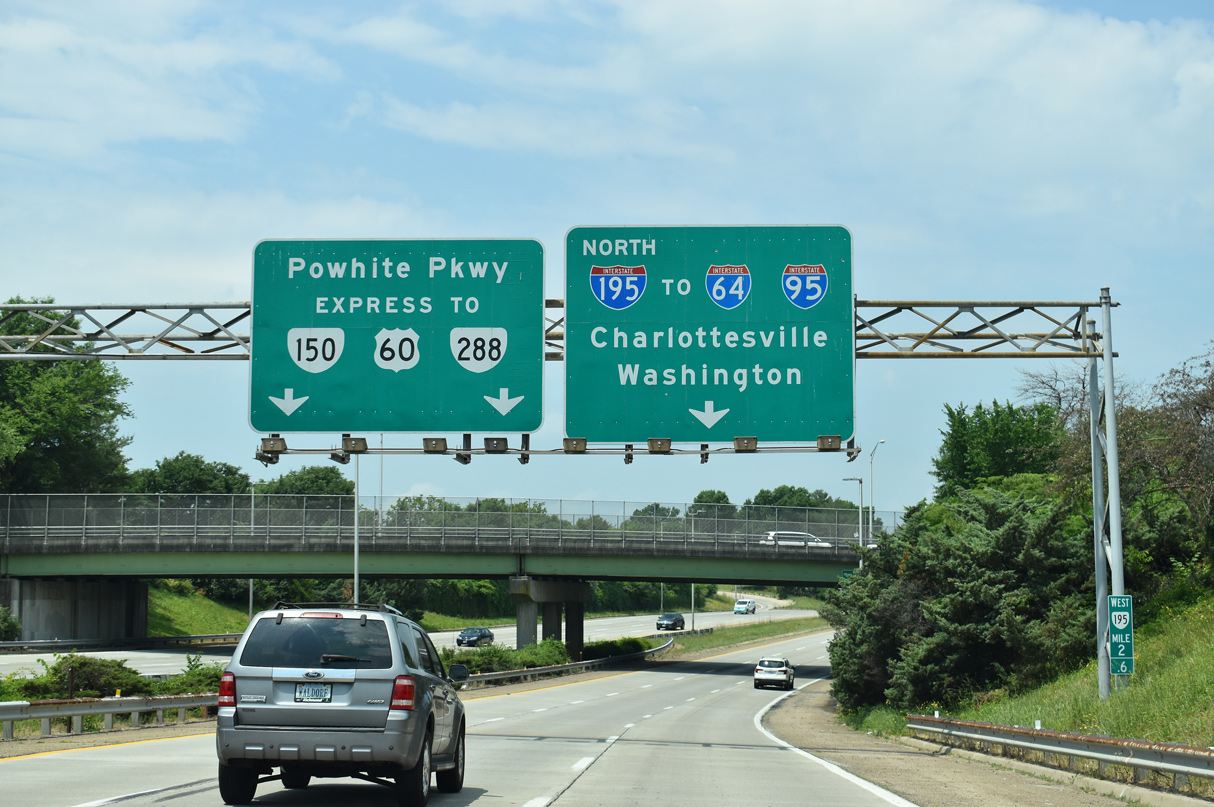
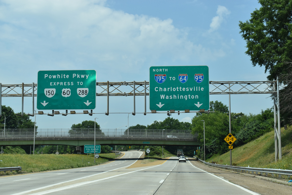
| SR 195 (Downtown Expressway) concludes as the separation of Interstate 195 and SR 146 (Powhite Parkway). SR 146 is the 0.86 mile connector to SR 76 west across the James River. 05/28/21 |
|
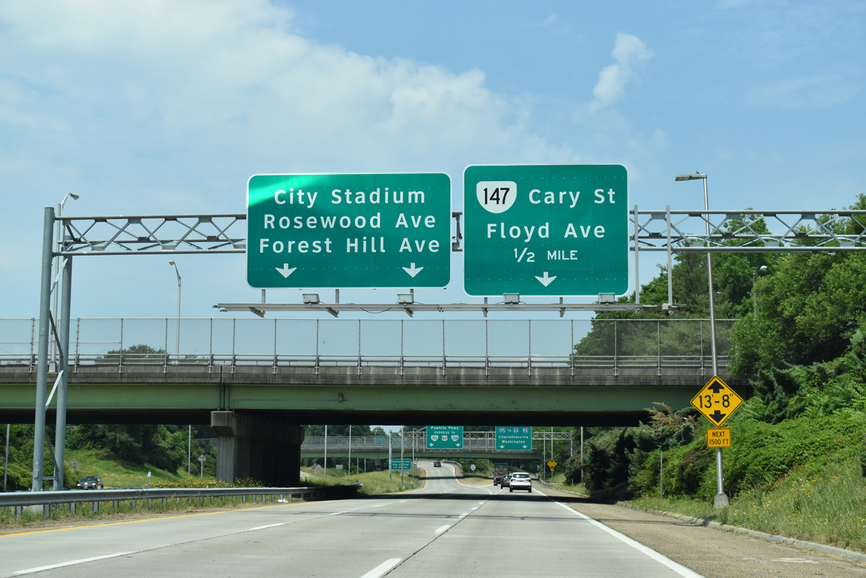
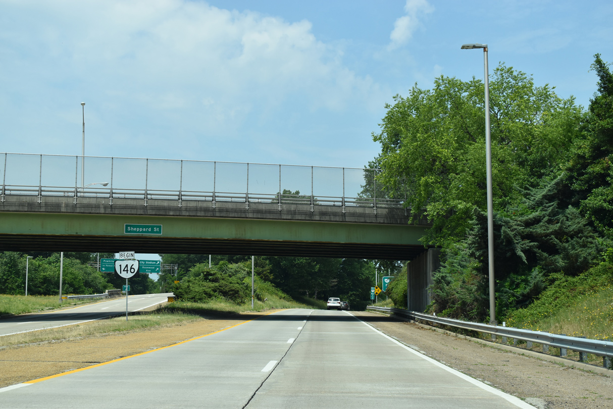
| A parclo interchange ties into the separation of I-195/SR 146 with Rosewood Avenue and McCloy Street by City Stadium. 05/28/21 |
|
| SR 76 (Powhite Parkway) is a toll road extending 12.10 miles from SR 146 at Carillon to SR 150 (Chippenhem Parkway, U.S. 60 and SR 288 south of Midlothian. 05/28/21 |
|
| A pair of begin shields for SR 146 precede the Rosewood Avenue off-ramp from the east leg of Powhite Parkway. 05/28/21 |
|
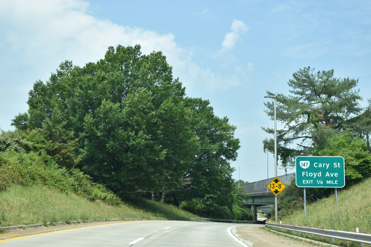
| Interstate 195 commences from SR 195 (Downtown Expressway) between the Stadium and Carytown neighborhoods parallel to SR 147 (Cary Street / Ellwood Avenue). 05/28/21 |
|
| Interstate 195 curves north into a wye interchange with the east end of SR 76 (Powhite Parkway) at the exit ramp for Floyd Avenue and Thompson Street south to SR 147 (Cary Street). SR 147 extends west from Windsor Farms nearby to the University of Richmond and the Huguenot Bridge across the James River. 05/28/21 |
|
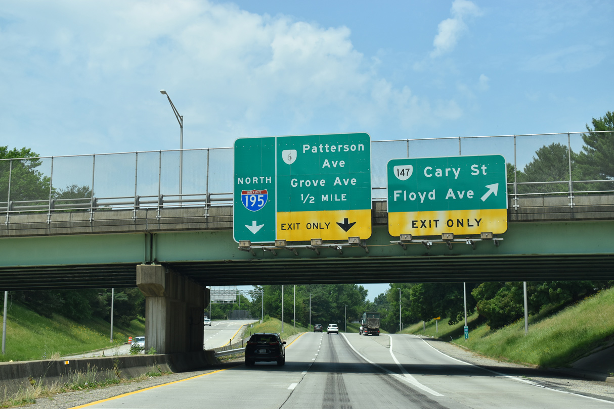
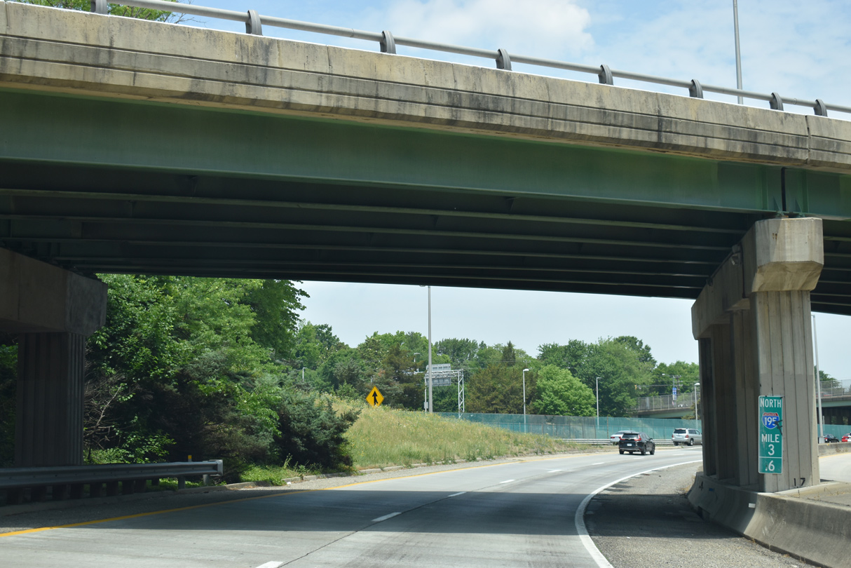
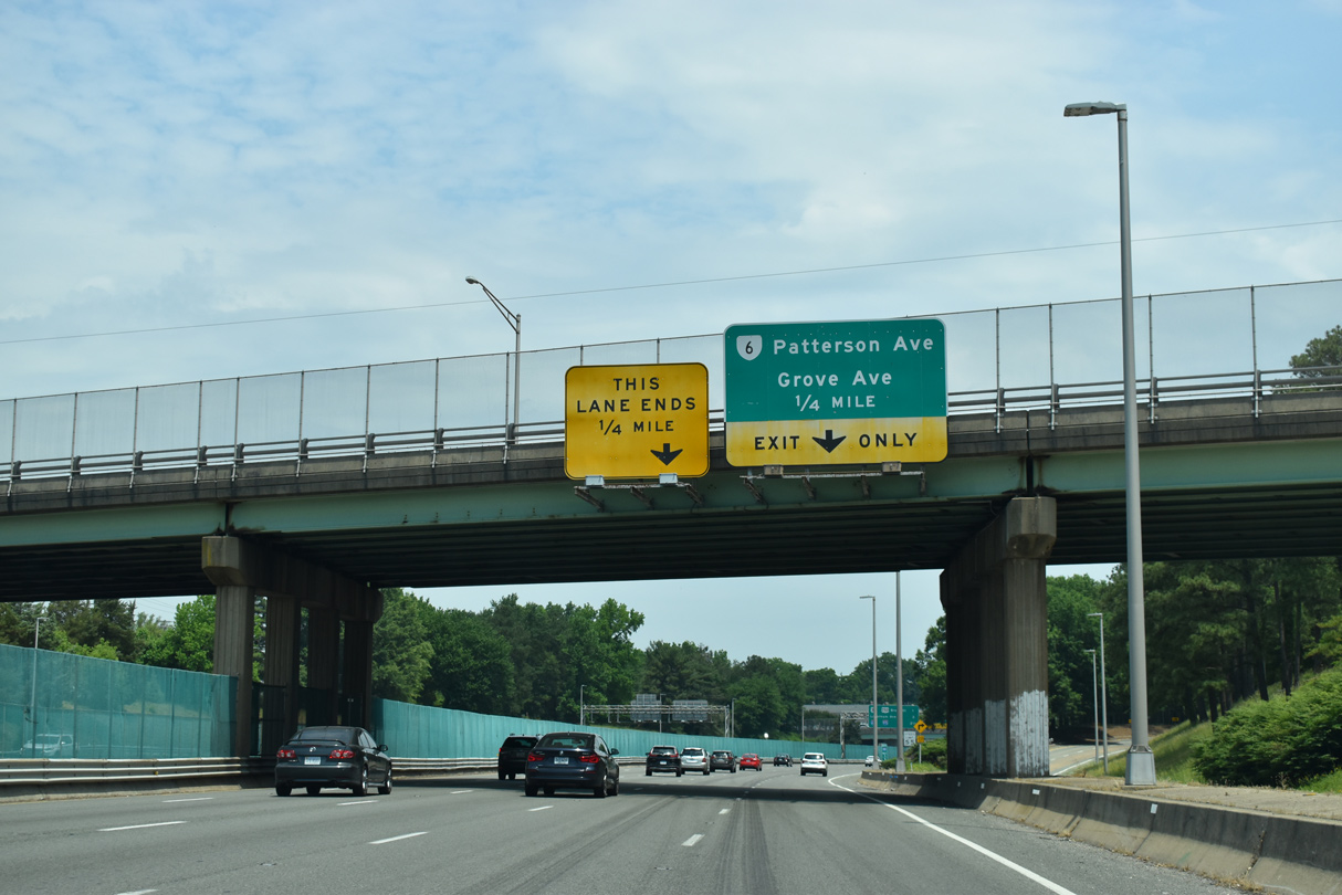
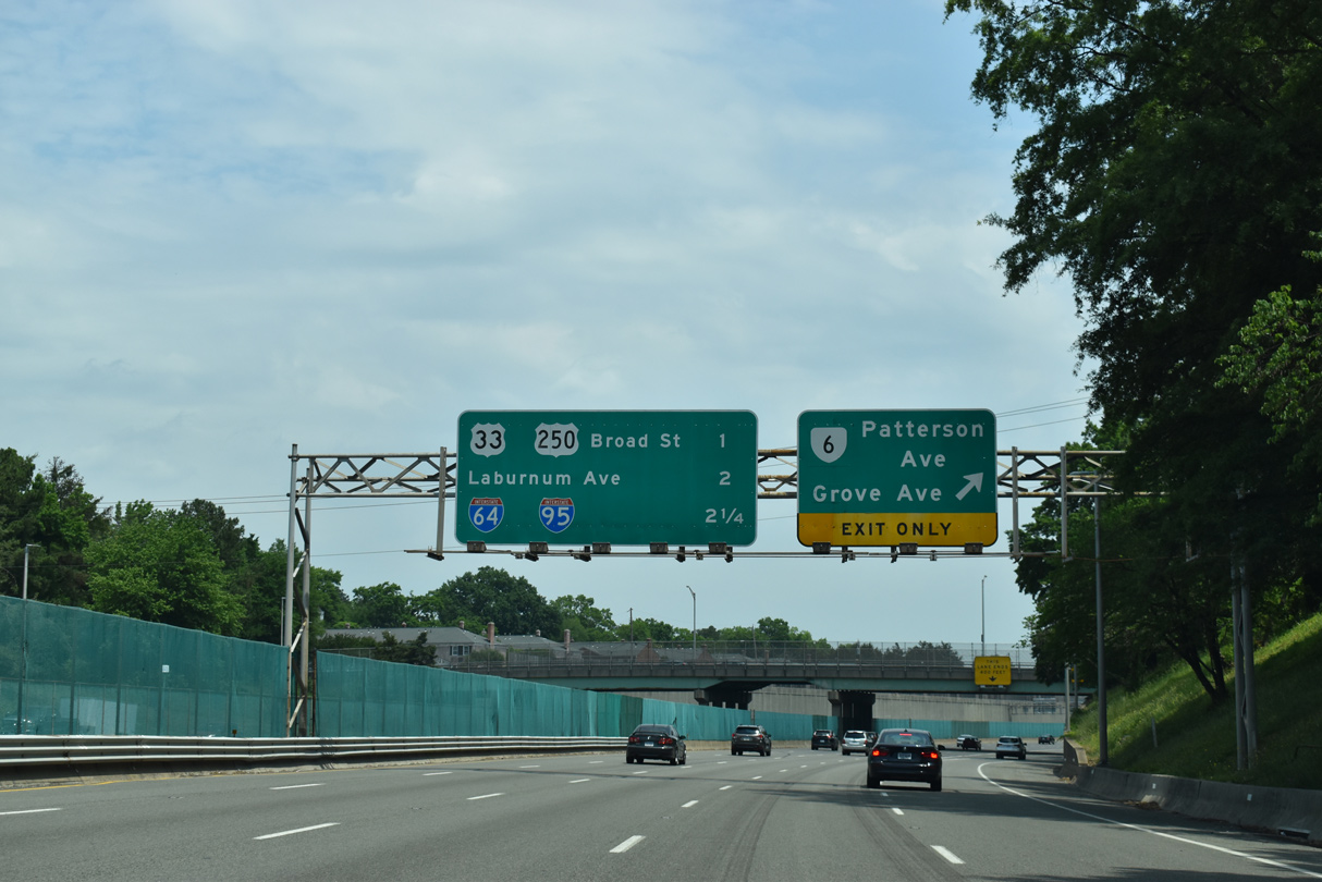
| Northbound I-195 continues with five lanes from the merge with SR 76 (Powhite Parkway) to the SR 6 (Patterson / Kensington Avenues) / Grove Avenue off-ramp. 05/28/21 |
|
| SR 6 (Kensington Avenue) parallels Grove Avenue three blocks to the north through the Museum District. The state route ends at SR 161 (Arthur Ashe Boulevard) to the east. Patterson Avenue leads the route west to Westhampton and Tuckahoe beyond the Richmond city line. 05/28/21 |
|
| A lane drop follows the northbound off-ramp to Thompson Street for SR 6 and Grove Avenue. 05/28/21 |
|
| A CSX Railroad line runs along the median of Interstate 195 (Beltline Expressway) north to U.S. 33/250 (Broad Street). 05/28/21 |
|
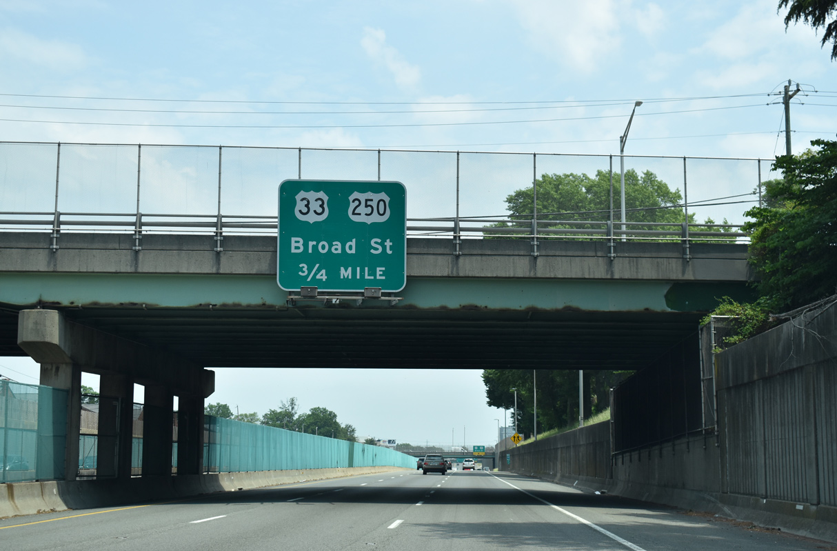
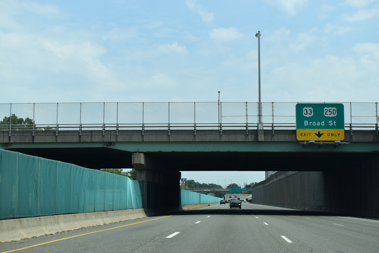
| U.S. 33/250 (Broad Street) overlap 3.1 miles northwest from SR 33 (Hancock / Harrison Streets) at VCU to Staples Mill Road by Willow Lawn mall. 05/28/21 |
|
| The exit for U.S. 33/250 (Broad Street) connects with Clay Street at Scott's Addition. U.S. 33 heads north from Richmond to Dumbarton. U.S. 250 parallels I-64 west to Short Pump. 05/28/21 |
|
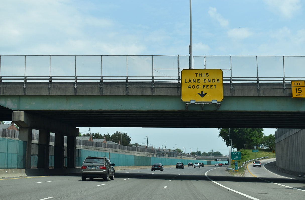
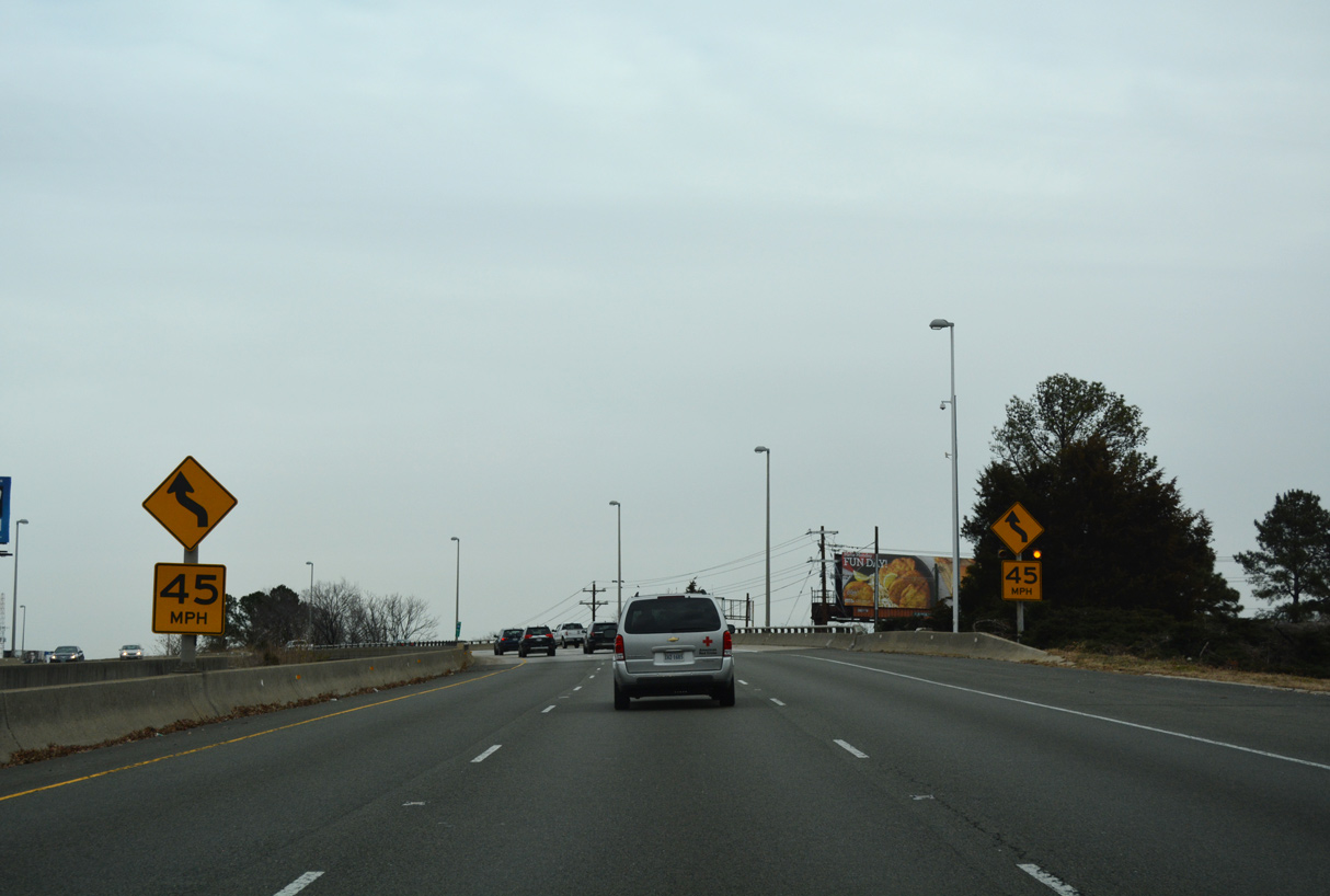
| The Beltline Expressway shifts northward onto an S-curve, spanning the CSX Railroad line to a half diamond interchange with Hamilton Street. 12/16/16 |
|
| A confirming marker for Interstate 195 stands ahead of the viaduct crossing Westwood Avenue (SR 197), Westwood Trail and a CSX Railroad yard. 05/28/21 |
|
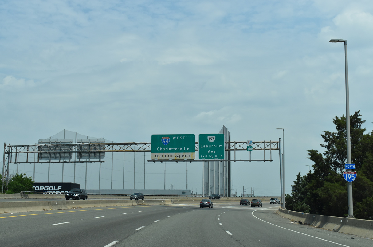
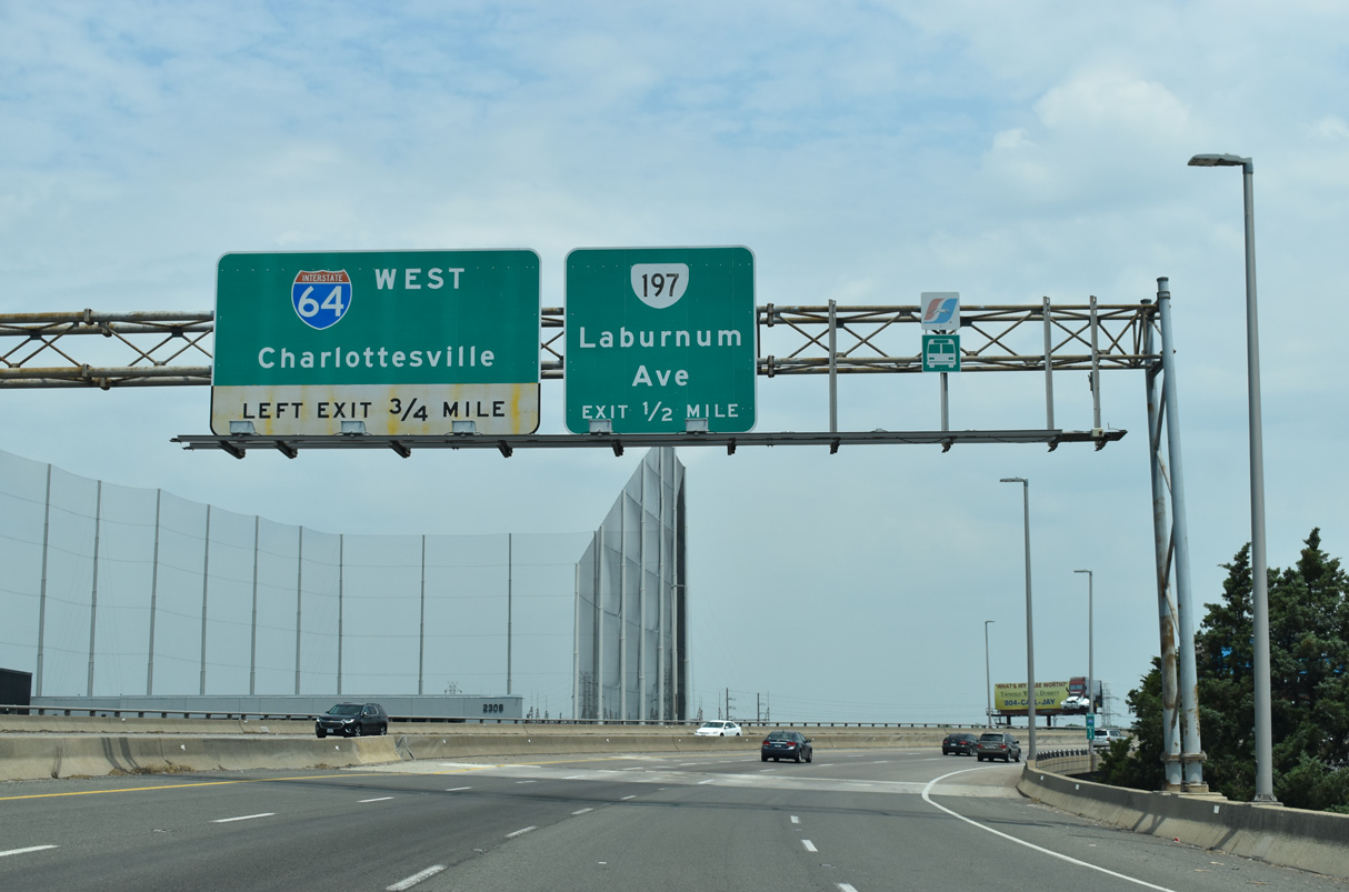
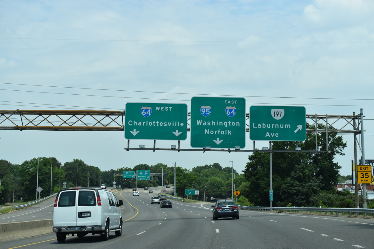
| The final exit from I-195 north departs in a half mile for Laburnum Avenue east to SR 197 at Saunders Avenue. Laburnum Avenue comprises an arterial belt route encircling Richmond south to Montrose and SR 895 (Pocahontas Parkway). 05/28/21 |
|
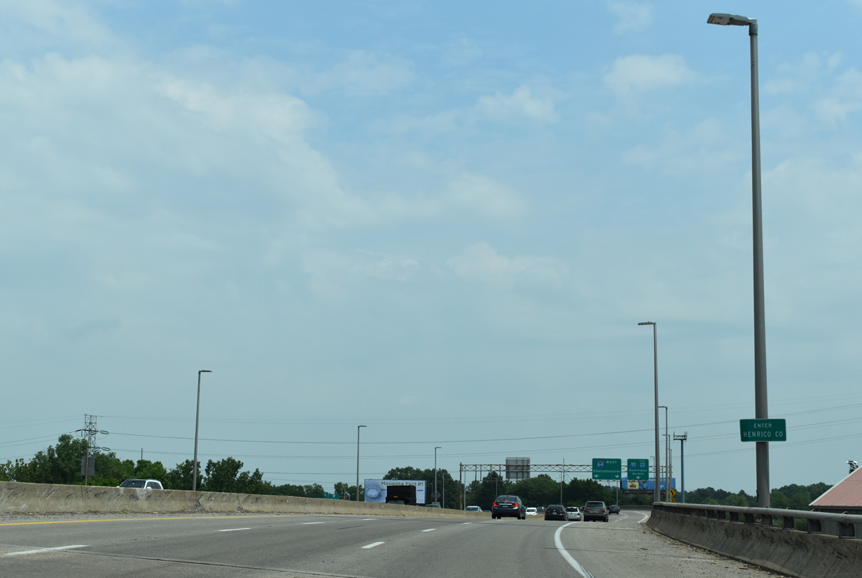
| Interstate 195 (Beltline Expressway) crosses into Henrico County along the elevated roadway above Laburnum Avenue (SR 961). 05/28/21 |
|
| The north end of Interstate 195 ties into a three wye interchange adjacent to the west split of I-64/95. 05/28/21 |
|
| Laburnum Avenue (SR 961/197) stems east from I-195 to Bellevue, Laburnum Park and Ginter Park in north Richmond. 05/28/21 |
|
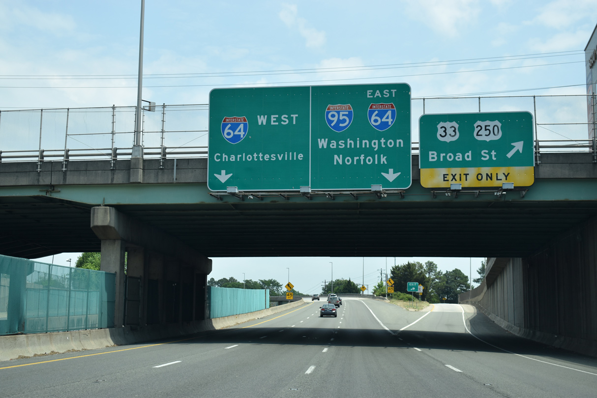
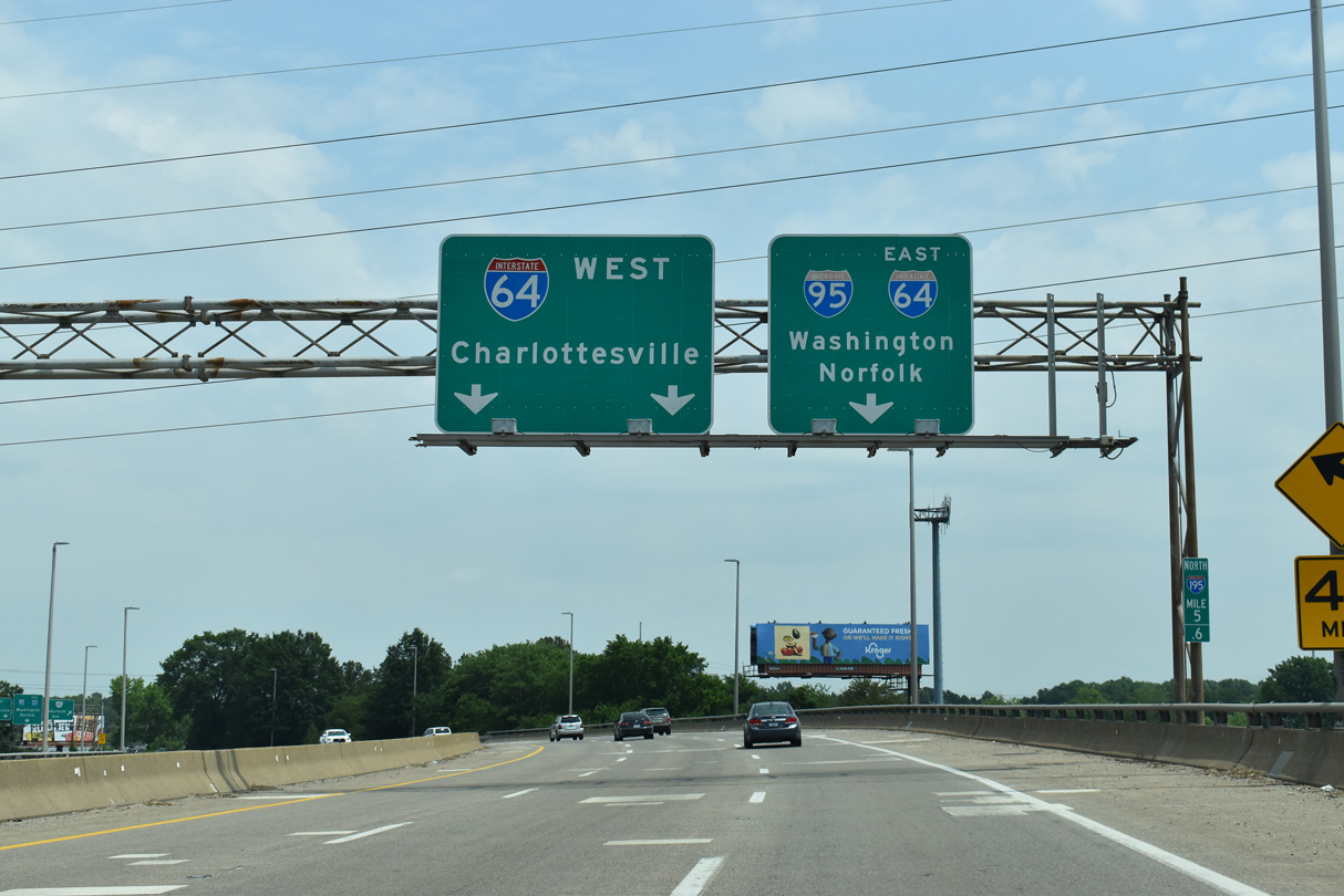
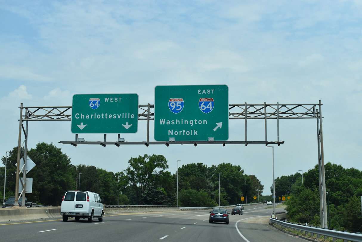
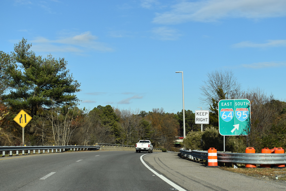
| Two lane ramps partition for Interstate 64 west to Charlottesville, Staunton and Lexington and I-64/95 southeast to Downtown Richmond. 05/28/21 |
|
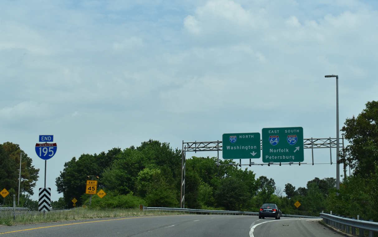
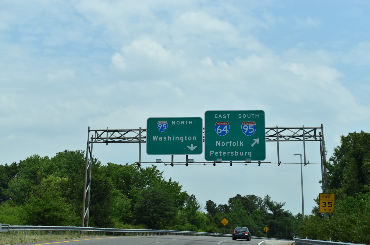
| An end shield stands at the gore point for I-64 west and I-95 and I-64 east. 05/28/21 |
|
| Beyond their three mile overlap, I-64 continues east to Williamsburg and Hampton Roads while I-95 continues along the Richmond-Petersburg Turnpike south. 05/28/21, 12/17/20 |
Page Updated 08-12-2021.


 North
North