|
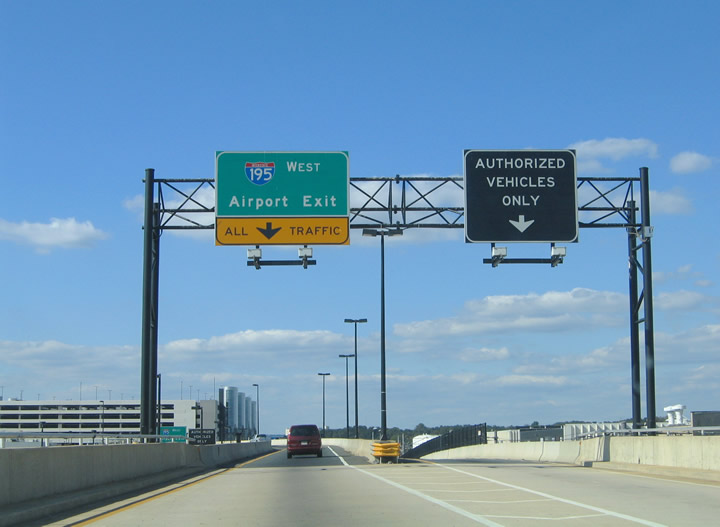
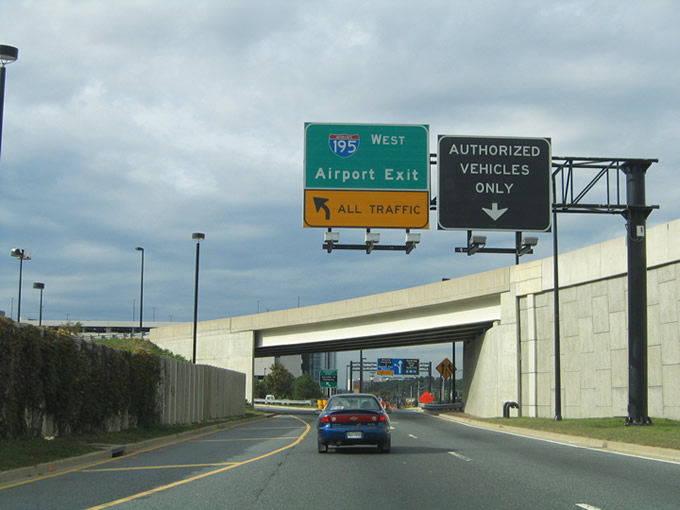
| The Interstate 195 westbound beginning from the Departures loop (upper deck) of Baltimore-Washington International Airport. What was an authorized vehicles only ramp is now open to general use for Elm Road north to Terminal Road. 10/10/04 |
|
| The Interstate 195 westbound beginning from the Departures loop (upper deck) of Baltimore-Washington International Airport. What was an authorized vehicles only ramp is now open to general use for Elm Road north to Terminal Road and MD 170. 06/27/10 |
|
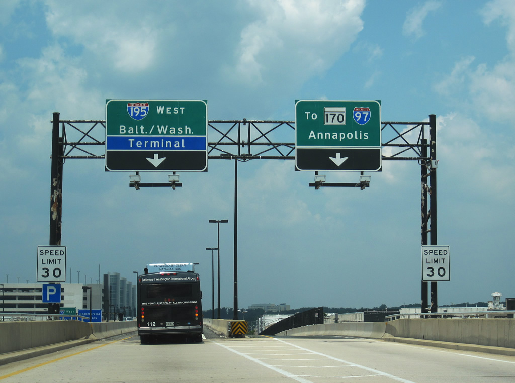
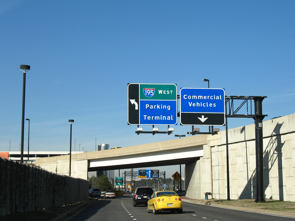
| Interstate 195 westbound departs the Arrivals loop (lower level) of the Baltimore-Washington International Airport terminal. The commercial vehicles ramps links directly with Elm Road north to MD 170 (Aviation Boulevard). 10/13/04, 12/18/07 |
|
| The first Interstate 195 eastbound shields are posted at the merge of the Arrival and Departure loops from BWI Airport. 06/27/10, 12/18/07 |
|
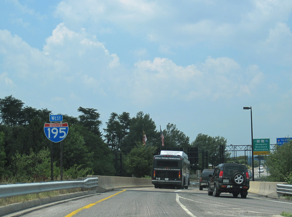
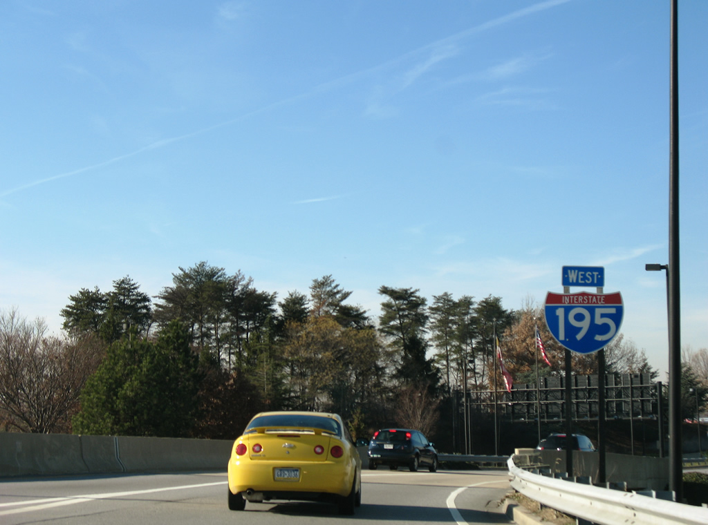
| A second Interstate 195 westbound shield stands at the Elm Road ramp onto the freeway north of the terminal departure point. Through traffic is directed onto the left two lanes for Interstate 95, MD 170, and MD 295 (Baltimore-Washington Parkway). 12/18/07 |
|
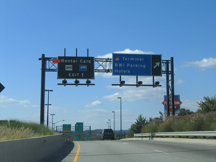
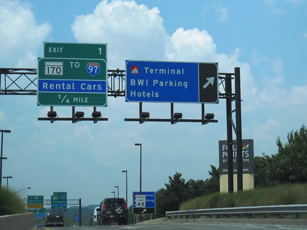
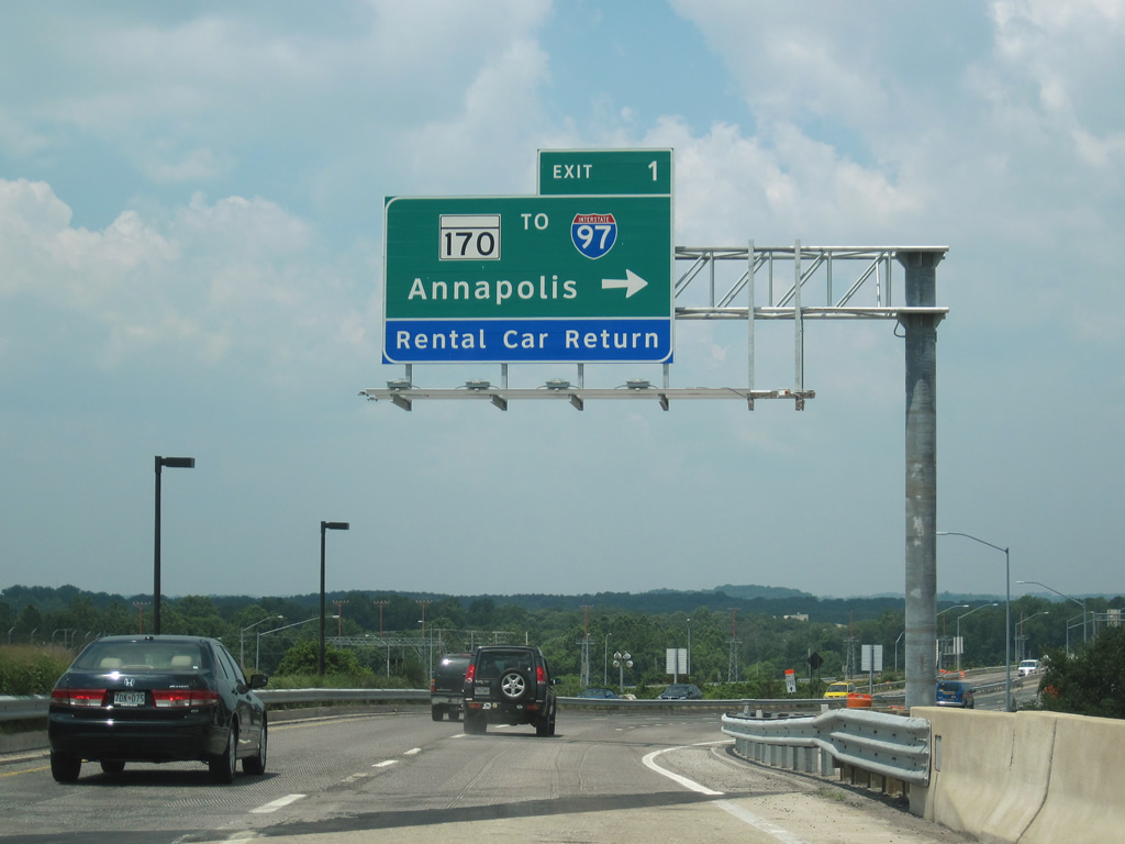
| Interstate 195 westbound at the Terminal Road off-ramp which provides return access to the terminal, parking for BWI Airport. Rental car traffic and those bound for the mass transit facilities (via Amtrak Way / unsigned MD 995 north) and Interstate 97 are directed to Exit 1 (MD 170 south). 10/10/04, 06/27/10 |
|
| MD 170 comprises one leg of the Aviation Loop around BWI Airport. The state route leads south to the MD 100 freeway and north to MD162 (Aviation Boulevard) south with connections to I-97 for Glen Burnie and Annapolis. 12/18/07, 06/27/10 |
|
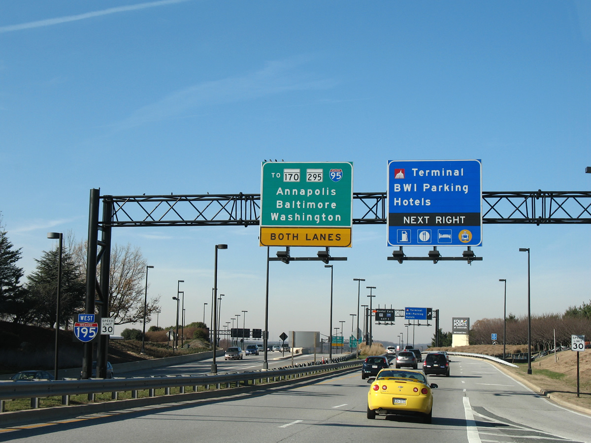
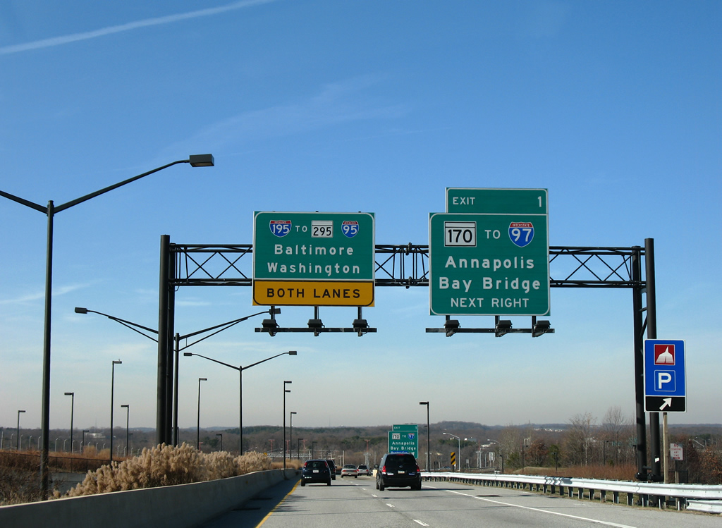
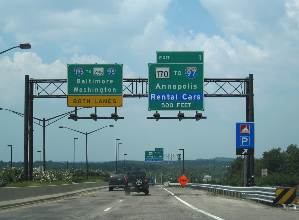
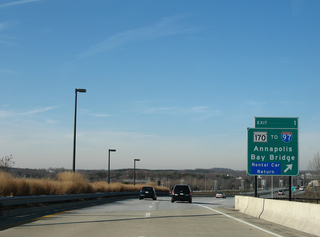
| Traffic to MD 170 (Aviation Boulevard) leaves Interstate 195 westbound at Exit 1. Interstate 97 travels just east of BWI Airport from Interstates 695 & 895 at Ferndale southward to I-595/U.S. 50-301 at Annapolis. Use Interstate 97 south to U.S. 50 east & 301 north for the Chesapeake Bay Bridge and the Eastern Shore of Maryland. 12/18/07, 06/27/10 |
|
| Forthcoming MD 295 provides an alternative to I-95 between Baltimore and Washington via the four lane Baltimore-Washington Parkway. Maintained by the National Park Service further south, the parkway is nearly truck free due to commercial traffic restrictions. 06/27/10 |
|
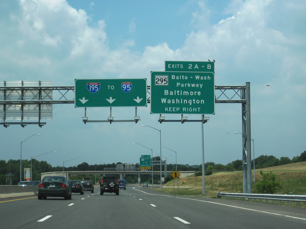
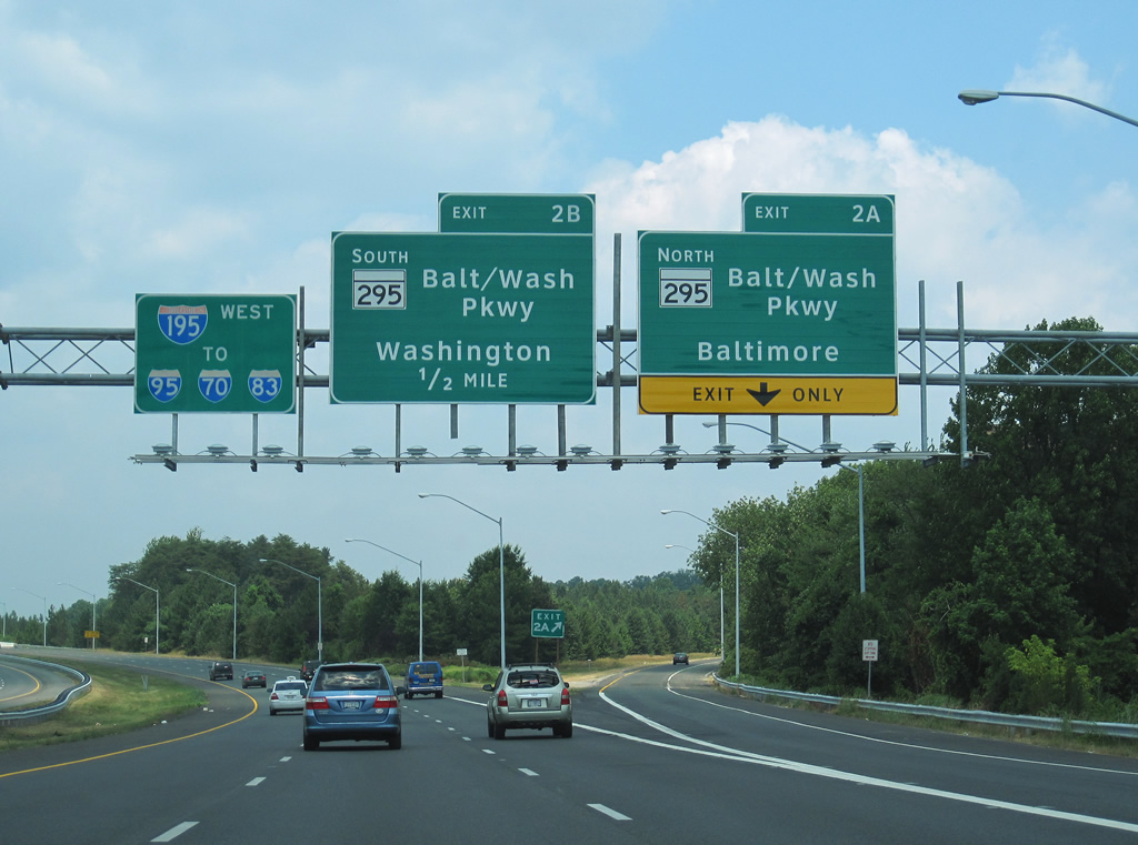
| Exit 2A departs ahead for MD 295 (Baltimore-Washington Parkway) northbound to Lansdowne and Baltimore. The parkway connects with Interstate 695 east to Glen Burnie, the Francis Scott Key Bridge, and Essex. 06/27/10 |
|
| North from Exit 2A, MD 295 provides connections to I-895 north for the Harbor Tunnel and I-95 north for Downtown and the Fort McHenry Tunnel. MD 295 follows Baltimore-Washington Parkway north to the exchange with Interstate 95 at Russell Street. 06/27/10 |
|
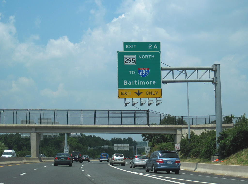
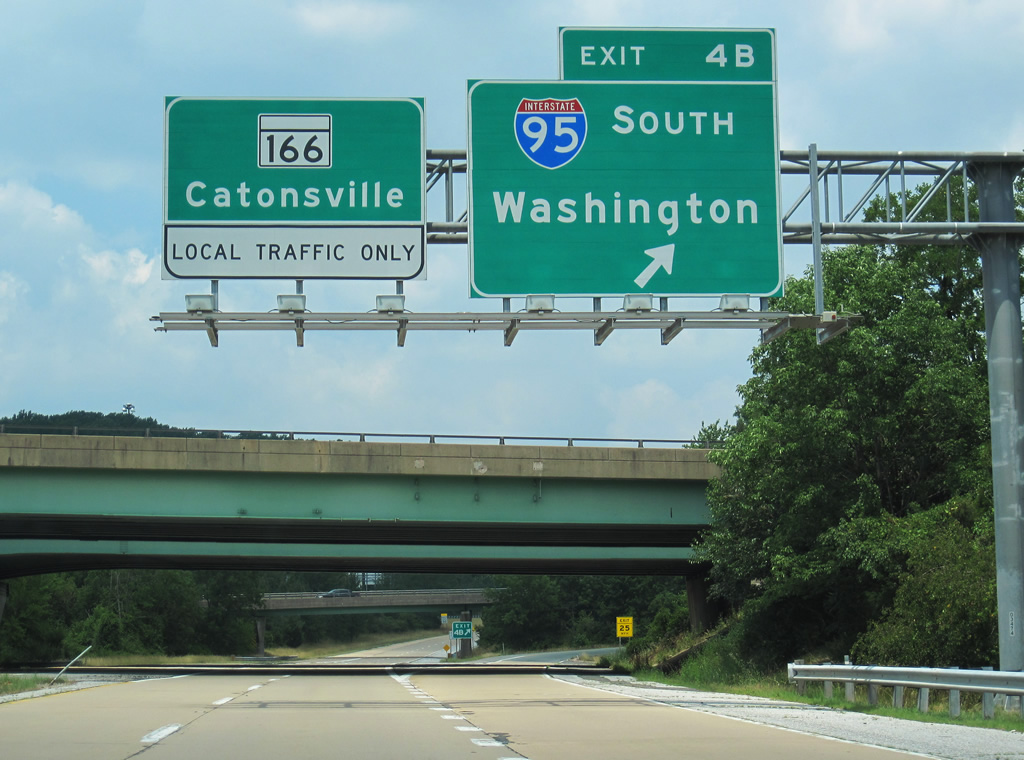
| Interstate 195 westbound at MD 295 north (Exit 2A). MD 295 ends at U.S. 40 northwest of downtown Baltimore. Traffic interests to Interstates 70, 83, and 95 are directed to remain along Metropolitan Boulevard to Exits 4A/B. 12/18/07 |
|
| Clearview based sign panels were added for Exits 2A and 2B on Interstate 195 west by 2010. The new signs omit the Interstate 695 reference for MD 295 north. 06/27/10 |
|
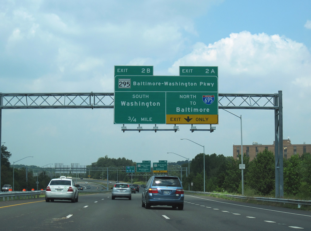
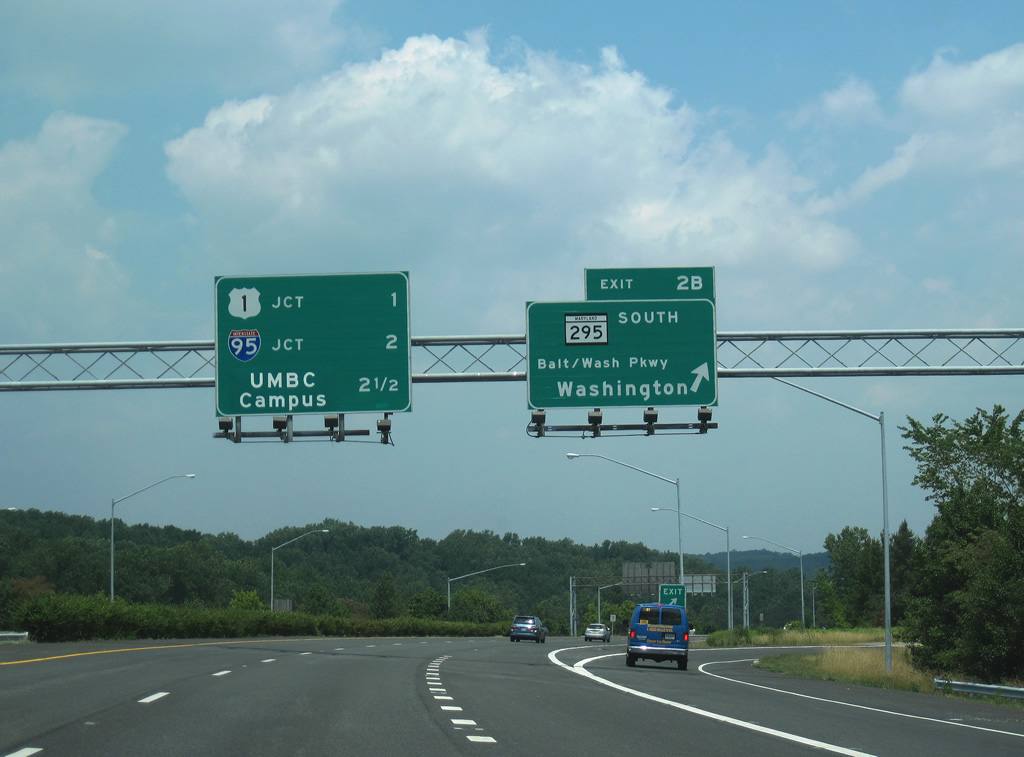
| A loop ramp carries drivers from Interstate 195 westbound onto MD 295 (Baltimore-Washington Parkway) southbound. Use MD 295 south for Jessup, Laurel, and the greater Washington, D.C. metropolitan area.
The panel to the left features the final three interchanges of Interstate 195 west. A greenout added in 2007 altered "Univ. of Md Balt. Co." into an acronym. 06/27/10 |
|
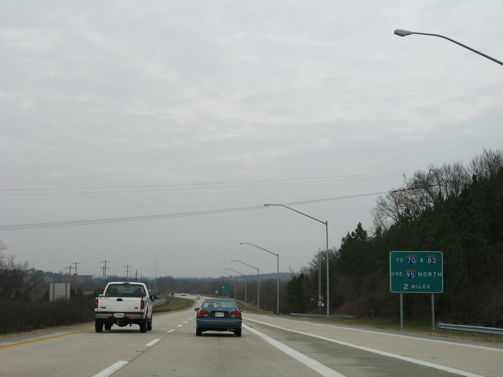
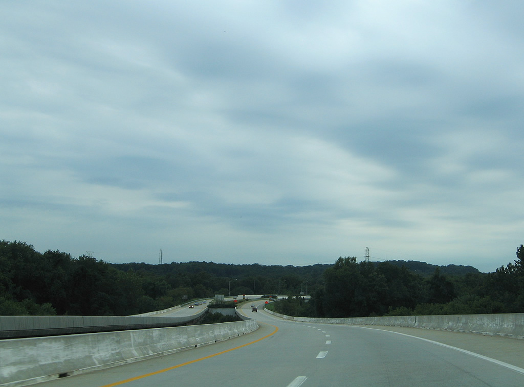
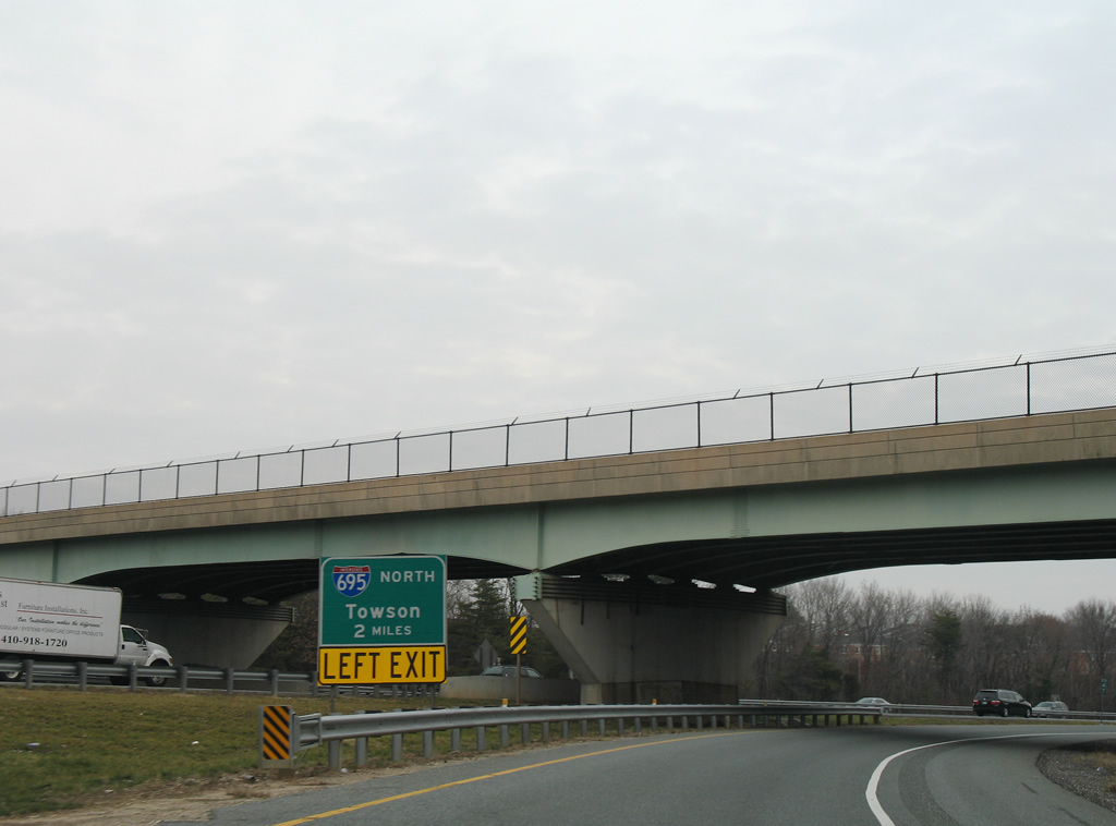
| Interstate 195 travels two miles north from MD 295 to Interstate 95 near Arbutus. A second guide sign advises motorists to use Interstate 95 north to Interstate 695 for the Interstate 70 and Interstate 83 corridors. 12/28/07 |
|
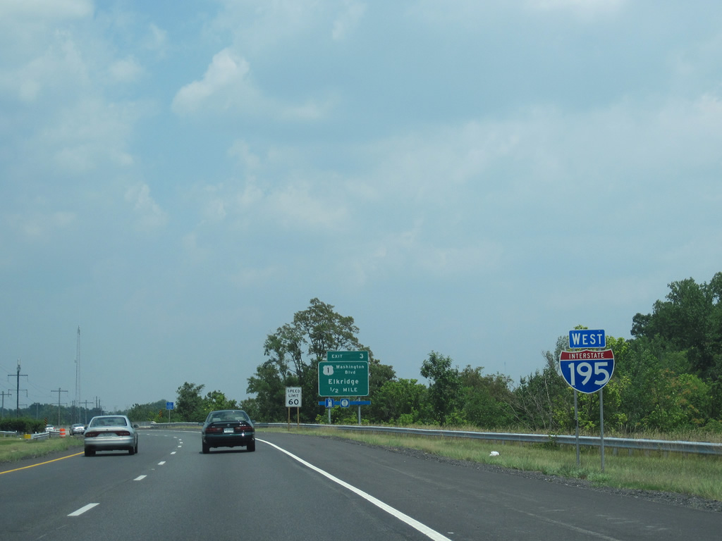
| Heading northward along Interstate 195 west at a reassurance shield west of Patapsco. 06/27/10 |
|
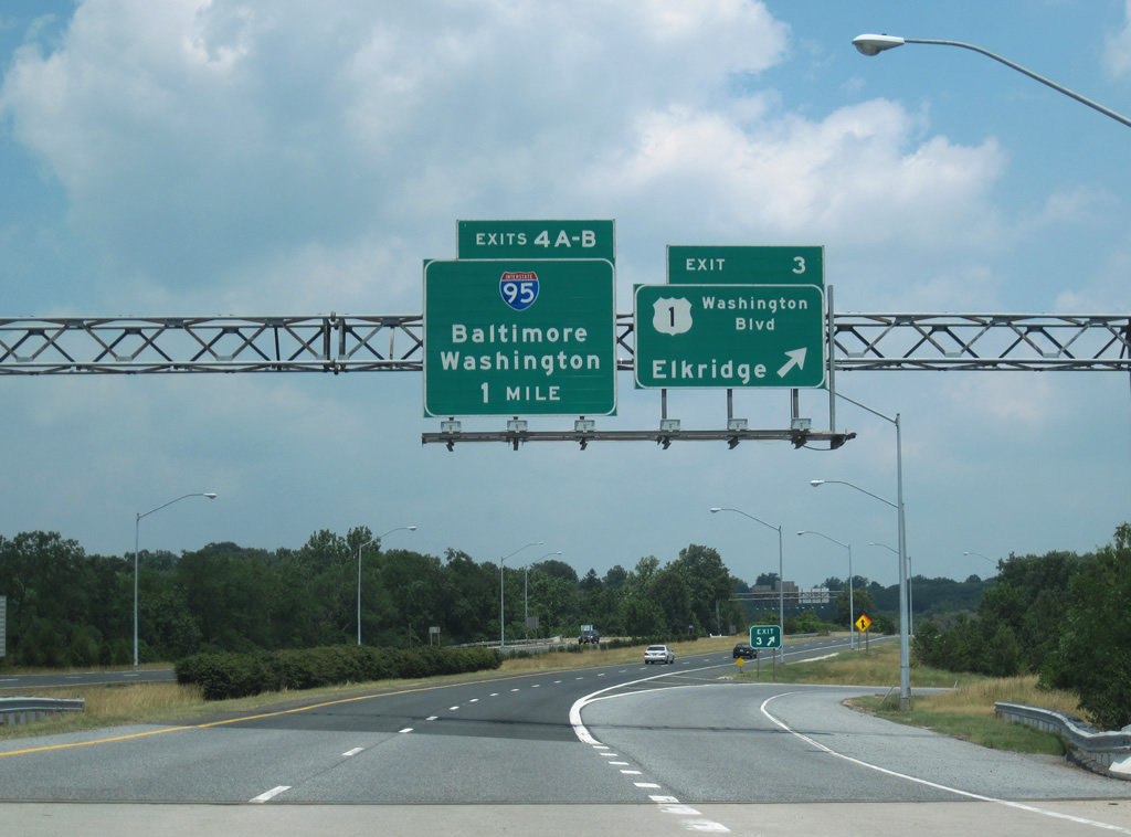
| Exit 3 joins U.S. 1 (Washington Boulevard) with Interstate 195 via a folded diamond interchange in one half mile. U.S. 1 parallels Interstate 95 and MD 295 north from College Park and Laurel to Elkridge at Interstate 195. The US highway splits with Washington Boulevard (U.S. 1 Alternate) at Southwestern Boulevard, one mile to the east of Exit 3. 06/27/10 |
|
| A pair of viaducts cross over the Patapsco River into Baltimore County on Interstate 195. Beyond the river is the Interstate 895 under crossing ahead of Exit 3. There is no direct access to the Harbor Tunnel Thruway from Interstate 195. 08/27/05 |
|
| Motorists bound for U.S. 1 (Washington Boulevard) depart Interstate 195 westbound via the Exit 3 loop ramp. U.S. 1 follows Southwestern Boulevard north from Washington Boulevard to Wilkens Avenue east in Baltimore. U.S. 1 Alternate continues Washington Boulevard northeast to Caton Avenue and Exit 50 of Interstate 95. 06/27/10 |
|
| Interstate 195 shield posted as Metropolitan Boulevard leaves Exit 3 and passes over an AMTRAK/MARC transit line. 06/27/10 |
|
| Winding northwest through the Relay area, Interstate 195 passes under Cedar Avenue and approaches the directional cloverleaf interchange with Interstate 95 (Exits 4A/B). 06/27/10 |
|
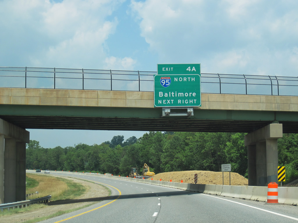
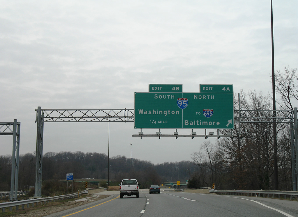
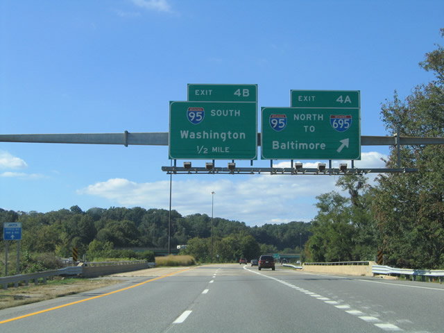
| Interstate 195 passes over Francis Avenue at the Exit 4A off-ramp to Interstate 95 northbound. Downtown Baltimore lies just six miles to the east. 12/28/07 |
|
| A look at the original sign bridge for Exits 4A/4B on Interstate 195 westbound. 10/10/04 |
|
| Northbound motorists using Exit 4A next meet Interstate 695 (Baltimore Beltway) before the freeway enters the city limits of Baltimore. A left side ramp connects with Interstate 695 north to Interstates 70 west, 795 north, and 83. 12/28/07 |
|
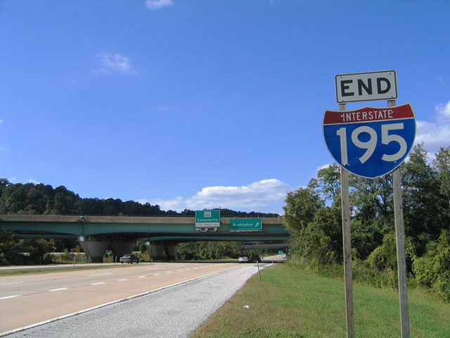
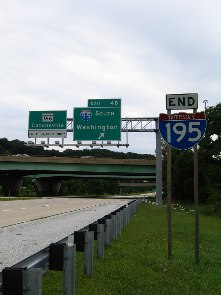
| An end shield for Interstate 195 is posted before the Exit 4B loop ramp departs for Interstate 95 southbound. While the designation appears to end here, the freeway continues another 1.5 miles northwest to the University of Maryland at Baltimore, Arbutus and MD 166 (Rolling Road). 10/10/04, 08/27/05 |
|
| Exit 4B loops onto Interstate 95 southbound for Laurel, Scaggsville, and Washington, D.C. I-95 crosses the Patapsco River into Howard County nearby on the 36 mile drive to the Nation's Capital. A new overhead assembly was added for Exit 4B in 2005, replacing bridge-mounted panels. 06/27/10, 10/10/04 |
|
| The next exit along westbound Interstate 195 is the access ramp to the University of Maryland at Baltimore County. The university fits snugly between the western terminus of Interstate 195 and the Baltimore Beltway (Interstate 695). 10/10/04, 06/27/10 |
|
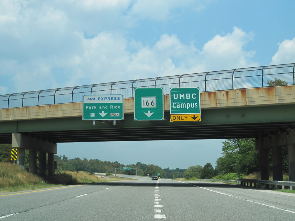
| Interstate 195 approaches its western terminus as the freeway splits into ramps for the university, MD 166 (Rolling Road) north, and the Park and Ride that rests in the median of the freeway where it ends. 10/10/04 |
|
| Westbound Interstate 195 splits with the ramp to the university. Note that the exit is not numbered. Selford Road passes over the freeway between MD 166 (Rolling Road) and Sulphur Spring Road nearby. A wye interchange serves the UMBC campus otherwise. 10/10/04, 06/27/10 |
|
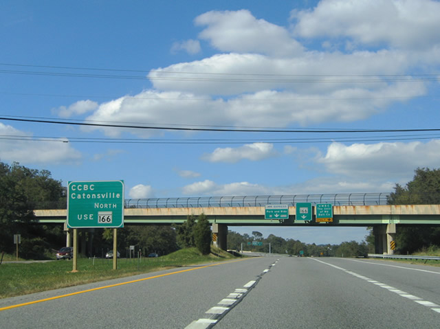
| Metropolitan Boulevard was prematurely signed as MD 166 north in 2004. The state route does not officially begin until the freeway ends at Rolling Road. 10/10/04 |
|
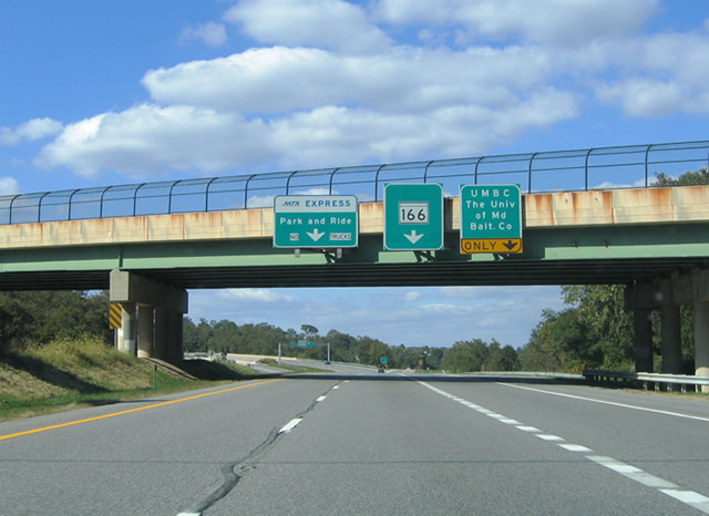
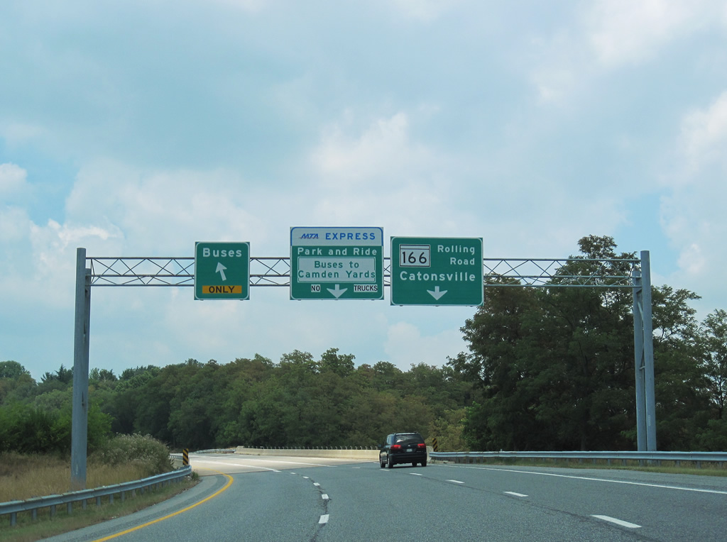
| The left two lanes prepare to exit into the Park and Ride and transit station in the median, while the right lane heads continues to Rolling Road and MD 166 north toward Catonsville. 06/27/10 |
|
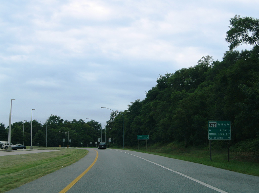
| Nearing the Metropolitan Boulevard end at Rolling Road and MD 166 north. Rolling Road joins the state route with Arbutus to the south. MD 166 continues the road northward to MD 372 (Wilkens Avenue) and the CCBC Catonsville Campus. 08/27/05, 06/27/10 |
|
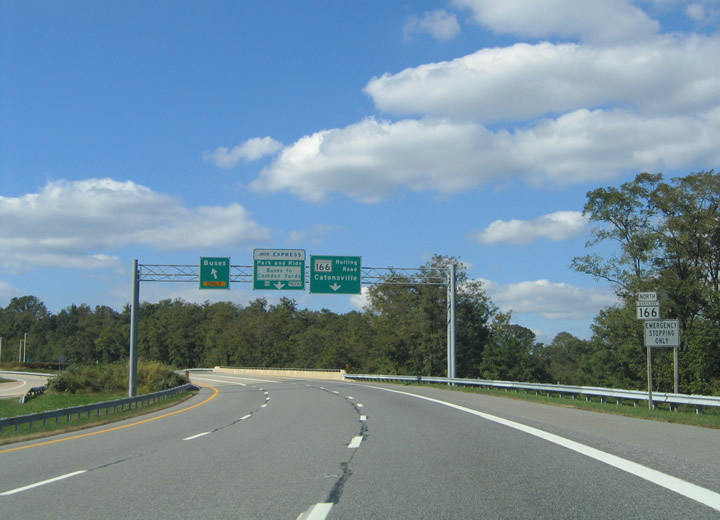
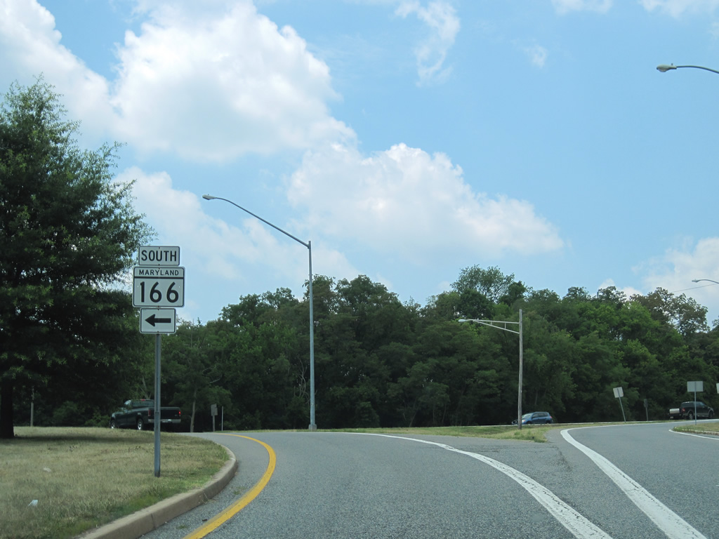
| Metropolitan Boulevard concludes at the northbound beginning of MD 166 (Rolling Road). MD 166 travels 2.71 miles from Interstate 195 to MD 144 (Frederick Road) at Catonsville. Contrary to the remaining sign (the northbound sign was missing in 2010), the state route does not continue south beyond the half diamond interchange with I-195. 06/27/10 |
Page Updated 03-22-2011.

 West
West