
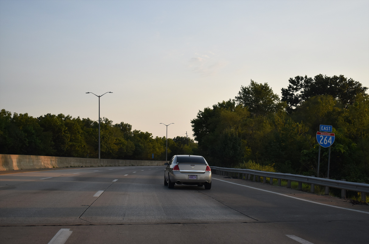
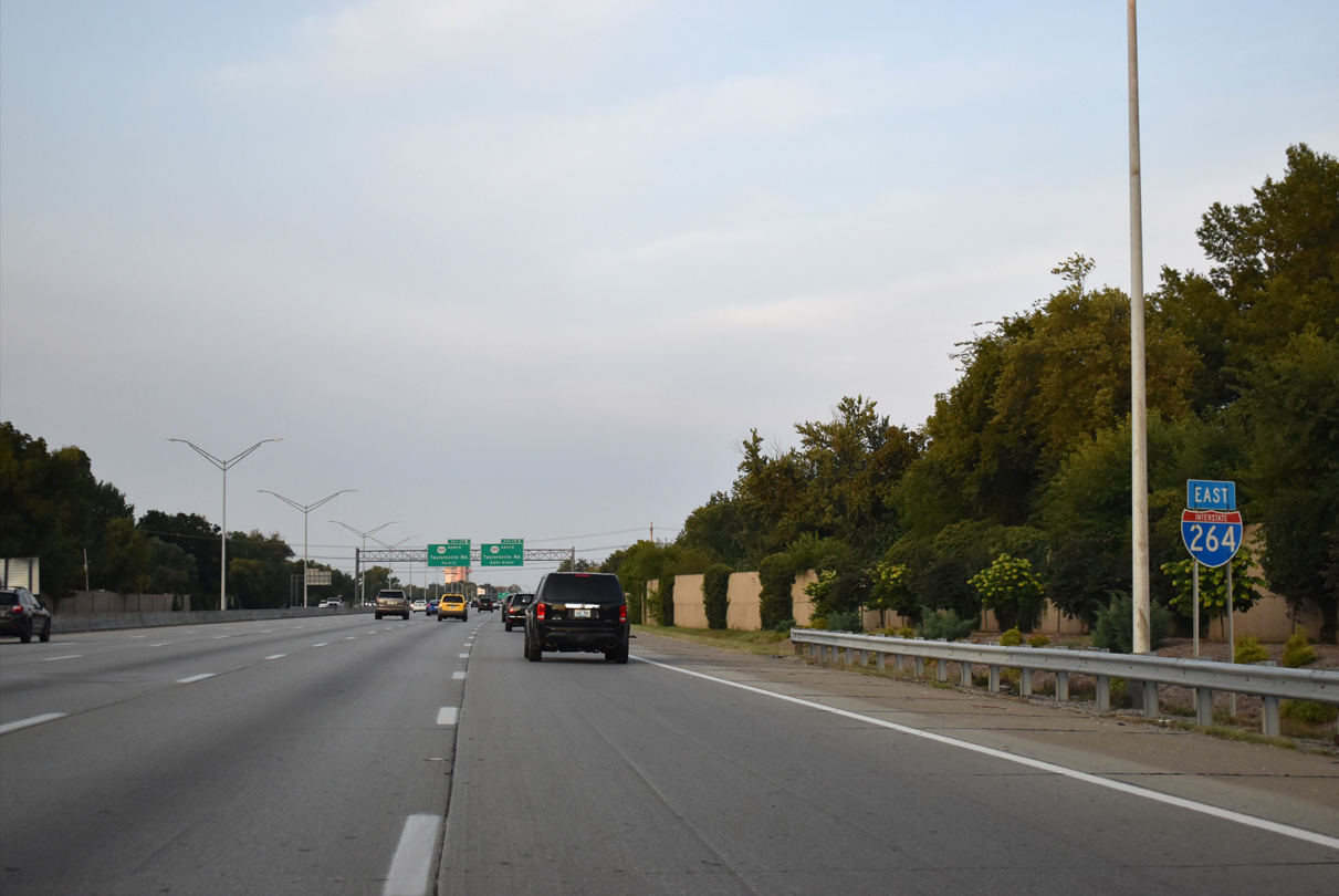
 East
East
I-264 stems southward from I-64 along the Ohio River to Exit 1 for Bank Street and Northwestern Parkway. Exit 1 consists of two loop ramps with Bank Street eastbound.
09/07/20
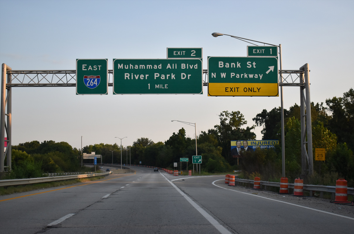
Exit 1 lowers from I-264 (Shawnee Expressway) east to Bank Street at 38th Street north to Northwestern Parkway near Shawnee Golf Course. Bank Street angles southeast into the Portland neighborhood.
09/07/20

Shifting eastward, I-264 advances to a split diamond interchange (Exit 2) with Muhammad Ali Boulevard west and River Park Drive east. The couplet join the Shawnee community east of the Ohio River with the Russell neighborhood.
09/07/20
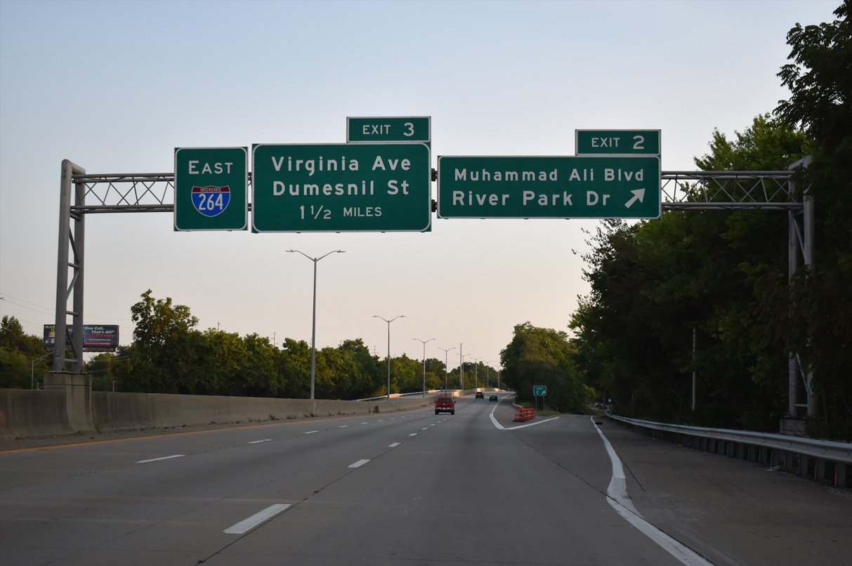
33rd Street links Muhammad Ali Boulevard at Exit 2 with River Park Drive two blocks to the south.
09/07/20
The Shawnee Expressway spans W Broadway and Louis Coleman, Jr. Drive southwest into the Chickasaw neighborhood.
09/07/20
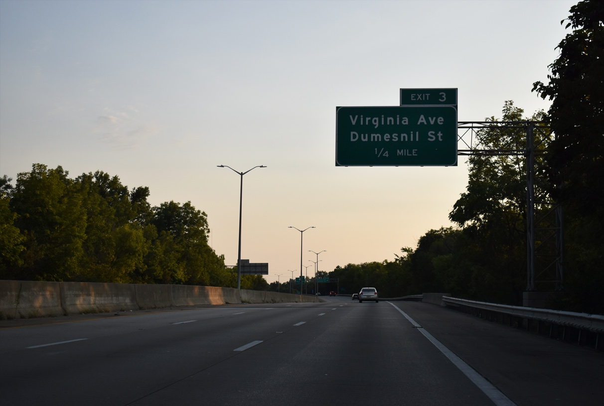
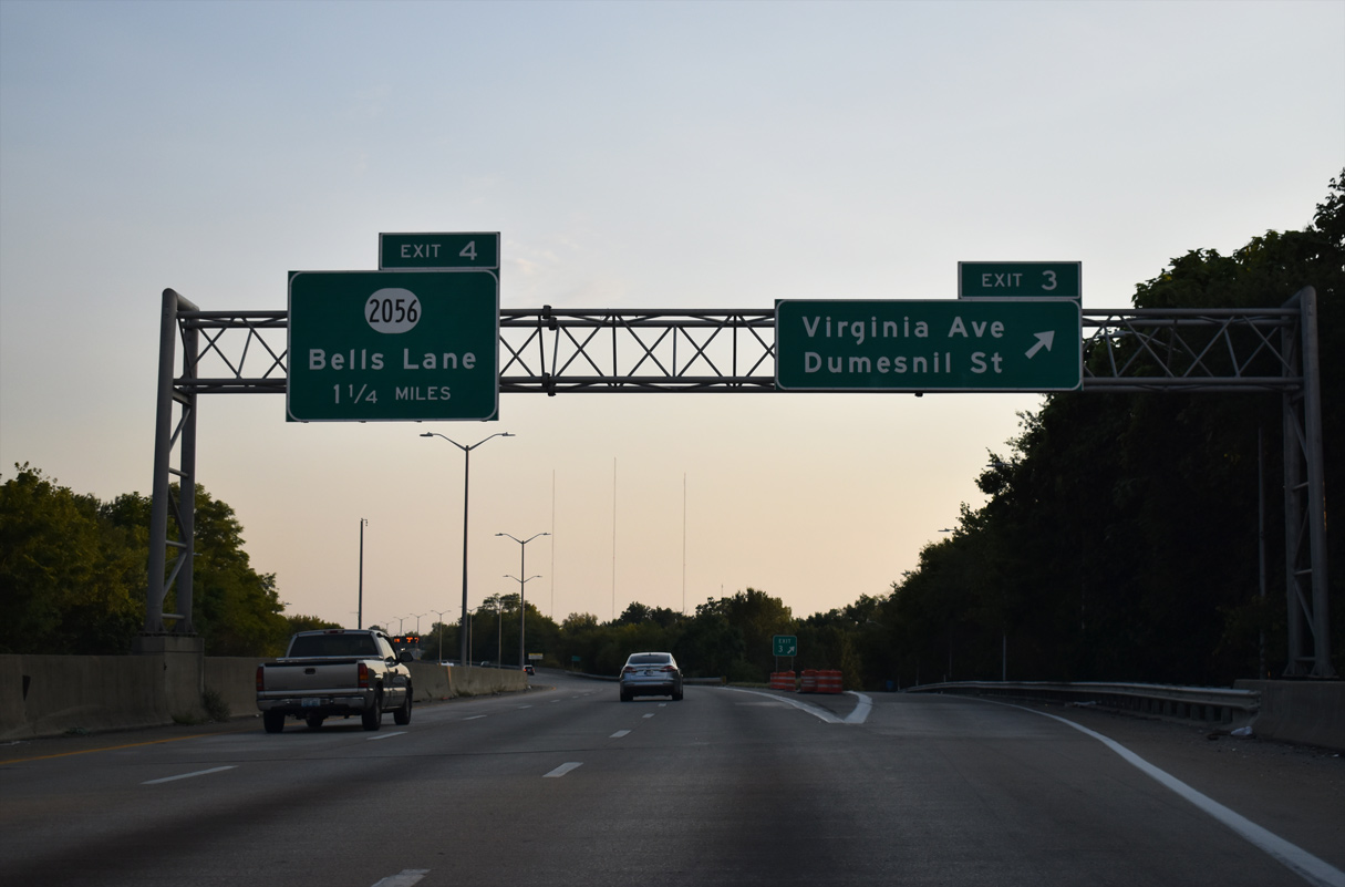
A split diamond interchange (Exit 3) links I-264 with Virginia Avenue west to Hale Avenue and Dumesnil Street east.
09/07/20
Hale Avenue extends west from Virginia Avenue to Southwestern Parkway at Chickasaw Park. Dumesnil Street flows eastward from Exit 3 to Parkland and U.S. 31W (22nd Street).
09/07/20

Interstate 264 passes east of an industrial area southward to Exit 4 with KY 2056 (Bells Lane).
09/07/20
KY 2056 (Bells Lane) spurs 1.02 miles west through an industrial plan area between I-264 and the Ohio River. East from Exit 4 and S 39th Street, KY 2056 extends 0.51 miles to KY 1934 (Cane Run Road) between the Park Duvalle neighborhood and a warehouse district.
09/07/20
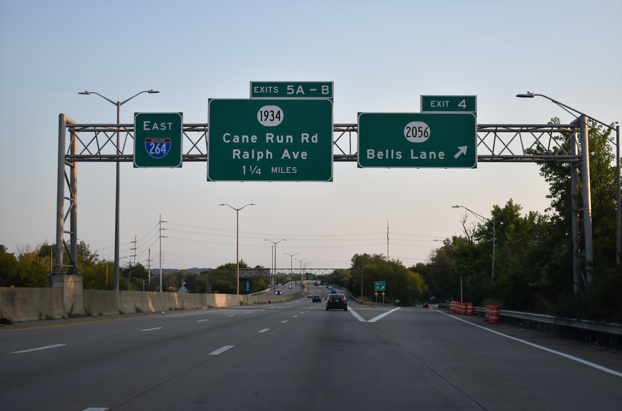
I-264 (Shawnee Expressway) advances south from KY 2056 (Bells Lane) to Exit 5A for Ralph Avenue and the Rubbertown neighborhood.
09/07/20
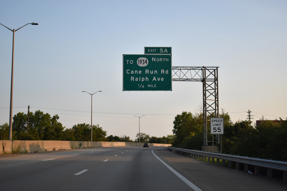
Exit 5A joins I-264 (Shawnee Expressway) east with Ralph Avenue to the Riverport and adjacent KY 1934 (Cane Run Road) north.
09/07/20
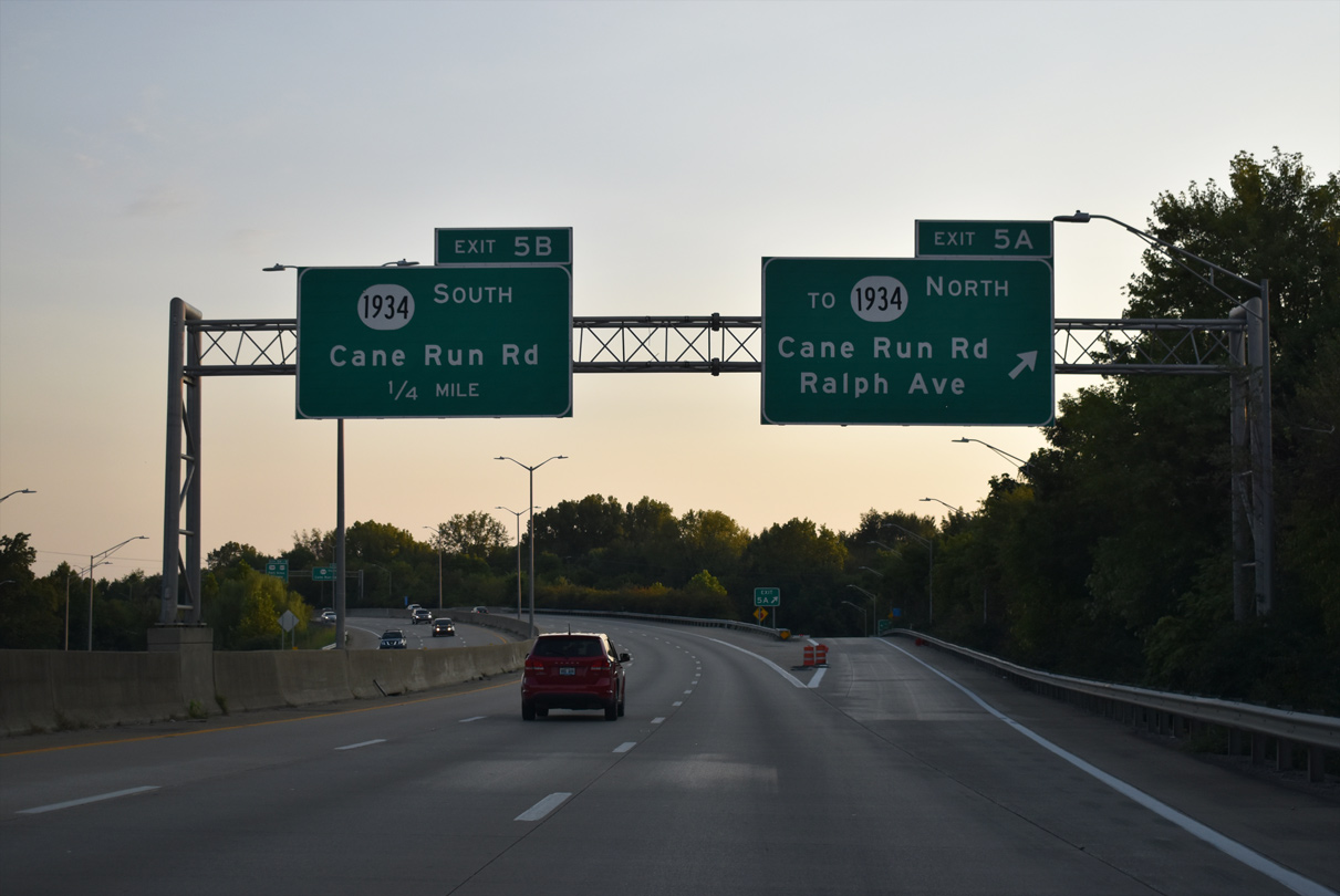
Ralph Avenue heads east into the city of Shively and west 0.65 miles to KY 2051 (Campground Road). Exit 5B links I-264 east with KY 1934 (Cane Run Road) south directly next.
09/07/20
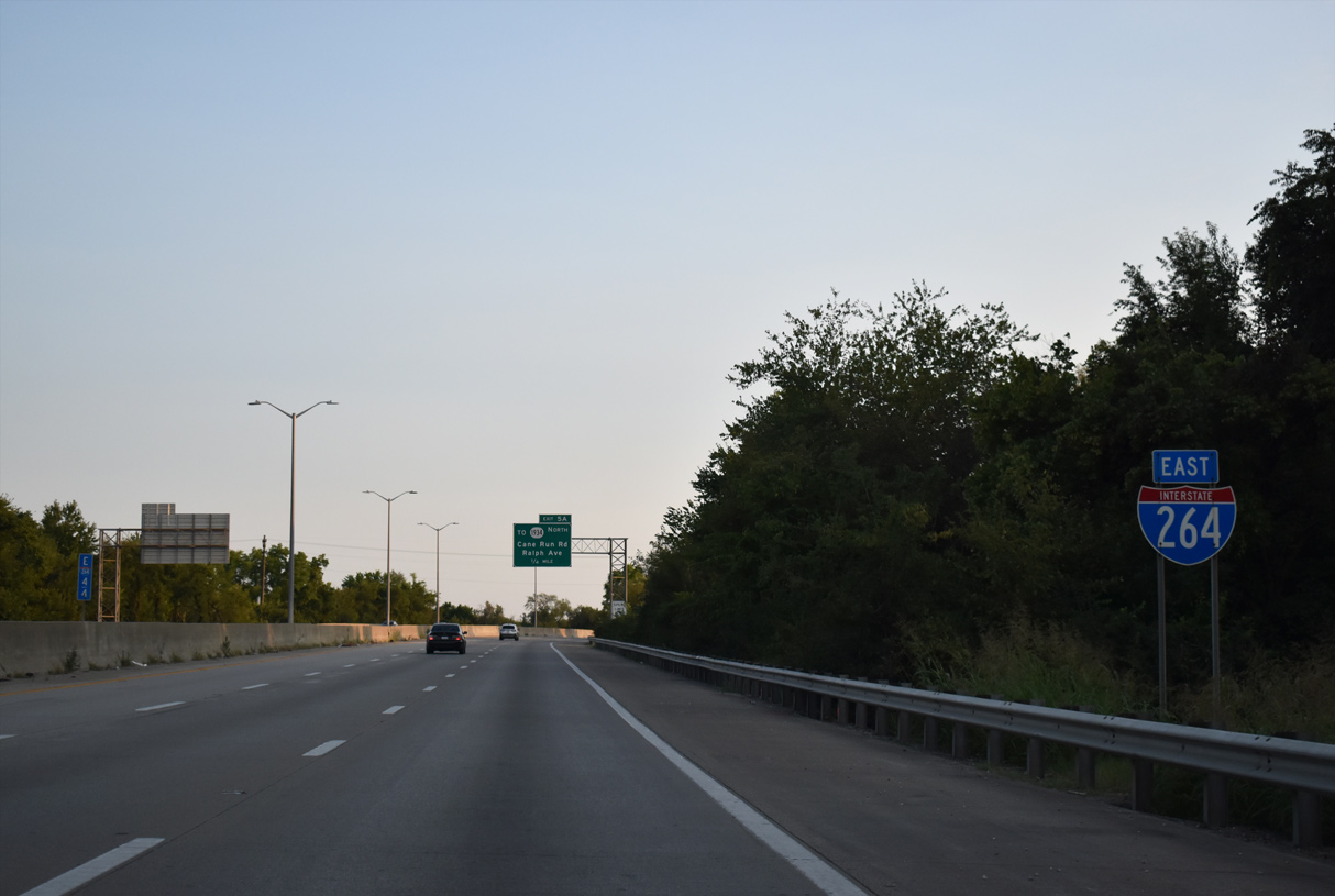
KY 1934 (Cane Run Road) angles southwest through a parclo interchange (Exit 5B) with I-264 on the Louisville/Shively city line. KY 1934 comprises an arterial beltway 9.97 miles south along Greenbelt Highway and east to KY 841 (Gene Snyder Freeway) at Valley Station.
09/07/20
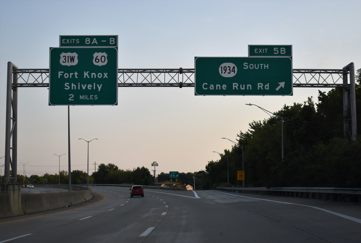
This confirming marker stands beyond the entrance ramp from KY 1934 (Cane Run Road).
09/07/20
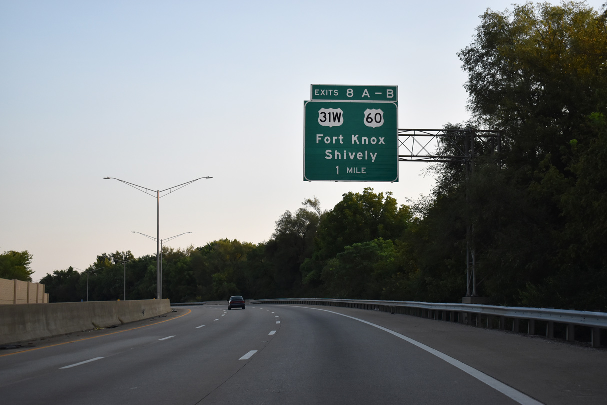
U.S. 31W/60 (Dixie Highway) converges with Interstate 264 at Exits 8A/B in south Shively.
09/07/20
U.S. 31W/60 (Dixie Highway) runs through southwest Louisville to Fort Knox Military Reservation and Muldraugh. Beyond Muldraugh, U.S. 31W/60 split for Radcliff and Hardinsburg respectively.
09/07/20
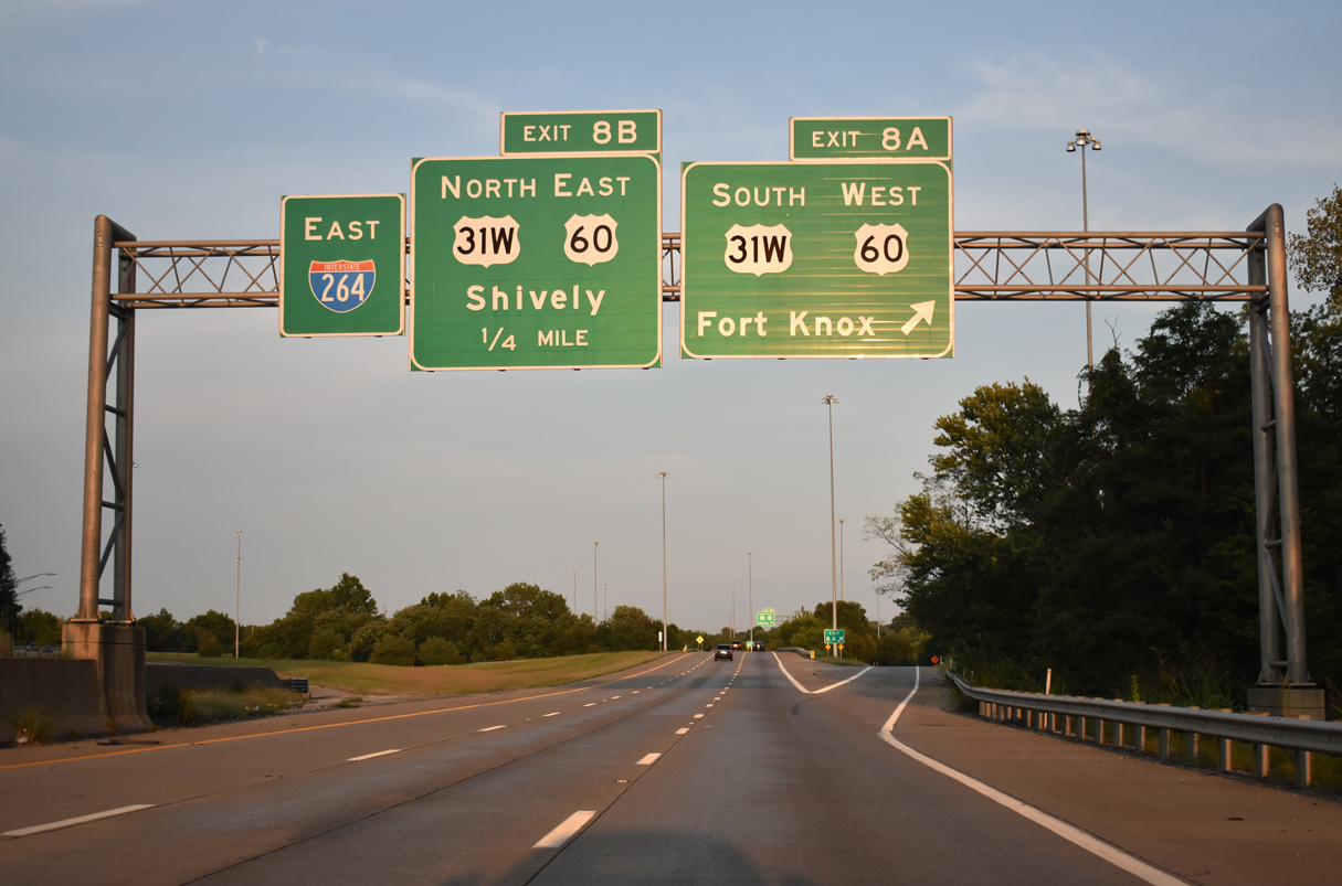
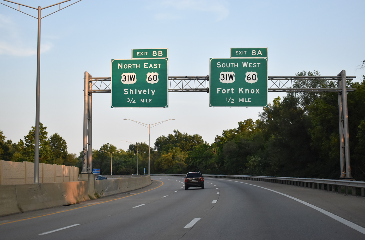
Curving traveling east, Interstate 264 enters a directional cloverleaf interchange (Exit 8A) with U.S. 31W/60 (Dixie Highway).
09/07/20
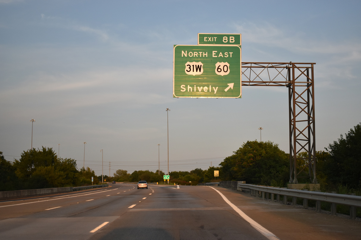
Exit 8B loops onto U.S. 31W/60 (Dixie Highway) north through Shively. U.S. 31W/60 overlap 2.75 miles north to Bernheim Lane at the Algonquin neighborhood in Louisville.
09/07/20
Interstate 264 reenters the city of Louisville along the Henry Watterson Expressway by the Cloverleaf neighborhood.
09/07/20
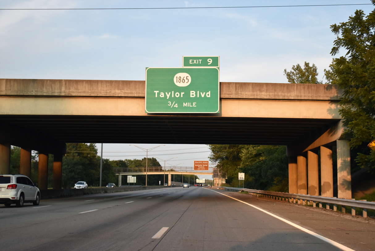
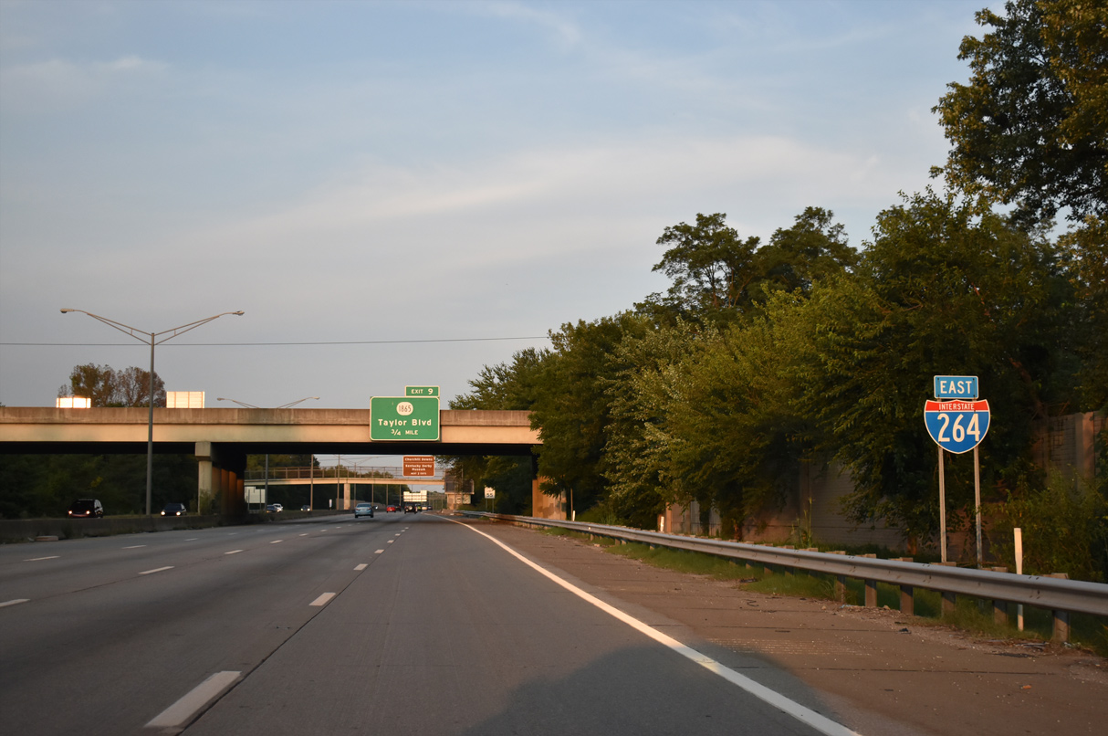
Meeting Henry Watterson Expressway next is KY 1865 (Taylor Boulevard).
09/07/20
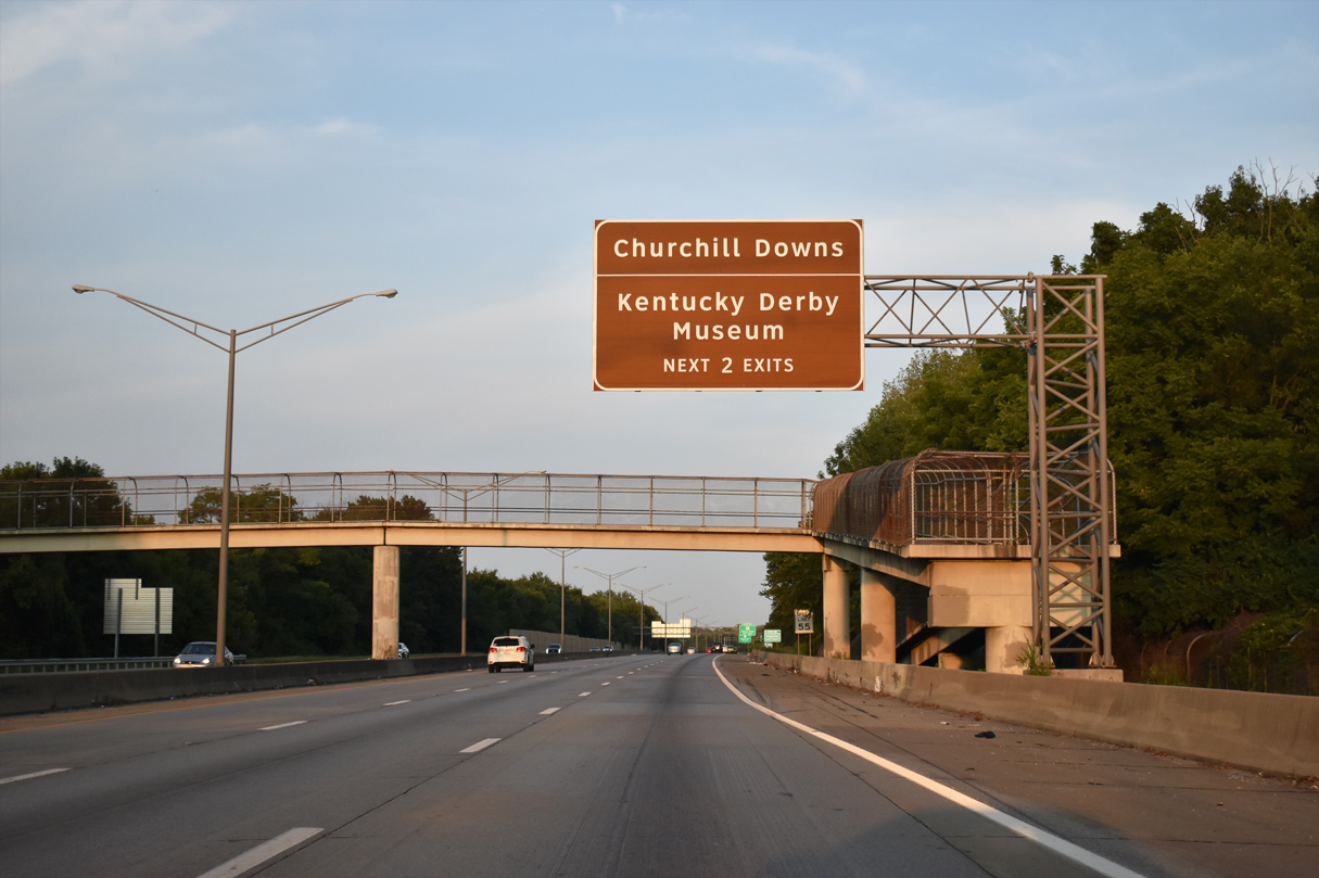
Exit 9 serves Churchill Downs, home of the Kentucky Derby race and Museum. The track is accessible from I-264 via KY 1834 (Taylor Boulevard) north to Longfield or Central Avenue.
09/07/20
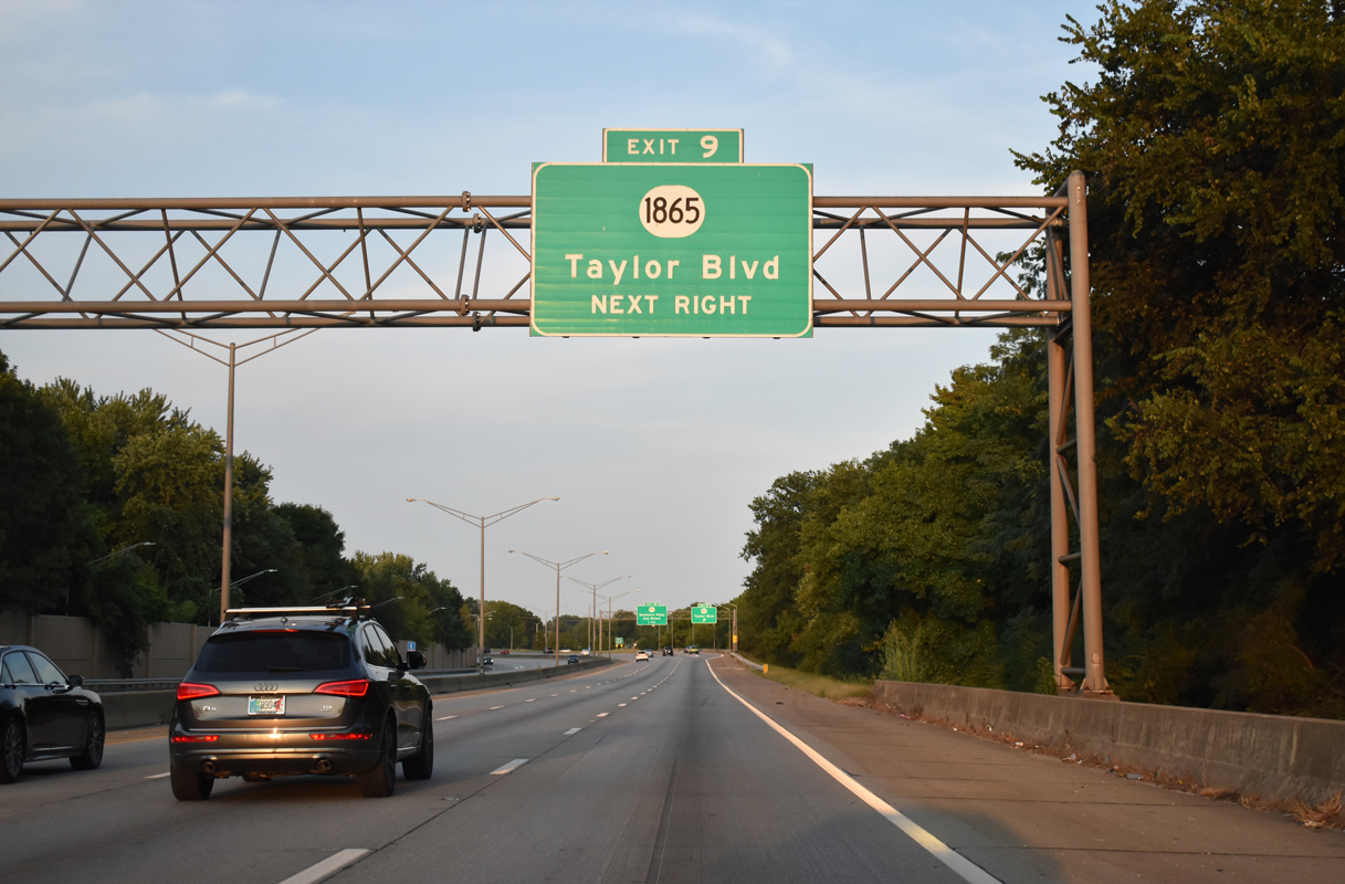
I-264 passes between the Jacobs and Hazelwood neighborhoods east to the parclo interchange (Exit 9) with KY 1865 (Taylor Boulevard). KY 1865 heads 4.61 miles south to KY 841 (Gene Snyder Freeway) and 0.44 miles north to U.S. 60 Alternate (Berry Avenue).
09/07/20
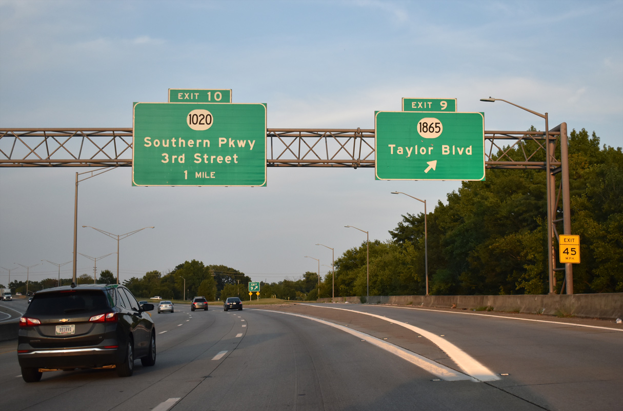
Exit 9 departs for KY 1865 (Taylor Boulevard) at Ashland Avenue. Ashland Avenue extends east through the Beechmont neighborhood to KY 1020 (Southern Parkway).
09/07/20
Navigating through an S-curve, I-264 (Henry Watterson Expressway) runs east between the Wyandotte and Beechmont neighborhoods on the ensuing stretch.
09/07/20
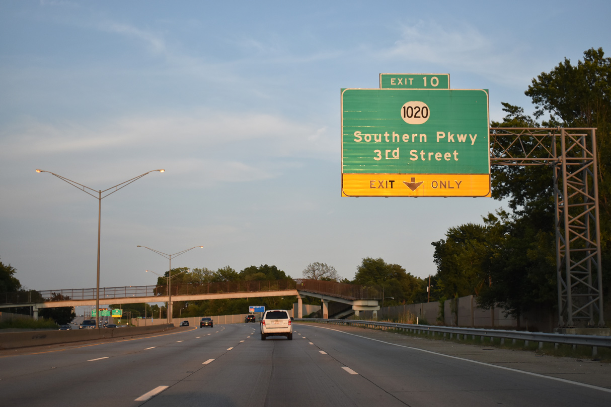
An auxiliary lane opens along I-264 east leading into the split diamond interchange (Exit 10) with KY 1020 and S 3rd Street.
09/07/20
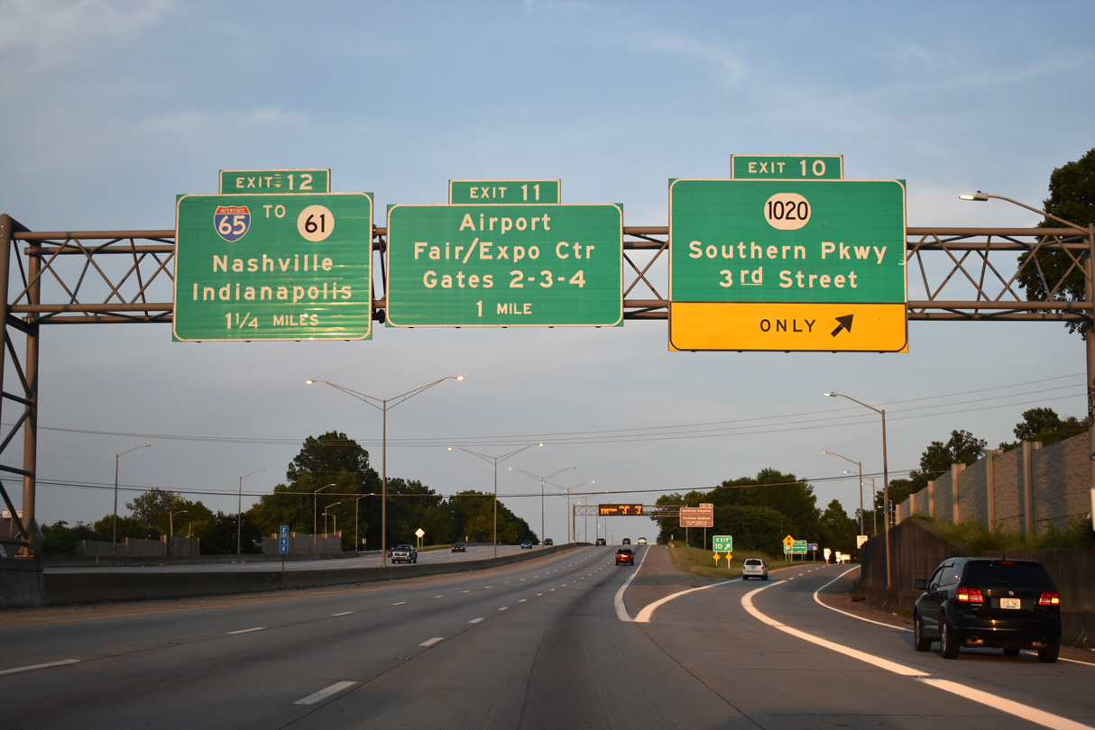
Southern Heights Avenue (KY 2801) links the ramps at Exit 10 between KY 1020 (Southern Parkway) and S 3rd Street. KY 1020 runs north along the Wilder Park neighborhood to 3rd Street between Churchill Downs and Cardinal Stadium.
09/07/20
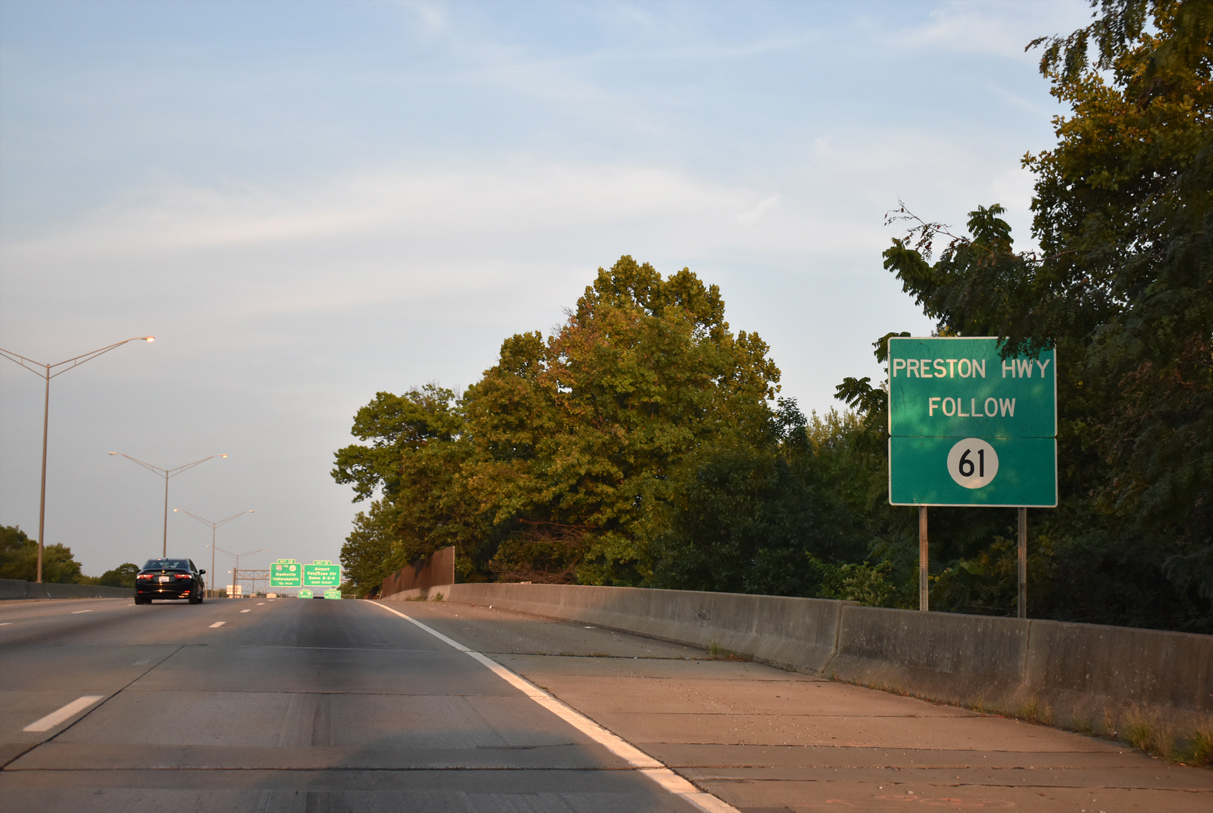
KY 61 (Preston Highway) parallels Interstate 65 north from the city of Lynnview to the Prestonia neighborhood and Audubon Park within the vicinity of I-264.
09/07/20
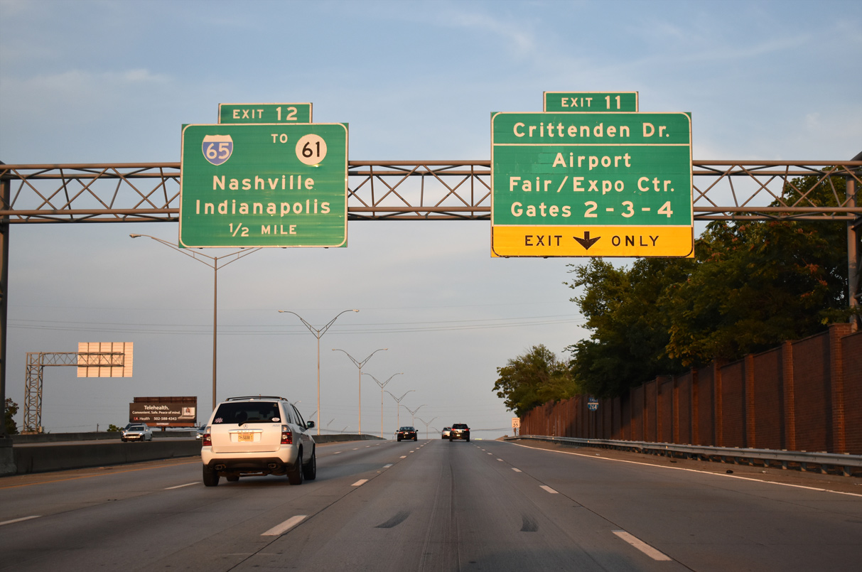
KY 1631 (Crittenden Drive) stems 1.58 miles north from Exit 11 to Kentucky Kingdom & Hurricane Bay theme park, Central Avenue to Cardinal Stadium and U.S. 60 ALT (Eastern Parkway).
09/07/20
Martha Moloney Drive extends east from Crittenden Drive (KY 1631) into Louisville International Airport (SDF). The Kentucky Fair and Exposition Center lies north of I-264 between KY 1631 and Interstate 65.
09/07/20

I-264 elevates along a viaduct over the CSX Railroad, Louisville Avenue and Old Park Boulevard ahead of the folded diamond interchange (Exit 11) with KY 1631 (Crittenden Drive).
09/07/20
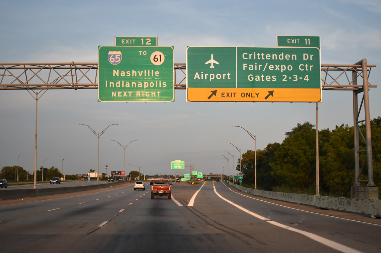
Two lanes depart I-264 east at Exit 11 for both KY 1631 (Crittenden Drive) and Terminal Drive to the passenger terminal at Louisville International Airport (SSF).
09/07/20
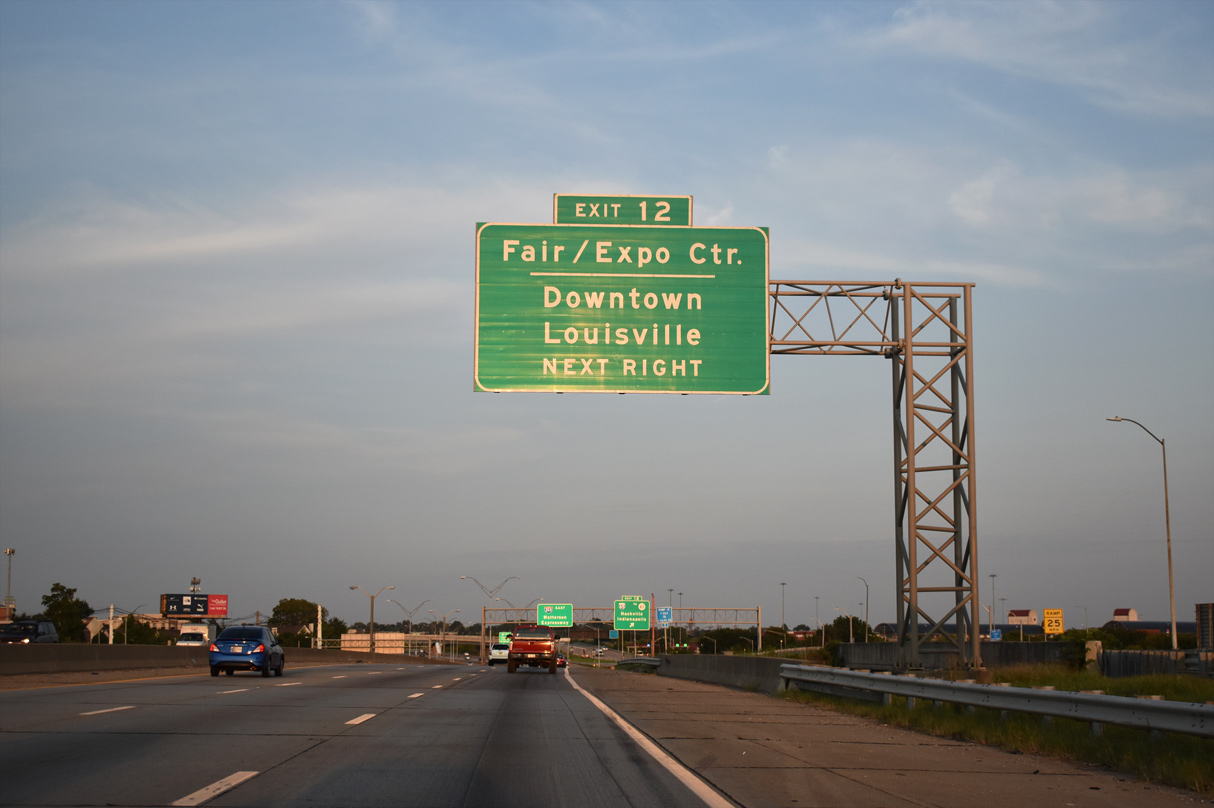
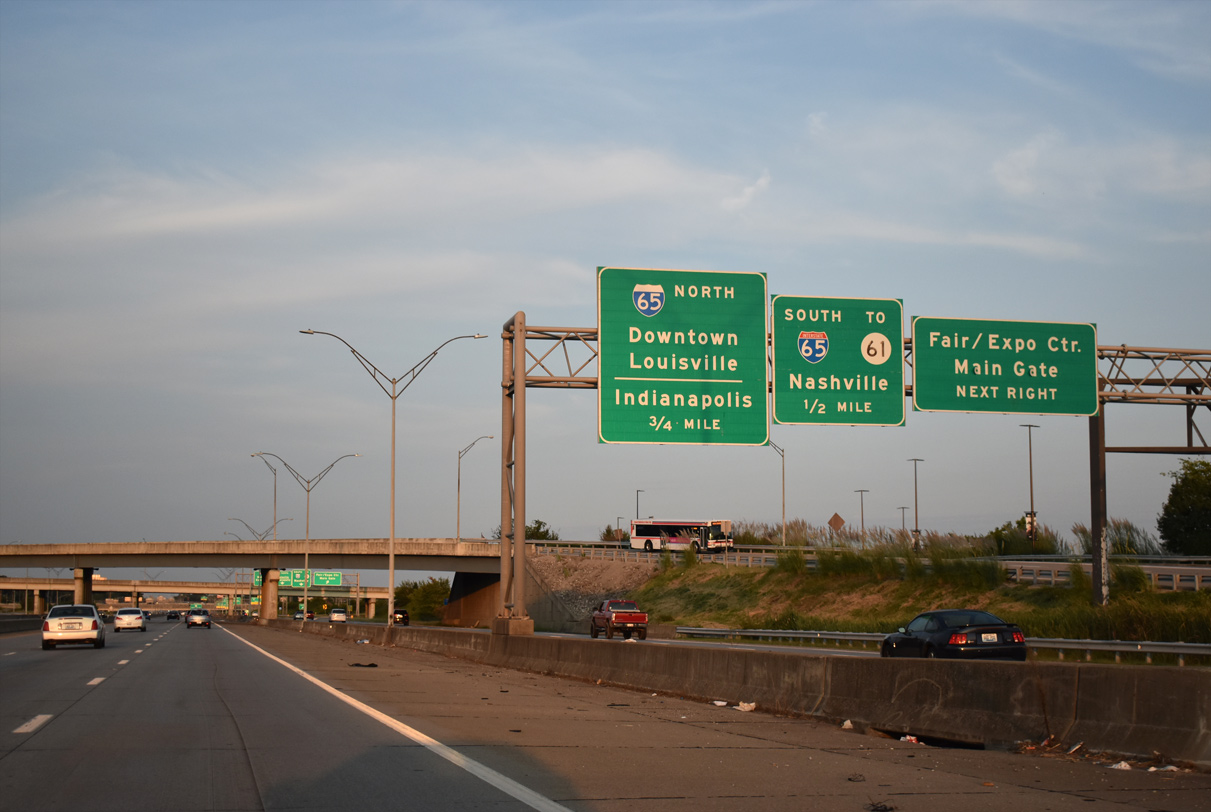
Freedom Way stems north from the c/d roadway system at Exit 12 to the Kentucky Exposition Center complex.
09/07/20
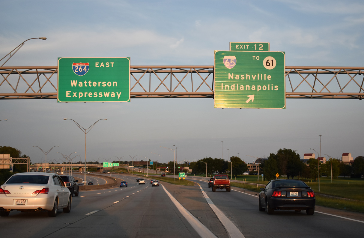
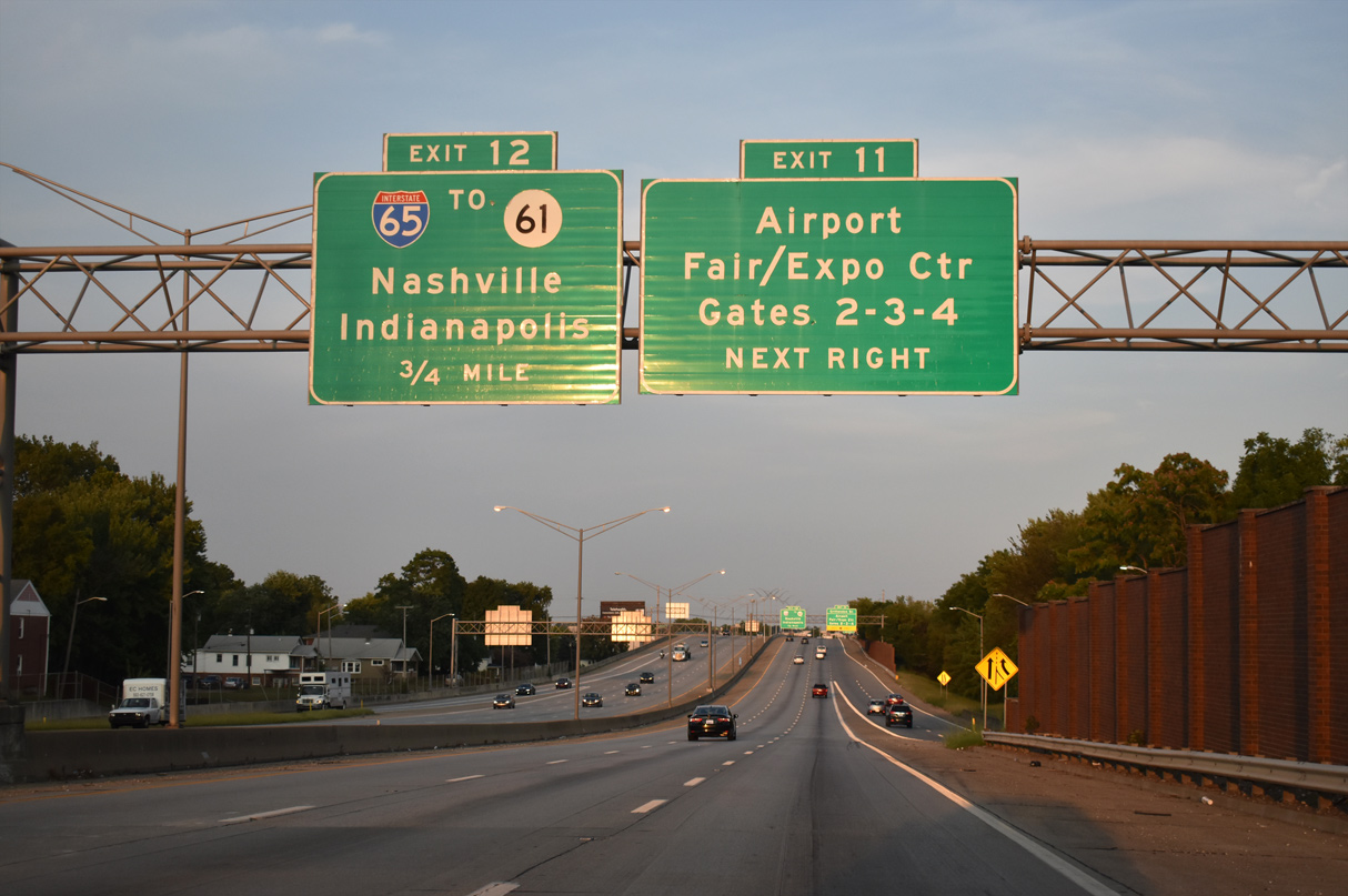
A 1.43 mile long collector distributor roadway separates at Exit 12 for Interstate 65 and KY 61 (Preston Highway).
09/07/20
Entrance ramps from Crittenden Drive and Terminal Drive join the c/d roadway ahead of the loop ramp for Freedom Drive north to the Kentucky Fair and Exposition Center.
09/07/20

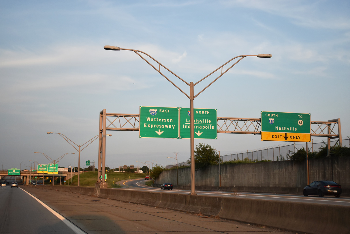
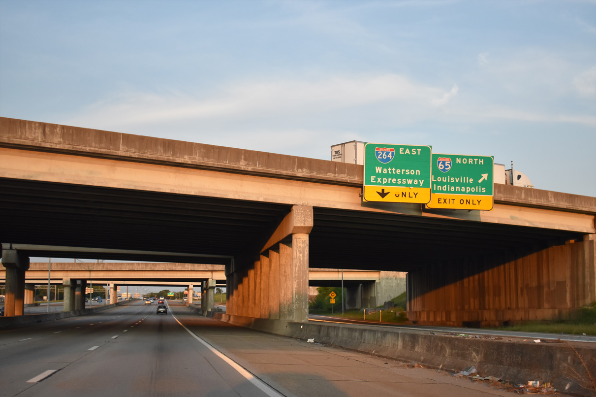
The southbound exit to I-65 (Dr. Martin Luther King, Jr. Expressway) to Elizabethtown and Nashville, Tennessee follows the exchange with Freedom Way.
09/07/20
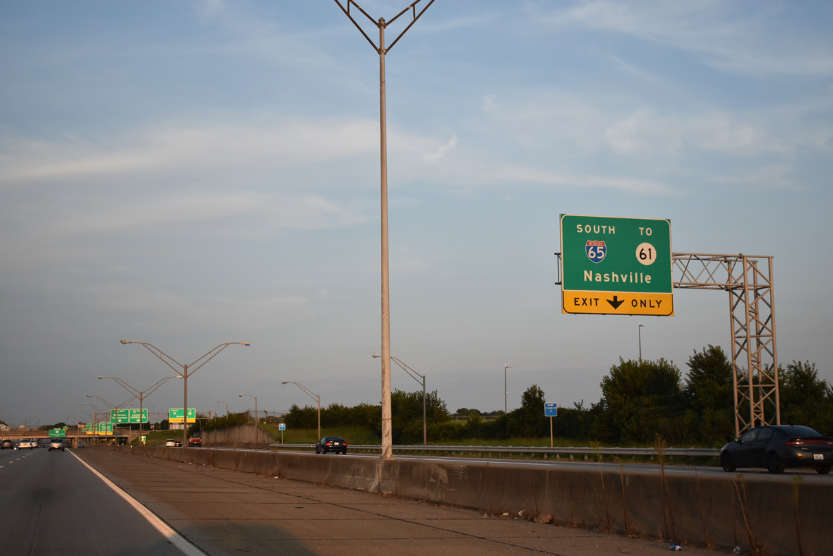
I-65 (Dr. Martin Luther King Jr. Expressway) south to Exit 130 (Grade Lane) serves as the connection between I-264 east and KY 61 (Preston Highway).
09/07/20
Two lanes depart the c/d roadway for Interstate 65 to the south suburbs and Bowling Green.
09/07/20
I-65 continues north along the Dr. Martin Luther King Jr. Expressway into Downtown Louisville and the Kennedy Interchange with I-64 and I-71 north.
09/07/20
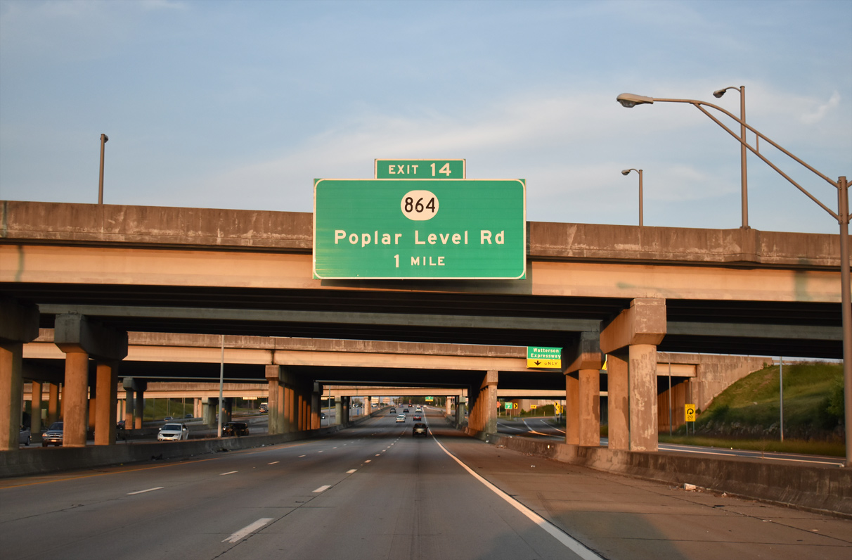
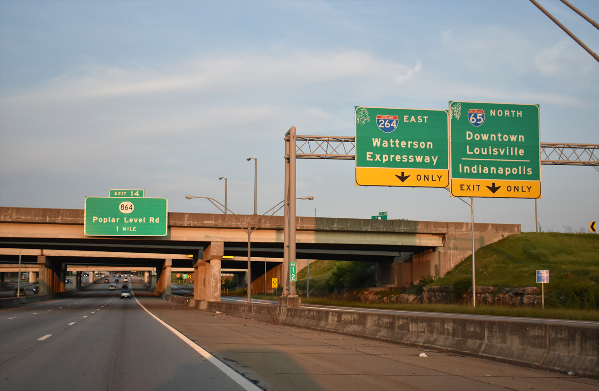
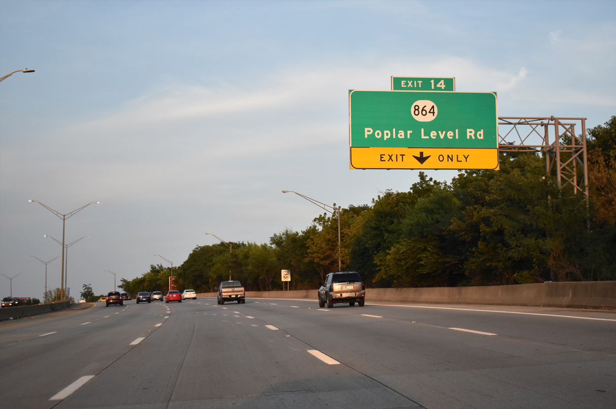
Interstate 264 east next meets KY 864 (Poplar Level Road) at a single point urban interchange (Exit 14).
09/07/20
Interstate 65 travels north across the tolled Abraham Lincoln Bridge over the Ohio River into Clarksville en route to Indianapolis, Indiana.
09/07/20
East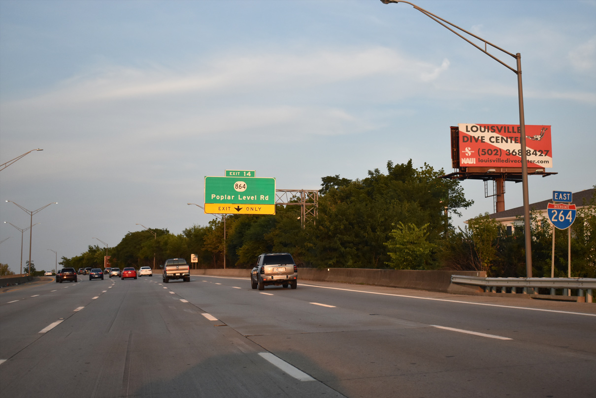
I-264 (Watterson Expressway) curves northward along the Prestonia and Camp Taylor neighborhoods to Exit 14.
09/07/20
A 15.98 mile long route within Jefferson County, KY 864 travels southeast to KY 1747 (Fern Valley Road) and north to U.S. 31E in the Phoenix Hill neighborhood east of Downtown Louisville.
09/07/20
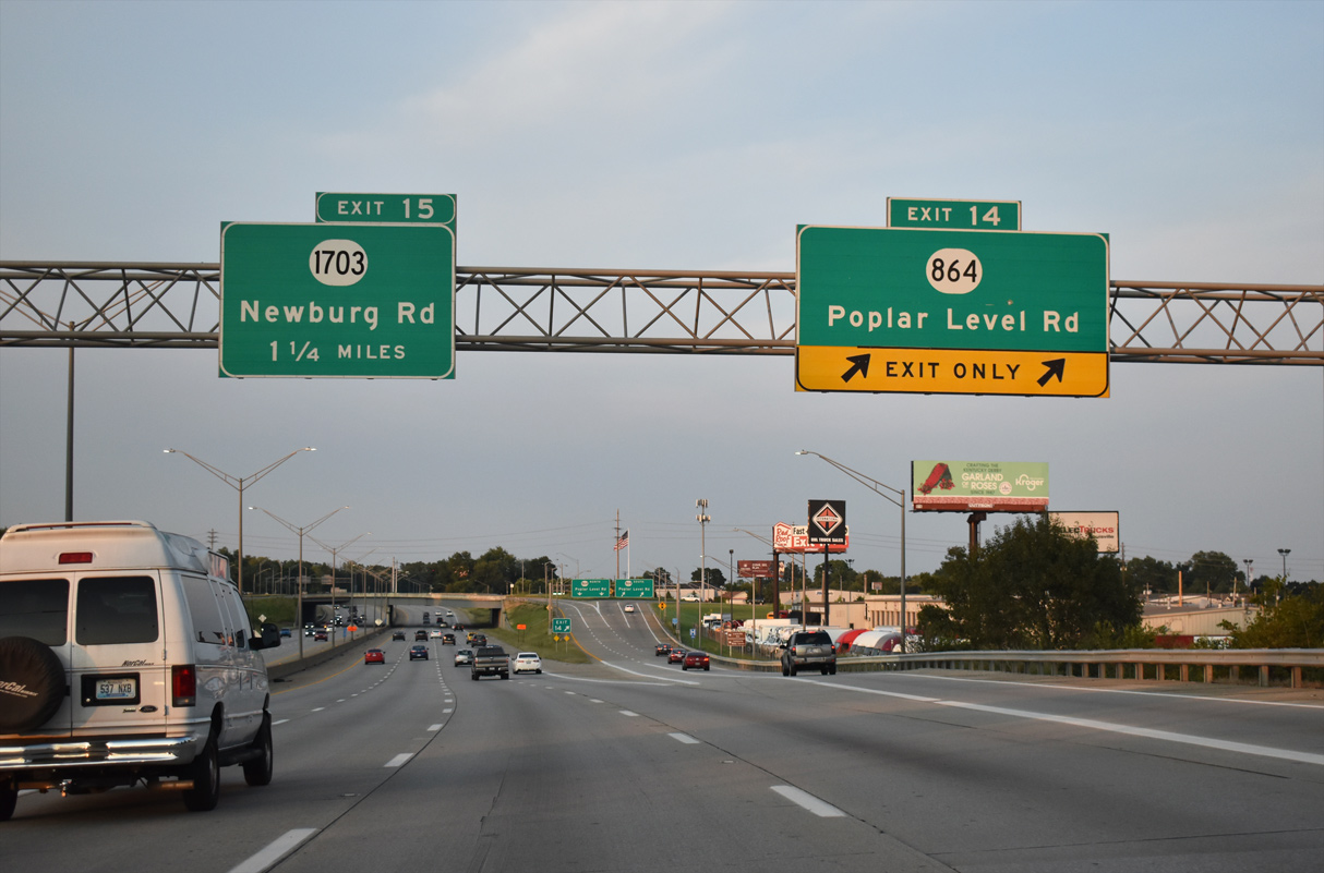
Two lanes depart I-264 east for Exit 14 to KY 864 (Poplar Level Road).
09/07/20
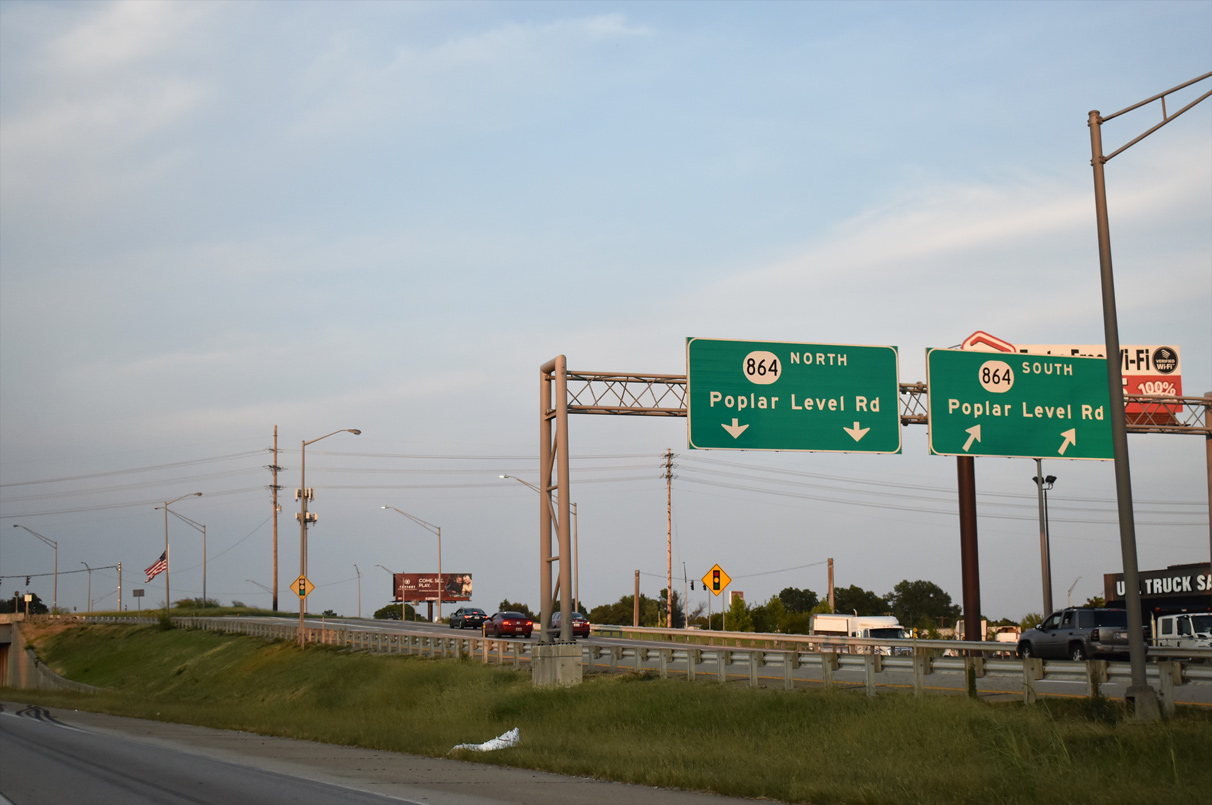
KY 864 (Poplar Level Road) angles northwest to Louisville Zoo and the Poplar Level and Germantown neighborhoods and southeast through a heavily industrialized area along the Louisville and Watterson Park city line.
09/07/20
Passing north of the Watterson Park city limits, Interstate 264 is eight lanes wide.
09/07/20
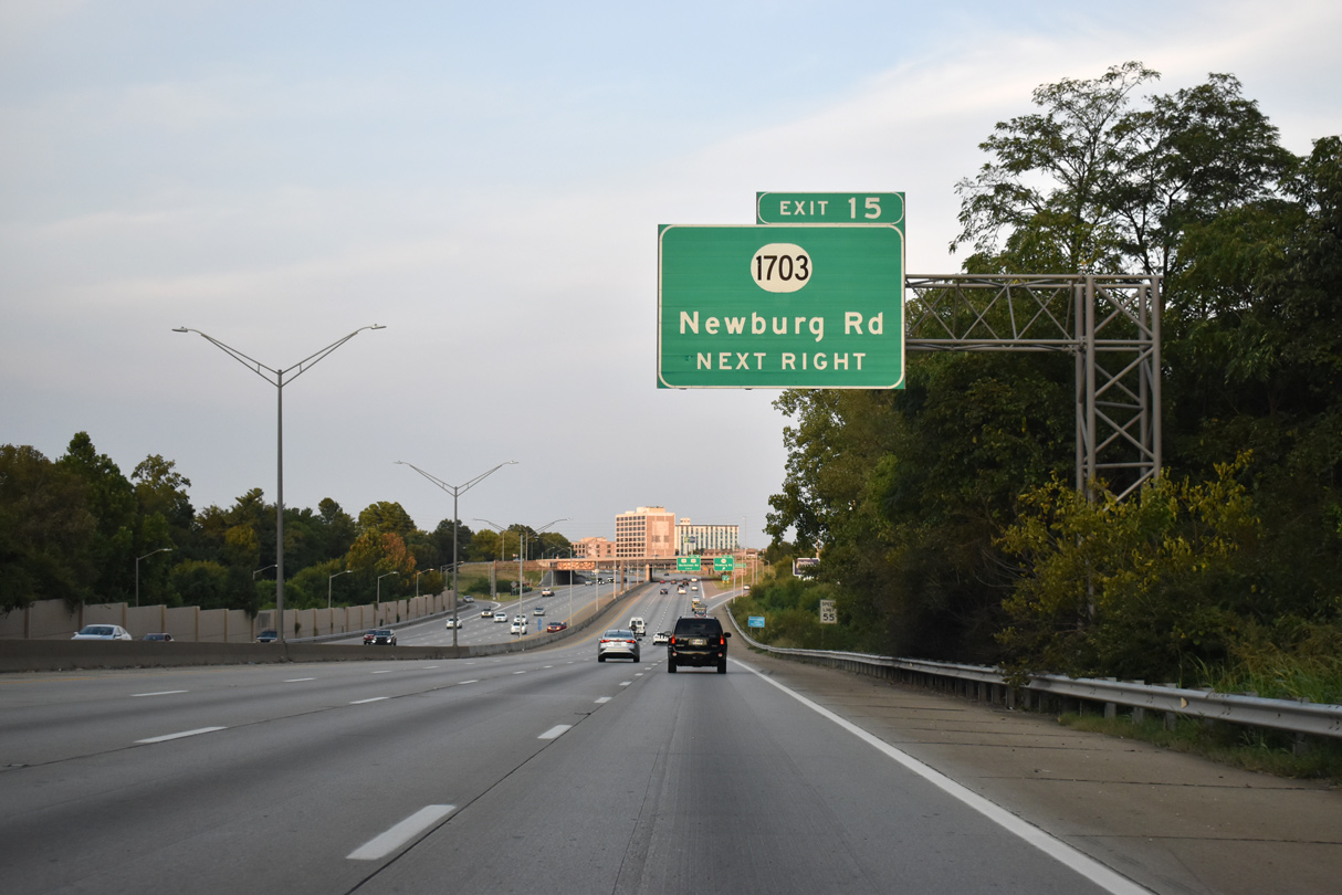
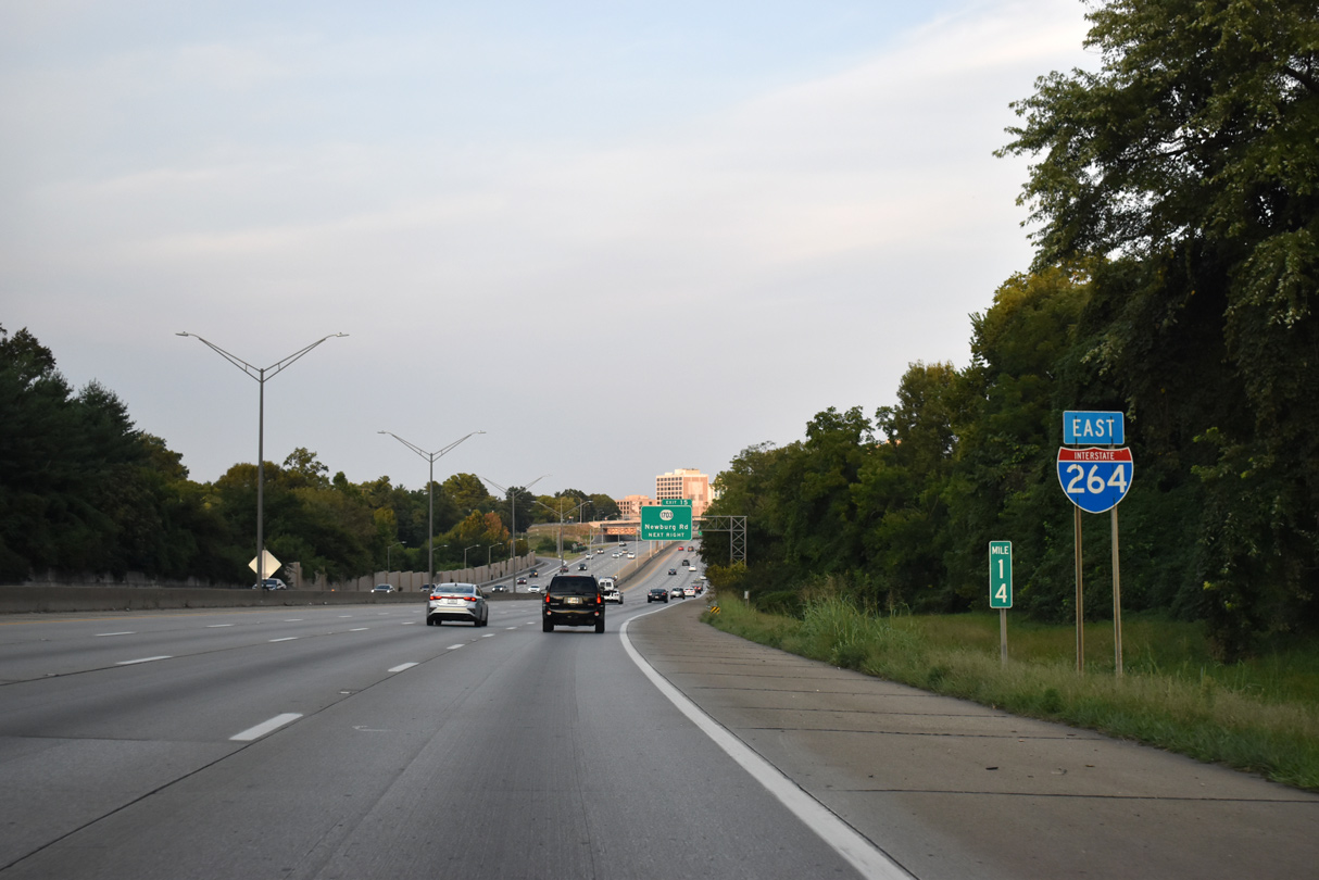
A five ramp parclo interchange joins I-264 with KY 1703 (Newburg Road) at Exit 15 and the Hayfield Dundee neighborhood in Louisville.
09/07/20
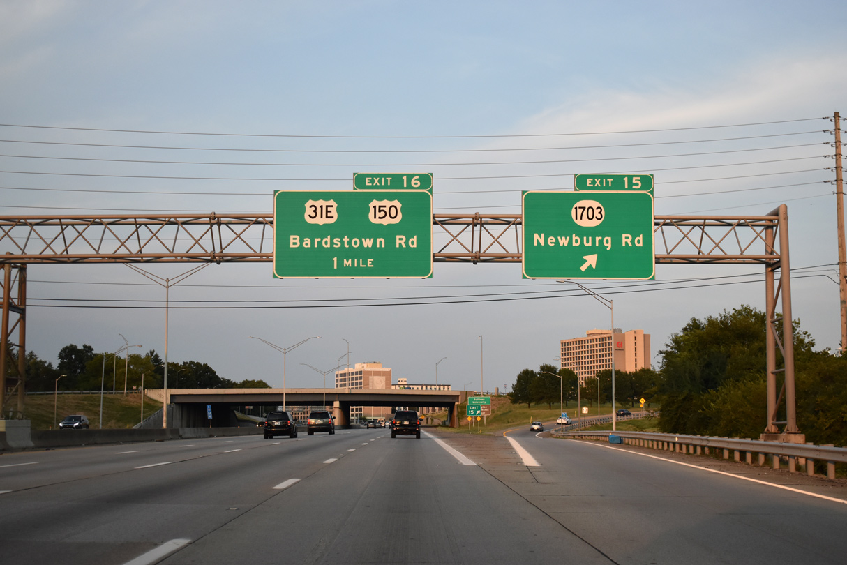
KY 1703 meanders 5.68 miles southeast from U.S. 31E at the Highlands neighborhood in central Louisville to Watterson Park, West Buechel and KY 2052 (Shepherdsville Road) at the Newburg community.
09/07/20
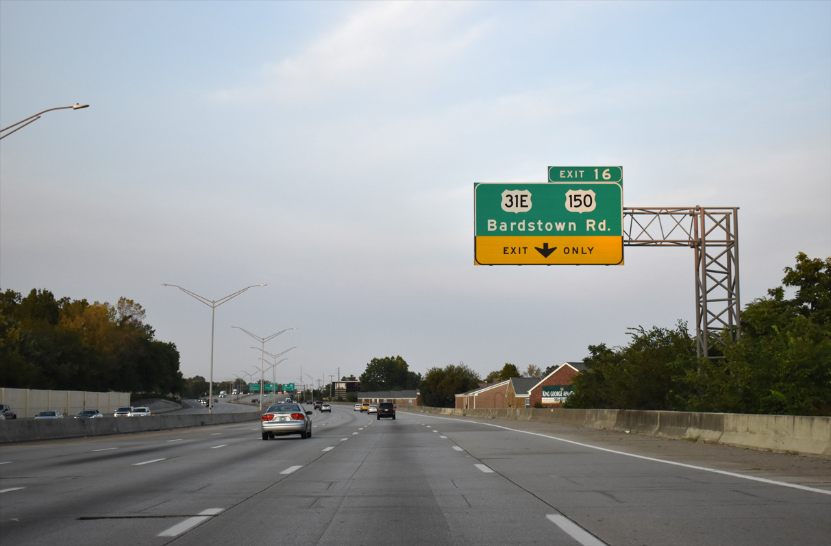
Continuing northeast, the Watterson Expressway meets U.S. 31E/150 (Bardstown Road) between the Bon Air neighborhood in Louisville and the city of Wellington.
09/07/20
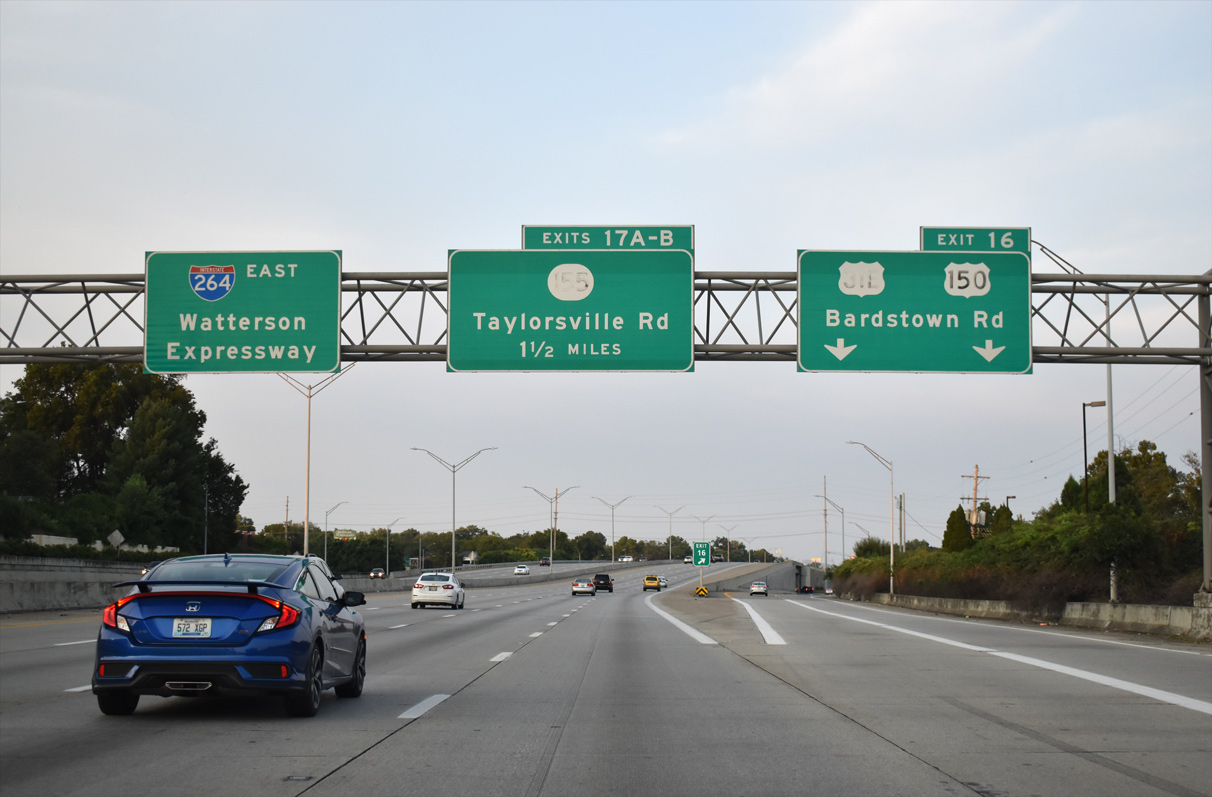
U.S. 31E/150 head southeast to the city of West Buechel locally and Bardstown in Nelson County. Northwest from the SPUI at Exit 16, U.S. 31E/150 (Bardstown Road) continue between Strathmoor Manor and Strathmoor Village to Belknap in Louisville.
09/07/20
Interstate 264 travels between the Hawthorne and Bon Air Estates neighborhoods en route to KY 155 (Taylorsville Road).
09/07/20
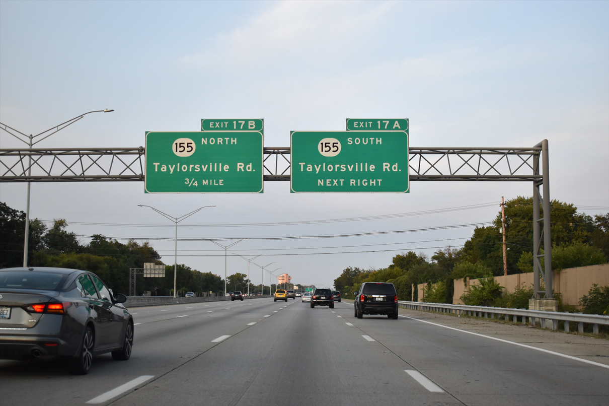
KY 155 (Taylorsville Road) branches 1.80 miles east from U.S. 31E/150 (Bardstown Road) to a six-ramp parclo interchange (Exit 17) with I-264. The roadways for I-264 originally separated with left exit ramps at this exchange.
09/07/20
KY 155 travels east along Taylorsville Road to Jeffersontown and Fisherville in Louisville. The 20.79 mile long route extends south to KY 55 at Elk Creek in rural Spencer County.
09/07/20
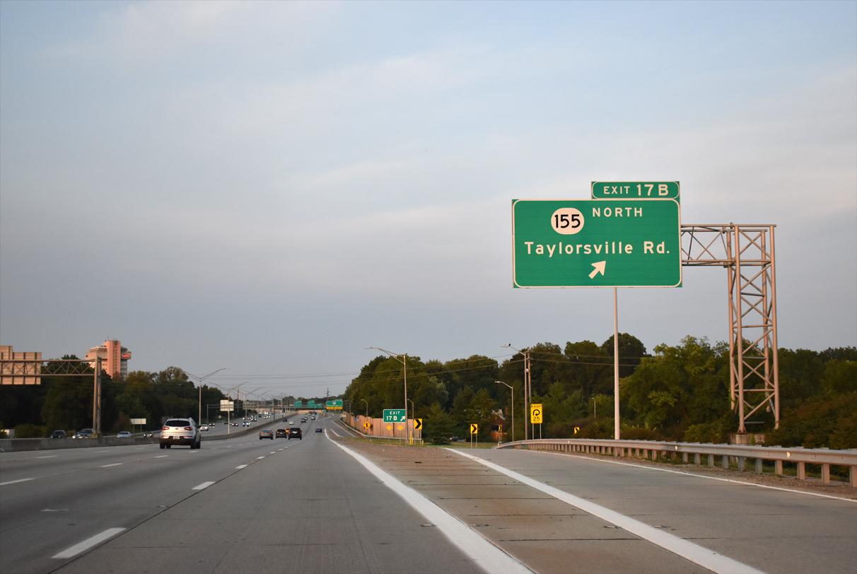
Exit 17B loops onto KY 155 (Taylorsville Road) west to Bowman Field (LOU), Kingsley and Seneca Gardens.
09/07/20
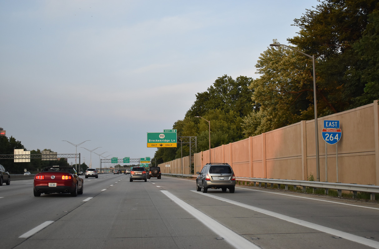
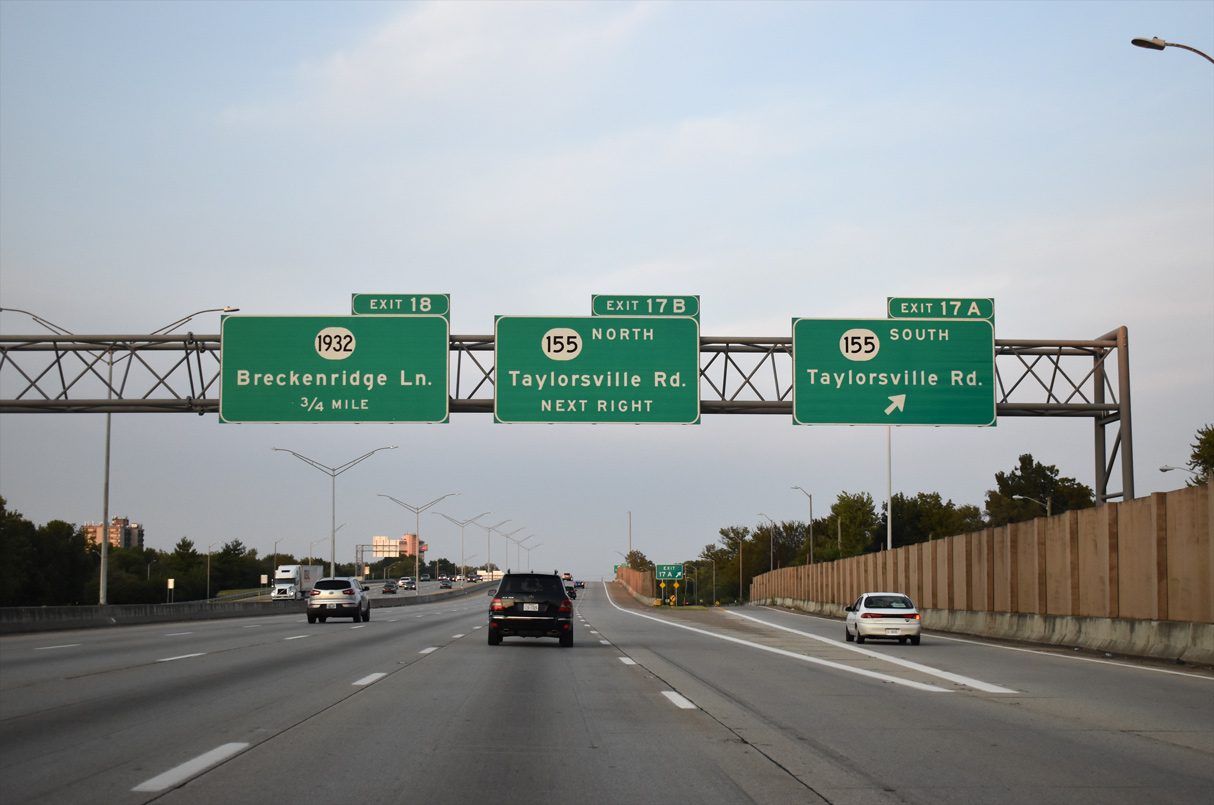
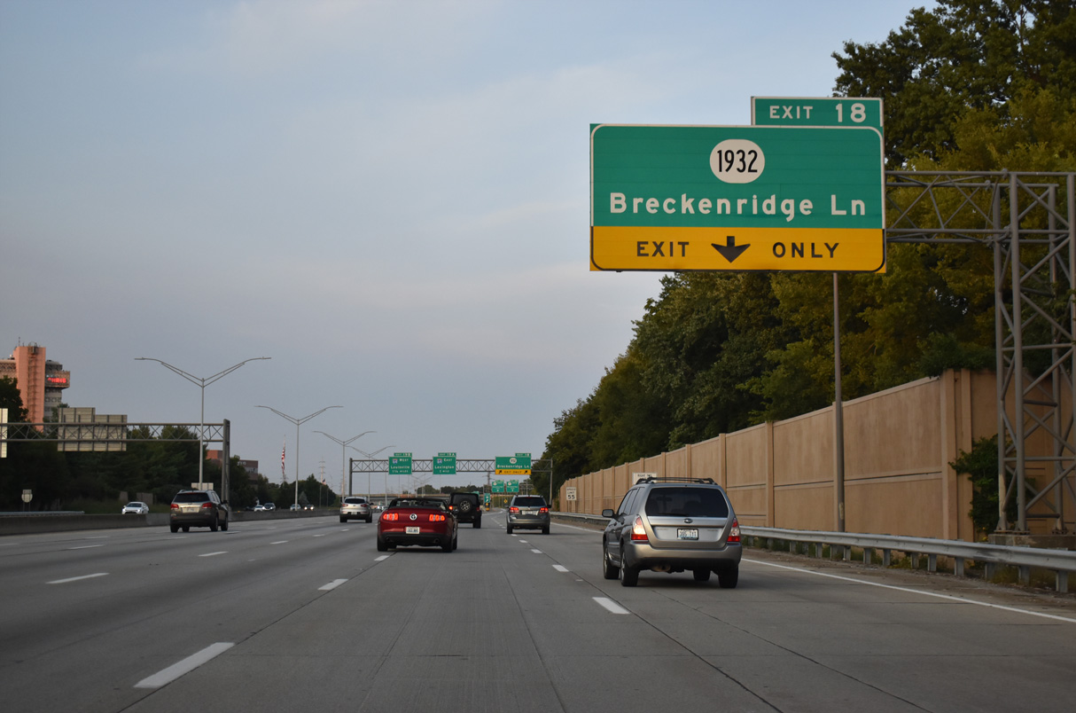
Interstate 264 eastbound expands to six lanes leading into the cloverleaf interchange (Exit 18) with KY 1932 (Breckenridge Lane) at Hikes Point in Louisville.
09/07/20
Interstate 264 eastbound expands to six lanes leading into the cloverleaf interchange (Exit 18) with KY 1932 (Breckenridge Lane) at Hikes Point in Louisville.
09/07/20
A c/d roadway links I-264 with KY 1932 (Breckenridge Lane) south 3.47 miles to U.S. 31E/150 (Bardstown Road) and northwest 3.12 miles to St. Matthews and U.S. 42 (Brownsboro Road) at Rolling Fields.
09/07/20
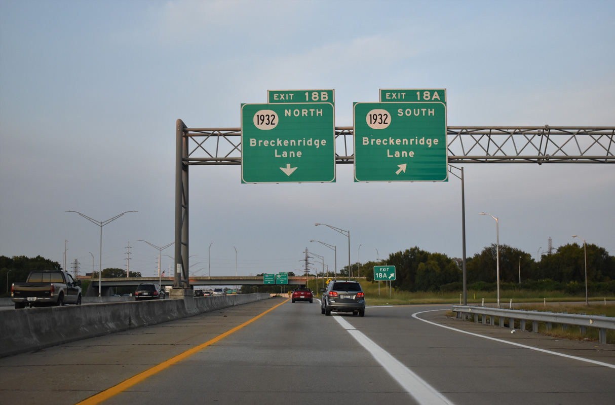
KY 1932 (Breckenridge Lane) angles southeast to KY 155 (Taylorsville Road) before turning southerly to the Klondike neighborhood.
09/07/20
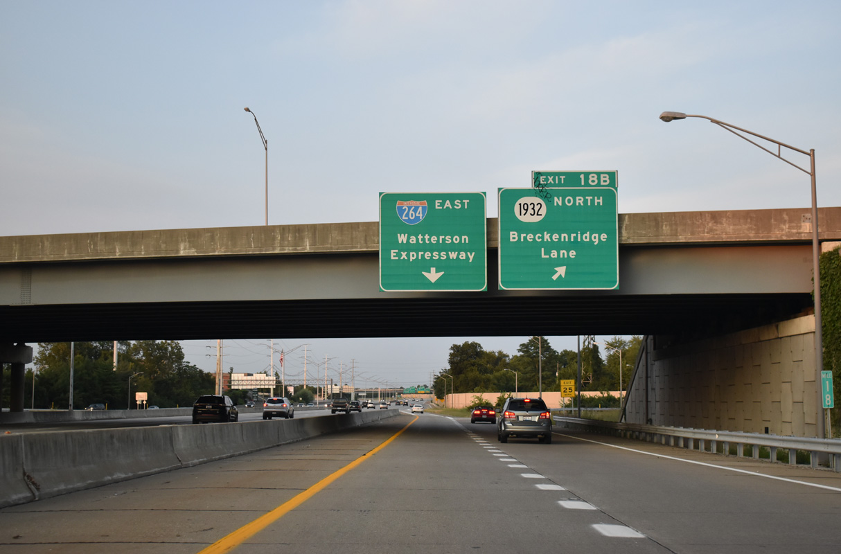
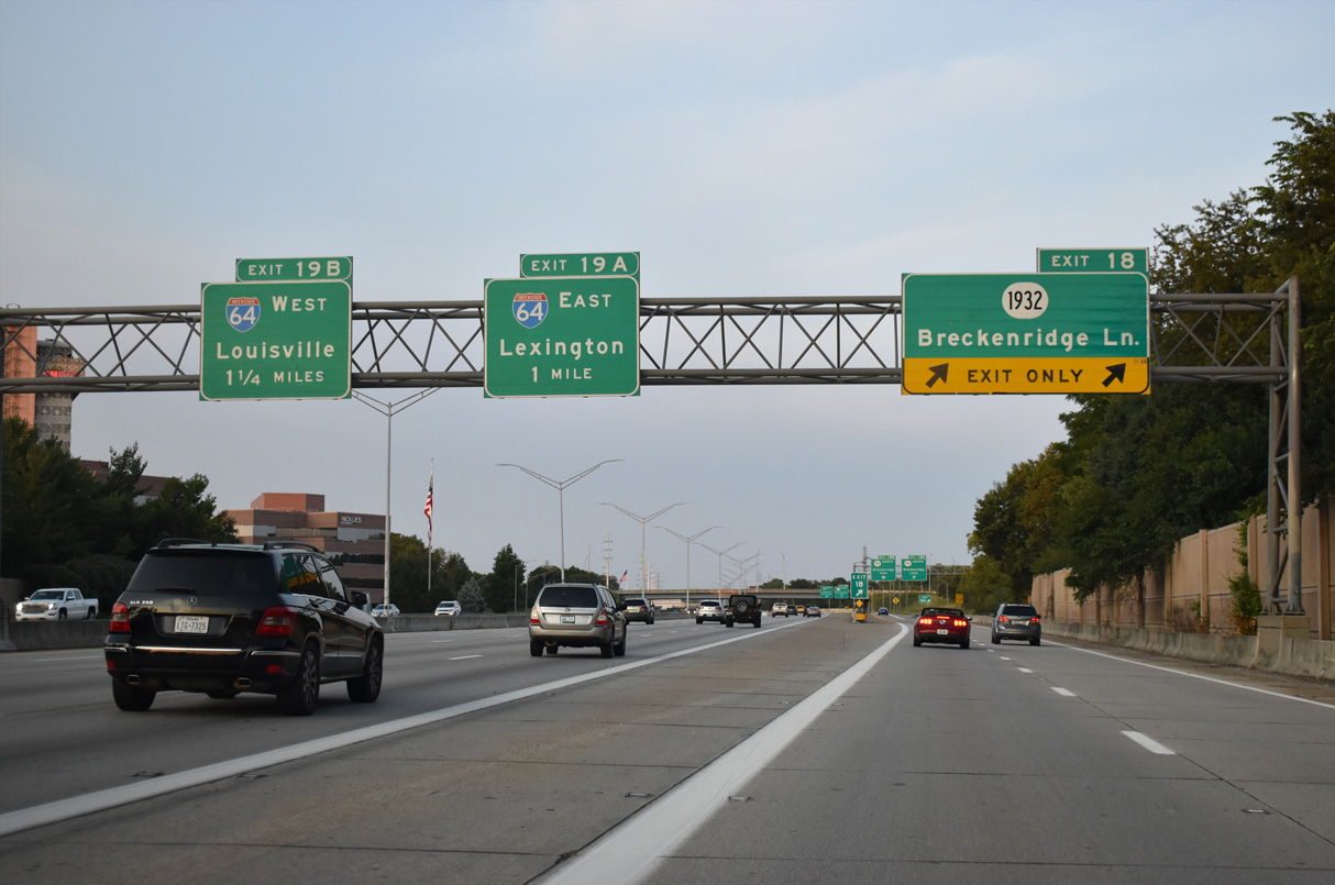
Exit 18B loops away to KY 1932 north as the c/d roadway returns to the Watterson Expressway. I-264 meets I-64 to Downtown Louisville and Lexington next.
09/07/20
An auxiliary lane briefly joins eastbound I-264 (Watterson Expressway) between KY 1932 and the exchange with I-64 (Exit 19).
09/07/20
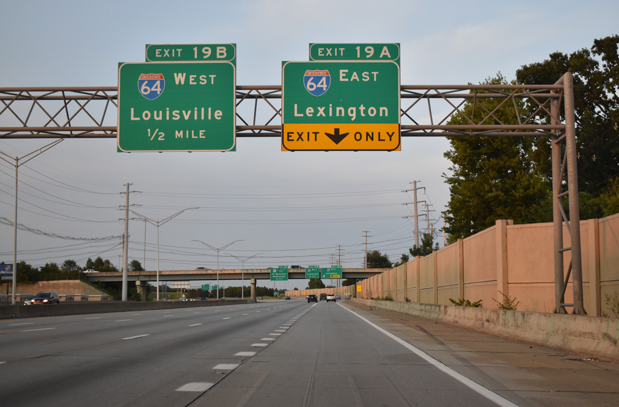
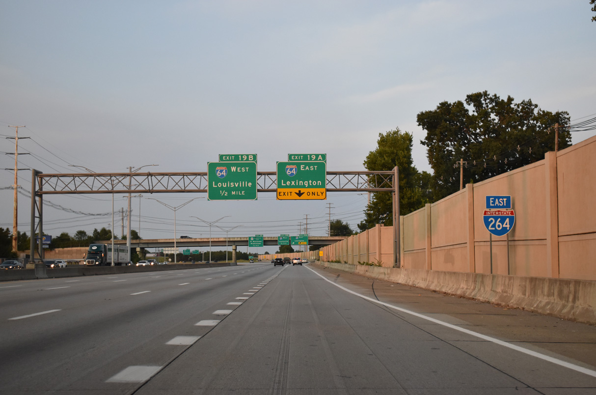
I-264 (Watterson Expressway) converges with Interstate 64 at a directional cloverleaf interchange (Exit 19) north of Hikes Point and the city of St. Regis Park.
09/07/20
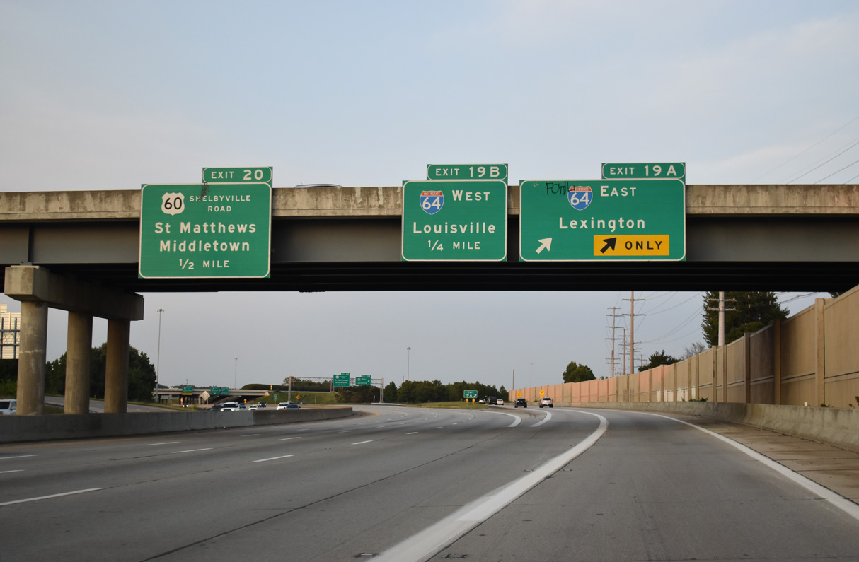
Interstate 64 continues from the eastern Louisville suburbs toward the capital city of Frankfort and I-75 at Lexington.
09/07/20
West from Exit 19B and the city of St. Matthews, Interstate 64 continues to Cherokee Park, Irish Hill and the Kennedy Interchange with I-65 and I-71 outside Downtown Louisville.
11/12/04

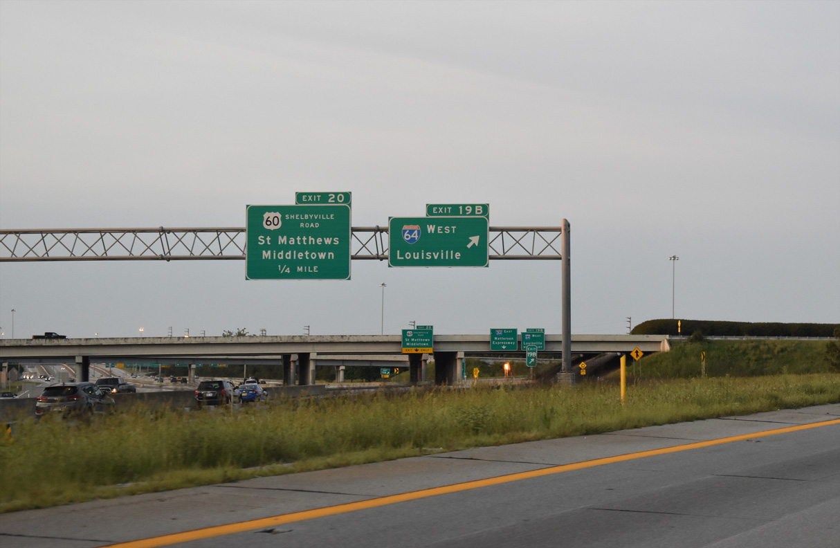
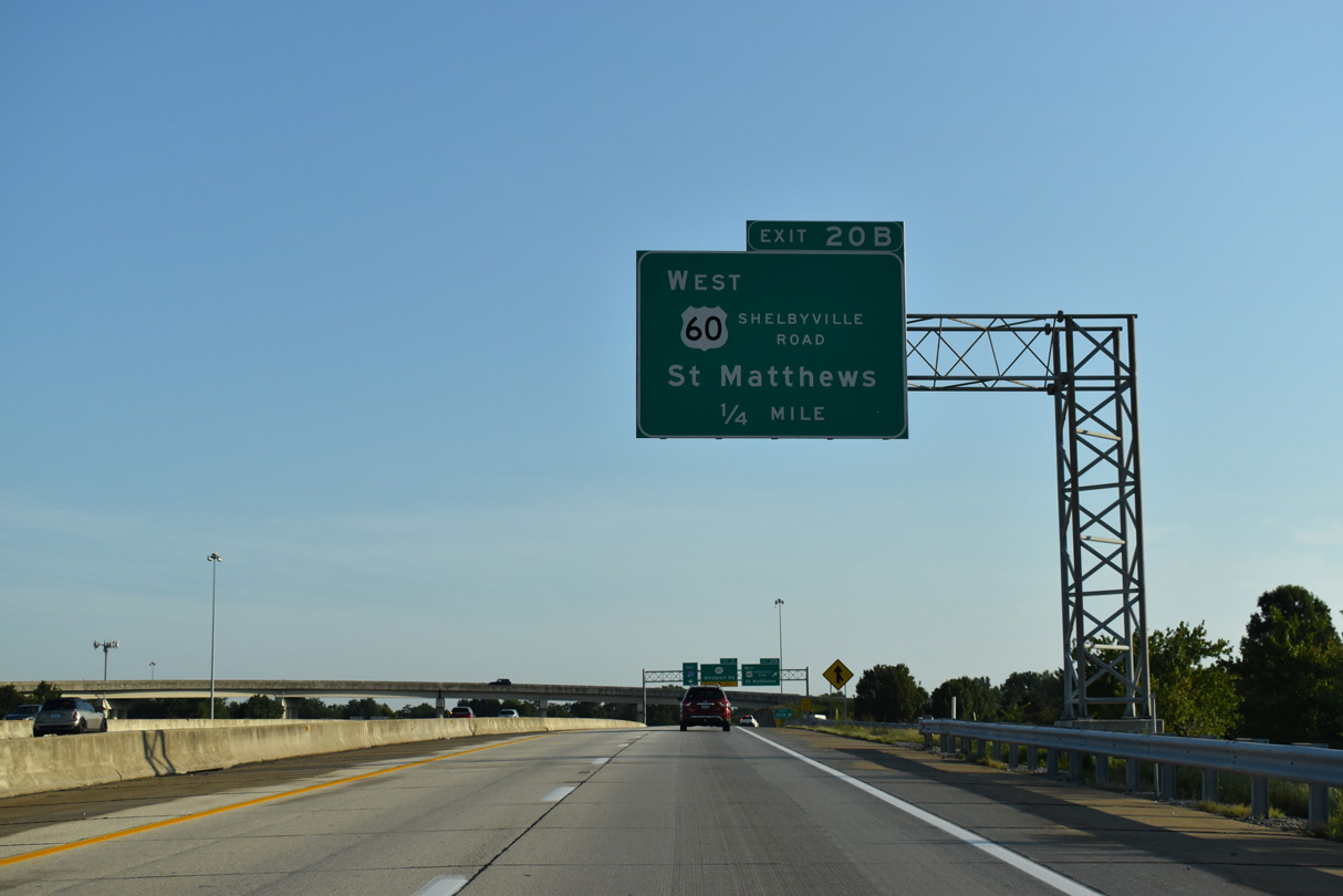
The c/d roadway at the exchange with I-64 extends north to Exit 20 for U.S. 60 (Shelbyville Road) between Mall St. Mathews and Oxmoor Center.
11/12/04

U.S. 60 (Shelbyville Road) leads west from I-264 into St. Matthews. The suburban city was named for a local church in 1851, and incorporated in 1950.
11/12/04
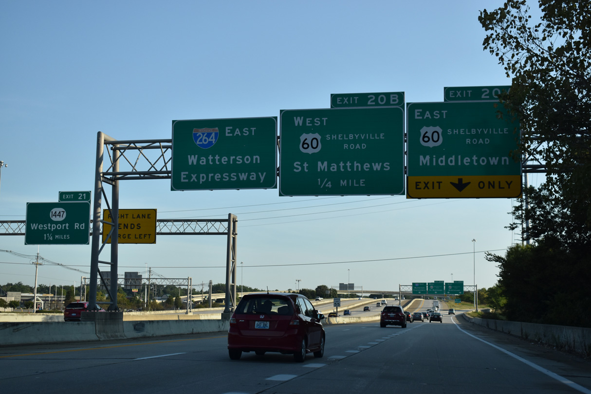
The original cloverleaf interchange at Exit 20 was rebuilt in the late 80s and early 90s when c/d lanes were added. The loop ramp from U.S. 60 west to Interstate 264 west was also replaced by a flyover.
09/08/20
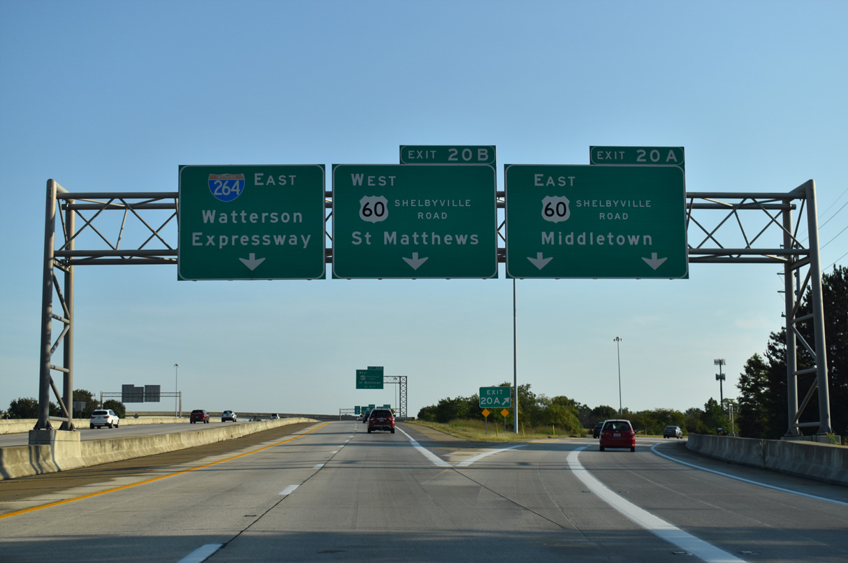
U.S. 60 (Shelbyville Road) runs east from the adjacent city of Norwood to Interstate 265 through the city of Middletown.
09/08/20
U.S. 60 (Shelbyville Road) proceeds 2.12 miles west from Exit 20B to split with U.S. 60 ALT (Lexington Road) in St. Matthews. U.S. 60 continues along Frankford Avenue to Crescent Hill in Louisville.
09/08/20
Mall St. Matthews, to the southwest of Exit 20B, opened in 1962 and was Kentucky's first enclosed suburban mall.
09/08/20
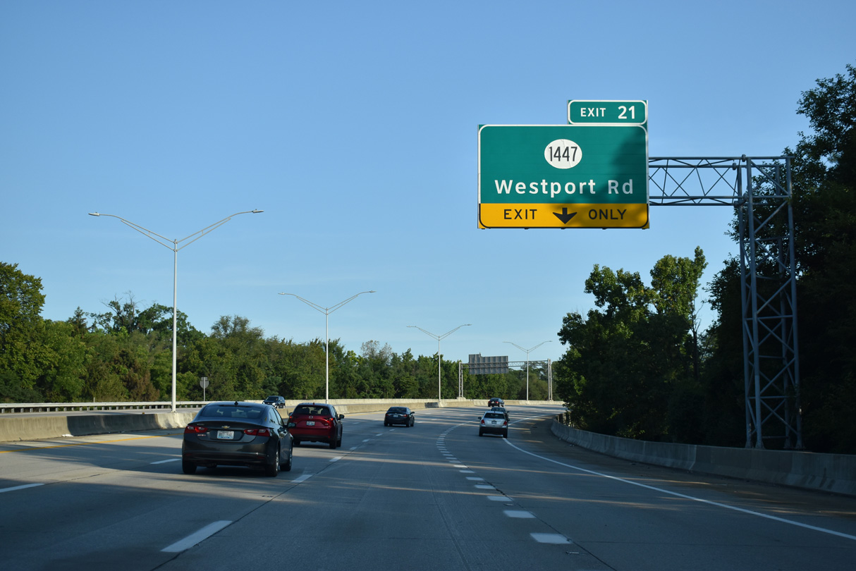
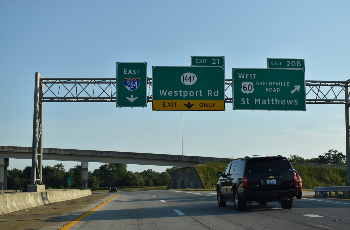
I-264 turns north through an S-curve between Beechwood Village and Lyndon. A single point urban interchange (Exit 21) opened in April 2010 between Watterson Expressway and KY 1447 (Westport Road) at Windy Hills and Woodlawn Park.
09/08/20
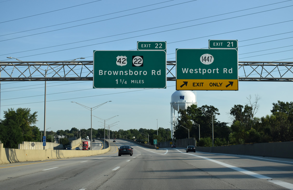
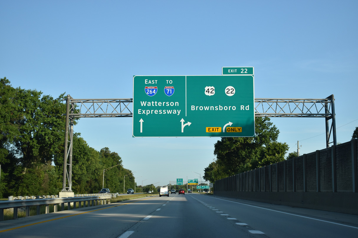
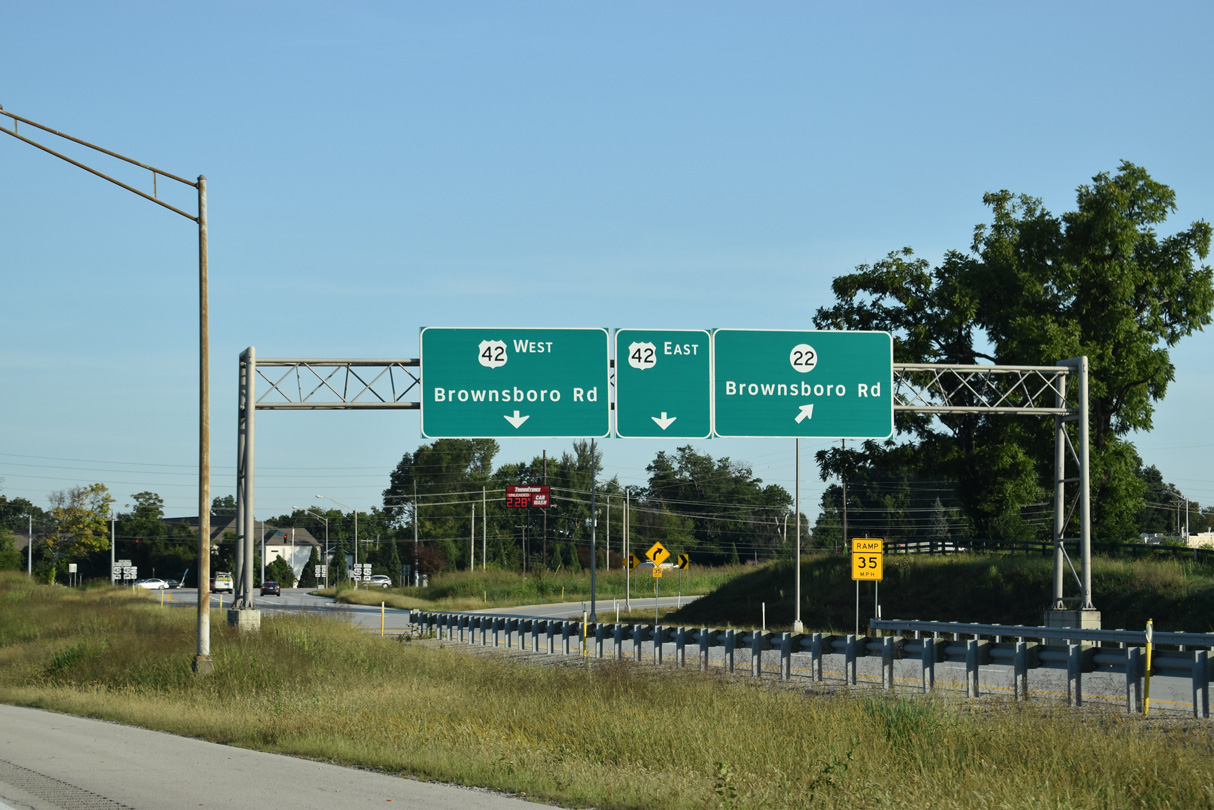
U.S. 42 (Brownsboro Road) meets Interstate 264 between the cities of Windy Hills and Northfield at Exit 22.
09/08/20
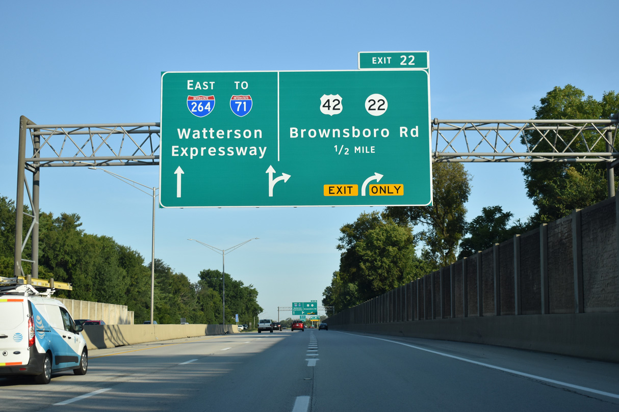
I-264 advances 1.3 miles northwest to the exchange with I-71 (Exit 23).
09/08/20
U.S. 42 originates at U.S. 60 in the Butchertown neighborhood of Louisville. The route travels northeast along the I-71 corridor to Cincinnati, Ohio.
09/08/20
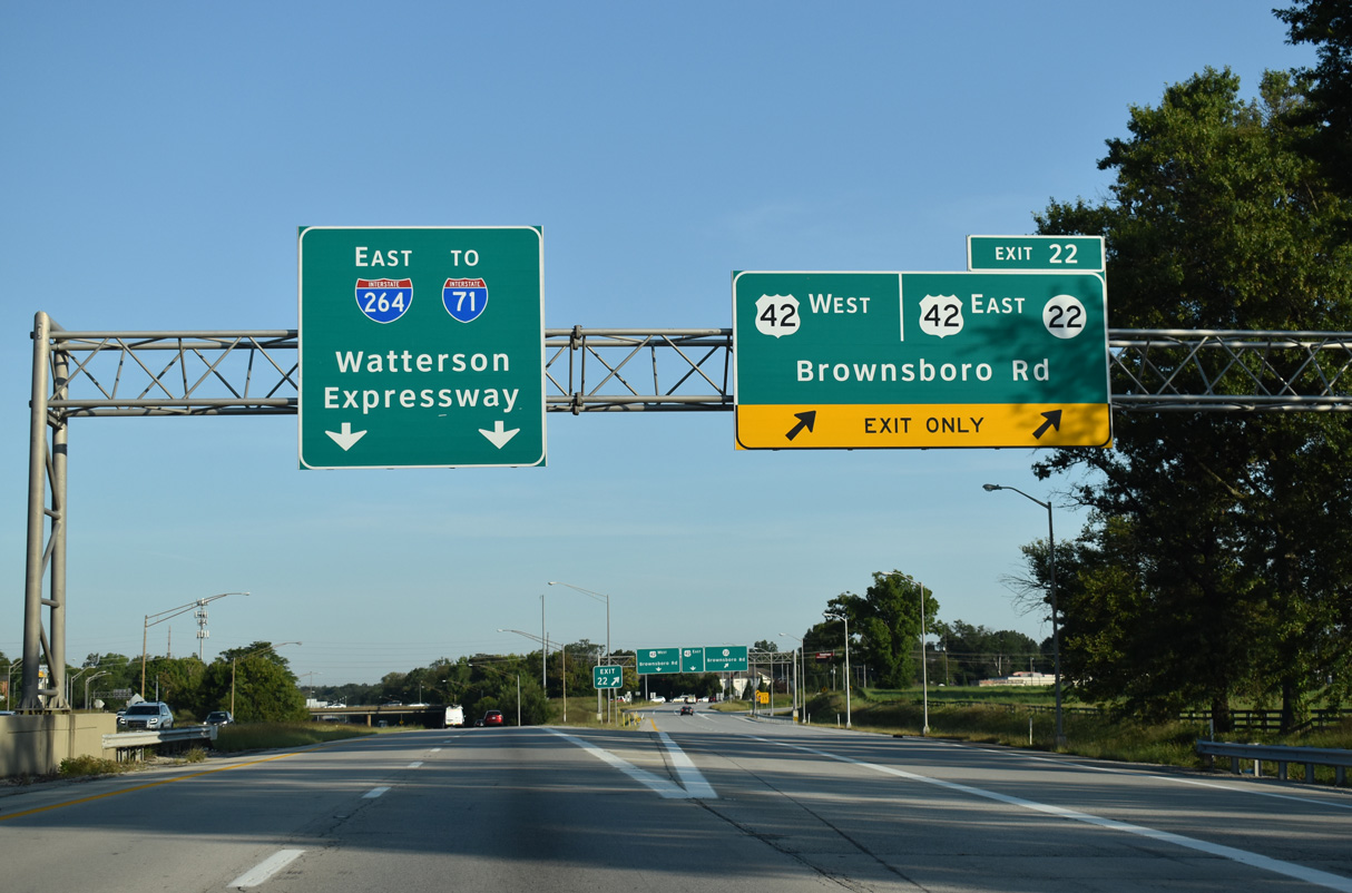
The diamond interchange (Exit 22) with U.S. 42 was expanded with a direct ramp from I-264 eastbound to the continuation of Brownsboro Road on KY 22 east. Zachary Taylor National Cemetery, where the remains of the 19th century President and his wife rest, is just west of Exit 22.
09/08/20
The diamond interchange (Exit 22) with U.S. 42 was expanded with a direct ramp from I-264 eastbound to the continuation of Brownsboro Road on KY 22 east. Zachary Taylor National Cemetery, where the remains of the 19th century President and his wife rest, is just west of Exit 22.
09/08/20
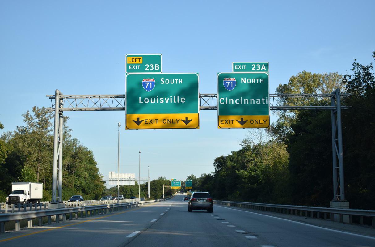
Interstate 264 concludes at directional T interchange (Exit 23) with I-71 between Indian Hills and Northfield.
09/08/20
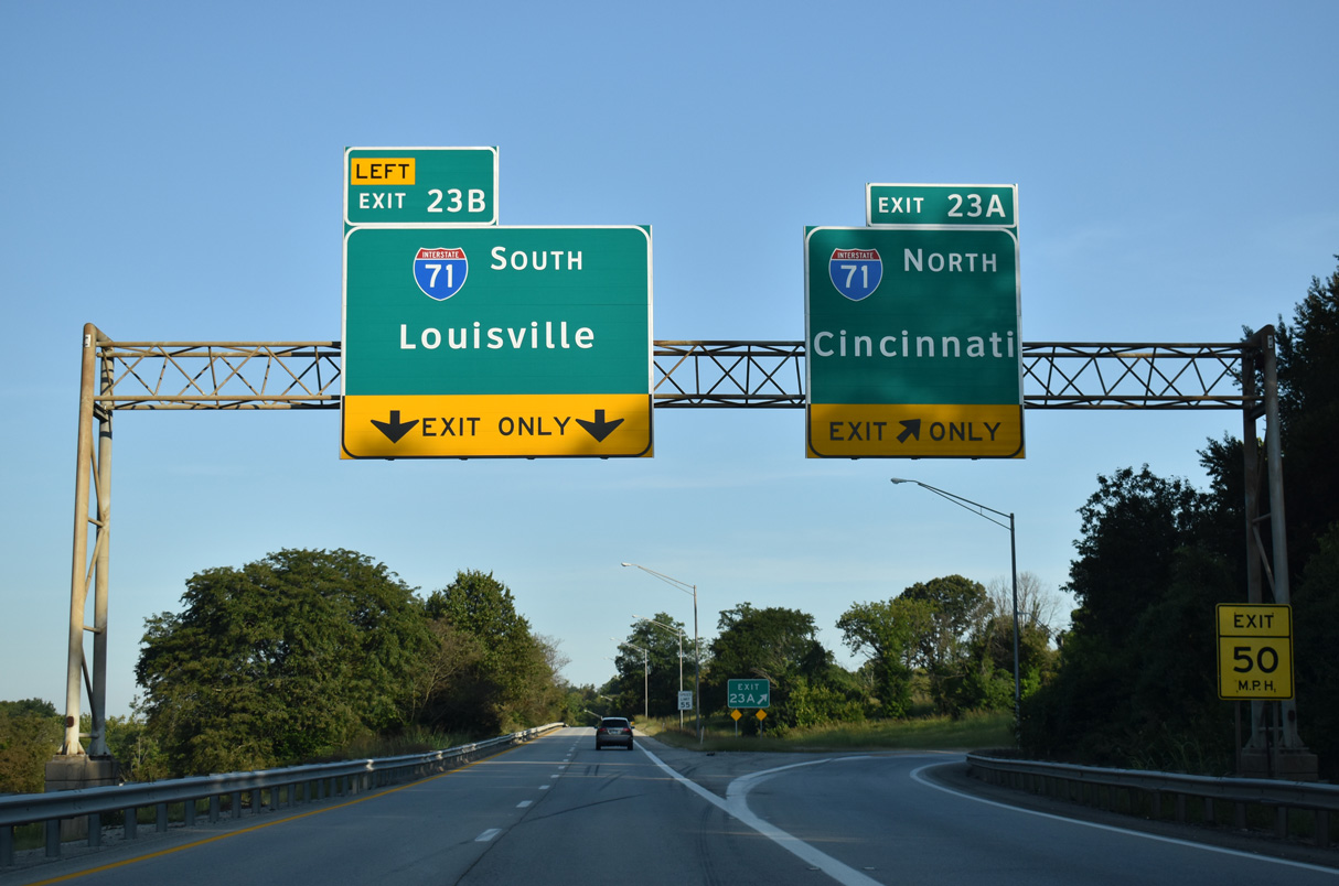
The freeway mainline defaults onto I-71 south for Downtown Louisville and the Kennedy Interchange with I-64/65. Exit 23A connects I-264 with Interstate 71 north to I-265 at Worthington in Louisville and Covington.
09/08/20
Connect with:
Interstate 64
Interstate 65
Interstate 71
Page Updated 02-26-2021.