|
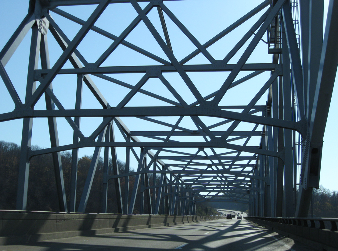
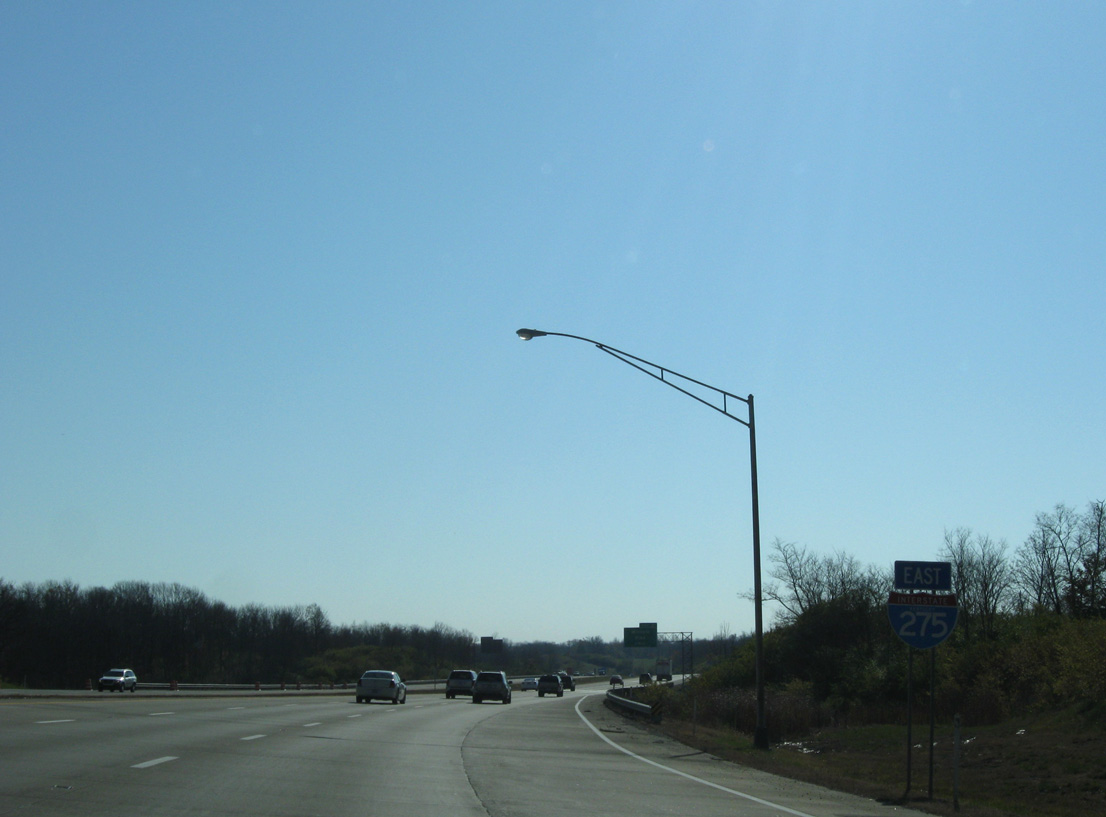
| The Caroll C. Cropper Bridge takes Interstate 275 southeast into Boone County. The bridge is without breakdown lanes. 11/08/09 |
|
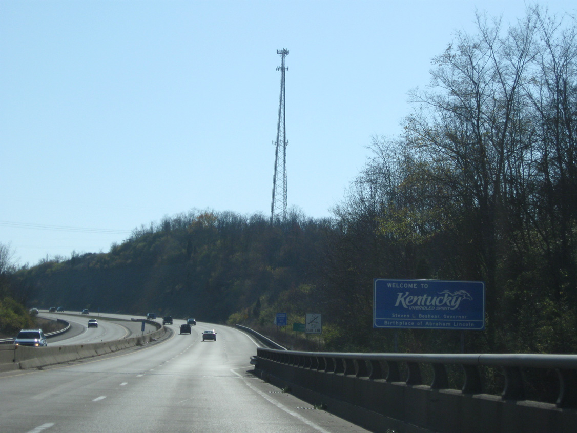
| Welcome to Kentucky sign posted as the freeway enters the hills northeast of Petersburg. 11/08/09 |
|
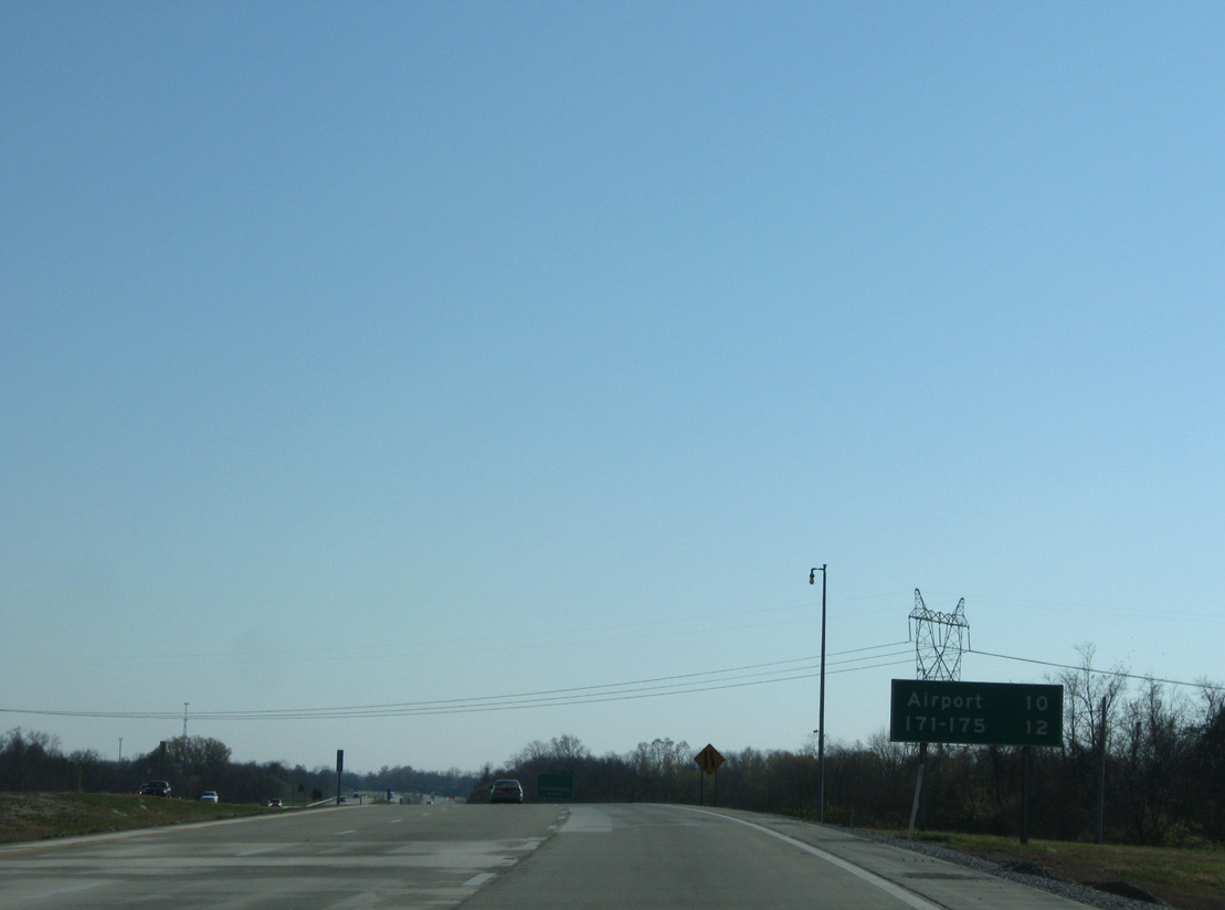
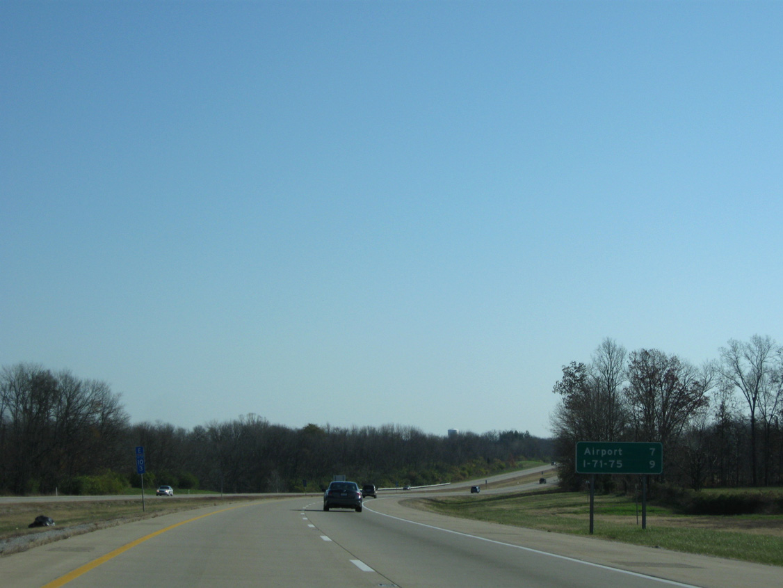
| A ten mile drive awaits motorists bound for Cincinnati / Northern Kentucky International Airport (CVG). I-71/75 follow at the city of Erlanger. 11/08/09 |
|
| The first Bluegrass State exit on the beltway joins I-275 with KY 3608 (Idlewild Bypass) in one mile. 11/08/09 |
|
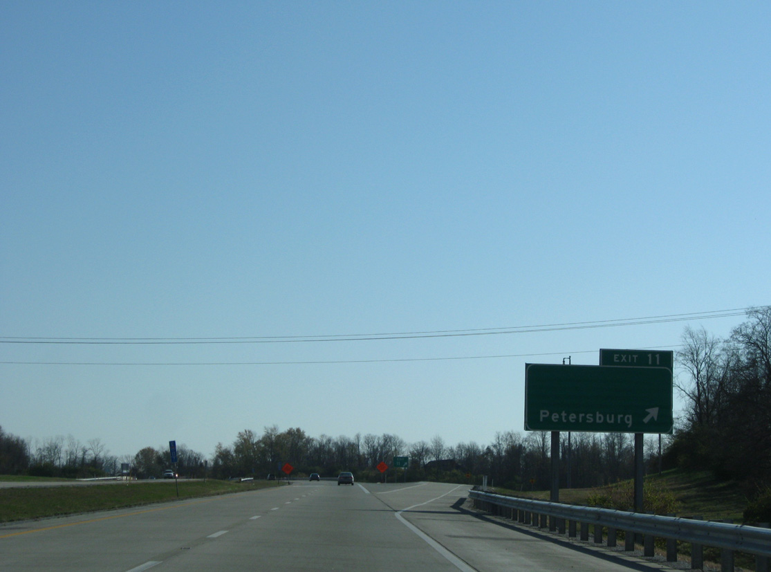
| KY 3608 links Interstate 275 with parallel KY 20 (Petersburg Road). KY 20 travels 20.73 miles from KY 18 near Belleview north along the Ohio River to Petersburg and east to Hebron and the CVG Airport vicinity. 11/08/09 |
|
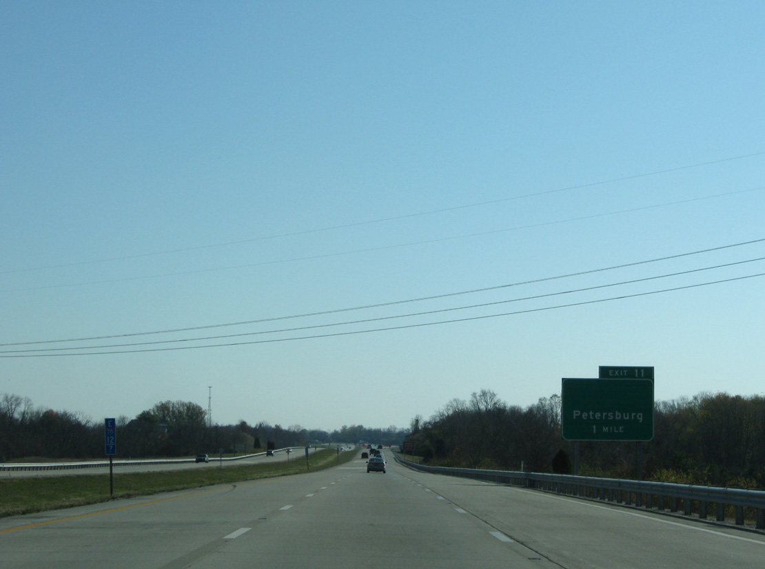
| Entering the diamond interchange (Exit 11) with KY 3608 (Idlewild Bypass) on Interstate 275 east. Garrison Creek Road ties into the exchange from forested hills to the north. 11/08/09 |
|
| Interstate 275 retains a rural feel east toward the suburbs of Francisville and Hebron. 11/08/09 |
|
| The Airport exit is seven miles away while the exchange with I-71/75 is two miles further. 11/08/09 |
|
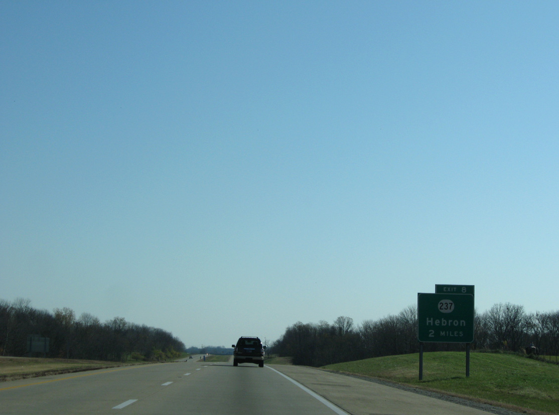
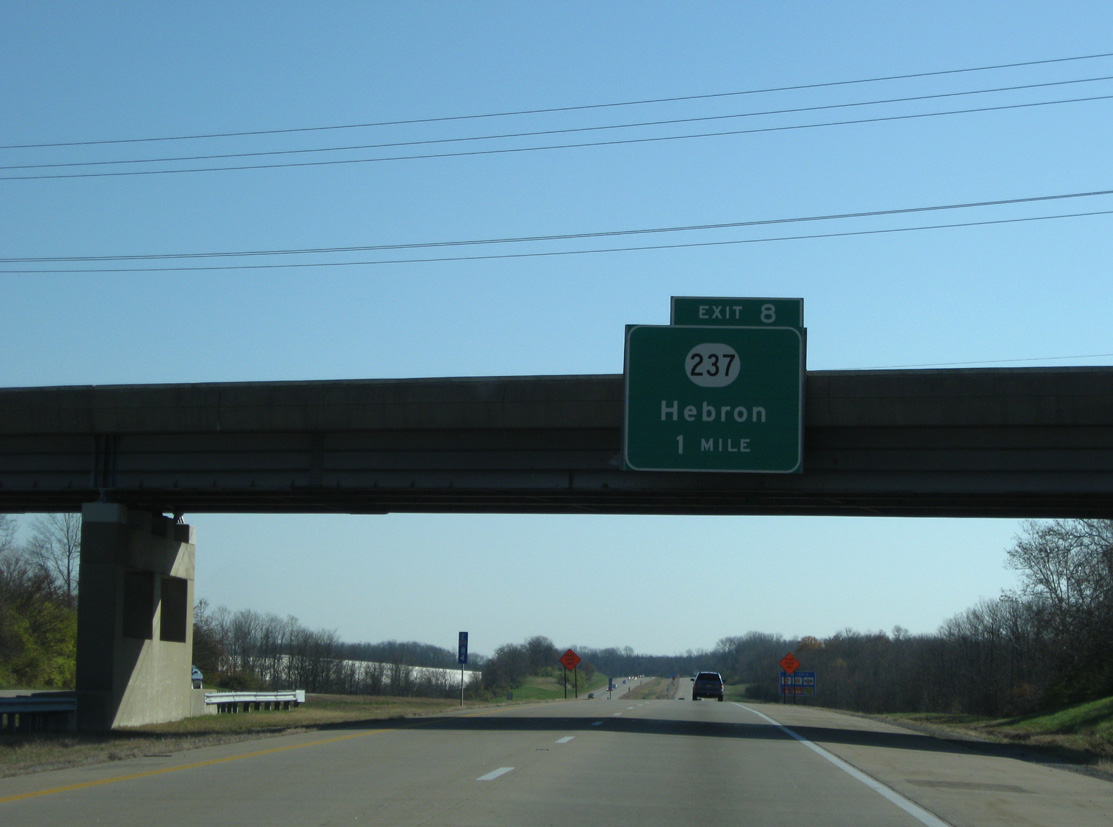
| Advancing east, the beltway passes just north of Bullittsville on the approach to KY 237 (Exit 8) at the unincorporated suburb of Hebron. 11/08/09 |
|
| KY 237 comprises an arterial route from Francisville and the adjacent South Park and Park West International business parks southward to Burlington. 11/08/09 |
|
| A parclo interchange (Exit 8) joins Interstate 275 with KY 237 (North Bend Road). The 14.78 mile state route runs north to KY 8 at North Bend Bottom along th Ohio River and south to KY 536 at the city of Union. 11/08/09 |
|
| Interstate 275 rides a ridge just south of Elijahs Creek as it passes north of a runway at CVG Airport. 11/08/09 |
|
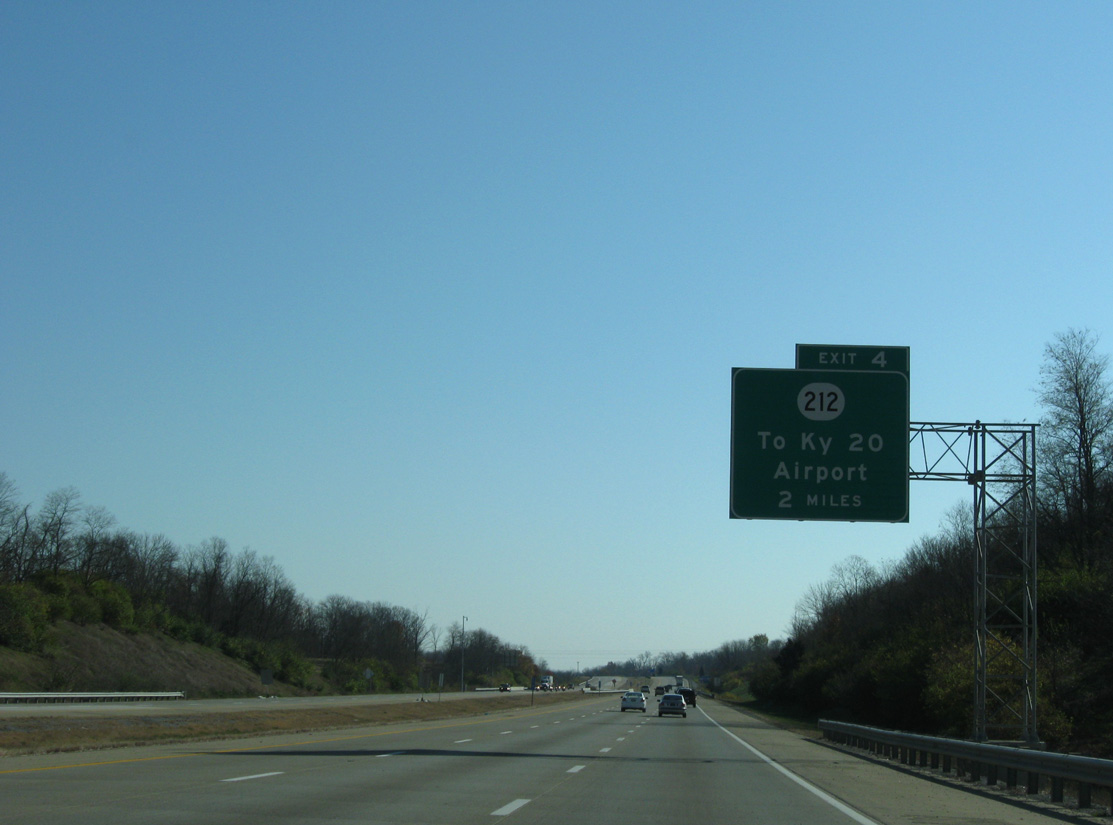
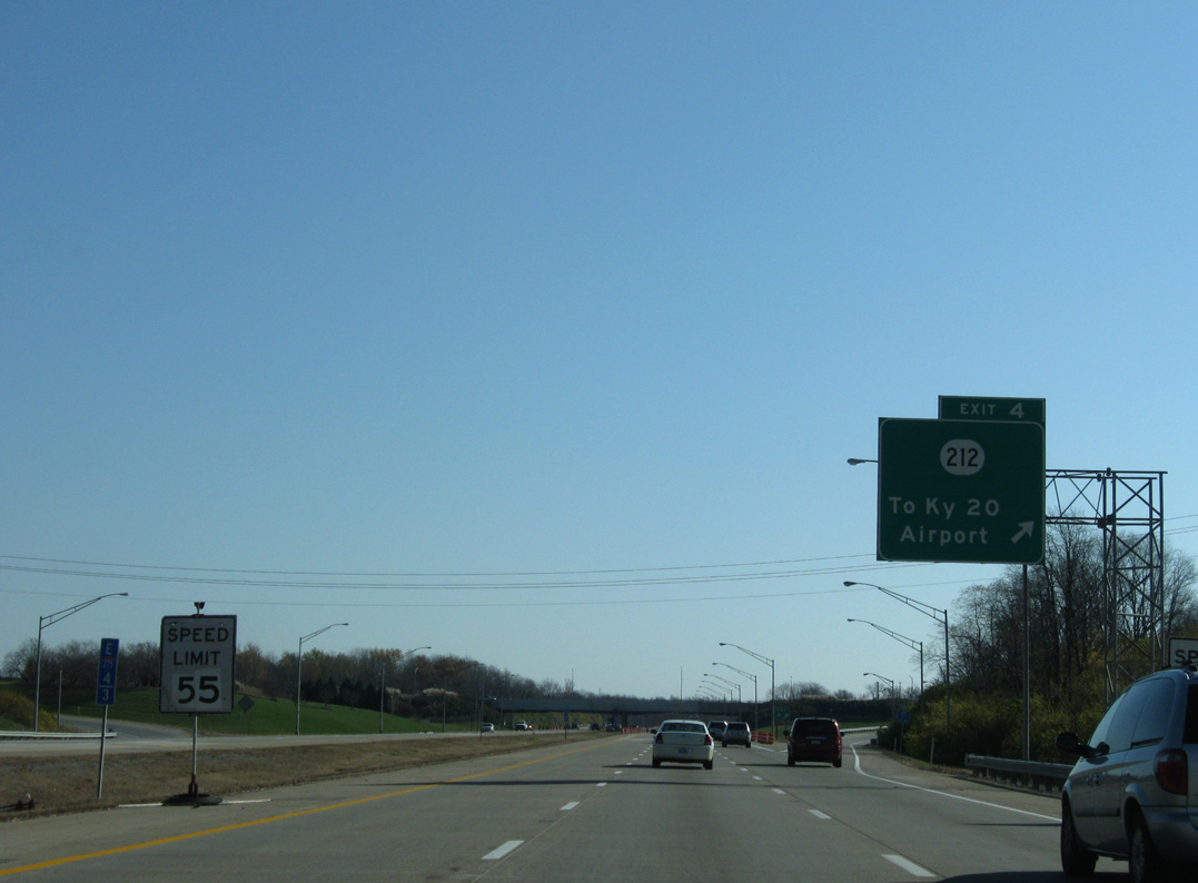
| Forthcoming KY 212 (Airport Access Road) provides the main route into Cincinnati / Northern Kentucky International Airport (CVG) from Interstate 275 and parallel KY 20 (Petersburg Road). 11/08/09 |
|
| A 1.07 mile route, KY 212 constitutes a north-south expressway from the passenger terminal of CVG Airport to adjacent KY 20 (Petersburg Road). 11/08/09 |
|
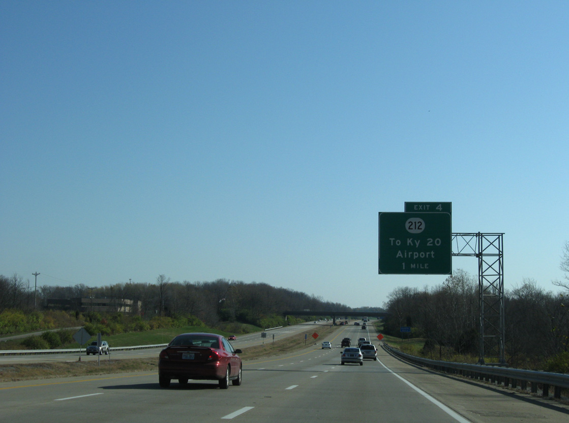
| Eastbound at the parclo interchange (Exit 4) with KY 212 (Airport Access Road). KY 212 south connects with KY 236 (Donaldson Highway) via a diamond interchange while KY 20 to the north lowers toward the Ohio River to end at KY 8 near Constance. 11/08/09 |
|
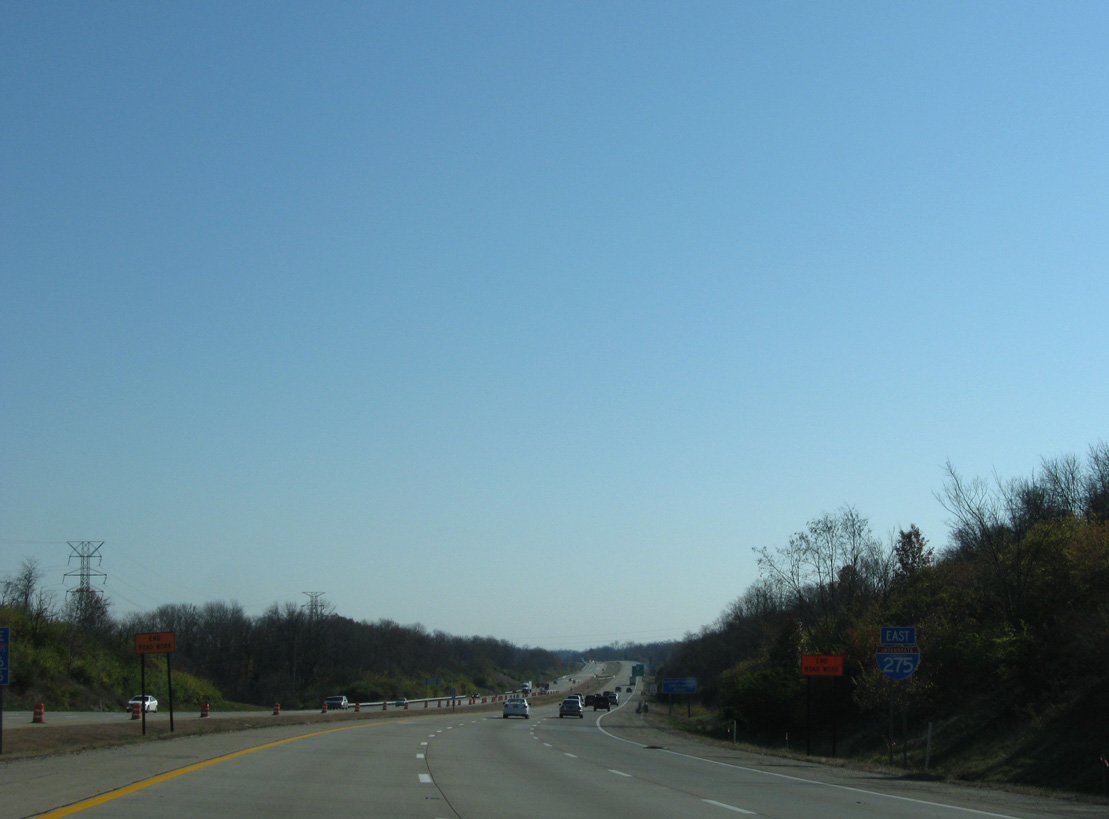
| Curving southeast, Interstate 275 parallels KY 236 (Donaldson Highway) as it encircles the eastern periphery of CVG Airport. The beltway expands to six overall lanes on this stretch. 11/08/09 |
|
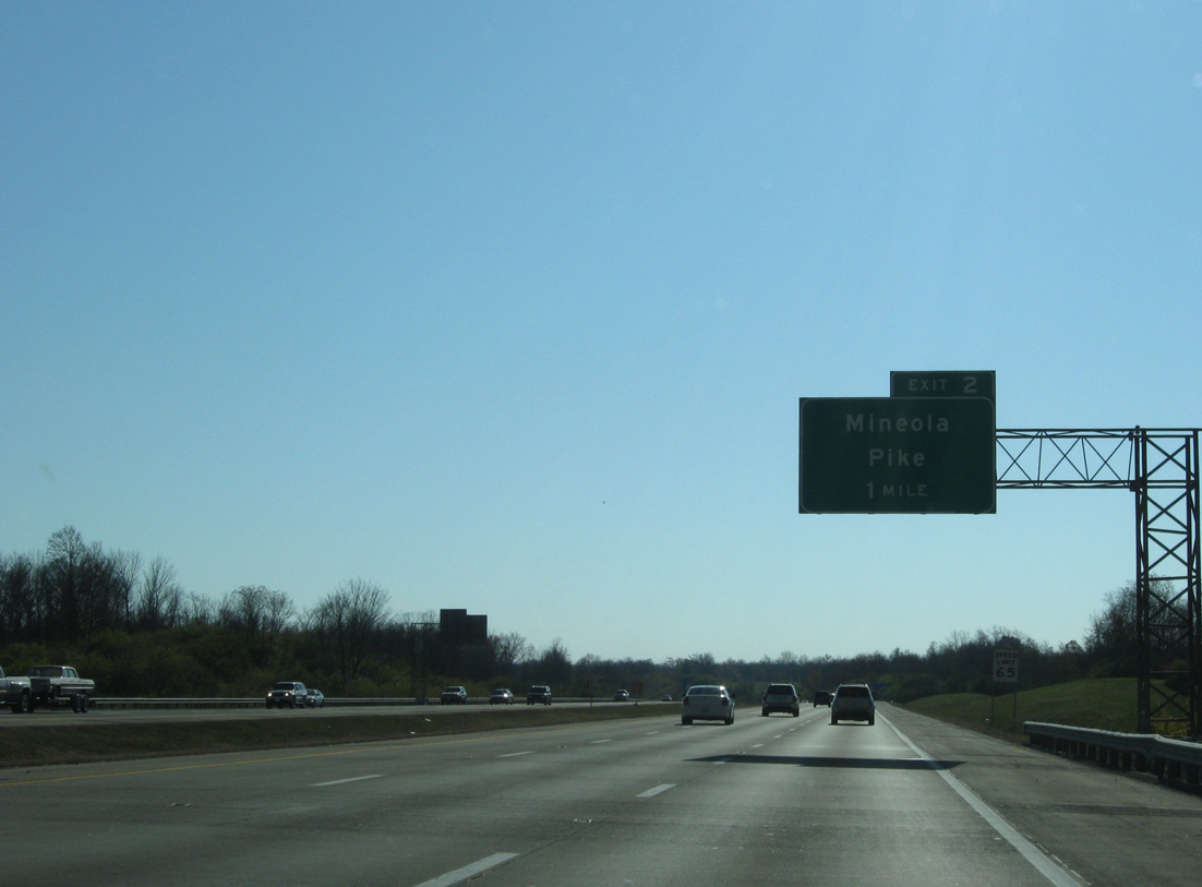
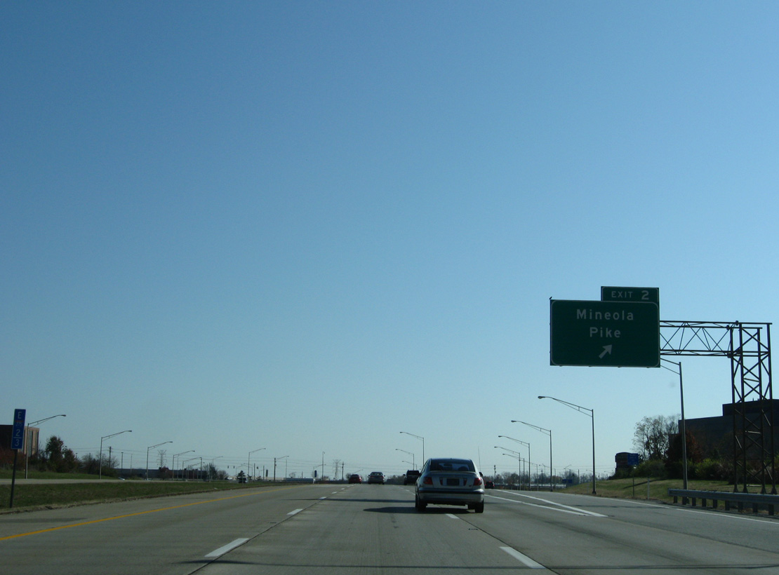
| The succeeding exit joins the beltway with Mineola Pike between Airport Exchange and Circleport Business Parks in one mile. 11/08/09 |
|
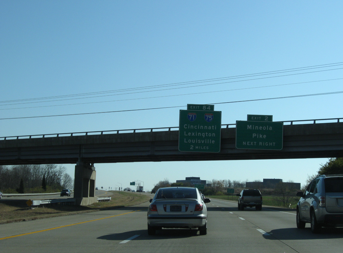
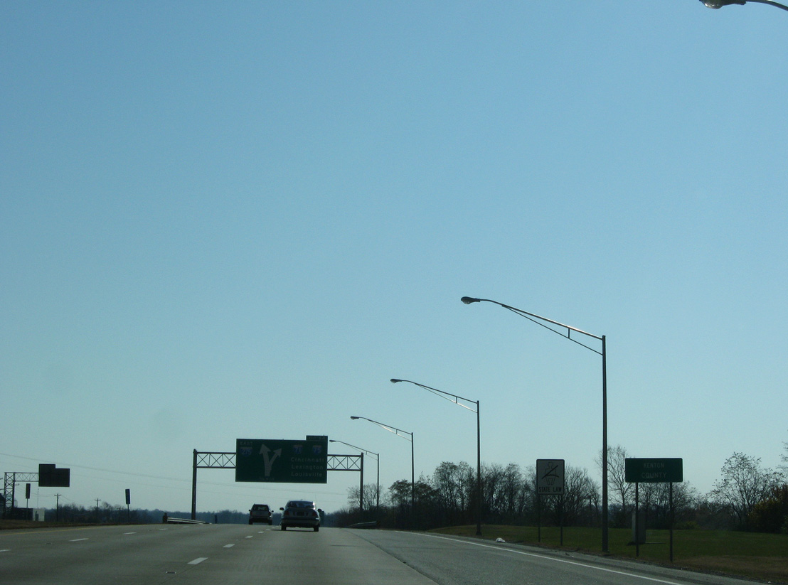
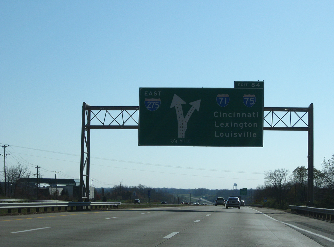
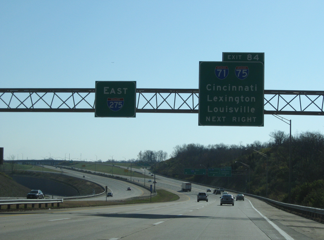
| Minneola Pike doubles as KY 3076, a 2.81 mile long route south to KY 236 (Donaldson Highway) and east along Dolwick Road to KY 2373 (Erlanger-Crescent Springs Road). KY 3076 parallels the upcoming four-level exchange (Exit 84) with I-71/75. 11/08/09 |
|
| Exit 2 departs Interstate 275 east at the diamond interchange with Mineola Pike (KY 3076). The state route reduces to rural two lane standards southwest by additional industrial pikes to KY 236. 11/08/09 |
|
| Travelers along the circle freeway cross the Kenton County line to the immediate southeast of Minneola Pike. 11/08/09 |
|
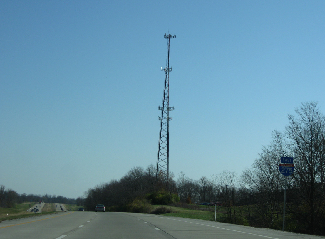
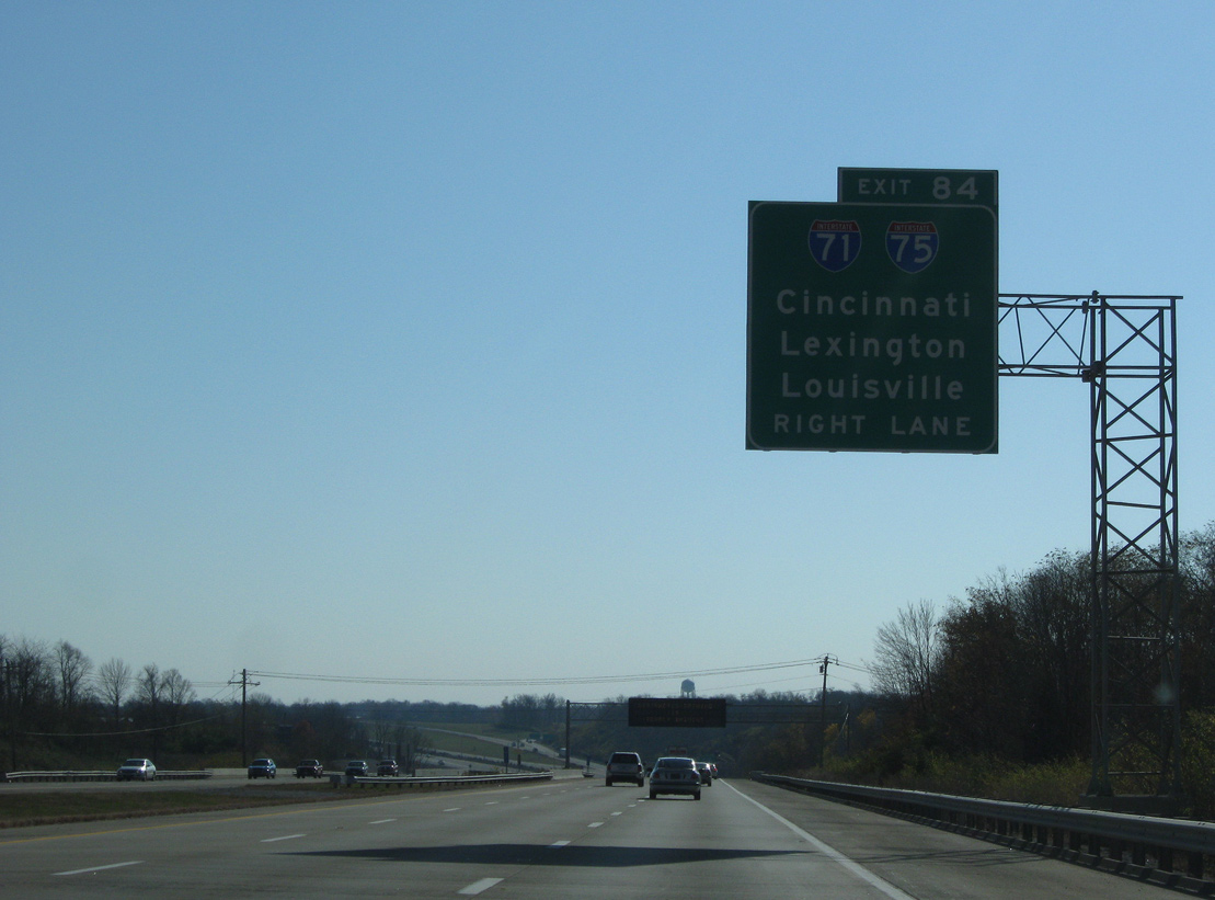
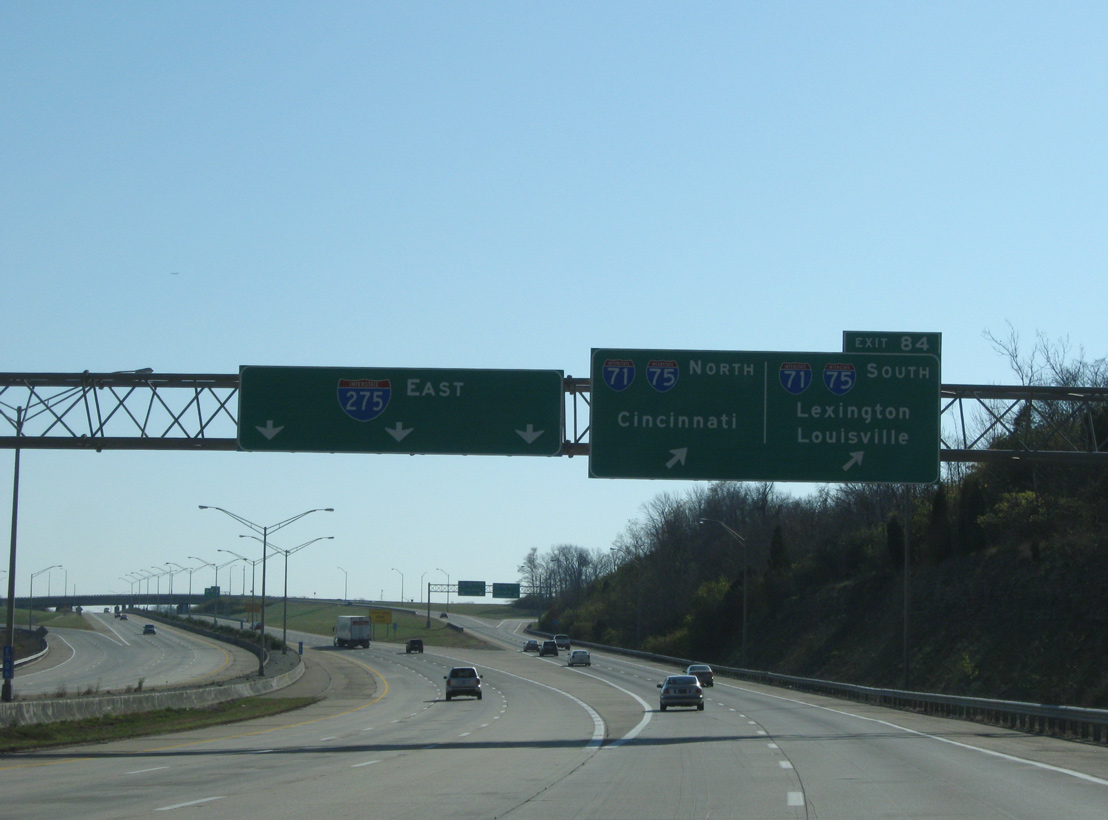
| A two lane off-ramp (Exit 84) takes motorists to I-71/75 north to Covington and Cincinnati and south through the suburbs of Florence and Walton. 11/08/09 |
|
| Angling southeast, Interstate 275 lines a plateau above parallel Dry Creek and the Ohio River city of Villa Hills. 11/08/09 |
|
| I-71/75 combine along a 19.70 mile stretch from a trumpet interchange at Walton to the north end of the Brent Spence Bridge by Downtown Cincinnati. 11/08/09 |
|
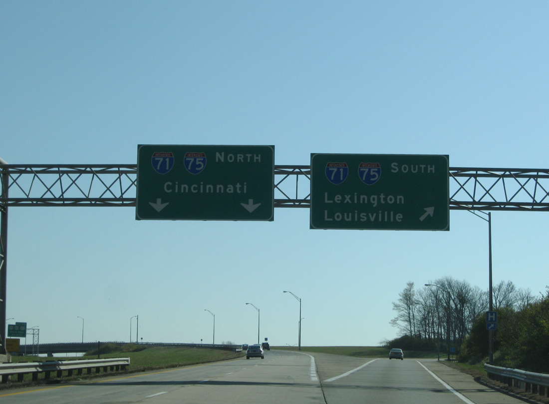
| Interstate 275 crosses paths with I-71/75 through the city of Erlanger. Costing $15 million, the symmetrical stack interchange joining the freeways was the first built in the state.2 11/08/09 |
|
| Traffic separates at Exit 84 with three lanes continuing east to Highland Heights and southeast Cincinnati. I-71/75 diverge from Northern Kentucky to form the Golden Triangle. Bound by I-71 southwest to Louisville and I-75 south to Lexington, the economic region is the state's most prosperous. 11/08/09 |
|
| A two lane flyover links with I-71/75 north through the suburban communities of Crescent Springs, Fort Mitchell and Fort Wright. Beyond the Ohio River, I-71 turns east along Fort Washington Way through the Cincinnati Central Business District while I-75 weaves through Camp Washington along the Mill Creek Expressway in the Queen City. 11/08/09 |
|
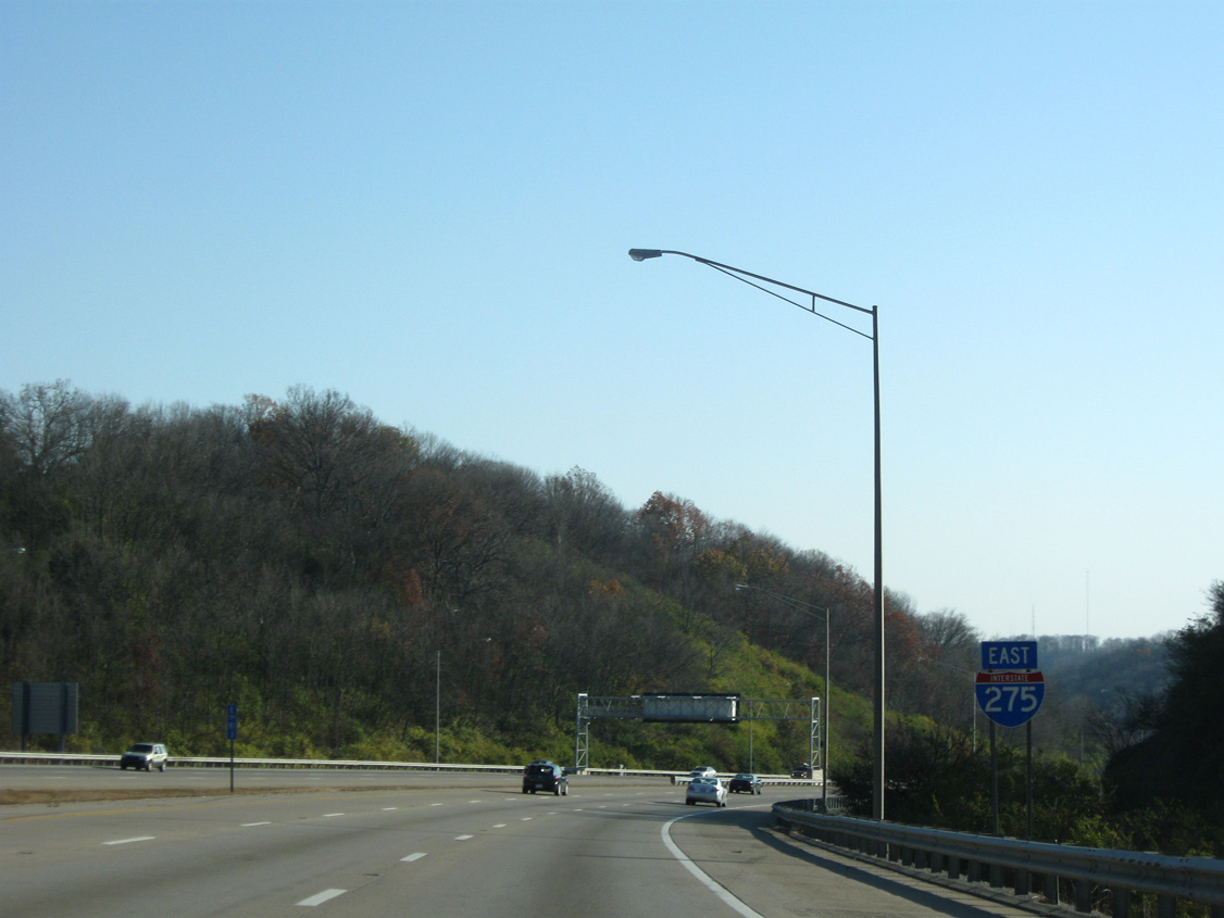
| Confirming marker for Interstate 275 east posted ahead of the city of Crestview Hills. 11/08/09 |
|
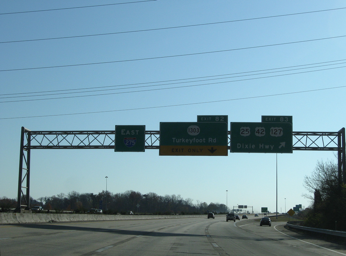
| U.S. 25-42-127 (Dixie Highway) parallel I-71/75 to the east from their merge at Florence northeast along a commercial arterial to Elsmere, Erlanger and I-275 at Exit 83. The three routes overlap northward to Fort Mitchell, Covington and the Clay Wade Bailey Bridge into Cincinnati. 11/08/09 |
|
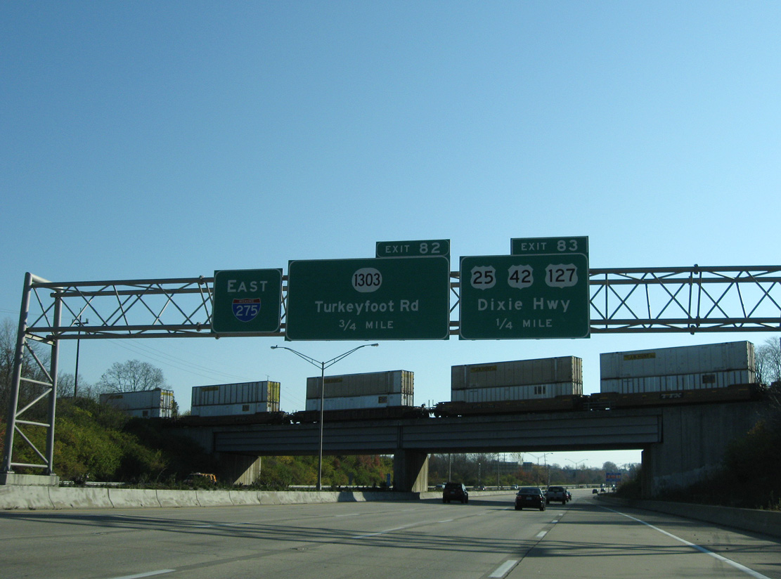
| Back to back off-ramps leave Interstate 275 east for Dixie Highway and adjacent Turkeyfoot Road (KY 1303). U.S. 25-42-127 and KY 1303 intersect at Lakeside Park just to the north. 11/08/09 |
|
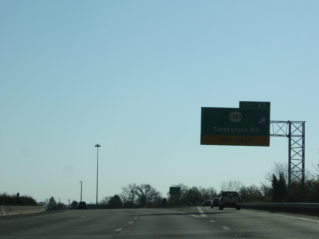
| The parclo and diamond interchanges at U.S. 25-42-127 and KY 1303 overlap as Exit 82 leaves for Turkeyfoot Road. KY 1303 branches south from Dixie Highway along a mostly four lane 6.25 mile route through suburban areas of Edgewood and east Erlanger to KY 536 (Mount Zion Road) near Ricedale. 11/08/09 |
|
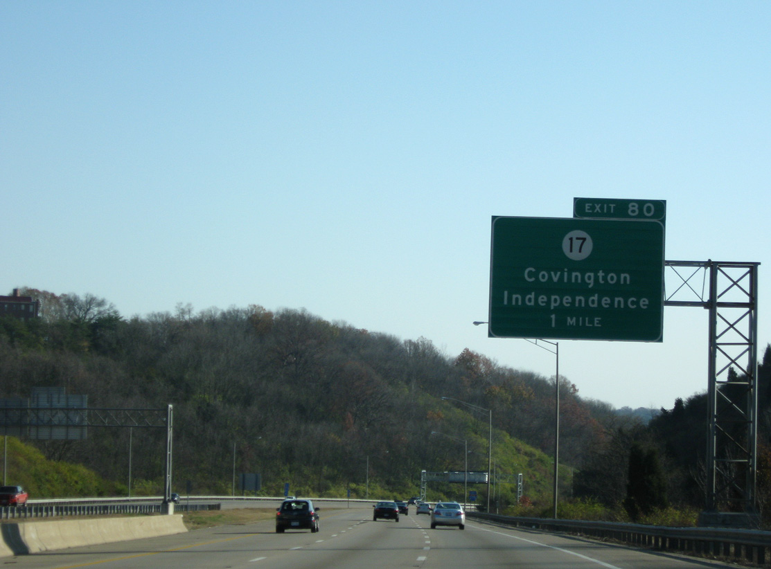
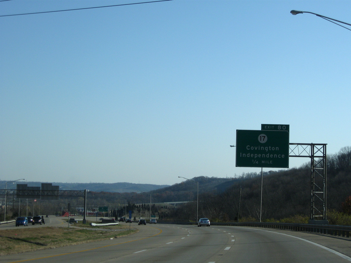
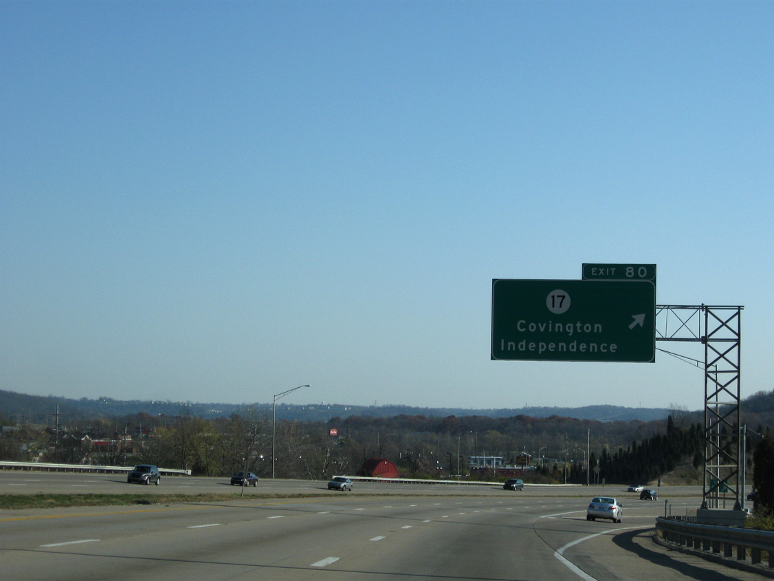
| KY 17 originates at the John A. Roebling Suspension Bridge across the Ohio River to run south through Covington to Exit 80. 11/08/09 |
|
| Progressing east, Interstate 275 runs through a valley to the city of Forth Wright. 11/08/09 |
|
| Interstate 275 lowers alongside KY 371 (Orphanage Road) to the folded diamond interchange (Exit 80) with KY 17 (Madison Pike). 11/08/09 |
|
| The 34.7 mile route of KY 17 extends south along a four lane controlled access arterial from Exit 80 to Independence. The state route becomes rural southeast of Nicholson to conclude at U.S. 27 in Pendleton County. 11/08/09 |
|
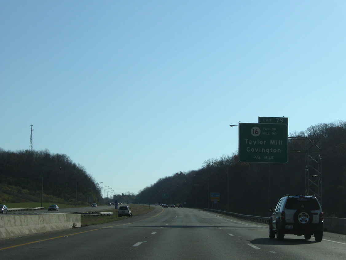
| A viaduct along I-275 spans Madison Pike, Banklick Creek and a railroad line on the 0.75 mile approach to KY 16 (Taylor Mill Road). 11/08/09 |
|
| Interstate 275 east from Dixie Highway to Taylor Mill Road opened to traffic in November 1977. 11/08/09 |
|
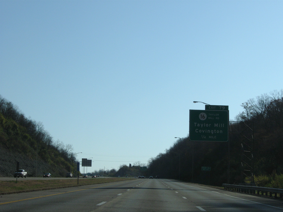
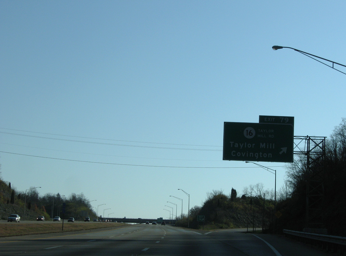
| Climbing toward Exit 79, the beltway passes through a section of the Covington city limits. Forthcoming KY 16 (Taylor Mill Road) meanders northward to a commercial strip along Winston Avenue. The state route ends a short distance further at KY 17 and the Latonia neighborhood. 11/08/09 |
|
| South from the six-ramp parclo interchange (Exit 79) with I-275, KY 16 transitions to Pride Parkway through the city of Taylor Mill. Taylor Mill Road loops to east from nearby as KY 3716. The 2.85 mile route is the former alignment of KY 16. 11/08/09 |
|
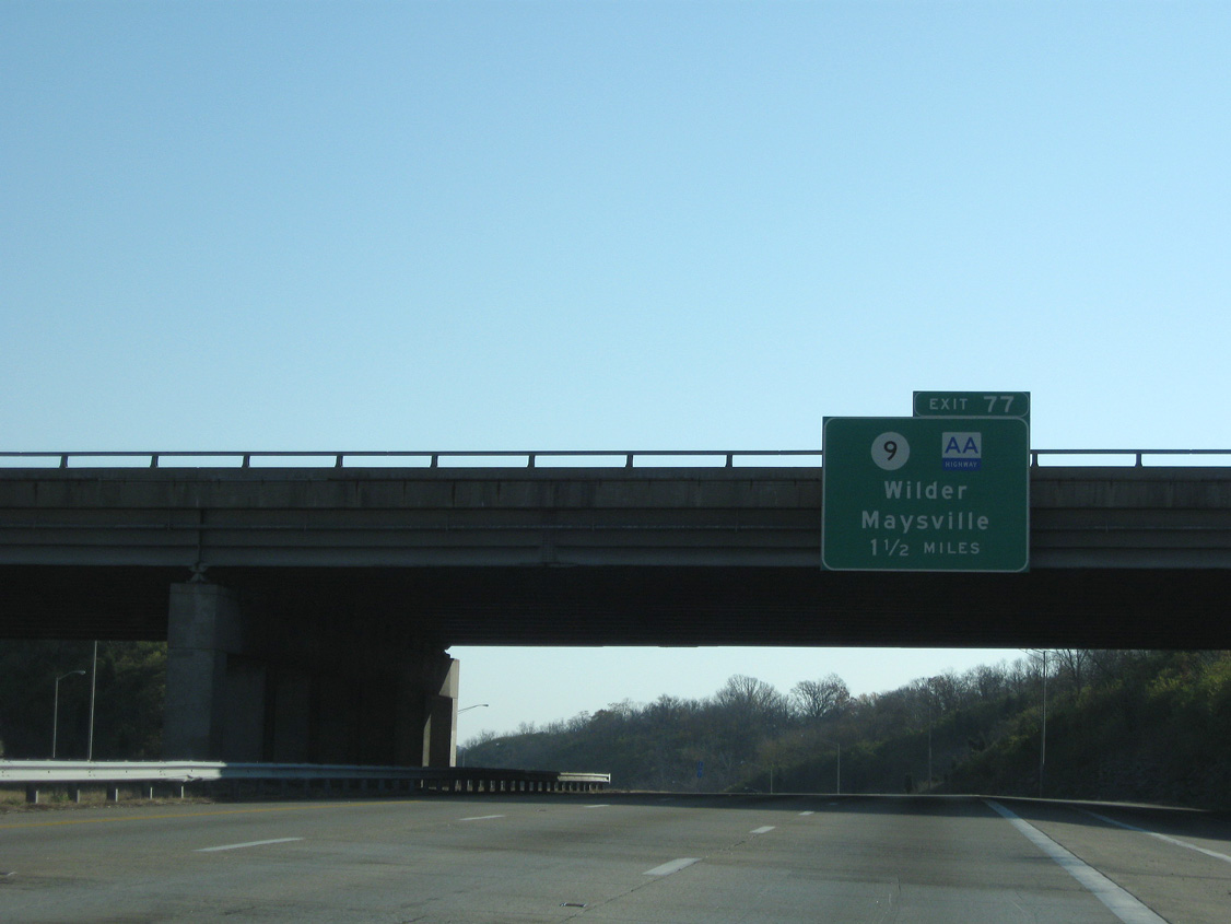
| The subsequent exit along the beltway eastbound joins I-275 with KY 9 and the AA Highway in 1.25 miles. 11/08/09 |
|
| A gradual descent leads Interstate 275 east from Taylor Mill to the high level bridge across the Licking River. 11/08/09 |
|
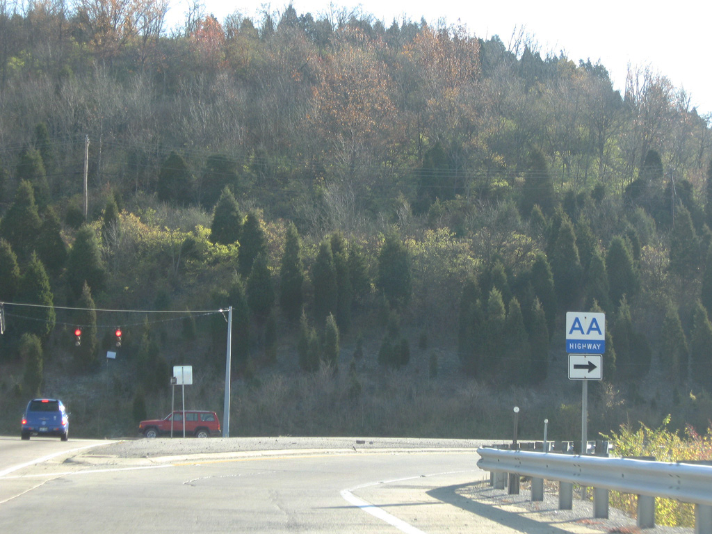
| The 116 mile route of KY 9 overlays all of the AA Highway mainline from Interstate 275 (Exit 77) southeast to Vanceburg and the Grayson Spur from KY 10 near Quincy to KY 1/7 at Grayson. 11/08/09 |
|
| KY 9 (Licking Pike) parallels the Licking River northward to Lowell Street and the Newport street grid. The state route and AA Highway south connect with U.S. 27 and KY 547 as they bypass Alexandria to the east. 11/08/09 |
|
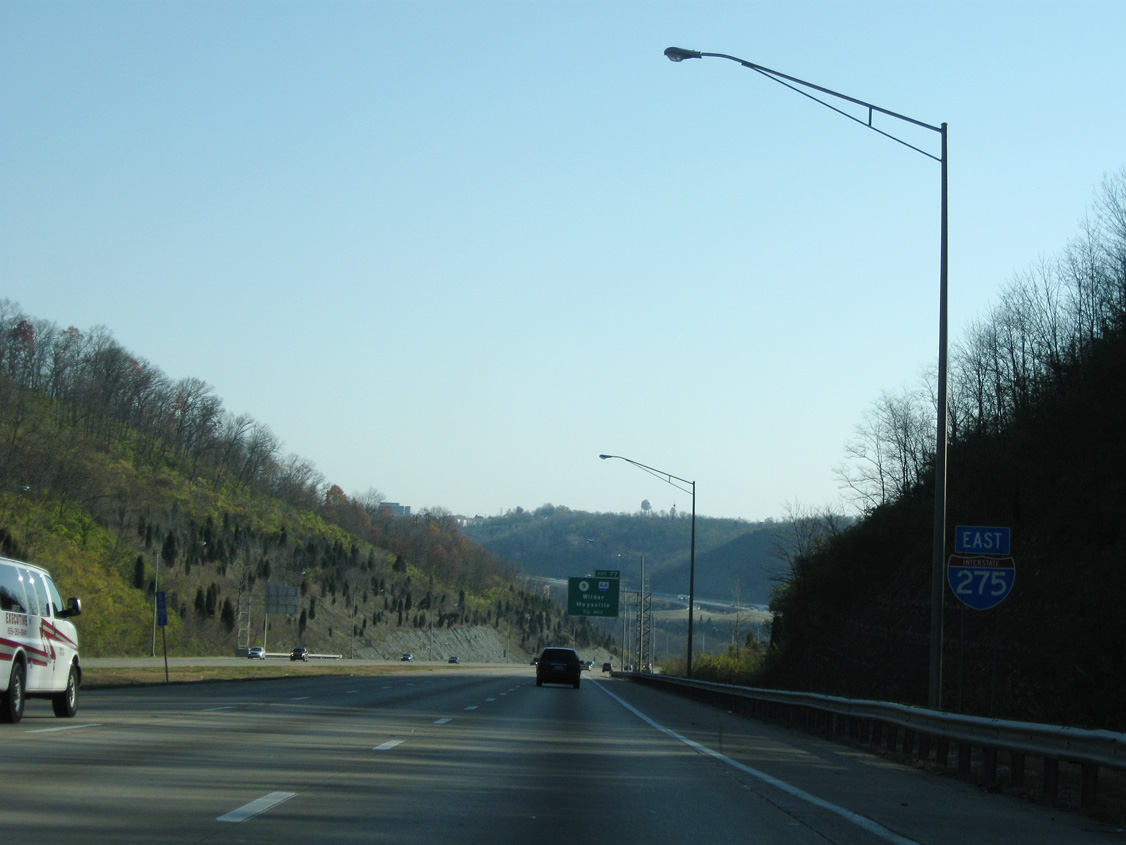
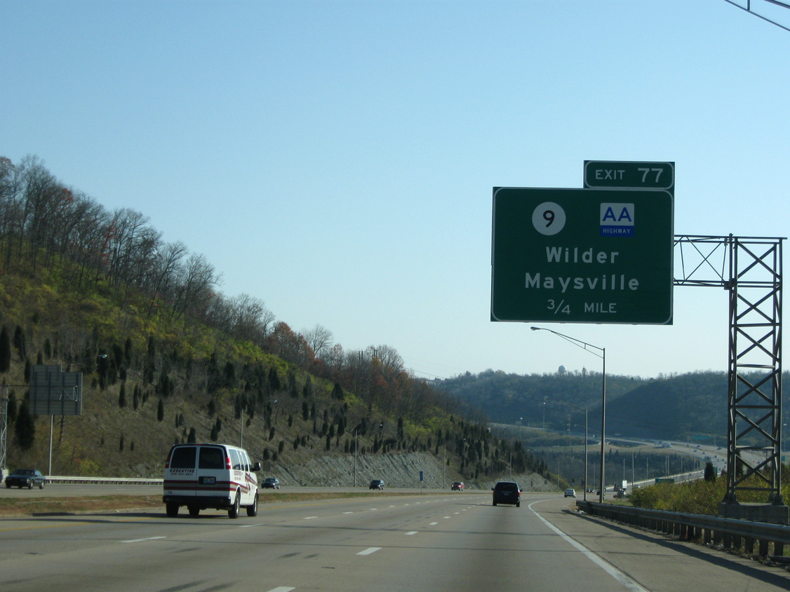
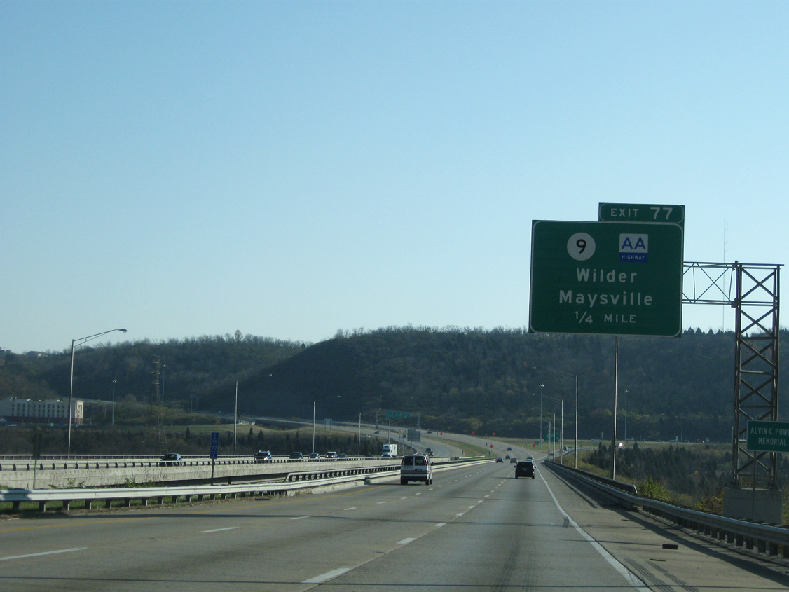
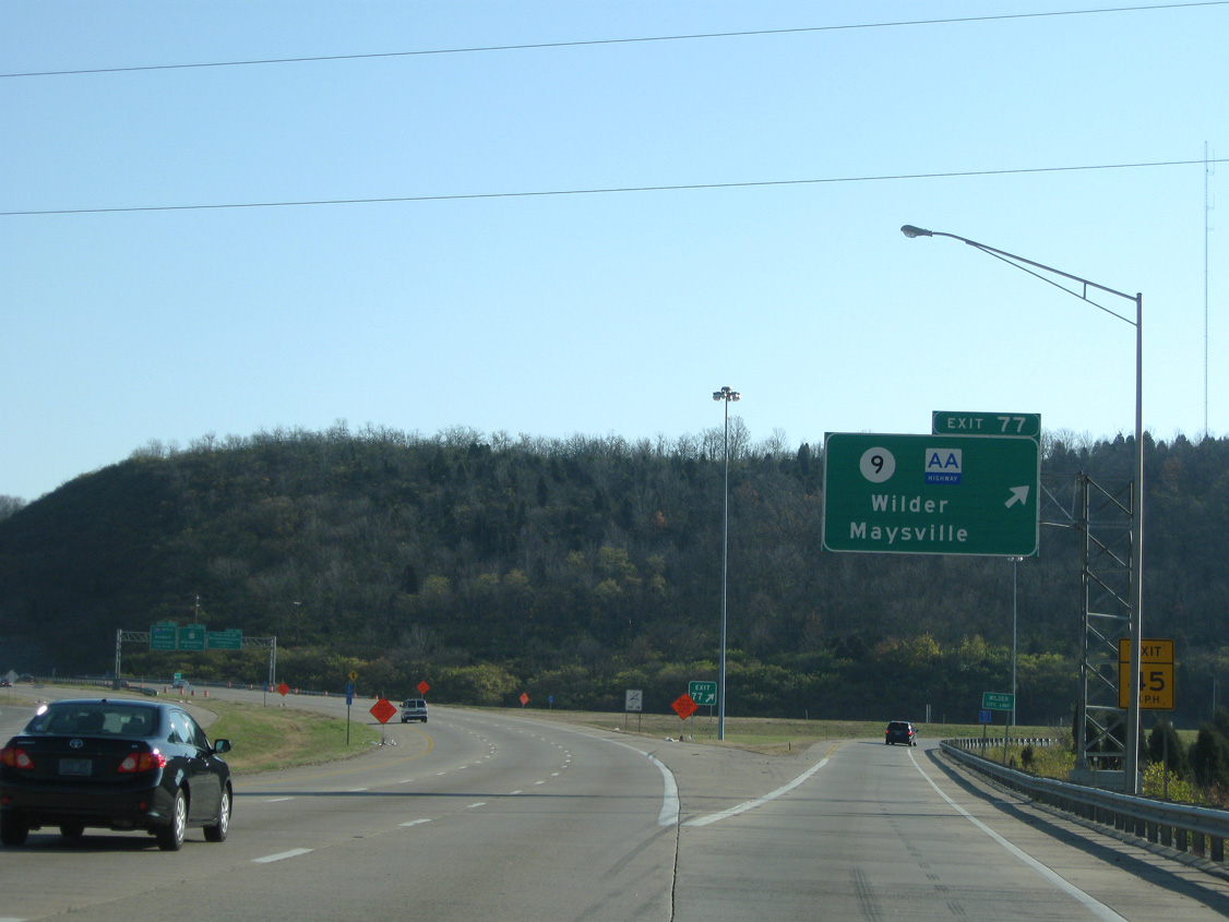
| The Licking River bridge along I-275 was the first section of the beltway built in Kentucky. Work on the twin spans ran from 1970 to February 1976. The bridge east end ties into a folded diamond interchange (Exit 77) with KY 9 and the AA Highway. 11/08/09 |
|
| Exit 77 partitions from the freeway mainline as I-275 east crosses the Wilder city line. The Ohio River city of Maysville lies 54 miles to the southeast along the AA Highway at U.S. 52 and U.S. 68. 11/08/09 |
|
| Trailblazer for the AA Highway posted on the off-ramp (Exit 77) to KY 9. Prior to 1994, KY 9 ran south to Hawthorne and Claryville. The state route was replaced KY 546 on the AA Highway east to Vanceburg and KY 690 south to Grayson. 11/08/09 |
|
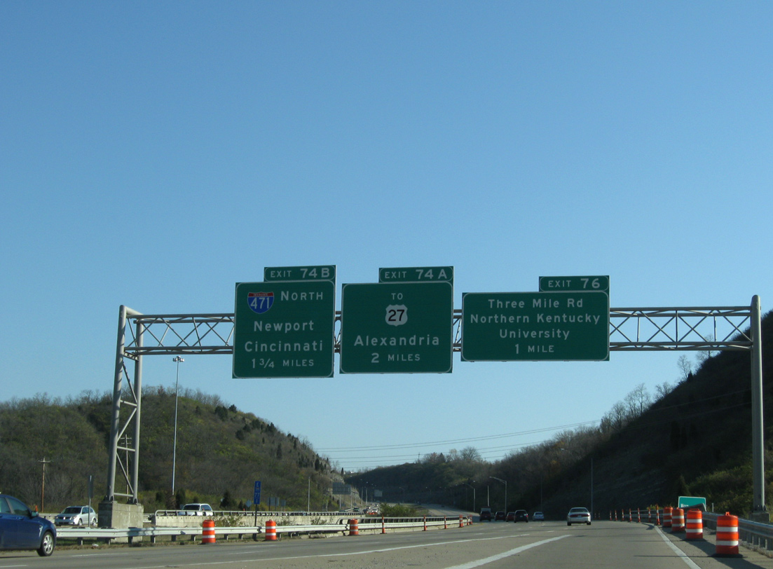
| The beltway next meets Three Mile Road (Exit 76) and Interstate 471 (Exits 74B/A) at the city of Highland Heights. 11/08/09 |
|
| Interstate 275 veers northward between Wilder and the campus of Northern Kentucky University. 11/08/09 |
|
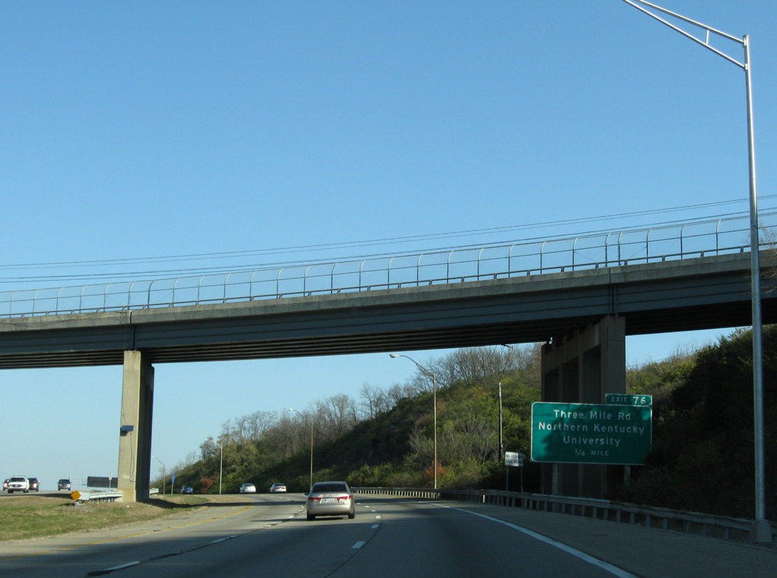
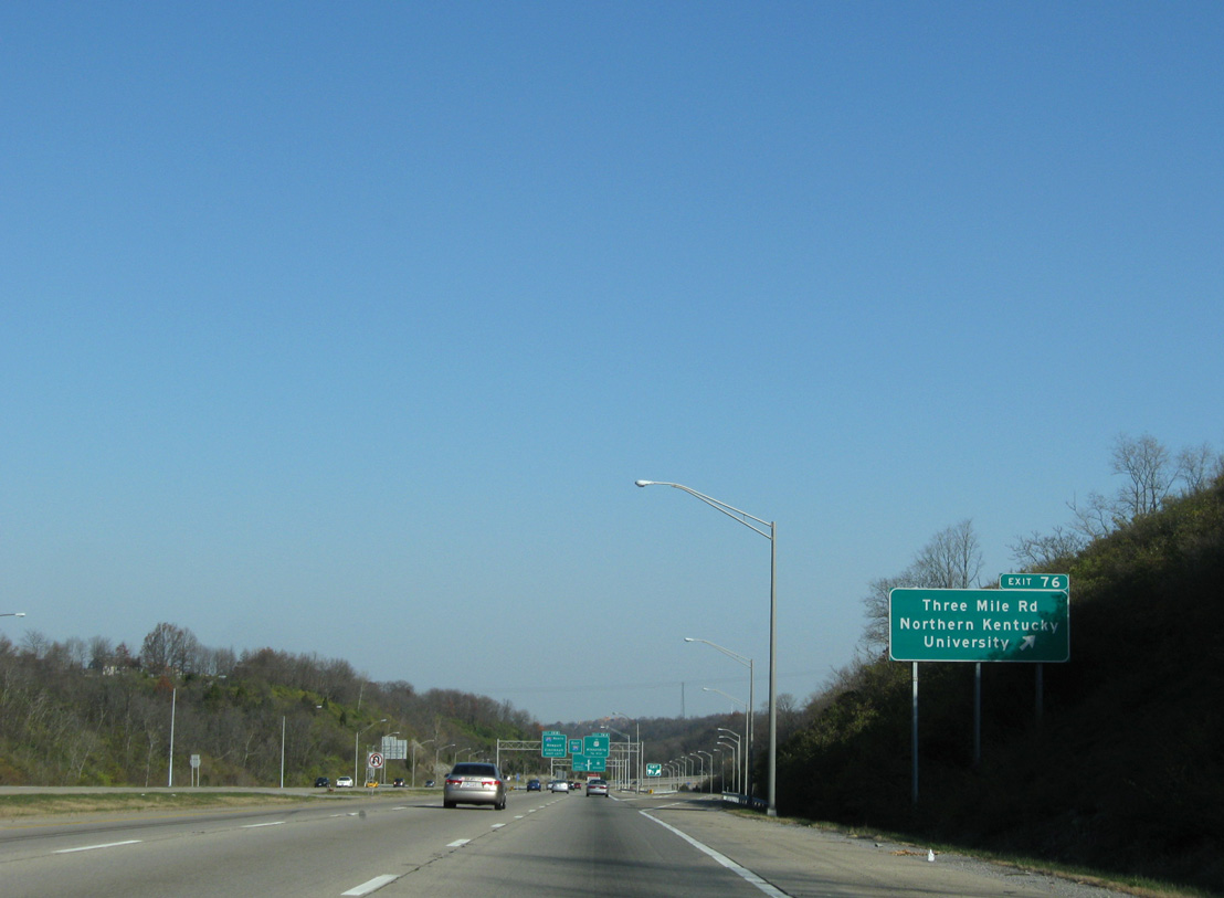
| KY 2345 (Johns Hill Road) spans I-275 a quarter mile ahead of the half diamond interchange (Exit 76) with KY 2238. KY 2238 follows University Drive south to Louie B. Nunn Drive and Three Mile Road north to Johns Hill Road in Wilder. 11/08/09 |
|
| Exit 76 parts ways with the freeway east for Northern Kentucky University (NKU) and Truist Arena. 11/08/09 |
|
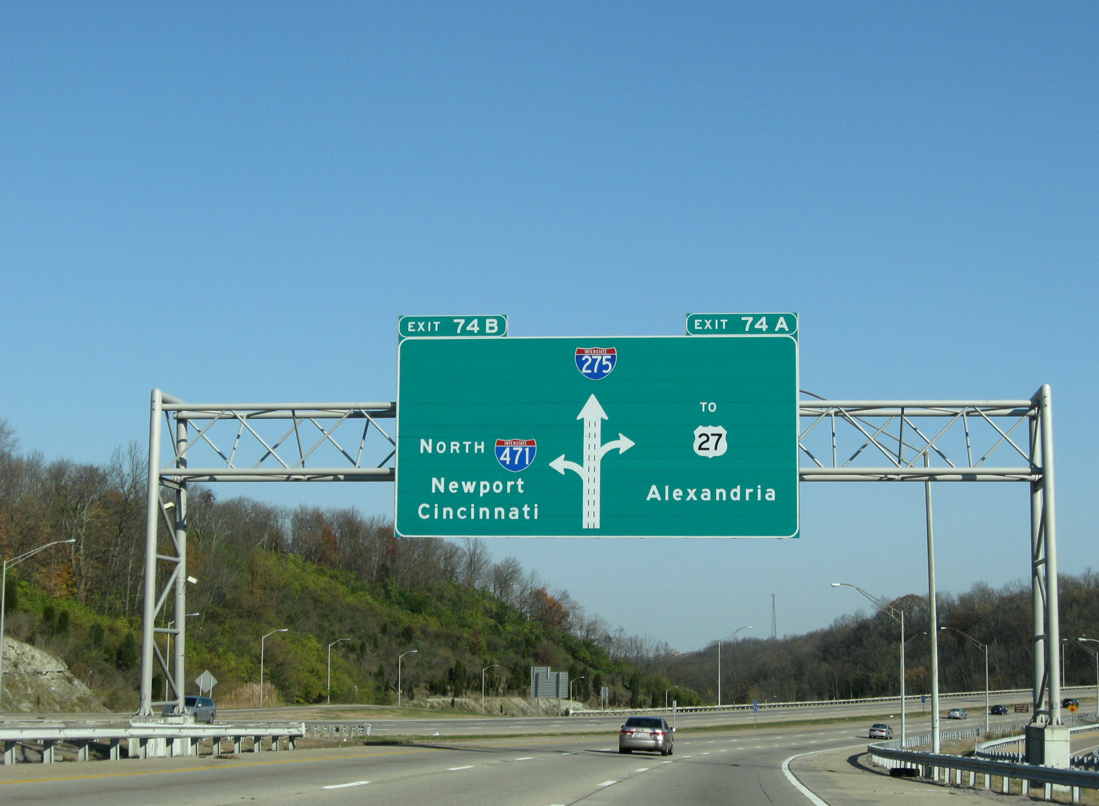
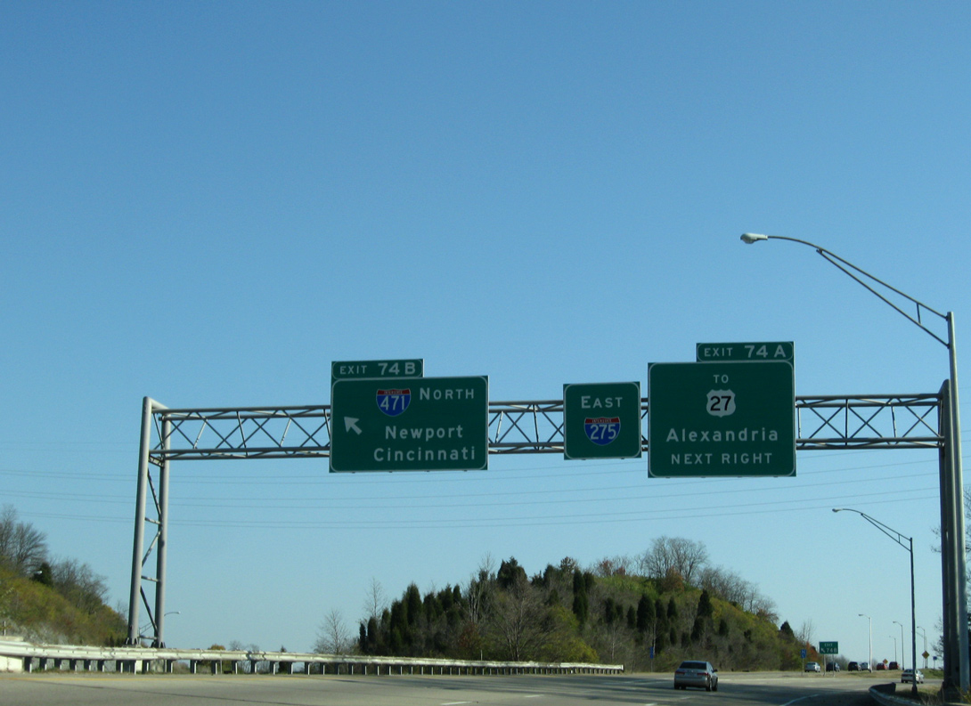
| Turning back to the east, Interstate 275 nears the directional interchange (Exits 74A/B) with I-471 north to Cincinnati and unsigned KY 471 south to U.S. 27 (Alexandria Pike) and Highland Heights. 11/08/09 |
|
| The exchange with Interstate 471 opened to traffic in December 1980. The design incorporates left side ramps in all directions. 11/08/09 |
|
| Interstate 471 winds northward between the suburbs of Southgate and Fort Thomas to the downtown areas of Newport and Bellevue. Spanning the Daniel Beard Bridge, I-471 crosses the Ohio River to Mt. Adams in Cincinnati. 11/08/09 |
|
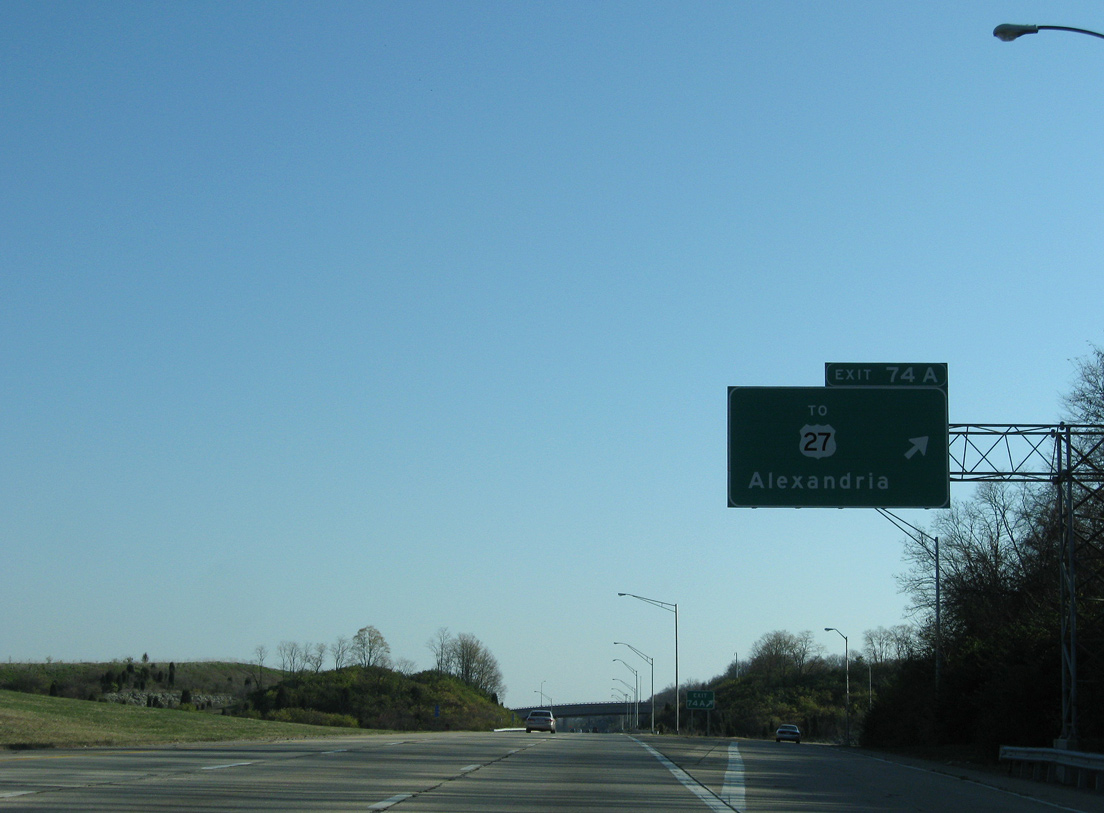
| The I-471 freeway (unsigned KY 471) spurs south to become the U.S. 27 mainline through Highland Heights and Cold Spring. U.S. 27 travels south to Alexandria, Falmouth and Cythiana. 11/08/09 |
|
| A left side on-ramp merges onto I-275 east as a flyover passes overhead from the beltway west to unsigned KY 471 south. 11/08/09 |
|
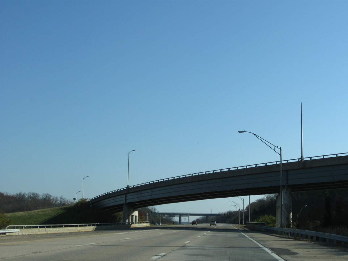
| U.S. 27 (Alexandria Pike) bypasses the I-275/471 junction along a winding course through Fort Thomas. A high level span carries the route across the beltway. 11/08/09 |
|
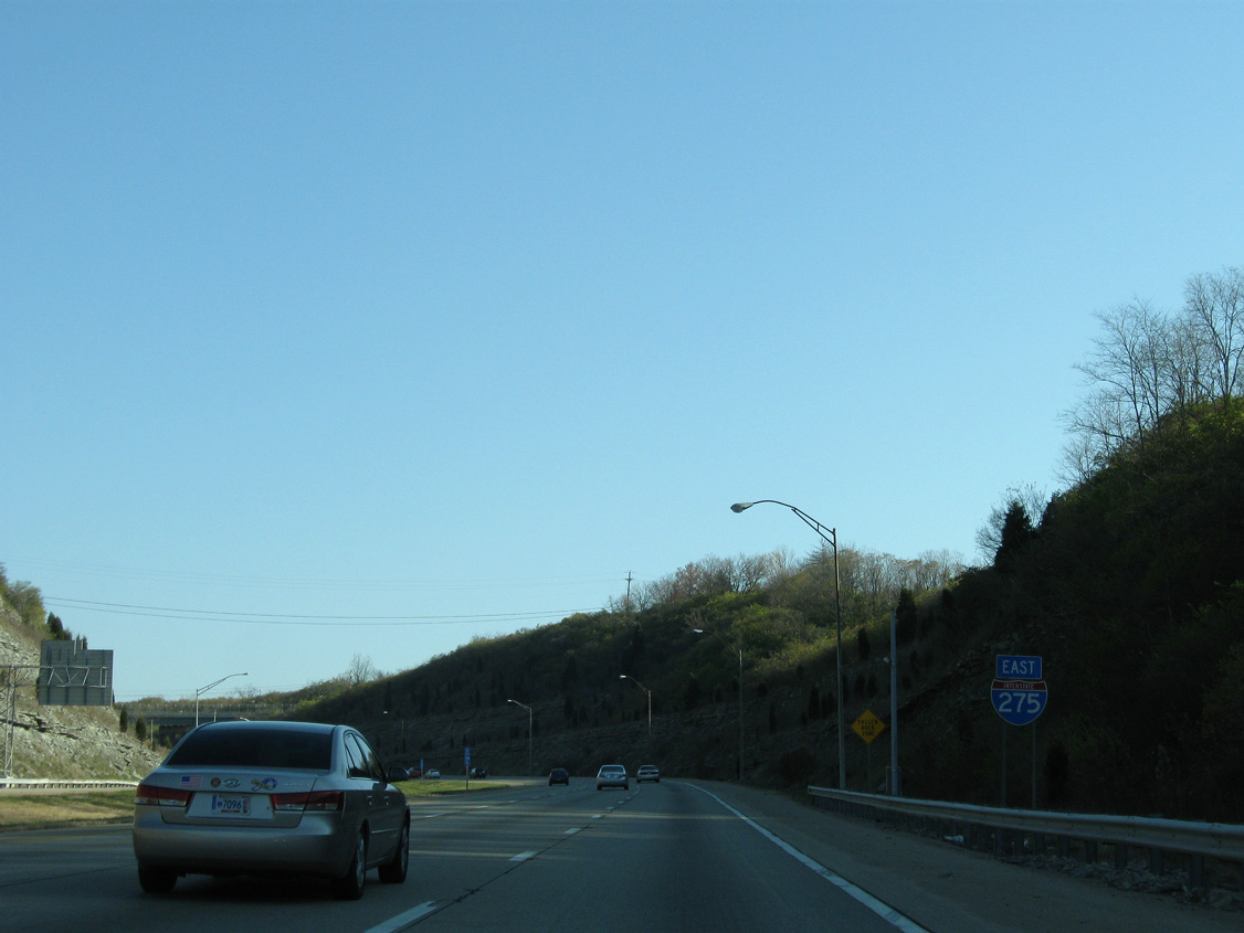
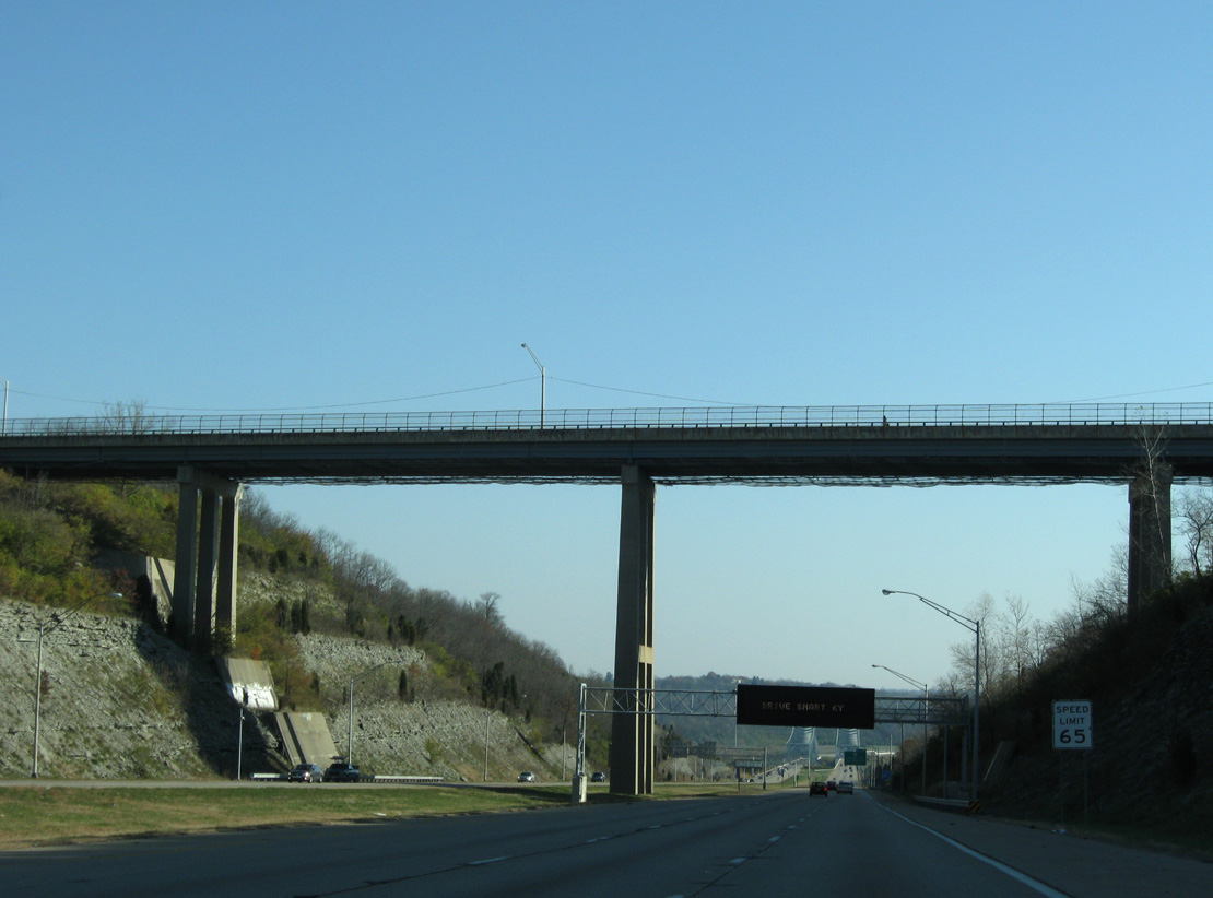
| Interstate 275 continues east into Ohio, where it meets U.S. 52 (Kellogg Avenue) west to the East End of Cincinnati. 11/08/09 |
|
| Descending toward the Ohio River, Interstate 275 exits Campbell County, Kentucky by the settlement of Brent. 11/08/09 |
|
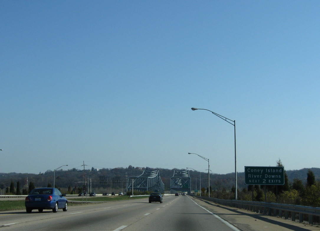
| The first two Ohio exits connect with Kellogg Avenue (old U.S. 52) to the Coney Island theme park and Belterra Park (formerly River Downs) thoroughbred racing facility. 11/08/09 |
|
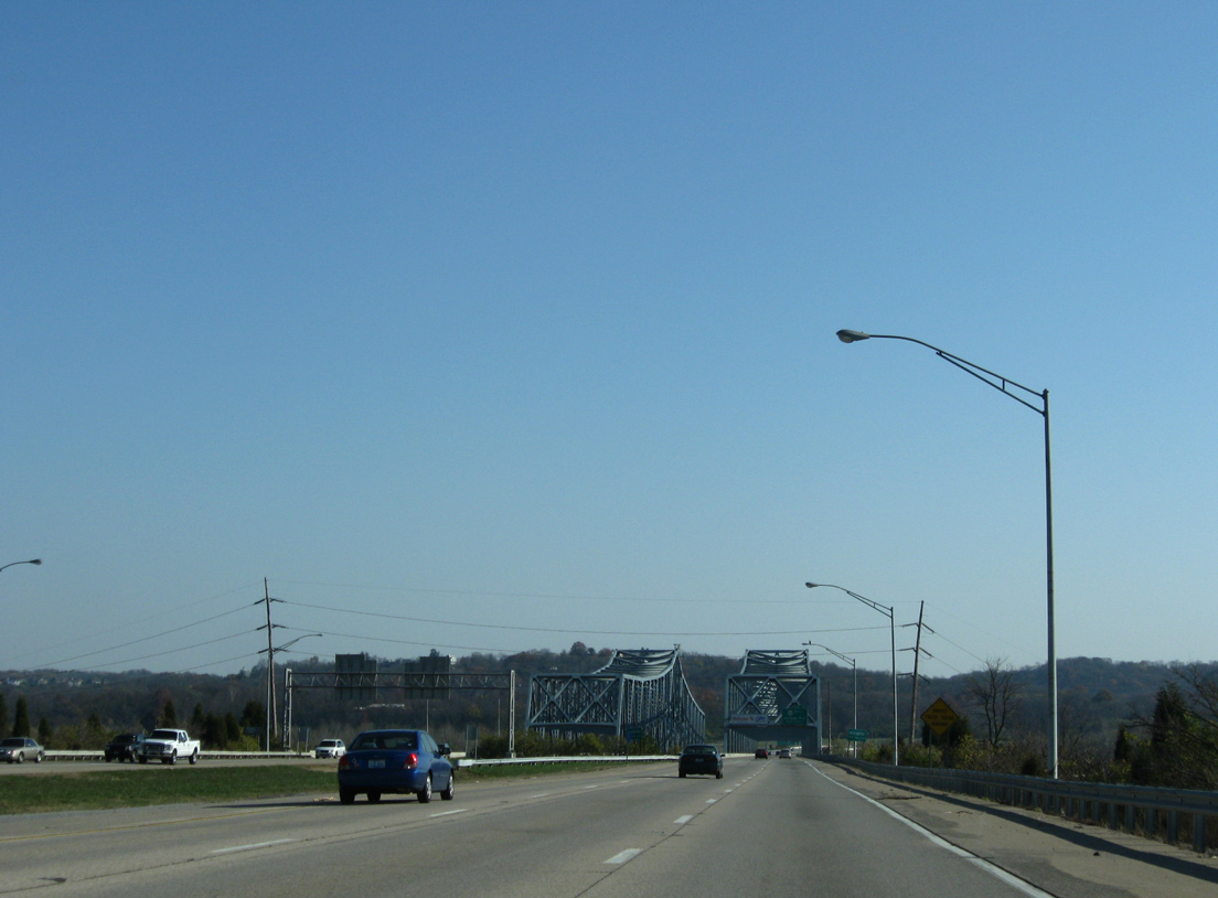
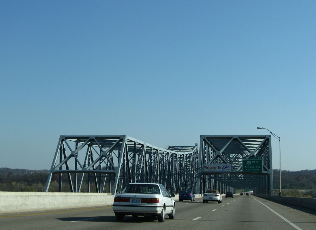
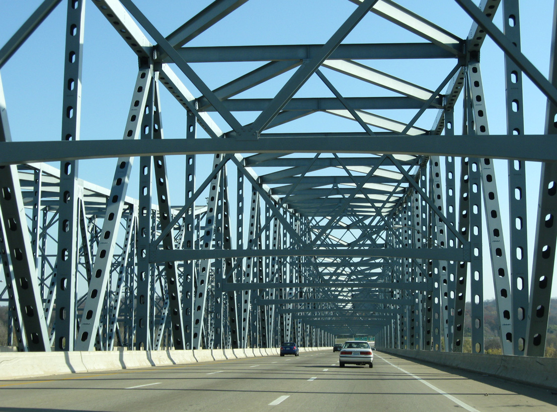
| A pair of cantilever bridges (Combs-Hehl Bridge) carry Interstate 275 east to the California neighborhood of Cincinnati. 11/08/09 |
|
| Named for former Kentucky Governor Bert T. Combs and Campbell County Judge Lambert Hehl, the crossing opened to traffic in December 1979. 11/08/09 |
|
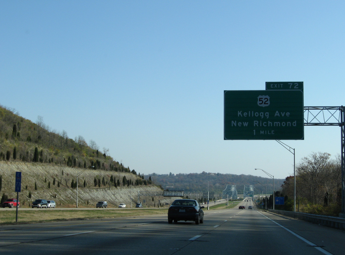
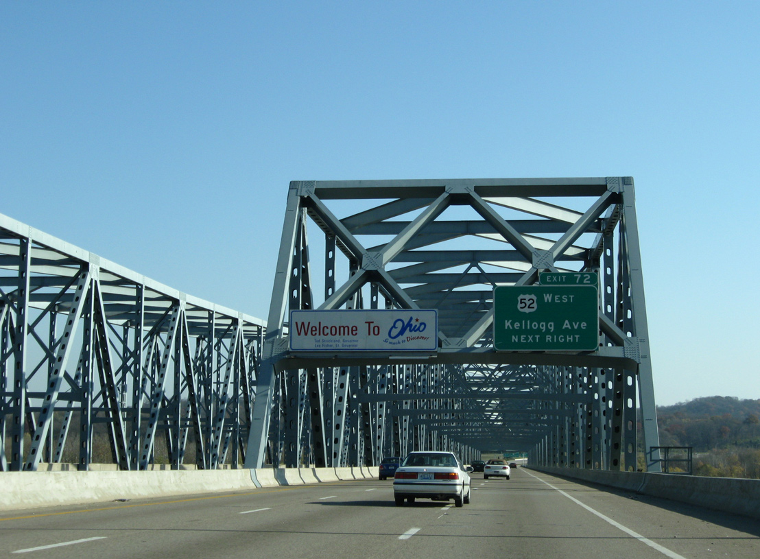
| The Ohio welcome sign appears along I-275 a half mile from Exit 72 to U.S. 52 west and Kellogg Avenue (old U.S. 52) east. U.S. 52 parallels the Ohio River northward to Cincinnati Municipal Lunken Airport (LUK), Mt. Adams and the Central Business District in the Queen City. 11/08/09 |
|
| The Ohio River Bridge carries six lanes of traffic at a total length of 1,440.6 feet.3 11/08/09 |
Page Updated 09-23-2016.

 East
East