|
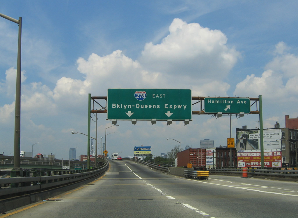
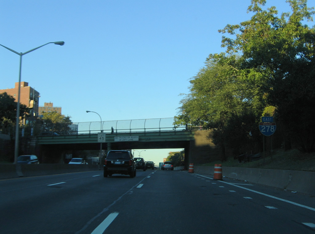
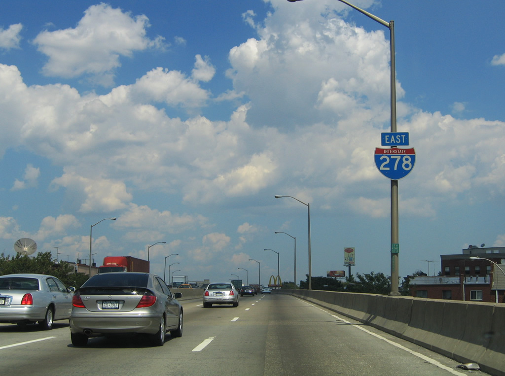
| Beyond the split with Interstate 478 (Brooklyn-Battery Tunnel) on Interstate 278 east, the off-ramp for Hamilton Avenue departs the Brooklyn-Queens Expressway. Hamilton Avenue comprises a frontage street alongside Interstate 278 eastbound between Clinton Street and the Battery Tunnel interchange. Hamilton Avenue continues northwest to Van Brunt Street, north of the Red Hook section of Brooklyn. 06/13/05 |
|
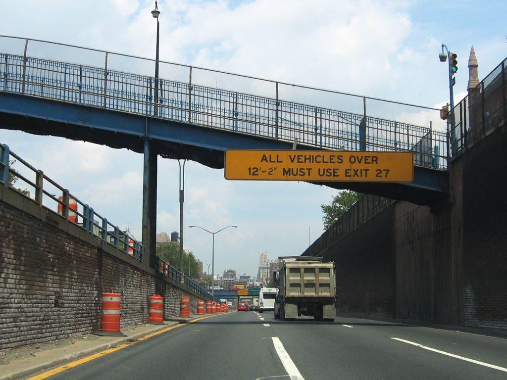
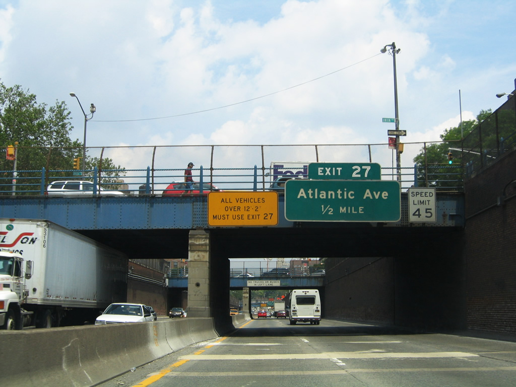
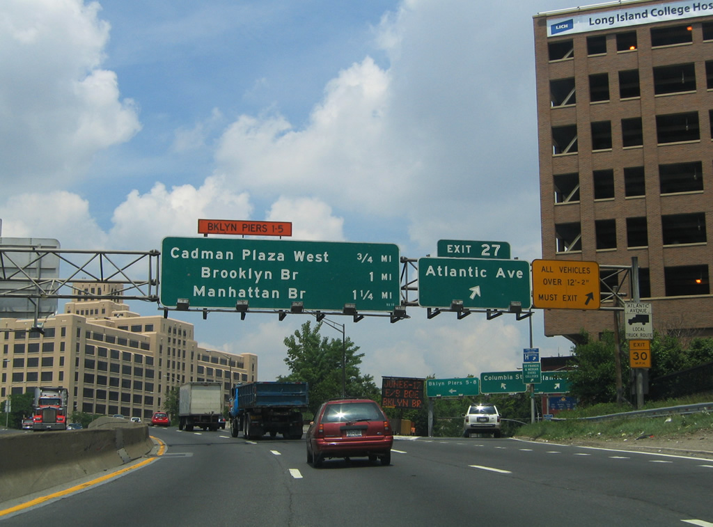
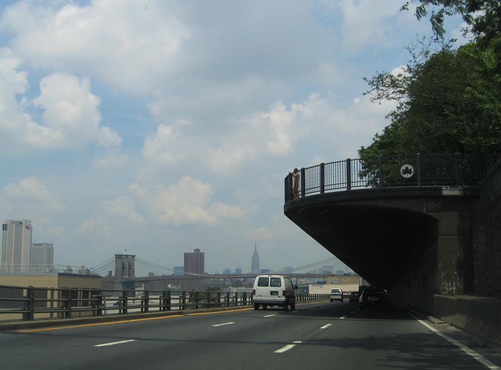
| Attached to a pedestrian overpass at Summit Street, a sign advises vehicles exceeding 12'2" in height to depart Interstate 278 at Exit 27. However posts on thetruckersreport.com forum cite a number of reasons behind its posting, including a low clearance for the right lane of the terraced section of the BQE below Brooklyn Heights Promonade, a one foot pad given by the state of New York when posting bridge clearances, or that the sign remains from an old construction project. 06/13/05 |
|
| The Brooklyn-Queens Expressway (BQE) descends below grade through the neighborhood of South Brooklyn. The six lane freeway receives an influx of traffic from Interstate 478 southbound as it advances from the Union Street overpass toward Atlantic Avenue (Exit 27). 06/13/05 |
|
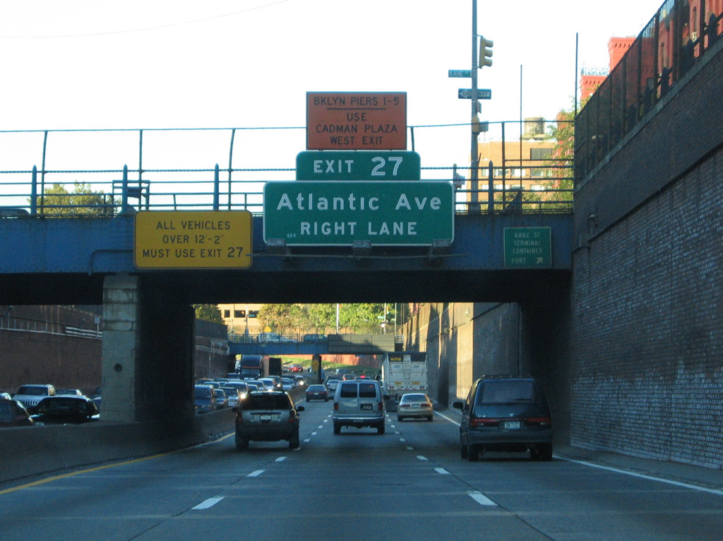
| Interstate 278 eastbound continues closer to the East River near the Atlantic Avenue interchange (Exit 27). Atlantic Avenue travels east from the East River piers at Columbia and Furman Streets, through South Brooklyn to Crown Heights and Broadway Junction in central Brooklyn. The surface street is a main through route between west Brooklyn and Richmond Hill / Jamaica in Queens. Pictured here is the second to last Exit 27 overhead at Kane Street. 10/03/04 |
|
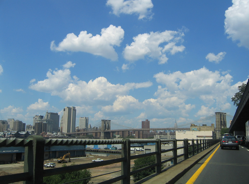
| Interstate 278 eastbound jaunts northwest from a parallel alignment along Hicks Street to a course along Furman Street and the East River. Traffic to Atlantic Avenue, Columbia Street, and the Brooklyn Piers 5 through 8 depart the BQE via Exit 27. 06/13/05 |
|
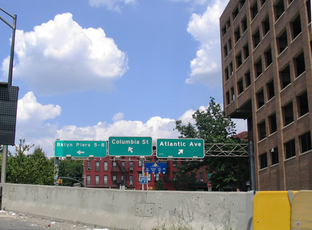
| A parting shot of the Exit 27 sign bridge partitioning of traffic for Atlantic Avenue eastbound to Crown Heights, Columbia Street southbound to Red Hook, and Brooklyn Piers 5 through 8. 08/09/04 |
|
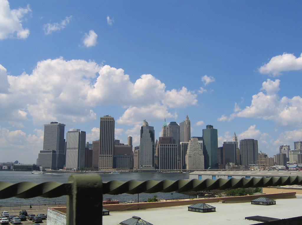
| Interstate 278 travels over the intersection of Atlantic Avenue and Columbia Street to meet the East River above Furman Street. There northbound motorists are greeted with a striking view of the lower Manhattan skyline of downtown New York City as the freeway transitions into a double-decked freeway configuration where westbound travels underneath the eastbound lanes. 08/09/04 |
|
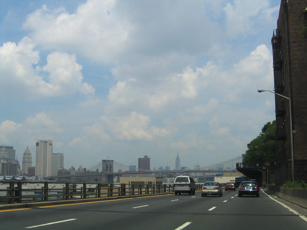
| A deck hangs over the eastbound lanes of the BQE supporting Brooklyn Heights Promenade. For Interstate 278 eastbound motorists, the cityscape remains quite striking with gazes of the famous Brooklyn Bridge available for the traffic weary eyes. 06/13/05 |
|
| The Brooklyn-Queens Expressway retains six overall lanes along its alignment adjacent to the Brooklyn Piers and East River. However there are no shoulders and traffic is subjected to lengthy delays when a disabled vehicle or accident arises. 06/13/05 |
|
| Continuing the cityscape of Lower Manhattan and the Brooklyn Bridge along Interstate 278 (BQE) eastbound. Note the twisted metal guard rail design that lines the left lanes. This style of barrier was present on other segments of the BQE viaduct throughout Brooklyn and Queens originally, but modernization efforts replace them with concrete barriers. 08/09/04, 10/03/04 |
|
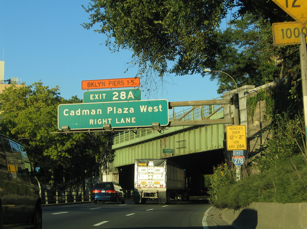
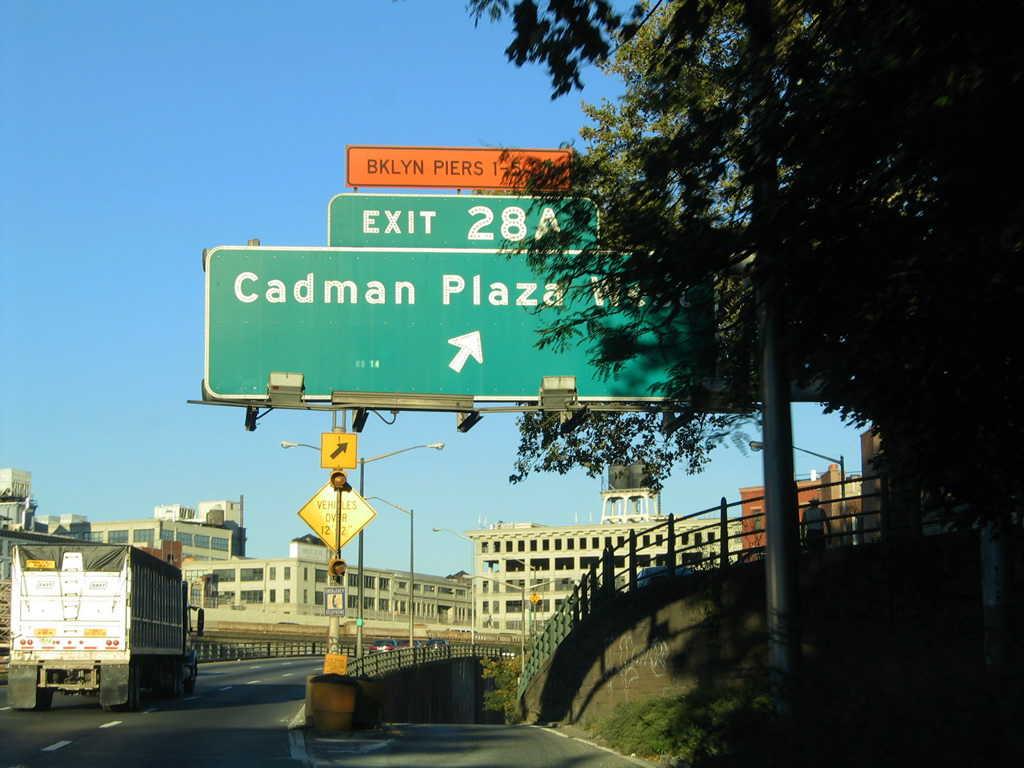
| The BQE eastbound emerges from the Brooklyn Heights Promenade at Columbia Heights as a six lane viaduct. Motorists bound for Exit 28A and Hicks Street to Cadman Plaza West and Old Fulton Street part ways with Interstate 278 eastbound. 10/03/04 |
|
| Cadman Plaza lies south of Old Fulton Street near the base of the Brooklyn Bridge alongside Samuel Parkes Cadman Plaza in the Brooklyn Heights section of the city. Use Exit 28A for Brooklyn Piers 1 through 5 as well. 10/03/04 |
|
| Continuing beyond the Cadman Plaza West (Exit 28A) off-ramp along Interstate 278 east toward the Brooklyn Bridge westbound approach. The bridge connects Brooklyn, just north of the BQE, with Lower Manhattan. 08/09/04 |
|
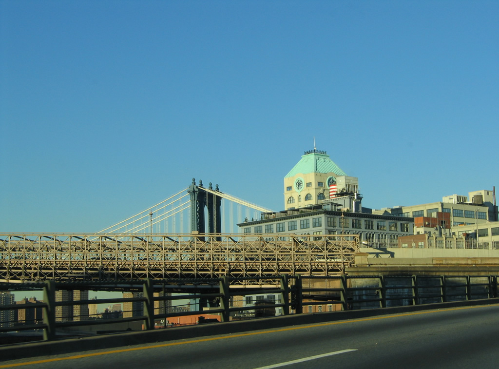
| Visible behind the Brooklyn Bridge is the Manhattan Bridge. The Manhattan Bridge along with the Brooklyn Bridge and Williamsburg Bridge provide free connections between Brooklyn and Manhattan Island. 10/03/04 |
|
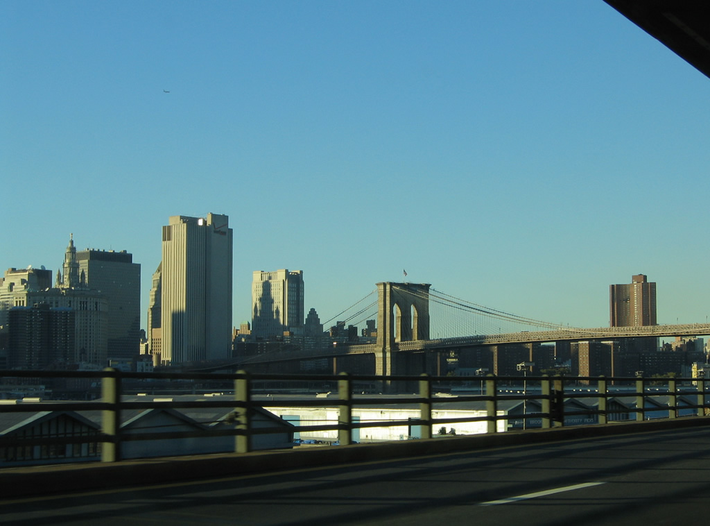
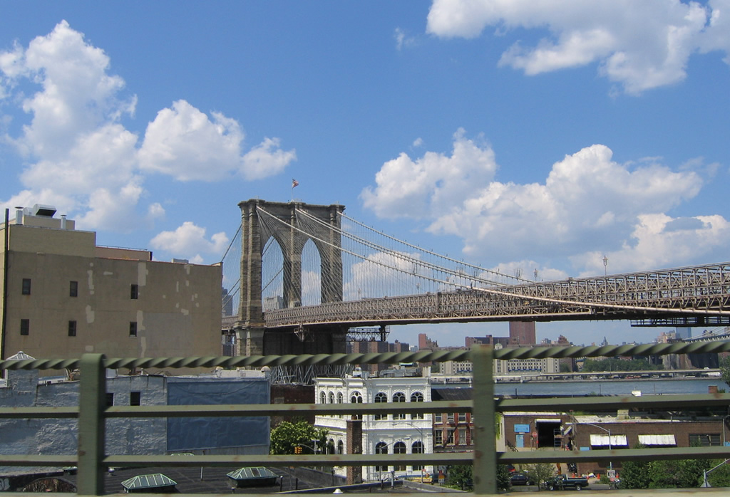
| A brief look to the west beyond the buildings of Brooklyn Heights shows the Brooklyn Bridge from the eastbound lanes of the BQE. The bridge represents one of the oldest active spans in the United States and one of the most famous. Opened on May 23, 1883, the bridge is a registered as a National Historic Landmark.1 08/09/04 |
|
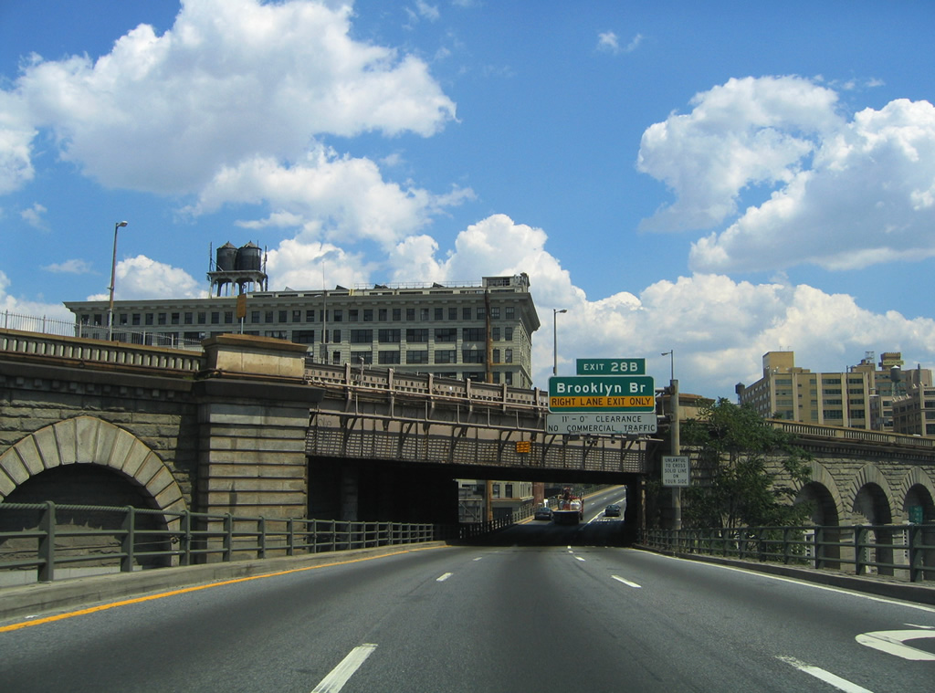
| Interstate 278 eastbound passes underneath the eastern approach of the Brooklyn Bridge ahead of its loop ramp on the span westbound (Exit 28B). The six lane bridge carries BQE eastbound traffic to Centre Street and Franklin D. Roosevelt (FDR) Drive in Lower Manhattan. 08/09/04, 10/03/04 |
|
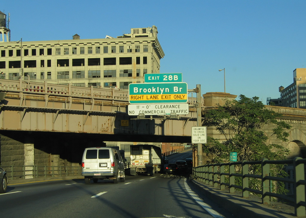
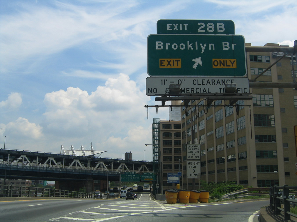
| Exit 28B departs the BQE for the Brooklyn Bridge northbound into Lower Manhattan. The bridge includes a height restriction for vehicles over 11 feet and is not open to commercial trucks. Traffic also enters the bridge via Brooklyn Bridge Boulevard from Atlantic Avenue northward.
In the background is the eastern approach of the Manhattan Bridge. 06/13/05 |
|
| Eastbound traffic is reduced to two overall lanes between the loop ramps of Exits 28B and 29A for the Manhattan Bridge. The Manhattan Bridge joins Flatbush Boulevard in Brooklyn with the confluence of Canal Street and Broadway at Chinatown in Manhattan. The suspension bridge was once considered a candidate for the Interstate 478 designation. Had the planned Lower Manhattan Expressway (Interstate 78) been built, Interstate 478 would apply to the bridge and approaches as the highway would join it with Interstate 278 (BQE) to the south. The designation appeared on maps between 1958 and the 1971 cancellation of Interstate 78 in Lower Manhattan.2 08/09/04 |
|
| Exit 29A leaves Interstate 278 eastbound for the Manhattan Bridge northbound. The Manhattan Bridge, like its companion nearby, is an older East River span opened to traffic on December 31, 1909. The suspension bridge was rehabilitated in the early 2000s and now carries seven-lanes on two-decks with two subway tracks (the B, D, and Q subway lines).2 10/03/04 |
|
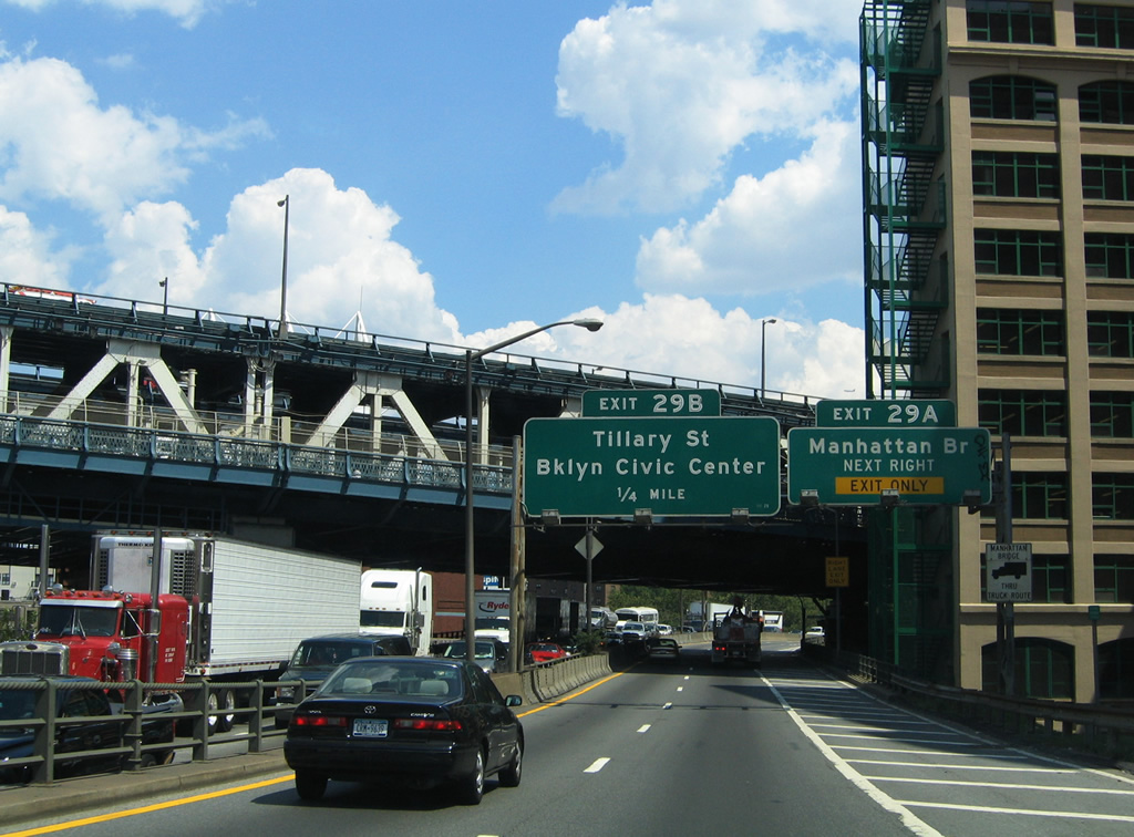
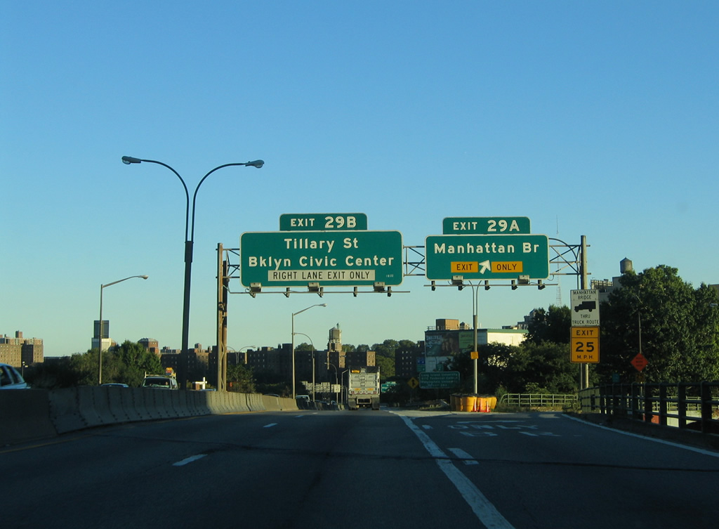
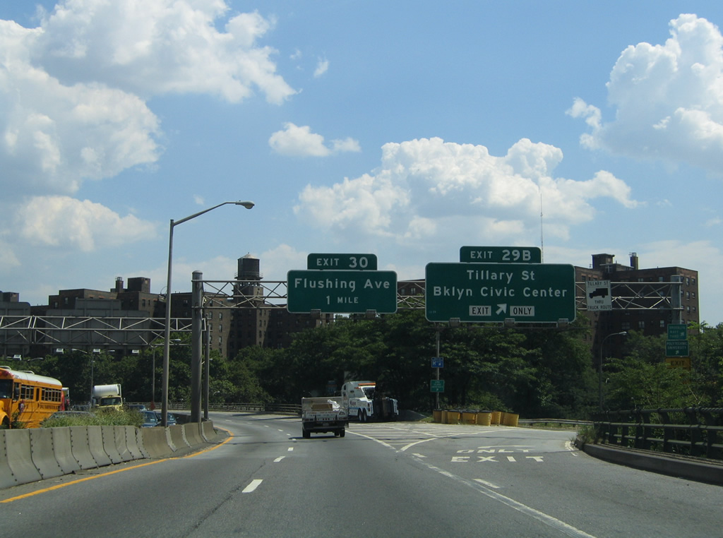
| The Brooklyn-Queens Expressway follows the orientation of the East River between the Brooklyn Heights Promenade and City Industrial Park. The freeway loops northeast then southeast before turning east again at the Tillary Street off-ramp (Exit 29B). Tillary Street travels east-west between Clinton Street and Cadman Plaza West to the BQE at Navy Street. Use Exit 29B for the Brooklyn Civic Center and its surrounding area. 08/09/04 |
|
| A rare Interstate 278 New York shield, since replaced, was in place after the Tillary Street off-ramp gore point at Exit 29B. There were only three state-named eastbound shields remaining on all of Interstate 278 throughout New York City in 2005. This was the first of those shields found along eastbound. 10/03/04 |
|
| Traffic merging onto the BQE from Tillary Street adds a third lane for Interstate 278 eastbound. From there the six lane viaduct travels along the split Park Avenue between Navy Street and Steuben Street. Pictured here was the first overhead (since removed and replaced with a new sign bridge one half mile to the west of Exit 30) for Flushing Avenue. Flushing Avenue continues Nassau Street east from Navy Street along the City Industrial Park area to the north of the BQE. 08/09/04 |
|
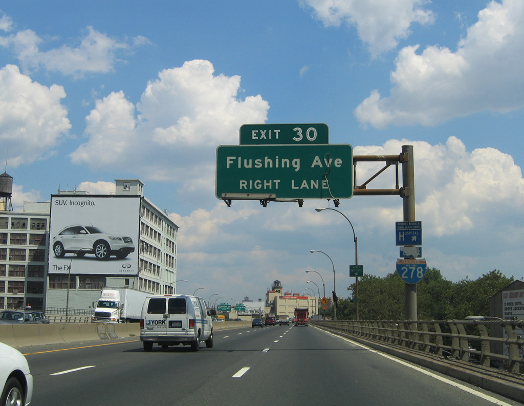
| The BQE again turns northward from Park Avenue to parallel Williamsburg Street at the Exit 30 half diamond interchange with Flushing Avenue. Drivers utilizing Exit 30 from Interstate 278 eastbound merge onto Classon Avenue ahead of its intersection with Flushing Avenue. Use Flushing Avenue west for City Industrial Park and eastbound for the Bushwick and Ridgewood sections of Brooklyn.
This sign bridge was replaced during a modernization project of the viaduct. 08/09/04 |
|
| A slip ramp carries northbound travelers from Williamsburg Street onto the BQE eastbound ahead of the Lee Avenue overpass. Posted at the merge is a eastbound reassurance shield for Interstate 278. 10/03/04 |
|
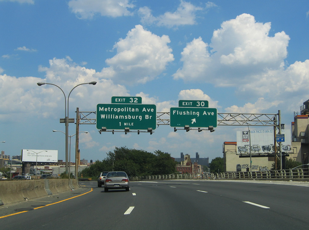
| Interstate 278 descends below grade between the Williamsburg Street one way street couplet between Exits 30 and 32 (Metropolitan Avenue). The forthcoming off-ramp carries motorists onto the adjacent Rodney Street, two blocks south of its intersection with Metropolitan Avenue. A series of overpasses cross the BQE ahead starting with Lee Avenue.
This overhead assembly was removed and a replacement was affixed to the Marcy Avenue overpass in the background. 08/09/04 |
|
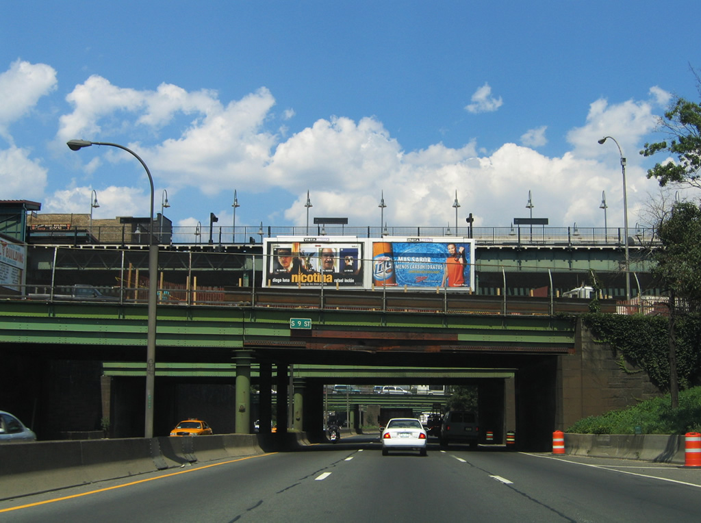
| Many overpasses cross over Interstate 278 ahead of the Exit 32 off-ramp to Rodney Street and Metropolitan Avenue. In view here is South 9th Street and Broadway as they cross the freeway at the Williamsburg section of the city. 08/09/04 |
|
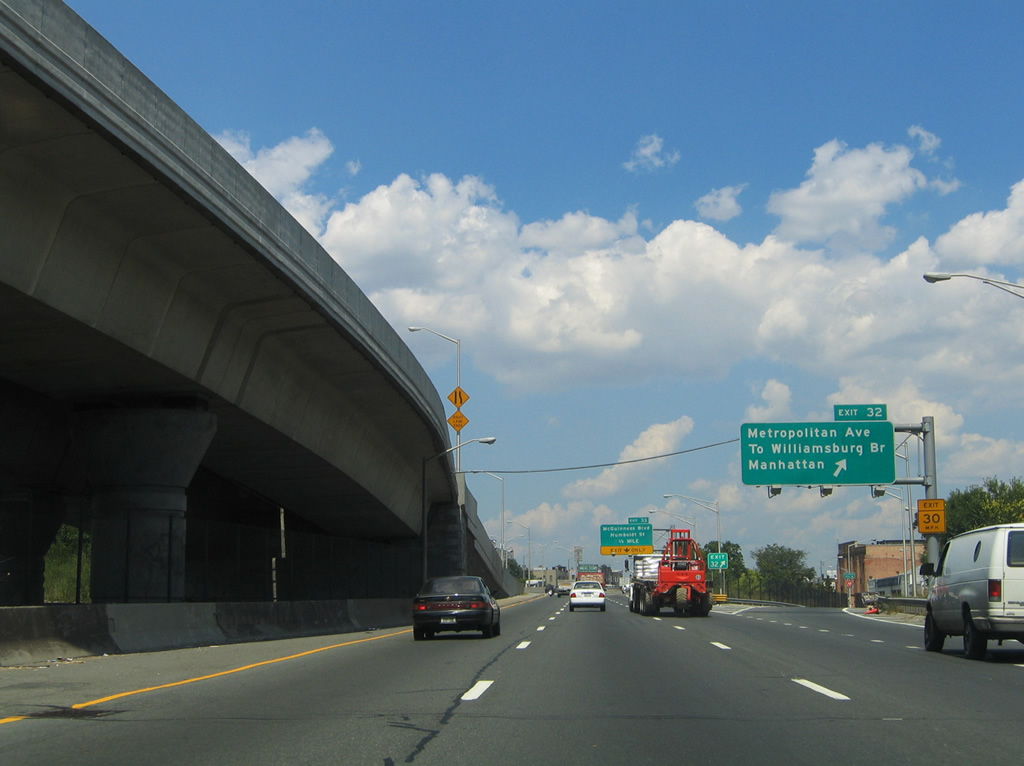
| A flyover ramp carries Williamsburg Bridge eastbound traffic onto Interstate 278 near the ramp departure of Exit 32. Drivers destined for Manhattan via the Williamsburg Bridge westbound should take Rodney Street north to Metropolitan Avenue west to Marcy Avenue southbound for the Borinquen Place on-ramp to the bridge.
The Williamsburg Bridge was touted as part of Interstate 78 between the planned Lower Manhattan and Bushwick Expressways. Between 1958 and 1971, Interstate 78 appeared on maps along the span.3 08/09/04 |
|
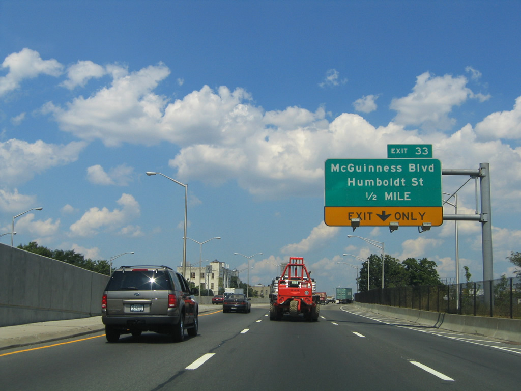
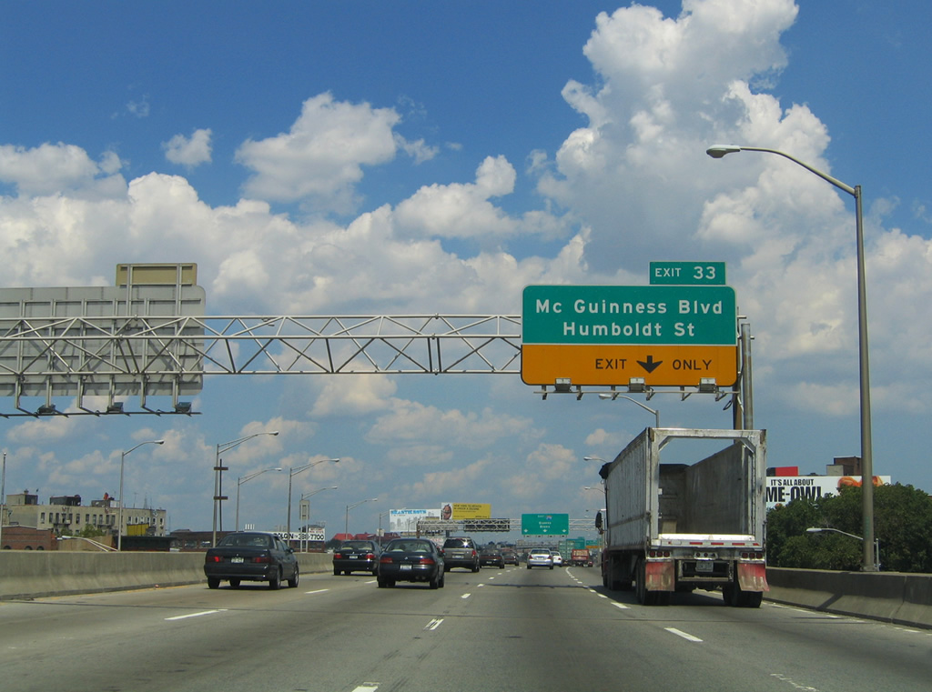
| The right lane of Interstate 278 eastbound becomes exit-only for Exit 33 while an additional lane is gained with the advent of Williamsburg Bridge traffic from the left. A half diamond interchange lies one half mile ahead at the BQE crossing of Humboldt Street near the Greenpoint section of Brooklyn. 08/09/04 |
|
| Interstate 278 eastbound approaches Exit 33 for Humboldt Street. Humboldt Street travels north from Grand Street in Williamsburg to Meeker Avenue and the BQE at McGuinness Boulevard. McGuinness Boulevard continues north from there into Greenpoint. 08/09/04 |
|
| Interstate 278 eastbound elevates again from Metropolitan Avenue northward between the Meeker Avenue frontage roads. Three through lanes are maintained for eastbound to the Kings / Queens County line and Borough of Queens. 08/09/04 |
|
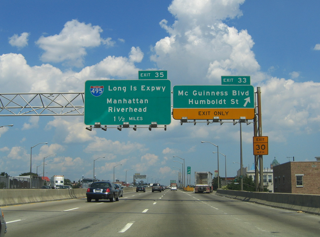
| The first sign of the Interstate 495 (Long Island Expressway) junction is posted at the Exit 33 off-ramp to Humboldt Street south and McGuinness Boulevard north. McGuinness Boulevard represents a multi-lane divided surface arterial between Interstate 278 and the Pulaski Bridge into Queens. 08/09/04 |
|
| Eastbound reassurance shield posted at the Exit 33 ramp departure. Although rehabilitated, the Interstate 278 viaduct is still shoulderless as it continues northeast toward the Borough of Queens. 08/09/04 |
|
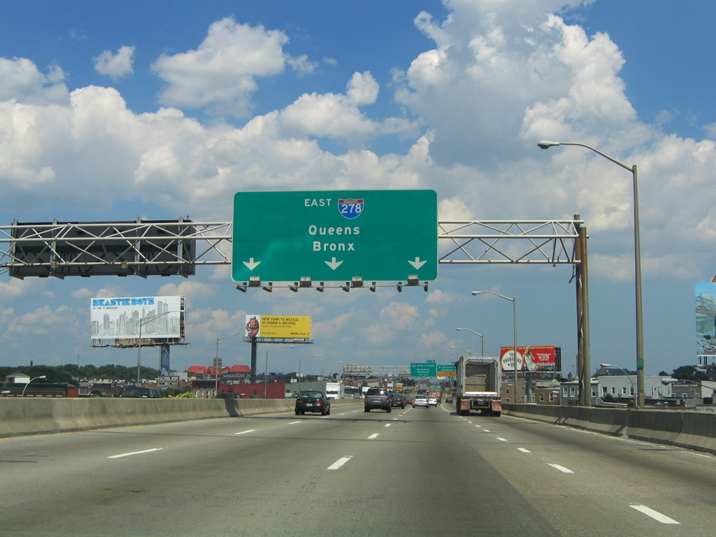
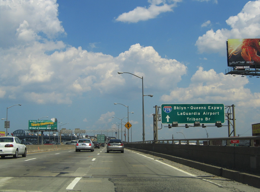
| Interstate 278 kinks eastward at Apollo Street alongside Cherry Street to Gardner Avenue and the Newtown Creek crossing. A slip ramp ascends from Cherry Street eastbound onto the Brooklyn-Queens Expressway. Note the inclusion of the Triboro Bridge and La Guardia Airport for the BQE connection with the Grand Central Parkway in Queens. 08/09/04 |
|
| Six lanes of Interstate 278 ascend over the high level Newtown Creek bridge between Brooklyn and Queens. The interchange with Interstate 495 (Long Island Expressway) exists at the north end of the bridge as Exit 35. The directional cloverleaf carries traffic into Mid-Manhattan via Interstate 495 west to the Queens Midtown Tunnel.
The Queens Midtown Tunnel is not officially acknowledged as part of the Interstate system. 06/13/05 |
|
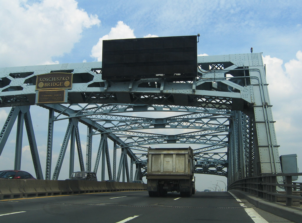
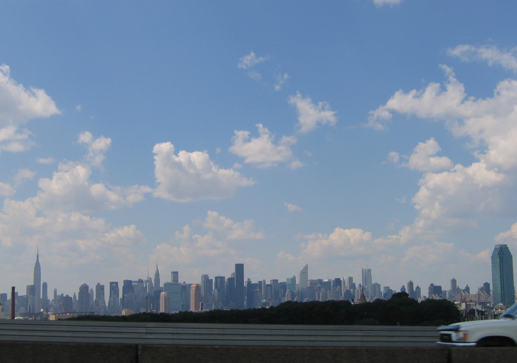
| Views of the Newtown Creek (Kosciuszko Bridge) crossing and Manhattan skyline off to the west from the BQE eastbound lanes. Opened in 1939, the 6,021-foot-long span travels 125 feet above the creek below. The steel truss bridge is named after Colonel Thaddeus Kosciuszko, a Revolutionary Army military engineer.4 06/13/05, 08/09/04 |
|
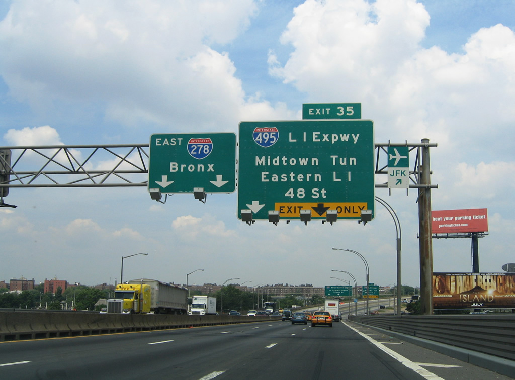
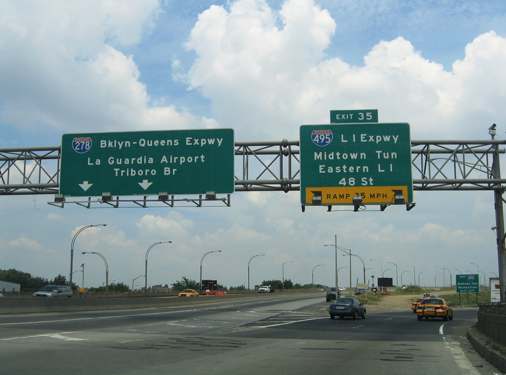
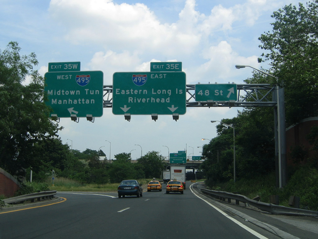
| Approaching the Exit 35 off-ramps to Interstate 495 (Long Island Expressway) on Interstate 278 east. New reflectorized signs replace Manhattan and Riverhead with Midtown Tunnel and Eastern Long Island. Additionally 48th Street is referenced for the off-ramp connection from the Interstate 495 east ramp to 53rd Avenue at 48th Street. 06/13/05 |
|
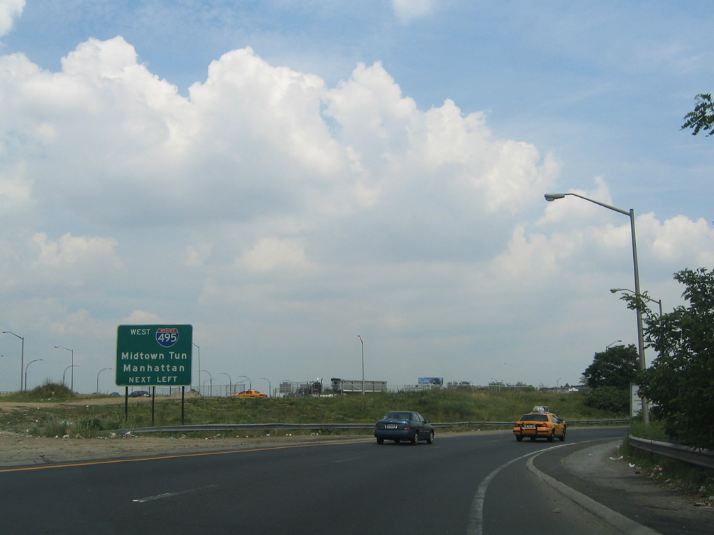
| Interstate 278 ascends to pass over the interchange complex with Interstate 495 at Exit 35. Interstate 495 westbound travelers cut through the Sunnyside section of Queens before descending under the East River via the tolled Queens Midtown Tunnel. Interstate 495 was to continue west from their along the Mid-Manhattan Expressway to the Lincoln Tunnel. From there planned Interstate 495 crosses the Hudson River into Weehaken, Union City, and North Bergen, New Jersey en route to Interstate 95 (New Jersey Turnpike). Completed sections of Interstate 495 were redesignated New Jersey 495 & NY 495 after plans for the Mid-Manhattan Expressway were cancelled in 1971. 06/13/05 |
|
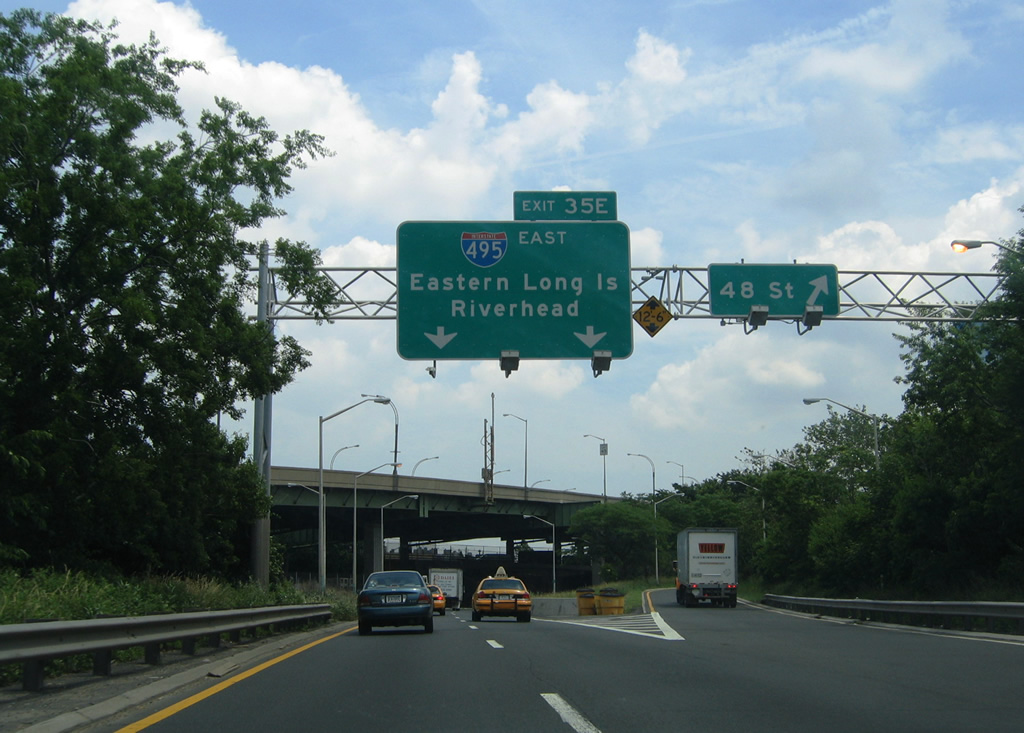
| Exit 35E continues with two lanes onto Interstate 495 (Long Island Expressway) east to Elmhurst and Flushing Meadow Park in Queens. 48th Street south connects with 56th Road for the Haberman and Maspeth neighborhoods of Queens. 06/13/05 |
|
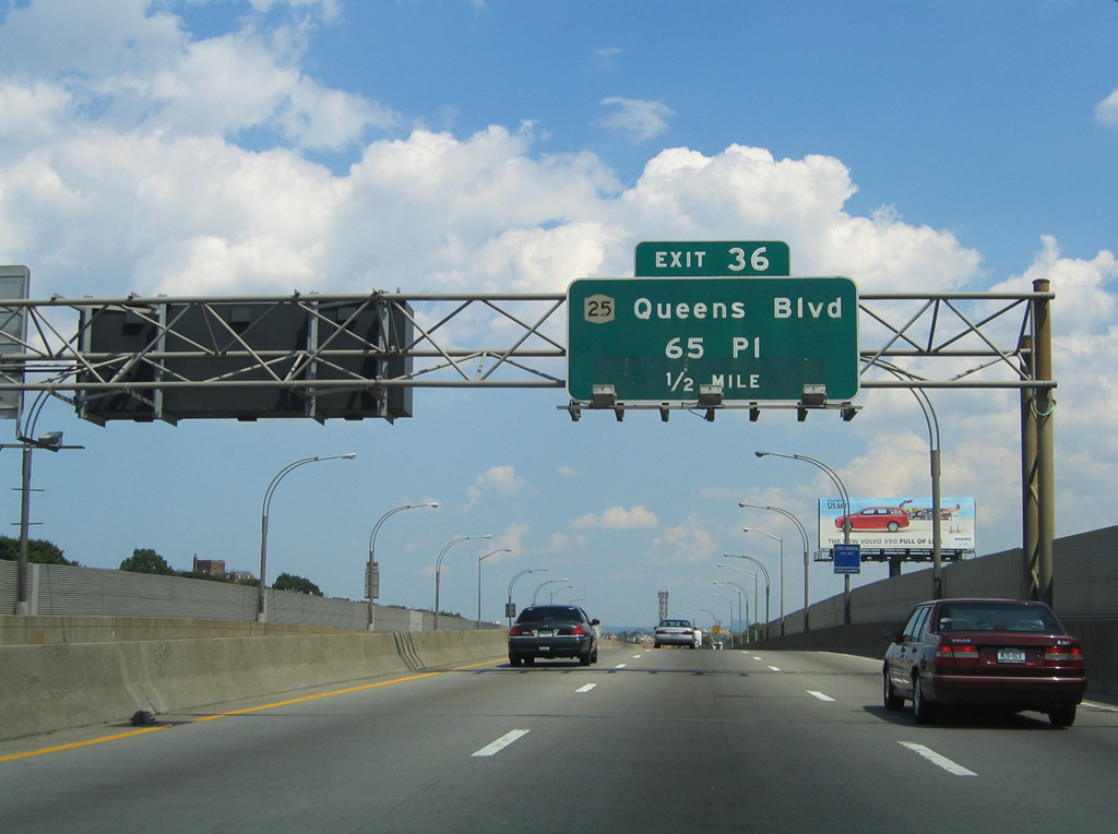
| One-half mile button copy sign for NY 25 (Queens Boulevard) on Interstate 278 (BQE) eastbound at Exit 39. Queens Boulevard represents a major surface arterial between the Queensboro Bridge, Long Island City, Sunnyside, and Woodside to the BQE, Elmhurst, and Jackson Heights. NY 25 remains one of the few signed surface routes through Queens. 08/09/04 |
|
| The Brooklyn-Queens Expressway travels along Laurel Hill Boulevard between 58th Street and 65th Place. Ramps to and from NY 25 (Queens Boulevard) utilize Laurel Hill Boulevard southwest from 65th Place to access Interstate 278. 65th Place otherwise travels north from Borden and Maurice Avenues to Queens Boulevard and Roosevelt Avenue. 08/09/04 |
|
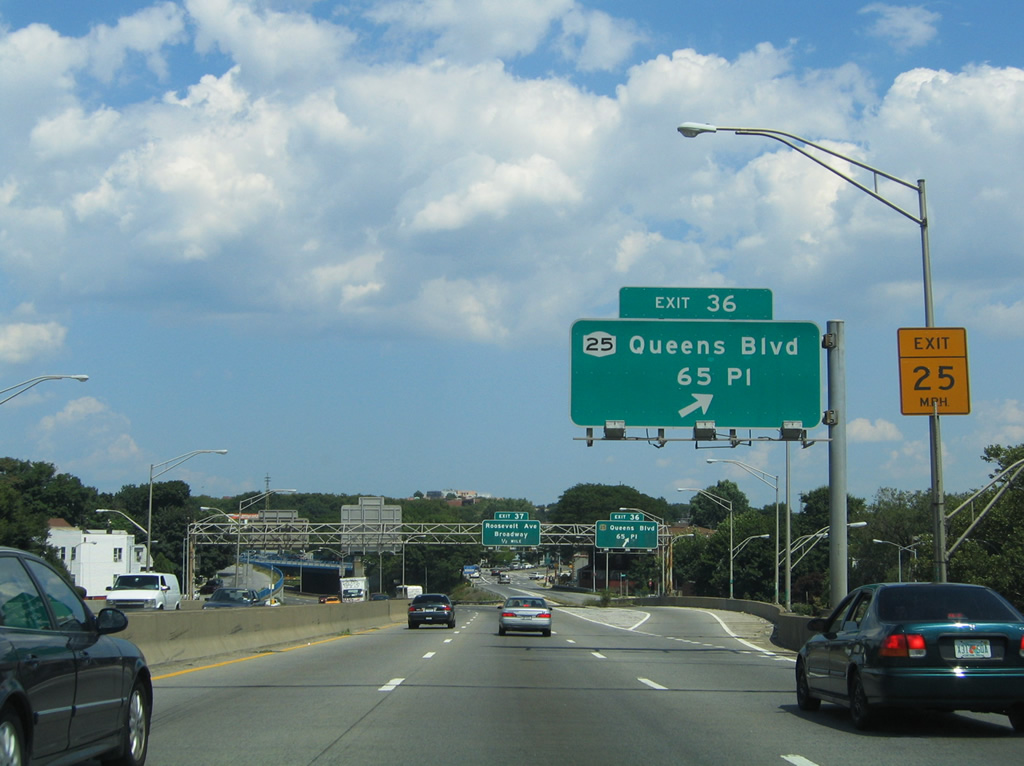
| Exit 39 departs Interstate 278 eastbound after the 61st Street under crossing for Laurel Hill Boulevard eastbound ahead of 65th Place. Drivers bound for NY 25 (Queens Boulevard) westbound utilize 65th Place north. Laurel Hill Boulevard east defaults onto the 67th Street ramp onto Queens Boulevard eastbound. 08/09/04 |
|
| Interstate 278 curves northward toward Jackson Heights and Woodside at the Exit 39 ramp. Laurel Hill Boulevard is visible as it intersects 65th Place to the right. NY 25 begins at the Queensboro Bridge end in Manhattan, to the west, and ends at the Queens-Nassau county border along Jericho Turnpike.
Exit numbers for Queens Boulevard and Roosevelt Avenue were renumbered to 39 and 40 respectively. 08/09/04 |
|
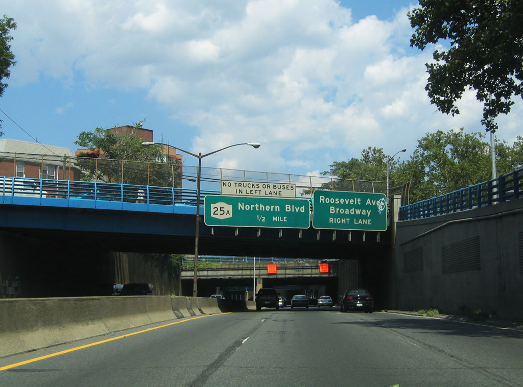
| The BQE again descends below grade from Queens Boulevard northward to NY 25A (Exit 41). Situated along the depressed freeway is the Exit 40 off-ramp onto Roosevelt Avenue at Jackson Heights. Roosevelt Avenue travels east-west between Long Island City and Woodside to Corona and Flushing.
A bridge refurbishment project at Woodside Avenue removed the overhead panels pictured here by 2007. 08/09/04 |
|
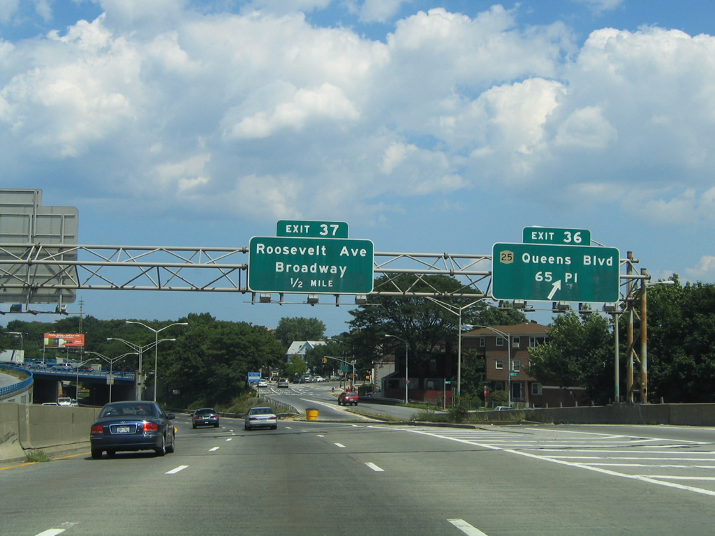
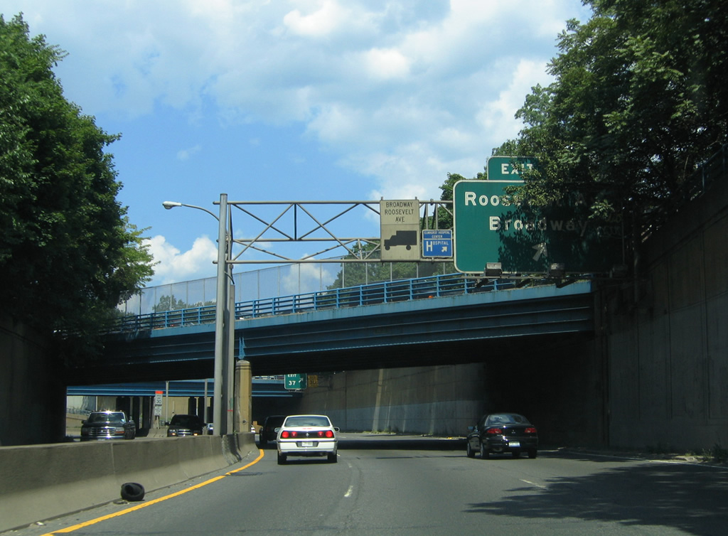
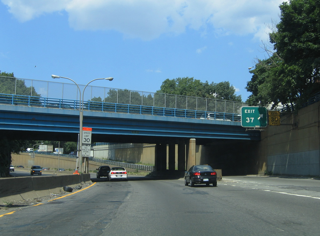
| 70th Street and 41st Avenue crisscross Interstate 278 at the Exit 37 ramp departure for Roosevelt Avenue on eastbound. Use Roosevelt Avenue for Broadway east to Elmhurst and northwest to Long Island City and Astoria.
Reconstruction in 2007 resulted in a replacement of both overpasses. This sign bridge was removed during that project. 08/09/04 |
|
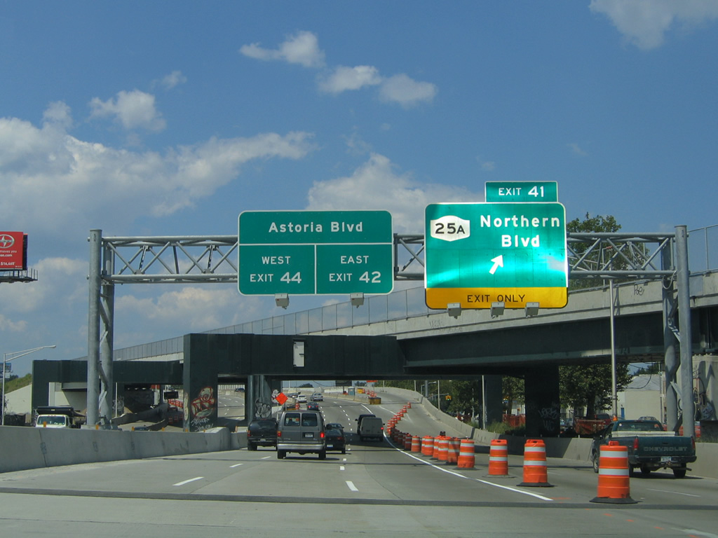
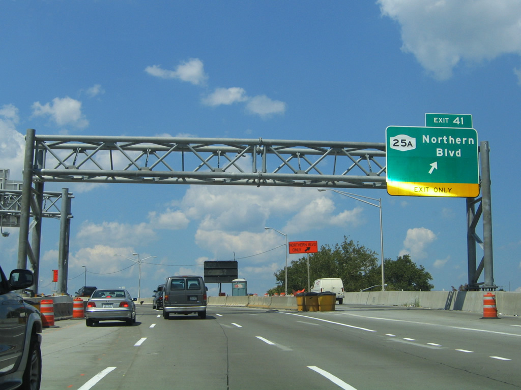
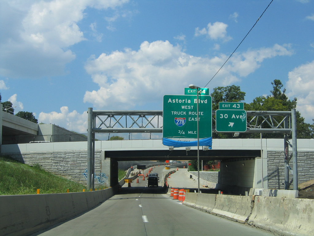
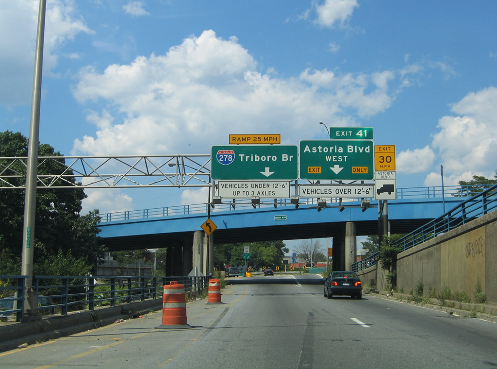
| The next interchange for Interstate 278 eastbound motorists is the junction with NY 25A (Northern Boulevard) at Exit 41. Reconstruction and resigning results in the renumbering of Exit 38 to 41. Northern Boulevard carries the NY 25A designation from Jackson Avenue at Long Island City east to Nassau County line at Little Neck. NY 25A provides an alternate route to and from the Queensboro Bridge and the BQE. Astoria Boulevard traffic meanwhile is partitioned between the Brooklyn Queens Expressway West and East branches respectively (Exit 42). 08/09/04 |
|
| The BQE ascends over 34th Avenue at the Exit 41 gore point for NY 25A (Northern Boulevard). NY 25A travels east to East Elmhurst and Flushing from Interstate 278. Northern Boulevard ties into the Grand Central Parkway and Interstate 678 (Whitestone Expressway) near Citi Field (home of Major League Baseball's New York Mets). Closed due to construction here was Exit 42 off-ramp for the Brooklyn Queens Expressway East branch to the Grand Central Parkway and Astoria Boulevard eastbound. 08/09/04 |
|
| Exit 43 leaves Interstate 278 eastbound at the 31st Avenue overpass for 30th Avenue. 30th Avenue stems east from the BQE to the North Beach and East Elmhurst neighborhoods of north Queens. 08/09/04 |
|
| Interstate 278 follows the Brooklyn Queens Expressway West branch between Exits 42 and 44 (Astoria Boulevard / Grand Central Parkway). The freeway narrows to just four lanes in tight confinement below grade at the Bulova Avenue overpass. 08/09/04 |
|
| Interstate 278 merges with the Grand Central Parkway at the end of the West branch of the BQE. Between Exit 41 (Astoria Boulevard westbound) and the Triboro Bridge, Interstate 278 follows Grand Central Parkway. Pictured here is the ramp departure of Exit 41 and the Astoria Boulevard eastbound over crossing. Astoria Boulevard constitutes the frontage streets of the Grand Central Parkway between 31st Street and 82nd Street at La Guardia Airport. Use Exit 41 for both the Steinway and Astoria neighborhoods of northwest Queens. 08/09/04 |
|
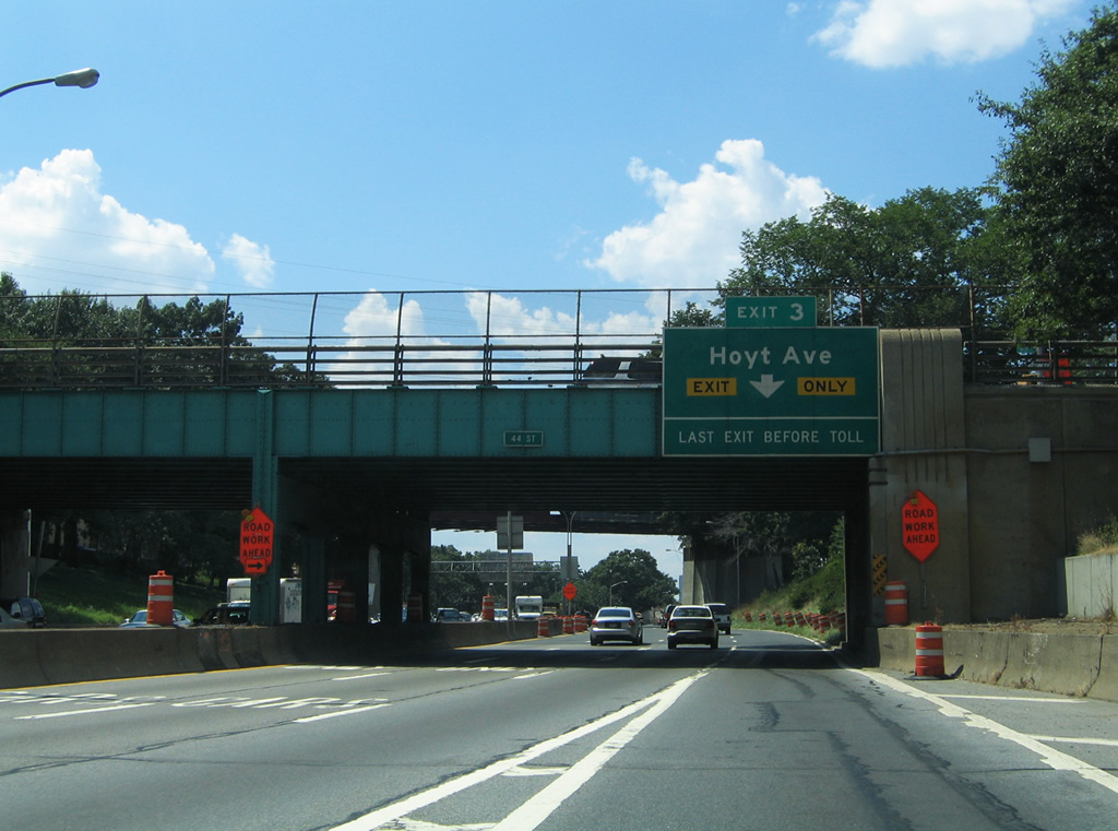
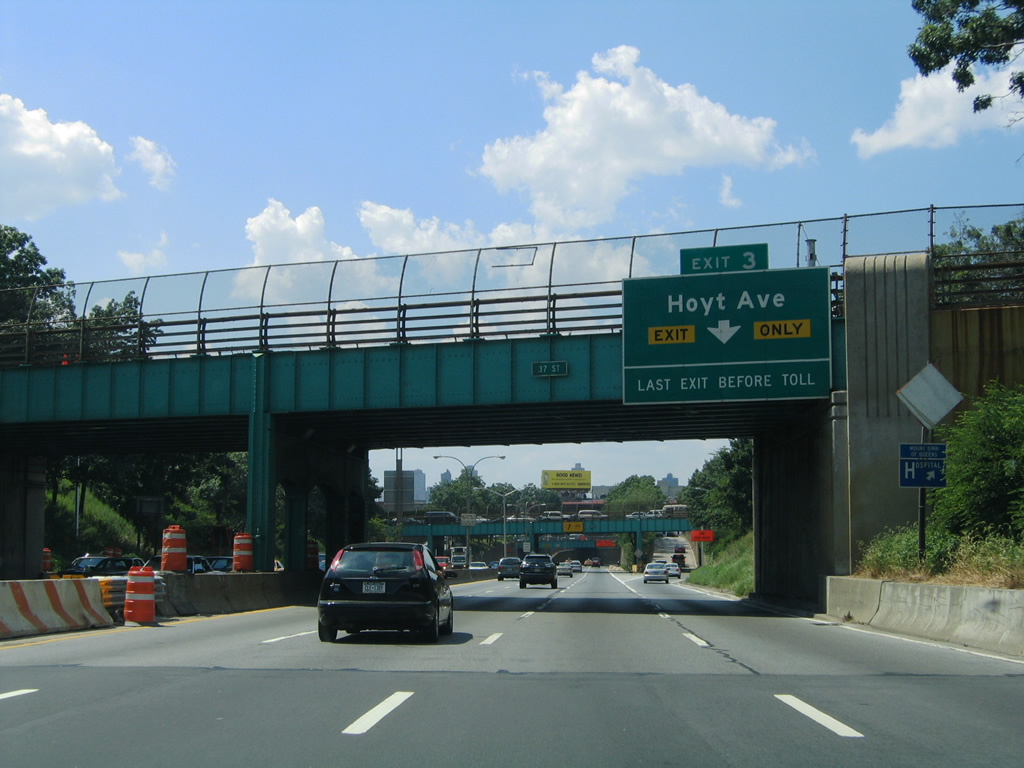
| Interstate 278 eastbound is relegated to just one lane on the transition from the BQE onto Grand Central Parkway at Astoria. Beyond the merge with GCP, the freeway carries six overall lanes to the Triborough Bridge at Astoria Park. Exit 45 (original GCP Exit 3) exists midway between the toll bridge and BQE for 31st Street (formerly signed to Hoyt Avenue) as the last departure point in Queens for Interstate 278 east. 44th Street passes over the Grand Central Parkway in this scene. 08/09/04 |
|
| Exit 3 departs Interstate 278 (Grand Central Parkway) eastbound for 31st Street and Astoria Park. The exit numbering convention along Interstate 278 between the BQE and the Triborough Bridge was that of the Grand Central Parkway system originally, but Exit 3 was renumbered to 45 to conform with I-278's system. Hoyt Avenue comprises the frontage street system of Interstate 278 between Astoria Avenue at 31st Street and 21st Street at Astoria Park. 31st Street leads southwest to NY 25A (Northern Boulevard) at Long Island City and northeast to Steinway. 08/09/04 |
|
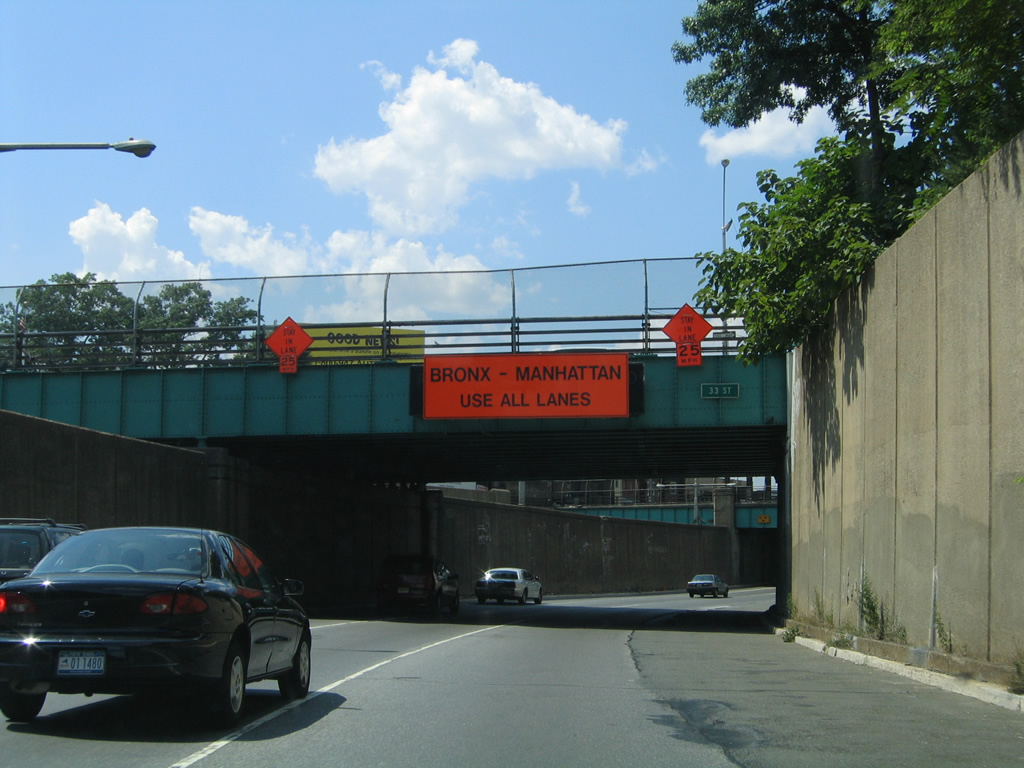
| Interstate 278 (Grand Central Parkway) remains below grade on the northwesterly curve toward the Triboro (Robert F. Kennedy) Bridge. 33rd Street passes over the six lane freeway between the Astoria and Steinway sections of Queens.
The construction sign pictured here overlaid an original "Right Lane Closed - Keep Left". 08/09/04 |
|
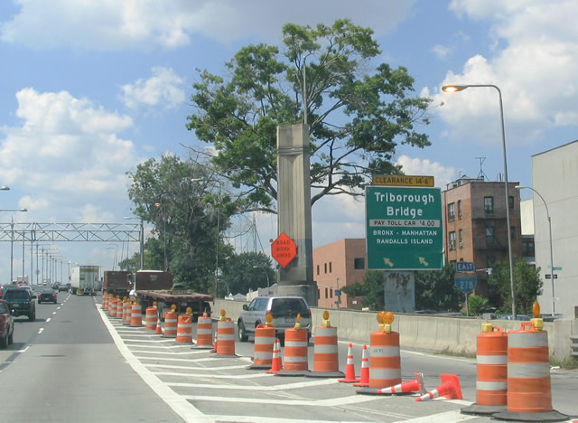
| The final entry point onto Interstate 278 eastbound exists in the form of a slip ramp from Hoyt Avenue westbound onto the Grand Central Parkway at 28th Street. Randalls Island is where the three branches of the Triboro Bridge converge ahead.
A sign replacement reflects the Triboro Bridge name change to Robert F. Kennedy Bridge in 2008. The state-named shield was removed with the new installation. 08/09/04 |
Page Updated 02-07-2012.

 East
East