|
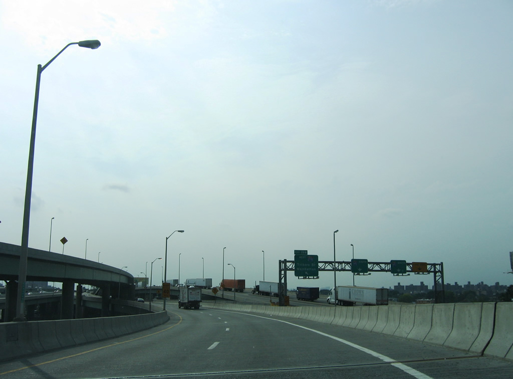
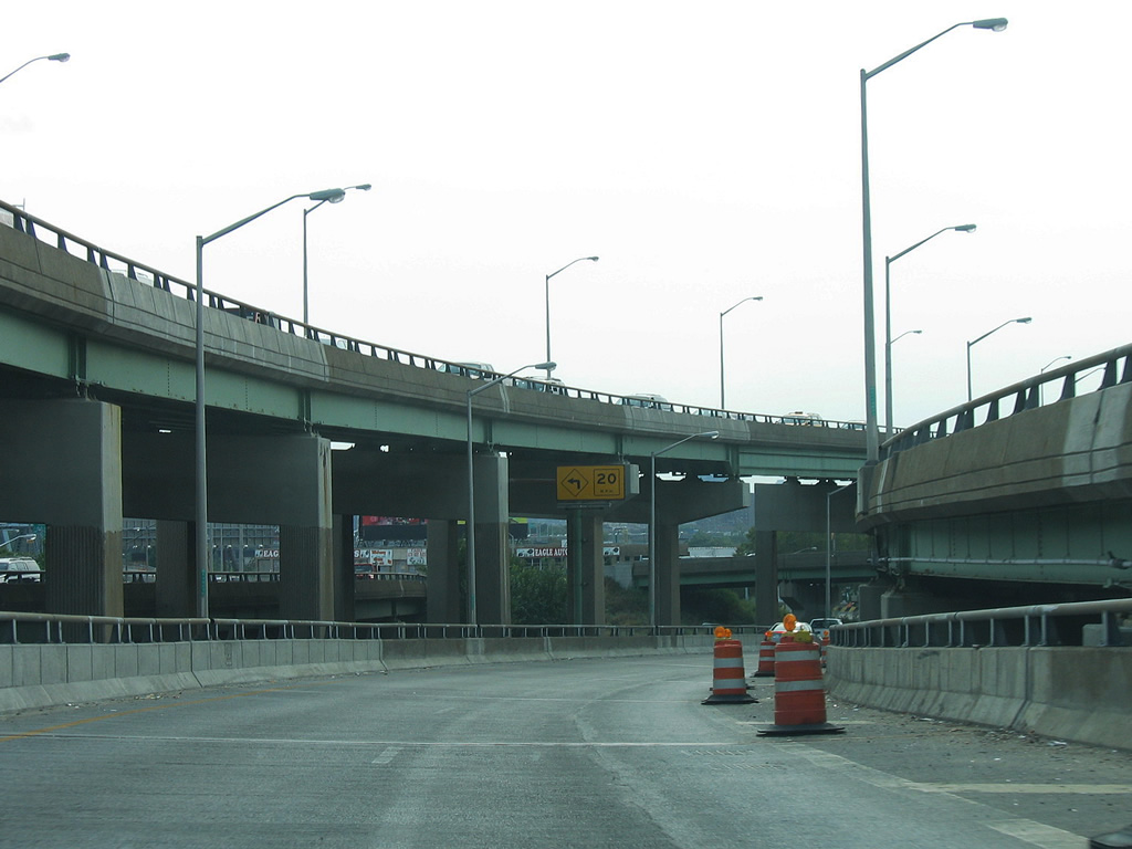
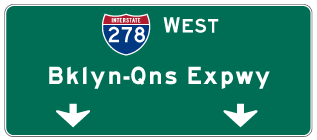
| Traveling through the Bruckner Interchange along the ramp joining I-295 (Cross Bronx Expressway Extension) north with I-278 (Bruckner Expressway) west. Exit 19 W from I-678 enters from the left as I-95 overtakes the Cross Bronx Expressway. 08/29/05 |
|
| The first Interstate 278 reassurance shield stands along the Bruckner Expressway where the ramps cnverge from I-95 south and I-295 north. 08/29/05 |
|
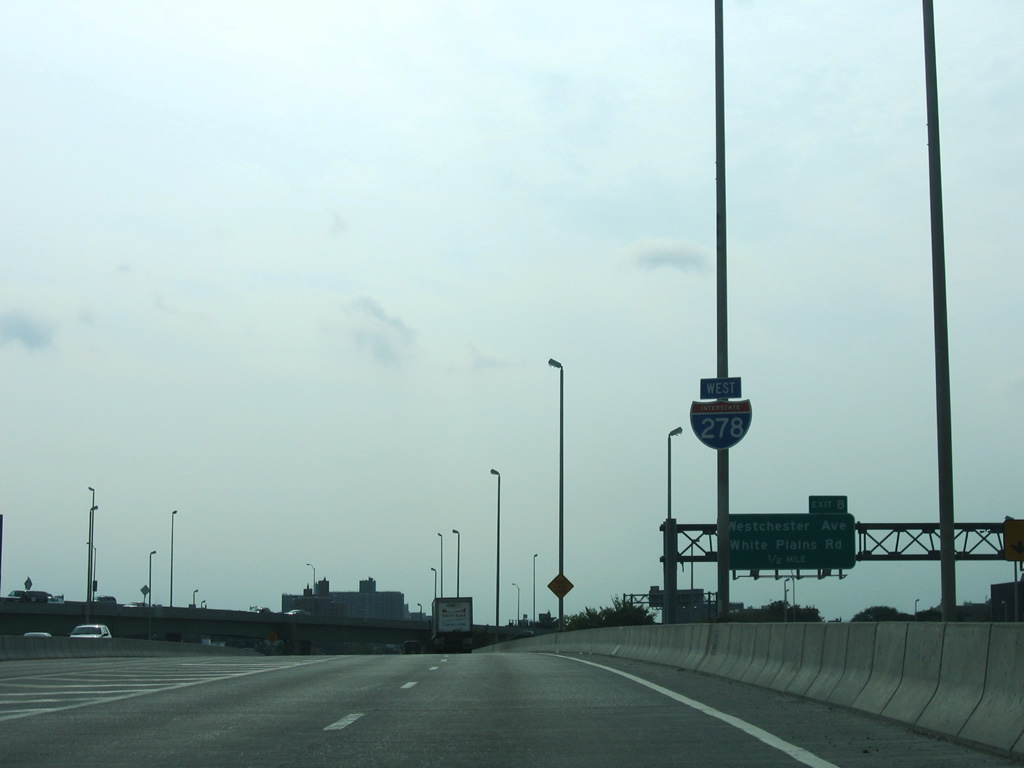
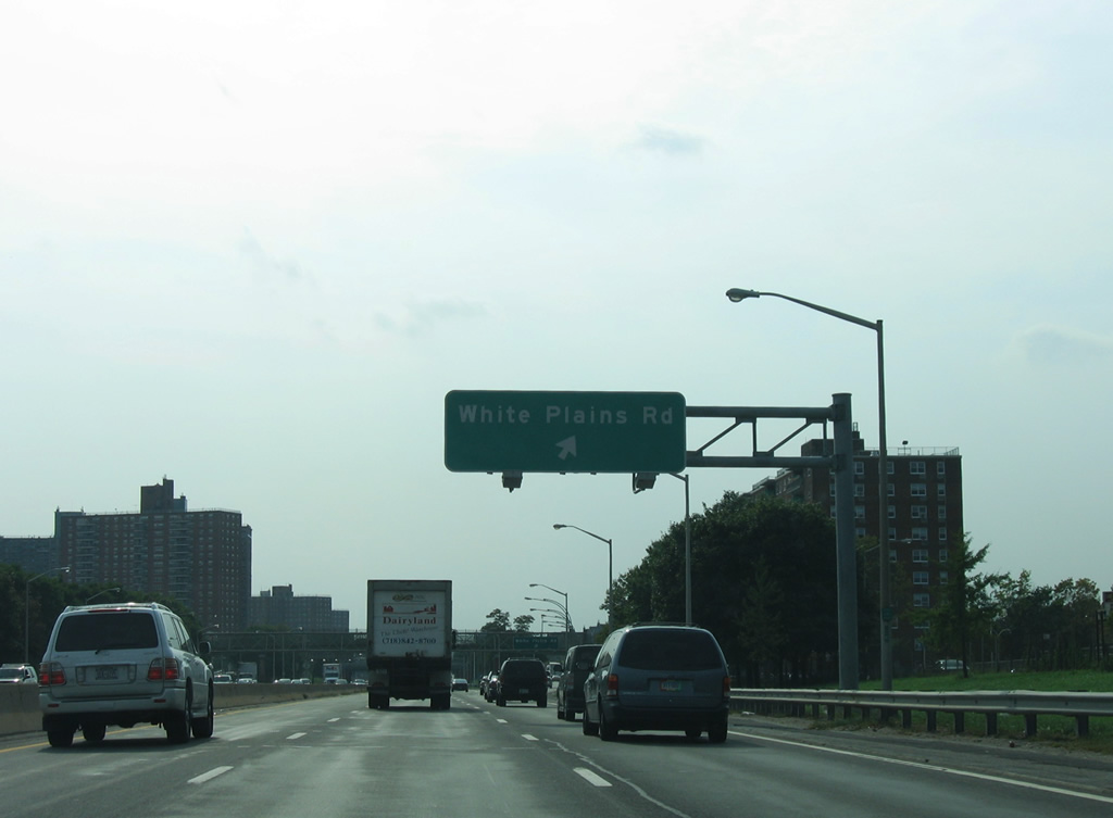
| The diamond interchange at Exit 52 utilizes parallel Bruckner Boulevard to connect with White Plains Road and Bronx River Parkway. 08/29/05 |
|
| Castle Hill Avenue spans I-278 a quarter mile from Exit 52. White Plains Road leads south to Clason Point. 08/29/05 |
|
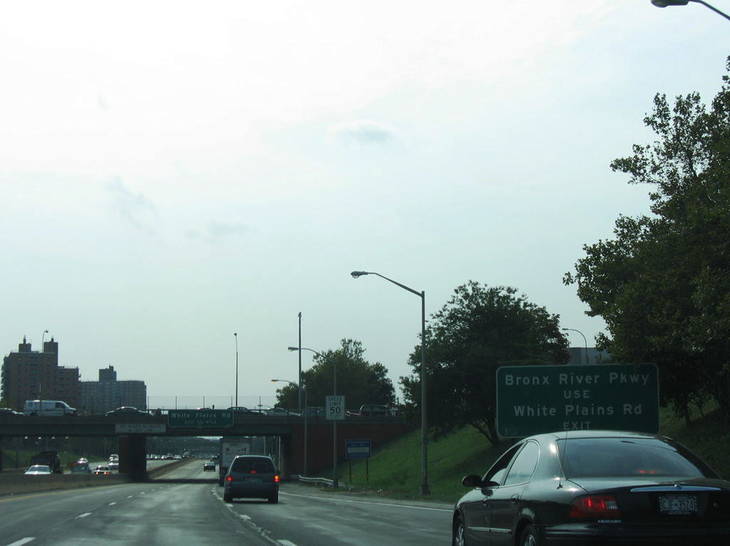
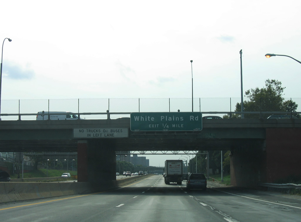
| North from Exit 52, White Plains Road enters Parkchester en route to Van Nest and Bronxdale, east of Bronx River Parkway. 08/29/05 |
|
| Since removed, this sign bridge appeared at the slip ramp (Exit 52) onto Bruckner Boulevard west. Bronx River Parkway begins at Sound View Park nearby and parallels the Bronx River to Mount Vernon and Yonkers. 08/29/05 |
|
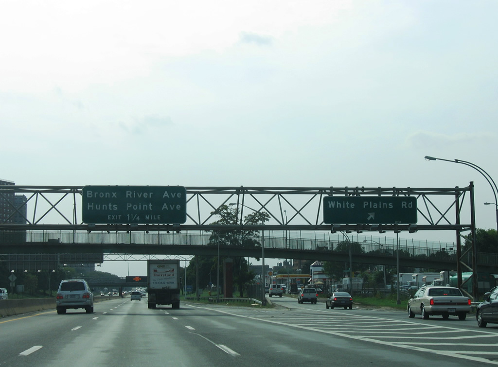
| An entrance ranp from Bruckner Boulevard joins Interstate 278 a quarter mile ahead of Exit 51 for Bronx River Avenue. Sign replacements were made here after the renaming of the Triborough Bridge to honor Robert F. Kennedy in 2008. 08/29/05 |
|
| A second pedestrian bridge passes over I-278 (Bruckner Expressway) ahead of the slip ramp (Exit 51) onto Bruckner Boulevard west for Bronx River Avenue. Both the expressway and boulevard cross the Bronx River on a draw bridge ahead. 08/29/05 |
|
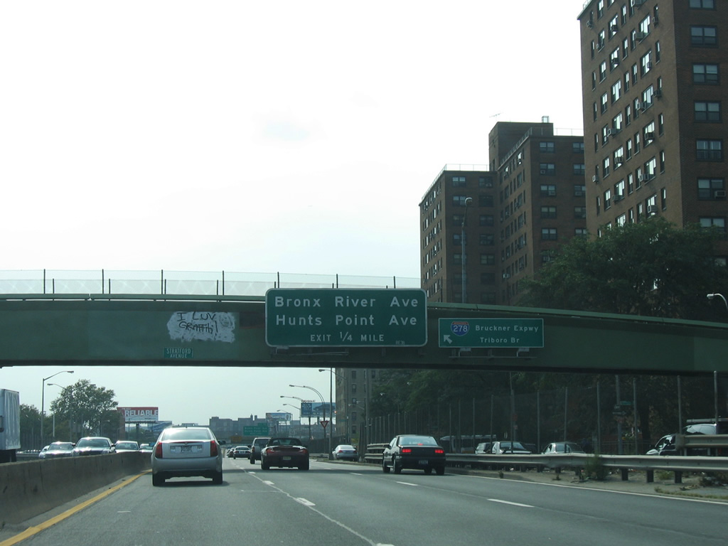
| Separate ramps connect I-278 west to Bronx River Avenue and Hunts Point Avenue. Bronx River Avenue heads north to West Farms and south to Story Avenue. 08/29/05 |
|
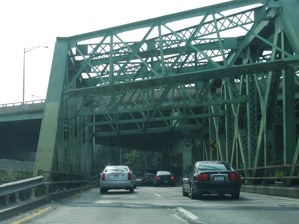
| Westbound shield posted for Interstate 278 at the Bronx River draw bridge. 08/29/05 |
|
| The westbound span over the Bronx River was built in 1930 and the eastbound crossing in 1953. 08/29/05 |
|
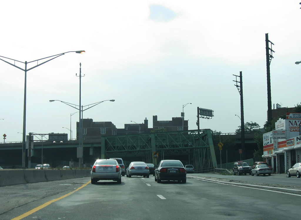
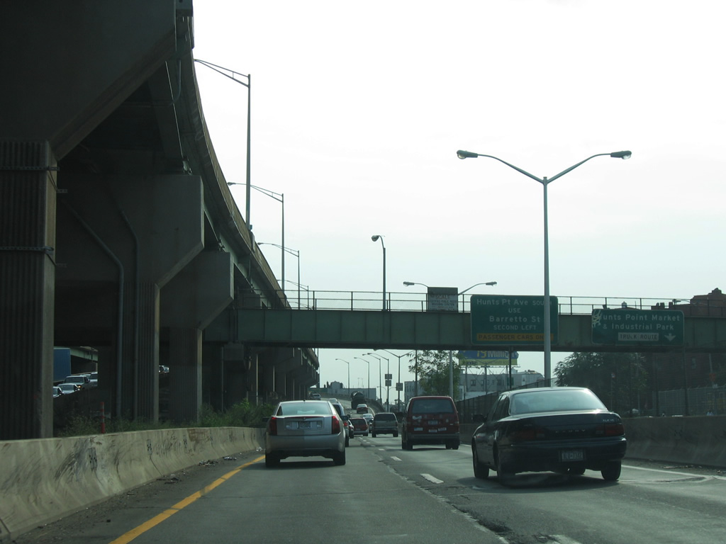
| A slip ramp was added beyond the Bronx River for Bruckner Boulevard west to Hunts Point Avenue. Hunts Point Avenue spurs southeast from E 163rd Street to the Hunts Point community. 08/29/05 |
|
| Westbound I-278 crosses a 120 foot long three-truss bridge over a set of AMTRAK and CSX Railroad lines just west of the Bronx River. The eastbound roadway crosses the railroad tracks on a 125 foot long, single span girder bridge. Both bridges were rehabilitated in 2011. 08/29/05 |
|
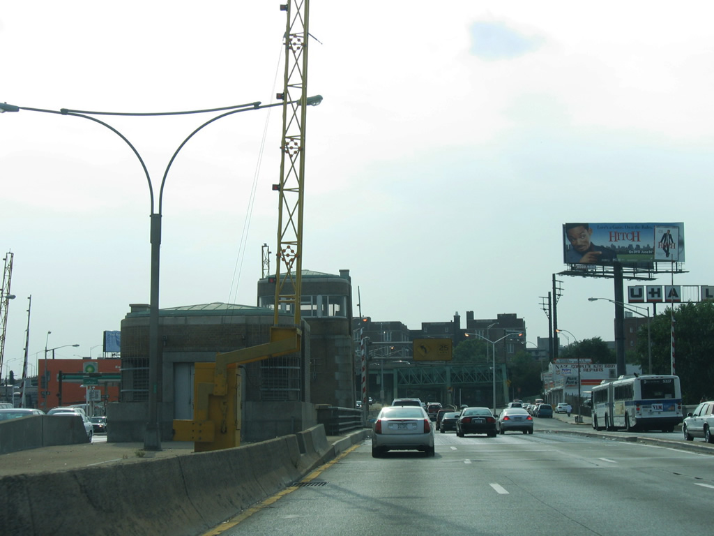
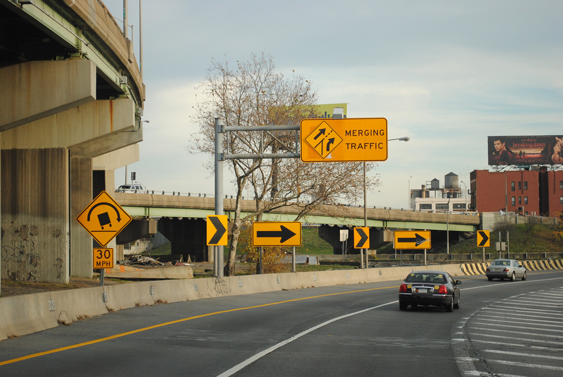
| Interstate 278 (Bruckner Expressway) turns southwesterly from near Hunts Point to Port Morris in the southwest Bronx. Adjacent Bruckner Boulevard combines with Whitlock Avenue ahead of Hunts Point Avenue and Barretto Street. 08/29/05 |
|
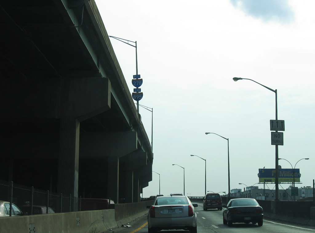
| The elevated roadway above I-278 carries the end of NY 895 south from Sheridan Boulevard. 08/29/05 |
|
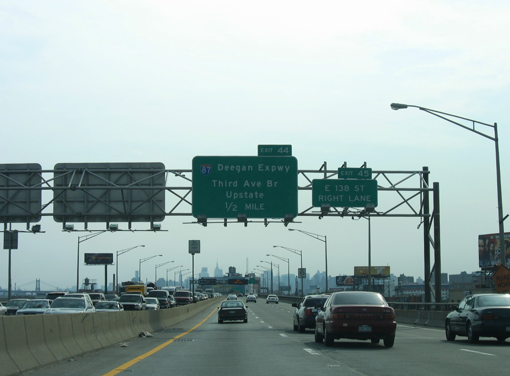
| Continuing west I-287 converges with the south end of Interstate 87 (Major Deegan Expressway) in one mile. 08/29/05 |
|
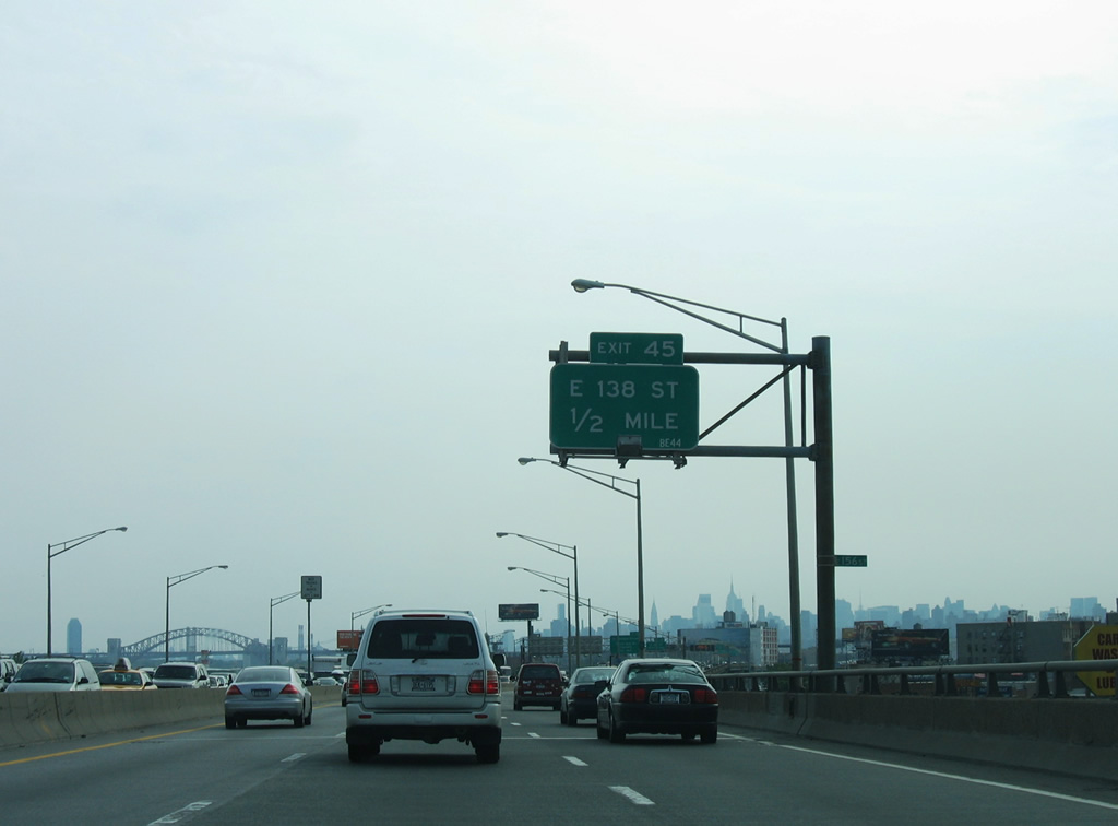
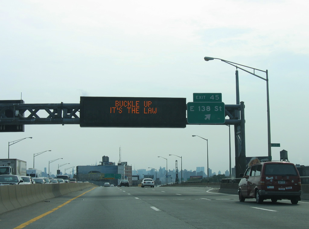
| The ensuing exit from I-278 west is for E 138th Street. E 138th Street connects with the Madison Avenue Bridge, one of the toll free crossings over the Harlem River between the Bronx and Manhattan Island. 08/29/05 |
|
| Exit 48 utilizes adjacent Bruckner Boulevard westbound between Southern Boulevard and E 138th Street. The return ramp to Interstate 278 west joins the Bruckner Expressway via Cypress Avenue at E 135th Street. 08/29/05 |
|
| Exit 48 joins I-278 west with the Port Morris and the Mott Haven sections of the Bronx. 08/29/05 |
|
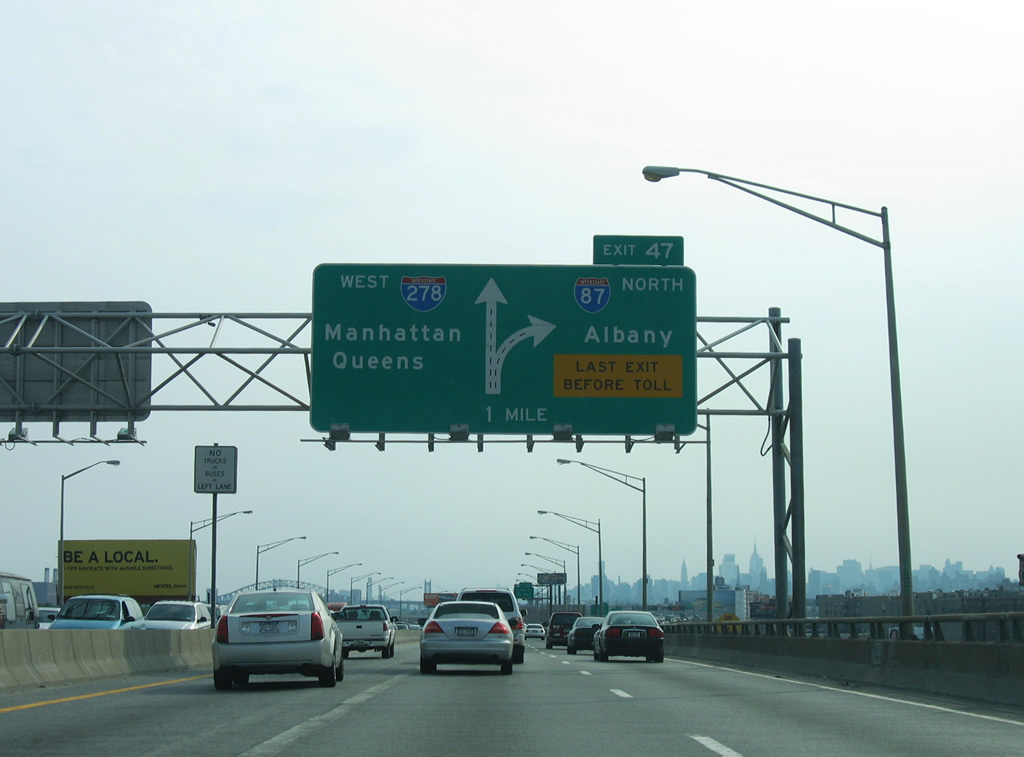
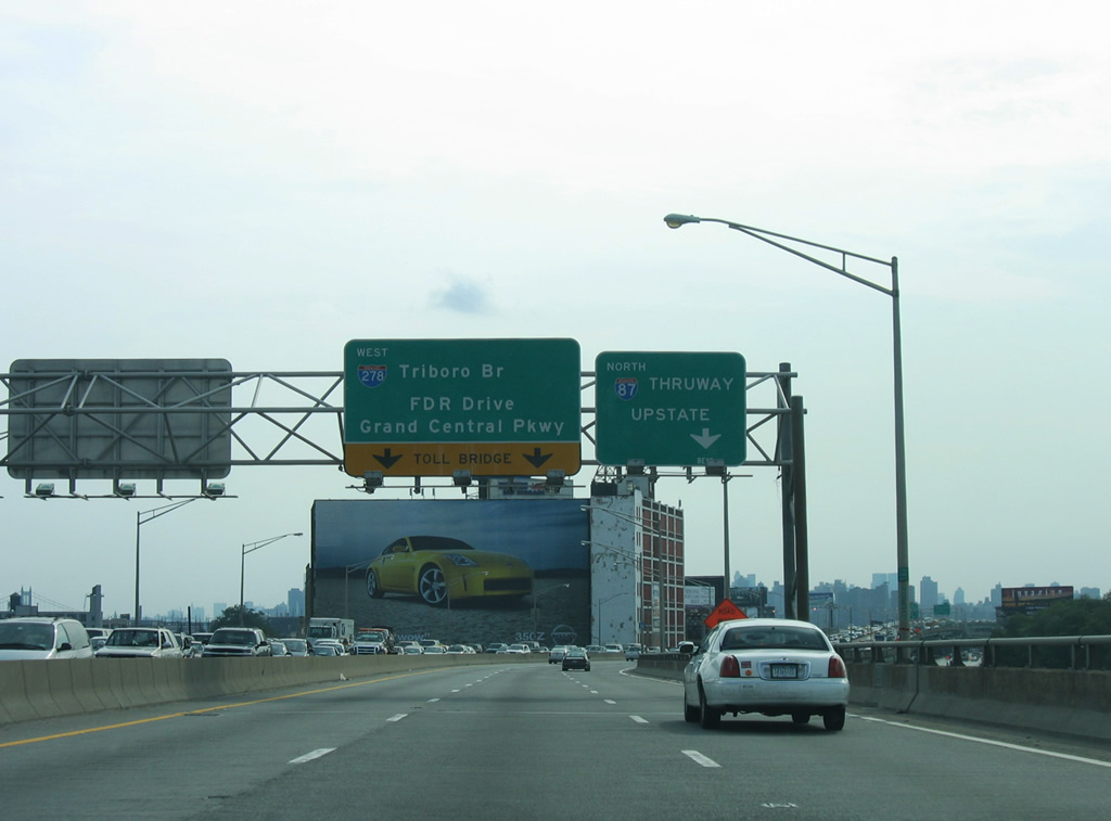
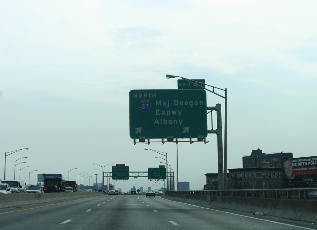
| Interstate 278 (Bruckner Expressway) advances west to the exchange with both I-87 north (Major Deegan Expressway) and the Robert F. Kennedy (Triborough) Bridge south. Older guide signs for I-87 used Upstate as the control point. 08/29/05 |
|
| Interstate 87 follows the Major Deegan Expressway northward through the Bronx to the West Chester County line. There I-87 transitions into the tolled Thomas E. Dewey New York Thruway northward to I-287 (Cross-West Chester Expressway). 08/29/05 |
|
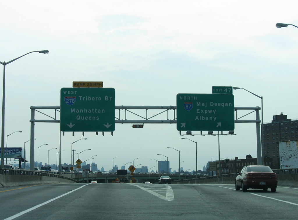
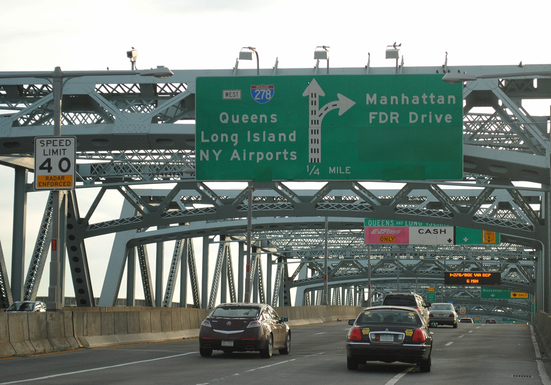
| Beyond Exit 47 for Interstate 87 (Deegan Expressway), I-278 turns south onto the tolled RFK (Triborough) Bridge. I-278 crosses Randalls Island, Wards Island and the East River between the Bronx and Queens. A separate bridge joins I-278 with Franklin D. Roosevelt Drive (FDR Drive) in Manhattan. 08/29/05 |
|
| Lowering through the directional T interchange (Exit 47) with Interstate 87 north on I-278 west. The Bruckner Expressway ends as Bruckner Boulevard travels through a tunnel en route to Willis Avenue and the 3rd Avenue Bridge. 08/29/05 |
|
| Traffic from the end of Interstate 87 turns southwest over Bruckner Boulevard to join I-278 at the foot of the fixed-truss bridge over Bronx Kill. 11/26/11 |
|
| The Robert F. Kennedy Bridge system consists of I-278 joining the Bronx and Queens with a suspension bridge over Hell Gate on the East River and a lift bridge over the Harlem River connecting Randalls Island with Manhattan Island.
Construction in 2011 added a new exit ramp to Randall and Wards Island from I-278 west. Prior to that, traffic bound for the recreational areas of the islands used the westbound ramp from the Harlem River bridge. 11/26/11 |
|
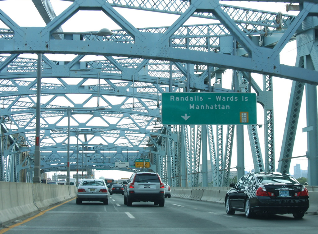
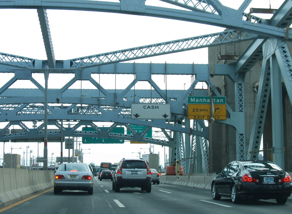
| Midway across the Robert F. Kennedy Bridge over Bronx Kill, I-278 enters a notch of New York County. Two lanes depart westward to Harlem and Franklin D. Roosevelt (FDR) Drive, a freeway straddling the west banks of the Harlem River along Manhattan Island. Sign changes made by 2011 on this panel greened out Randalls - Wards Islands. 08/29/05 |
|
| Beyond the end of the fixed-truss bridge portion of the RFK Bridge, I-278 enters a directional interchange with the Harlem leg of the bridge system. The westbound bridge defaults onto Martin Luther King Jr., Boulevard (125th Street) at Harlem. 08/29/05 |
|
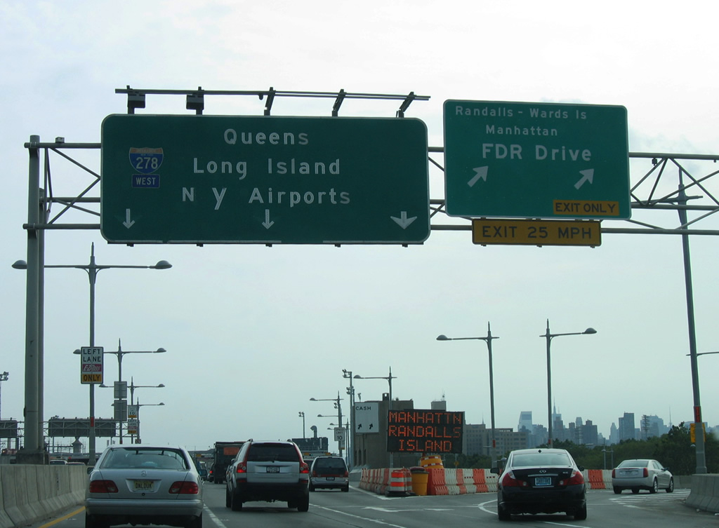
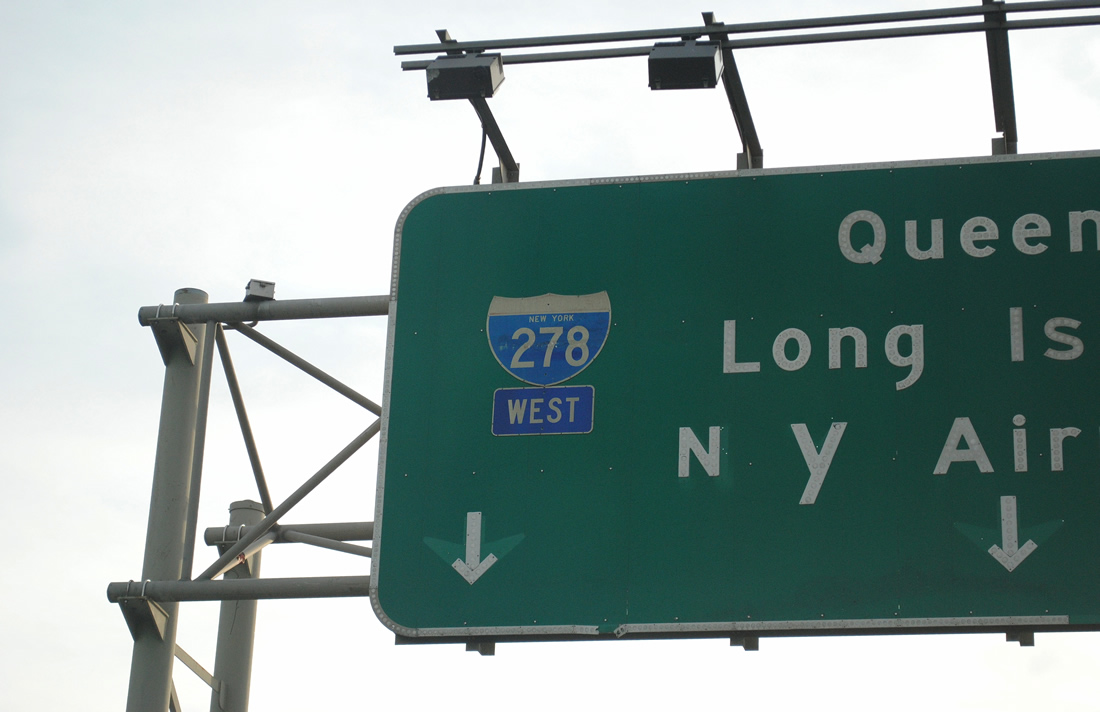
| Emerging over Randalls Island, Interstate 278 splits with the westbound ramp to Manhattan and FDR Drive. An original button copy sign directed through traffic southward to Queens with connections to La Guardia and JFK International Airports via Grand Central Parkway. 08/29/05 |
|
| A rare state named shield for Interstate 278 appeared on the overhead for the Triborough (Robert F. Kennedy) Bridge southbound. This was the last remaining state named shield on the mainline in 2011. 11/26/11 |
|
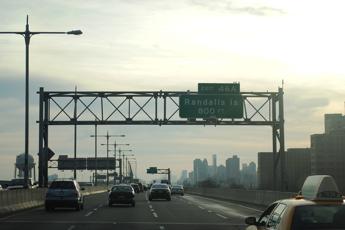
| Continuing south beyond the forner main line toll plaza, Interstate 278 advances to Exit 46 A for Randalls Island. 11/26/11 |
|
| The southbound Triborough (Robert F. Kennedy) Bridge before reconstruction expanded the viaduct and added a new off-ramp to Wards Island. Original light fixtures were retained during the rebuild, but low-sodium lights fixtures were replaced. 08/29/05 |
|
| Exit 46 A leaves Interstate 278 west ahead of the southeastern turn onto the Hell Gate suspension bridge to Queens. 11/26/11 |
|
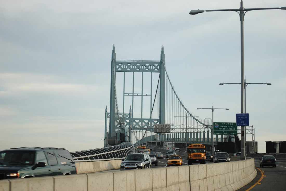
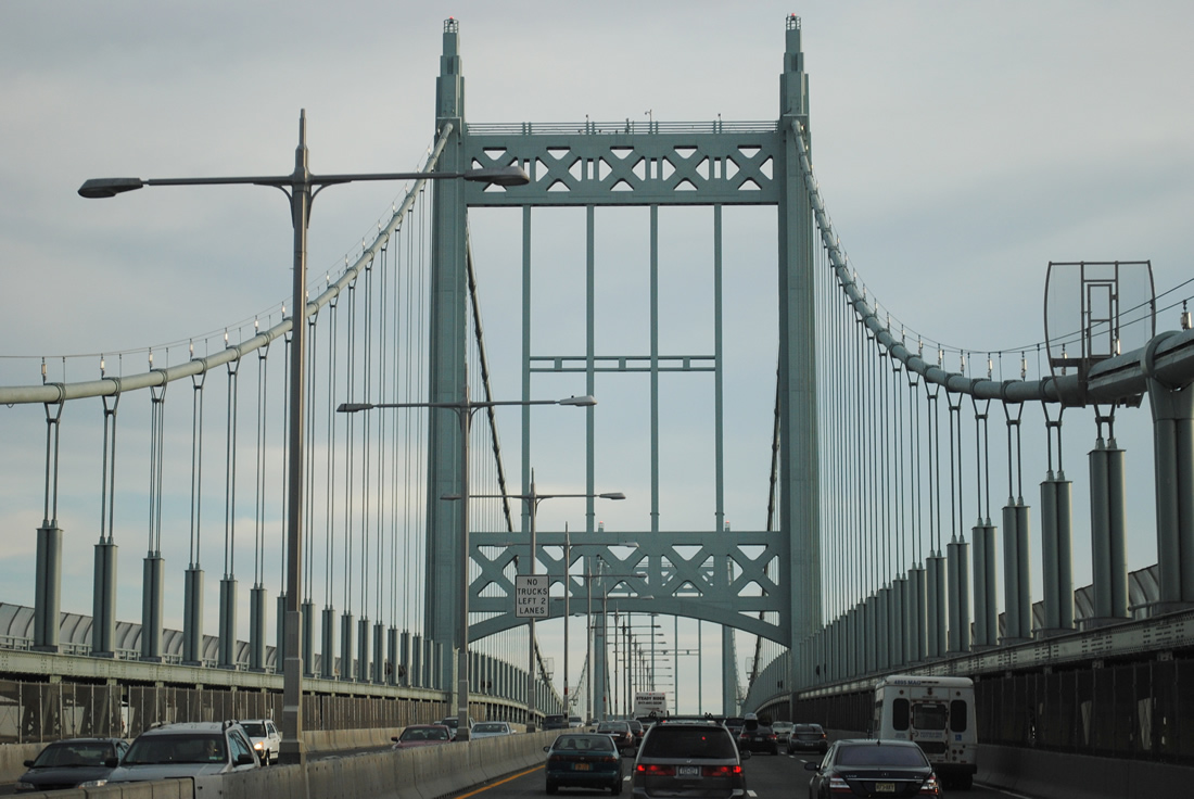
| Opened on July 11, 1936 at a cost of $37 million, the Triborough Bridge system was envisioned by New York City Parks Commissioner Robert Moses to connect residents of Manhattan with the parks system of Long Island. The 1,380 foot long span travels 135 feet above the East River.1 11/26/11 |
|
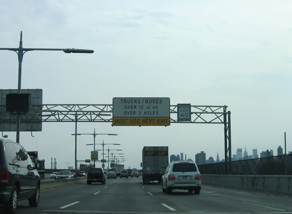
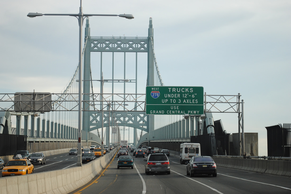
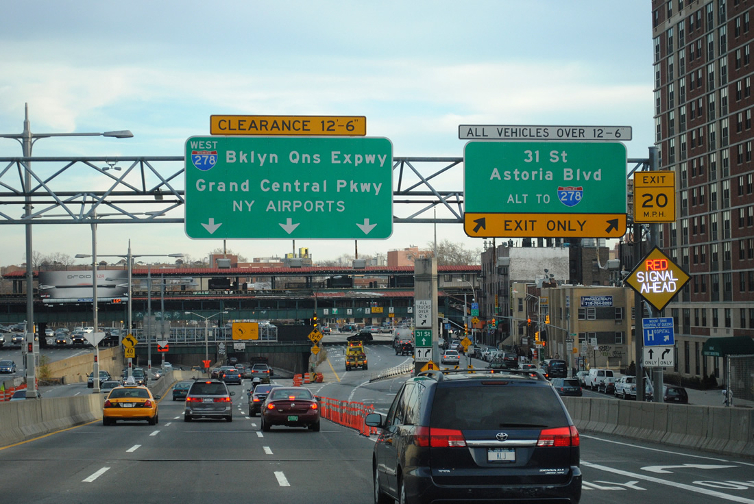
| I-278 transitions from the RFK. Kennedy Bridge onto the western leg of Grand Central Parkway (GCP) in northwest Queens. An overhead sign advises drivers of vehicles below 12'6" to remain along I-278 west onto the GCP, while omitting the mandate of those exceeding that height to depart at Hoyt Boulevard exit beyond the bridge. 11/26/11 |
|
| The suspension bridge over the East River carries eight overall lanes of traffic from Wards Island to Astoria and Queens. 11/26/11 |
|
| Lowering into Queens, I-278 next meets 31st Street at a diamond interchange with 31st Street. A slip ramp joins adjacent Hoyt Avenue eastbound at 29th Street. Hoyt Avenue converges with Astoria Boulevard in two blocks to form the frontage street system of I-278 along the GCP. All trucks exceeding the height restriction are directed onto the parallel boulevard. 11/26/11 |
|
| The right lane defaults onto Hoyt Avenue as Interstate 278 enters Grand Central Parkway. 31st Street leads southwest to NY 25A (Northern Boulevard) at Long Island City and northeast to Steinway. 11/26/11 |
Page Updated 02-09-2012.

 West
West