|
| Heavy traffic is a regular occurrence along Interstate 278 at Gowanus Canal near Red Hook. 08/29/05 |
|
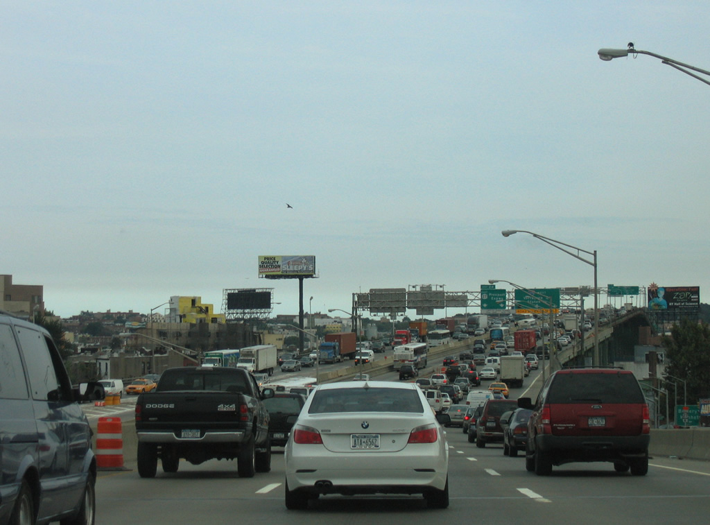
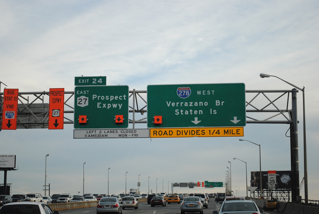
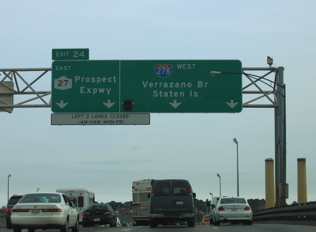
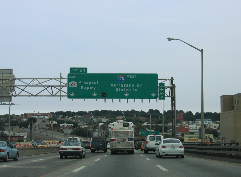
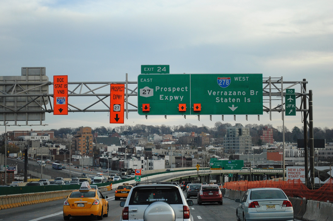
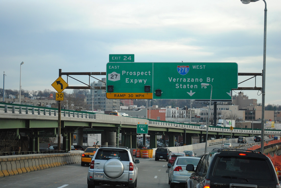
| Interstate 278 advances south to a directional interchange (Exit 24) with NY 27 beyond Gowanus Canal. Beginning at Exit 24, NY 27 follows the Prospect Expressway southeast to Caton Avenue (Exit 5) at Kensington. 11/26/11 |
|
| NY 27 travels 122.28 miles from Exit 24 to Montauk Point State Park in eastern Long Island. The state route navigates along Caton Avenue east from Kensington to Flatbush and Linden Boulevard. Linden Boulevard carries NY 27 to East Flatbush and Ozone Park. 08/29/05 |
|
| Results of the Gowanus Expressway Repair and Interim Deck Replacement Project are evident along Interstate 278 (Gowanus Expressway) westbound at the Prospect Expressway interchange. Work between 2008 and 2012 focused on replacing the bridge deck of the Gowanus Expressway at NY 27. Future work will widen the viaduct. 08/29/05, 11/26/11 |
|
| Two lanes depart at Left Exit 24 for the Prospect Expressway as I-278 turns southwesterly. The Prospect Expressway spurs southeast onto Ocean Parkway at Church Avenue. Separate plans in the 1960s called for extending the expressway southward to Coney Island or Gil Hodges Memorial Bridge. 11/26/11 |
|
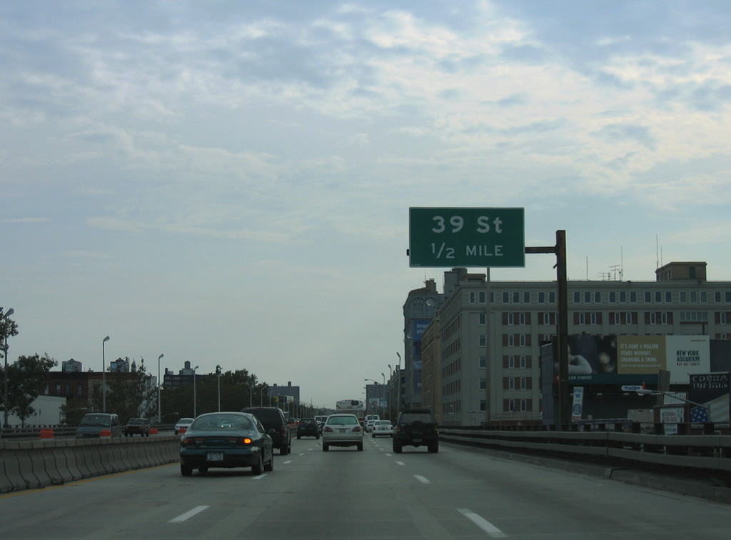
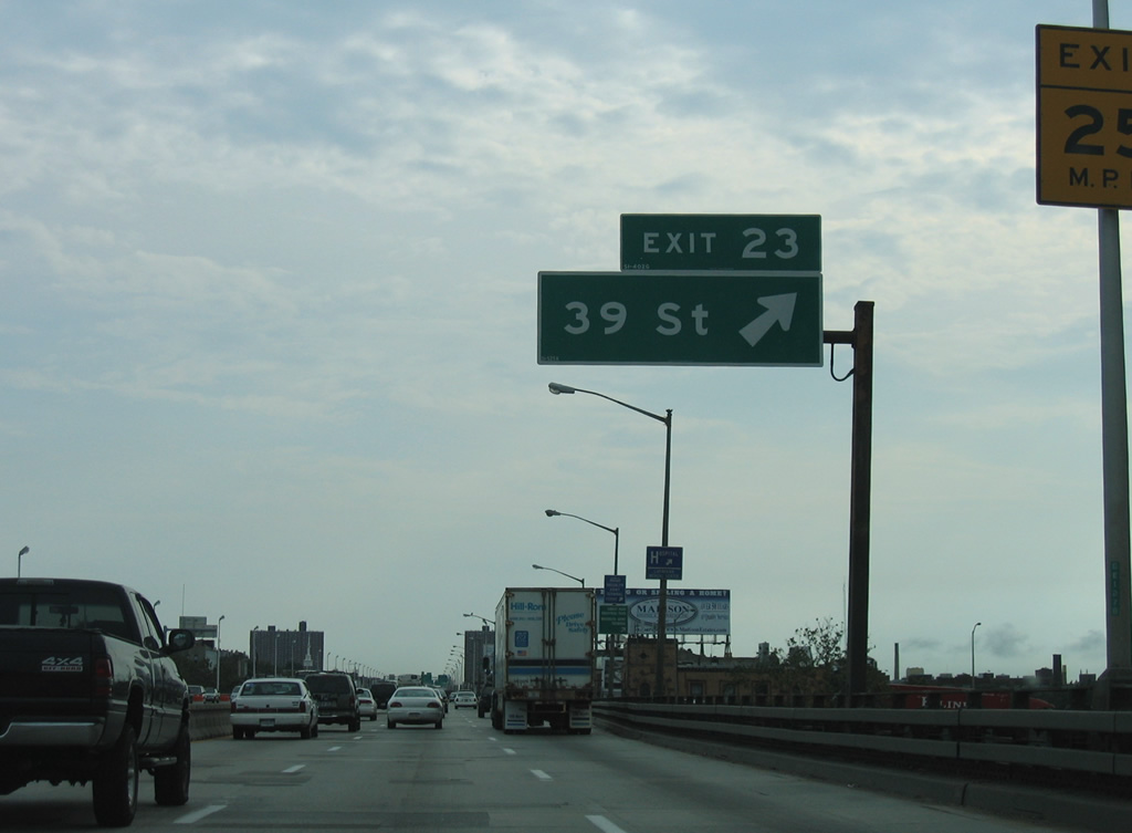
| Elevated above 3rd Avenue, Interstate 278 continues a half mile to Exit 23 for 39th Street. 08/29/05 |
|
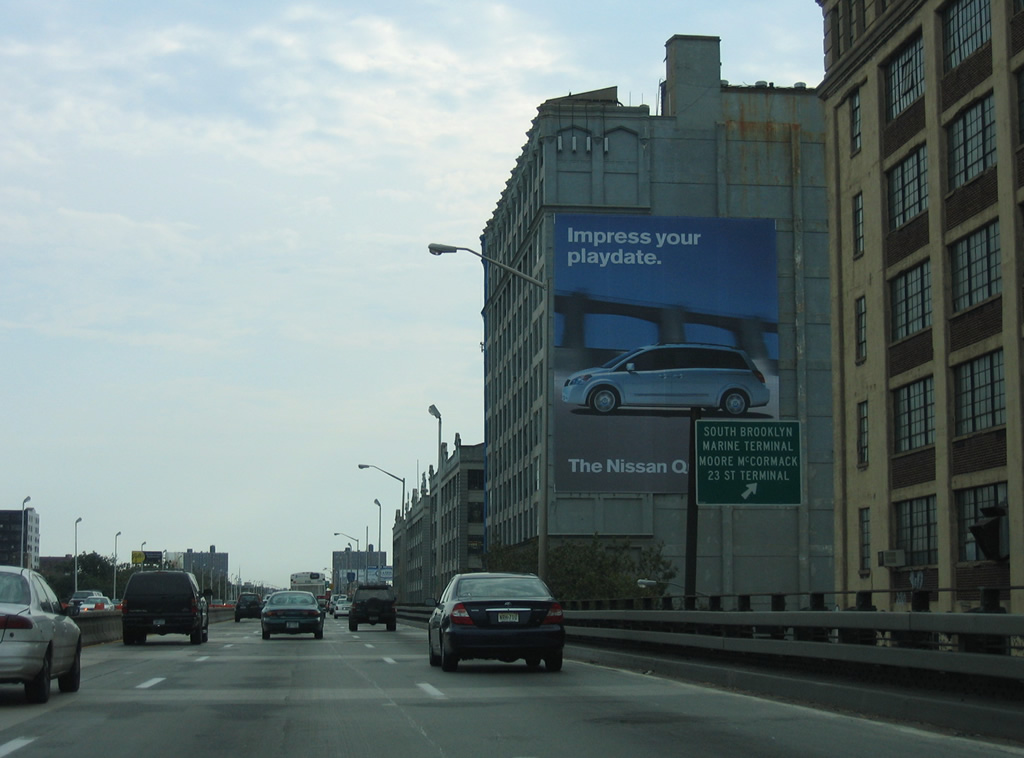
| Exit 23 connects I-278 with the South Brooklyn Marine Terminal and the Moore McCormack 23rd Street Terminal. 08/29/05 |
|
| Exit 23 leaves Interstate 278 (Gowanus Expressway) west and turns 90 degrees to join 39th Street at parallel 2nd Avenue. 08/29/05 |
|
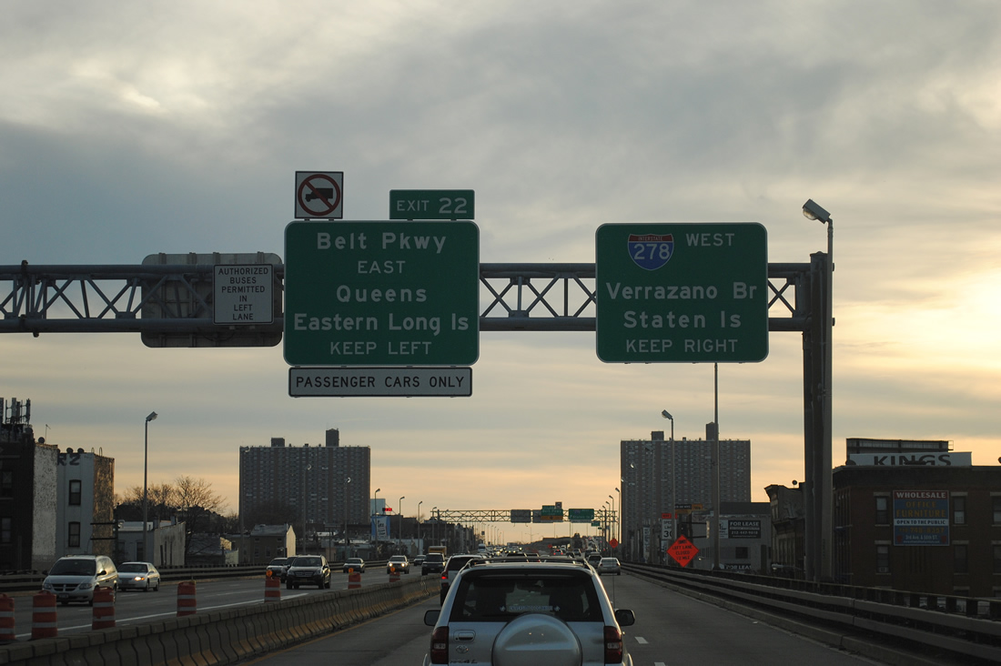
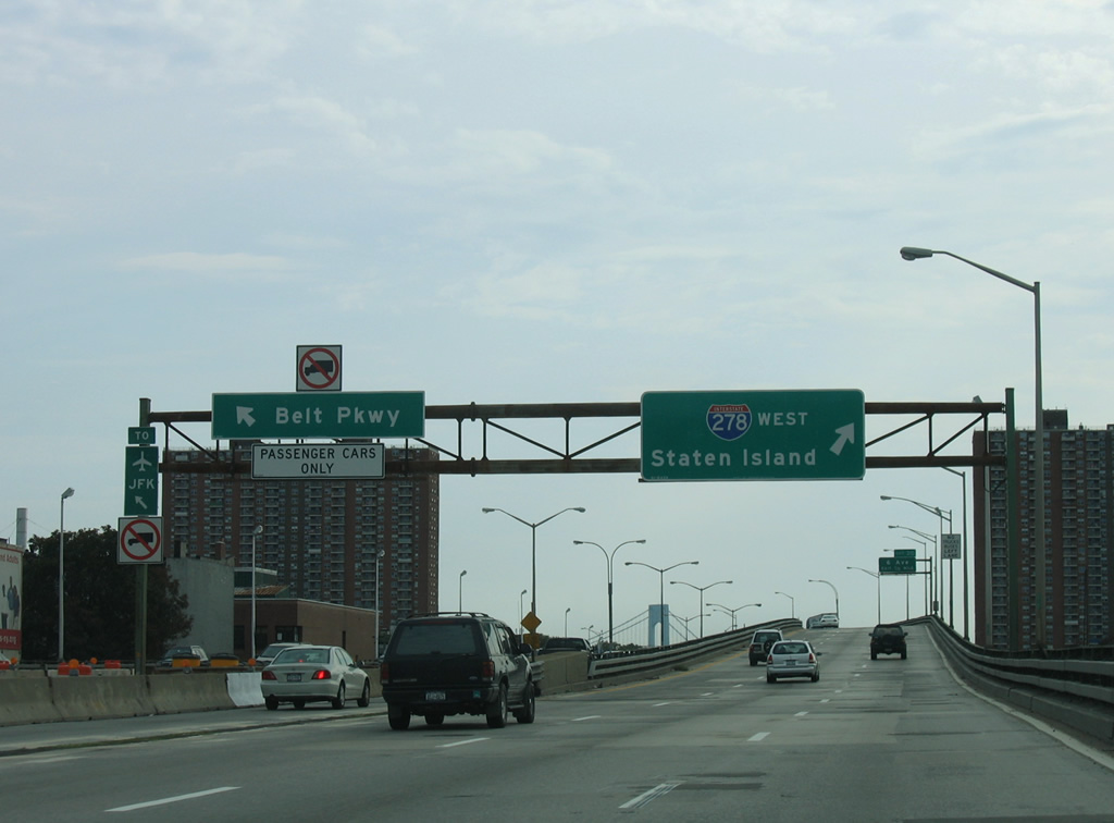
| Progressing south to Bay Ridge, I-278 westbound next meets Shore Parkway at Exit 22. Shore Parkway comprises the western leg of the Belt Parkway system encircling Brooklyn and Queens. 08/29/05 |
|
| Interstate 278 loops east from Exit 22 toward the Verrazzano-Narrows Bridge while Shore Parkway loops west along The Narrows to Fort Hamilton. Belt Parkway is open to passenger vehicles only, so trucks must remain along I-278 (Gowanus Expressway) west. 11/26/11 |
|
| Left Exit 22 is a wye interchange with Shore (Belt) Parkway south. Belt Parkway angles southeast toward Coney Island before turning northward to John F. Kennedy International Airport (JFK) and Laurelton near the Nassau County line. Connections with Southern State Parkway and I-495 lead motorists toward eastern Long Island.
This sign bridge was removed by 2011. 08/29/05 |
|
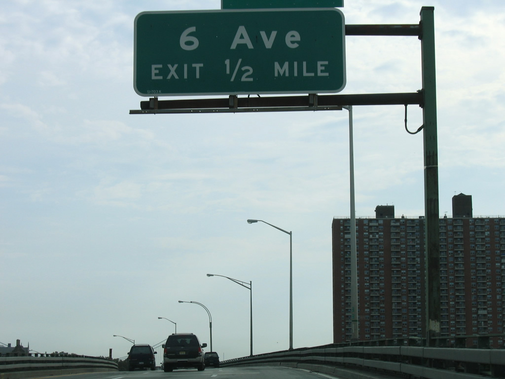
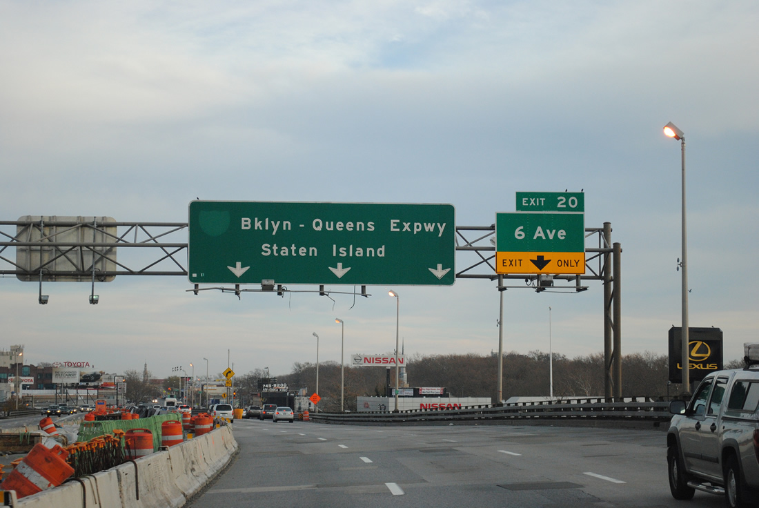
| Curving southeasterly, I-278 proceeds a half mile to the split diamond interchange (Exit 20) for 6th Avenue and Bay Ridge. 08/29/05 |
|
| Interstate 278 maintains three through lanes at Exit 20 to 6th Avenue. 6th Avenue heads north from Bay Ridge to Sunset Park and south to Fort Hamilton Parkway. 65th Street joins the Gowanus Expressway with Borough Park and New Utrecht to the southeast. 11/26/11 |
|
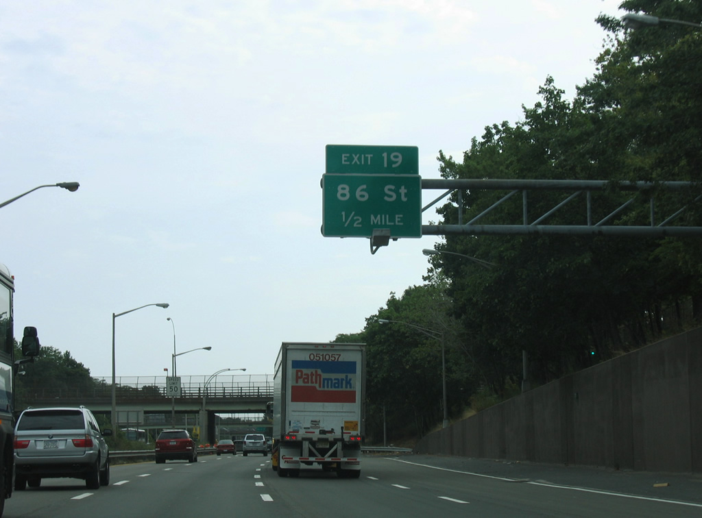
| Facing south again, Interstate 278 lowers below grade alongside 7th Avenue to Exit 19 for 86th Street. 08/29/05 |
|
| Bay Ridge Parkway passes over Interstate 278 ahead of Exit 19 to Gatling Place. Gatling Place overtakes 7th Avenue as the frontage street to 86th and 92nd Streets at Fort Hamilton. 08/29/05 |
|
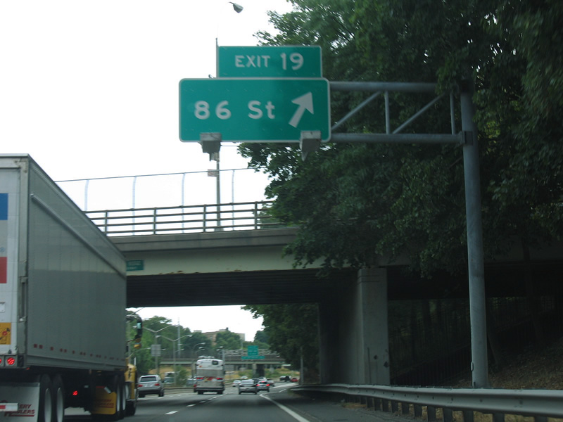
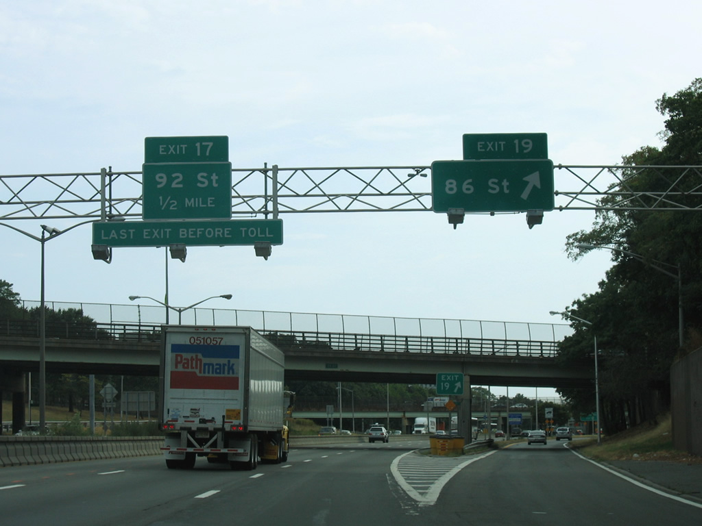
| 86th Street travels west from Exit 19 to Shore Road through Fort Hamilton and east to Dyker Heights and Bath Beach. Exit 17 quickly follows onto Gatling Place as well in a half mile. 08/29/05 |
|
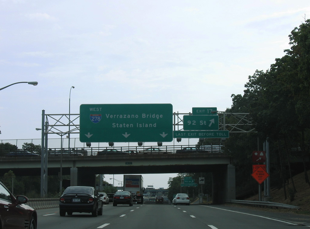
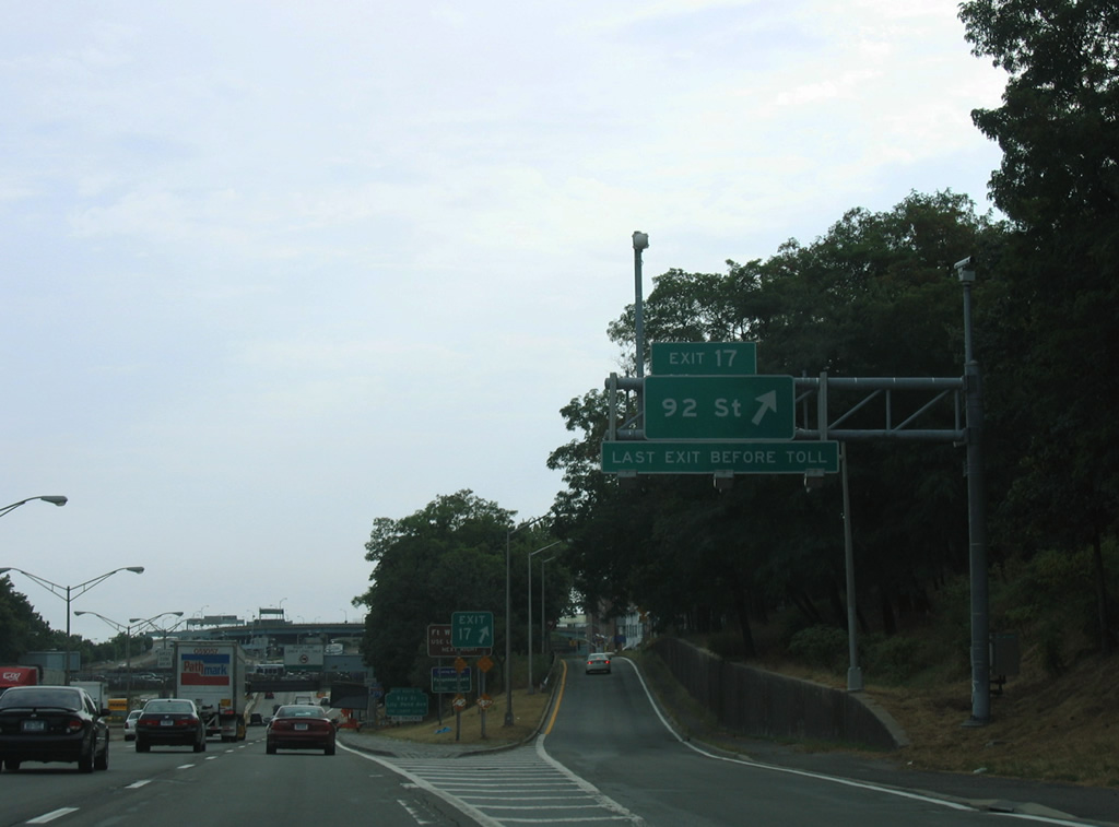
| Exit 17 is the last in Brooklyn from Interstate 278 west before the Gowanus Expressway reaches the tolled Verrazzano-Narrows Bridge. A diamond interchange connects I-278 with 92nd Street, three blocks west of 7th Avenue and Dyker Beach Golf Course. 08/29/05 |
|
| 92nd Street continues west from Exit 17 and Gatling Place to Fort Hamilton Parkway and 3rd Avenue. 08/29/05 |
|
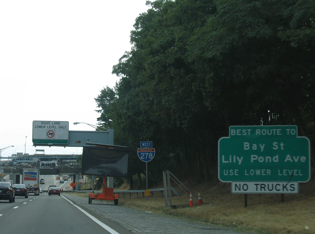
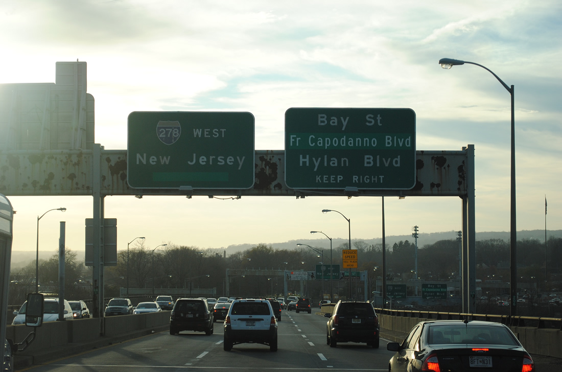
| I-278 sinks toward the Verrazzano-Narrows Bridge separation into upper and lower levels. Exit 15 to Lily Pond Avenue south and School Street east to Bay Street departs just south of lower level end. 08/29/05 |
|
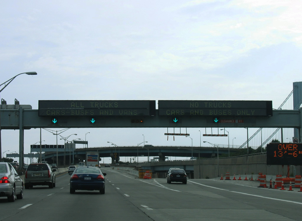
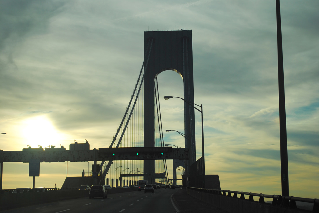
| Continuing south of 92nd Street, traffic on I-278 partitions into the upper (through) level and lower (local) level of the Verrazzano-Narrows Bridge. Trucks must use the upper level. 11/26/11 |
|
| Loop ramps pass over Interstate 278 to add traffic from Belt Parkway west as the lower level roadway diverges from the freeway mainline. 08/29/05 |
|
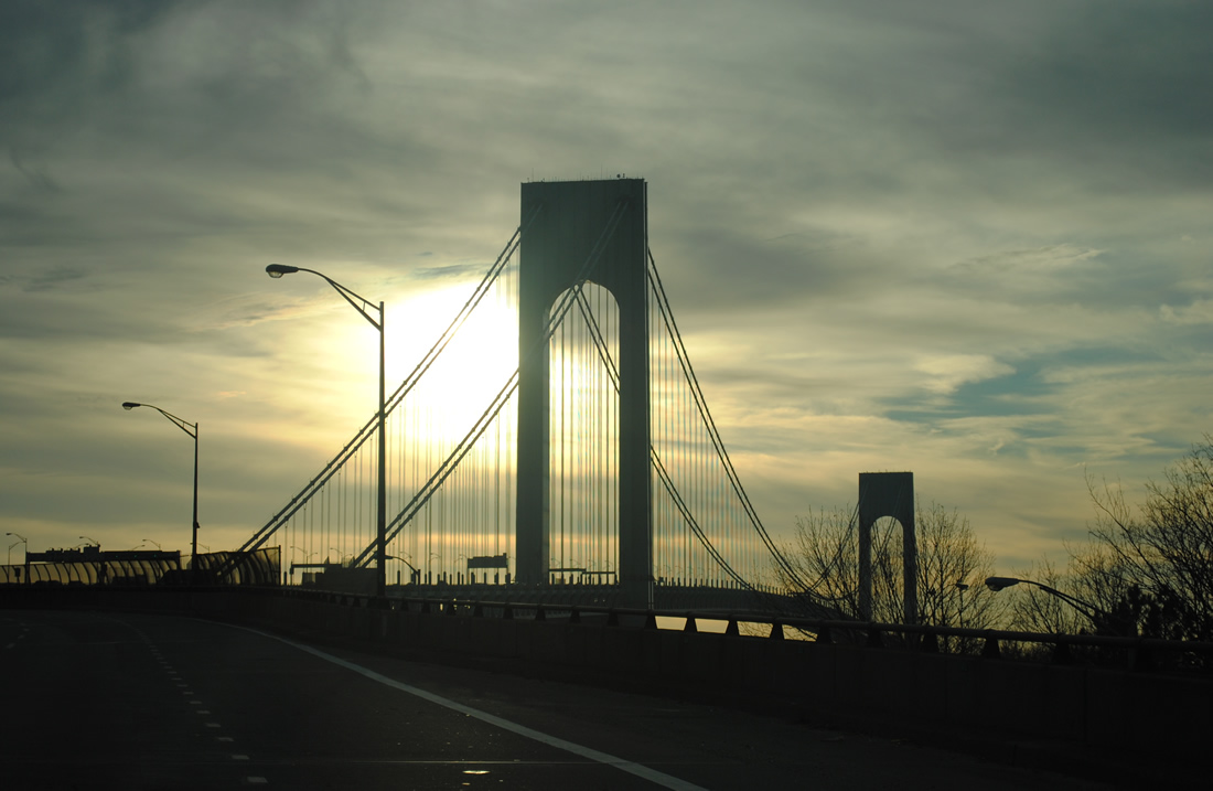
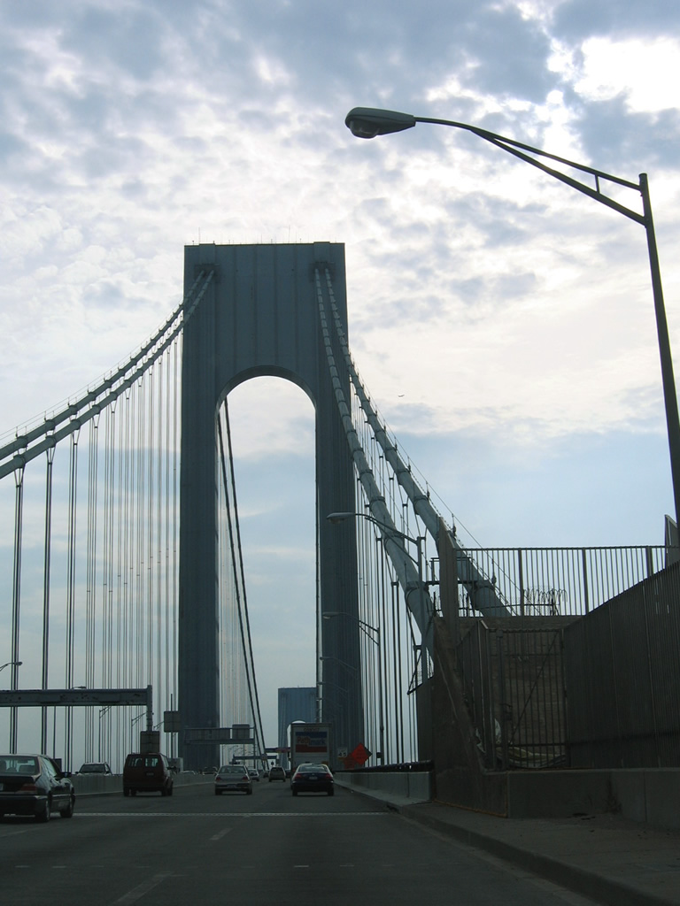
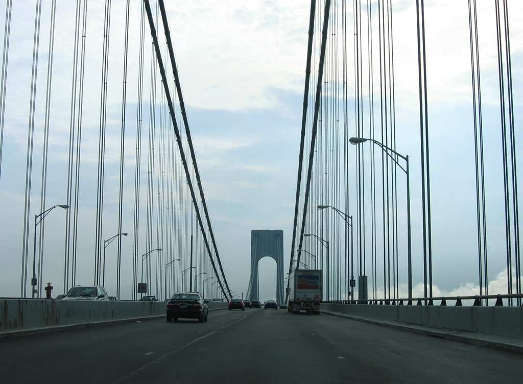
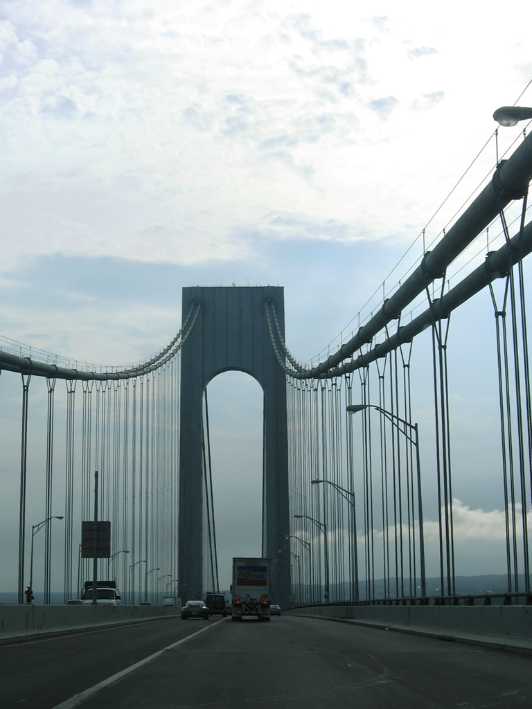
| Accommodating 12 overall lanes between Fort Hamilton and Staten Island, the Verrazano-Narrows Bridge spans The Narrows between Lower and Upper New York Bay. 11/26/11 |
|
| Surpassing the Golden Gate Bridge as the largest suspension bridge in the world at the time, the Verrazzano-Narrows Bridge opened to traffic on November 21, 1964.1 11/26/11, 08/29/05 |
|
| Designed by Othmar Amman, architect of the Bayonne Bridge, the Verrazzano-Narrows Bridge incorporates the curvature of the earth and seasonal expansions which result in a 12 foot difference in the bridge deck height from Summer to Winter.1 08/29/05 |
|
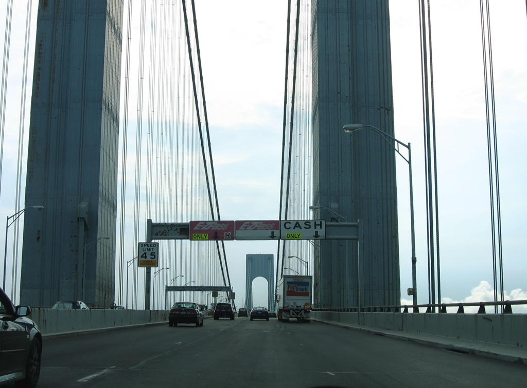
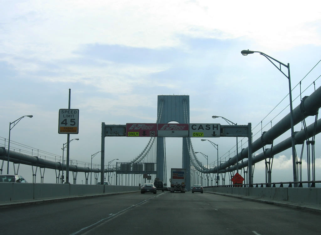
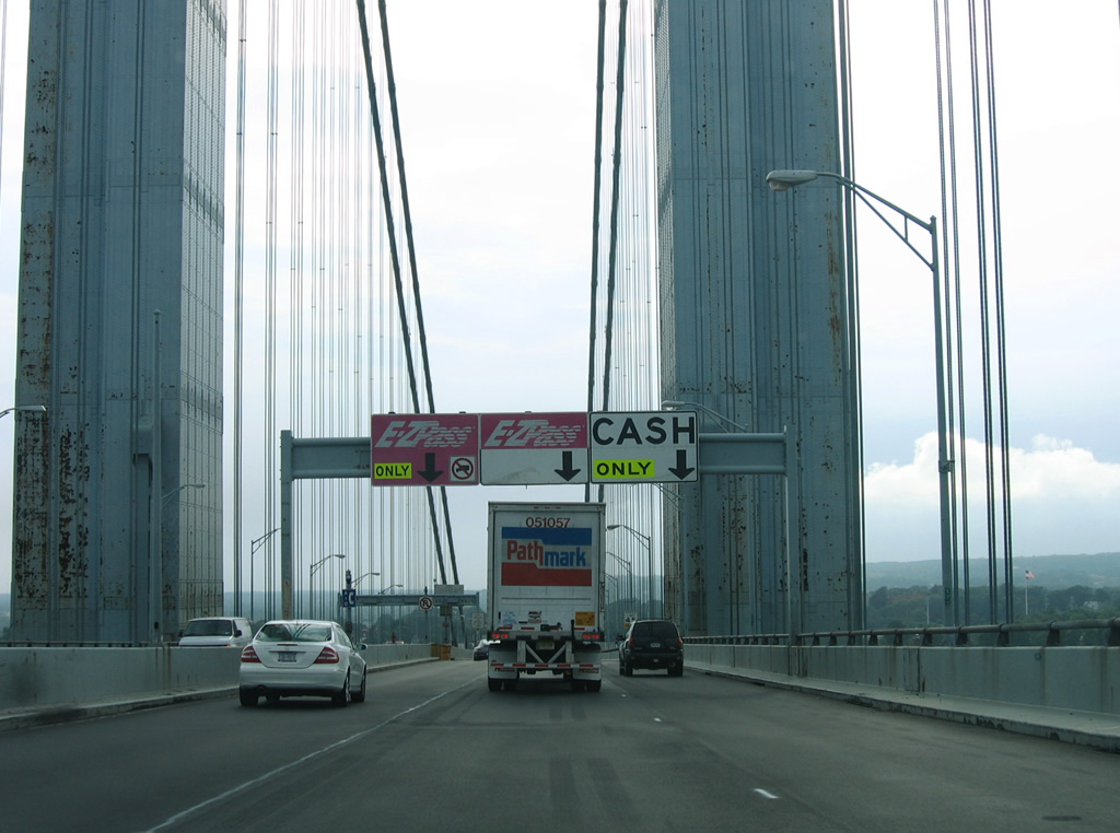
| Tolls are collected electronically with non MTA based E-Zpass holders charged a higher rate. Previously tolls for I-278 westbound varied between E-ZPass and cash transactions and peak versus off-peak hours. Increases in tolls on December 30, 2010 increased the cash toll rate then to $13.00 per passenger vehicle. 08/29/05 |
|
| The towers for the Verrazzano-Narrows Bridge top out at 693 feet. The suspension bridge and approaches measure 13,700 feet in length. The lower deck of the span was completed on June 28, 1969.2 08/29/05 |
|
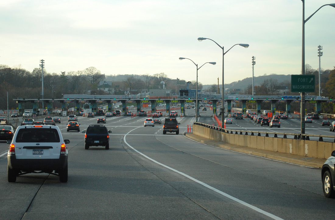
| Interstate 278 descends from 228 feet at mid span2 to Fort Wadsworth within Gateway National Recreation Area on Staten Island. The former main line toll plaza preceded the six-ramp parclo interchange with Lily Pond Avenue. 08/29/05 |
|
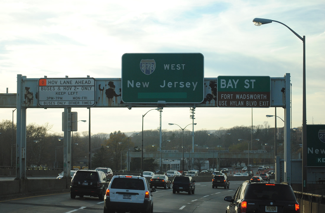
| Lily Pond Avenue becomes Father Capodanno Boulevard south ahead of Gateway National Recreation Area and South Beach. Narrows Road N forms a north side frontage street to Fingerboard Road and Hylan Boulevard. 11/26/11 |
|
| Access to the School Road exit from the lower level is not permitted from the upper level. Narrows Road N to Fingerboard Road or Hylan Boulevard connects with Bay Street to Fort Wadsworth, Rosebank, Clifton and St. George. 11/26/11 |
|
| Since removed, this was the sprawling toll plaza on I-278 west at Fort Wadsworth. Eastbound tolls were dropped in 1986, yet three of the eastbound toll booths were still in place until February 1, 2012. Others were demolished by 2011. 11/26/11 |
Page Updated 02-09-2012.

 West
West