|
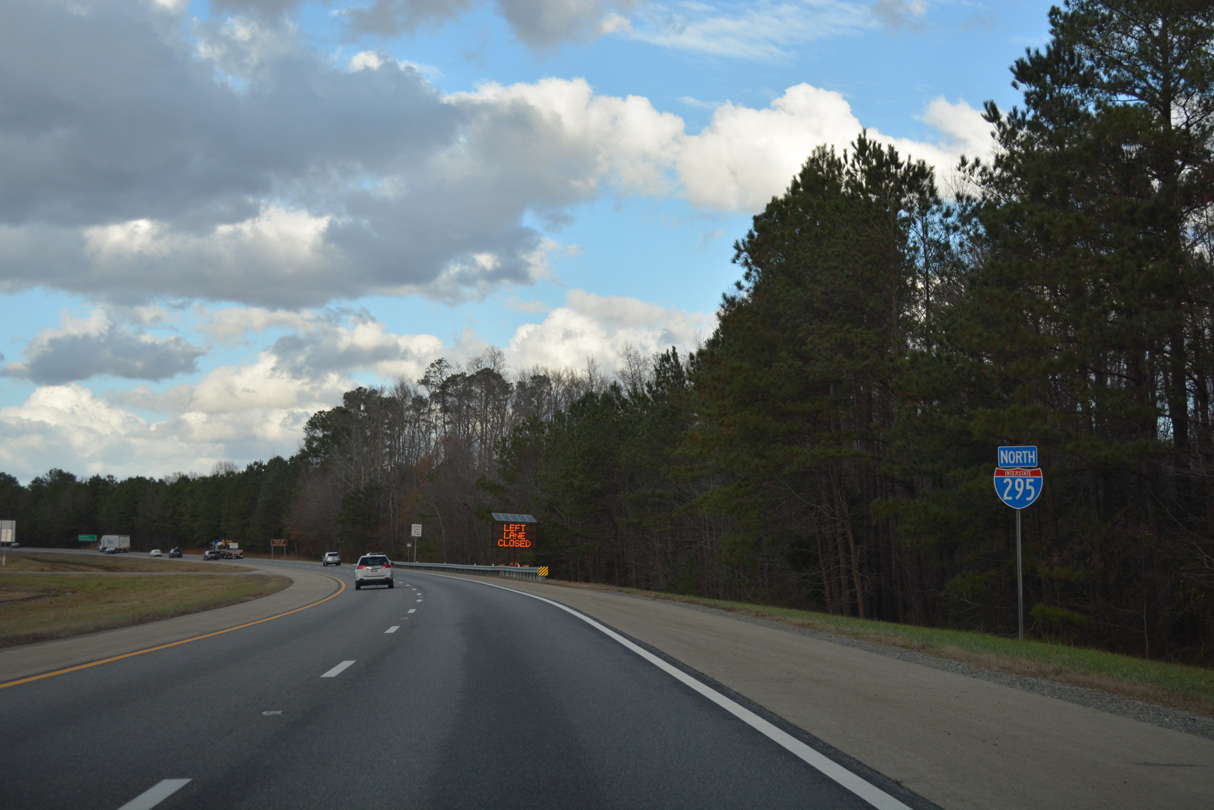
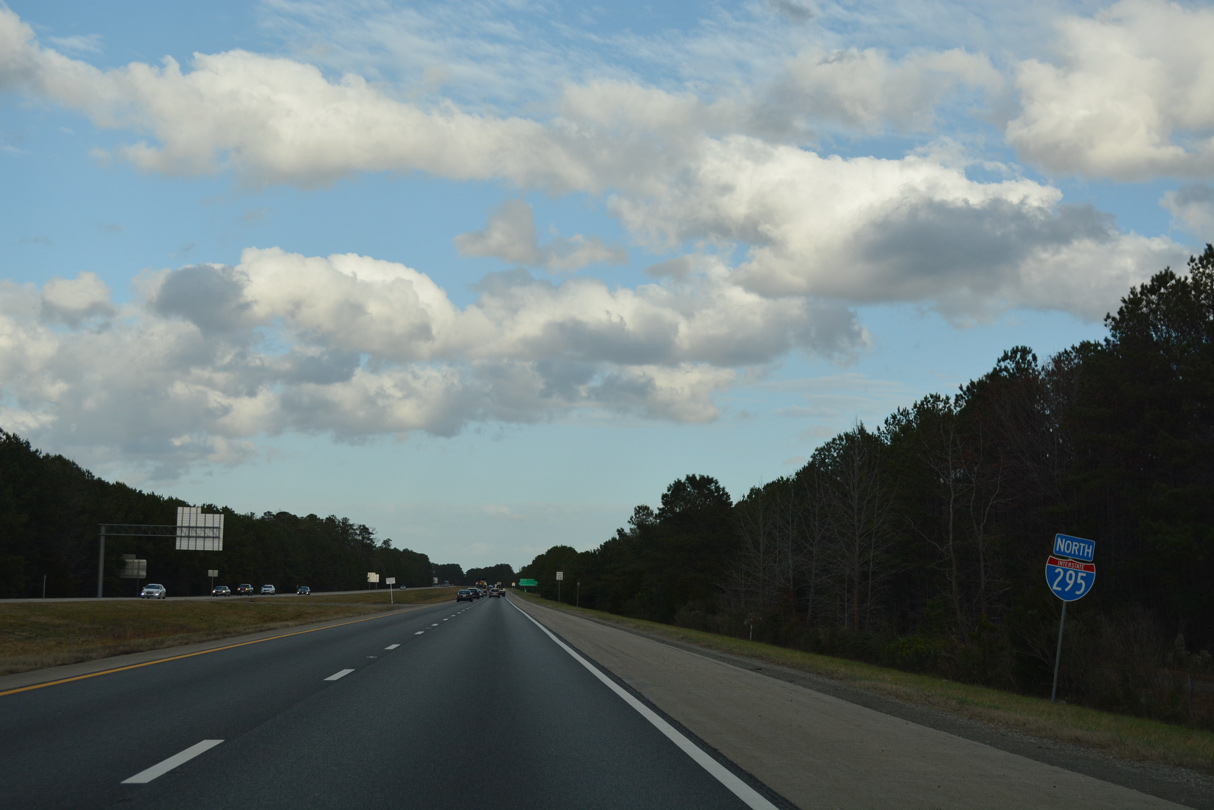
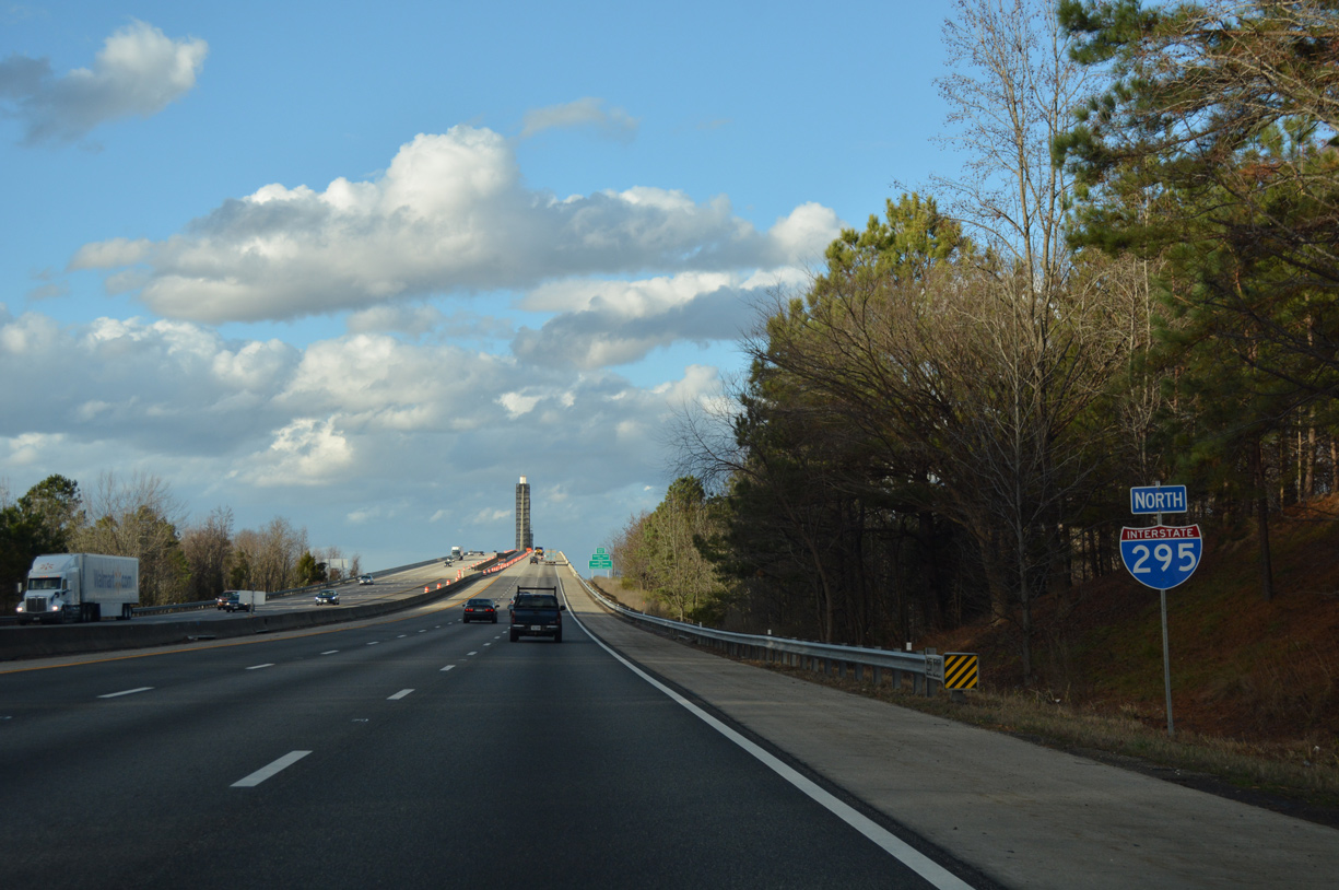
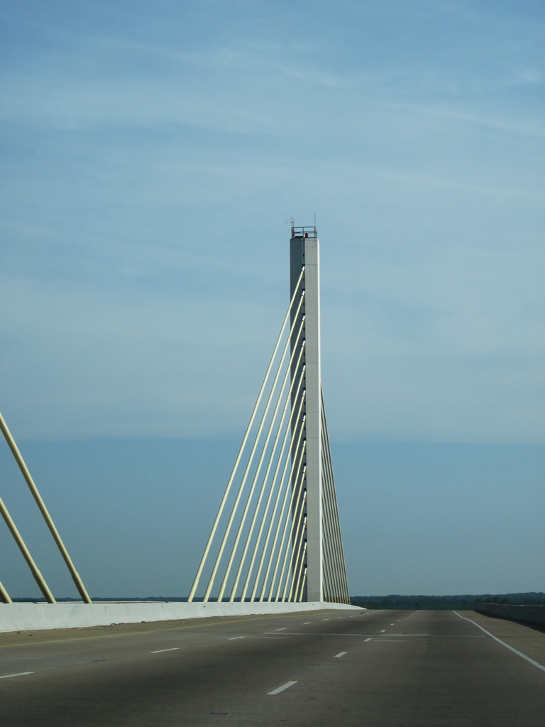
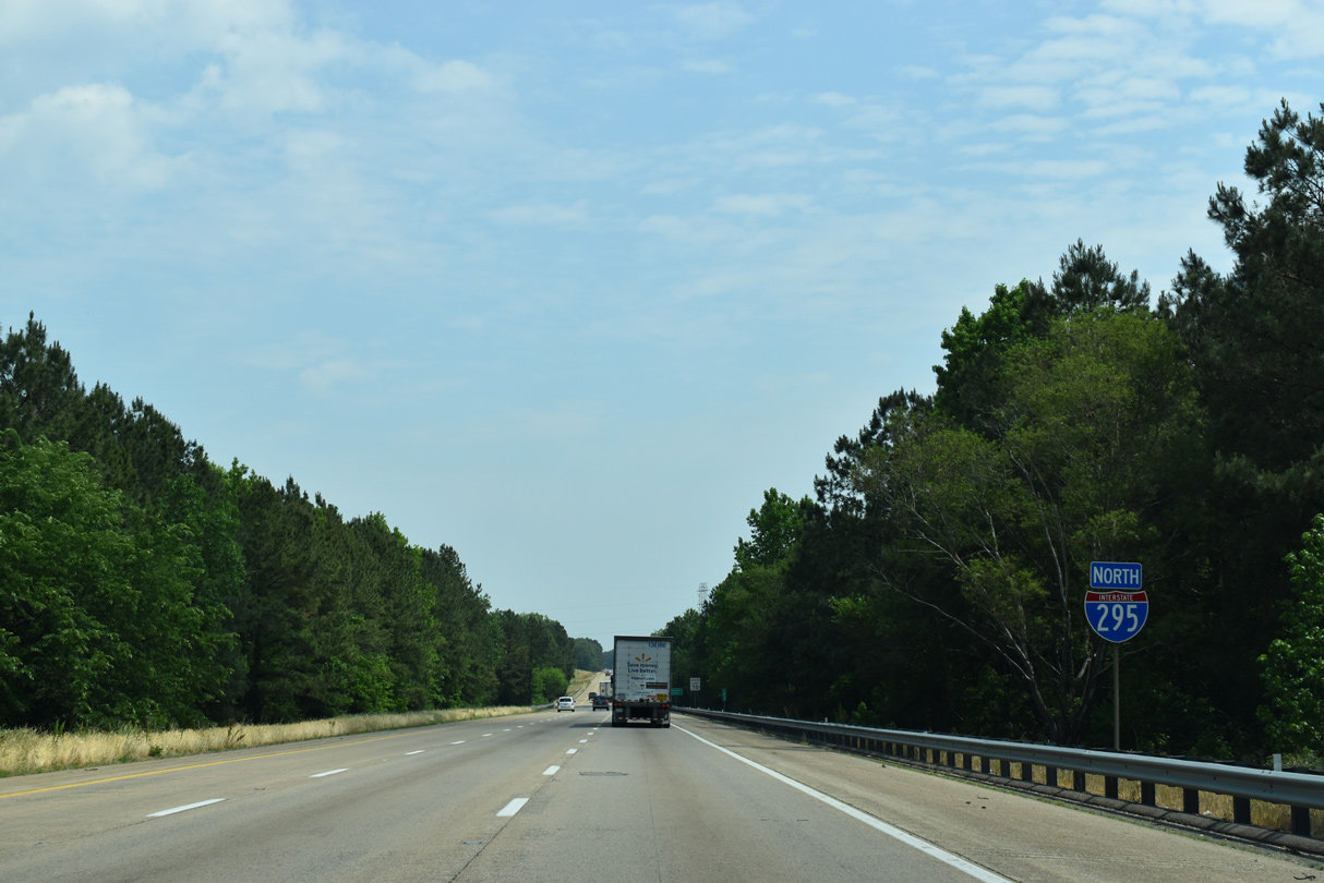
| Interstate 295 begins south of Petersburg by Second Swamp and Izaak Walton Pond. Pictured here is the first northbound reassurance marker of the 52.56 mile freeway. 12/21/18 |
|
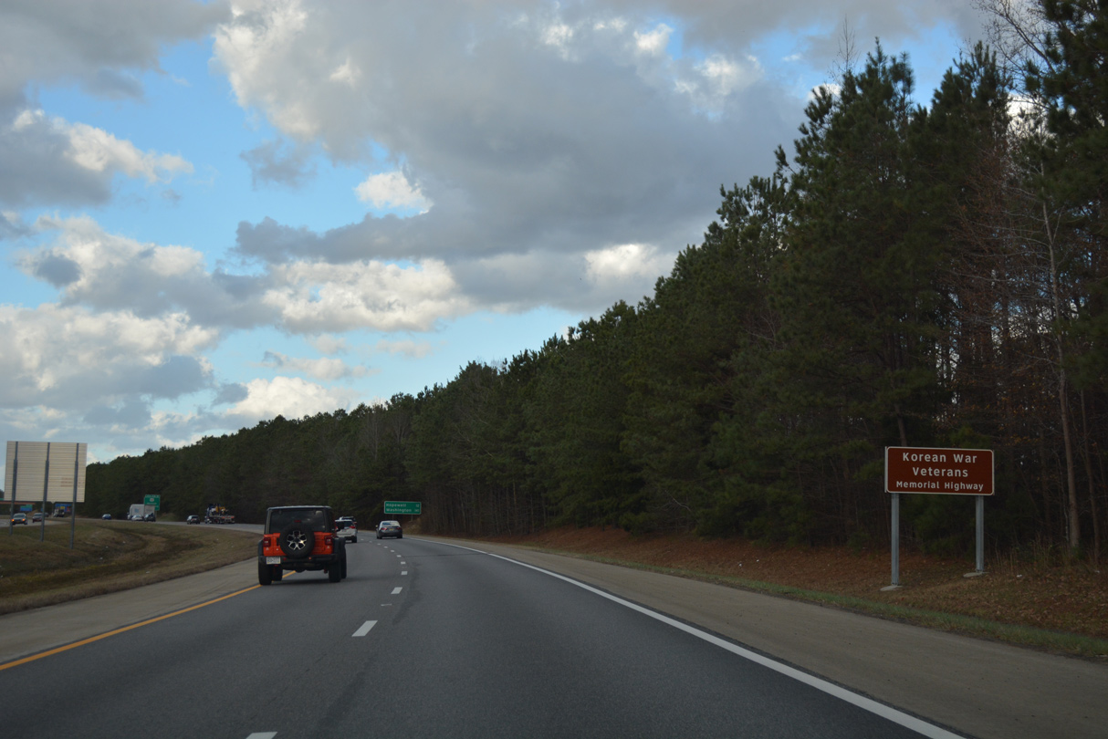
| Like Delaware State Route 1, a toll road joining Dover with Wilmington, Interstate 295 is also the Korean War Veterans Memorial Highway. 12/21/18 |
|
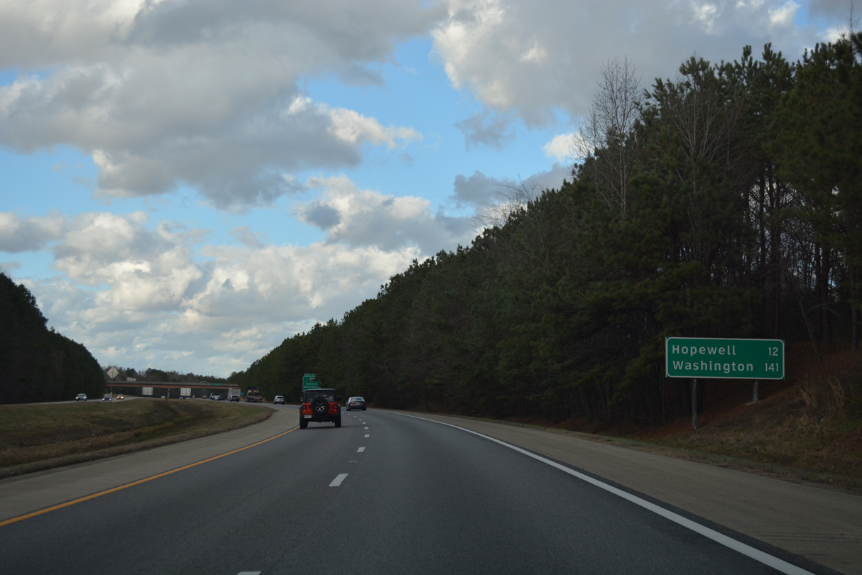
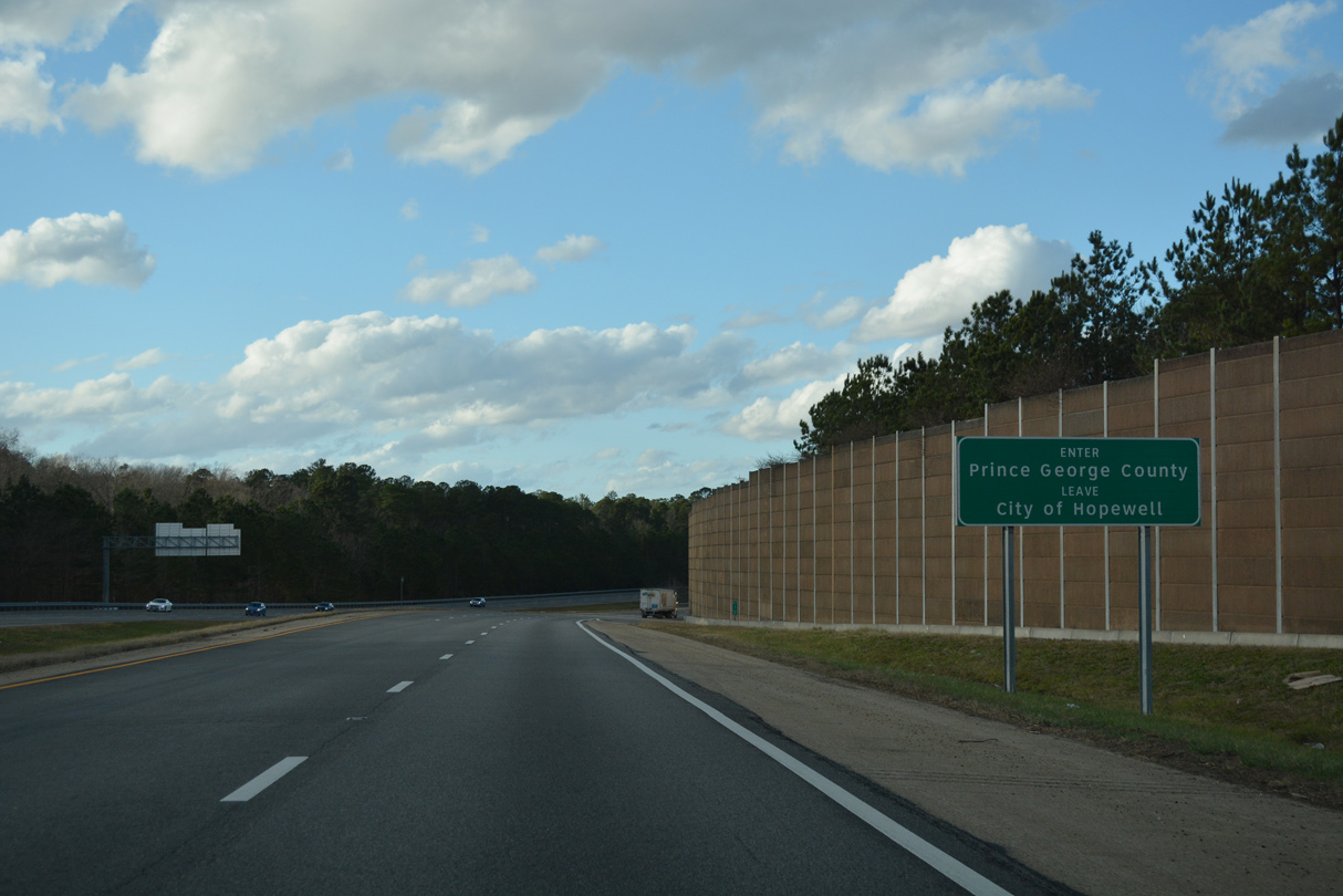
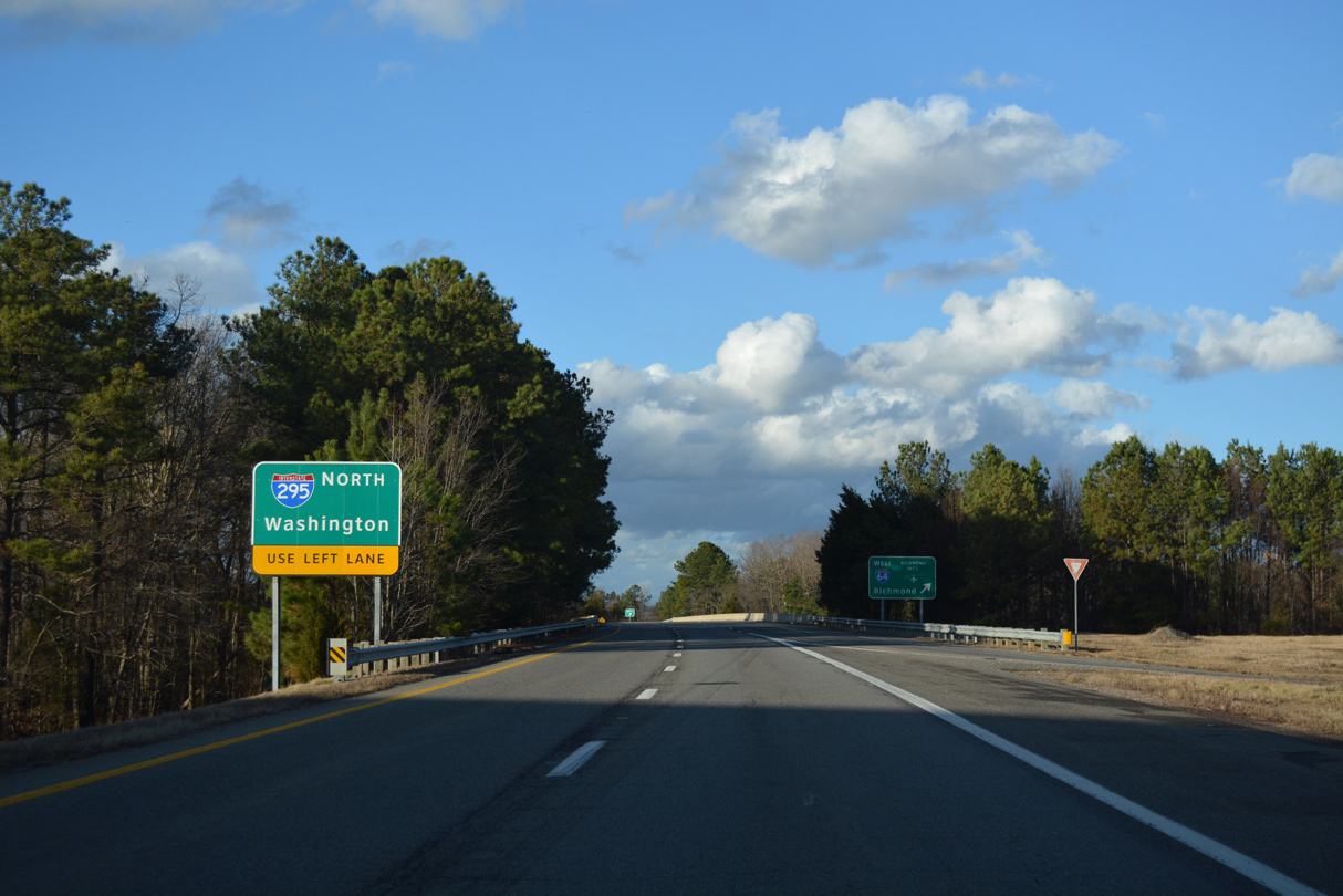
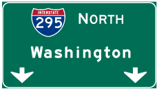
| The freeway encircles the eastern side of Petersburg on the 12 mile drive north to Hopewell. Washington is referenced on I-295 distance signs for travelers bypassing I-95 through Richmond. 12/21/18 |
|
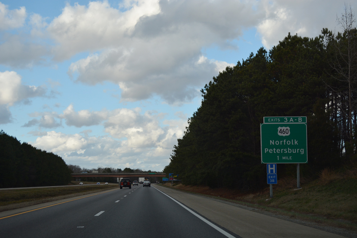
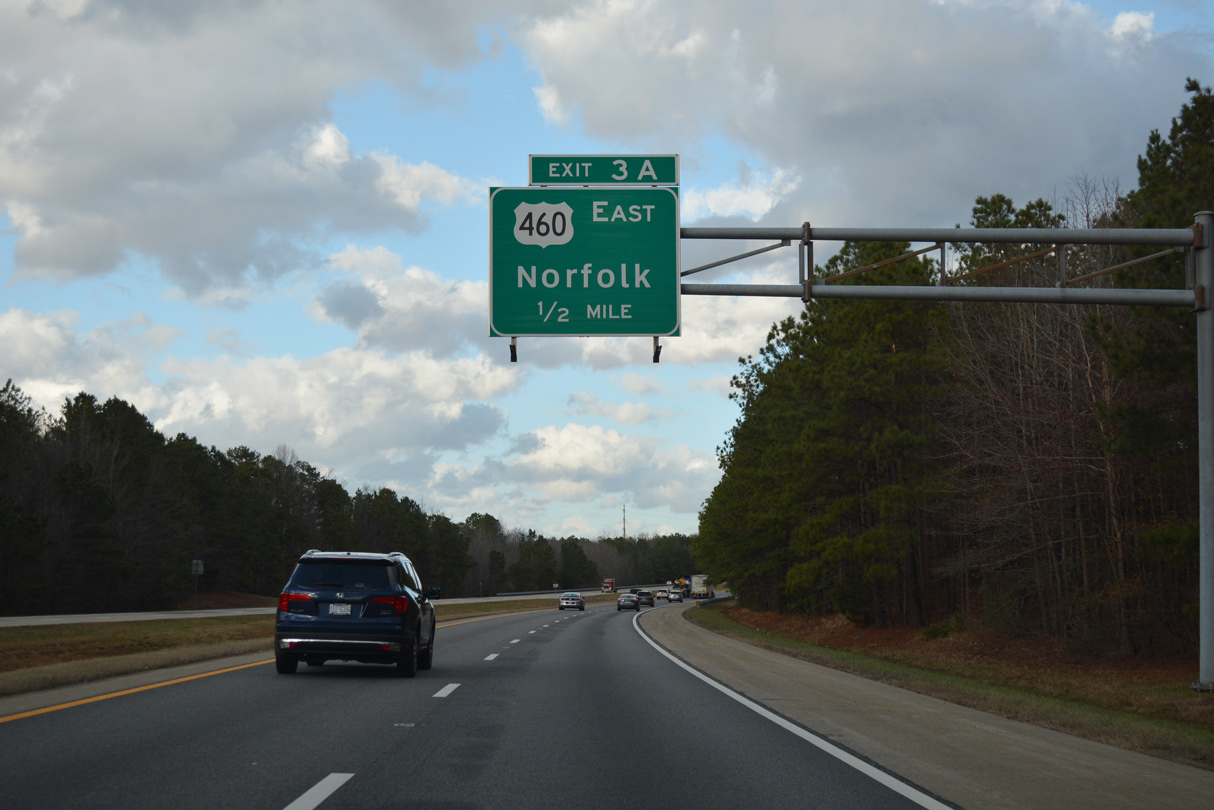
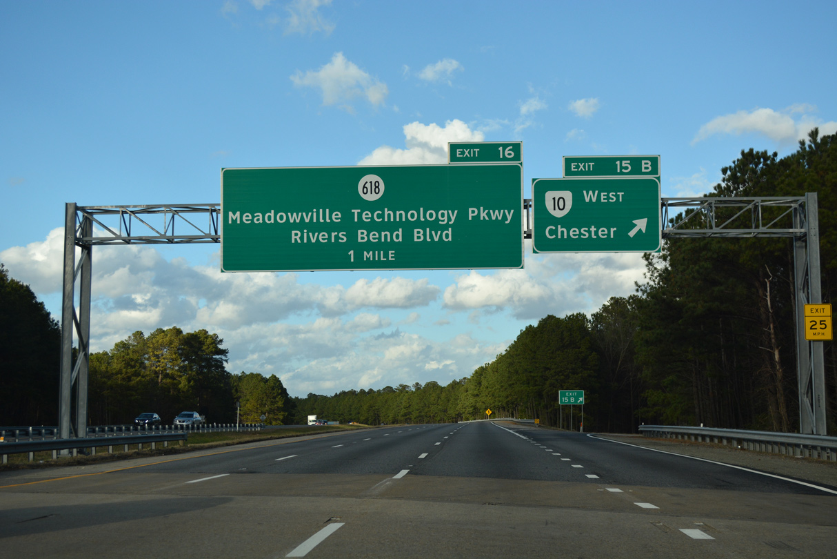
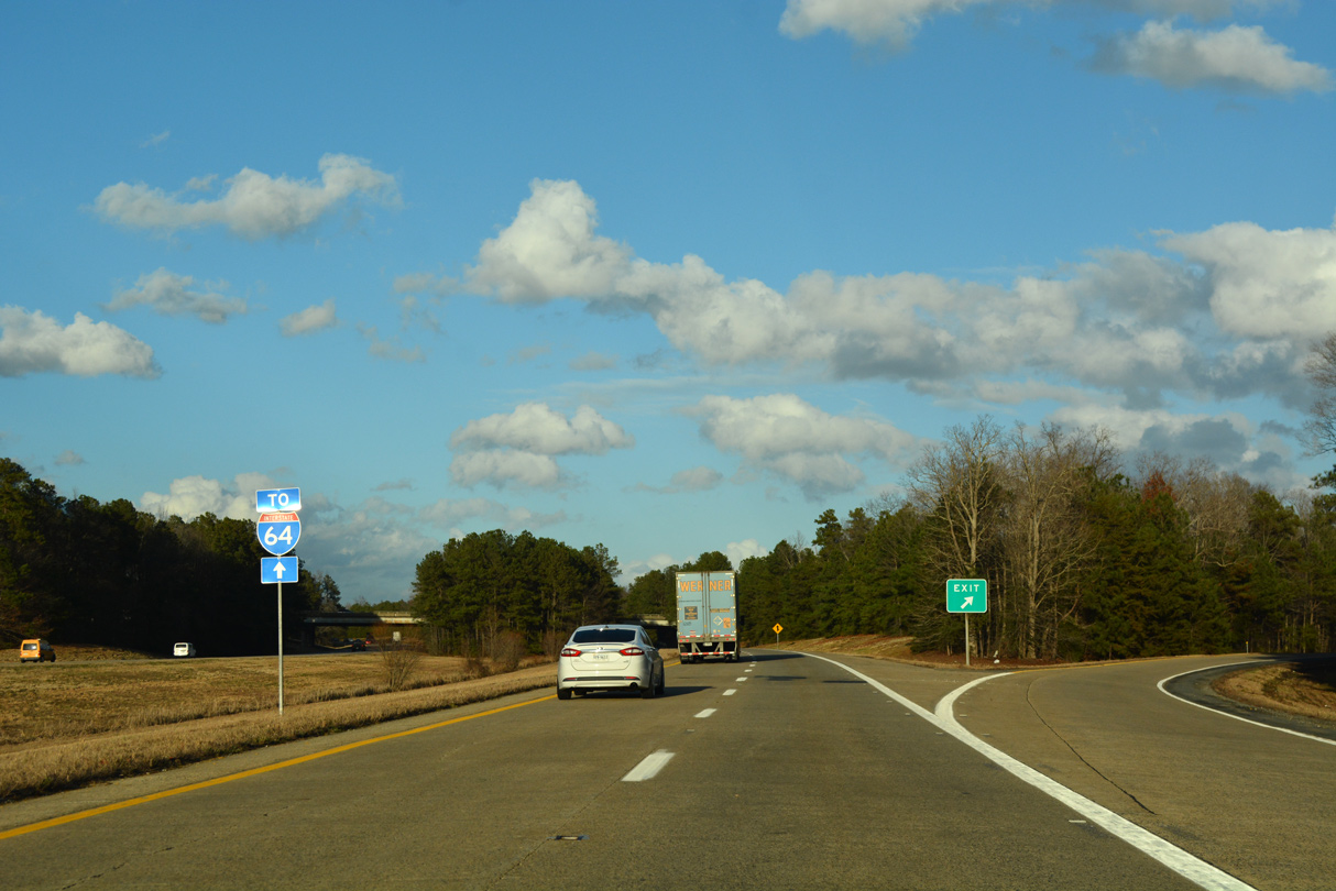
| Just about every interchange along Interstate 295 is a cloverleaf. Exceptions occur at Exit 16, which was added in 2011, at SR 895 (Pocahontas Parkway) and the exchanges with I-64/95. Meeting the freeway at the first exit is U.S. 460 (County Drive) between Petersburg and New Bohemia. 12/21/18 |
|
| U.S. 460 (County Drive) leaves the Petersburg area for Suffolk and Hampton Roads. The US highway ends 83 miles to the east in Norfolk. 12/21/18 |
|
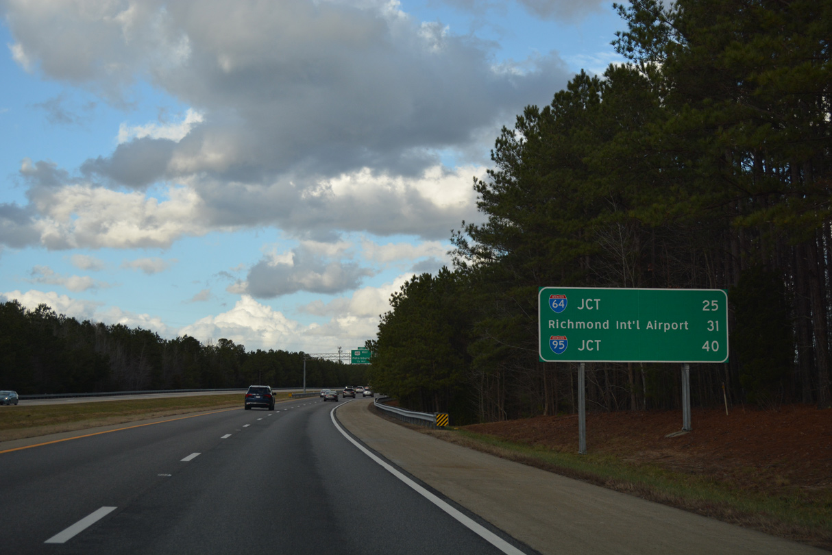
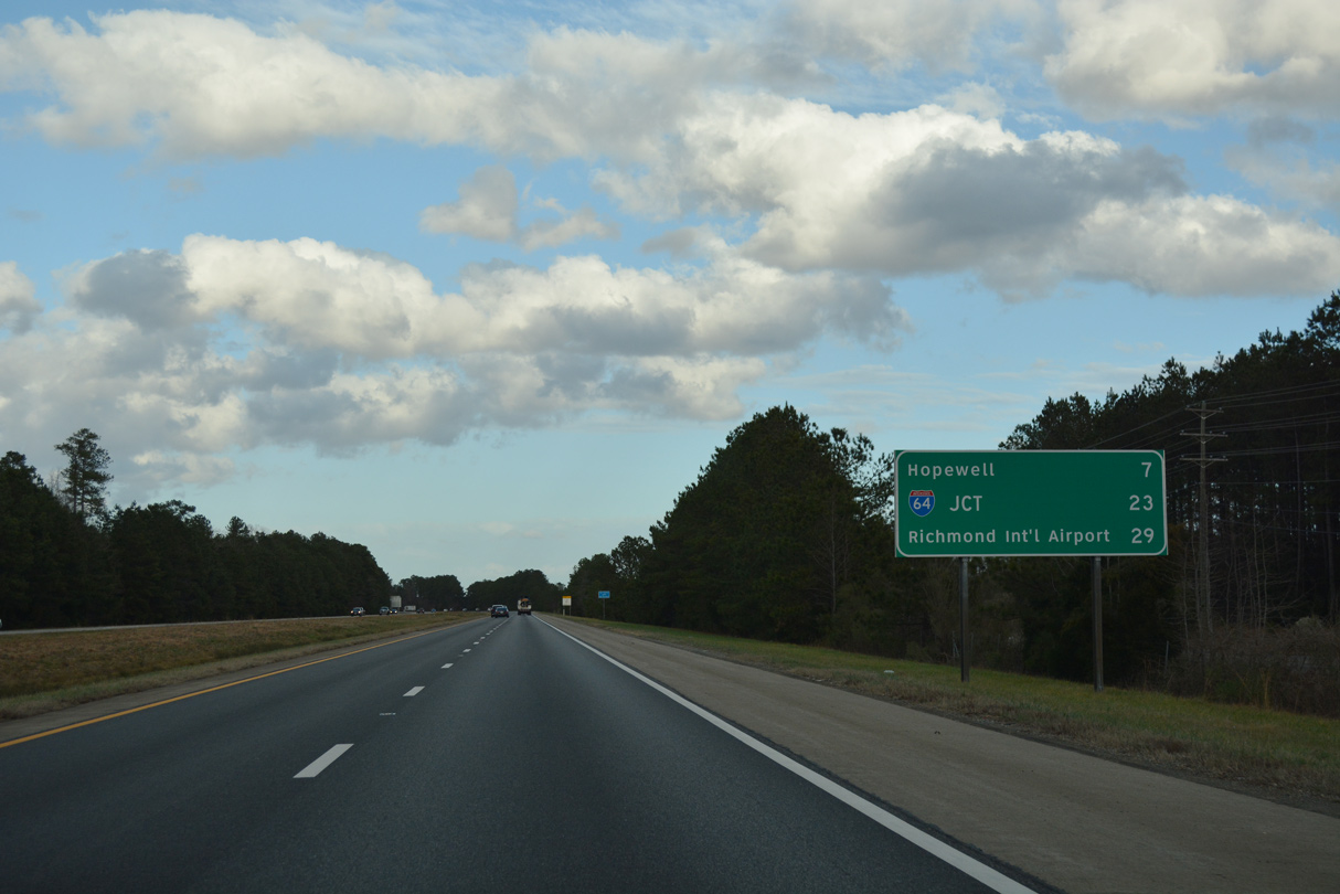
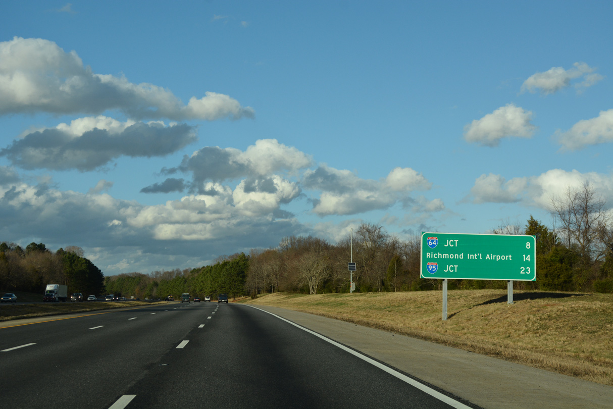
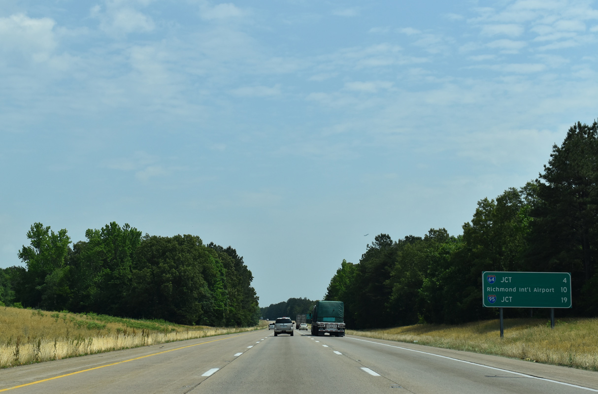
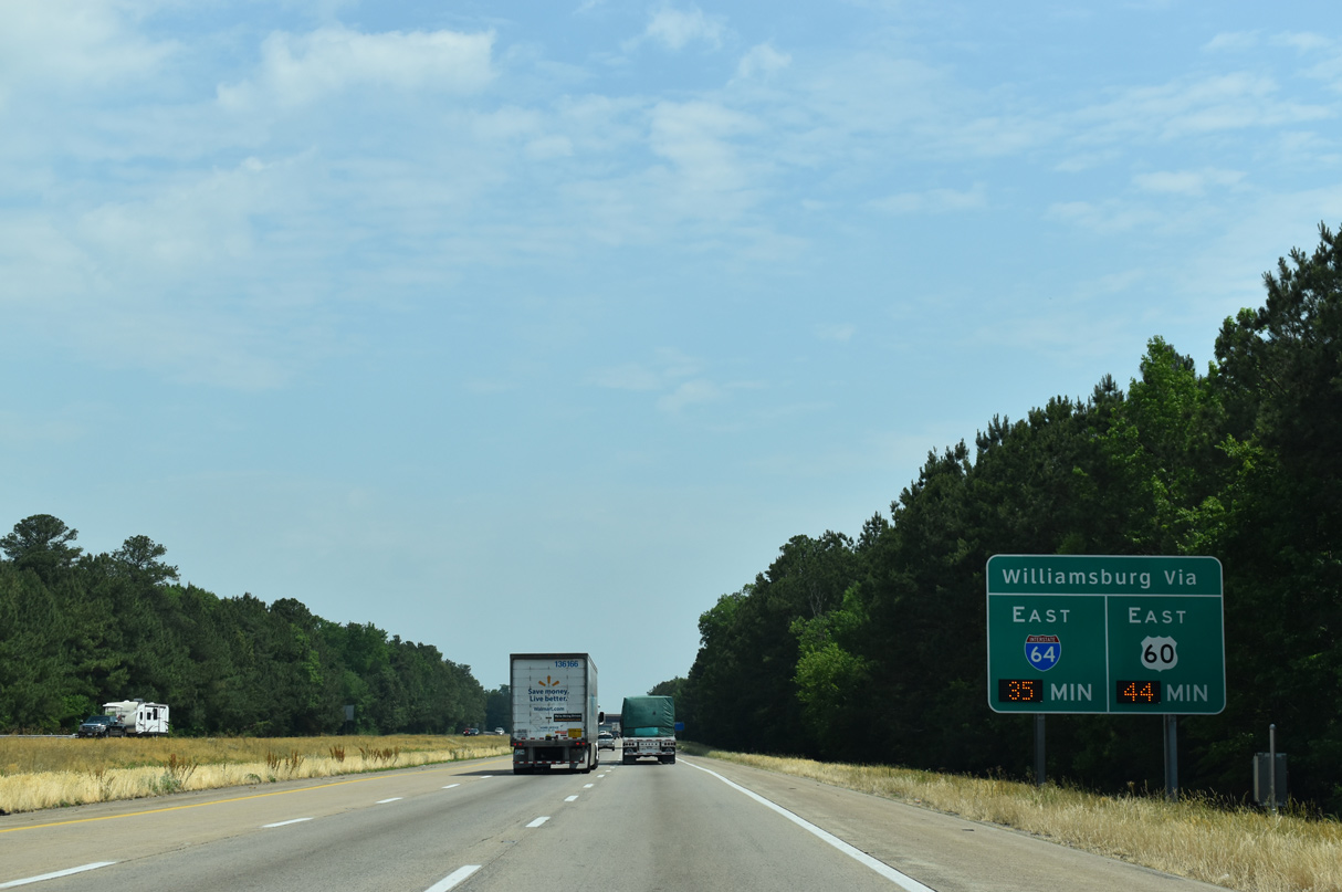
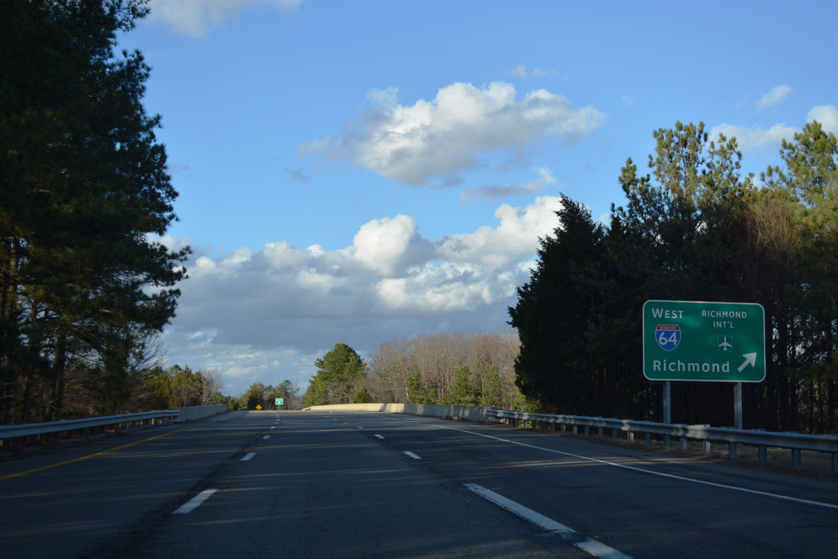
| Distance signs periodically posted along Interstate 295 list the distances to the junctions with I-64 and I-95. Richmond International Airport (RIC) lies just west of the freeway, but south of I-64. 12/21/18 |
|
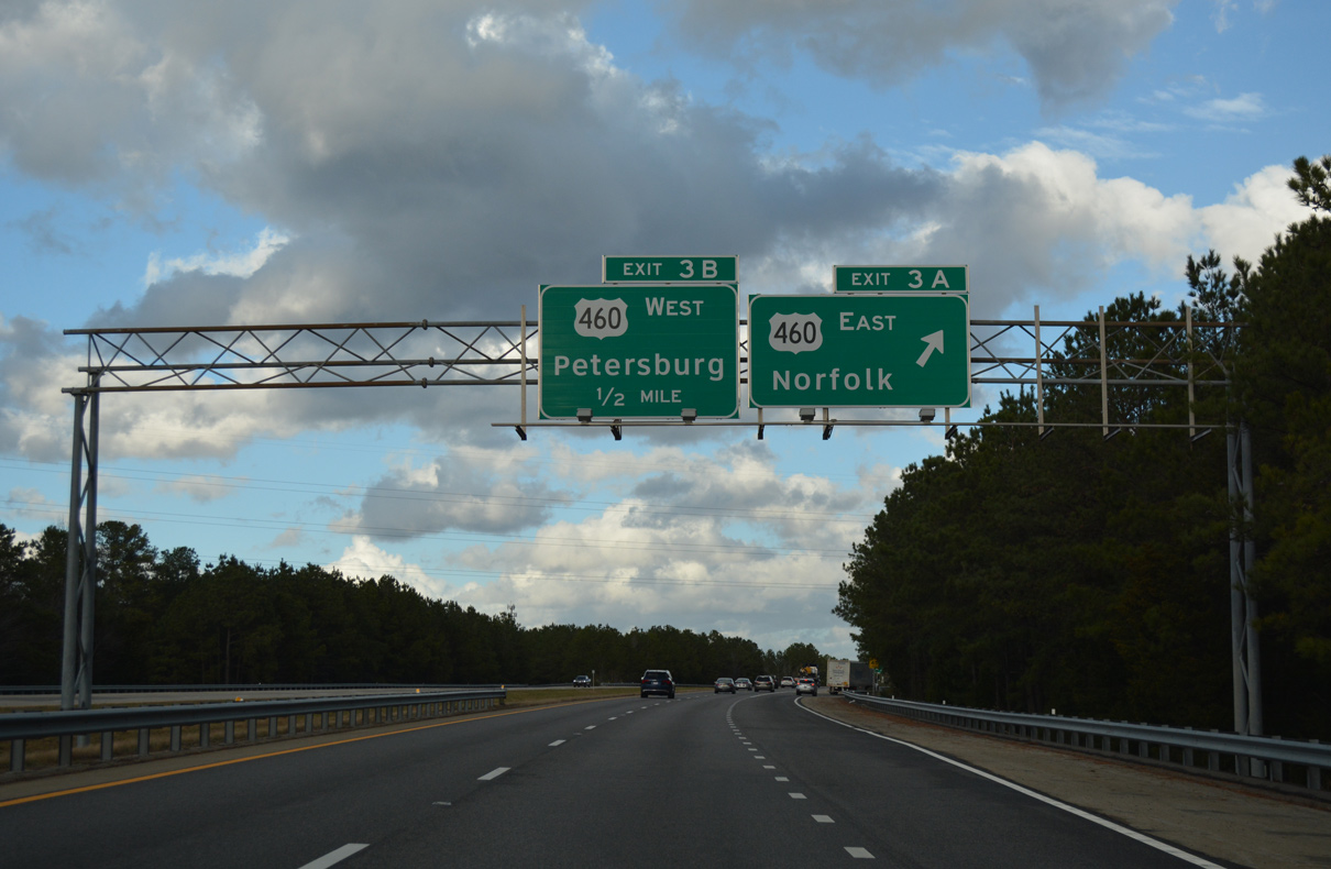
| Exit 3A departs I-295 north for U.S. 460 (County Drive) east. U.S. 460 bee lines southeast six miles to Disputanta and 54 miles to U.S. 13/58 in Suffolk. The corridor was previously considered for a high speed toll road. 12/21/18 |
|
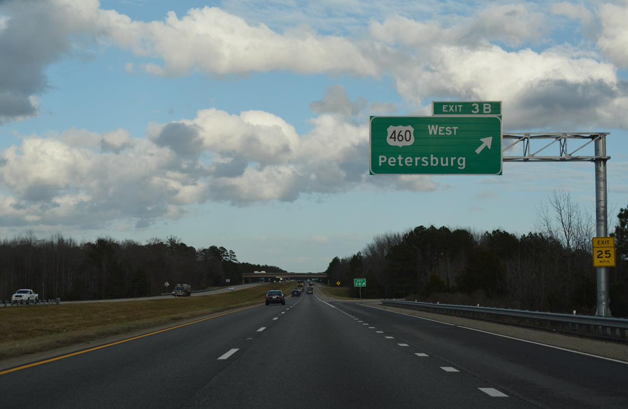
| U.S. 460 (County Drive) continues 0.74 miles west from Exit 3B to the split with U.S. 460 Business. The US route turns west on Wagner Drive to merge with Interstate 95 north into Petersburg. 12/21/18 |
|
| Interstate 295 continues northeast toward Prince George on the seven mile drive to Hopewell. 12/21/18 |
|
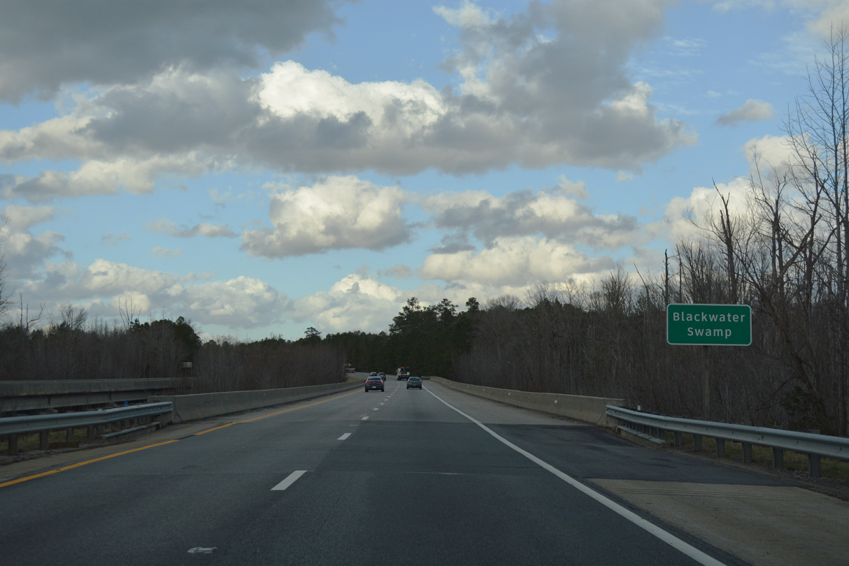
| I-295 spans Blackwater Swamp south of Prince George. Waters in Blackwater Swamp flow southeast to form the Blackwater River, which continues south to the Chowan at the North Carolina state line. 06/25/10, 12/21/18 |
|
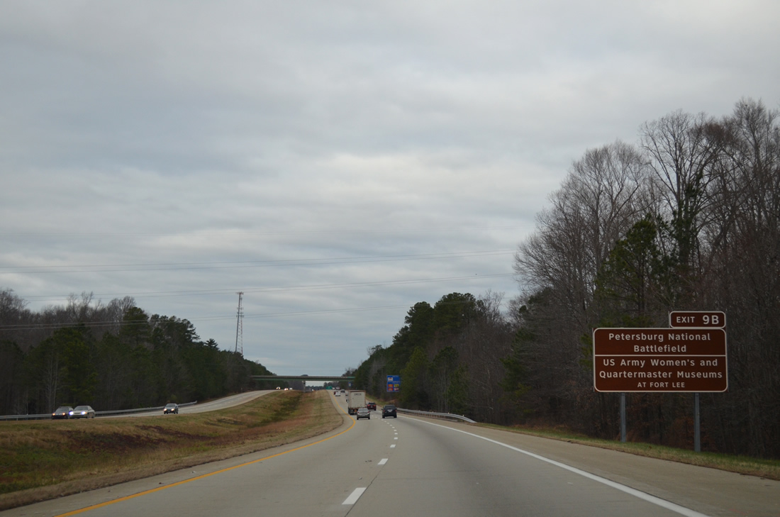
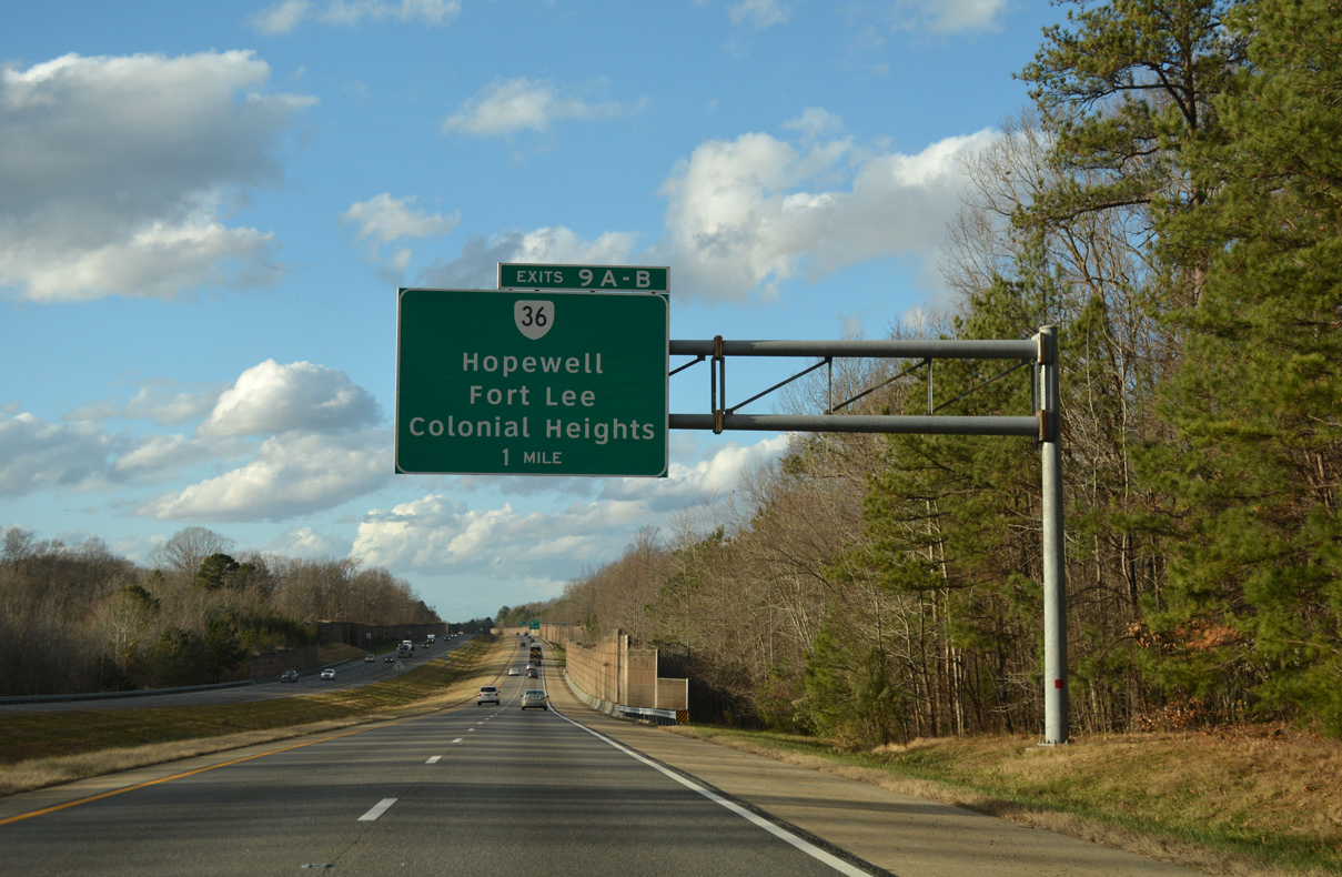
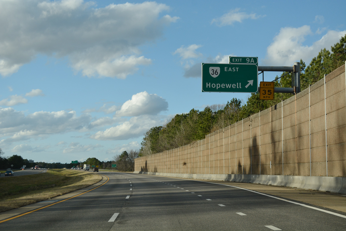
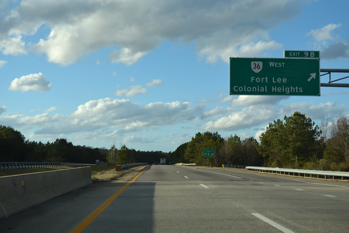
| SR 36 crosses paths with Interstate 295 at a cloverleaf interchange (Exits 9A/B). The state route provides access to the main site of Petersburg National Battlefield to the west and the City Point Unit on the James River to the east. 12/21/18, 12/21/12 |
|
| Exit 9A provides access into the independent city of Hopewell via SR 36 (Oaklawn Boulevard) east. 12/21/18 |
|
| SR 36 partitions into a one way street couplet through the Cedar Level and Kenwood communities nearby, using Oaklawn eastbound and Woodlawn Street west. 12/21/18 |
|
| SR 36 travels 1.7 miles east in Hopewell to meet SR 156 (High Avenue). Turning north at that point, SR 36 angles to Downtown Hopewell, ending at SR 10 (Randolph Road) via 6th Avenue. 12/21/18 |
|
| Exit 9B follows onto SR 36 (Oaklawn Boulevard) west to Fort Lee, Petersburg National Battlefield and Petersburg. SR 144 (Temple Avenue) begins nearby and provides direct access to Colonial Heights. Overall SR 36 travels 16.70 miles between Matoaca and Hopewell. 12/21/18 |
|
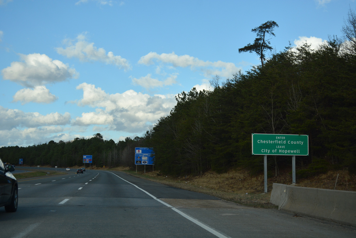
| I-295 passes through a wedge of Hopewell city limits through the exchange with SR 36 and then reenters Prince Georges County. 12/21/18 |
|
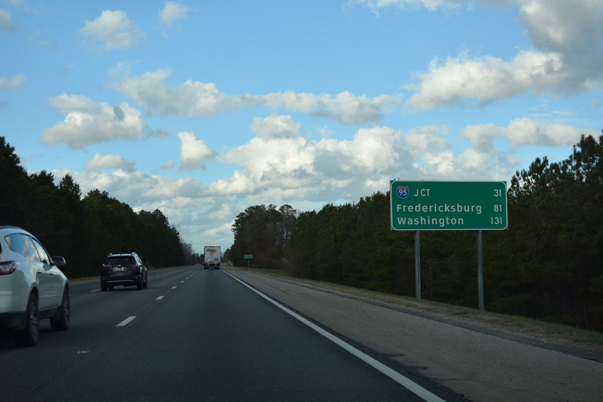
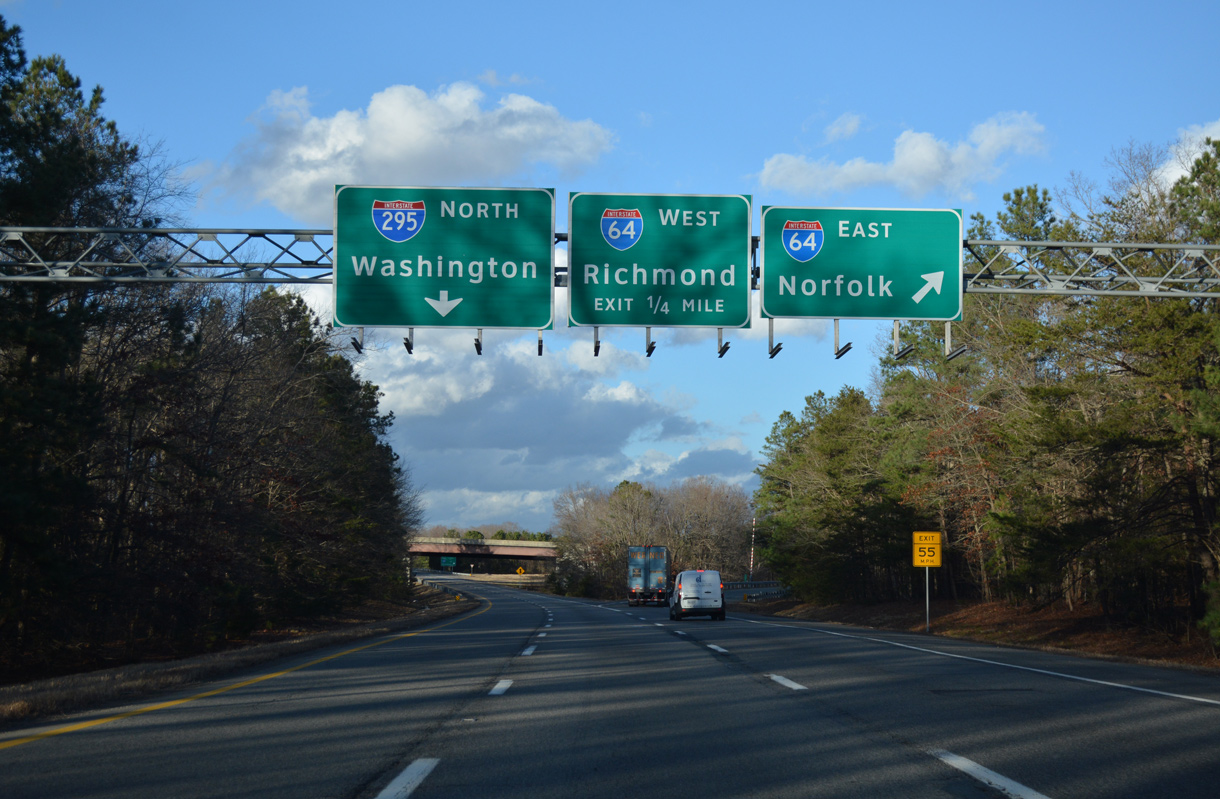
| I-64/95 alternate as a destination on Interstate 295 northbound distance signs. Fredericksburg, the next control city north of Richmond, accompanies Washington for motorists returning to I-95. 12/21/18 |
|
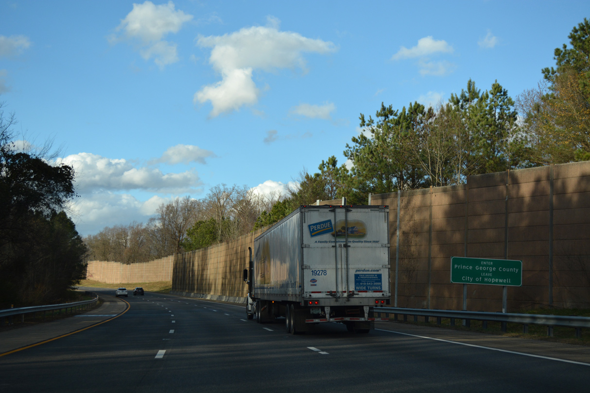
| Travelers along Interstate 295 north straddle the Hopewell city and Prince Georges County line to the Appomattox River. Sound walls buffer the adjacent subdivision from the freeway at one notch of Prince Georges County, south of River Road. 12/21/18 |
|
| Interstate 295 spans the Appomattox River into Chesterfield County along the Frederick T. Gray Bridge. 12/21/18 |
|
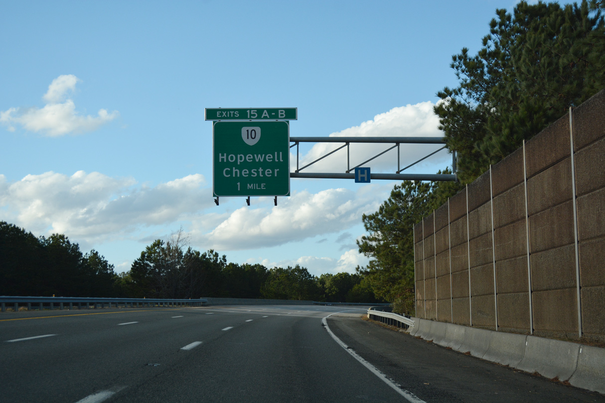
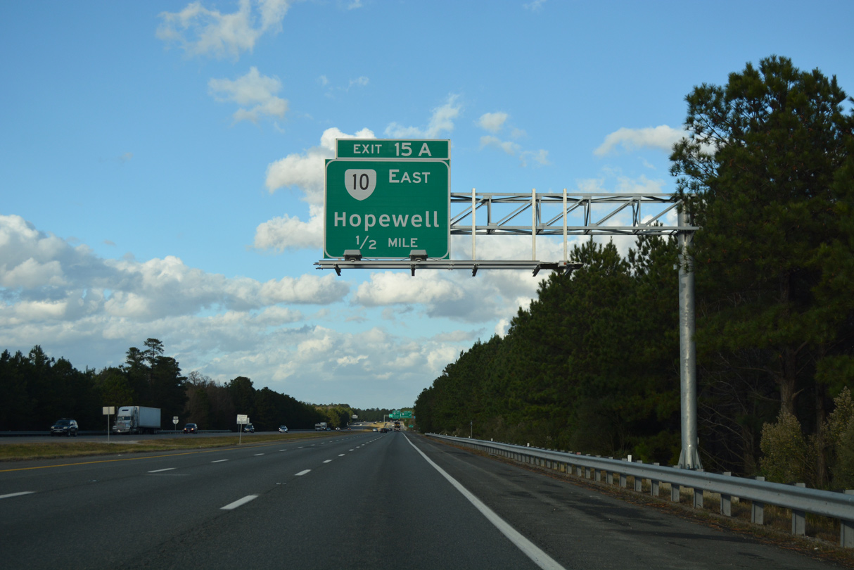
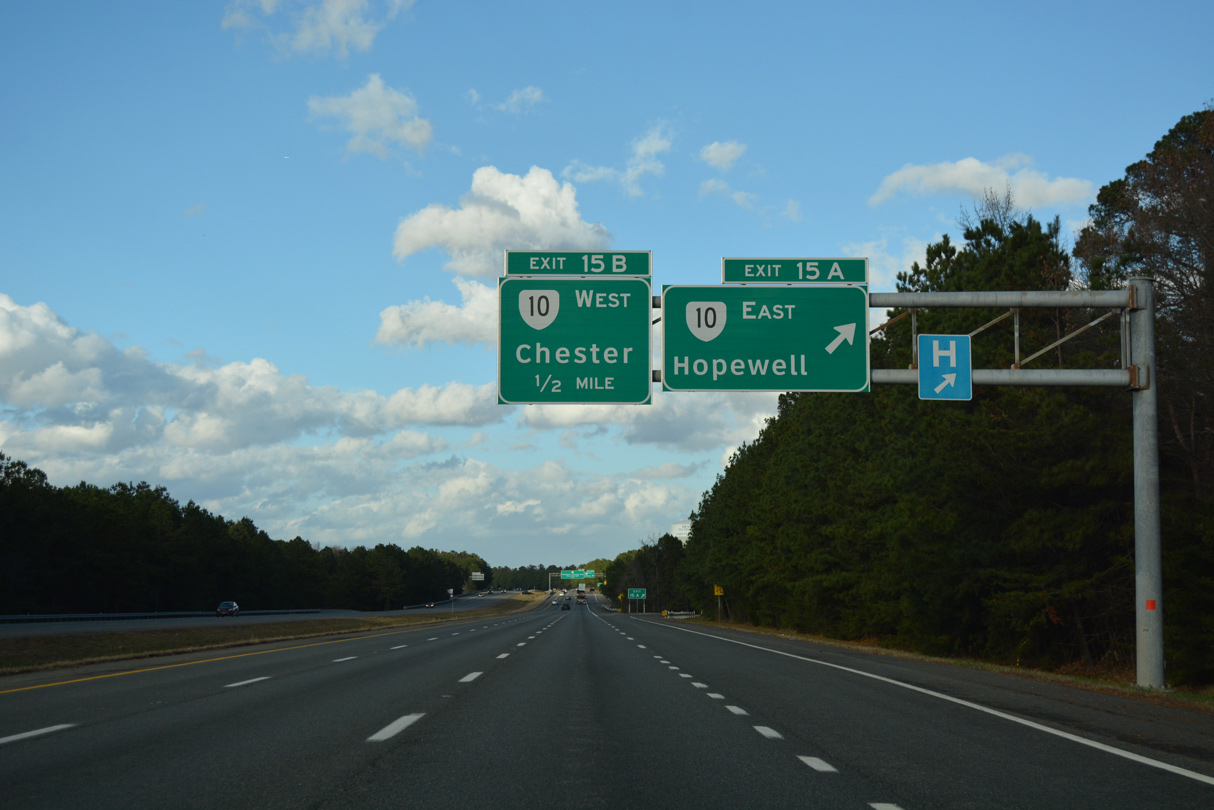
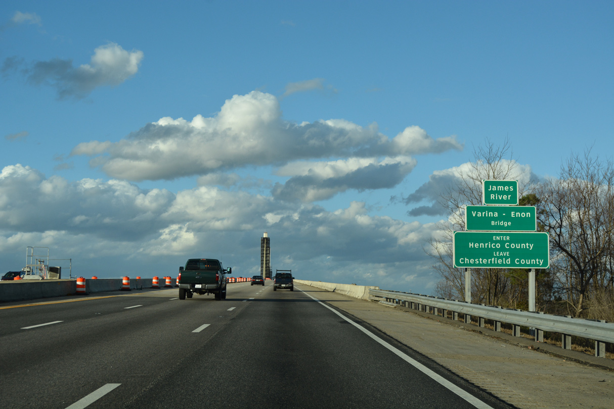
| The freeway meanders between suburban areas of southeast Chesterfield County on the one mile approach to SR 10 (Exits 15A/B). SR 10 (Hundred Road) joins Hopewell with Chester and the county seat of Chesterfield from I-295. 12/21/18 |
|
| SR 10 travels east from Hopewell along the James River valley to Surry and Smithfield before turning south to end in Suffolk. Overall the state route measures 91.32 miles in length. 12/21/18 |
|
| Exit 15A departs I-295 north for SR 10 (Hundred Road) east to Screamersville, Rivermont and Downtown Hopewell. West from Exit 15B, the divided highway loops 3.9 miles to I-95 near Chester and 8.4 miles to Chesterfield. 12/21/19 |
|
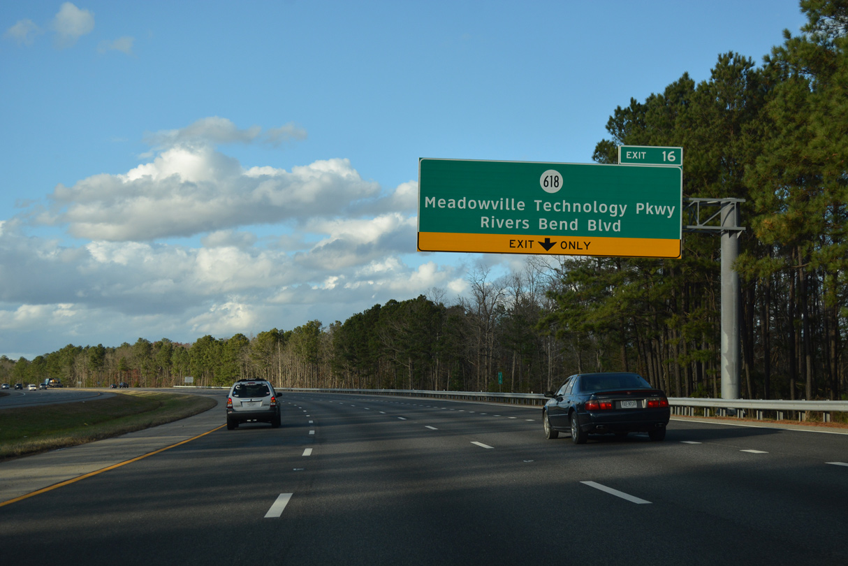
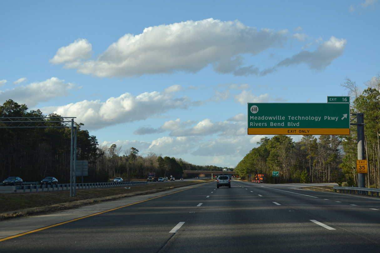
| The diamond interchange (Exit 16) at SR 618 (Meadowville Technology Parkway) opened to traffic on December 15, 2011. Exit 16 serves Meadowville Technology Park and the Rivers Bend community along the Old Channel of the James River. 12/21/18 |
|
| An auxiliary lane opens northbound on Interstate 295 from SR 10 to Exit 16. SR 618 follows Rivers Bend Boulevard west to SR 10 (Hundred Road). 12/21/18 |
|
| East from Exit 16, SR 618 leads to Meadowville and Enon Church Road. The interchange with I-295 includes provisions to upgrade it to a cloverleaf if traffic counts warrant. 12/21/18 |
|
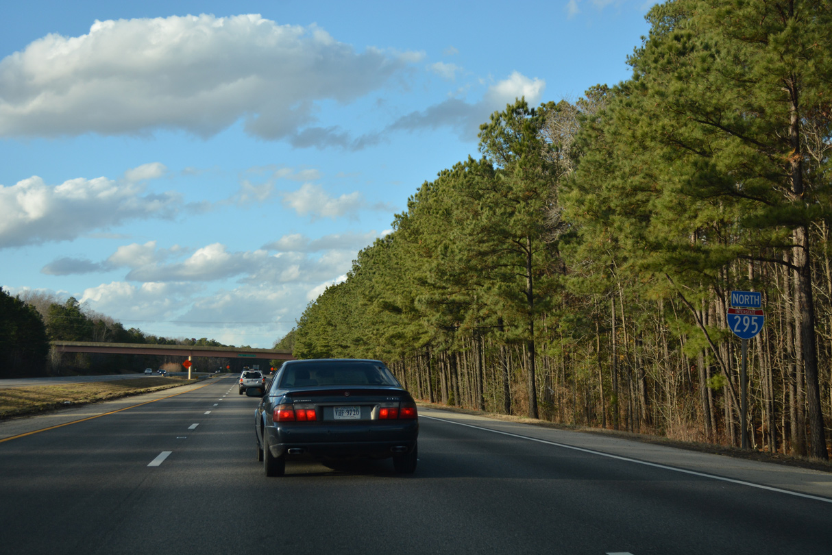
| Interstate 295 bends northwest through the exchange with SR 618 beyond Woodvale. 12/21/18 |
|
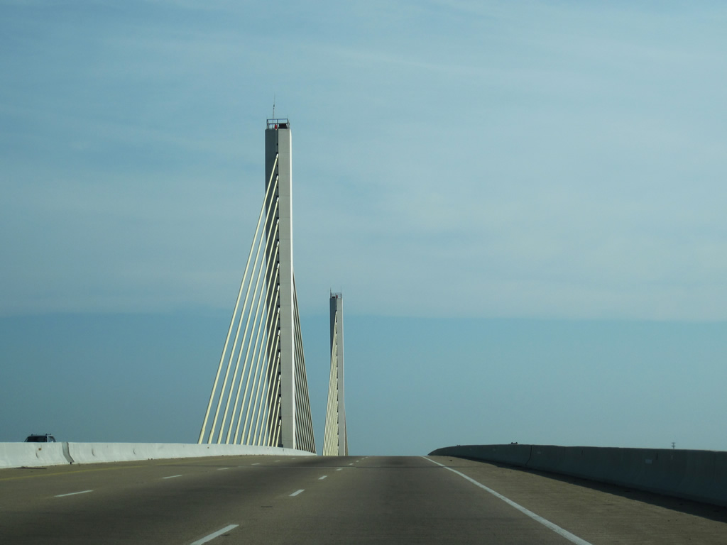
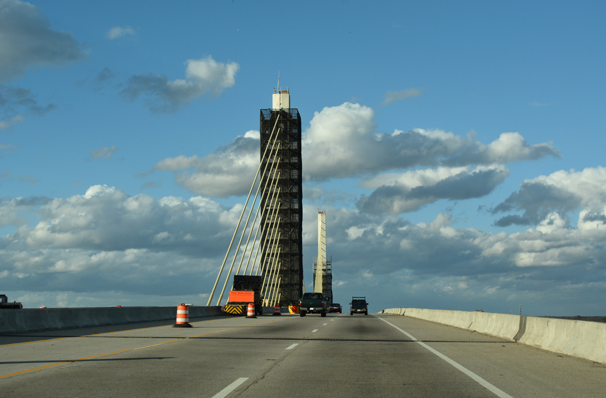
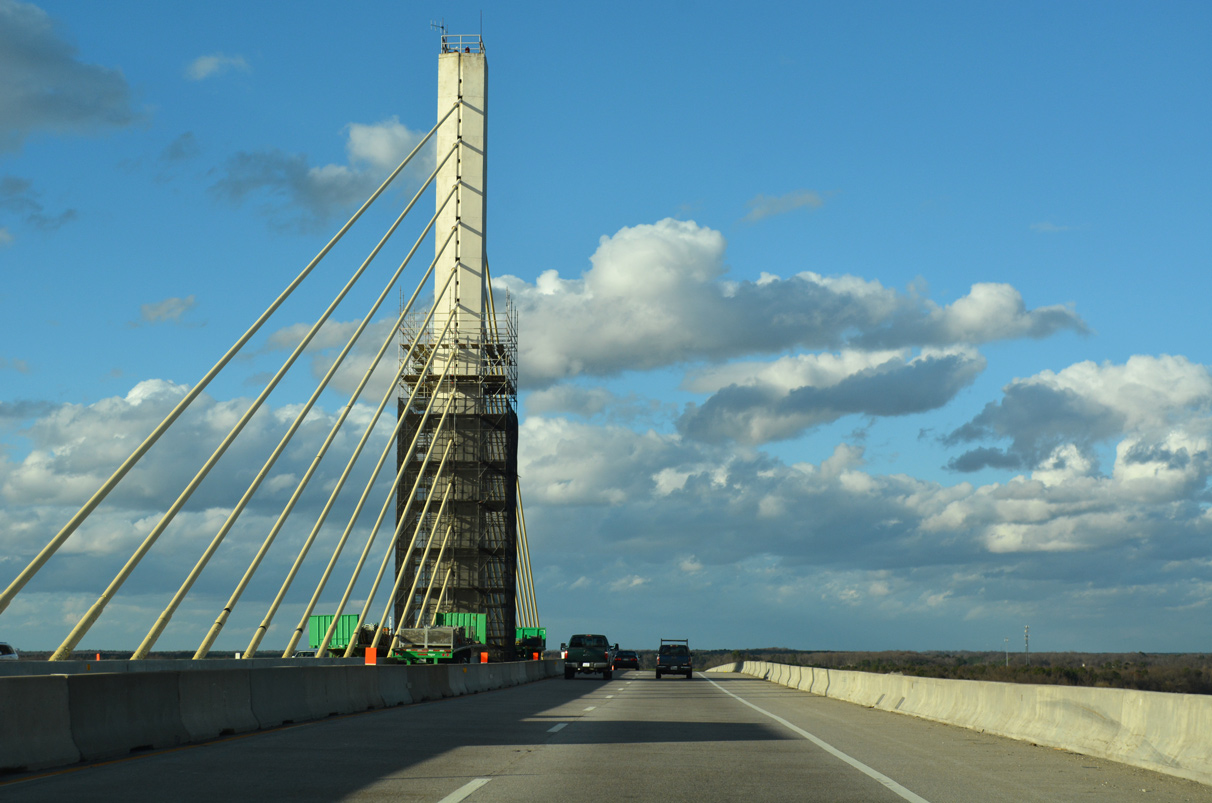
| Rising onto the Varina-Enon Bridge, Interstate 295 crosses the James River into Henrico County. Opened in July 1990, the crossing includes a 630 foot long cable-stayed main span. 12/21/18 |
|
| Two 145 foot high towers support the 4,680 foot long Varina-Enon Bridge.1 06/25/10, 12/21/18 |
|
| The Varina-Enon Bridge is similar to design to the Sunshine Skyway Bridge along I-275 over Tampa Bay, Florida and the William V. Roth, Jr. Bridge along SR 1 across the Chesapeake & Delaware Canal at St. Georges, Delaware. 06/25/10, 12/21/18 |
|
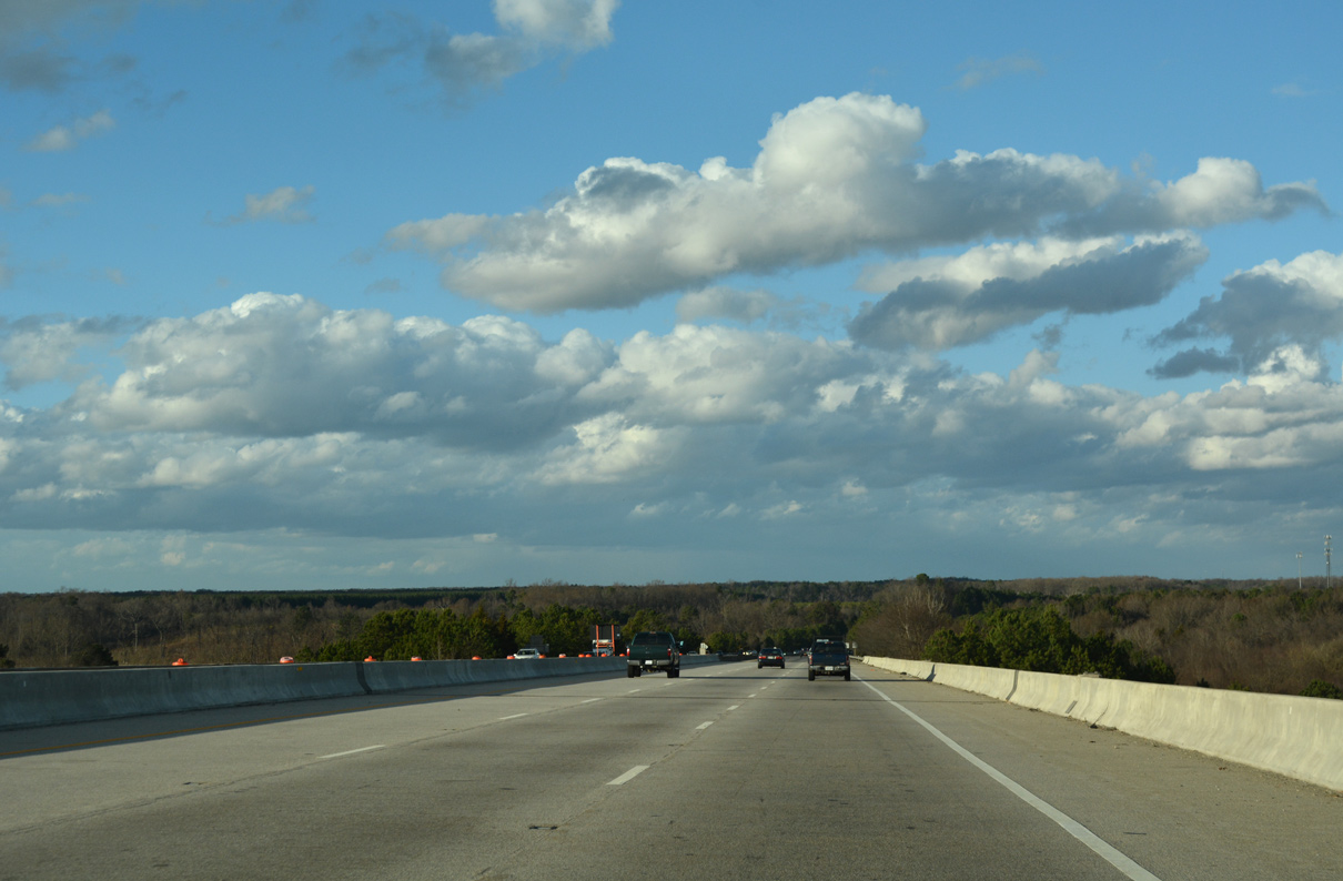
| I-295 lowers from the Varina-Enon Bridge across an agricultural area spreading north from the James River. 12/21/18 |
|
| Interstate 295 returns to grade level near Fair Hill. The exchanges with I-64 follow in eight miles and I-95 in 23 miles. 12/21/18 |
|
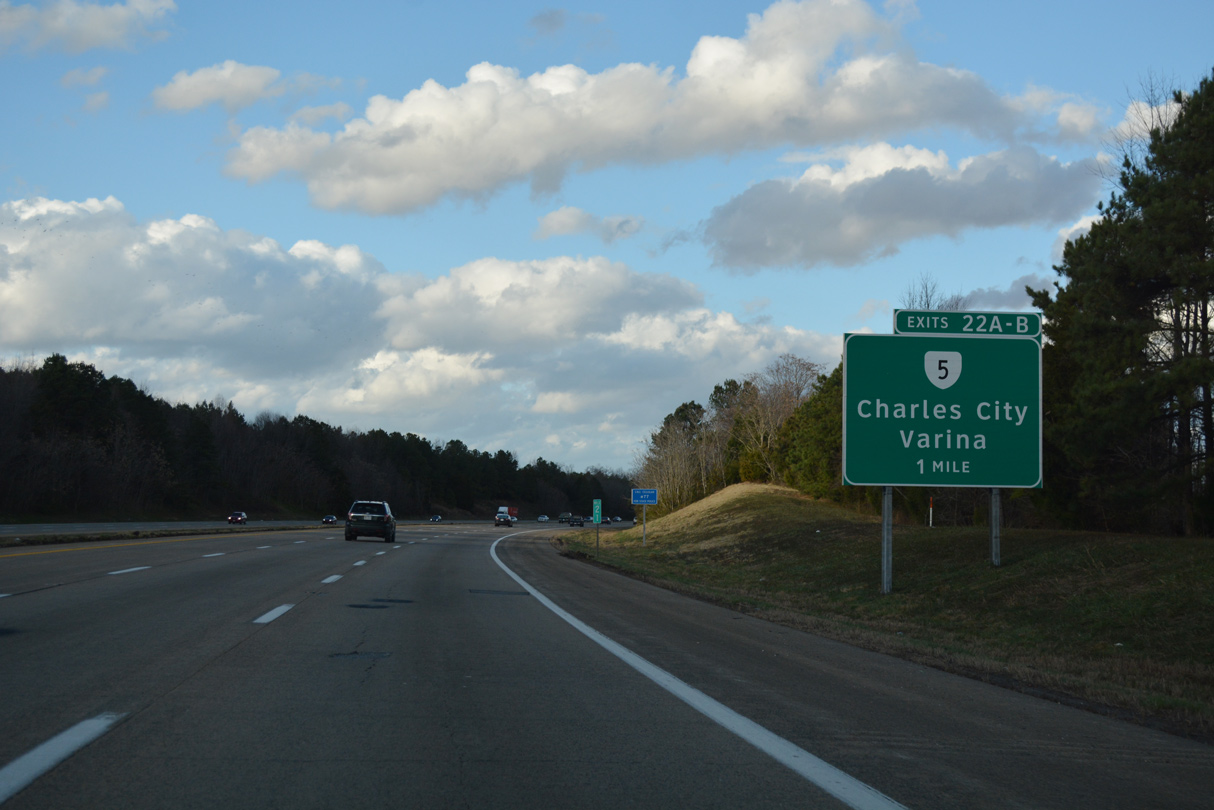
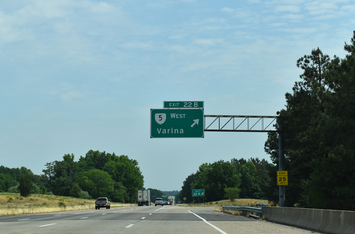
| SR 5 (New Market Road) crosses paths with Interstate 295 at a cloverleaf interchange (Exit 22) in one mile. The state route angles northwest through suburban areas of Varina to Richmond. 12/21/18 |
|
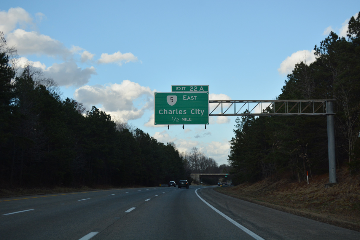
| Buffin Road passes over I-295 north on the approach to Exit 22A for SR 5 east. Linking Richmond with Jamestown and Williamsburg to the east, SR 5 is part of the Jamestown 2007 Discovery Trail, a Virginia scenic Byway. 12/21/18 |
|
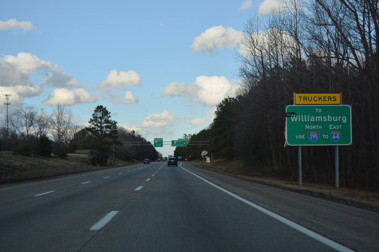
| SR 5 is not considered a truck route for those bound for Williamsburg. Truckers are directed to remain on Interstate 295 north to I-64 east. 12/21/18 |
|
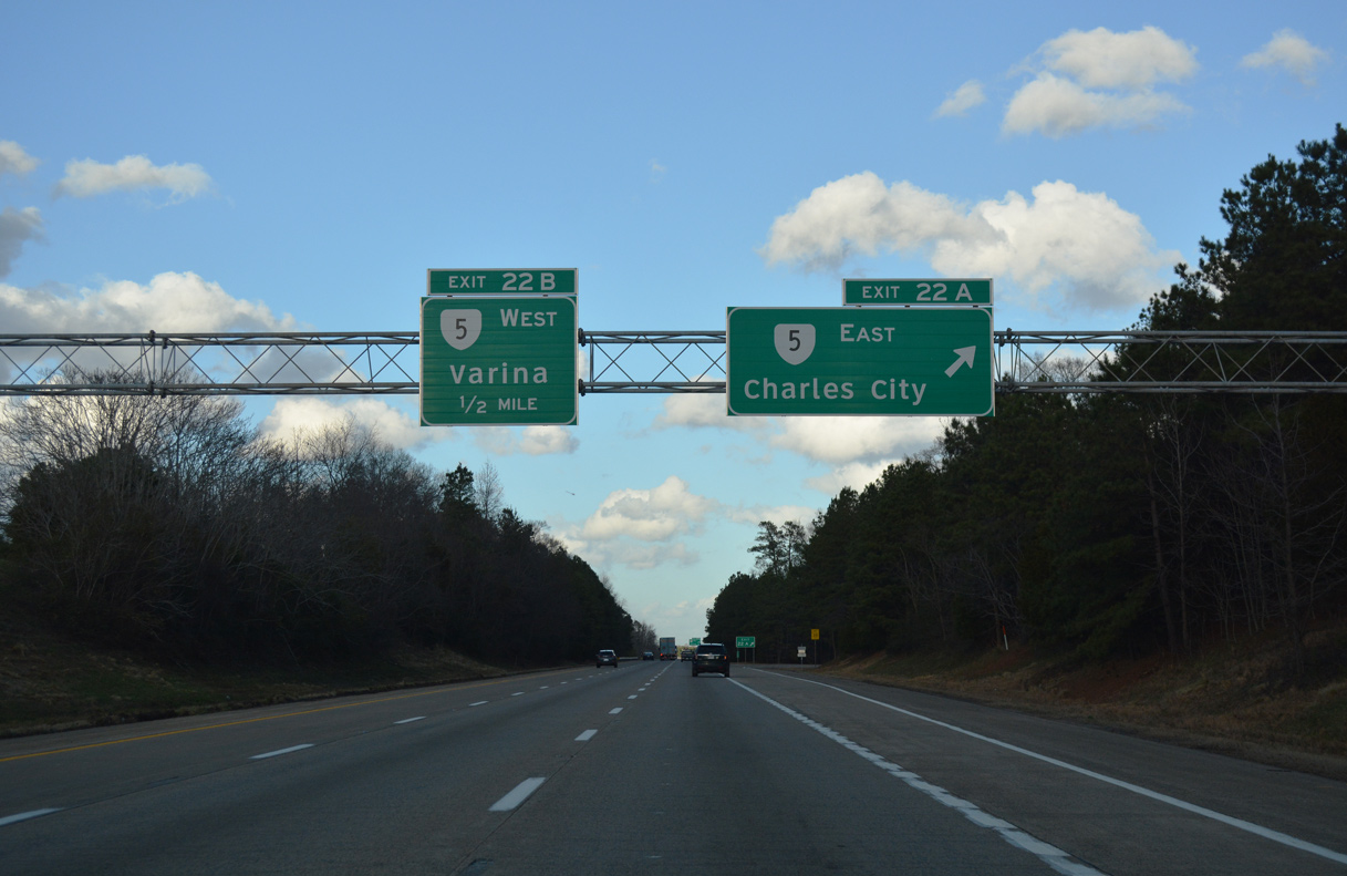
| Exit 22A leaves Interstate 295 north for SR 5 (New Market Road) east to Charles City. The state route concludes 46.6 miles east in Williamsburg at SR 143. 12/21/18 |
|
| Northwestward, SR 5 continues from Exit 22B to Richmond National Battlefield Park, Capitol View, Oakland and Richmond, where it ends at U.S. 60. 05/28/21 |
|
| Interstate 295 undulates over Fourmile Creek northeast of Varina Grove. 05/28/21 |
|
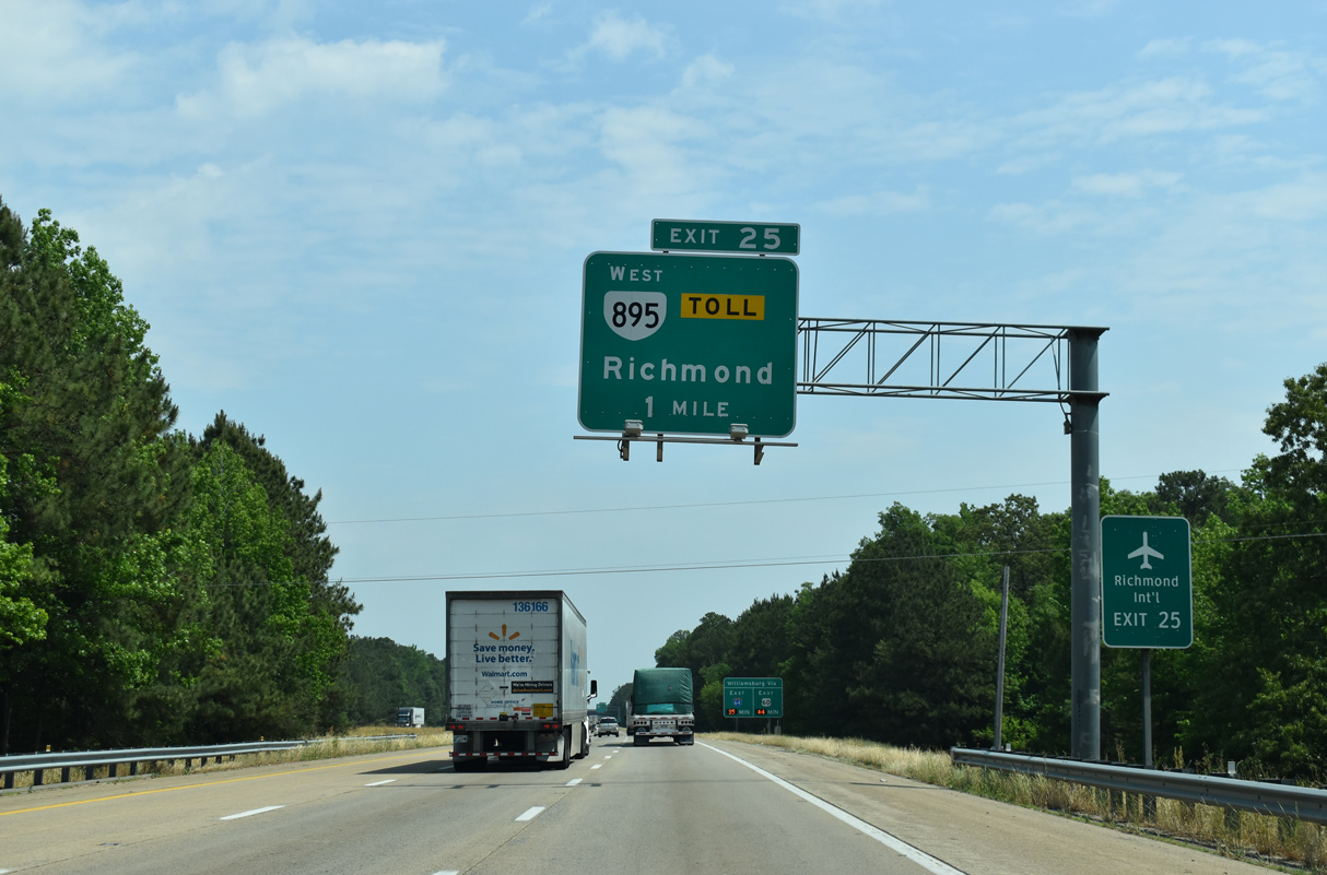
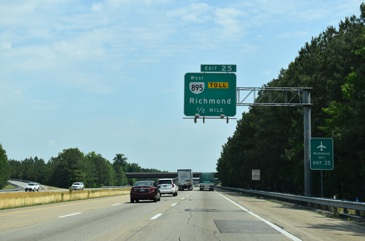
| The predecessor of this distance sign predated the opening of Airport Drive by six months. It was replaced in kind with this assembly. Opened on January 14, 2011, the 1.6 mile long Richmond Airport Connector Road stems north from SR 895 (Pocahontas Parkway) to the airport terminal. Construction on the $50 million road commenced in early 2009.2 05/28/21 |
|
| SR 895 (Pocahontas Parkway) is an 8.8 mile long toll road linking Interstate 295 with Richmond International Airport (RIC), I-95 and Chippenham Parkway (SR 150). 05/28/21 |
|
| The travel time sign for Williamsburg was installed along I-295 north by 2015. 05/28/21 |
|
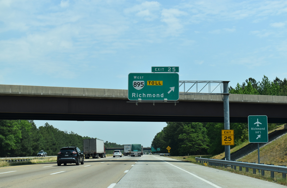
| An elongated trumpet interchange joins Interstate 295 with SR 895 (Pocahontas Parkway) west. The toll road becomes SR 150 (Chippenham Parkway) beyond the Vietnam Veterans Memorial Bridge over the James River en route to Richmond and Bon Air. 05/28/21 |
|
| Exit 25 loops onto SR 895 (Pocahontas Parkway) west. Pocahontas Parkway opened in 2002. There are no plans to add the toll road to the Interstate highway system. 05/28/21 |
|
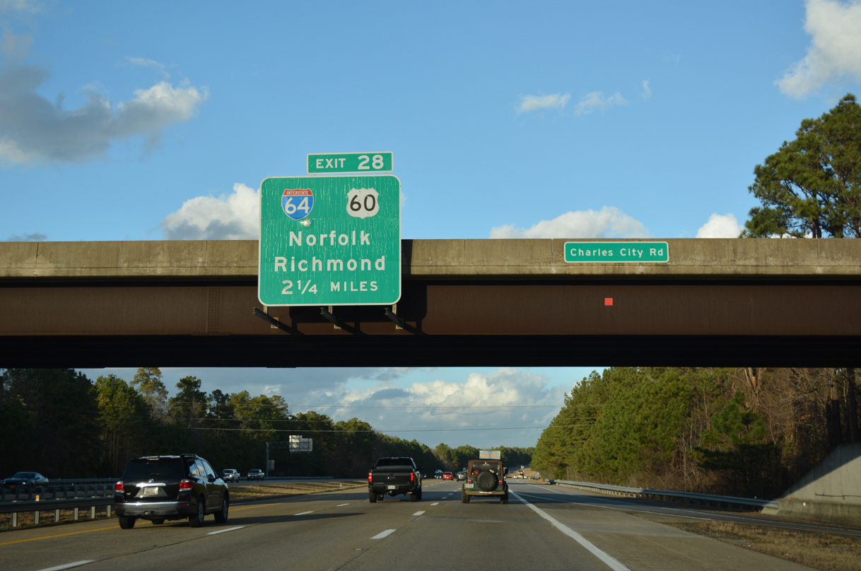
| The first sign for the I-64 and U.S. 60 (Williamsburg Road) collector distributor roadway system appears along I-295 northbound at the Charles City Road overpass by SR 895. 12/21/18 |
|
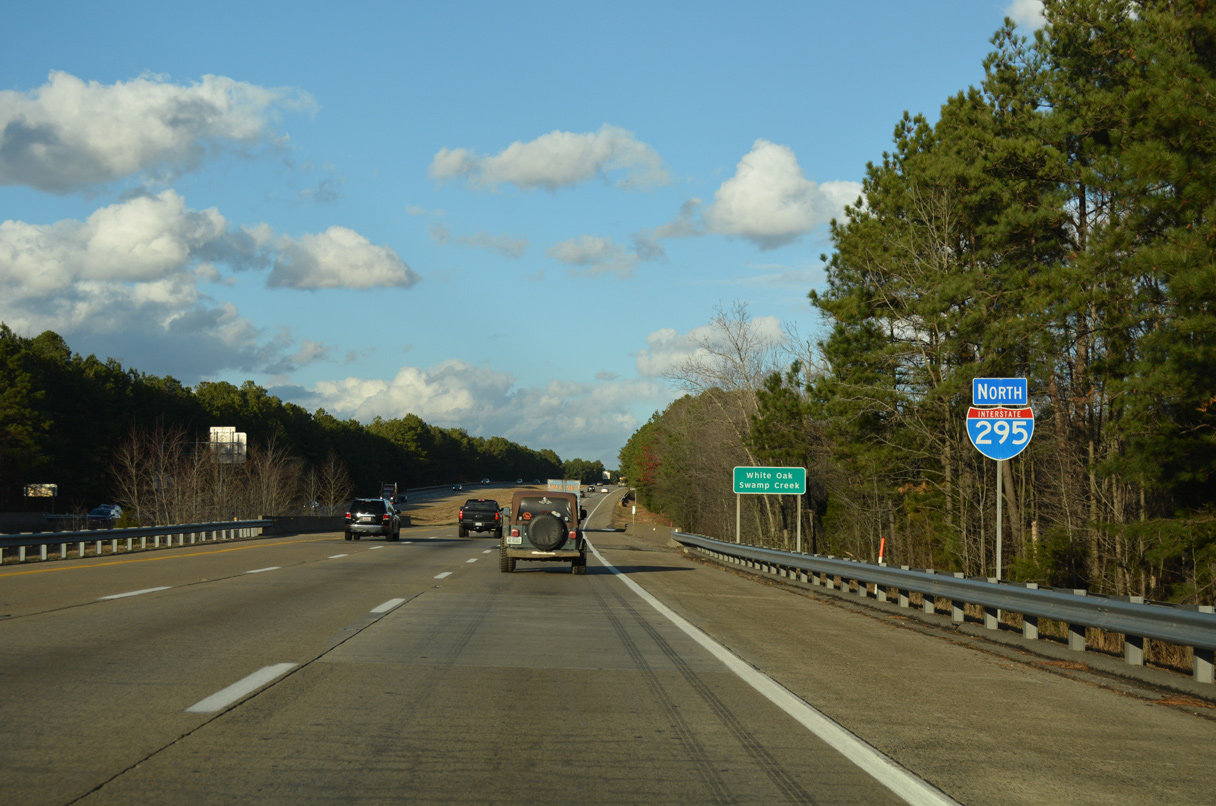
| Spanning White Oak Swamp Creek just southeast of Richmond International Airport (RIC) on Interstate 295 north. 12/21/18 |
|
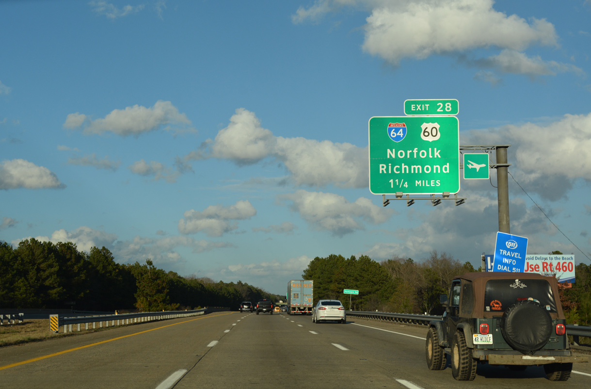
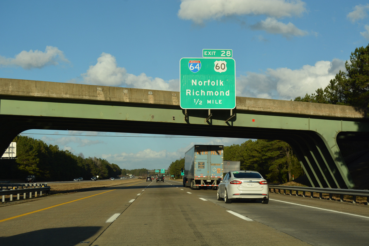
| I-295 crosses a CSX Railroad line and Portugee Road, 1.25 miles ahead of Exit 28 for I-64 and U.S. 60. 12/21/18 |
|
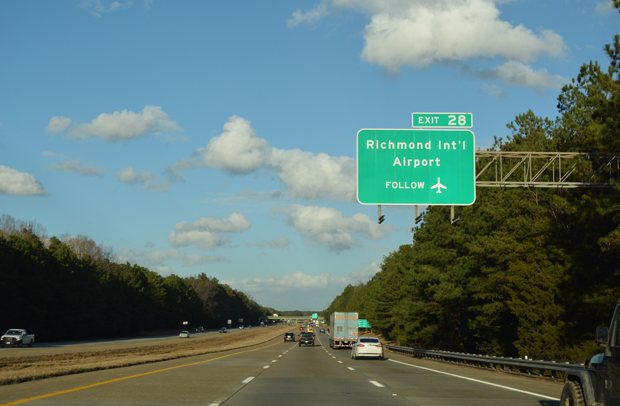
| La France Road passes over I-295 east from Richmond International Airport (RIC). Traffic to the airport is directed onto U.S. 60 (Williamsburg Road) west from Exit 28 to Airport Drive. 12/21/18 |
|
| Interstate 64 joins the Richmond area with Hampton Roads and Virginia Beach along the Atlantic coast. 12/21/18 |
|
| The c/d roadway (Exit 28) for Interstate 64 and U.S. 60 separates from I-295 a half mile beyond the La France Road overpass. 12/21/18 |
|
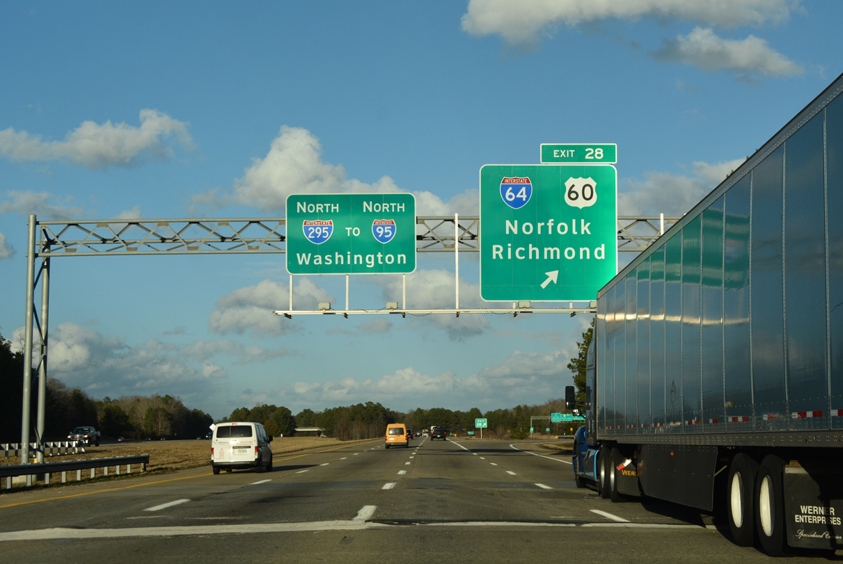
| A single lane separates from I-295 north for the c/d roadway at Exit 28. Succeeding ramps at the cloverleaf interchanges with U.S. 60 (Williamsburg Road) and Interstate 64 are not assigned exit number suffixes. 12/21/18 |
|
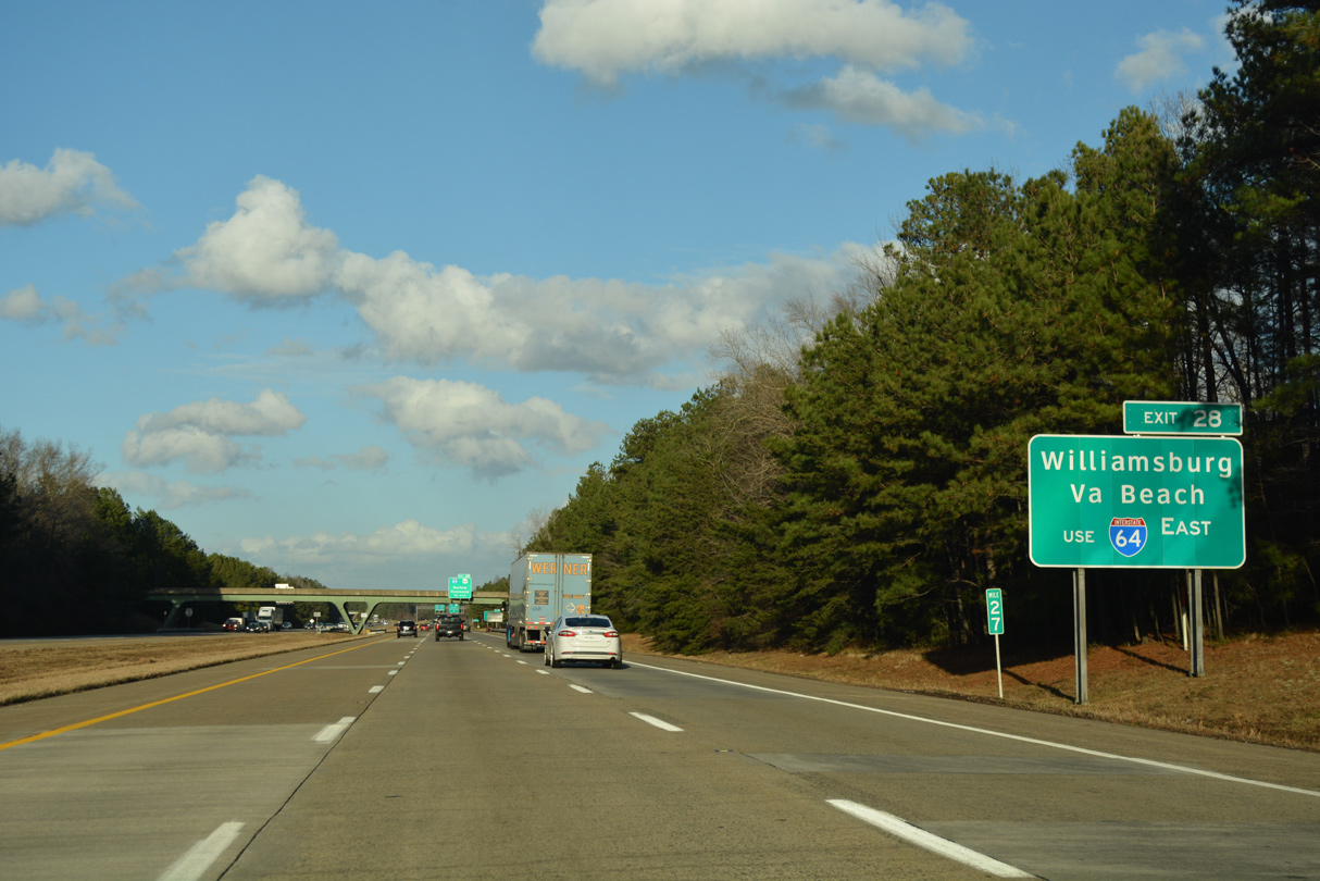
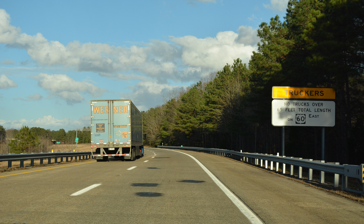
| A truck restriction for trailers exceeding 65 feet in length is in effect for U.S. 60/ SR 33-156 east from Interstate 295. 12/21/18 |
|
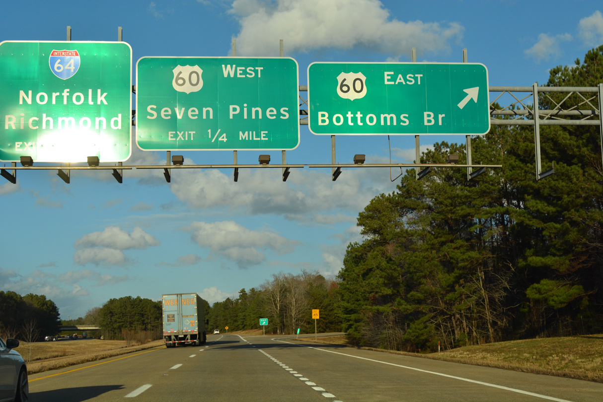
| U.S. 60 overlaps with SR 33/156 through the exchange with I-295. SR 156 joins U.S. 60 at Bottoms Bridge two miles to the east. SR 33 continues beyond Bottoms Bridge along U.S. 60 to New Kent Highway and I-64 at Exit 205. 12/21/18 |
|
| The I-64 centerline lies 0.8 miles north of U.S. 60. 12/21/18 |
|
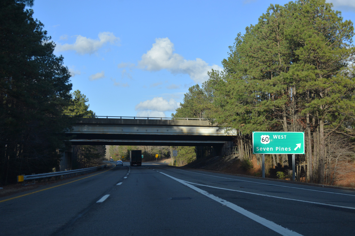
| West from I-295, U.S. 60 (Williamsburg Road) travels through Seven Pines and Sandston to the north of RIC Airport. SR 33 turns northward along Nine Mile Road at Seven Pines to Fair Oaks and Highland Springs. SR 156 lines Airport Drive northward to I-295 at Exit 31 and Old Cold Harbor. 12/21/18 |
|
| Southeast from I-295, Interstate 64 reaches the Newport News city limits in 47 miles. 12/21/18 |
|
| Interstate 295 and the c/d roadways for Exit 28 span I-64 through the directional cloverleaf interchange. 12/21/18 |
|
| The loop ramp for I-64 west joins the freeway three miles ahead of SR 156 (Airport Drive) for Richmond International Airport (RIC). I-64 enters the city of Richmond in 7.4 miles. 12/21/18 |
|
| The c/d roadway reduces to a single lane ahead of the entrance ramp from I-64 westbound. The roadway returns to I-295 beyond the Meadow Road overpass. 12/21/18 |
Page Updated 08-11-2021.

 North
North