|
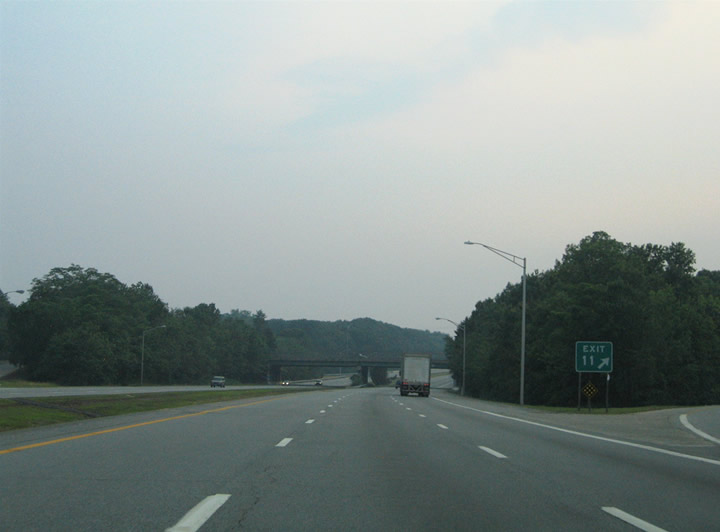
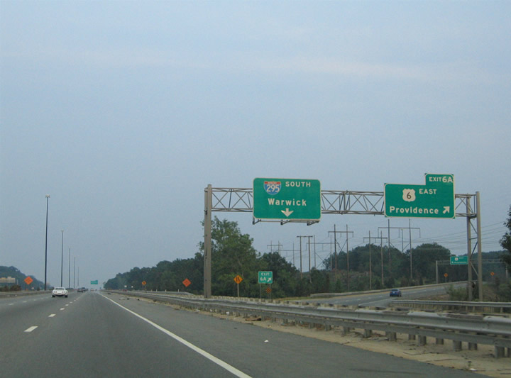
| Though most signs for Exit 11 are positioned within Massachusetts, the off-ramp itself leaves Interstate 295 southbound from one half mile within the Ocean State. Exit 11 joins the freeway with Route 114 (Diamond Hill Road) at Cumberland. 06/26/05 |
|
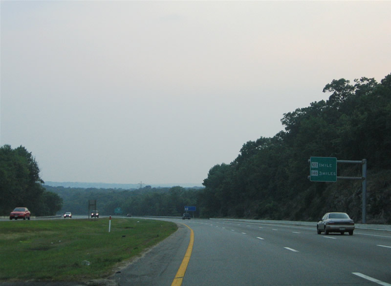
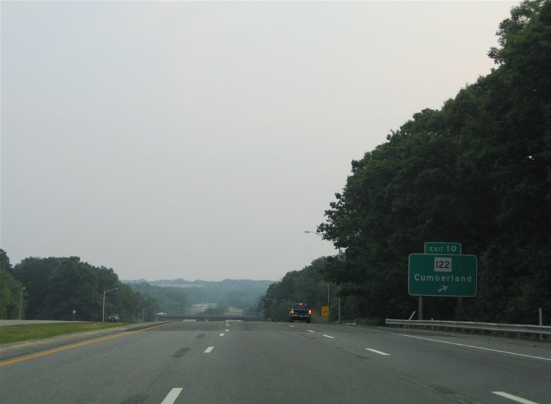
| Interstate 295 continues in a westerly fashion to junctions with Route 122 (Exit 10) and Route 146 (Exit 9). 06/26/05 |
|
| Route 122 (Mendon Road) serves the communities of Woonsocket and Berkeley among others in its northerly route out of Pawtucket. The multi-state route travels overall from Providence to Worcester and North New Salem in Massachusetts. 06/26/05 |
|
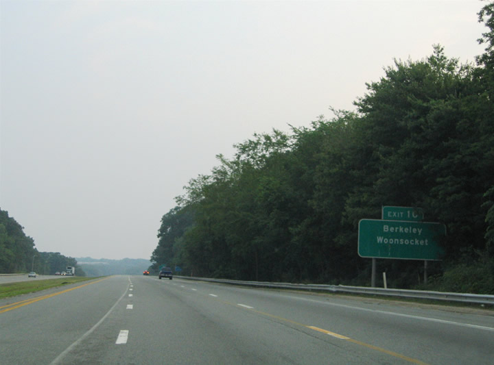
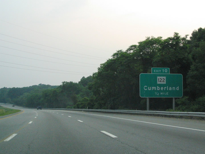
| Like Exit 11, Exit 10 also serves the town of Cumberland in northeastern Rhode Island. Route 122 sees a folded diamond interchange with Interstate 295 adjacent to the Providence & Worcester Railroad and the Blackstone River. 06/26/05 |
|
| Interstate 295 southbound at the Exit 10 ramp departure to Route 122 (Mendon Road). Route 122 enters Ashton and Berkeley just south of the freeway en route to Lonsdale and Central Falls. Northward the state highway continues to Cumberland Hill and Route 99 at Woonsocket. 06/26/05 |
|
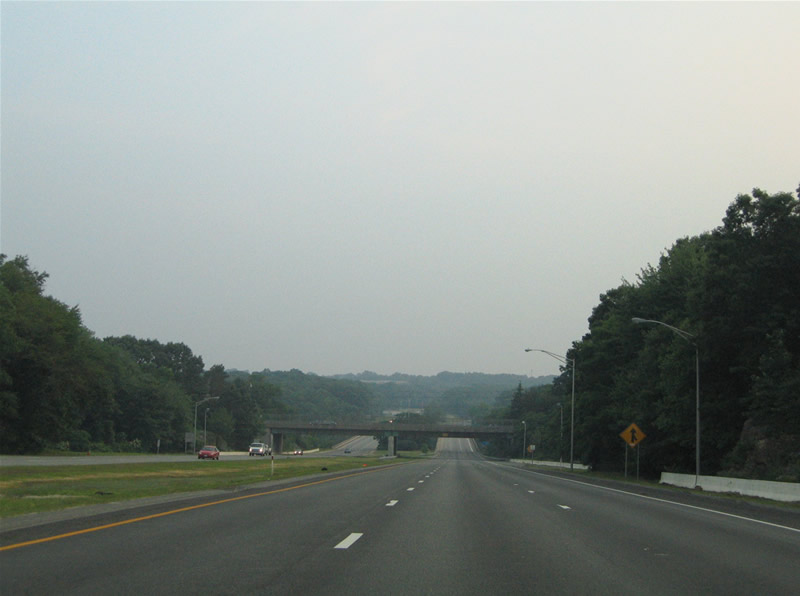
| Sinking toward the Blackstone River crossing on Interstate 295 south. Mendon Road travels overhead. 06/26/05 |
|
| Restriping allows for three overall southbound lanes across the Blackstone River in lieu of freeway standard shoulders. The Blackstone River flows south from Worcester, Massachusetts to the Seekonk River and Narragansett Bay. 06/26/05 |
|
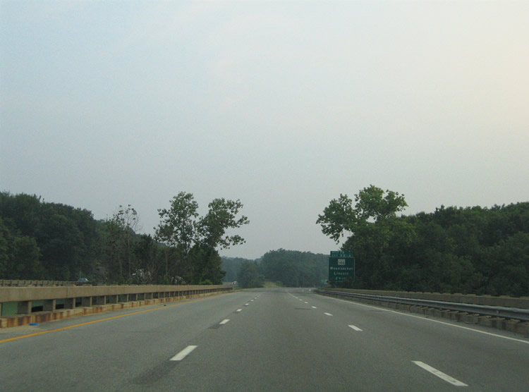
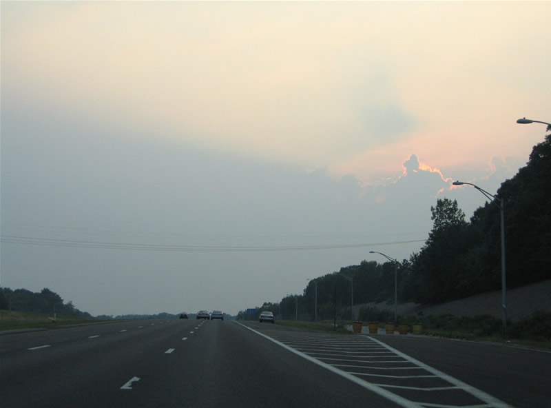
| Older button copy signs featured both the exit number and freeway milepost on Interstate 295. The two mile guide sign was one such example of the older format, though a resigning project in 2007 replaced most older signs. Intersecting the freeway ahead is the Route 146 freeway, a north-south route linking Providence with Worcester, Massachusetts. 06/26/05 |
|
| Interstate 295 sees a roadway split and an abandoned southbound side rest area on the stretch between the Blackstone River and Route 126 (Old River Road) over crossing. The rest area is slated for reuse as a new facility. 06/26/05 |
|
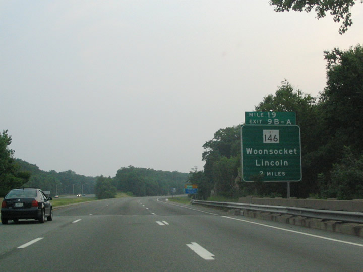
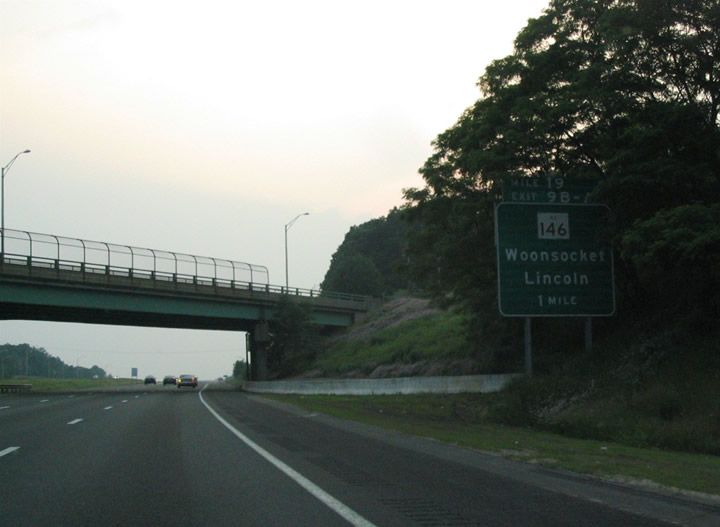
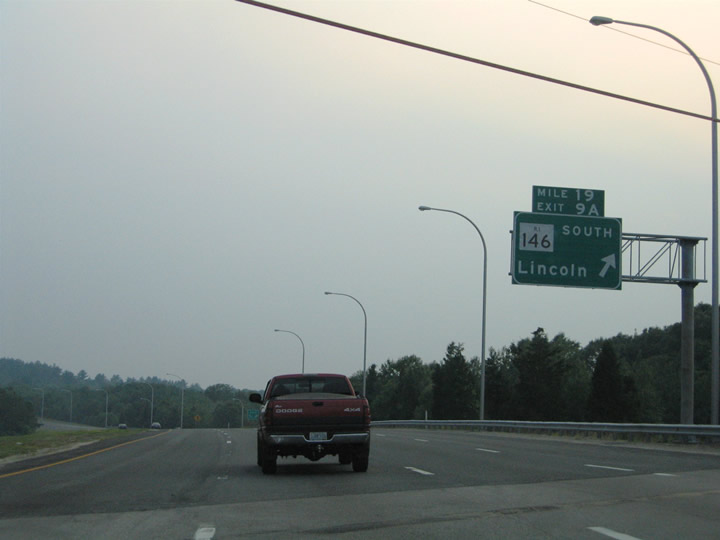
| The one mile guide sign for Exits 9B/A (Route 146) resides at the Old River Road overpass on Interstate 295 south. A cloverleaf interchange joins the two freeways at the town of Lincoln. Route 146 provides direct links to Interstate 95 at Providence and Interstate 290 near downtown Worcester, Massachusetts. The freeway also includes several interchanges to Woonsocket area roads, including the Route 99 (Woonsocket Industrial Highway) freeway spur. 06/26/05 |
|
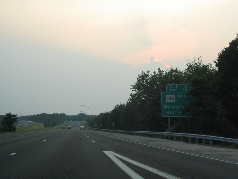
| Approaching the Exit 9B off-ramp to Route 146 northbound on Interstate 295 south near the Lincoln area weigh station. Route 146 splits with Route 99 just north of the Interstate 295. Route 99 serves nearby Manville before ending at Route 122 near Cumberland Hill. 06/26/05 |
|
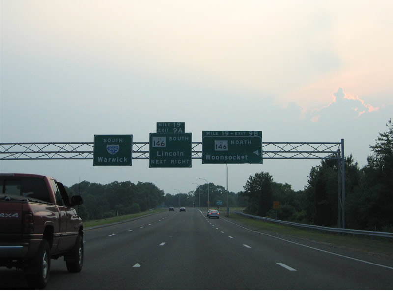
| Older guide signs directed motorists toward the respective Exit 9 ramps for Route 146. Route 146 heads 16 miles northwest to Whitinsville and 29 miles to Worcester. 06/26/05 |
|
| Southbound at the Exit 9B loop ramp onto Route 146 south. Route 146 continues 8.5 miles through Lincoln to North Providence and the capital city. 06/26/05 |
|
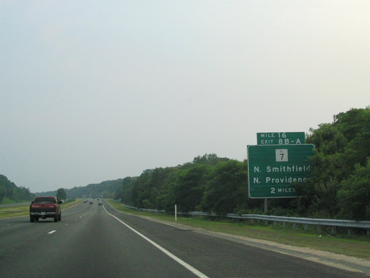
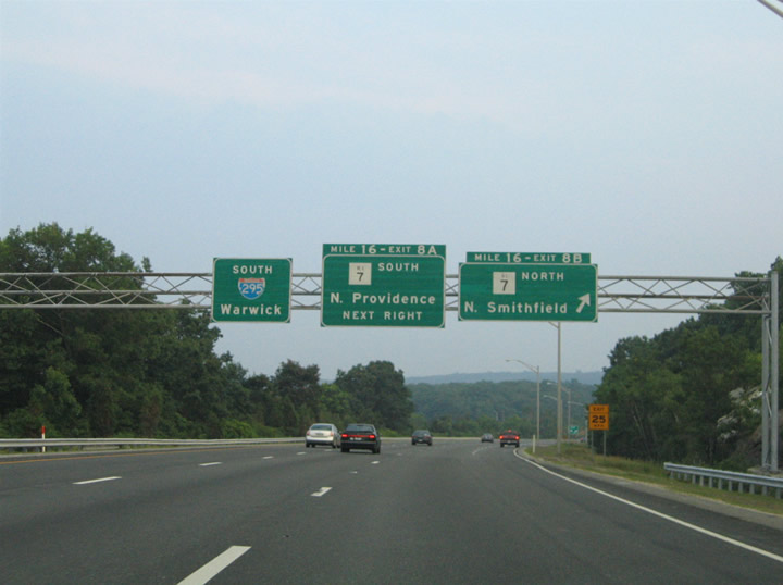
| Interstate 295 makes a southwestern turn between Exits 9 and 8. Meeting the freeway next is Route 7 (Douglas Pike), a north-south road serving the North Providence and North Smithfield areas. 06/26/05 |
|
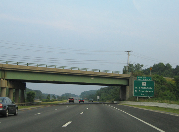
| Route 116 (George Washington Highway) passes over Interstate 295 one mile ahead of the cloverleaf interchange with Route 7 (Exits 8B/8A). Route 7 follows Douglas Avenue northwest out of the capital city through North Providence to North Smithfield. Douglas Avenue and Pike derive their name from the road's connection to Douglas, Massachusetts. 06/26/05 |
|
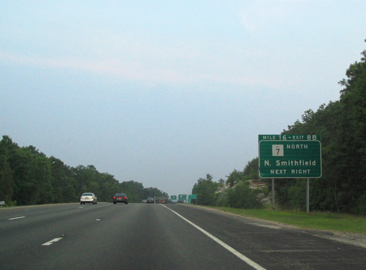
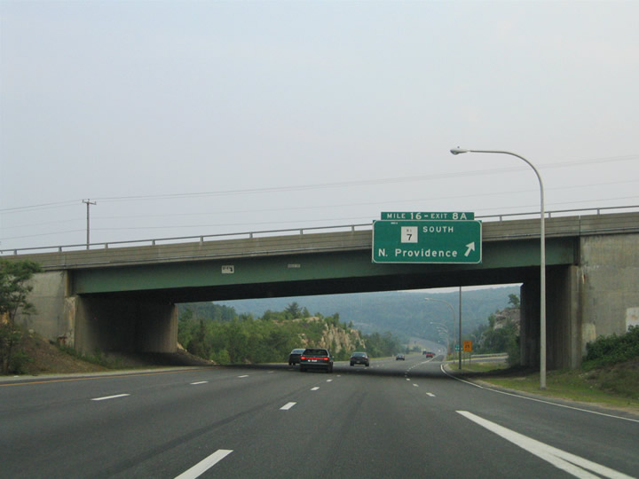
| An older standard, a ground level sign announced the first ramp departure of the Interstate 295 cloverleaf interchange with Route 7. Route 7 continues northwest to Oak Valley and Nasonville, ending officially at the Douglas Turnpike end of state maintenance near Mohegan.1 06/26/05 |
|
| Interstate 295 southbound at Exit 8B for Route 7 (Douglas Pike) northbound. Route 7 serves local area points of interest including Bryant University and the Smith Appleby House. 06/26/05 |
|
| Route 7 (Douglas Pike) ventures southeast through North Providence to its terminus at Route 246 in the city of Providence.1 06/26/05 |
|
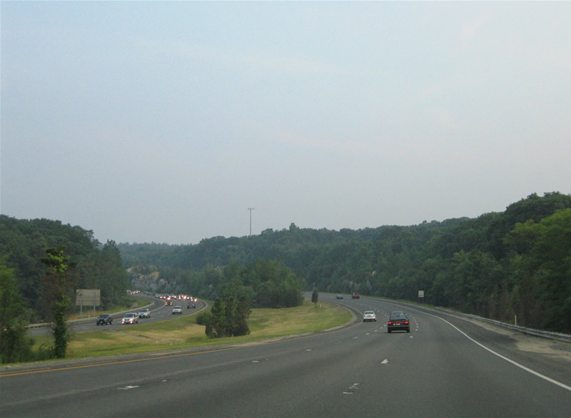
| Interstate 295 continues to drop in elevation southward through the Providence suburbs. 06/26/05 |
|
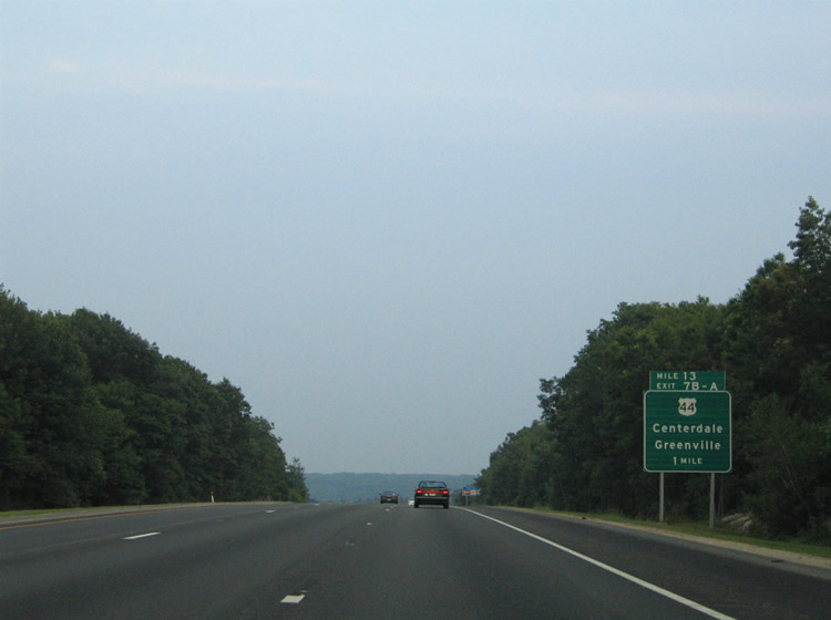
| Southbound near the community of Georgiaville at the two mile guide sign for U.S. 44 (Exits 7B/A) and the Route 104 (Farnum Pike) overpass. U.S. 44 constitutes one of three US highways serving Rhode Island. The east-west route straddles the northern reaches of the state between Putnam, Connecticut and Seekonk, Massachusetts. 06/26/05 |
|
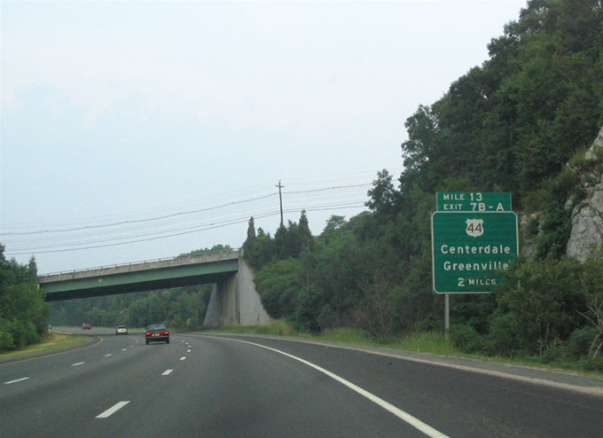
| Continuing south to within one mile of the cloverleaf interchange (Exit 7) with U.S. 44 (Putnam Pike) on Interstate 295. U.S. 44 locally serves the towns of Greenville to the west and Centerdale to the east. 06/26/05 |
|
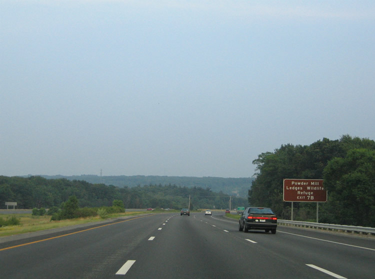
| U.S. 44 heads west to the Powder Mill Ledges Wildlife Refuge and Casimir Pulaski Memorial State Park among other area attractions. U.S. 44 crosses the state line in 16 miles on the 21 mile drive to Putnam, Connecticut. 06/26/05 |
|
| The Greenville town center lies two miles to the west at the U.S. 44 crossroads with Route 116 (Smith and Pleasant View Avenues). 06/26/05 |
|
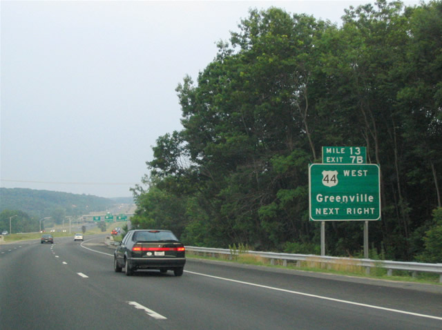
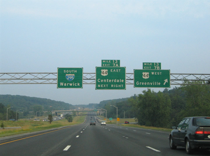
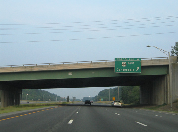
| Exit 7B leaves Interstate 295 southbound for U.S. 44 (Putnam Pike) westbound. U.S. 44 serves the communities of West Greenville, Harmony, Chepachet, and West Glocester on the drive to the Constitution State. The US highway rendezvous with U.S. 6 at Manchester, with both highways serving the capital city of Hartford. 06/26/05 |
|
| U.S. 44 (Putnam Pike) eastbound continues through Centerdale to Downtown Providence and East Providence, sharing mileage with U.S. 6 across the Seekonk River. U.S. 44 follows Putnam Pike east to Smith Street in the capital city. 06/26/05 |
|
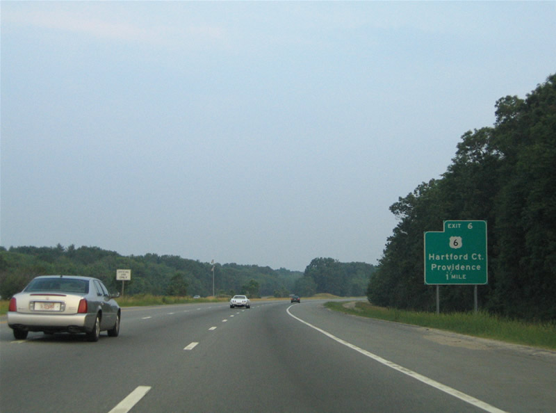
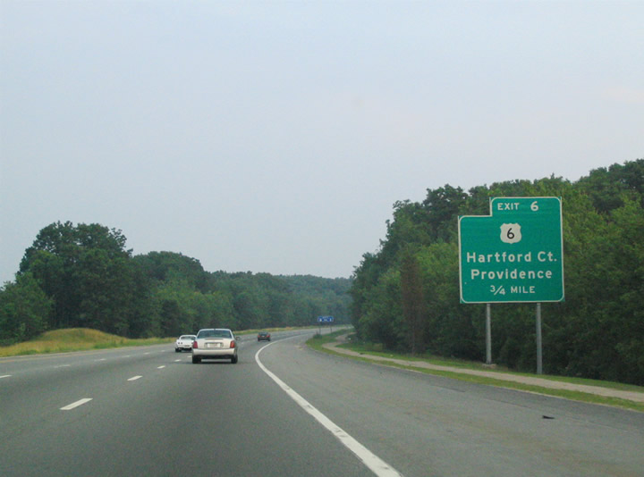
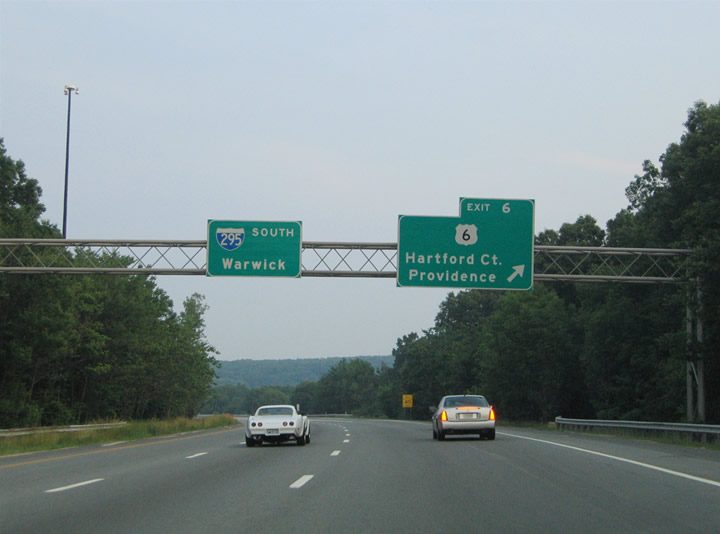
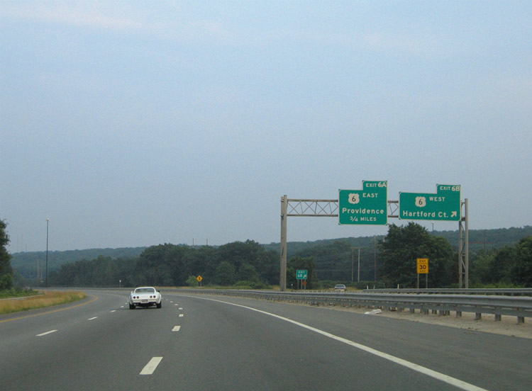
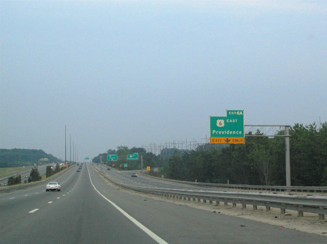
| Interstate 295 converges with U.S. 6 at Exit 6 within the town of Johnston. U.S. 6 constitutes the main route between the cities of Hartford and Providence. In addition the route serves interests in the Providence metropolitan area, joining the capital city with North Scituate and Chopmist. 06/26/05 |
|
| The roadways of Interstate 295 diverge ahead of the parclo interchange with U.S. 6 west & U.S. 6A east (Hartford Avenue) at Johnston. U.S. 6 eastbound joins Interstate 295 briefly to make the jump from Hartford Avenue onto a freeway leading east into Providence. 06/26/05 |
|
| A lengthy collector distributor roadway serves the interchanges with Hartford Avenue (U.S. 6 west & U.S. 6A east) and the U.S. 6 east freeway. U.S. 6 constitutes a full freeway between Interstates 295 and 95 at downtown Providence. The freeway was constructed in anticipation of Interstate 84's planned routing from Hartford, Connecticut to Providence. However with the majority of the route between Manchester and Providence unconstructed, the freeway through Johnston and Providence is all that was built of the defunct Interstate within the Ocean State. 06/26/05 |
|
| Exit 6B parts ways with the southbound c/d roadway for U.S. 6 west and U.S. 6A east. U.S. 6A follows the original U.S. 6 Hartford Avenue routing through Johnston and the Merino and Olneyville neighborhoods of west Providence. U.S. 6 westbound heads 3.5 miles west to North Scituate, 9.5 miles to South Foster, and 67 miles to Hartford, Connecticut. 06/26/05 |
|
| A wide swath of freeway mainline and c/d roadways travel between Hartford Avenue (U.S. 6A) and the U.S. 6 freeway. The U.S. 6 mainline utilizes the c/d roadways for its southward jog to the eastward leading freeway into downtown Providence. 06/26/05 |
|
| The right lane of the southbound c/d roadway defaults onto the U.S. 6 eastbound freeway (Exit 6A). The planned Interstate 84 routing serves east Johnston, Manton, and Providence. U.S. 6 merges with the Route 10 freeway ahead of its respective merges with Interstate 95 south and Interstate 195 east. U.S. 6 travels across town to East Providence and Seekonk, Massachusetts with Interstate 195. 06/26/05 |
|
| The directional cloverleaf interchange between Interstate 295 and U.S. 6 includes abandoned provisions for the unconstructed westward extension of the freeway for Willimantic and Hartford. Ghost ramps and a freeway stub remain in place from the interchange completion of May 1971.2 06/26/05 |
|
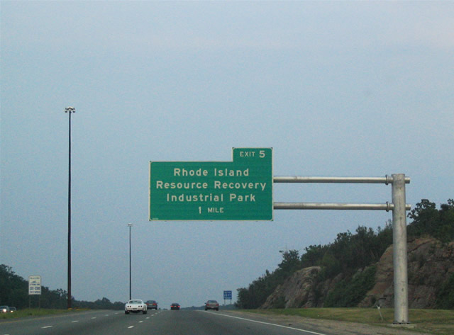
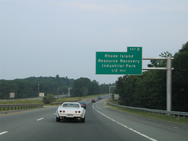
| Exit 5 serves the Rhode Island Resource Recovery Industrial Park in Johnston. The forthcoming diamond interchange joins Interstate 295 with a disjointed section of Scituate Avenue. Scituate Avenue was severed at the east end of the interchange, likely to discourage truck traffic from using the road to reach Route 5 (Atwood Avenue) to the east. 06/26/05 |
|
| One half mile north of Exit 5 to Scituate Avenue westbound to the Rhode Island Resource Recovery Industrial Park. The industrial park is run by the Rhode Island Resource Recovery Corporation, a state environmental agency that deals with waste management and materials recycling. 06/26/05 |
|
| Southbound at the Exit 5 ramp departure to Scituate Avenue west. Scituate Avenue meets Shun Pike and a disjointed section of Old Pocasset Road to the west. Shun Pike serves industrial areas west and south to Route 14 (Plainfield Avenue) and Peck Hill Road in west Johnston. 06/26/05 |
|
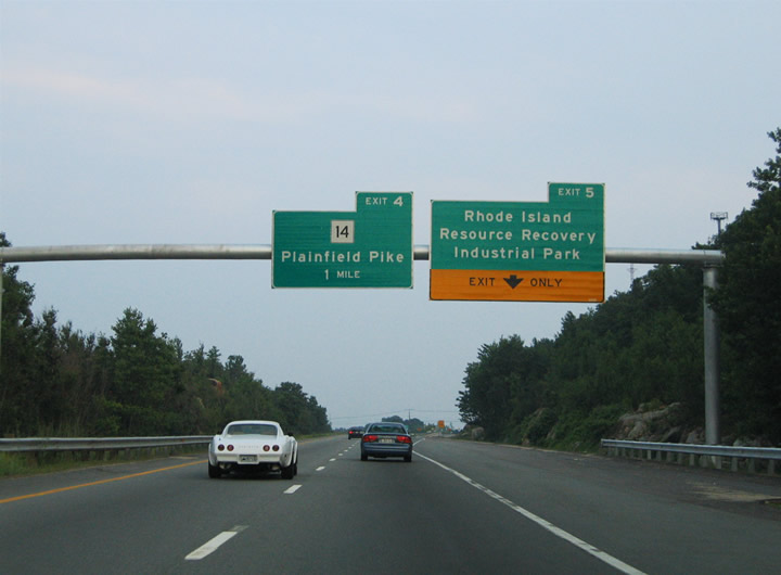
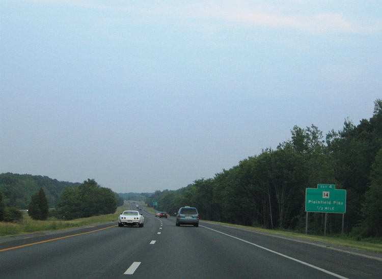
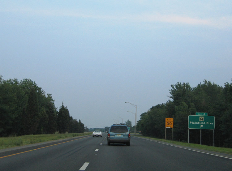
| Interstate 295 continues south to the half-cloverleaf interchange with Route 14 (Plainfield Pike). Route 14 comprises a multistate route with Route 14 from Willimantic to Providence. Locally the route serves the Thornton and Simmonsville communities. 06/26/05 |
|
| An older style button copy sign directed motorists onto the Exit 4 off-ramp to Route 14 (Plainfield Pike). Route 14 heads west eight miles to Scituate Reservoir and Rockland. Eastward, Plainfield Pike heads one mile to Thornton and four miles to Olneyville in Providence. 06/26/05 |
|
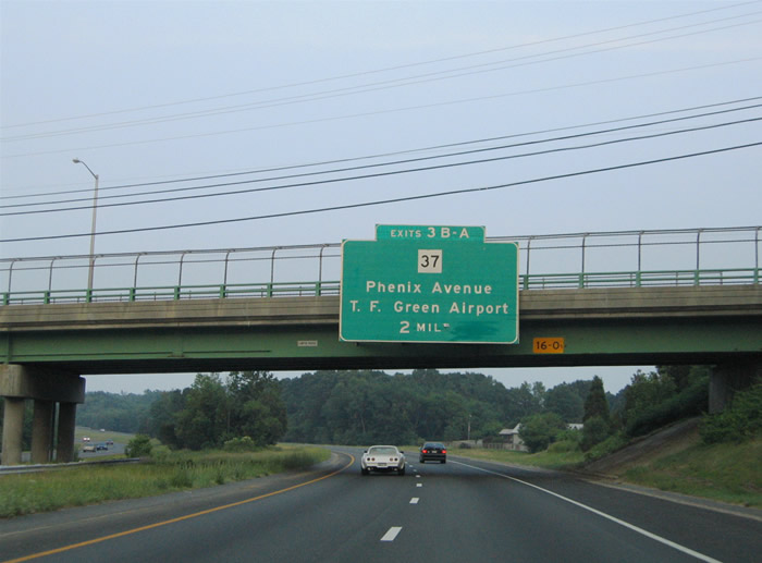
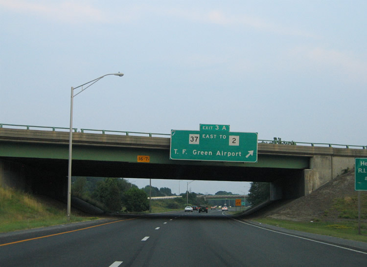
| Attached to the Scituate Avenue (Route 12) over crossing is the two mile overhead for Route 37. Route 37 represents a full freeway from Phenix Avenue and Interstate 295 east to Interstate 95 and U.S. 1 (Post Road) near T.F. Green Airport. 06/26/05 |
|
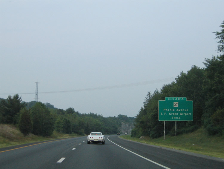
| More rock cuts lie along the freeway median of Interstate 295 ahead of the Exit 3B/A cloverleaf interchange with Route 37. Route 37 begins at the forthcoming interchange, comprising all of the three mile freeway between east Cranston and north Warwick. The freeway features sequentially numbered interchanges serving Oaklawn, Howard, Norwood, and Lincoln Park. 06/26/05 |
|
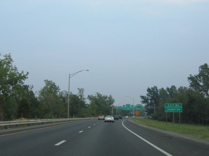
| Interests to Cranston should use Exit 3B onto the freeway west to its end at Natick Avenue. Natick Avenue travels north-south between Phenix Avenue (Route 51) and Wilbur Avenue. Route 51 follows the locally maintained Phenix Avenue southwest from Meshanticut to Lipitt. 06/26/05 |
|
| Entering the cloverleaf interchange with the Route 37 freeway. Route 37 west ends just west of Interstate 295 at Natick Avenue. The freeway overall was constructed in anticipation of the planned and unconstructed Interstate 895 east-belt freeway for the Providence metropolitan area.1 Coventry appears on the original Exit 3B overhead for the Route 51 (Phenix Avenue) connection to the town of Coventry. 06/26/05 |
|
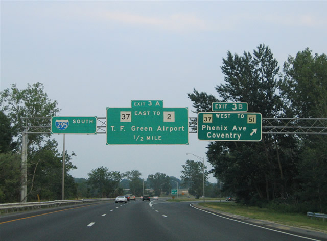
| Interstate 295 southbound at the Exit 3A ramp departure to Route 37 eastbound. Route 37 interchanges with Route 2 (New London Avenue) at the adjacent interchange. 06/26/05 |
|
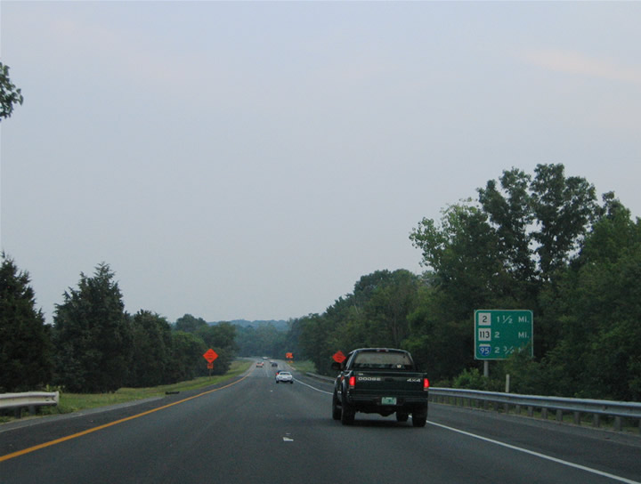
| Distance sign listing the final three exits along Interstate 295 southbound. 06/26/05 |
|
| Interstate 295 meets Route 2 (Bald Hill Road) just south of the Kent County line near Pontiac and Natick. Route 2 ventures southwest from Providence and Cranston to Warwick on its southerly course to Charlestown along the south coast. Use Route 2 south to Route 117 west for West Warwick or to Route 113 (East Avenue) east for the Warwick town center. 06/26/05 |
|
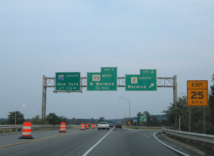
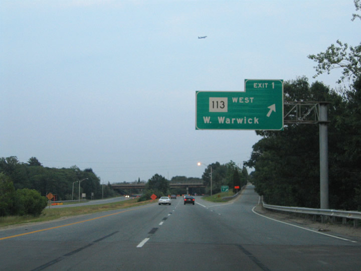
| Interstate 295 crosses the Pawtucket River between the Exit 2 half-cloverleaf interchange and the parclo interchange with Route 113 (East Avenue). Exit 1 provides access onto East Avenue westbound only ahead of its intersection with Route 2 (Bald Hill Road). For access to Route 113 eastbound, drivers should use Exit 2. Route 113 interchanges with Interstate 95 just east of its ramps with Interstate 295. 06/26/05 |
|
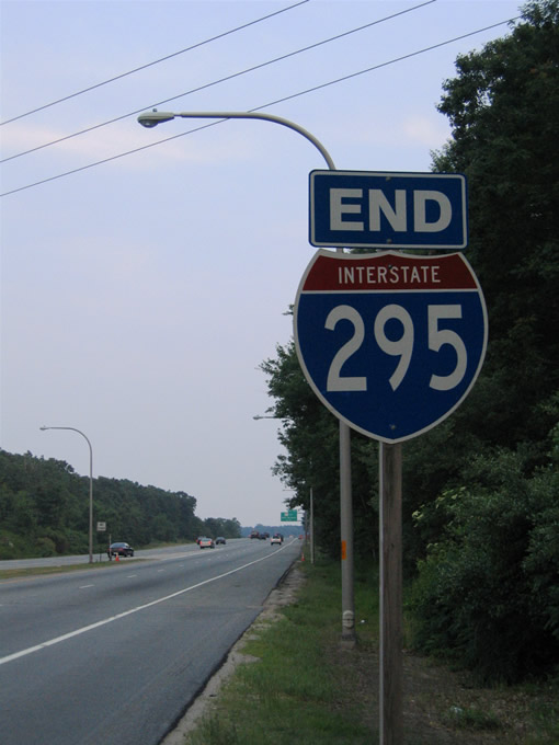
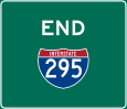
| End Interstate 295 marker posted at the wye interchange merge with Interstate 95 south. Interstate 95 next meets Route 117 (Centerville Road) at Exit 10, located between West Warwick and Warwick. The control point of New York City lies 152 miles to the southwest. 06/26/05 |
Page Updated 08-14-2012.

 South
South