|
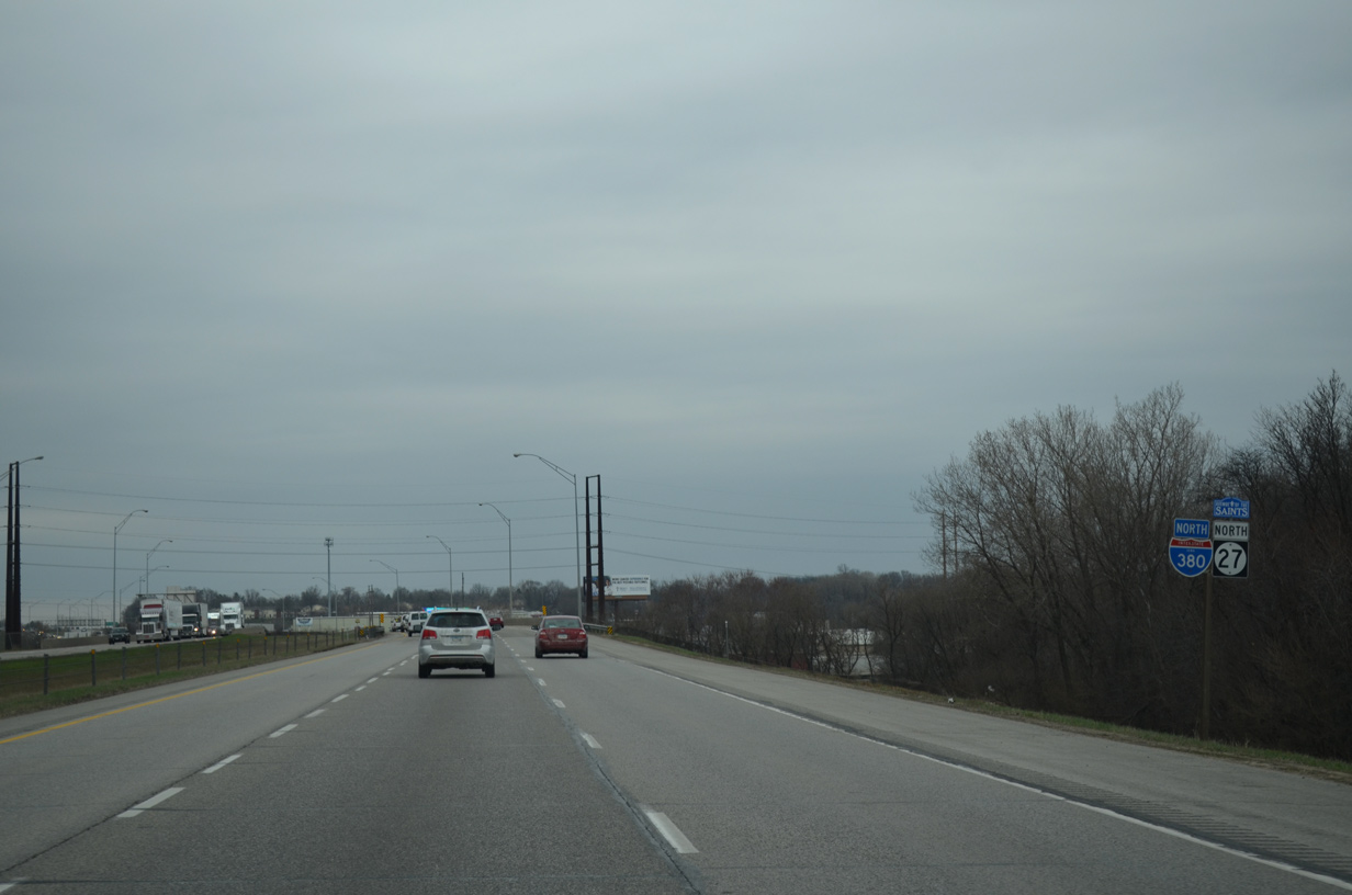
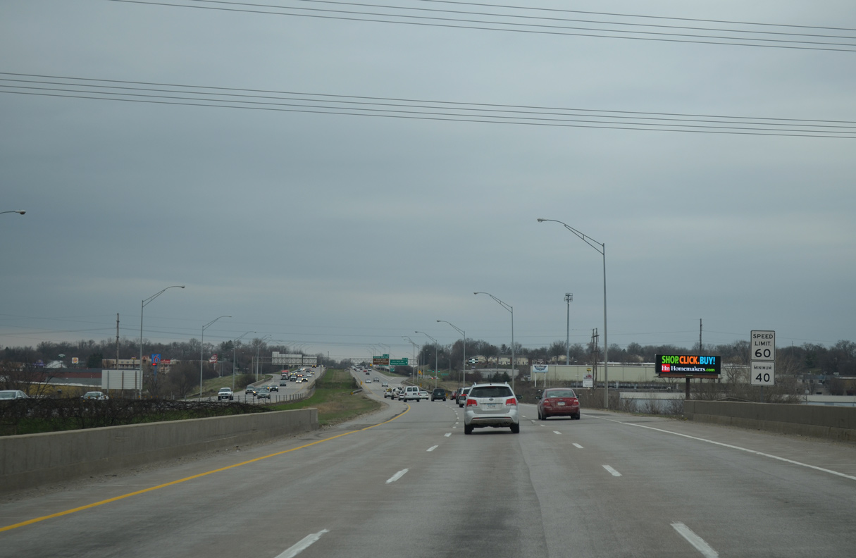
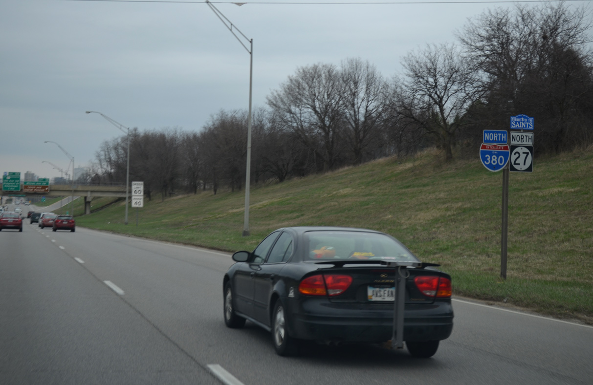
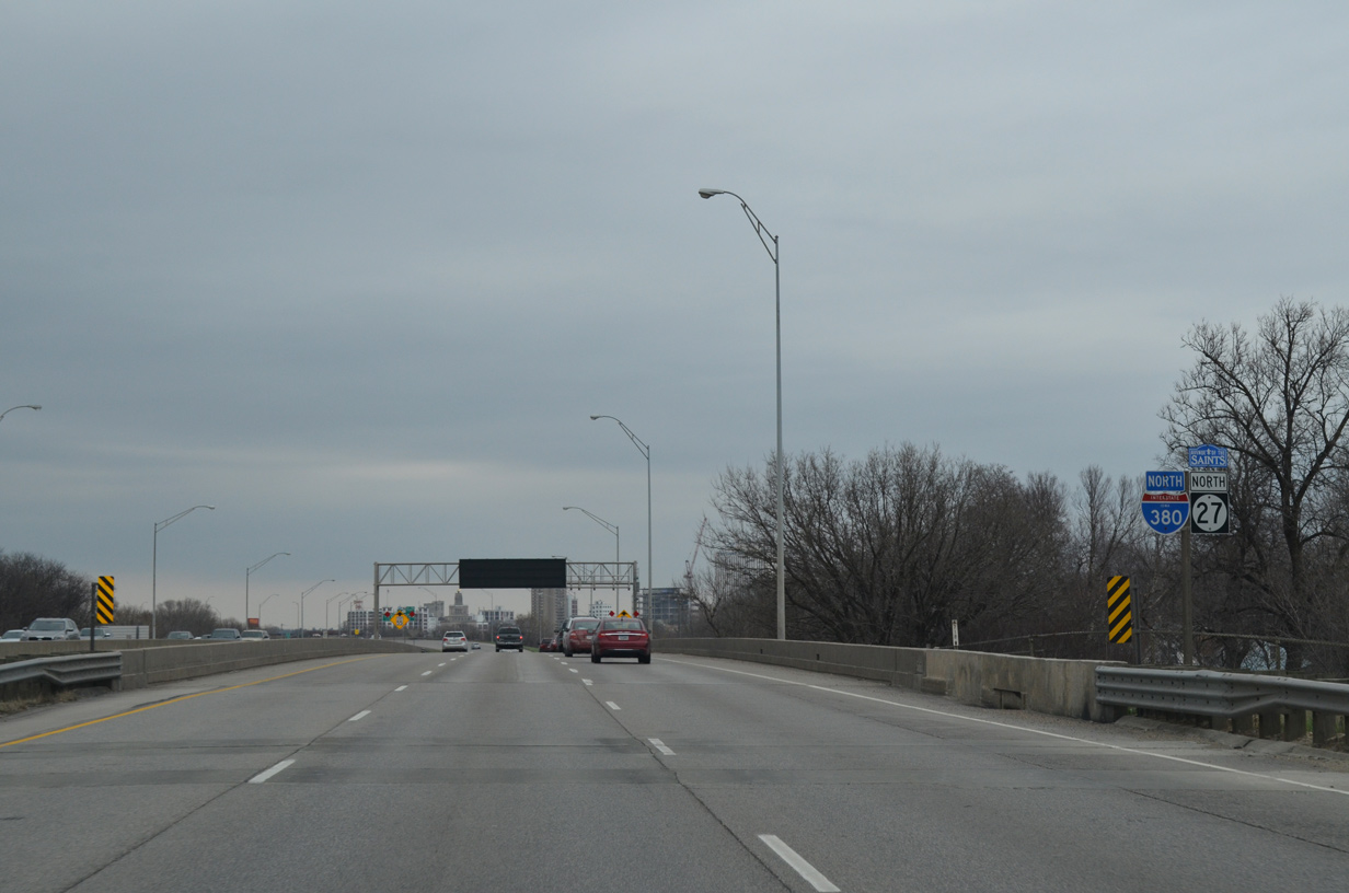
| Interstate 380 and Iowa 27 north expand to six overall lanes beyond U.S. 30-151-218. 03/30/16 |
|
| Spanning Prairie Creek and a Union Pacific Railroad along I-380 east of Hawkeye Downs. 03/30/16 |
|
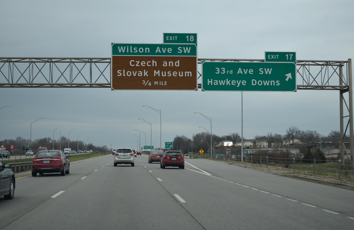
| 33rd Avenue SW serves the industrial south side of Cedar Rapids and Hawkeye Downs via 6th Street SW to the west of Exit 17. 03/30/16 |
|
| I-380/Iowa 27 drops below grade at 27th Avenue SW between the diamond interchanges with 33rd Avenue and Wilson Avenue SW. 03/30/16 |
|
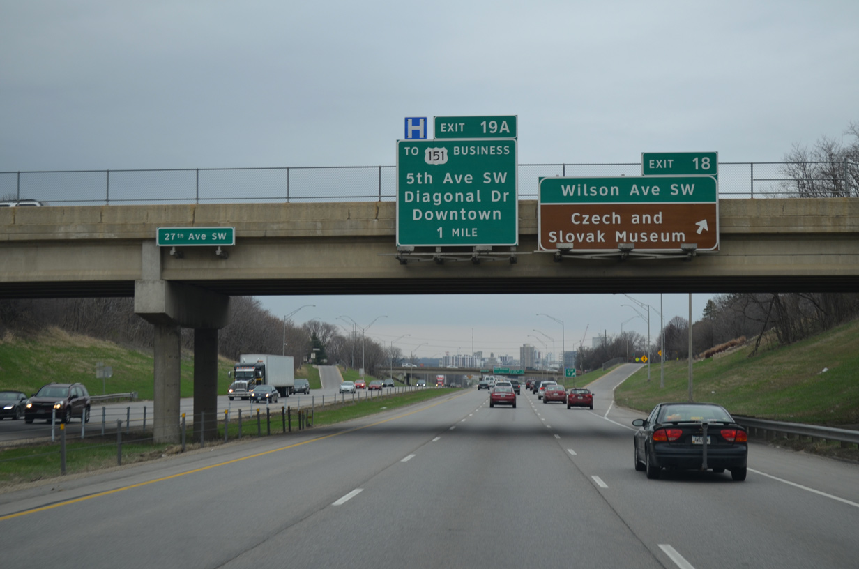
| Wilson Avenue SW heads east to C Street SW and west to U.S. 151 Business (Williams Boulevard) by Westdale Mall. Points of interest served by Exit 18 include Veterans Memorial Stadium (minor league baseball), Kingston Stadium (high school football), ImOn Ice arena and the Czech and Slovak Museum. 03/30/16 |
|
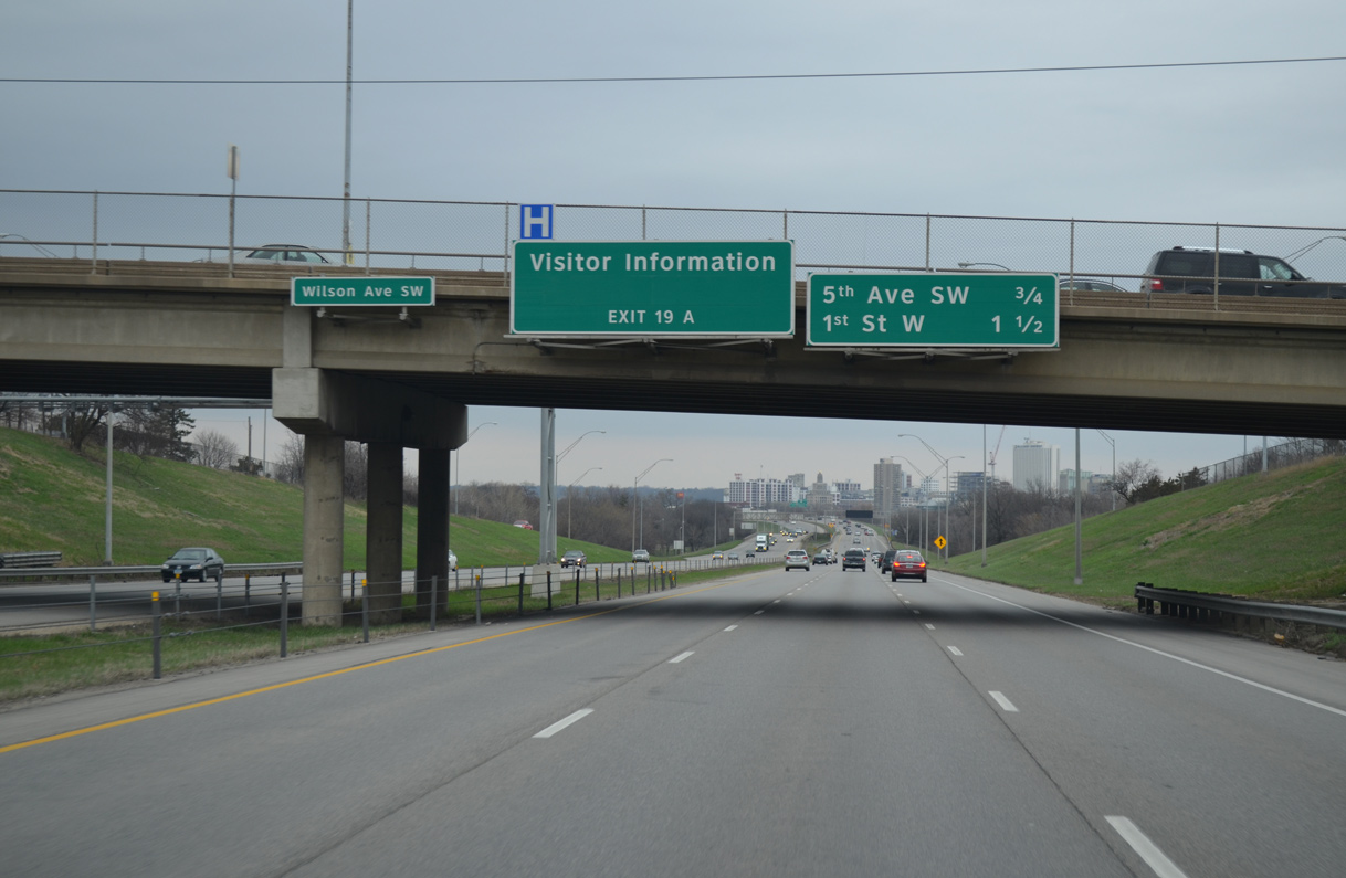
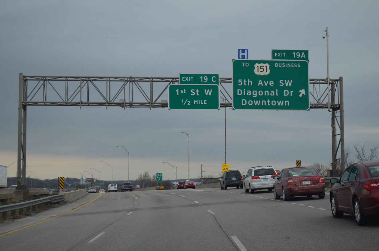
| A split diamond interchange (Exit 19 A) follows with Diagonal Drive, 5th Avenue SW and U.S. 151 Business (1st Avenue) in 0.75 miles. Sign replacements here made by 2011 removed Science Station IMAX, as the attraction's Downtown location was destroyed during the historic floods of 2008.1 03/30/16 |
|
| Viaducts elevate I-380/Iowa 27 above 16th and 15th Avenues SW. 03/30/16 |
|
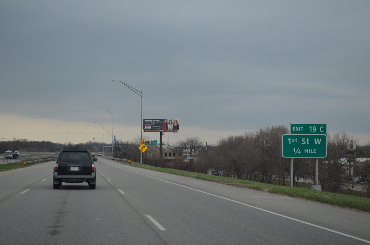
| Exit 19 A lowers onto 3rd Street SW at Diagonal Drive east and 5th Avenue SW west. U.S. 151 Business (Iowa 922) runs nearby southwest to Westdale Mall and northeast through Downtown to Iowa 100 at Marion. 03/30/16 |
|
| I-380/Iowa 27 curve eastward onto a viaduct leading across the Cedar Rapid to Downtown. Exit 19 C departs from the elevated roadway to 1st Street NW by Riverfront Park. 03/30/16 |
|
| 1st Avenue NW lines the west banks of the Cedar River northward through a former residential area that was submerged by the flooding of 2008. The avenue south connects with adjacent U.S. 151 Business. 03/30/16 |
|
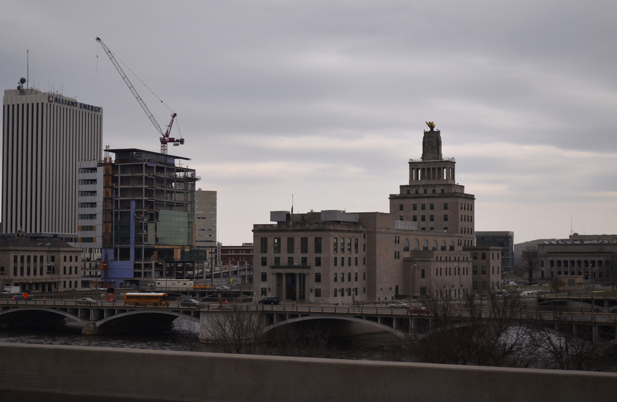
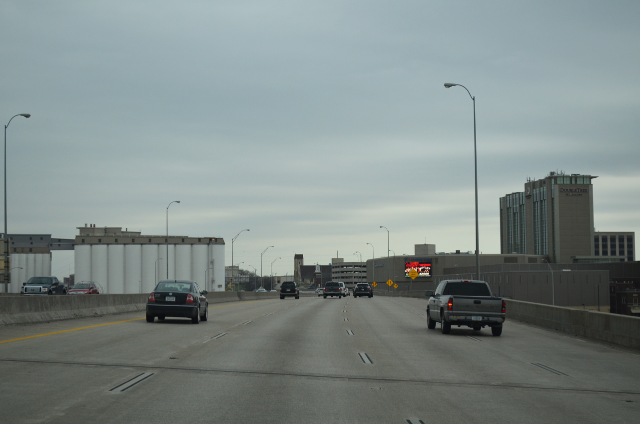
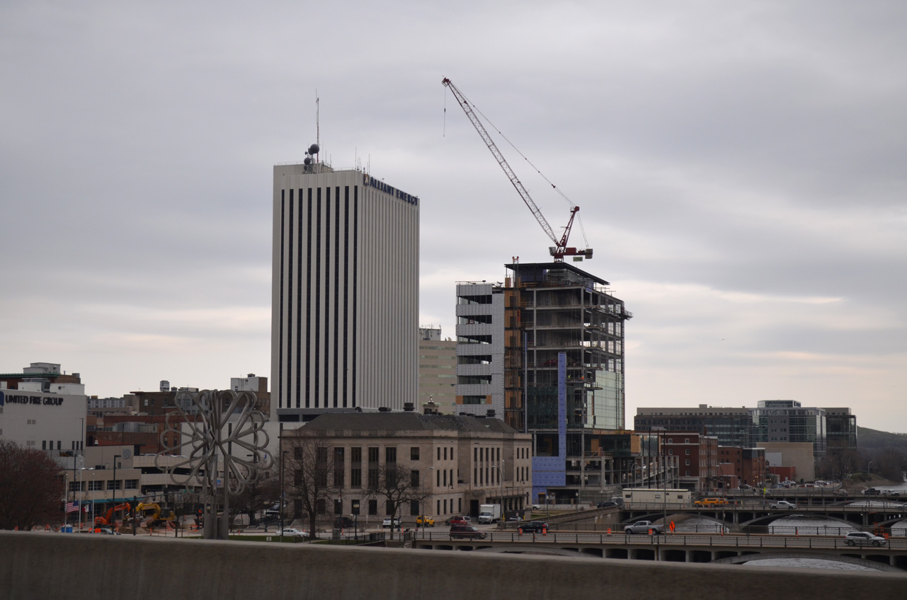
| Downtown Cedar Rapids comes into view east of the viaduct along I-380 at 1st Avenue SW. 03/30/16 |
|
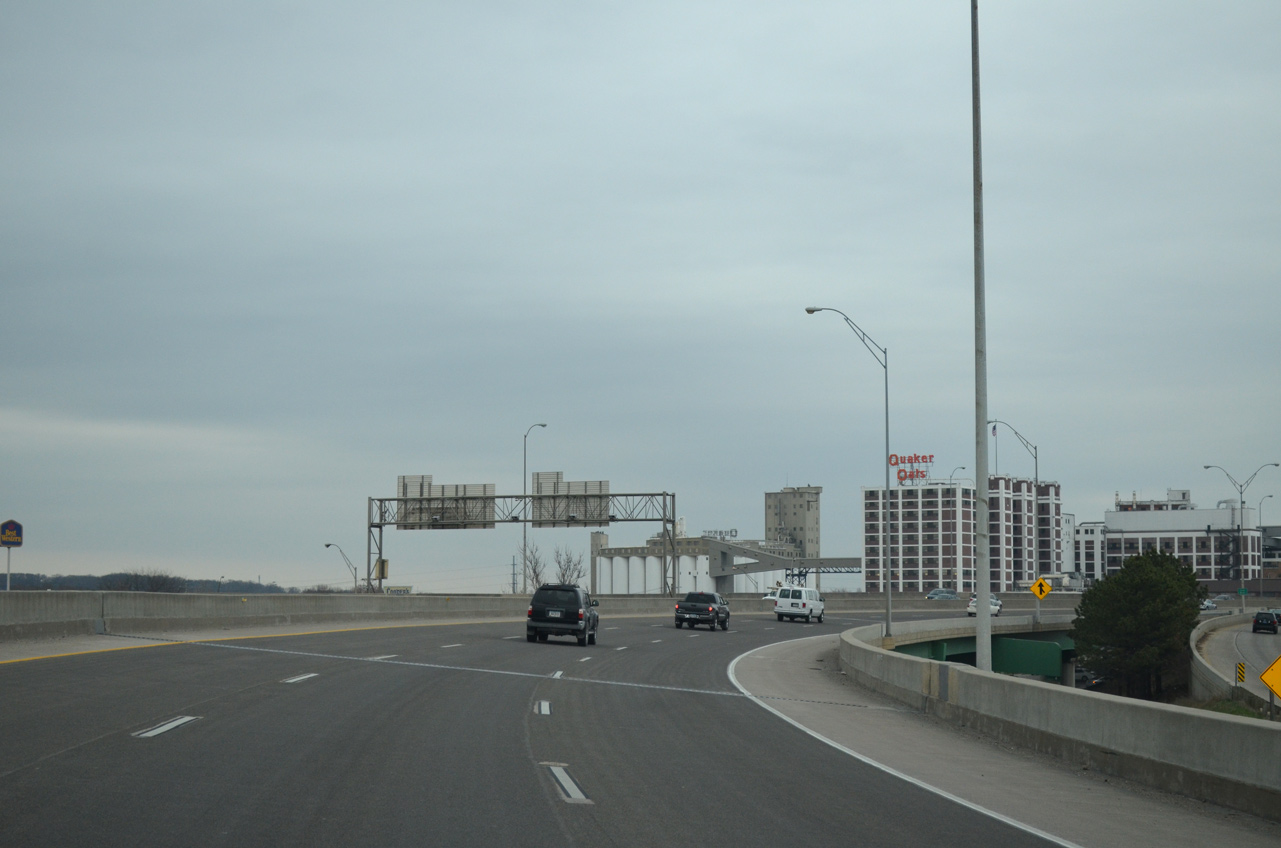
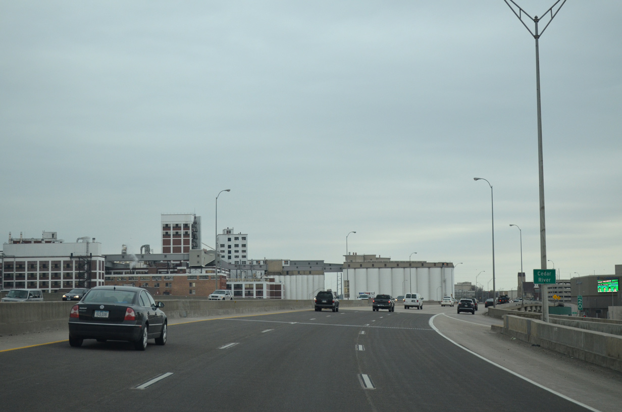
| The Quaker Oaks plant rises prominently on the north side of I-380 opposite from Downtown. Despite efforts to hold back flood waters from the Cedar River, the 14-story plant succumbed to water on June 13, 2008. Restoration efforts returned the plant to limited capacity in three weeks and full operations three months later.2 03/30/16 |
|
| An entrance ramp joins I-380/Iowa 27 north at the Cedar River from U.S. 151 Business at 3rd Street NW. 03/30/16 |
|
| Looking south at Mays Island from I-380. The small island on the Cedar River is home to the Linn County Courthouse. 03/30/16 |
|
| U.S. 151 Business (Iowa 922) spans the Cedar River just south of I-380 on a concrete arch bridge built in 1920.3 03/30/16 |
|
| The I-380 span across the Cedar River includes a lower deck joining 1st Street NW with 1st Street NE. 03/30/16 |
|
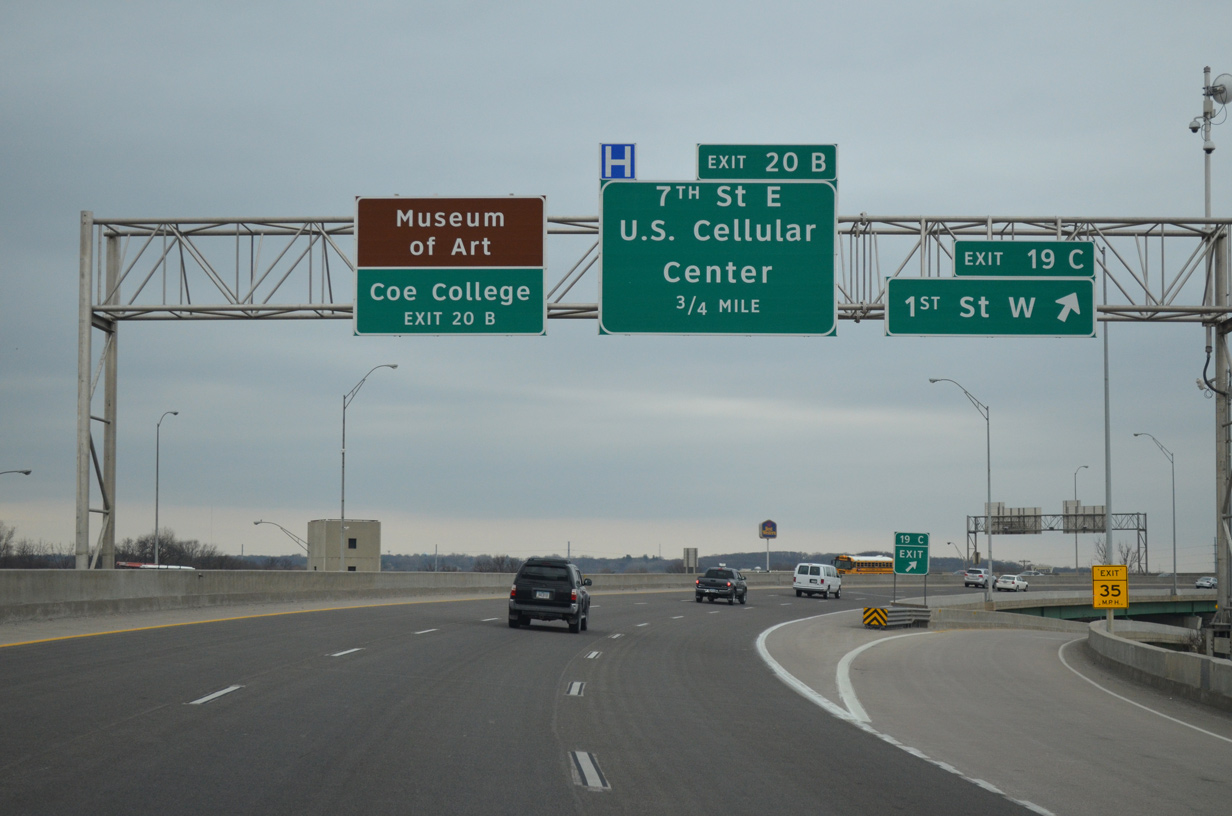
| Interstate 380 passes between the Quaker Oaks plant and Alliant Energy PowerHouse, a concert and basketball arena opened in 1979. The venue was U.S. Cellular Center until 2020.4 03/30/16 |
|
| A parclo interchange (Exit 20 B) quickly follows the end of the I-380 viaduct with 7th and 8th Streets NE for Alliant Energy PowerHouse and eastern areas of Downtown. 03/30/16 |
|
| A quick succession of exits line I-380/Iowa 27 leading north from Cedar Lake to Iowa 100 (Collins Road) and north Cedar Rapids. 03/30/16 |
|
| A third viaduct carries I-380/Iowa 27 by Unity Point Health - St. Luke's Hospital and the eastern periphery of Cedar Lake. 03/30/16 |
|
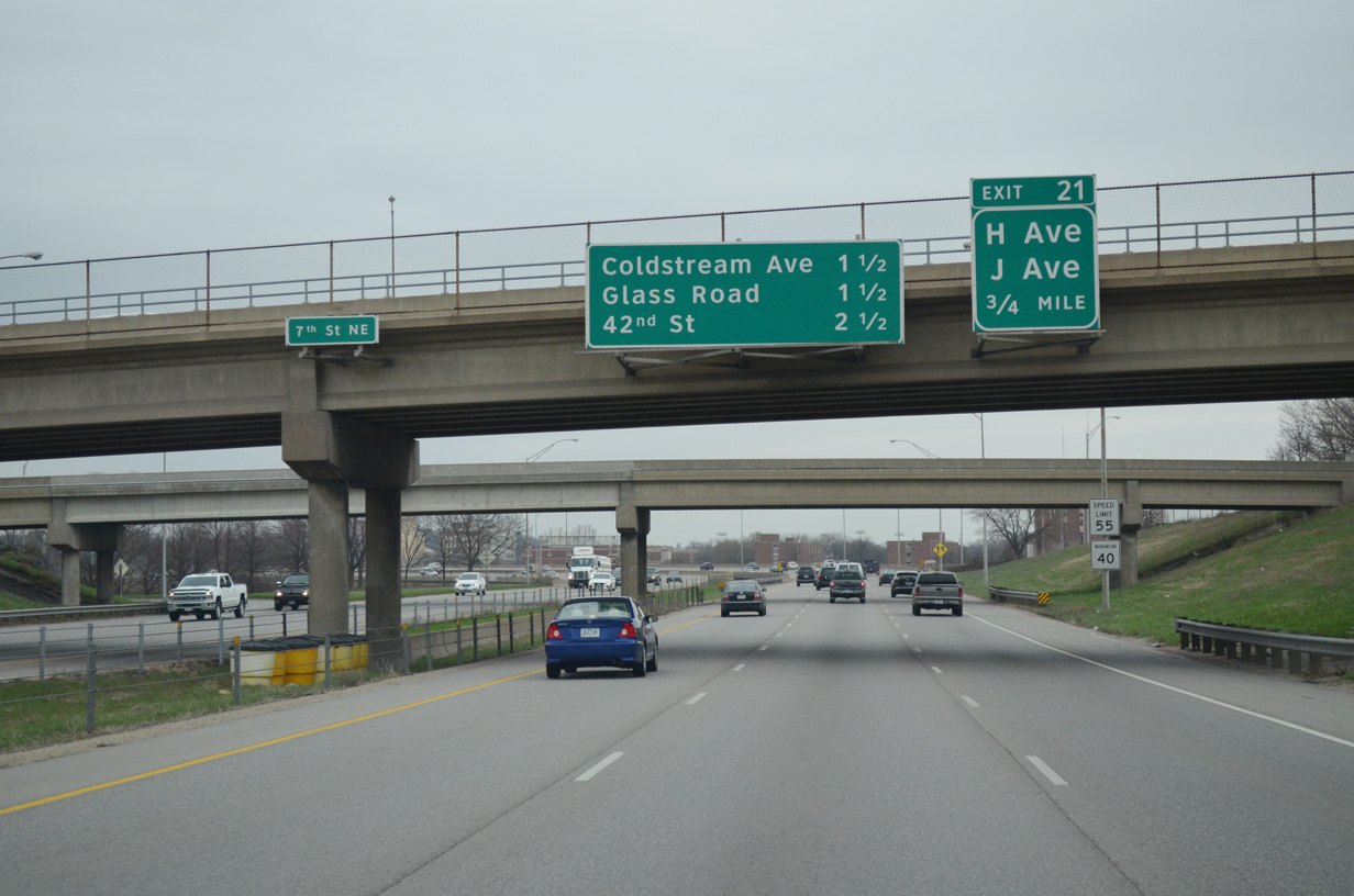
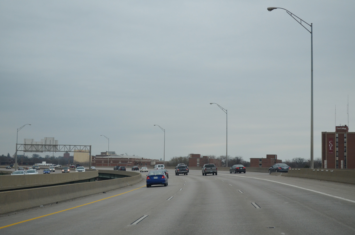
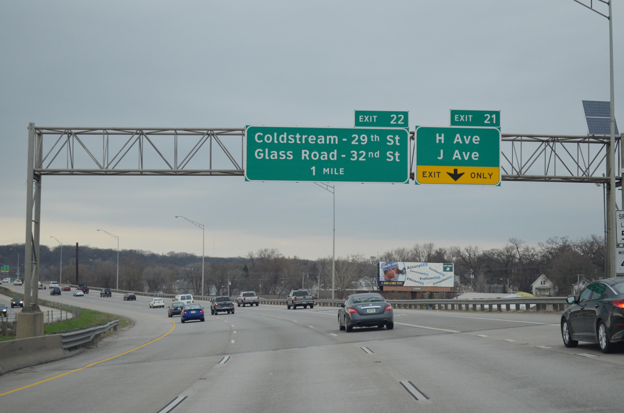
| Departing next is Exit 21 onto 11th Street NE to H and J Avenues, local roads running between Daniels Park and an industrial area off Shaver Road. 03/30/16 |
|
| Entering the diamond interchange (Exit 21) with H and J Avenues on I-380/Iowa 27 north. 03/30/16 |
|
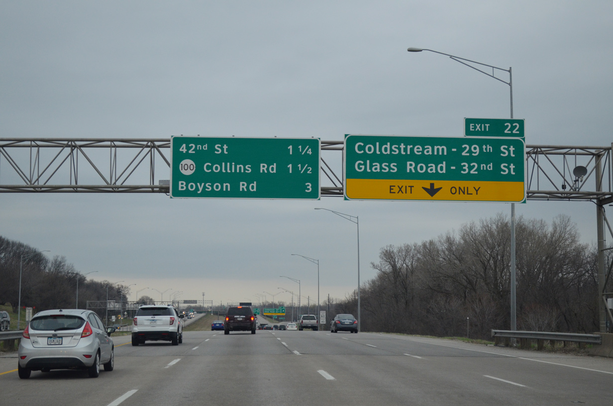
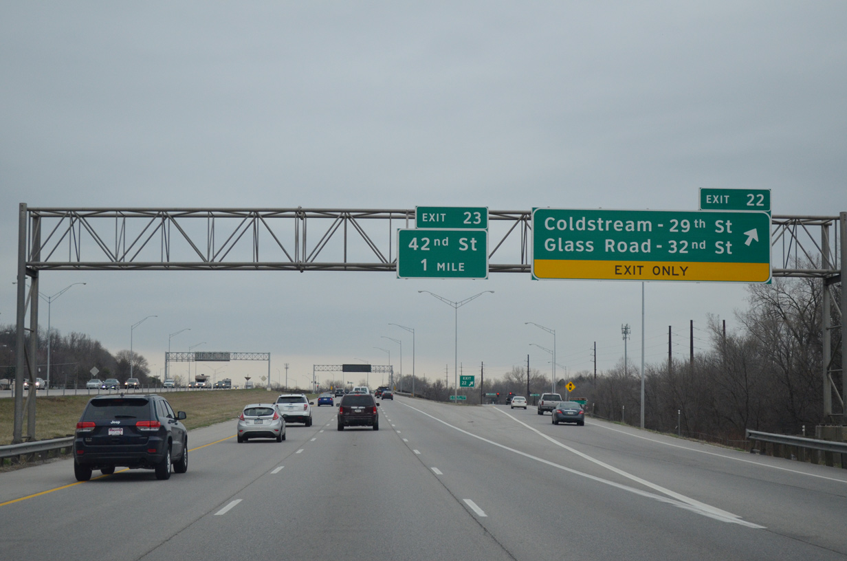
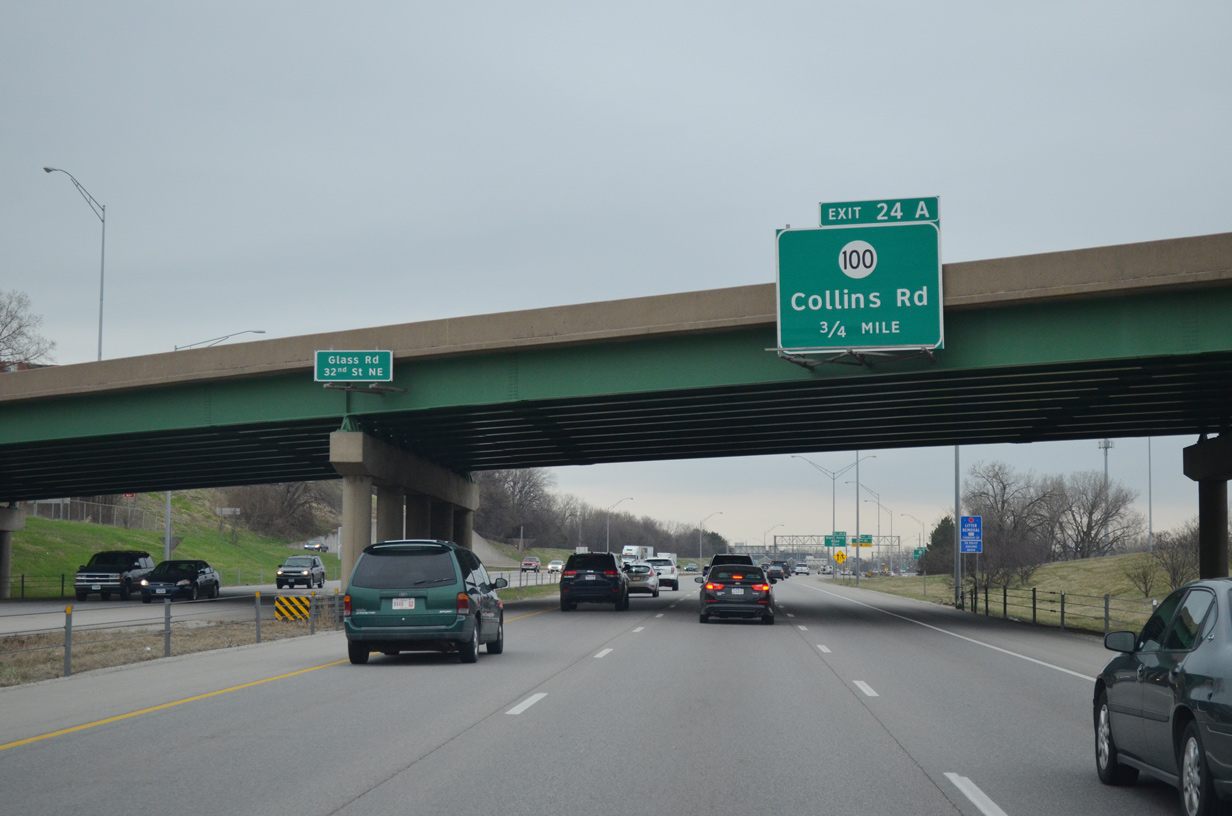
| Another split diamond interchange joins Interstate 380 with Coldstream Avenue / 29th Street NE and Glass Road / 32nd Street NE at McLouds Run Park. 03/30/16 |
|
| Northbound I-380 at Exit 22. Coldstream Avenue and Glass Roads extend the numbered streets west into leafy residential areas off Wenig Road. 29th Street NE east leads to Mt. Mercy University and the Brucemore Historic Site off U.S. 151 Business (1st Avenue NE). 03/30/16 |
|
| A frontage road system accompanies Interstate 380 from 42nd Street / Exit 23 north to the three level interchange (Exit 24 A) with Iowa 100 (Collins Road) in 0.75 miles. 03/30/16 |
|
| The entrance ramp from Glass Road forms an auxiliary lane along I-380 north to the half diamond interchange (Exit 23) with 42nd Street. 42nd Street comprises a boulevard west to residential areas, a pair of schools and Twin Pines Golf Course. 03/30/16 |
|
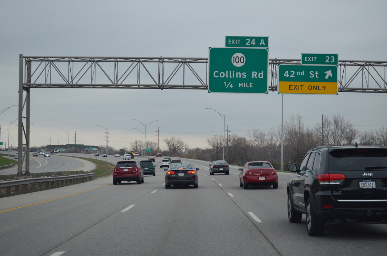
| Exit 23 parts ways with I-380/Iowa 27 north for 42nd Street. 42nd Street east heads to Noelridge Park and Old Marion Road NE by Elmcrest Country Club.
The slip ramp (Exit 24 A) onto the adjacent frontage road for Iowa 100 follows in one quarter mile. 03/30/16 |
|
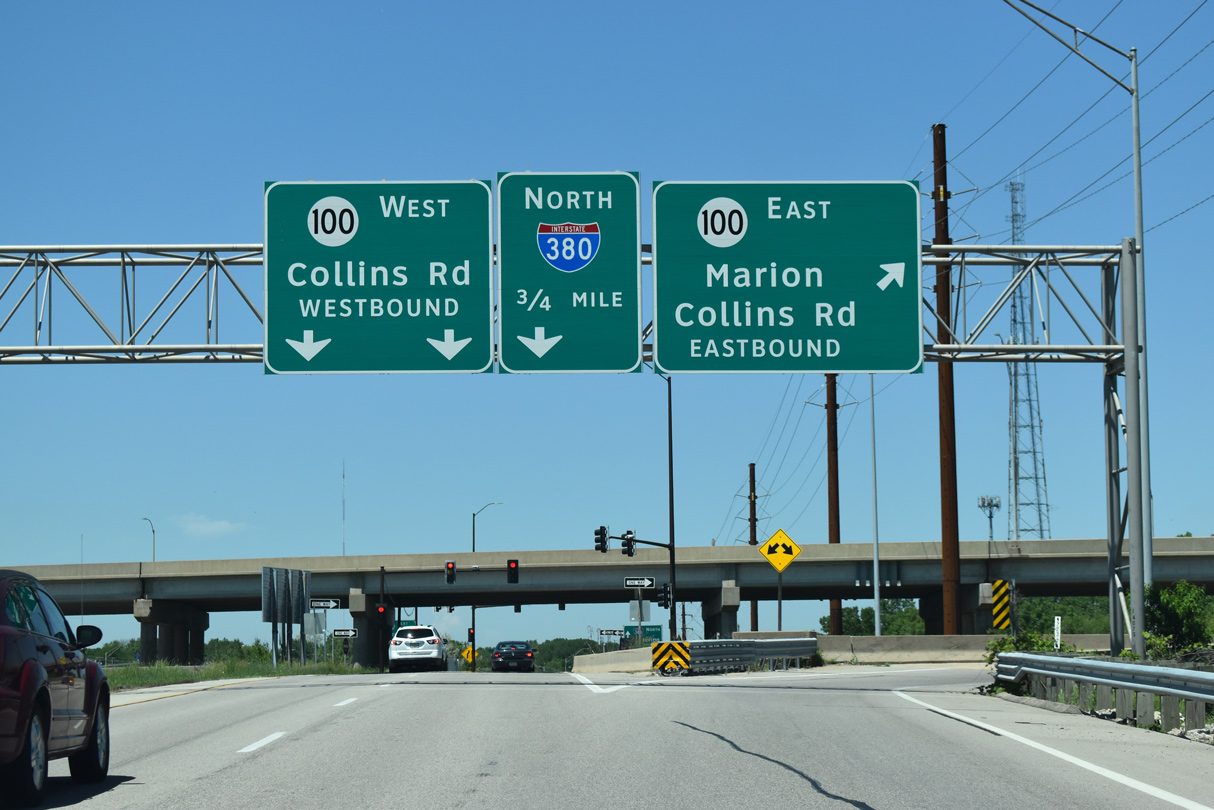
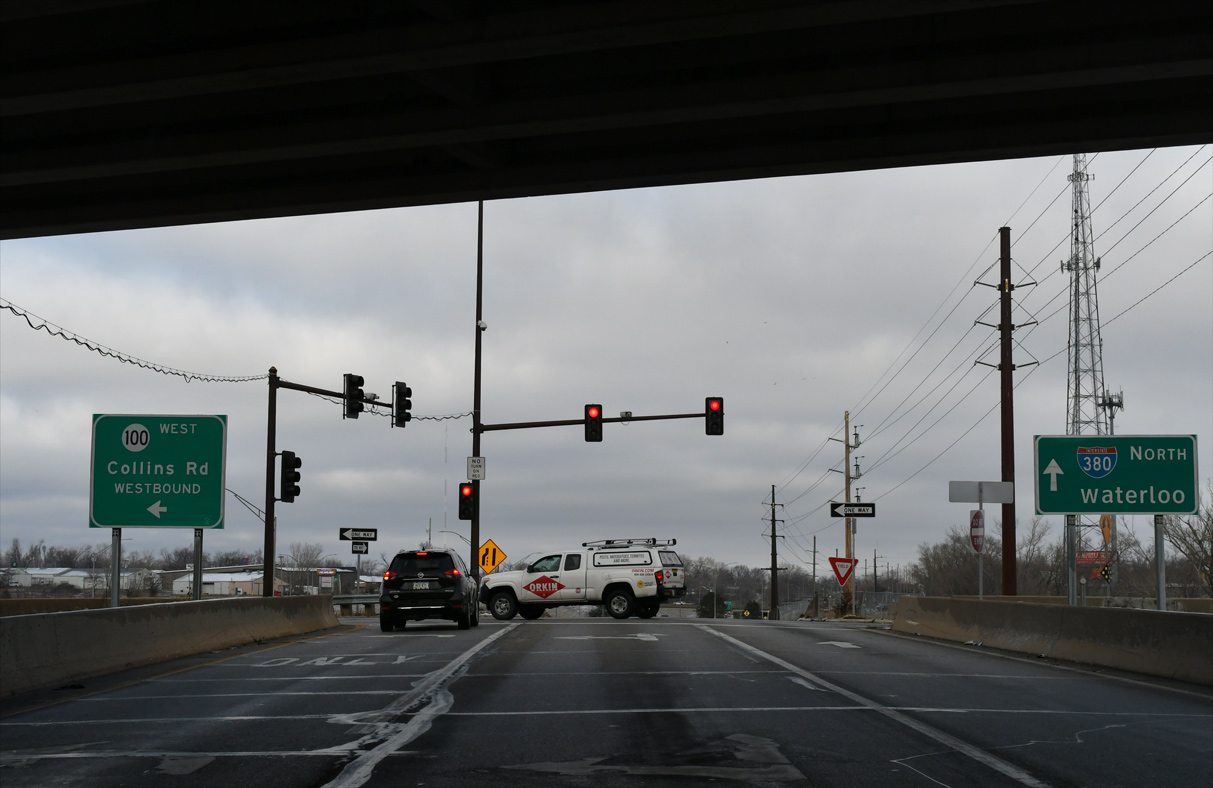
| Iowa 100 forms a 16.14 mile loop around the north and west side of Cedar Rapids between U.S. 30/218 and U.S. 151/Iowa 13 in the city of Marion. 03/30/16 |
|
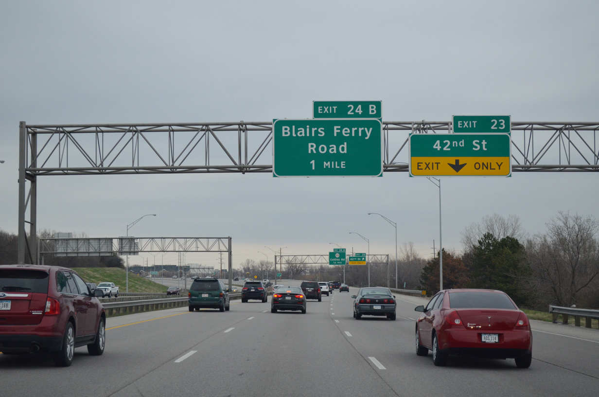
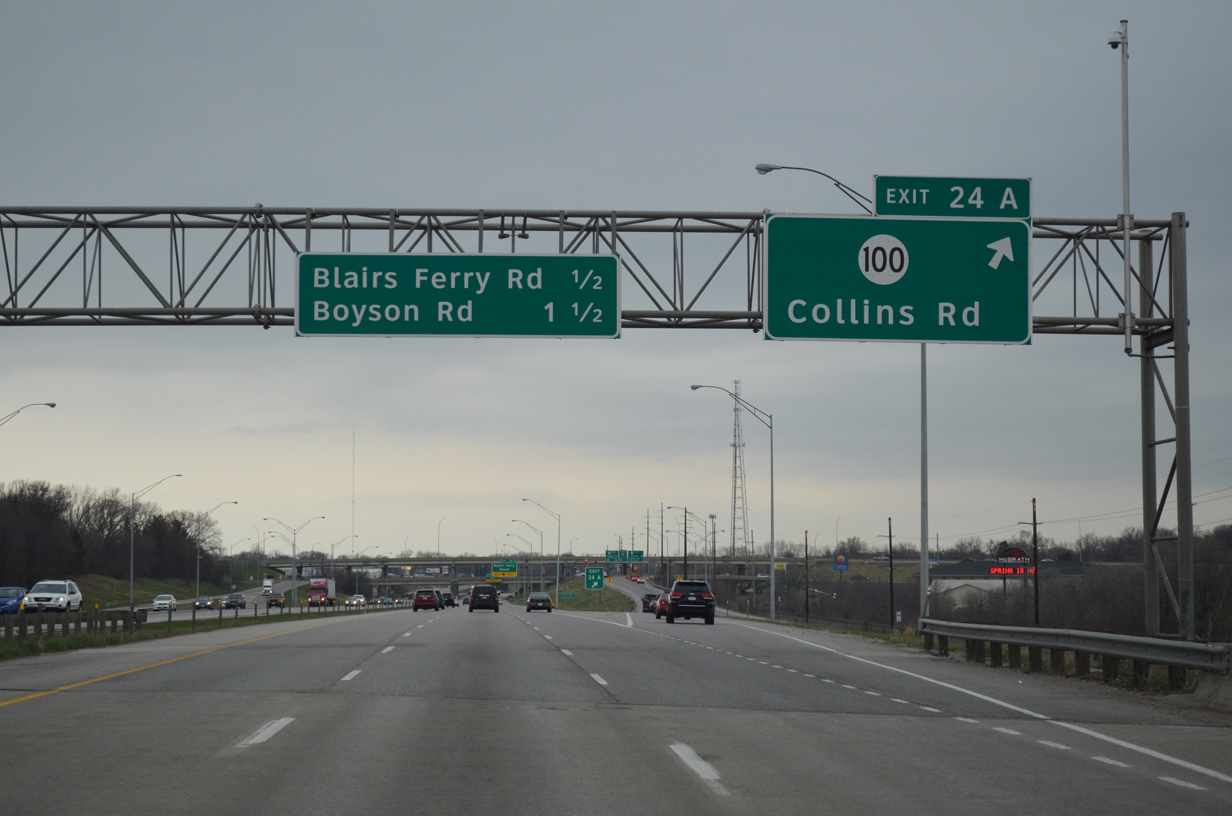
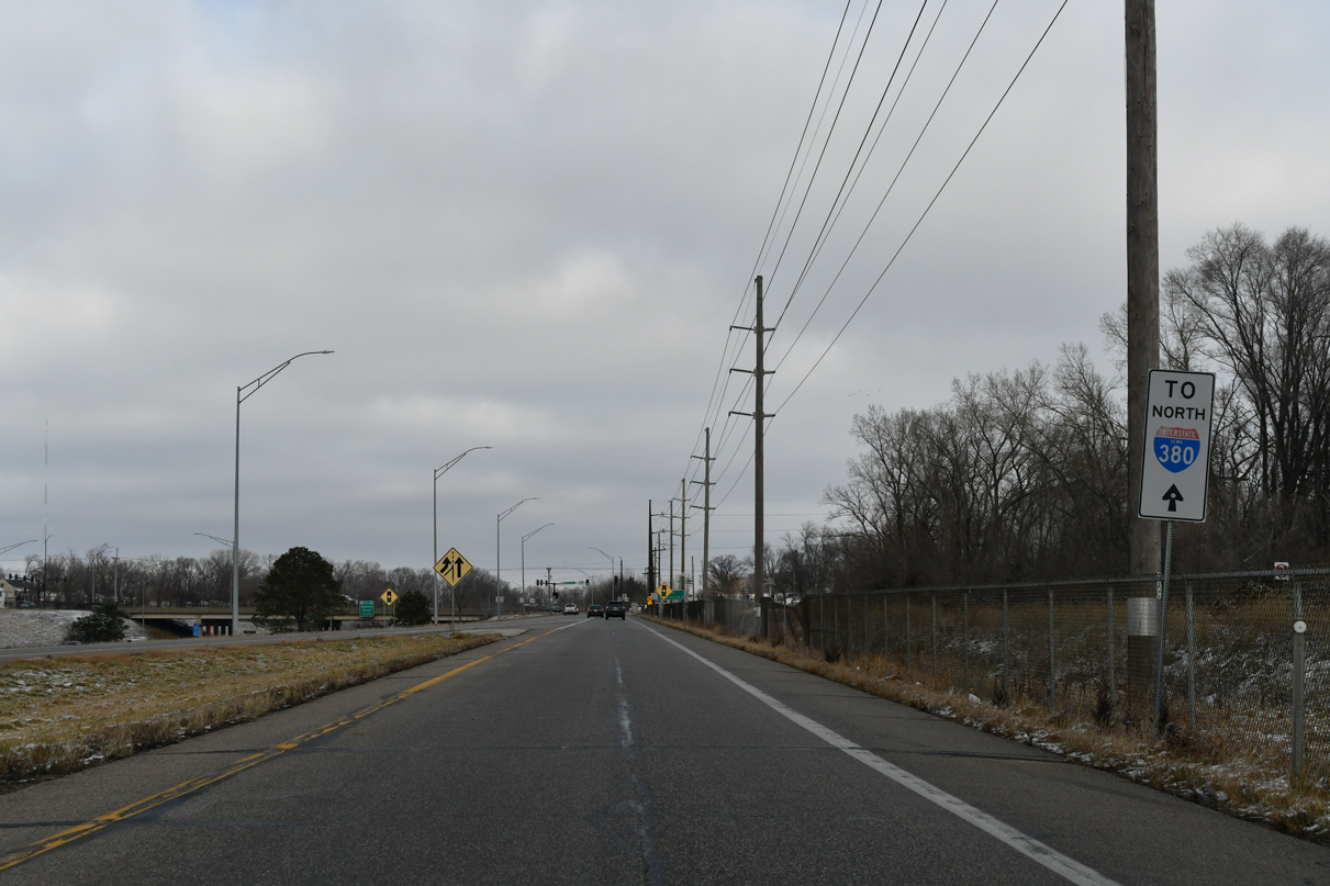
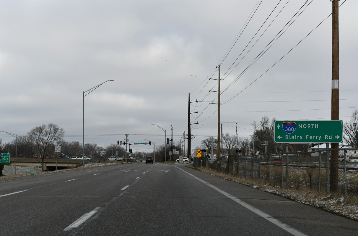
| Blairs Ferry Road meets I-380/Iowa 27 at a diamond interchange (Exit 24 B) just north of Iowa 100. The arterial transitions to County Route E36 beyond the city of Hiawatha to the west. 03/30/16 |
|
| Iowa 100 (Collins Road) constitutes a commercial arterial east to Lindale Mall and U.S. 151 Business (1st Avenue E), and a controlled access expressway (Marion Bypass) beyond there. 05/26/18 |
|
| Construction of a 7.5 mile extension for Iowa 100 got underway on May 27, 2014. The $200 million beltway5 was completed west to Covington Road (CR W36) by the end of 2016. Iowa 100 south to U.S. 30/218 at 16th Avenue SW opened on December 12, 2018.6 12/29/23 |
|
| The frontage roads rise to intersect the ramps for Iowa 100 (Collins Road) while the state highway mainline passes above. Other examples of this interchange design are I-476 and U.S. 1 at Media, PA; I-240 and U.S. 70 at Asheville, NC; and U.S. 250 and I-470 at Wheeling, WV. 03/30/16 |
|
| Exit 24 B consists of a slip ramp onto the adjacent frontage road for Blairs Ferry Road. The arterial serves industrial areas to the east to U.S. 151 Business in Marion. 03/30/16, 12/29/23 |
|
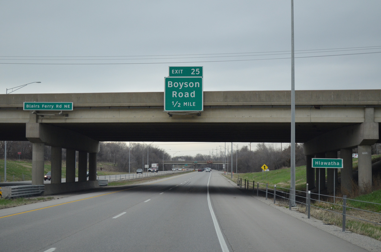
| I-380/Iowa 27 north enter the Hiawatha city limits at the Blairs Ferry Road overpass, a half mile ahead of Exit 25 to Boyson Road. 03/30/16 |
|
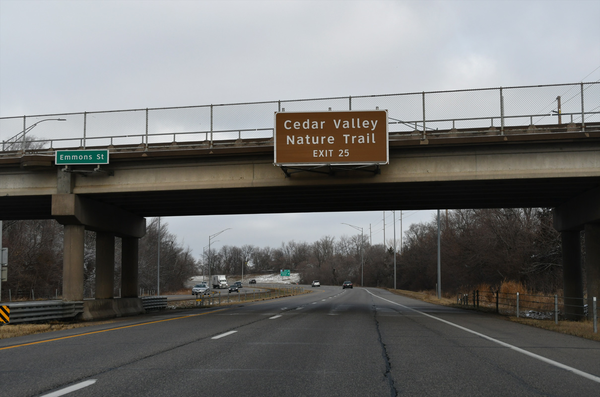
| Cedar Valley Nature Trail extends north from Hiawatha along the former Waterloo Railroad line. The trail parallels I-380 northwest to Center Point, Urbana and Brandon before turning west to La Porte City. 12/29/23 |
|
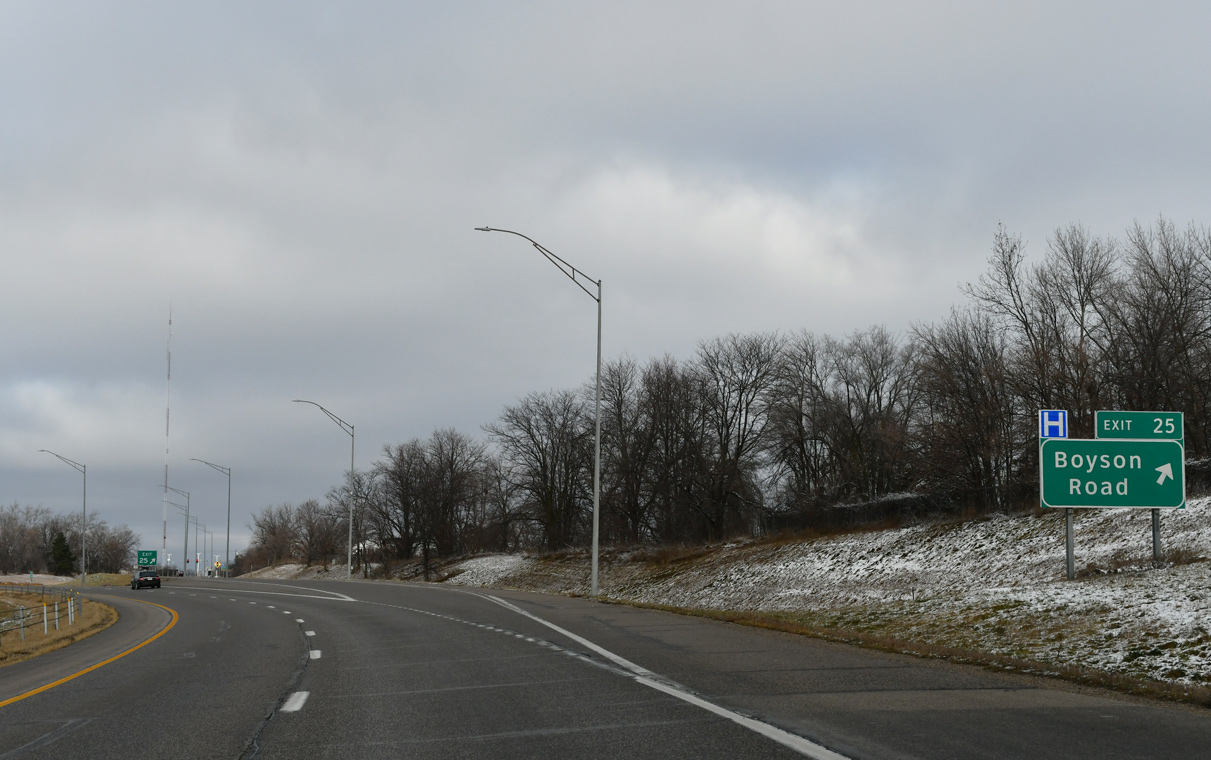
| The freeway bends northwest into the diamond interchange (Exit 25) with Boyston Road. Boyson Road links I-380 with a business park area to the west ahead of Miller Road and an industrial park to the east en route to northern areas of Cedar Rapids. Planned construction in 2024 rebuilds Exit 25 into a DDI. 12/29/23 |
|
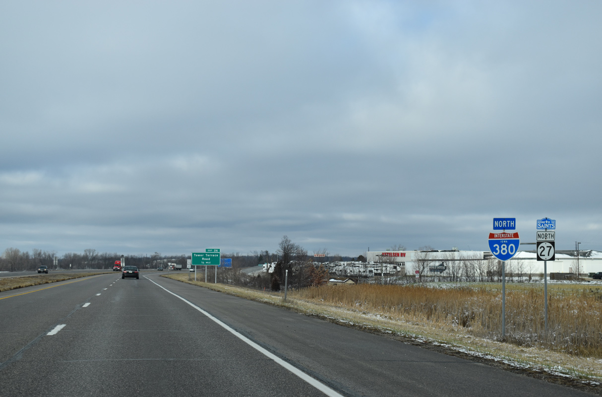
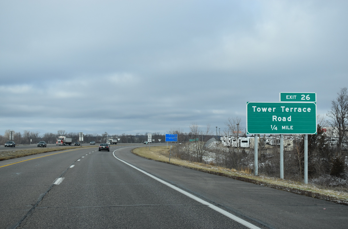
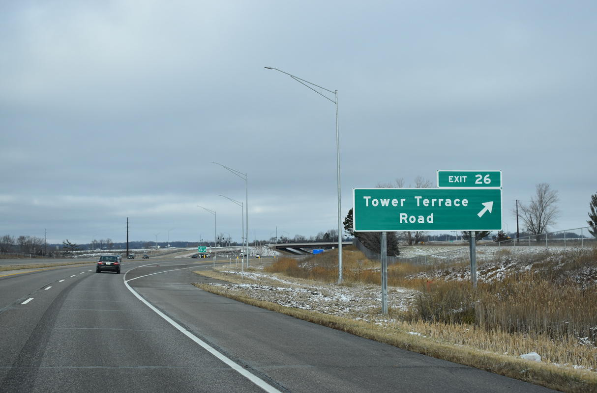
| I-380/Iowa 27 curve back to the north ahead of Cedar Rapids / Hiawatha city line at Tower Terrace Road. 12/29/23 |
|
| A $22 million project started in 2022 built a diverging diamond interchange (DDI) with Tower Terrace Road. A ribbon cutting ceremony for the exchange took place on June 22, 2023.7 12/29/23 |
|
| Tower Terrace Road is a segmented arterial route ultimately planned to join Hiawatha with Marion. 12/29/23 |
|
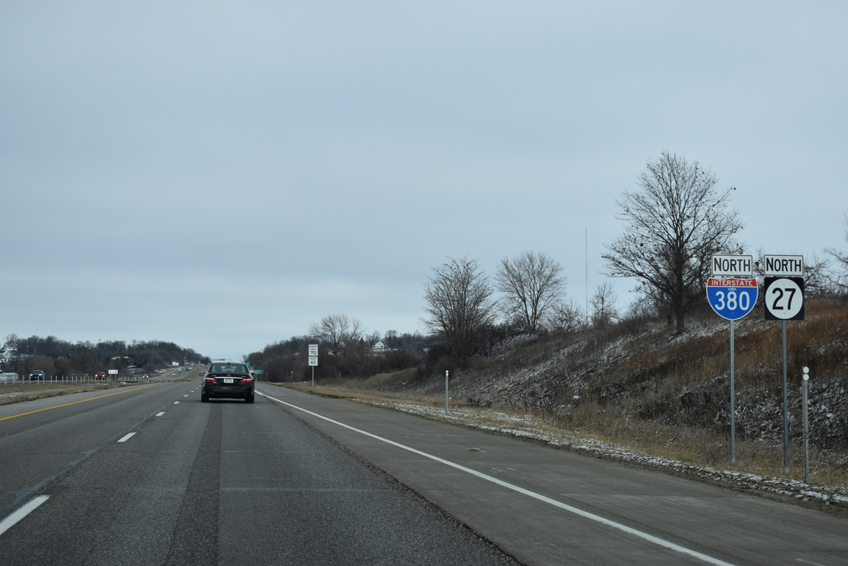
| I-380/Iowa 27 straddles the Hiawatha / Robins city line north from Exit 26 to Exit 28. 12/29/23 |
|
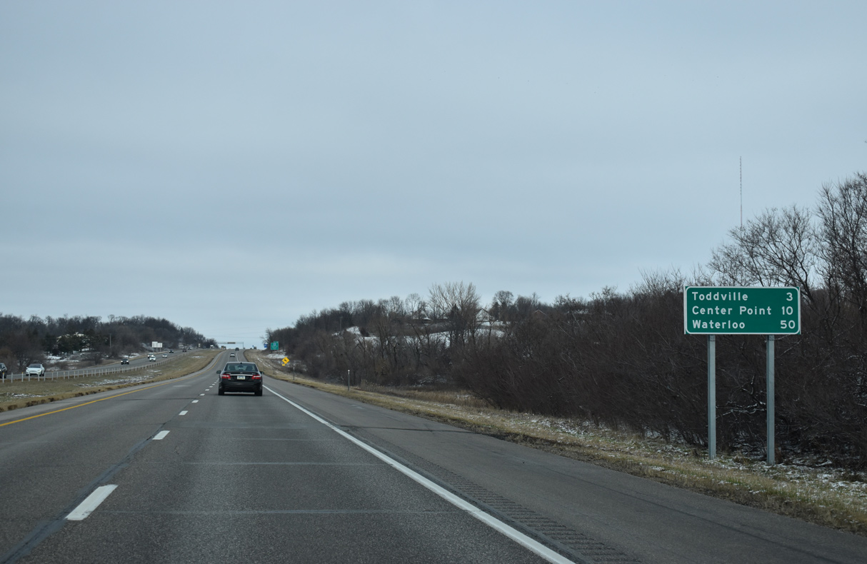
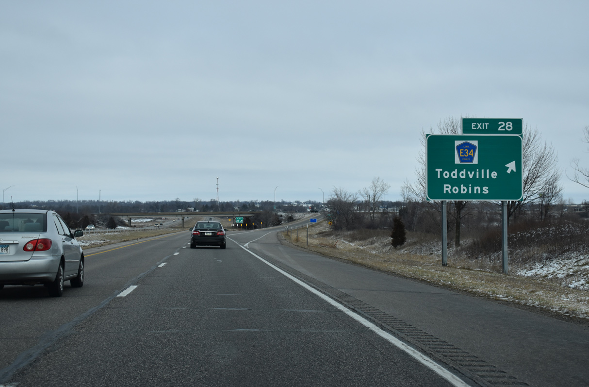
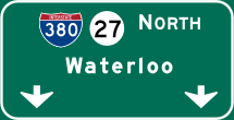
| The succeeding exit connects Interstate 380 with the unincorporated community of Toddville. I-380 transitions to a rural freeway ahead of Center Point, Waterloo is 50 miles away. 12/29/23 |
|
| The diamond interchange at Exit 28 joins I-380/Iowa 27 with Linn County Route E34 (County Home Road). 12/29/23 |
|
| East from Exit 28, County Route E34 (County Home Road) runs across northern reaches of Robins. Westward, the highway follows a convoluted loop to Toddville, the Wickiup Hill Outdoor Learning Area and Feather Ridge Road south to CR E36 (Blairs Ferry Road). 12/29/23 |
|
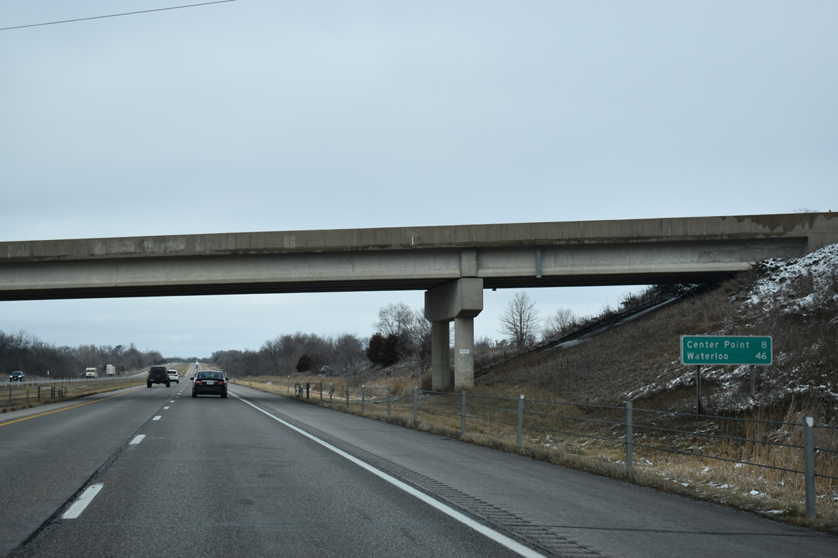
| Continuing north through rural Linn County, I-380/Iowa 27 replaced Iowa 150 (North Center Point Road) as the main route between Robins and Center Point. Old Iowa 150 parallels to the east along County Route W6E. 12/29/23 |
|
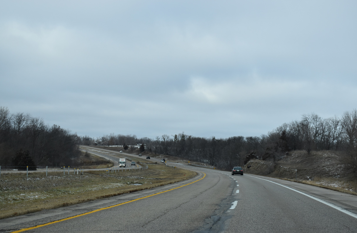
| Interstate 380 north at West Otter Creek. 12/29/23 |
|
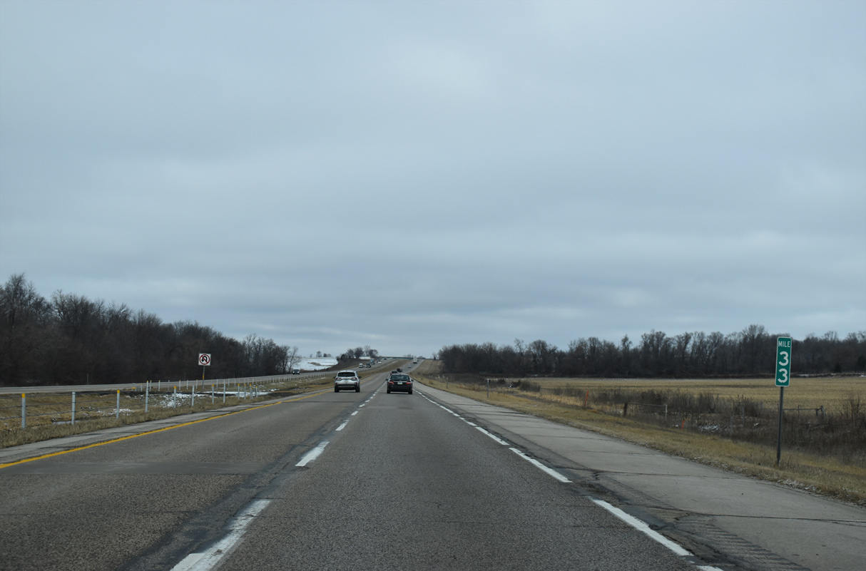
| An old railroad grade and Nelson Creek line the west side of Interstate 380 beyond mile marker 33. 12/29/23 |
|
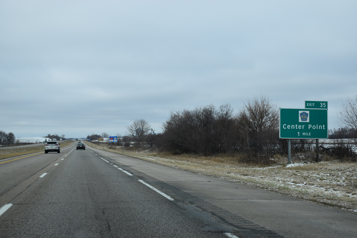
| County Route W36 (Lewis Access Road) was extended northward from Wildlife Road to North Center Point Road (CR W6E) in conjunction with the construction of Interstate 380. A diamond interchange joins the two routes in one mile at Exit 35. 12/29/23 |
|
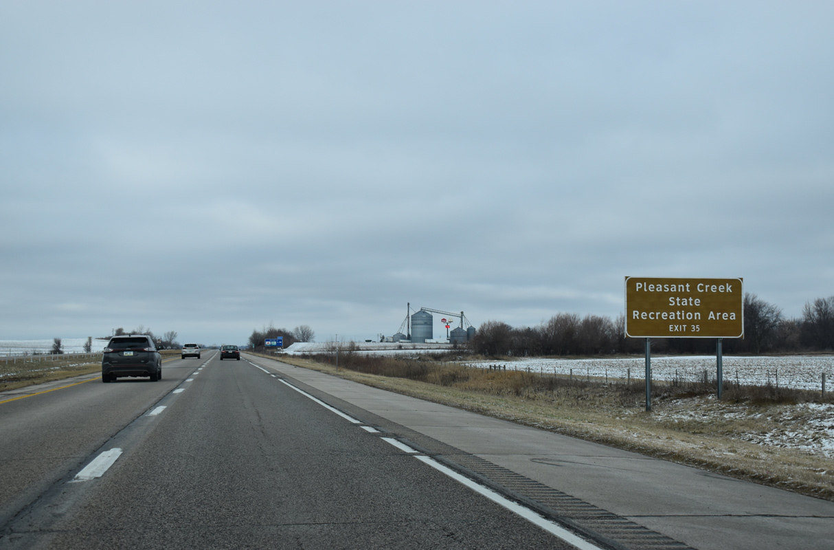
| CR W36 spans the Cedar River on the southward drive to Pleasant Creek State Recreation Area and the city of Palo. 12/29/23 |
|
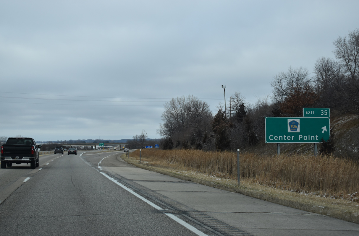
| Exit 35 departs I-380/Iowa 27 north for CR W36 (Lewis Access Road). Northward Lewis Access Road overtakes Center Point Road as Franklin Street into the bedroom community of Center Point. 12/29/23 |
Page Updated 02-09-2024.


 North
North