|
| Taking the southbound ramp from Interstate 5 (Exit 302B) onto Interstate 405 & U.S. 30 west, visible to the left is a ramp stub for an unconstructed flyover onto the Stadium Freeway spur to Kerby Avenue. Original plans called for the Stadium Freeway to continue northeast as the Rose City Freeway to the planned Prescott Freeway. 08/27/06 |
|
| Ascending upon the two lane ramp to Interstate 405 south from Interstate 5 north & U.S. 30 west. A ghost ramp exists beyond the Speed 50 sign to the right for the unconstructed Rose City Freeway. The Rose City Freeway never got beyond the planning stages. An elevated "X" stack interchange handles the movements between the two freeways above the city street grid. 06/02/06 |
|
| Ramps from Interstate 5 merge with the Stadium Freeway to form the Fremont Bridge of Interstate 405 south & U.S. 30 west. 08/27/06 |
|
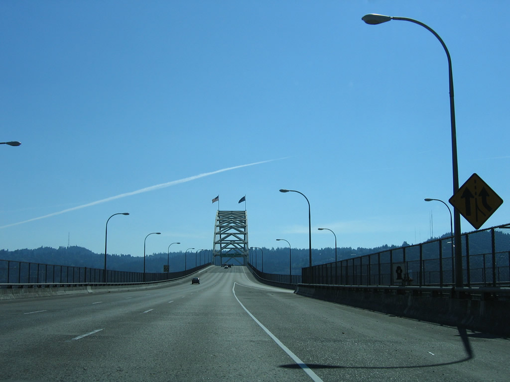
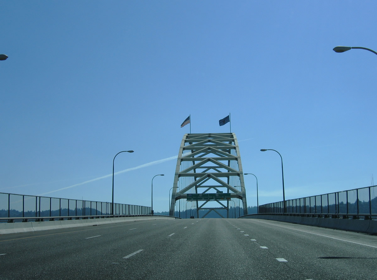
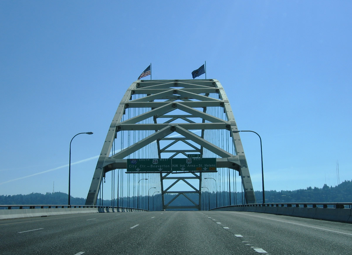
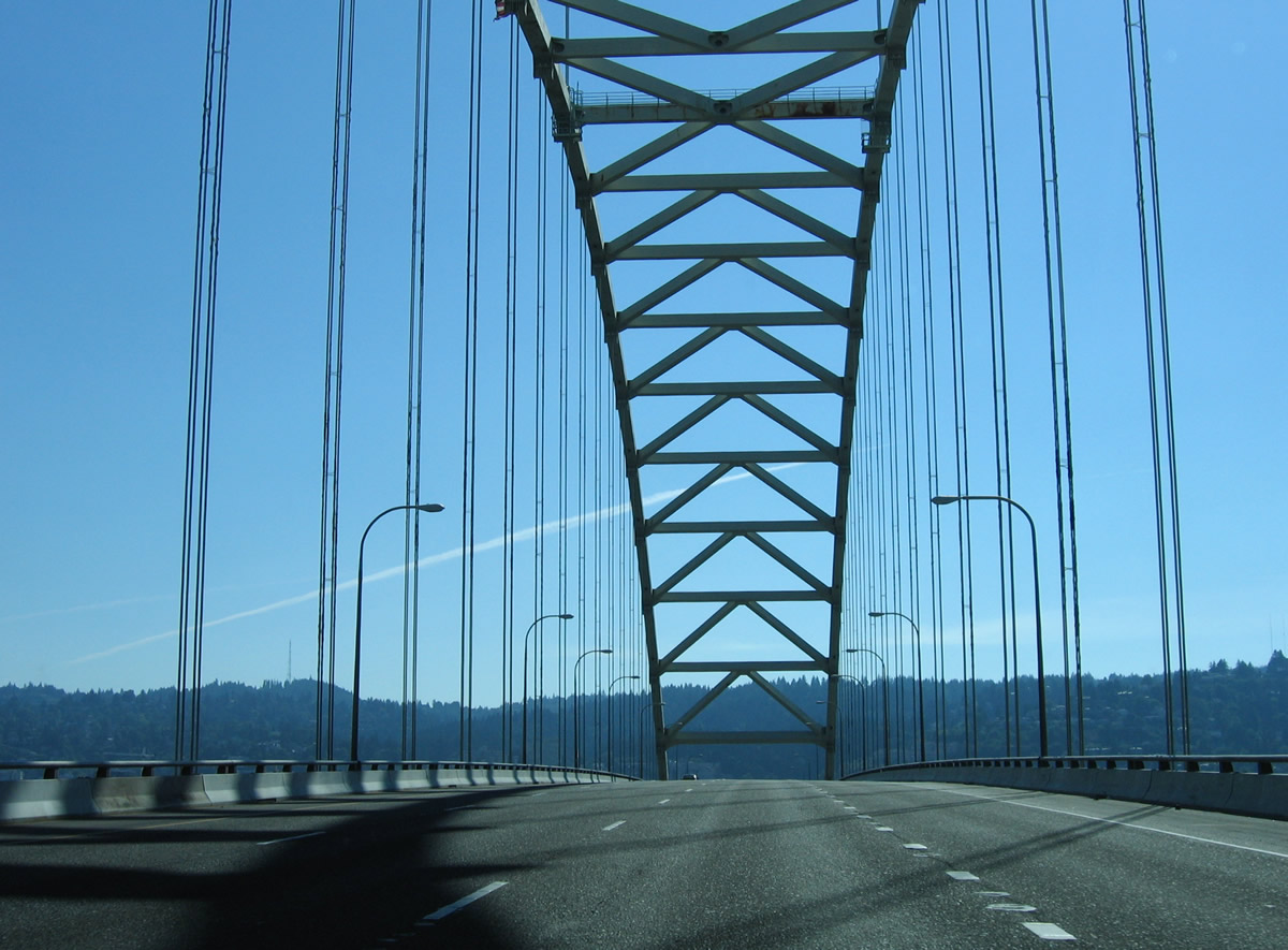
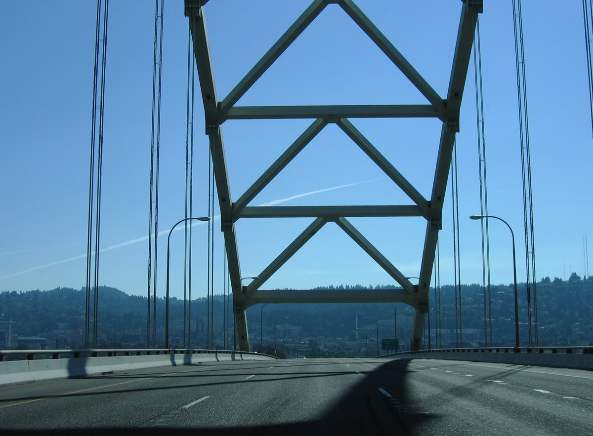
| Interstate 405 south & U.S. 30 west leave the Interstate 5 interchange and cross the majestic Fremont Bridge over the Willamette River. The tied-arch bridge totals 2,154 feet in length and provides a vertical clearance of 175 feet above the waterway.1 08/27/06 |
|
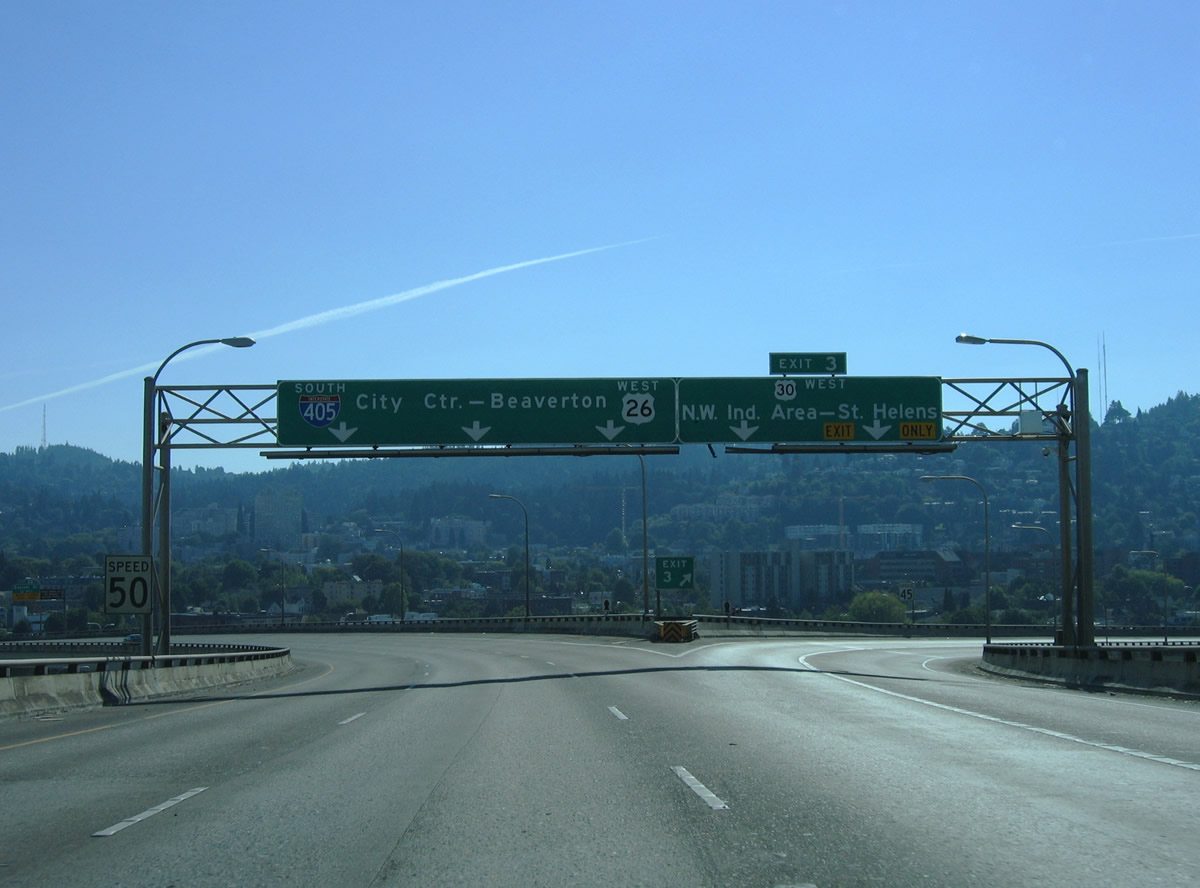
| U.S. 30 west parts ways with Interstate 405 south at the south end of the Fremont Bridge. Exit 3 constitutes a two lane off-ramp onto the Lower Columbia River Highway west to the Northwest Industrial Area of Portland. 08/27/06 |
|
| Southbound travelers utilize the upper deck of the two-deck Fremont Bridge. The Willamette River span opened on November 15, 1973, completing the 4.25 mile freeway loop.1 08/27/06 |
|
| Entering the directional interchange with the U.S. 30 freeway northwest to Yeon Avenue. U.S. 30 follows the Columbia River northwest from Portland to St. Helens and Astoria.
The U.S. 30 interchange utilizes ramps originally constructed for Interstate 505, a planned 1.44 mile spur northwest to St. Helens Road (old U.S. 30). Cancellation of the Interstate route occurred in 1979 with U.S. 30 later shifting to its own freeway to Yeon Avenue at Nicolai Street by 1988.2 08/27/06 |
|
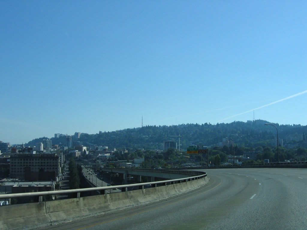
| Interstate 405 lowers from the Fremont Bridge onto a trandition freeway viaduct from Exit 3 to Glisan Street (Exit 2B). 08/27/06 |
|
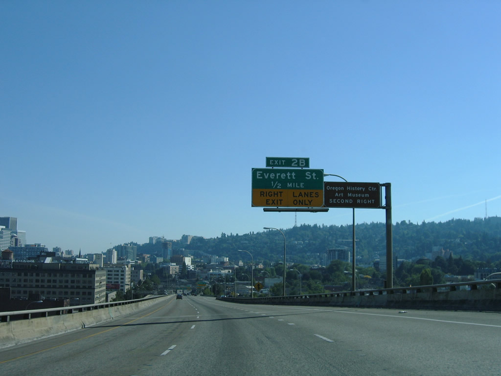
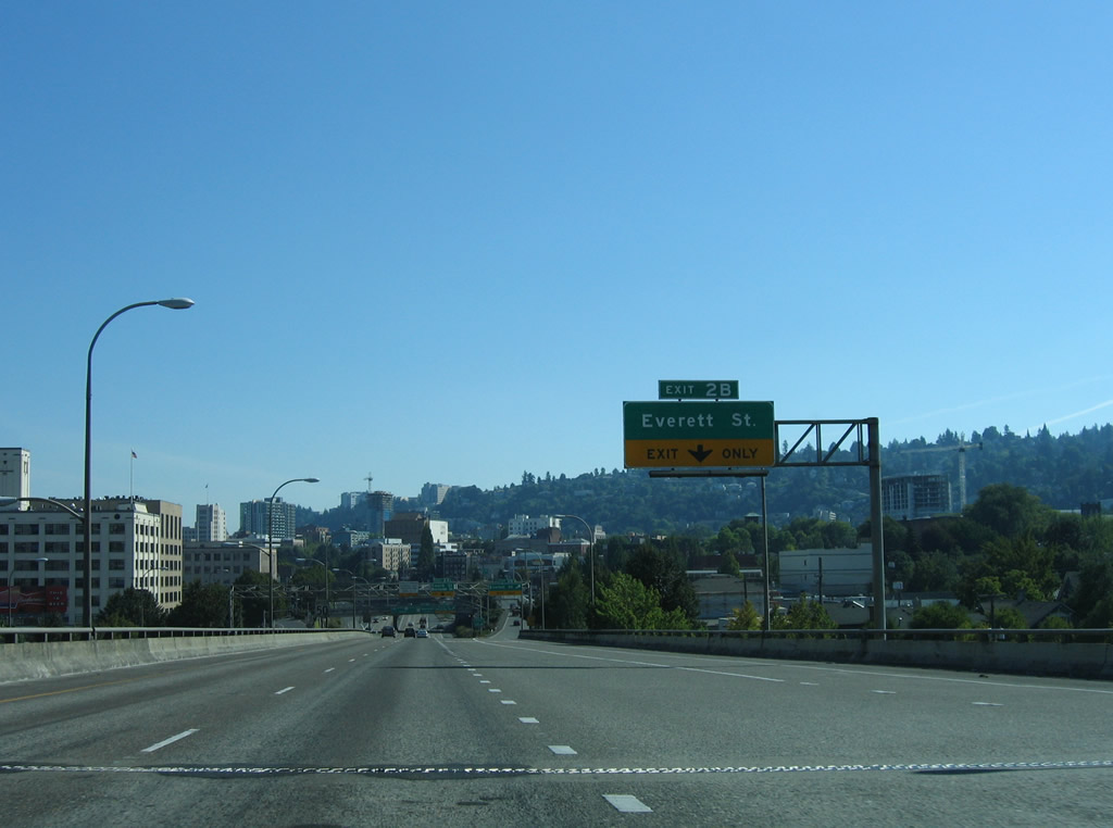
| Exit 2B consists of a half diamond interchange with parallel NW 16th and 15th Avenues ahead of Glisan and Everett Streets. Exit 2B serves interests to the Oregon History Center and Portland Art Museum. 08/27/06 |
|
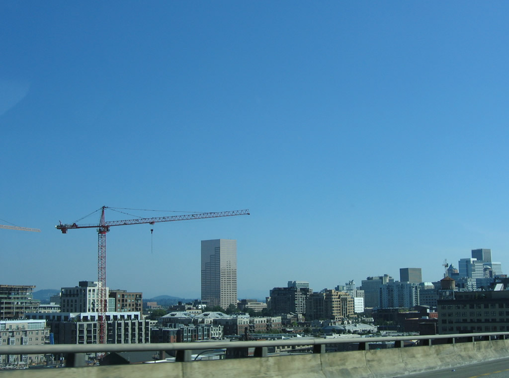
| Southeasterly view of Portland's skyline on the Interstate 405 descent from the Fremont Bridge. 08/27/06 |
|
| Everett Street travels east-west between the Northwest District and Pearl District within the vicinity of Interstate 405. East-west streets in west Portland are named alphabetically from south to north between Ankey and Wilson Streets. 08/27/06 |
|
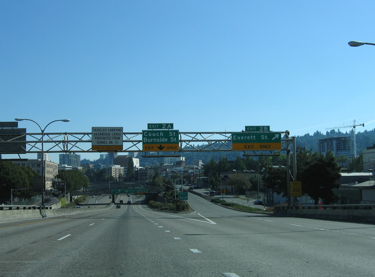
| Southbound at the Exit 2B ramp departure from Interstate 405 (Stadium Freeway) south. Exit 2A follows to NW 15th Avenue south at Couch and Burnside Streets east of PGE Park (Home of the Portland Timbers MLS franchise). 08/27/06 |
|
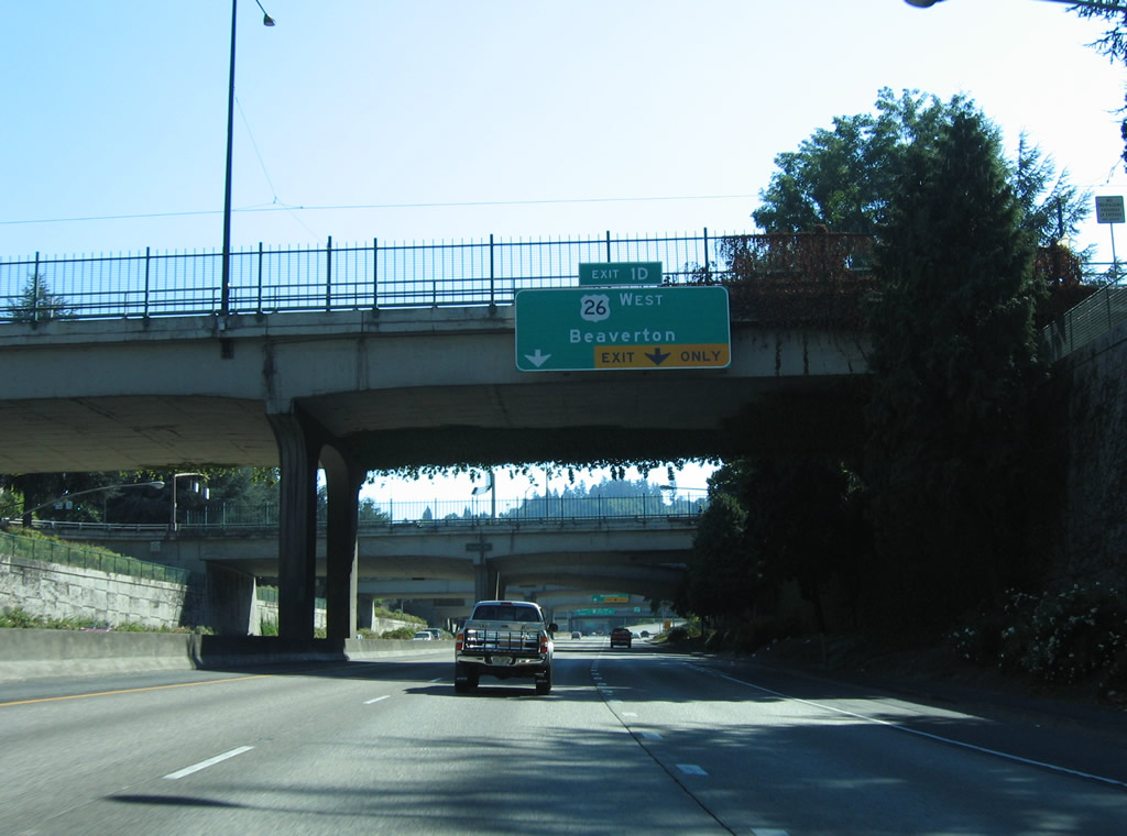
| Drivers bound for Couch and Burnside Streets leave Interstate 405 south at the Exit 2A modified diamond interchange. U.S. 26 (Sunset Highway) merges onto the Stadium Freeway south at the forthcoming stack interchange (Exit 1D). Speed limits remain at 50 mph. 08/27/06 |
|
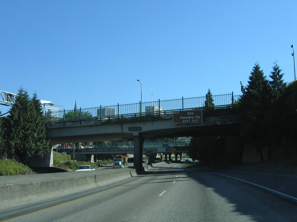
| Interstate 405 winds southeast from the Couch Street overpass to parallel SW 14th and 13th Avenues east of the Goose Hollow neighborhood. U.S. 26 travels through the Vista Ridge Tunnels en route to Washington Park and the Oregon Zoo west from Exit 1D. 08/27/06 |
|
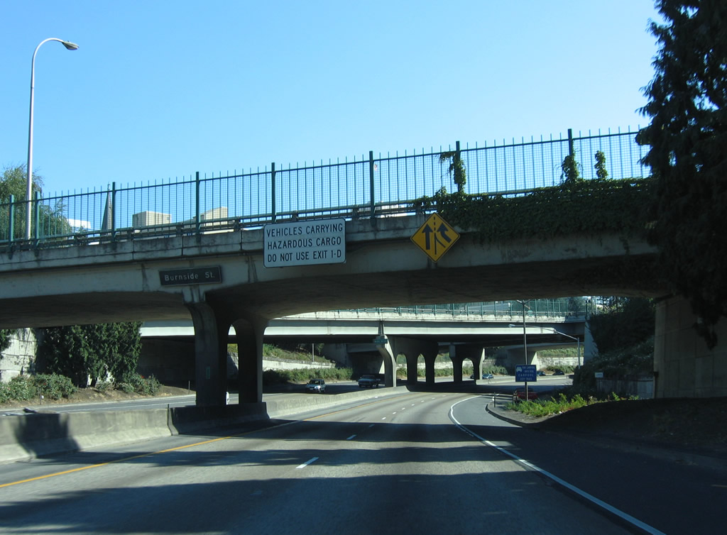
| Vehicles carrying hazardous materials are prohibited from using the Vista Ridge Tunnels of U.S. 26. That traffic should use OR 217 north from Interstate 5. 08/27/06 |
|
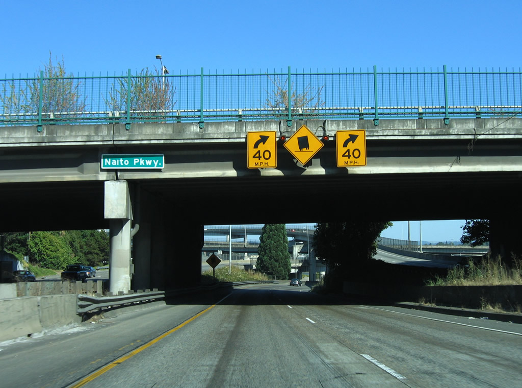
| A on-ramp drops down onto Interstate 405 south from Taylor Street west to form an exit-only lane to U.S. 26 (Sunset Highway) west. U.S. 26 originally followed Naito Parkway north with OR 99W to the one way street couplet of Market Street (east) and Clay Street (west) through the Portland city center. The US route shifted to its brief overlap with Interstate 405 in 2005.3 08/27/06 |
|
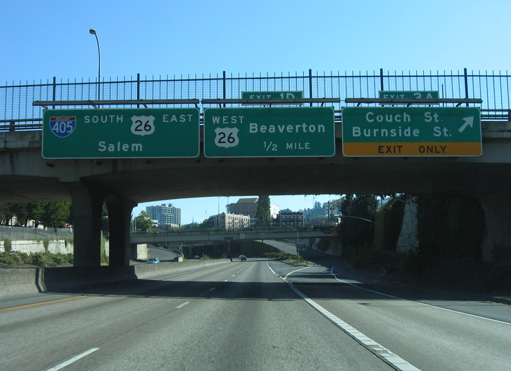
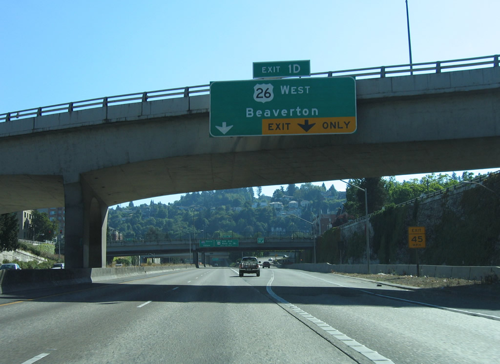
| Exit 1D carries two lanes from Interstate 405 south onto U.S. 26 (Sunset Highway) west. The Sunset Highway constitutes a full freeway west to Beaverton, Hillsboro, and many unincorporated suburbs of Portland. U.S. 26 ends otherwise at U.S. 101, south of Seaside, in 74 miles. 08/27/06 |
|
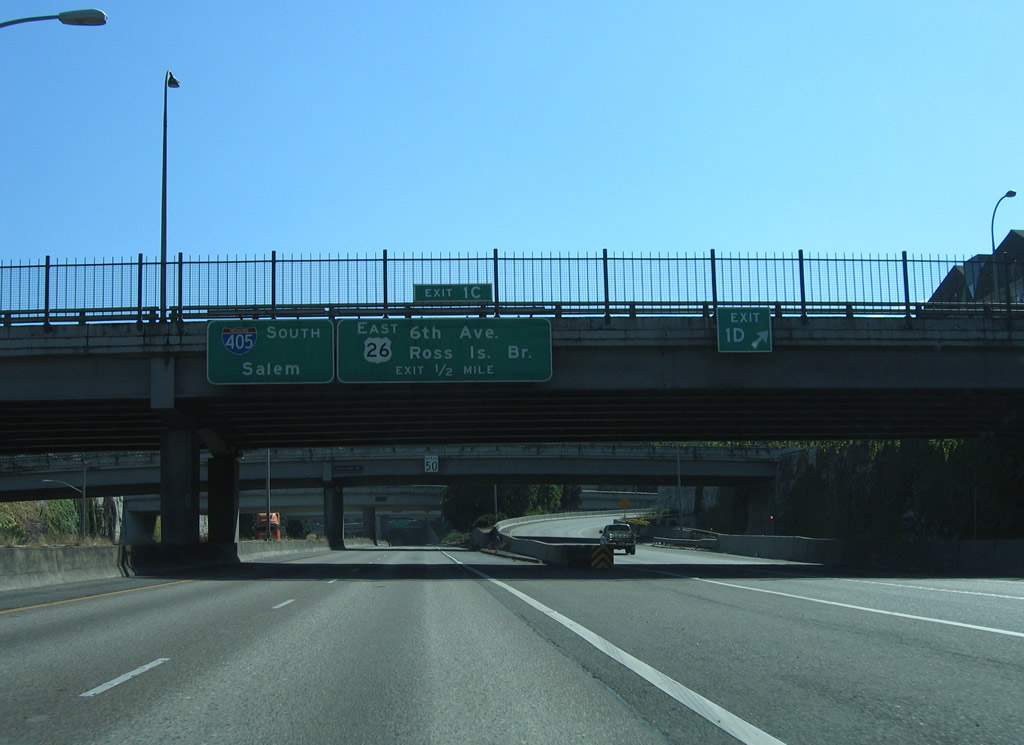
| U.S. 26 east joins Interstate 405 south briefly between Exits 1D and 1C (SW Broadway). The US Highway follows a locally maintained route of SW Broadway, 5th Avenue, Sheridan Street, 3rd Avenue and Arthur Street to Naito Parkway from Exit 1C. 08/27/06 |
|
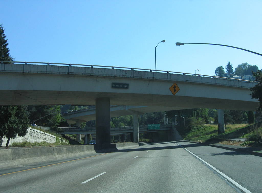
| Traveling within the directional interchange of Interstate 405 south and Sunset Highway west. Market Street (old U.S. 26) splits from Sunset Highway east above. 08/27/06 |
|
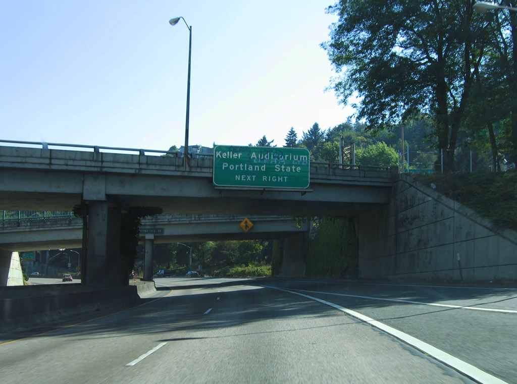
| An overpass provides access from SW 13th Avenue onto Interstate 405 south at Montgomery Street. Forthcoming Exit 1C connects with SW 6th Avenue north. 6th Aveune leads to Portland State University. Interests to Keller Auditorium should follow 6th to Market Street. 08/27/06 |
|
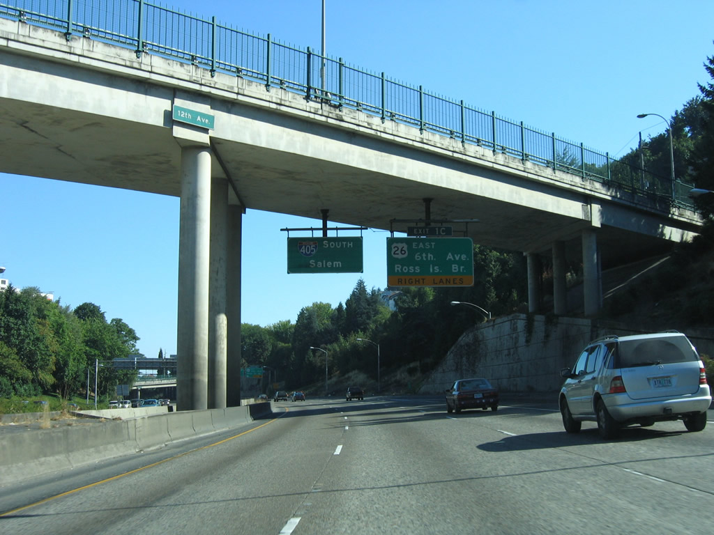
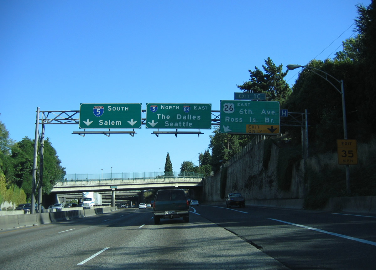
| Traffic from U.S. 26 east merges onto Interstate 405 (Stadium Freeway) south at the 12th Avenue overpass. The busiest part of Interstate 405 is where drivers from U.S. 26 eastbound conflict with entering traffic from Montgomery Street and exiting traffic to SW Broadway (Exit 1C). Substantial traffic congestion ensues during peak rush hours. Lake Oswego, Southwest Portland, the Ross Island Bridge and Milwaukie are all accessed through Exit 1C. 08/27/06 |
|
| Interstate 405 (Stadium Freeway) continues east from the split with U.S. 26 (Exit 1C) to Interstate 5 at the Marquam Bridge. U.S. 26 spans the Willamette River along the Ross Island Bridge between Naito Parkway (OR 10) and Powell Boulevard. There is no direct access to the span from either Interstate 5 or 405. 08/27/06 |
|
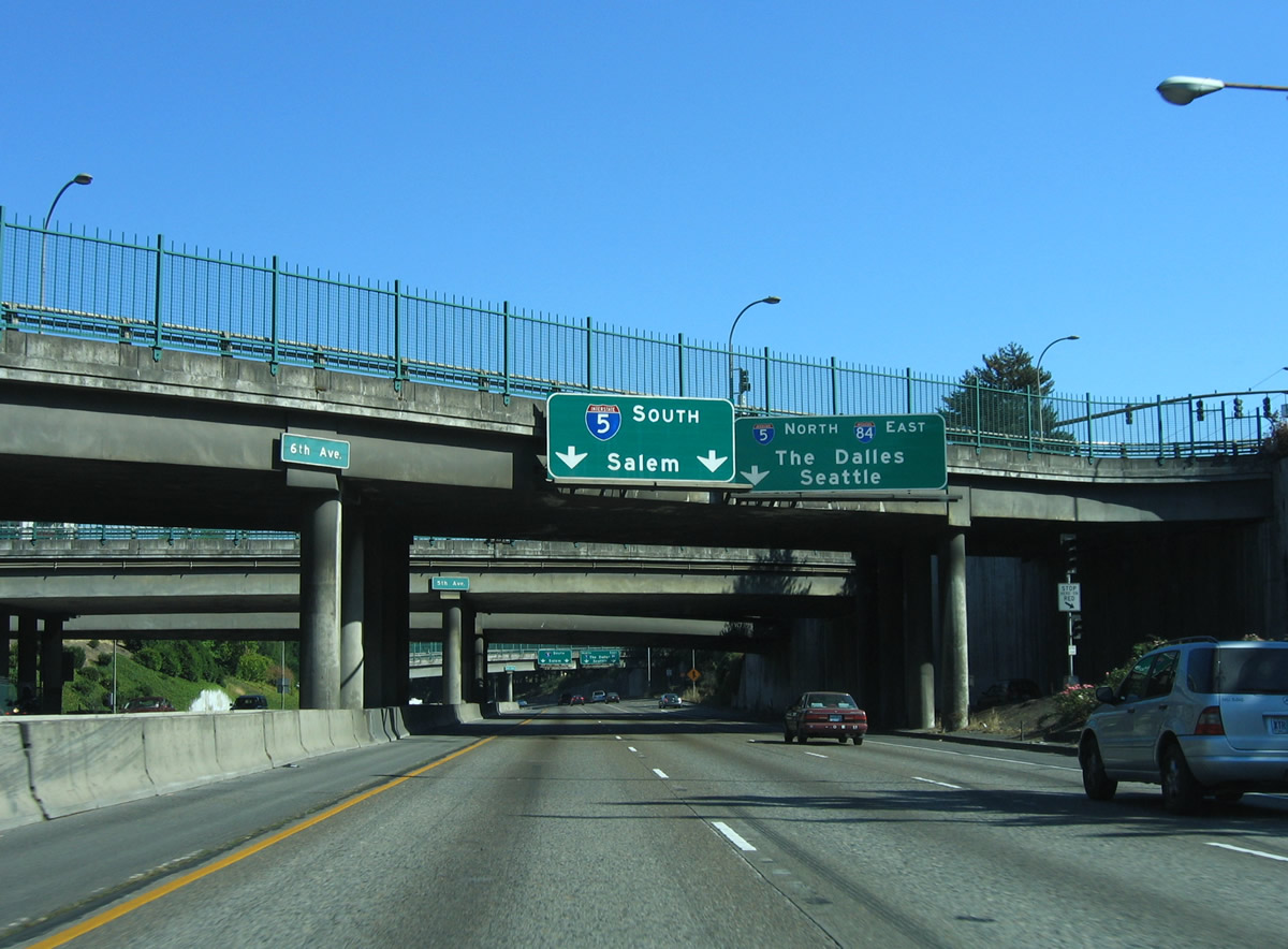
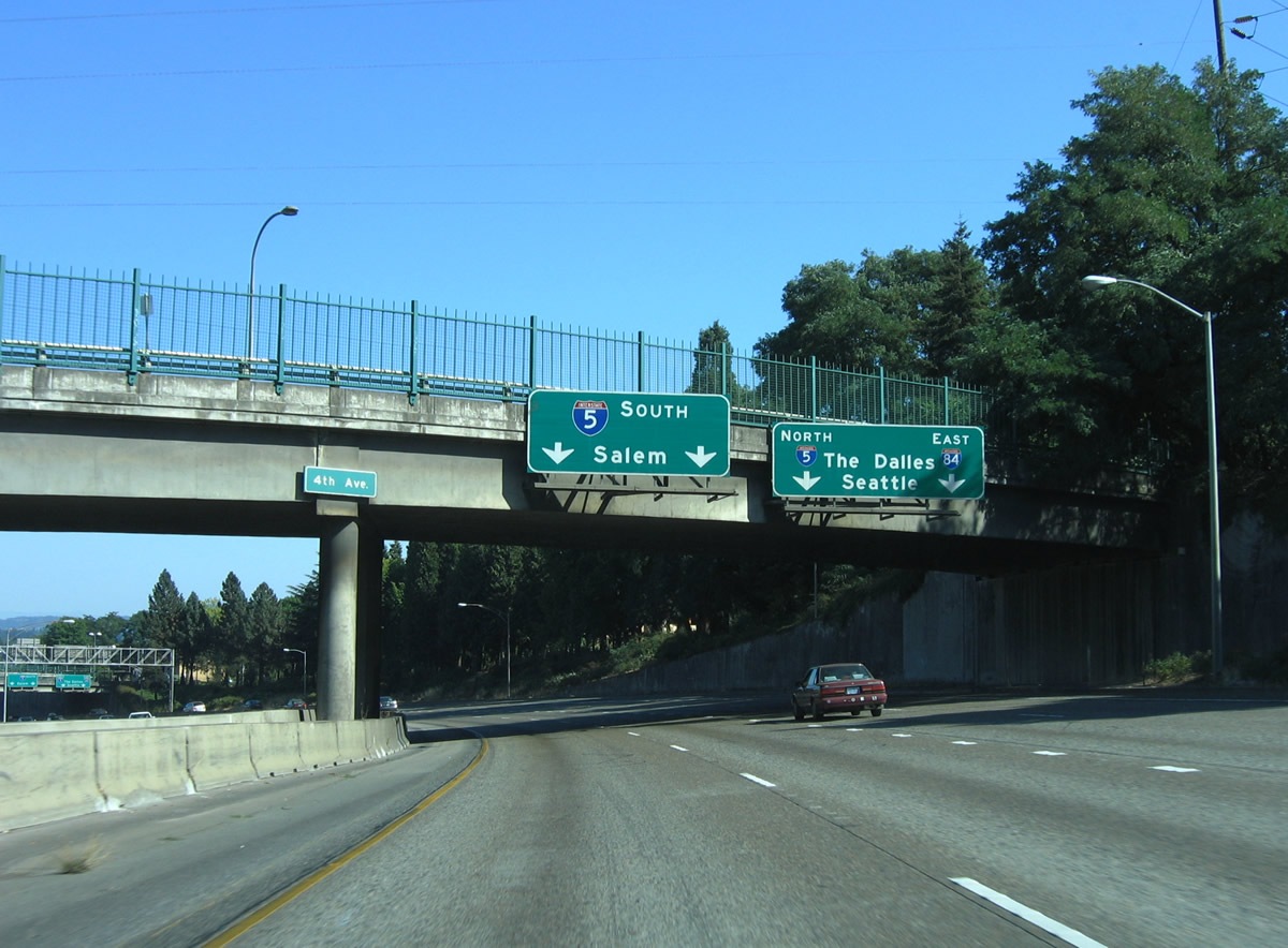
| 6th and 5th Avenues pass overhead as Interstate 405 widens to three lanes in anticipation of the merge back onto Interstate 5. A return ramp from SW Broadway enters from the right. 08/27/06 |
|
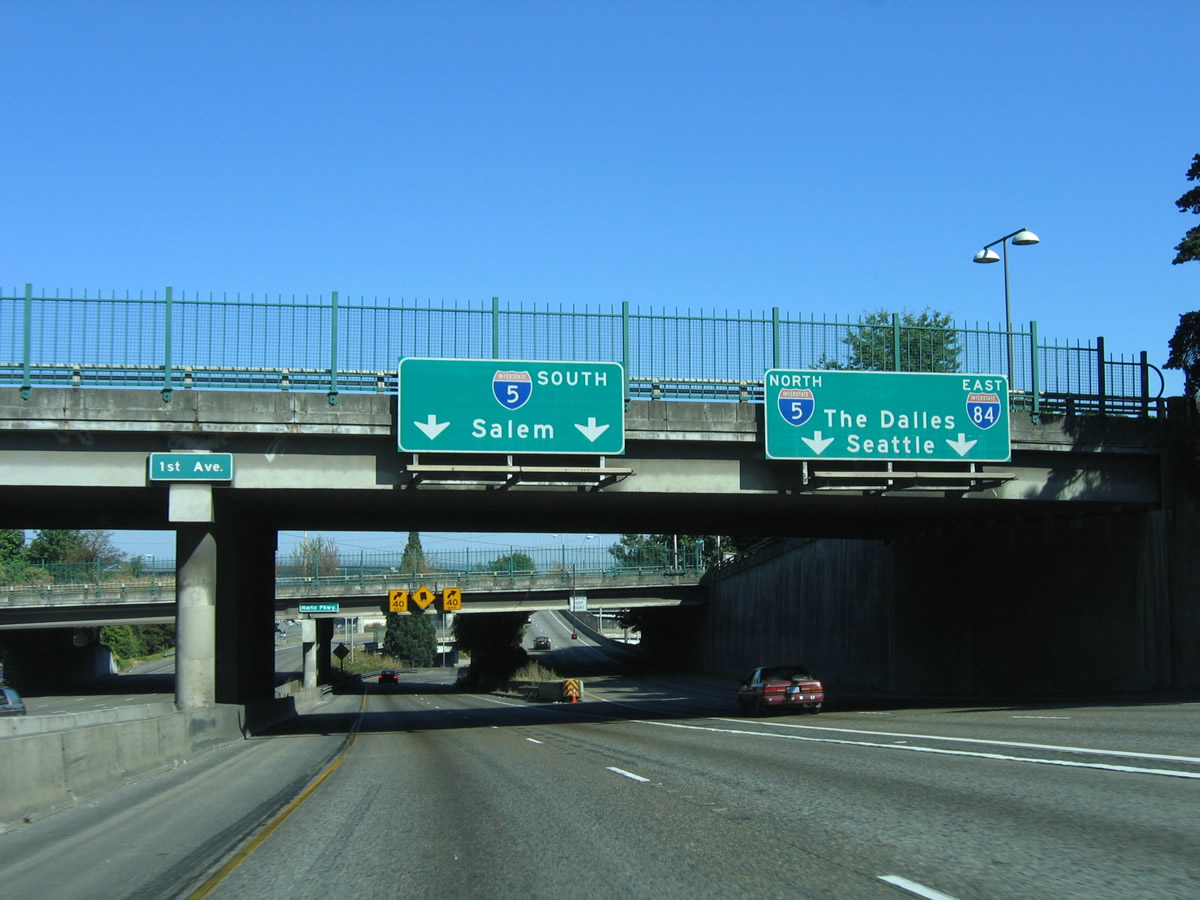
| Interstate 405 southbound reaches its terminus at the high-speed directional interchange with Interstate 5. The two left lanes default onto Interstate 5 southbound for the capital city of Salem, Eugene, and eventually California. The right lanes access Interstate 5 north to Seattle and British Columbia as well as Interstate 84 east through the Columbia River Gorge and Idaho. 08/27/06 |
|
| Travelers taking the northbound ramp join Interstate 5 at the Marquam Bridge above the Willamette River. Exit 300 provides a lengthy ramp to I-84/U.S. 30 east to The Dalles nearby.
The southbound ramp to Salem first joins Harbor Drive, an original expressway leading south from the Portland City Center to Interstate 5. 08/27/06 |
|
| Turning southward onto Harbor Drive south from the Stadium Freeway. OR 99W followed Harbor Drive originally and later shifted to Naito Parkway. Now the route ends at Interstate 5 (Exit 294) near the Tigard city line. 08/27/06 |
|
| Joining Harbor Drive south from the Stadium Freeway, Interstate 405 motorists see milepost 300 of Interstate 5, even though the flyover of the southbound mainline has yet to touch down. Harbor Drive was removed as a river side expressway north of Market Street in 1974.4 South of Market Street, the freeway is an at-grade facility joining Naito Parkway with Interstate 405. 08/27/06 |
Page Updated 11-19-2010.

 South
South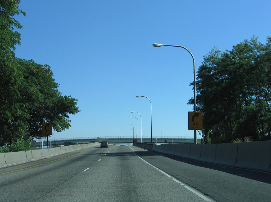

 west
west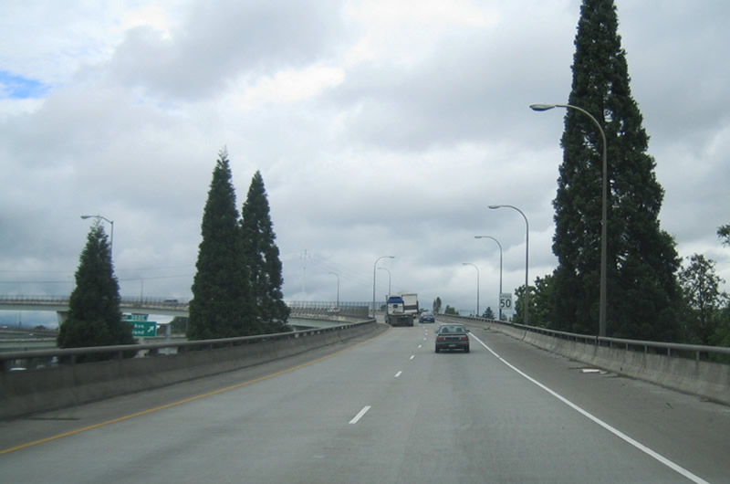
 east
east