|
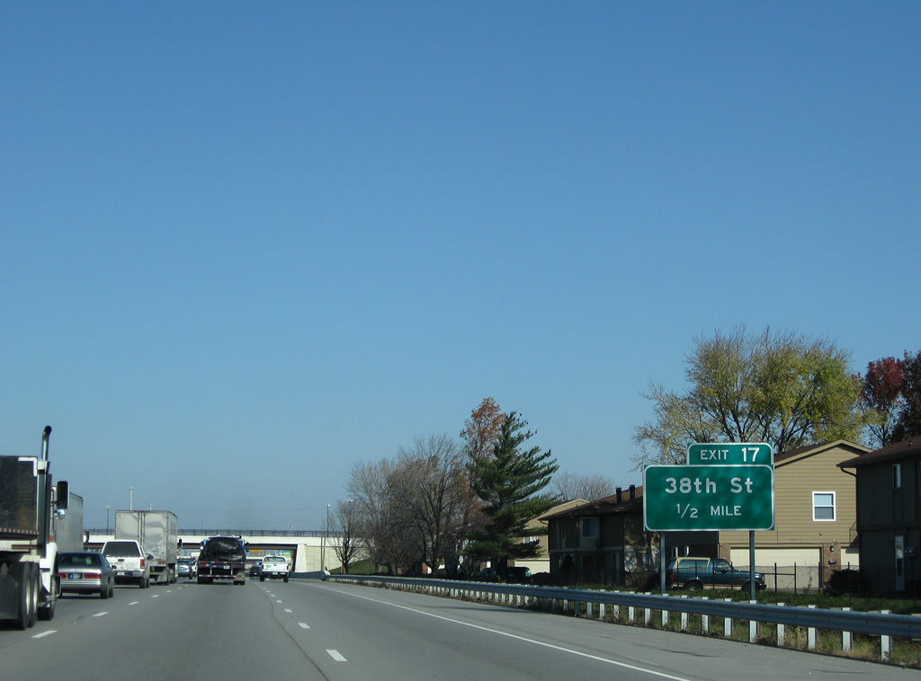
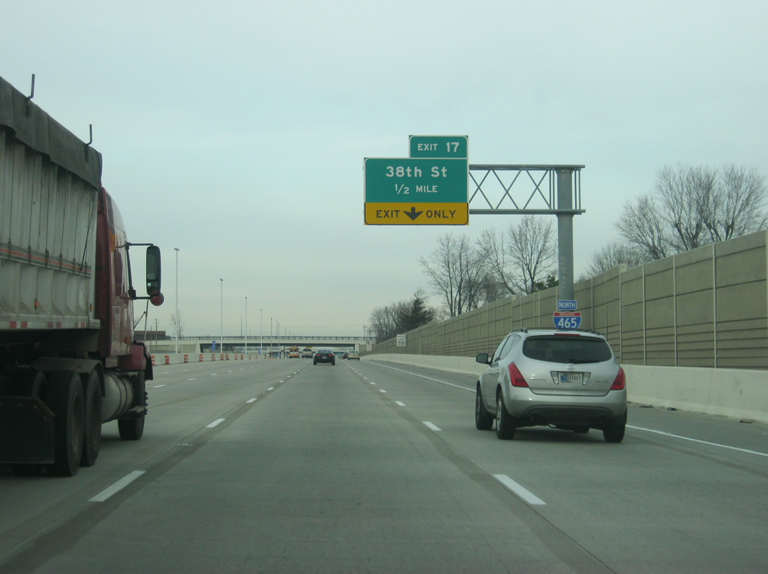
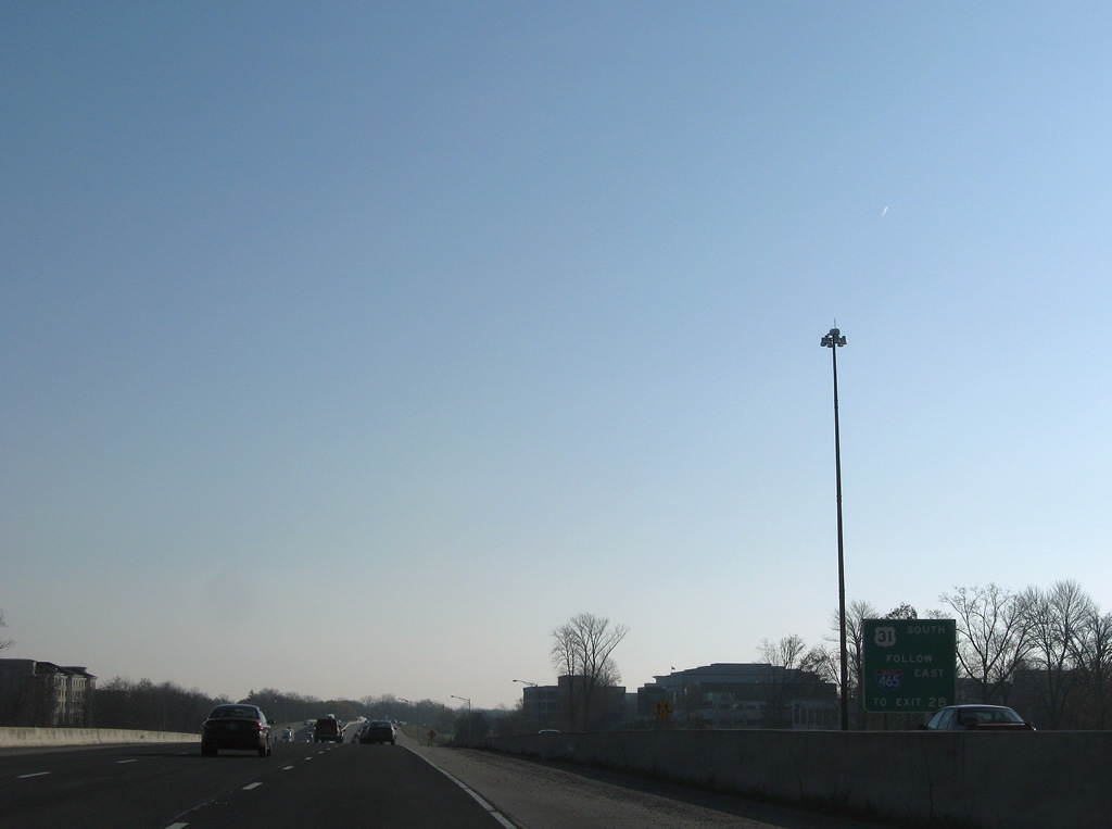
| The section of Interstate 465 leading north from Interstate 74 was reconstructed and widened by 2009. Work at Exit 17 (38th Street) added a loop ramp from 38th Street eastbound onto the Beltway northbound and reconfigured the remaining ramps. The far right lane will default into the exit ramp onto 38th Street. 11/05/09, 12/06/12 |
|
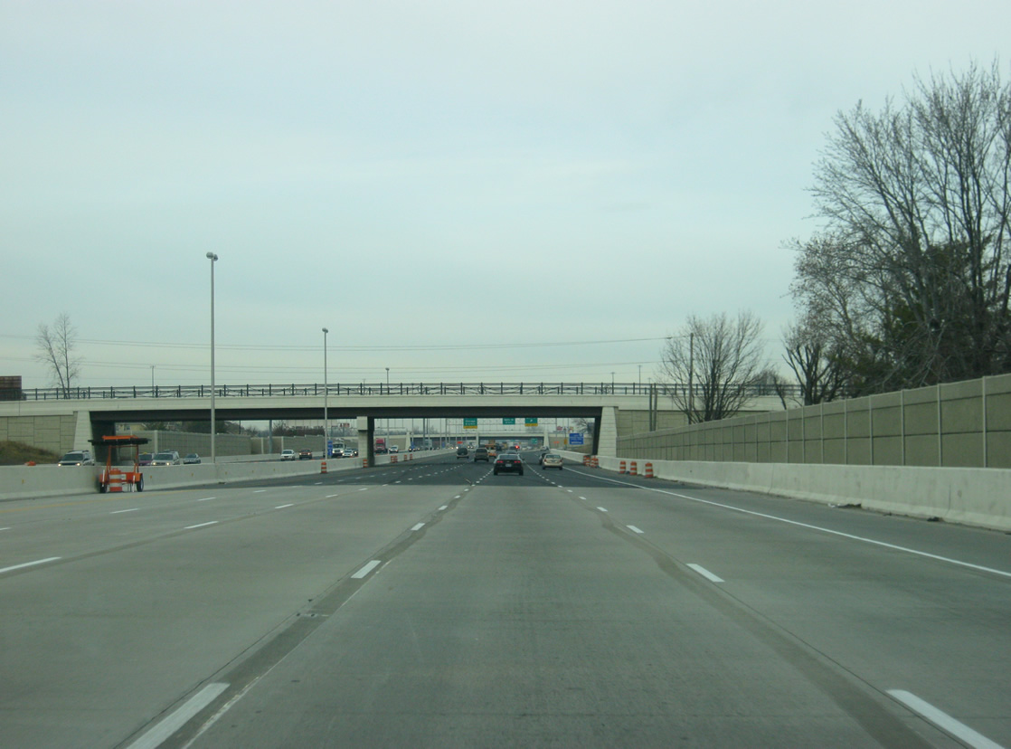
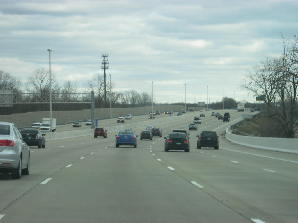
| A view of northbound Interstate 465 at the 34th Street overpass, showing the final ten lane configuration of the highway as it travels in between Interstate 74 and 38th Street. 12/06/12 |
|
| 38th Street ventures west to Eagle Creek Airport and Eagle Creek Reservoir and east to Exit 119 of Interstate 65. Interstate 65 bends northwest from 38th Street to cross Interstate 465 at Exit 20 in 2.5 miles. 11/05/09 |
|
| Five lanes of Interstate 465 travel by an adjacent apartment complex and this reassurance marker. 11/05/09 |
|
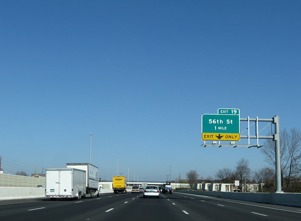
| The right lane defaults onto the off-ramp (Exit 19) to 56th Street in one mile. 56th Street lines Eagle Creek Park west to Raceway Road. 11/05/09 |
|
| One half mile south of the Exit 19 half diamond interchange with 56th Street. Departing next is a connector roadway linking Interstate 465 north with Interstate 65 north to Gary and Chicago, Illinois. 11/05/09 |
|
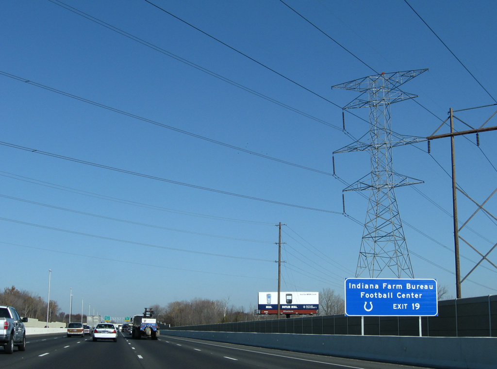
| Indiana Farm Bureau Football Center, the Indianapolis Colts practice facility, lies west along 56th Street midway between Exit 19 and Reed Road. A power line corridor passes over Interstate 465 and parallels 56th Street east to a substation by Guion Road. 11/05/09 |
|
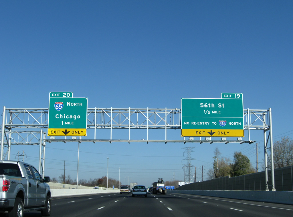
| Interstate 465 northbound at the Exit 19 ramp departure to 56th Street. A left exit (Exit 20) follows onto Interstate 65 north to Lebanon, Lafayette, Merrillville and the Indiana East-West Toll Road (Interstate 90) at Gary. 11/05/09 |
|
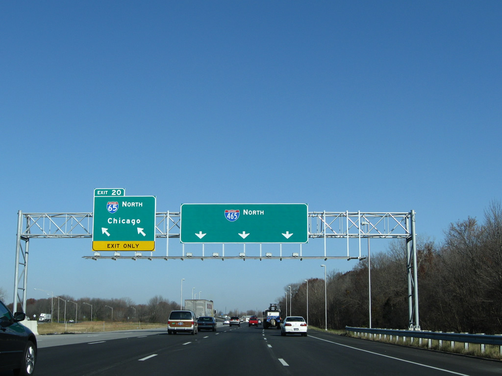
| Exit 20 consists of a wye interchange linking the left sides of Interstate 465 north with Interstate 65 north. There is no access to Interstate 65 south in this direction. 11/05/09 |
|
| Passing under the Interstate 65 mainline, one mile south of Exit 21 with 71st and 73rd Streets. A loop ramp joins Interstate 465 south with I-65 south. A single lane ramp connects I-65 north with I-465 north as well. 11/05/09 |
|
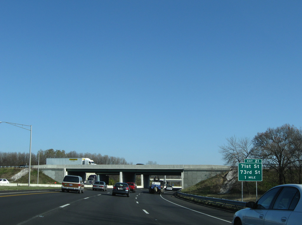
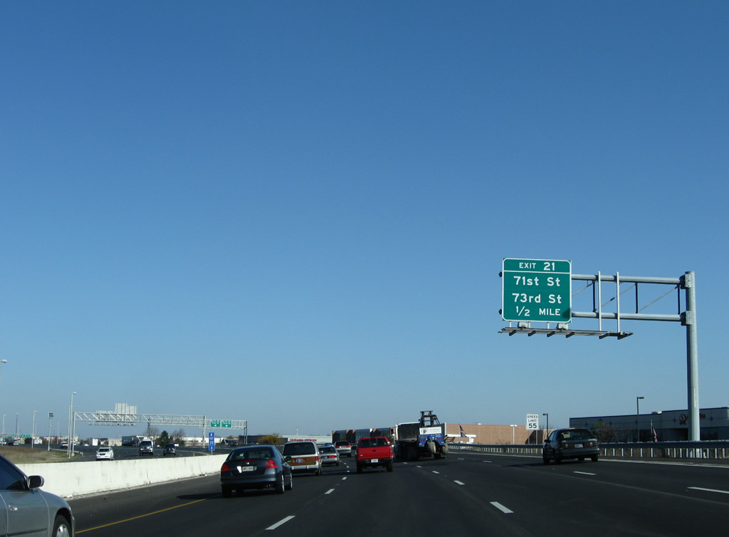
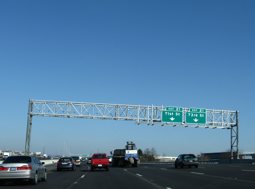
| Interstate 465 lines a business park from 62nd Street to 71st Street by Legendary Hills. Exit 21 provides ramps to both 71st Street east to New Augusta and west to Eagle Creek Park and 73rd Street east at Woodland Drive. 11/05/09 |
|
| 73rd Street spurs east from Exit 21 into a sprawling Park 100 bound by I-465, 71st Street, 86th Street and Georgetown Road. The original diamond interchange at Exit 21 was expanded to include a loop ramp from 71st Street west to the Beltway south and a direct ramp to 73rd Street under 71st Street. 11/05/09 |
|
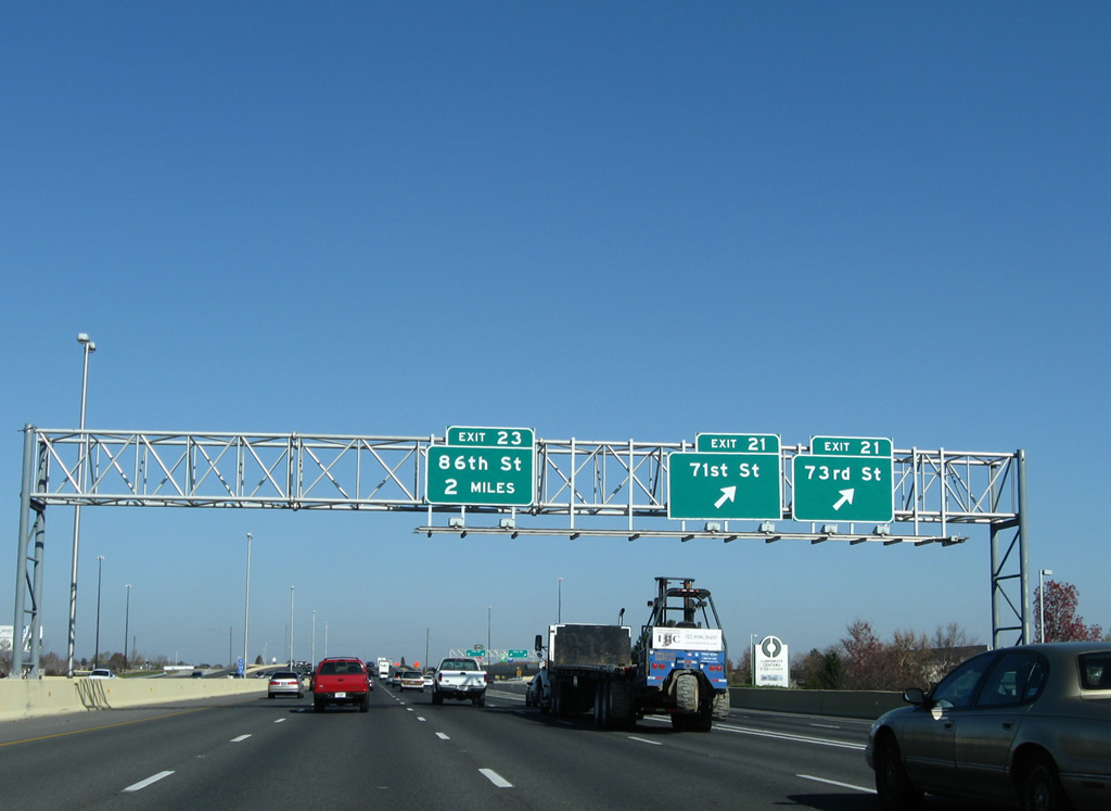
| Interstate 465 maintains eight overall lanes through the 71st Street (Exit 21) exchange. A second parclo interchange follows with 86th Street in two miles. 11/05/09 |
|
| The Beltway northbound briefly swells to six overall lanes between Exits 21 and 23. 11/05/09 |
|
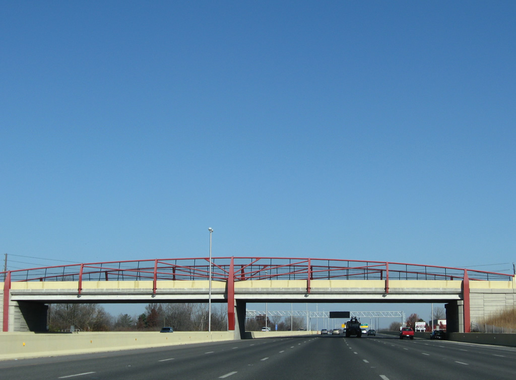
| 79th Street bisects Park 100 east from this decorative overpass and the Trader's Point neighborhood of the city. 11/05/09 |
|
| 86th Street ventures west from Exit 20 to Trader's Point and Hendricks County and east through Park 100 and College Park. 11/05/09 |
|
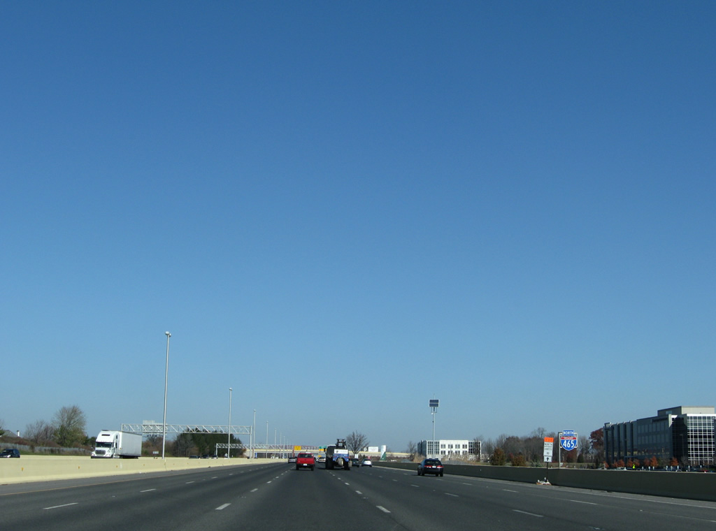
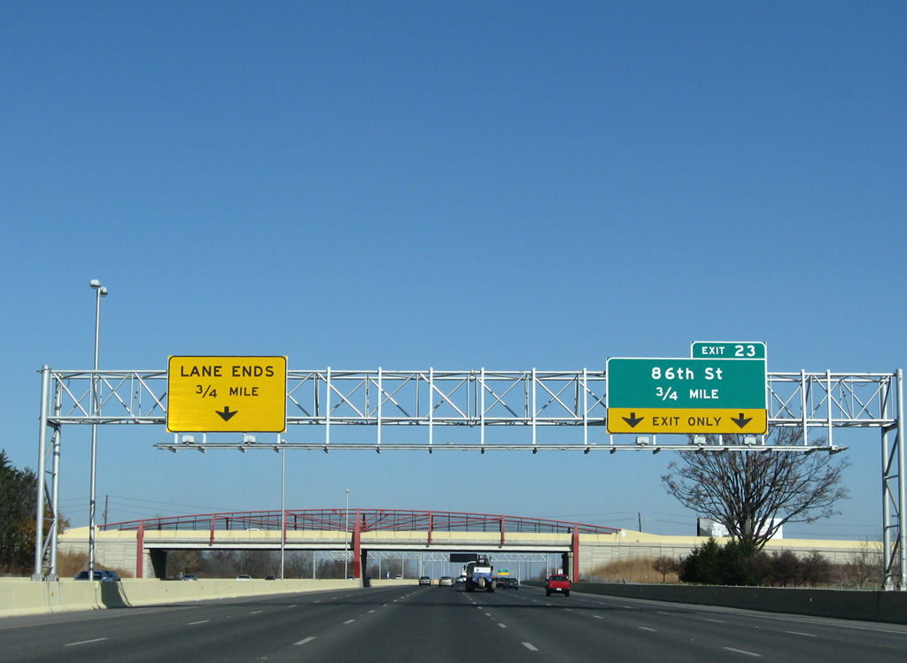
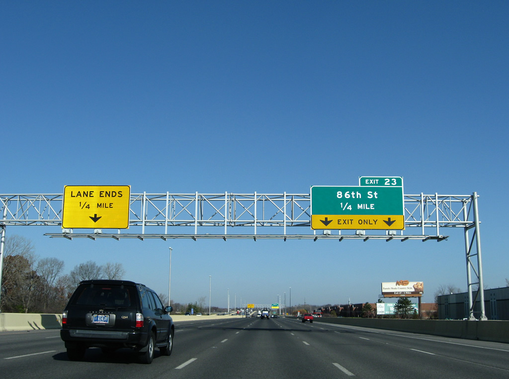
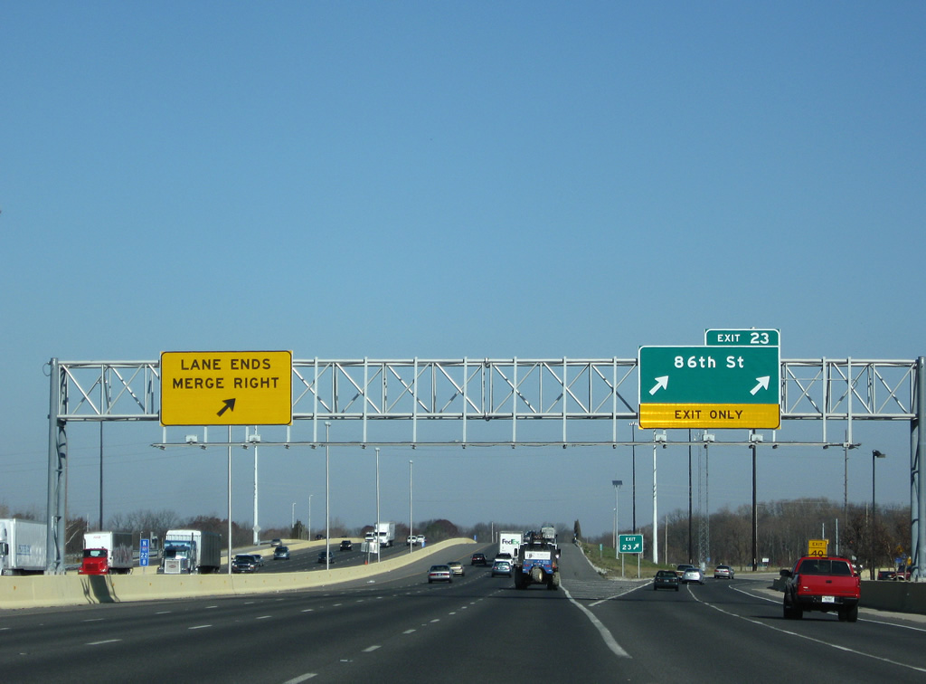
| Exit 23 claims the right two lanes for West 86th Street as the left lane ends. 11/05/09 |
|
| Northbound reassurance shield for Interstate 465 posted after the 86th Street on-ramp. 11/05/09 |
|
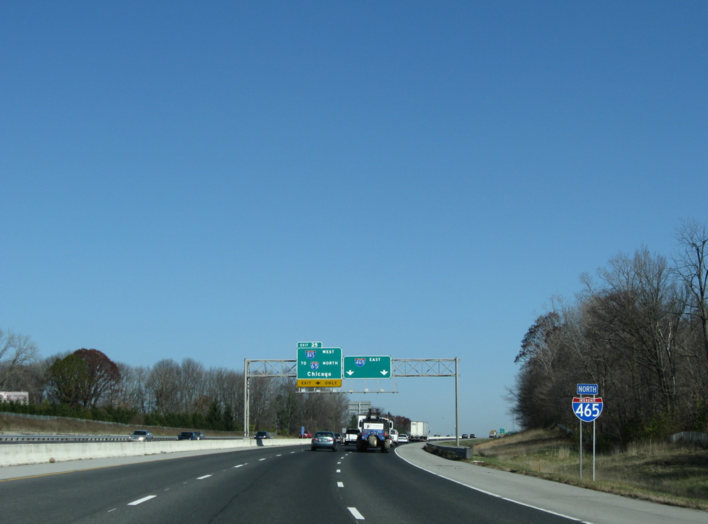
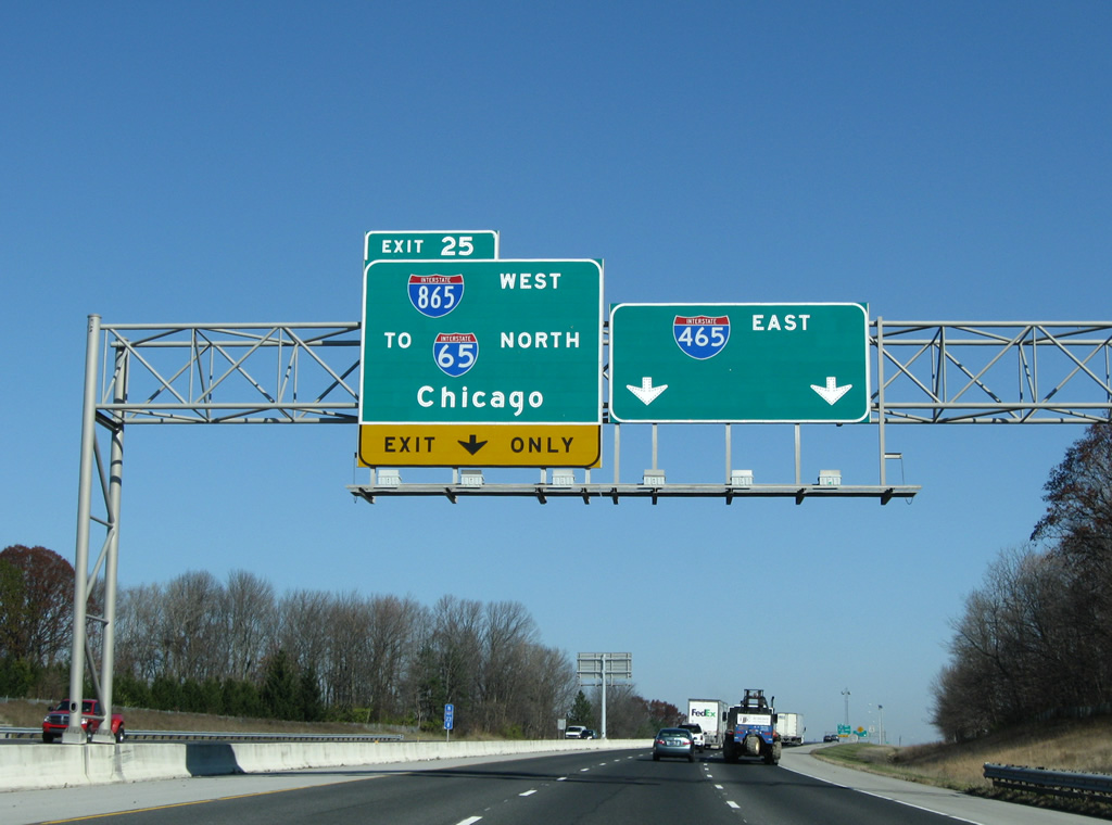
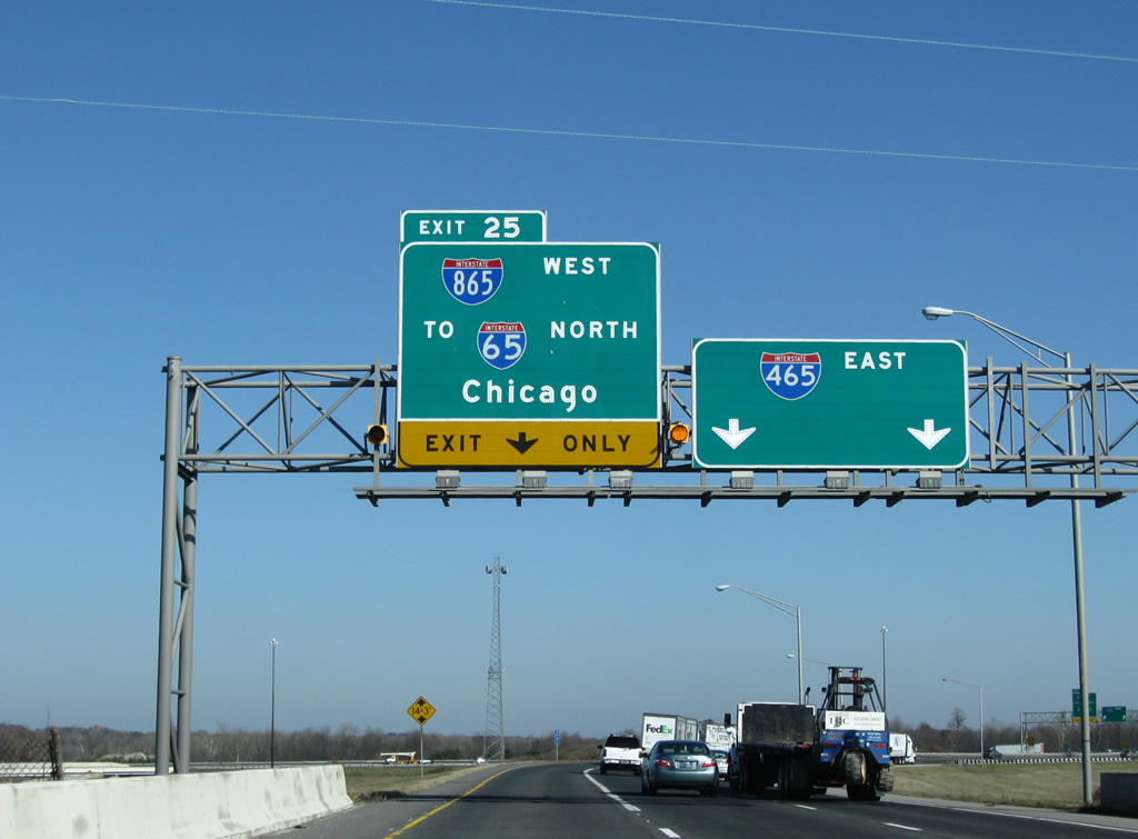
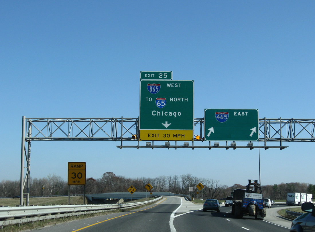
| Interstate 465 next splits with Interstate 865 west (Exit 25) at the eastern turn in southern Boone County. 11/05/09 |
|
| Exit 25 consists of a directional interchange between the Indianapolis Beltway mainline and the original Interstate 465 "dogleg" Renumbering to Interstate 865 in May 2002, the dogleg consists of a 4.7 mile connector between Interstate 465 and Interstate 65 at Royalton. 11/05/09 |
|
| Traffic partitions between Interstate 465 east through the north side of Indianapolis and Carmel and Interstate 865 west at Exit 25. There are no exits along the Interstate 865 mainline and the freeway defaults onto Interstate 65 north. 11/05/09 |
|
| A short distance east of the merge with U.S. 52 at Interstate 865 is the eastbound transition into Marion County and the city of Indianapolis. Interstate 465 east (inner loop) crosses over West 96th Street at the county line. 11/05/09 |
|
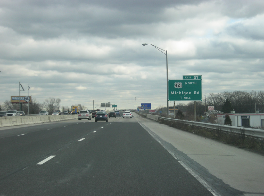
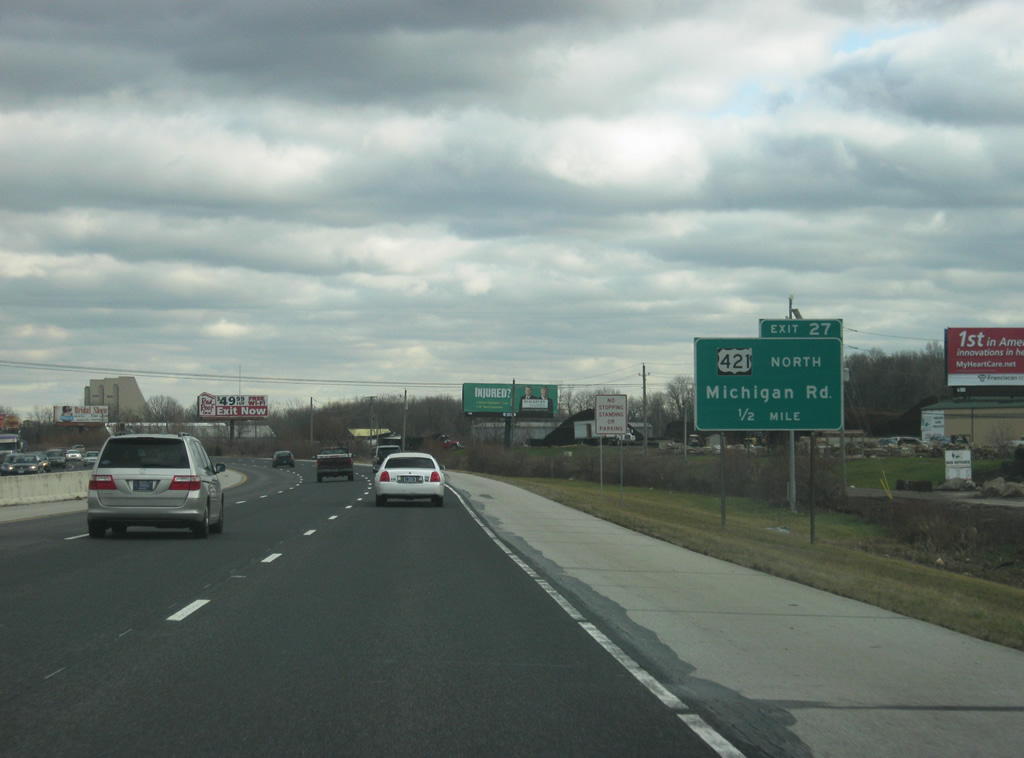
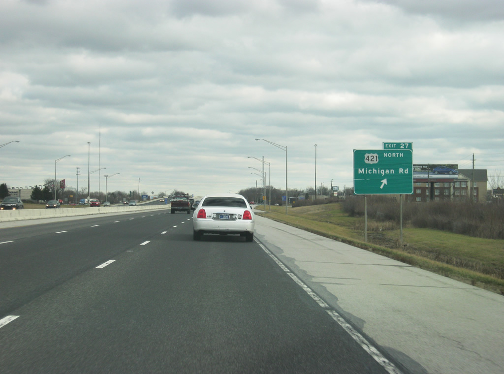
| U.S. 421 (Michigan Road) joins the Beltway from Zionsville at the Exit 27 diamond interchange. Michigan Road south carried U.S. 421 to West 38th Street (former U.S. 36), Dr. Martin Luther King, Jr. Street and West Street through downtown. 12/17/11 |
|
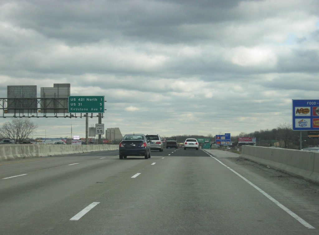
| A distance sign in the median announces the distances to the next three exits, for U.S. 421 North (one mile), U.S. 31 North (five miles), and Keystone Avenue (seven miles). In the Indianapolis area, these signs can only be found along Interstate 465 on the Northwest side and along Interstate 70 from the Indianapolis International Airport to Downtown Indianapolis. 12/17/11 |
|
| Continuing north, U.S. 421 follows Michigan Road to the edges of both Zionsville and Carmel. From Interstate 465 north to 116th Street (former SR 334), U.S. 421 is four lanes. Traveling 232 miles in the state, U.S. 421 ends at Michigan City (U.S. 20) and enters Indiana at Madison from Kentucky. Looming in the distance are the Pyramids, three office buildings that are part of the College Park business park and a local landmark along Interstate 465. 12/17/11 |
|
| Now at Exit 27 with Michigan Road and U.S. 421 North. The diamond interchange was rebuilt in the 2000s to handle the additional traffic that travel it from the suburbs of western Carmel and Zionsville. To the south are several hotels and restaurants that are part of the College Park area, where the Pyramids are. 12/17/11 |
|
| East of Exit 27, U.S. 421 south silently merges with U.S. 52 east along the inner loop of the Beltway to Exit 47. Interstate 465 remains six lanes across the far northern tier of Marion County. 12/17/11 |
|
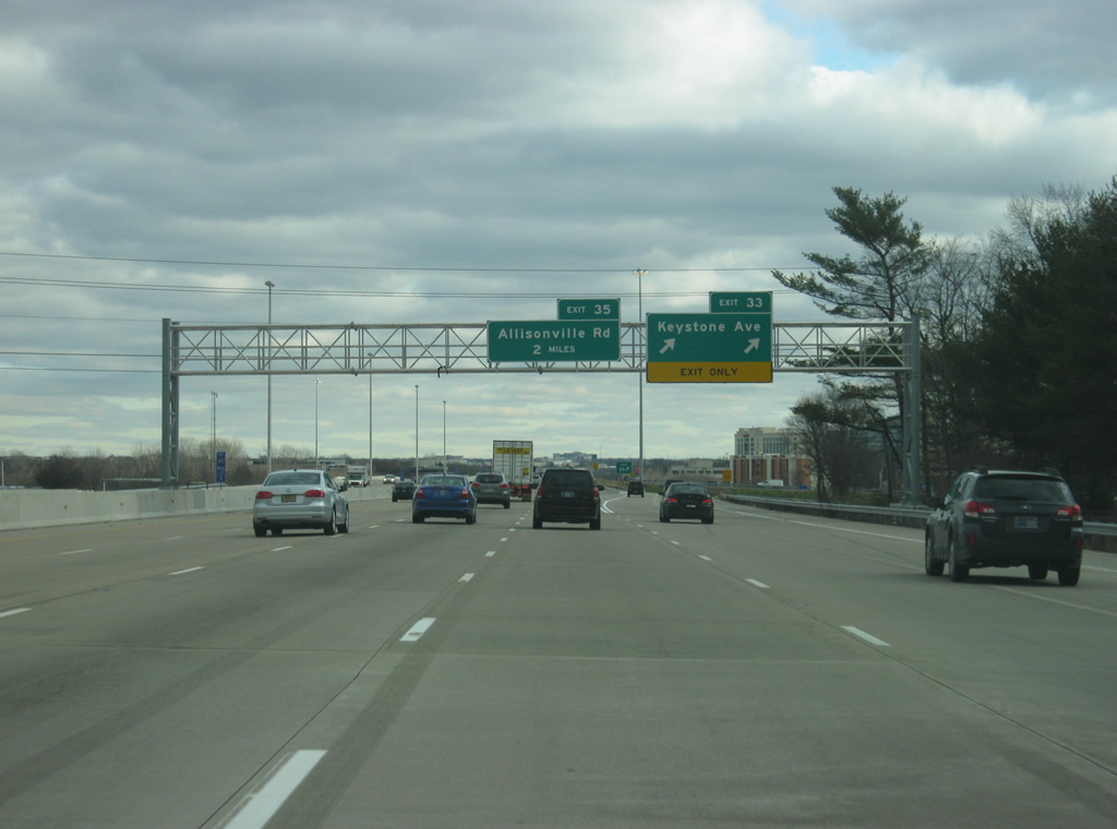
| Passing under Township Line Road, eastbound drivers see an interchange sequence sign two miles west of the six-ramp parclo interchange with Meridian Street and U.S. 31 north. Keystone Avenue (former SR 431) follows in five miles. Allisonville Road, near the Castleton Square Mall, is seven miles away. 12/17/11 |
|
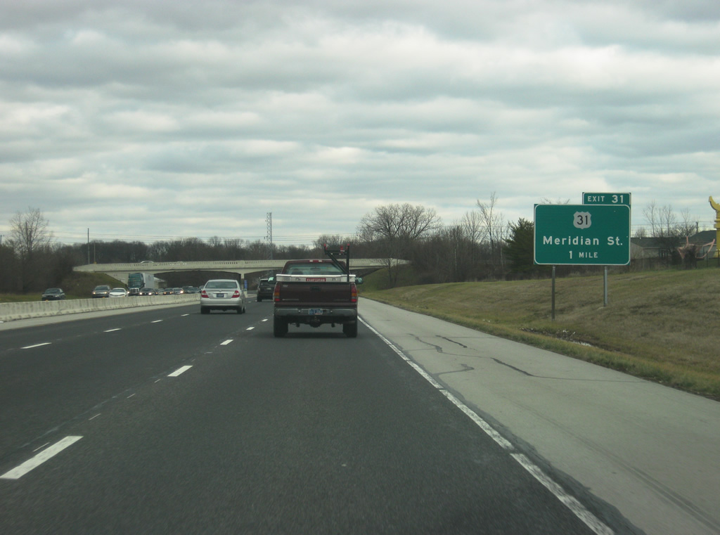
| Truck traffic bound for Keystone Avenue are advised to use Exit 31 for U.S. 31 (Meridian Street) north to Carmel. U.S. 31 constitutes a divided highway with controlled access (no private driveways) from 103rd Street to Range Line Road. 12/17/11 |
|
| One mile west of the Exit 31 off-ramp to U.S. 31 (Meridian Street) north. Meridian Street represents historic U.S. 31 southward through Williams Creek, Meridian Hills, Meridian-Kessler, and downtown Indianapolis. 12/17/11 |
|
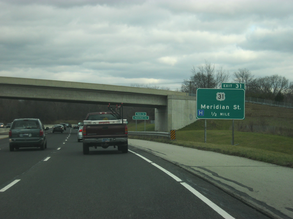
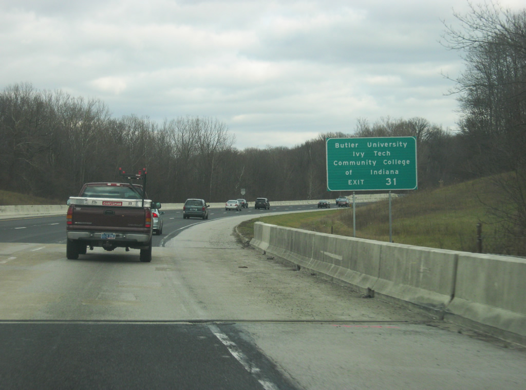
| Travelers along Interstate 465 east reenter Hamilton County at the West 96th Street over crossing, one half mile west of U.S. 31 (Exit 31). Exit 31 serves Butler University and Ivy Tech Community College of Indiana via Meridian Street south. 12/17/11 |
|
| Exit 31 serves Butler University and Ivy Tech Community College via Meridian Street south. 12/17/11 |
|
| Exit 31 parts ways with the inner loop of the Beltway for U.S. 31 (Meridian Street) north to Carmel and Meridian Street south into Indianapolis. U.S. 31 represents a major corridor north from the capital city to Kokomo and South Bend. Upgrades of the route add additional freeway segments, such as a 20 mile stretch of limited-access highway east of La Paz and Lakeville slated to open in 2014. With that, the current interchange with U.S. 31 is going to be changed to allow for free flowing traffic between the new U.S. 31 freeway and Interstate 465. 12/17/11 |
|
| U.S. 31 southbound merges onto Interstate 465 & U.S. 52-421 east from a distributor roadway. The US route shares a hidden overlap with the eastern half of the Indianapolis Beltway to Exit 2. East of Exit 31, Interstate 465 widens to ten lanes as the highway receives the traffic from U.S. 31. 12/17/11, 11/05/09 |
|
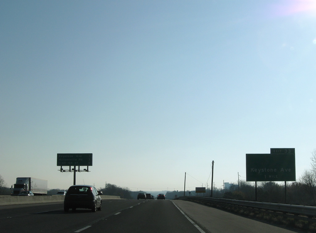
| Interstate 465 kinks southeast from the College Avenue underpass to reenter Marion County. The stretch of Interstate 465 from U.S. 31 (Exit 31) to Allisonville Road (Exit 37) was widened to ten lanes throughout to handle the additional traffic that flows through this area. As well, both Exits 33 (Keystone Avenue) and 35 (Allisonville Road) were rebuilt. 11/05/09, 12/17/11 |
|
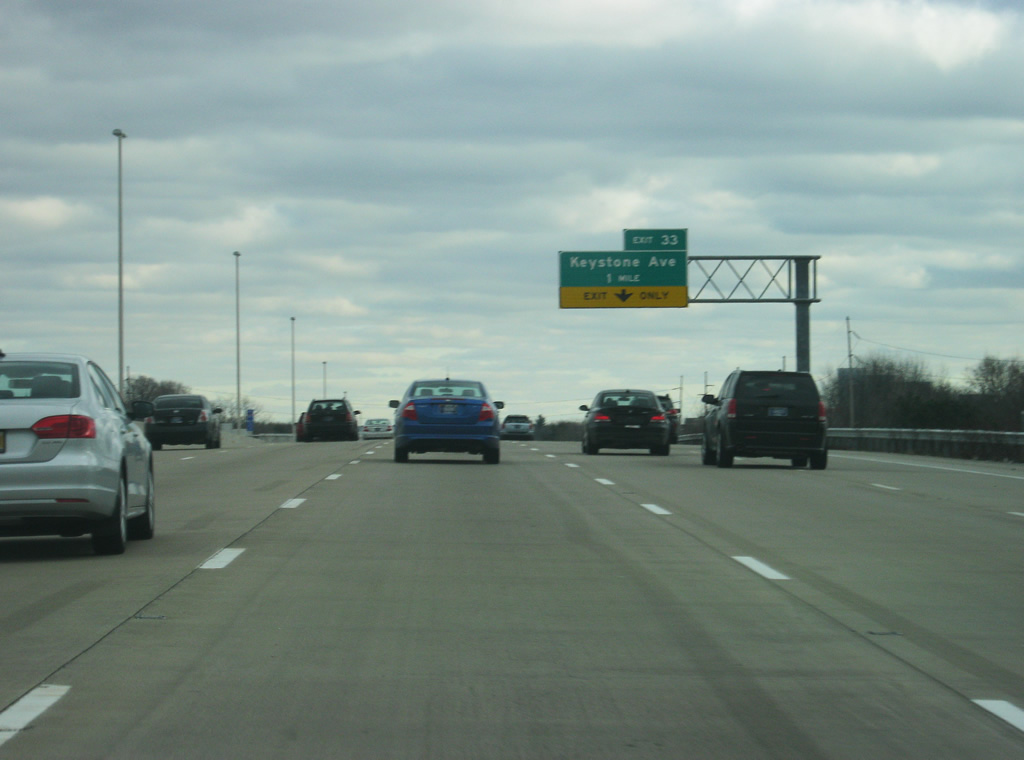
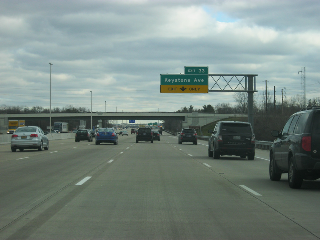
| Interstate 465 is one mile from Keystone Avenue (Exit 33). Keystone Avenue travels north to Carmel and represents a recently decommissioned stretch of SR 431. 11/05/09, 12/17/11 |
|
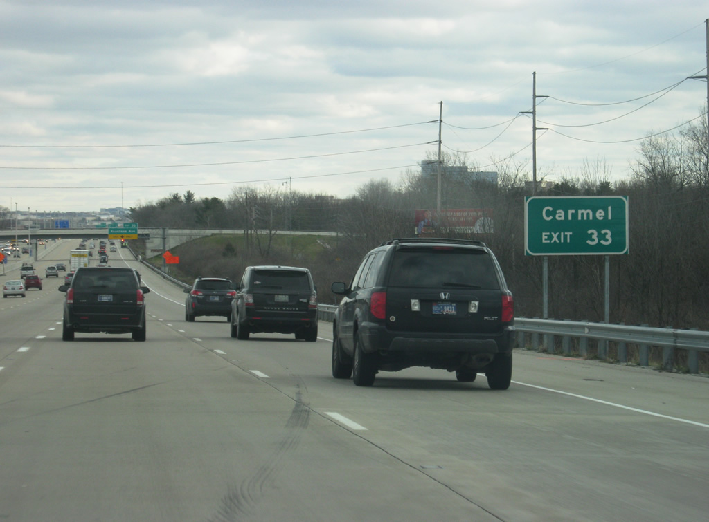
| The growing suburb of Carmel can be reached via Exit 33 and Keystone Avenue/Keystone Parkway. 12/17/11 |
|
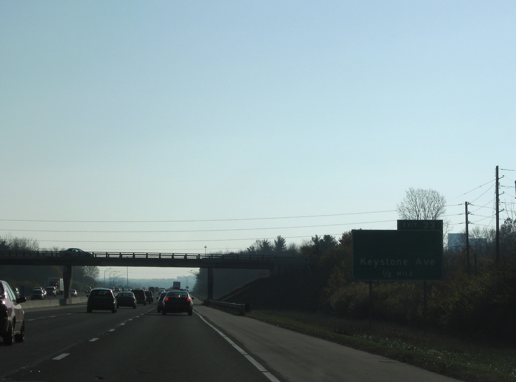
| Keystone Avenue is now within a half mile away. To the south, Keystone is a major arterial that goes through the Keystone at the Crossing and Glendale areas. Now owned by the city of Carmel, the road was renamed Keystone Parkway and turned into a freeway-like highway with roundabout interchanges at 106th Street, 116th Street, Carmel Drive, 126th Street, Main Street and 131st Street. 11/05/09, 12/17/11 |
|
| Nearing Keystone Avenue (Exit 33), a new Travel Time Sign alerts motorists of the distance and estimated time to reach Interstates 69 and 70. As of late 2011, the signs were not yet operational. 12/17/11 |
|
| Exit 33 departs Interstate 465 west for Keystone Avenue. Keystone Avenue carried SR 431 north 5.7 miles to a wye interchange with U.S. 31 until October 19, 2007. In 2011, the interchange was redesigned from a diamond to a partial diamond interchange with wider ramps to handle the traffic that goes through this area. The area around the interchange is known as Keystone at the Crossings and is home to the upscale Fashion Mall. 12/17/11 |
|
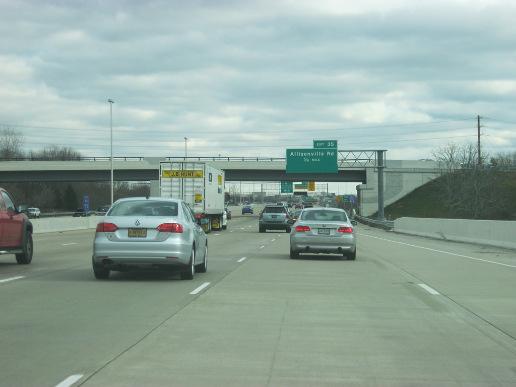
| Approaching the White River crossing on Interstate 465 east, one half mile out from the Exit 35 diamond interchange with Allisonville Road. 12/17/11 |
|
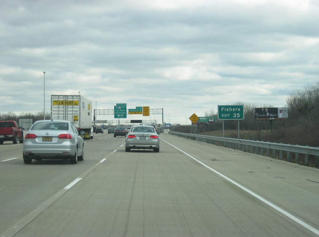
| The suburb of Fishers can be reached from Allisonville Road via Exit 35. The suburb can also be reached from Interstate 69 via Exit 37. 12/17/11 |
|
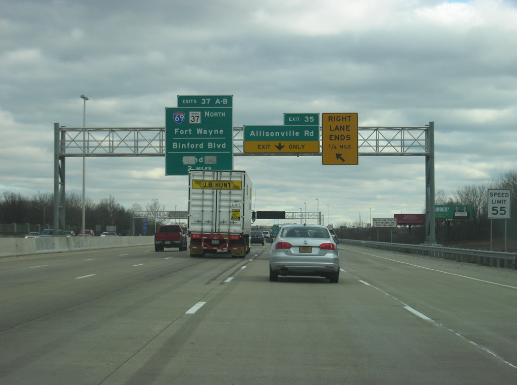
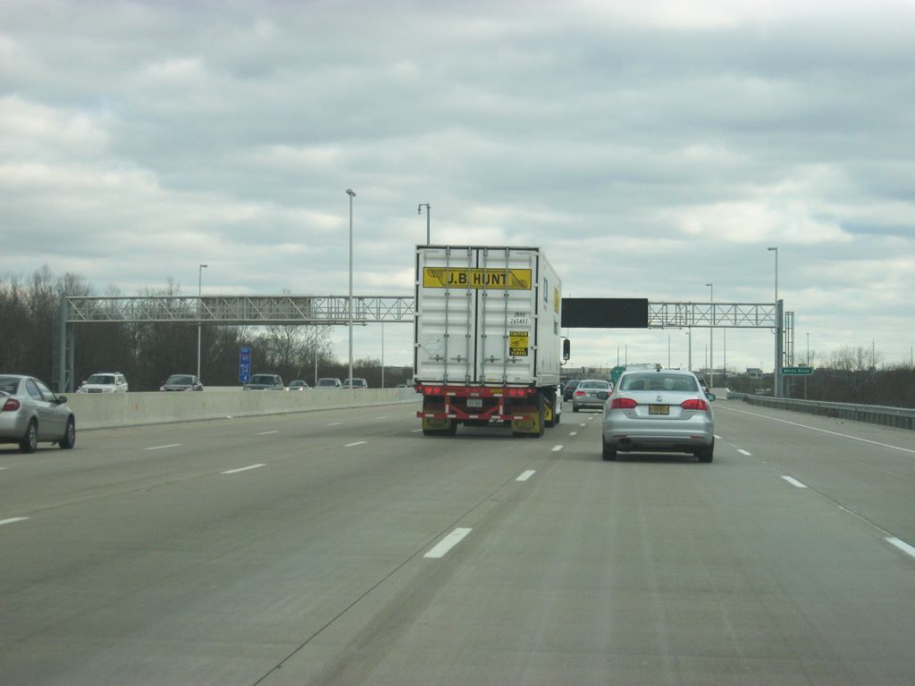
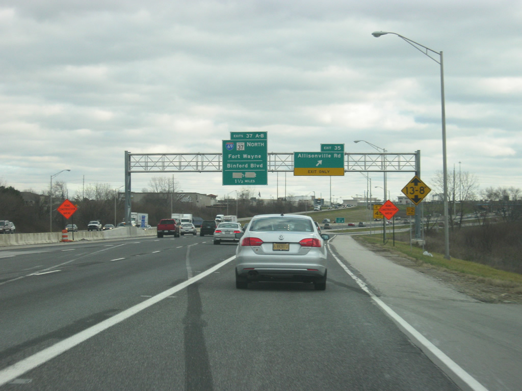
| The right lane ends as the new section of Interstate 465 prepares to give way to the older pavement that hasn't been rebuilt yet. The Northeast 465/69 project is supposed to rebuild the stretch of Interstate 465 from Exit 31 (Meridian Street/U.S. 31) to near Exit 40 (around Fall Creek). That includes a complete rebuild of the Exit 37, which is why the sign announcing that exit also has 82nd Street on the sign (covered in this photo), as the redesigned interchange will connect with 82nd Street east of Castleton. 12/17/11 |
|
| Interstate 465 crosses the White River as it approaches Exit 35 (Allisonville Road). 12/17/11 |
|
| Interstate 465 enters the Castleton and Allisonville area at Exit 35 with Allisonville Road. Exit 35 is buffeted by commercial development centering around Castleton Square Mall. Allisonville Road continues north from Binford Boulevard (former SR 37) to Castleton, Indianapolis Metropolitan Airport and Fishers. In 2012, Exit 35 will be rebuilt as a single-point urban interchange. 12/17/11 |
|
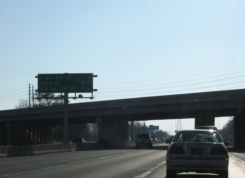
| Passing under 82nd Street, Interstate 465 eastbound advances one mile to a directional cloverleaf interchange with I-69/SR 37 north and Binford Boulevard (former SR 37) south. 56th Street and U.S. 36 follow on the southbound inner loop. 11/05/09 |
|
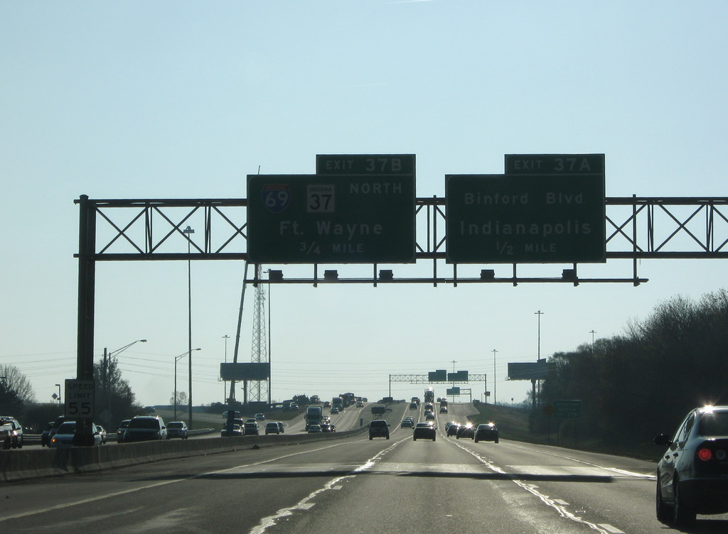
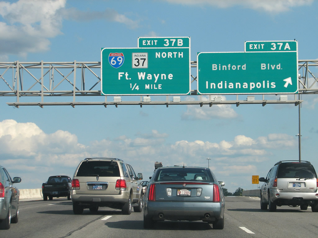
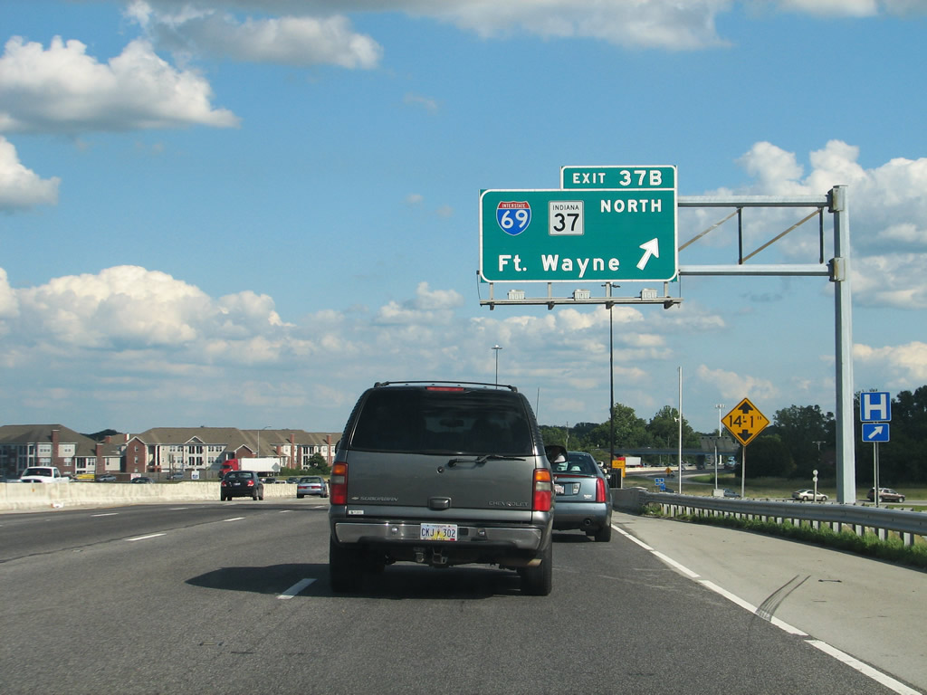
| Interstate 69 begins at Exit 37B presently and travels northeast to Fort Wayne and Lansing, Michigan. The freeway was slated to continue southwest into the city along the unconstructed Northeast Freeway, following Binford Boulevard to Keystone Avenue and a new alignment to the unbuilt 30th Street Freeway and southward to meet I-65/70 at the north end of their overlap.1 11/05/09 |
|
| Exit 37A joins Binford Boulevard south ahead of East 75th Street. Binford Boulevard carried SR 37 signage to Fall Creek Parkway before its realignment onto Interstate 465 between Exits 4 and 37. SR 37 north joins Interstate 69 northeast to Exit 5 toward Noblesville otherwise. 07/31/09 |
|
| Exit 37B loops onto the northbound beginning of Interstate 69 from Interstate 465 east. Interstate 69 otherwise travels 109 miles to Fort Wayne. The original section of Interstate 69 is joined by four others: a 13 mile spur from Interstate 55 west to U.S. 61 in northern Mississippi, a 1.77 mile segment from Interstates 64 & 164 to SR 68 near Evansville, a 55 mile stretch along Interstate 24 and Western Kentucky Parkway from near Madisonville to Eddyville, and a 6.2 mile segment of U.S. 77 between Texas 44 and Interstate 37 at Corpus Christi. These southern segments were added / built in anticipation of the overall plan to extend Interstate 69 southward to Laredo, Texas. 07/31/09 |
Page Updated 02-26-2013.

 North
North