|
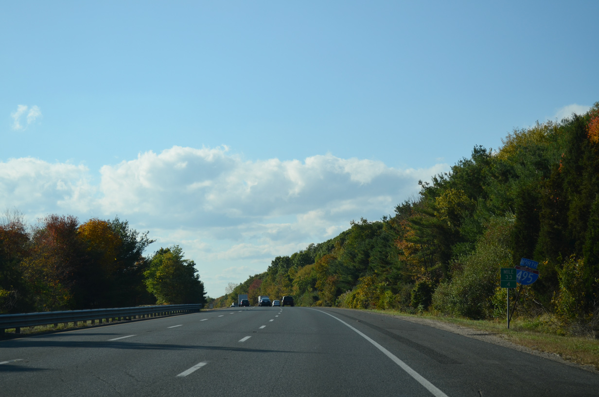
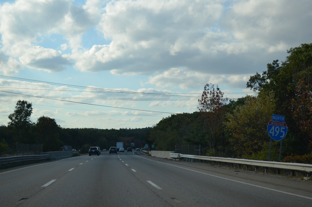
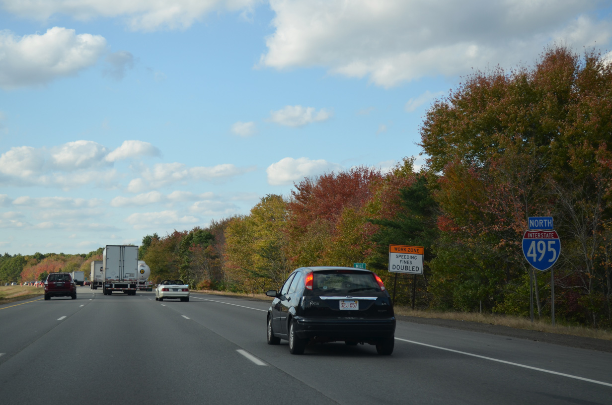
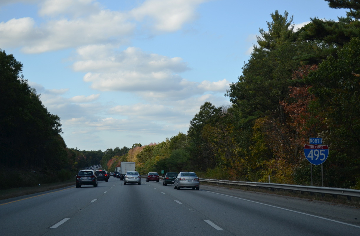
| Confirming marker for I-495 north posted between the Route 106 (Green Street) and South Street overpasses. 10/06/14 |
|
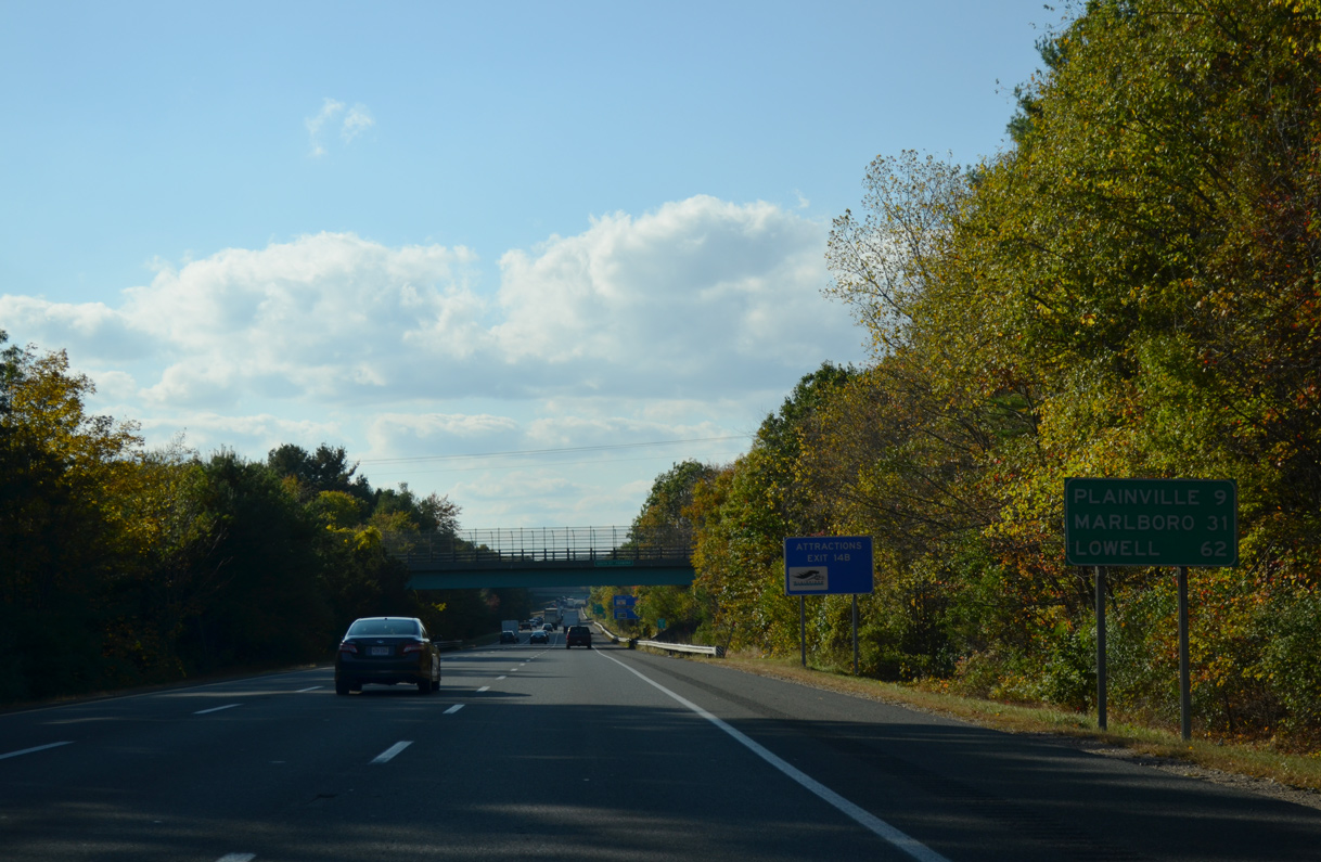
| The Plainville town center is a nine mile drive to the southwest via forthcoming U.S. 1. Marlboro, where the beltway meets both U.S. 20 and I-290, is 31 miles to the north. 10/06/14 |
|
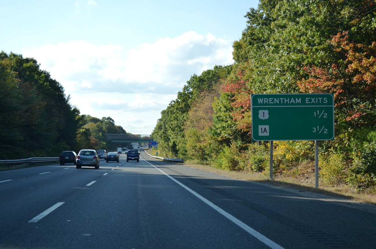
| Interstate 495 passes through the town of Wrentham west of Foxboro. U.S. 1 travels through eastern reaches of the town while Route 1A leads to the town center from Exit 36. 10/06/14 |
|
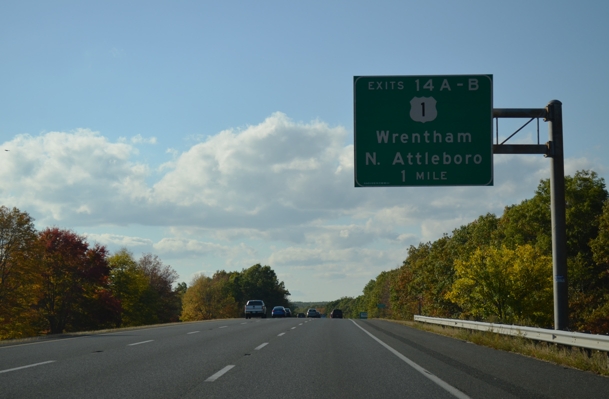
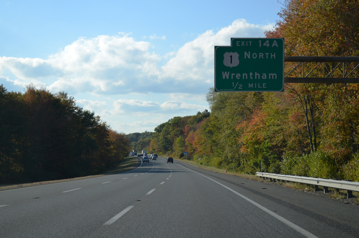
| The roadways of I-495 separate with a wooded median on the mile preceding Exits 36 A/B with U.S. 1 (Washington Street). 10/06/14 |
|
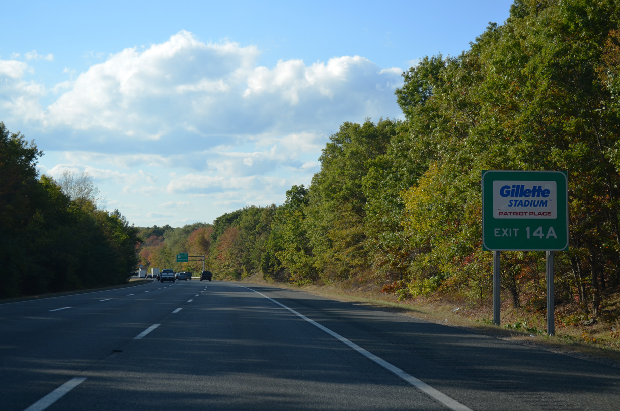
| U.S. 1 travels four miles north from Exit 36 A to Patriot Place and Gillette Stadium (home of the New England Patriots NFL franchise). 10/06/14 |
|
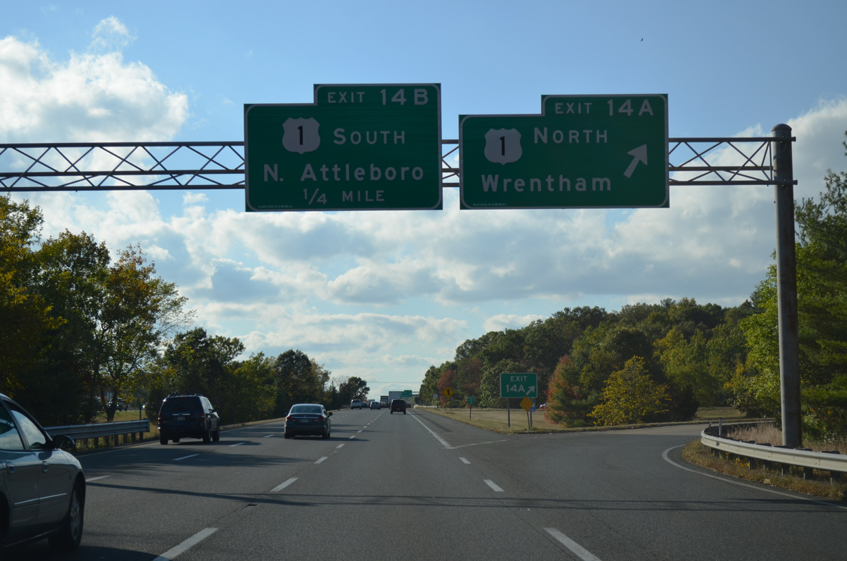
| I-495 crosses the Wrentham town line ahead of the cloverleaf interchange (Exits 36 A/B) with U.S. 1. 10/06/14 |
|
| U.S. 1 heads northeast through east Wrentham and west Foxborough to converge with Interstate 95 at Walpole. 10/06/14 |
|
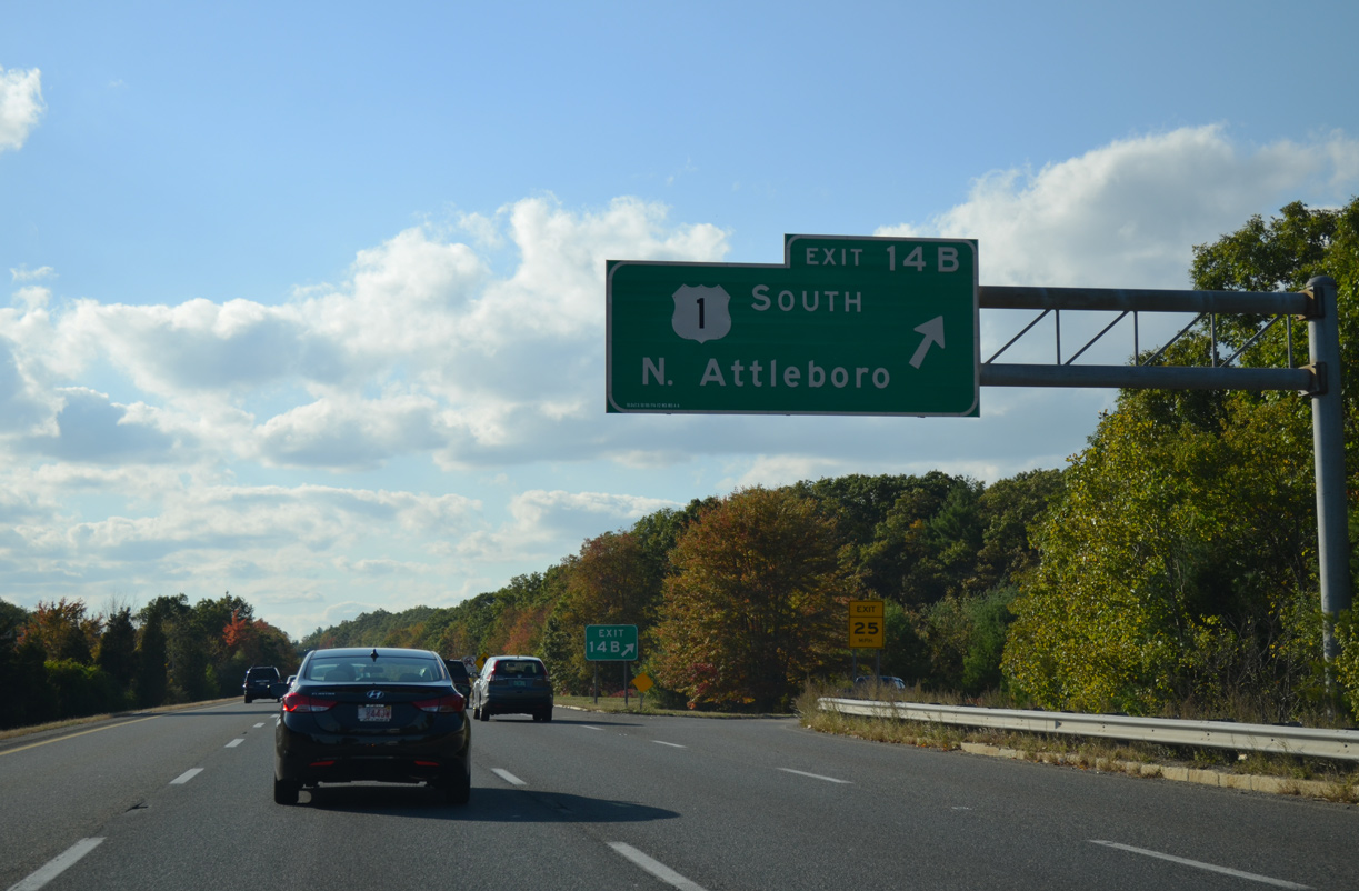
| South from Exit 36 B, U.S. 1 follows Washington Street to North Attleborough Center. There U.S. 1 shifts eastward onto an at-grade bypass around the town center ahead of I-295. 10/06/14 |
|
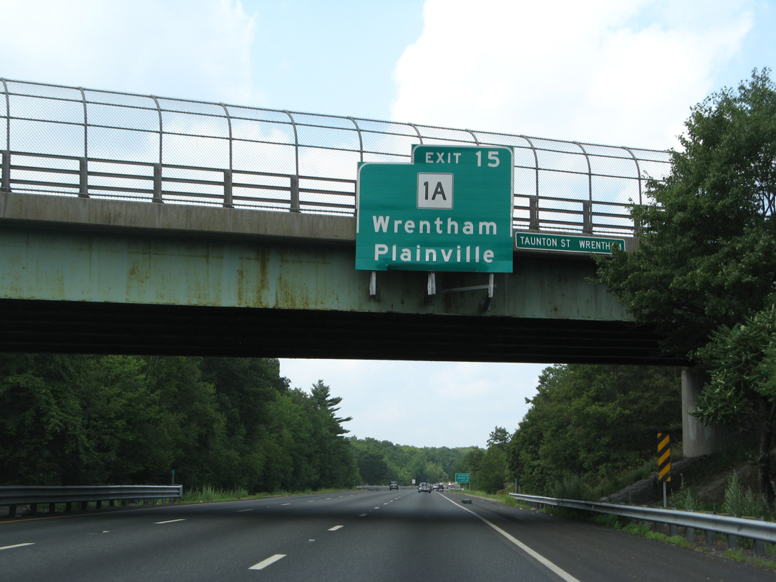
| A damaged overhead for Exit 38 to Route 1A was removed from the Taunton Street overpass by 2012. 07/29/07 |
|
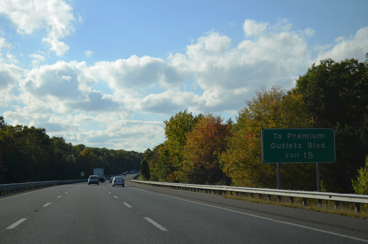
| Interstate 495 traverses areas of Wretham State Forest west to Exit 38, which lies northeast of the Wretham Village Premium Outlet Mall. 10/06/14 |
|
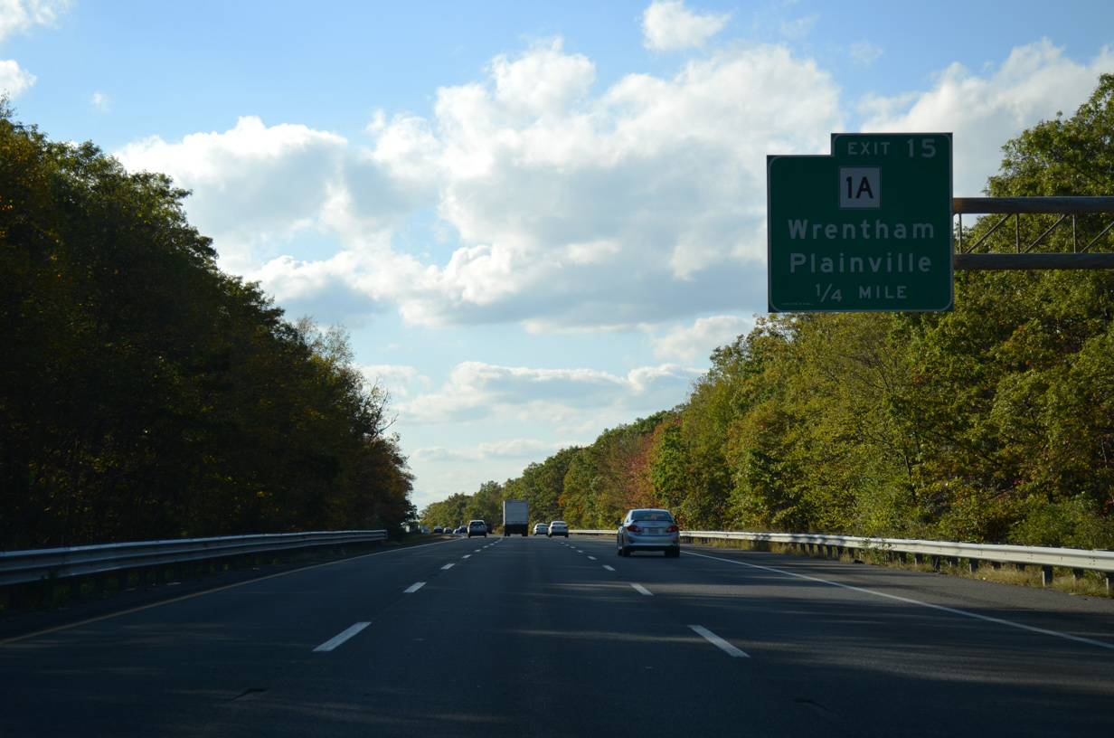
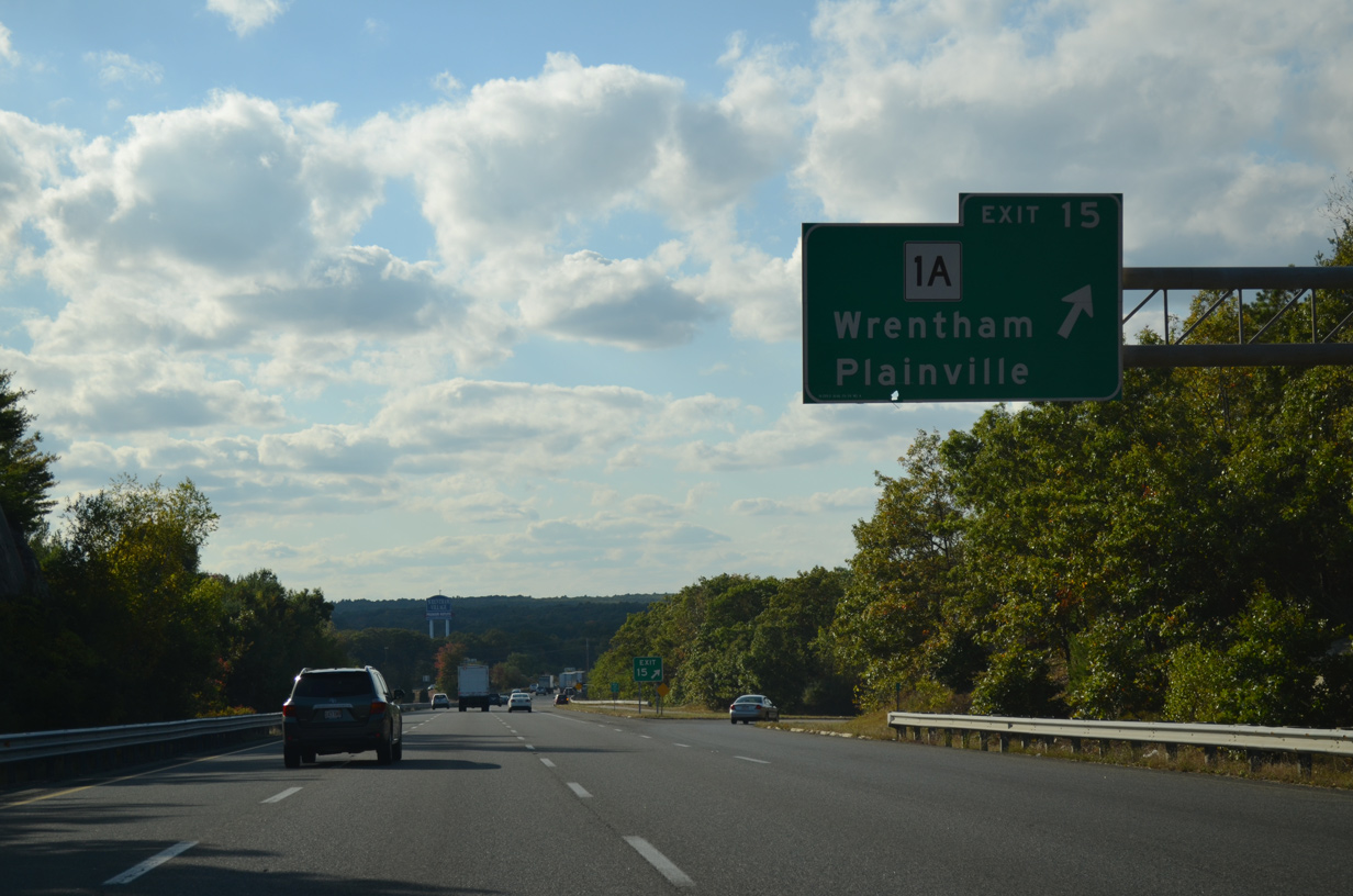
| Route 1A (South Street) branches west from U.S. 1 at North Attleboro to Plainville and Wrentham. 10/06/14 |
|
| A parclo A2 interchange (Exit 38) joins Route 1A (South Street) with Interstate 495 south of Wampump Corner and Route 121. There is no direct access to Route 121 west to Sheldonville from the beltway. 10/06/14 |
|
| Northbound I-495 crosses an abandoned railroad grade at this confirming marker just west of Route 1A. 10/06/14 |
|
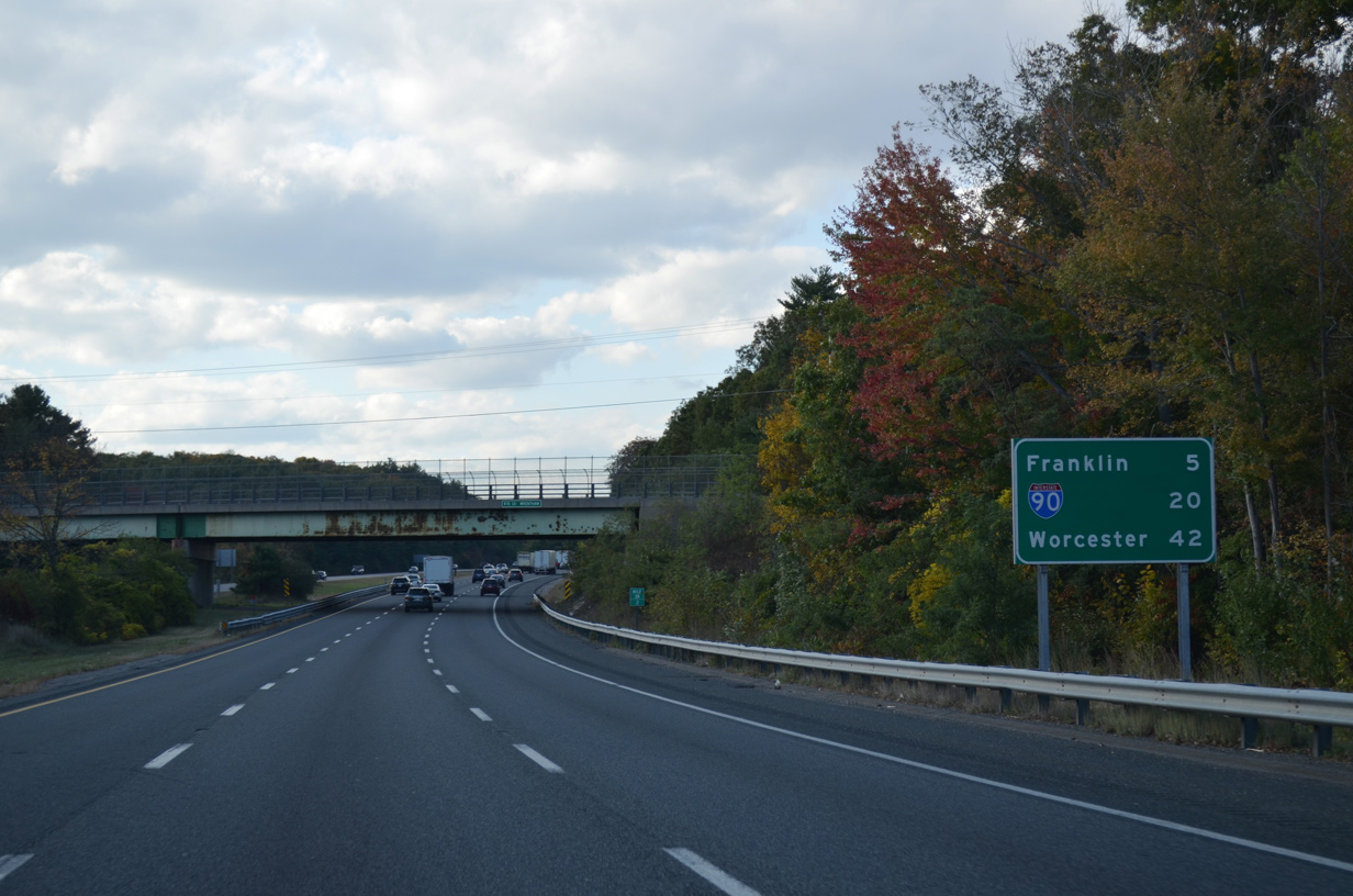
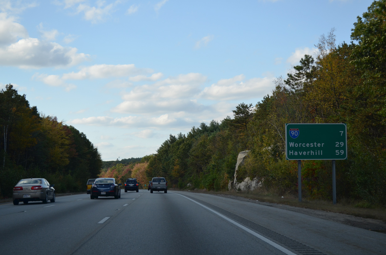
| Motorists bound for the Mass Pike reach Interstate 90 in 20 miles. Worcester is 42 miles to the northwest via I-90 or I-290. 10/06/14 |
|
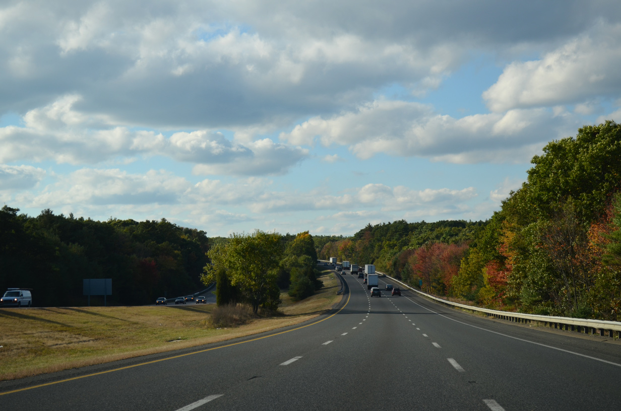
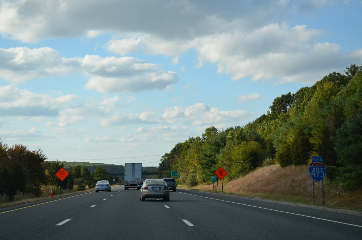
| Fall scenery along Interstate 495 west of Bald Hill at the Franklin town line. 10/06/14 |
|
| A second reassurance marker stands on the 3.2 mile stretch between Exits 38 and 41 after the Summer Street underpass. 10/06/14 |
|
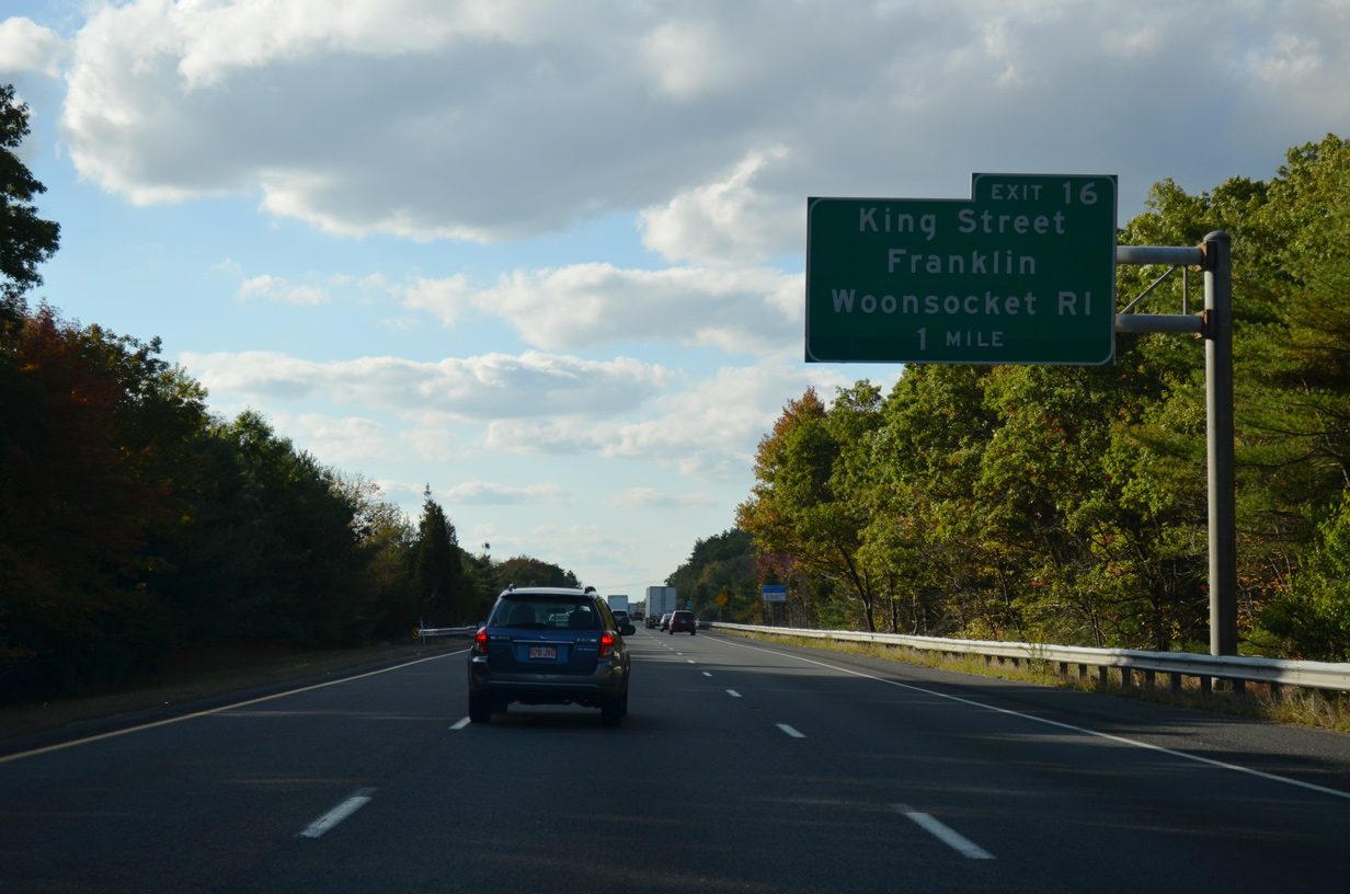
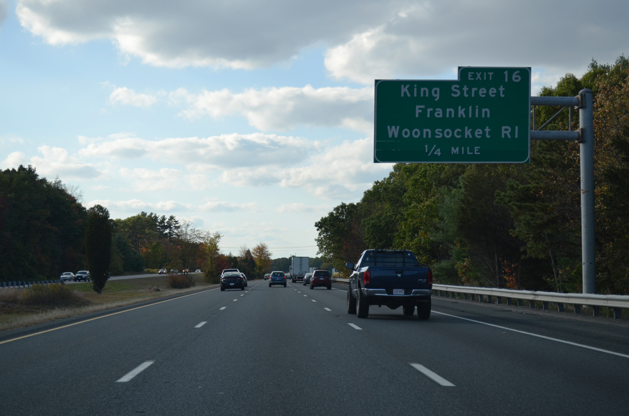
| The diamond interchange at Exit 41 joins I-495 with King Street in one mile. The exchange serves adjacent Franklin Industrial Park via Constitution Boulevard. The 300 acre master-planned office park is home to several distribution and manufacturing companies.1 10/06/14 |
|
| King Street north to Union Street or Route 140 west leads motorists to the Franklin town center from Exit 41. 10/06/14 |
|
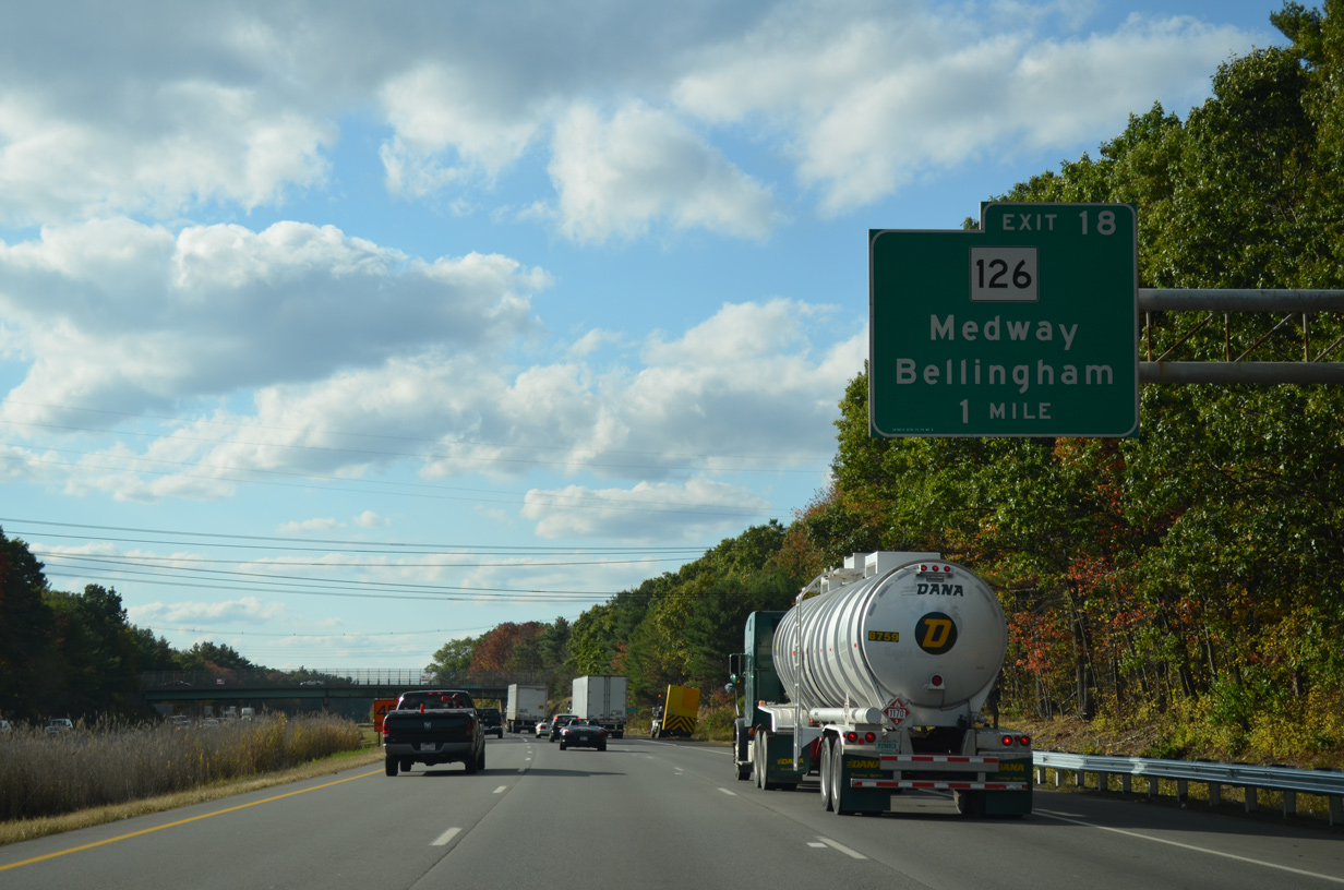
| West from I-495, King Street becomes Washington Street en route to south Bellingham and Route 126 to Woonsocket, Rhode Island. 10/06/14 |
|
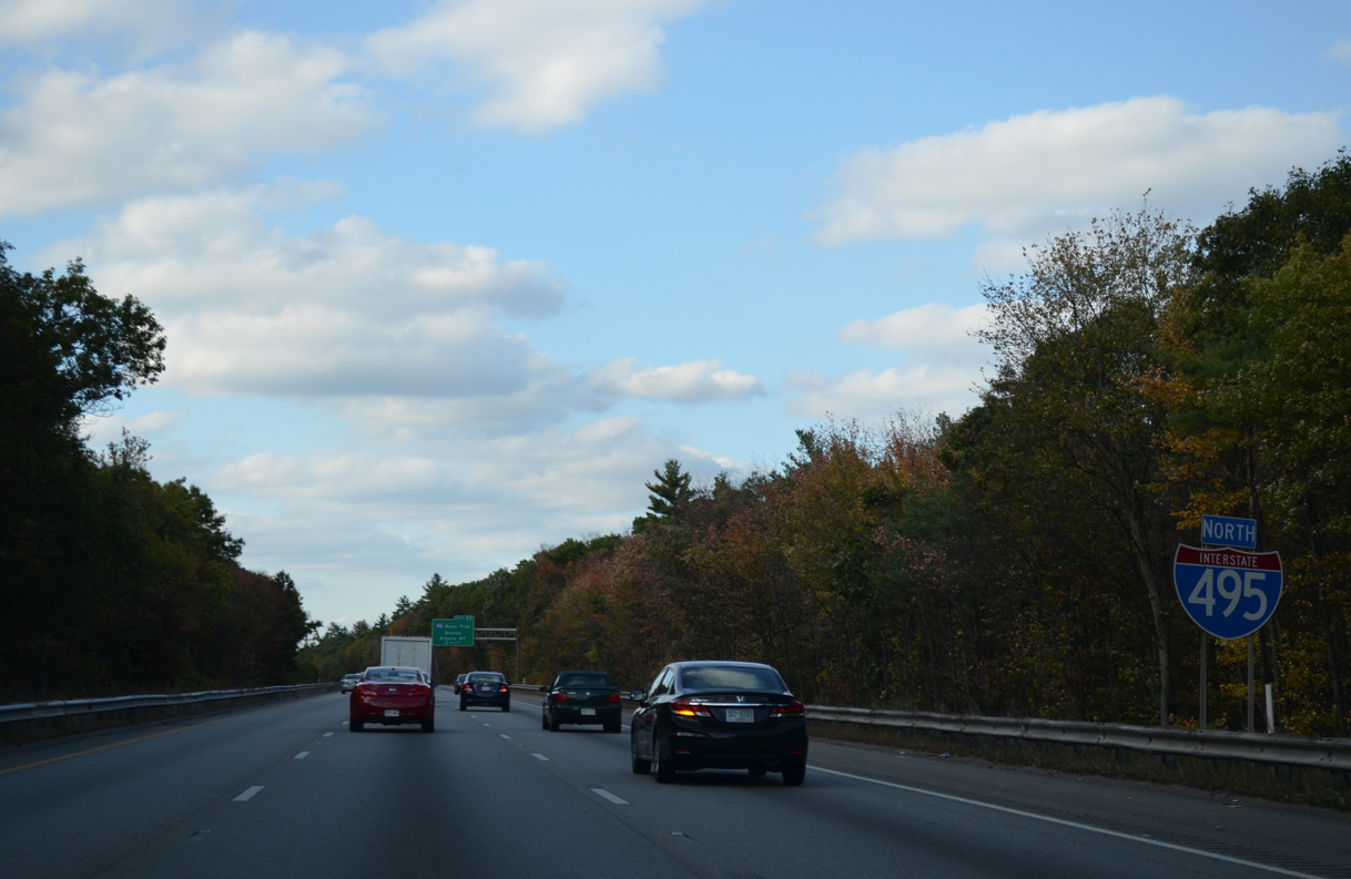
| This confirming marker for I-495 north precedes the Washington Street overpass. 10/06/14 |
|
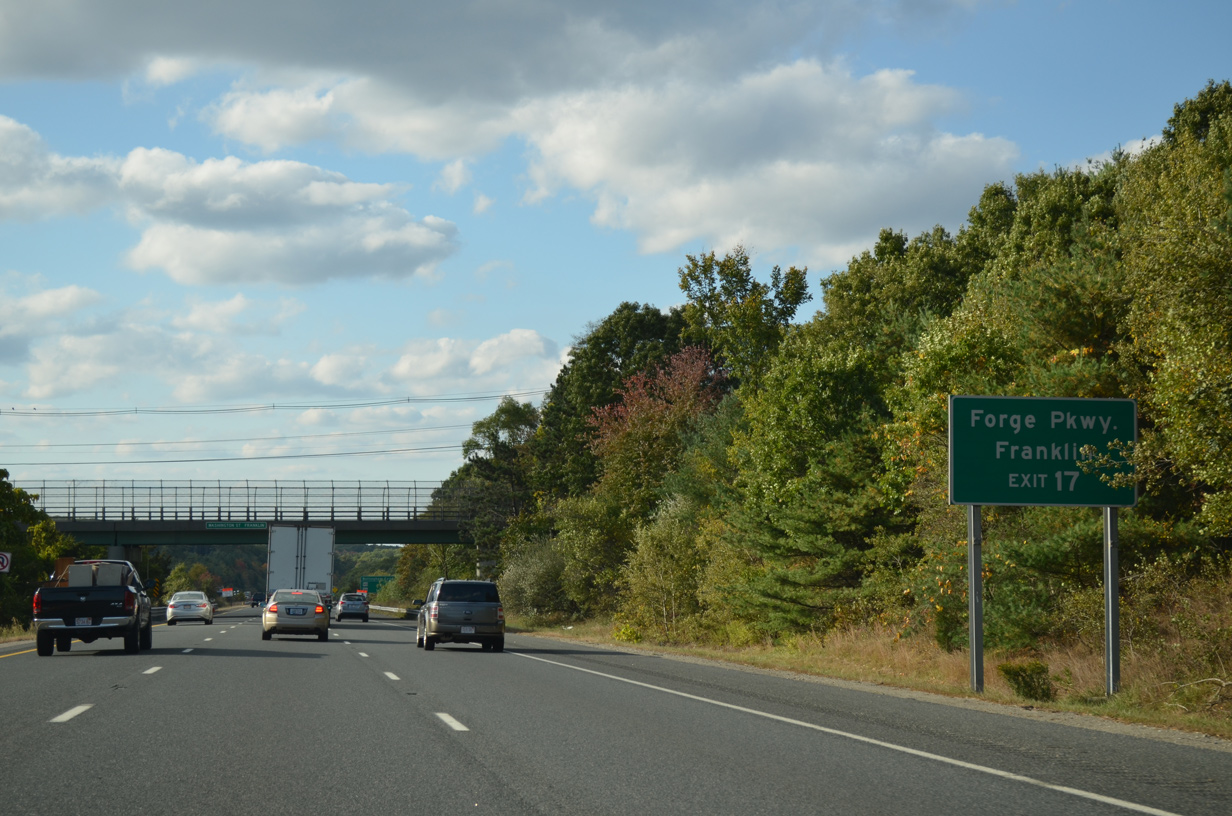
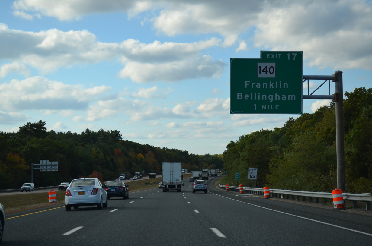
| Turning more northward, I-495 continues through the town of Franklin to Exit 43 with Route 140 by the 360 acre Forge Park. Forge Park is another master-planned industrial park located just west of I-495 via Forge Parkway south. 10/06/14 |
|
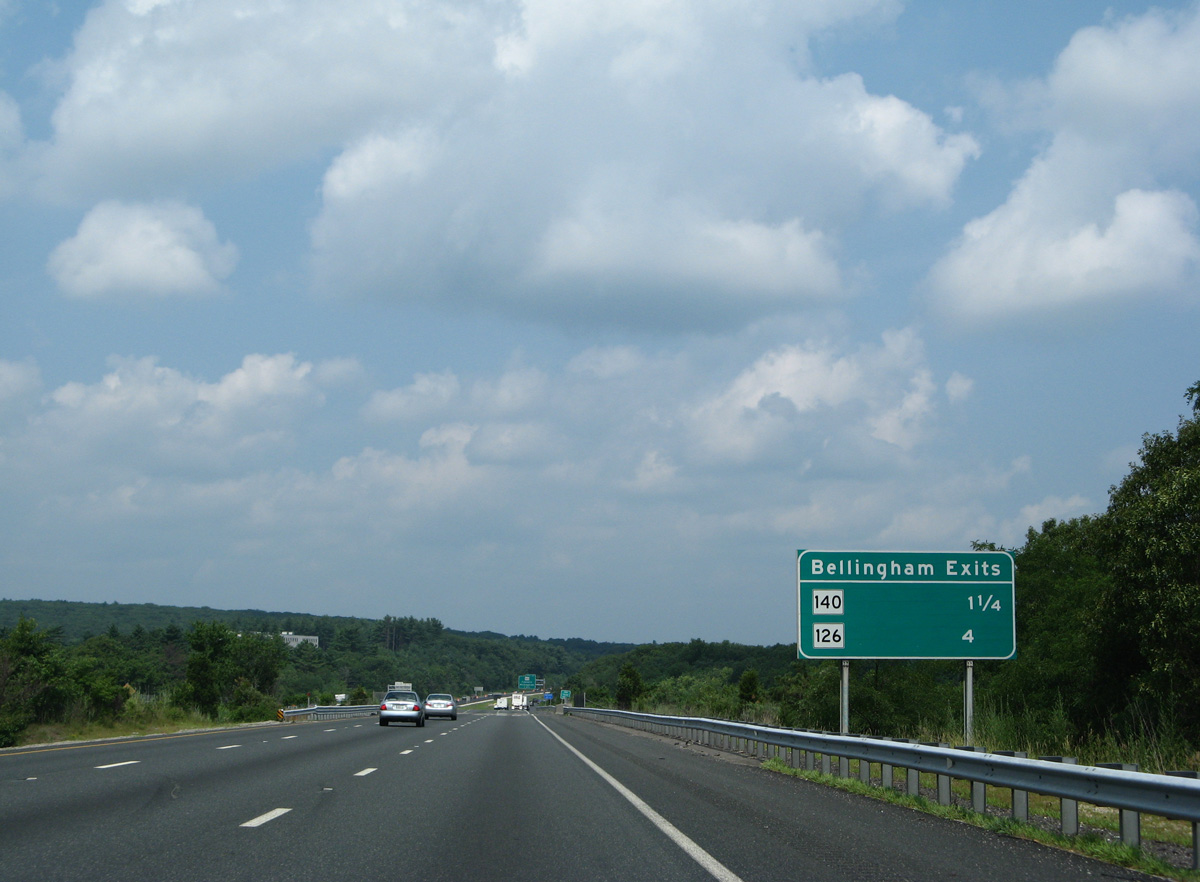
| Route 140 is the first of two exits connecting Interstate 495 with the town of Bellingham. The town center lies at the cross roads between the two routes 10/06/14 |
|
| The freeway passes between Spring and Beaver Ponds ahead of Unionville and Route 140 (Central Street). 10/06/14 |
|
| Route 140 comprises a 107.9 mile long highway from U.S. 6 in New Bedford to Route 12 in the town of Winchendon. 10/06/14 |
|
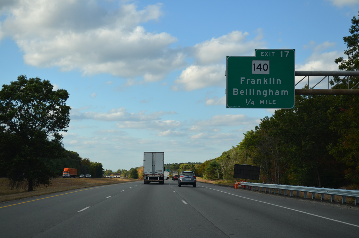
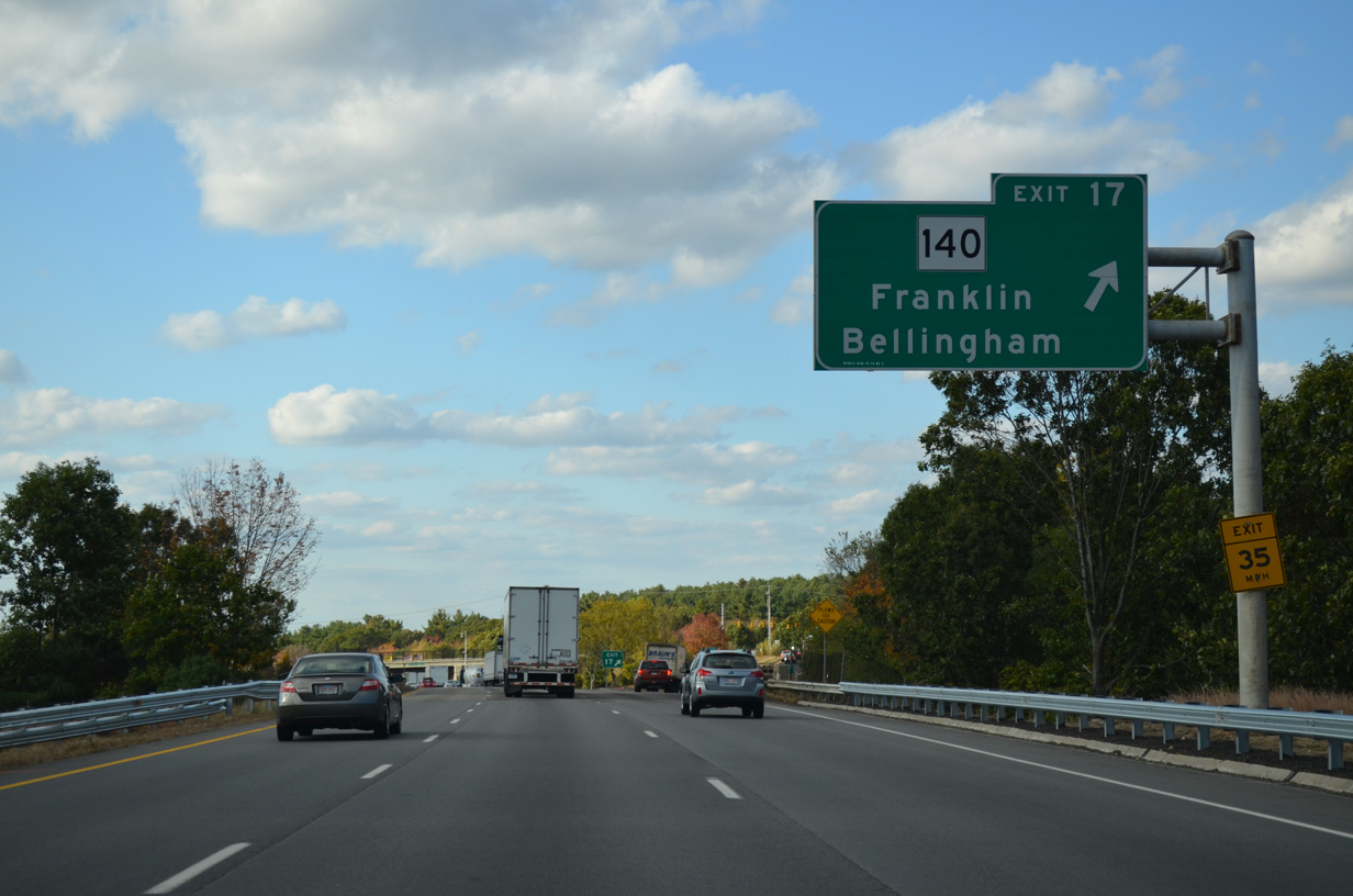
| Entering the diamond interchange (Exit 43) with Route 140 (Central Street) on I-495 north. The state route travels between Bellingham and Franklin, partially as a four lane arterial. 10/06/14 |
|
| I-495 runs alongside Mine Brook and associated wetland areas just north of Exit 43. 10/06/14 |
|
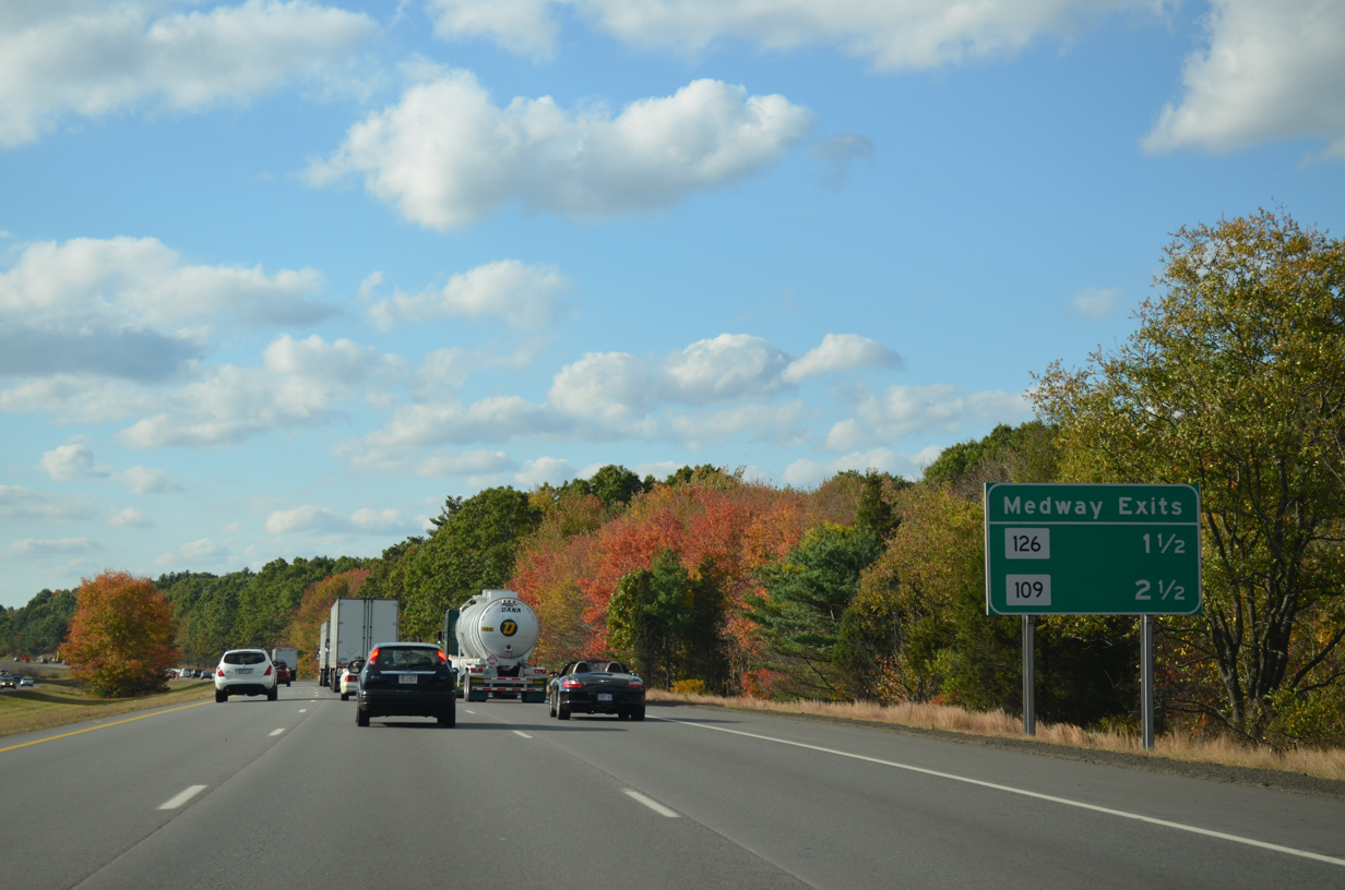
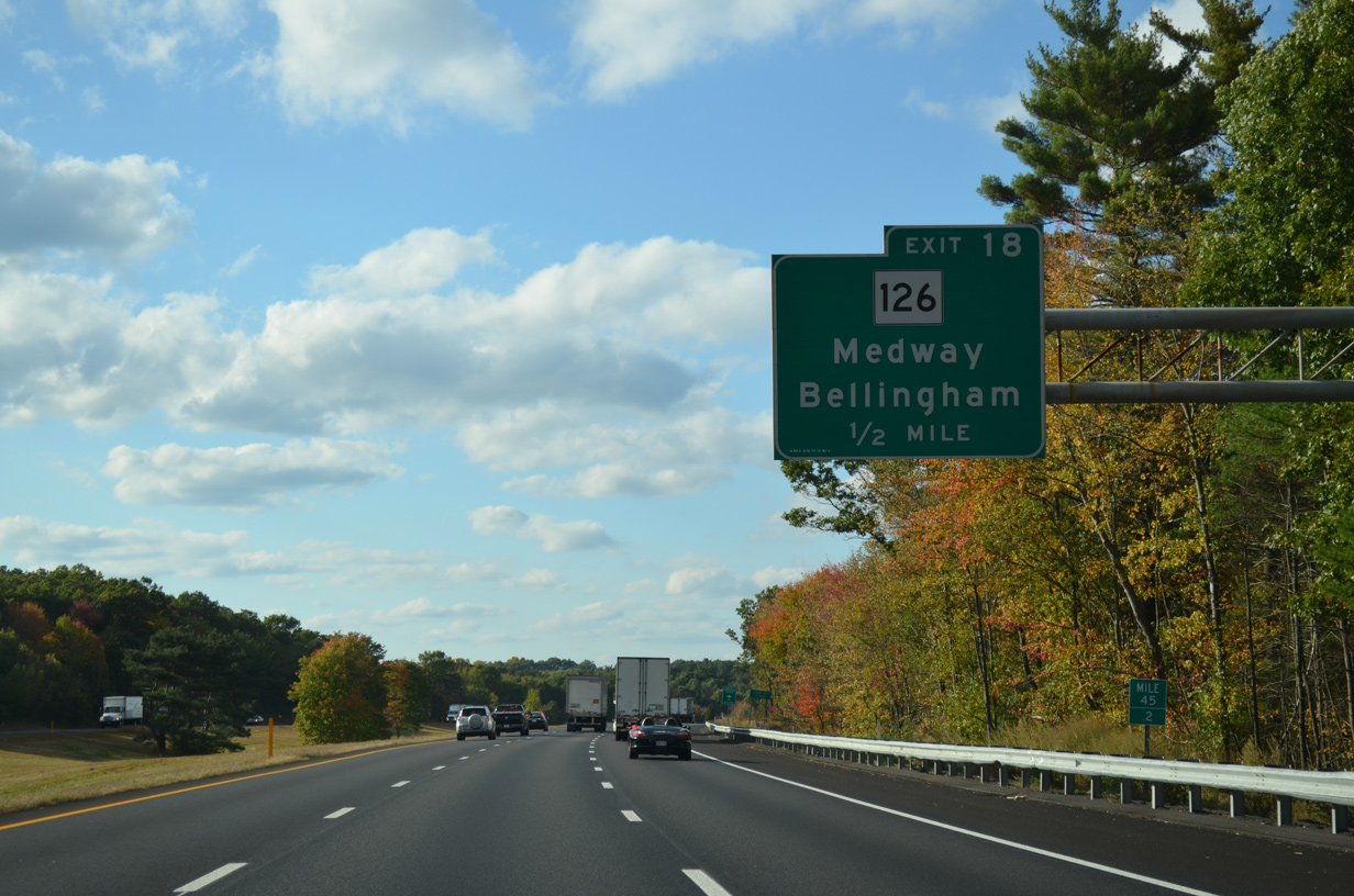
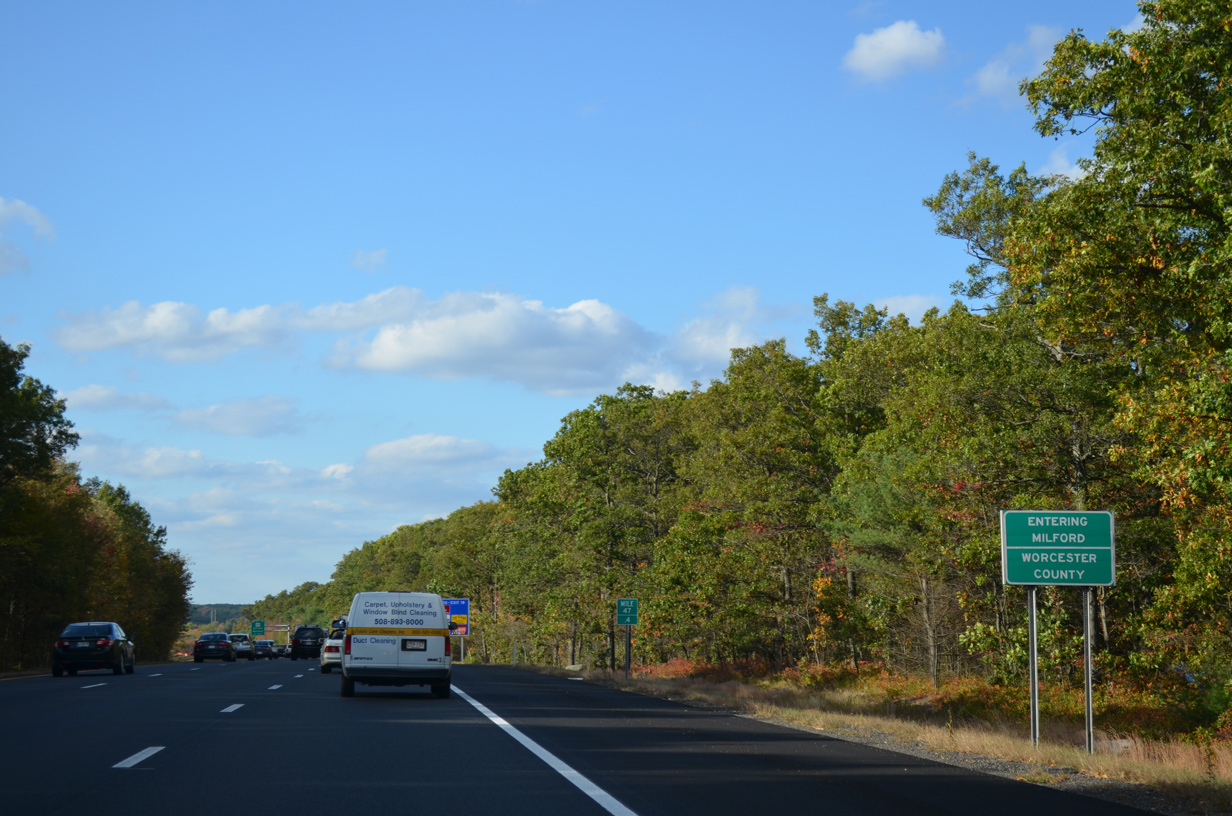
| The beltway nips the southwest corner of Medway midway between Route 126 / Exit 46 and Route 109 / Exit 48. The two state routes converge east of their respective exchanges with I-495 in the town. 10/06/14 |
|
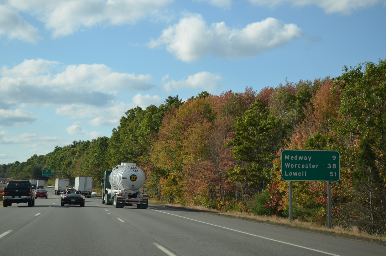
| Worcester is 38 miles to the northwest while Lowell is 51 miles to the northeast. 10/06/14 |
|
| Route 126 continues north from Bellingham along N Main Street to Hartford Avenue east and I-495 at Exit 46. 10/06/14 |
|
| The 33.6 mile long course of Route 126 ends at Route 2 in Concord to the north. Southward, Route 126 becomes Rhode Island Route 126, a 14.3 mile long highway between Woonsocket and U.S. 1 in Providence. 10/06/14 |
|
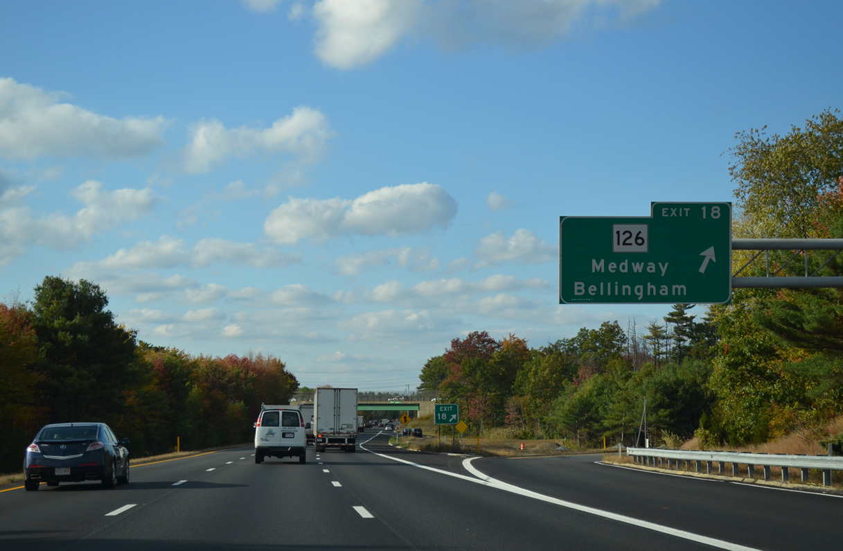
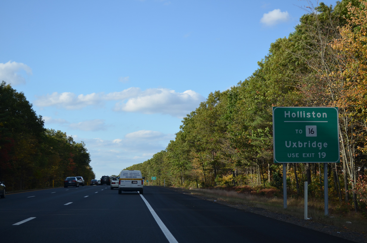
| Big box retail occupies three of the four quadrants abutting the folded diamond interchange (Exit 46) with Route 126 (Hartford Avenue). The state route splits with Main Street in Medford for Summer Street north to Route 16 in Holliston. 10/06/14 |
|
| Interstate 495 runs between subdivisions to the west and wetland areas of Stall Brook to the east. 10/06/14 |
|
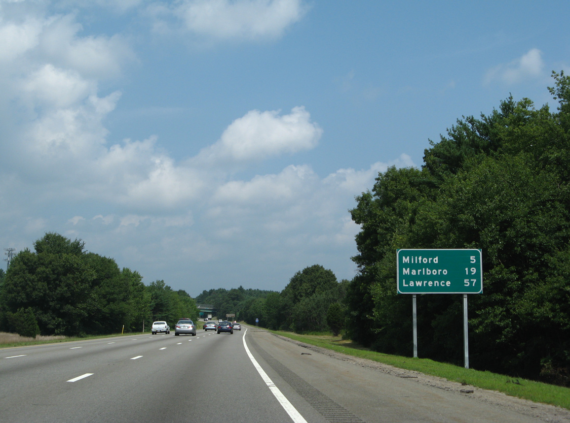
| The beltway bypasses Milford to the east as it continues north 19 miles to Marlboro and 57 miles to Lawrence and Interstate 93. 07/29/07 |
|
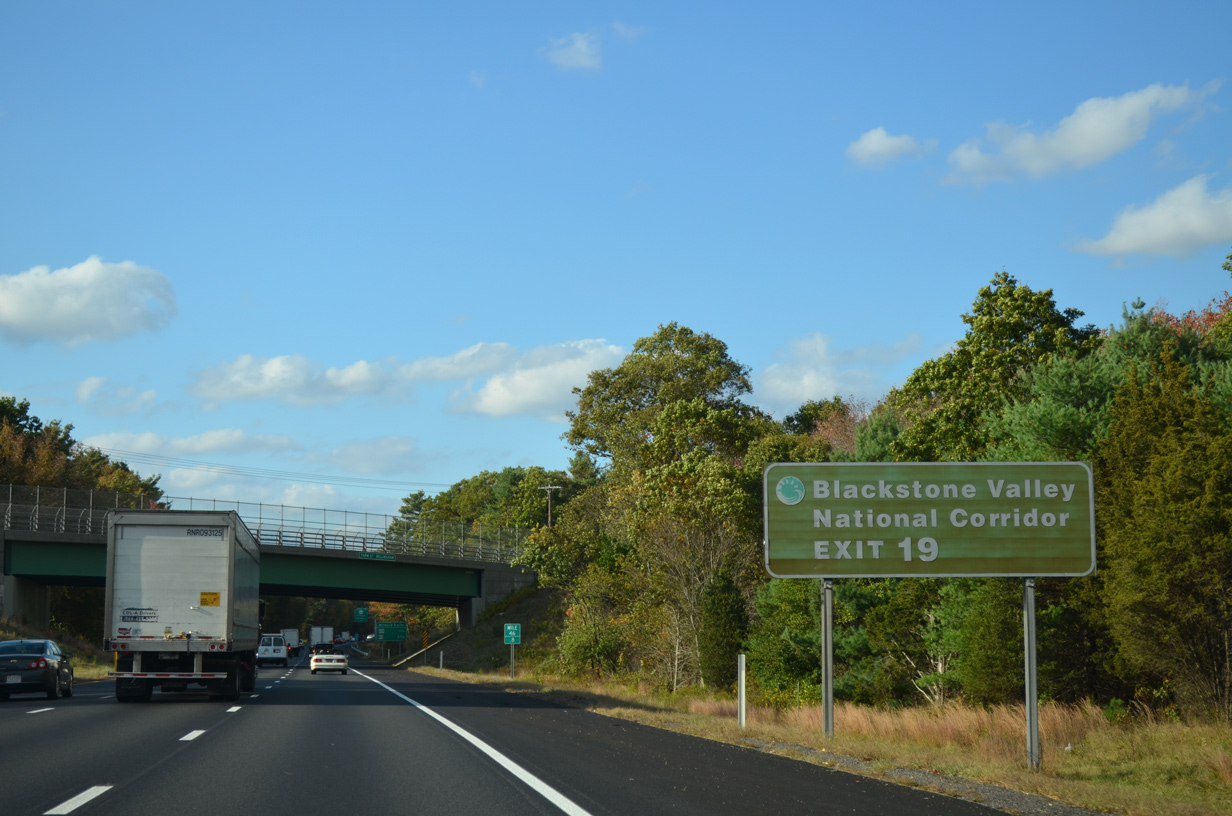
| The Blackstone Valley National Corridor centers around the Blackstone River from Worcester to Providence, Rhode Island. The corridor covers a number of attractions and sites related to the American Industrial Revolution. 10/06/14 |
|
| The ensuing exits lead motorists west to the Milford town center. 10/06/14 |
|
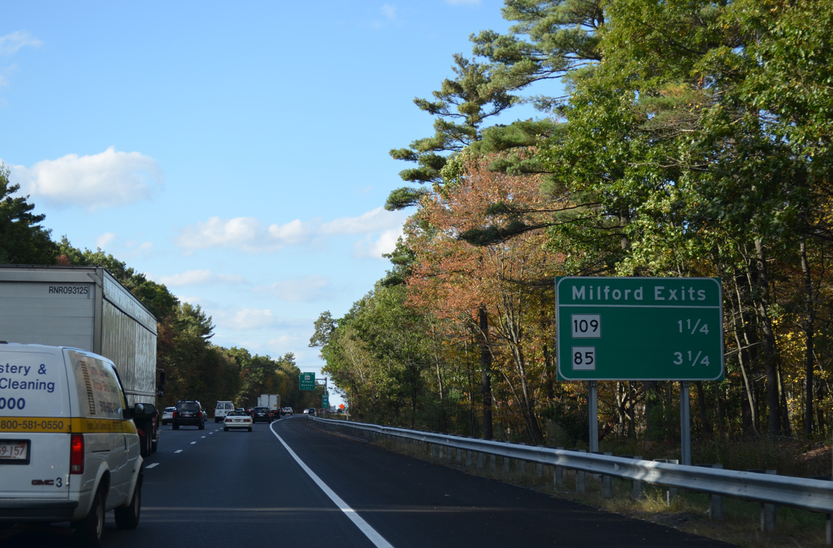
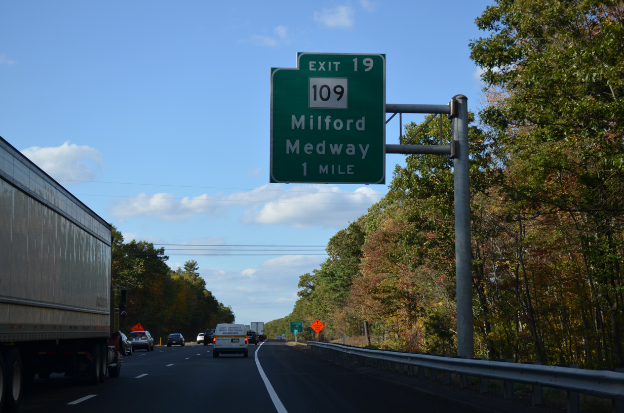
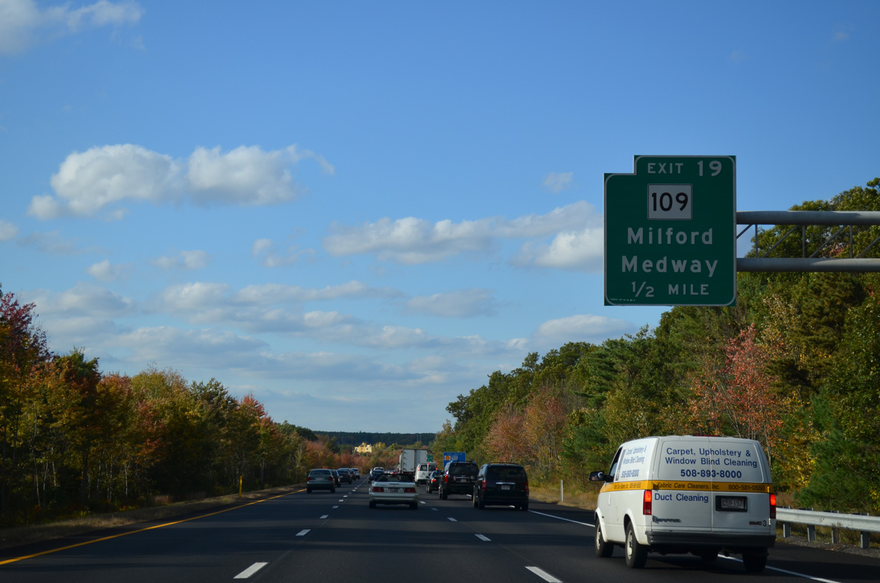
| Route 109 originates in Milford from Route 16 (Main Street) just west of Exit 48. The 20.9 mile long route travels east to Medway and Mills and north to Westwood and VFW Parkway (old U.S. 1) in Boston. 10/06/14 |
|
| Route 109 (Medway Road) links I-495 with Route 16 west to Downtown Milford and east to Holliston. The state route stretches 59.9 miles from Webster and Uxbridge to Boston and Revere. 10/06/14 |
|
| The fourth county along Interstate 495 north is Worcester County. The freeway passes through eastern reaches of it twice to Marlboro. 10/06/14 |
|
| A half mile ahead of the diamond interchange (Exit 48) with Route 109 (Medway Road) on I-495 north. The freeway crosses Stall Brook ahead. 10/06/14 |
|
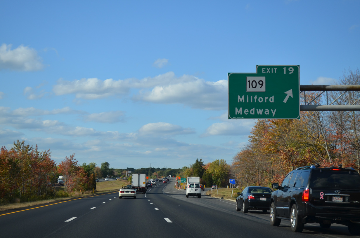
| Exit 48 departs I-495 north for Medway Road west to adjacent retail areas to Route 16 (Main Street). The state route becomes more rural along Milford Street east into Medford. 10/06/14 |
|
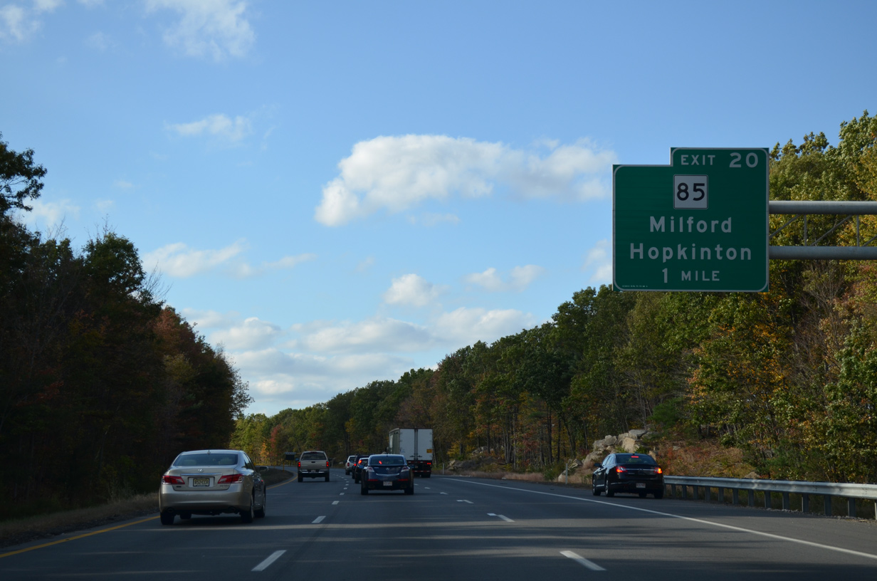
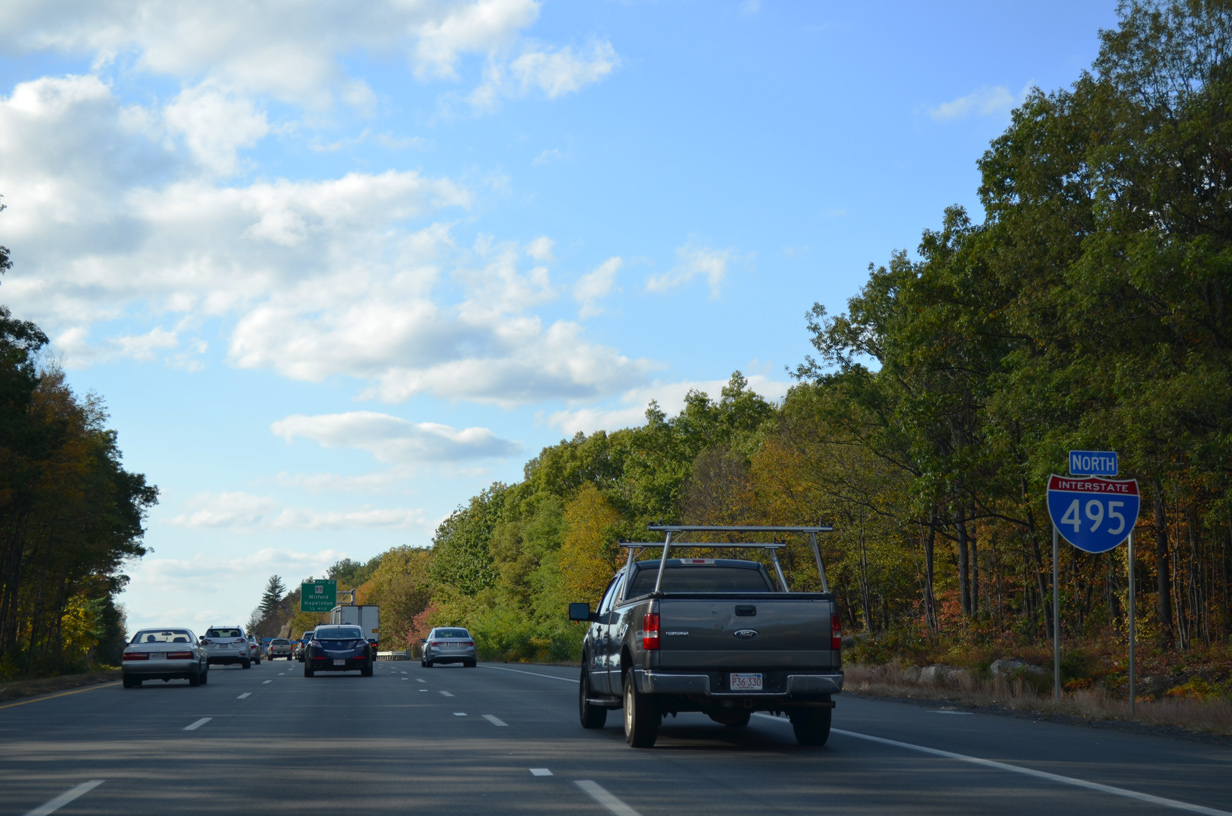
| Interstate 495 encircles an expansive retail and industrial park area, including Quarry Square, northwest to meet Route 85 (Cedar Street) at Exit 50. 10/06/14 |
|
| Rocky Woods Range rises to over 135 feet above sea level on the north side of I-495 by Exit 50. 10/06/14 |
|
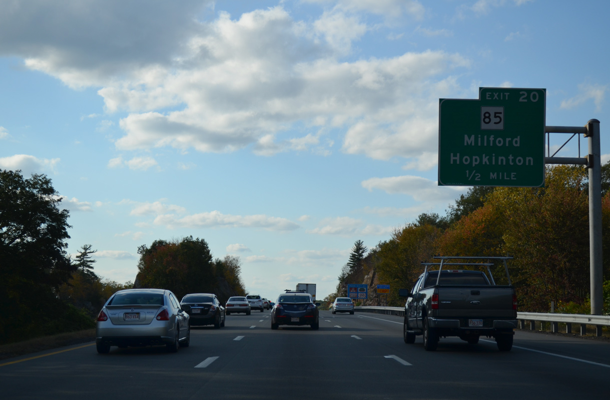
| A 21.0 mile long highway, Route 85 begins in Milford from Route 16 (Main Street). The state route follows the beltway north to Route 117 at Bolton. 10/06/14 |
|
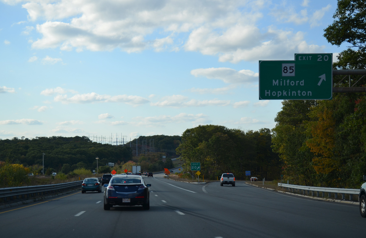
| North from the diamond interchange (Exit 50) with Interstate 495, Route 85 parallels the Charles River to College Rock and Hayden Row in the town of Hopkinton. 10/06/14 |
|
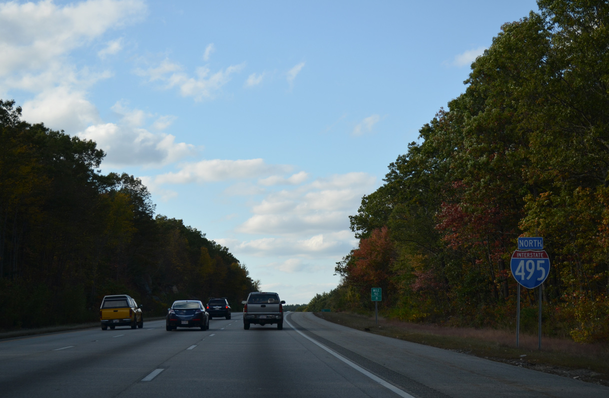
| Hilly terrain separates the north and southbound roadways with a forested median to Exit 54. 10/06/14 |
|
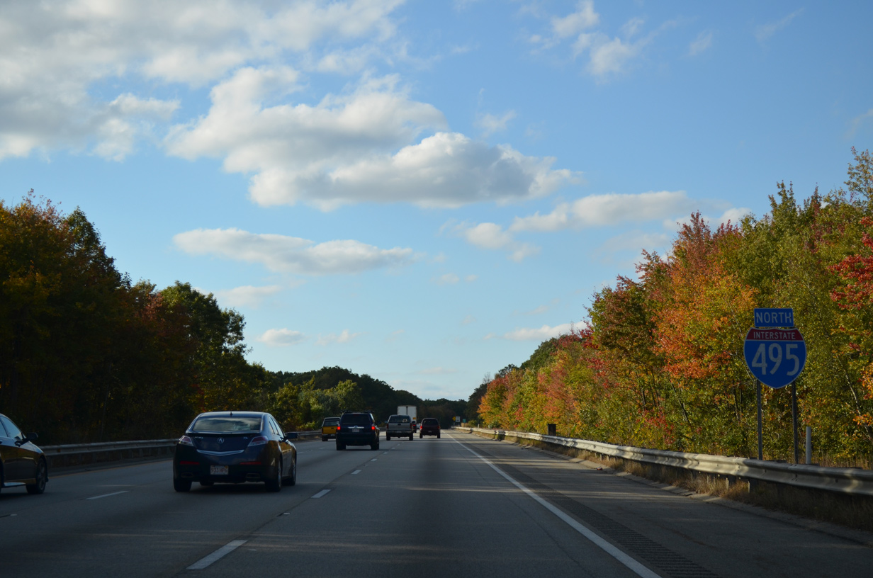
| I-495 and I-90 converge another in seven miles on the Hopkinton and Westborough town line. Haverhill appears for the first time on distance signs at 59 miles out. 10/06/14 |
|
| The Charles River flows south from Echo Lake through wetland areas north of Milford. This reassurance marker stands after the Charles River sign on northbound. 10/06/14 |
|
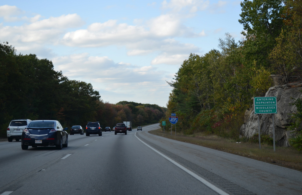
| A rural 5.5 mile long stretch through Middlesex County takes Interstate 495 north through the town of Hopkinton. 10/06/14 |
|
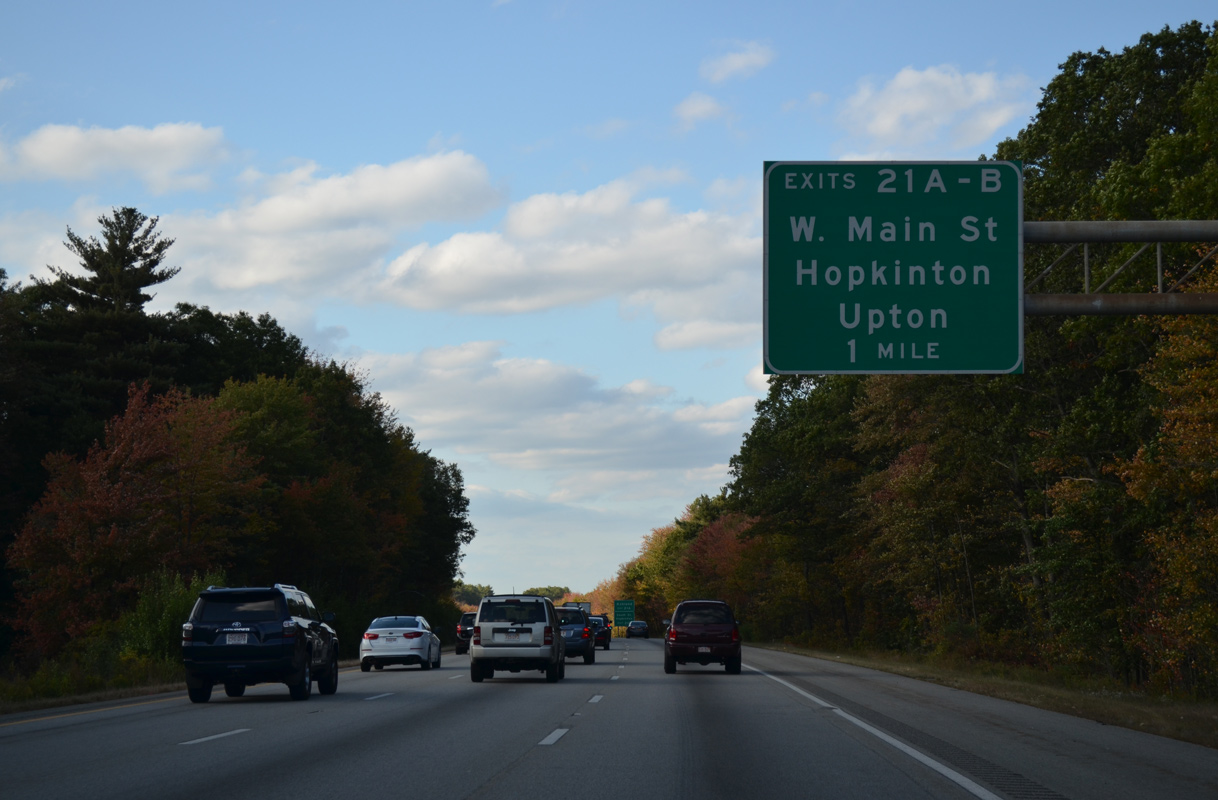
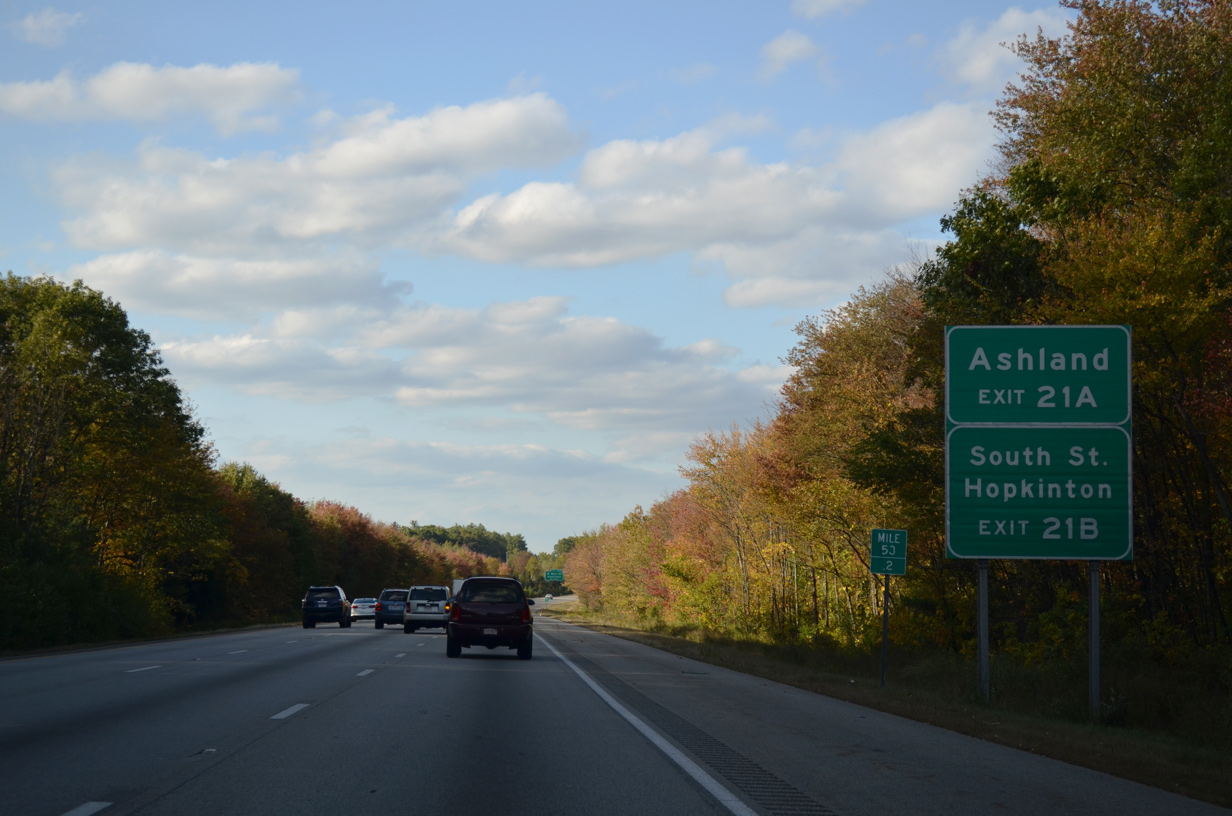
| Several business and industrial parks abut the west side of Interstate 495 along South Street to West Main Street and Exits 54 A/B. 10/06/14 |
|
| W Main Street angles northeast to converge with Route 135 ahead of the Hopkinton town center. Joining Hopkinton with Ashland and Westborough, Route 135 is not directly accessible from I-495. 10/06/14 |
|
| One half mile from from the cloverleaf interchange (Exits 54 A/B) with W Main Street on I-495 north. 10/06/14 |
|
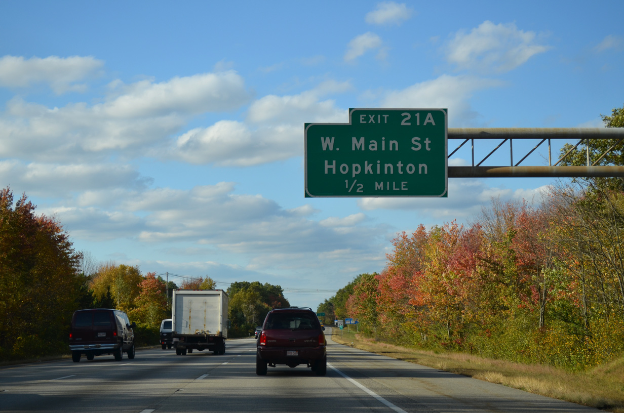
| West Main Street combines with Route 135 one mile east of Exit 54 A. Route 135 follows a S-shaped route 29.6 miles from U.S. 20 at Northborough to I-95 at Dedham. 10/06/14 |
|
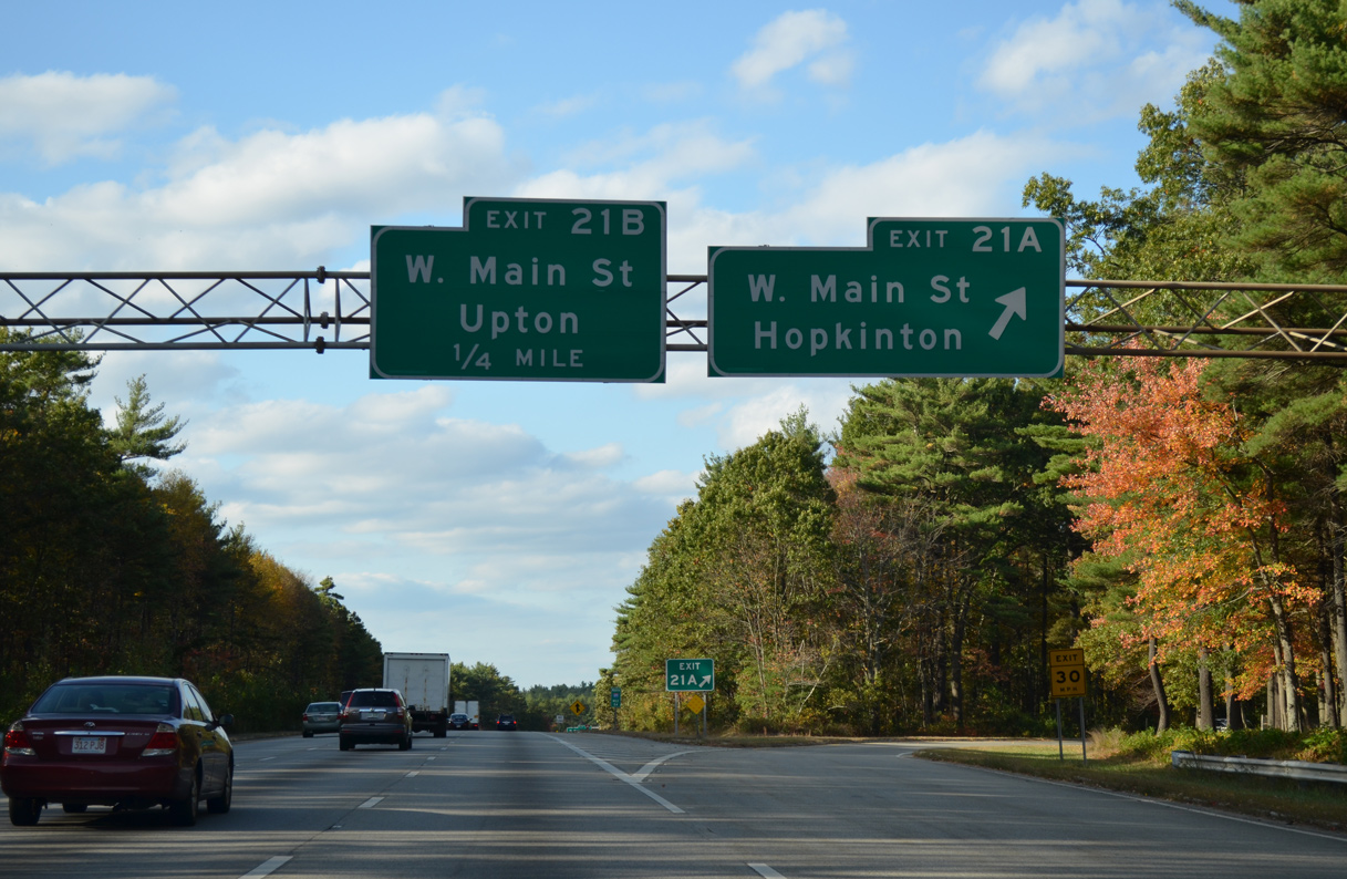
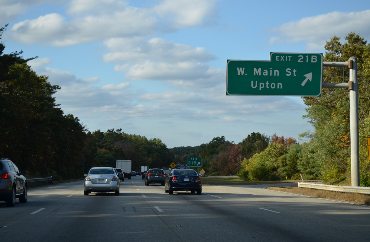
| Exit 54 B loops away from Interstate 495 north. W Main Street crosses Lake Maspenock west from South Street to the town of Upton. 10/06/14 |
|
| Interstate 495 progresses north from milepost 55 across a series of hills east of Whitehall Reservoir. 10/06/14 |
|
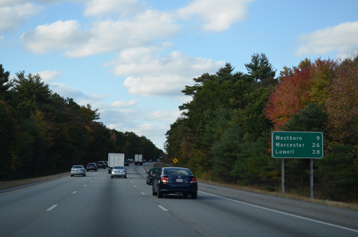
| The town of Westboro lies nine miles to the northwest at the crossroads of Route 30 and 135. Worcester is 26 miles to the west while I-495 north meets the freeway along U.S. 3 outside Lowell in 34 miles. 10/06/14 |
|
| A second reassurance marker for Interstate 495 north appears beyond the Route 135 (Wood Street) underpass. 10/06/14 |
|
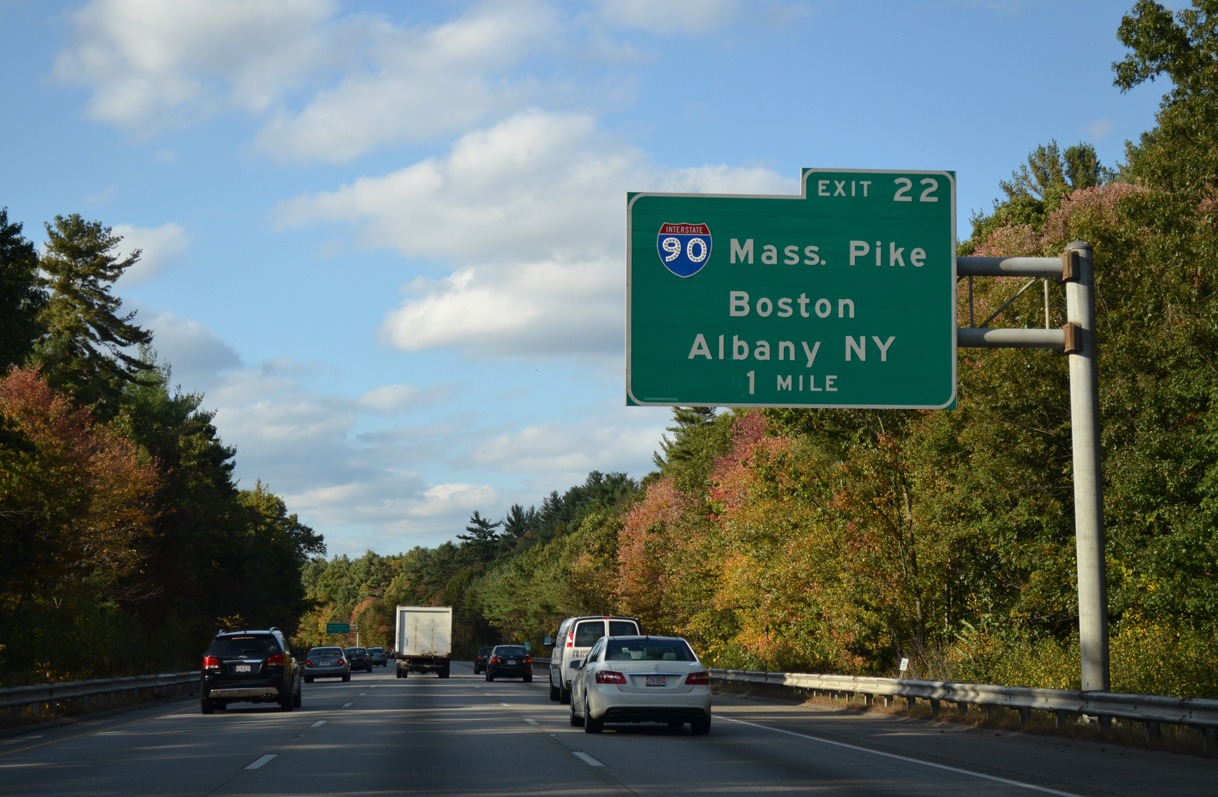
| Two miles ahead of Exit 58 to Interstate 90 on I-495 north. Better known as the Mass Pike, I-90 crosses the state from the Berkshire Mountains to the west to Boston Logan International Airport (BOS) to the east. 10/06/14 |
|
| The 138 mile long route of Interstate 90 in Massachusetts joins Boston with Worcester and Springfield. The tolled portion of I-90 extends west along the Berkshire Section of the New York Thruway toward Albany. 10/06/14 |
|
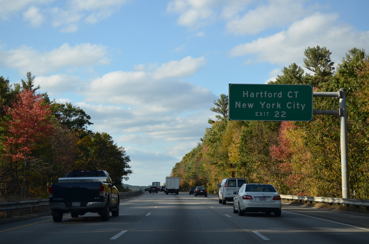
| I-90 west to Interstate 84 at Sturbridge comprises part of a long distance route linking Boston with Hartford, Connecticut and New York City (via I-684 south or other routes). 10/06/14 |
|
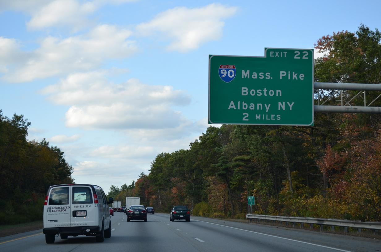
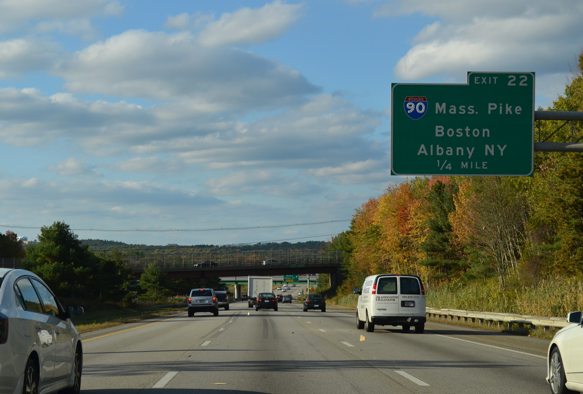
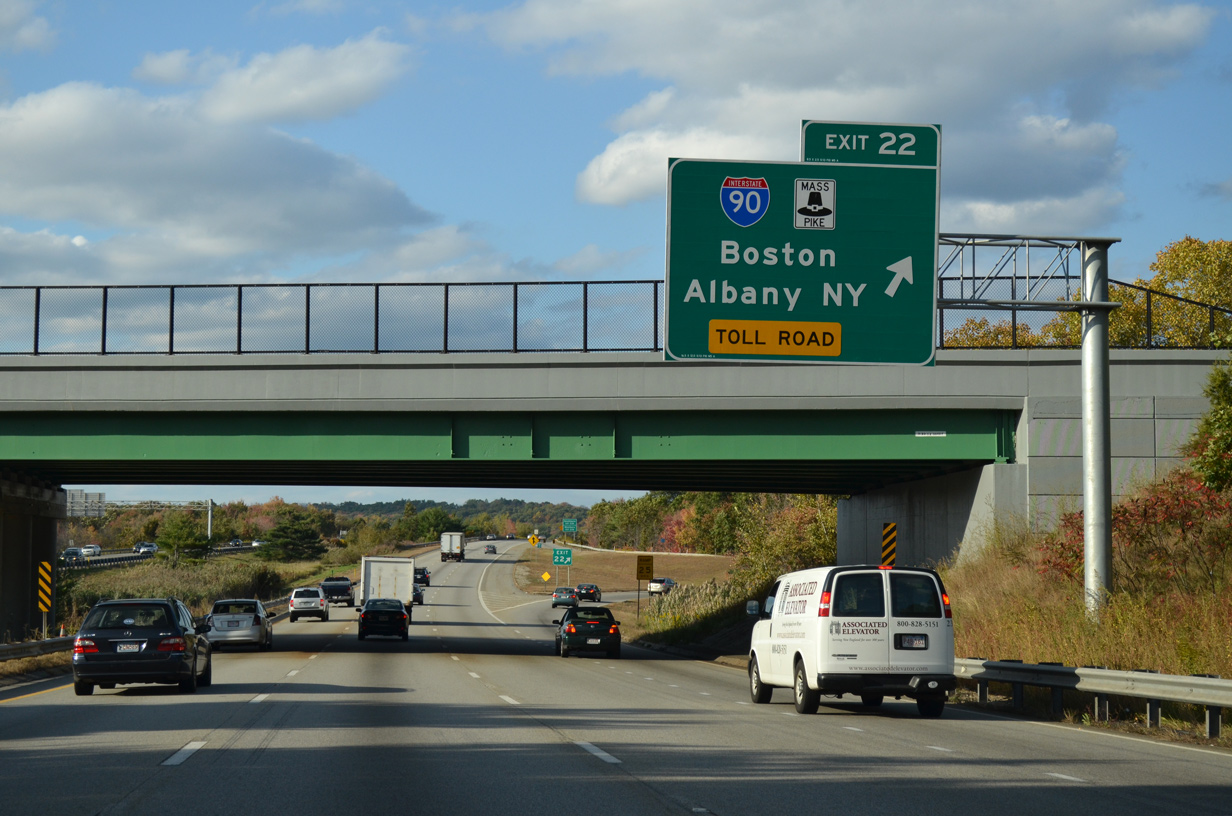
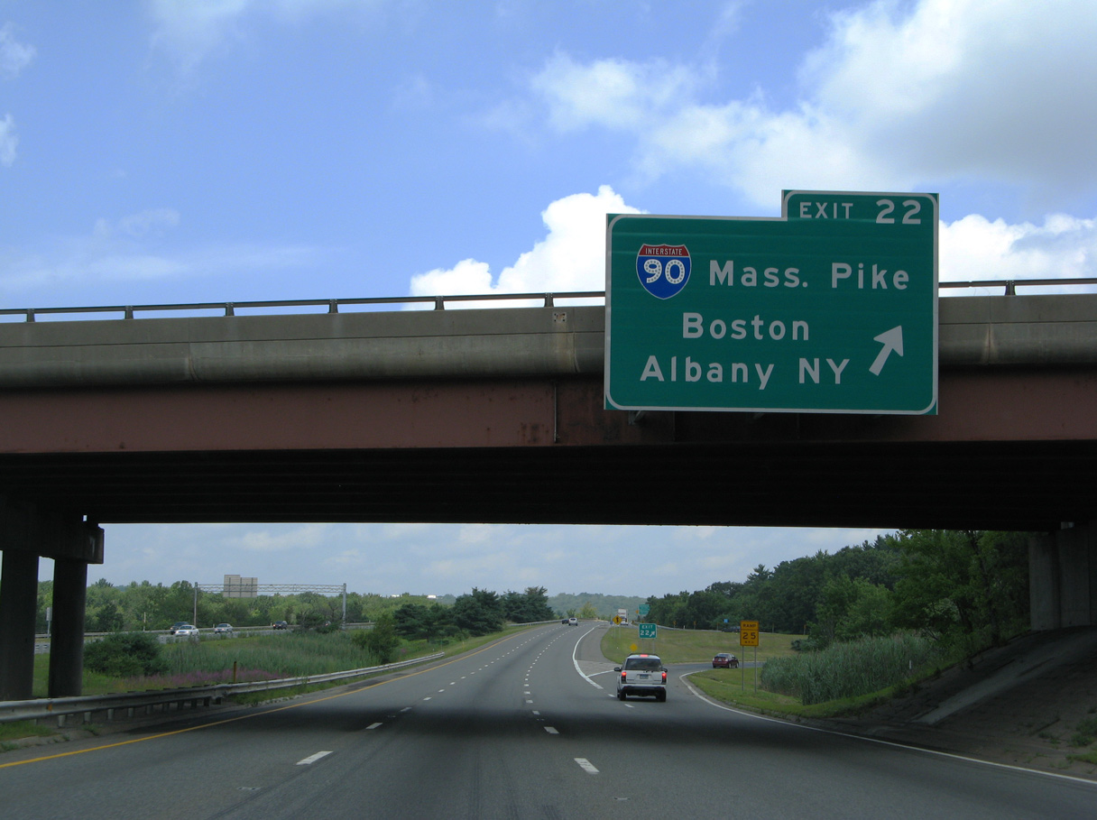
| The beltway advances to the Fruit Street overpass and trumpet interchange (Exit 22) with the Mass Pike access road. Long range plans called for four years of construction starting in 2021 to improve the exchange between the two Interstate highways. Designs include several flyover ramps.2 10/06/14 |
|
| Motorists taking I-90 next reach Route 9 at Framingham in five miles to the east and Route 122 at Millbury, ten miles to the west. The turnpike switched to all electronic tolling (AET) in 2016. 10/06/14 |
|
| This sign for Exit 22 was located at the Mass Pike access road overpass. It was taken down by 2011 ahead of a rehabilitation project for the span. Design work for the I-495/I-90 interchange improvements project got underway in May 2022 and runs through December 2024. Five stages of construction are outlined through June 2027.3 07/29/07 |
Page Updated 09-19-2016.

 North
North