|
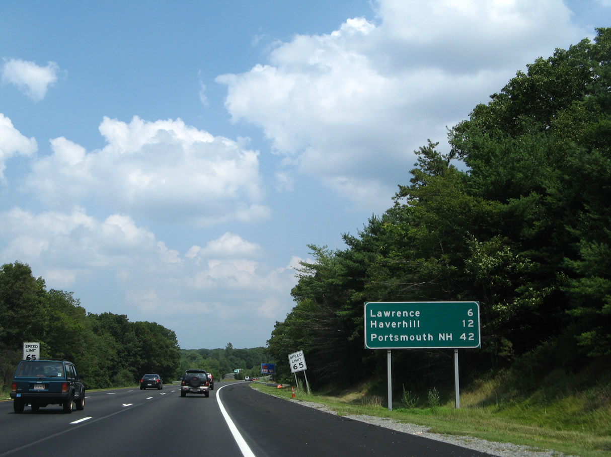
| The ensuing three exits join I-495 with the city of Lawrence. Lawrence was the first planned industrial city in the nation, with origins in the 1840s. The Merrimack River and an associated canal network supported a number of mills that elevated Lawrence as a leading producer of textiles.1 07/29/07 |
|
| The city of Haverhill lies further down river from Lawrence in 12 miles. Portsmouth, New Hampshire is 42 miles away. 07/29/07 |
|
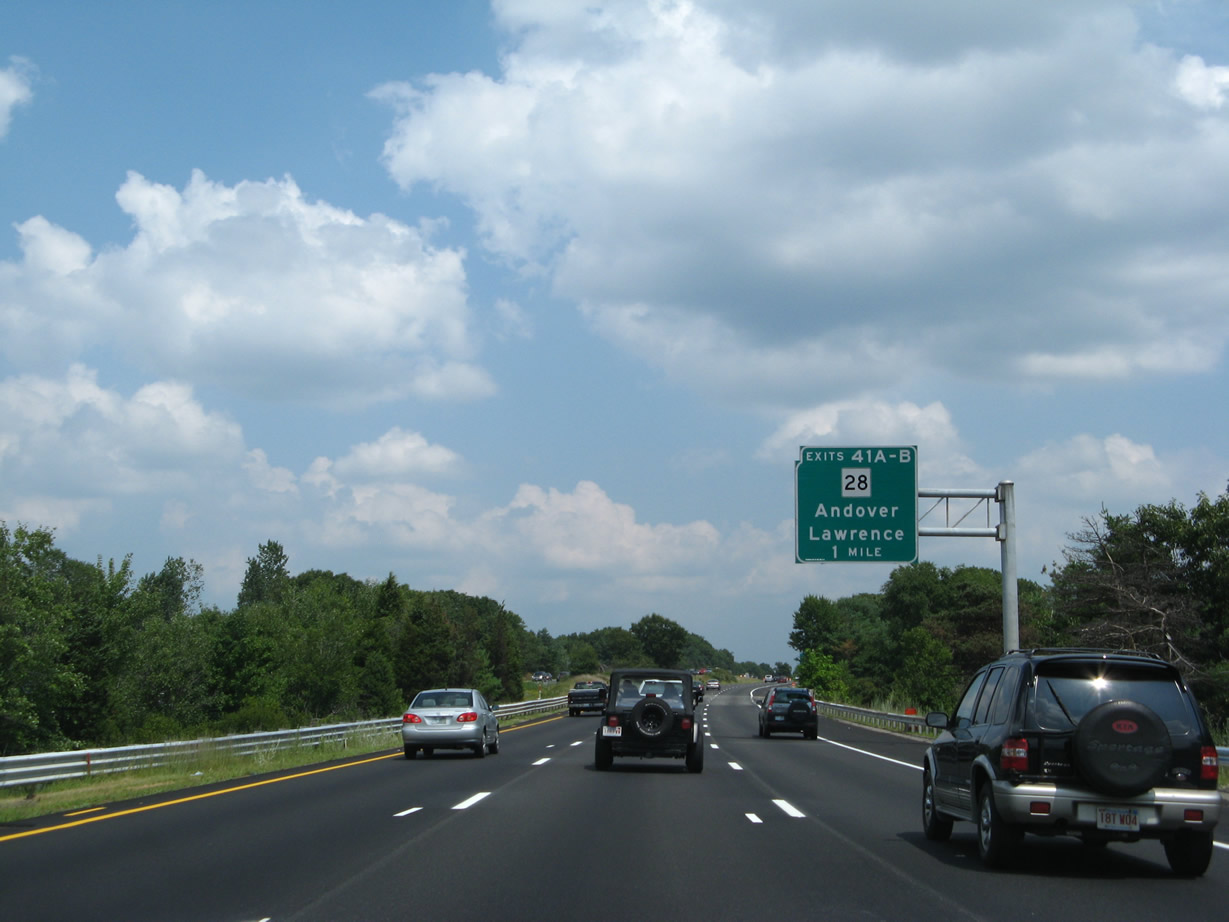
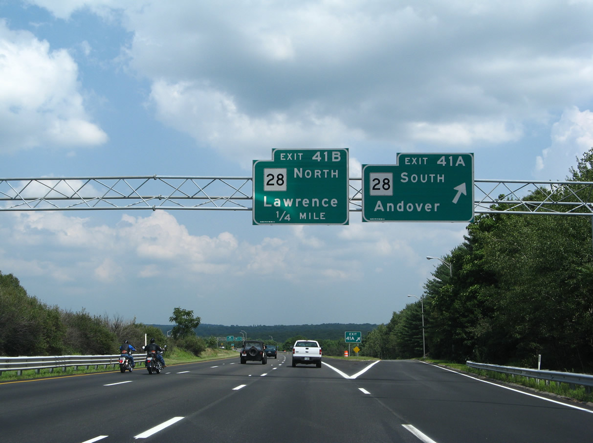
| Route 28, a multi state highway with NH 28 north to Salem and Derry, passes through Lawrence along Broadway from Exit 99 B. 07/29/07 |
|
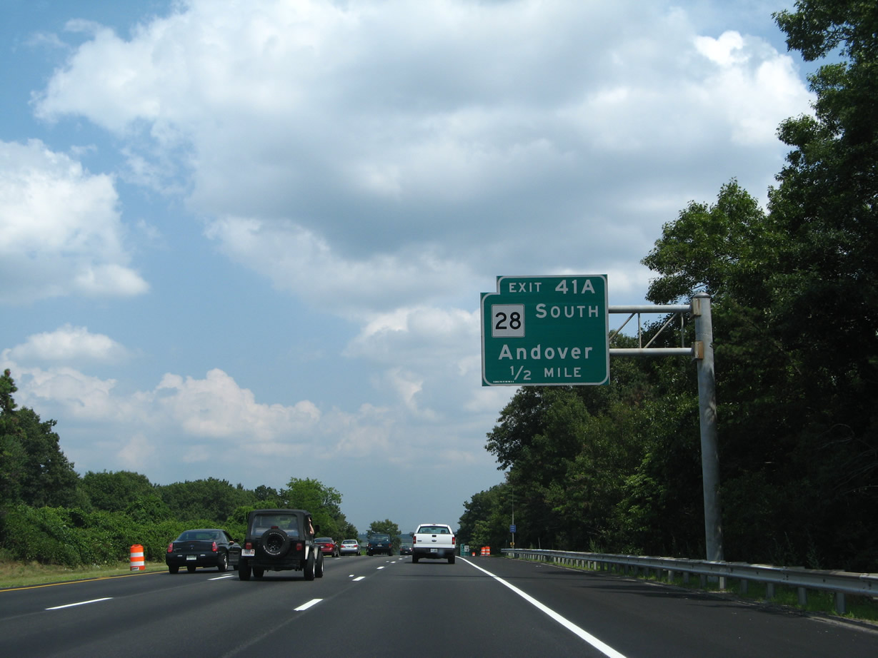
| Exit 99 A leads onto Route 28 (Main Street) south to the Andover town center in a half mile. 07/29/07 |
|
| Route 28 separates into the couplet of South Street north and Broadway / Main Street south through the directional cloverleaf interchange (Exits 99 A/B) with Interstate 495. 07/29/07 |
|
| North from Exit 99 B, South Street splits with Union Street to South Lawrence and the McGovern Transportation Center. Collectively Route 28 and NH 28 are 238 miles in length from Orleans on Cape Cod to Lake Winnipesaukee and Ossipee. 07/29/07 |
|
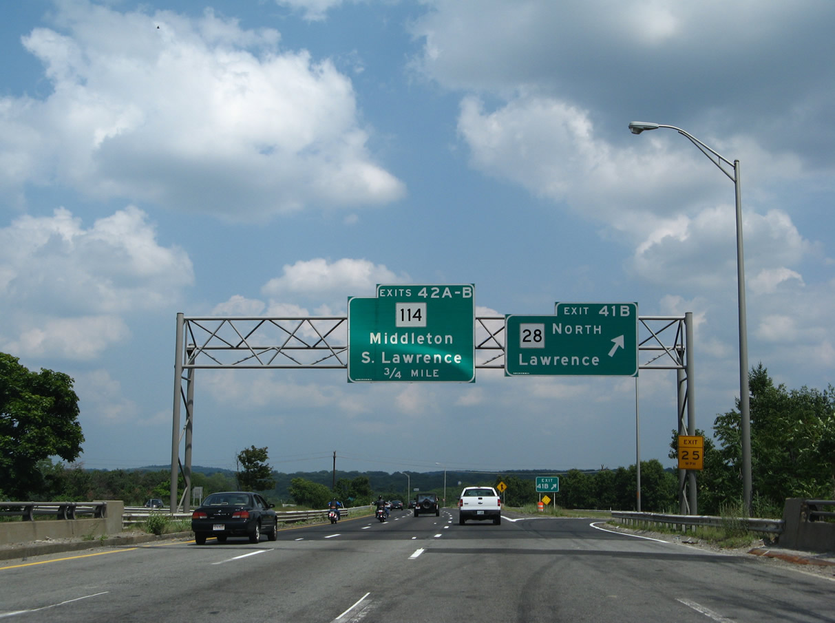
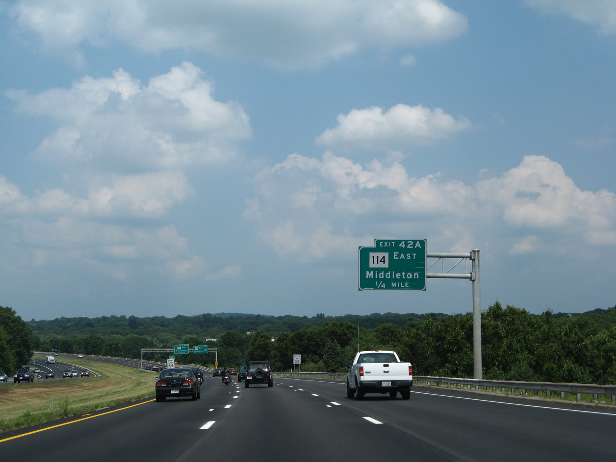
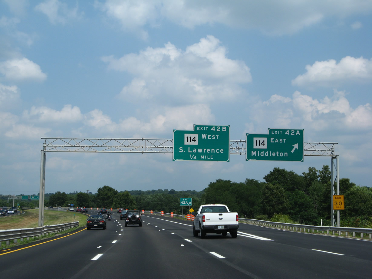
| A six-ramp parclo interchange (Exits 100 A/B) quickly follows on I-495 north with Route 114 (Winthrop Avenue). 07/29/07 |
|
| Heading south from Exit 100 A, Route 114 crosses the adjacent Shawsheen River and straddles the North Andover town line to overlap with Route 125 (Turnpike Street) by Merrimack College. The state route bee lines southeast to Middleton and Danvers. 07/29/07 |
|
| Route 114 concludes a 22.45 mile long alignment from Marblehead at Broadway (Route 28) by the Merrimack River in Lawrence. The state route dog legs north from Winthrop Avenue along Parker Street north and Merrimack Street west through the city street grid. 07/29/07 |
|
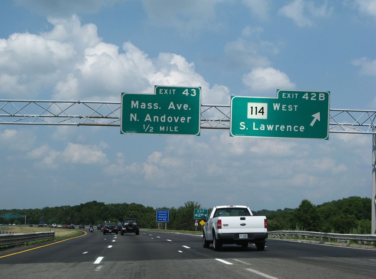
| Turning northward, I-495 advances to the diamond interchange (Exit 101) with Massachusetts Avenue at North Andover. 07/29/07 |
|
| Exit 101 leaves I-495 north as the freeway passes over the Shawsheen River. Massachusetts Avenue becomes Loring Street west into Lawrence and connects the beltway with the Andover town center to the east. 07/29/07 |
|
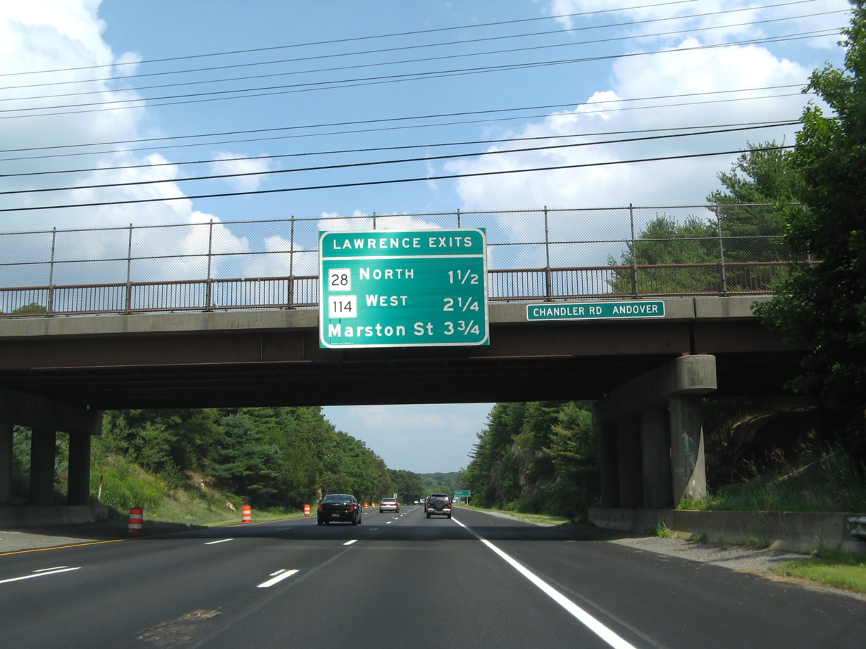
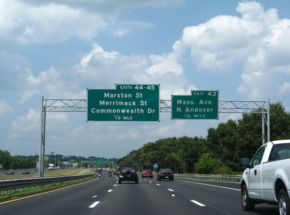
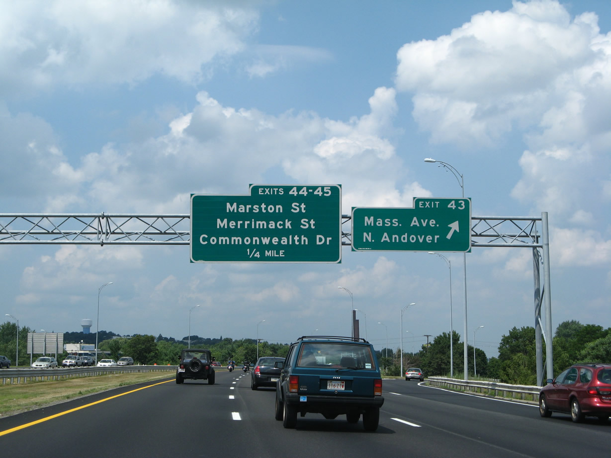
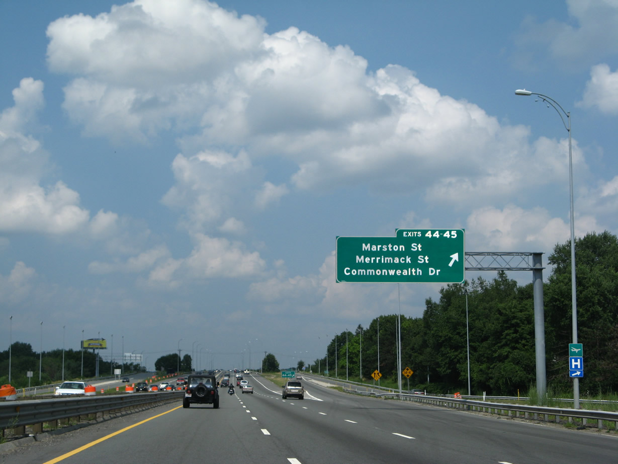
| A collector distributor roadway separates from the I-495 northbound mainline for Exit 102 to Marston Street, Exit 103 A to Commonwealth Drive and Exit 103 B to Marston Street. 07/29/07 |
|
| The c/d roadway gains traffic at the half diamond interchange with Merrimack Street east and Sutton Street west ahead of the Merrimack River. 07/29/07 |
|
| A double deck bridge spans the Merrimack River. The I-495 mainline travels above with six overall lanes while the c/d roadways travel below with two lanes per direction. 07/29/07 |
|
| The c/d roadway emerges from below I-495 to circle north to Commonwealth Drive and an auto mall, Marston Street north as it parallels the beltway, and the southbound c/d roadway back to Merrimack Street west. 07/29/07 |
|
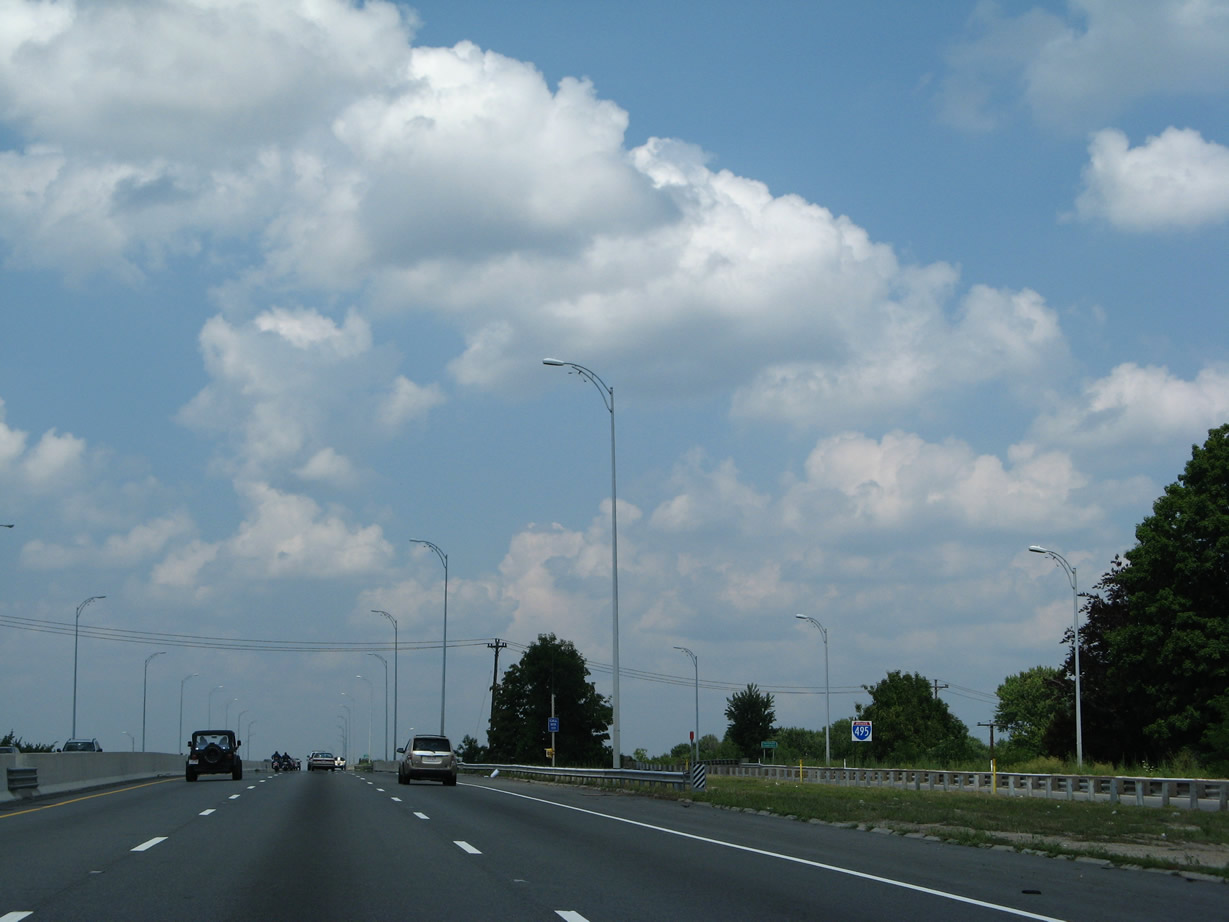
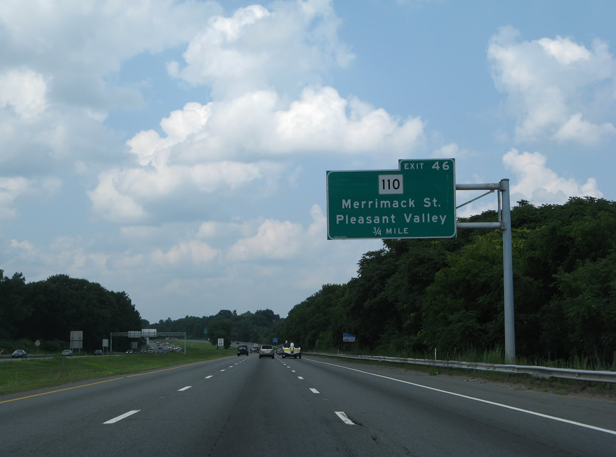
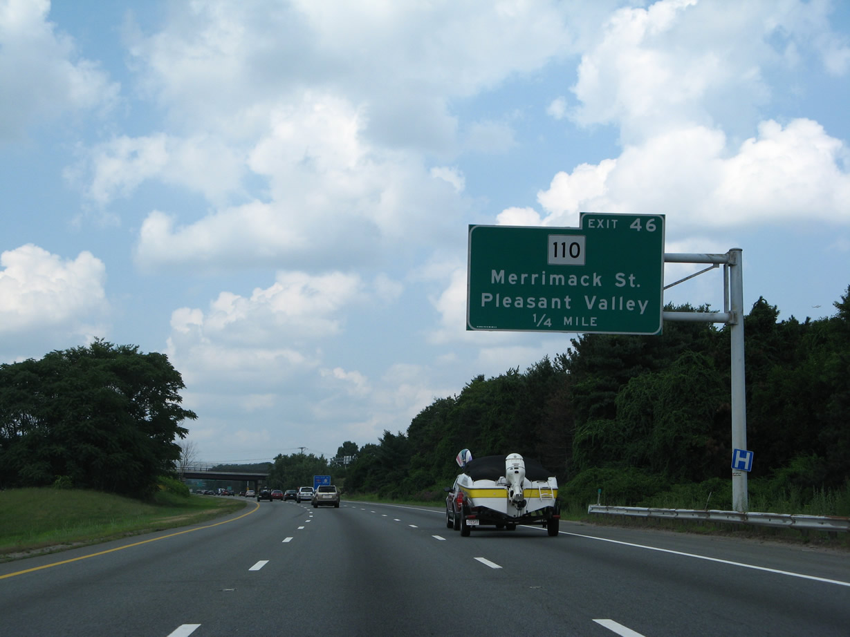
| Continuing north, Interstate 495 runs alongside the Merrimack River to the parclo interchange (Exit 104) with Route 110 (Merrimack Street). 07/29/07 |
|
| Route 110 overtakes parallel Merrimack Street from East Street to cross I-495 for the third time en route to Pleasant Valley. 07/29/07 |
|
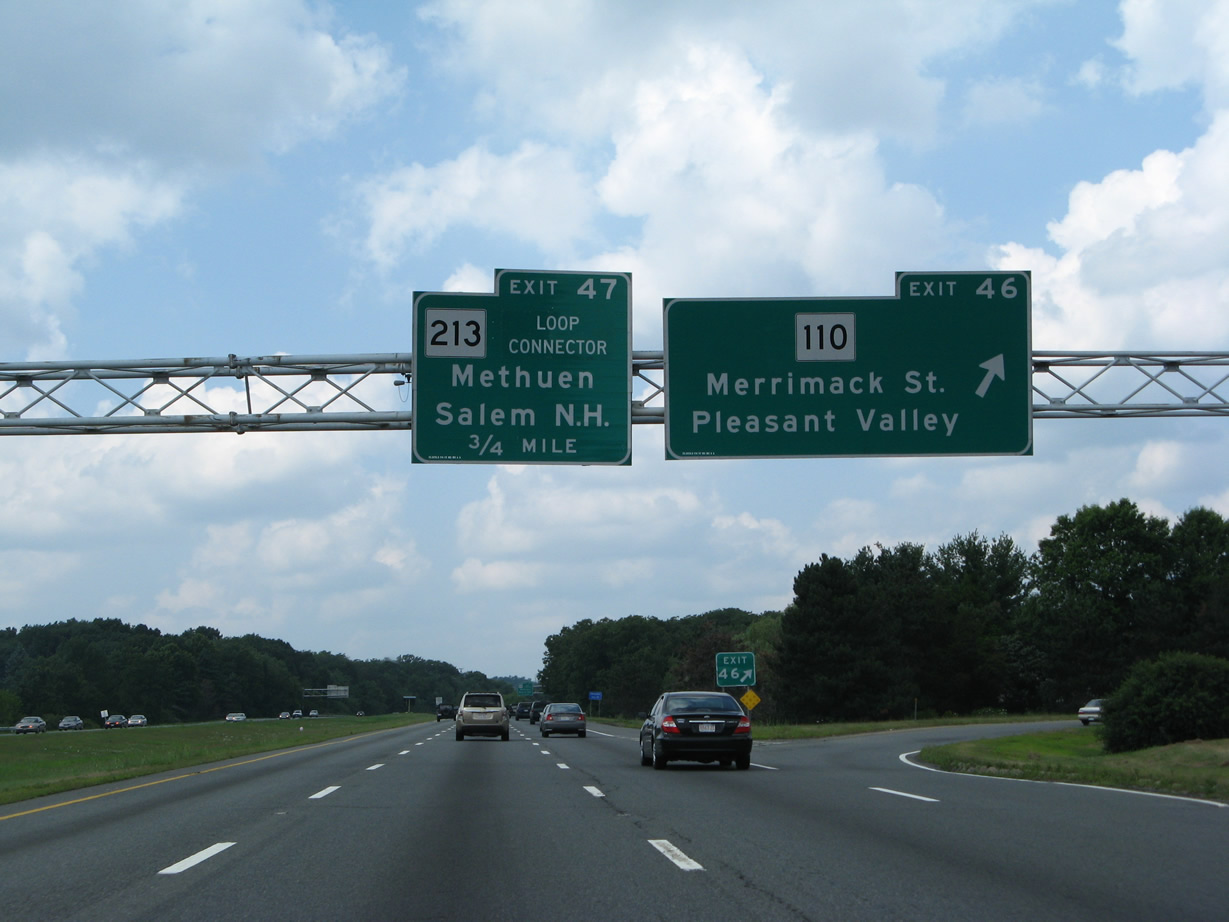
| Exit 104 loops away from Interstate 495 north to Route 110 in the city of Methuen. A trumpet interchange (Exit 105) follows with the Loop Connector west to Interstate 93. 07/29/07 |
|
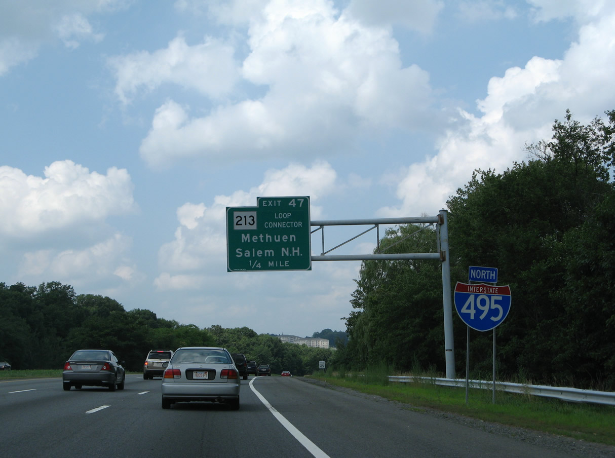
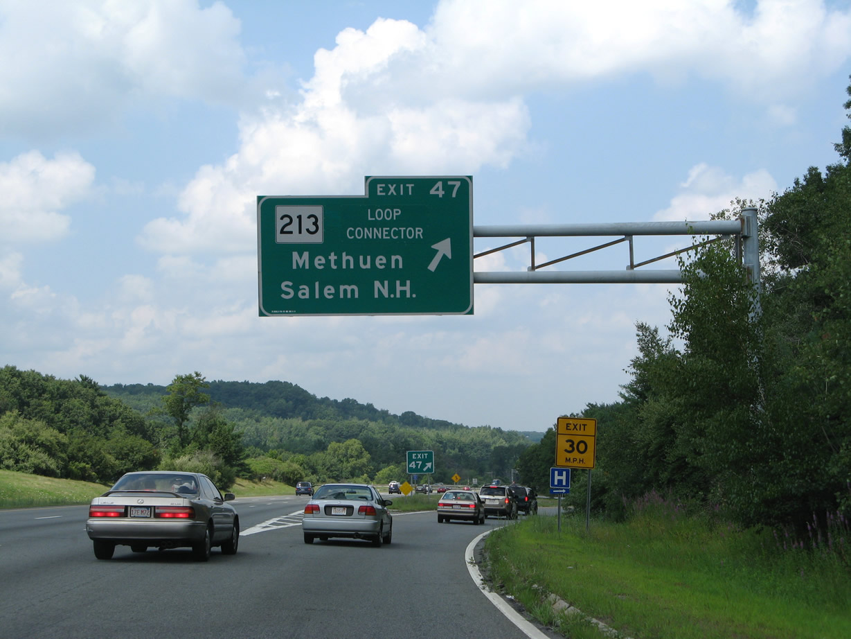
| Several subdivisions front the I-495 right of way to Exit 105 for Route 213 (Loop Connector) west. Route 213 connects the beltway with The Grove retail center along adjacent Route 113 (Pleasant Valley Street). 07/29/07 |
|
| The Loop Connector constitutes a suburban freeway as it arcs west from Exit 105 across Methuen to Route 28 (Broadway) and I-93 by Salem, New Hampshire. 07/29/07 |
|
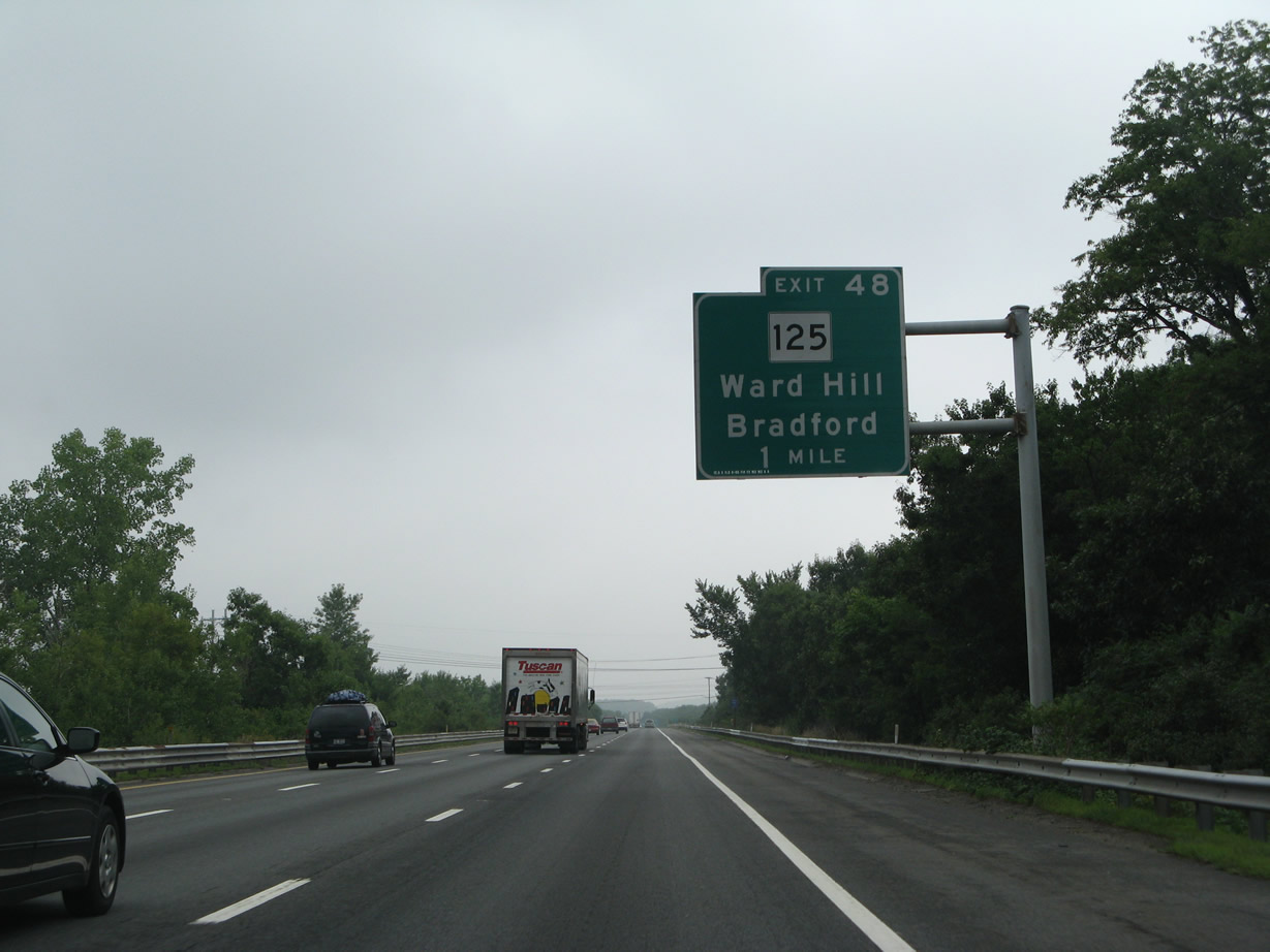
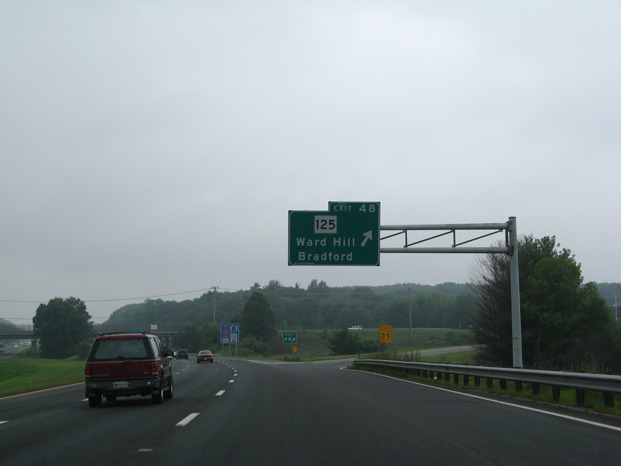
| Interstate 495 north reaches the first of five exits for the city of Haverhill in one mile. The Route 125 Connector serves the Ward Hill Business Park 07/30/07 |
|
| Spanning Route 110/113 and the Merrimack River, I-495 crosses into the city of Haverhill. 07/30/07 |
|
| The Route 125 Connector spurs south from Recovery Way and Exit 106 as a controlled access expressway to Route 125 (Main Street) at Ward Hill. 07/30/07 |
|
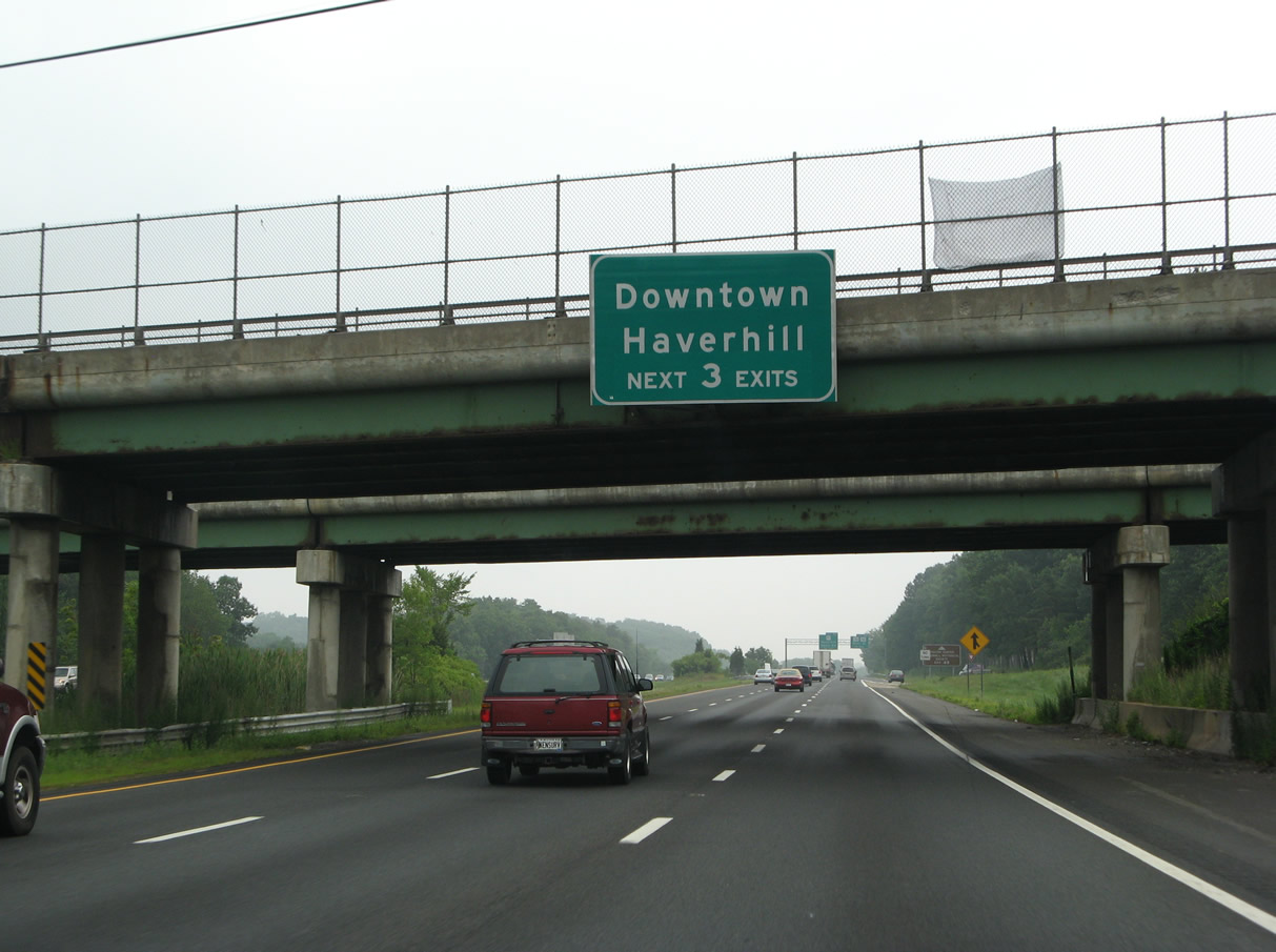
| The beltway encircles the Haverhill city center over the next three miles. The subsequent interchanges all serve streets radiating from Downtown. 07/30/07 |
|
| Route 110/113 (River Street) follow the course of the Merrimack River north from Methuen to I-495 at Exit 107. 07/30/07 |
|
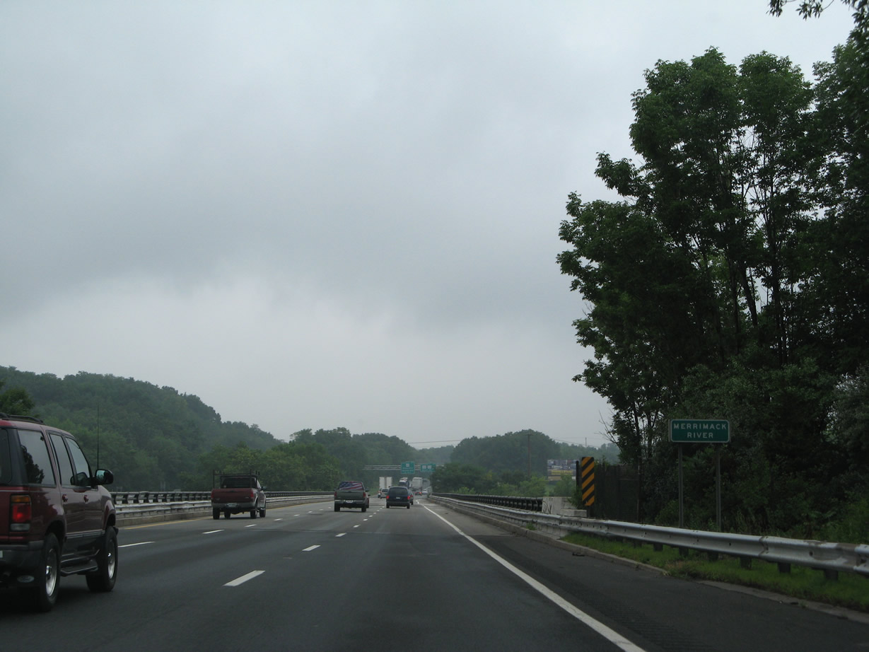
| The Merrimack River flows underneath Interstate 495 for the third time through west Haverhill. The freeway and river mirror the course of one another to Amesbury. 07/30/07 |
|
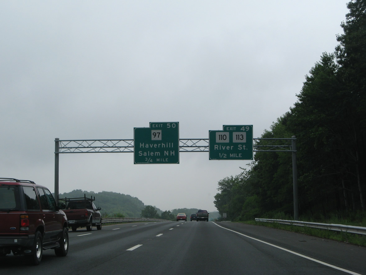
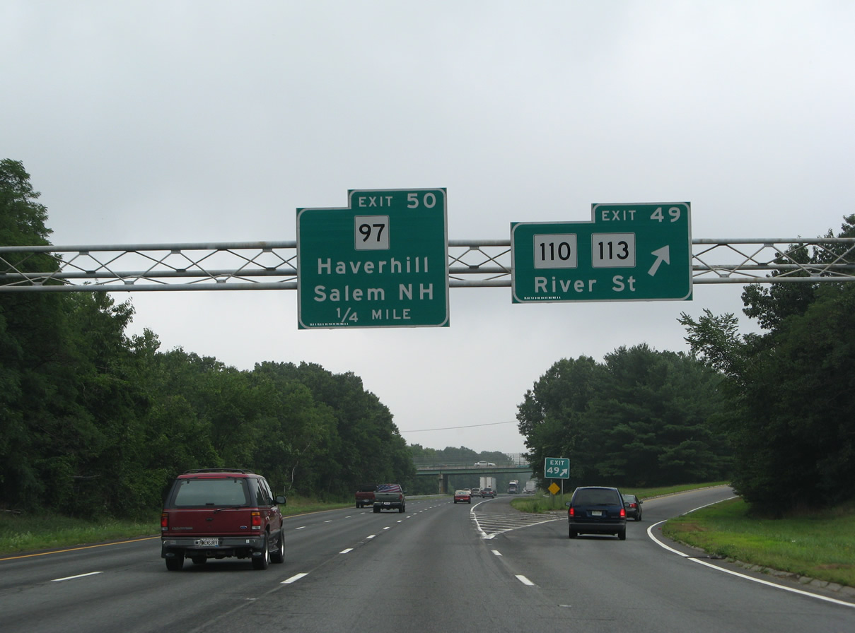
| East from the parclo interchange (Exit 107) with I-495, Route 110/113 split at Washington Square in Downtown Haverhill. Route 113 combines with Route 97 east from Haverhill to Groveland. The 50.5 mile route ends at U.S. 1 in Newburyport. 07/30/07 |
|
| A collector distributor roadway separates local traffic from River Street to Broadway / Exit 108. 07/30/07 |
|
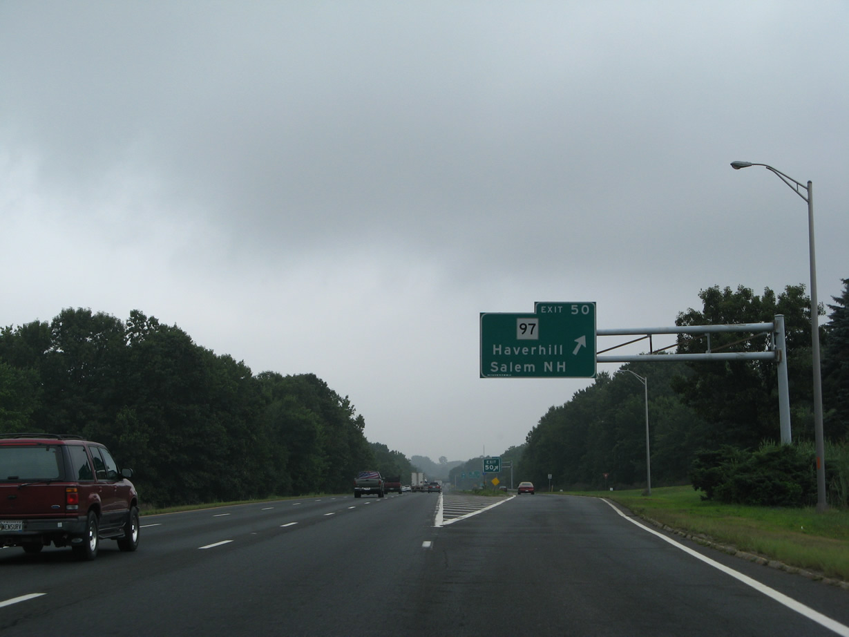
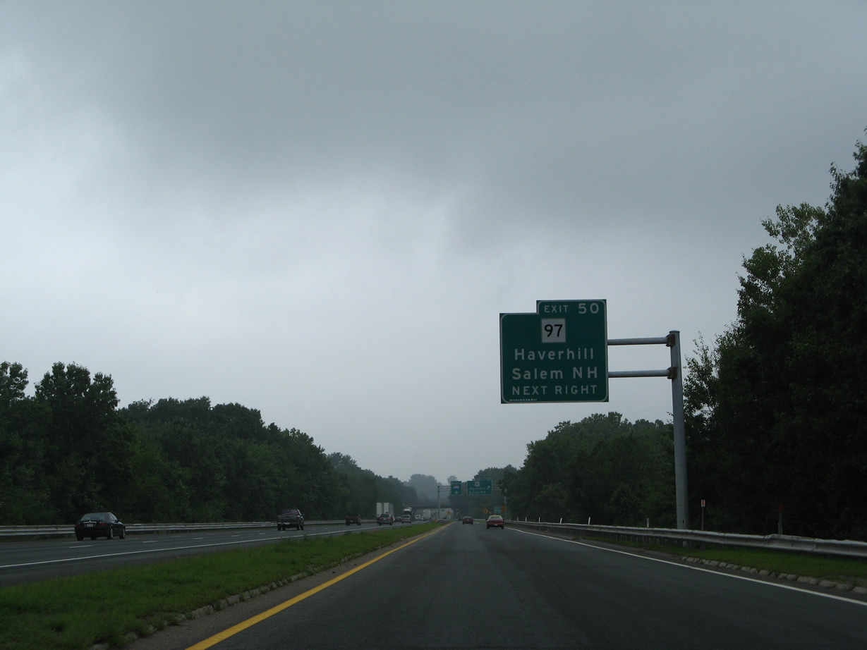
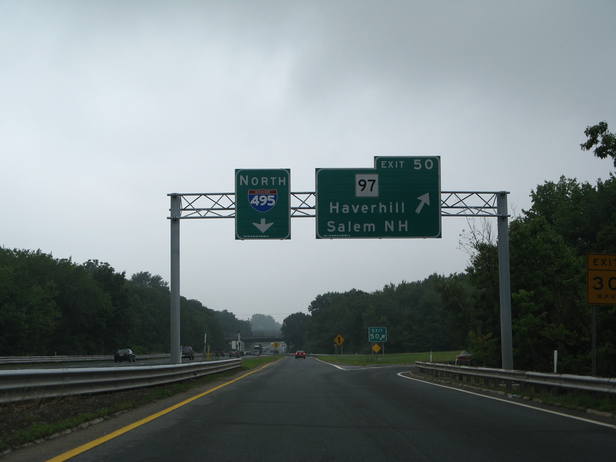
| Route 97 (Broadway) meets Interstate 495 at the succeeding parclo A2 interchange (Exit 108). 07/30/07 |
|
| Exit 108 departs from I-495 north to Route 97 (Broadway) at Monument Street. The multi state highway follows a 27.5 mile course from NH 28 in Salem to Route 1A at Beverly. 07/30/07 |
|
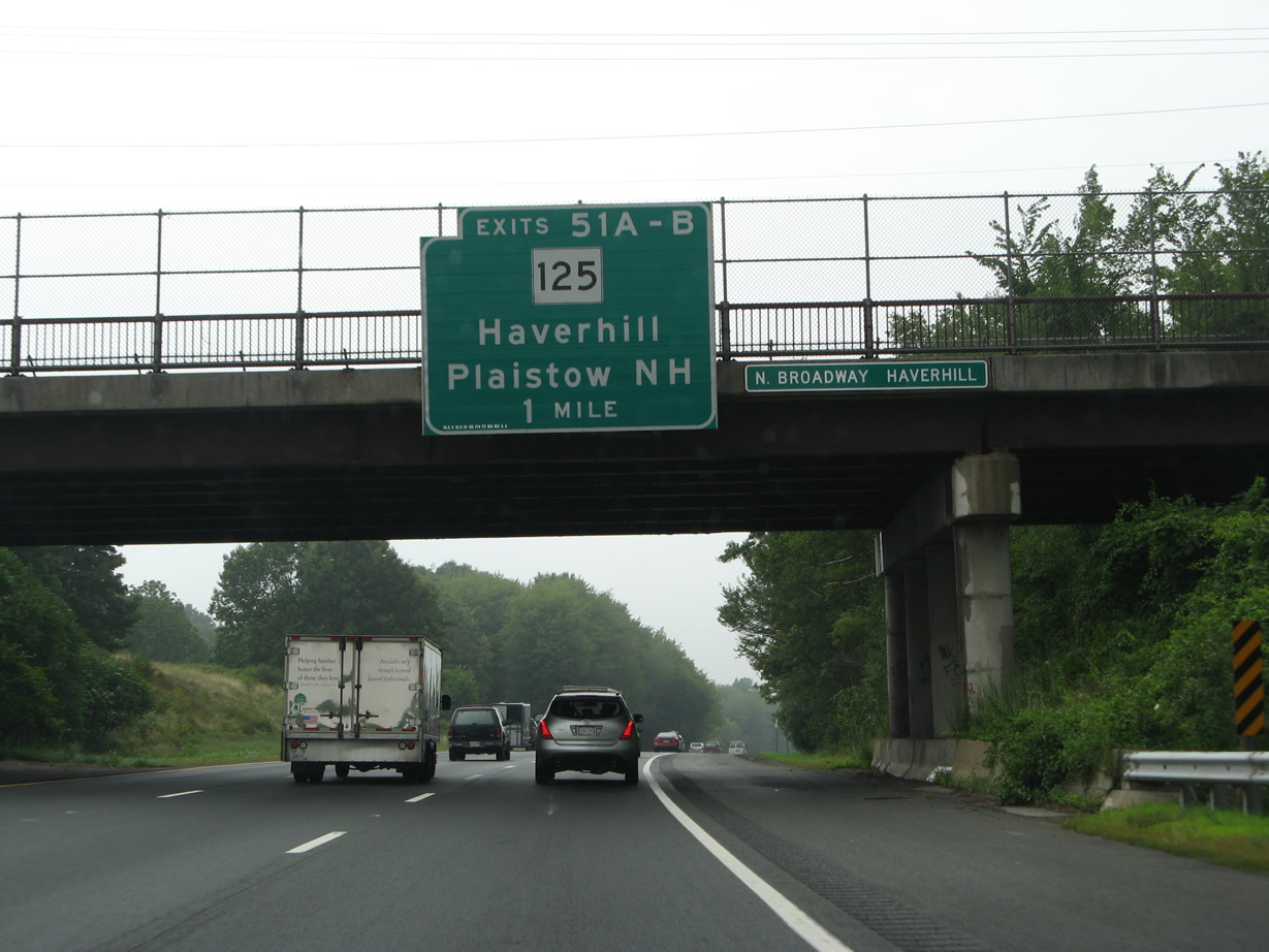
| N Broadway branches from Route 97 (Broadway) to span I-495, one mile southwest of the cloverleaf interchange (Exits 109 A/B) with Route 125 (Main Street). 07/30/07 |
|
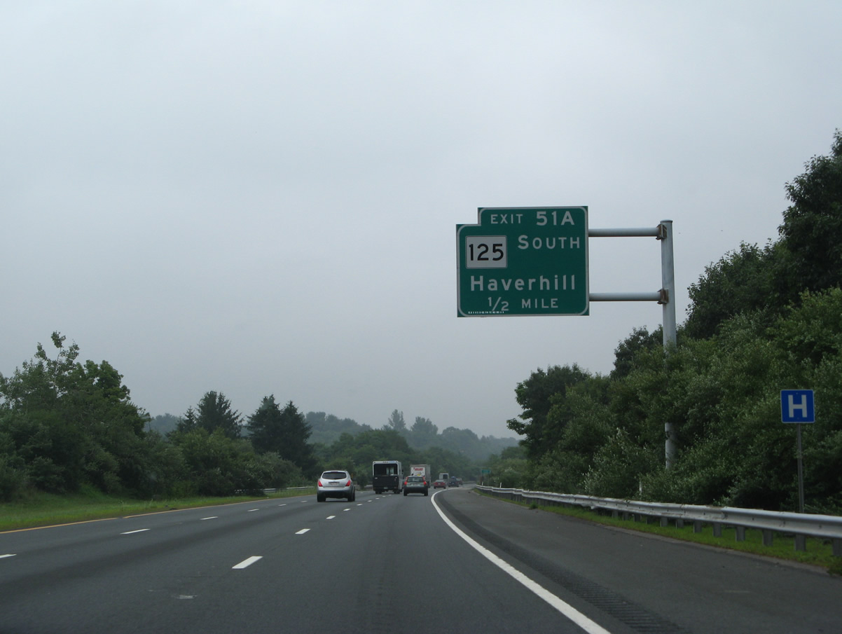
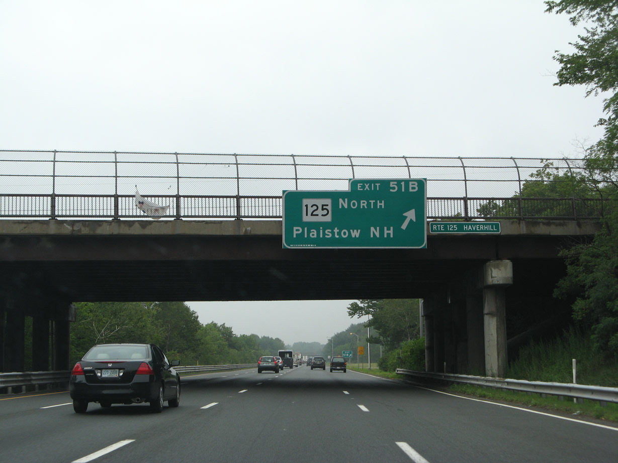
| Main Street takes Route 125 south from Exit 109 A, 1.9 miles to the Haverhill city center. 07/30/07 |
|
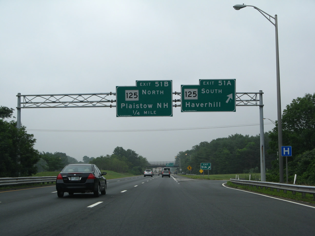
| Route 125 joins Haverhill with Bradford and North Andover as part of a 18.9 mile route to I-93 in Wilmington. The state route north becomes NH 105 through the adjacent town of Plaistow. 07/30/07 |
|
| Exit 109 B loops onto Route 125 (Main Street) north 1.2 miles to the Granite State. NH 125 extends northward for 52 miles to Rochester and Wakefield. 07/30/07 |
|
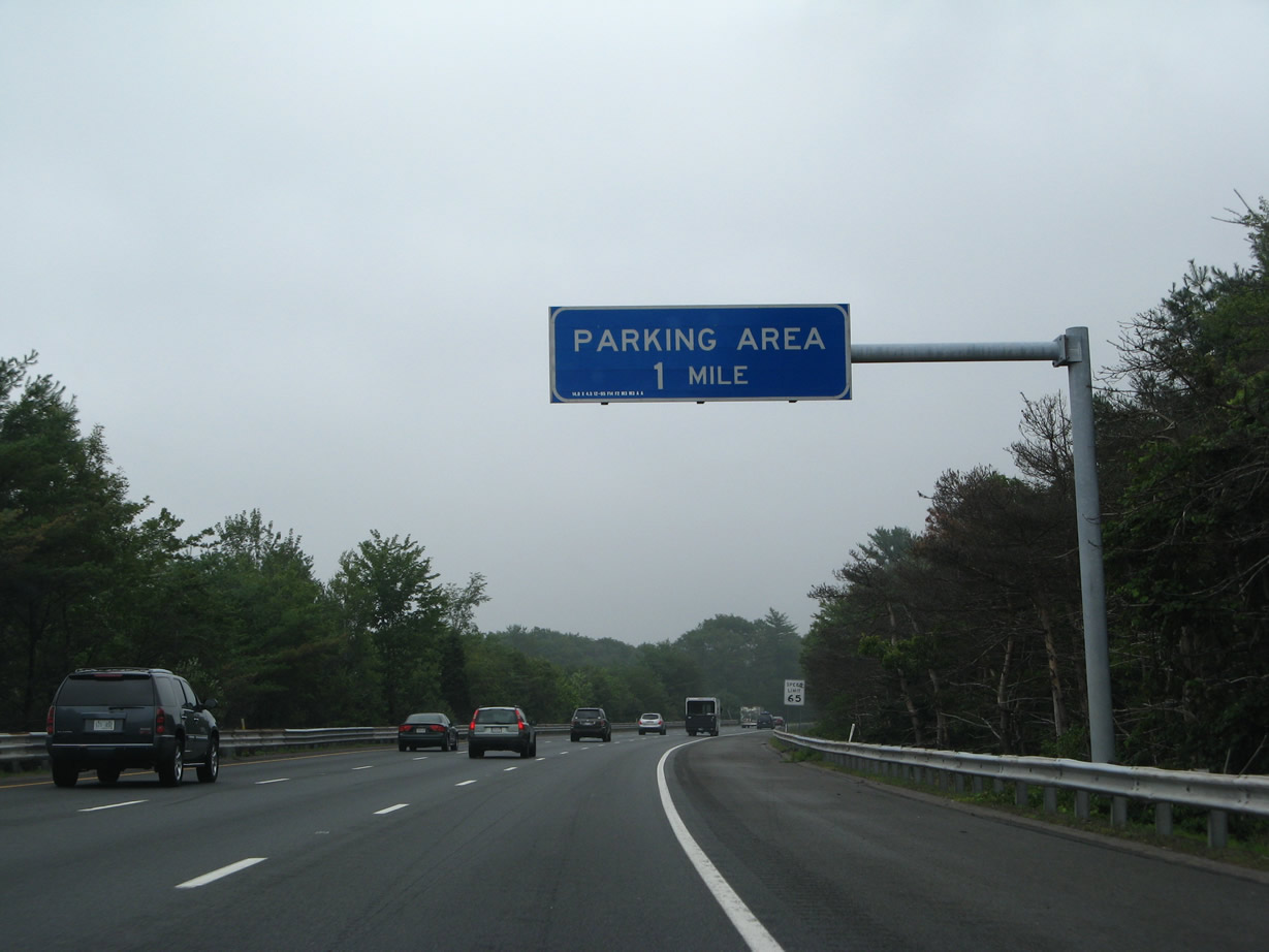
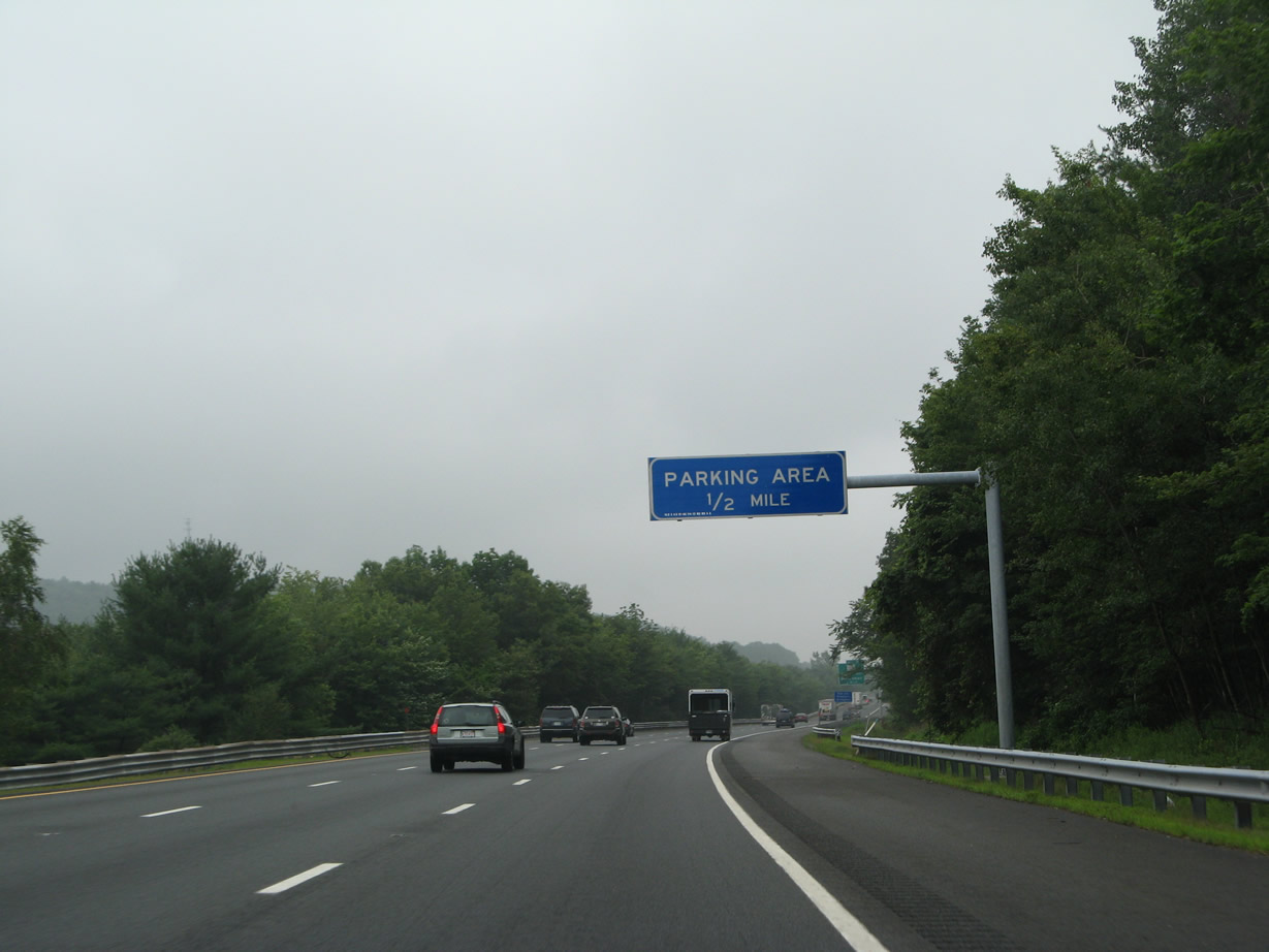
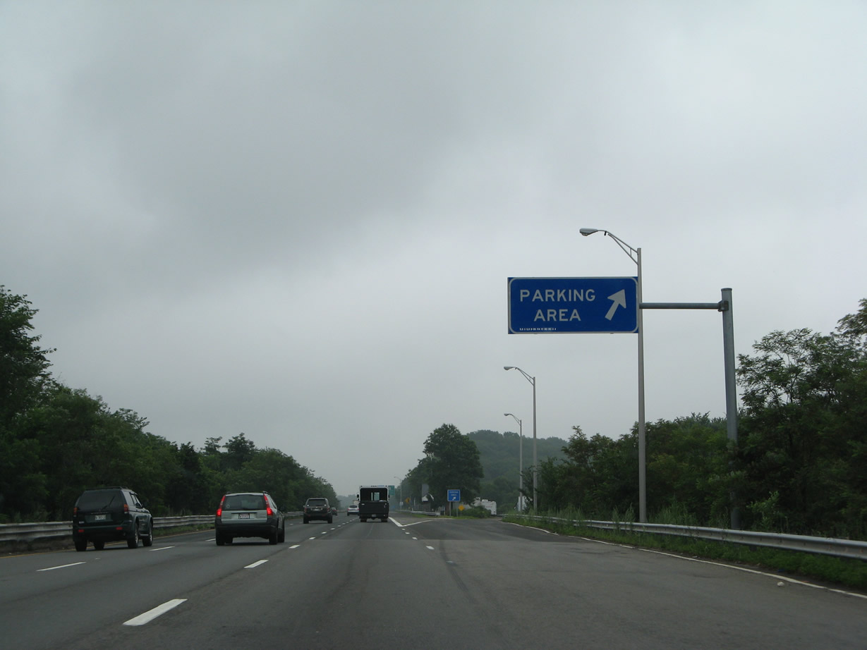
| Interstate 495 arcs east from Frye Pond to an northbound parking area by Ayers Hill. 07/30/07 |
|
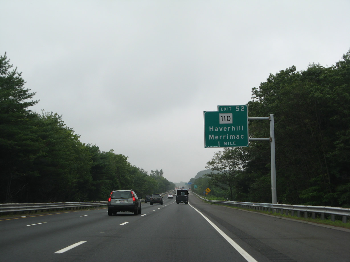
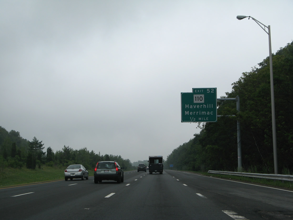
| Route 110 (Kenoza Avenue) forks northeast from Route 125 (Main Street) between Lake Pentucket and Kenoza Lake to cross paths with I-495 at a parclo B2 interchange (Exit 111). 07/30/07 |
|
| The northbound parking area at Haverhill lies just east of the Route 108 (Newton Road) underpass and south of the New Hampshire state line. 07/30/07 |
|
| North from Exit 111, Route 110 (Amesbury Road) stays close to Interstate 495 through the towns of Merrimac and Amesbury though to Exit 55. 07/30/07 |
|
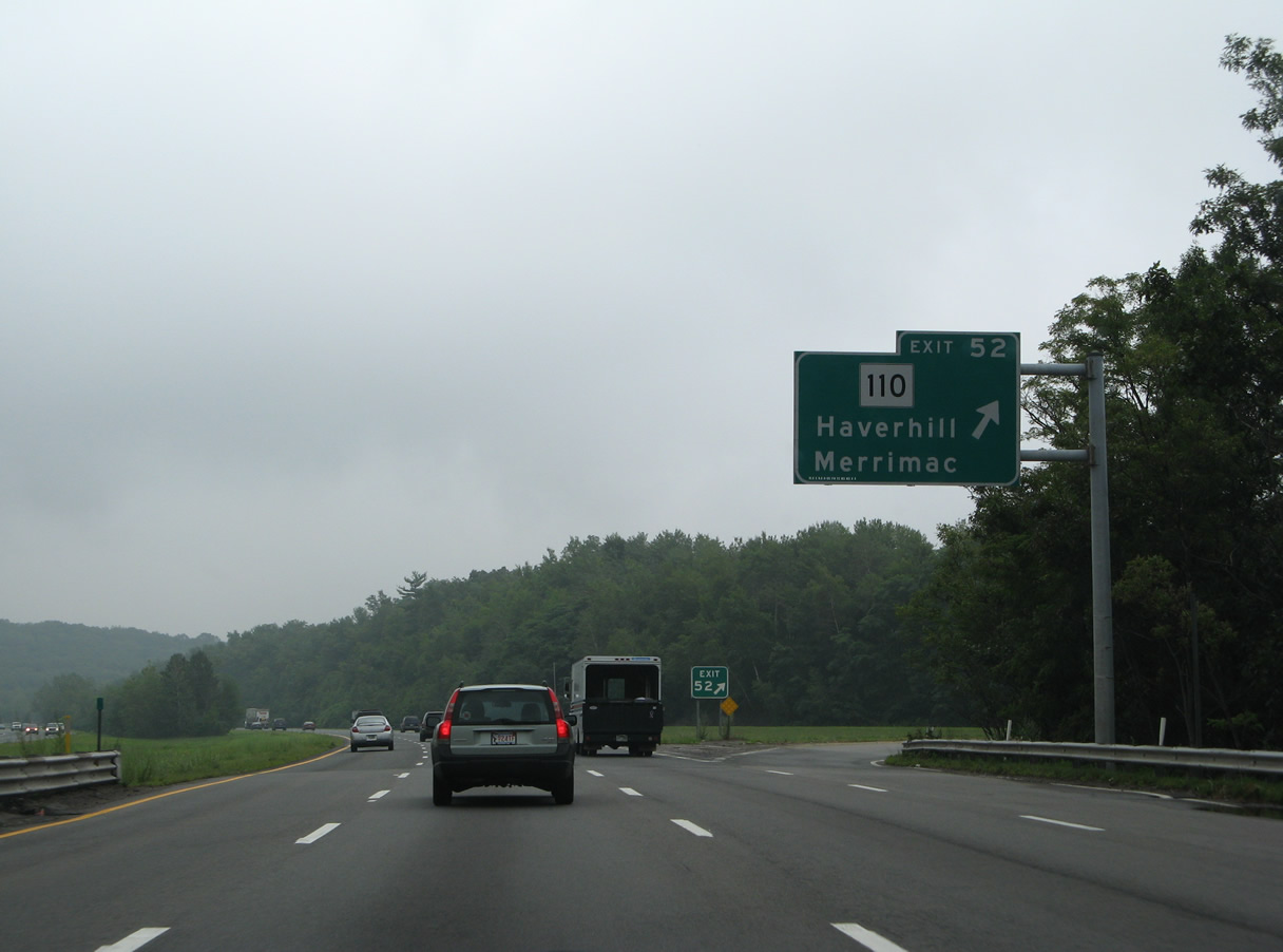
| Exit 111 loops away from I-495 north to Route 110 south back into Haverhill and north to the Merrimac town center. 07/30/07 |
|
| Jon Hill rises on the south side of Interstate 495 beyond this confirming marker. 07/30/07 |
|
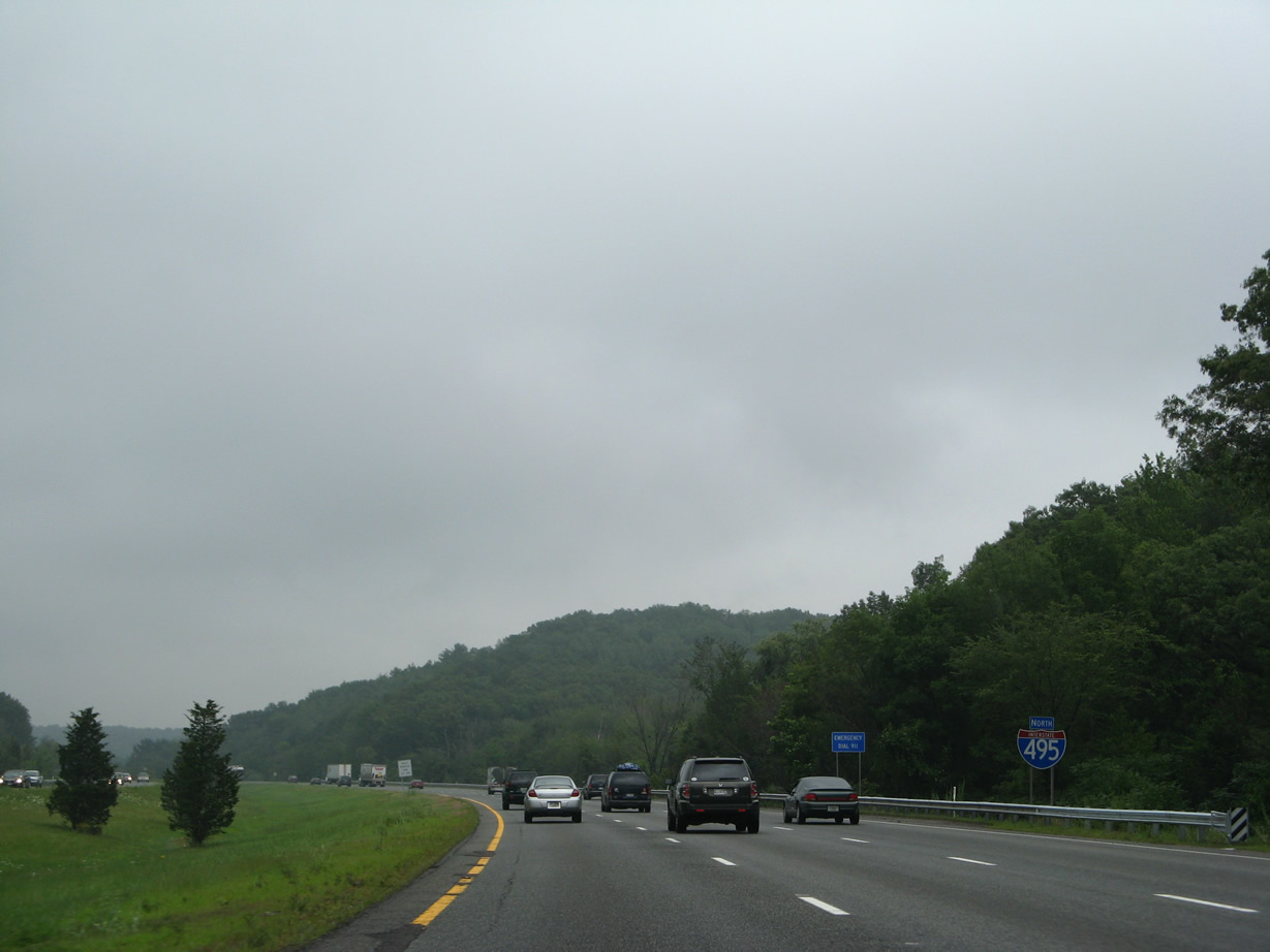
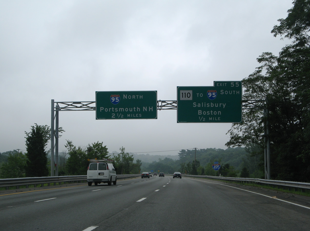
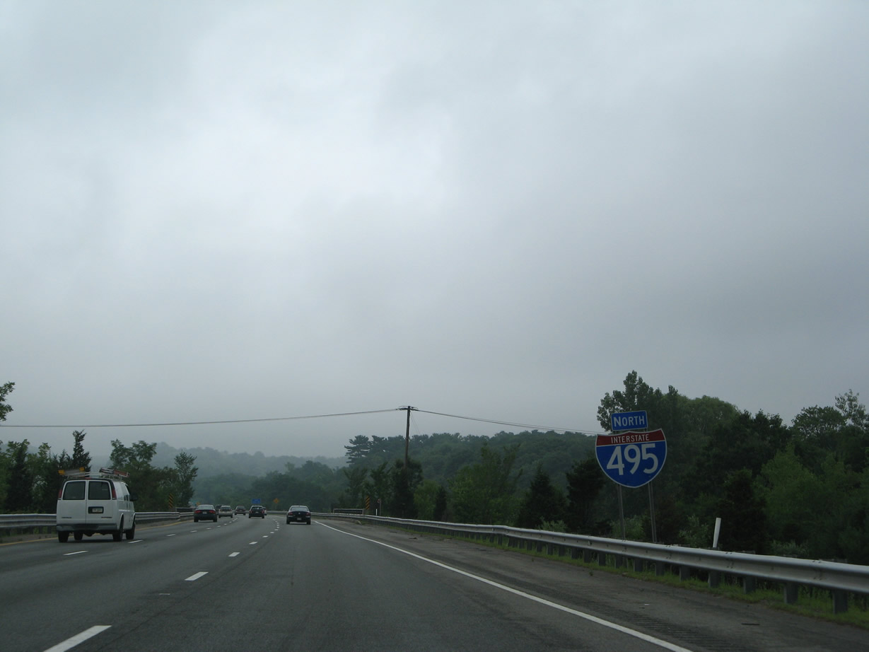
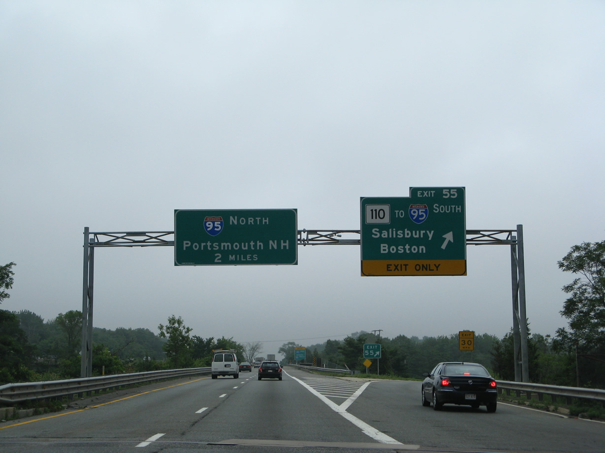
| Interstate 495 ends in 8.6 miles at I-95 north. Portsmouth lies 20 miles to the north from there via the tolled Blue Star Turnpike in New Hampshire. 07/30/07 |
|
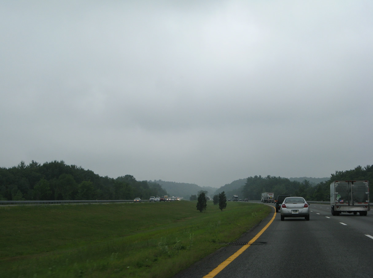
| Distant hills mark the Merrimack town line in this scene along Interstate 495 north. 07/30/07 |
|
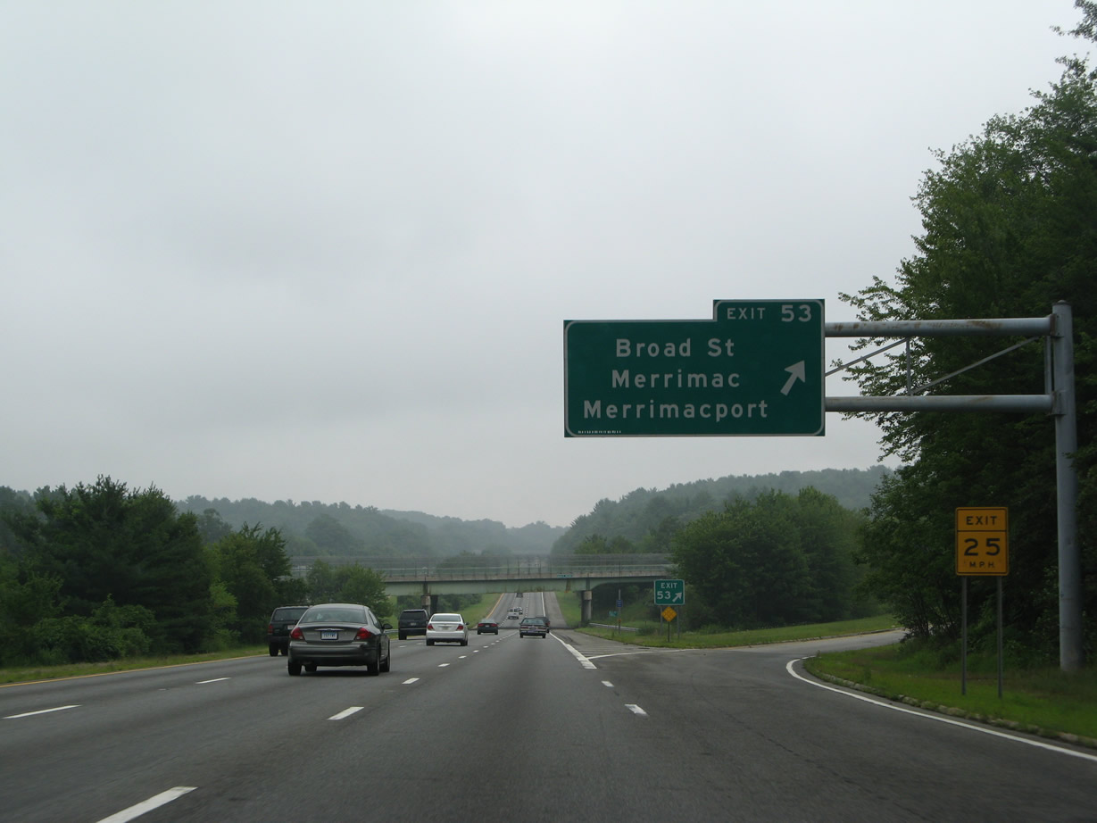
| Exit 115 to Broad Street connects I-495 with the Merrimac town center via Route 110 (Main Street) in one mile. 07/30/07 |
|
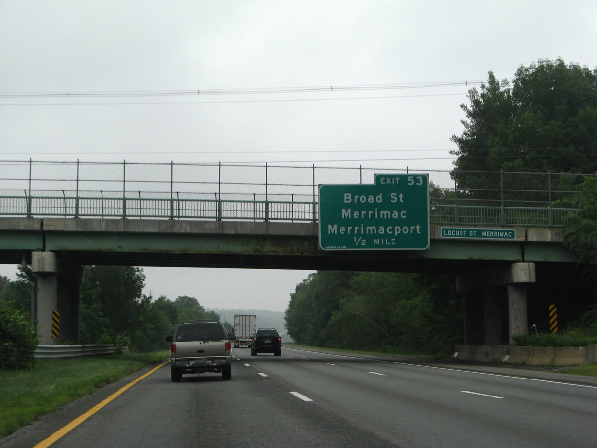
| Locust Street passes over the beltway a half mile west of the diamond interchange (Exit 115) with Broad Street. 07/30/07 |
|
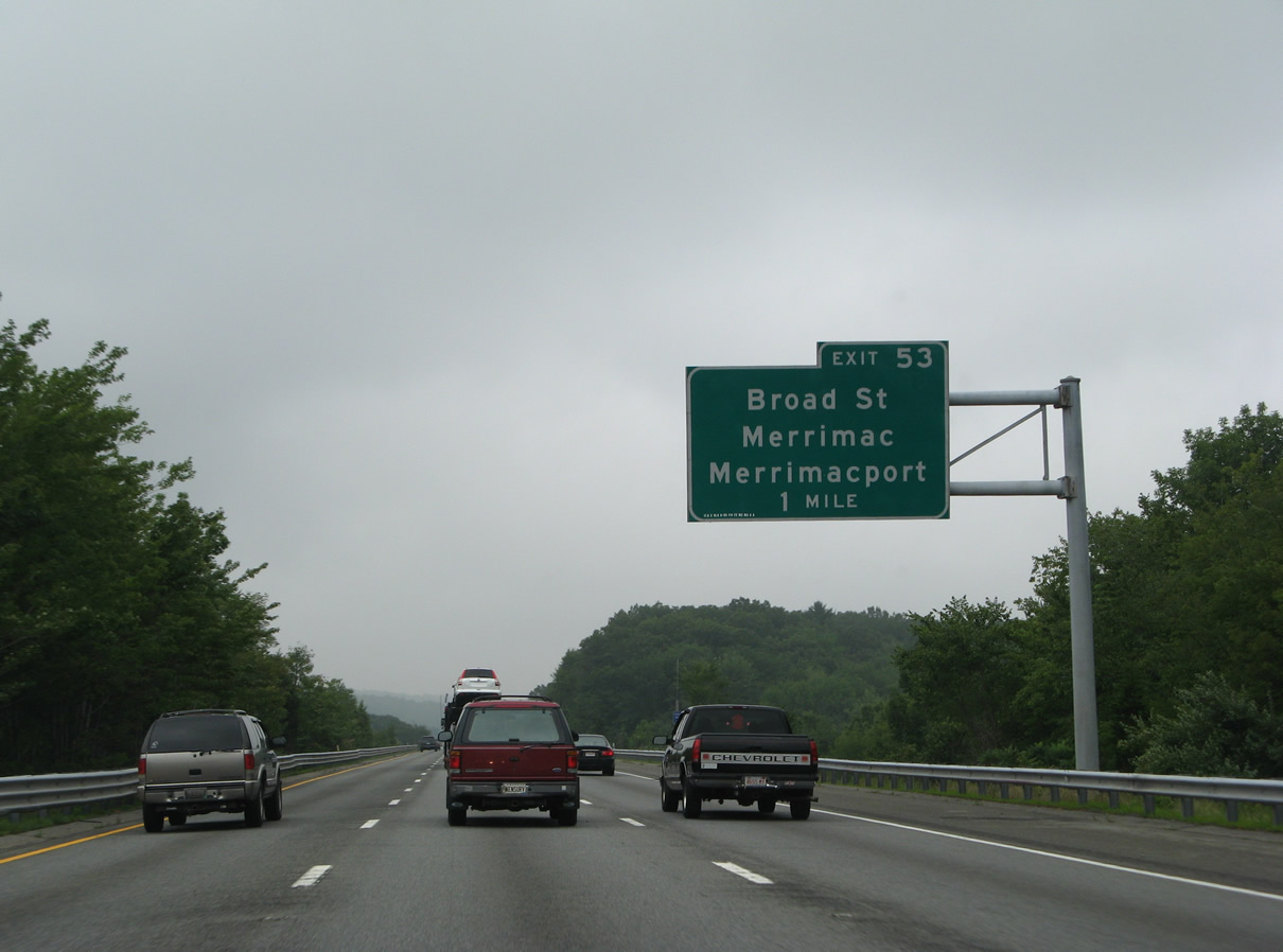
| Northbound I-495 reaches Exit 53 to Broad Street. Broad Street south ties into to River Road at Merrimacport. 07/30/07 |
|
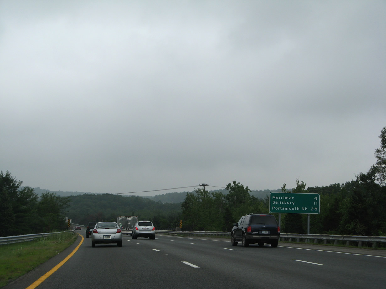
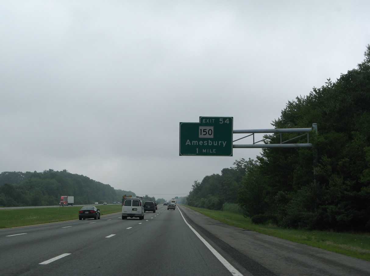
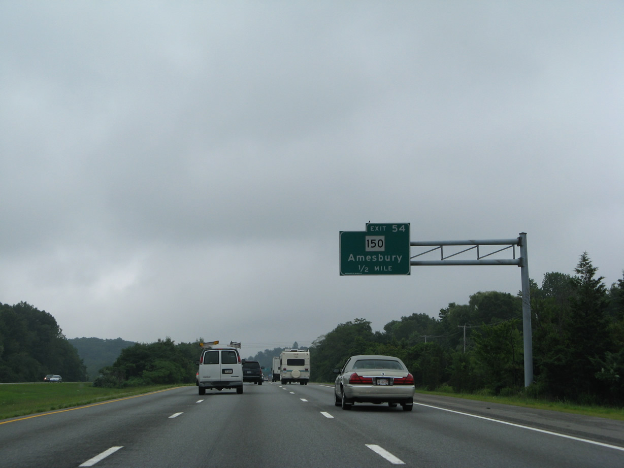
| Route 150 extends 3.77 miles south from NH 150 to Beacon Street in the town of Amesbury. 07/30/07 |
|
| I-495 and Route 150 come together at a parclo interchange (Exit 118) in 0.5 miles. 07/30/07 |
|
| Route 110 (Haverhill Road) leads east from Route 150 (Hillside Avenue) to cross I-495 for the final time at Exit 119. Route 150 continues north to the Amesbury town center and Kensington, New Hampshire. 07/30/07 |
|
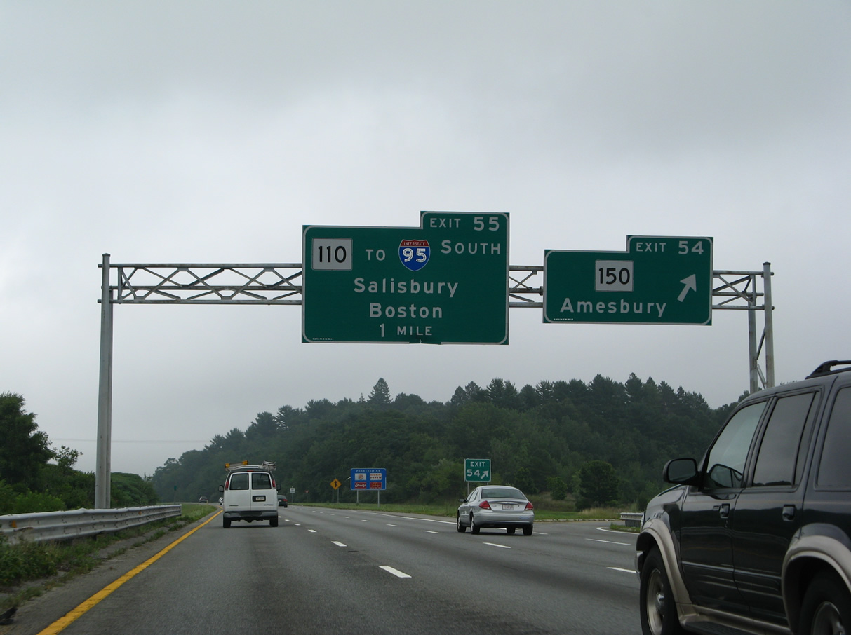
| I-495 north defaults onto Interstate 95 north through north Salisbury in 2.5 miles. Route 110 (Macy Street) provides the connection with I-95 south to Boston in a half mile. 07/30/07 |
|
| The final confirming marker for Interstate 495 stands ahead of the Main Street underpass. 07/30/07 |
|
| Exit 119 branches away from I-495 north at the Powwow River for Route 110 east to I-95 south and U.S. 1 and Route 1A at the Salisbury town center. Route 1A (Beach Road) links the state route with the Salisbury Beach resort area. 07/30/07 |
|
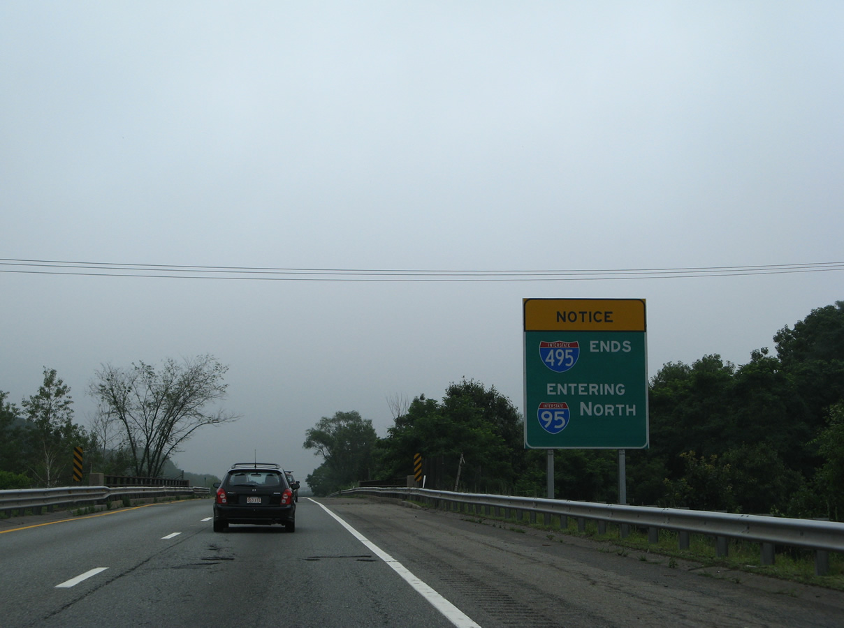
| An Interstate 495 ends sign was posted just beyond the gore point at Exit 119. A new sign replicates this information further north. 07/30/07 |
|
| One mile ahead of the wye interchange with Interstate 95 north on I-495 north. This overhead was replaced with a ground level sign by 2012. The new panel omits Portsmouth, NH. 07/30/07 |
|
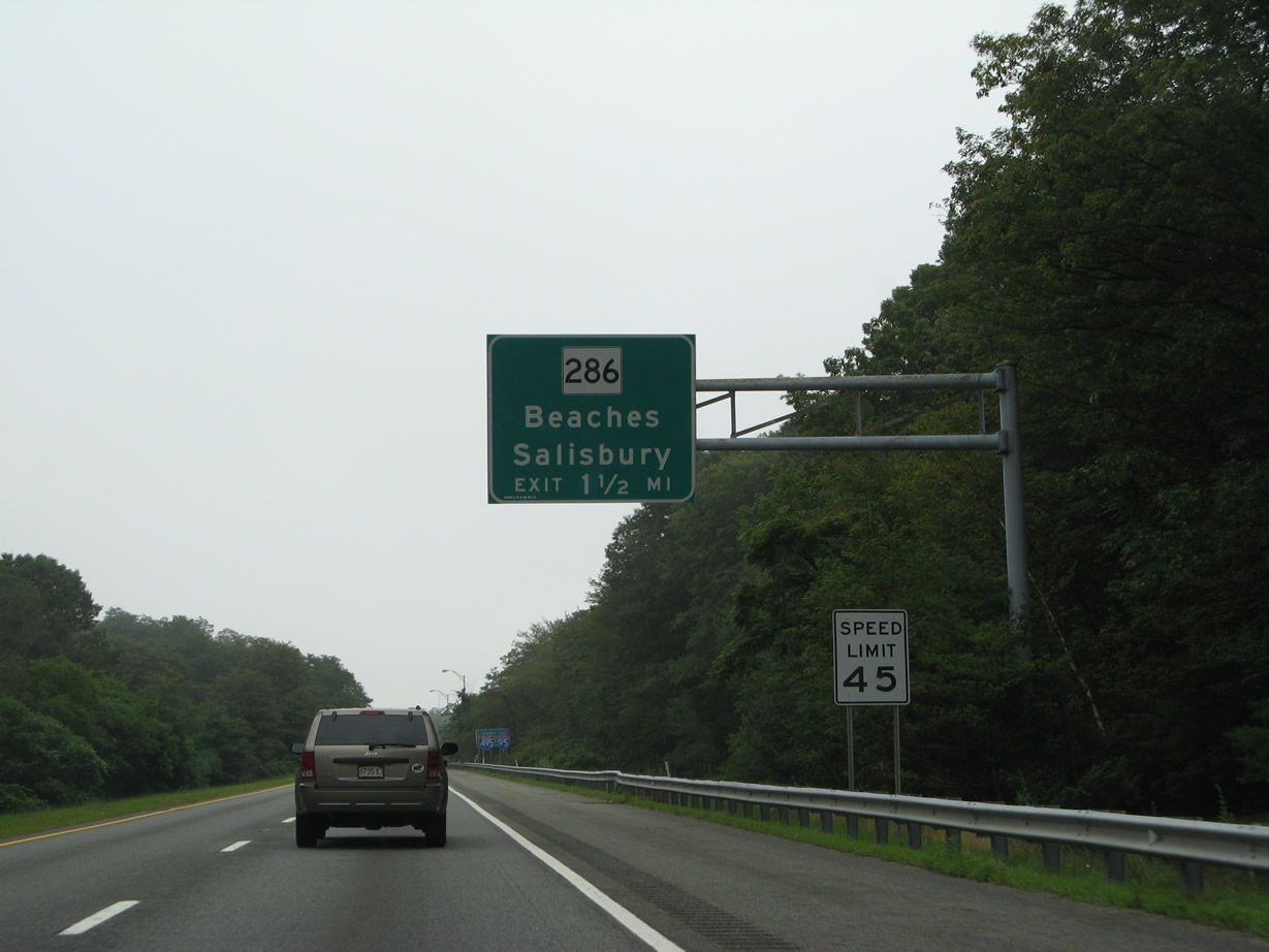
| The ensuing exit of Interstate 95 north is the last within Massachusetts. It connects the freeway with Route 286, a 1.43 mile extension of NH 286 west from Seabrook.
This sign was replaced by 2012 and now includes a tab for Exit 90. 07/30/07 |
|
| An end shield for Interstate 495 was posted ahead of the bridges across I-95. It was replaced by 2012 with a guide sign displaying I-495 Ends / Entering I-95 north.
Motorist aid call box service was discontinued along Interstate 495 after 2009. 07/30/07 |
Page Updated 09-19-2016.

 North
North