|
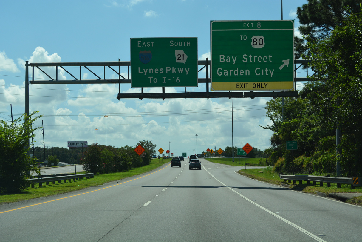
| SR 21 (Augusta Road) transitions into I-516 between Oak Street and the parclo interchange (Exit 8) with Burnsed Boulevard. Paralleling I-516/SR 21, U.S. 80 follows Bay Street east to Lathrop Avenue, which leads north to the Port of Savannah - Ocean Terminal. 01/03/14 |
|
| Burnsed Boulevard links U.S. 80/SR 26 with SR 25 (Main Street). U.S. 80/SR 26 lead west from Garden City to Pooler and east along Bay Street to Lynes Parkway south at Exit 7. 07/25/22 |
|
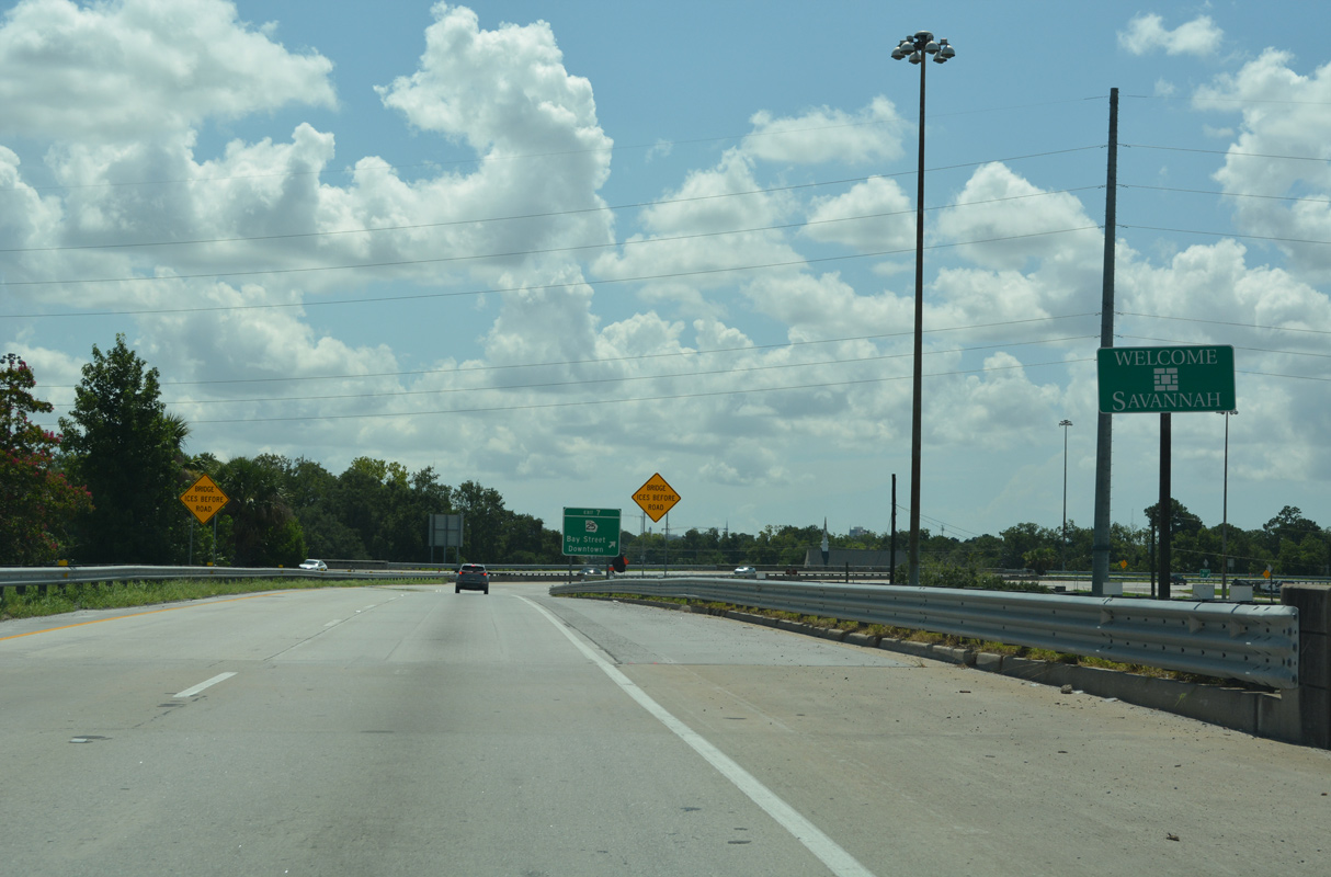
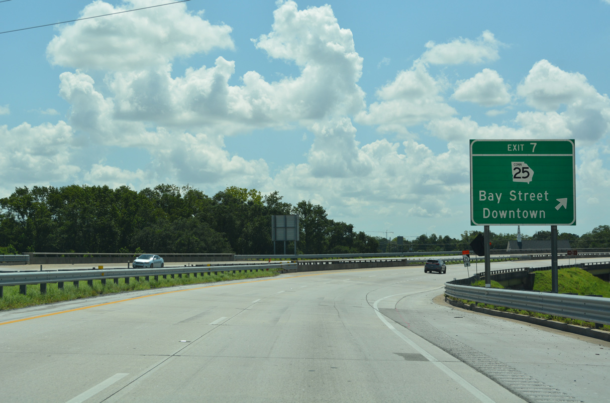
| A loop ramp (Exit 7) joins I-516 east with SR 25 Connector (Bay Street), a 3.12 mile long route east to Downtown Savannah and the Talmadge Bridge (U.S. 17/SR 404 Spur). 07/25/22 |
|
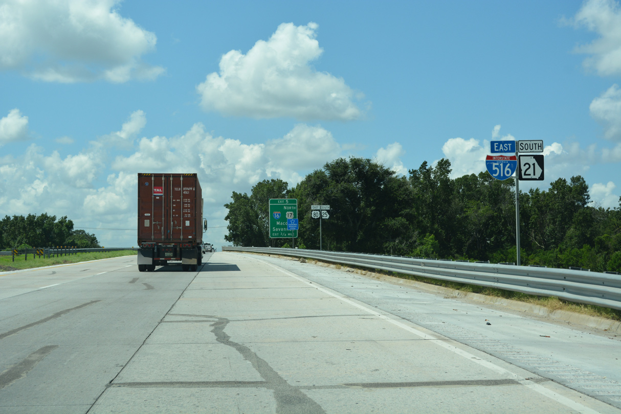
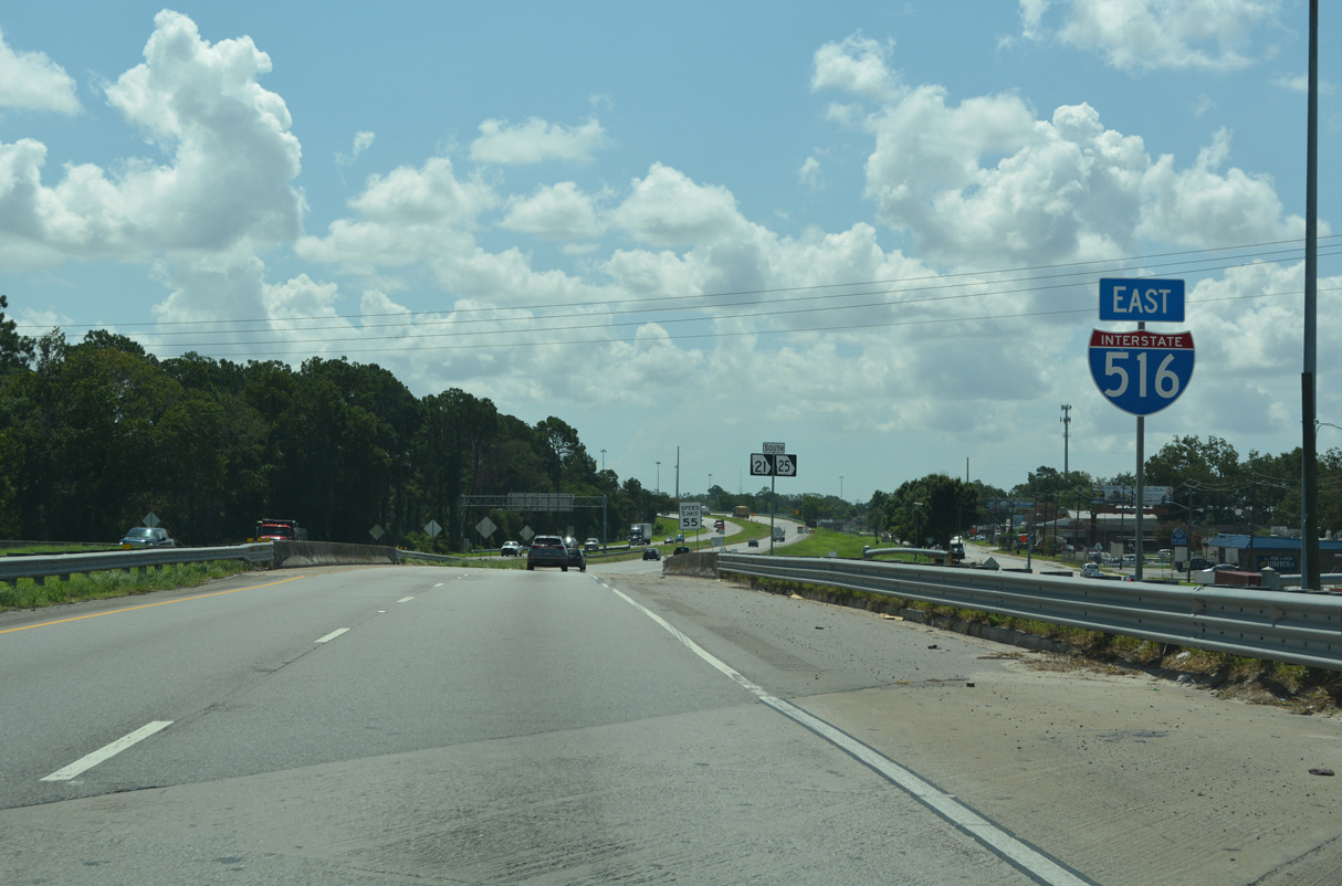
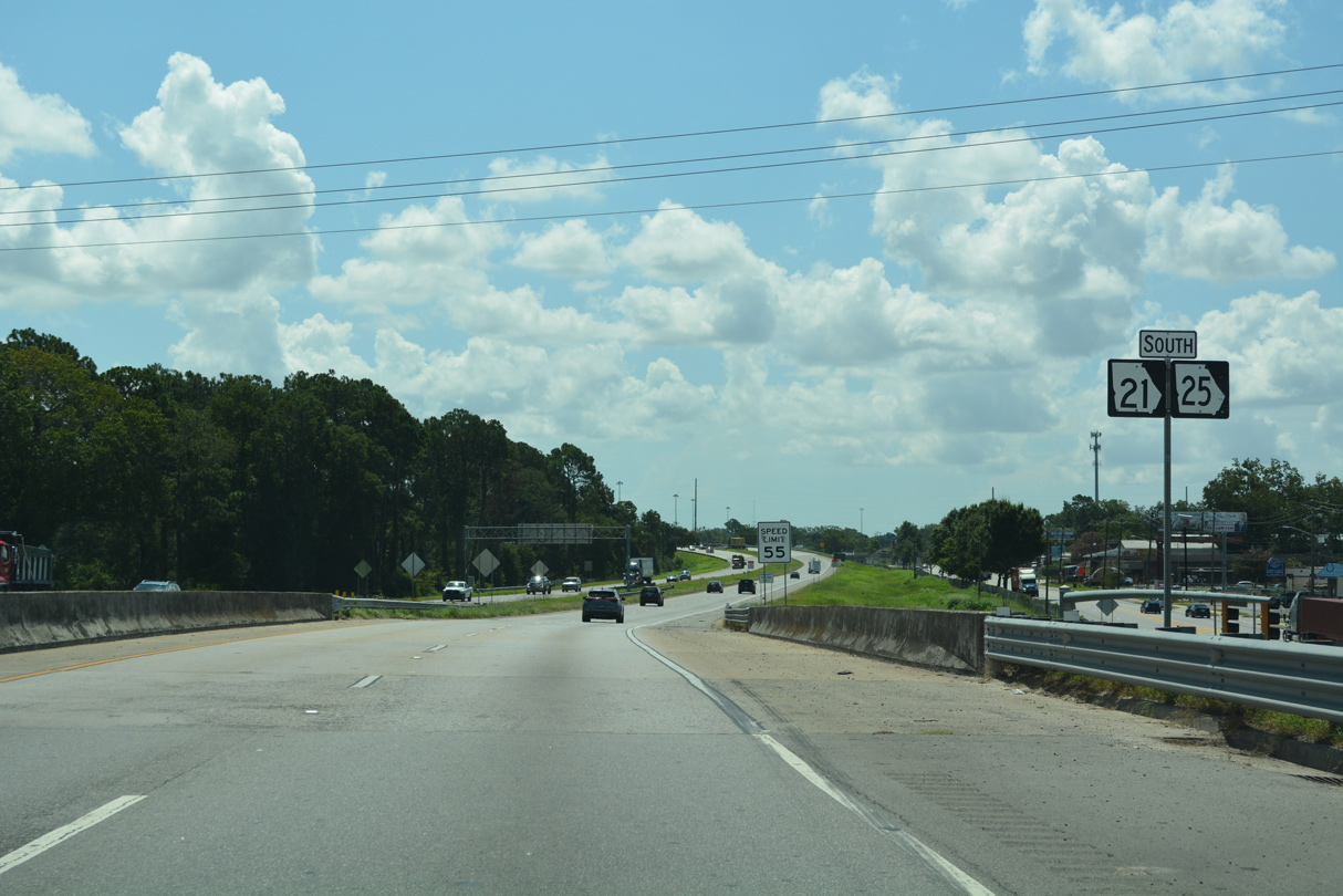
| SR 25 combines with I-516/SR 21 south from Main Street and Port Wentworth. SR 25 runs along Lynes Parkway for 3.79 miles to Ogeechee Road, where it joins U.S. 17 south to the Florida state line. 07/25/22 |
|
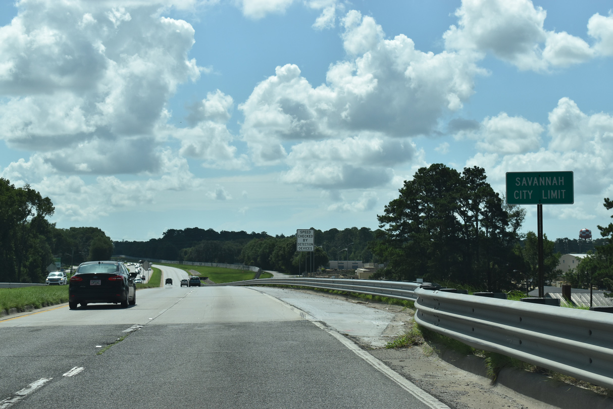
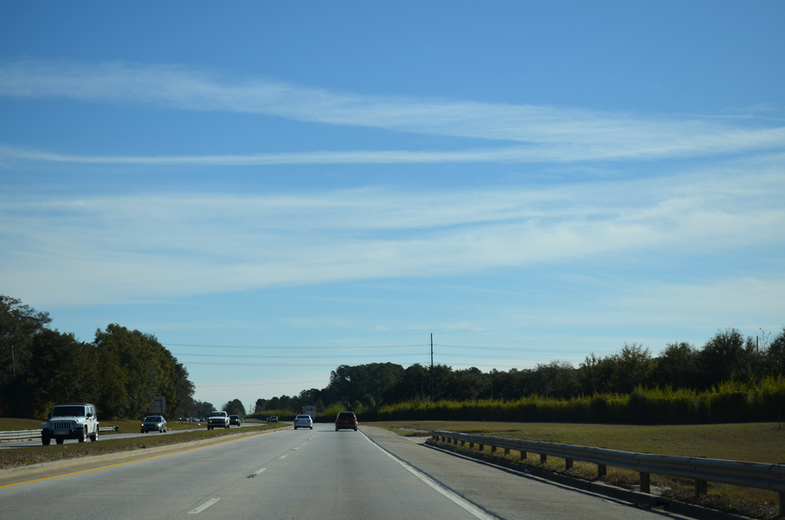
| I-516/SR 21-25 turn south into the Savannah city limits between the Hudson Hill and West Savannah neighborhoods. 07/25/22 |
|
| SR 25CO branches east from SR 25 at Exit 7 for Bay Street. Bay Street, the former alignment of U.S. 80, extends 1.9 miles east to Martin Luther King, Jr. Boulevard, which directs SR 25CO south toward the Talmadge Bridge, ahead of Downtown Savannah. 07/25/22 |
|
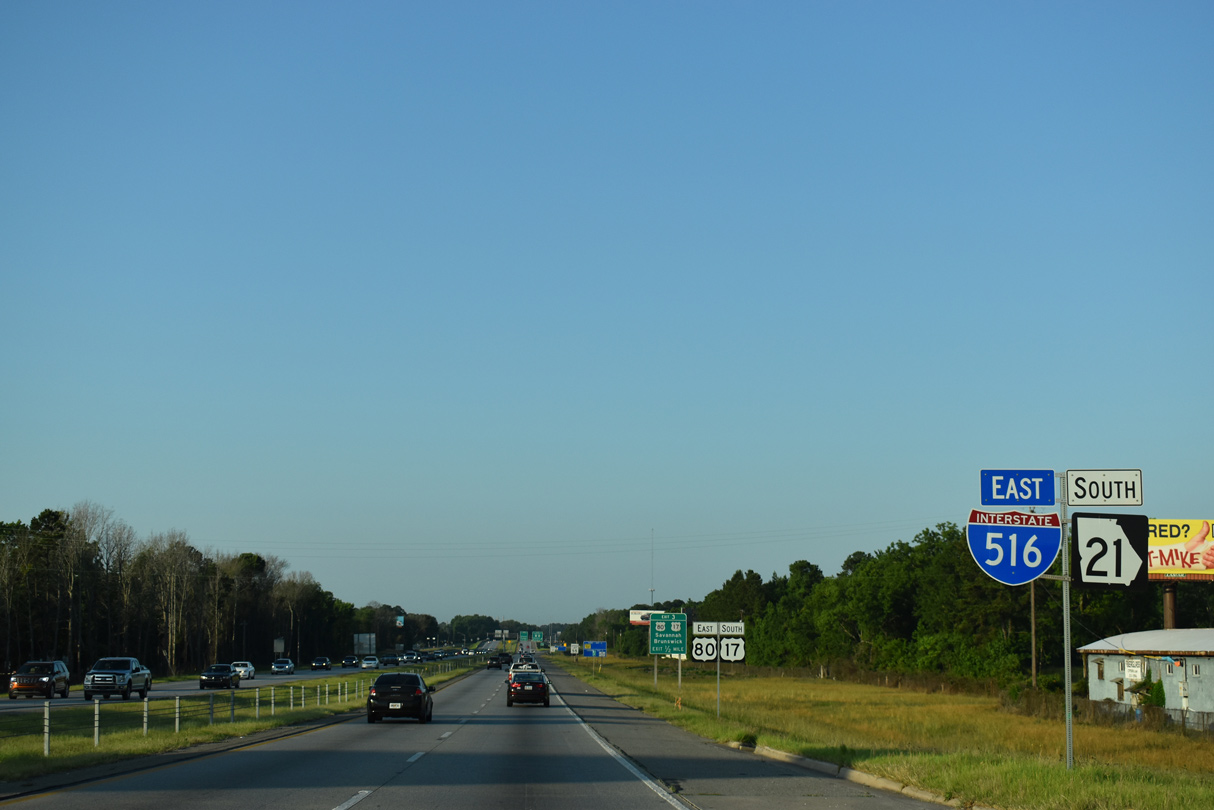
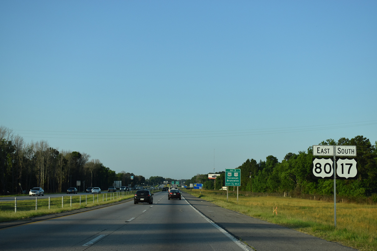
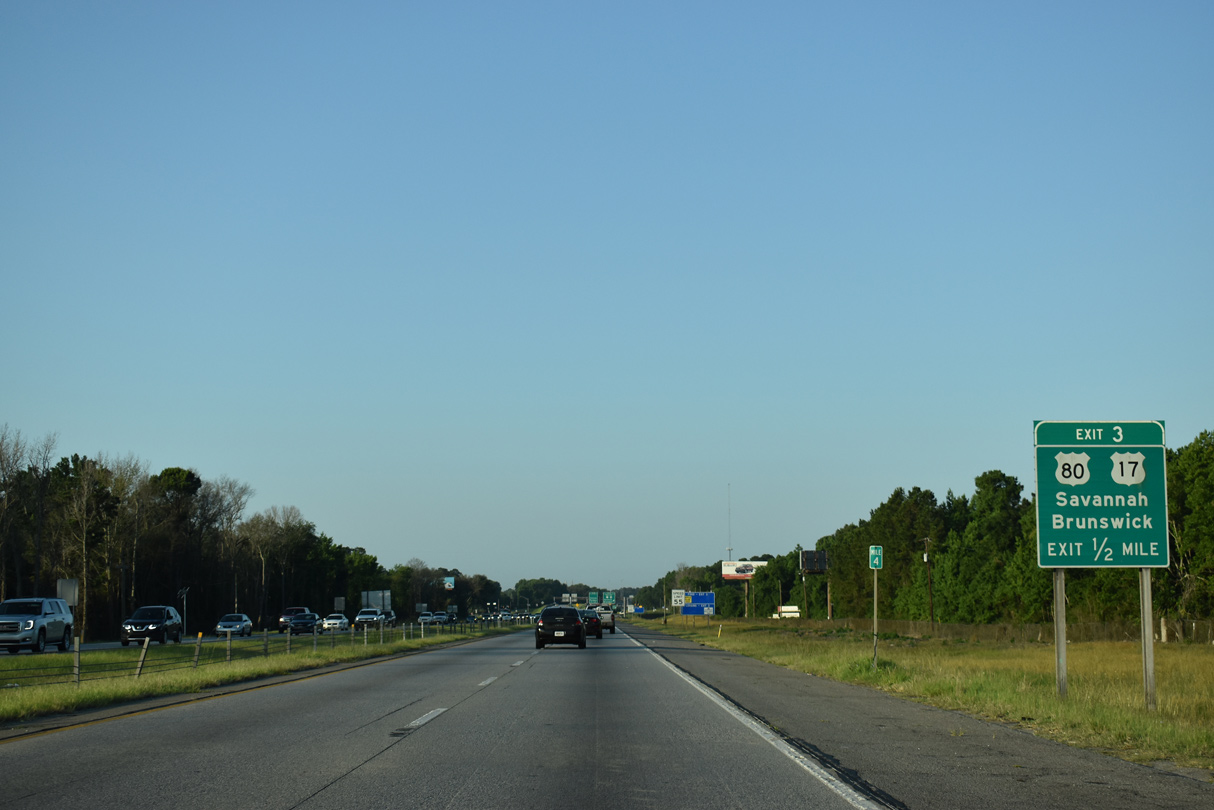
| U.S. 80 overlaps with I-516 south 2.61 miles from the half diamond interchange with Augusta Avenue to Exit 3 with Ogeechee Road. 07/25/22 |
|
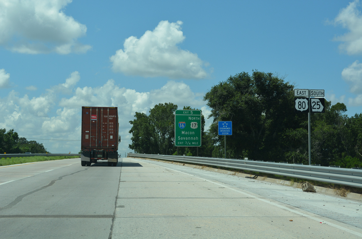
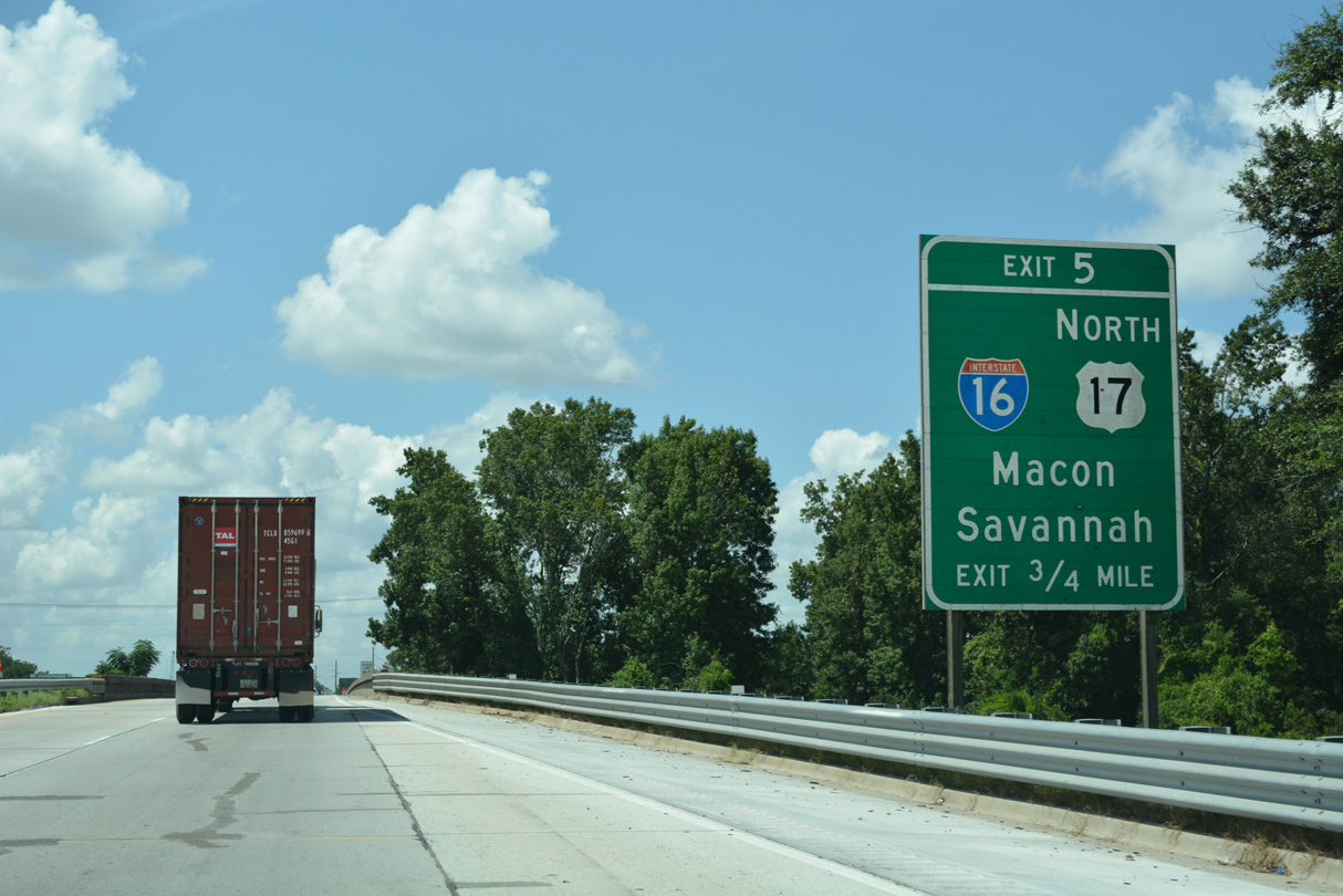
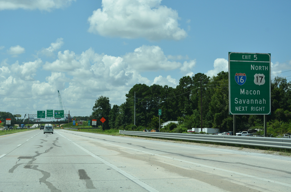
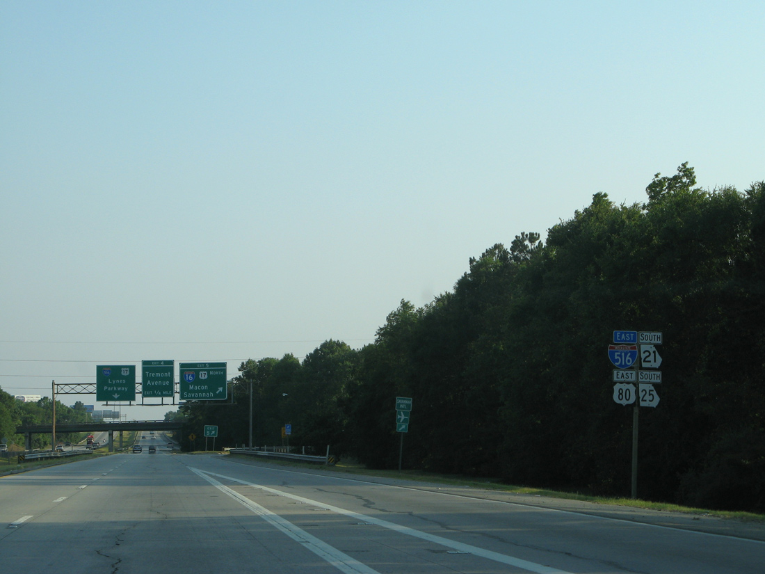
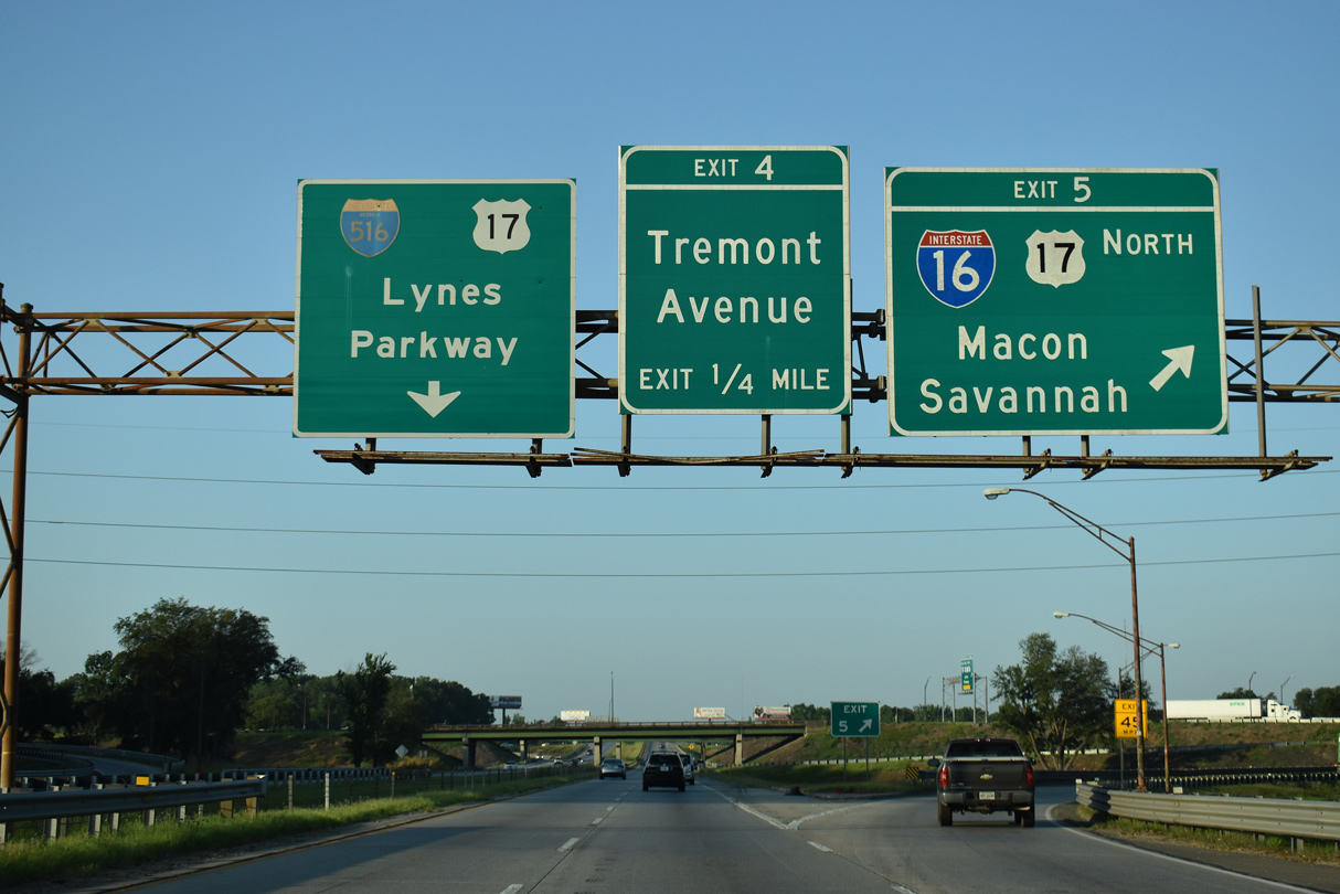
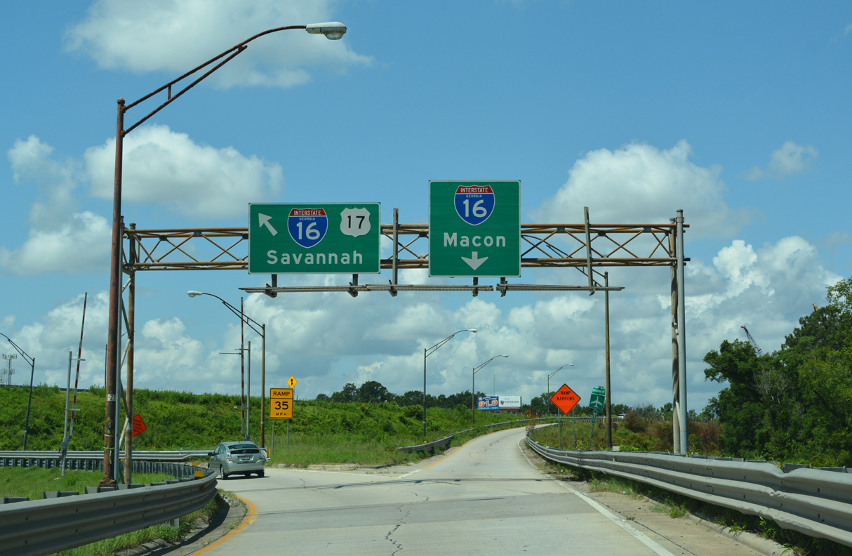
| Spanning Louisville Road and a Norfolk Southern Railroad line, Lynes Parkway advances south to a directional cloverleaf interchange (Exit 5) with I-16/U.S. 17. I-16 provides a direct route to the Historic District of Savannah while U.S. 17 north links the city with Jasper County, South Carolina via the Talmadge Bridge. 07/25/22 |
|
| A half diamond interchange connects Gwinnett Street with I-516 just north of Exit 5 for Interstate 16. 05/29/07 |
|
| An auxiliary lane opens south ahead of Exit 5 parts for Interstate 16 east / U.S. 17 north into Savannah and I-16 west to Pooler, Bloomingdale and Dublin. 07/25/22 |
|
| Confirming markers formerly posted at the entrance ramp from Gwinnett Street. U.S. 17 followed I-516 south from Garden City to I-16 until 1988, when it was relocated east onto the original Talmadge Bridge. 05/29/07 |
|
| All traffic bound for I-16 departs I-516 east in unison at Exit 5. An intrastate route, I-16 travels 165.71 miles overall west from the couplet of Montgomery Street and Martin Luther King, Jr. Boulevard in Savannah to Interstate 75 at Macon. 05/24/19 |
|
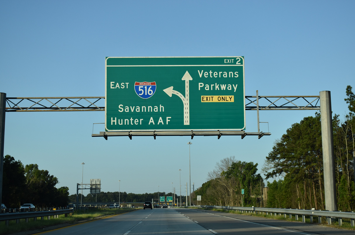
| Interstate 16 heads 1.2 miles east to the 37th Street Connector (old SR 204) to Midtown and 2.3 miles to Montgomery Street outside Downtown. Westward, I-16 continues six miles to Interstate 95 at Pooler. 07/25/22 |
|
| Lynes Parkway elevates over a CSX Railroad line and Tremont Road ahead of Exit 4. Tremont Road angles southeast from an industrial area at Telfair Junction to U.S. 80/SR 26 (Ogeechee Road). The Savannah Amtrak Station is located along Telfair Road near Tremont Avenue. 05/24/19 |
|
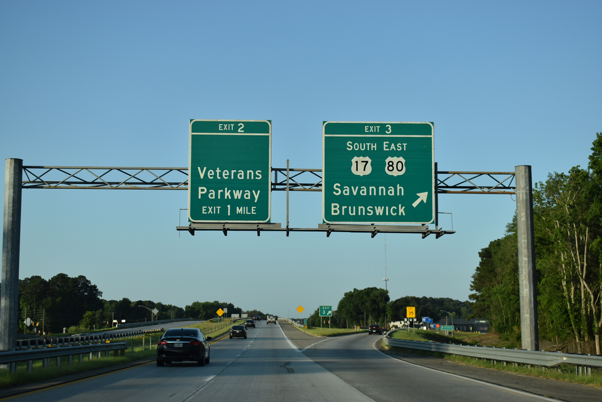
| U.S. 17 combines with Interstate 516 southward 1.33 miles from I-16 to Exit 3 with Ogeechee Road. 05/24/19 |
|
| U.S. 17/SR 25 south and U.S. 80/SR 26 east split with I-516 at the diamond interchange (Exit 3) with Ogeechee Road. U.S. 17/SR 25 follow Ogeechee Road southwest to Silk Hope toward Richmond Hill and Brunswick. U.S. 80/SR 26 resume an eastward heading to Victory Drive through Midtown Savannah. 05/24/19 |
|
| U.S. 80/SR 26 travel another 20.76 miles east from Exit 3 to Thunderbolt, Fort Pulaski National Monument and Tybee Island along the Atlantic Ocean. 05/24/19 |
|
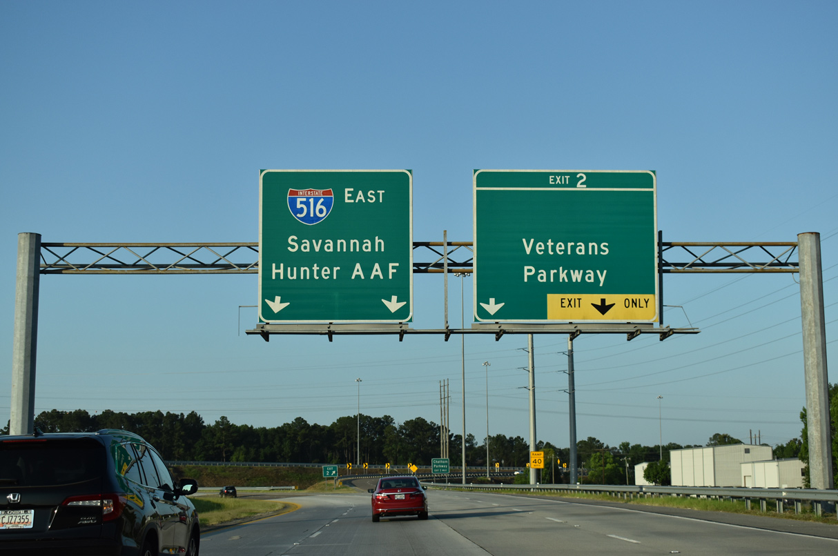
| Veterans Parkway branches southwest from Exit 2 to SR 204 (Abercorn Street Extension) by Southside Savannah. Constructed in the early 1990s, the 6.82 mile long freeway was formerly named the Southwest Bypass. 05/24/19 |
|
| Maintained by Chatham County, Veterans Parkway provides a bypass route from the trumpet interchange at Exit 2 to SR 204 west toward both Interstate 95 and Richmond Hill. 05/24/19 |
|
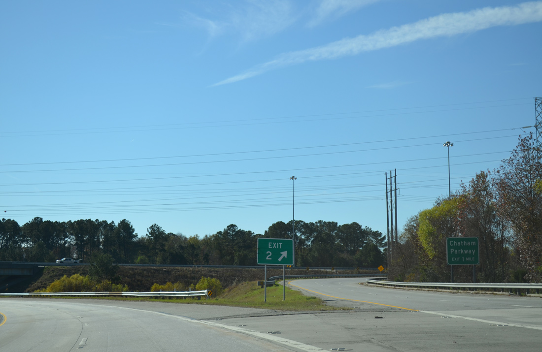
| Veterans Parkway winds west to a diamond interchange with Chatham Parkway before turning south across marshland surrounding the Little Ogeechee River. 01/03/14 |
|
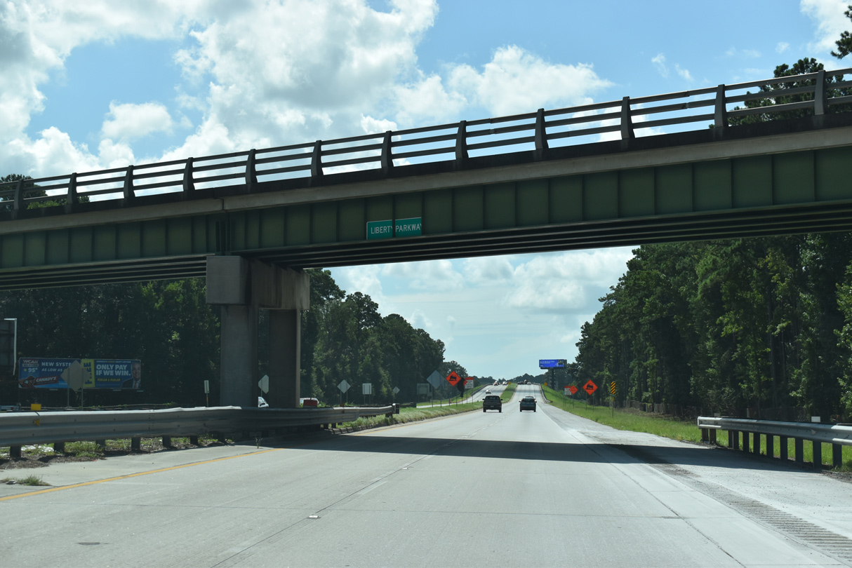
| Lynes Parkway curves east ahead of Liberty Parkway and reenters Savannah city limits at the CSX Southover Yard underpass. 07/25/22 |
|
| An intersection stub remains alongside Interstate 516 east / SR 21 south opposite Mitchell Boulevard in Hunter Army Air Field. 01/03/14 |
|
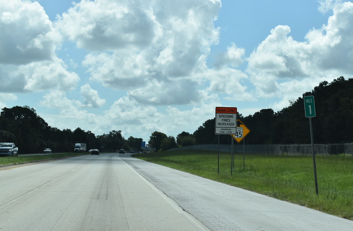
| Milepost one for I-516 east / SR 21 south. Hunter AAF lines the south side of the freeway to Mildred Street. 07/25/22 |
|
| SR 21 transitions onto DeRenne Avenue east of Mildred Street and this overhead assembly. A set of concrete barriers block access onto Mildred Street south. 07/25/22 |
|
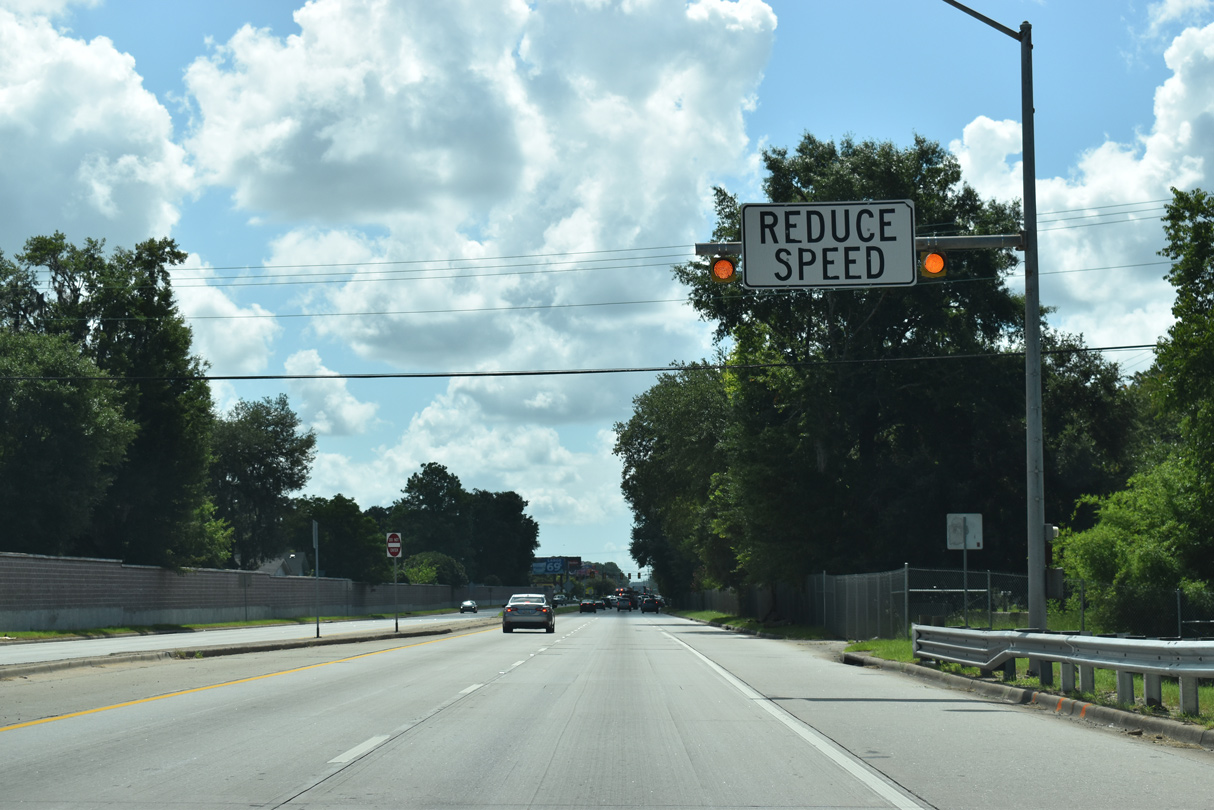
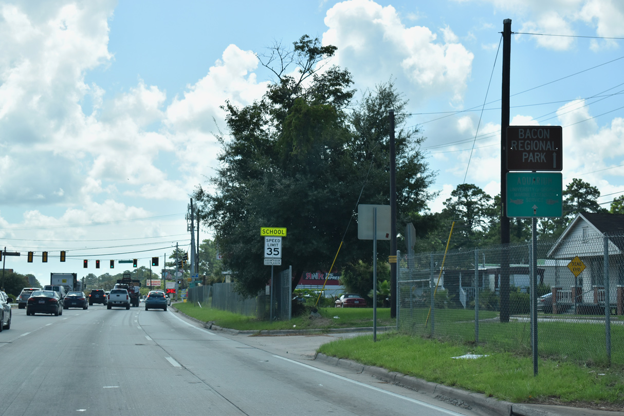
| DeRenne Avenue constitutes a busy arterial east to Waters Avenue and Truman Parkway near Bacon Park. 07/25/22 |
|
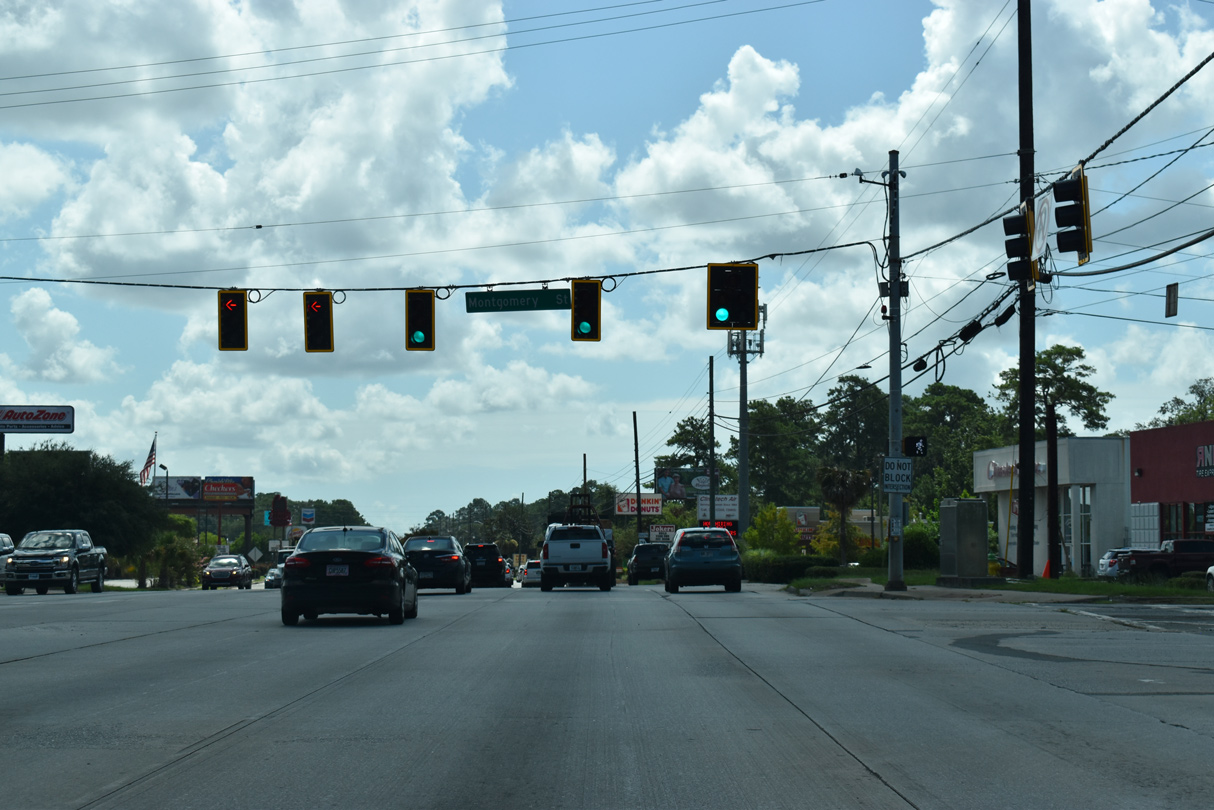
| SR 21 (DeRenne Avenue) extends 0.44 miles east from Montgomery Street to the east end of SR 204 at Abercorn Street. 07/25/22 |
Page Updated 11-29-2022.

 East
East  South
South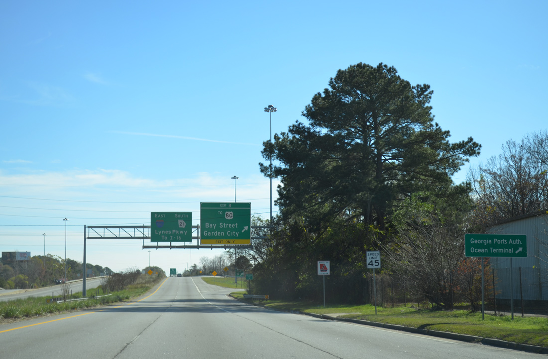
 South
South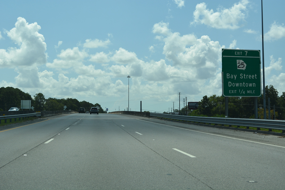

 East
East