|
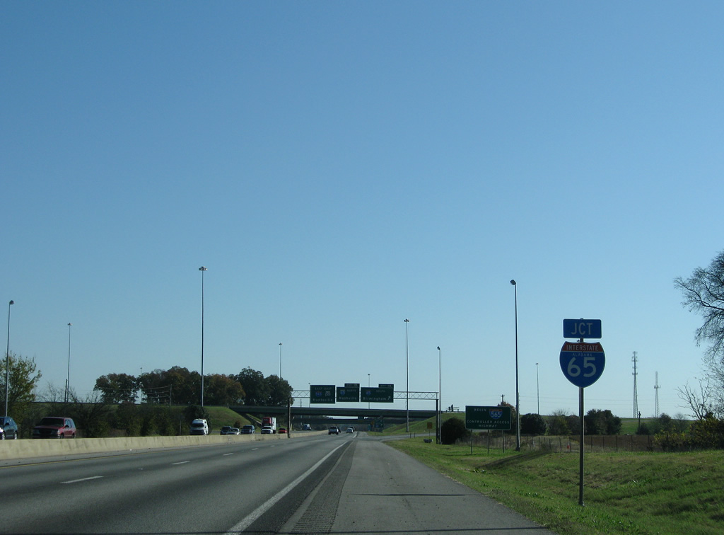
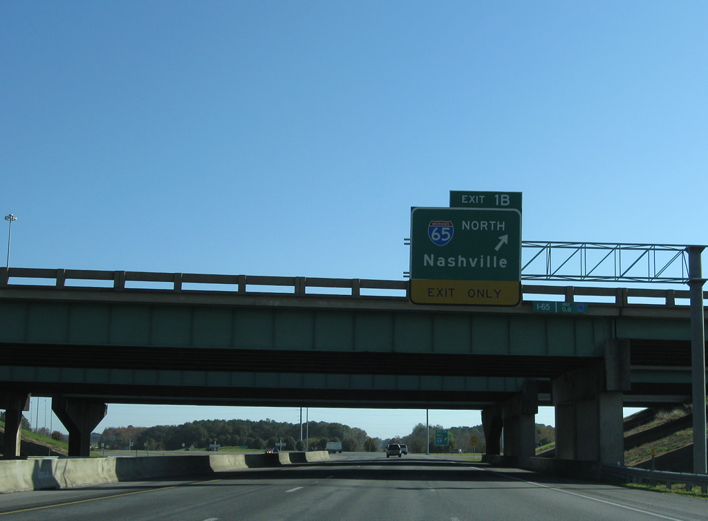
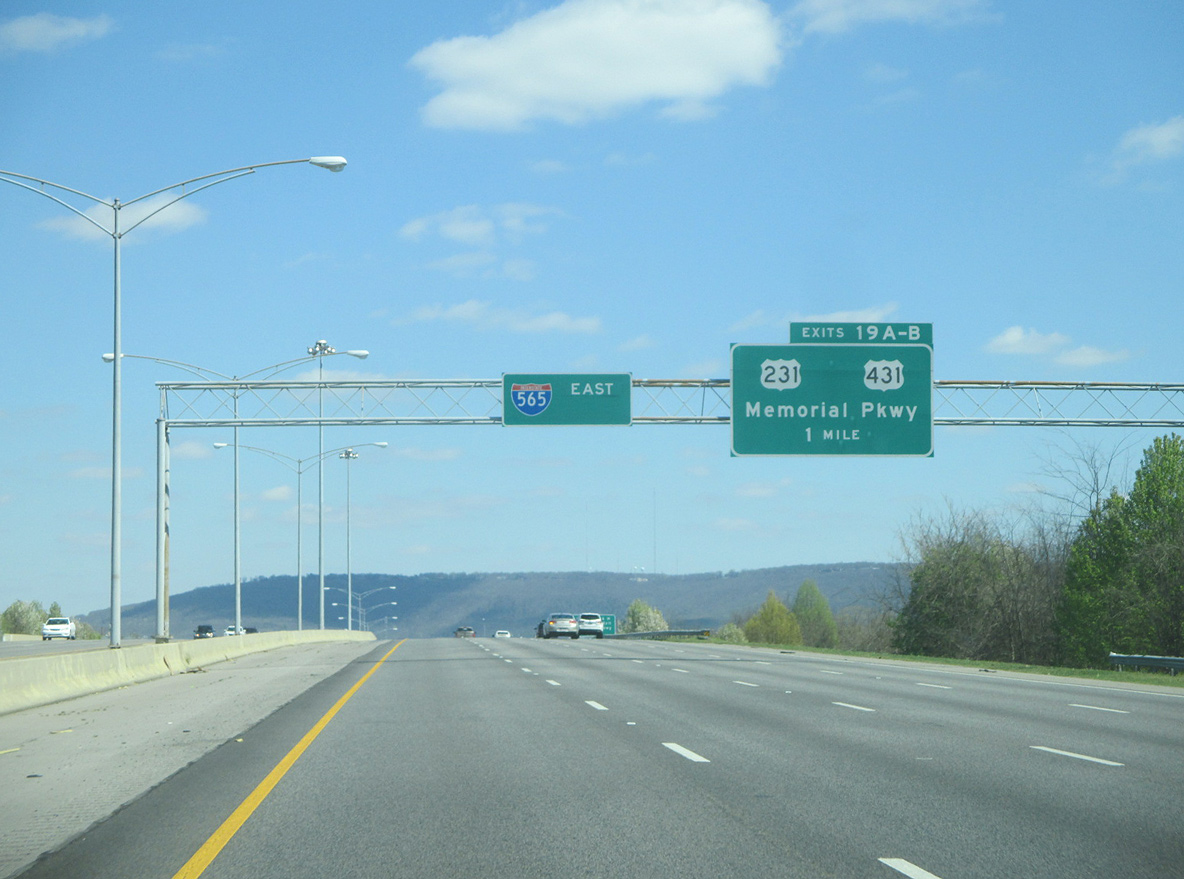
| U.S. 72 Alternate & SR 20 (Huntsville-Decatur Highway) become Interstate 565 at the directional cloverleaf interchange with Interstate 65 (Exits 1A/B). SR 20 ends as Interstate 565 begins. 11/04/09 |
|
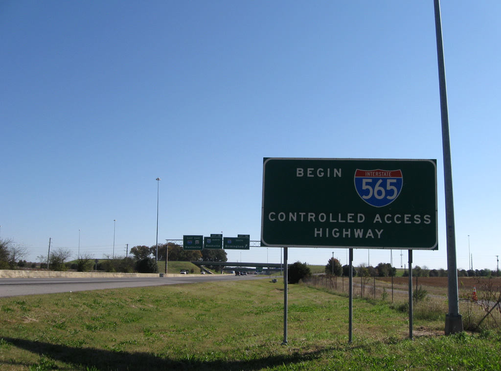
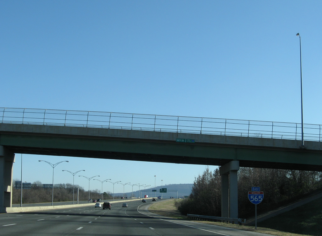
| Interstate 565 replaced SR 20 when it was completed in 1990 at Interstate 65. Originally a six-ramp parclo interchange joined Interstate 65 with Huntsville-Decatur Highway. When the freeway was built, sections of old SR 20 became frontage (such as the road to the right in this scene) or local access roads (such as Old Highway 20 at Mooresville). This sign indicates the beginning of the Interstate 565 designation and freeway. 11/04/09 |
|
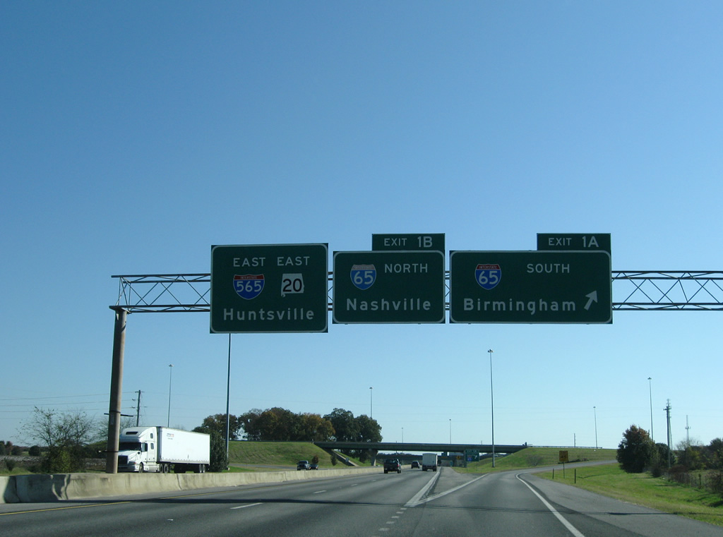
| Exit 1A joins Interstate 65 southbound across the Tennessee River into Morgan County east of Decatur. Interstate 65 continues south to Cullman and Birmingham. 11/04/09 |
|
| Typical freeway to freeway ramps include gore point signs featuring the Interstate shield. Interstate 65 south reaches Birmingham in 80 miles, Montgomery in 164 miles and Mobile in 335 miles. 11/04/09 |
|
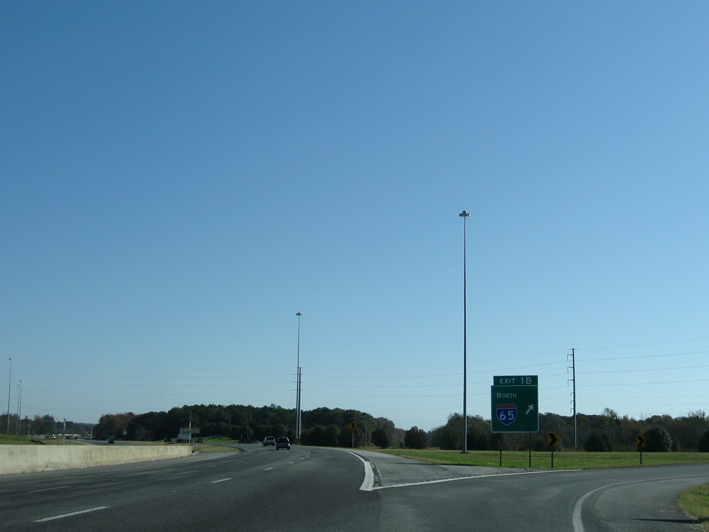
| Exit 1B follows as a loop ramp onto Interstate 65 north to Athens and Nashville, Tennessee. 11/04/09 |
|
| Interstate 65 exits the state in 27 miles near Ardmore and continues 80 miles to the Tennessee capital city. 11/04/09 |
|
| Interstate 565 traverses an area of wetlands across Wheeler National Wildlife Refuge between Exits 3 and 7. The freeway spans Beaverdam Creek on this stretch. 03/21/16 |
|
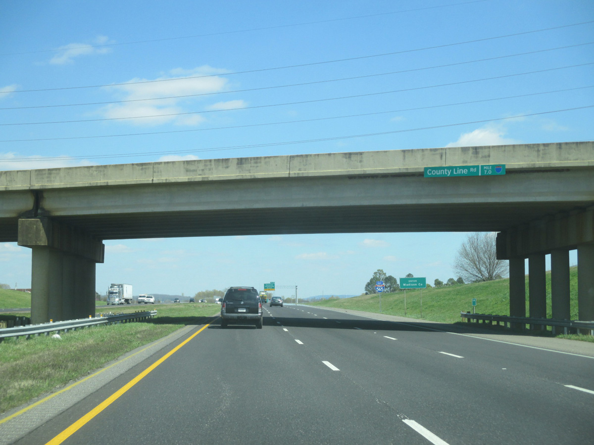
| A wye interchange takes motorists from I-565 & U.S. 72 Alternate east onto Madison Boulevard ahead of County Line Road. Madison Boulevard is the former route of SR 20. It comprises a frontage road running along the north side of the freeway. 03/21/16 |
|
| Loop ramps were added at County Line Road and Interstate 565 during construction from December 2013 to April 2015. The freeway east otherwise enters Madison County. 03/21/16 |
|
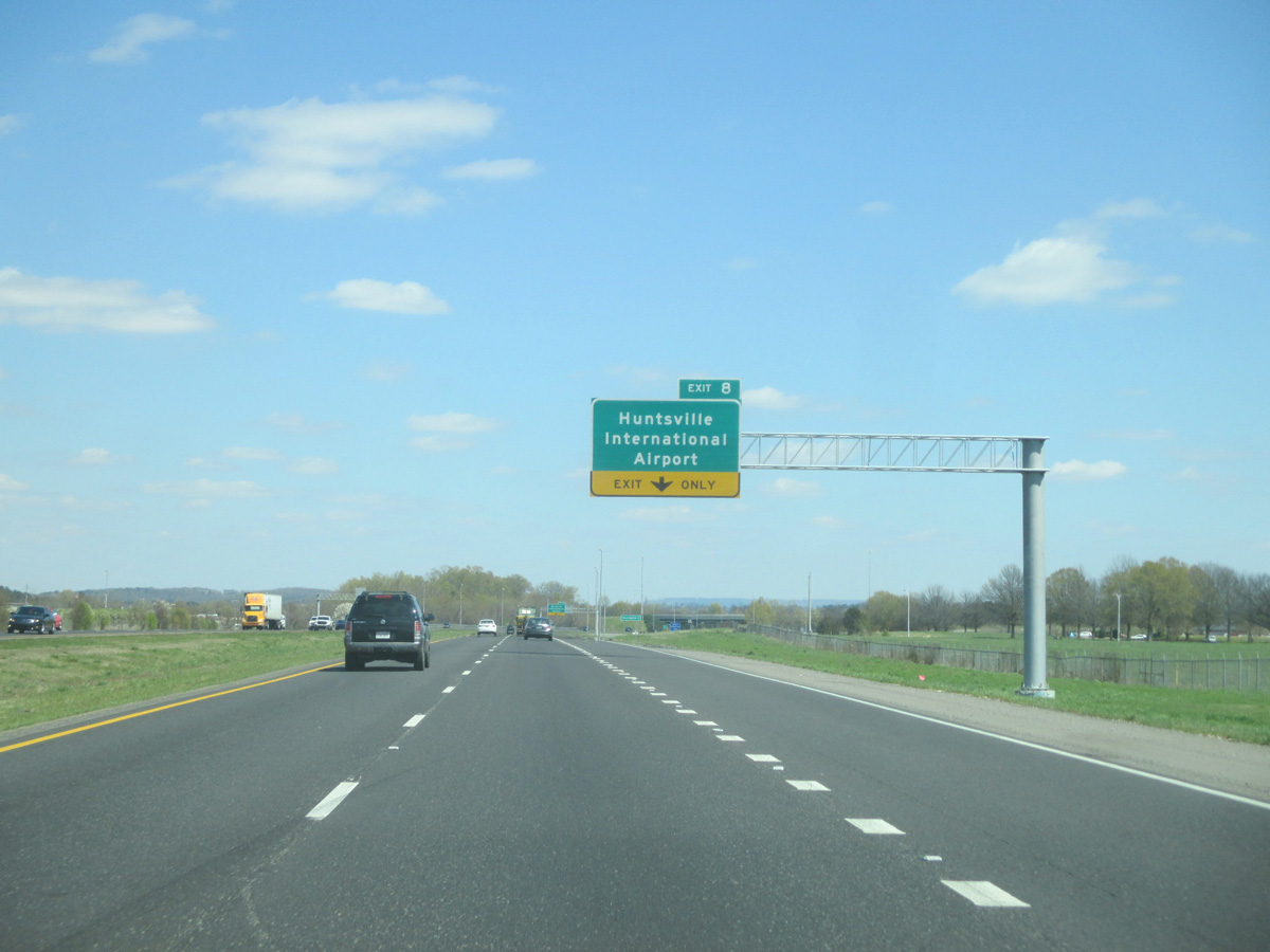
| Auxiliary lanes were added to both directions of I-565 between County Line Road and the trumpet interchange (Exit 8) with Glenn Hearn Boulevard south during road work completed in 2015. 03/21/16 |
|
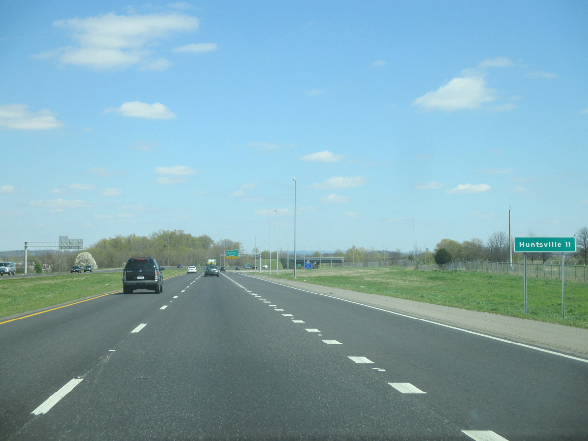
| Downtown Huntsville lies another 11 miles to the east via Interstate 565. 03/21/16 |
|
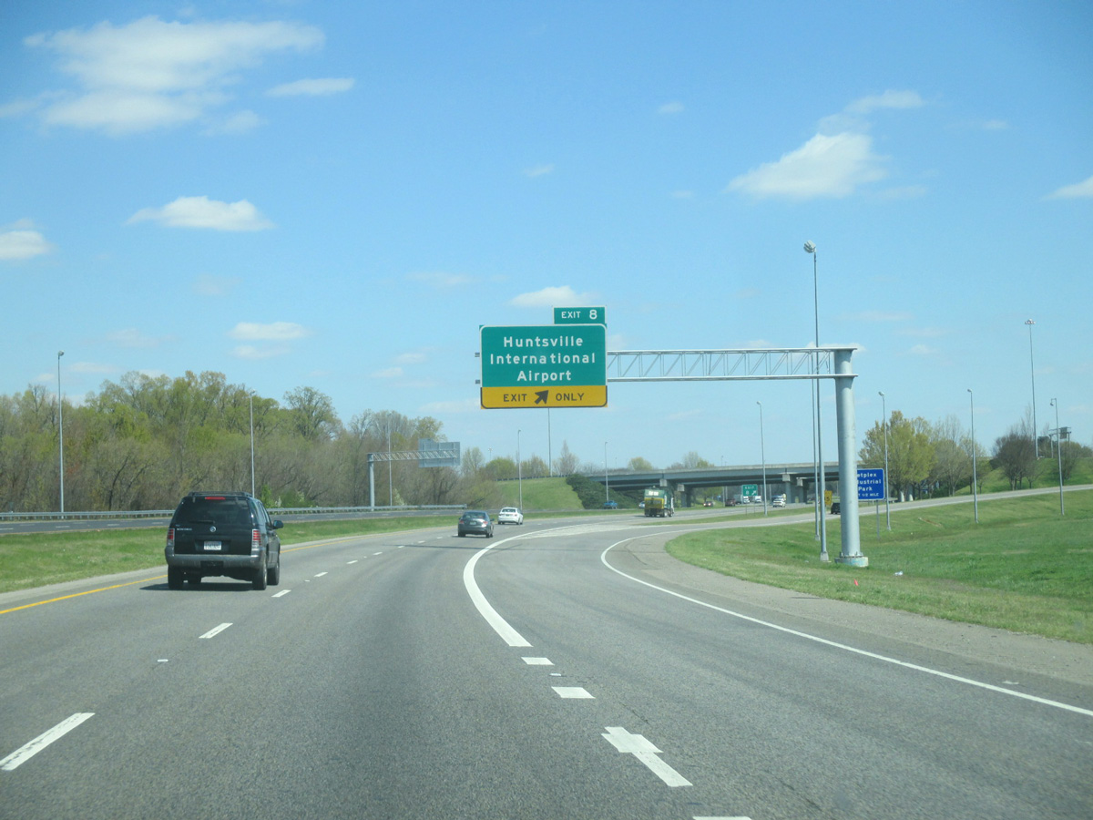
| Glenn Hearn Boulevard spurs south from Interstate 565 & U.S. 72 Alternate to the passenger terminal of Huntsville International Airport (HSV). A folded diamond interchange nearby serves Jetplex Industrial Park. 03/21/16 |
|
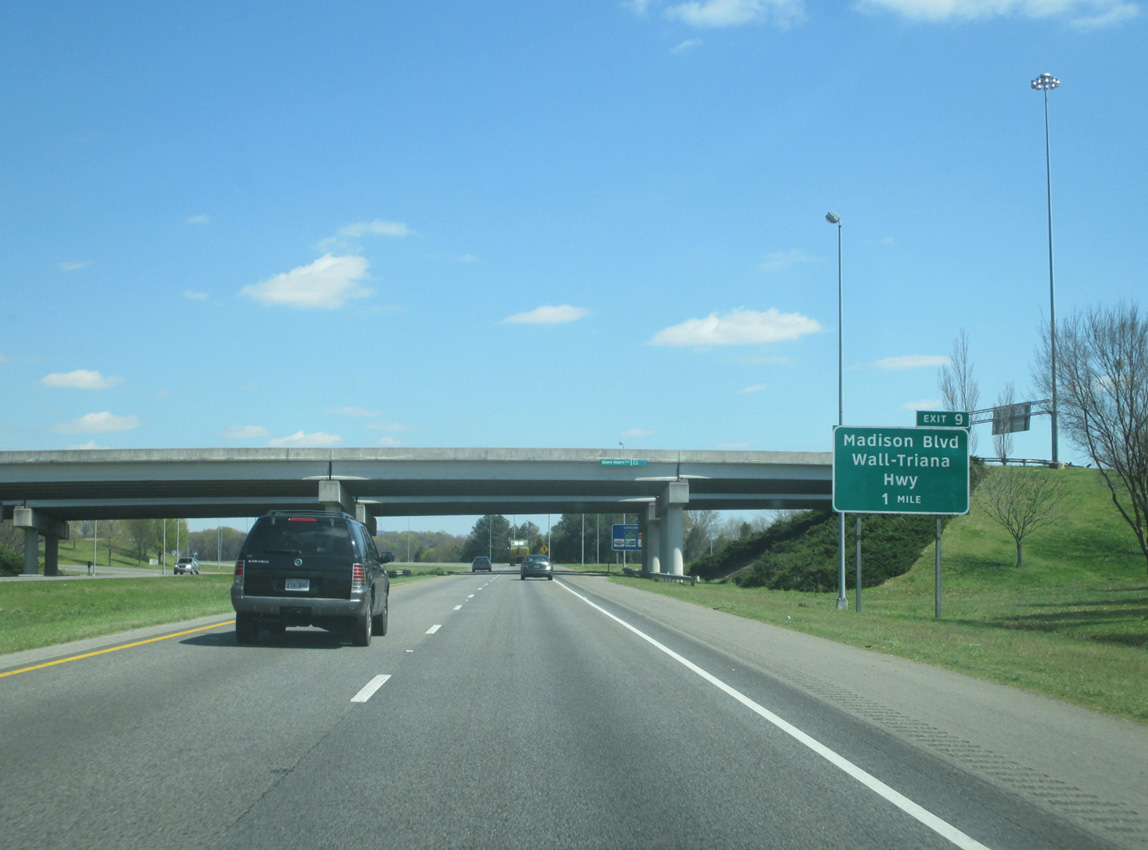
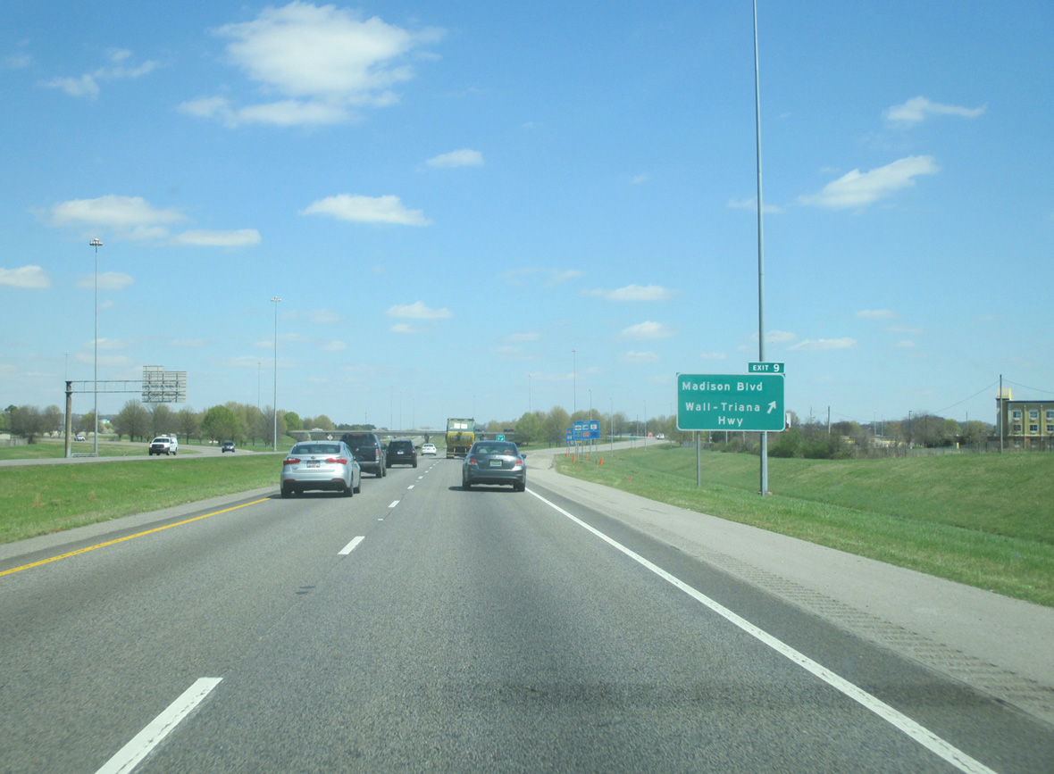
| Leaving the airport area, Interstate 565 & U.S. 72 Alternate next meet Wall-Triana Highway. The north-south road runs links the freeway with the community of Triana along the Tennessee River to the south. 03/21/16 |
|
| Entering the parclo interchange (Exit 9) with Wall-Triana Highway on I-565 & U.S. 72 Alternate east. Wall-Triana Highway extends north from adjacent Madison Boulevard through central Madison to U.S. 72. 03/21/16 |
|
| These confirming shields for I-565 & U.S. 72 Alternate stand east of the Intergraph Way underpass. The open land south of the freeway will be developed as part of the Town Madison commercial project. Associated work adds a directional T interchange here from 2016 to June 2017. 03/21/16 |
|
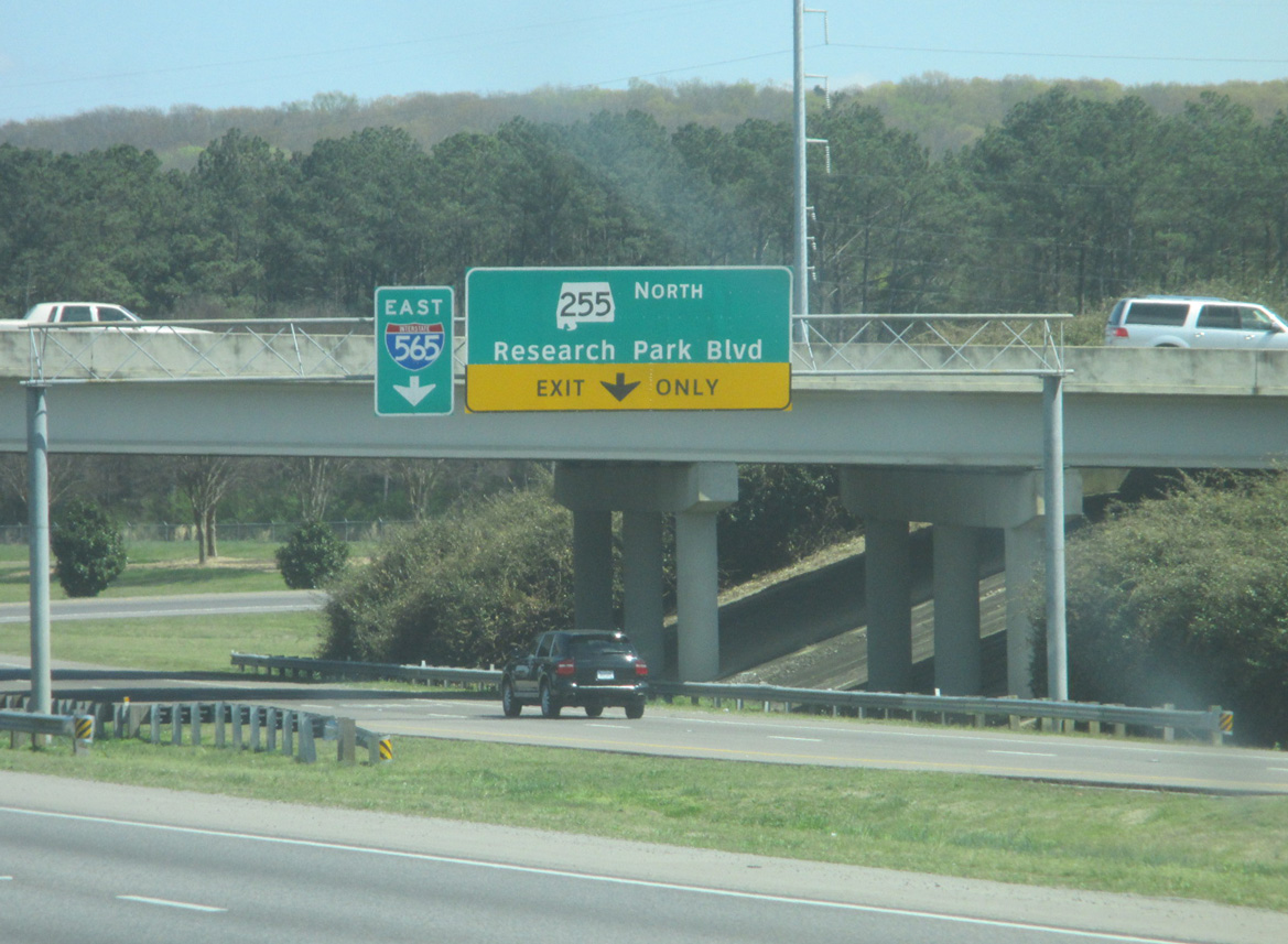
| Two lanes depart from an eight lane stretch of Interstate 565 & U.S. 72 Alternate for both Research Park Boulevard (SR 255) north and Rideout Road south to Redstone Arsenal Gate 9. SR 255 forms a freeway leading north from I-565 to SR 53 (Ardmore Highway). 03/21/16 |
|
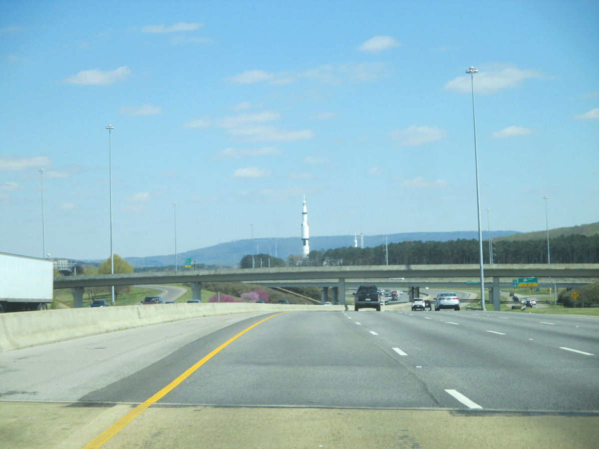
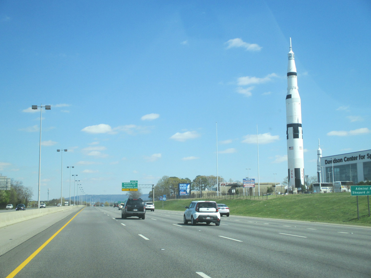
| Two rockets appear along the eastern horizon from the US Space & Rocket Center located on the south side of Interstate 565 between Exits 14 and 15. 03/21/16 |
|
| Presently SR 255 runs 10.5 miles north from the Redstone Arsenal to the four lane highway end east of Pulaski Pike. Bob Wade Lane extends the roadway east to U.S. 431 with two lanes. 03/21/16 |
|
| Passing by the US Space & Rocket Center along Interstate 565 east. Forthcoming Exit 15 serves the attraction. 03/21/16 |
|
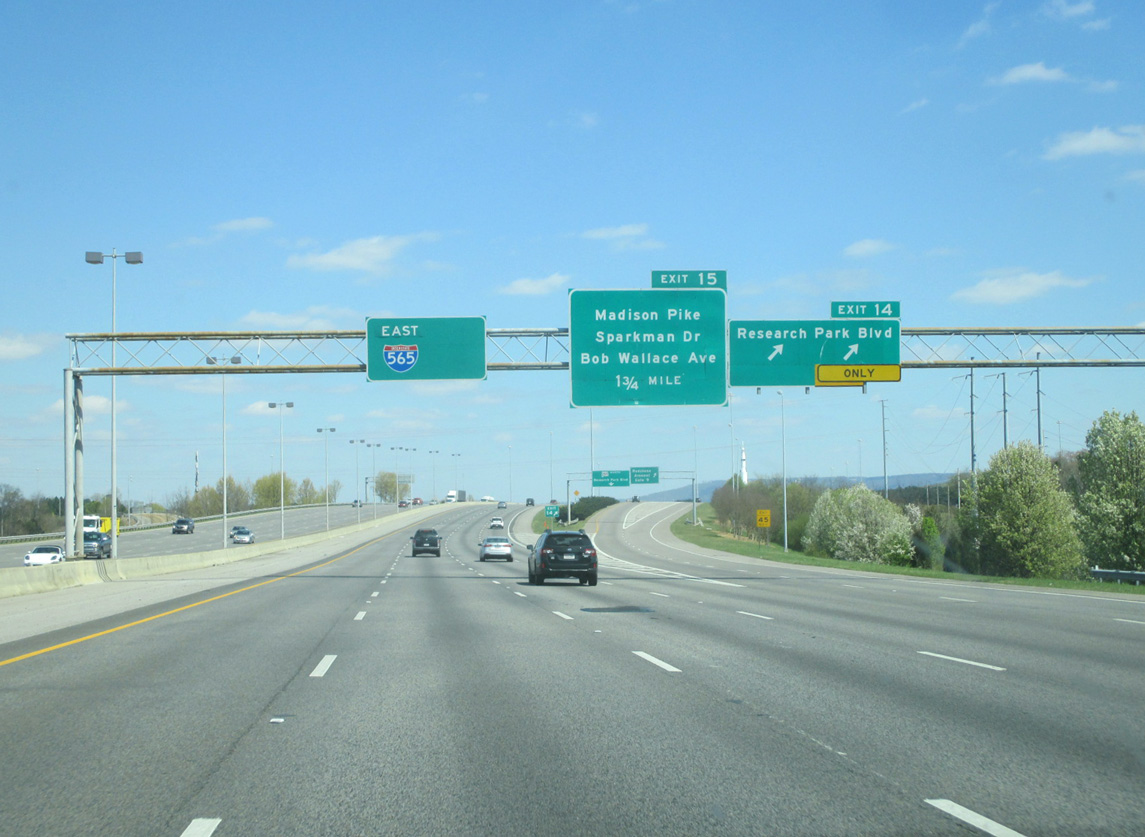
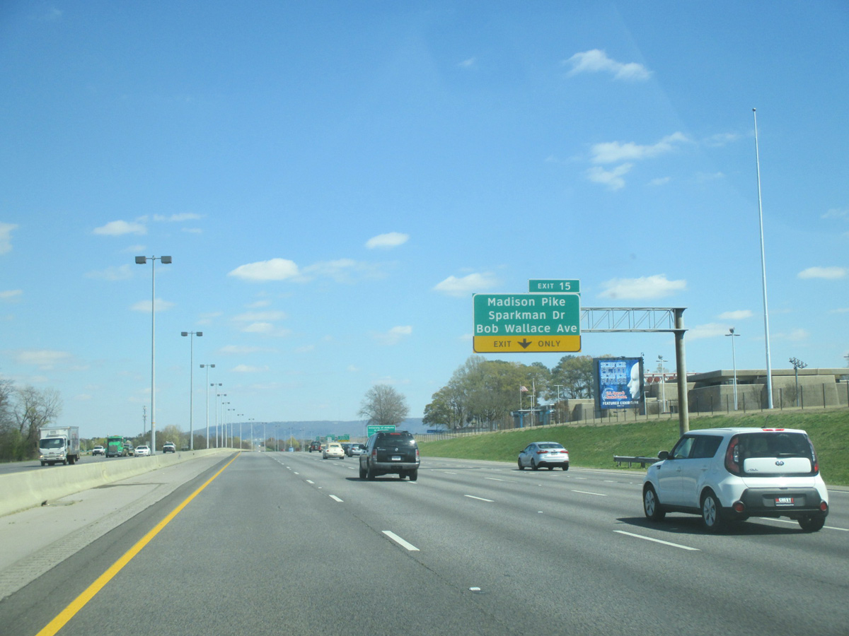
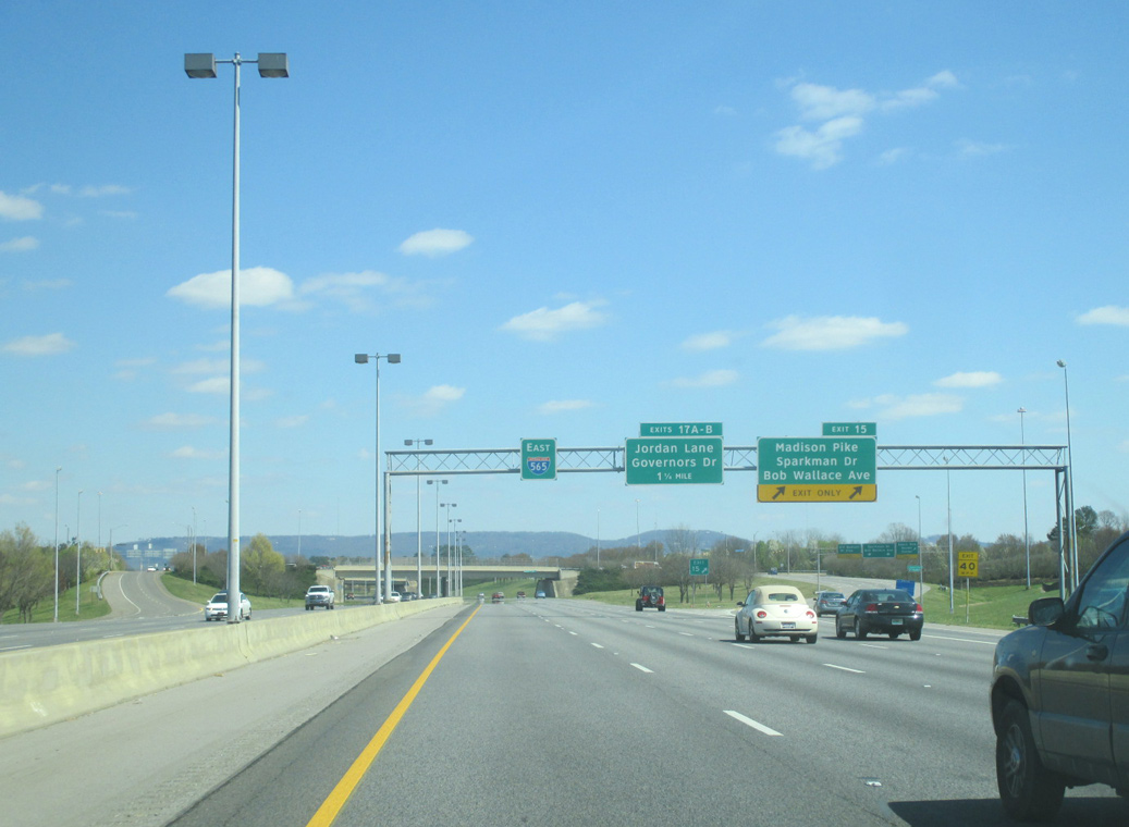
| An auxiliary lane accompanies I-565 & U.S. 72 Alternate east to the split diamond interchange (Exit 15) with Madison Pike west, Sparkman Drive north to the University of Alabama in Huntsville and Bob Wallace Avenue east. 03/21/16 |
|
| Eastbound at the two lane off-ramp (Exit 15) for Sparkman Drive north and Bob Wallace Avenue east. Sparkman Drive constitutes an at-grade belt route encircling Huntsville northeast to U.S. 231 & 431 at their split with U.S. 72. Bob Wallace Avenue extends the loop east to Whitesburg Drive. 03/21/16 |
|
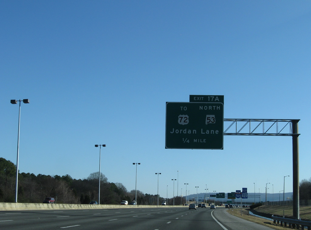
| SR 53, overlapped with U.S. 231 in a hidden fashion from Dothan to Huntsville, intersects Interstate 565 at a diamond interchange (Exit 17A). The state route follows Jordan Lane north from I-565, connecting with U.S. 72 (University Drive) in one mile. 12/28/09 |
|
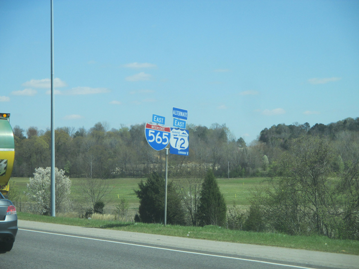
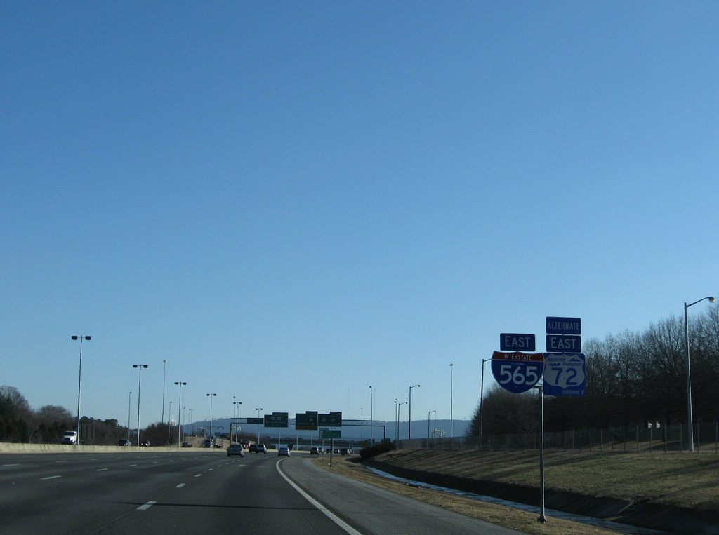
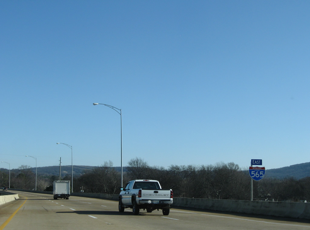
| Interstate 565 & U.S. 72 Alternate reassurance shield posted along the eastbound freeway at Westlawn. U.S. 72 Alternate shields feature a blue color scheme and reference Appalachian Development Corridor V. 12/28/09 |
|
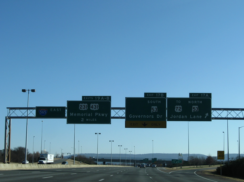
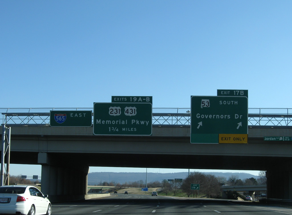
| Exit 17A serves traffic interests to SR 53 (Jordan Lane) north to U.S. 72 and Brandontown and Jordan Lane south to Patton Road and the Redstone Arsenal. Exit 17B provides a direct connection to SR 53 south along Governors Drive east to U.S. 231 & 431 (Memorial Parkway) near West Huntsville. SR 20 used to depart the freeway here for Governors Drive as well. 12/28/09 |
|
| Exit 17B consists of wye interchange situated within Exit 17A. SR 53 turns east from Jordan Lane onto Governors Drive above the freeway. Interstate 565 continues 1.75 miles east to meet U.S. 231 & 431 directly at a cloverstack interchange (Exits 19A/B). 12/28/09 |
|
| Interstate 565 & U.S. 72 Alternate pass under 14th Street NW south of Russell Hill and north of SR 53 (Governors Drive). 12/28/09 |
|
| A second reassurance shield assembly includes U.S. 72 Alternate on the Interstate 565 eastbound freeway near an abandoned railroad under crossing. 12/28/09 |
|
| Now one mile west of the interchange (Exit 19) with U.S. 231 & 431 (Memorial Parkway). U.S. 231 & 431 part ways 1.5 miles to the south at Governors Drive. There SR 53 begins its cross-state overlap with U.S. 231 while U.S. 431 overtakes Governors Drive east to Longwood and Round Top Mountain. 03/21/16 |
|
| A glimpse of the Huntsville skyline comes into view along Interstate 565 & U.S. 72 Alternate before the freeway lowers to pass under Triana Boulevard. Traffic bound for Alabama A & M University is directed onto Memorial Parkway north from Exit 19B. 12/28/09 |
|
| Interstate 565 & U.S. 72 Alternate skirt northern reaches of Downtown along a lengthy viaduct. U.S. 231 & 431 constitute a north-south urban expressway to the west of the central business district. The controlled access portion of Memorial Parkway leads northeast to U.S. 72 at Sparkman Drive and south to Martin Road. 03/21/16 |
|
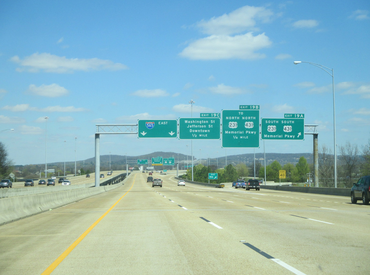
| Eastbound at the off-ramp (Exit 19A) to U.S. 231 & 431 (Memorial Parkway) south. U.S. 231 leaves Huntsville for Arab and Oneonta. U.S. 431 drifts eastward on its southbound drive to Guntersville, Gadsden and Anniston. 03/21/16 |
|
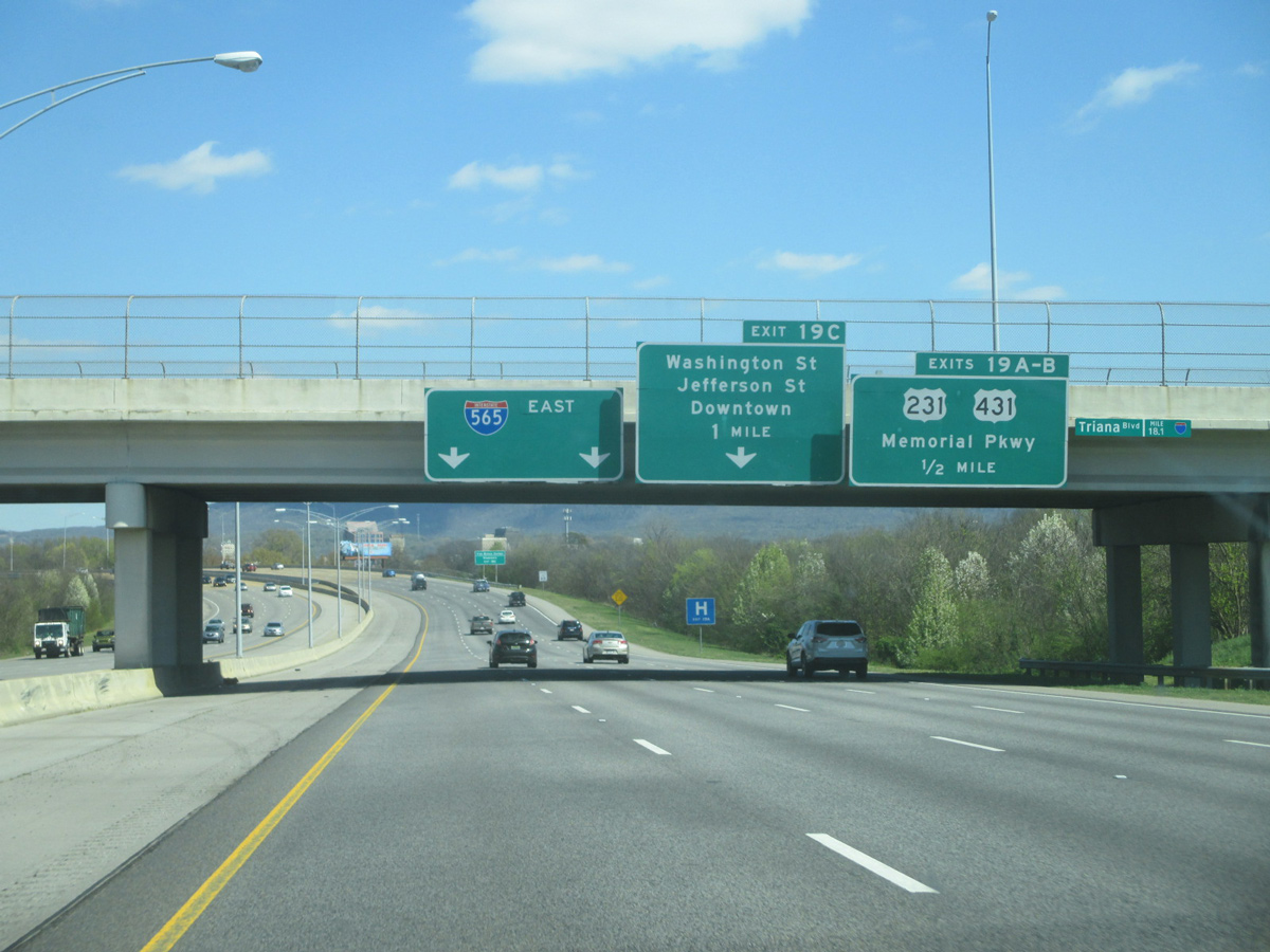
| Exit 19B constitutes a collector distributor roadway for U.S. 231 & 431 (Memorial Parkway) north and return access to Interstate 565 east from Memorial Parkway. Memorial Parkway generally is commercialized throughout Huntsville. Frontage roads and slip ramp provide local access from the elevated main line. U.S. 231 & 431 briefly combine with U.S. 72 between University and Sparkman Drives and otherwise exit Alabama in 17 miles near Fisk. 03/21/16 |
|
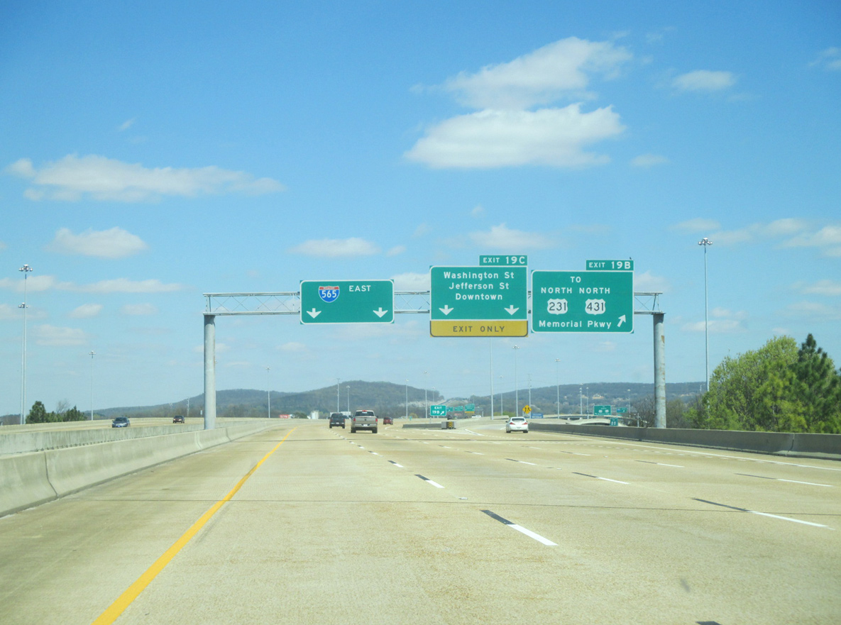
| A single point urban interchange (SPUI) joins Interstate 565 & U.S. 72 Alternate with the north end of the one way street couplet of Jefferson & Washington Streets. Jefferson Street leads into Downtown and serves interests to the Von Braun Center via Monroe Street. Washington Street carries two-way traffic north to U.S. 72. 03/21/16 |
|
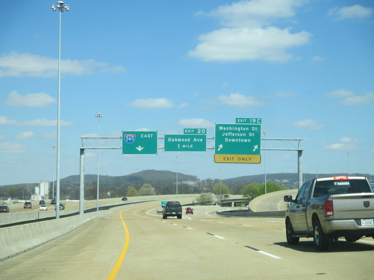
| Interstate 565 eastbound reduces to two through lanes beyond Exit 19C. A pair of wye interchanges connect the elevated freeway with Oakwood Avenue in one half mile.
The pull-through panel was altered after the interchange with U.S. 72 at Chapman Mountain opened on May 17, 2004. The new exit extended the freeway eastward to Certain Gap. 09/26/03, 12/28/09 |
|
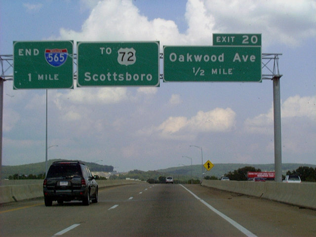
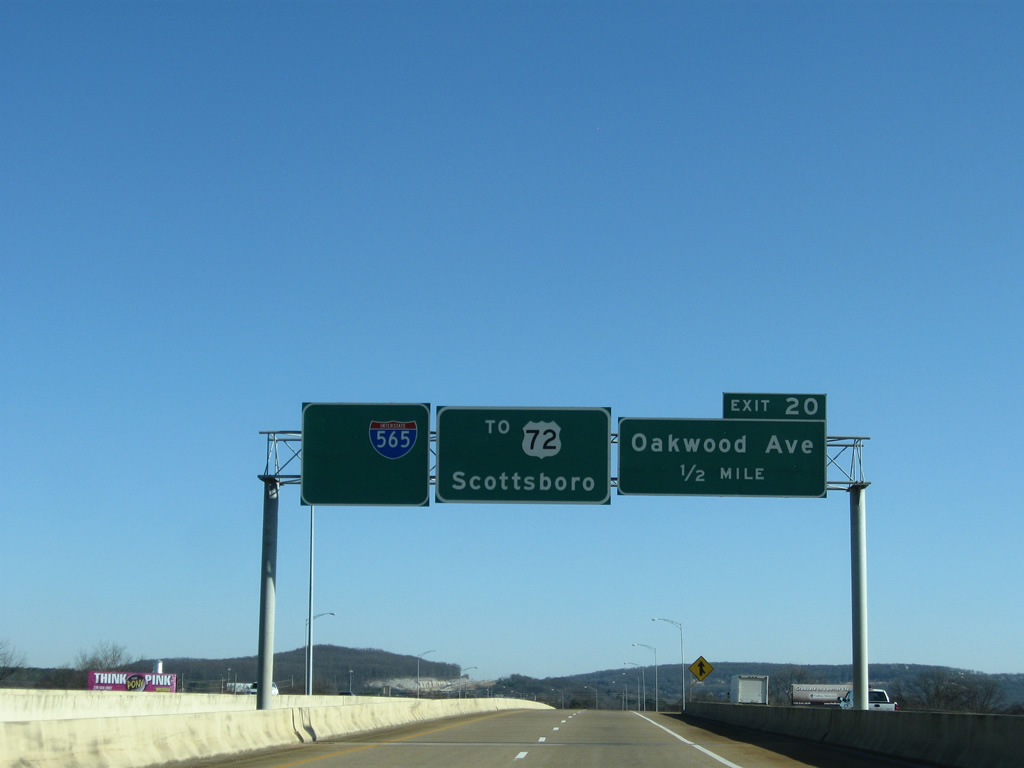
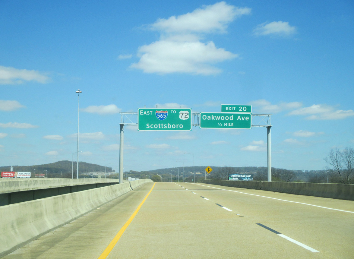
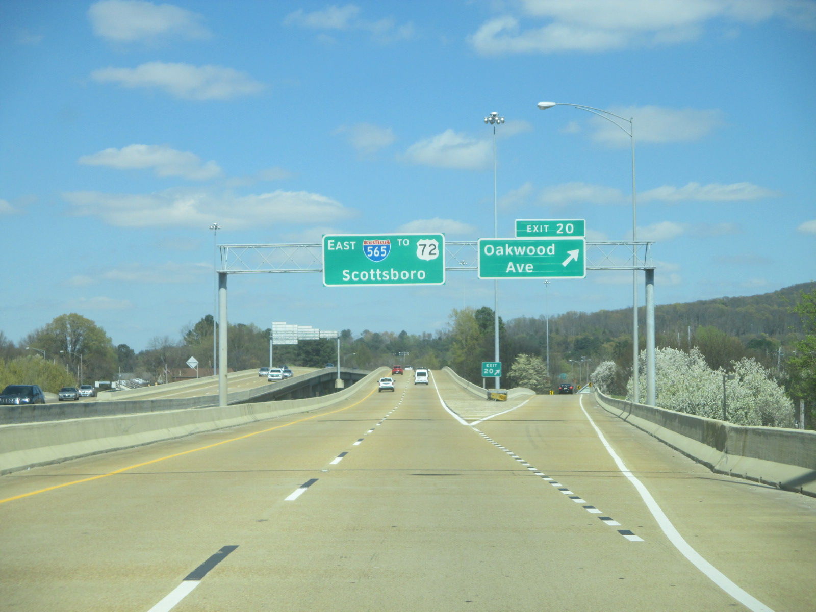
| Clearview font based signs were installed for Exit 20 by 2013. 03/21/16 |
|
| The c/d roadway that began at Memorial Drive returns with traffic from Washington Street above Meridian Street (former U.S. 231 Business and historic U.S. 241). 12/28/09 |
|
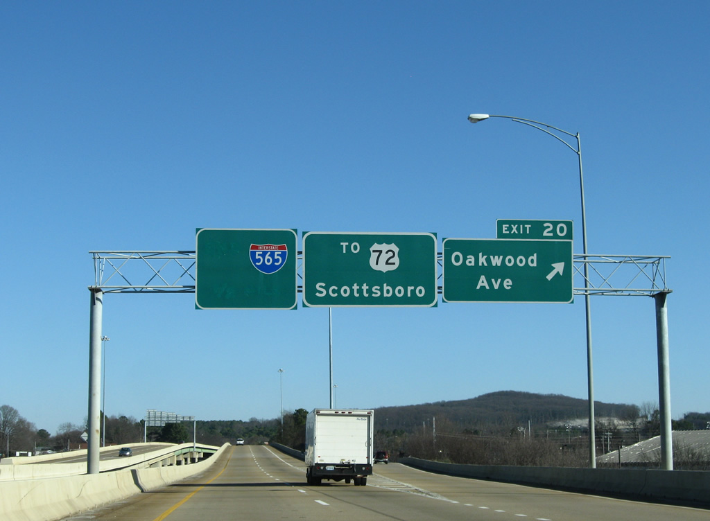
| Exit 20 lowers from Interstate 565 & U.S. 72 Alternate to Oakwood Avenue. Oakwood Avenue leads east to Chapman Heights, Darwin Downs and Oak Park and west to Lincoln and Oakwood. 12/28/09 |
|
| A second pull through panel at Exit 20 indicates the I-565 connection with U.S. 72 east for Scottsboro. 03/21/16 |
|
| The Andrew Jackson Way / Oakwood Avenue on-ramp joins Interstate 565 after the viaduct ends on the one mile approach to Exit 21 with U.S. 72 west. 12/28/09 |
|
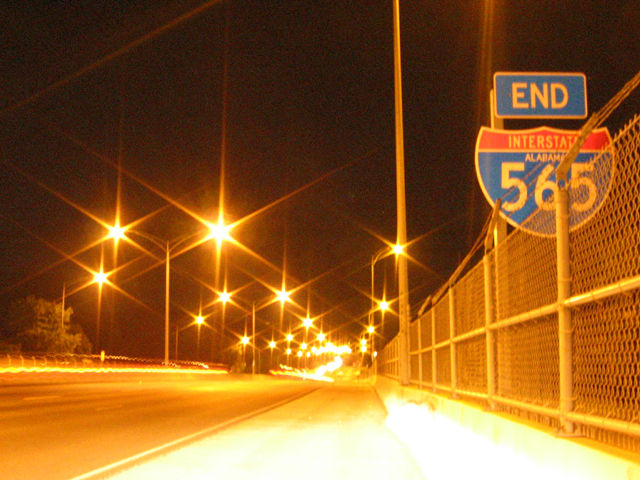
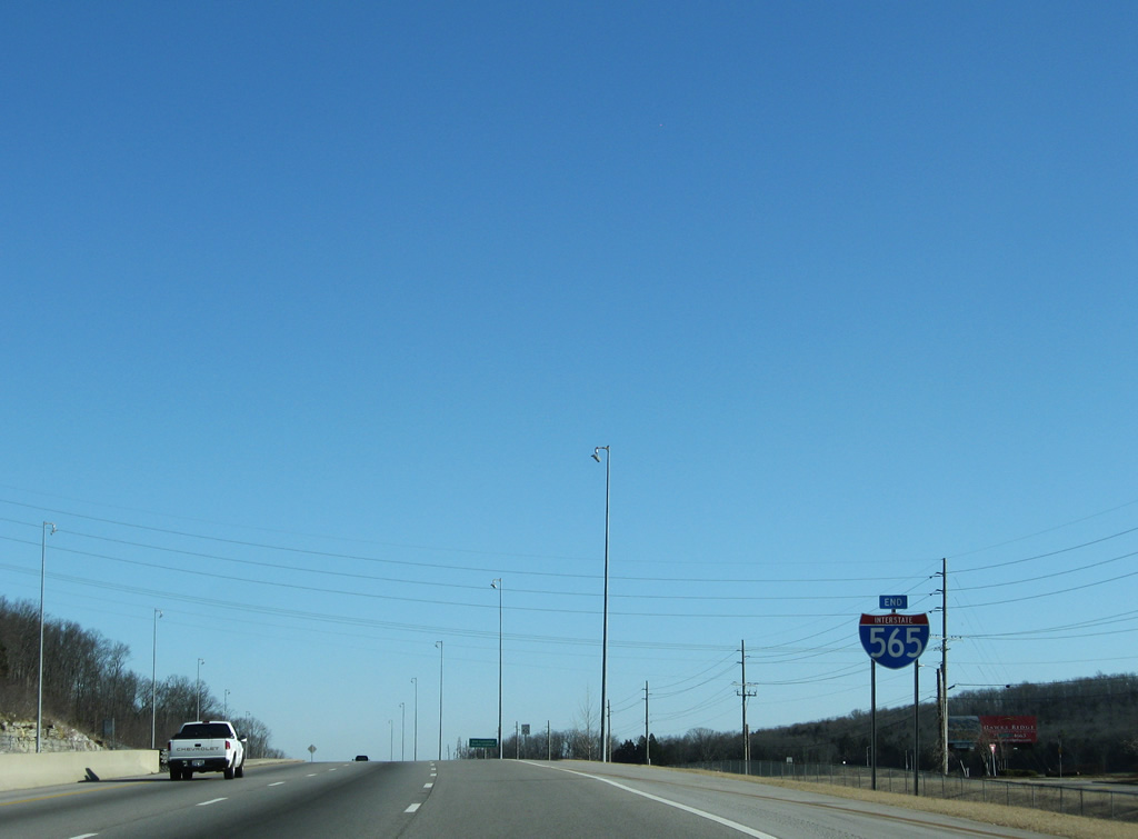
| An Interstate 565 end shield was originally posted along the freeway near the Chapman Avenue underpass ahead of the original at-grade intersection with U.S. 72. 08/24/03 |
|
| Interstate 565 directly replaced Andrew Jackson Way (historic U.S. 72) from Oakwood Avenue northeast to Chapman Mountain. Portions of the old road remain in use as frontage roads. U.S. 72 shifted to its current alignment, between Memorial Parkway and Exit 21, by 1959. 12/28/09 |
|
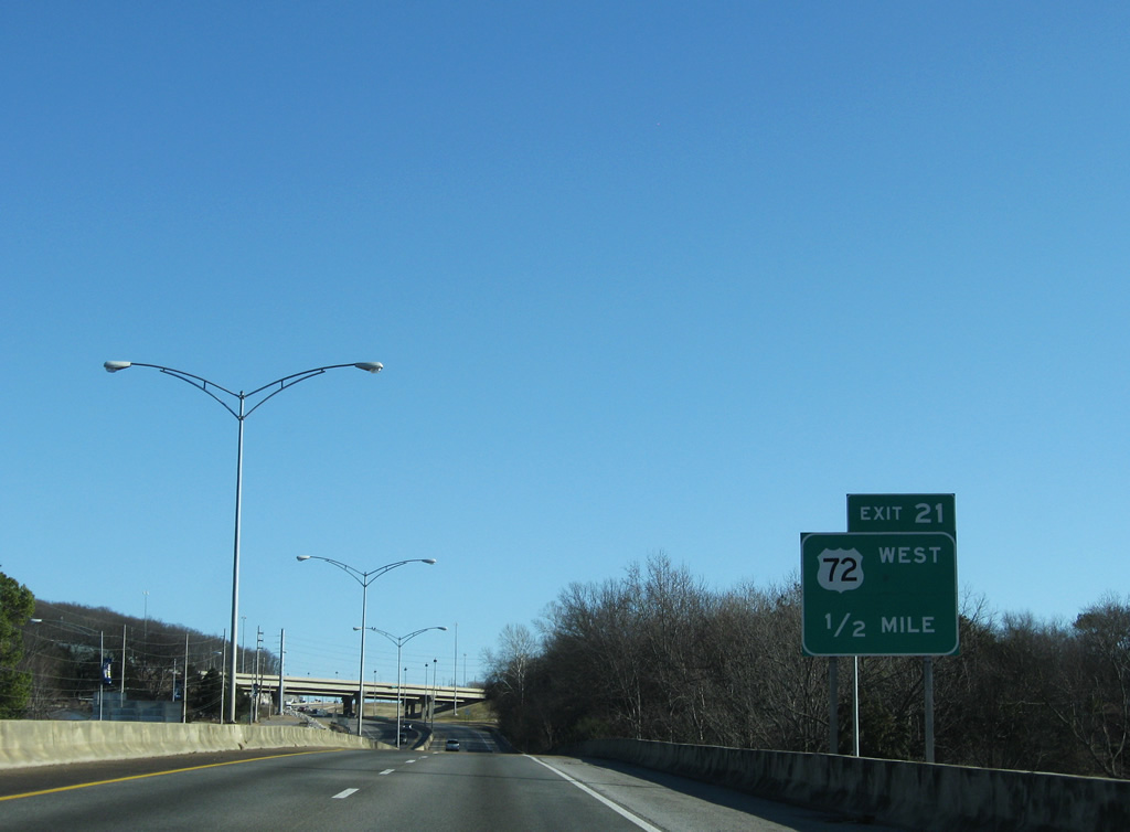
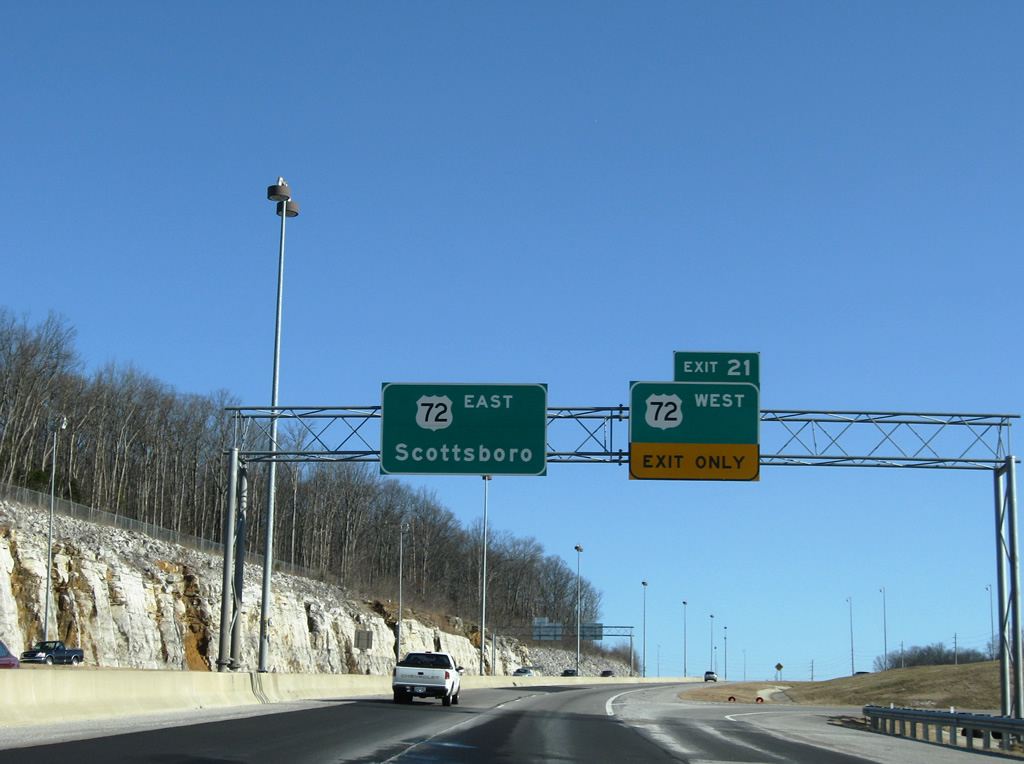
| U.S. 72 overtakes Interstate 565 at a folded diamond interchange (Exit 21). The US route continues up Chapman Mountain to Chase and beyond to Ryland, and Scottsboro. 12/28/09 |
|
| Signage for the Interstate 565 and Controlled Access Highway End follow the U.S. 72 merge with the freeway. 12/28/09 |
Page Updated 03-22-2016.