|
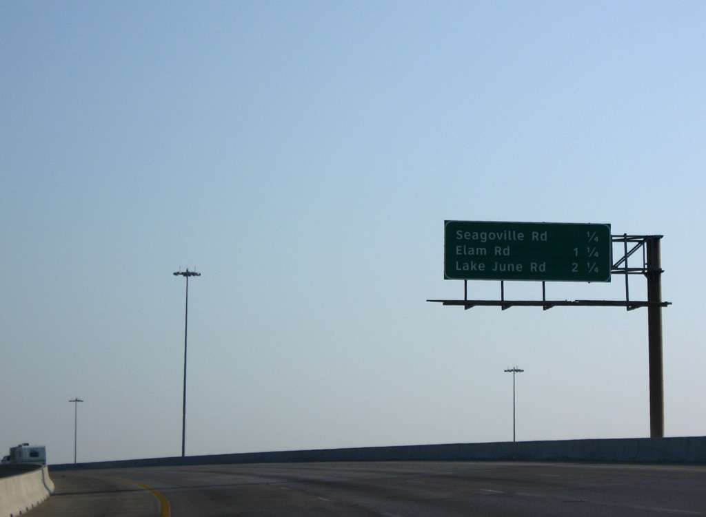
| Passing over the IH 20 mainline, IH 635 north progresses one quarter mile to the Seagoville Road off-ramp (Exit 1A), the first of three exits for the city of Balch Springs. 09/07/09 |
|
| Exit 1A departs ahead of the on-ramp from IH 20 west to IH 635 north. Seagoville Road travels west to Masters Drive in Dallas and east to Pioneer Road. 09/07/09 |
|
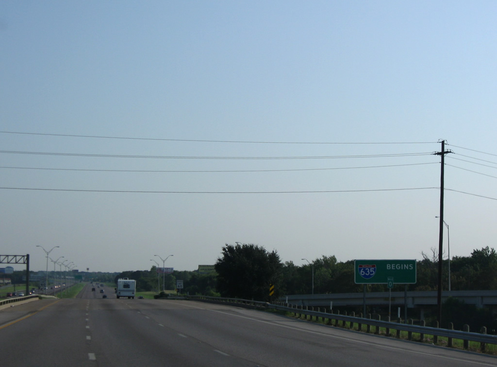
| Milepost zero coincides with an Interstate 635 begins sign as the LBJ Freeway passes over Seagoville Road. 09/07/09 |
|
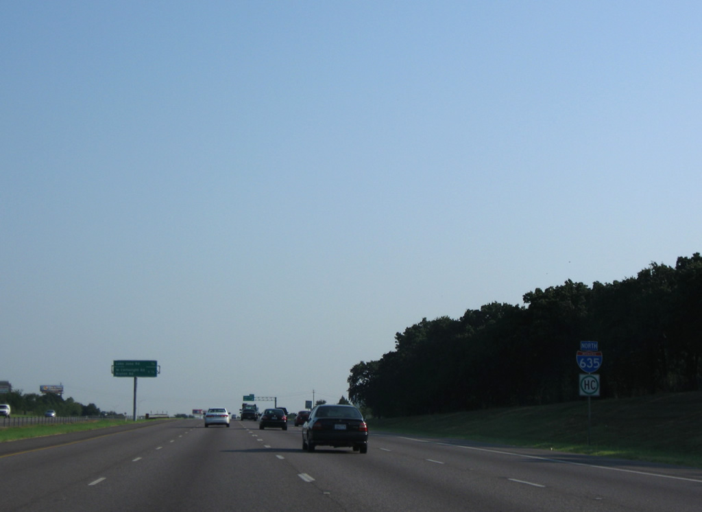
| Exit 1B follows in one quarter mile for Elam Road; IH 635 enters the city of Mesquite in two miles ahead of the diamond interchange (Exit 3) with West Cartwright Road east and Bruton Road west. 09/07/09 |
|
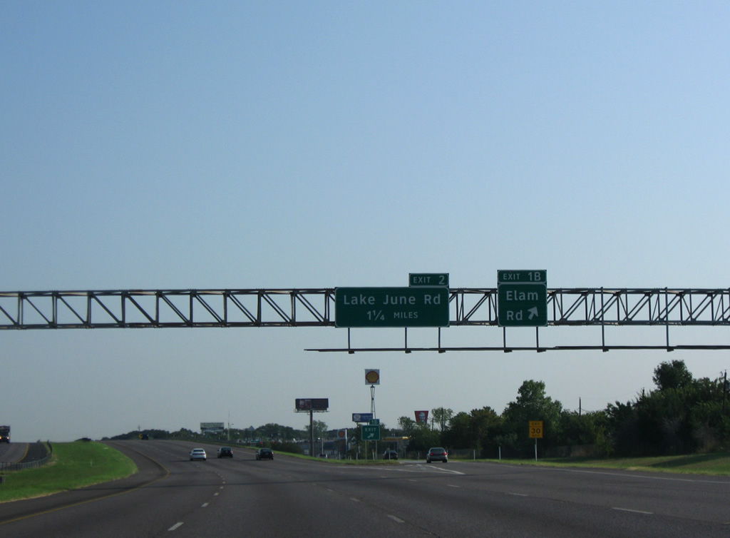
| Entering the diamond interchange (Exit 1B) with Elam Road on IH 635 north. Elam Road stems west from Pioneer Road in Balch Springs to the Pleasant Grove community in southeast Dallas. 09/07/09 |
|
| Northbound reassurance marker for IH 635 posted after the Quail Drive overpass. 09/07/09 |
|
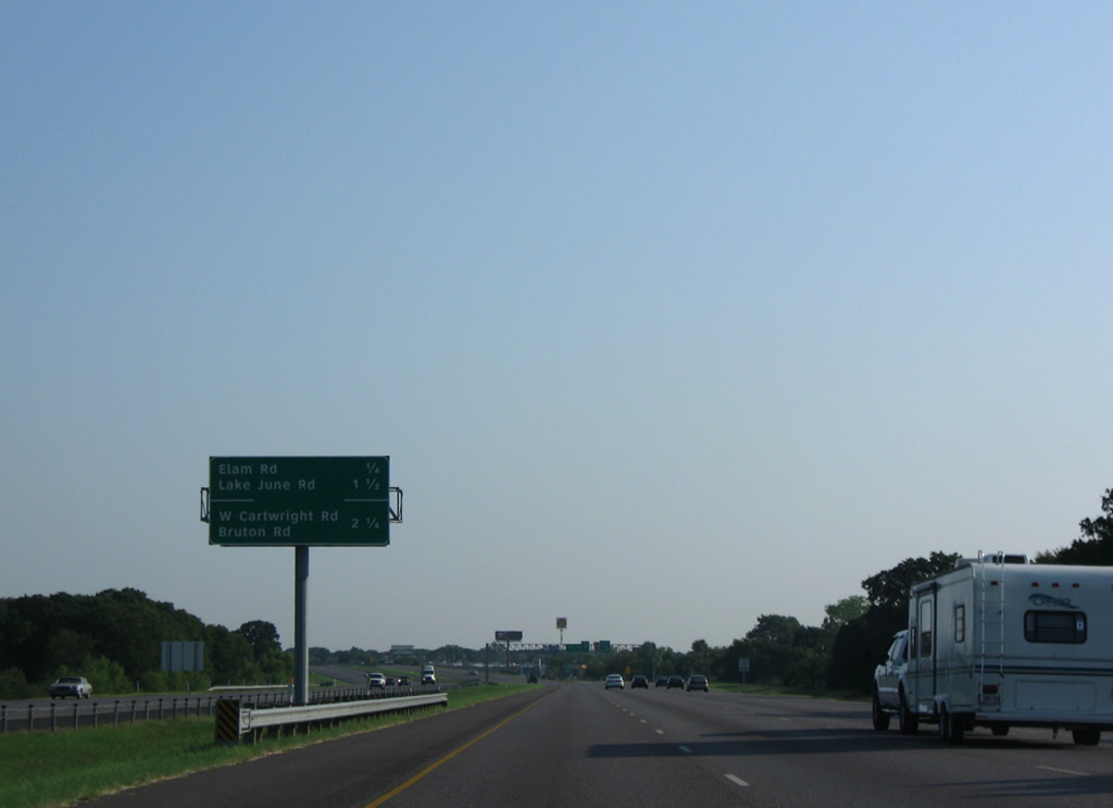
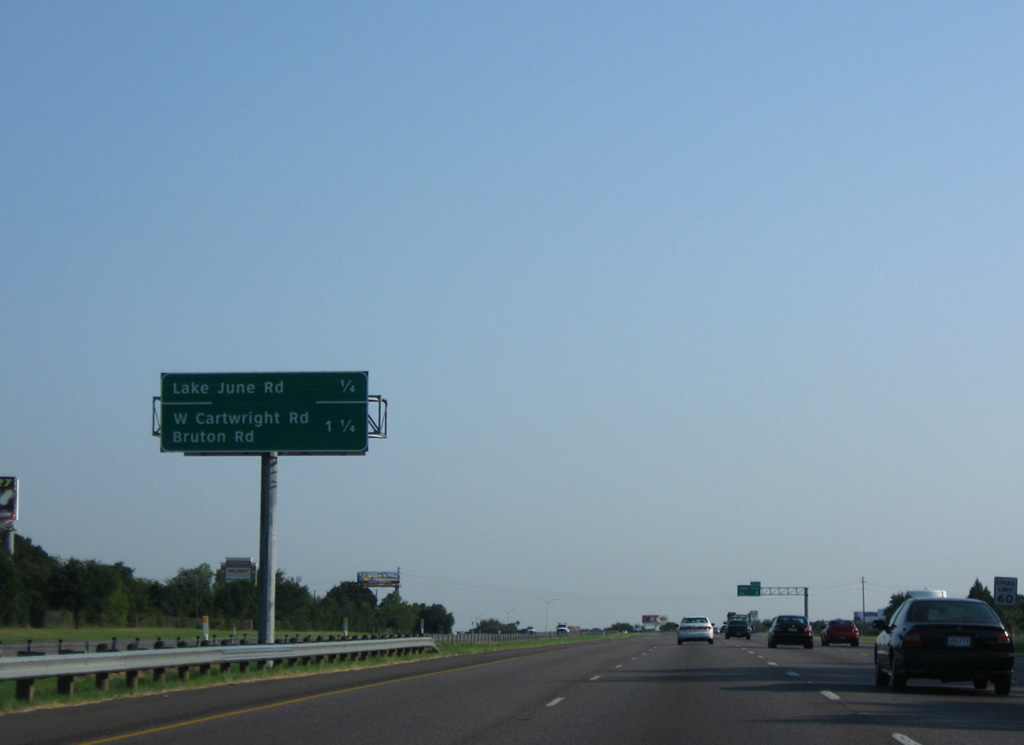
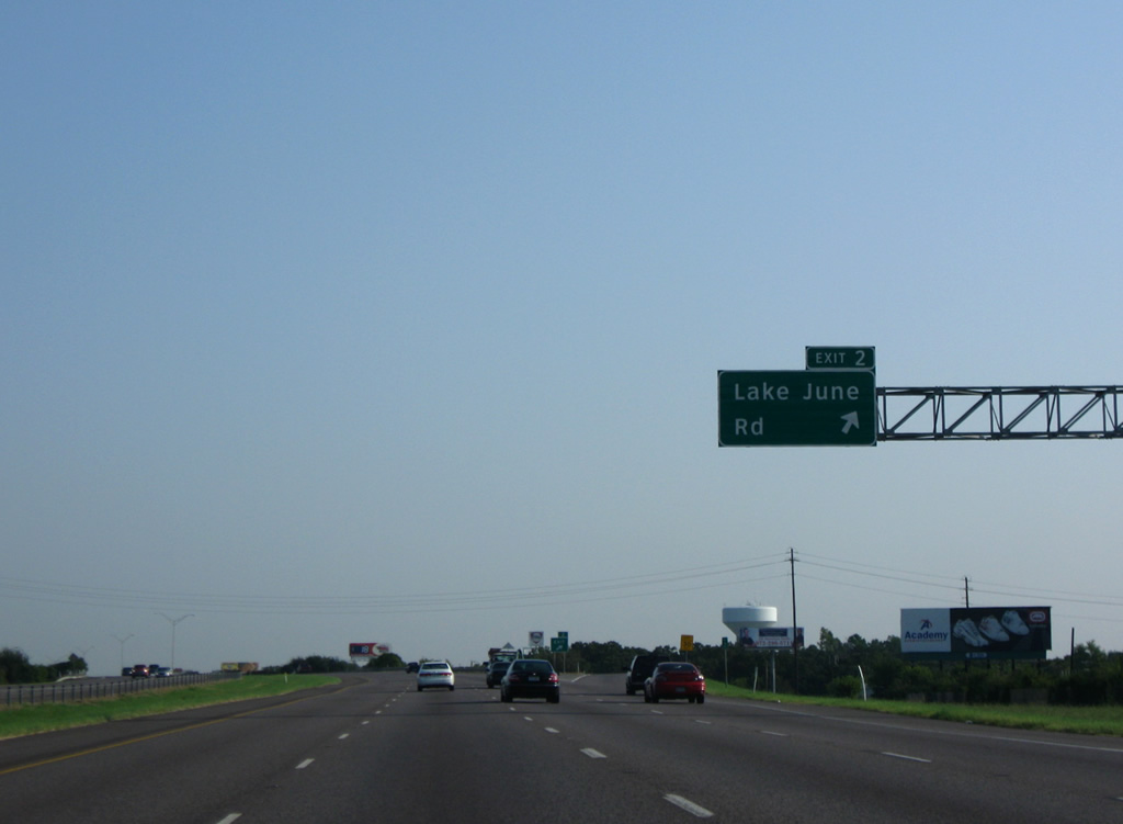
| Lake June Road heads east from the Piedmont Addition area of southeast Dallas to Pleasant Grove and IH 635 at forthcoming Exit 2. 09/07/09 |
|
| Lake June Road turns northeast from Exit 2 to becomes Belt Line Road South through the city of Mesquite. 09/07/09 |
|
| The LBJ Freeway crosses the Mesquite city line on the quarter mile approach to Exit 3 with West Cartwright and Bruton Roads. 09/07/09 |
|
| West Cartwright Road winds east from the diamond interchange (Exit 3) with IH 635 to Lawson Road in southeast Mesquite. Bruton Road extends the arterial west along the Balch Springs city line to Riverway Estates in Dallas. 09/07/09 |
|
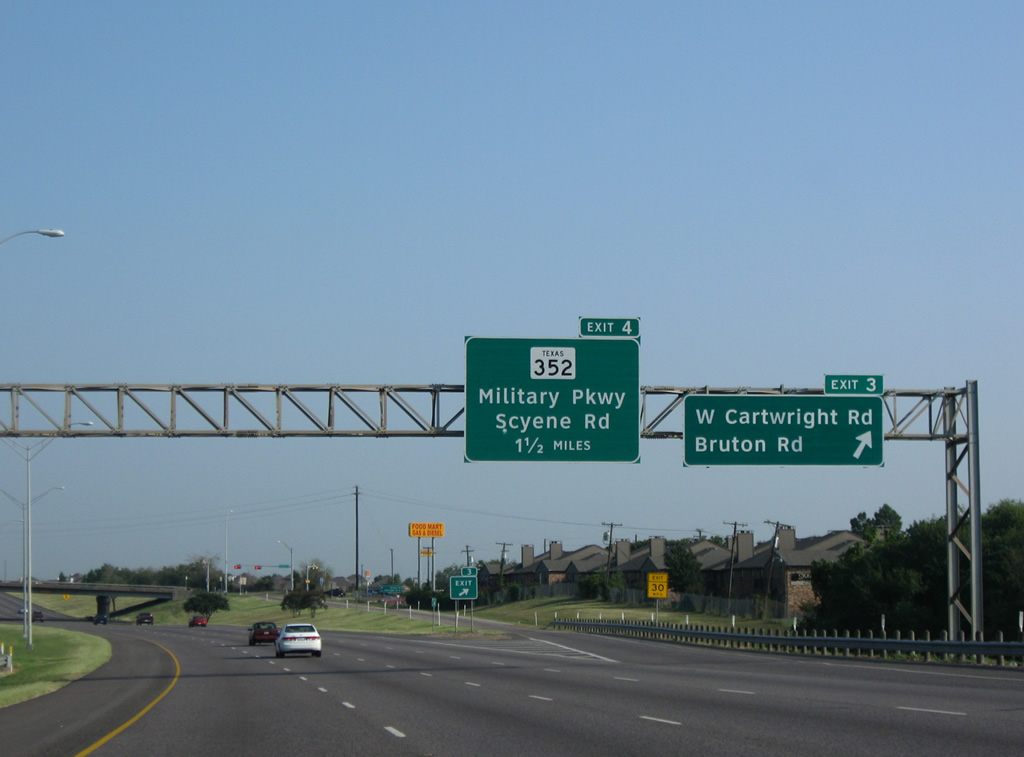
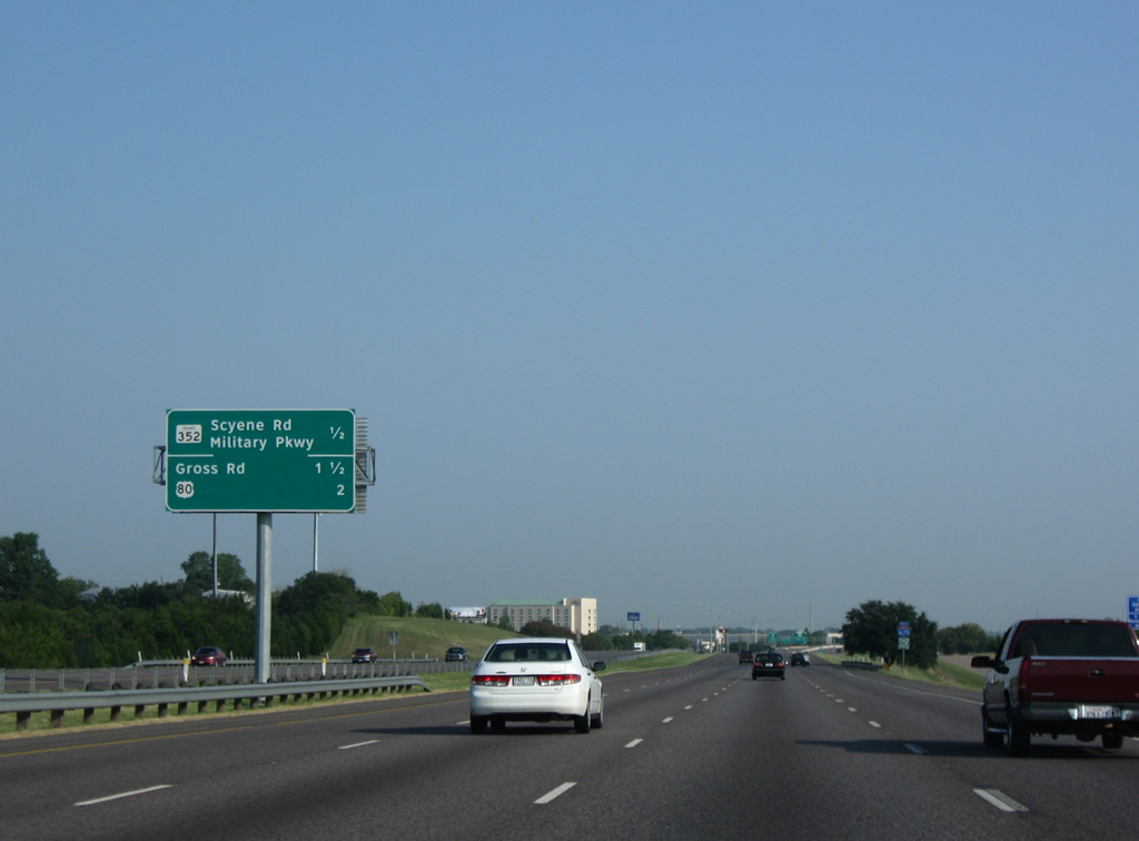
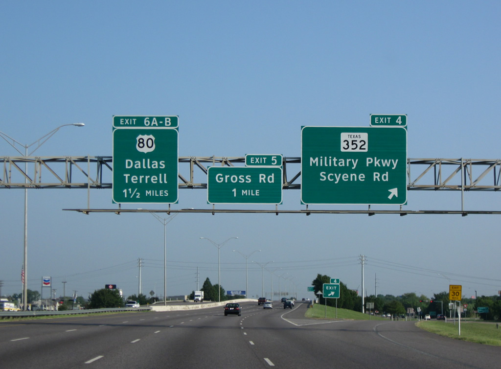
| Interchange identification sign posted a half mile south of the split diamond interchange (Exit 4) with Texas 352 (Military Parkway / Scyene Road). SH 352 represents the old route of U.S. 80 through Mesquite and east Dallas. U.S. 80 travels a freeway to the north, meeting IH 635 in two miles at Exit 6. 09/07/09 |
|
| A rural swath opens to the east of this shield assembly at the LBJ parallels South Mesquite Creek. 09/07/09 |
|
| Northbound IH 635 at Exit 4 to SH 352. The state highway partitions into a couplet of Military Parkway / Davis Street east and Main Street / Scyene Road west through the heart of Mesquite. Scyene Road carries both directions of SH 352 west to the Riverway Estates and Urban Park communities of east Dallas. 09/07/09 |
|
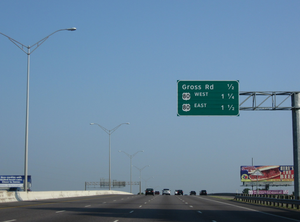
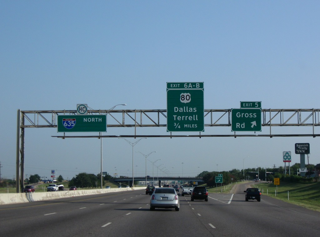
| Crossing over a Union Pacific Railroad line, Interstate 635 next meets Gross Road at a diamond interchange (Exit 5). 09/07/09 |
|
| Gross Road angles northwest from Kearney Street to becomes Gus Thomasson Road at the U.S. 80 freeway. U.S. 80 and IH 635 come together in 0.75 miles. 09/07/09 |
|
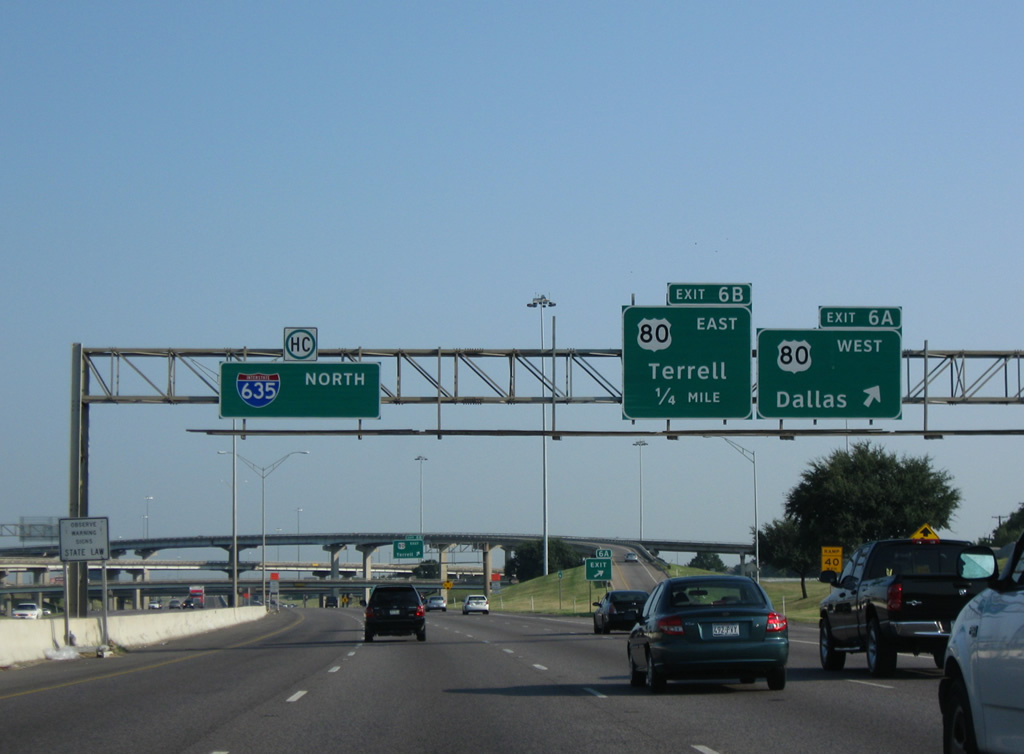
| Exit 6A shuttles motorists onto U.S. 80 west for its final miles to IH 30 at Claremont in Dallas. The US highway originally continued west to Fort Worth, Weatherford and San Diego, California. 09/07/09 |
|
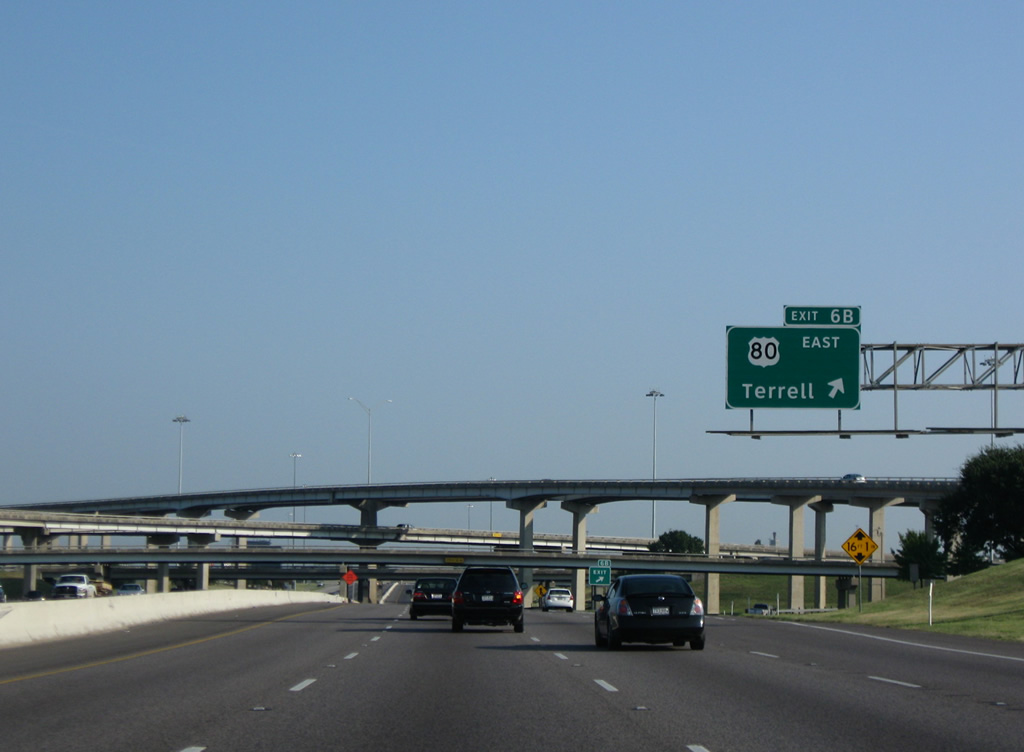
| The U.S. 80 freeway extends east from Mesquite to Forney and Spur 557 outside Terrell. The route was the original alignment of IH 20. 09/07/09 |
|
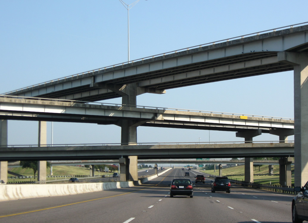
| The symmetrical stack interchange with U.S. 80 was built in 1970. 09/07/09 |
|
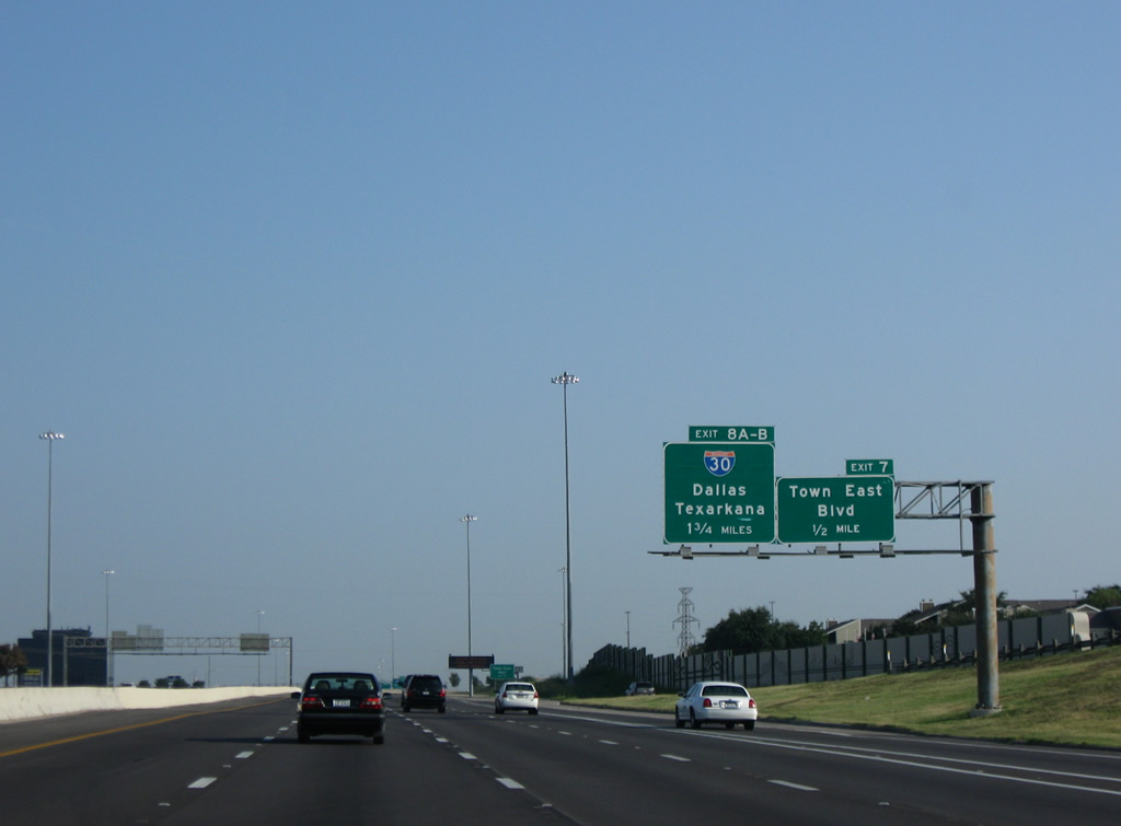
| Continuing north, the LBJ Freeway next reaches the Town East Mall area and Exit 7. The commercial hub precedes the junction with IH 30 (Exits 8A/B). 09/07/09 |
|
| Exit 7 leaves IH 635 north at the Towne Center Driver overpass for a frontage road by Town East Mall. Town East Boulevard forms the main economic arterial for Mesquite east toward Sunnyvale and west to residential areas beyond Gus Thomasson Road. 09/07/09 |
|
| Interstate 635 travels with ten overall lanes by Town East Mall. The retail center opened in 1970. 09/07/09 |
|
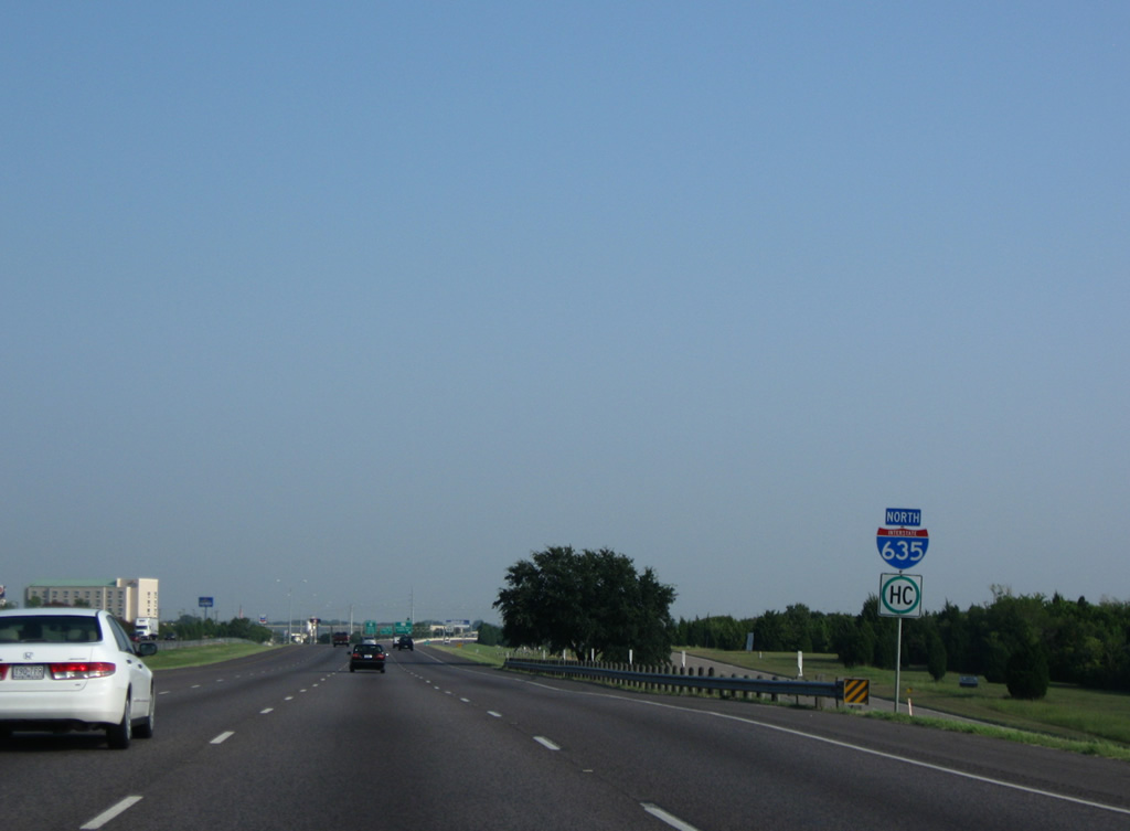
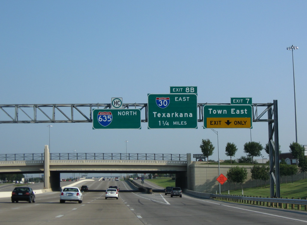
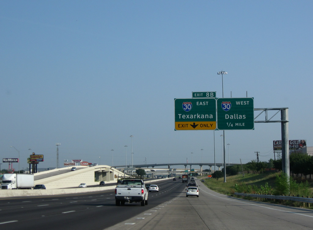
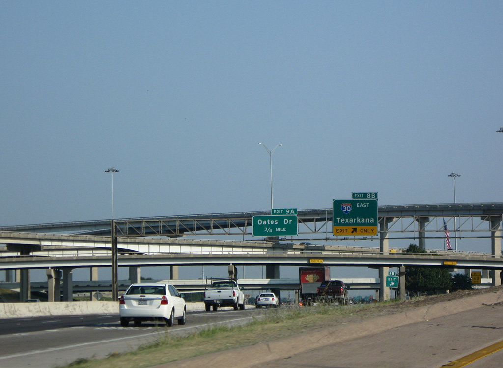
| Back to back on-ramps join IH 635 ahead of the symmetrical stack interchange (Exit 8) with IH 30. IH 30 joins the Dallas area with Texarkana and Little Rock, Arkansas as part of a 367 mile route. 09/07/09 |
|
| Interstate 30 west doubles as U.S. 67 from Mesquite along the R.L. Thornton Freeway to Urban Park, Fair Park and Downtown, Dallas. 09/07/09 |
|
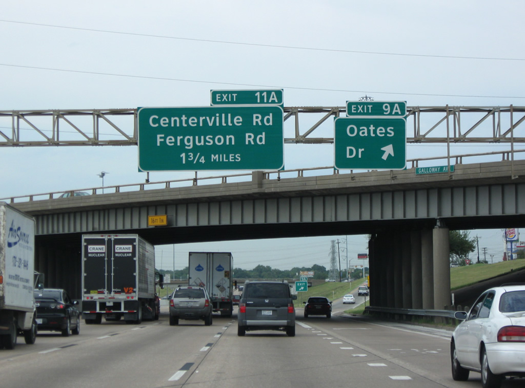
| The final Mesquite exit joins Interstate 635 (Lyndon B. Johnson Freeway) with Oates Drive at Exit 9A. Oates Drive angles southwest to Eastfield College and northeast to Audubon and Gatewood Parks. 09/04/09 |
Page Updated 09-17-2015.

 North
North