|
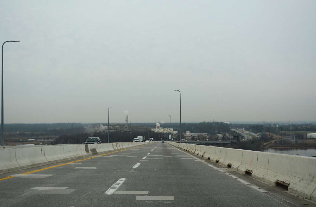
| Started on January 22, 2007, construction upgraded the exchange joining I-695 with I-95 into a systems interchange as part of the I-95 Express Toll Lanes project from I-895 northward to the Harford County line. Four HOT lanes were added to the middle of the John F. Kennedy Memorial Highway along this stretch. 06/30/10 |
|
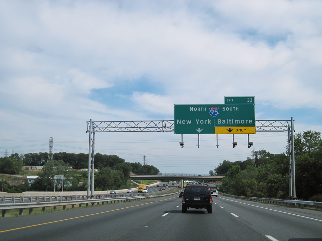
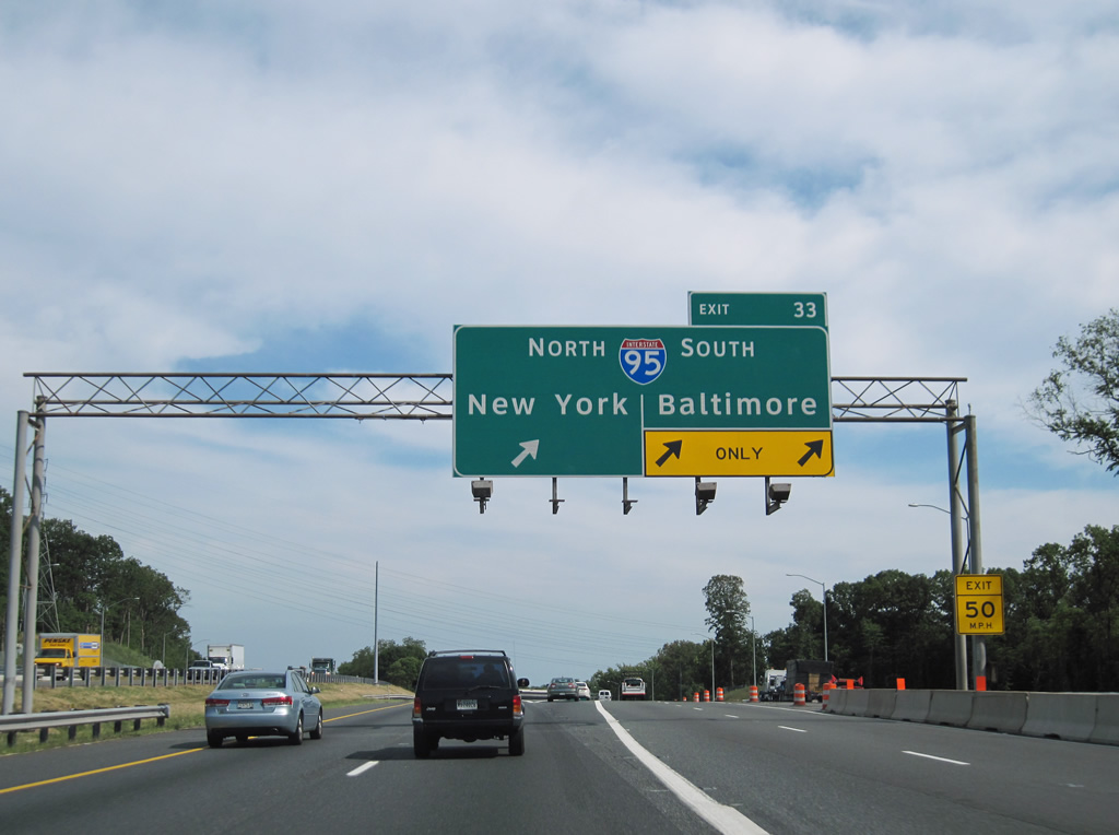
| With three lanes, a single off-ramp connects I-695 east with both directions of I-95. Previously separate ramps, including a left exit, joined the two freeways. 06/30/10 |
|
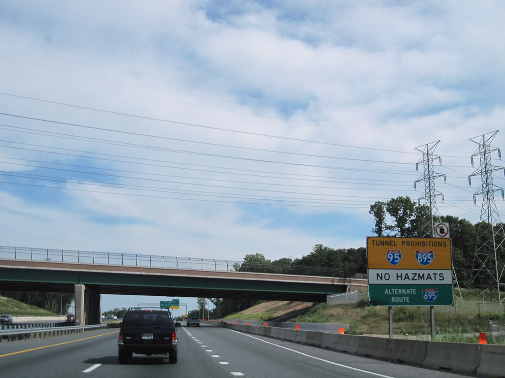
| I-95 and I-895 south both cross the Patapsco River/Inner Baltimore Harbor through tunnels that prohibit vehicles carrying hazardous materials. Hazmat vehicles are routed south along I-695 to the Francis Scott Key Bridge. 06/30/10 |
|
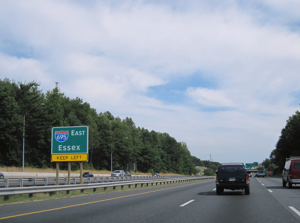
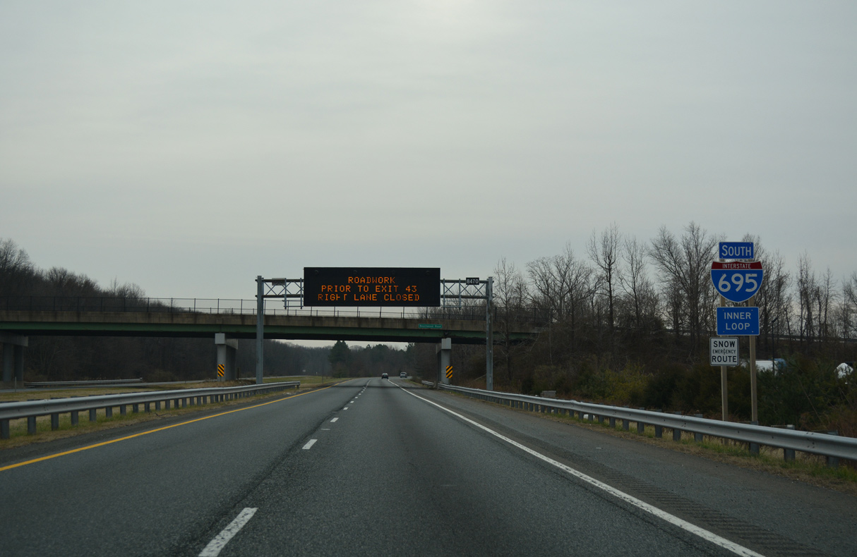
| The two roadways for I-695 originally switched sides through the exchange with I-95. Exit 33 departs for I-95 just beyond the Lillian Holt Drive overpass, and a half mile before the previous Exit 33A for I-95 south. 06/30/10 |
|
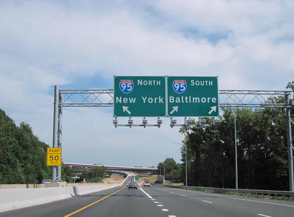
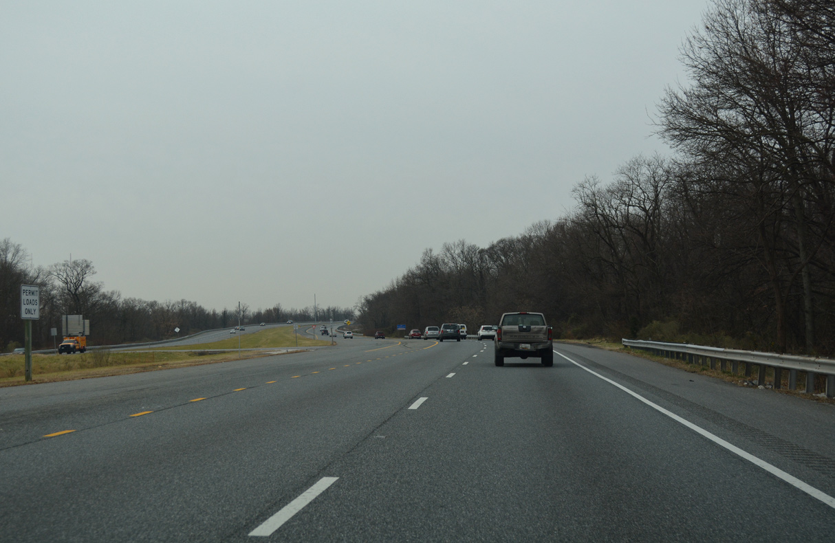
| Interstate 95 follows John F. Kennedy Memorial Highway northeast to Aberdeen, Havre De Grace, Elkton and Newark, Delaware. I-95 south enters Baltimore at the split with I-895 (Harbor Tunnel Thruway) next. 06/30/10 |
|
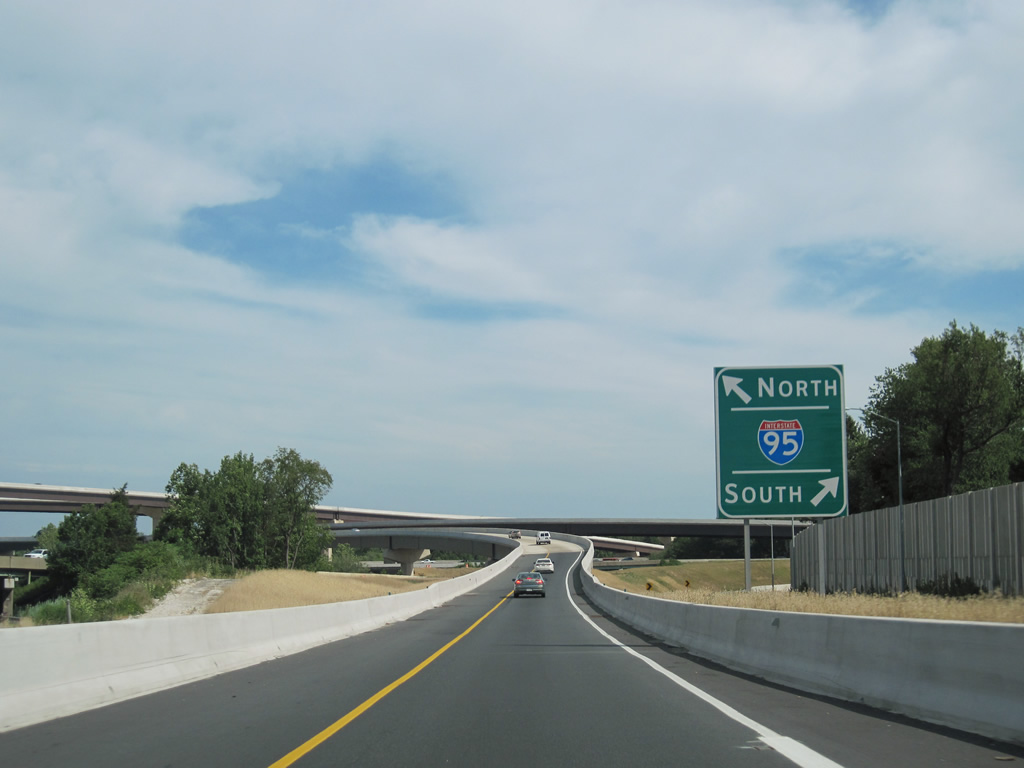
| A long flyover links I-695 east with I-95 (John F. Kennedy Memorial Highway) northbound ahead of White Marsh. I-95 travels north to Wilmington, Delaware, Philadelphia, Pennsylvania and New York. 06/30/10 |
|
| The Baltimore Beltway advances southeast from I-95 at Exit 33 to Middle River, Essex and Sparrows Point. 01/04/19 |
|
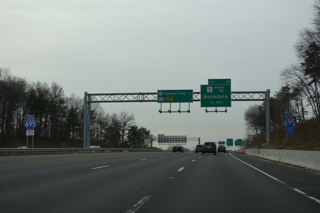
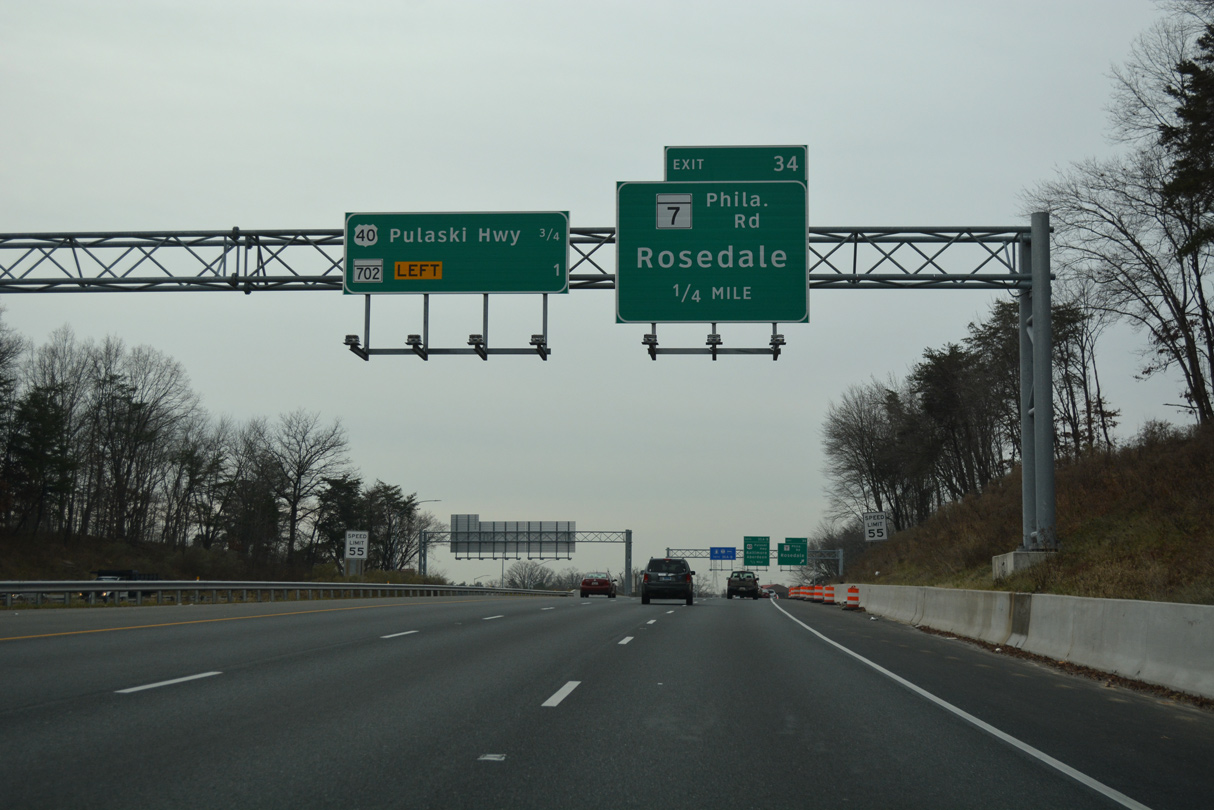
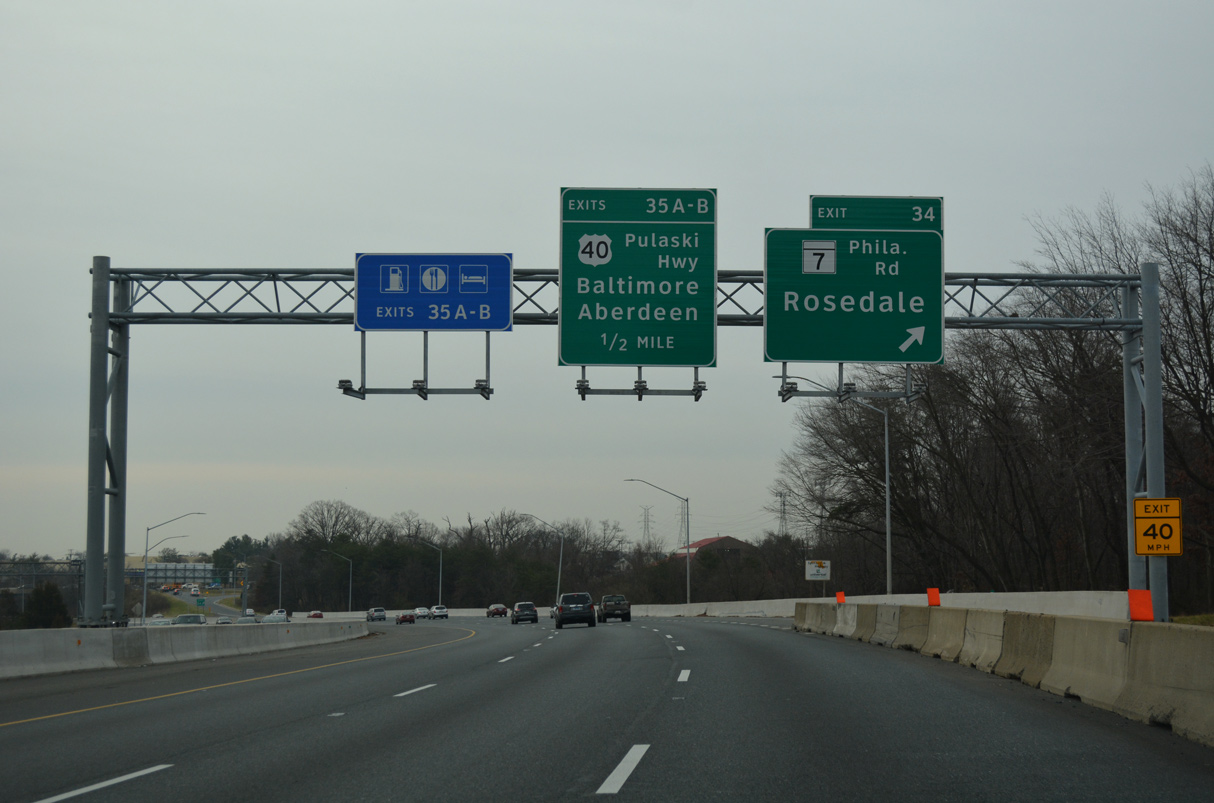
| A parclo interchange joins I-695 with MD 7 (Philadelphia Road) at Rossville just south of I-95. Paralleling Pulaski Highway, MD 7 represents the original alignment of U.S. 40 throughout northeastern Maryland. 01/04/19 |
|
| MD 7 (Philadelphia Road) heads west to Rosedale and U.S. 40 by the Baltimore city line. The 22.83 mile long route extends east to White Marsh and U.S. 40 at Aberdeen. 01/04/19 |
|
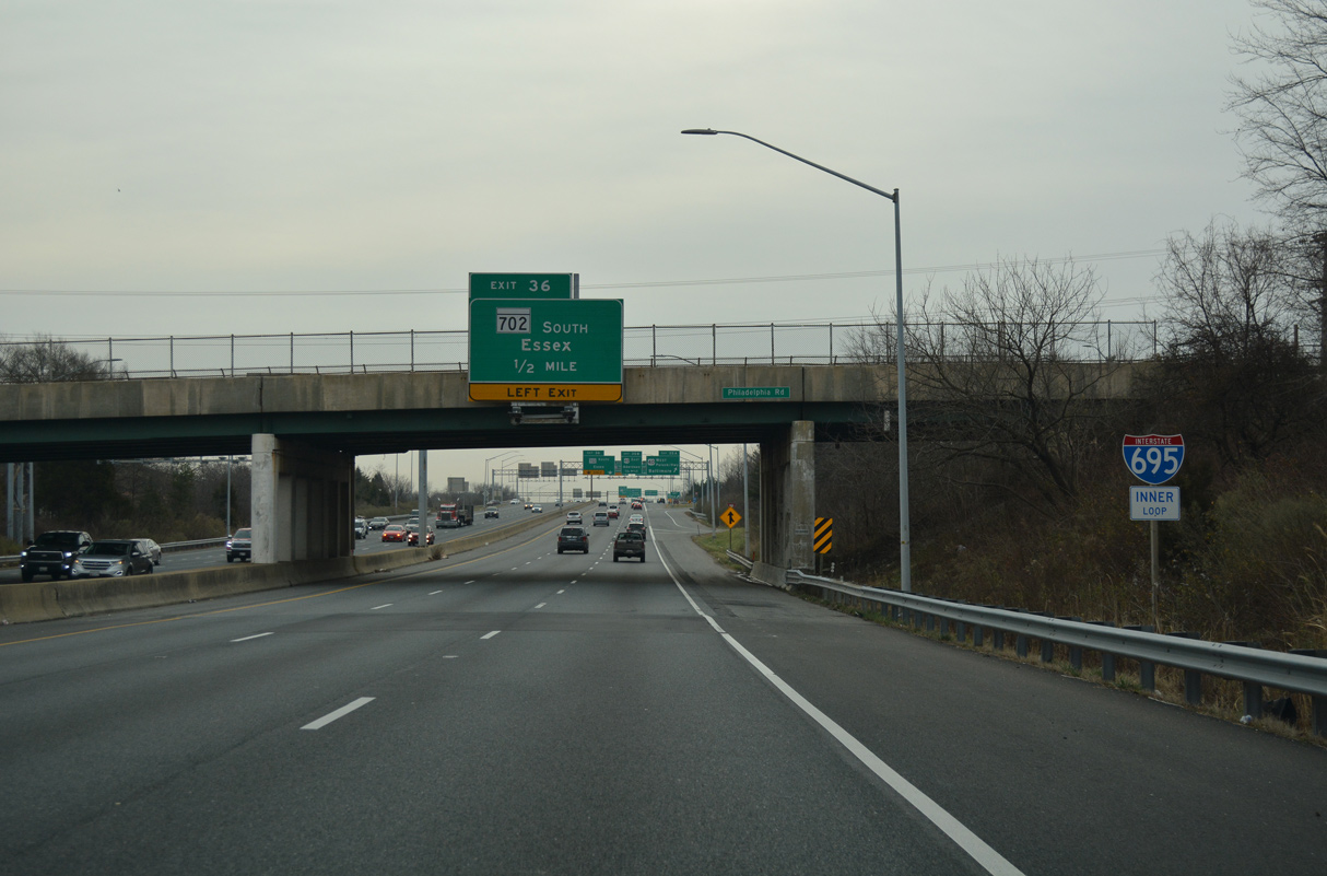
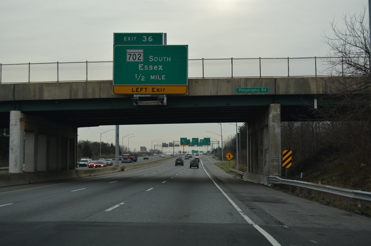
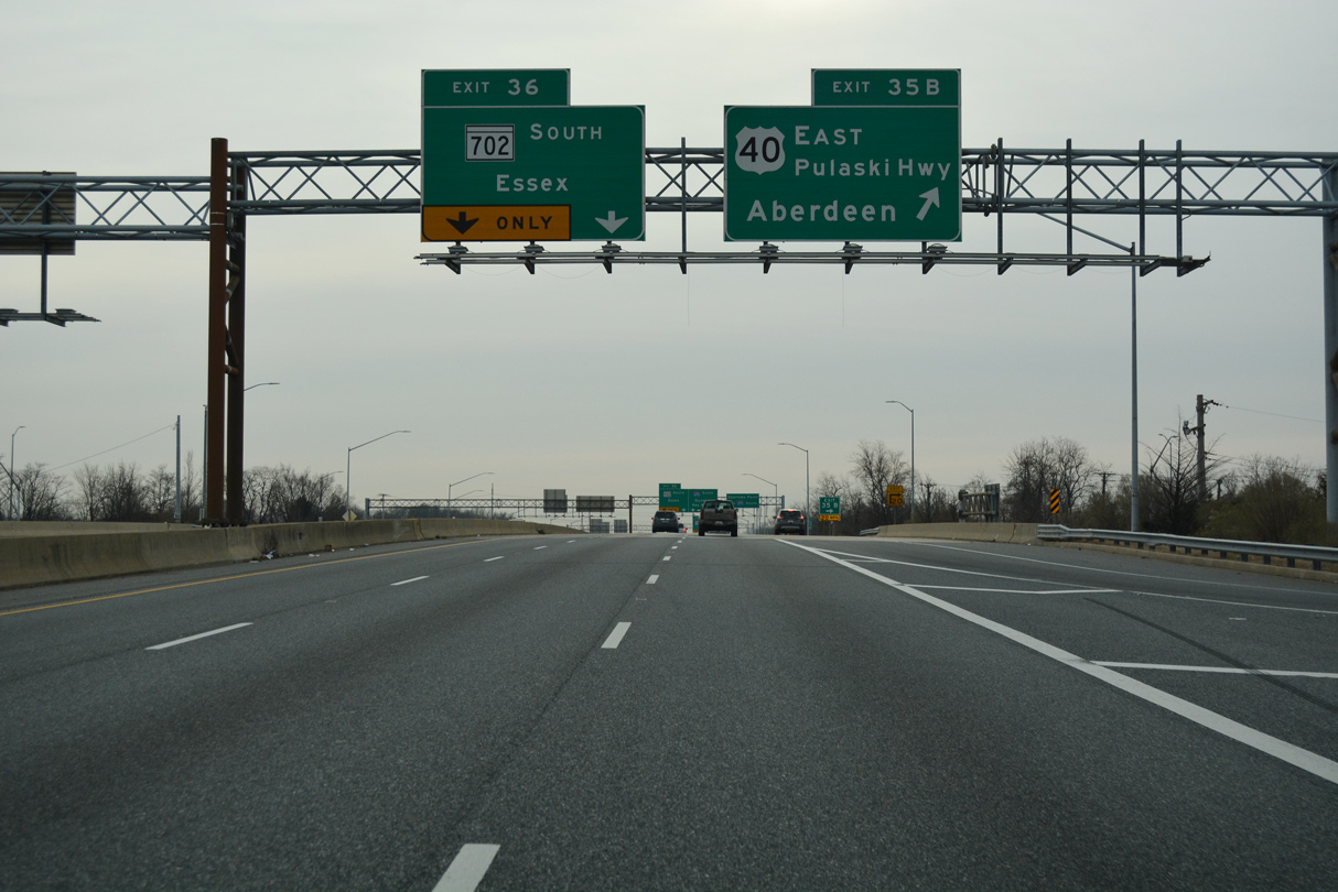
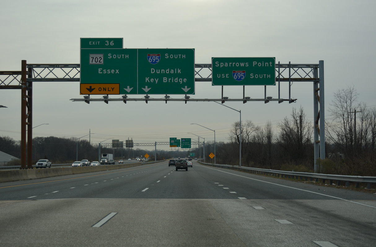
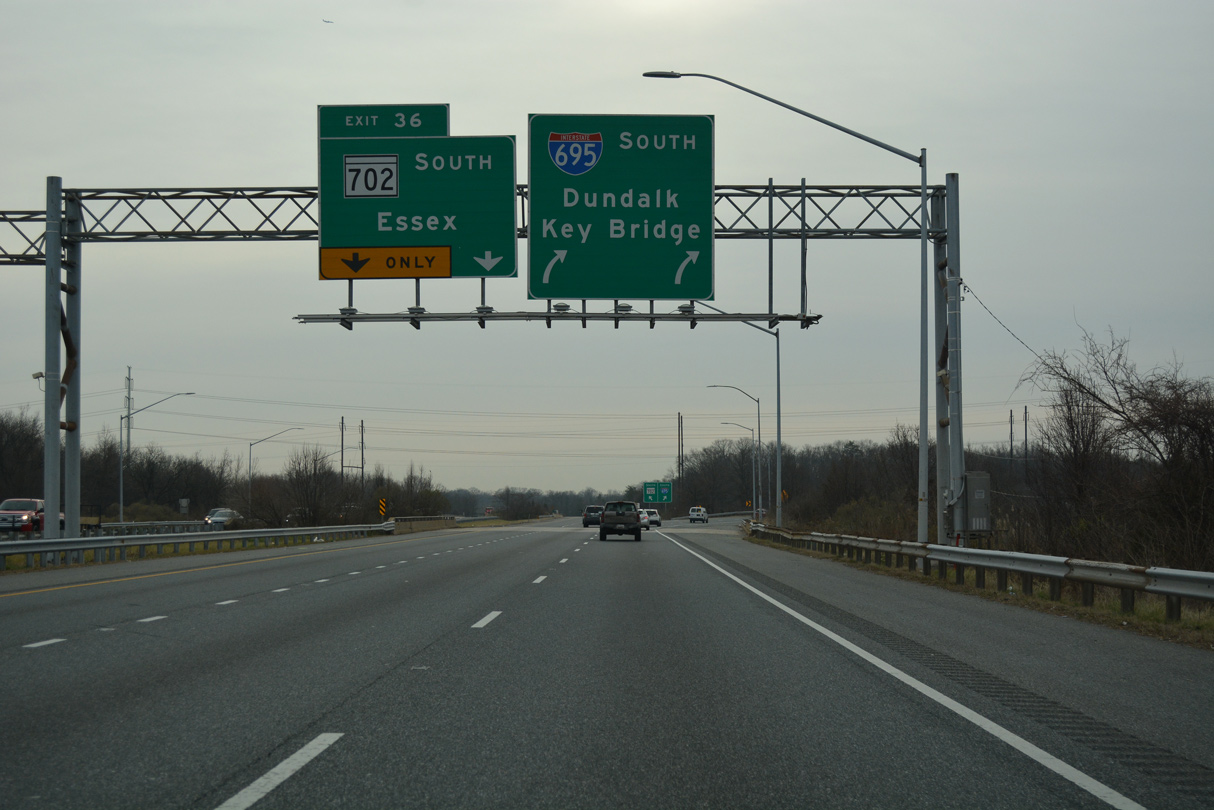
| MD 7 (Philadelphia Road) spans I-695 a half mile ahead of Left Exit 36 for MD 702 (Southeast Expressway). 01/04/19 |
|
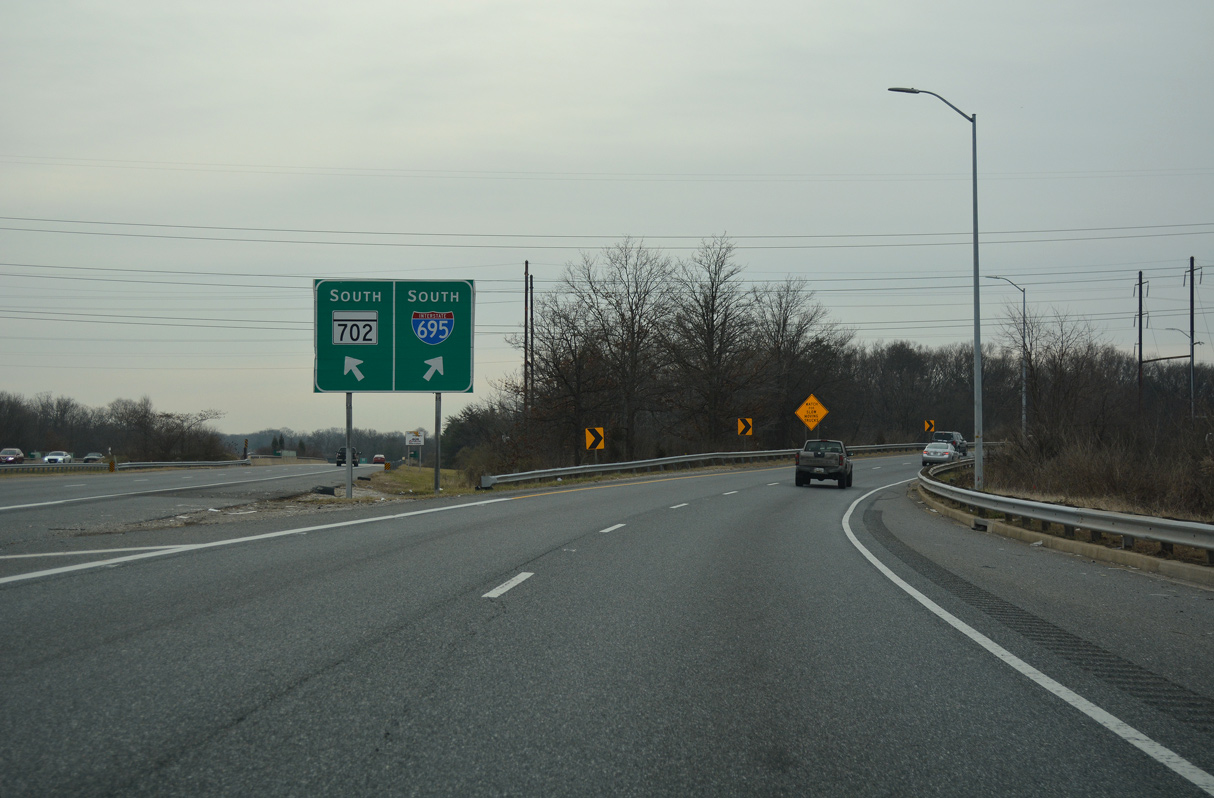
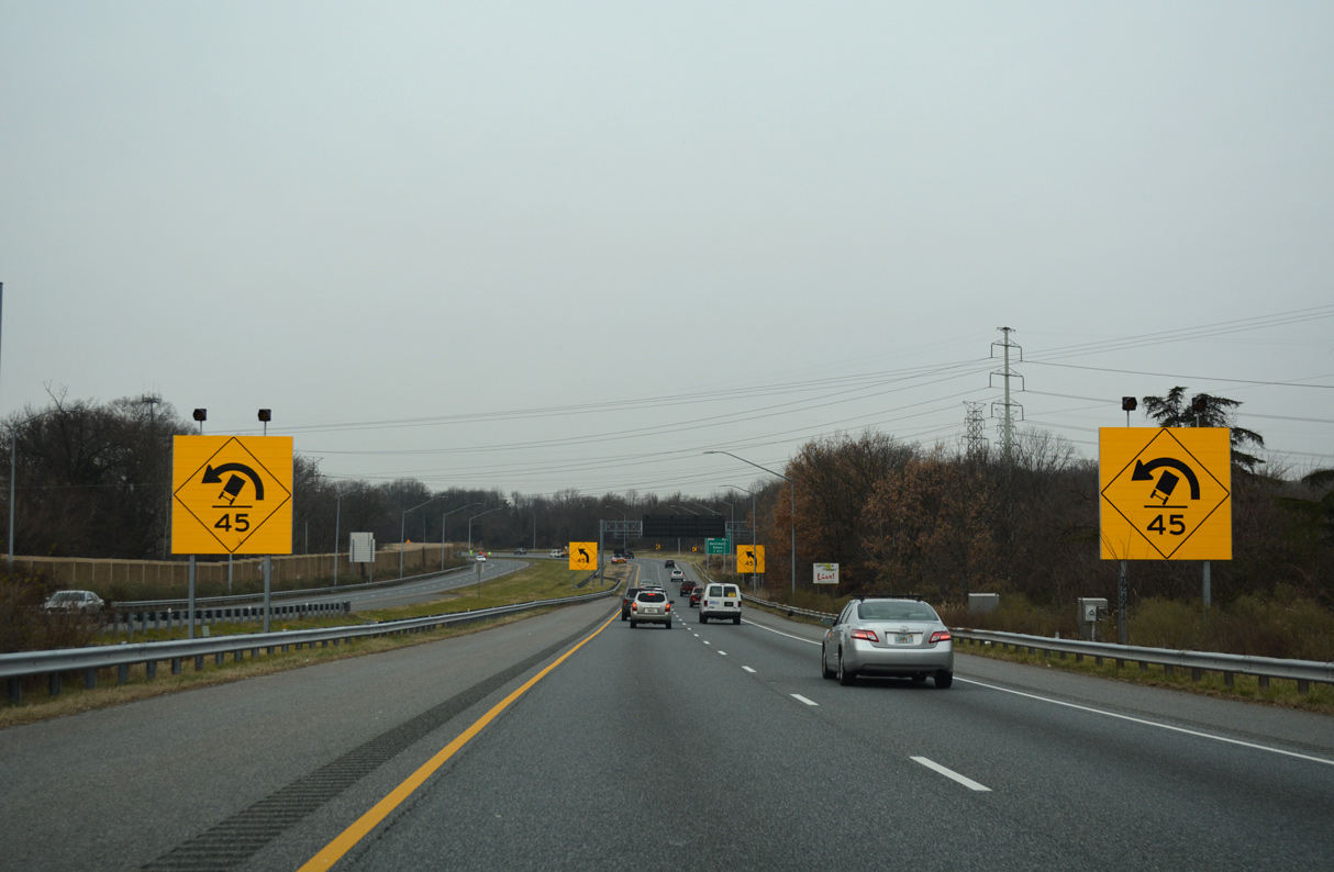
| Interstate 695 becomes part of the Southeast Expressway from U.S. 40 to MD 702. MD 702 continues the Southeast Expressway east to MD 150 at Essex while I-695 turns southwest onto the Windlass Freeway. 01/04/19 |
|
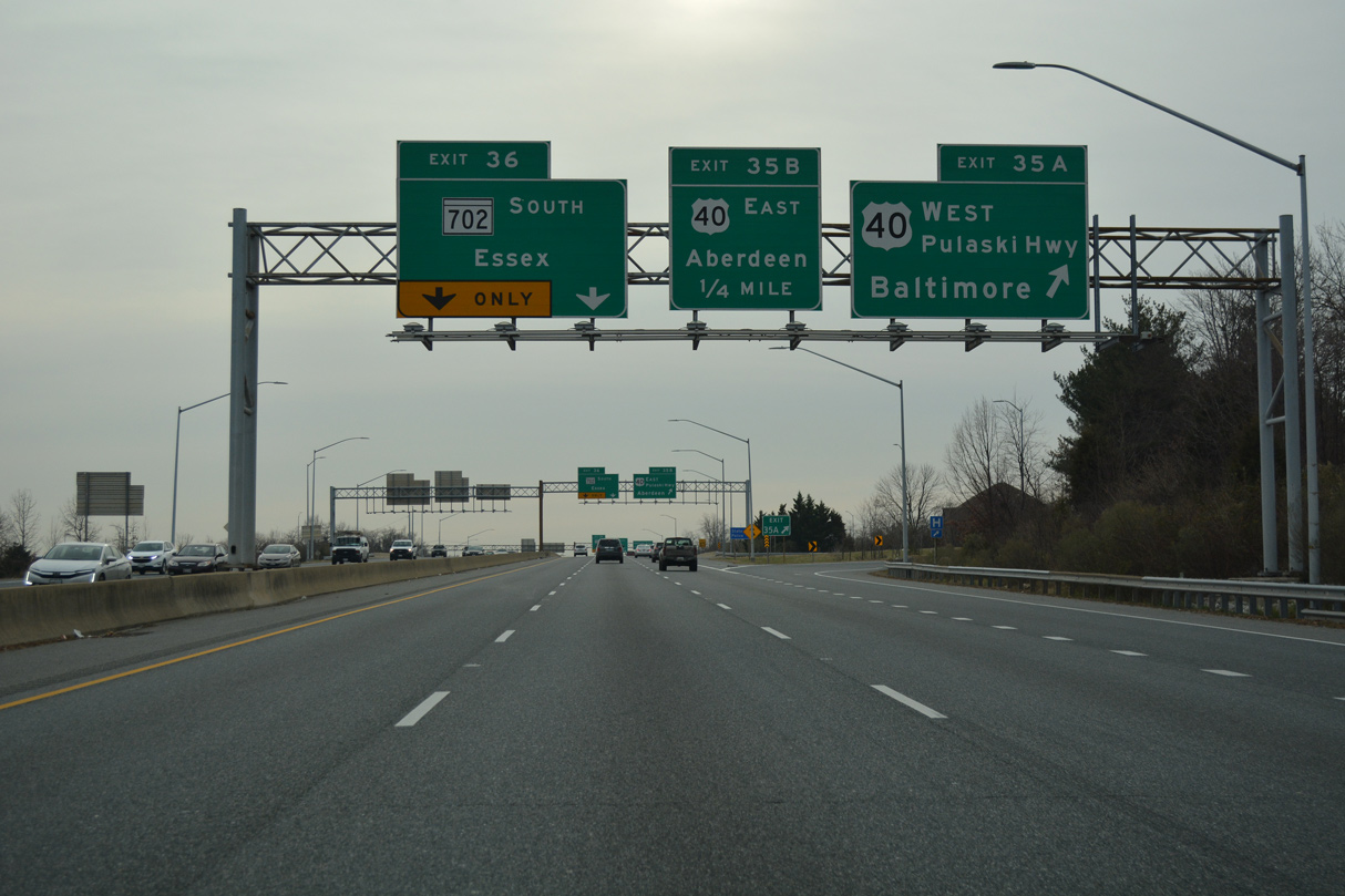
| Exit 35A for U.S. 40 (Pulaski Highway) west to Rosedale and Baltimore ties into Golden Ring Road adjacent to Pulaski Highway. 01/04/19 |
|
| U.S. 40 (Pulaski Highway) continues east from the cloverleaf interchange with I-695 to Middle River, White Marsh, Aberdeen and Havre De Grace. U.S. 40 follows Pulaski Highway from Baltimore east to U.S. 13 at State Road, Delaware. 01/04/19 |
|
| MD 702 spurs 4.17 miles southeast from Left Exit 36 to Back River Neck Road near Cedar Beach. 01/04/19 |
|
| The Southeast Expressway was originally planned to continue further toward Cedar Beach. The freeway concludes in 1.9 miles at Old Eastern Avenue south of MD 150 (Eastern Avenue). 01/04/19 |
|
| Interstate 695 reduces to four overall lanes southwest from the directional T interchange (Exit 36) with MD 702 to Glen Burnie. 01/04/19 |
|
| The interchange joining I-695 and MD 702 was constructed with provisions for an extension of the Windlass Freeway. The Windlass Freeway was originally proposed to connect I-95 at Moravia Road with the Middle River and Glenmar area in southeast Baltimore County. 01/04/19 |
|
| I-695 follows the Windlass Freeway southwest from MD 702 to the Patapsco Freeway at Batavia Park. The remainder of the Windlass Freeway was never built. 01/04/19 |
|
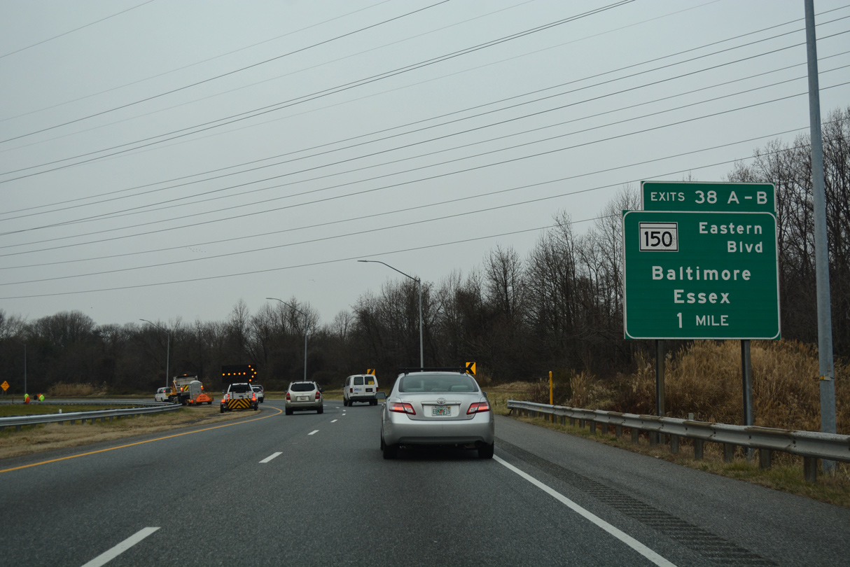
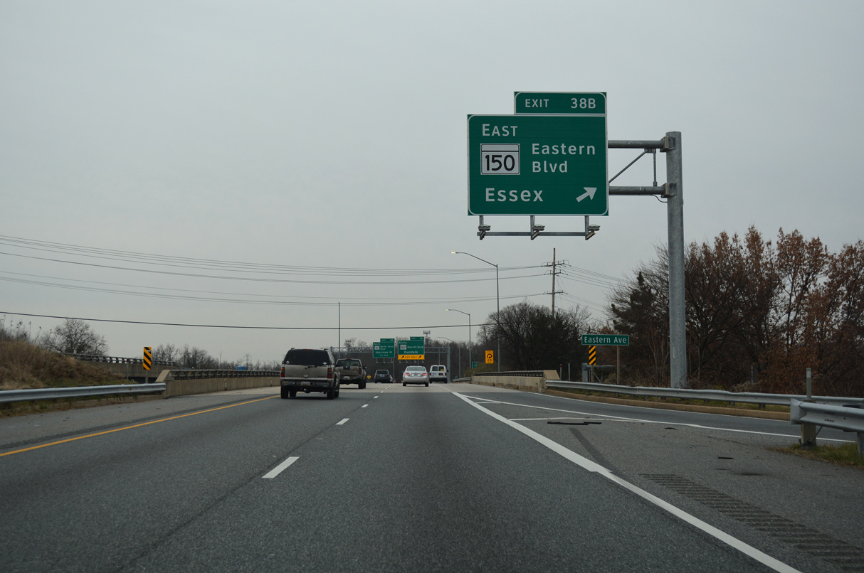
| I-695 makes a sharp turn south onto the Patapsco Freeway near Eastpoint, one mile ahead of the cloverleaf interchange (Exit 38) with MD 150 (Eastern Avenue). 01/04/19 |
|
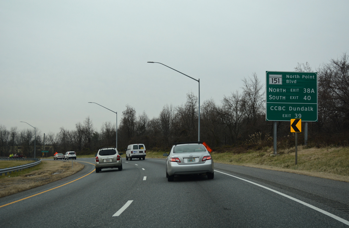
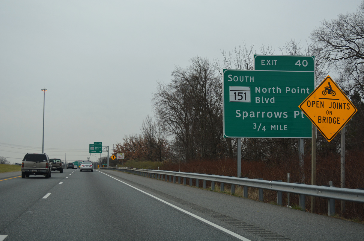
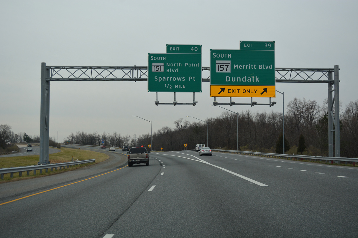
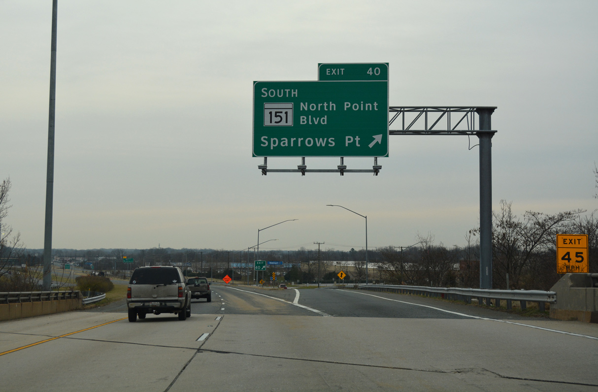
| MD 151 (North Point Boulevard) constitutes a 10.80 mile long route from U.S. 1 (Bel Air Road) in Baltimore south to Sparrows Point. Exit 40 joins I-695 south with MD 151 south directly while MD 150 (Eastern Boulevard) links the beltway with MD 151 north via Exit 38A. 01/04/19 |
|
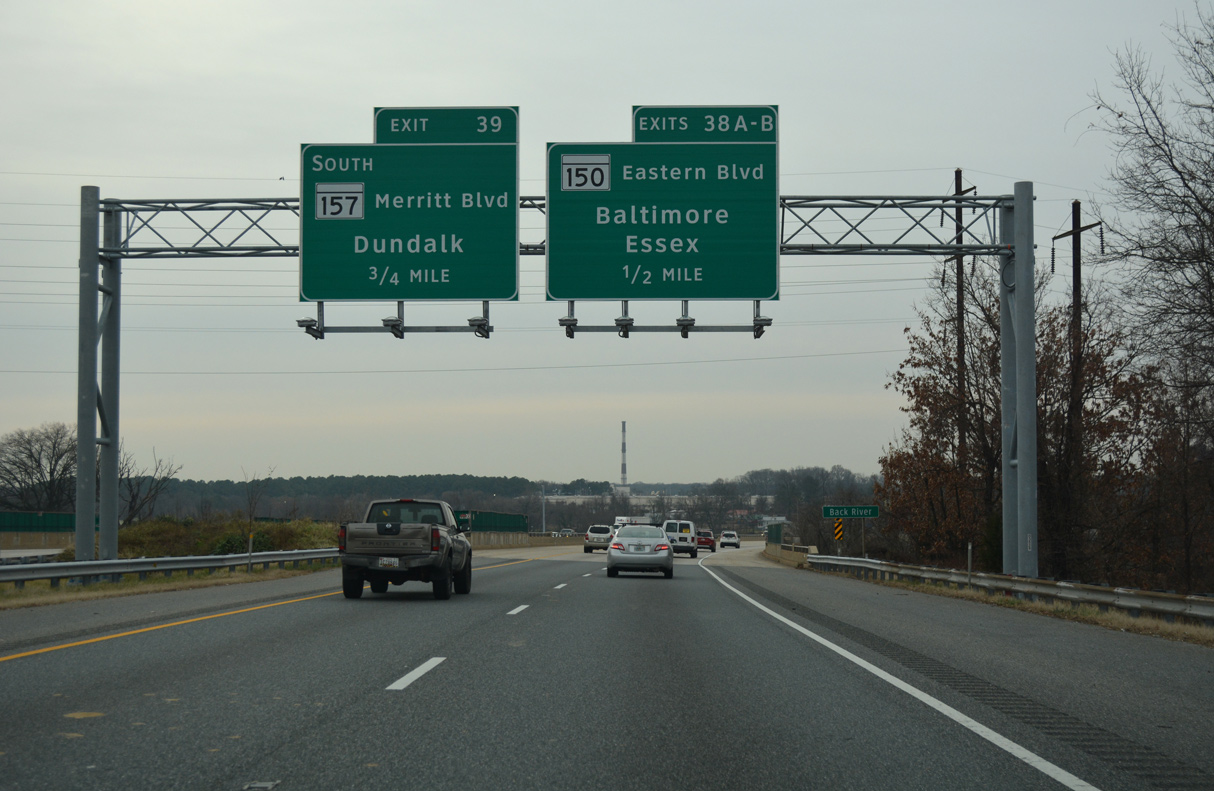
| A 13.01 mile long route, MD 150 (Eastern Boulevard) leads east across the Back River to Essex and Middle River and west into Baltimore at the Pulaski Industrial Area. 01/04/19 |
|
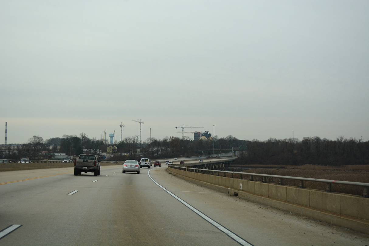
| Interstate 695 (Patapsco Freeway) crosses the Back River south ahead of the industrial area along Patapsco River Neck. 01/04/19 |
|
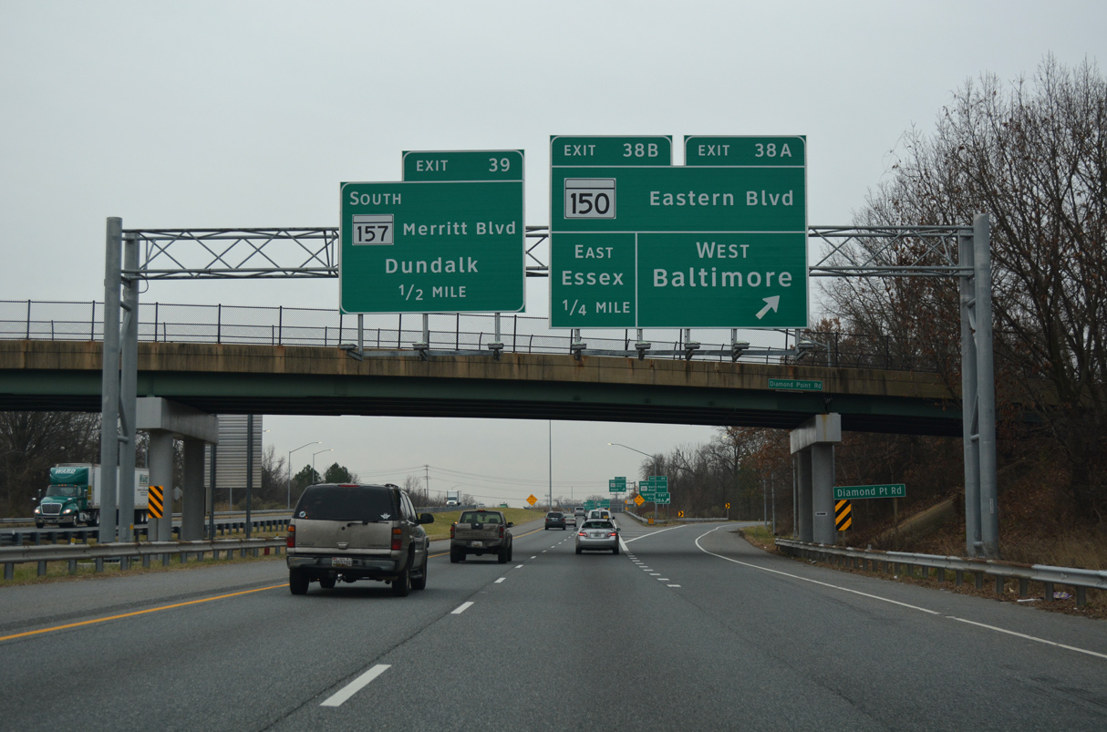
| Exit 38A leaves I-695 south for MD 150 (Eastern Avenue) west at the Diamond Point Road overpass. Eastern Avenue heads west to Eastpoint Mall, Eastwood and Ponca Street at the Greektown neighborhood in Baltimore. 01/04/19 |
|
| MD 151 (North Point Boulevard) runs alongside I-695 southeast from Merritt Boulevard to Exit 40 and North Point. 01/04/19 |
|
| Exit 38A loops onto MD 150 east across the Back River into Essex, where Eastern Avenue becomes Eastern Boulevard. MD 150 extends east to Middle River, Martin State Airport (MTN) and Graces Quarter Road at Chase. 01/04/19 |
|
| MD 157 (Merritt Boulevard) stems south from a wye interchange (Exit 39) with I-695 (Patapsco Freeway) to Dundalk. 01/04/19 |
|
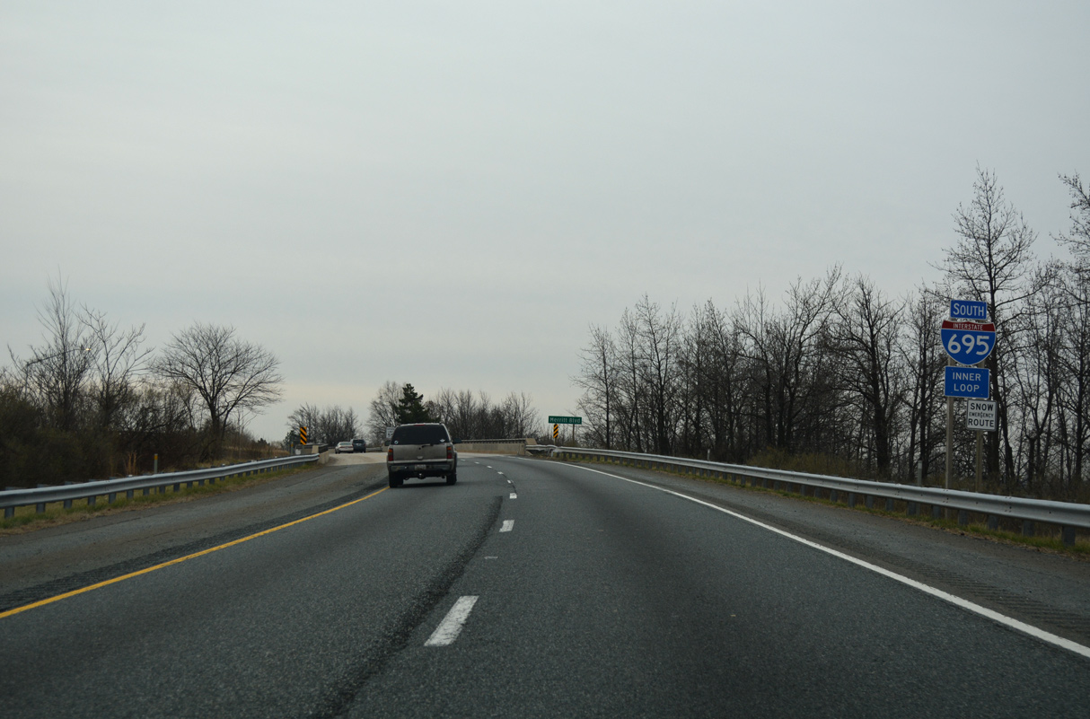
| I-695 crosses over the north end of Merritt Boulevard by this confirming marker. 01/04/19 |
|
| A remaining trailblazer for the Francis Scott Key Bridge. 01/04/19 |
|
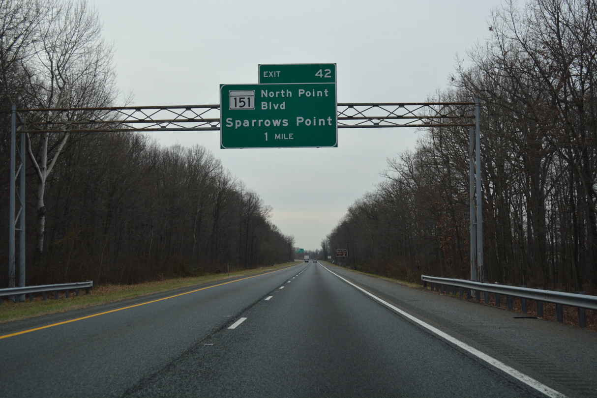
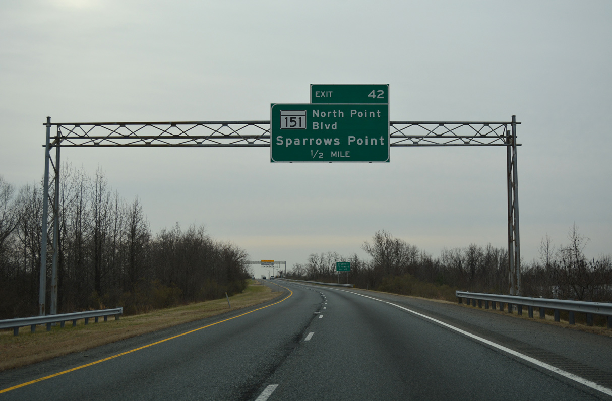
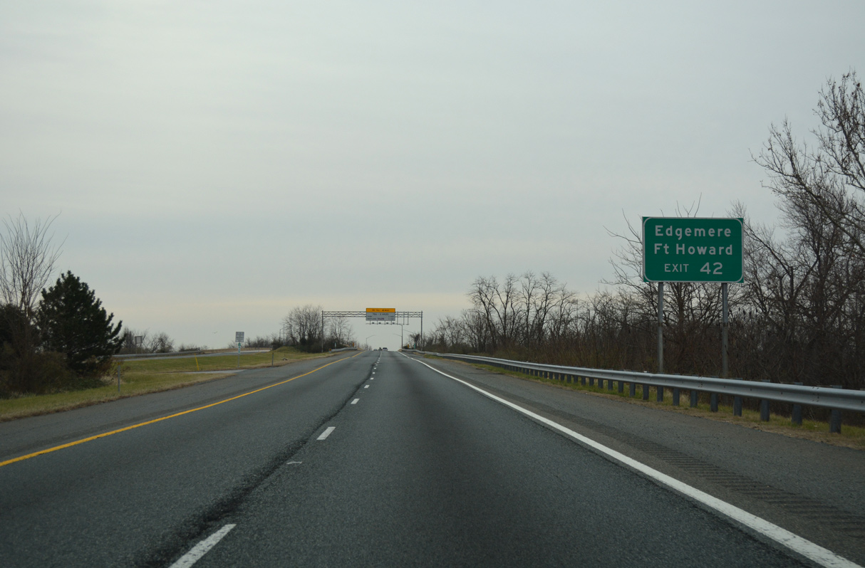
| Paralleling I-695 (Patapsco Freeway) south to Charlesmont and North Point Village, MD 151 (North Point Boulevard) meets the Beltway again at Exit 42 by the community of Edgemere at Exit 42. 01/04/19 |
|
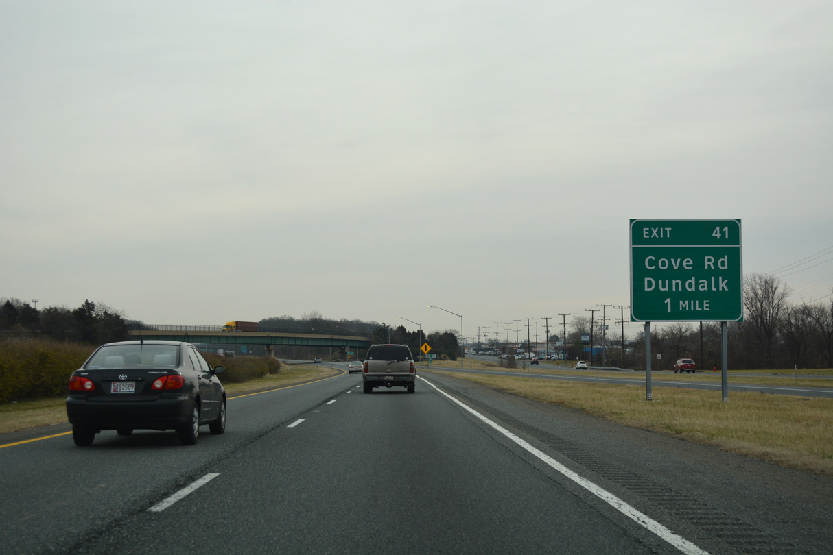
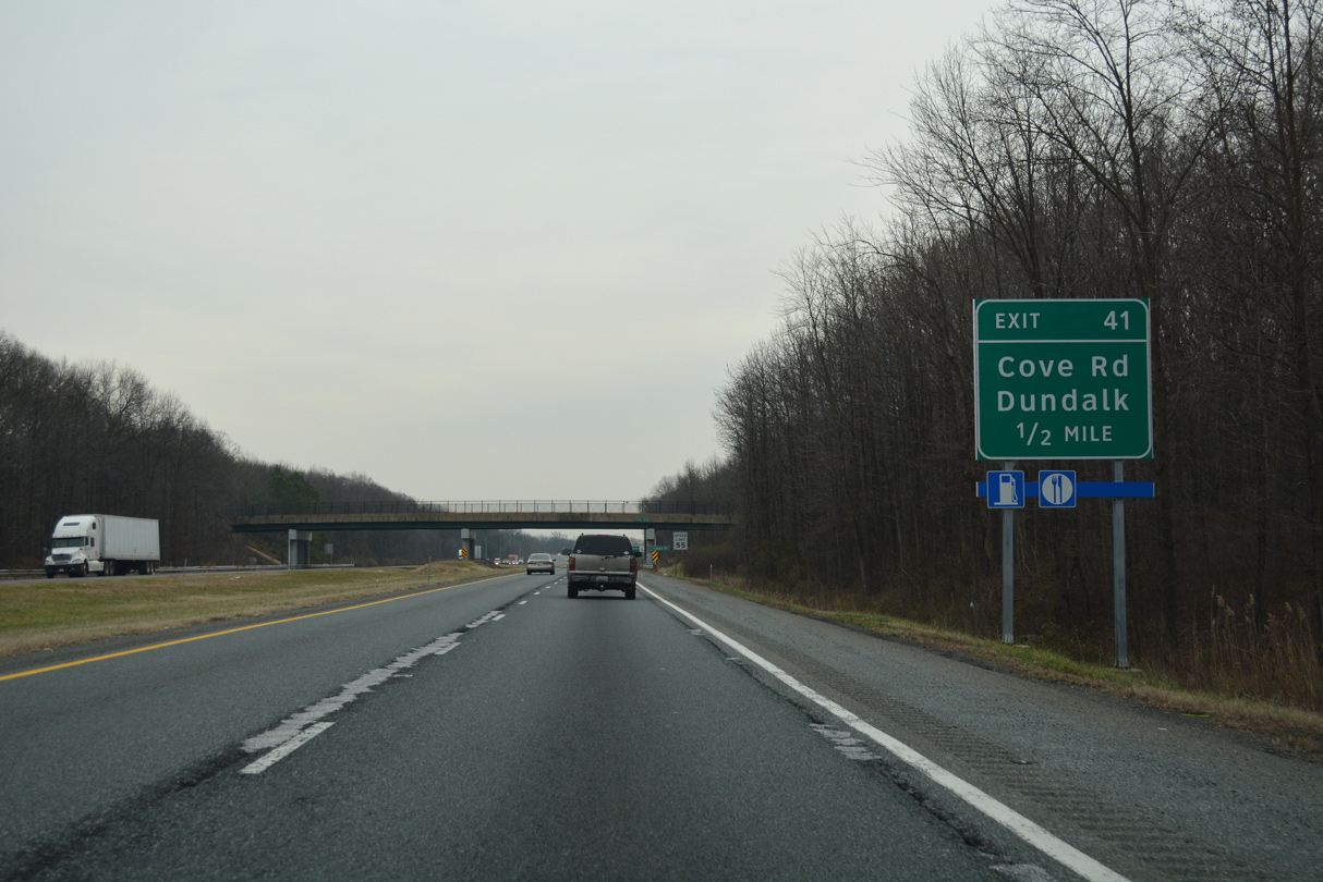
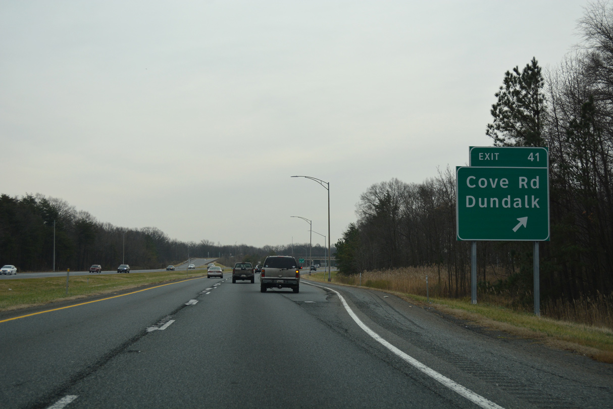
| A diamond interchange (Exit 41) connects Interstate 695 (Patapsco Freeway) south next with Cove Road at North Point Village. 01/04/19 |
|
| Cove Road spurs 0.59 miles north from MD 151 (North Point Boulevard) to I-695 and Glenhurst Road along the Back River. 01/04/19 |
|
| Beachwood Road passes over Interstate 695 beyond this confirming marker. 01/04/19 |
|
| The roadways of Interstate 695 diverge between Beachwood Road and the Morse Lane under crossing. 01/04/19 |
|
| MD 151 (North Point Boulevard) returns to Interstate 695 at Exit 42 between Morse Lane and MD 158 (Bethlehem Boulevard). 01/04/19 |
|
| MD 151 continues south from MD 158 (Bethlehem Boulevard) along Sparrows Point Boulevard west into the Sparrows Point Industrial Complex. 01/04/19 |
|
| North Point Road stems southeast from MD 158 (Bethlehem Boulevard) just east of MD 151 at Edgemere to North Point State Park and Fort Howard. 01/04/19 |
|
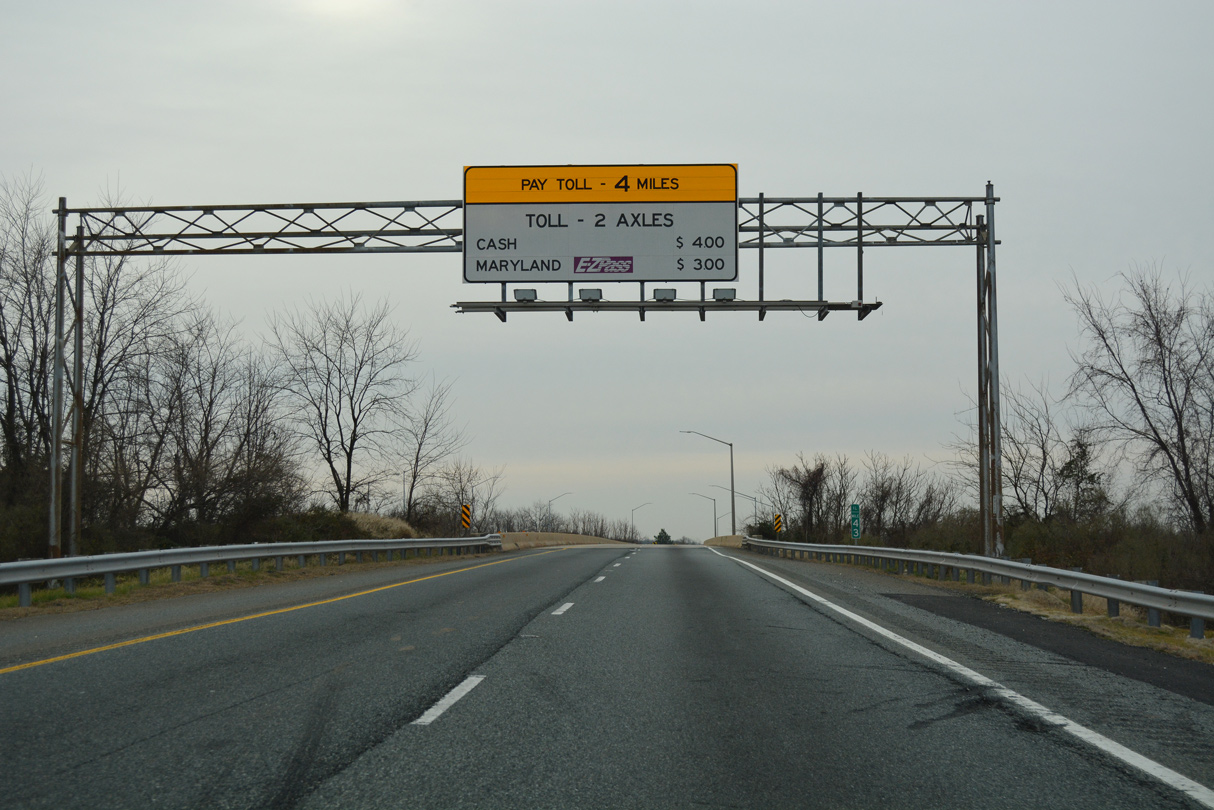
| I-695 turns west ahead of MD 151 four miles to the tolled Francis Scott Key Bridge. The Sparrows Point section of Interstate 695 was widened from two to four lanes by 2001. 01/04/19 |
|
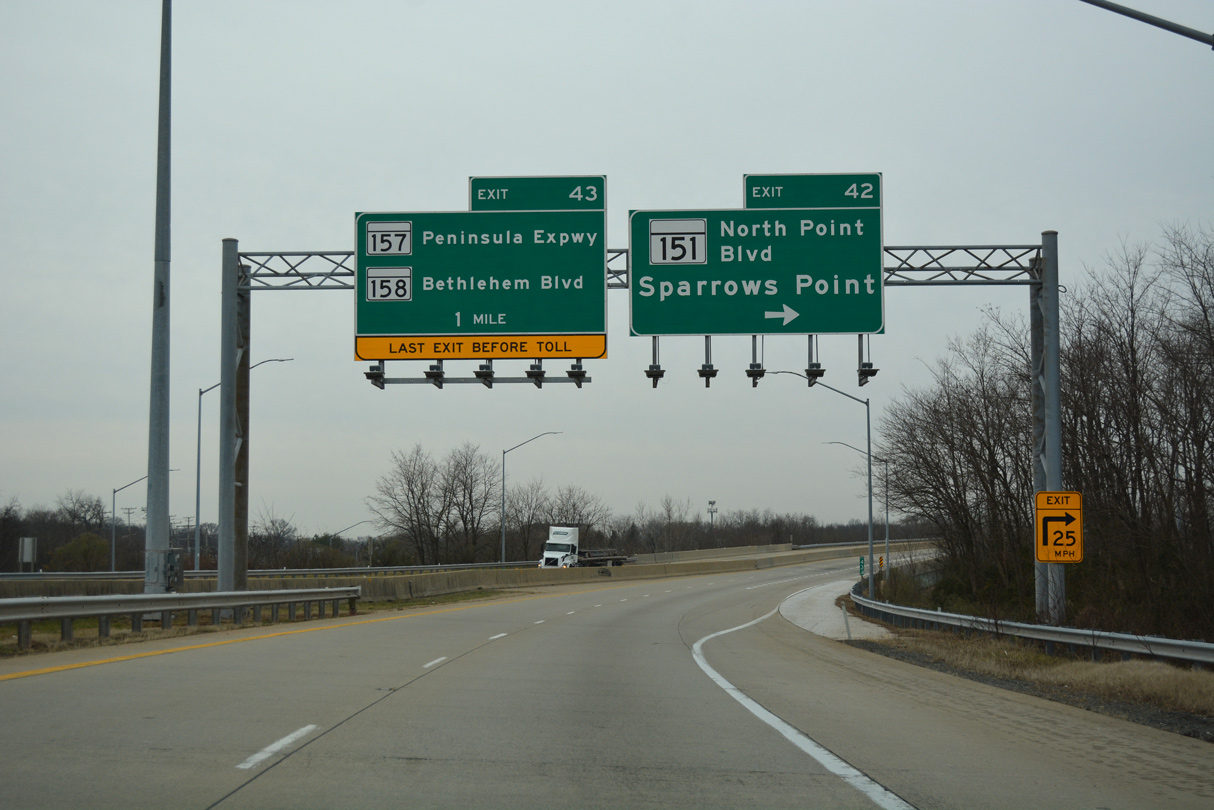
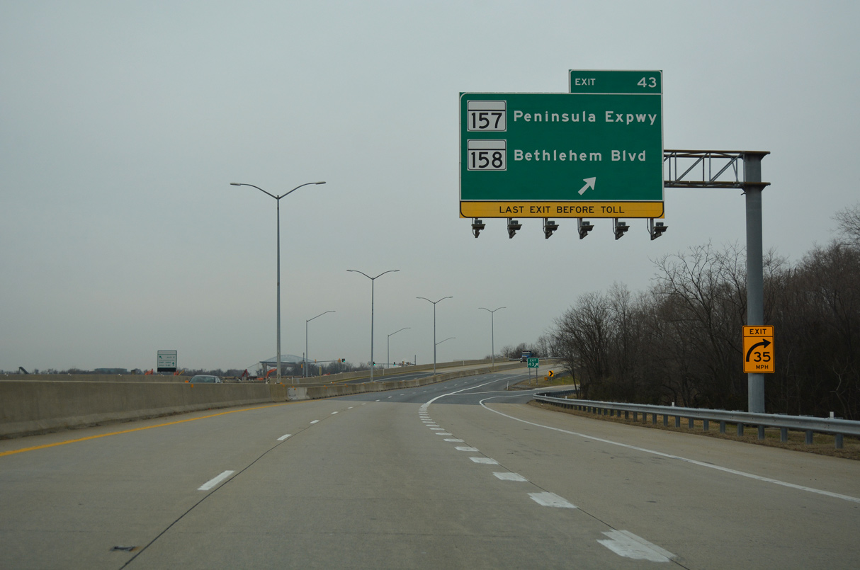
| MD 151 (Sparrows Point Boulevard) serves a number of distribution centers west of Wharf Road (MD 151B) at Sparrows Point. 2.35 miles in length, MD 158 runs along the south side of I-695 to Exit 43 and Riverside Drive along Bear Creek. 01/04/19 |
|
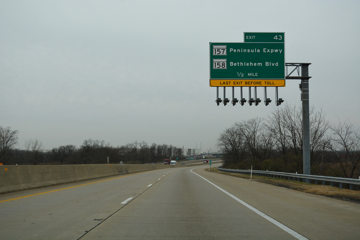
| Interstate 695 converges with the south end of MD 157 (Peninsula Expressway) at Exit 43. The forthcoming six-ramp parclo interchange is the last departure point from I-695 south before the Key Bridge. 01/04/19 |
|
| A c/d roadway separates from I-695 south for MD 157 (Peninsula Expressway) north to Dundalk and MD 157 south to MD 158 (Bethlehem Road). Bethlehem Road derived its name from a Bethlehem Steel Complex formerly located nearby. 01/04/19 |
|
| Interstate 695 proceeds west by Grey's Landfill to span Bear Creek. 01/04/19 |
|
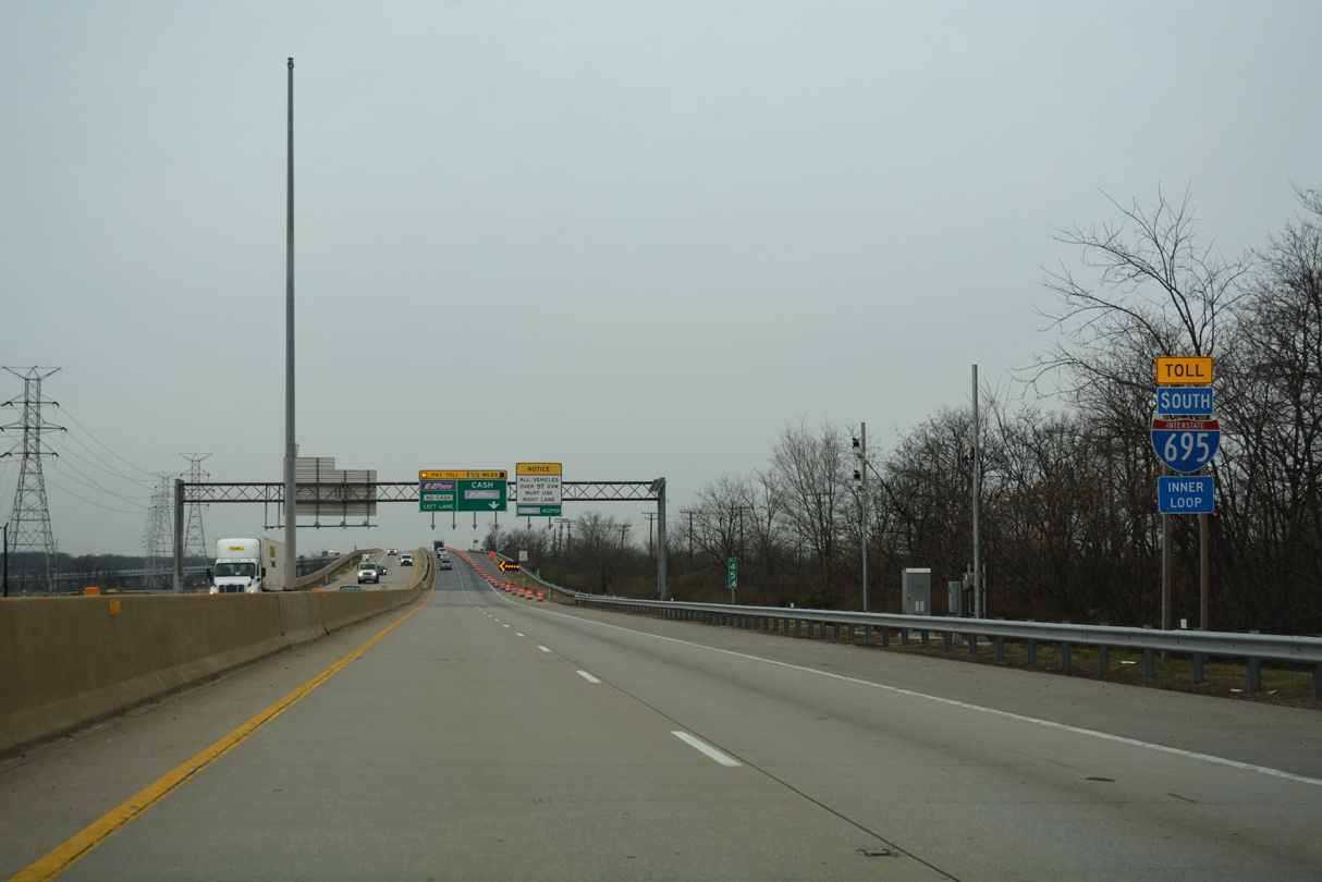
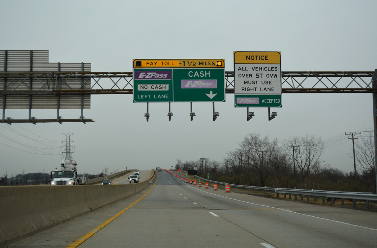
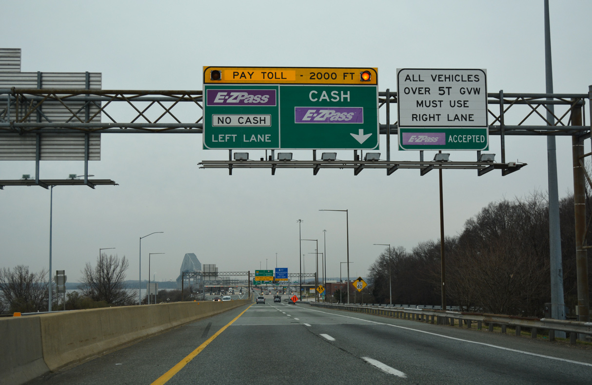
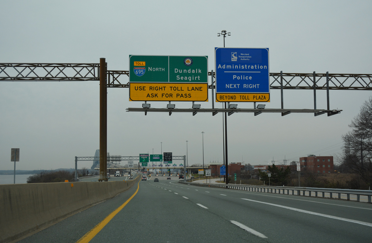
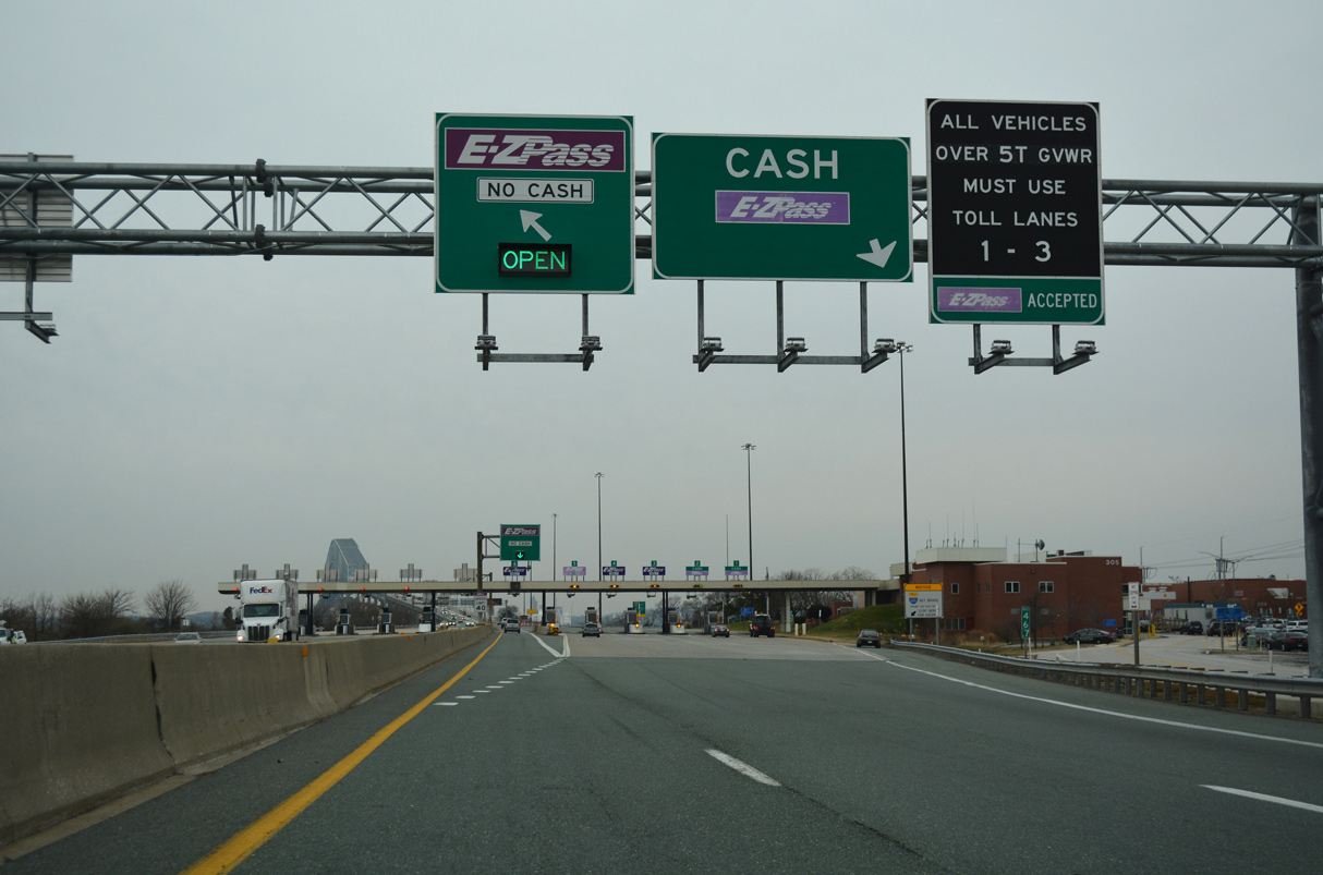
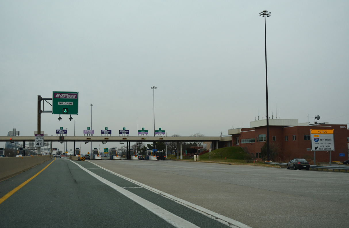
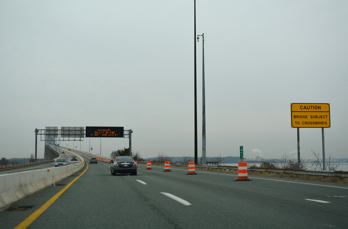
| The Francis Scott Key Bridge toll plaza was located along the east banks of the Patapsco River. With the switch to all electronic tolling (AET), the toll booths at the plaza were closed by July 15, 2019.1 01/04/19 |
|
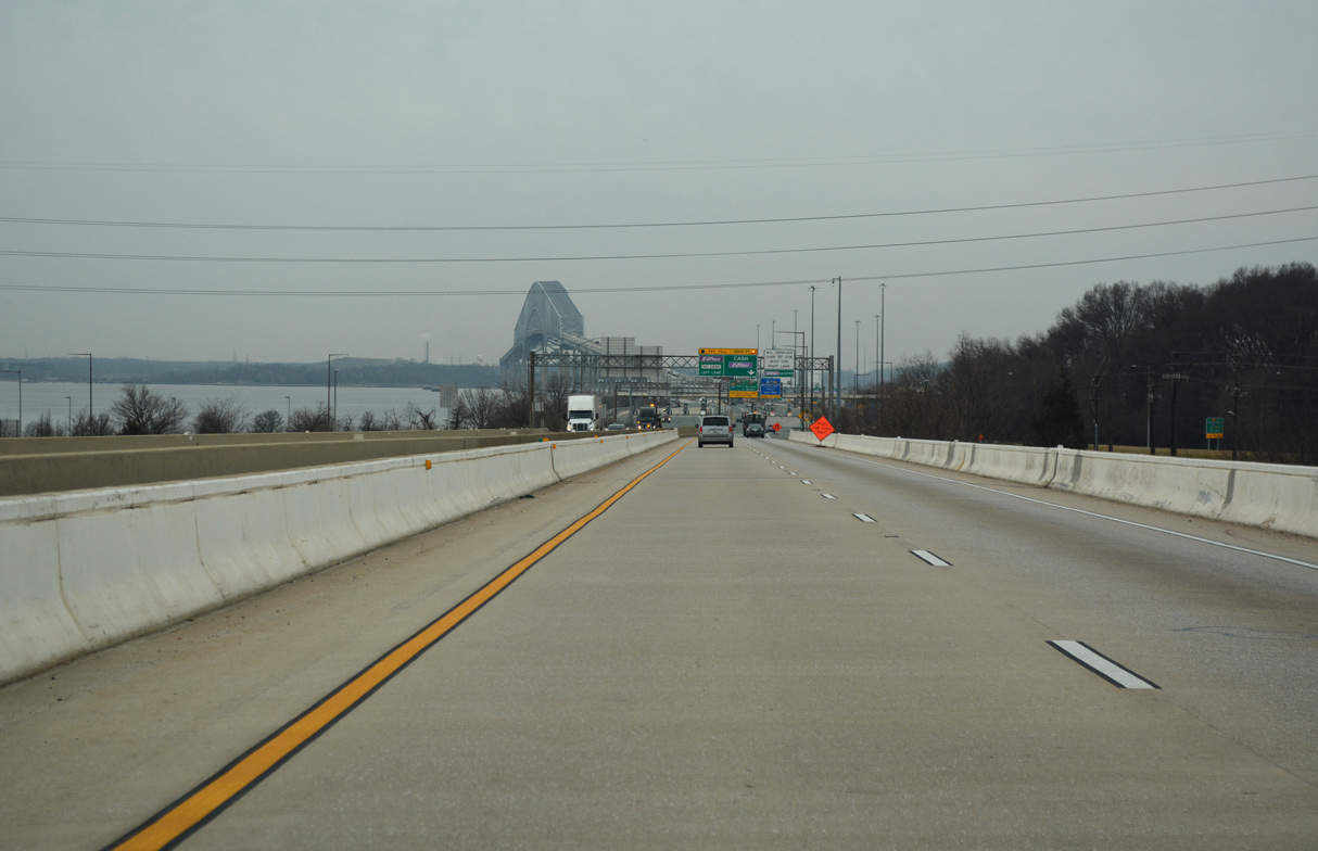
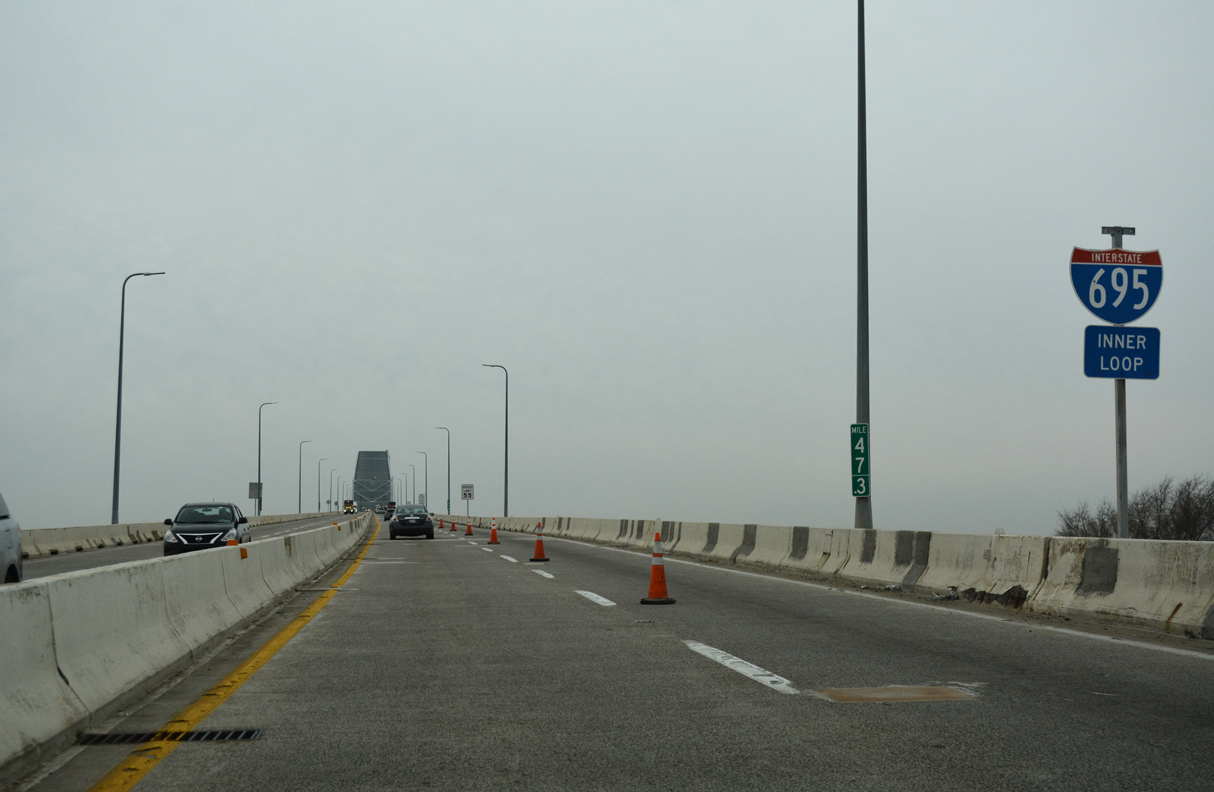
| The Francis Scott Key Bridge rises along I-695 west of Bear Creek. Completion of I-695 between Sparrows Point and Dundalk over Bear Creek led to the demolition of the Dundalk Avenue bridge between MD 158 (Bethlehem Road) and Dundalk. 01/04/19 |
|
| Interstate 695 westbound lowers into a half diamond interchange (Exit 44) with MD 695 (Broening Highway) north at Coffin Point. An overhead tolling gantry was installed just to the west for the Key Bridge by September 2019.1 01/04/19 |
|
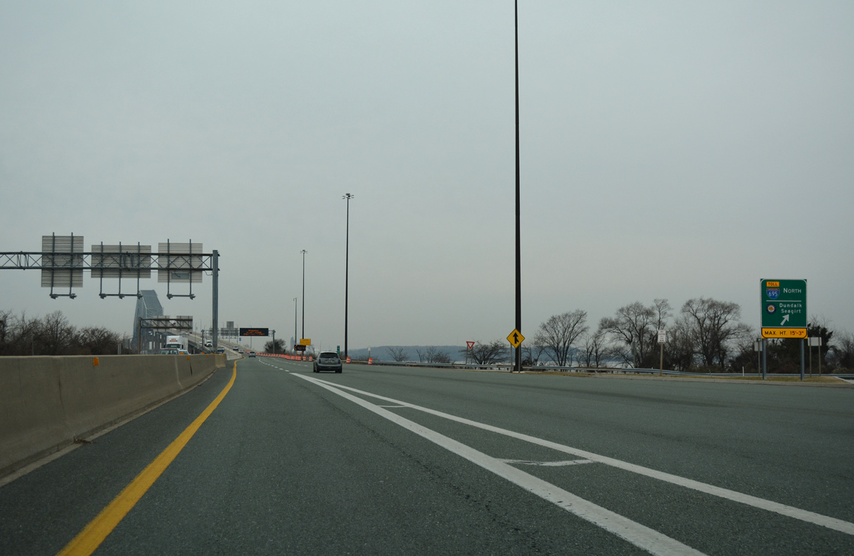
| A U-turn ramp connects I-695 west with I-695 east for Broening Highway (MD 695) to the Port of Baltimore Marine Terminals at Dundalk and Seagirt. 01/04/19 |
|
| The contract to convert the Key Bridge to AET and demolish the toll plaza at Sollers Point was from December 8, 2019 to December 31, 2021.2 01/04/19 |
|
| Interstate 695 ascends across the Patapsco River into south Baltimore beyond U-turn ramp for Authority Drive (MD 695C) and Broening Highway (MD 695A) north. 01/04/19 |
|
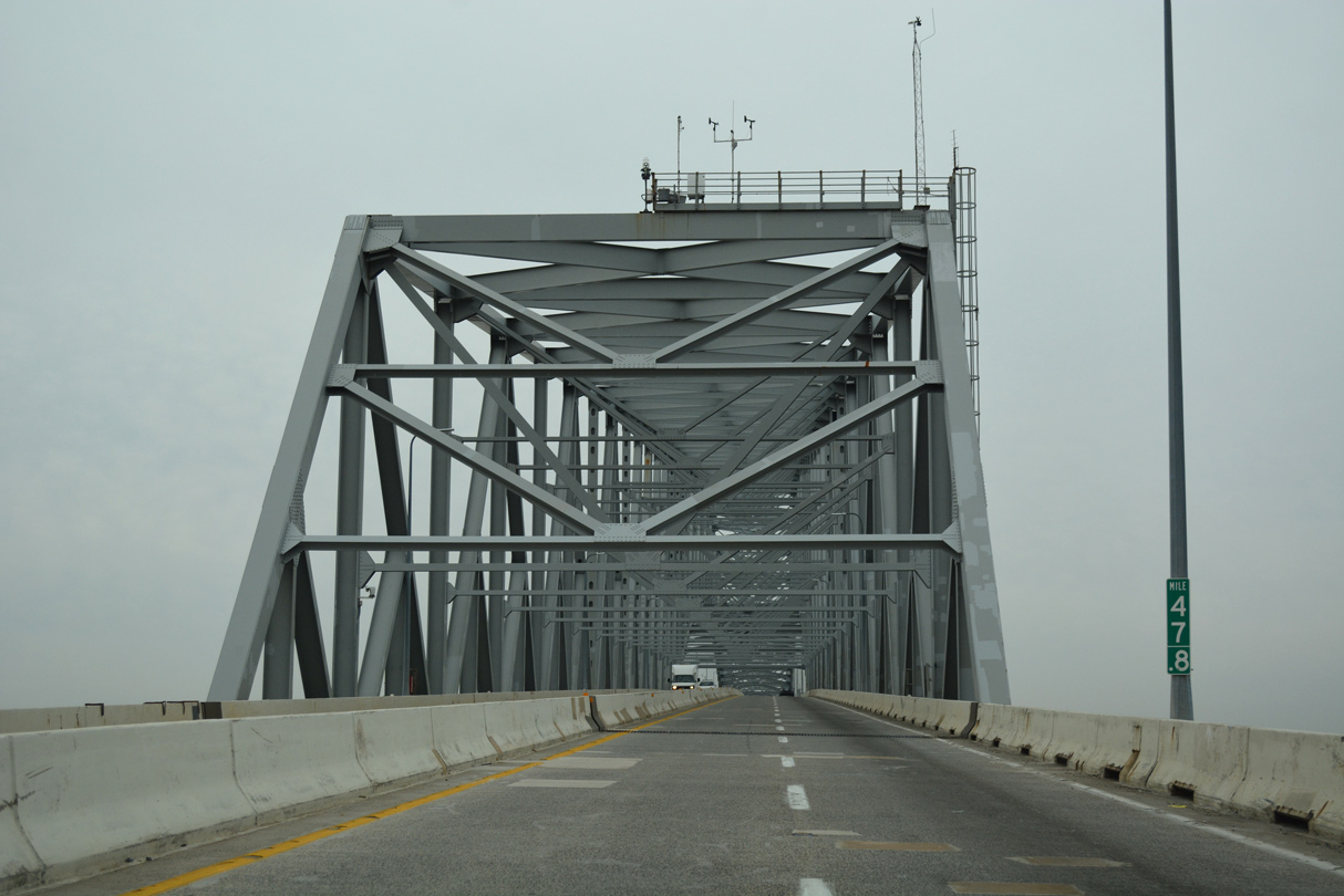
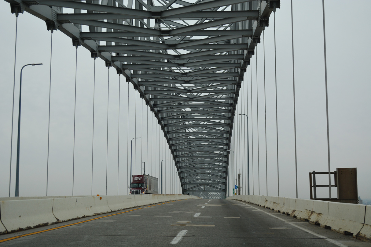
| Subject to strong crosswinds, the outer harbor crossing along Interstate 695 provides 185 feet of vertical clearance.3 01/04/19 |
|
| Interstate 695 spans the Patapso River southeast of the Baltimore Inner Harbor. The Middle Branch of the Patapsco River extends west to the Cherry Hill and South Baltimore areas of the city. 01/04/19 |
|
| 1960s plans for a second Baltimore Harbor crossing proposed a single tube tunnel. Due to substantially high costs in 1970, plans shifted to the concept of a four lane bridge.3 01/04/19 |
|
| The entire through arch truss portion of the Francis Scott Key Bridge collapsed at approximately 1:20 EDT on March 26, 2024 due to a collision by the Dali, a 1948 foot long cargo ship on one of the main piers.4 01/04/19 |
|
| The Francis Scott Key Bridge was constructed from 1972 to March 23, 1977 at a cost of $60.3 million.2 01/04/19 |
|
| Although it is unmarked, Interstate 695 nips the northern notch of Anne Arundel County midway across the Francis Scott Key Bridge. 01/04/19 |
|
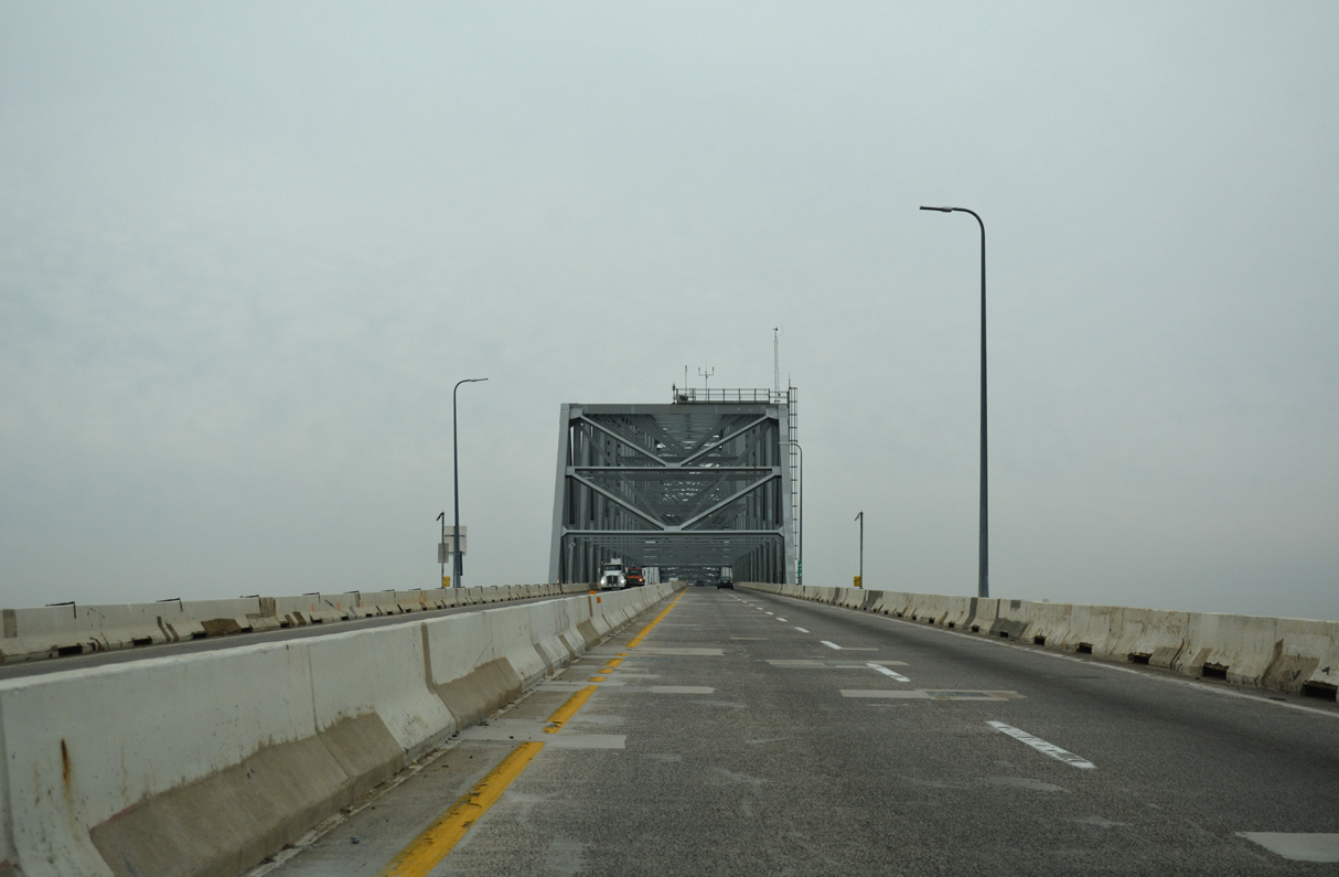
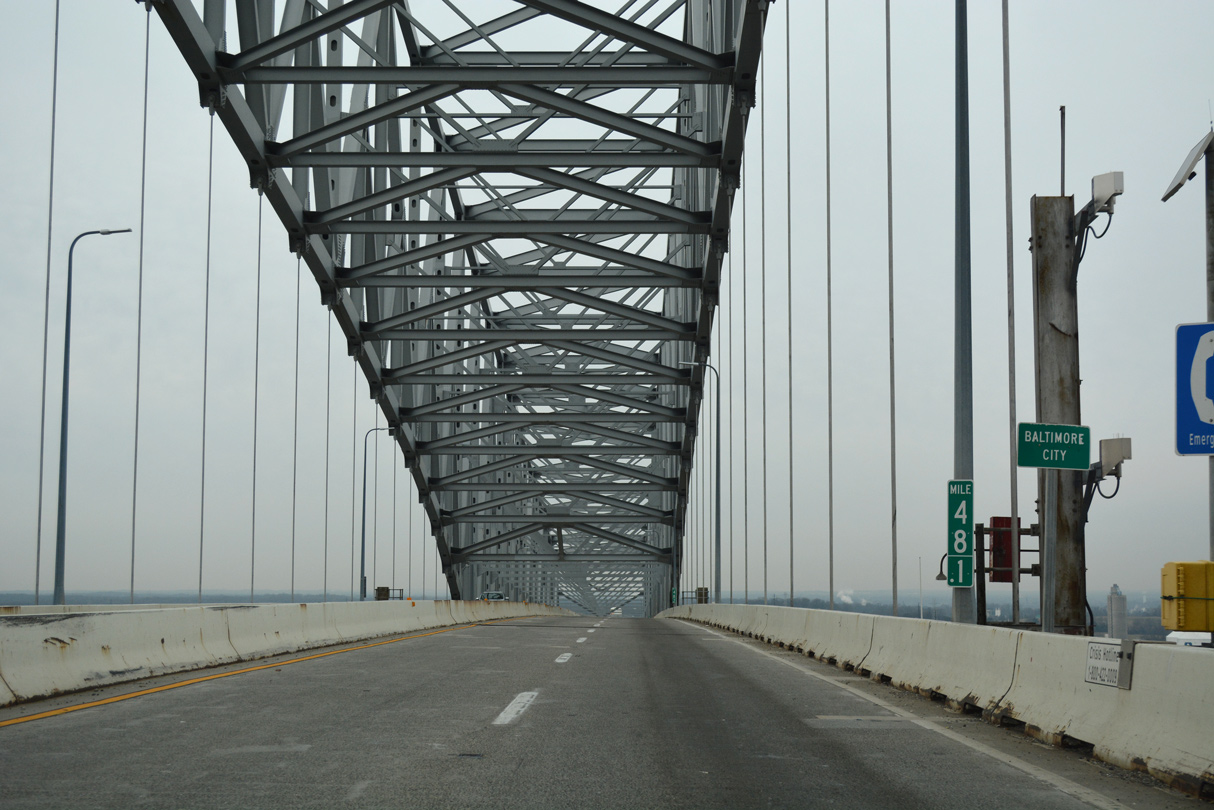
| Entering the city of Baltimore at mile marker 48.1, the Francis Scott Key Bridge spans the Patapsco River with four lanes and no shoulders. 01/04/19 |
|
| The Francis Scott Key Bridge is 1.6 miles long with 8.7 miles of approach roadways.3 01/04/19 |
|
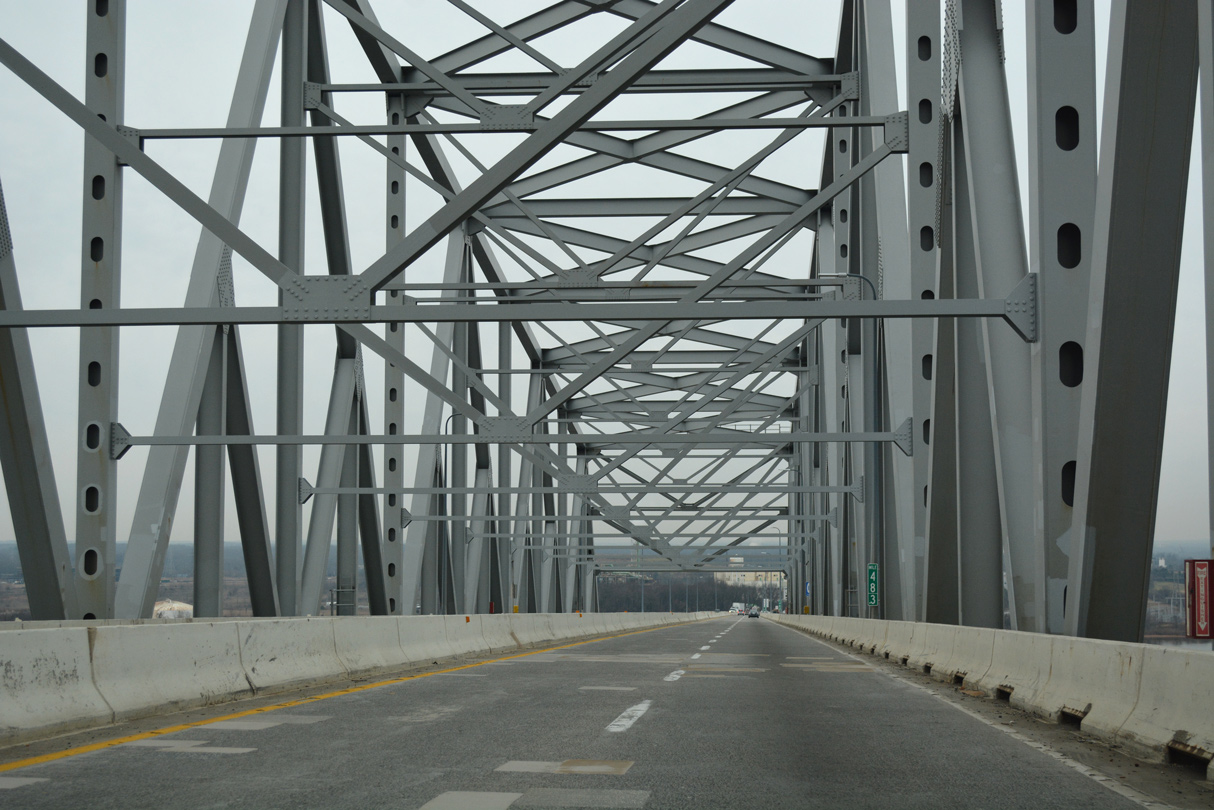
| The steel through arch bridge lowers into the Hawkins Point section in south Baltimore. 01/04/19 |
Page Updated 10-29-2021.


 East
East