|
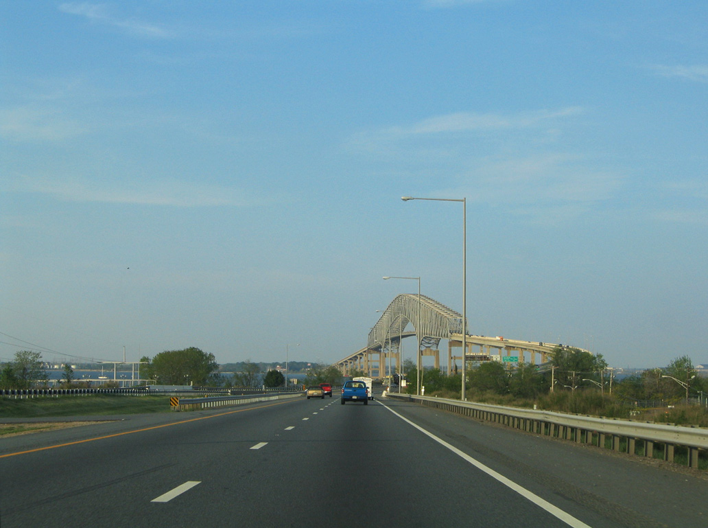
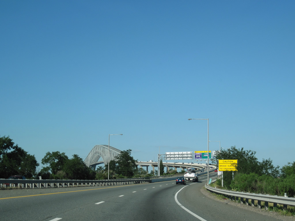
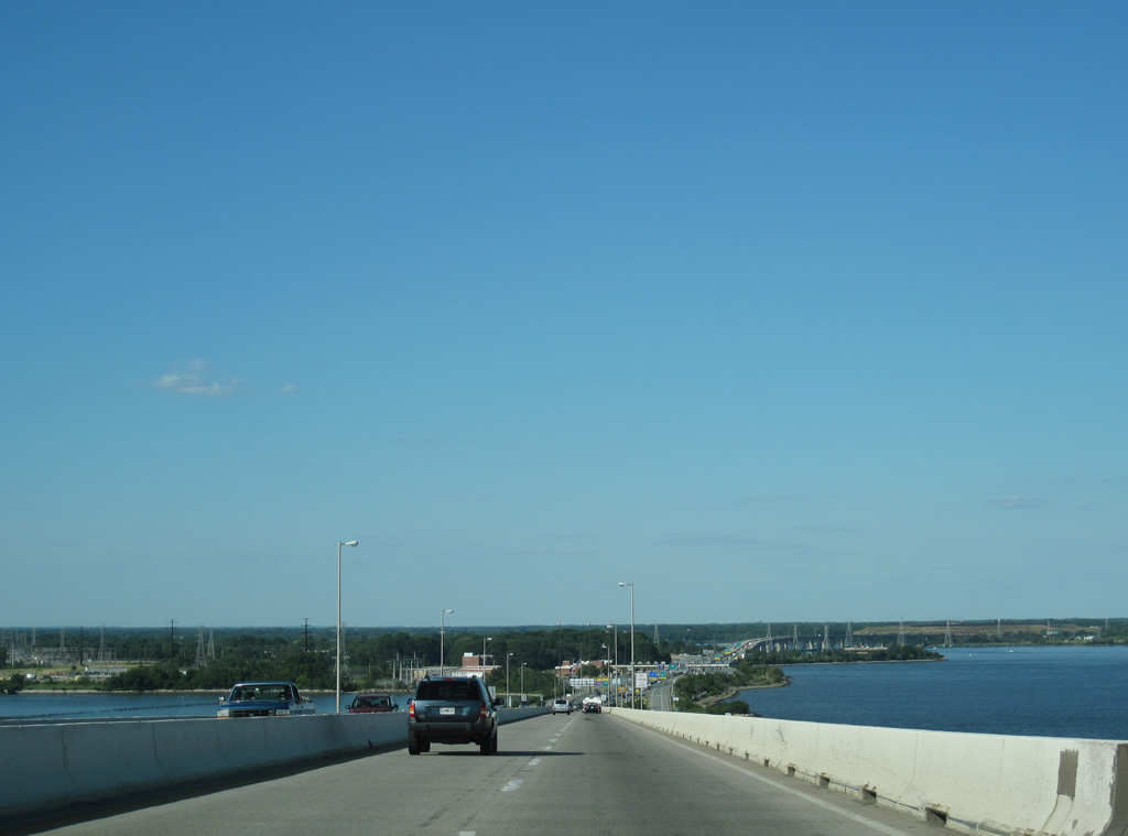
| Continuing beyond the entrance ramp from Fort Armistead Road, I-695 advances on the Francis Scott Key Bridge approach to the Patapsco River. 07/02/10 |
|
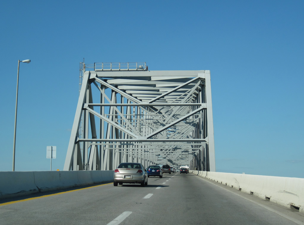
| The Francis Scott Key Bridge spans the entrance to Baltimore Harbor between Hawkins Point and Sollers Point. 07/02/10 |
|
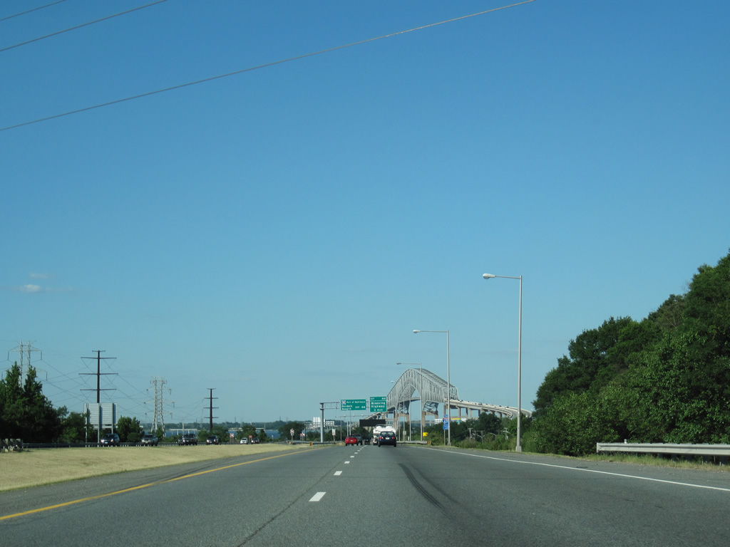
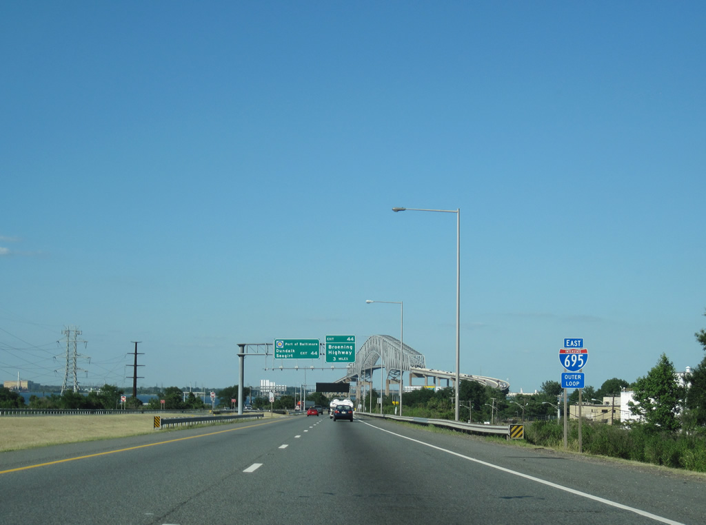
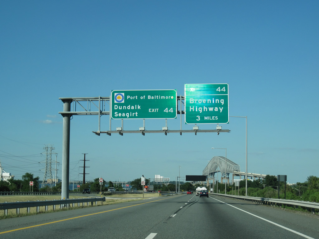
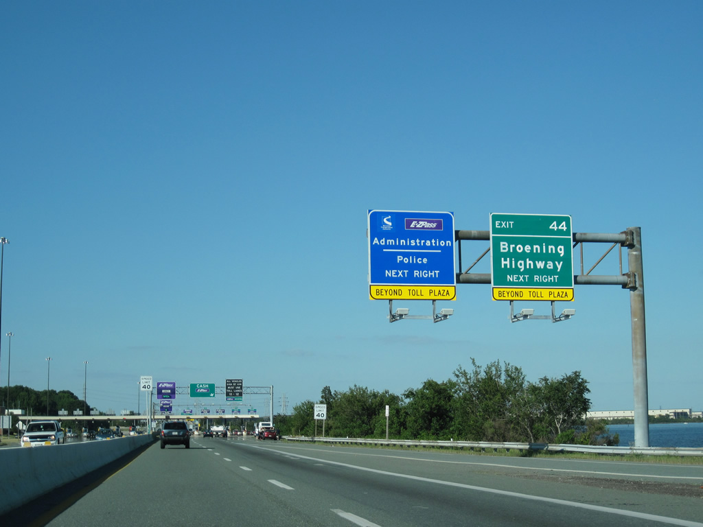
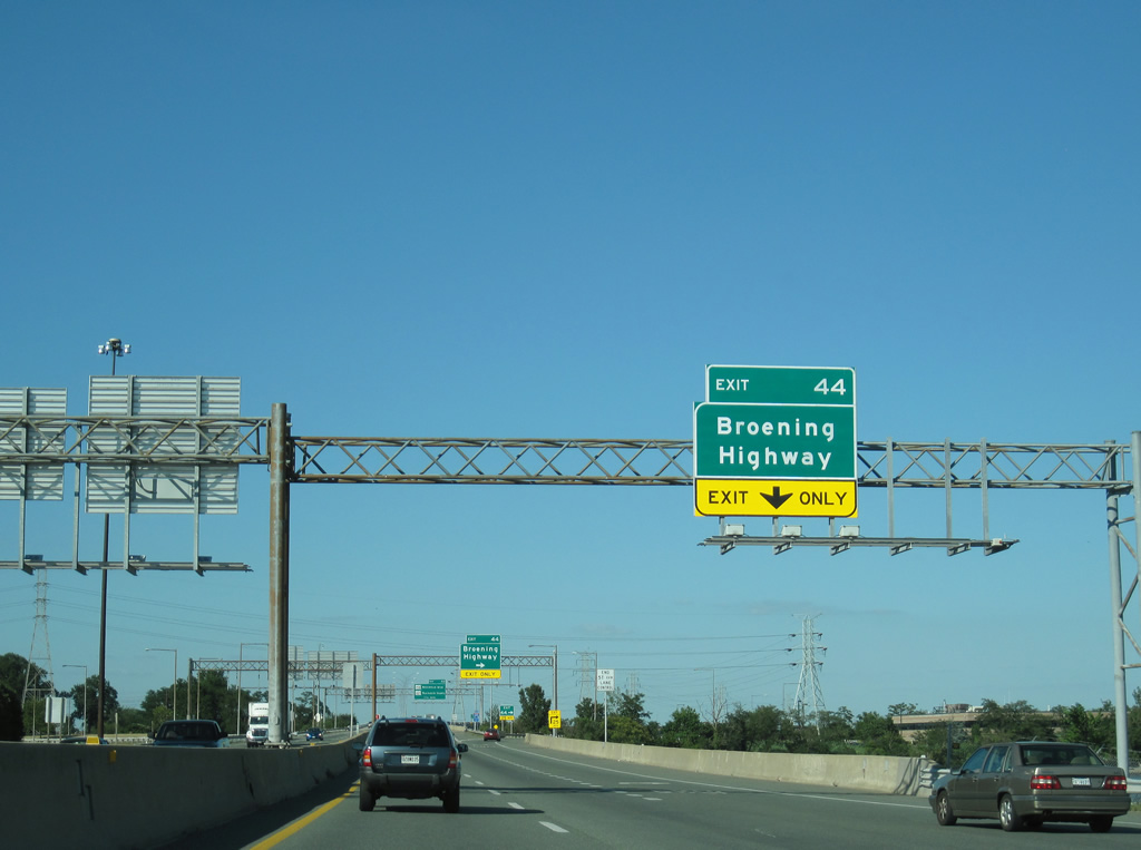
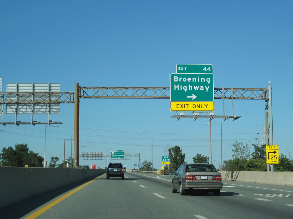
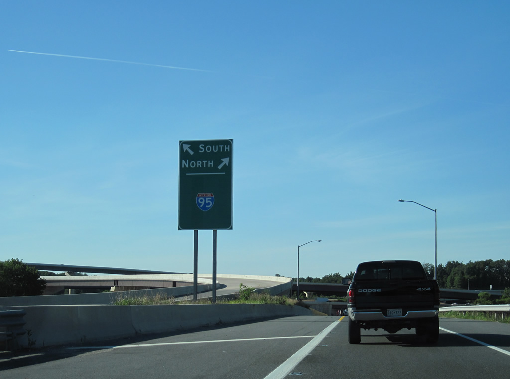
| A wye interchange (Exit 44) at Coffin Point connects I-695 east with Broening Highway (unsigned MD 695) north to the Dundalk and Seagirt Marine Terminals in three miles. 07/02/10 |
|
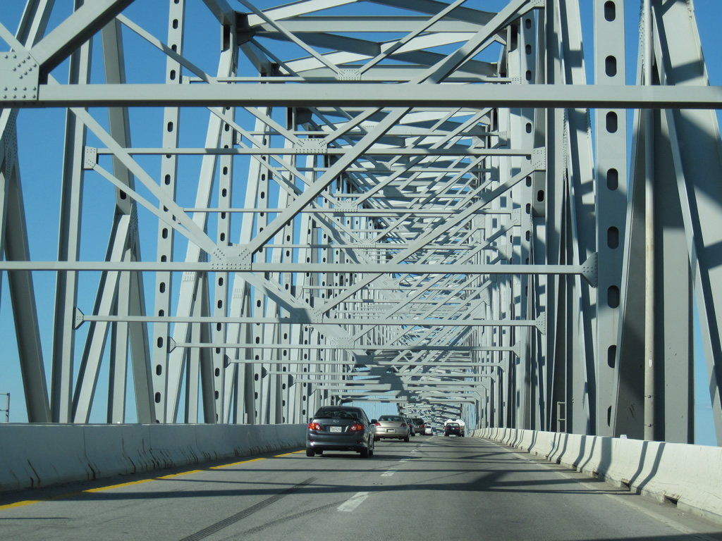
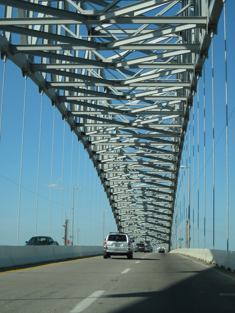
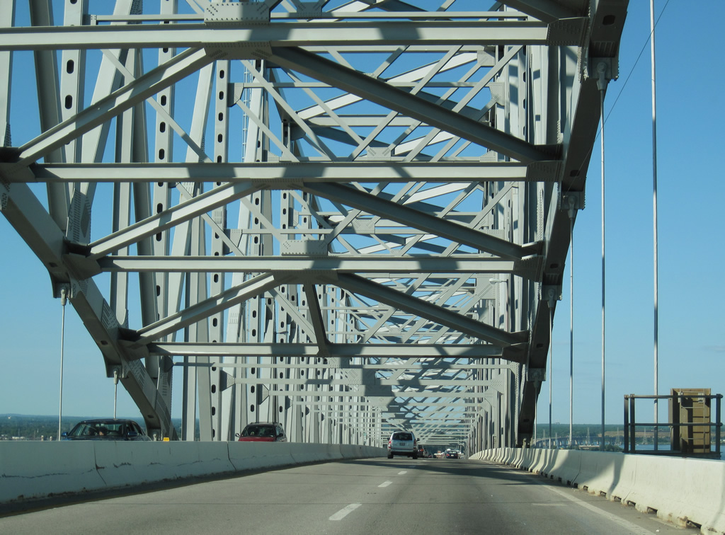
| Opened on March 23, 1977,1 the Francis Scott Key Bridge, along with two lane approaches on both sides, were the last completed sections along the Baltimore Beltway. 04/30/04 |
|
| The steel through arch bridge over the Patapsco River is named for Francis Scott Key. Key who wrote the Star Spangled Banner, the national anthem, after witnessing a spectacular battle at Fort McHenry during the War of 1812 in Baltimore Harbor. 07/02/10 |
|
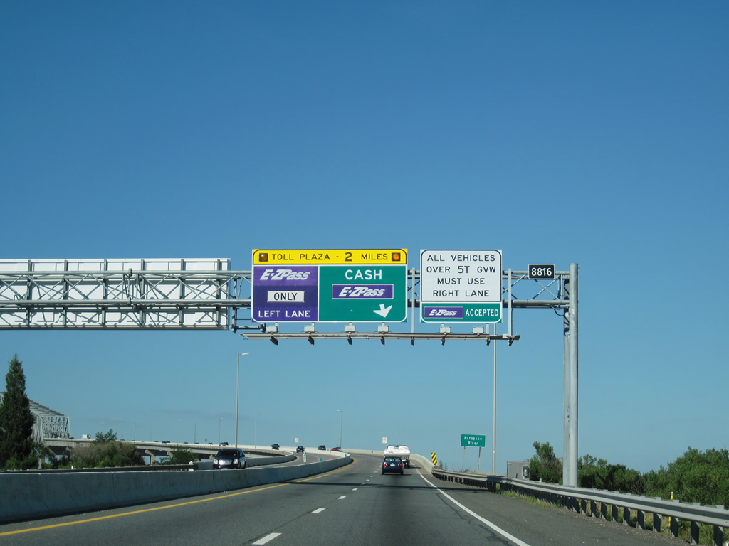
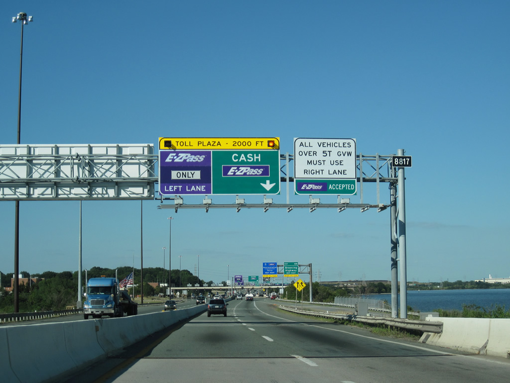
| Cash toll collection ceased for the Francis Scott Key Bridge on October 30, 2019. Toll collection gantries were installed beyond the east end of the span.2 07/02/10 |
|
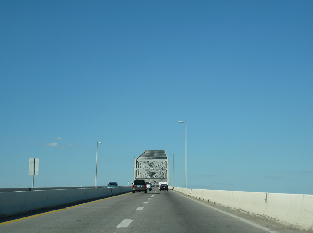
| Originally planned as a two lane tunnel, a four lane high rise bridge was instead constructed for the second Baltimore Harbor crossing to save on costs.1 07/02/10 |
|
| The Francis Scott Key Bridge cost $60.3 million and took five years to build.1 07/02/10 |
|
| The collision of the cargo ship Dali with one of the main pier supports on the morning of March 26, 2024 resulted in the collapsed of the entire truss portion of the Francis Scott Key Bridge.4 07/02/10 |
|
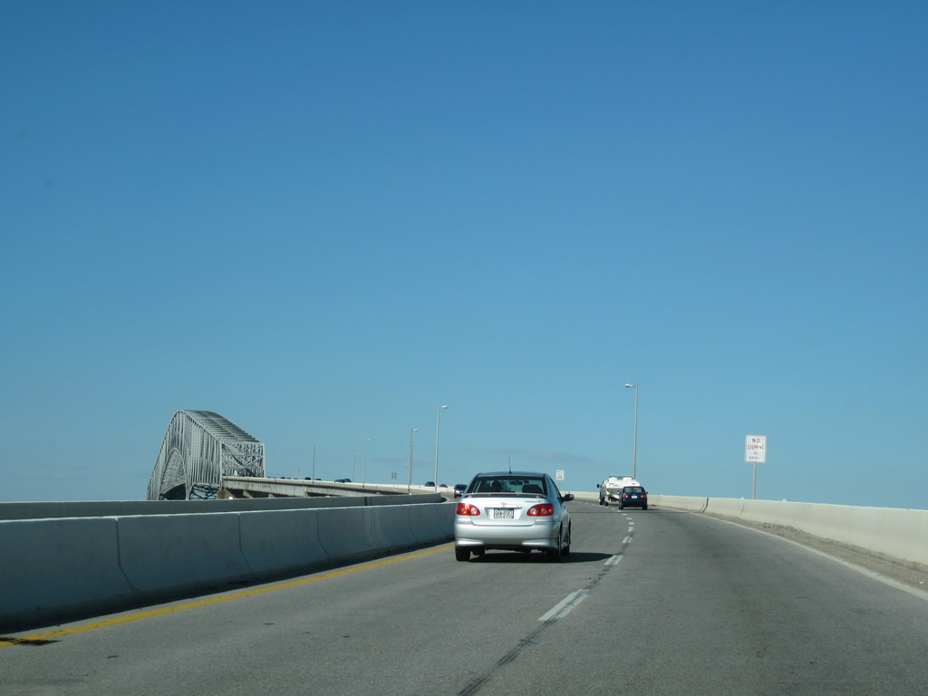
| The Francis Scott Key Bridge provides a vertical clearance of 185 feet.1 07/02/10 |
|
| Interstate 695 nips a corner of Anne Arundel County between the city o Baltimore and Baltmire County. 07/02/10 |
|
| 1.6 miles in length, the Francis Scott Key Bridge lowers into Dundalk. 07/02/10 |
|
| Final work demolishing the Francis Scott Key Bridge toll plaza and repaving was completed in Spring 2021.3 07/02/10 |
|
| Exit 44 departs I-695 just beyond the toll collection point for the Francis Scott Key Bridge. Broening Highway (unsigned MD 695) leads northwest to Dundalk and Dundalk Avenue in east Baltimore. Authority Drive (MD 695C) spurs west of Broening Highway to an MTA Administration facility nearby. 07/02/10 |
|
| I-695 runs along Bear Creek east to Exit 44. Broening Highway (unsigned MD 695) angles 1.93 miles northwest to the Maryland Port Authority Dundalk and Seagirt Marine Terminals and the Baltimore city line. 07/02/10 |
|
| Broening Highway extends another 2.18 miles northwest in Baltimore to the Medford and O'Donnell Heights neighborhoods by Interstate 95. 07/02/10 |
|
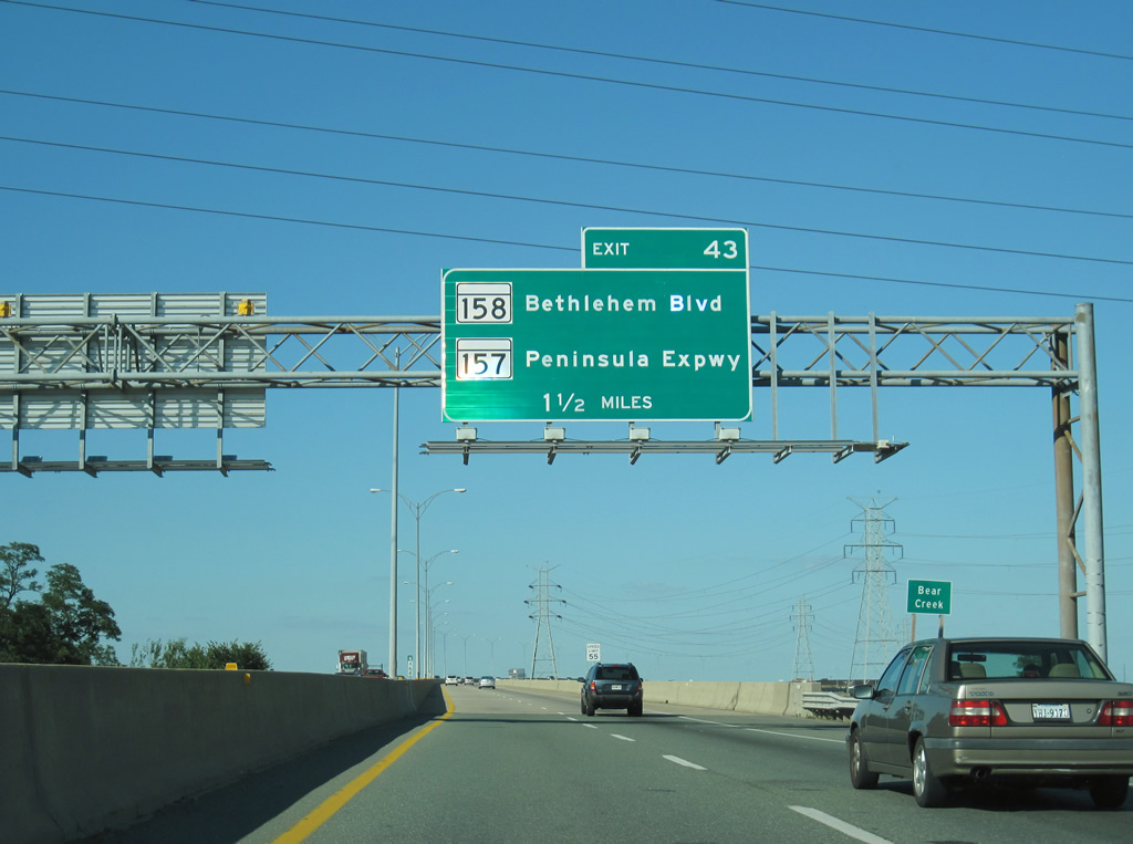
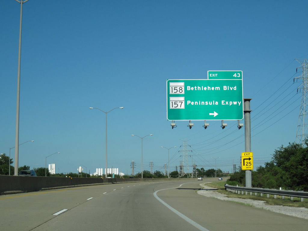
| Interstate 695 rises across Bear Creek Bridge. Part of the Key Bridge approaches, the two lane bridge system was expanded to four in 2000.
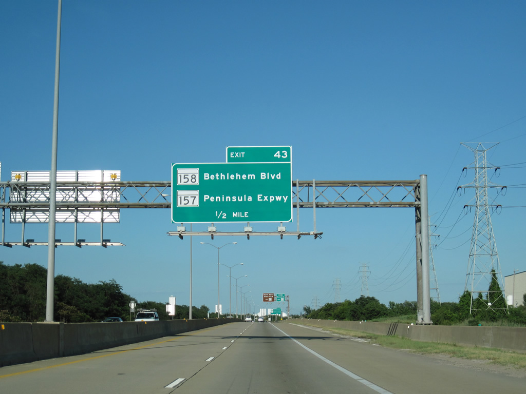
A six-ramp parclo interchange follows at MD 158 (Bethlehem Boulevard) and the south end of MD 157 (Peninsula Expressway). 07/02/10 |
|
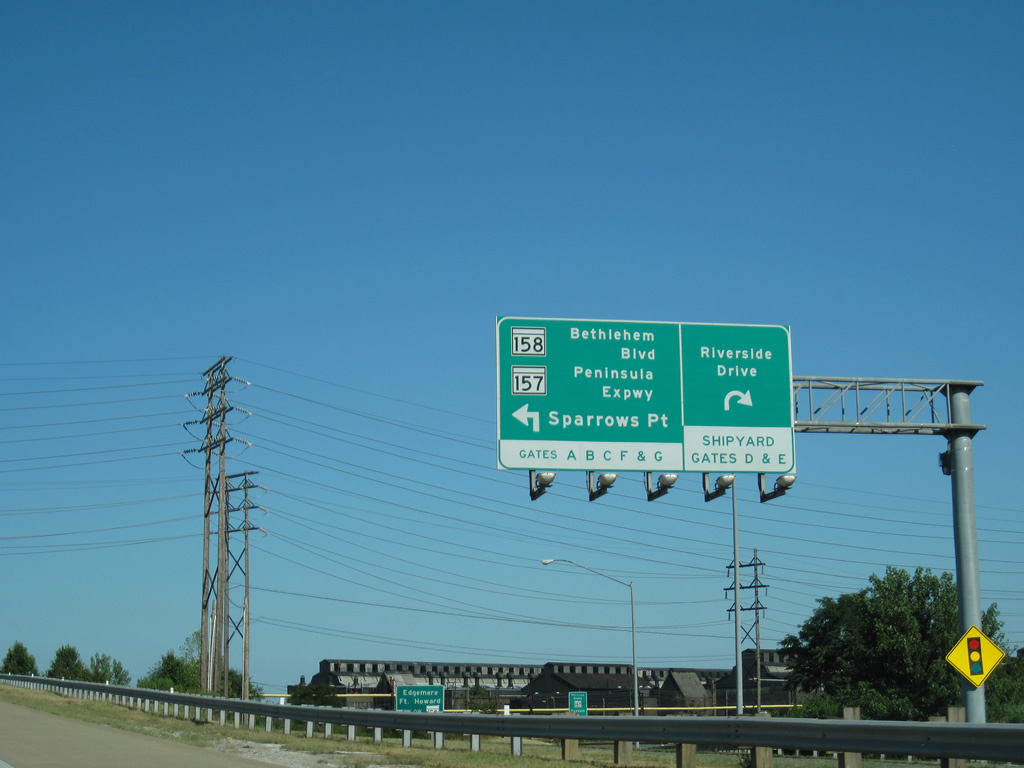
| MD 158 (Bethlehem Boulevard) runs alongside Interstate 695 east from Riverside Drive at Sparrows Point to MD 157 (Peninsula Expressway) at Exit 43 and Edgemere. 07/02/10 |
|
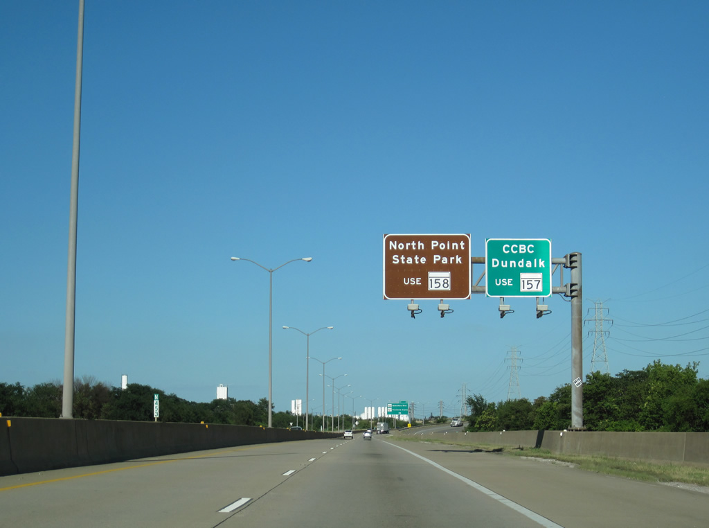
| MD 158 (Bethlehem Boulevard) concludes to the east at North Point Road in Edgemere. North Point Road leads south to North Point State Park. MD 157 heads northwest to Dundalk and the Community College of Baltimore County (CCBC) Dundalk. 07/02/10 |
|
| Exit 43 joins I-695 east with adjacent MD 158 (Bethlehem Boulevard). A 4.79 mile long route, MD 157 lines Peninsula Expressway northwest and Merritt Boulevard northeast to Exit 39. 07/02/10 |
|
| Serving an array of distribution centers, MD 158 comprises a 2.35 mile long minor arterial. 07/02/10 |
|
| Interstate 695 curves northeast across Patapsco River Neck past Edgemere, where an entrance ramp joins MD 151 (North Point Boulevard) with the beltway outer loop. 07/02/10 |
|
| The roadways for Interstate 695 separate with a wooded median north of the Morse Lane and Norfolk Southern Railroad underpass. 07/02/10 |
|
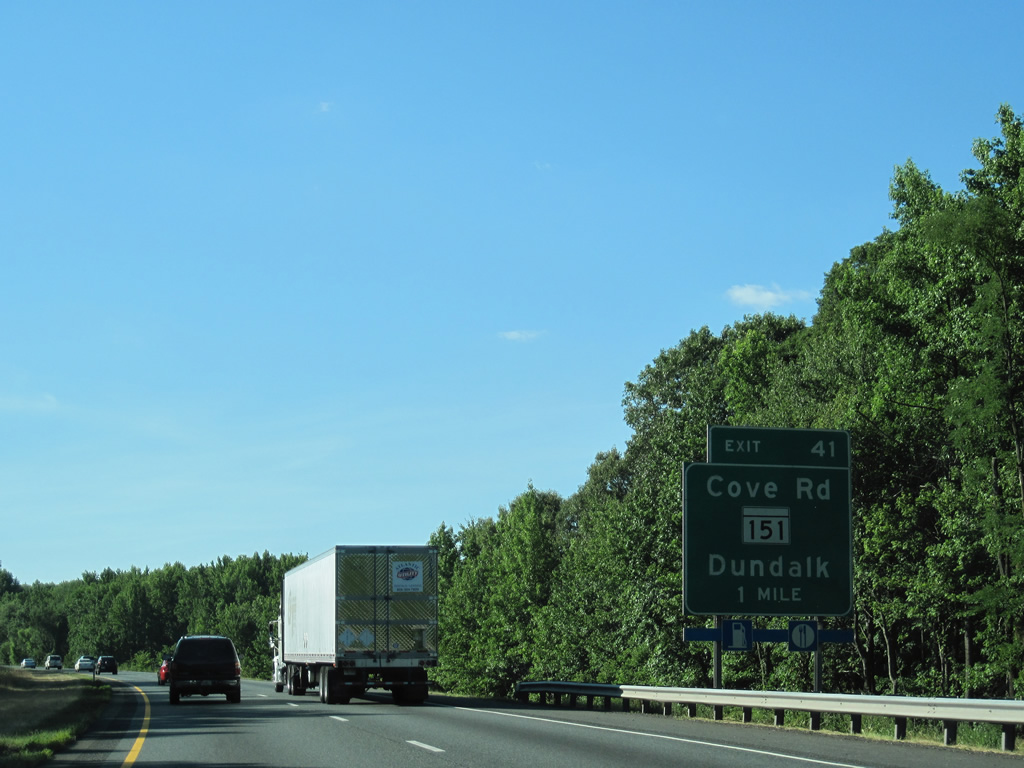
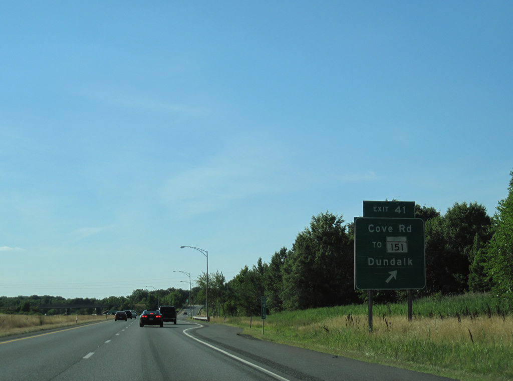
| A diamond interchange (Exit 41) links Interstate 695 with Cove Road west to MD 151 (North Point Boulevard) and Dundalk. 07/02/10 |
|
| Cove Road spurs 0.59 miles north from MD 151 at North Point to Glenhurst Road on the Back River. MD 151 runs 10.71 miles northwest from Sparrows Point to U.S. 1 (Bel Air Road) at Belair-Edison in Baltimore. 07/02/10 |
|
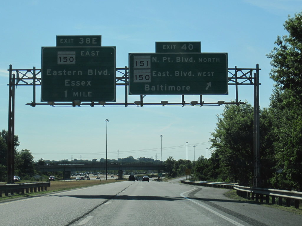
| The roadways for MD 151 (North Point Road) separate alongside I-695 at a split diamond interchange (Exit 40) east of Eastpoint Mall and MD 150 (Eastern Avenue). 07/02/10 |
|
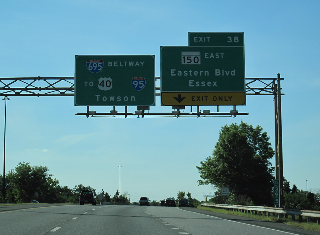
| A slip ramp joins I-695 from MD 151 north. Interstate 695 curves northward to a three quarter cloverleaf interchange (Exit 38) with MD 150 next. 07/02/10 |
|
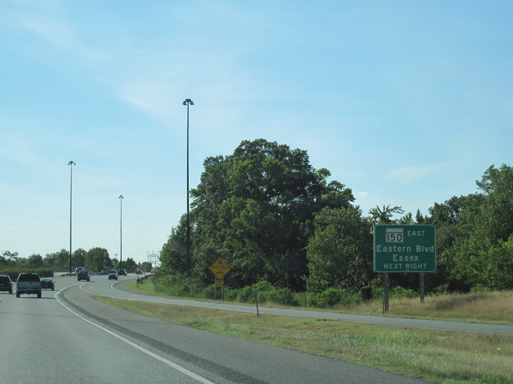
| MD 150 stretches 13.07 miles east from U.S. 40 (Pulaski Highway) in Baltimore to Essex, Middle River and Chase. Exit 38 provides access to Eastern Avenue eastbound ahead of the Back River. 07/02/10 |
|
| Three successive interchanges follow along Interstate 695 north between Essex and Rossville. 07/02/10 |
|
| Interstate 695 crosses Moores Run at the Back River between Exits 38 and 36. 07/02/10 |
|
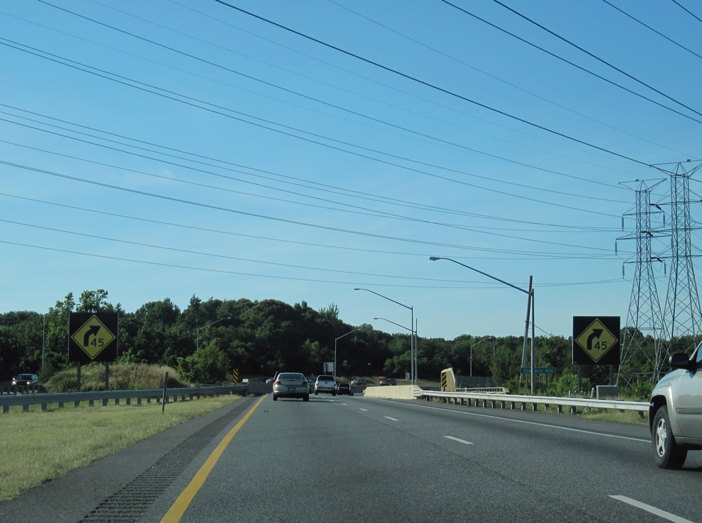
| A sharp turn takes Interstate 695 east from the Patapsco Freeway onto the Windlass Freeway at Batavia Park. 07/02/10 |
|
| The S-curve around Chesaco Park along I-695 is where the unbuilt section of the Windlass Freeway was to extend west to I-95 at Moravia Road. 07/02/10 |
|
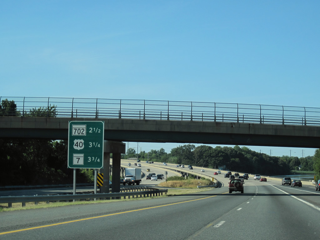
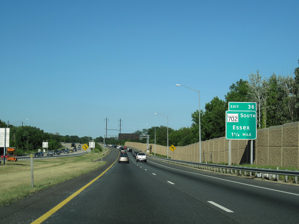
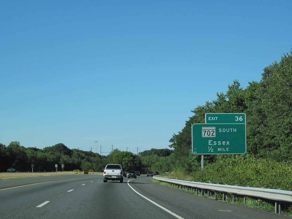
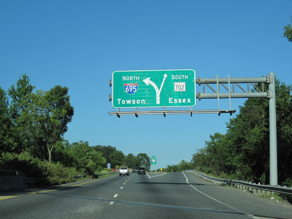
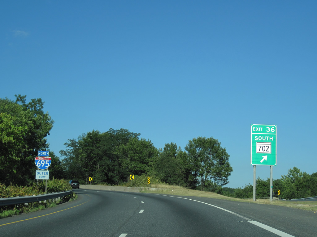
| I-695 (Windless Freeway) parallels Northeast Creek to the directional T interchange (Exit 36) with MD 702 (Southeast Expressway). MD 702 joins the Beltway with MD 150 west of Middle River, Middleborough and Rocky Point Park. 07/02/10 |
|
| Planned to extend southeast to Rocky Point Park, MD 702 was to be part of a larger freeway system in the area southeast of Baltimore. 07/02/10 |
|
| A roadway stub remains from the unbuilt extension of the Windlass Freeway at the exchange with MD 702. The Windless Freeway was proposed to roughly parallel the Amtrak corridor toward the proposed White Marsh Expressway (MD 43) east of U.S. 40. 07/02/10 |
|
| MD 702 spurs 4.17 miles south along Southeast Expressway / Boulevard to Back River Neck Road. 07/02/10 |
|
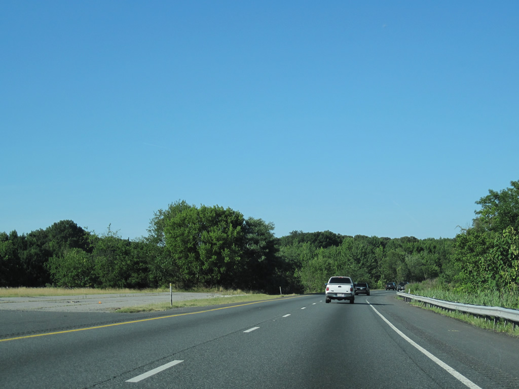
| Interstate 695 east utilizes the ramp from the Windless Freeway to the Beltway north. 07/02/10 |
|
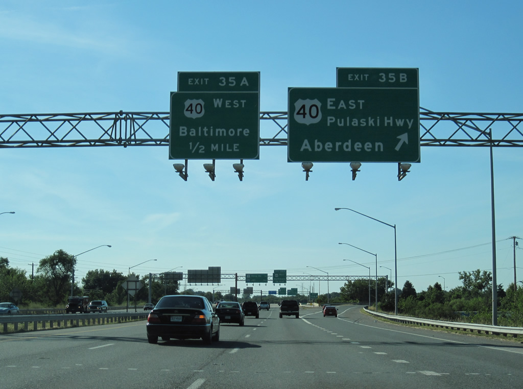
| U.S. 40 (Pulaski Highway) travels east from the cloverleaf interchange at Exit 35 to Rossville, Middle River and White Marsh before leaving Baltimore County at Gunpowder Falls State Park to Joppatowne. 07/02/10 |
|
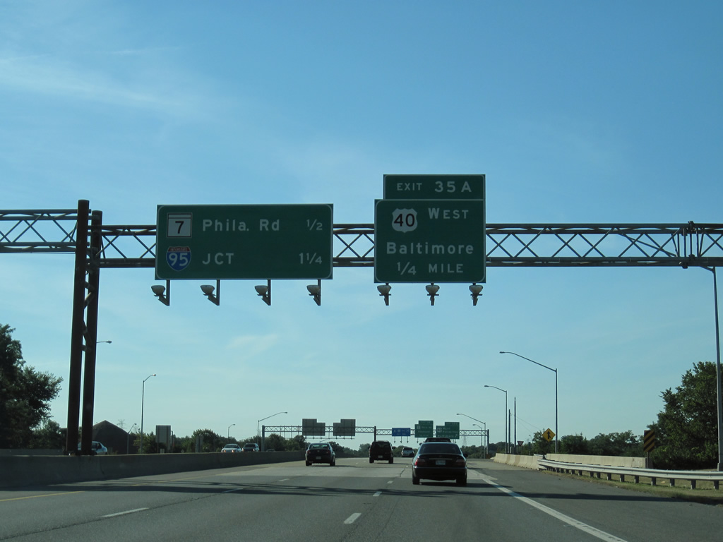
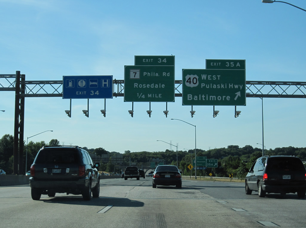
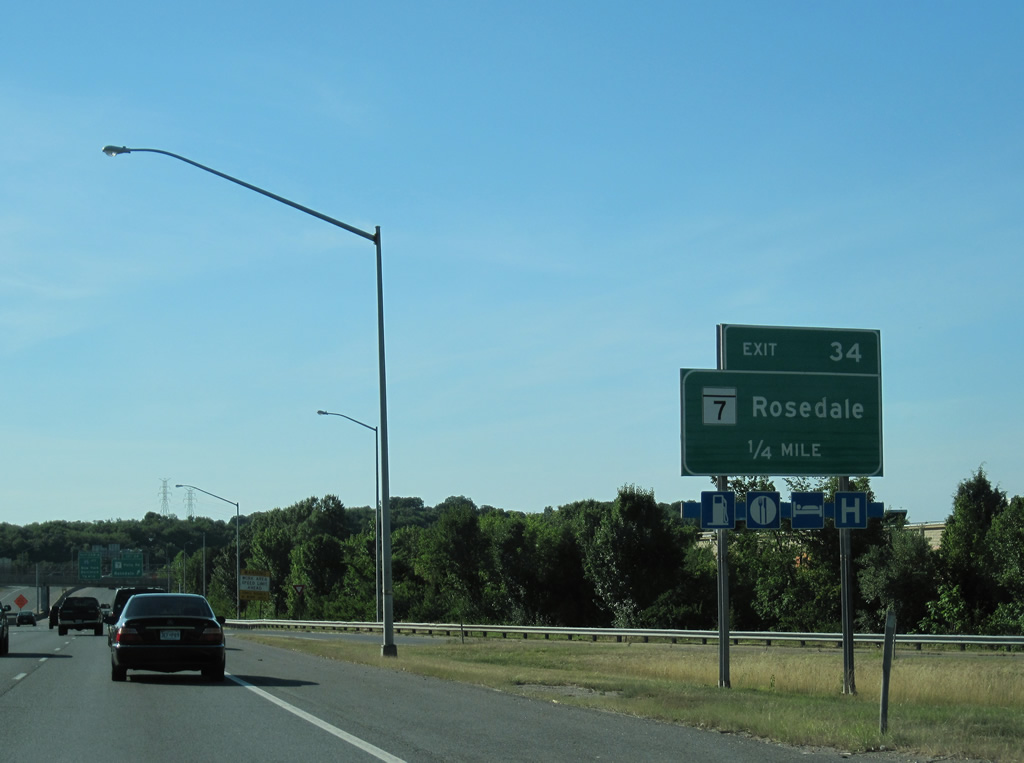
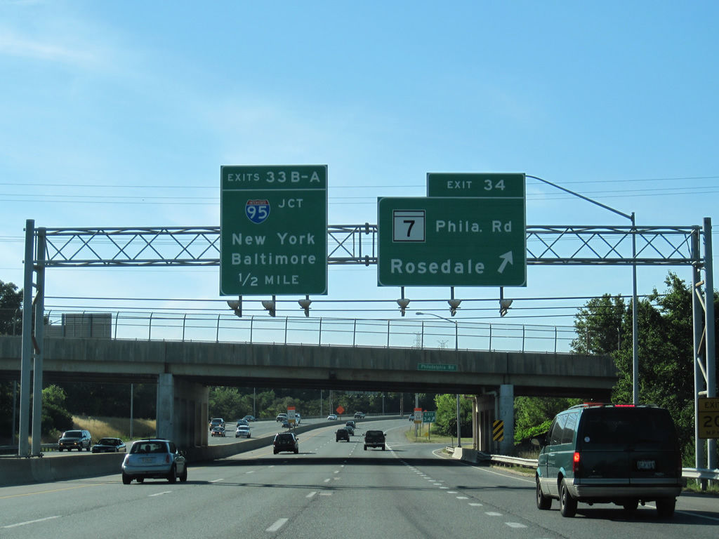
| Exit 35A loops onto U.S. 40 (Pulaski Highway) west to Rosdale and Orangeville in east Baltimore. MD 7 (Philadelphia Roadz) meets the Beltway at the ensuing exit. 07/02/10 |
|
| U.S. 40 follows Pulaski Highway west to Orleans Street at Ellwood Park / Monument in Baltimore. MD 7 converges with U.S. 40 west of Rosedale by the Baltimore city line. 07/02/10 |
|
| Much like MD 144, which follows old sections of U.S. 40 west of Baltimore, MD 7 represents old alignments of U.S. 40 east of Baltimore to Elkton. This branch of MD 7 extends 22.83 miles east from Rosedale to U.S. 40/MD 159 at Aberdeen. 07/02/10 |
|
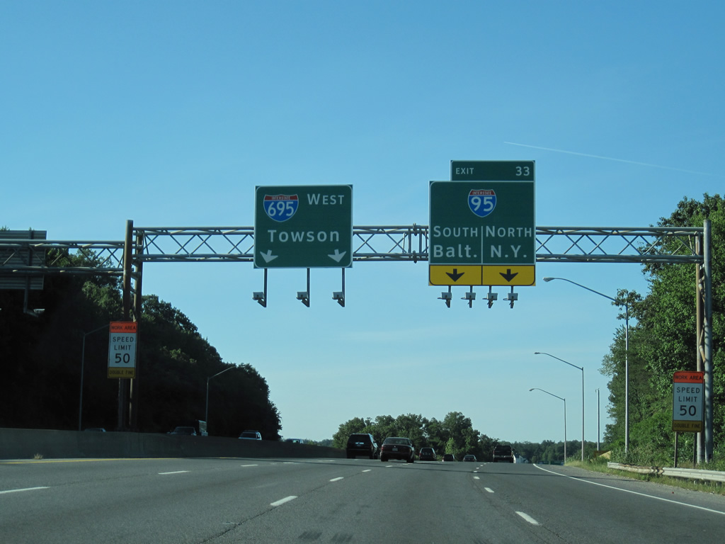
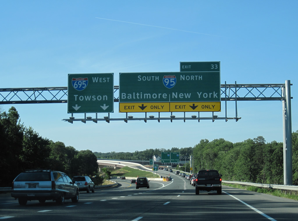
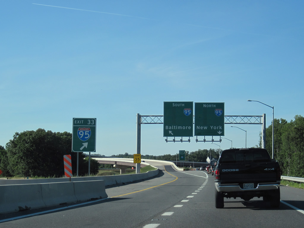
| I-695 (Baltimore Beltway) advances north from a parclo interchange (Exit 34)`with MD 7 (Old Philadelphia Road) into a systems exchange (Exit 33) with Interstate 95 near Kenwood Park. 07/02/10 |
|
| Construction began on January 22, 2007 to reconstruct the interchange at I-95/695 during the I-95 Express Toll Lanes (ETL) project. Opened on December 6, 2014, the four HOT lanes were added to the middle of John F. Kennedy Memorial Highway from I-895 in Baltimore to the Harford County line. Provisions for ramps between the Express Lanes and Baltimore Beltway were incorporated into the design. 07/02/10 |
|
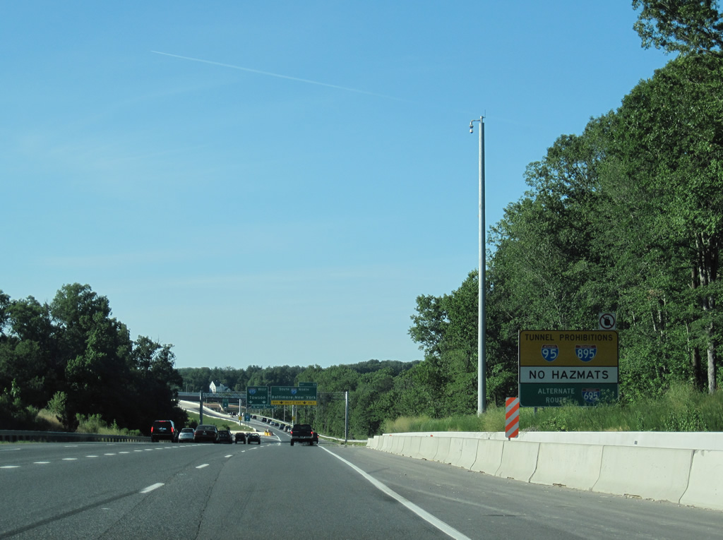
| Due to the tunnels under the harbor near Downtown Baltimore, both I-95 and I-895 south have restrictions for hazardous vehicles. 07/02/10 |
|
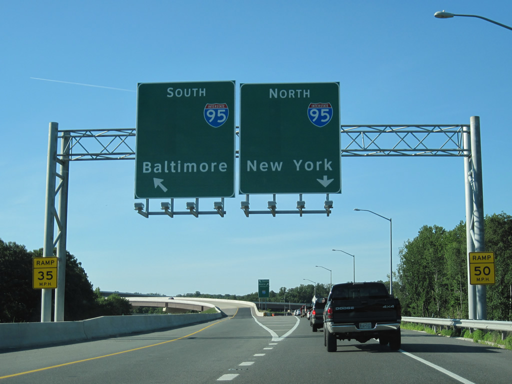
| Two lanes part ways at Exit 33 for both directions of Interstate 95. Prior to 2010, separate ramps (Exits 33B/A), including a left exit, joined I-695 north with I-95. 07/02/10 |
|
| Exit 33 partitions into a high flyover to Baltimore and a grade level ramp to John F. Kennedy Memorial Highway north to Harford and Cecil Counties. 07/02/10 |
|
| Since replaced, blank spaces on the guide signs at Exit 33 were designed to display information for the I-95 ETL. The toll lanes aid in the movement of heavy commuter traffic along Interstate 95 northeast from Baltimore to Joppatowne and Bel Air. 07/02/10 |
|
| Travelers continuing north onto I-95 follow the John F. Kennedy Memorial Highway to Aberdeen, Havre De Grace and Elkton before leaving Maryland at the Delaware Turnpike. Southbound I-95 enters Baltimore at the split with Interstate 895 (Harbor Tunnel Thruway) next. 07/02/10 |
|
| Flyovers replaced the left side ramps between the Baltimore Beltway and John F. Kennedy Memorial Highway. 07/02/10 |
Page Updated 11-01-2021.


 East
East