The Lynchburg Expressway encircles the city of Lynchburg from Madison Heights west to Brookview and north toward Boonesboro. The four lane freeway carries U.S. 501 south from Boonesboro Road to Candler Mountain Road and U.S. 29 Business east from Wards Road to Amherst Highway in Madison Heights. Sequential exit numbers are used along the route from the Main Street exit south of Downtown to Graves Mill Road south of U.S. 221.
Lynchburg Expressway carried U.S. 29 until the October 2005 completion of the Lynchburg-Madison Heights Bypass. U.S. 29 Business shifted from Wards Road, Fort Avenue, Memorial Avenue and 5th Street onto the freeway, leaving Virginia Route 163 along the former route.
|
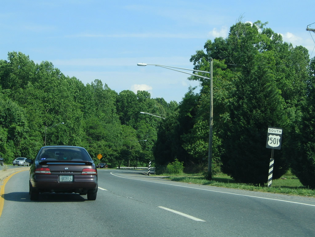
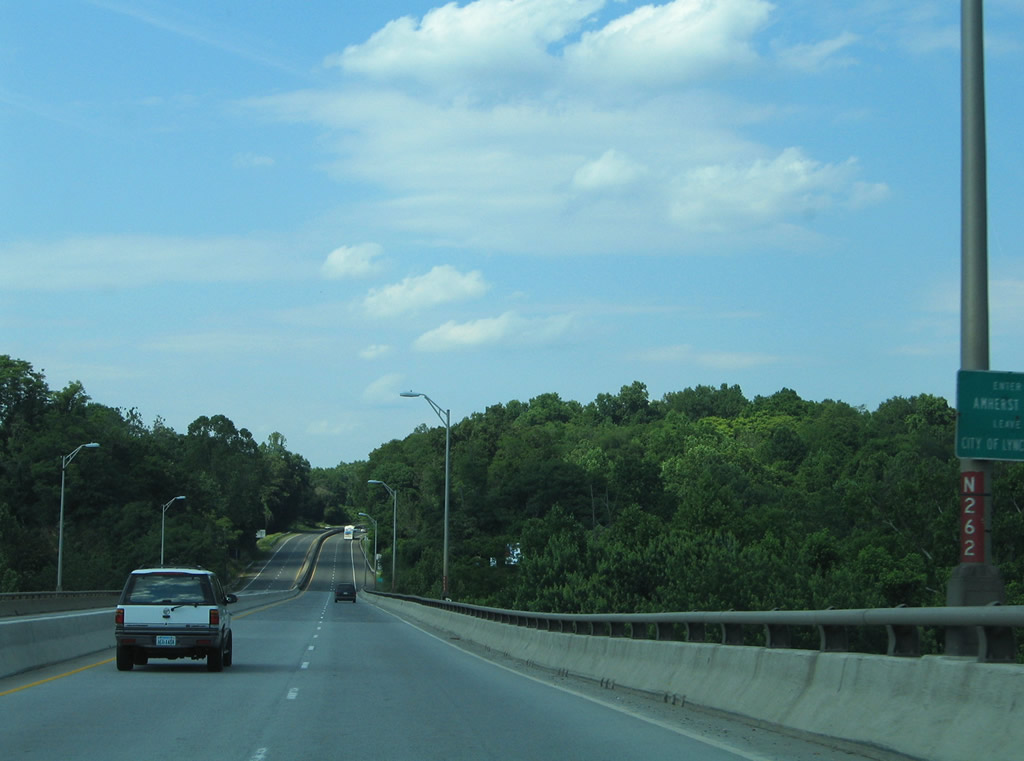
| U.S. 29 Business follows the Lynchburg Expressway southward toward downtown Lynchburg and Wards Road. Old U.S. 29 Business, now designated SR 163, continues along the Amherst Highway to 5th Street in the city. 06/05/05 |
|
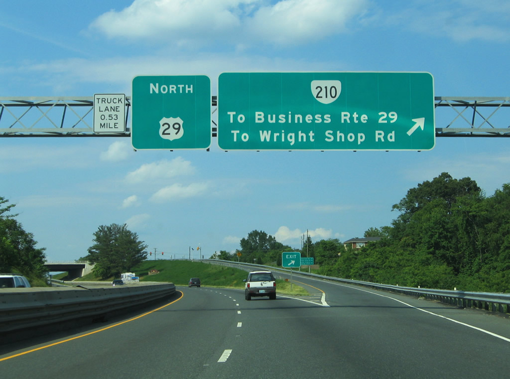
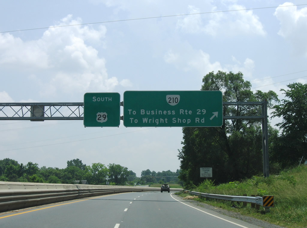
| A diamond interchange quickly follows between U.S. 29 Business (Lynchburg Expressway) and SR 210 (Colony Road). SR 210 comprises a short connector between SR 163 (Amherst Highway) and U.S. 29 (Lynchburg-Madison Heights Bypass) through the Madison Heights and Colony area. SR 210 originally originally ended at the Central Virginia Training Center, but now follows an expressway alignment east to U.S. 29. 06/05/05 |
|
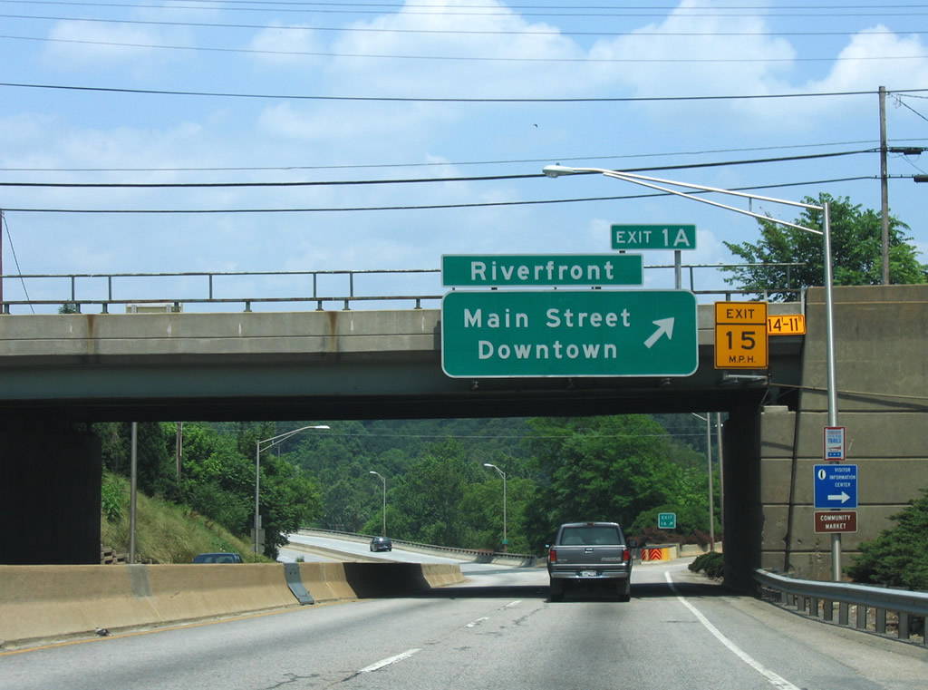
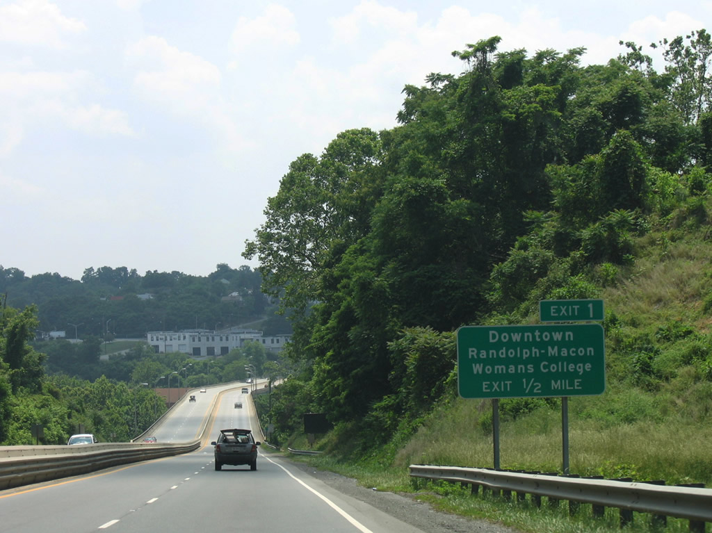
| Southbound drivers lower toward the Lynchburg Expressway crossing of the James River into Lynchburg proper. Exit 1 lies one half mile ahead with Main Street south of downtown. 06/05/05 |
|
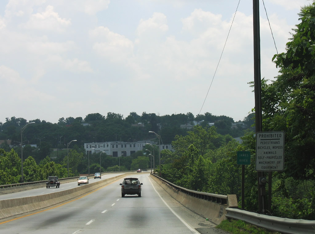
| The James River separates Amherst County from the independent city of Lynchburg. 06/05/05 |
|
| Concord Turnpike lines the James River and passes under U.S. 29 Business, ending at Washington and Jefferson Street in this northward facing scene. 06/05/05 |
|
| A loop ramp carries all traffic interests to Main Street from U.S. 29 Business (Lynchburg Expressway) southbound. Main Street heads directly north into the central business district, eventually becoming Rivermont Avenue (former U.S. 501) northward to Rivermont. Main Street south joins the freeway with White Rock Hill and Florida Avenue. 06/05/05 |
|
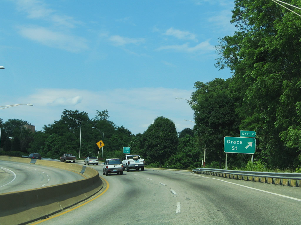
| U.S. 29 Business winds southward toward the folded diamond interchange (Exit 2) with Miller Street and Robins Road. Mill Street connects the Lynchburg Expressway with Monroe Street north and Grace Street. 06/05/05 |
|
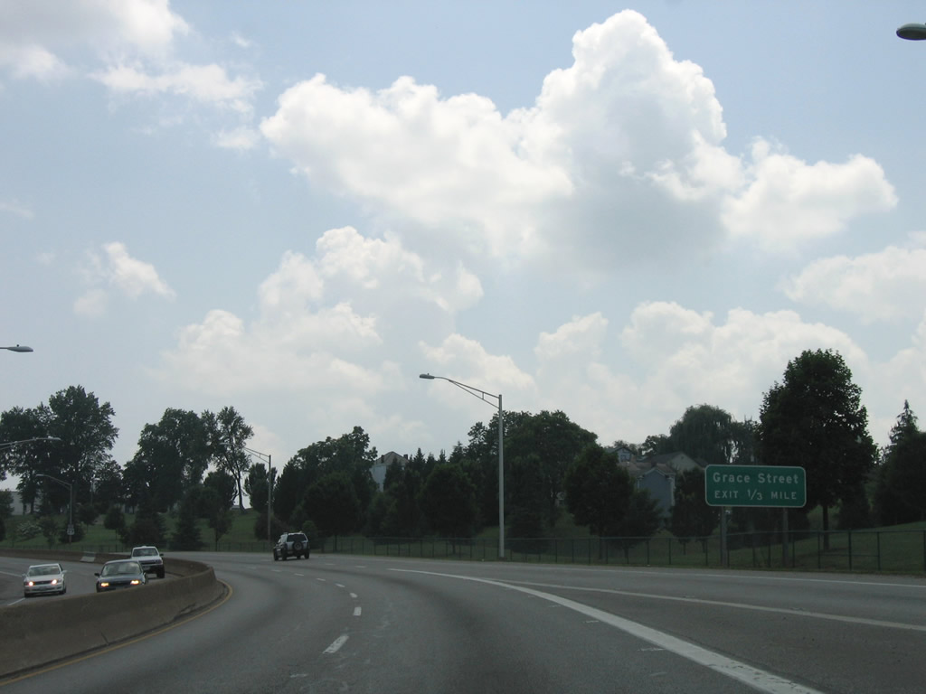
| A swath of open space lines the westbound lanes of the Lynchburg Expressway by this southbound shield for U.S. 29 between Main and Grace Streets. 06/05/05 |
|
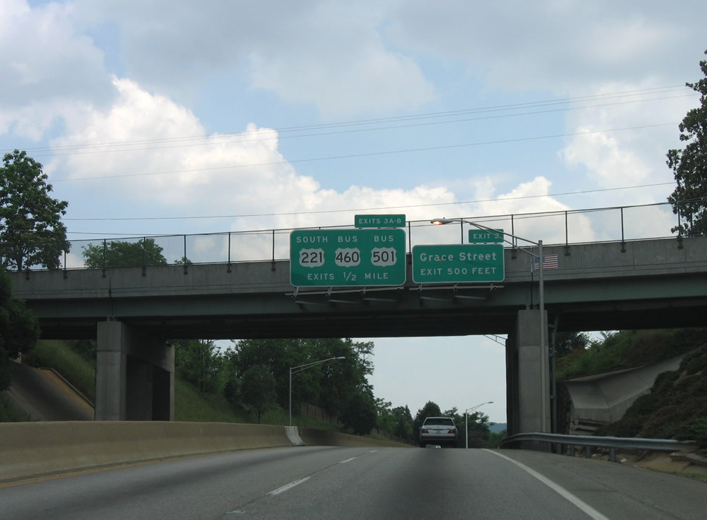
| Grace Street travels west from Florida Avenue on a northerly course into Downtown Lynchburg. Monroe Street connects Exit 2 with 12th Street and SR 163 (5th Street) at Park Avenue.
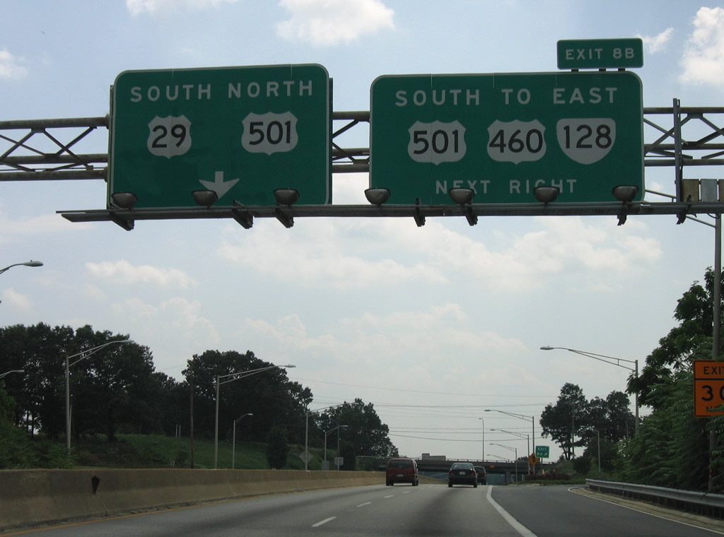
U.S. 29 Business advances south to meet the north end of U.S. 221 and U.S. 460-501 Business. 06/05/05 |
|
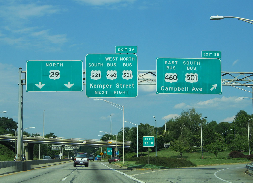
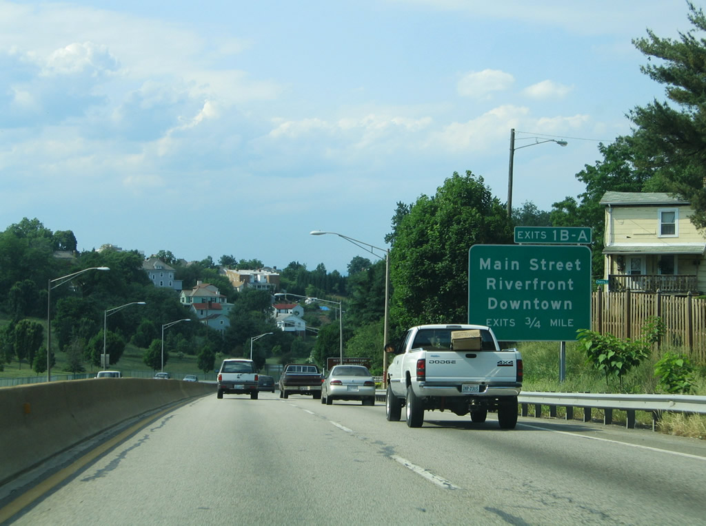
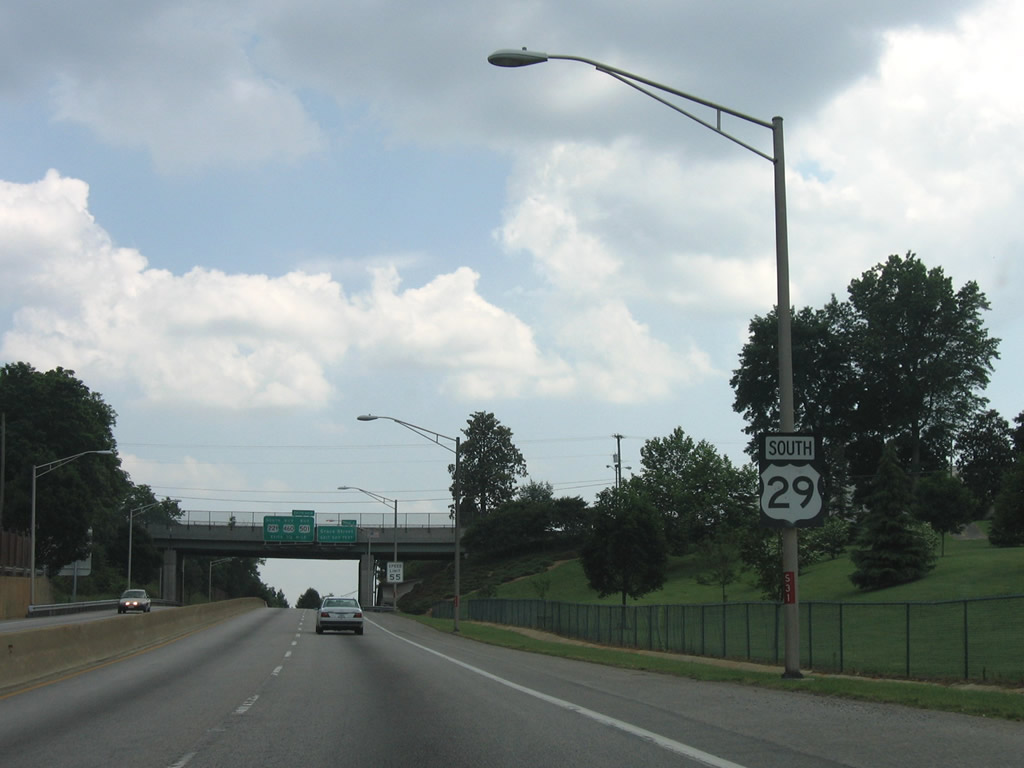
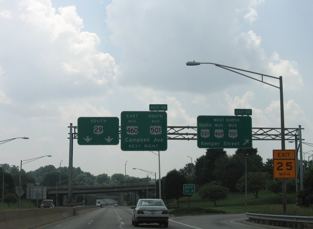
| Exit 3A leaves U.S. 29 Business (Lynchburg Expressway) south for U.S. 221 south and U.S. 460-501 Business on Kemper Street. The three routes head northward to Fort and Park Avenues. Fort Avenue carries U.S. 460 Business west to Exit 10 of the Lynchburg Expressway. U.S. 221 follows Fort Avenue to Oakley Avenue north. U.S. 501 Business runs along Langhorne Road north to Rivermont Avenue. 06/05/05 |
|
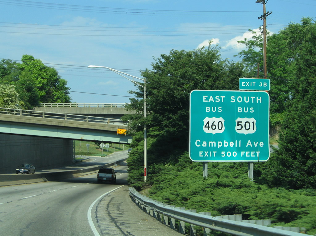
| Exit 3B follows within the cloverleaf interchange between U.S. 29 Business and Kemper Street. U.S. 460 Business east / U.S. 501 Business south continue on Kemper Street to merge with Campbell Avenue at Fairview Heights. The pair end at U.S. 29-460-501 (Richmond Highway). 06/05/05 |
|
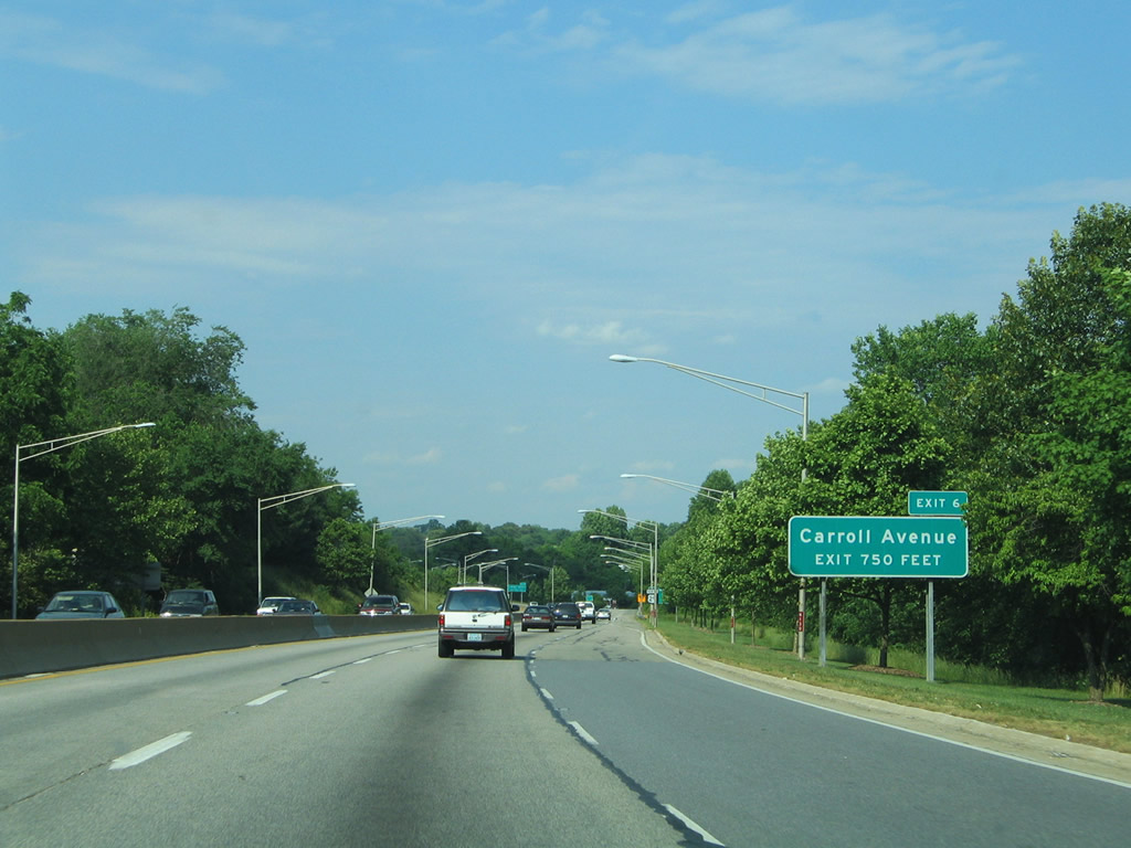
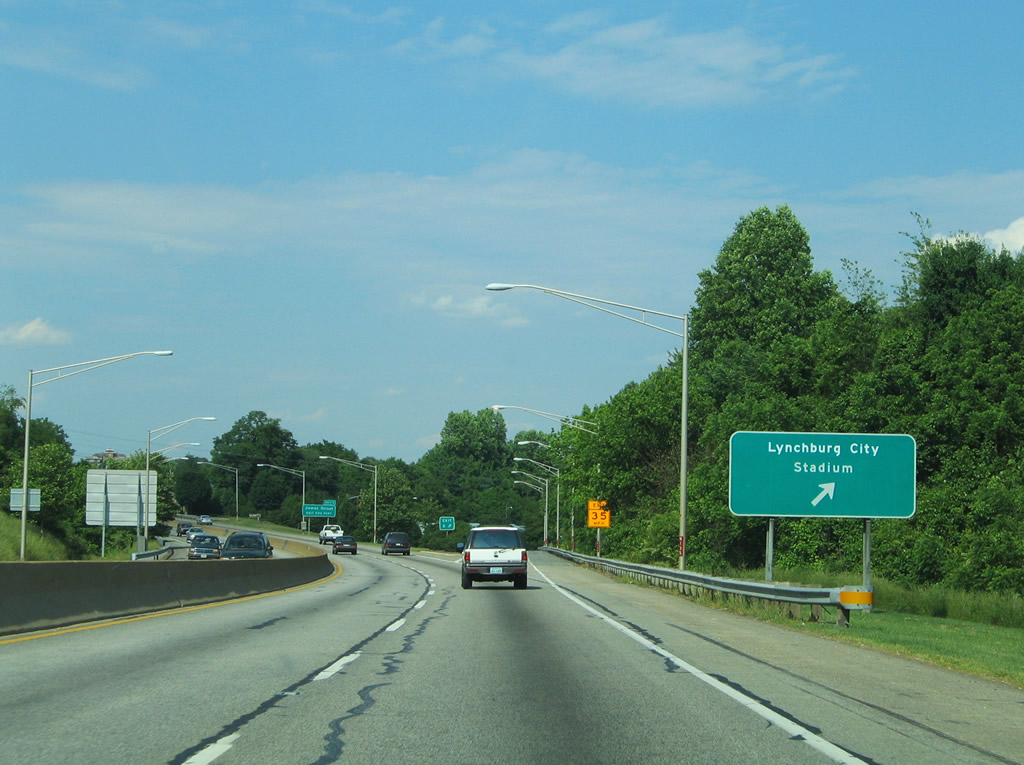
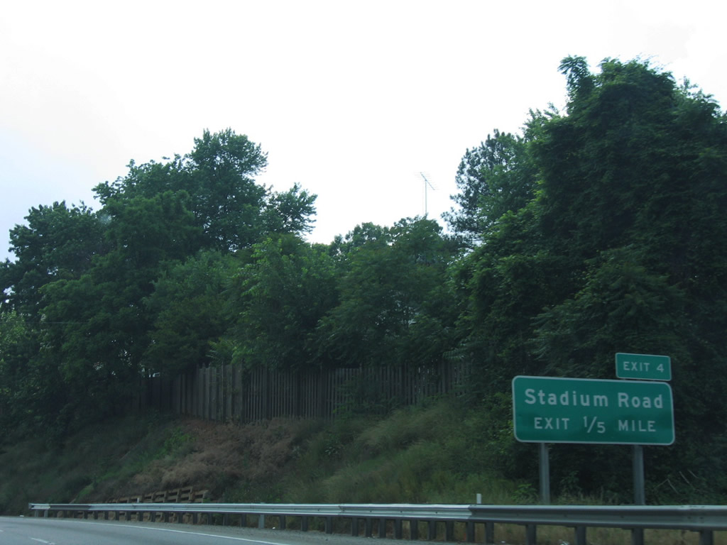
| U.S. 29 Business southbound emerges from underneath Campbell Avenue, an abandoned railroad bridge, and the Norfolk Southern Railroad overpasses on the one-fifth of a mile approach to Exit 4, Stadium Road. Stadium Road connects Carroll Avenue with Calvin Falwell Field, home of the Lynchburg Hillcats (Carolina League Baseball). 06/05/05 |
|
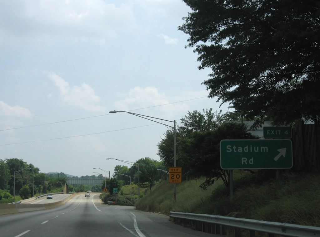
| Drivers bound for Stadium Road depart U.S. 29 Business (Lynchburg Expressway) south. Stadium Road connects with Wythe Road north to U.S. 221/460 Business (Fort Avenue). 06/05/05 |
|
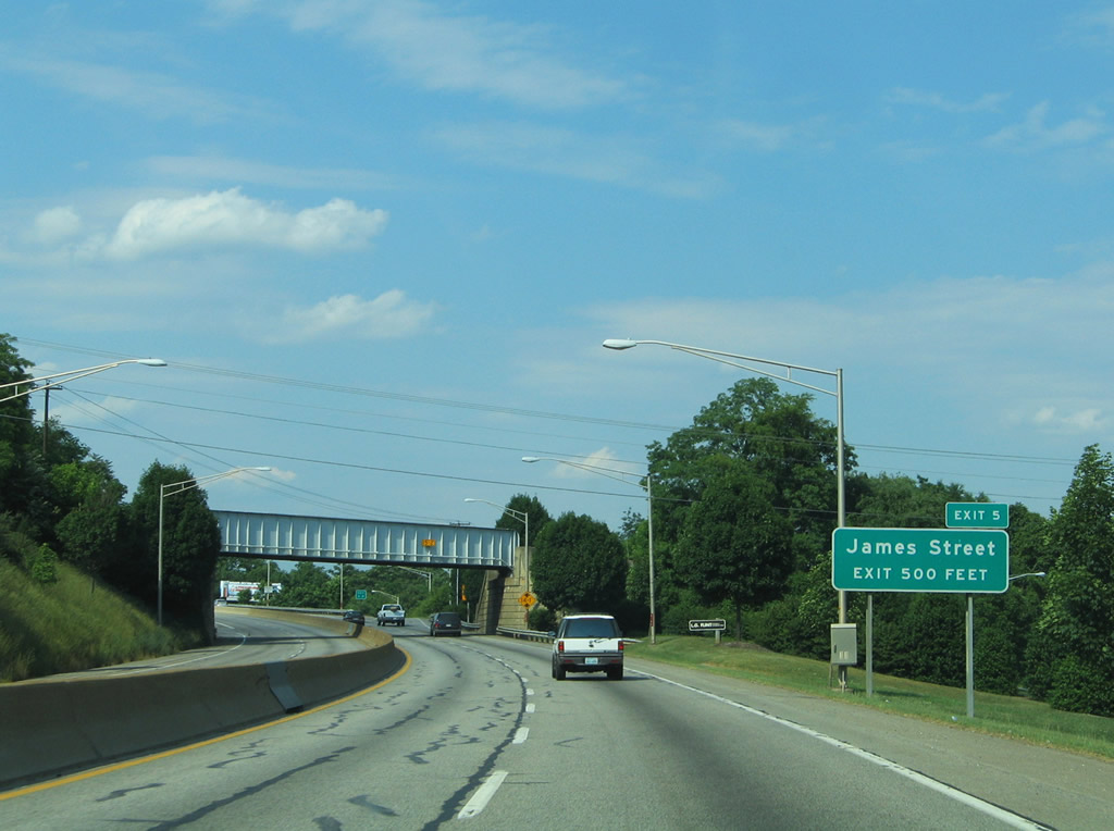
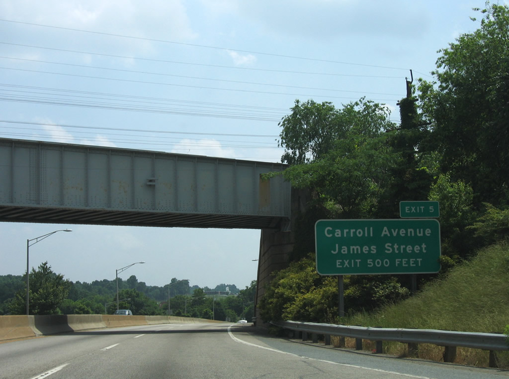
| A loop ramp follows between U.S. 29 Business south and James Street. James Street connects Stadium Road with Carroll Avenue. Carroll Avenue meanders southward to SR 128 at Perkins Park. 06/05/05 |
|
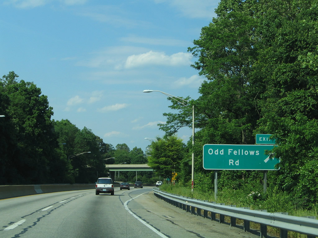
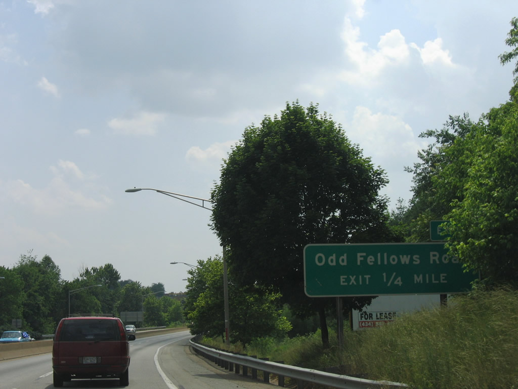
| Odd Fellows Road ties into the Lynchburg Expressway at a trumpet interchange (Exit 7) next. 06/05/05 |
|
| Heading southeast, Odd Fellows Road leads toward SR 128 (Mayflower Drive) at Perkins Park. 06/05/05 |
|
| Reassurance shield that was posted for U.S. 29 south after the Odd Fellows Road on-ramp. 06/05/05 |
|
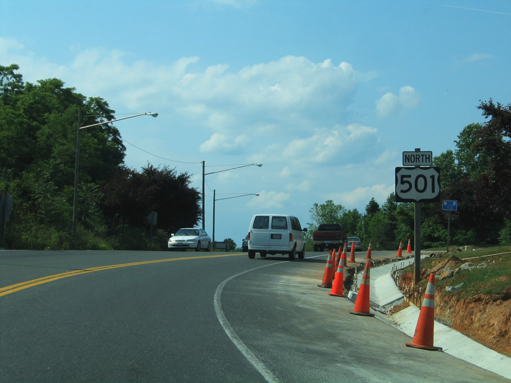
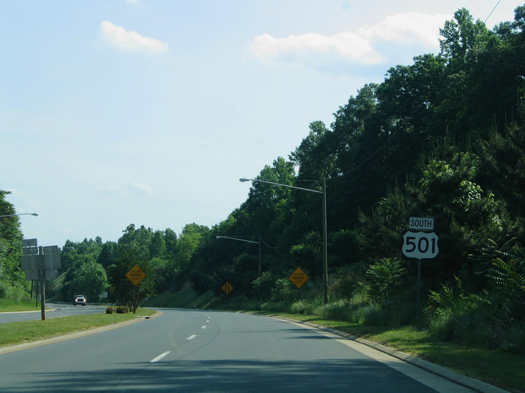
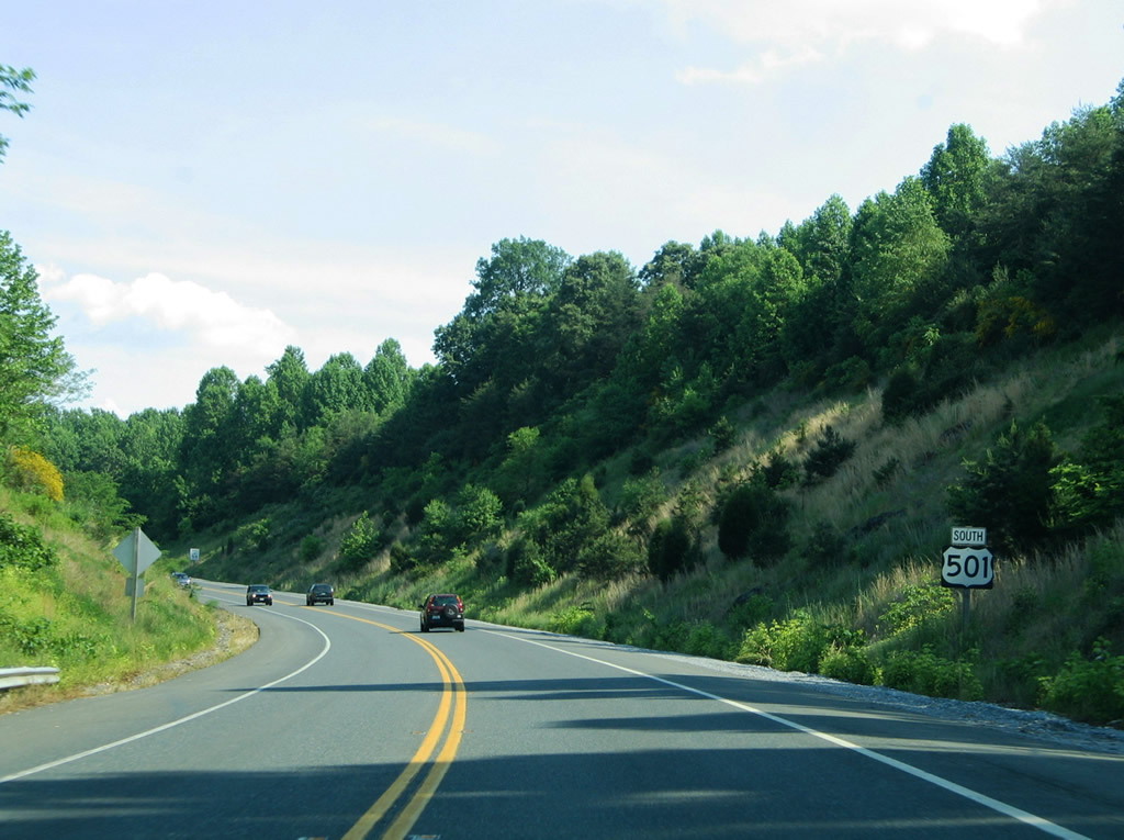
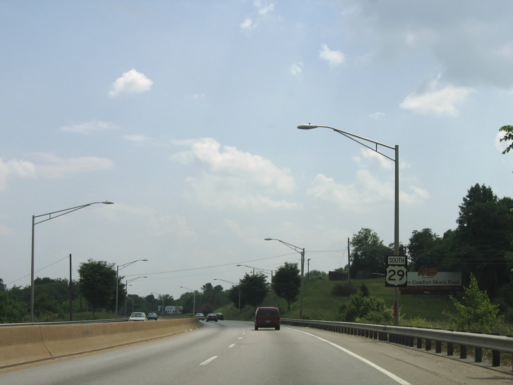
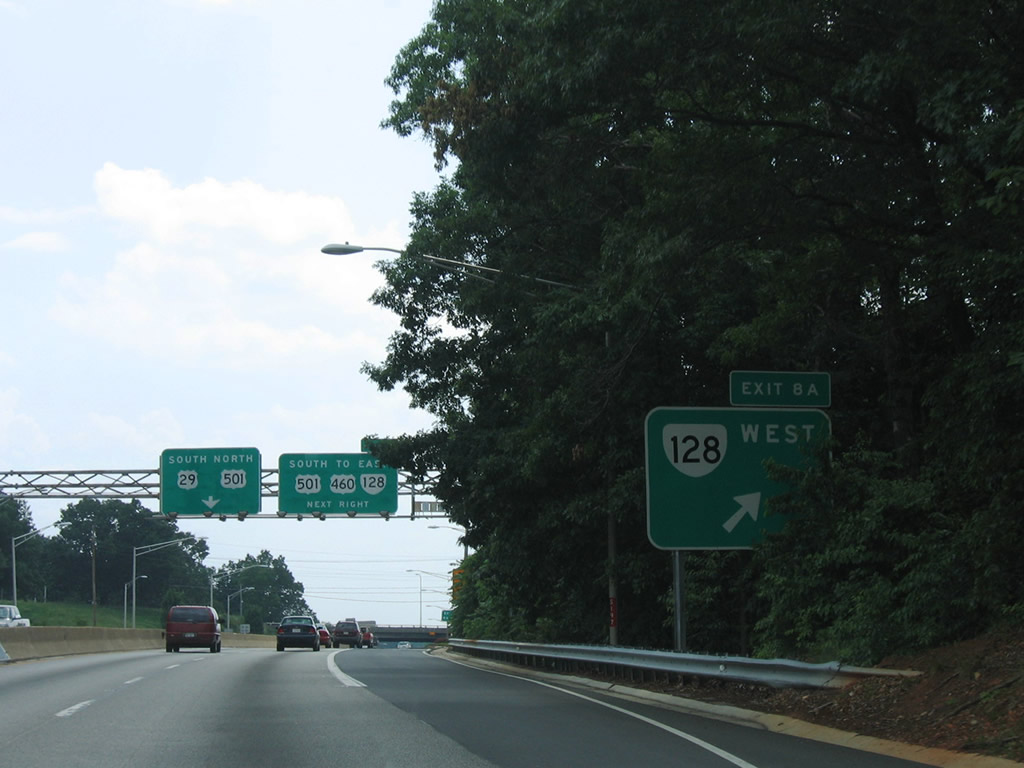
| Continuing west along the Lynchburg Expressway toward the cloverleaf interchange (Exit 8) with U.S. 501 south and SR 128 (Candlers Mountain Road). 06/05/05 |
|
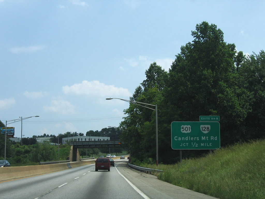
| SR 128 (Candlers Mountain Road) links U.S. 501/29 Business with Wards Road (SR 163 / former U.S. 29 Business). 06/05/05 |
|
| U.S. 501/SR 128 (Candlers Mountain Road) combine briefly between the Lynchburg Expressway and Mayflower Drive by River Ridge Mall. U.S. 501 continues from there to combine with U.S. 29 north / U.S. 460 (Liberty Mountain Road) east. 06/05/05 |
|
| U.S. 501/29 Business briefly overlap by River Ridge Mall between Candler Mountain Road and Wards Road south. Signed here as U.S. 29, U.S. 29 Business follows Wards Road back to U.S. 29 by Lynchburg Regional Airport. 05/30/05 |
|
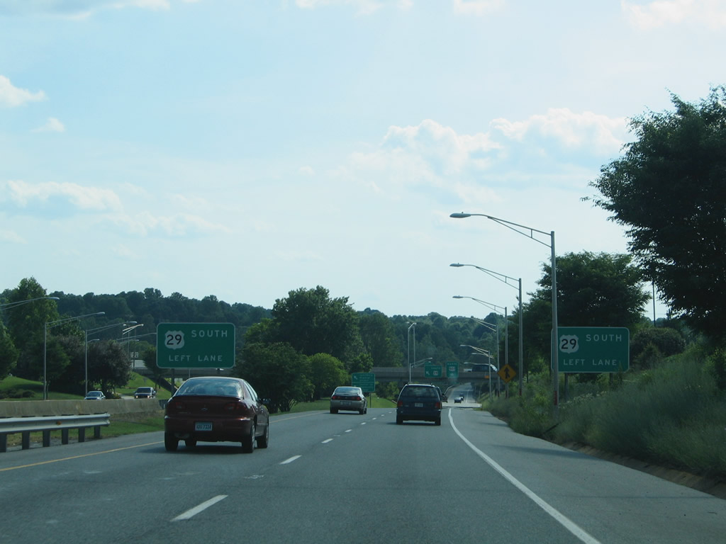
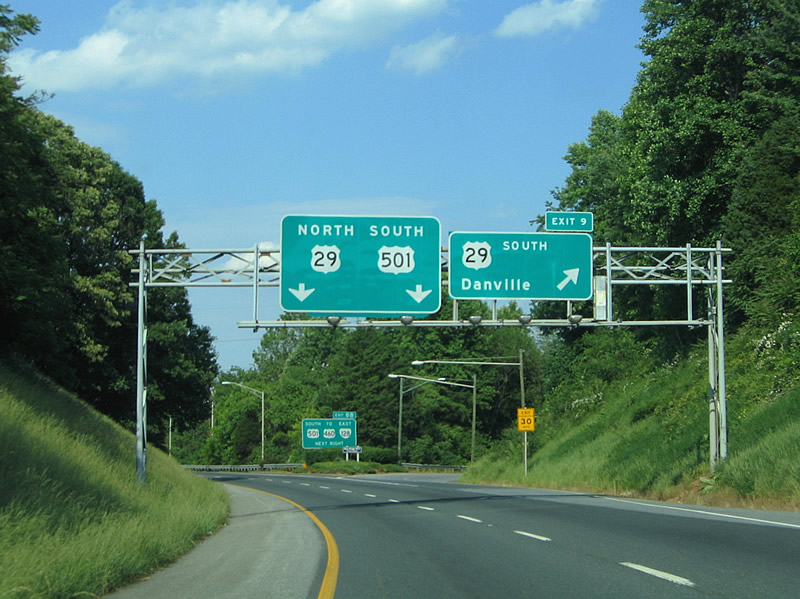
| Exit 9 comprises a left side directional ramp from the Lynchburg Expressway south to Wards Road near Central Virginia Community College. U.S. 29 Business continues to Vista Acres before ending at U.S. 460. 06/05/05 |
|
| Westbound on the Lynchburg Expressway at the split of U.S. 29 Business south from U.S. 501 north. SR 163 travels Wards Roads south from U.S. 460 Business and Fort Avenue. 05/30/05 |
|
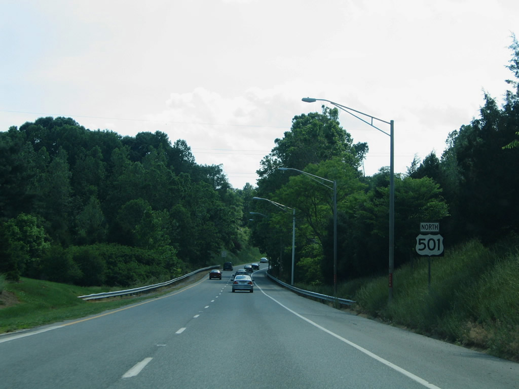
| U.S. 501 bends northwesterly from Wards Road toward the Brookville and Clay communities of Lynchburg. 05/30/05 |
|
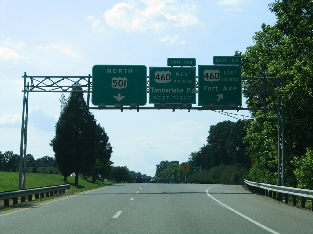
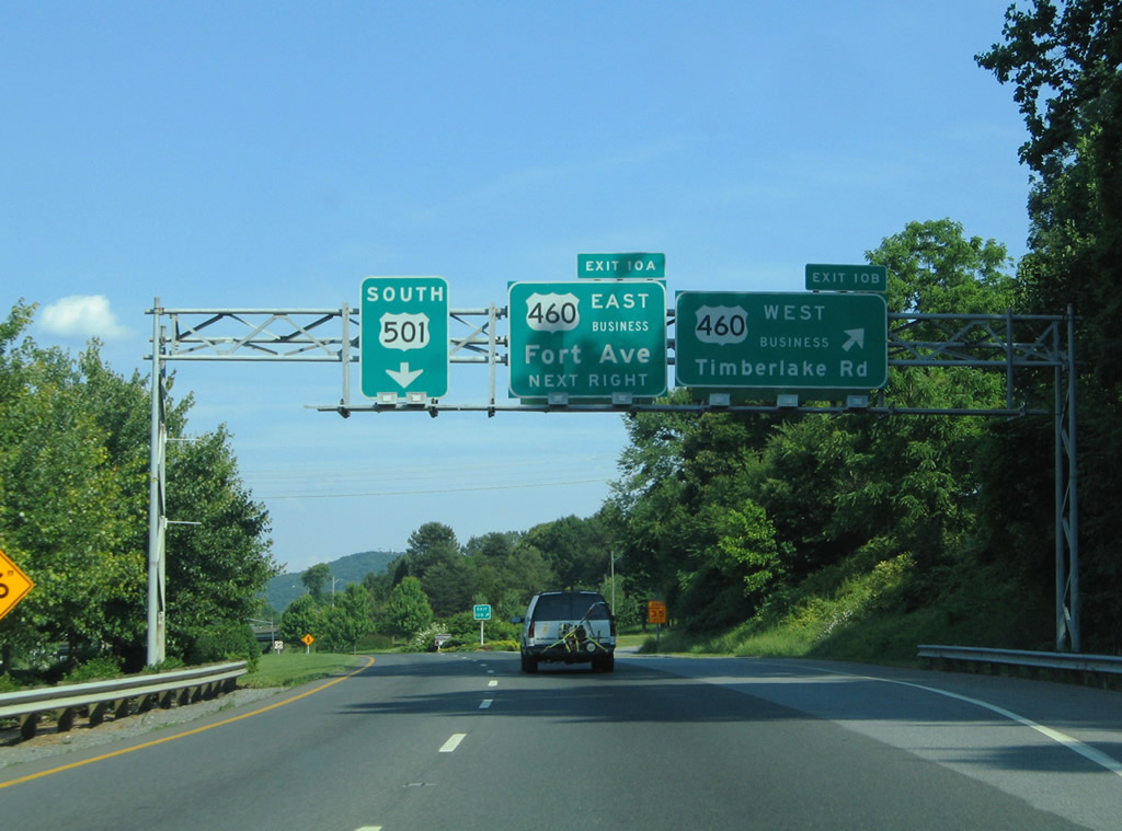
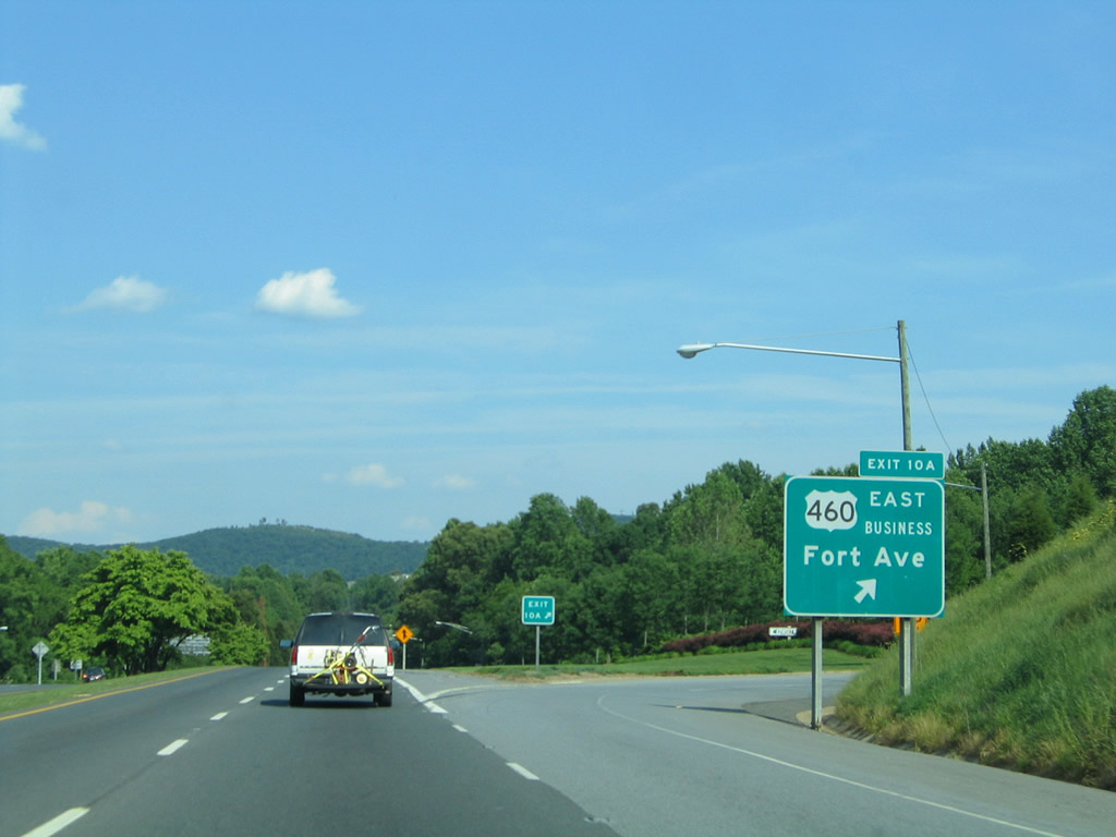
| Exits 10A/B consist of a cloverleaf interchange with U.S. 460 Business (Fort Avenue) east of Richland Hills. 05/30/05 |
|
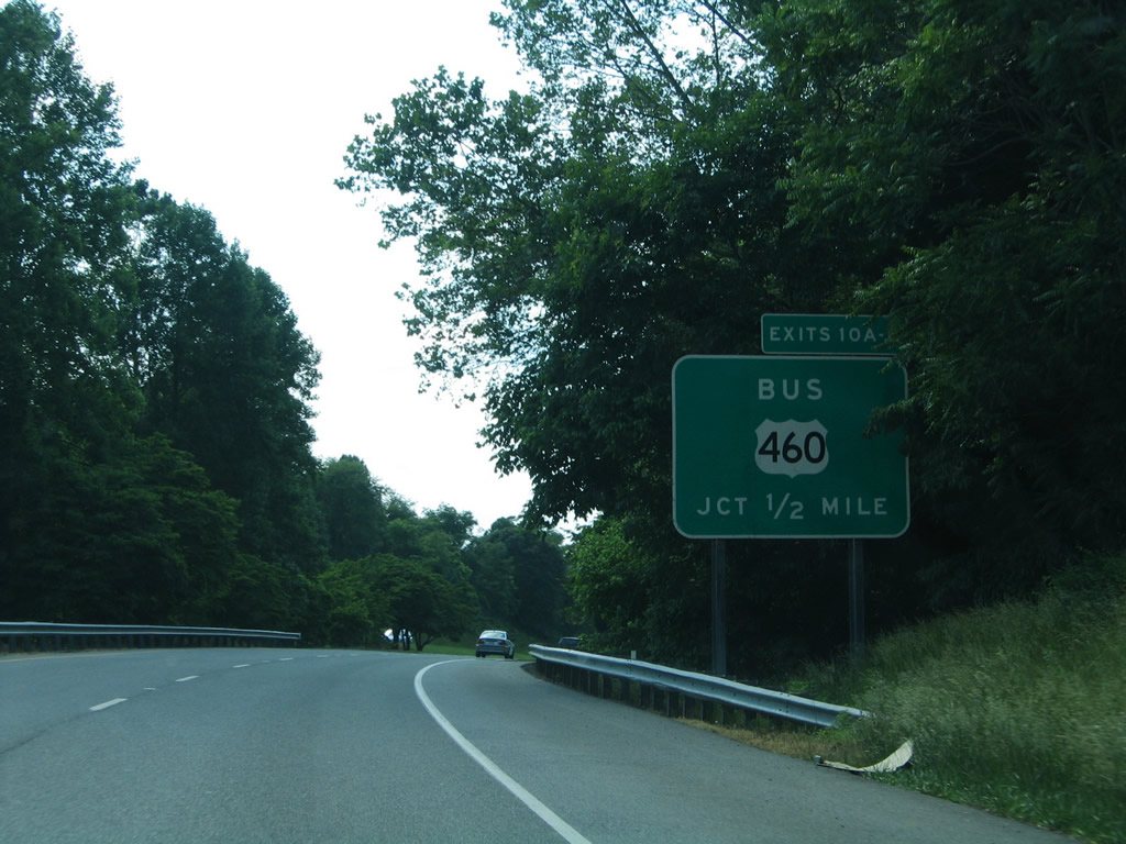
| Trees and bushes occupy land between the roadways of U.S. 501 on the approach to U.S. 460 Business. Landscaping is maintained by sponsors.
U.S. 460 used to follow the Lynchburg Expressway to Timberlake Road west. 05/30/05 |
|
| Exit 10A leaves U.S. 501 (Lynchburg Expressway) north for U.S. 460 (Fort Avenue) east to Fort Hill. 05/30/05 |
|
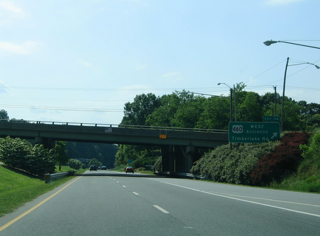
| U.S. 460 Business follows Timberlake Road west from Brookville to Beechwood Hills, Brush Tavern, and Timberlake west of the city line. 05/30/05 |
|
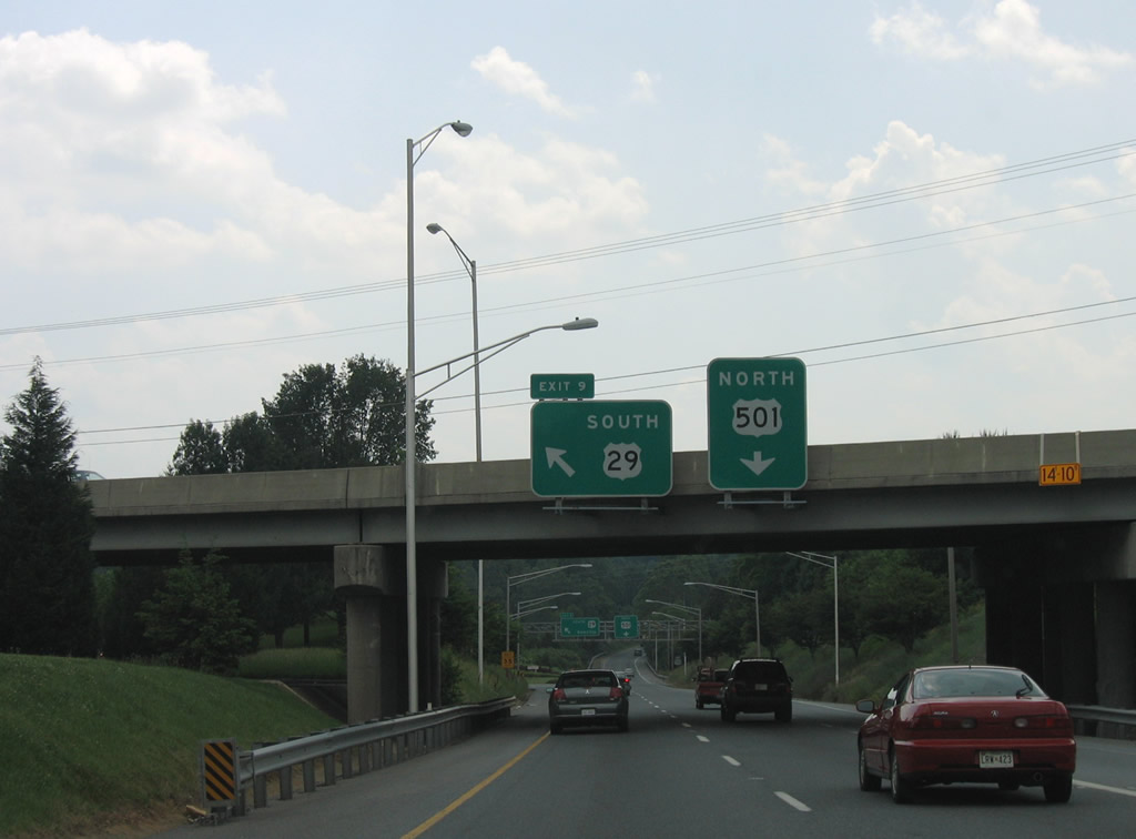
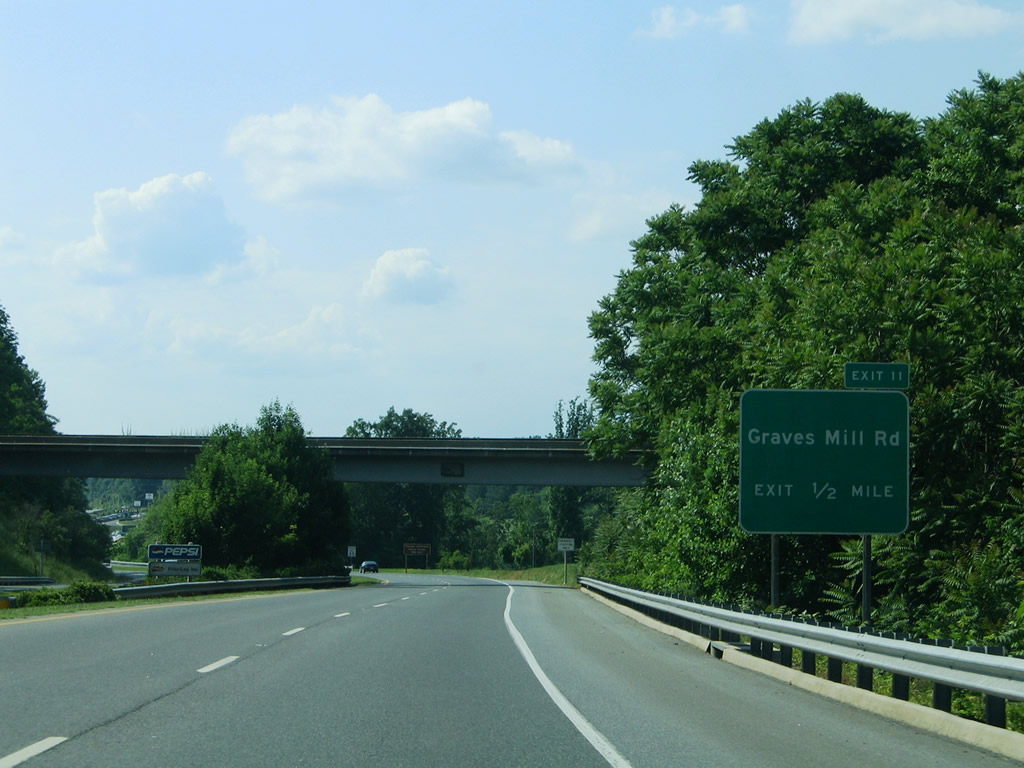
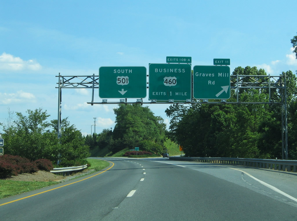
| One half mile south of the diamond interchange (Exit 11) with Graves Mill Road at a NS Railroad overpass. U.S. 221 south links with SR 661 (Bateman Bridge Road) toward Thomas Jefferson Poplar Forest. 05/30/05 |
|
| U.S. 501 (Lynchburg Expressway) northbound at the Exit 11 ramp departure to Graves Mill Road. Graves Mill Road travels west to U.S. 221 (Forest Road) and southeast to U.S. 460 (Fort Avenue) parallel to U.S. 501. The routing was once a part of SR 126 05/30/05 |
|
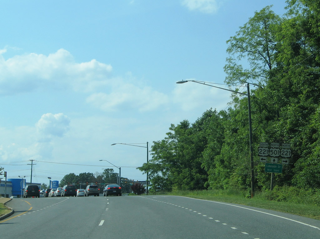
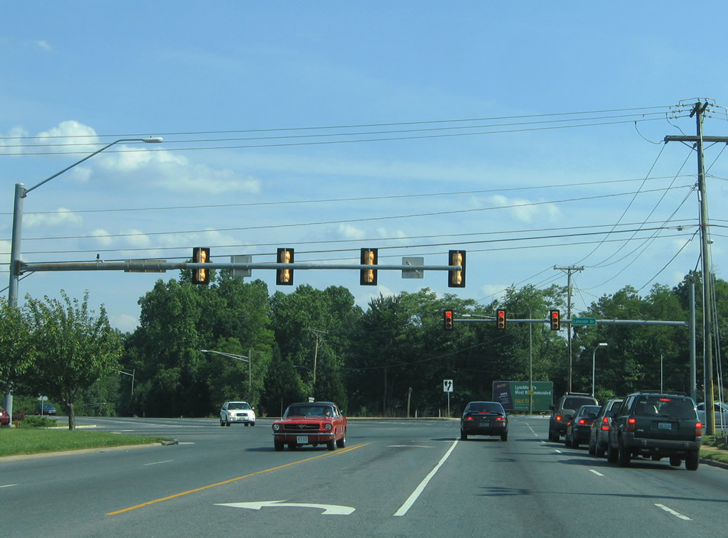
| Northbound reassurance shield posted for U.S. 501 on the approach to U.S. 221 (Lakeside Drive). 05/30/05 |
|
| The freeway portion of U.S. 501 comes to an end briefly at the traffic light with U.S. 221 (Lakeside Drive). 05/30/05 |
|
| U.S. 221 follows Lakeside Drive east to Lynchburg College and Oakley Avenue and Forest Road west from the city line to Forest, Goode, and the city of Bedford. 05/30/05 |
|
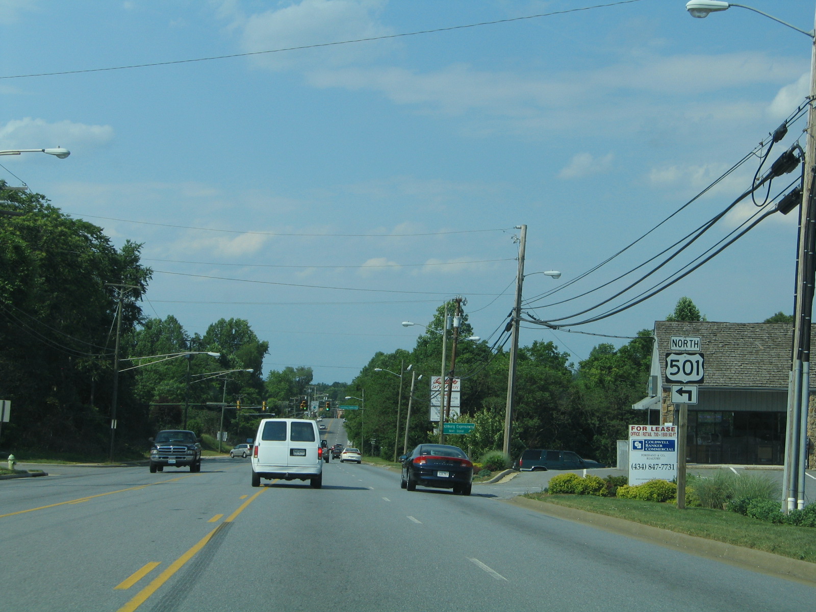
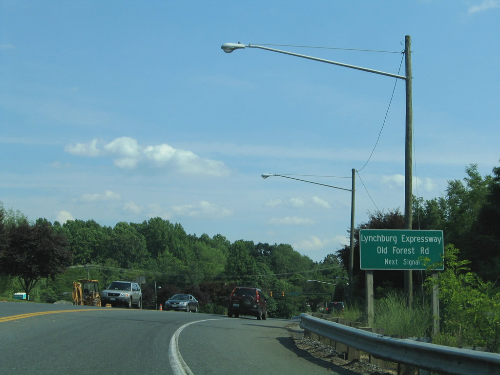
| U.S. 501 turns northeastward along Old Forest Road briefly before again upgrading into the Lynchburg Expressway. Old Forest Road was a part of SR 291 until 1989, when U.S. 501 was relocated from Rivermont Avenue. 05/30/05 |
|
| The section of Lynchburg Expressway between Old Forest Road and Boonsboro Road (U.S. 501 Business) consists mainly of a Super-Two Expressway. U.S. 501 departs Old Forest Road for the freeway at the next traffic light.
SR 291 followed Old Forest Road in its entirety from U.S. 221 (Lakeside Drive) to Lynchburg College and a portion of the Lynchburg Expressway between Lakeside Drive and Fort Avenue. Old Forest Road is now locally maintained, with a commercial strip following the split with U.S. 501. 05/30/05 |
|
| Resuming along the Lynchburg Expressway northbound on U.S. 501 west of Blue Ridge Farms. 05/30/05 |
|
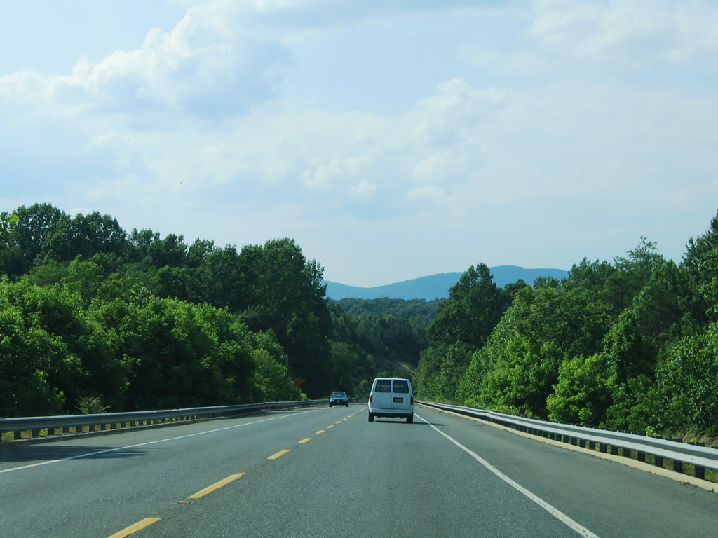
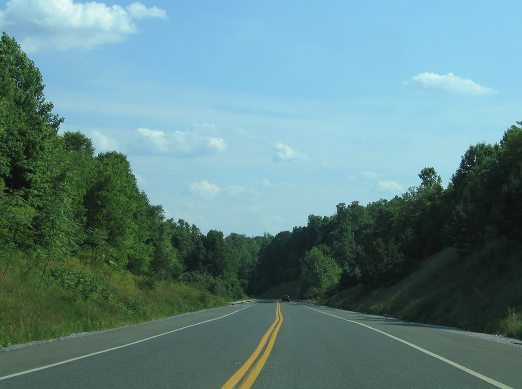
| Passing opportunities are striped along the Super-Two section of the Lynchburg Expressway. Fleming and Tobacco Row Mountains are visible along the horizon. 05/30/05 |
|
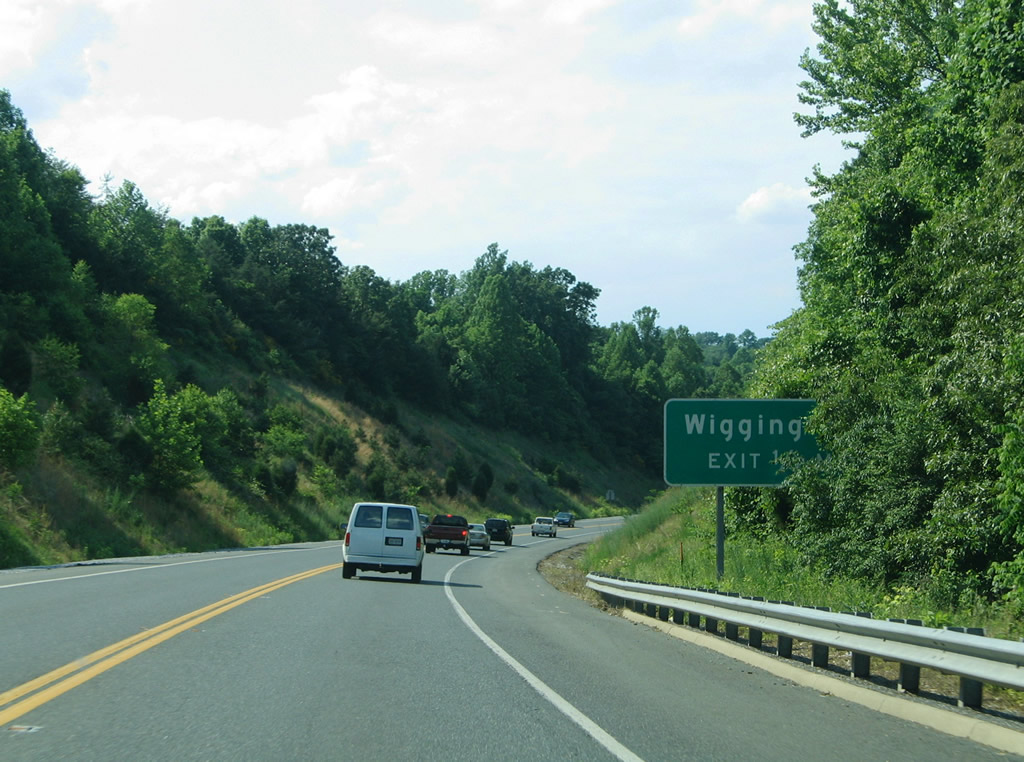
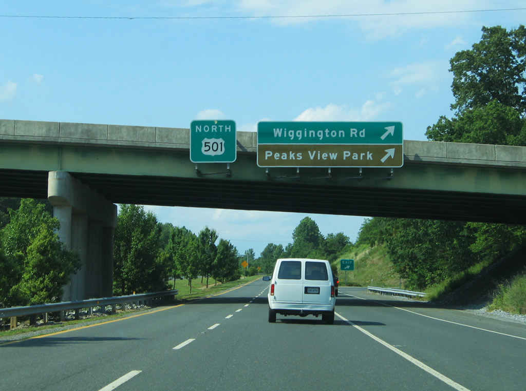
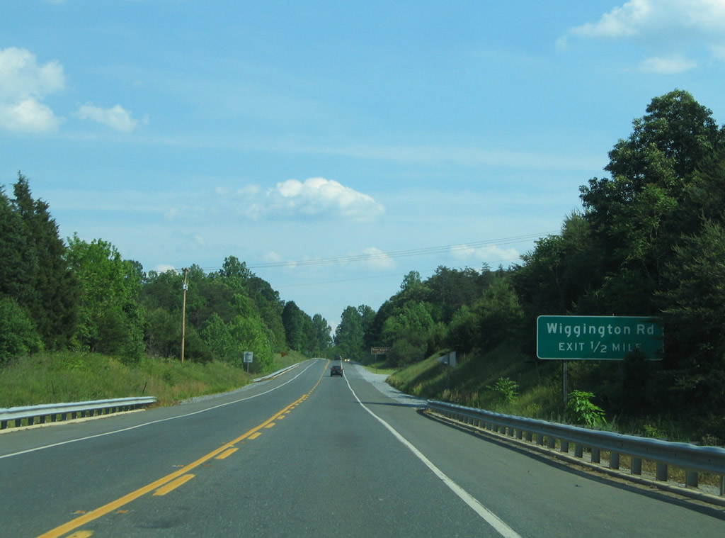
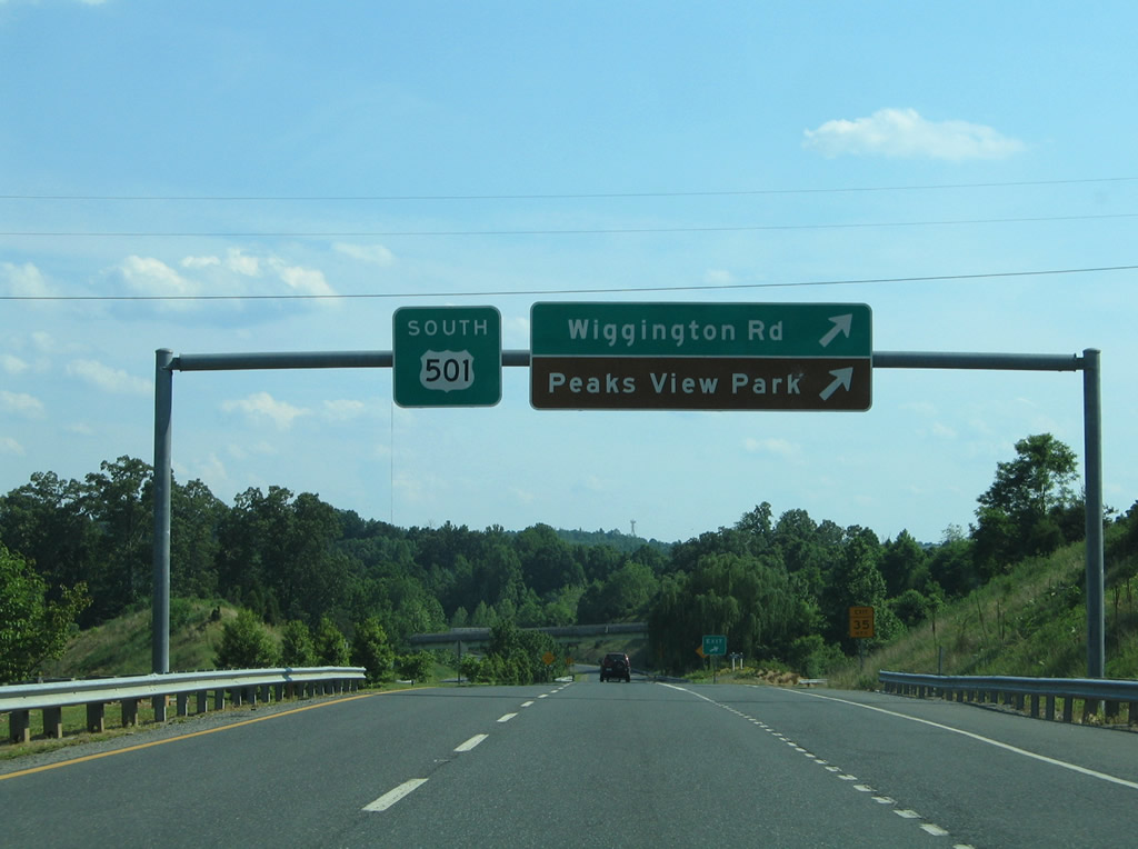
| A folded diamond interchange joins U.S. 501 (Lynchburg Expressway) with Wiggington Road next. Wiggington Road stems northwest from Old Forest Road to becomes SR 620 outside the city. 05/30/05 |
|
| U.S. 501 widens into a conventional four lane freeway at the Wiggington Road off-ramp. Wiggington Road south provides access to Peaks View Park along Ivy Creek. SR 620 continues the road northwest to SR 644 near Boonsboro. 05/30/05 |
|
| Continuing north, U.S. 501 again reduces to two overall lanes. 05/30/05 |
|
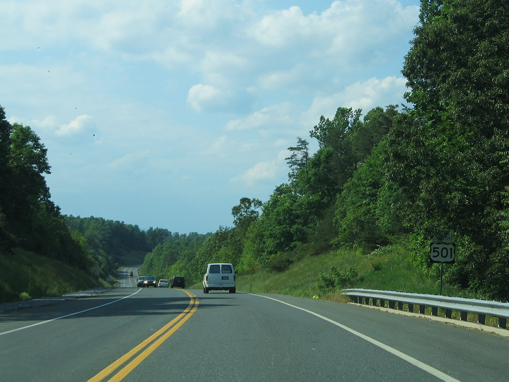
| Nearing the north end of the Lynchburg Expressway, U.S. 501 prepares to resume its original course along Boonesboro Road. Boonesboro Road east carries U.S. 501 Business to Rivermont Avenue. 05/30/05 |
|
| The Lynchburg Expressway defaults onto U.S. 501 Business (Boonesboro Road) south (east) to Peakland and downtown Lynchburg. U.S. 501 meanwhile travels Boonesboro Road to the Lee Jackson Highway, Coleman Falls,and Big Island. 05/30/05 |
|
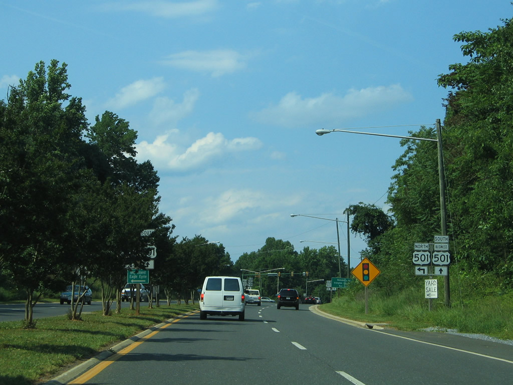
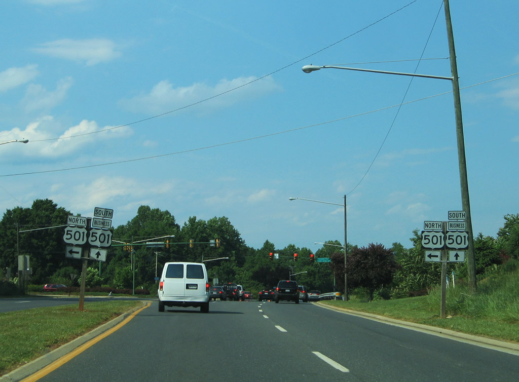
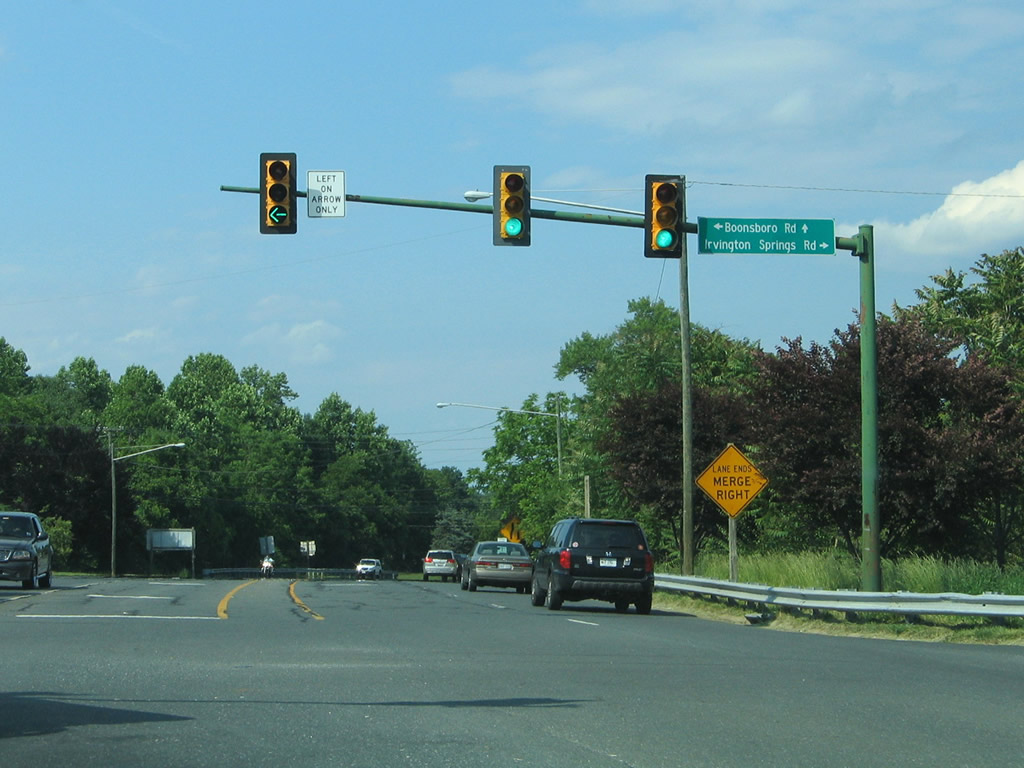
| Irvington Springs Road ties into the exchange joining U.S. 501/501 Business exchange from the south. 05/30/05 |
|
| Turning southward onto the Lynchburg Expressway, U.S. 501 briefly carries four lanes from Boonesboro Road. 05/30/05 |
|
| Sinking southward along U.S. 501 (Lynchburg Expressway) near Cheese Creek. 05/30/05 |
|
| Wiggington Road meets U.S. 501 at a folded diamond interchange west of Blue Ridge Farms. 05/30/05 |
|
| U.S. 501 expands to four overall lanes at the Wiggington Road exit. Wiggington Road travels to Peaks View Park nearby en route to Old Forest Road (old SR 291). Northward the road continues to Coffee Road (SR 644). 05/30/05 |
|
| U.S. 501 turns southeast over Ivy Creek as a Super Two freeway again. 05/30/05 |
|
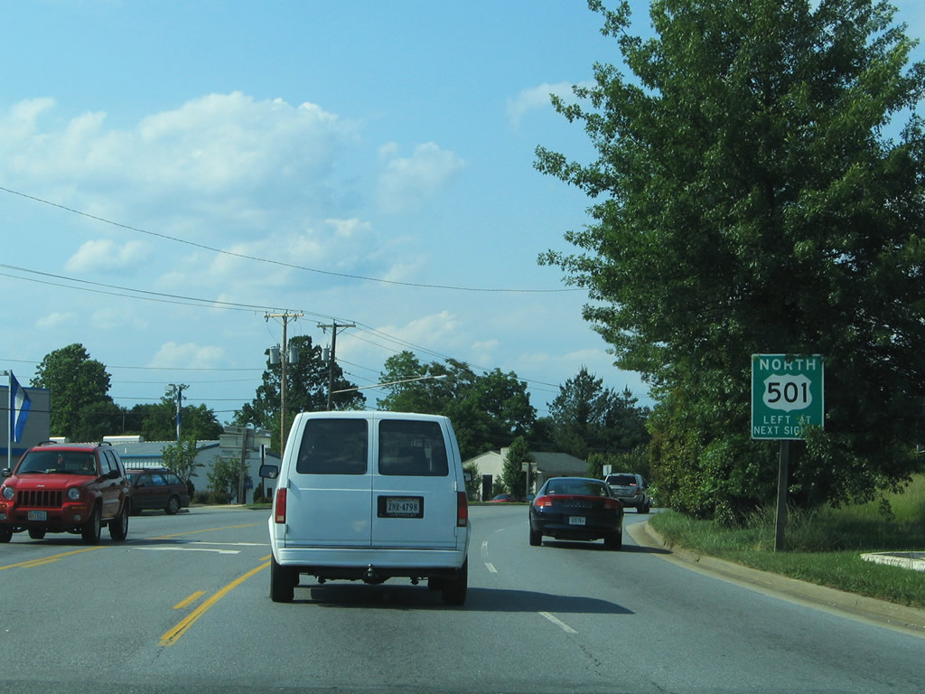
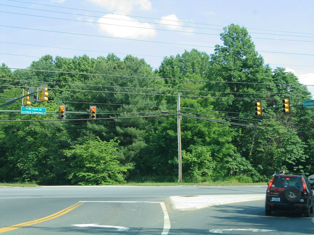
| The north segment of the Lynchburg Expressway ends at the traffic light with Old Forest Road. U.S. 501 turns southward onto the arterial to make the connection with the south segment of the freeway at U.S. 221 (Lakeside Drive). 05/30/05 |
|
| U.S. 501 follows Old Forest Road south to U.S. 221 (Lakeside Drive). U.S. 221 follows a 150 mile route in Virginia from Lynchburg west to the North Carolina line, south of Independence. 05/30/05 |
|
| Southbound at the traffic light with Lakeside Drive. U.S. 221 begins in Lynchburg and travels west along Kemper Street, Forest Avenue, Oakley Avenue, and Lakeside Drive to Forest Road en route to Forest, Goode and Bedford. 05/30/05 |
|
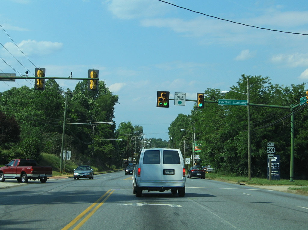
| Heading south, U.S. 501 upgrades into a conventional freeway directly from U.S. 221. The initial freeway between Lakeside Drive and Fort Avenue was originally signed as SR 291. 05/30/05 |
|
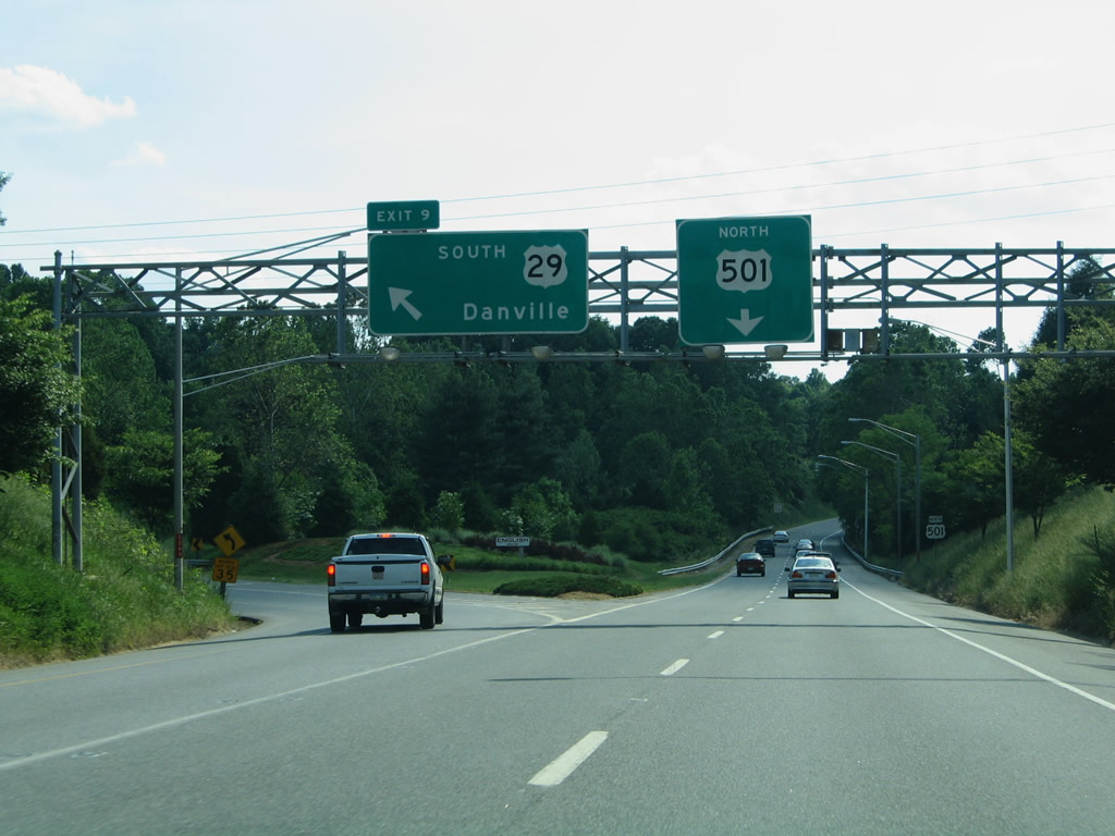
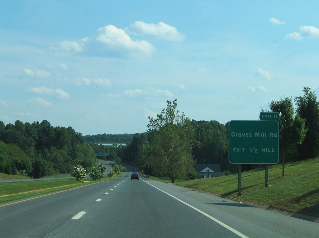
| Exit 11 joins U.S. 501 with Graves Mill Road in one half mile. Graves Mill Road was signed as SR 126 until 1977.2 05/30/05 |
|
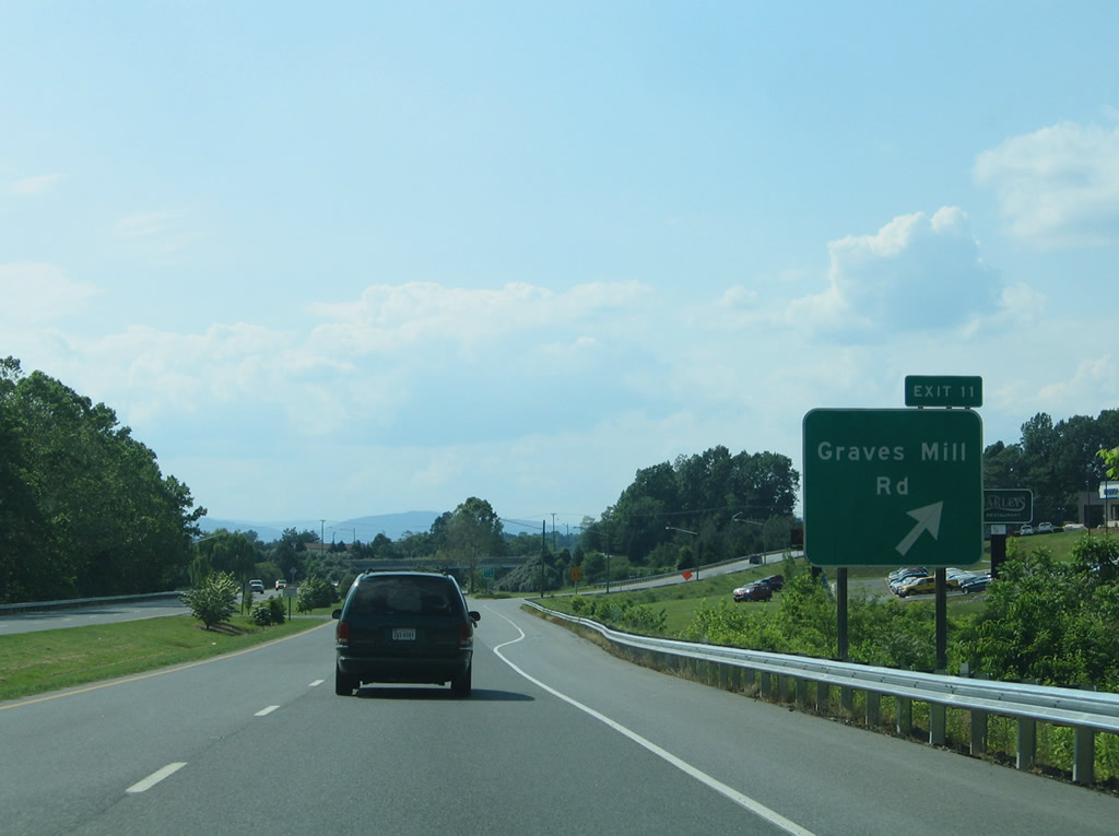
| Drivers bound for Graves Mill Road west to Richland Hills or U.S. 221 (Forest Road) depart U.S. 501 south. Graves Mill Road east parallels U.S. 501 south to U.S. 460 Business (Fort Avenue). 05/30/05 |
|
| U.S. 460 Business follows Timberlake Road east from Timberlake to meet U.S. 501 (Lynchburg Expressway) at a cloverleaf interchange (Exits 10B/A). 05/30/05 |
|
| Fort Avenue continues U.S. 460 Business east to Fort Hill and U.S. 221 (Oakley Avenue) southwest of downtown Lynchburg. 05/30/05 |
|
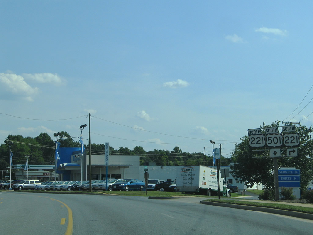
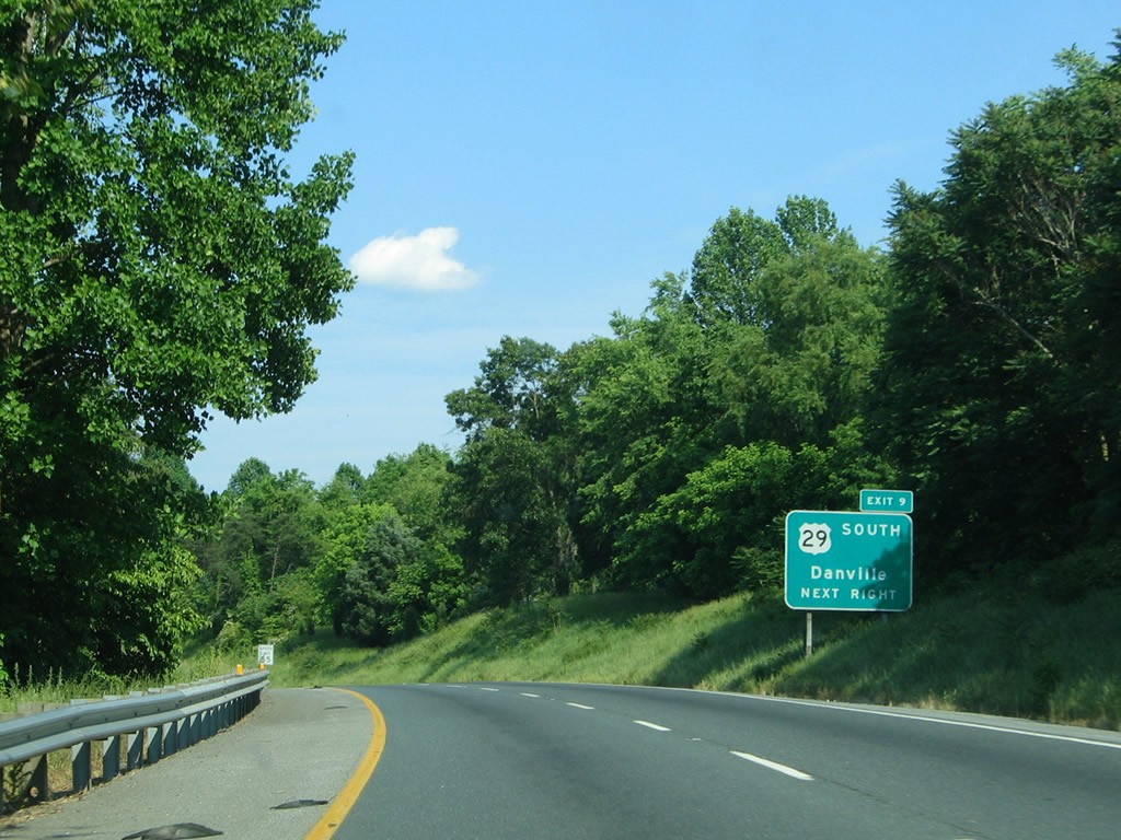
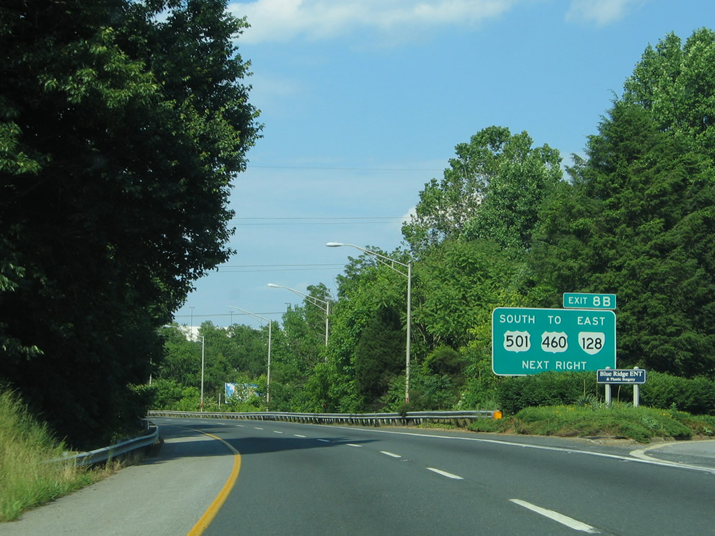
| Next in line for southbound drivers is the Exit 9 off-ramp to U.S. 29 Business (Wards Road) south. Wards Road begins at U.S. 460 Business (Fort Avenue) and carries SR 163 signage to the transition into U.S. 29 Business. 05/30/05 |
|
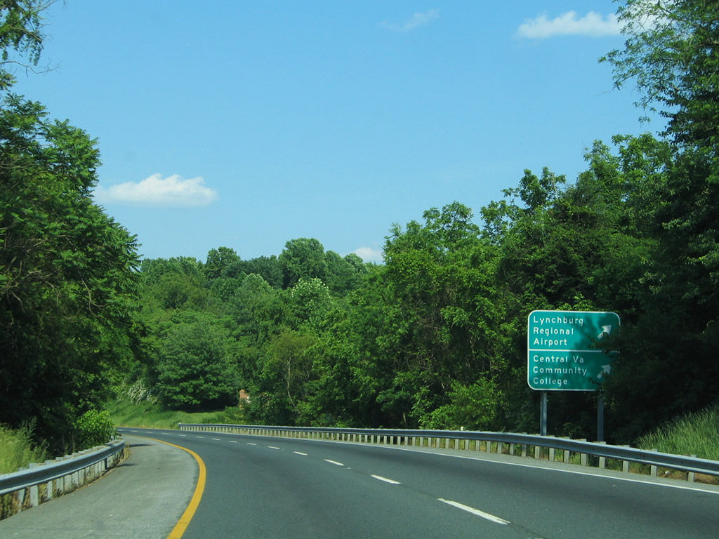
| Use Wards Road south for Central Virginia Community College nearby, and Lynchburg Regional Airport south of U.S. 29/460. 05/30/05 |
|
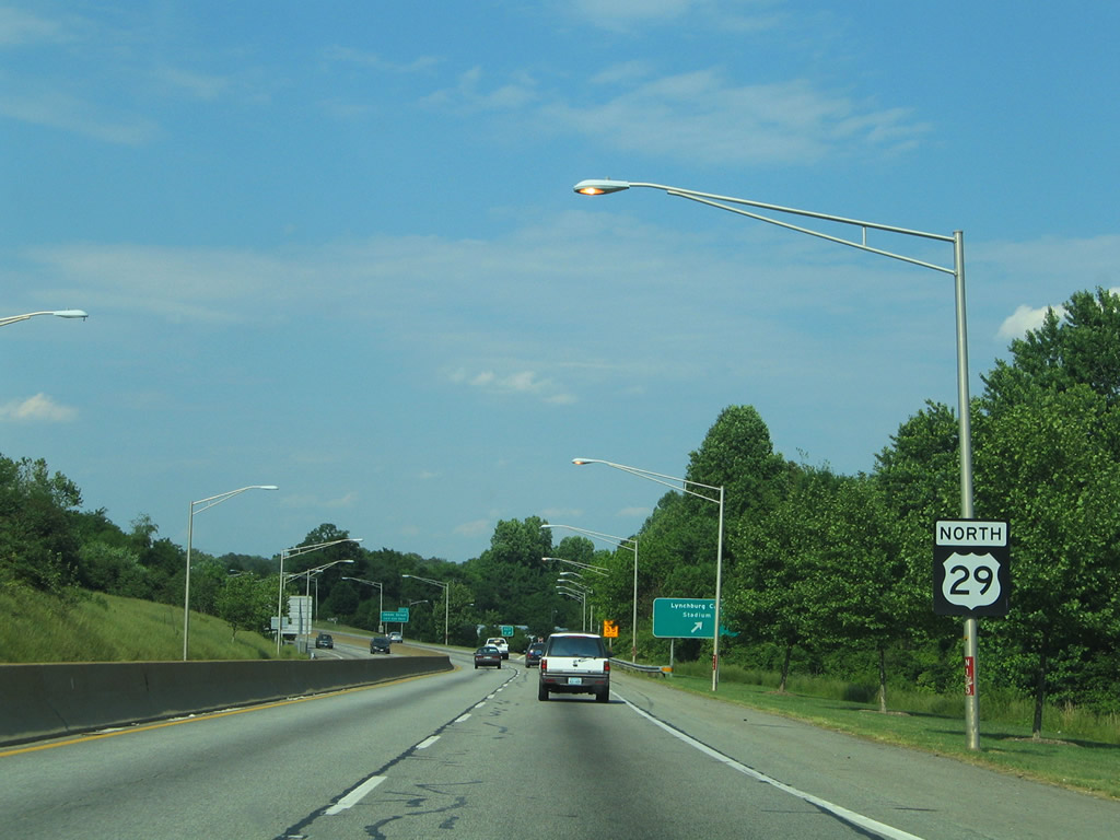
| U.S. 29 joins the Lynchburg area with Altavista, Hurt, Gretna, Chatham, and Danville. The US route mainline was relocated from the Lynchburg Expressway in October 2005 when the Lynchburg-Madison Heights Bypass opened to traffic. 05/30/05 |
|
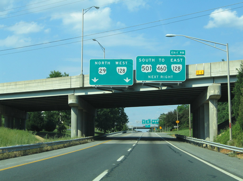
| U.S. 501 south / U.S. 29 Business north briefly overlap between Wards Road and Candler Mountain Road (Exit 8B). 05/30/05 |
|
| Candler Mountain Road heads southeast from Wards Road (SR 163) as SR 128 to the Lynchburg Expressway at Exit 8. U.S. 501/SR 128 briefly merge by River Ridge Mall to Mayflower Drive and Candler Mountain Road south to Liberty University. 05/30/05 |
|
| U.S. 501 joins the Lynchburg Expressway with U.S. 29/460 (Liberty Mountain Drive) via a four lane arterial. SR 128 meanders east from U.S. 501 to Perkins Park and Fairview Heights and west to SR 163 at Sheffield Drive. 05/30/05 |
|
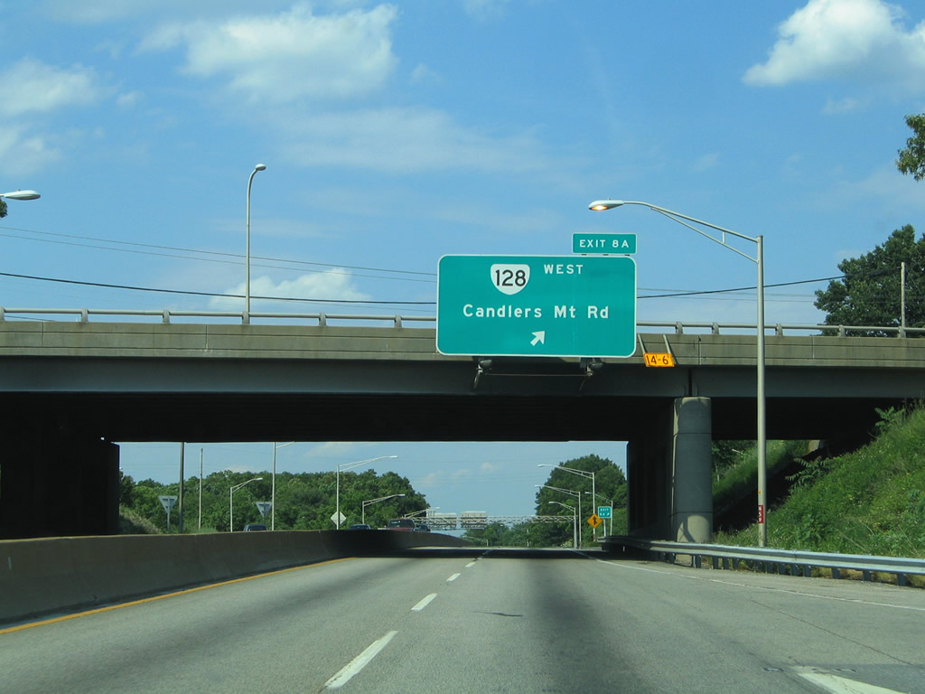
| Exit 8B loops onto SR 128 (Candler Mountain Road) leading west to Wards Road and U.S. 460 Business/SR 163 (Fort Avenue) from U.S. 29 Business (Lynchburg Expressway) north. 05/30/05 |
|
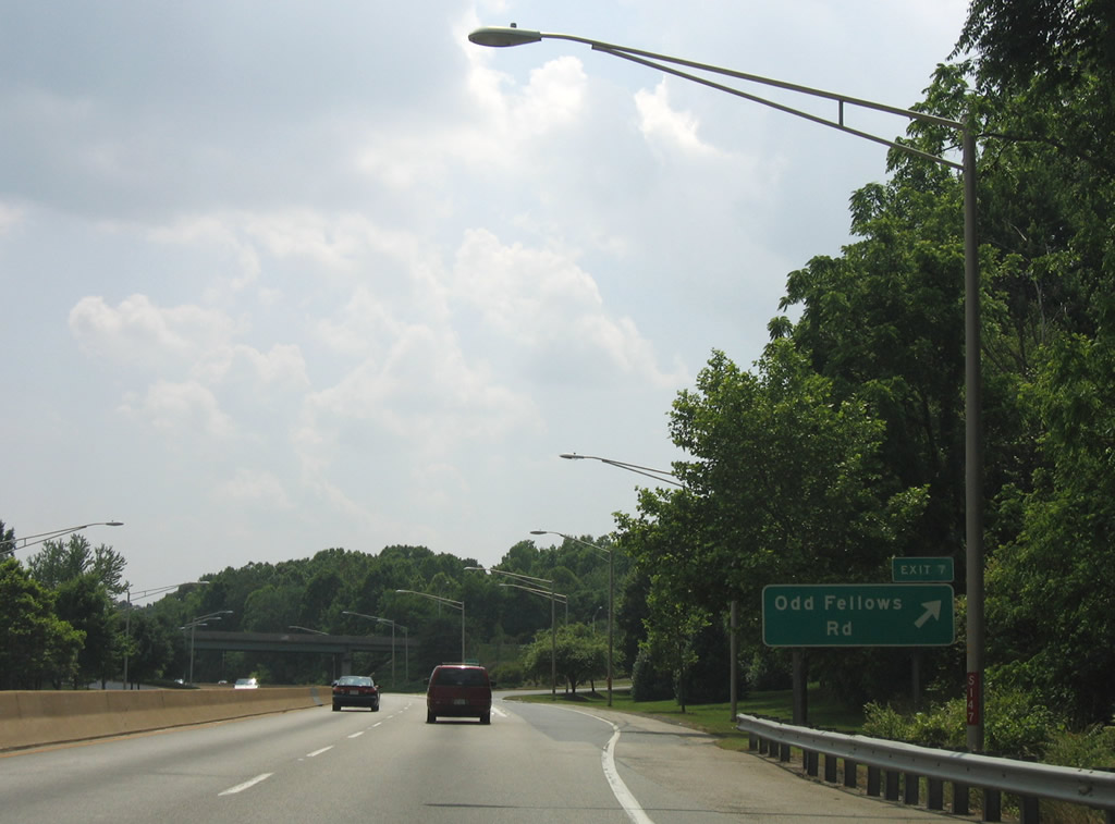
| Odd Fellows Road spurs east from the Lynchburg Expressway to SR 128 (Mayflover Drive) and the Perkins Park section of Lynchburg. 05/30/05 |
|
| U.S. 29 Business northbound at the trumpet interchange (Exit 7) with Odd Fellows Road. A 3.47 mile long route, SR 128 concludes east of Odd Fellows Road at U.S. 460-501 Business (Campbell Avenue) at Fairview Heights. 05/30/05 |
|
| Exit 6 follows and joins the Lynchburg Expressway with parallel Carroll Avenue near James Street. Carroll Avenue meanders northward from SR 128 (Mayflower Avenue) to 12th Street and Langhorne Road (U.S. 501 Business). 05/30/05 |
|
| Most of the signs posted within the city of Lynchburg feature a one-piece design. This U.S. 29 reassurance marker was typical of the style. 05/30/05 |
|
| Exit 6 departs U.S. 29 Business north for Carroll Avenue to Stadium Road. Stadium Road travels west to Wythe Road and Calvin Falwell Field, home of the Lynchburg Hillcats (Carolina League Baseball). 05/30/05 |
|
| A parclo interchange follows with James Street directly at Exit 5. James Street leads northwest from Carroll Avenue to Stadium Road. 05/30/05 |
|
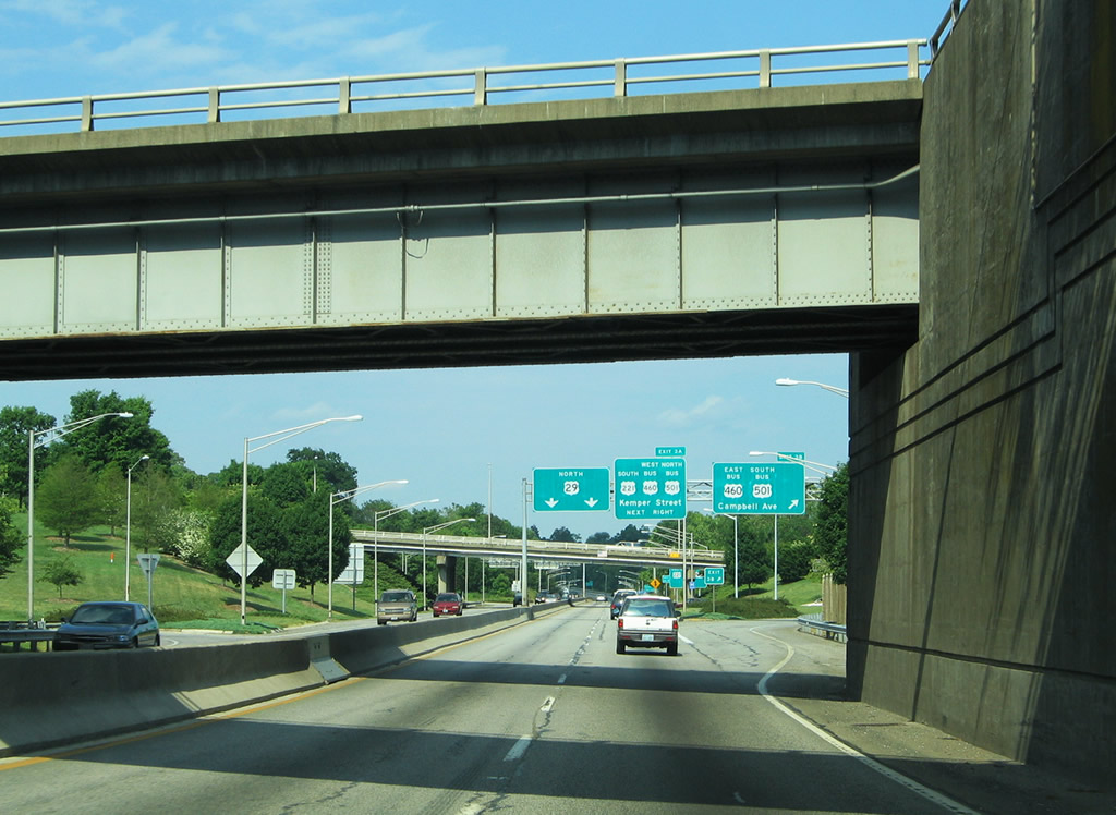
| A partial-diamond interchange brings traffic from Carroll Avenue onto U.S. 29 Business (Lynchburg Expressway) one half mile ahead of the Exit 3 cloverleaf interchange with U.S. 221, U.S. 460 Business, and U.S. 501 Business (Kemper Street). The junction represents U.S. 221's northern terminus. 05/30/05 |
|
| U.S. 29 Business drops below grade under Campbell Avenue, an abandoned railroad overpass, and the Norfolk Southern Railroad. Exit 3B departs immediately afterward for U.S. 401-501 Business (Kemper Street) east. The business route overtakes Campbell Avenue en route to Fairview Heights and U.S. 29-460-501 (Richmond Highway). 05/30/05 |
|
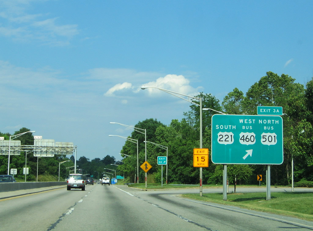
| Exit 3A loops onto Kemper Street north to the southbound beginning of U.S. 221 and the continuation of U.S. 401-501 Business along Kemper Street to 12th Street and Fort Avenue. U.S. 221 runs 158 miles in Virginia between Lynchburg and the North Carolina line south of Independence. 05/30/05 |
|
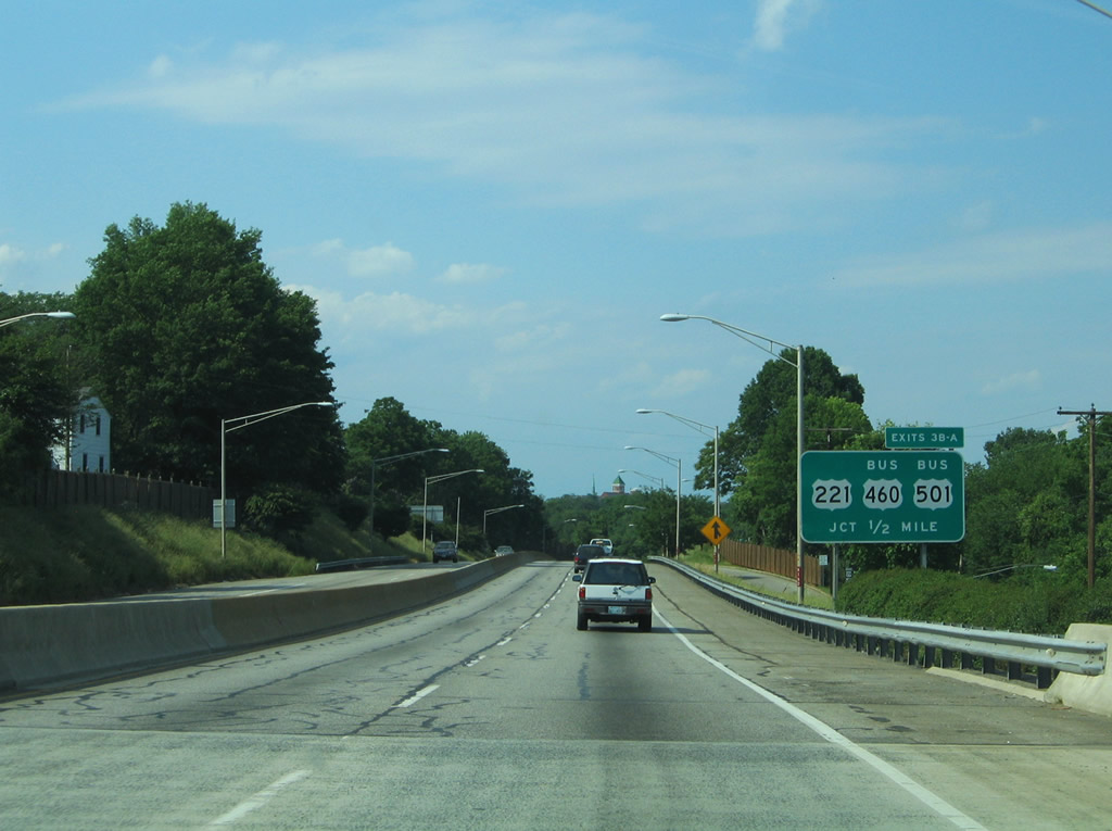
| Northbound drivers bound for Kemper Street depart U.S. 29 Business at Exit 3A. U.S. 460 Business travels 11.56 miles from U.S. 29-460-501 to New London. The route follows Kemper Street north to 12th Street and Fort Avenues west. U.S. 501 Business follows Kemper Street north to Fort Avenue west to Langhorne Road north to Dearington and Rivermont Avenue east of Peakland within the city. 05/30/05 |
|
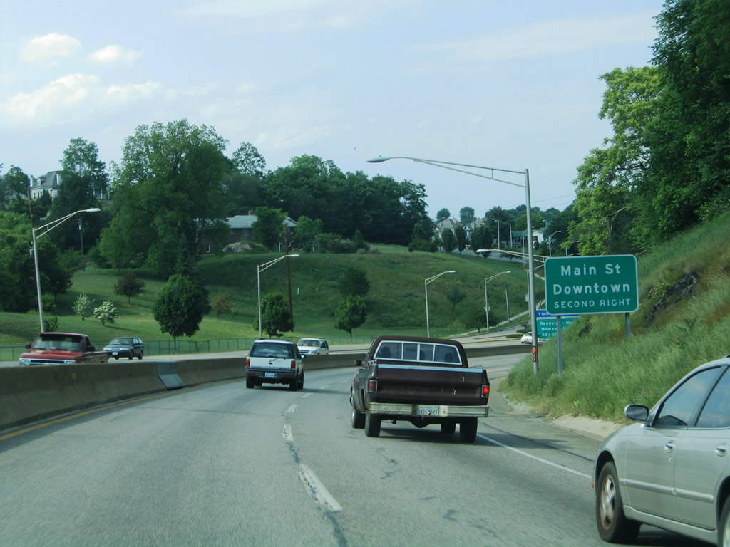
| The Lynchburg Expressway winds eastward toward downtown, next meeting Grace Street via a folded diamond interchange with Robins Road and Miller Street. 05/30/05 |
|
| Northbound reassurance shield that was posted for U.S. 29 near the Exit 2 off-ramp onto Robins Road. 05/30/05 |
|
| Grace Street connects U.S. 29 Business with Florida Avenue to the east near White Rock Hill and Jackson Heights and downtown Lynchburg to the north. 05/30/05 |
|
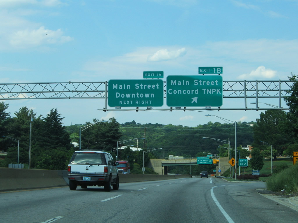
| Exits 1B/A follow with separate ramps to Main Street south of the central business district and north of White Rock Hill. 05/30/05 |
|
| A loop ramp (Exit 1A) joins Main street north through downtown. Main Street historically represented a portion of U.S. 501 Alternate to Rivermont Avenue. This alignment was retired in 1990 when U.S. 501 shifted to its bypass alignment.1 05/30/05 |
|
| Exit 1B ascends from U.S. 29 Business to Main Street south to Florida Avenue and Buena Vista Street. Motorists can connect with Concord Turnpike leading south along the James River to Pleasant Valley Boulevard and U.S. 29/460 (Richmond Highway). 05/30/05 |
|
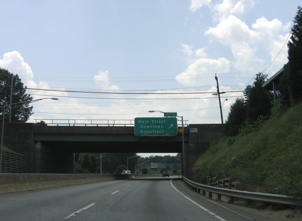
| U.S. 29 Business (Lynchburg Expressway) descends toward its crossing of the Jame River beyond Exit 1A. Main Street travels through downtown to SR 163 (5th Street) before merging with Church Street to form Rivermont Avenue. 06/05/05 |
|
| Spanning the James River along U.S. 29 Business north. The waterway separates the city of Lynchburg from Amherst County. 05/30/05 |
|
| Continuing north, U.S. 29 enters Madison Heights and sees a diamond interchange with SR 210 (Colony Road). SR 210 travels north to SR 163 (Amherst Highway) and east to Colony and U.S. 29.
Both signs were altered since the time of this photograph: the left panel now displays U.S. 29 Business; the right hand panel now displays "TO Route 163". SR 163 follows the original path of U.S. 29, and later U.S. 29 Business, from Lynchburg through Madison Heights. 05/30/05 |
|
| A half diamond interchange joins SR 163 (Amherst Highway) with U.S. 29 Business at the Lynchburg Expressway end. SR 163 loops east of U.S. 29 Business briefly before ending at the U.S. 29 over taking of Amherst Highway north. 05/30/05 |
Page Updated 03-11-2010.

 South - Lynchburg Expressway
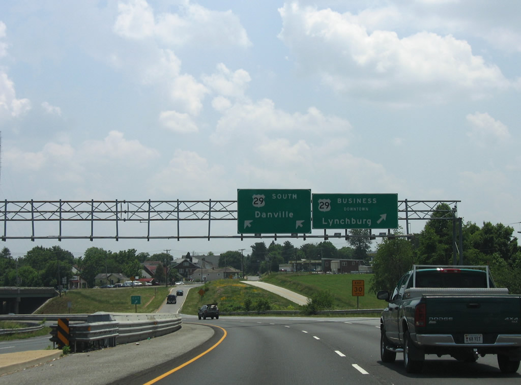

 North - Lynchburg Expressway