|
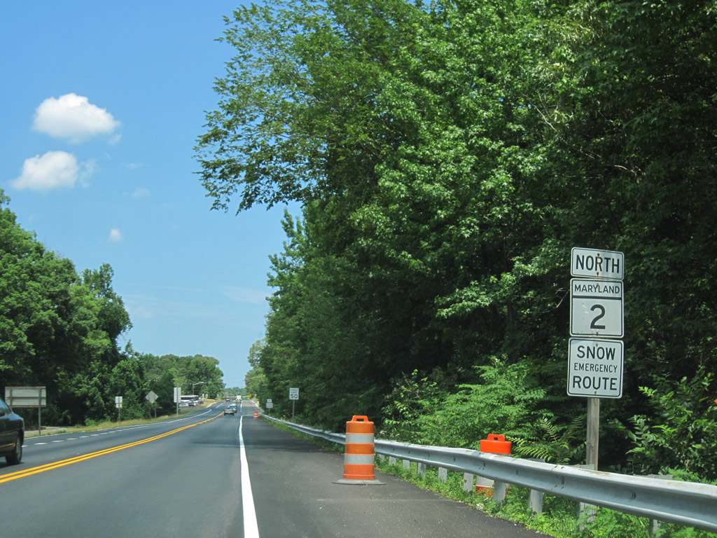
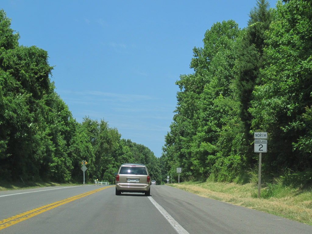
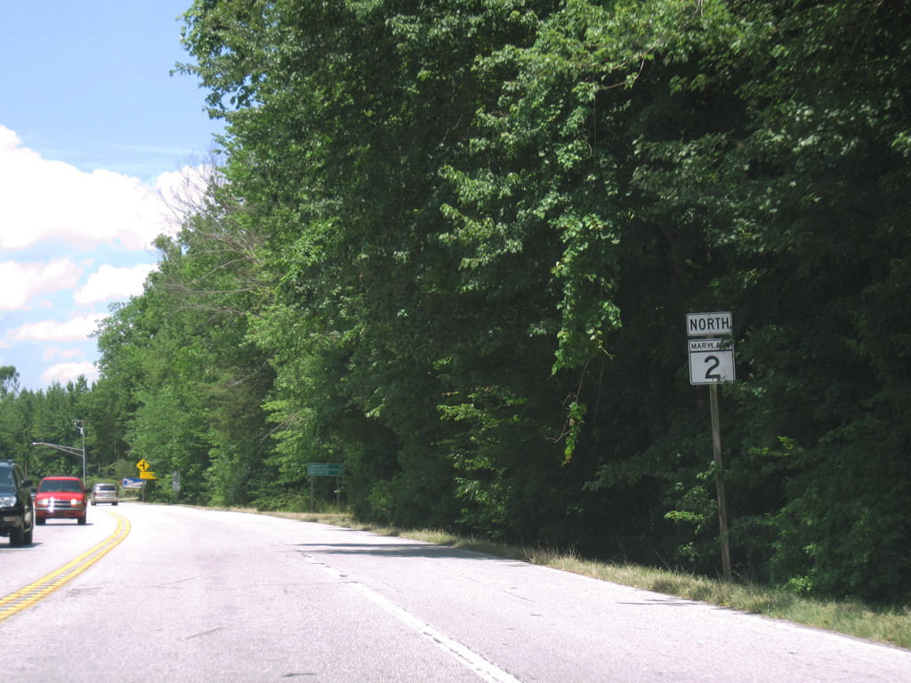
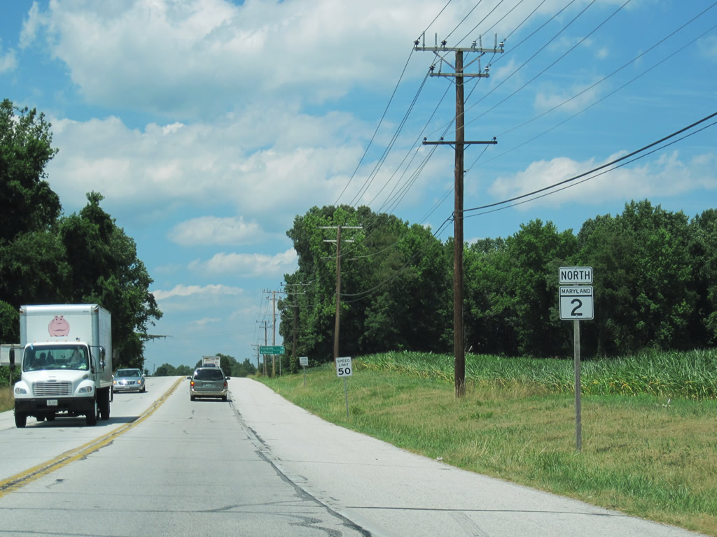
| MD 2 continues Solomons Island Road northeast from MD 4 (Southern Maryland Boulevard) to I-595/U.S. 50-301 in Annapolis. 06/25/10 |
|
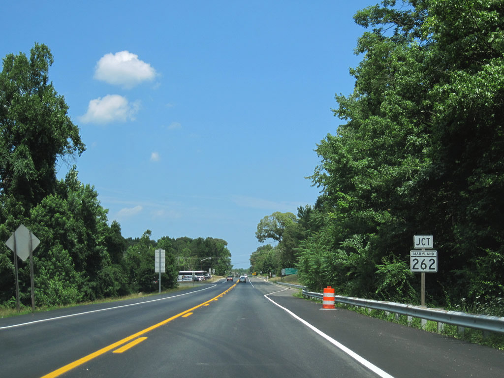
| MD 262 (Lower Marlboro Road) crosses MD 4 to end at MD 2 (Solomons Island Road) near Sunderland. 06/25/10 |
|
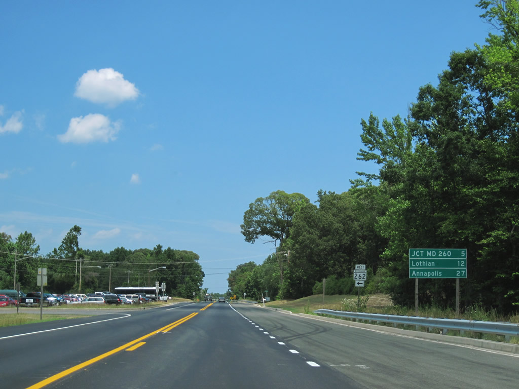
| A 4.48 mile route, MD 262 meanders west from MD 2 to Lower Marlboro along the Patuxent River. 06/25/10 |
|
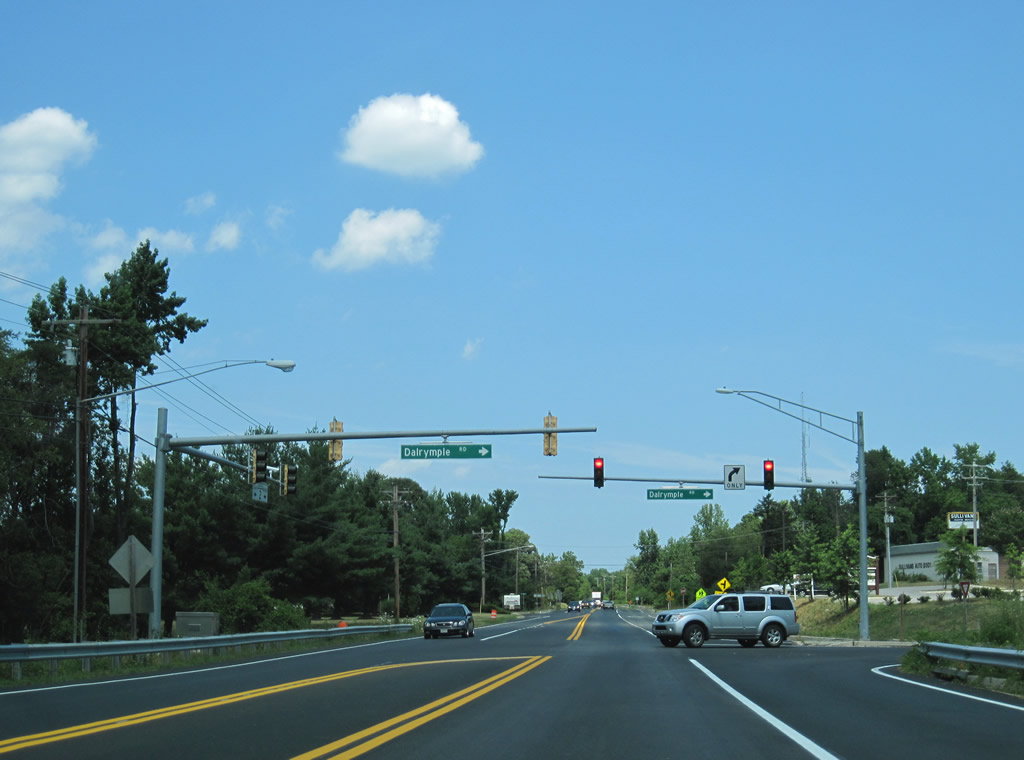
| Dairymple Road winds eastward from MD 2 to Summer City Boulevard at Randle Cliff Beach on the Chesapeake Bay. 06/25/10 |
|
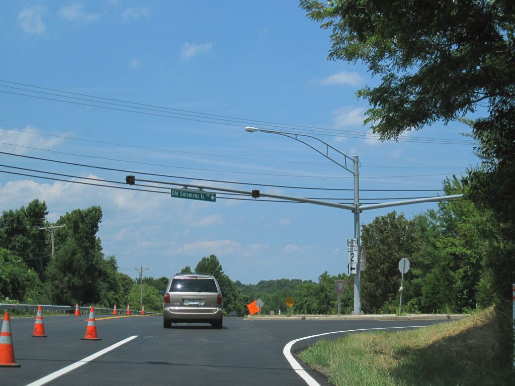
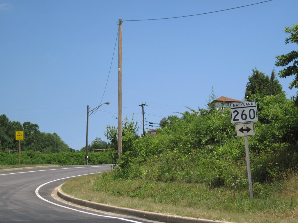
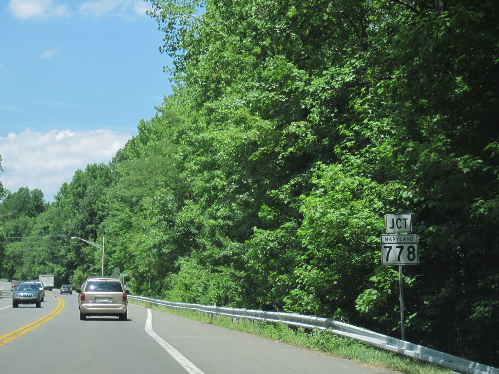
| Old Solomons Island Road (MD 778) loops through Owings east from MD 2 ahead of MD 260. 06/25/10 |
|
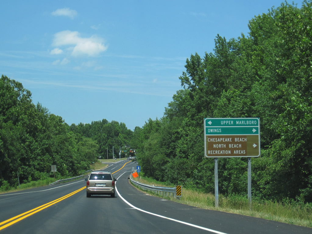
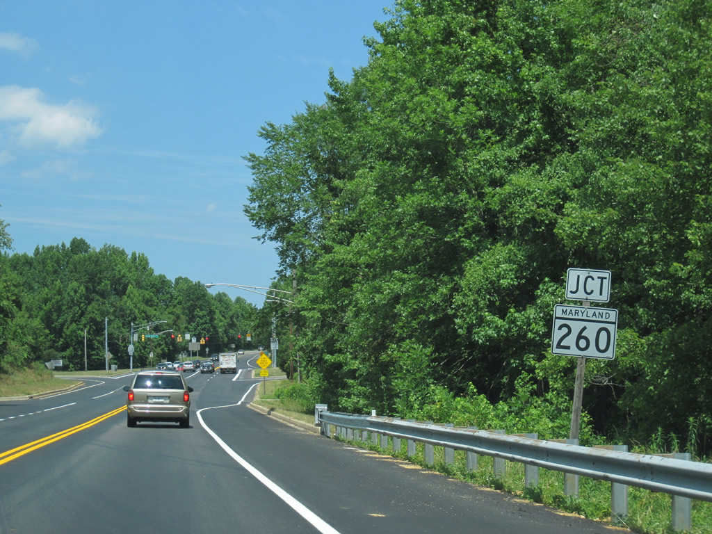
| MD 260 (Chesaspeake Beach Road) angles northwest from a trumpet interchange with Mt. Harmony Road at Paris to cross MD 260 near Owings. The state route provides a four lane corridor east from Paris to West, North, and Chesapeake Beaches. 06/25/10 |
|
| West from MD 2, MD 260 continues Chesapeake Beach Road to Chaney and an interchange with MD 4 at Lyons Creek. 06/25/10 |
|
| Tallying 8.68 miles, MD 260 ends at MD 261 to the east and MD 4 to the west. The connection with the MD 4 freeway leads drivers to the Prince George County seat of Upper Marlboro. 06/25/10 |
|
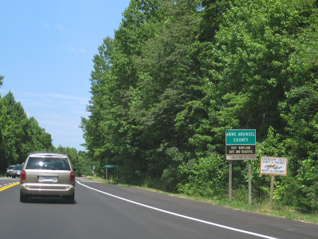
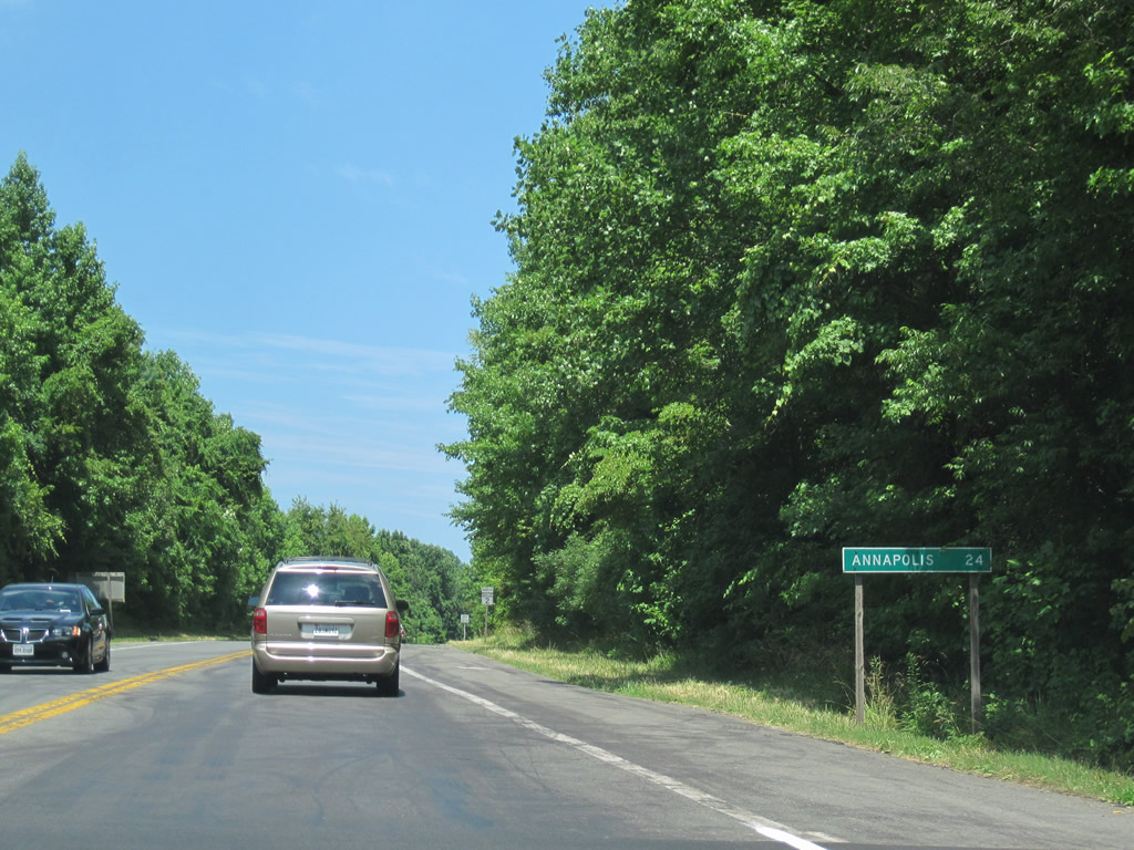
| Entering Anne Arundel County after the intersection with MD 260 near Owings. Downtown Annapolis remains 24 miles to the northeast. 06/25/10 |
|
| MD 2 (Solomons Island Road) remains rural with a mixture of forest and farm land from Calvert County north to Friendship. 06/25/10 |
|
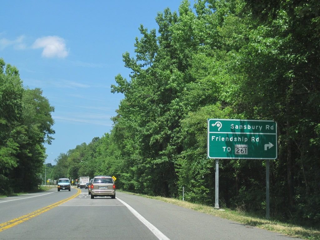
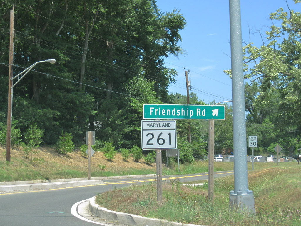
| A roundabout replaced the at-grade intersection between MD 2 and MD 261's northern terminus (Friendship Road). 06/25/10 |
|
| MD 261 began at MD 263 south of Willows and straddled the bay shore through Chesapeake Beach and Rose Haven before turning west to meet MD 2 opposite Sansbury Road. 06/25/10 |
|
| Sansbury Road stems westward to Wilson Road and MD 260 near the Calvert County line. 06/25/10 |
|
| MD 2 stays west of Friendship from MD 261 northward. Old Solomons Island Road (MD 778) intersects MD 261 (Friendship Road) at the actual community. 06/25/10 |
|
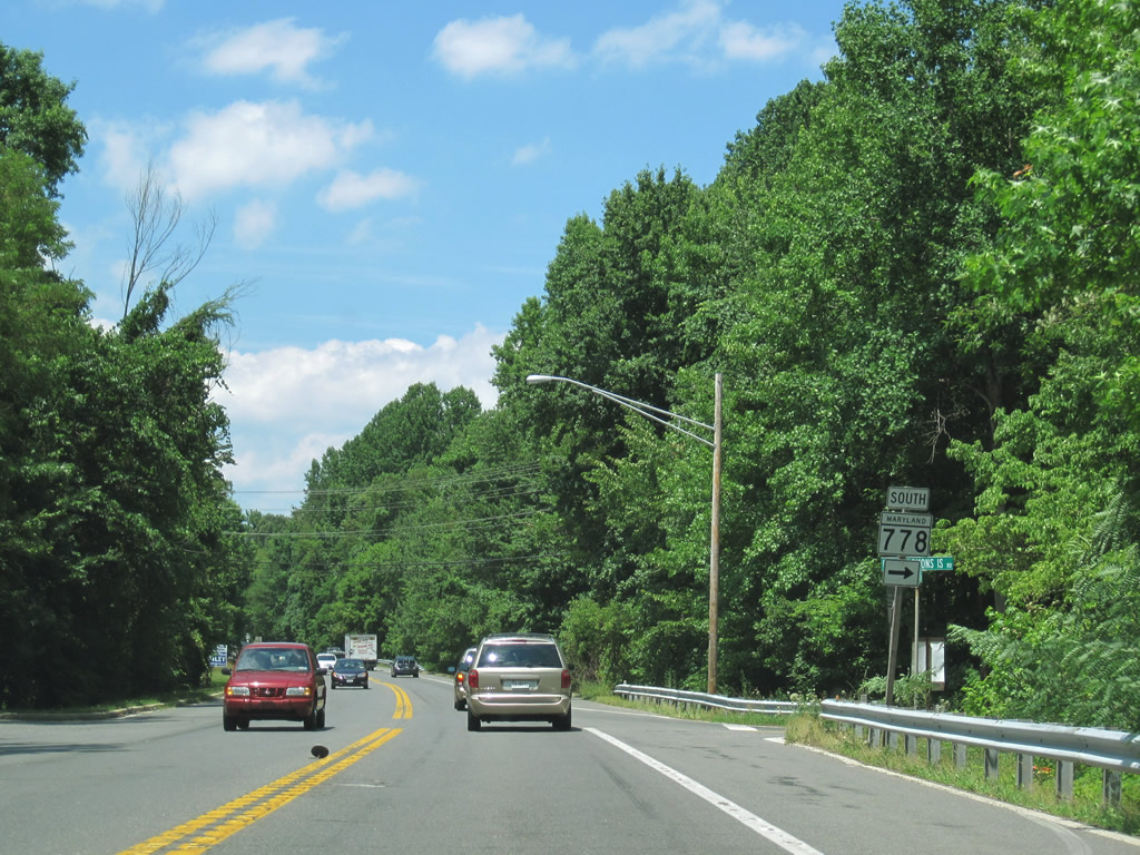
| MD 778 (Old Solomons Island Road) returns to MD 2 to end north of Friendship. 06/25/10 |
|
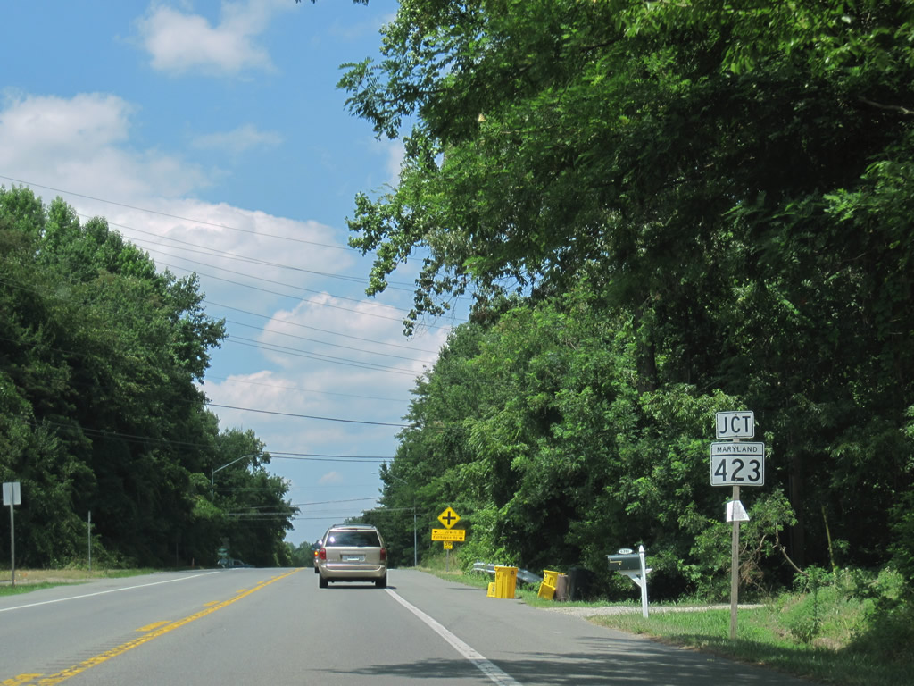
| A short distance northward is the intersection with MD 423 (Fairhaven Road) east and Jewell Road west. MD 423 begins its 2.79 mile trip to Arudel Road at Fairhaven from MD 2. Jewell Road continues the highway west to Jewell, Chaney, and MD 260. 06/25/10 |
|
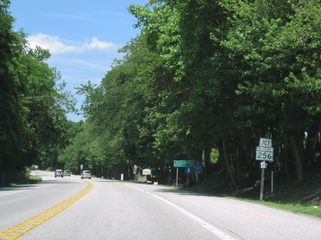
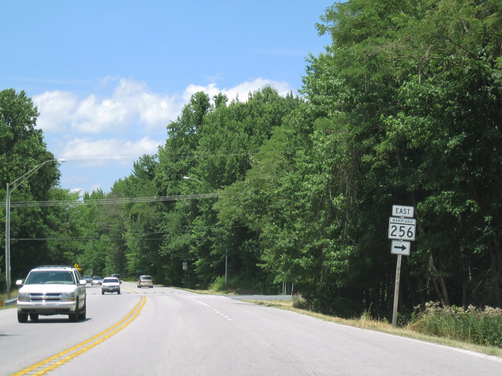
| Northbound MD 2 at Tracys Landing and MD 256 (Deale Road) east. 06/25/10 |
|
| MD 256 is another short state route that joins MD 2 (Solomons Island Road) with the Chesapeake Bay coast line. Following Deale Road, MD 256 ventures east to Nutwell and Deale off Herring Bay. Deale Churchton Road continues the route northward to its end at MD 468 (Muddy Creek Road) near Oakland. 06/25/10 |
|
| 19 miles south of Annapolis along MD 2 north. 06/25/10 |
|
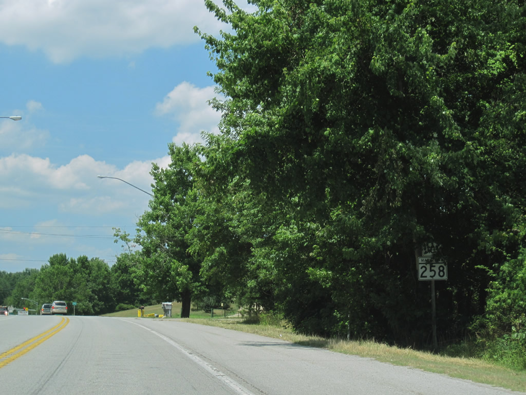
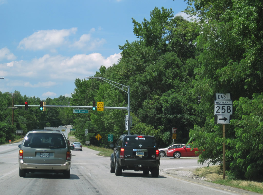
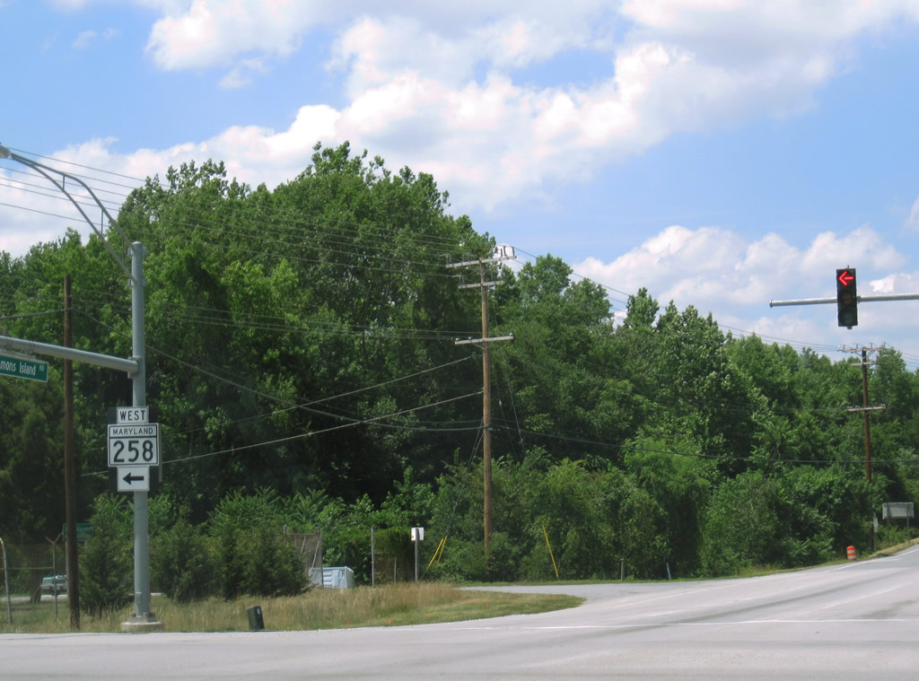
| MD 258 journeys west from MD 256 at Deale Mission to meet MD 2 (Solomons Island Road) north of Tracys Landing. 06/25/10 |
|
| West Bay Front Road carries MD 258 west to McKendree, Bristol, and MD 4 five miles east of Upper Marlboro. 06/25/10 |
|
| MD 258 stretches 7.13 miles across southern Anne Arundel County along Bay Front Road. 06/25/10 |
|
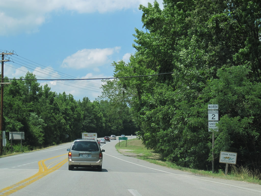
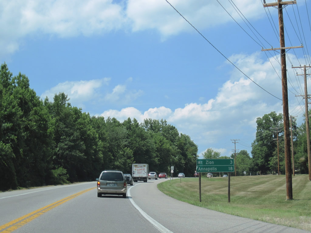
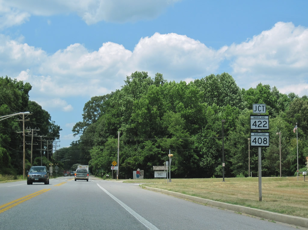
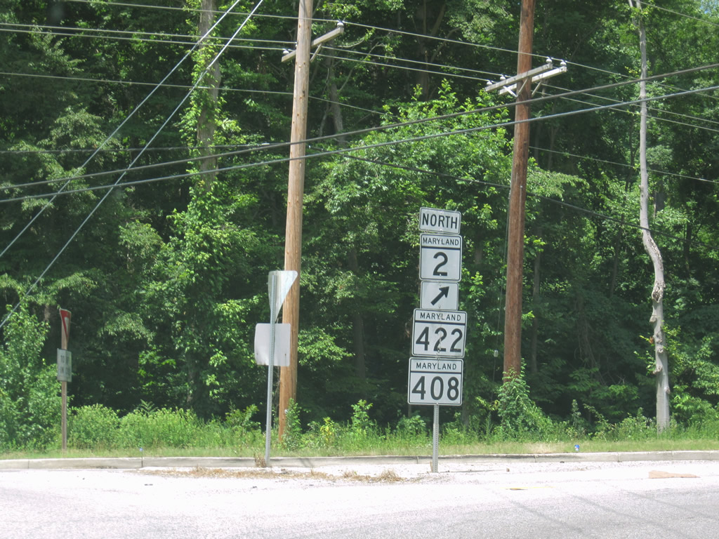
| Mt. Zion (MD 408 and 422) follows in three miles. 06/25/10 |
|
| MD 408 and 422 east come together at the Mt. Zion roundabout with MD 2 (Solomons Island Road). 06/25/10 |
|
| MD 422 (Bayard Road) spurs 3.04 miles northwest from Mt. Zion and MD 2 to Bayard. 06/25/10 |
|
| MD 408 (Mt. Zion Marlboro Road) is a 5.62 mile route leading south to Greenock (MD 259) and west to Waysons Corner and MD 4. 06/25/10 |
|
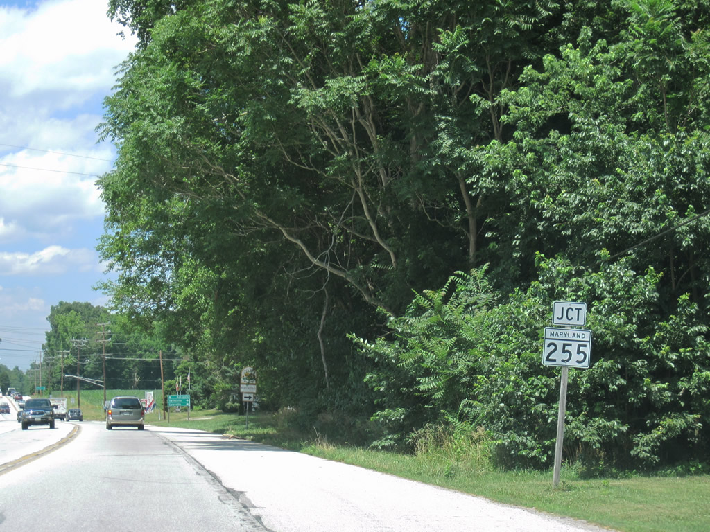
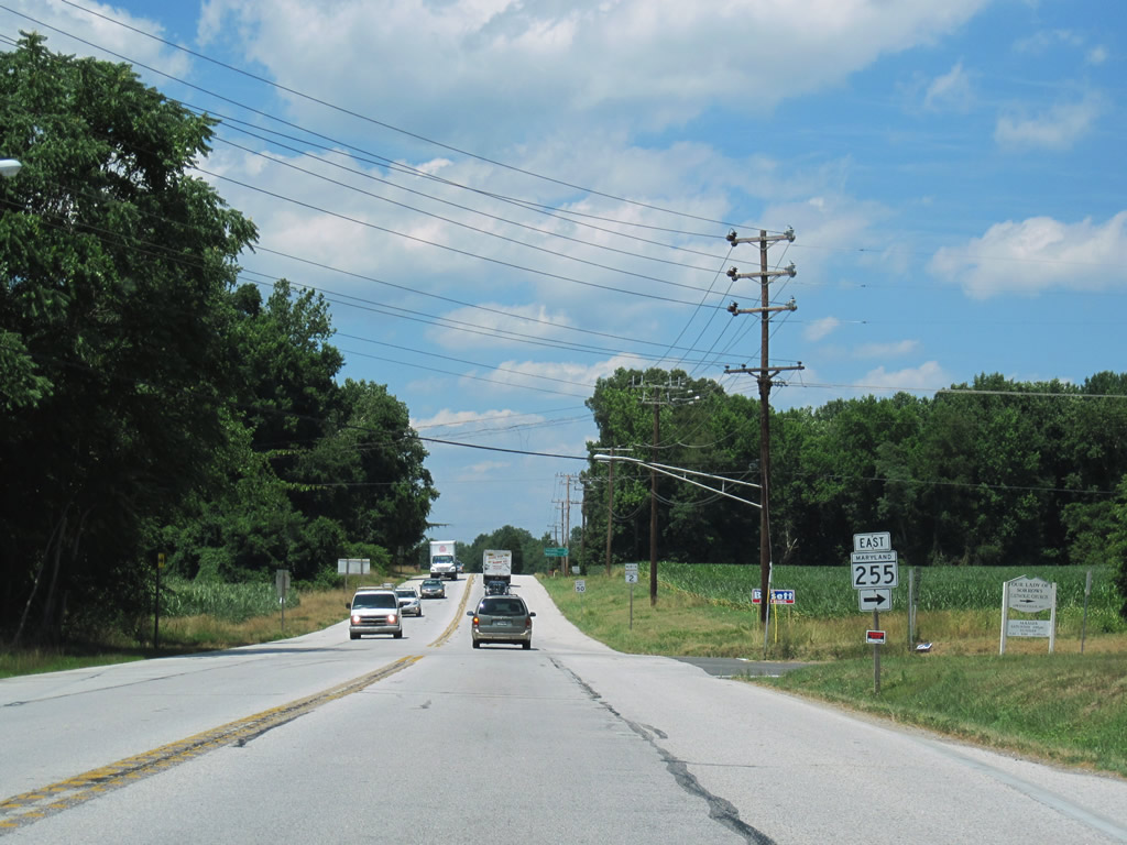
| Heading north from Mt. Zion, MD 2 (Solomons Island Road) next meets MD 255 (Owensville Road) east to West River and Galesville. 06/25/10 |
|
| East-west MD 255 talleys 4.21 miles from MD 2 to the West River on Chesapeake Bay. The state route intersects MD 468 (Muddy Creek Road) north of Oakland and south of Cumberstone before entering Galesville. 06/25/10 |
|
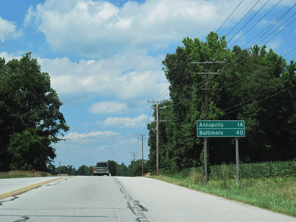
| MD 2 shield assembly and distance sign posted 14 miles south of Annapolis and 40 miles out from Baltimore. 06/25/10 |
|
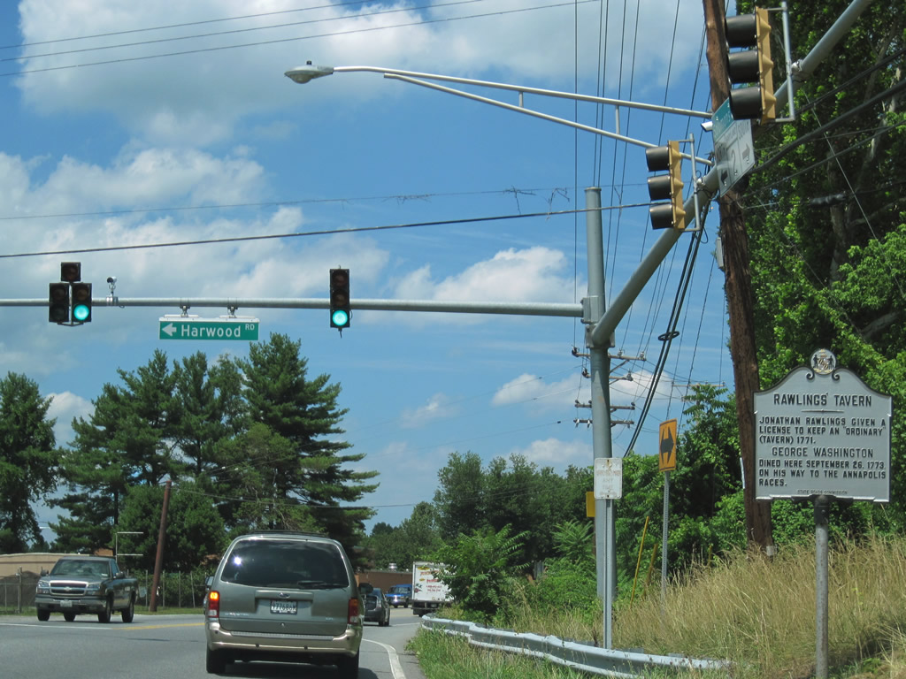
| Harwood Road meanders northwest from a traffic light at Harwood to Patuxent River Road. 06/25/10 |
|
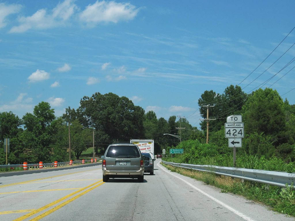
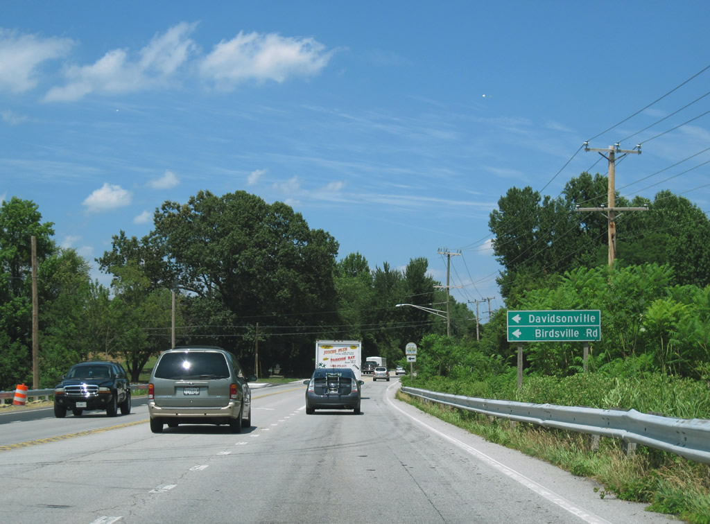
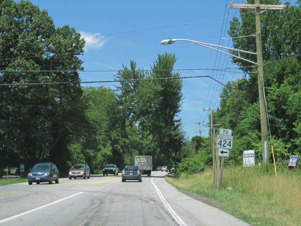
| Birdsville Road links MD 2 (Solomons Island Road) with MD 424 at MD 214 in Davidonsville. 06/25/10 |
|
| MD 424 meets I-595/U.S. 50-301 at Exit 16 and continues north from there to Crofton. 06/25/10 |
|
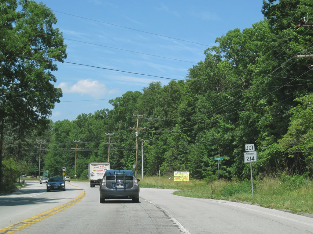
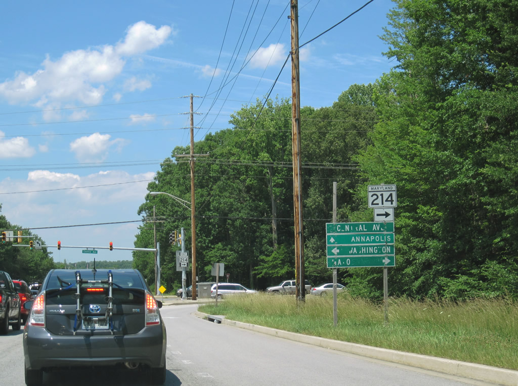
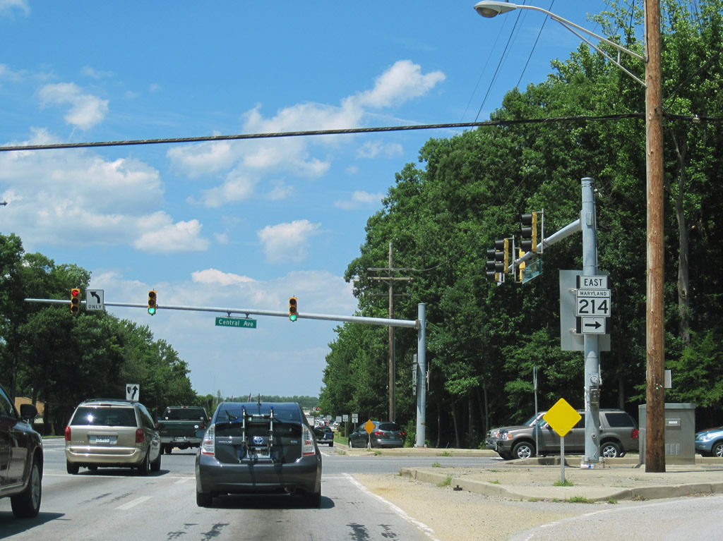
| Three miles north of Birdsville, MD 2 transitions from a semi-rural two lane highway into a four and then six lane commercial arterial. MD 214 (Central Avenue) crosses paths with Solomons Island Road at the transition. 06/25/10 |
|
| Traveling 24.97 miles, MD 214 (Central Avenue) ends to the east at Mayo and to the west at the District of Columbia line, becoming East Capitol Street. 06/25/10 |
|
| Central Avenue east from MD 2 serves Selby Beach, Cape Loch Haven, Turkey Point, Shoreham Beach, Saunders Point, and Beverly Beach among other coastal communities south of Annapolis. Westward, MD 214 continues to Davidonsville and Hall. 06/25/10 |
|
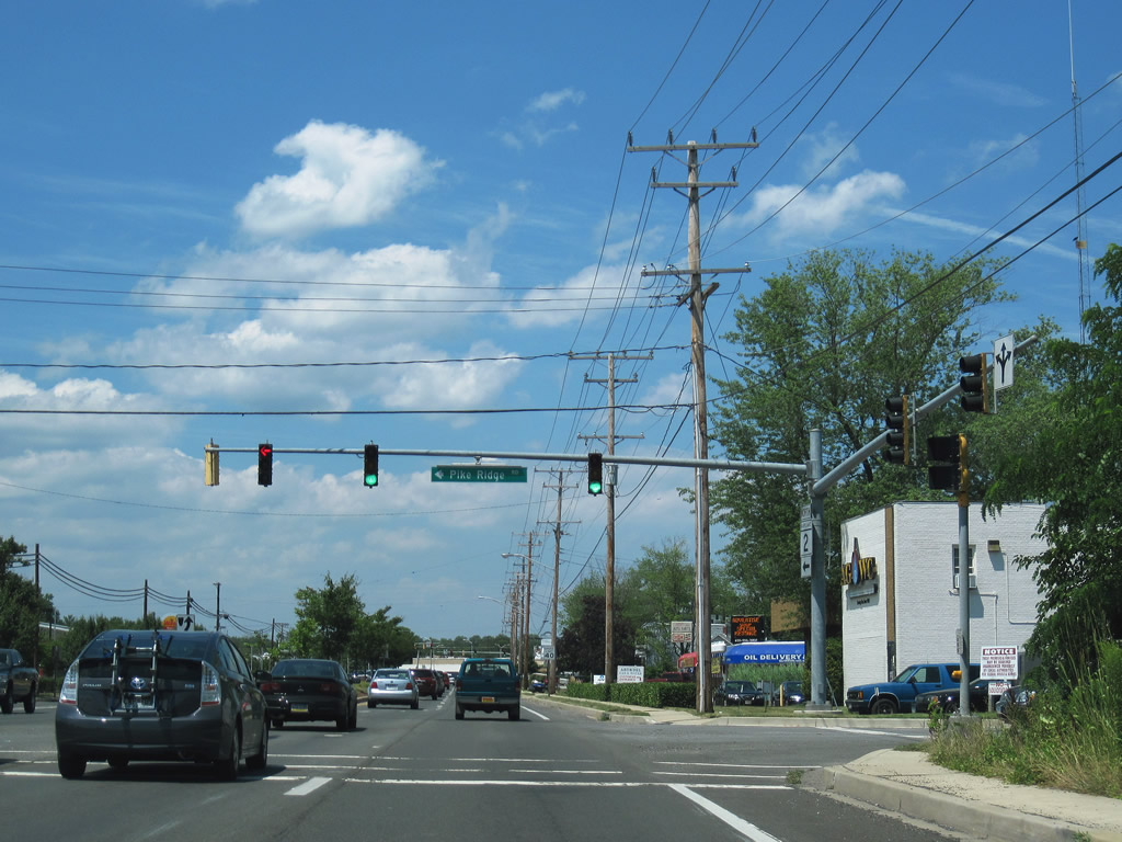
| Pike Ridge Road cuts the corner between MD 214 (Central Avenue) west of Steuart Level to MD 2 (Solomons Island Road) at Steuart Corner. 06/25/10 |
|
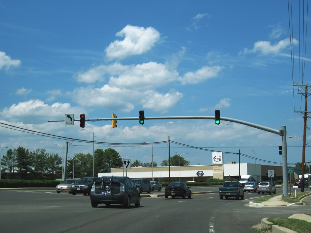
| Four lanes of MD 2 kink northeastward at the intersection with Southdown Road west. 06/25/10 |
|
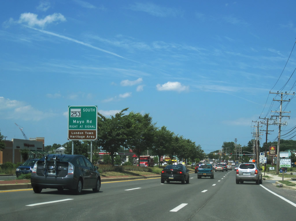
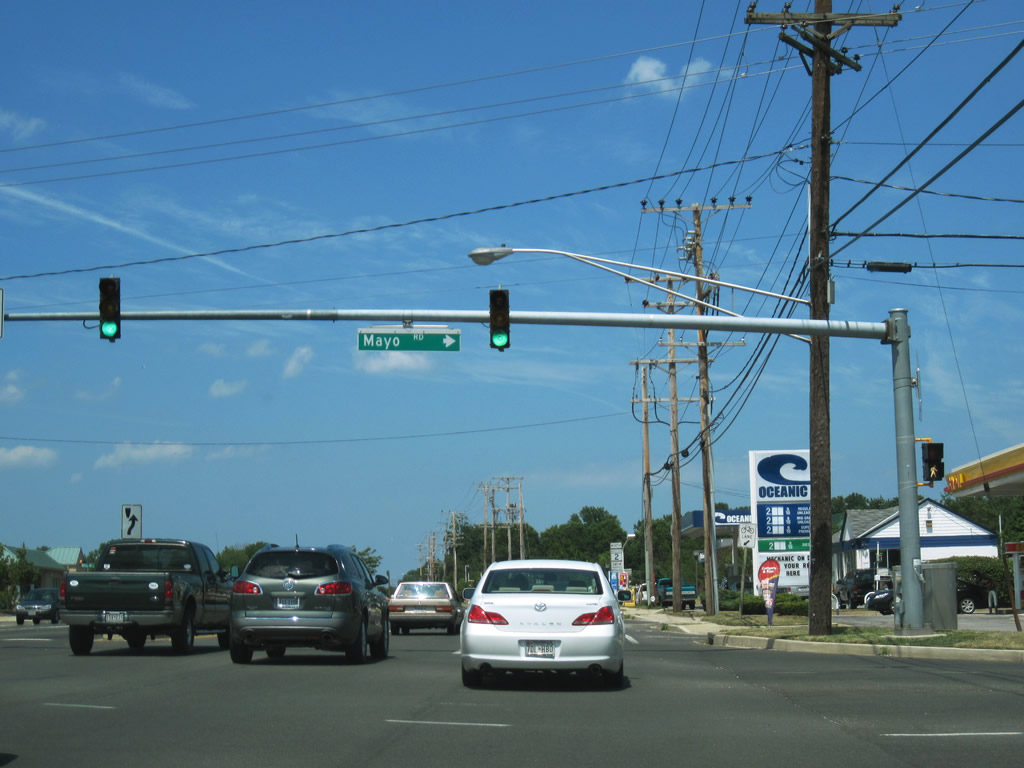
| Mayo Road arcs southeast from MD 2 as MD 253 to MD 210 (Central Avenue) near Collison Corner and Woodland Beach. 06/25/10 |
|
| MD 253 serves the Londontown community west of Glebe Bay along its 1.34 mile routing. 06/25/10 |
|
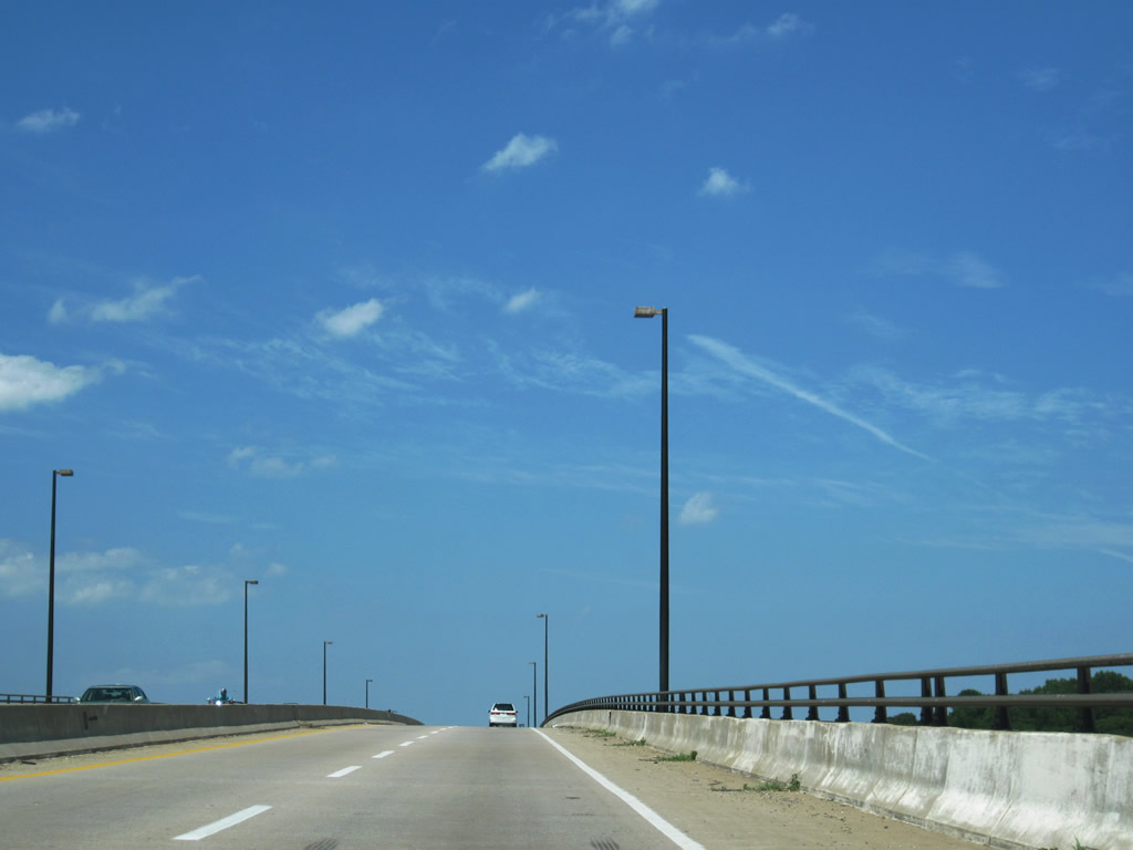
| Spanning the South River along MD 2 north between South River Park and Edgewater in suburban Annapolis. 06/25/10 |
|
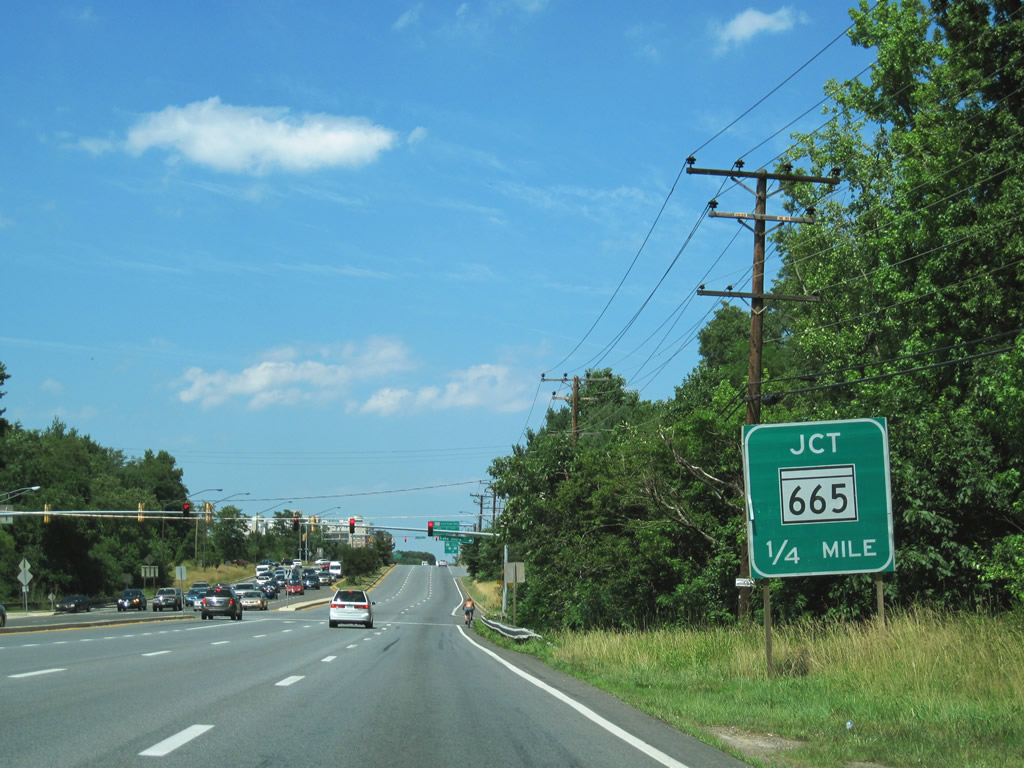
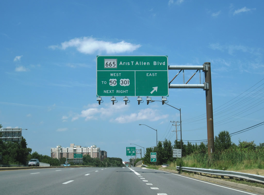
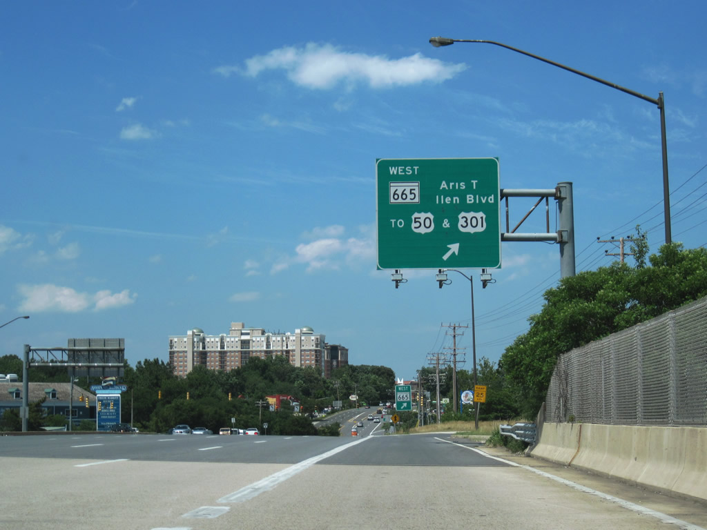
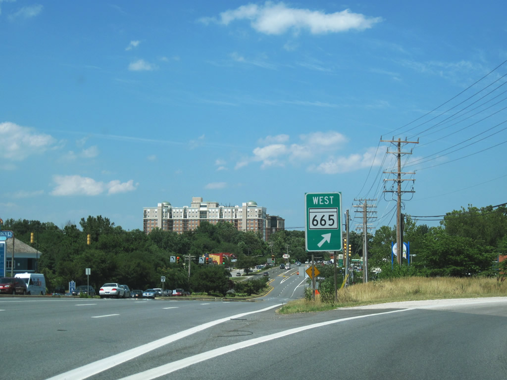
| A six-ramp parclo interchange joins MD 665 (Aris T. Allen Boulevard) with MD 2 (Solomons Island Road) near Parole. MD 665 comprises a freeway connector to Interstate 97, Interstate 595, and U.S. 50/301 nearby. 06/25/10 |
|
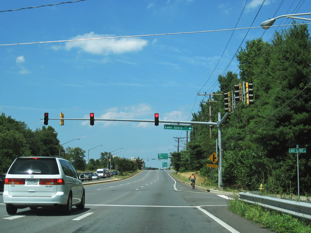
| Admiral Cochrane Drive and Lake Shore Drive come together at MD 2 south of MD 665. Admiral Cochrane Drive serves a number of office building between Solomons Island Road and Riva Road. 06/25/10 |
|
| Entering the interchange with MD 665, drivers bound for Aris T. Allen Boulevard east to Forest Drive and Chinquapin Round Road north to MD 450 (West Street) in Annapolis depart MD 2 north. MD 665 officially ends at the Forest Drive intersection with Bywater Road. 06/25/10 |
|
| Aris T. Allen Boulevard transitions into Forest Drive at Forest Villa; Forest Drive was originally MD 665 southeast to Victor Haven. 06/25/10 |
|
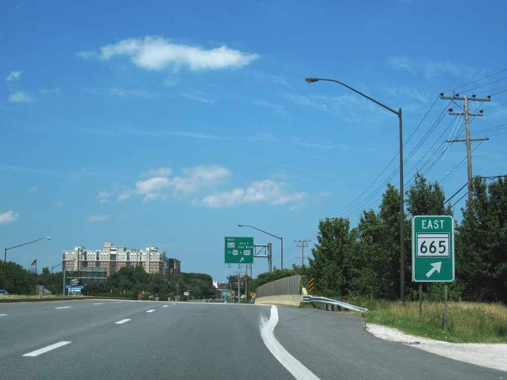
| A loop ramp carries motorists onto MD 665 (Aris T. Allen Boulevard) west to Riva Road and I-595/U.S. 50-301 (John Hanson Highway). MD 665's west end joins a c/d roadway that doubles as the northbound beginning of Interstate 97 to Glen Bernie and Baltimore. 06/25/10 |
|
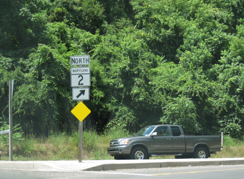
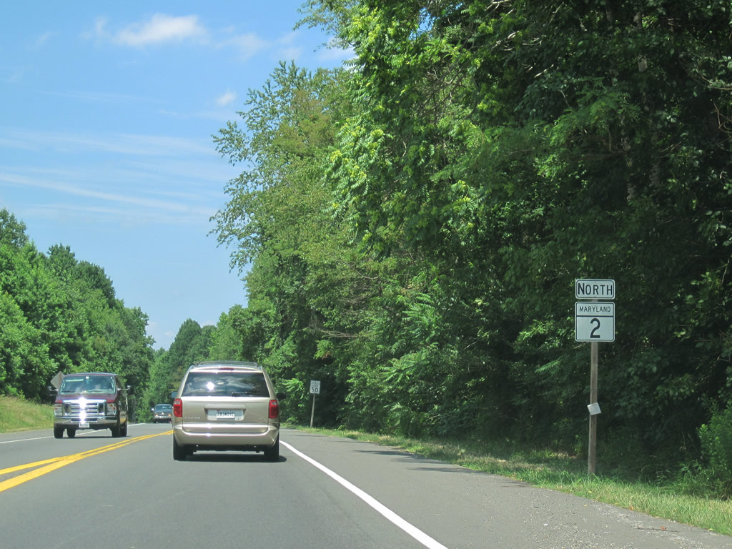
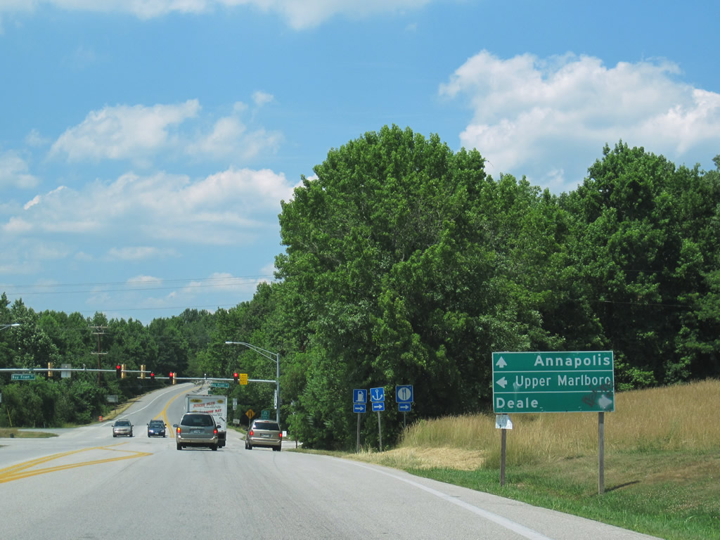
| MD 2 (Solomons Island Road) continues north from MD 665 to Parole and a merge with U.S. 50 east & 301 north across the Severn River. 06/25/10 |
Page Updated 08-31-2010.