|
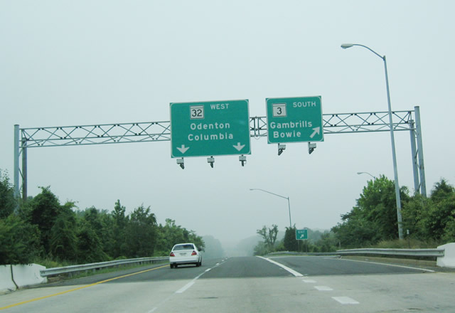
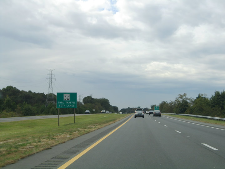
| The first exit along westbound MD 32 beyond I-97 connects with MD 3 south to Gambrills and Bowie. At Bowie, MD 3 meets U.S. 50 and U.S. 301; U.S. 301 continues southwest from Bowie en route to La Plata in Charles County and the state of Virginia. Meanwhile, MD 32 continues northwest as a freeway, with destination cities of Odenton (MD 677/170) and Columbia (U.S. 29). 06/07/04 |
|
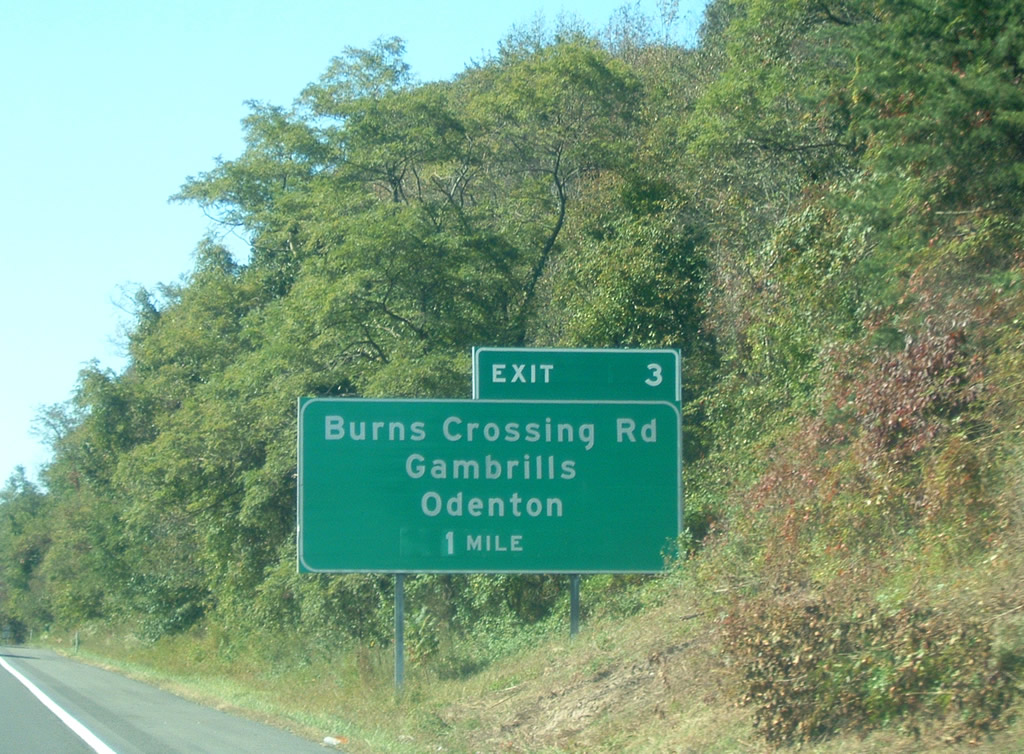
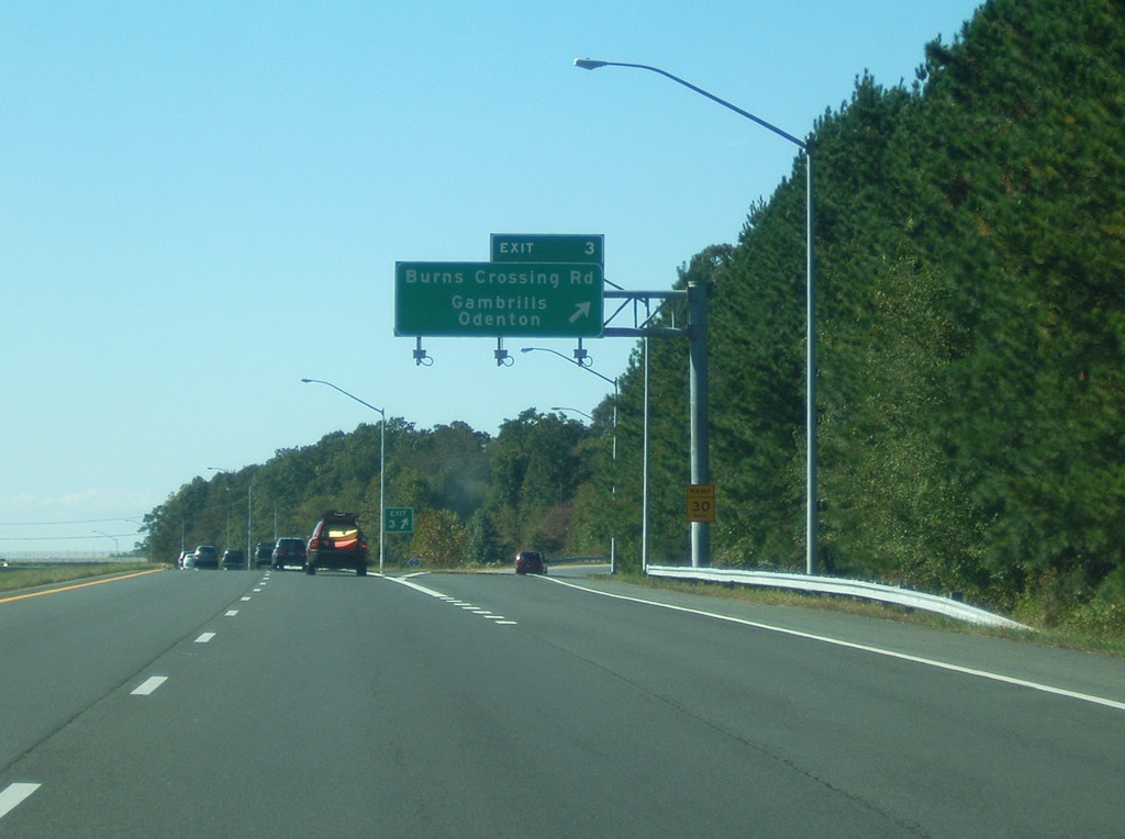
| The next exit along westbound is with Burns Crossing Road north to Ridgeway, southwest to MD 677 and Odenton, and southeast to Gambrills. 10/13/04 |
|
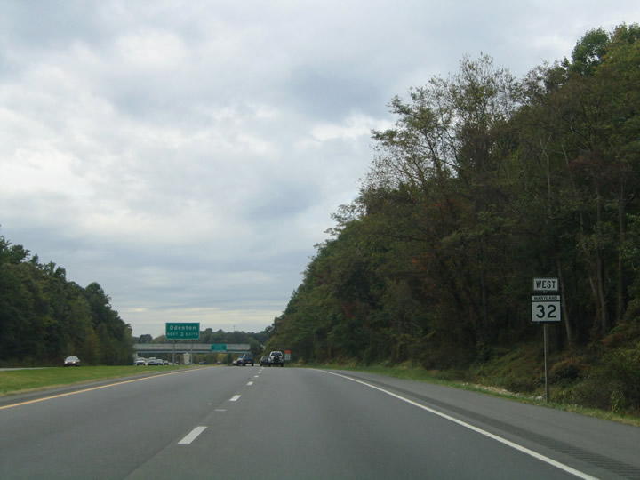
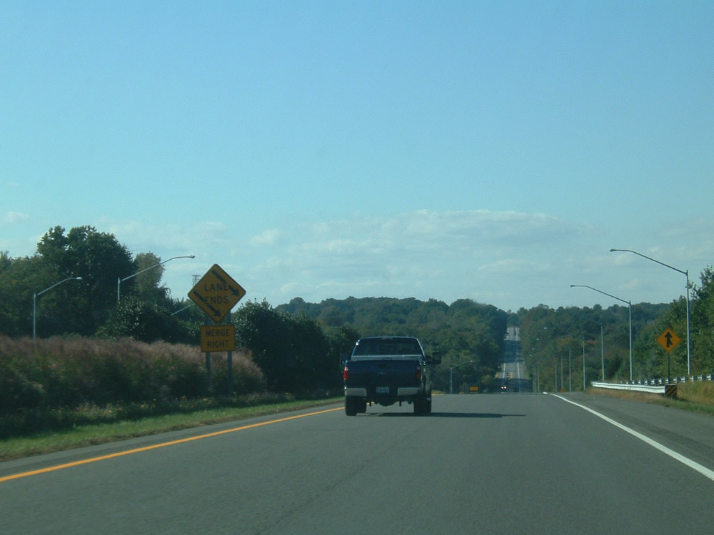
| Westbound reassurance shield posted as MD 32 leaves the confluence of Interstate 97 and MD 3 (Robert Crain Highway) at Millersvile. The next sign indicates that the following three exits serve the community of Odenton. 10/13/04 |
|
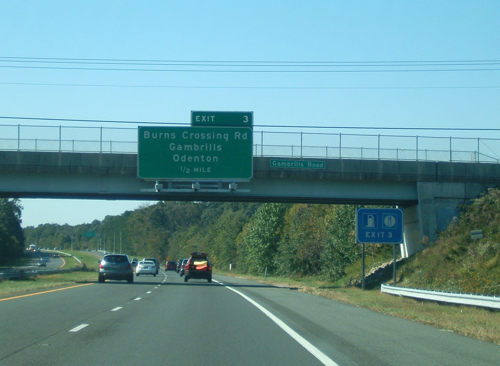
| Westbound MD 32 passes under an over crossing for Gambrills Road; the one half mile advance warning guide sign for Burns Crossing Road (Exit 3) is mounted on the bridge. Gambrills Road intersects Burns Crossing Road just south of the freeway near the center of the town of Gambrills. 10/13/04 |
|
| Westbound MD 32 at Exit 3, Burns Crossing Road to MD 677/Odenton. Unlike most east-west highways, mileposts and exit numbers increase from southeast to northwest. This may be due to the fact that MD 32 turns north-south after it passes U.S. 29 and Interstate 70 near Columbia. 10/13/04 |
|
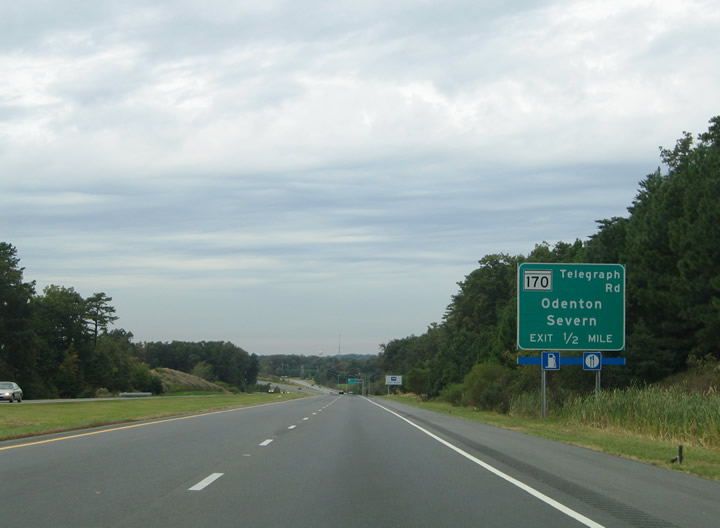
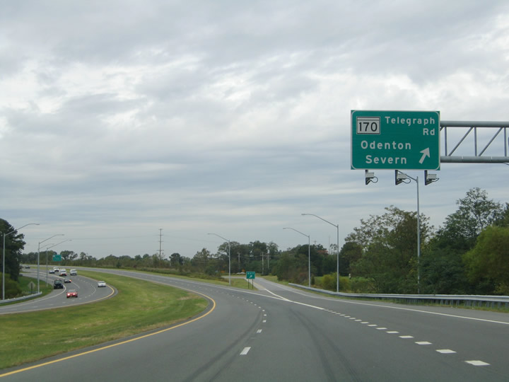
| One mile ahead of MD 170 (Telegraph Road), which heads south to Odenton and north to Severn. 10/13/04 |
|
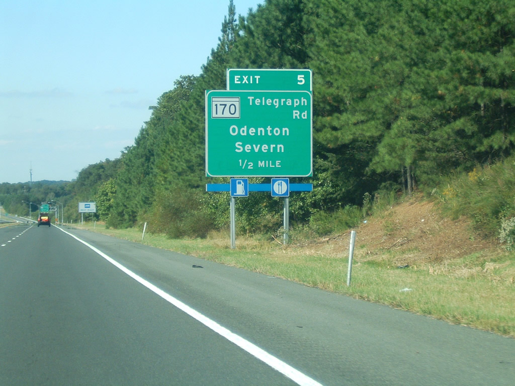
| MD 170/Telegraph Road is a major north-south arterial that heads southeast into Odenton (to reach its southern terminus at MD 175) and north to Severn and Baltimore-Washington International Airport, culminating in Baltimore. Despite the number, MD 170 has no relation to Interstate 70. Instead, MD 170 is part of a cluster of routes in the 170-series in this area. Other nearby routes include MD 174/Reece Road and Donaldson Avenue, MD 175/Annapolis Road, and MD 178/Generals Highway. 10/13/04, 10/04/09 |
|
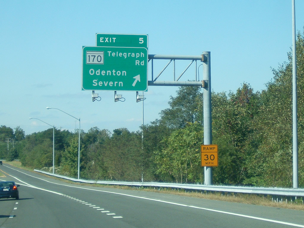
| Exit 5 leaves MD 32 for MD 170 (Telegraph Road) The diamond interchange serves interests to the Maryland Farmers Market at Piney Orchard and the Odenton MARC commuter rail station. Note the addition of exit tabs to the freeway guide signs. 10/13/04, 10/04/09 |
|
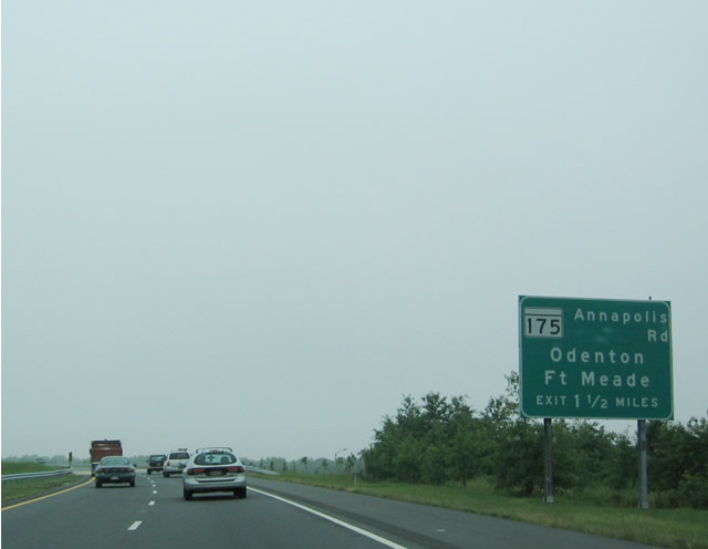
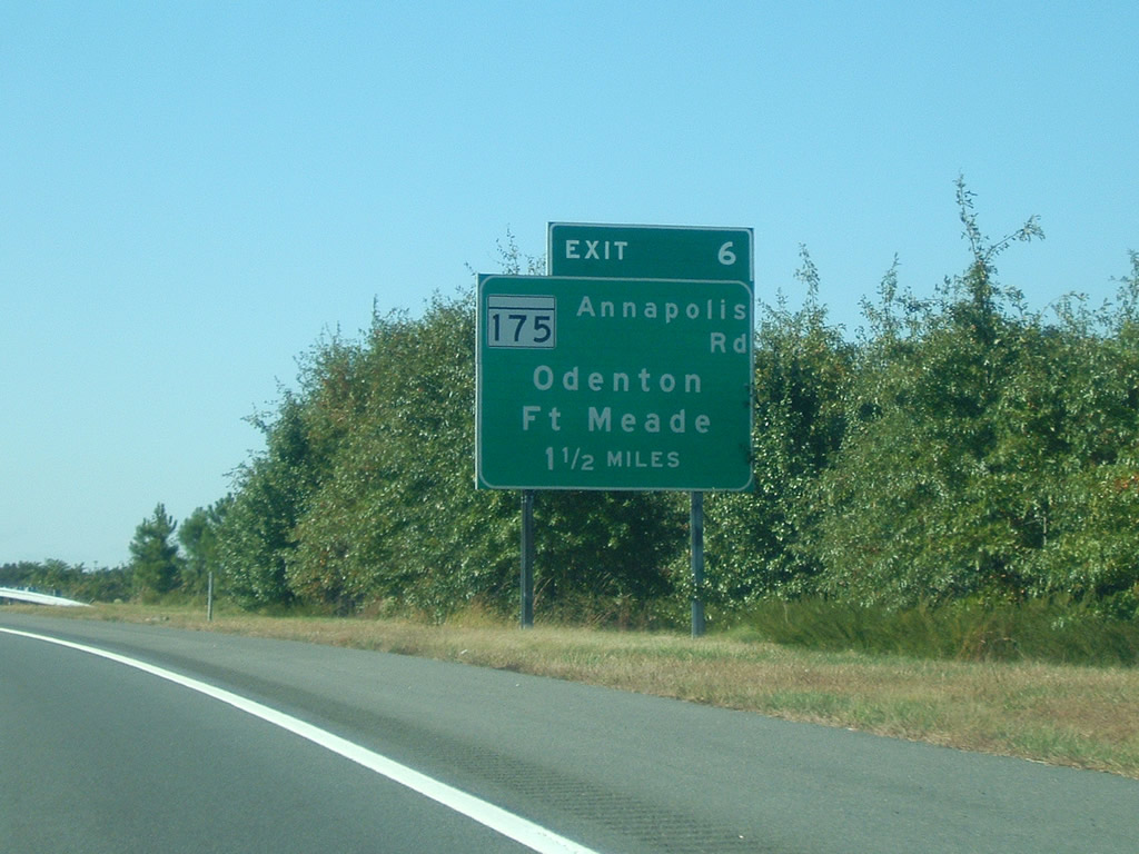
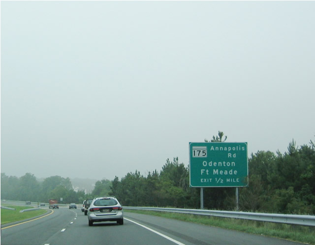
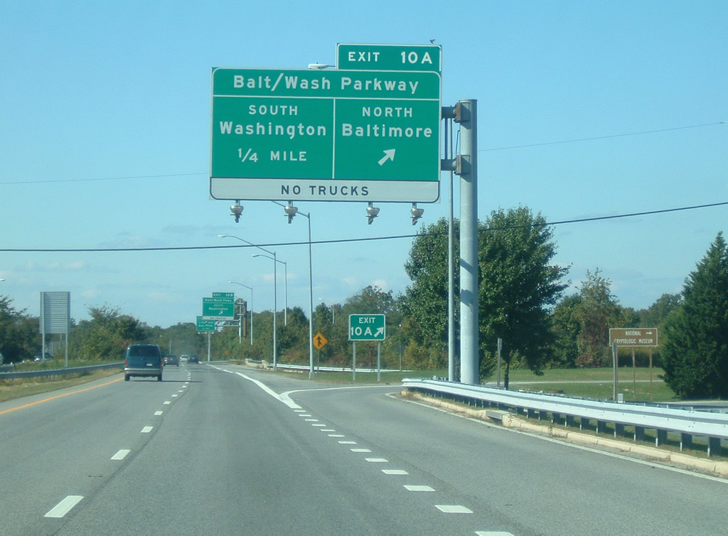
| Continuing west, MD 32 meets MD 175 (Annapolis Road) in 1.5 miles. In addition to heading southeast into Odenton, MD 175 also provides direct access into Fort Meade. All signs for MD 175 are now signed with Exit 6 tabs. 06/07/04, 10/04/09 |
|
| As MD 32 skirts the northeastern edge of Odenton, MD 175/Annapolis Road passes directly through the community, connecting to MD 170/Telegraph Road in downtown Odenton. 06/07/04 |
|
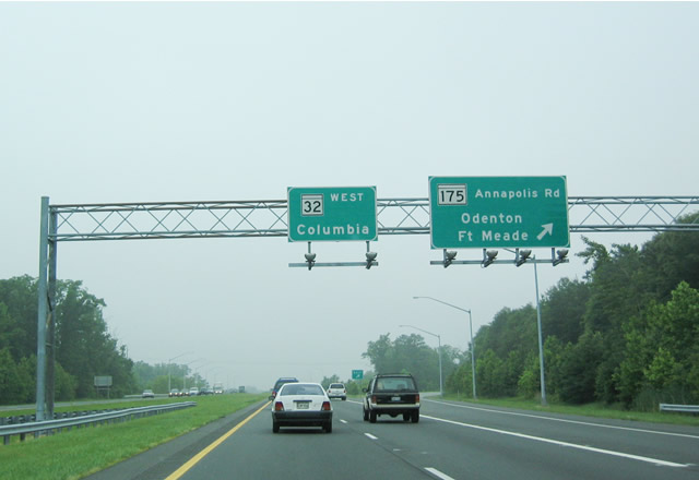
| Westbound MD 32 at Exit 6 for MD 175 (Annapolis Road) southeast into Odenton and northwest into Fort Meade. MD 32 leaves the vicinity of Odenton and advances as a freeway northwest toward Baltimore-Washington Parkway and I-95 before reaching U.S. 29 and the city of Columbia. 06/07/04 |
|
| MD 32 westbound straddles the boundary of Fort George G. Meade and Patuxent National Wildlife Research Refuge west of Odenton. 10/13/04 |
|
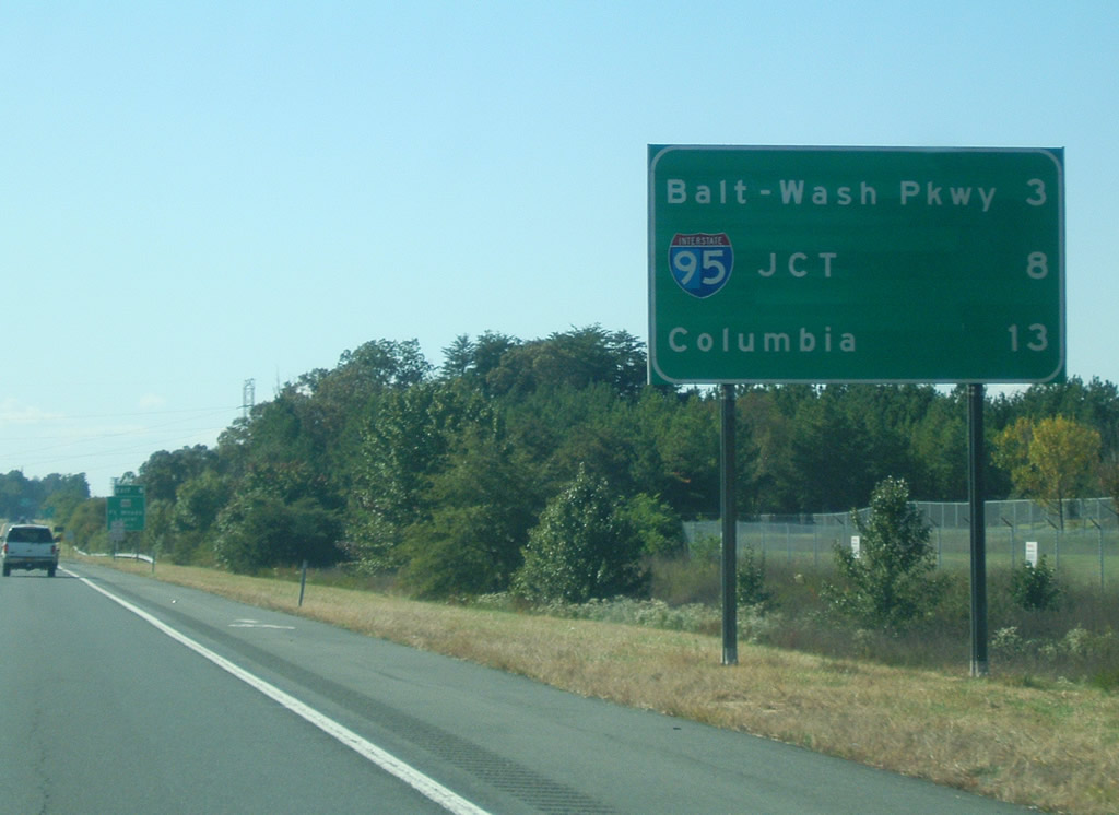
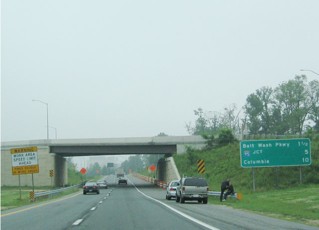
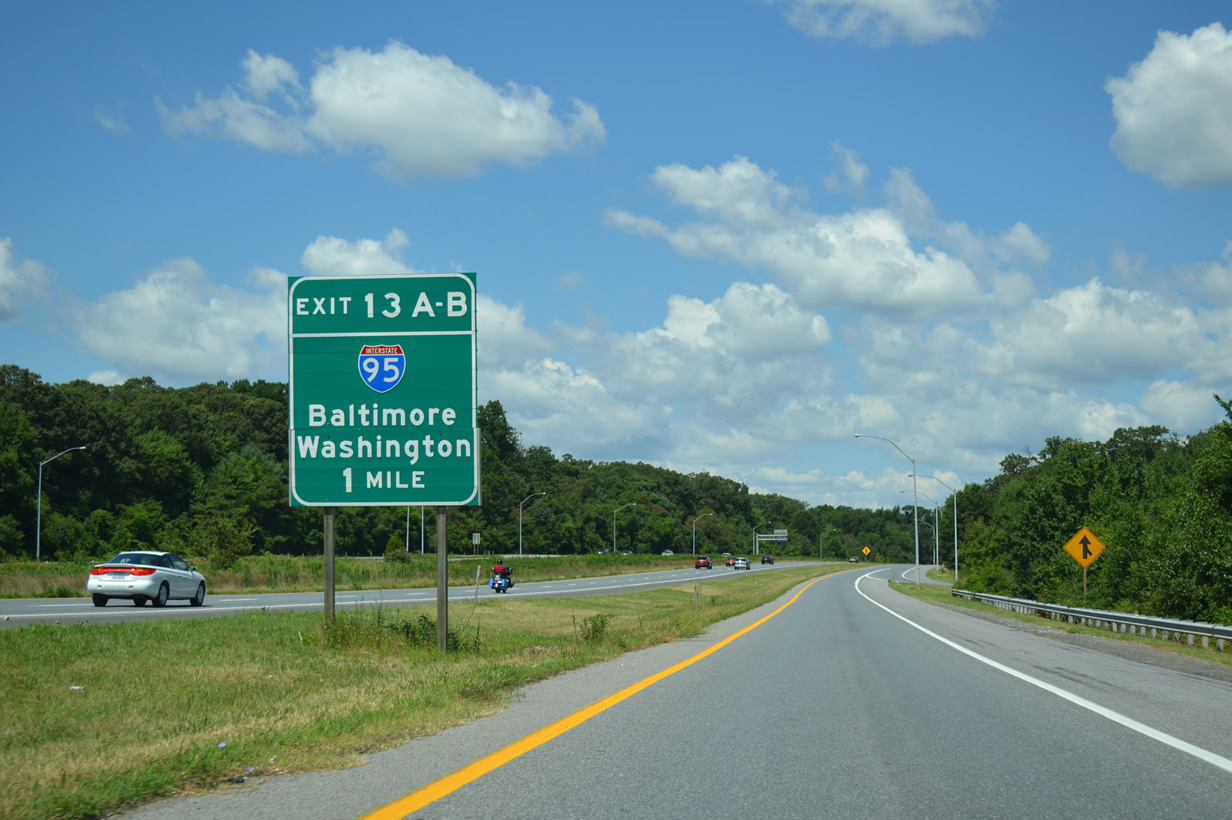
| Westbound distance sign for Baltimore-Washington Parkway (Exits 10A/B), Interstate 95 (Exits 13A/B) and Columbia (U.S. 29 - Exits 16A/B). 10/04/09 |
|
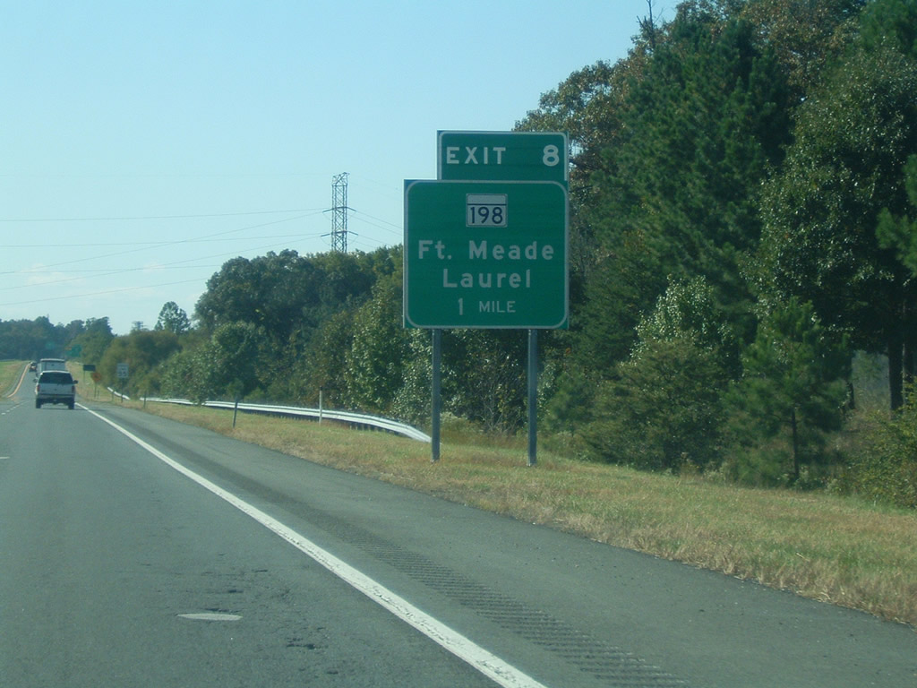
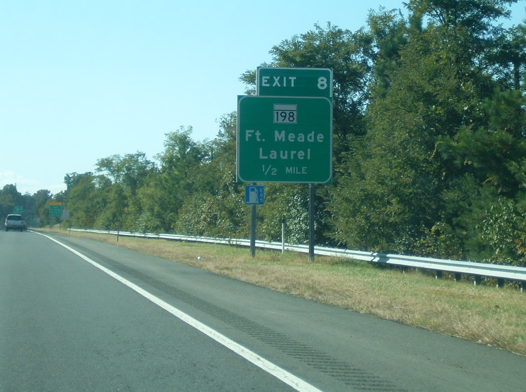
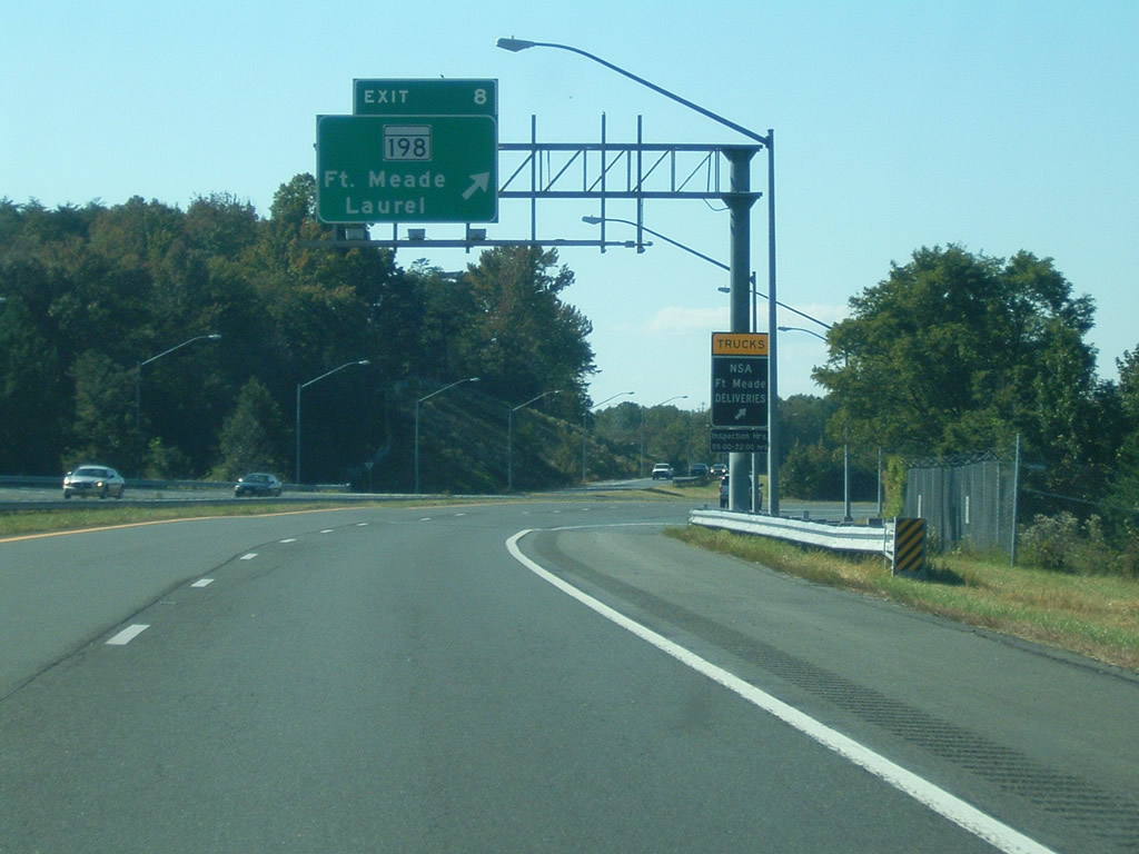
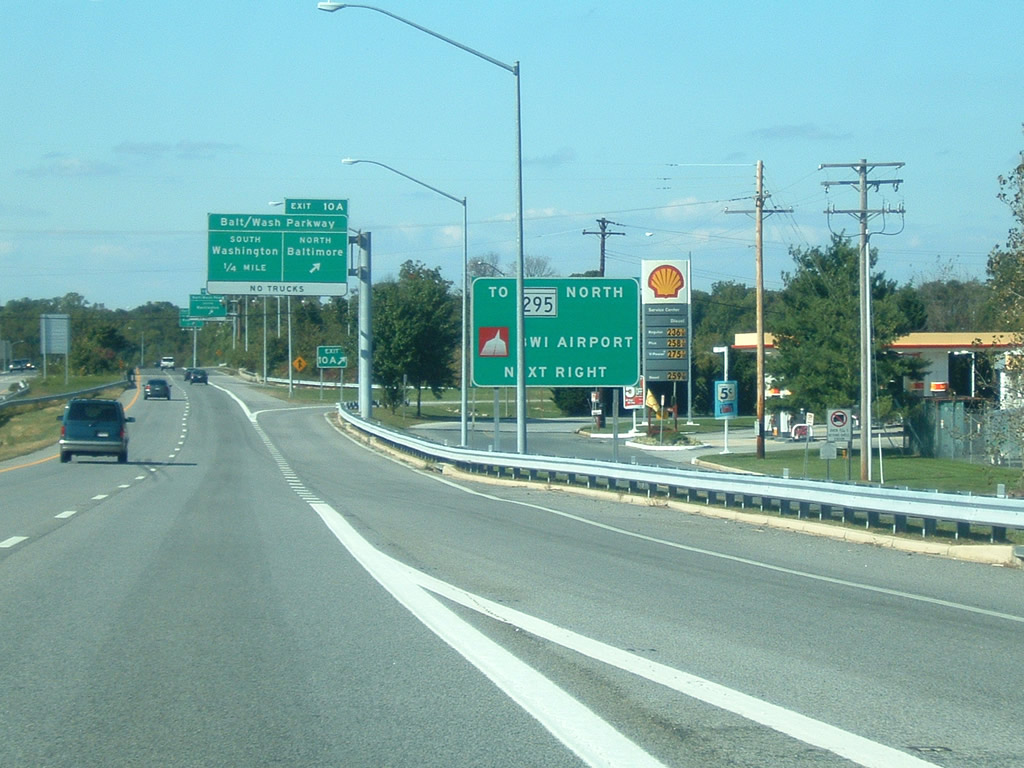
| The succeeding exit ramp along MD 32 west is with MD 198 southwest to Fort Meade and Laurel. MD 32 enters Fort George G. Meade and remains within it until passing the Baltimore-Washington Parkway interchange (Exit 10). 10/04/09 |
|
| MD 32 through traffic maintains four overall lanes through Fort George G. Meade. 10/13/04 |
|
| MD 198/Laurel-Fort Meade Road reaches its eastern terminus here at MD 32 Exit 8. From here, it heads west to a full interchange with the Baltimore-Washington Parkway (Route 295) into Laurel. Continuing west of Laurel, MD 198 follows Gorman Avenue to Interstate 95, and then continues along Sandy Spring Road into Montgomery County (as Spencerville Road). MD 198 reaches its western terminus at Browns Corner at the intersection with MD 650/New Hampshire Avenue. 10/04/09 |
|
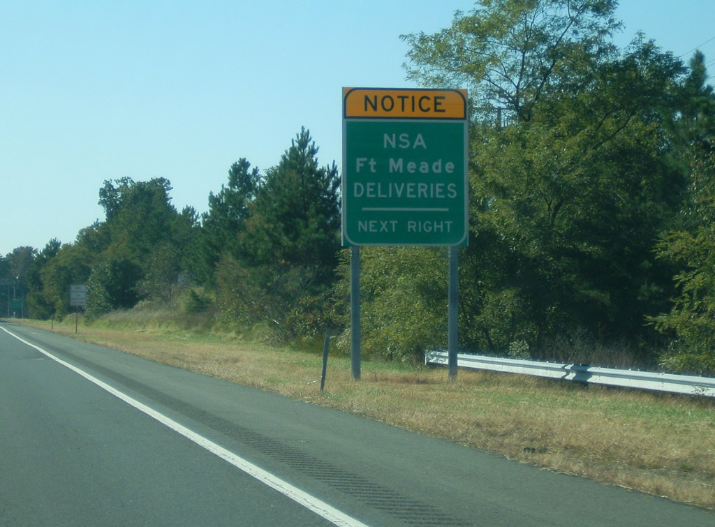
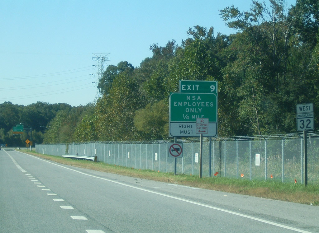
| Prior to reaching the exit for MD 198, the MD 32 freeway used to transition into a signalized divided highway, with cross-traffic and intersections. Upgrading of the highway into a freeway was completed by October of 2004. Forthcoming Exit 9 should be used for all National Security Agency (NSA) and Fort Meade deliveries. 10/04/09 |
|
| Westbound MD 32 (Patuxent Freeway) at the Exit 8 diamond interchange with MD 198 (Laurel Fort Meade Road) west and Mapes Road north. Roundabouts lie at the end of both ramps between the freeway and the state route. 10/04/09 |
|
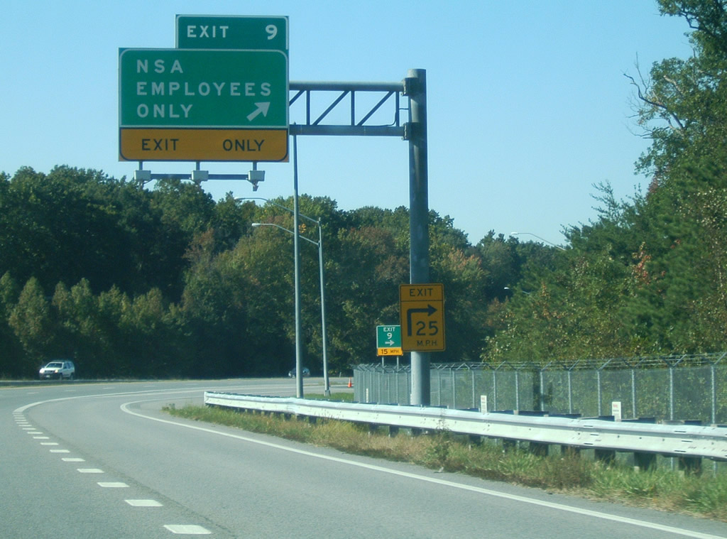
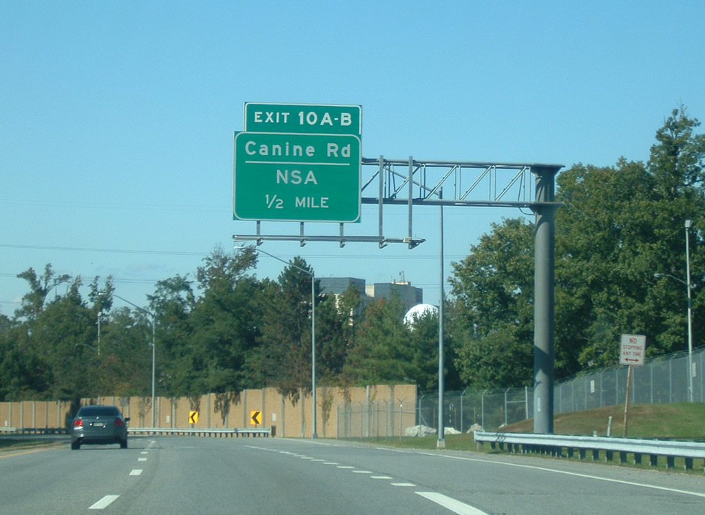
| The next exit along westbound is Exit 10, an exit dedicated for employees of the federal government's NSA complex. The complex is of such size that an exit is required here as well as along the Baltimore-Washington Parkway (Route 295). 10/04/09 |
|
| MD 32 westbound at the NSA (National Security Agency) employee off-ramp at Fort Meade. Access to the NSA facility is provided for both directions to and from MD 32 onto Canine Road north ahead of Samford Road east. 10/04/09 |
|
| This distance sign is located in front of an overpass that carries a left exit from eastbound MD 32 to the NSA complex. Not identified on this distance sign, the succeeding exit is a trumpet interchange (Exit 10A). The following exit is with Baltimore-Washington Parkway. 06/07/04 |
|
| Exit 10A provides access to Canine Road east to Colony Seven Road and the National Security Agency. 10/04/09 |
|
| One half mile south of the cloverleaf interchange with Baltimore-Washington Parkway at the final Fort Meade off-ramp. For the most part, Exit 10A serves only authorized vehicles as Canine Road sees a security gate after its intersection with Colony Seven Road. 10/13/04 |
|
| MD 32 (Patuxent Freeway) parallels Colony Seven Road briefly before reaching the Exit 10A off-ramp to Baltimore-Parkway north. Baltimore-Parkway is a National Park Service Maintained facility from MD 201 (Kenilworth Avenue) northward to MD 175, the next northbound exit. 10/04/09 |
|
| MD 295 begins north of the MD 175 cloverleaf interchange north of Fort Meade, carrying Baltimore-Washington Parkway north to Baltimore-Washington International Airport (BWI) and the city of Baltimore. 10/04/09 |
|
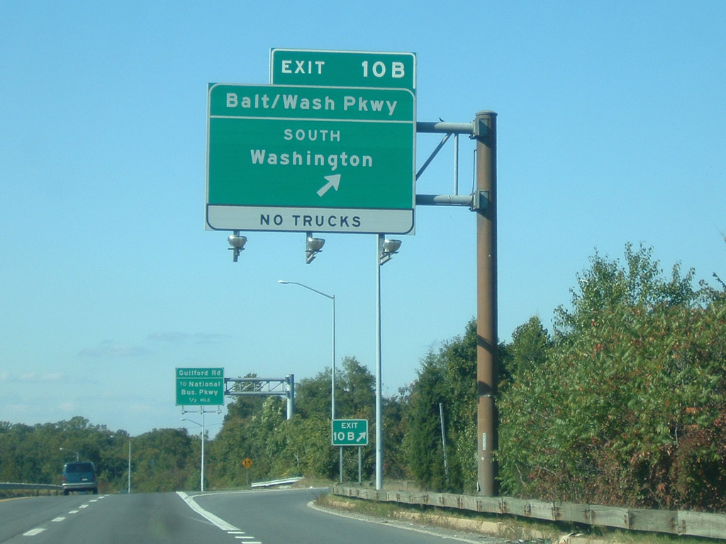
| Exit 10B loops onto the National Park Service maintained section of Baltimore-Washington Parkway south to Laurel, Greenbelt, and Cheverly. Connections with MD 201 (Kenilworth Avenue) lead motorists southward to Washington via DC Route 295. 10/04/09 |
|
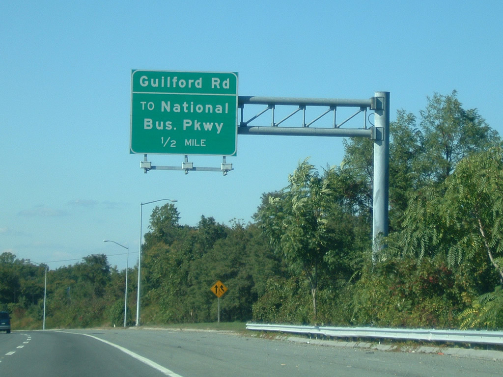
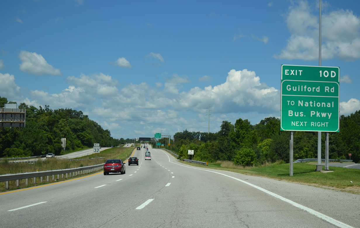
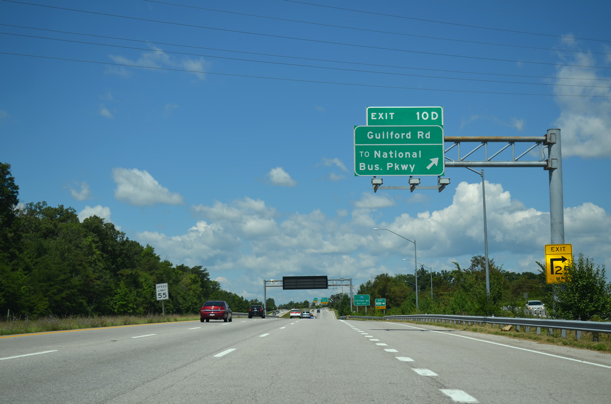
| Guilford Road continues National Business Parkway northwest alongside MD 32 (Patuxent Freeway) to Old Columbia Road near Exit 16. The next exit connects MD 32 west with the parallel road. 10/04/09, 08/04/13 |
|
| Westbound MD 32 at the Guilford Road off-ramp (numbered Exit 10D by 2011). National Business Parkway spurs northeast from Guilford Road through a series of business parks. Guilford Road, the former alignment of MD-32, continues west otherwise to Dorsey Run Road. 08/04/13 |
|
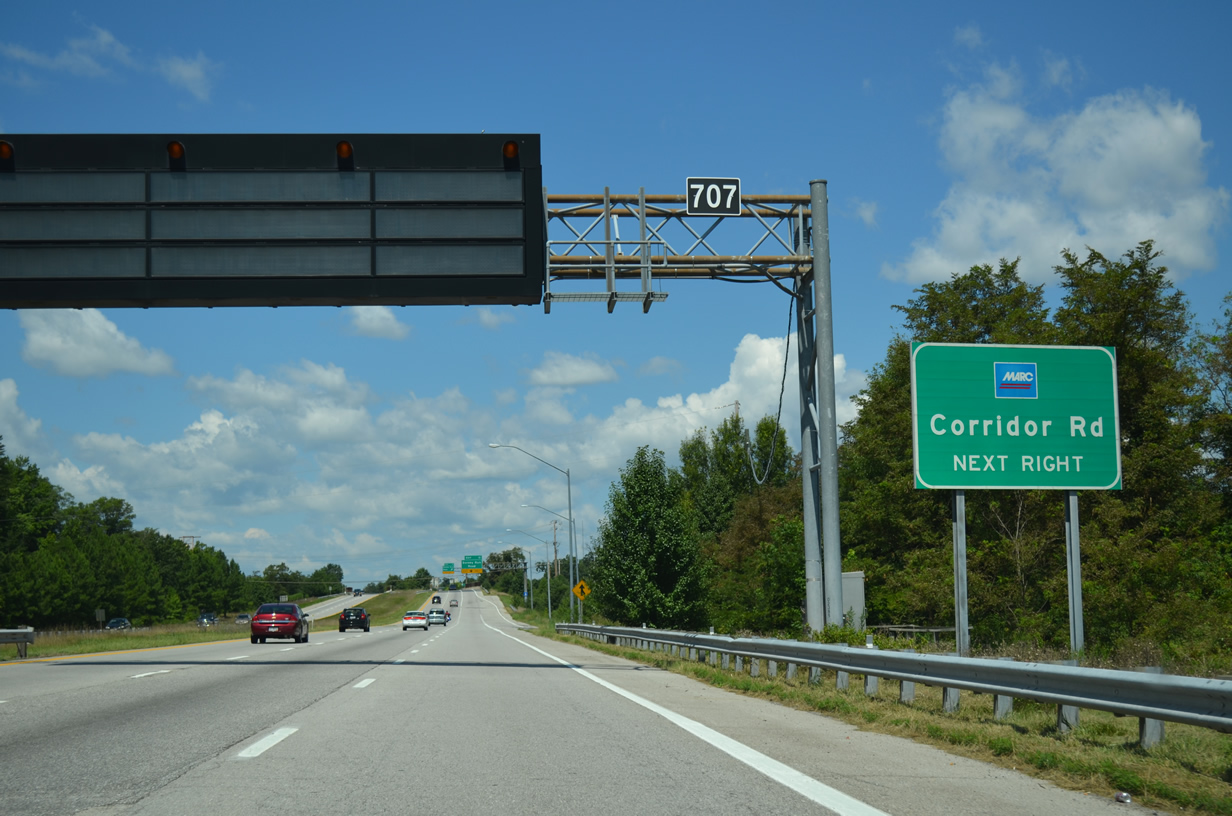
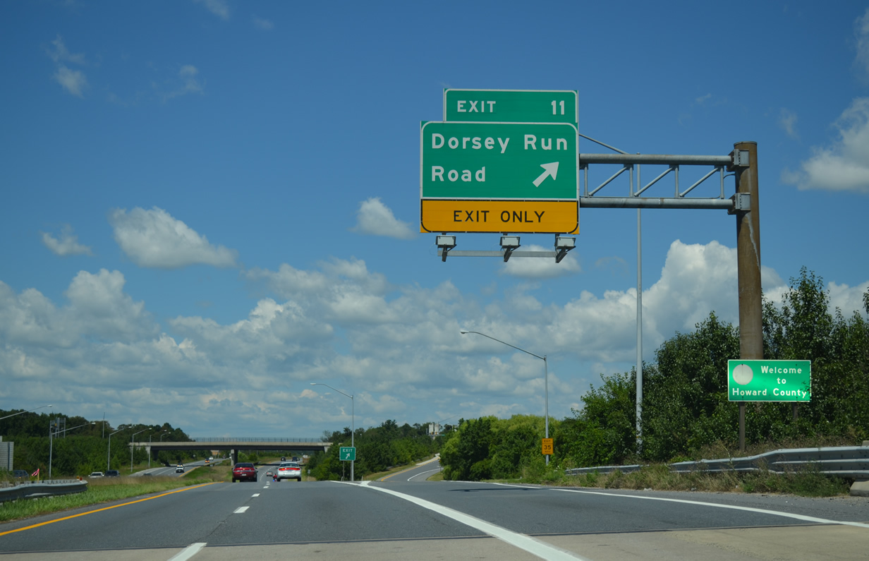
| A parclo interchange (Exit 11) joins MD 32 next with Dorsey Run Road just north of Corridor Road and a MARC station. 08/04/13 |
|
| Dorsey Run Road begins at Brock Bridge Road and the MARC commuter station nearby and heads north to Jessup and MD 175 (Waterloo Road). 08/04/13 |
|
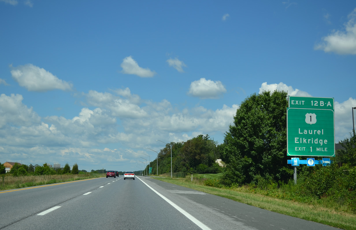
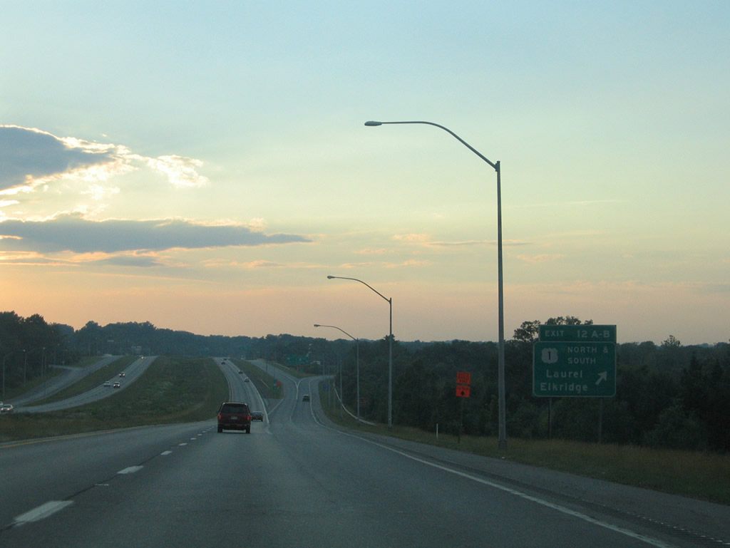
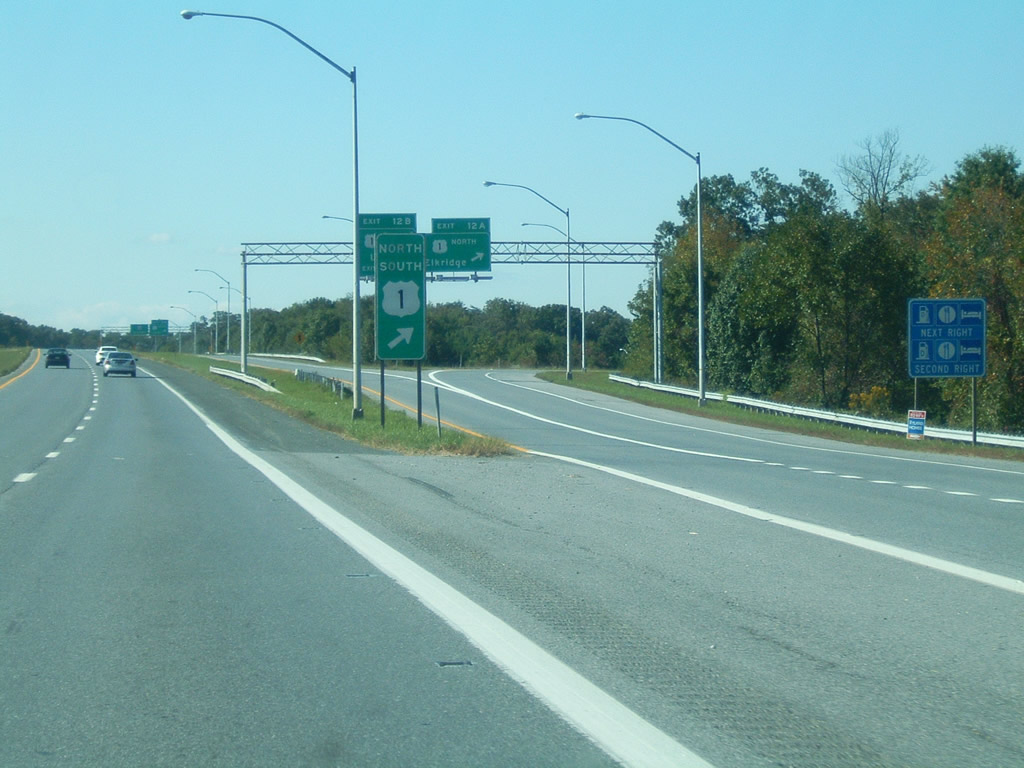
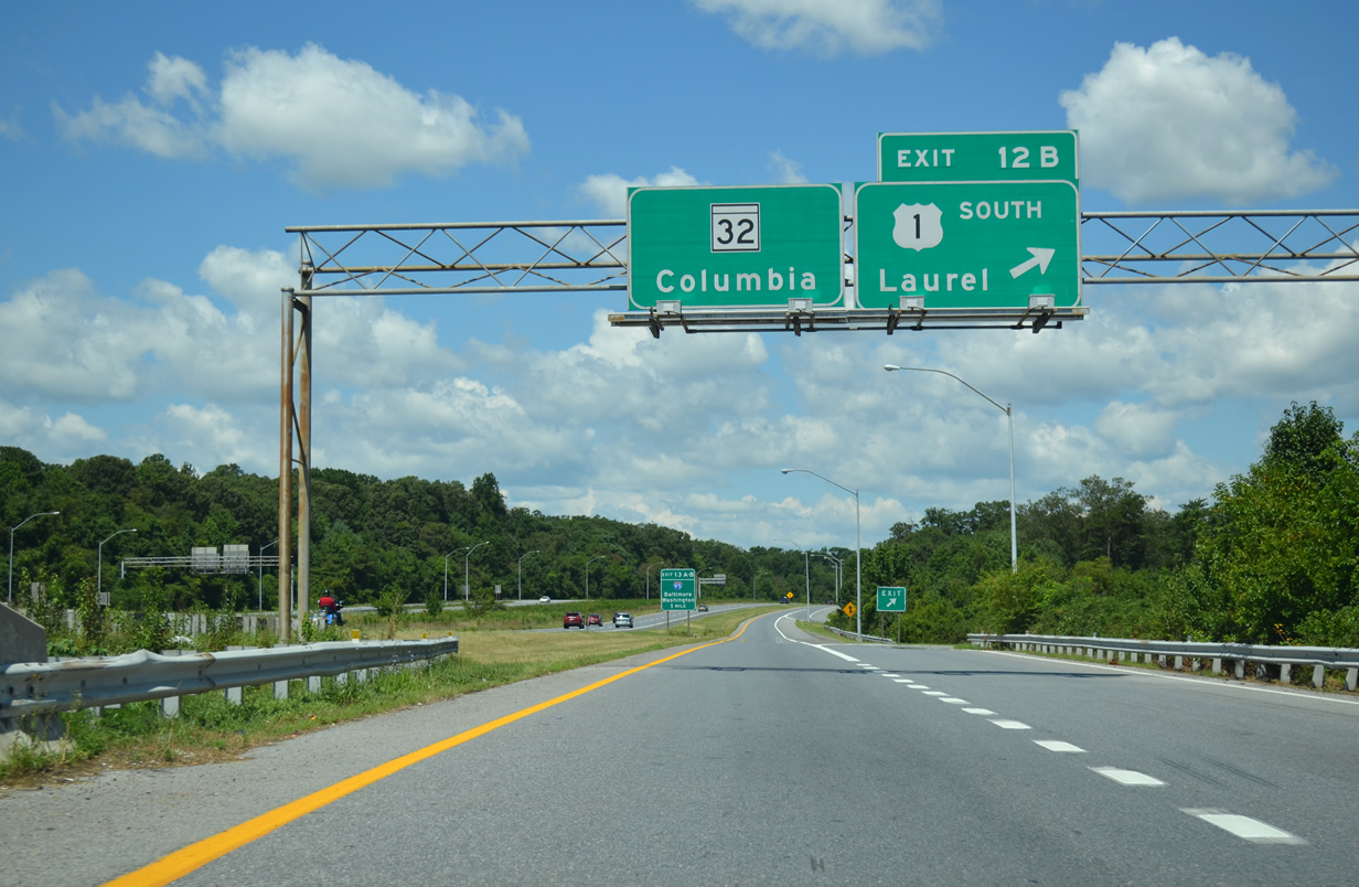
| Now in Howard County, next in line for westbound drivers is the cloverleaf interchange (Exits 12B/A) with U.S. 1 (Washington Boulevard). 08/04/13 |
|
| U.S. 1 travels midway between the Interstate 95 and Baltimore-Washington Parkway corridors through Laurel, Savage, Jessup and Elkridge. 08/04/13 |
|
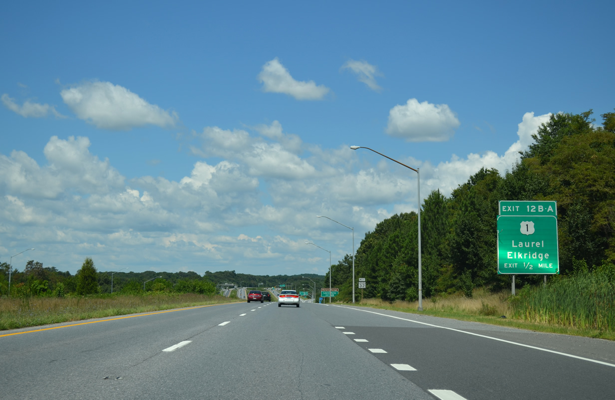
| Collector distributor roadways facilitate the movements to U.S. 1 (Exits 12A/B). These roadways come into view beyond this westbound reassurance shield for MD 32. 08/04/13 |
|
| Westbound at the Exit 12 c/d roadway for U.S. 1 (Washington Boulevard). U.S. 1 serves a variety of commercial businesses, warehouses, and industrial parks between Laurel and Elkridge. 06/22/05, 10/04/09 |
|
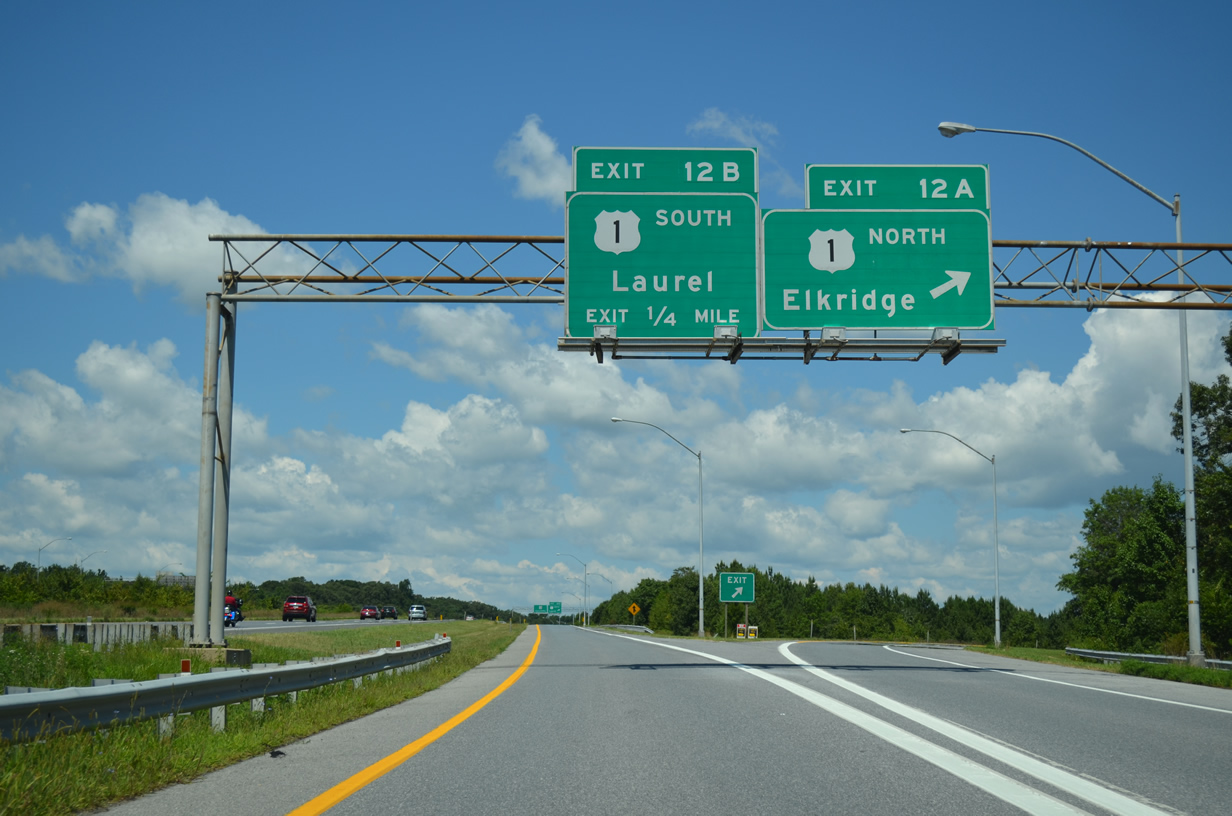
| Exit 12A departs MD 32 west for U.S. 1 north to Jessup. U.S. 1 mainly serves local traffic movements between the two freeway corridors. 08/04/13 |
|
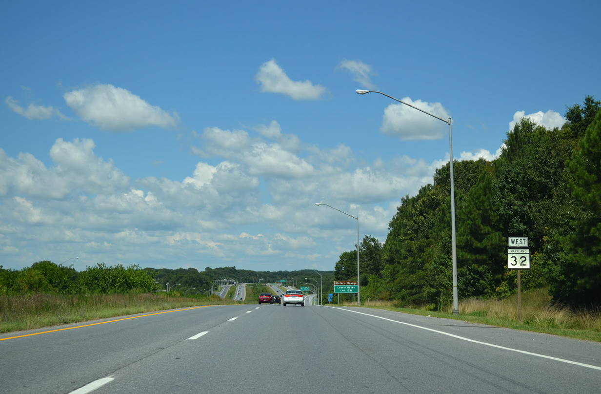
| Leading south, U.S. 1 continues along Washington Boulevard to adjacent Savage and Downtown Laurel (MD 198). 08/04/13 |
|
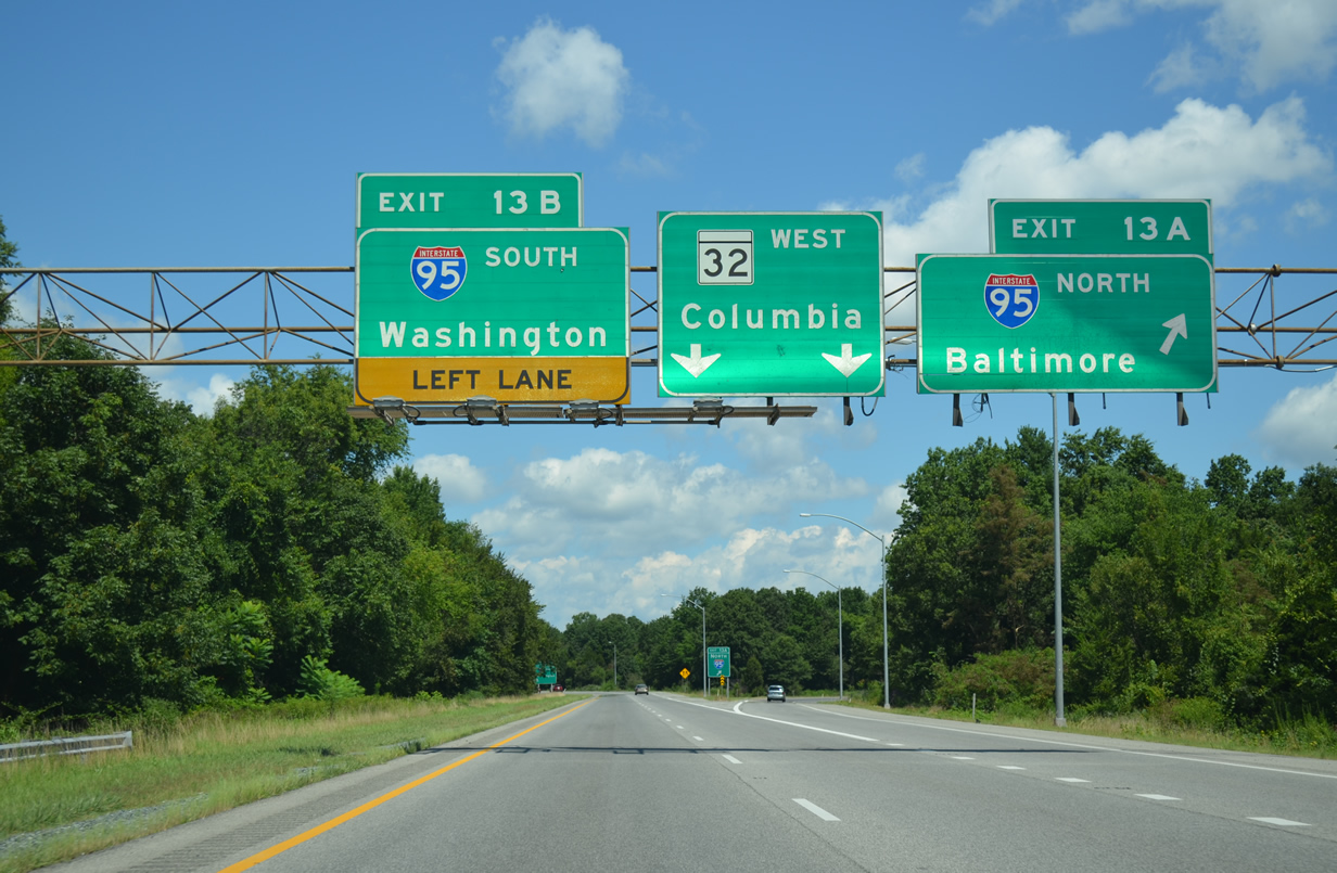
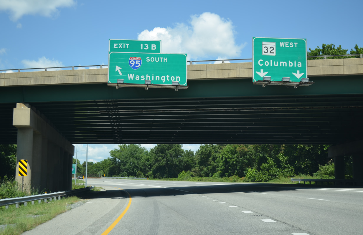
| A directional cloverleaf interchange (Exits 13A/B) joins Interstate 95 with MD 32 amid a leafy area fronted by the Little Patuxent River and the Guilford community. 08/04/13 |
|
| MD 32 curves northward away from Savage toward Guilford. Guilford Road, former MD-32, remains parallel to the east. 08/04/13 |
|
| Vollmerhausen Road spans MD 32 (Patuxent Freeway) one quarter mile ahead of Exit 13A onto Interstate 95 north. 08/04/13 |
|
| Interstate 95 travels nearly 110 miles across Maryland, leading northeast from D.C. to Delaware, Philadelphia and New Jersey. Downtown Baltimore is just 15 miles from Exit 13A via I-95. 08/04/13 |
|
| A left side off-ramp (Exit 13B) follows for Interstate 95 southbound travelers bound for College Park, Silver Springs, and Washington, DC. 08/04/13 |
|
| Exit 13A joins the left side of Interstate 95 south ahead of the exchange with MD 216 near Laurel. I-95 merges with the Capital Beltway in 11 miles. 08/04/13 |
|
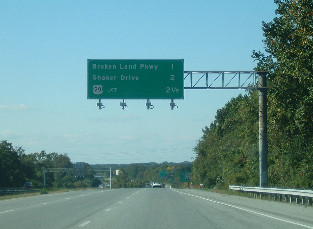
| Distance overhead listing the next three interchanges of MD 32 west after Interstate 95. Exit 14 serves Broken Land Parkway to Owen Brown and Guilford, Exit 15 serves Shaker Drive and King's Contrivance, and Exit 16 joins MD 32 with the U.S. 29 freeway at Atholton. 10/04/09 |
|
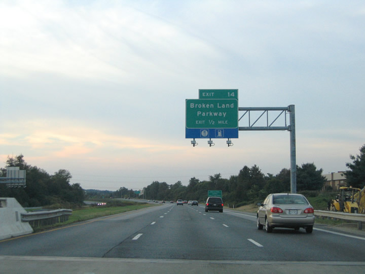
| Guilford Road passes underneath MD 32 one half mile east of the six-ramp parclo interchange with Broken Land Parkway (Exit 14). Broken Land Parkway constitutes a surface arterial from MD 32 northwest to Owen Brown and Columbia. 09/25/04 |
|
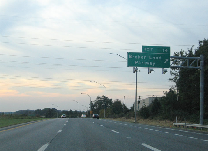
| Exit 14 departs MD 32 westbound for Broken Land Parkway. Broken Land Parkway ends at Guilford Road just south of the interchange near Gorman Park. Northward the parkway intersects Snowden River Parkway, a north-south surface arterial between Owen Brown and MD 100 at Long Reach. 09/25/04 |
|
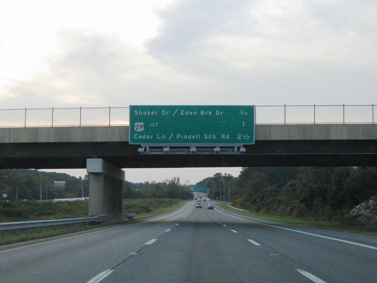
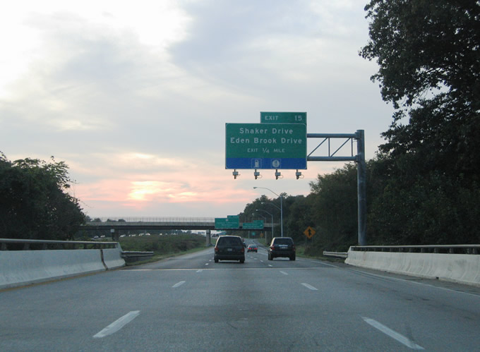
| Attached to the Broken Land Parkway overpass is an interchange sequence sign for MD 32 westbound. This sign was amended by 2009 to replace Pindell School Road with Sanner Road. A parclo interchange (Exit 15) joins the freeway with Shaker Drive and Eden Brook Drive in 0.75 miles. 09/25/04 |
|
| Eden Brook Drive stems north from Kings Contrivance to Guilford Road, Old Columbia Road, and MD 32. The north-south road changes to Shaker Drive as it crosses over MD 32 en route to Atholton. 09/25/04 |
|
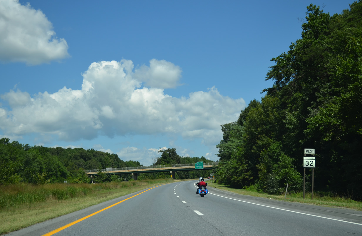
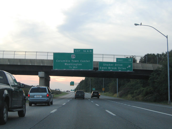
| Exit 15 departs MD 32 westbound for Shaker Drive west and Eden Brook Drive south. Shaker Drive parallels MD 32 west to the U.S. 29 where it turns north as a freeway frontage road. U.S. 29 (Columbia Pike) and MD 32 meet at a cloverleaf interchange one half mile to the west at Exits 16A/B. 09/25/04 |
|
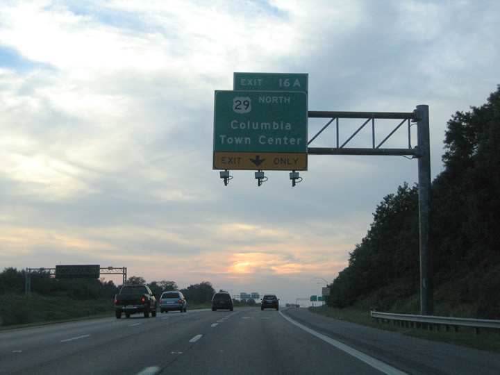
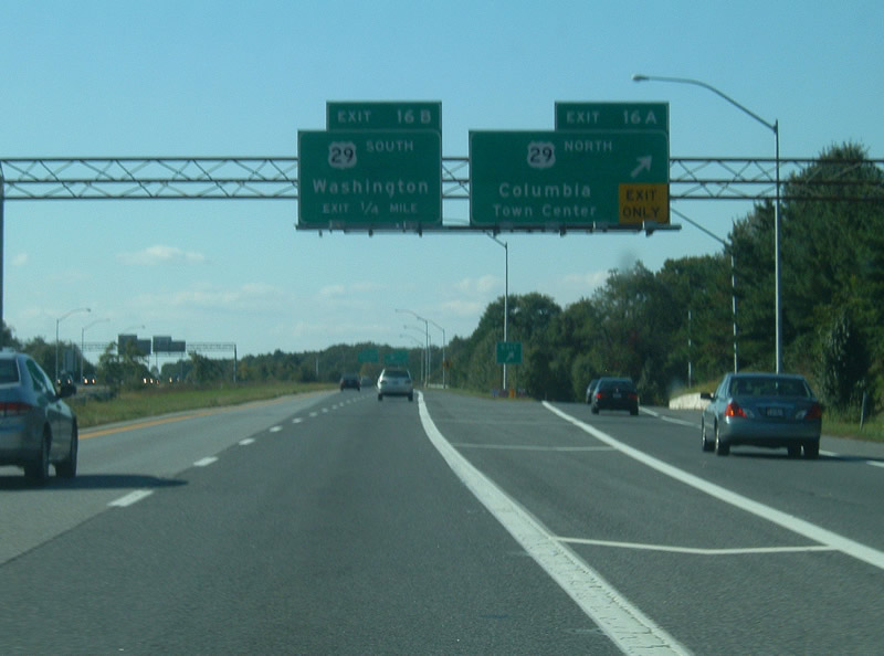
| Traffic merging onto MD 32 west from Exit 15 forms the exit-only lane for U.S. 29 north (Exit 16A). Exit 16A serves interests north for the Columbia Town Center, Ellicott City, and Interstate 70 west of Baltimore. U.S. 29 comprises a full freeway from MD 32 northward to its terminus at MD 99 (Old Frederick Road). The freeway upgraded from a six lane surface boulevard during the 1980s and 1990s. 09/25/04 |
|
| Exit 16A leaves MD 32 west for U.S. 29 north. U.S. 29 ends in nine miles at Mt. Hebron. Overall the highway follows as 1,036 mile route between Maryland and Pensacola, Florida. 08/27/05 |
|
| U.S. 29 continues along a freeway south to the Montgomery County line. South of the Patuxent River, the highway transitions into a busy arterial. Construction associated with the Inner County Connector (ICC) / MD 200 will upgrade a portion of the route into additional freeway. 10/04/09 |
|
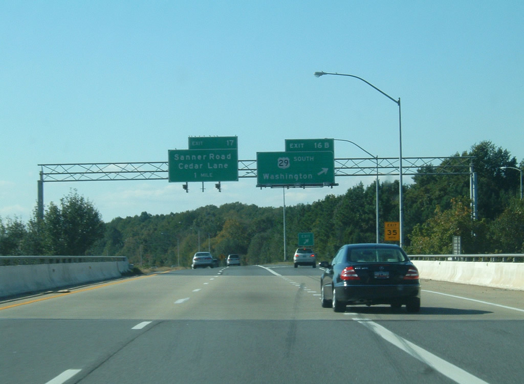
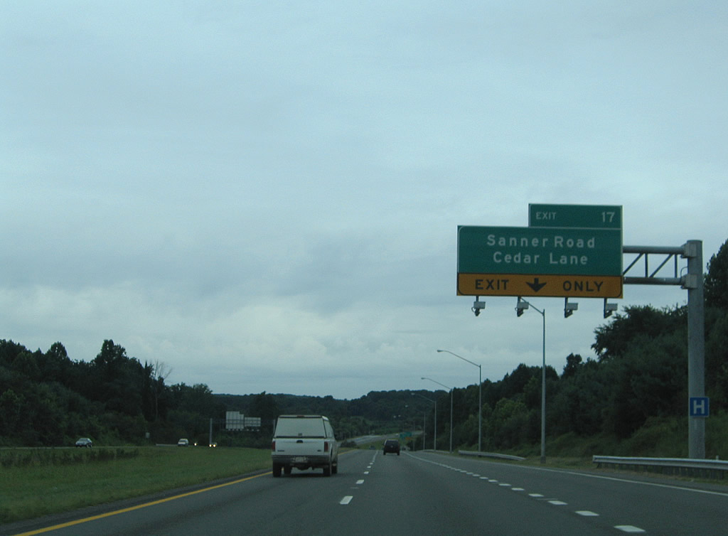
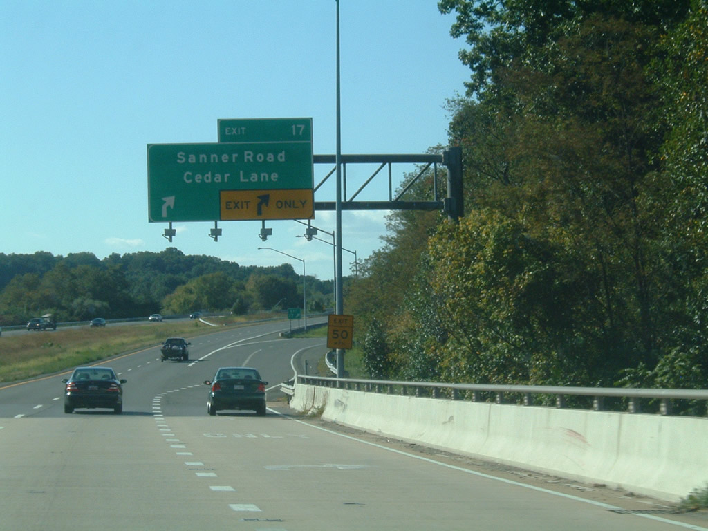
| A diamond interchange joins MD 32 with Sanner Road south and Cedar Lane north after the crossing of the Little Patuxent River. Sanner Road leads south to the John Hopkins Applied Physics Lab and Hopkins Road. Cedar Lane ventures north to Columbia and Little Patuxent Parkway. 08/27/05, 10/04/09 |
|
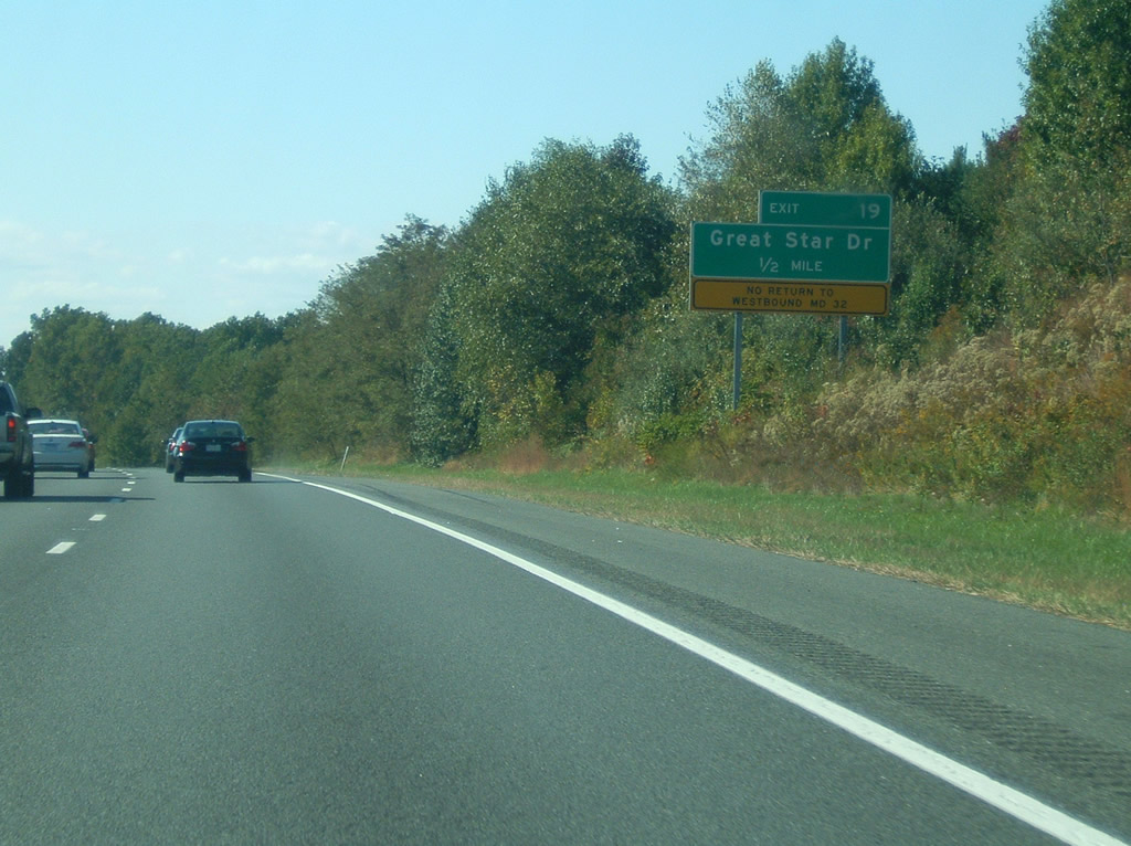
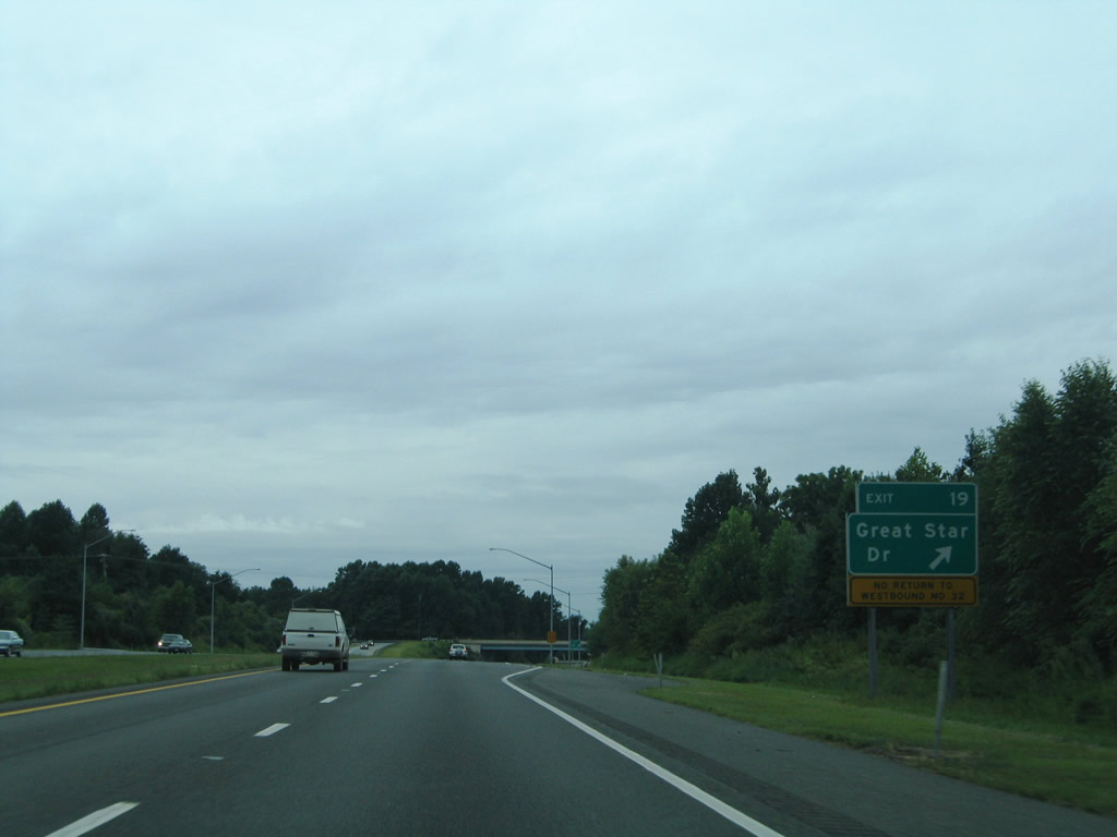
| Several subdivisions encourage upon the MD 32 right of way along the approach to Exit 19 with Great Star Drive. Great Star Drive provides access to the area neighborhoods southward to Guilford Road and northwest to MD 108 (Clarksville Pike). 10/04/09 |
|
| Exit 19 consists of a half diamond interchange with Great Star Drive. Therefore there is no return access. 08/27/05 |
|
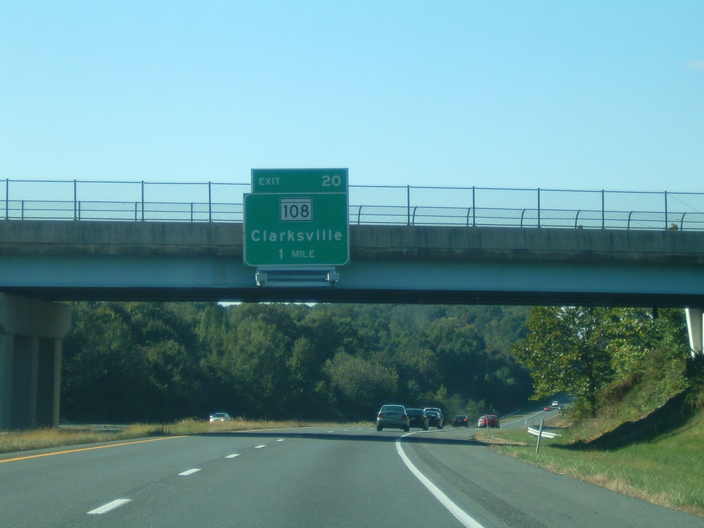
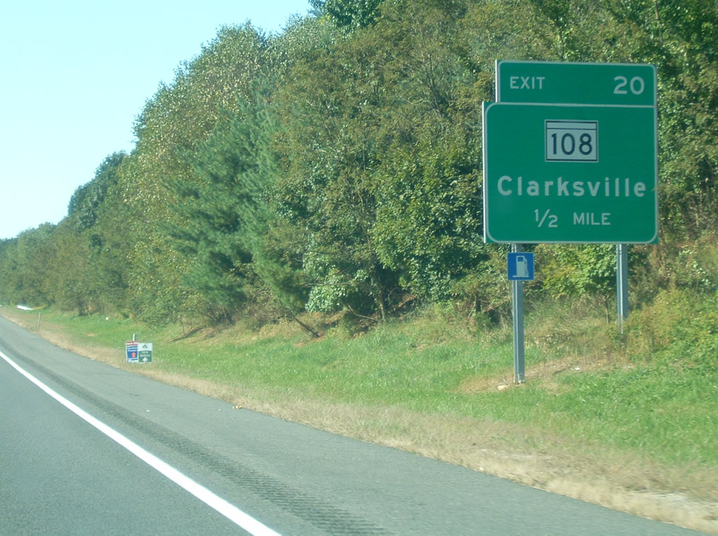
| MD 108 (Clarksville Pike) crosses paths with MD 32 at the Exit 20 diamond interchange one mile west of Great Star Drive. 10/04/09 |
|
| MD 108 meanders east-west across Montgomery and Howard Counties along a 34.23 mile route between Damascus to MD 175 near Interstate 95. 10/04/09 |
|
| Exit 20 departs MD 32 west for MD 108 at Clarksville. Much of the area nearby has succumbed to suburban sprawl in the form of auto dealerships, shopping plazas, and business parks. MD 108 (Clarksville Pike) otherwise leads south to Highland, Sandy Spring, and Olney and north to Chapel Woods and Ellioak in the Columbia vicinity. 08/27/05 |
|
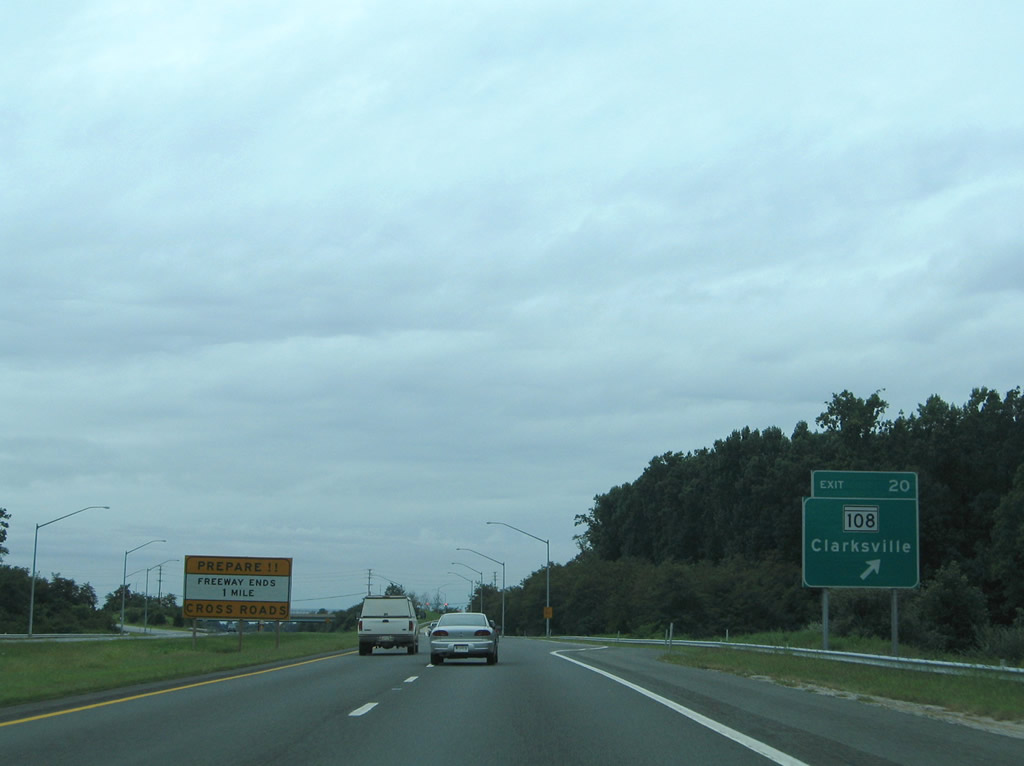
| The westbound on-ramp from MD 108 merges onto MD 32 at the beginning of the two lane portion. MD 32 continues northward to Sykesville and a terminus at MD 140 north of Westminster. 10/04/09 |
|
| MD 32 transitions from a four lane freeway into a two lane rural roadway leading northward from Clarksville to Dayton and Glenelg. 08/27/05 |
|
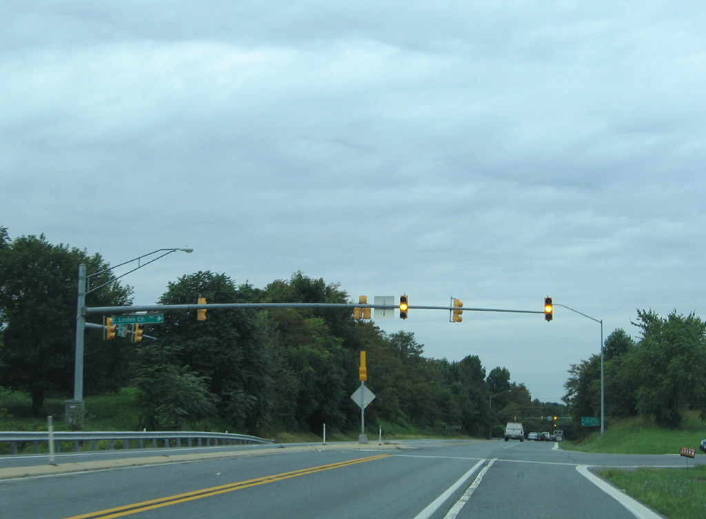
| The first at-grade intersection of MD 32 west occurs at Linden Church Road east. Linden Church Road exists in two portions. Eastward, the road spurs into a rural area; westward the road connects MD 32 with Ten Oaks Road south of the Dayton community. 08/27/05 |
Page Updated 10-07-2009.