|
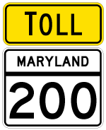
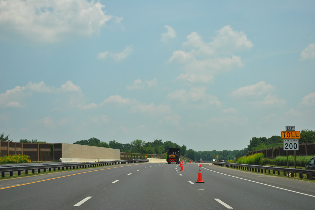
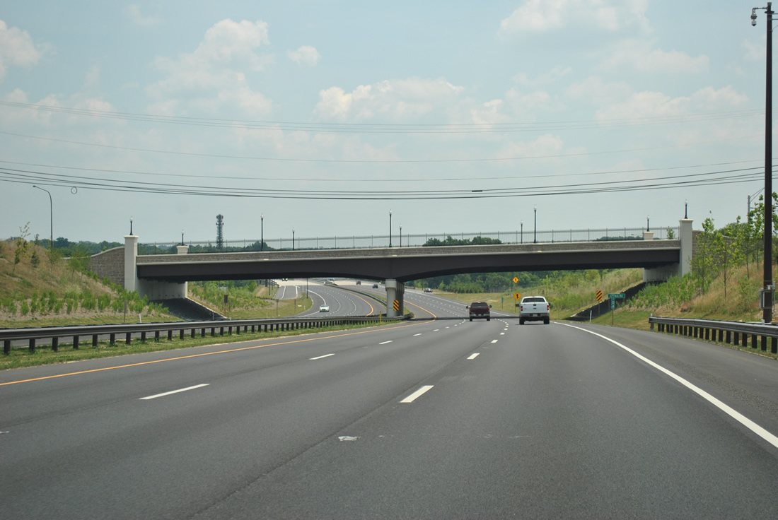
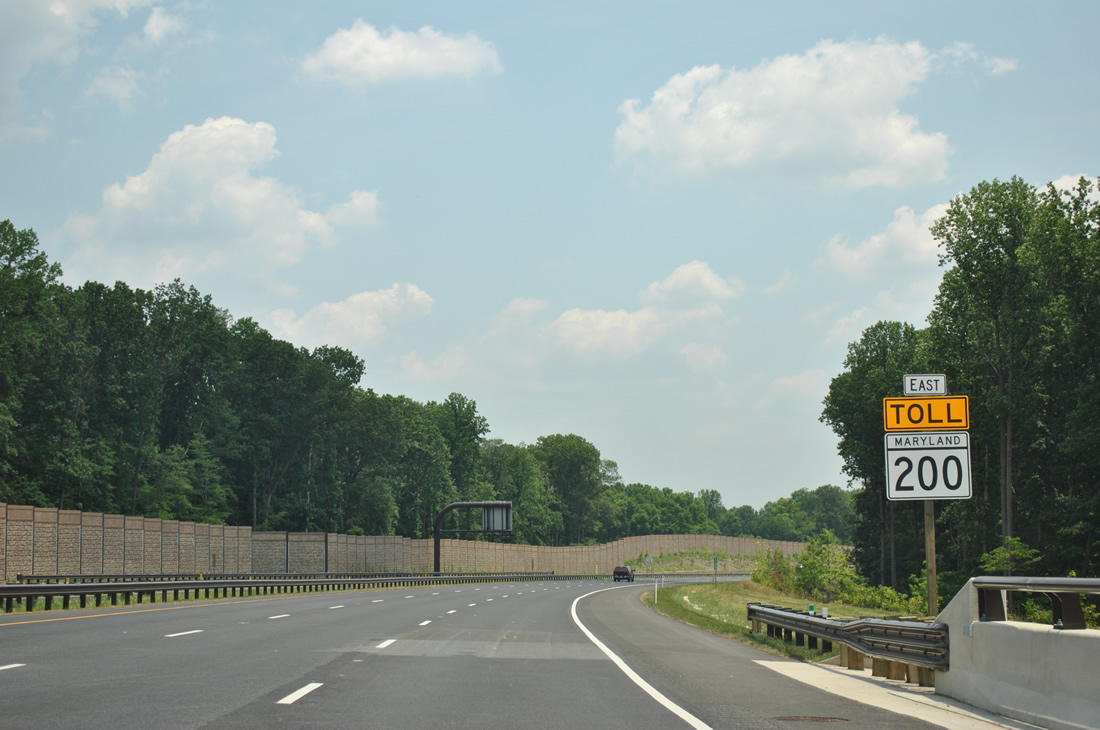
| The first eastbound shield of MD 200 lies ahead of the Shady Grove Road underpass. 06/20/12 |
|
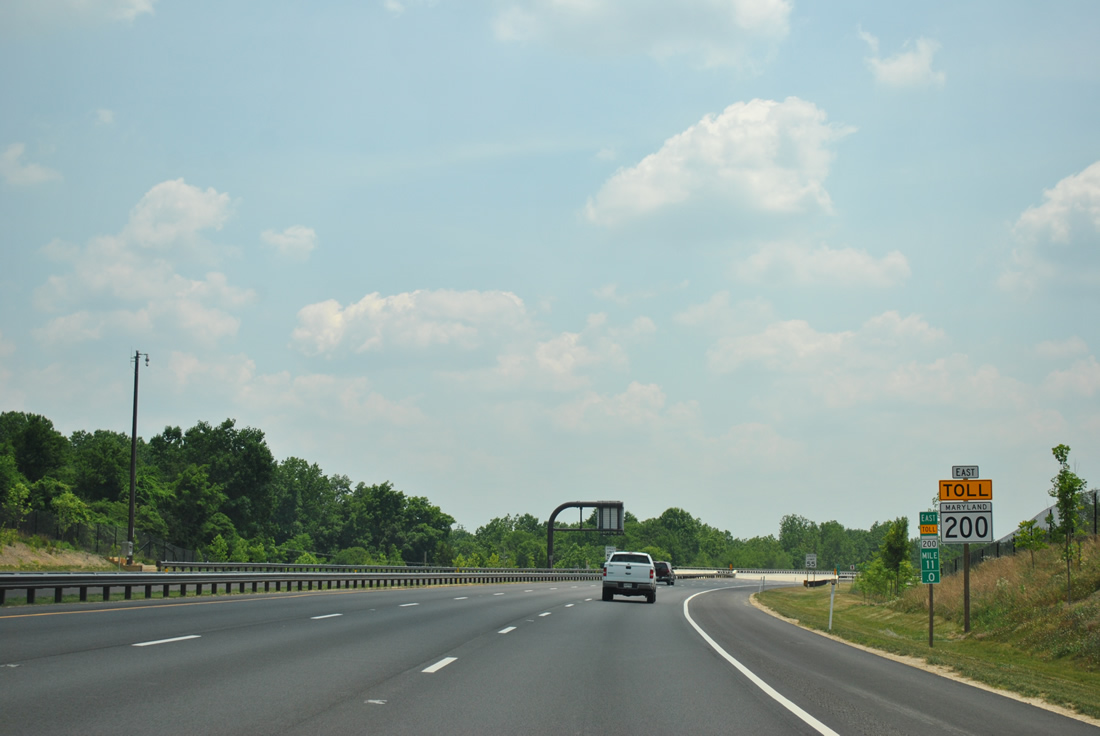
| A toll collection point resides just east of the Redland Road overpass. Tolls are levied with transponder readers for E-ZPass account holders or video tolling for others. 06/20/12 |
|
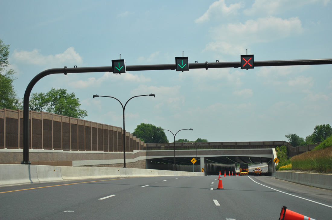
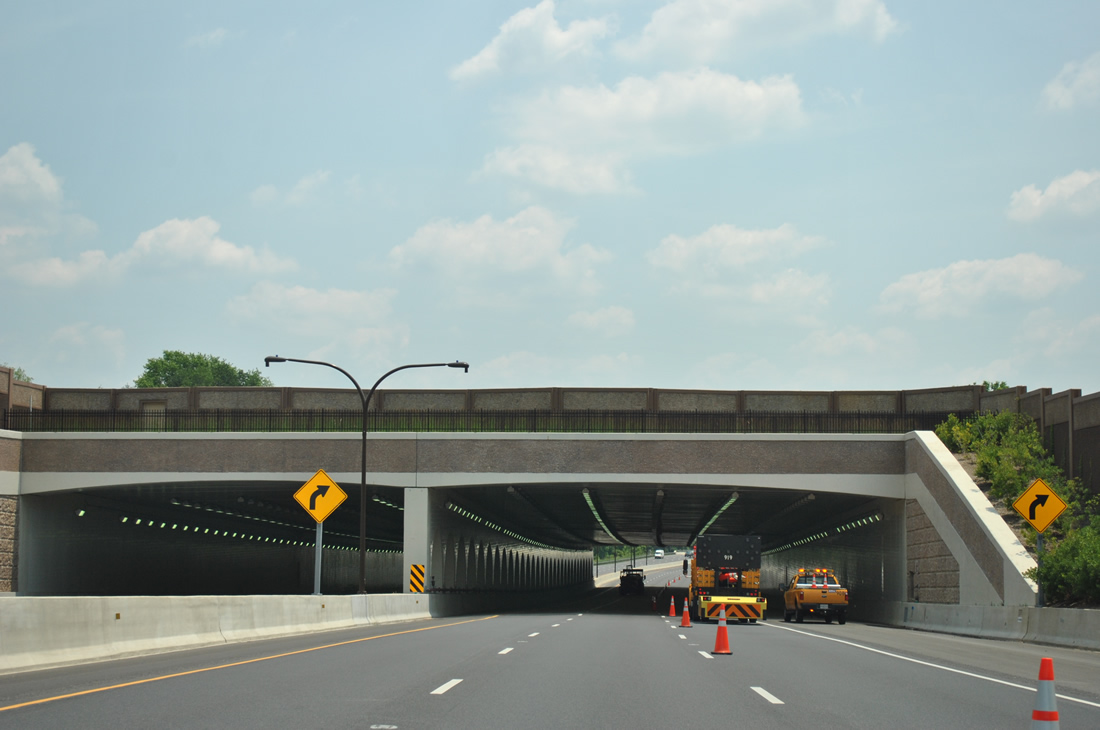
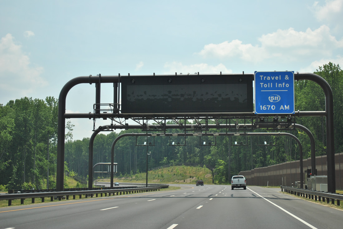
| Lane control signals precede the Winters Run tunnel along the Intercounty Connector (ICC) eastbound. 06/20/12 |
|
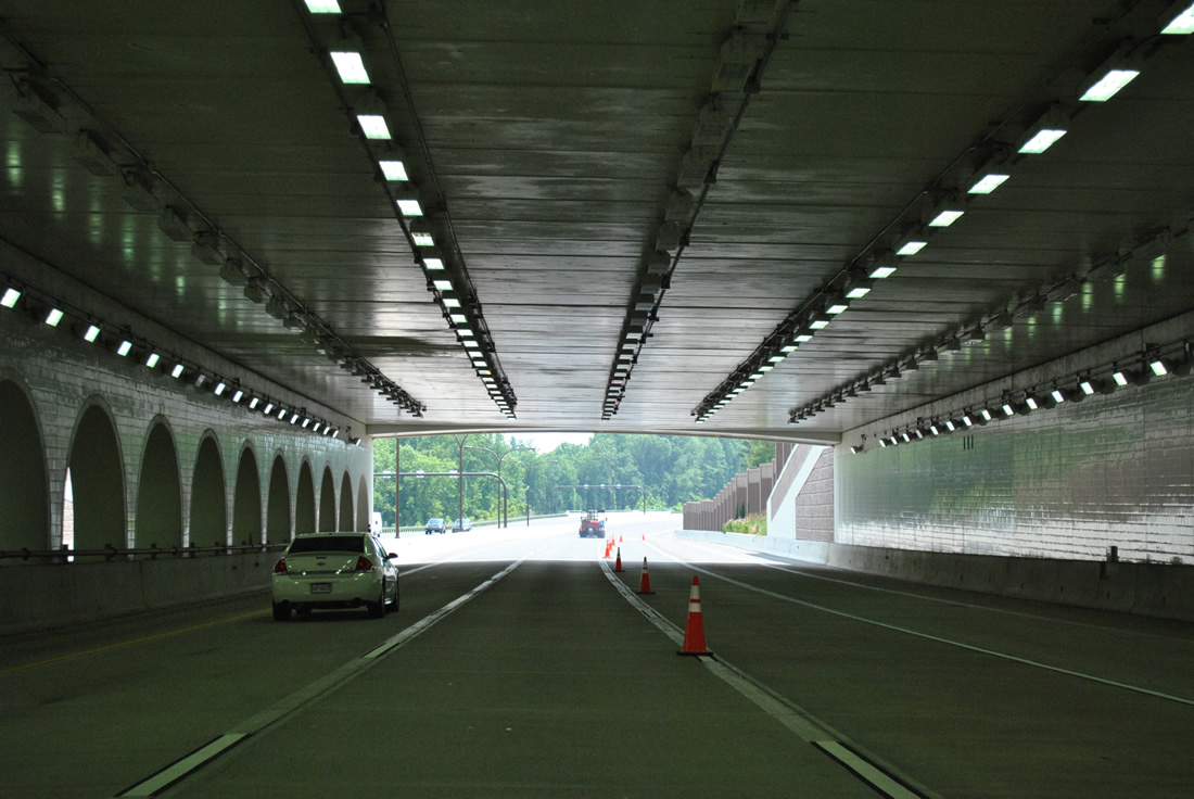
| The Winters Run tunnel is a cut and cover structure built to link the Winters Run subdivision that was separated due to construction of the ICC. MD 200 maintains six overall lanes with full shoulders through the under crossing. 06/20/12 |
|
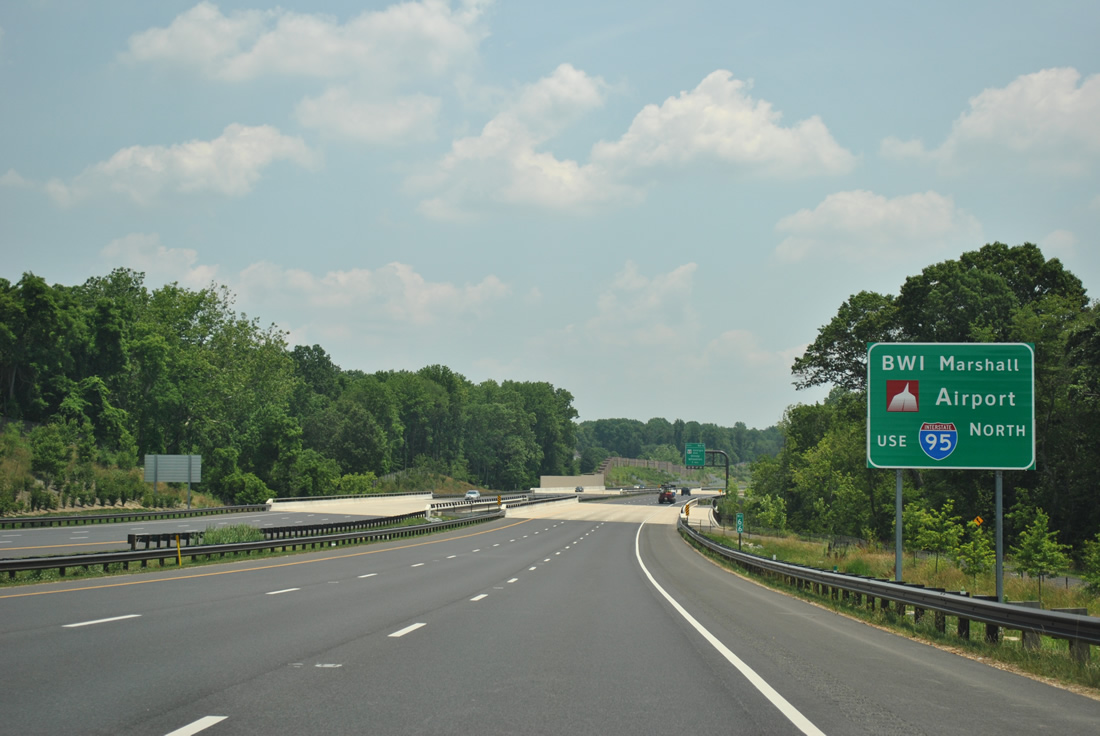
| Travelers bound for BWI Marshall International Airport should remain along the ICC east to Interstate 95 north. This type of sign for BWI Airport is common throughout the Baltimore-Washington metropolitan area.
MD 200 spans North Branch Rock Creek in the background. 06/20/12 |
|
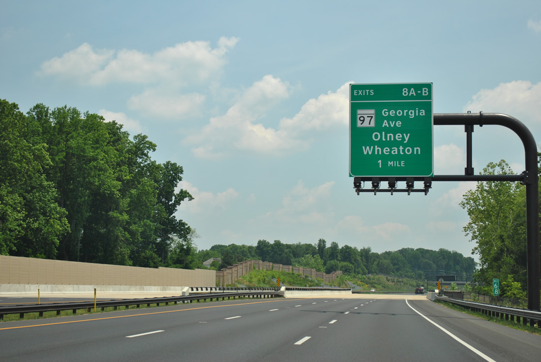
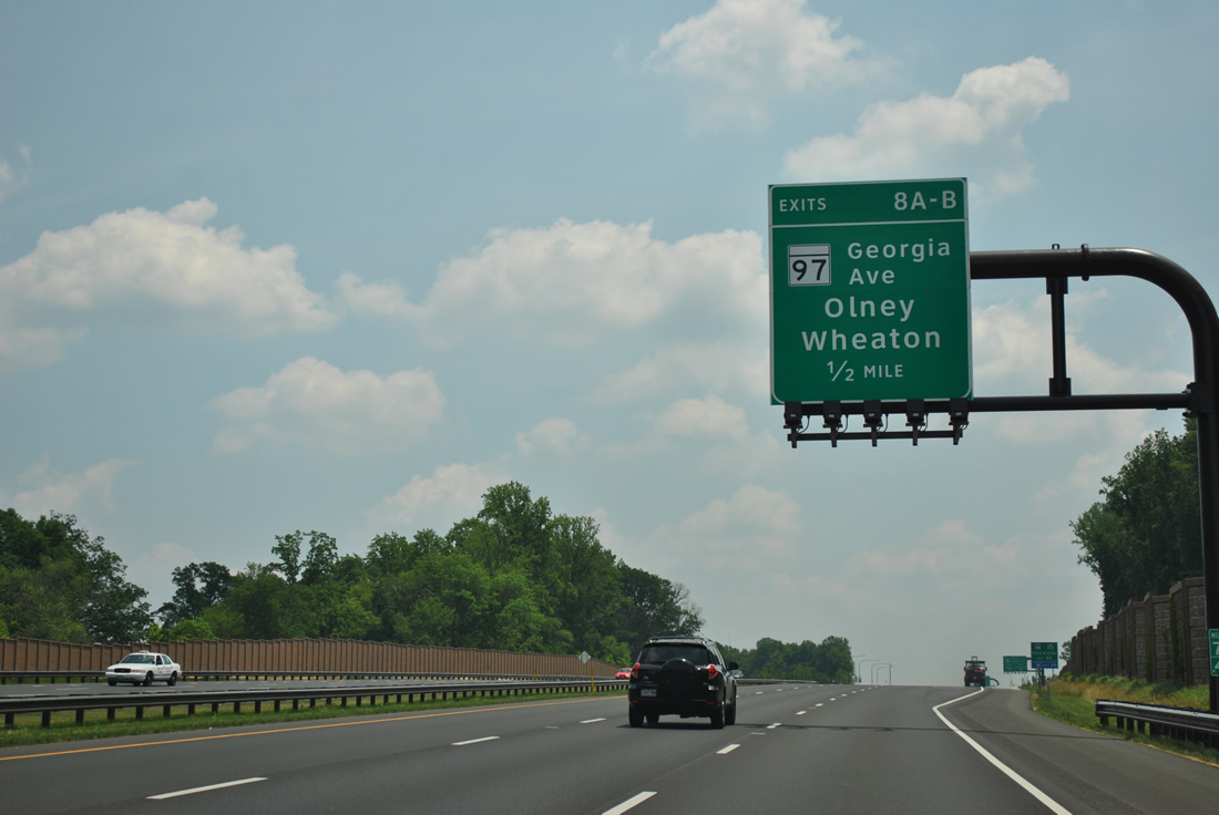
| MD 97 (Georgia Avenue) meets the Intercounty Connector in one mile at a six-ramp parclo interchange (Exits 8A/B) in one mile. 06/20/12 |
|
| One half mile west of the Exit 8A off-ramp to MD 97 (Georgia Avenue) south to Rossmoor, Aspen Hill and Wheaton. 06/20/12 |
|
| Exit 8 expands MD 200 east briefly to five lanes in anticipation of the ramps to MD 97. MD 97 follows a 55.27 mile course from Silver Spring north to the Pennsylvania state line northwest of Westminster. 06/20/12 |
|
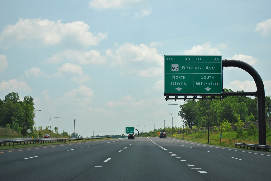
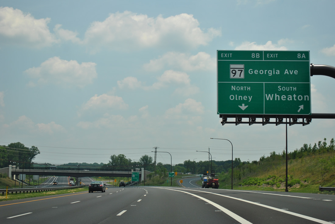
| Exit 8 forms a painted distributor roadway and splits into separate ramps for Georgia Avenue south to Norbeck and north to Olney. 06/20/12 |
|
| A loop ramp (Exit 8B) joins MD 97 (Georgia Avenue) north to Olney, Glenwood and Cooksville. 06/20/12 |
|
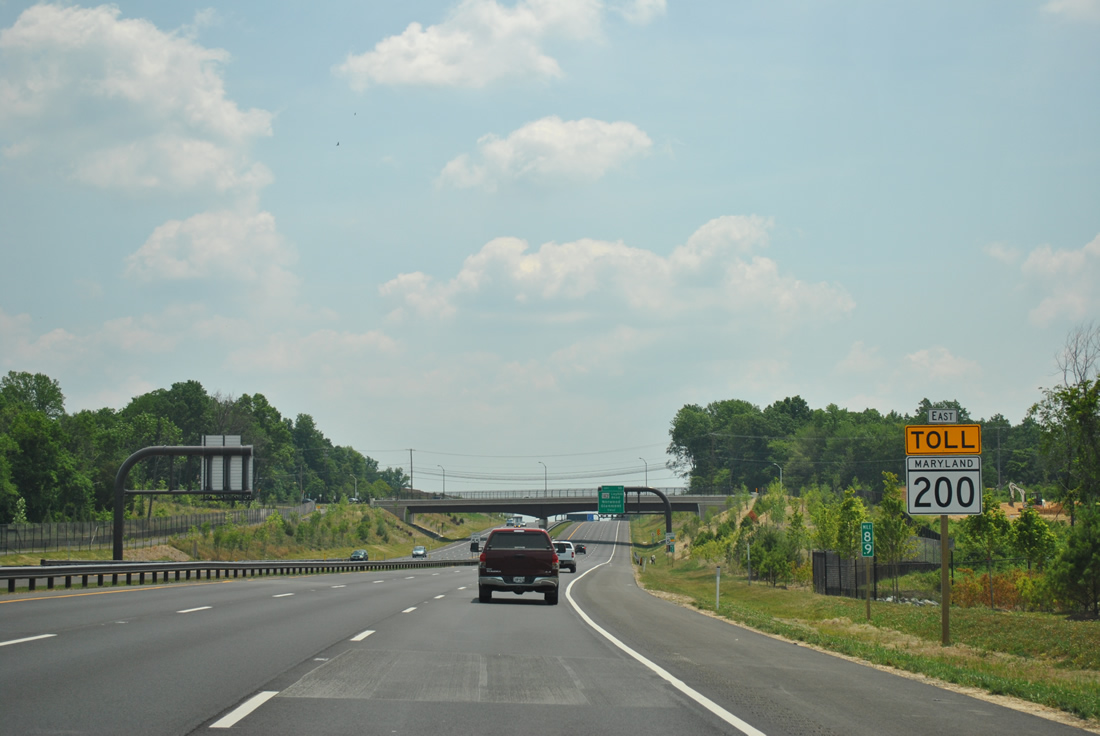
| The second shield of MD 200 Toll is posted near the MD 28 overpass. When the first segment of the ICC opened in February 2011, the east end linked MD 200 with MD 28 (Norbeck Road) via a temporary roadway. This was eliminated with the completion of the toll road. 06/20/12 |
|
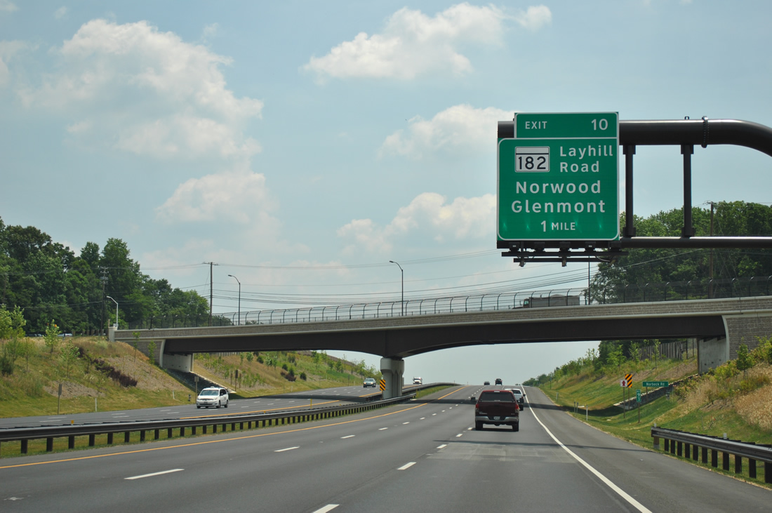
| MD 182 (Layhill Road) meets the Intercounty Connector at the next exit in one mile. 06/20/12 |
|
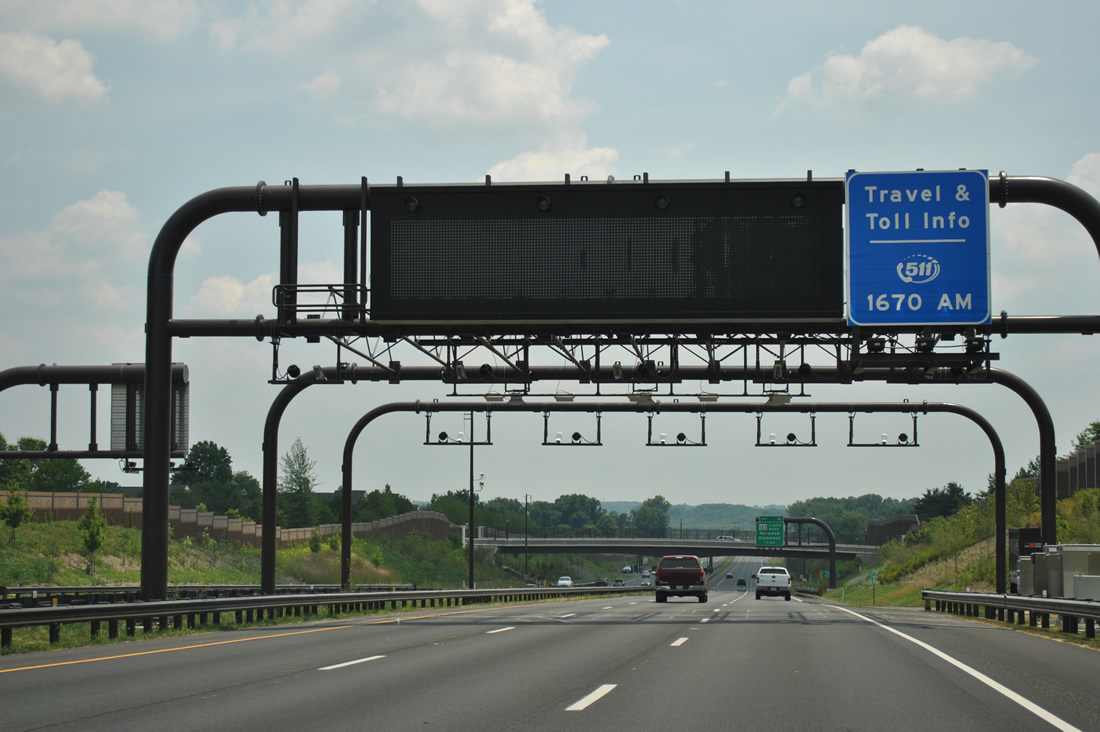
| A second toll collection facility collects fees between the MD 28 and Longmead Crossing Drive overpasses. Wintergate Drive follows the westbound side of the ICC as a frontage road. 06/20/12 |
|
| MD 182, a 6.60 mile route, runs from MD 97 (Georgia Avenue) at Glenmont to MD 108 (Olney Sandy Spring Road) outside Olney. 06/20/12 |
|
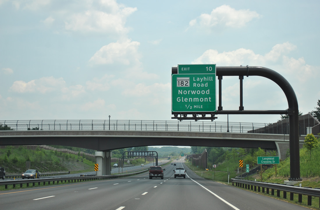
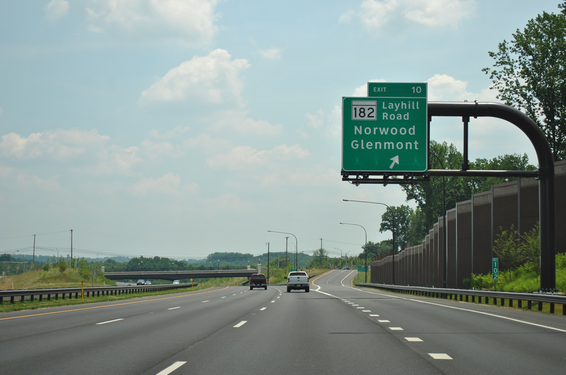
| Entering the diamond interchange between MD 200 Toll and MD 182 (Layhill Road) along the ICC eastbound. Norwood is a two mile drive north along Layhill Road. 06/20/12 |
|
| Nearing the crossing of Northwest Branch, eastbound drivers see the next eastbound shield for MD 200. 06/20/12 |
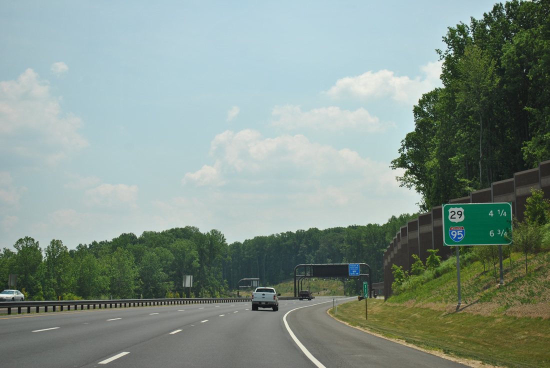
|
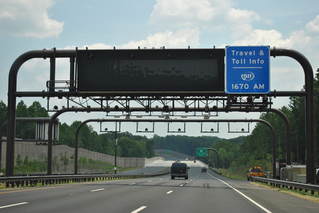
| Distances to U.S. 29 and Interstate 95 are posted on this distance sign in lieu of control cities. 06/20/12 |
|
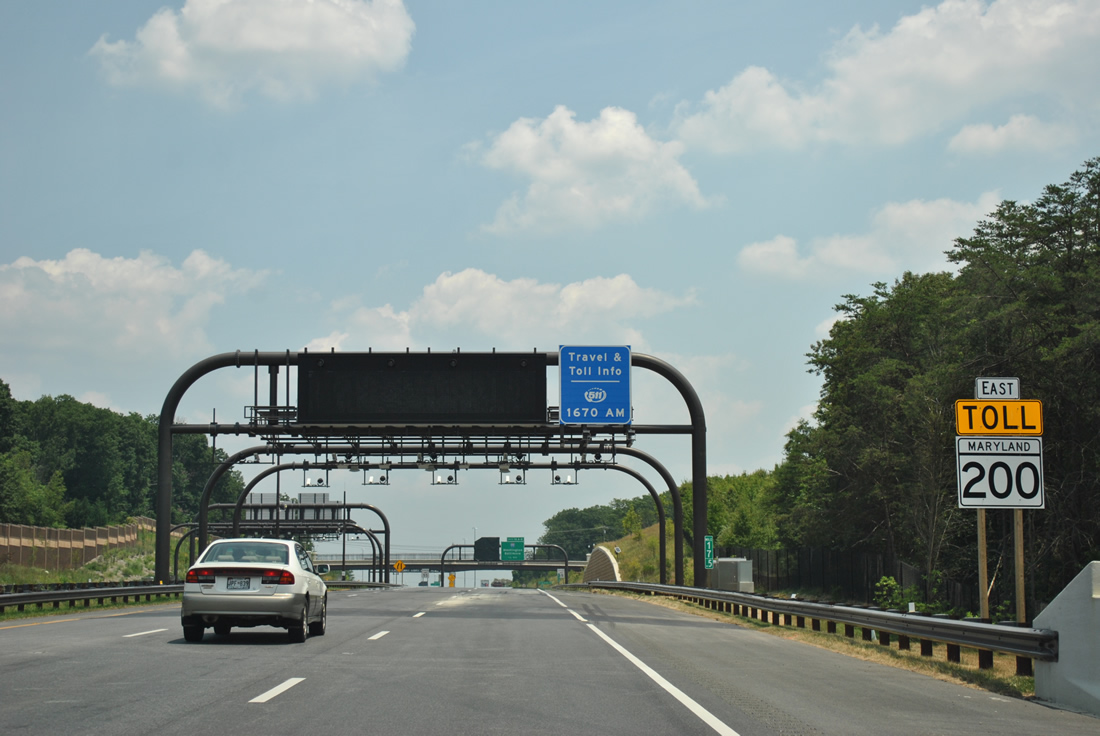
| A third toll collection point resides between the second and third crossings of Northwest Branch. 06/20/12 |
|
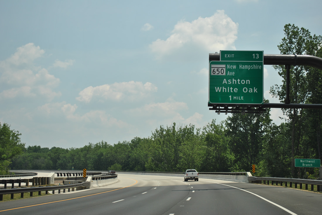
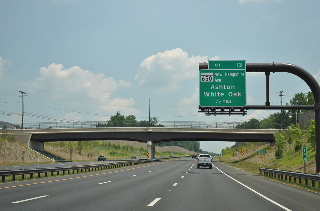
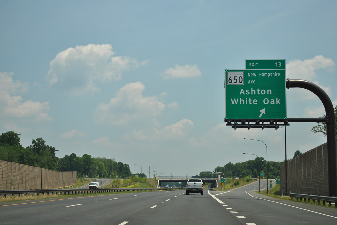
| Turning eastward again, MD 200 advances to within one mile of the single point urban interchange (SPUI) with MD 650 (New Hampshire Avenue). 06/20/12 |
|
| MD 650 constitutes a 25.9 mile route from the District of Columbia line to Etchison. 06/20/12 |
|
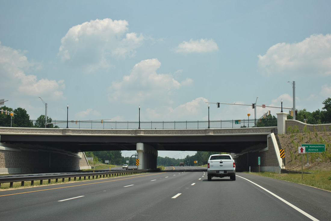
| Exit 13 parts ways with the ICC eastbound for MD-650. MD 650 (New Hampshire Avenue) constitutes a busy arterial north to Ashton and south to Colesville, White Oak and Takoma Park. New Hampshire Avenue continues south of the state line to U.S. 29 (Georgia Avenue). 06/20/12 |
|
| Spanning a tributary of Paint Branch, drivers pass by the next MD 200 shield assembly. 06/20/12 |
|
| 3.75 miles of the ICC lie ahead to Interstate 95 in Prince George's County. 06/20/12 |
|
| Traveling under the fourth toll collection facility just west of the bridges over Paint Branch. 06/20/12 |
|
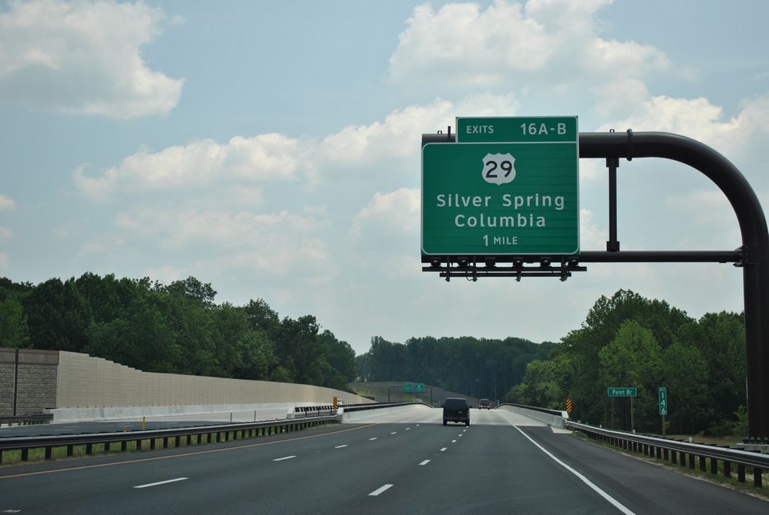
| U.S. 29 (Columbia Pike), a north-south road stretching 1,036 miles from Pensacola, Florida to Mt. Hebron, Maryland, meets the ICC at its most elaborate interchange, a multi-level directional cloverleaf (Exits 16A/B). 06/20/12 |
|
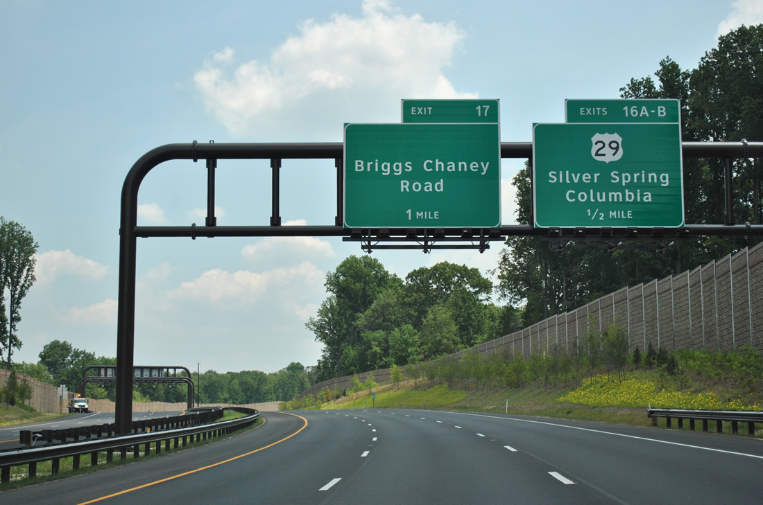
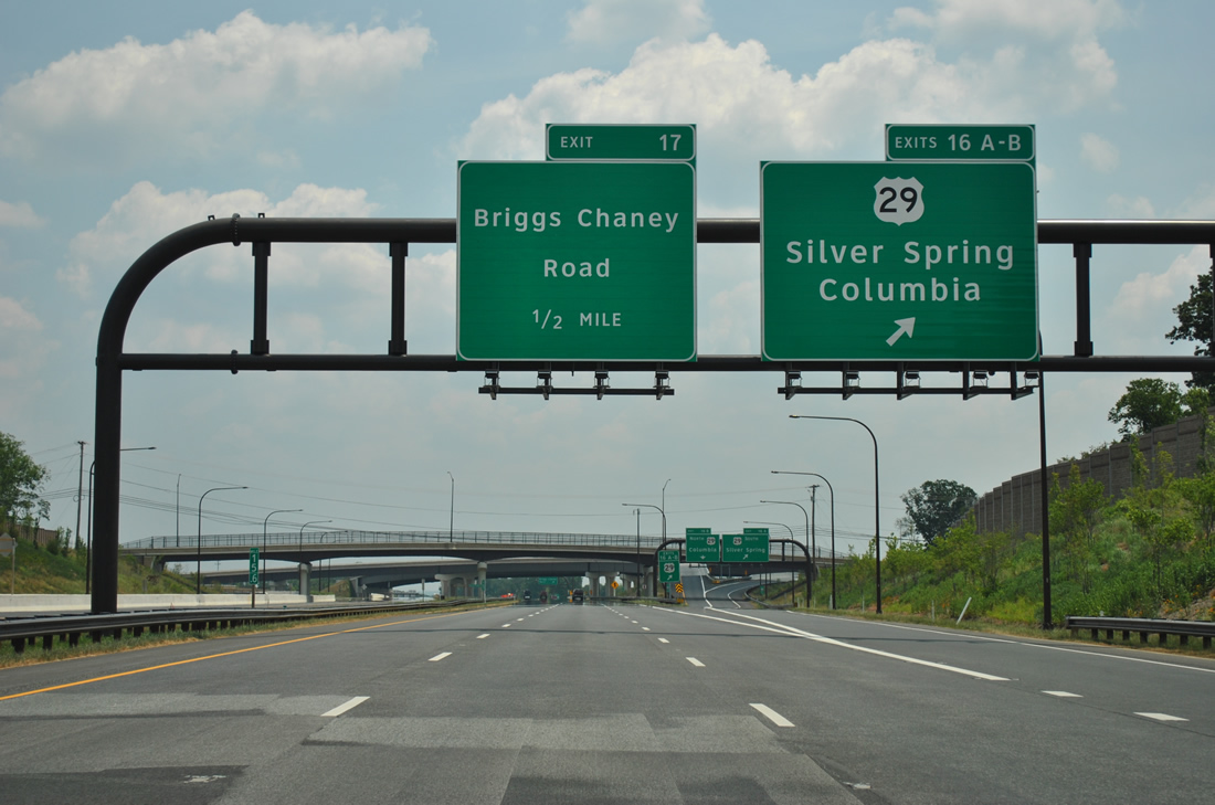
| One half mile west of the Exit 16 ramp departure for U.S. 29 (Columbia Pike) along the ICC east. U.S. 29 becomes a controlled access route northeast from an interchange with MD 650 to its end at MD 99 near Interstate 70. The stretch at Fairland is expressway standards with an interchange joining Columbia Pike and Briggs Chaney Road nearby. Exit 17 joins MD 200 with the exit ramp of U.S. 29 north to the arterial. 06/20/12 |
|
| Exit 16 carries all traffic in unison from MD 200 Toll to U.S. 29. Silver Spring is seven miles to the southwest. Columbia is 11 miles to the north. 06/20/12 |
|
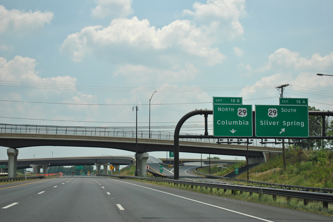
| The separation of Exits 16A/B for U.S. 29 south at Fairland and north to the freeway portion through Howard County. 06/20/12 |
|
| The Intercounty Connector mainline comprises the middle level of the stack with U.S. 29. Columbia Pike travels below. 06/20/12 |
|
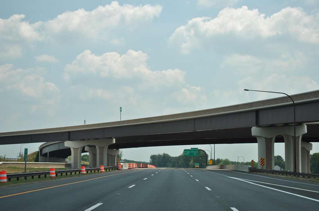
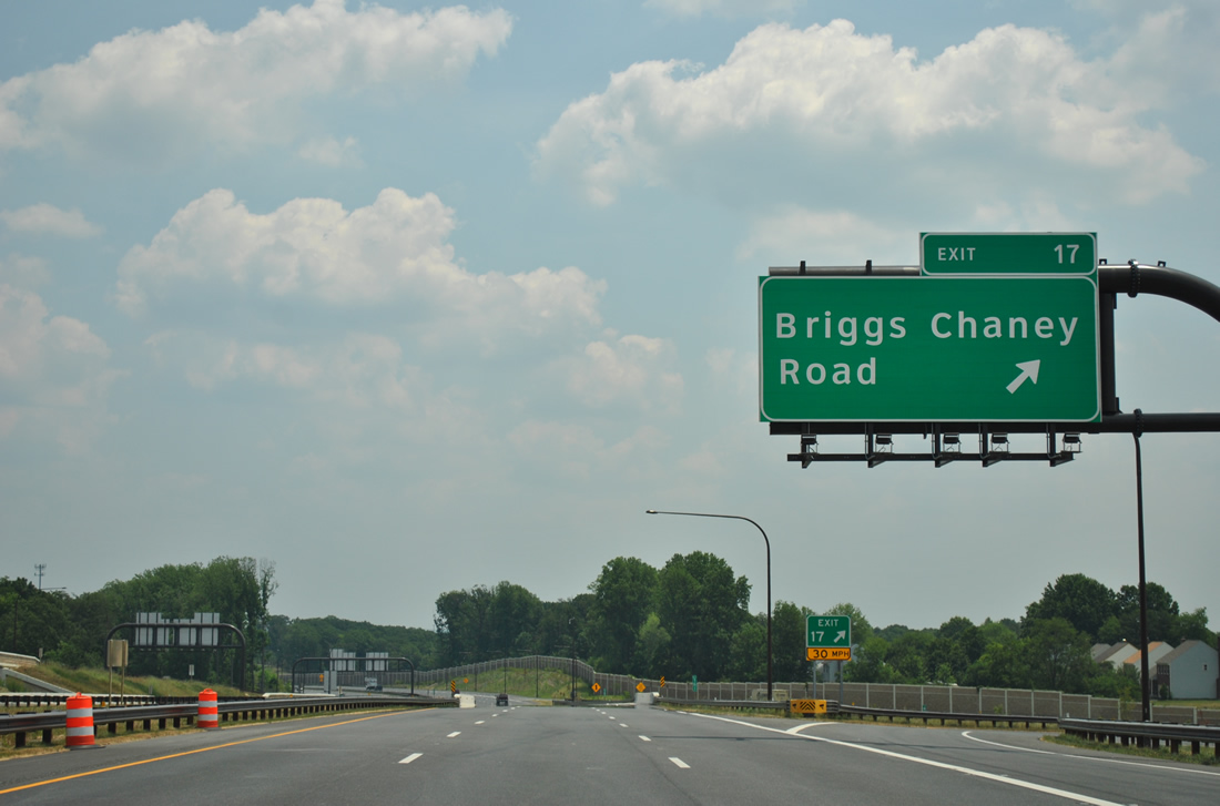
| Exit 17 quickly follows onto the ramp for Briggs Chaney Road. Briggs Chaney Road winds southeast to Cross Creek Golf Club and Calverton and westward from U.S. 29 to MD 650 at Cloverly. 06/20/12 |
|
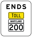
| A half diamond interchange joins the ICC westbound with Briggs Chaney Road directly. End signs are present for the temporary conclusion of MD 200 at forthcoming Interstate 95. 06/20/12 |
|
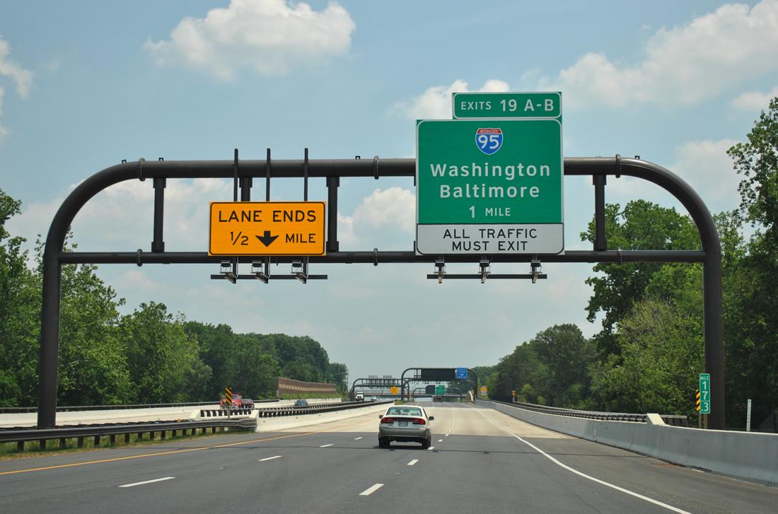
| Eastbound drivers enter Prince George's County ahead of the crossing over Little Paint Branch. The one mile sign bridge for Exits 19A/B (Interstate 95) resides overhead. 06/20/12 |
|
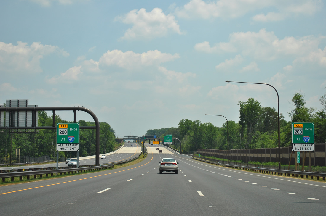
| The last MD 200 Toll shield and the fifth toll collection point are situated just west of the Old Gunpowder Road over crossing. 06/20/12 |
|
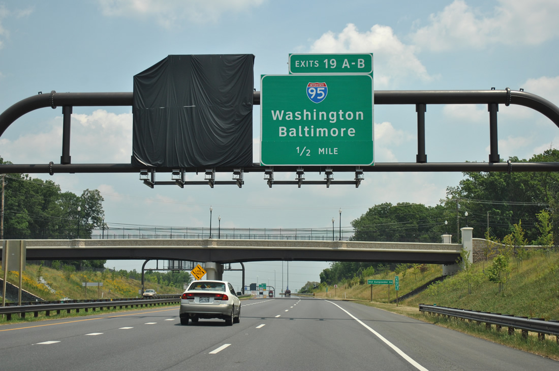
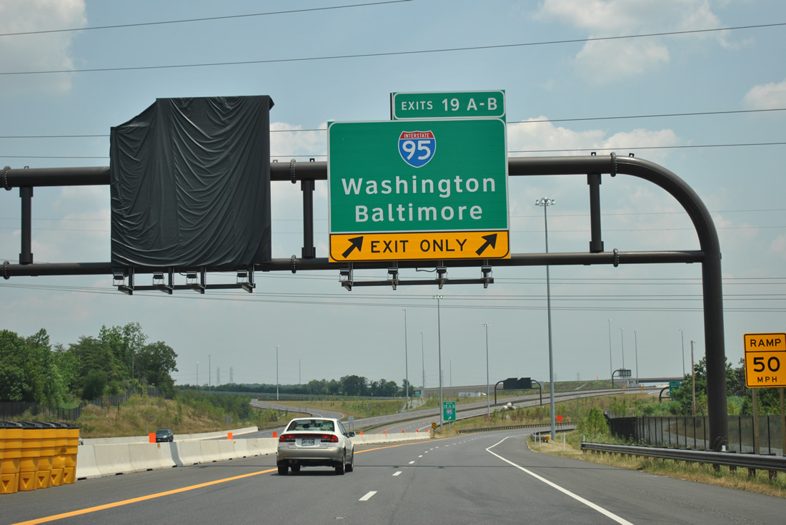
| One half mile west of the Exit 19 ramps to Interstate 95. A tarp covers the future signage for the ICC extension east to U.S. 1 (Baltimore Avenue). The greenout on the half mile sign for I-95 alludes to the eventual "Exit Only" status of the right lane. 06/20/12 |
|
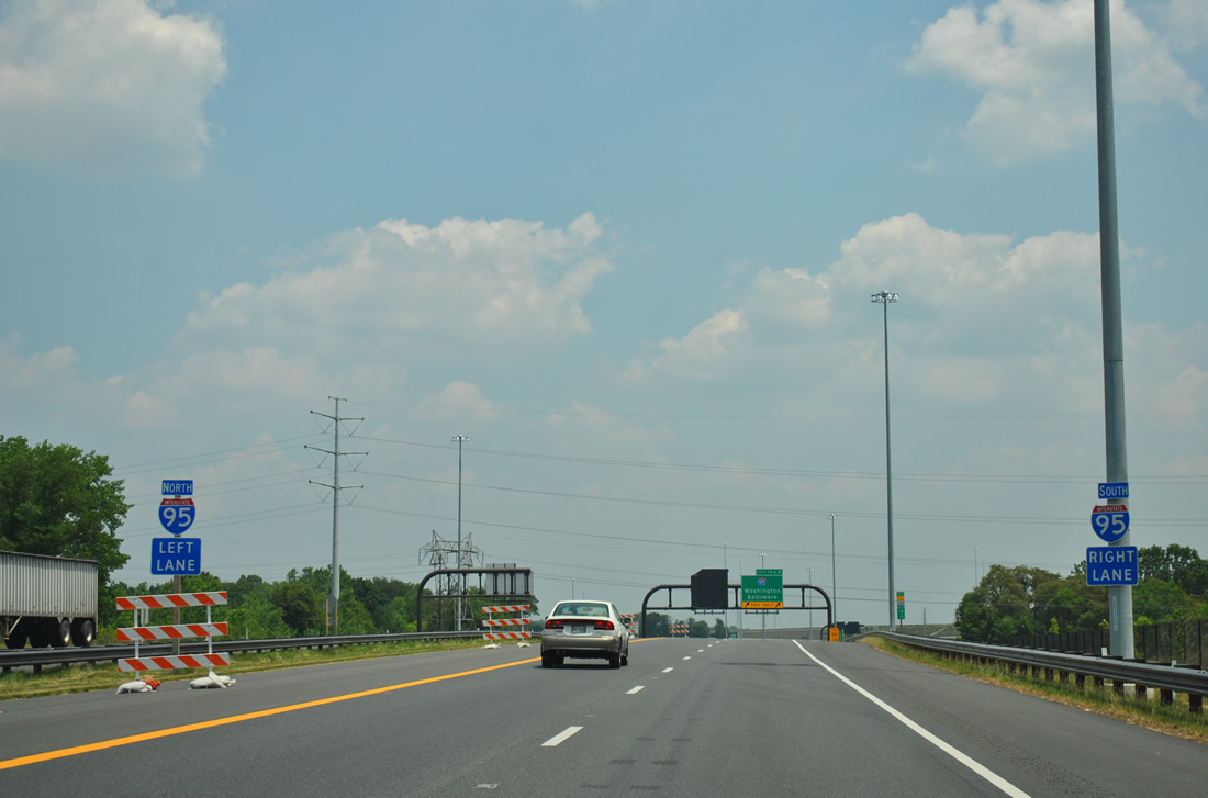
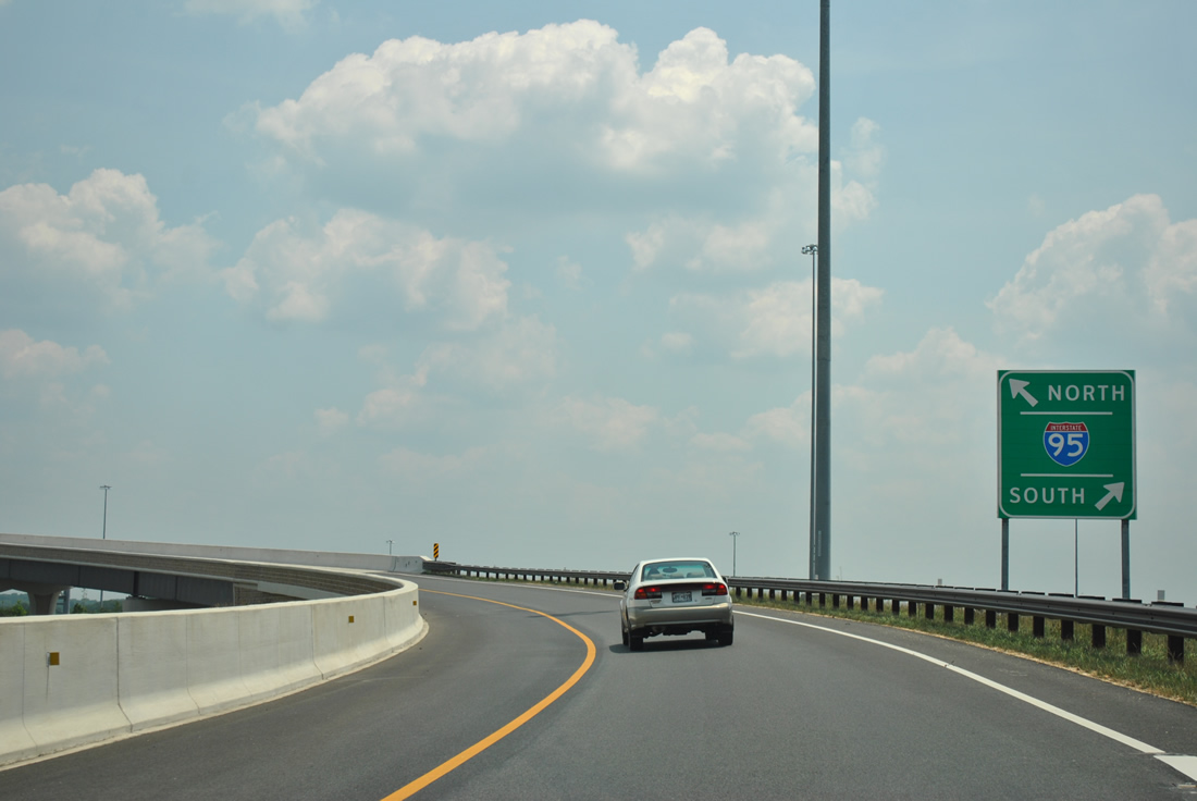
| Shields and blue placards direct the two remaining lanes of MD 200 Toll onto the respective ramps for Interstate 95. Interstate 95 joins the Capital Beltway 4.5 miles to the south. 06/20/12 |
|
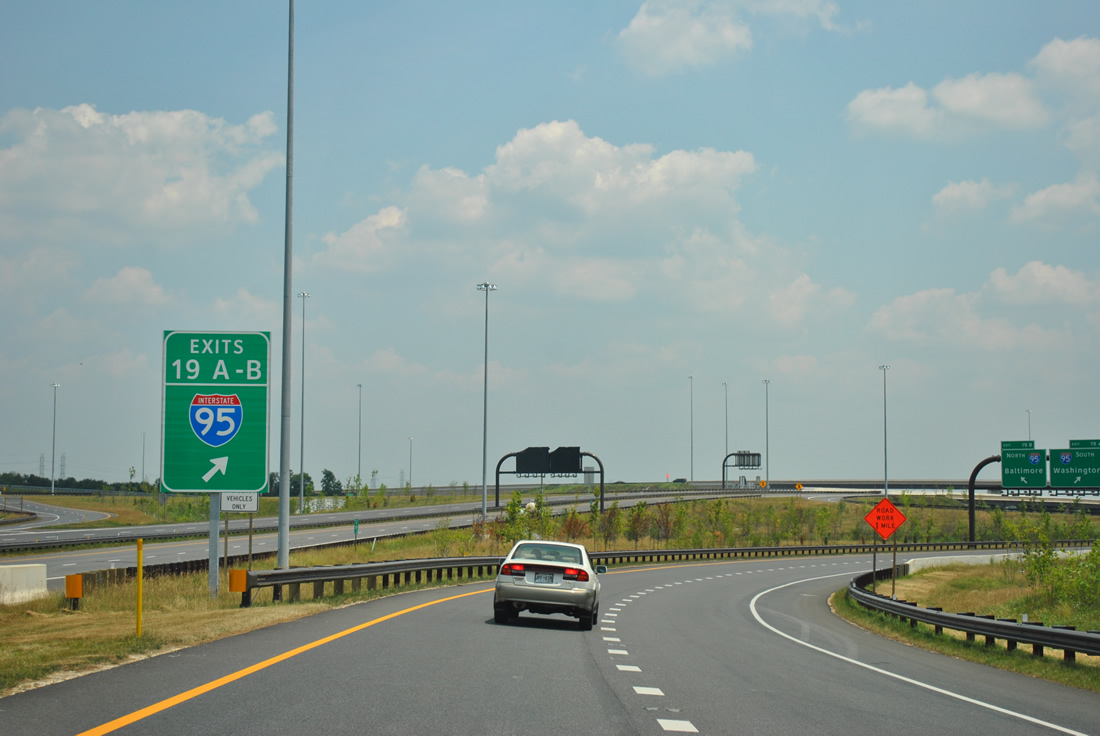
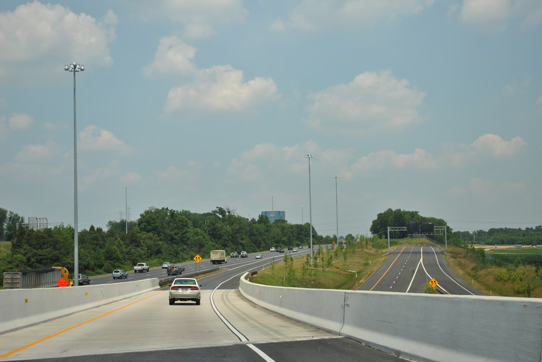
| Construction barriers shunt all traffic onto Exit 19 for Interstate 95. The extension east to U.S. 1 is anticipated to open in spring 2014. Interstate 95 north meets the Baltimore Beltway in 17 miles. 06/20/12 |
|
| Beyond the Interstate 95 gore point sign, the ICC mainline sits striped with signs concealed. An interchange with Virginia Manor Road will precede the end at U.S. 1 outside Laurel. 06/20/12 |
|
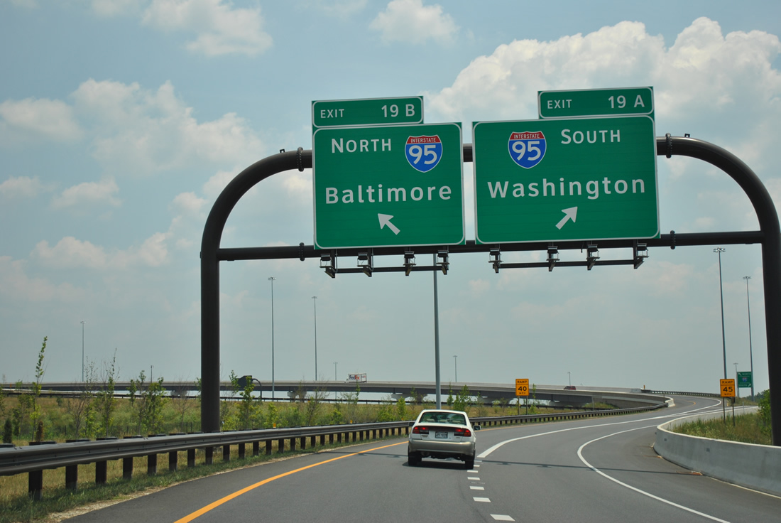
| Single lane ramps carry motorists onto Interstate 95 south to Beltsville and north to Laurel. 06/20/12 |
|
| The highest flyover between Interstate 95 and the ICC touches down on I-95 northbound from MD 200 east. A collector distributor roadway system along I-95 between MD-200 and MD 198 (Sandy Spring Road) will be completed as part of Contract D/E of the ICC to eliminate weaving traffic concerns between the two interchanges. 06/20/12 |
Page Updated 07-18-2012.