|
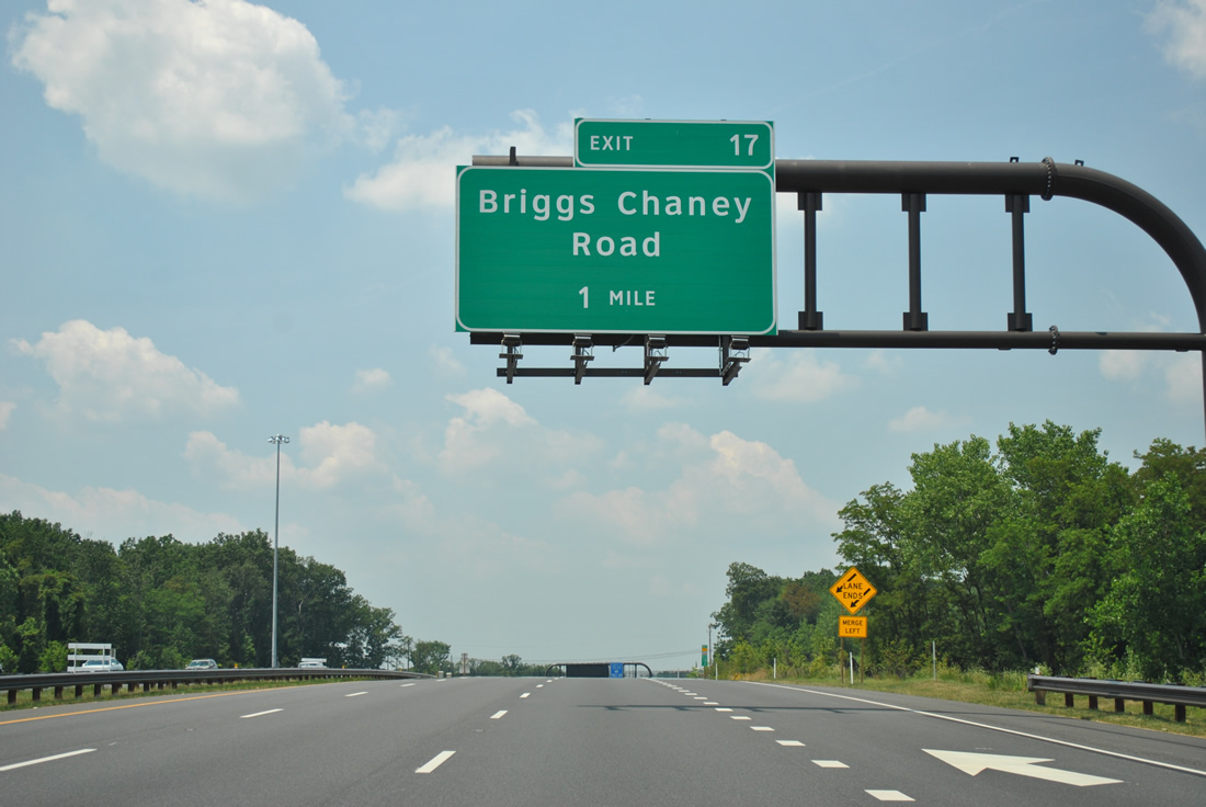
| Leading away from Interstate 95, MD 200 carries six overall lanes to a half diamond interchange with Briggs Chaney Road (Exit 17). 06/20/12 |
|
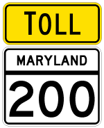
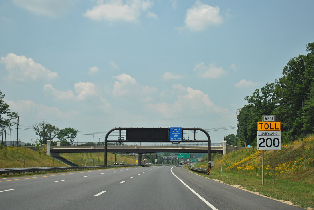
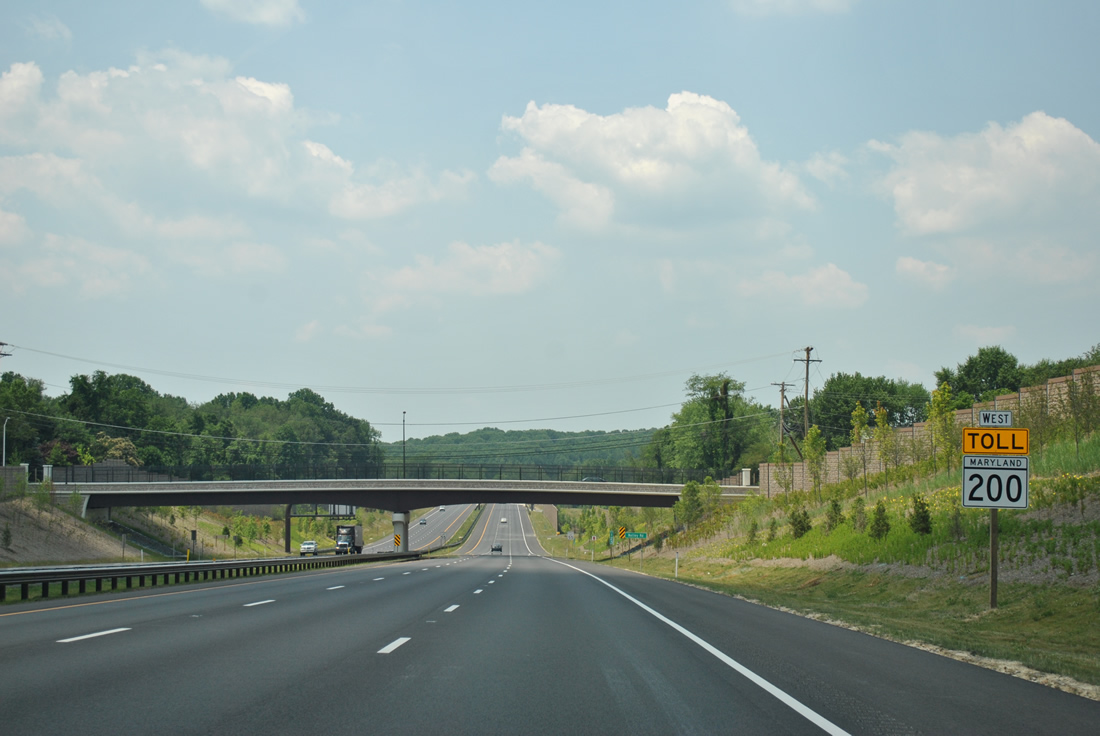
| The first westbound shield of MD 200 lies ahead of the Old Gunpowder Road overpass. All shields for MD 200 include a yellow and black TOLL banner as required by the MUTCD for tolled facilities. 06/20/12 |
|
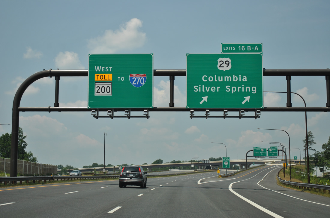
| The first of four sets of transponder readers and video tolling apparatus join the half mile sign bridge for Briggs Chaney Road. These readers levy tolls to all drivers and take the place of conventional toll booths.
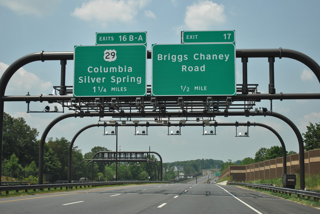
A multi-level stack interchange (Exits 16B/A) follows in one mile between MD 200 and U.S. 29 (Columbia Pike) at Fairland. 06/20/12 |
|
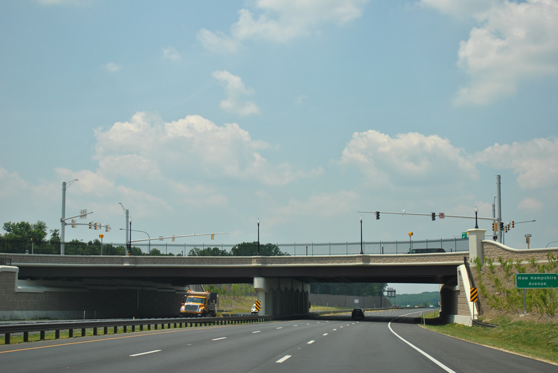
| Exit 17 departs the Intercounty Connector westbound for Briggs Chaney Road as MD 200 enters Montgomery County. Briggs Chaney Road connects with U.S. 29 nearby at a commercialized interchange to the north and winds southeast to Cross Creek Golf Club and Calverton. 06/20/12 |
|
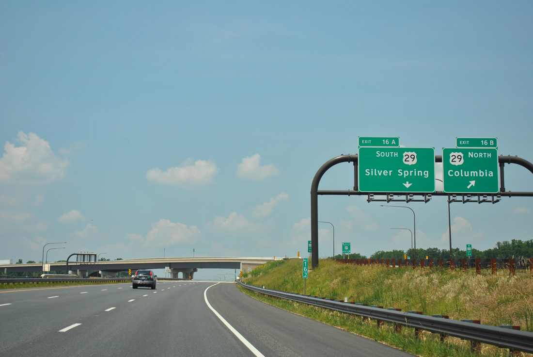
| A two lane ramp carries traffic from MD 200 Toll west to U.S. 29 at Exit 16. U.S. 29 (Columbia Pike) comprises a busy arterial route southward to White Oak and Silver Spring and northward to Burtonsville. 06/20/12 |
|
| The gore point for Exits 16B/A includes a U.S. 29 shield, indicative of the expressway to expressway connection here as U.S. 29 is controlled access from Fairland Road north to Greencastle Road. 06/20/12 |
|
| A flyover ramp (Exit 16A) shuttles drivers onto U.S. 29 south at Fairland. Silver Spring is seven miles to the southwest. Columbia, in Howard County, is 11 miles to the north. Beyond MD 198 and Burtonsville, U.S. 29 upgrades to a limited access highway. 06/20/12 |
|
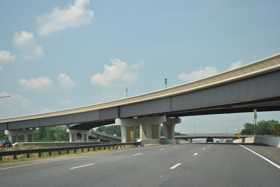
| The Intercounty Connector mainline comprises the middle level of the stack with U.S. 29. Columbia Pike travels below. 06/20/12 |
|
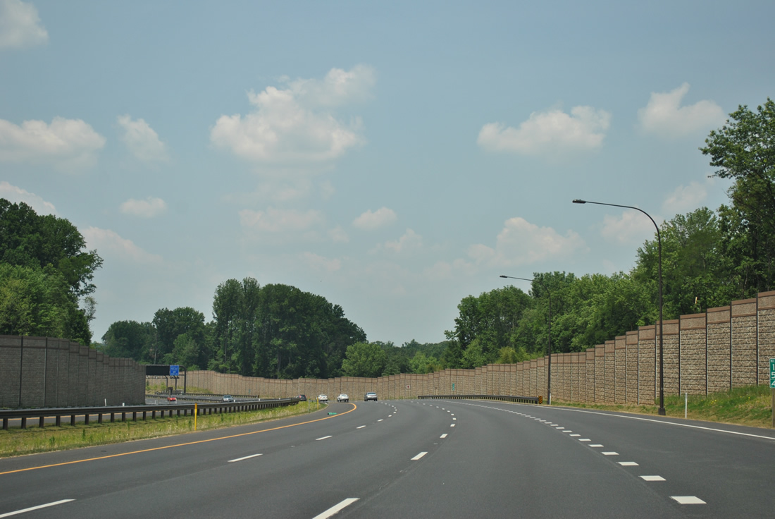
| Earth colored sound walls abut the six lane ICC to screen the toll road from the adjacent subdivisions near Fairland. 06/20/12 |
|
| The second set of transponder readers and video tolling follows the interchange with U.S. 29. Rates are charged depending upon time of day. Drivers with E-ZPass accounts pay a lower rate than those utilizing video tolling (pay by plate). 06/20/12 |
|
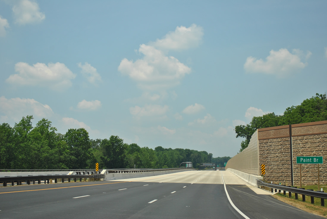
| Traveling through Upper Paint Branch Stream Valley Park, MD 200 spans Paint Branch in this scene. 06/20/12 |
|
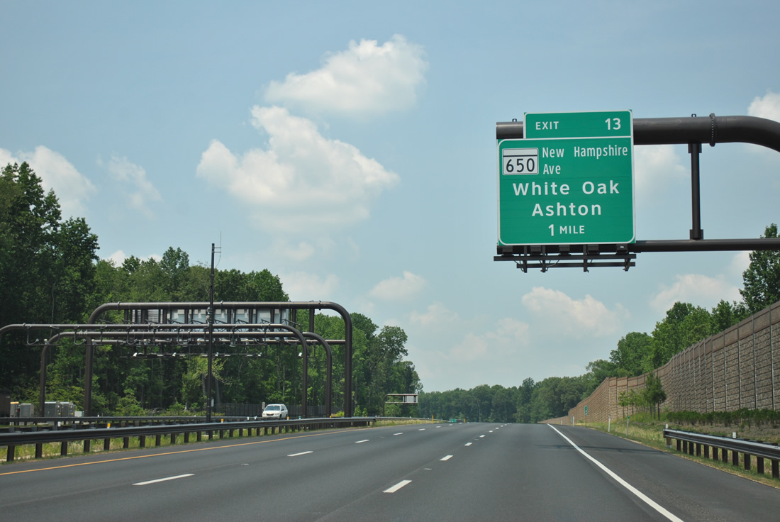
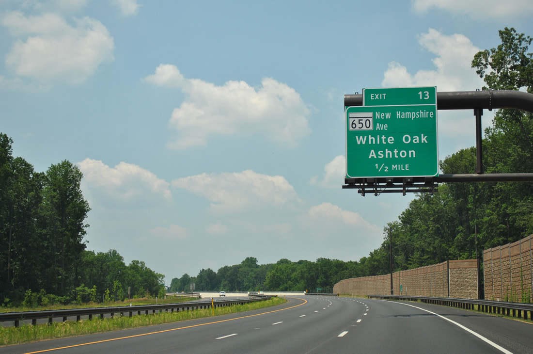
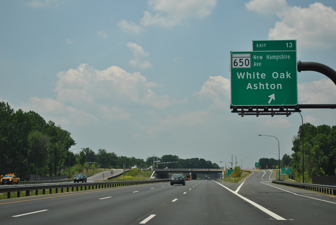
| MD 650, a 25.9 mile route from the District of Columbia line to Etchison, crosses paths with MD 200 at Exit 13 in one mile. 06/20/12 |
|
| MD 650 (New Hampshire Avenue) constitutes a busy arterial north to Ashton and south to Colesville, White Oak and Takoma Park. New Hampshire Avenue continues south of the state line to U.S. 29 (Georgia Avenue). 06/20/12 |
|
| A single point urban interchange (SPUI) facilitates the movements between MD 200 Toll and MD 650 (New Hampshire Avenue) at Exit 13. 06/20/12 |
|
| MD 200 shield posted ahead of the Notley Road overpass near Colesville. 06/20/12 |
|
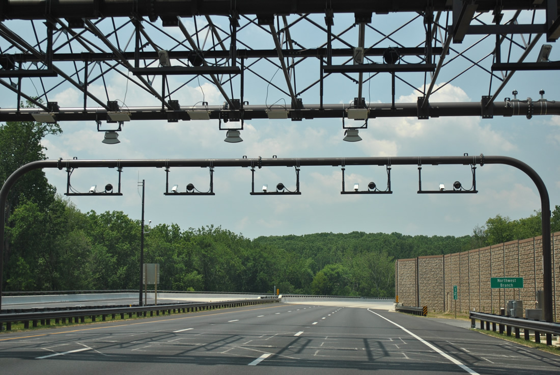
| A third set of toll collection apparatus hangs above the ICC westbound lanes ahead of the Northwest Branch. 06/20/12 |
|
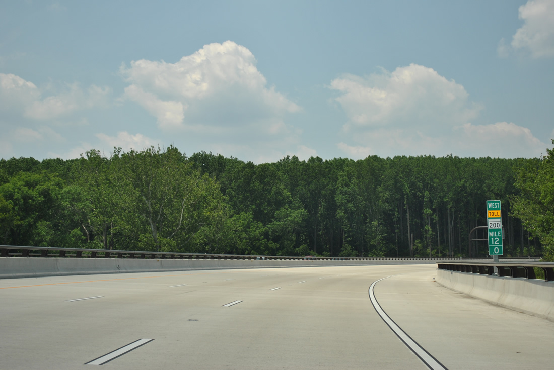
| An elevated sweeping curve takes drivers above the Northwest Branch. Pictured in this scene is a typical mile marker for MD 200. 06/20/12 |
|
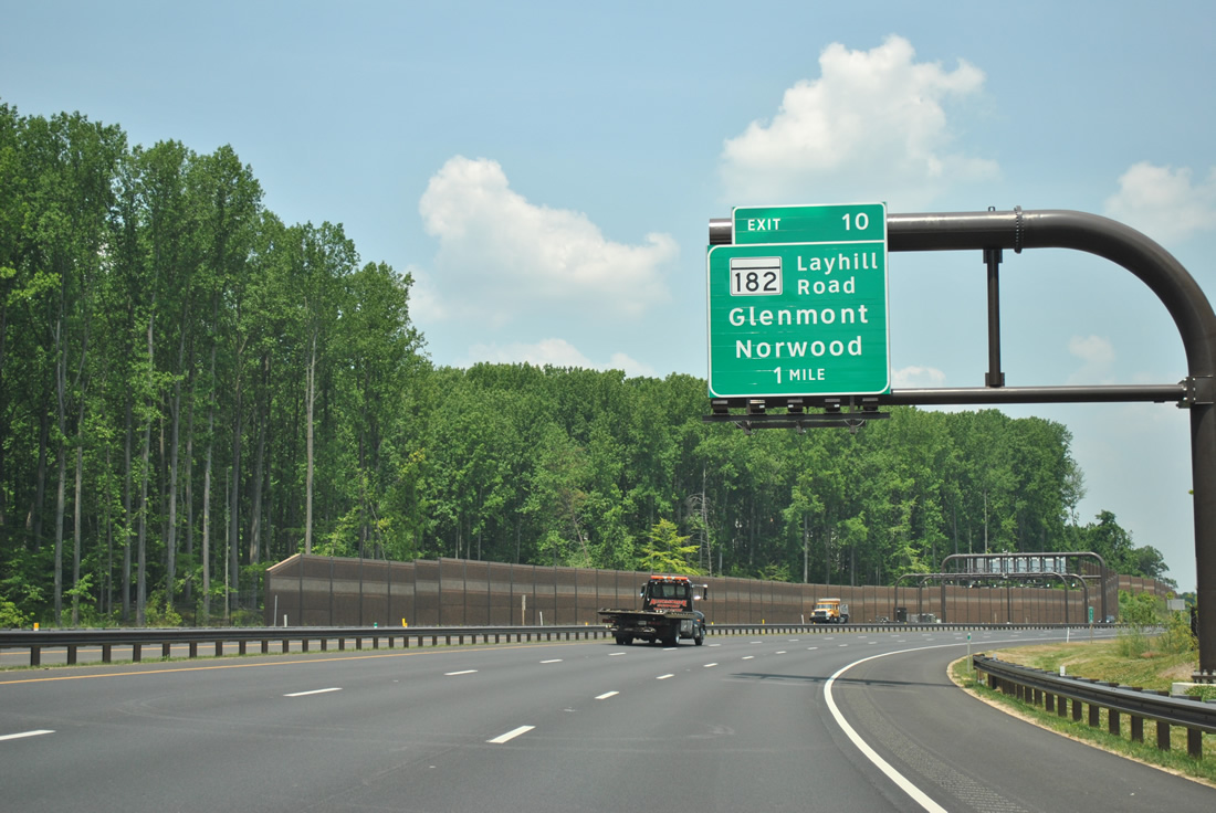
| MD 200 continues northwesterly from Northwest Branch to Olney and Redland. Next in line for westbound motorists is the Exit 10 diamond interchange with MD 182 (Layhill Road). 06/20/12 |
|
| MD 182 totals 6.60 miles from MD 97 (Georgia Avenue) at Glenmont to MD 108 (Olney Sandy Spring Road) outside Olney. 06/20/12 |
|
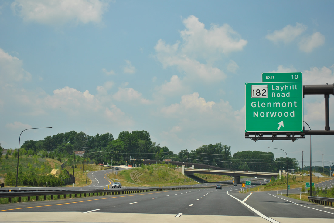
| Westbound at the Exit 10 off-ramp to MD 182 (Layhill Road) along MD 200 near Layhill. Norwood is a two mile drive north along the state highway. 06/20/12 |
|
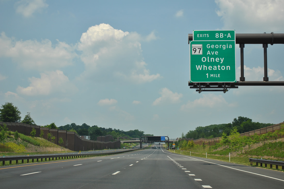
| Development lines both sides of the Intercounty Connector on the one mile approach to Exit 8 and MD 97 (Georgia Avenue). A westbound side frontage road (Park Vista Drive / Wintergate Drive) connects MD-182 and MD-28 beyond the sound wall here. 06/20/12 |
|
| A fourth toll collection point of the westbound ICC follows this MD 200 shield. Longmead Crossing Drive spans the toll road in the distance. 06/20/12 |
|
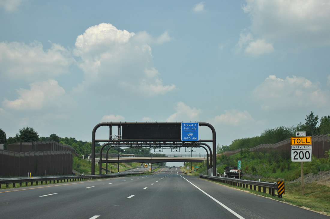
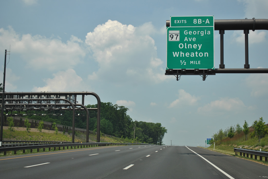
| A six-ramp parclo interchange (Exit 8) joins MD 200 with MD 97 (Georgia Avenue) in a half mile. The ICC passes under MD 28 (Norbeck Road) beyond the hill, but without direct access. The toll road temporarily ended at the state route in 2011. 06/20/12 |
|
| The deceleration lane for Exit 8 departs well ahead of MD 97 (Georgia Avenue). The 55.27 mile state route travels south to U.S. 29 and MD 384 at Silver Spring and north to the Pennsylvania state line along the former path of U.S. 140. 06/20/12 |
|
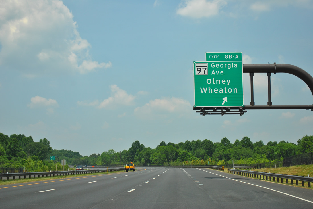
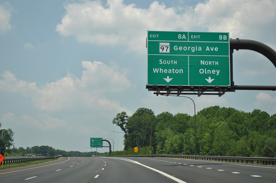
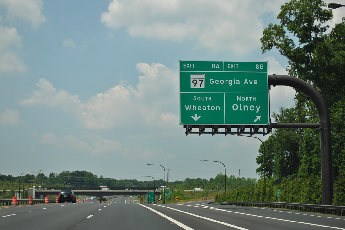
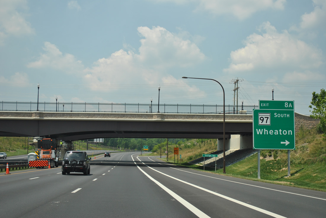
| Exit 8 quickly expands to two lanes for MD 97 (Georgia Avenue) north into Olney and south to Rossmoor, Aspen Hill and Wheaton. 06/20/12 |
|
| A painted distributor roadway separates traffic to MD 97 (Georgia Avenue) south at Norbeck. 06/20/12 |
|
| The final westbound shield for MD 200 lies along a six mile exit less stretch across the North Branch Rock Creek and Rock Creek itself. 06/20/12 |
|
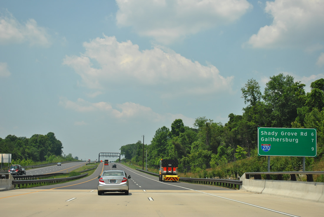
| Spanning Emory Lane, a distance sign outlines the distance to the final MD-200 exit, Gaithersburg and Interstate 270 (via Interstate 370). 06/20/12 |
|
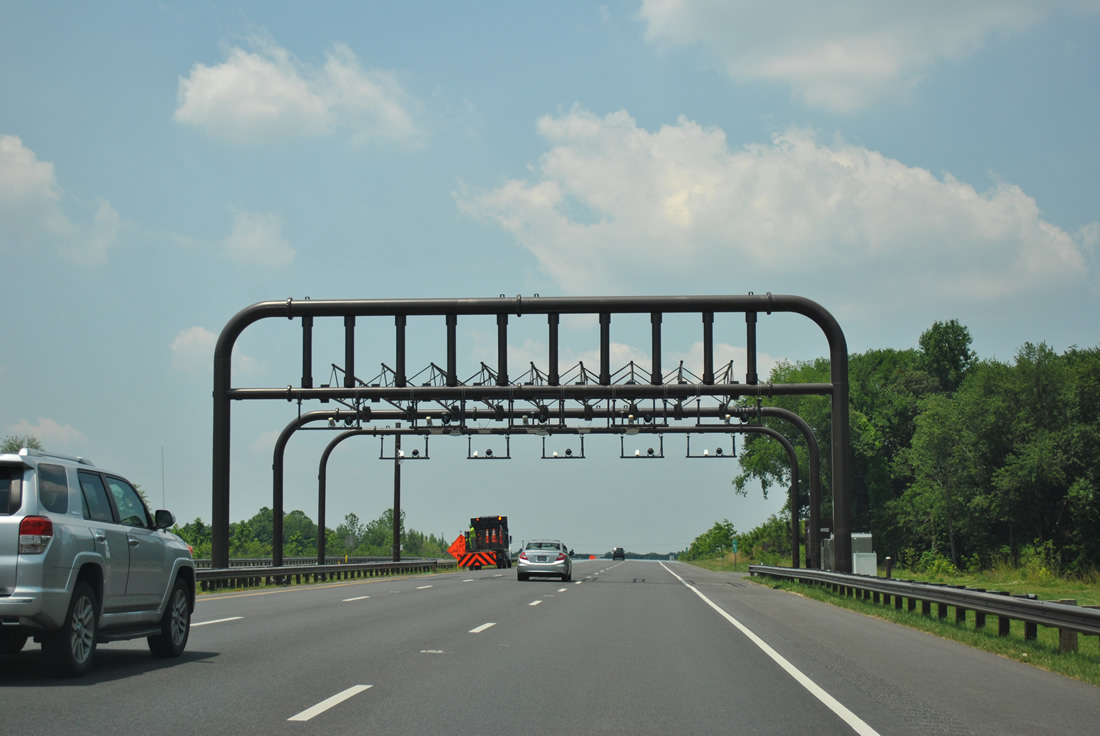
| A fifth and final toll collection point follows. 06/20/12 |
|
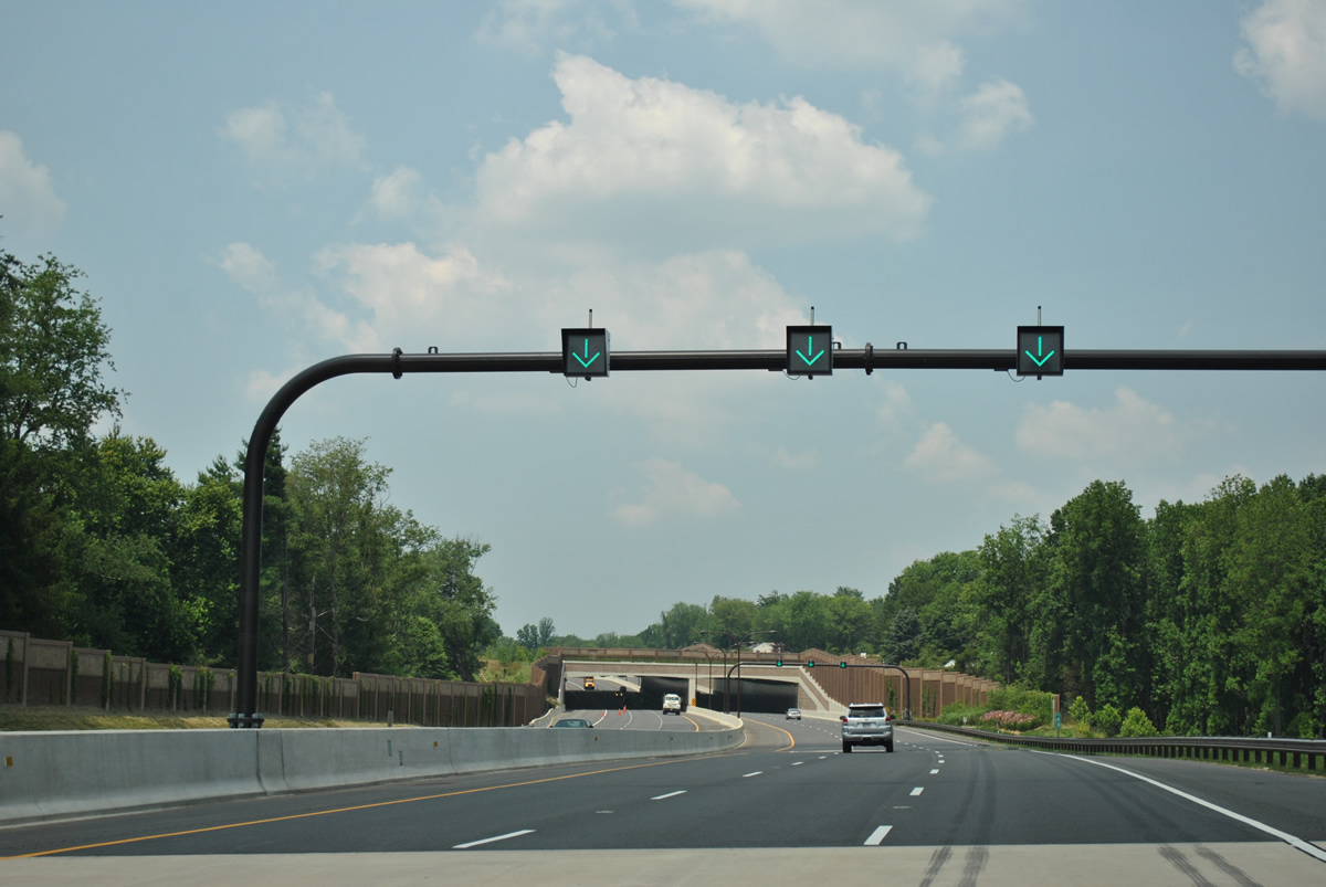
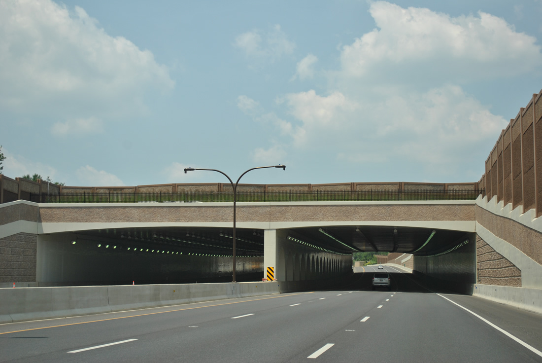
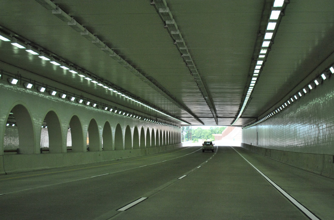
| Lane control signals precede the Winters Run tunnel, a cut and cover structure linking the Winters Run subdivision above the Intercounty Connector. 06/20/12 |
|
| Traveling through the "deckover", the MdTA name for the Winters Run tunnel. Six lanes and full shoulders are maintained for MD 200 Toll. 06/20/12 |
|
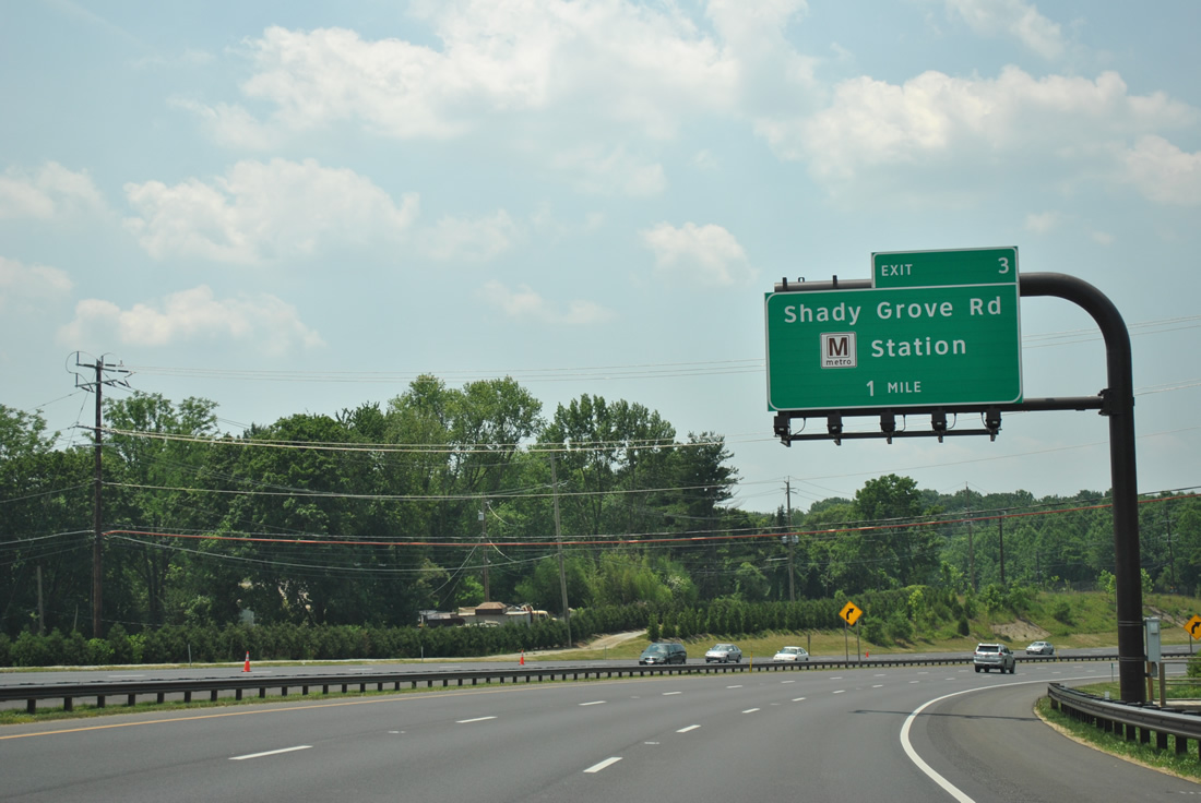
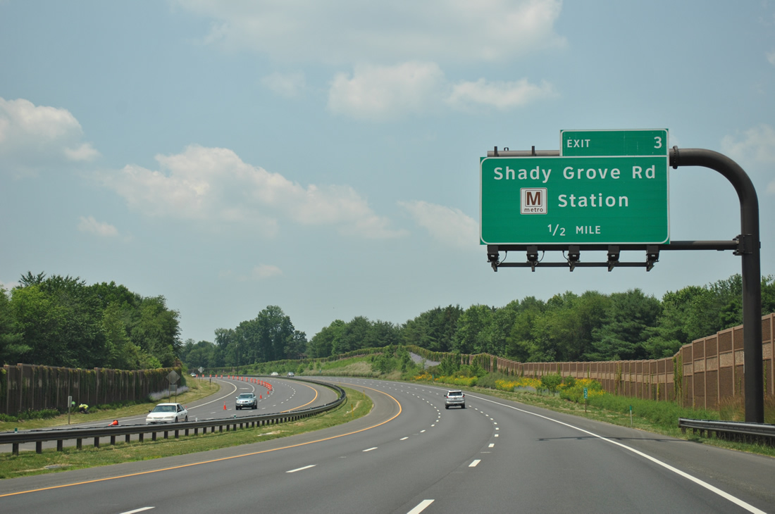
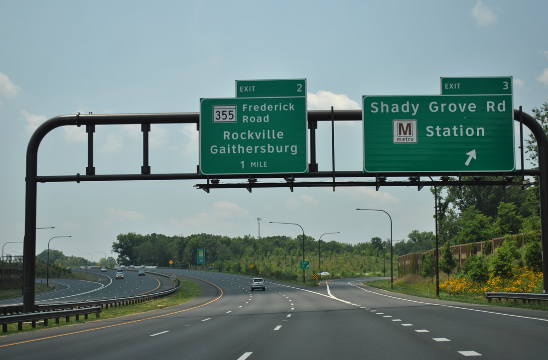
| Continuing west, MD 200 winds westward into Redland, next meeting the unsigned MD 200A (former Interstate 370) freeway spur (Exit 3) south to Shady Grove Road and the Shady Grove Metro station. 06/20/12 |
|
| MD 200 Toll passes over Shady Grove Road and parallels Mill Creek ahead of the half mile sign for Exit 3. MD 200A sees a six-ramp parclo interchange with adjacent Shady Grove Road before defaulting into the subway station. This north-south freeway was originally the eastern extent of Interstate 370. 06/20/12 |
|
| Construction of the Intercounty Connector tied MD 200 Toll in with Interstate 370 just north of Shady Grove Road. A trumpet interchange (Exit 3) was built at the original curve of I-370, resulting in a shortening of the Interstate highway. Exit 2 continues the exit numbering convention of the ICC at MD 355 (Frederick Road). 06/20/12 |
|
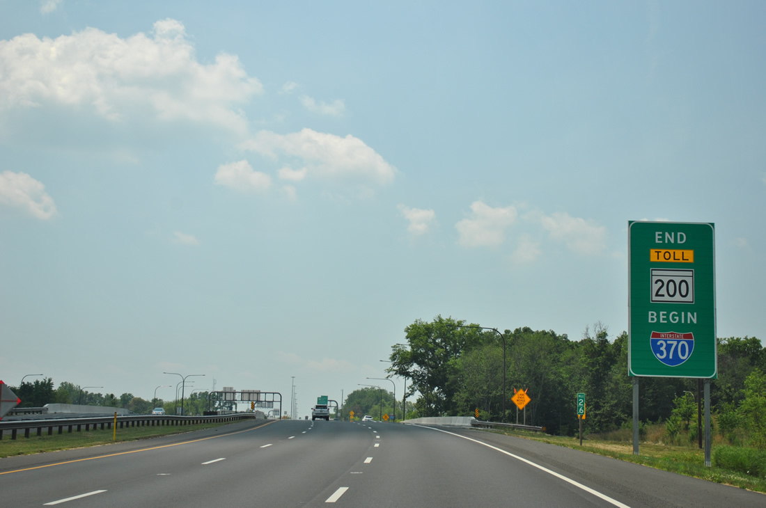
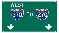
| MD 200 ends and Interstate 370 begins sign posted at Exit 3. Interstate 370 continues the freeway west to Rockville, Interstate 270, and west Gaithersburg. 06/20/12 |
Page Updated 07-18-2012.