
North Carolina Highway 12 constitutes a lengthy coastal route extending north from U.S. 70 at Sea Level to Cape Hatteras, Bodie Island, and Corolla. The state route utilizes ferry service to access both ends of Ocracoke Island.
The bulk of NC 12 across Ocracoke, Hatteras and Pea Islands navigates through Cape Hatteras National Seashore. North from Nags Head to Kill Devil Hills and Kitty Hawk, NC 12 travels through built up areas along the Atlantic Ocean on Virginia Dare Trail, the former route of U.S. 158. The route extends 21 miles north along Bodie Island, from the U.S. 158 western turn across Currituck Sound, to the community of Corolla.
Damage from Hurricane Irene on August 27, 2011 washed out several sections of NC 12 between Pimlico Sound and the Atlantic Ocean. New inlets created between the two bodies of water were as wide as 100 feet and deep as 8 feet. Ferry service was started to Hatteras due to the road closure.
A 662 foot long truss bridge was quickly built over one of the new inlets and opened by October 11, 2011, restoring access to Rodanthe, Salvo and Waves.1 Despite legal hurdles due to environmental concerns to 2016, the long term replacement project of the Oregon Inlet Bridge advanced.
The Bonner Bridge Replacement Project contructed a new 3,500 long high rise span across Oregon Inlet. Work on the $246 million project formally commenced on March 13, 2016 and the new span opened to traffic on February 25, 2019.
Overall construction, including the demolition of the old Herbert C. Bonner Bridge, ran through September 2019. A 1,000 foot long section of the old span was retained for use as a pedestrian walkway. The replacement bridge measures 2.8 miles in length and rises to a height of 90 feet above Oregon Inlet. The two lane crossing has eight foot shoulders in each direction.2
A ribbon-cutting ceremony for the NC 12 bridge across Oregon Inlet took place on April 2, 2019, where the span was formally renamed the Marc Basnight Bridge. Basnight, a former state Senator representing Dare County from 1984 to 2011, was a staunch proponent for the replacement of the 1963-built Bonner Bridge. The renaming of the span was supported by the Dare County Board of Commissioners and officials from Kill Devil Hills, Manteo and Nags Head. The State Board of Transportation voted to rename the bridge on March 7, 2019.3
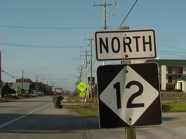
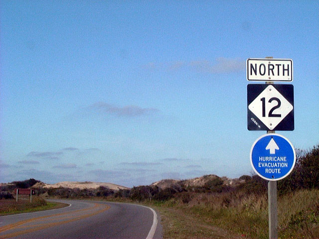 | Northbound reassurance shield for NC 12 posted near Bodie Island Lighthouse on the Outer Banks Scenic Byway within Cape Hatteras National Seashore. 12/16/01 |
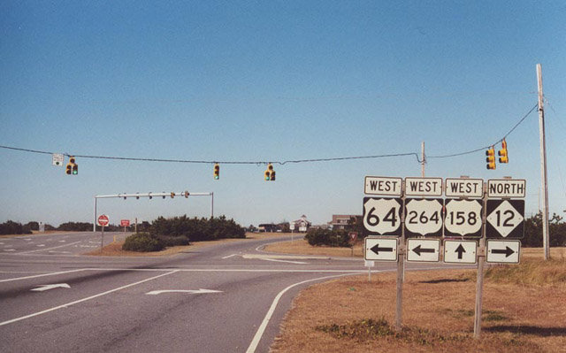
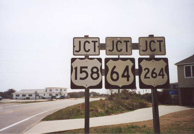
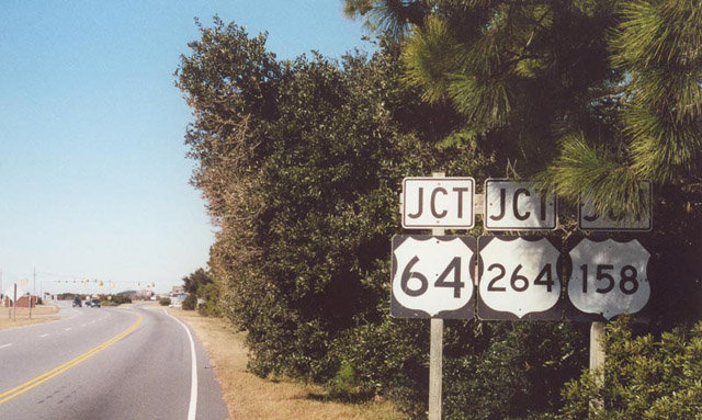 | Leaving Cape Hatteras National Seashore, northbound NC 12 approached U.S. 64/158/264 at Virginia Dare Trail. Virginia Dare Trail overlays U.S. 64 west to Roanoke Island and NC 12 north along the beaches. A connector links NC 12 directly with U.S. 158 westbound as well. 12/26/00 |
 | U.S. 64 begins at NC 12 (Virginia Dare Trail) and travels west to Manteo, Manns Harbor, Raleigh and ultimately Teec Nos Pos, Arizona. U.S. 158 follows Croatan Highway north to Kill Devil Hills and Kitty Hawk. The highway continues to Elizabeth City and ultimately to Mocksville. 12/26/00 |
 | NC 12 parallels U.S. 158 (Croatan Highway) two to three blocks to the east. U.S. 158 constitutes a five lane commercial boulevard from Whalebone Junction to Martin's Point. NC 12 offers a slower two lane drive along the beach. 12/16/01 |
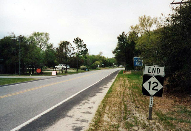 | North Carolina Highway 12 ends where Ocean Trail transitions to SR 1437 at Corolla. SR 1437 provides access to North Beach Access Road, a road restricted to vehicles with four-wheel, 2.5 miles north to Carava. 04/01/01 |
 | NC 12 (Virginia Dare Trail) curves southwest from the beach to U.S. 64 and 158 (Croatan Highway) beyond the split with Old Oregon Inlet Road. U.S. 64 begins ahead and extends Virginia Dare Trail west onto Cedar and Pond Islands to the Washington Baum Bridge. Old Oregon Inlet Bridge heads 4.9 miles south, rejoining NC 12 within the National Seashore. 04/01/01 |
| Herbert C. Bonner Bridge |
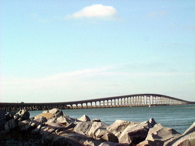 | The Herbert C. Bonner Bridge departed from the northern shores of Hatteras Island across Oregon Inlet. The two lane span opened in 1963. 12/16/01 |
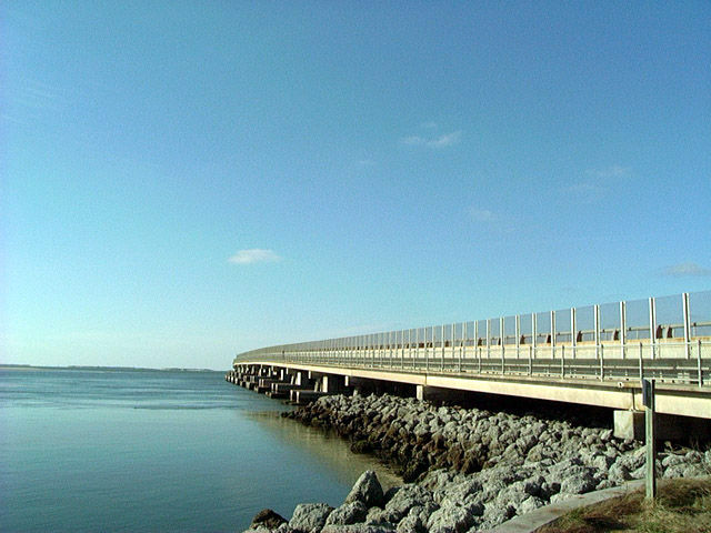 | Looking north at the Herbert C. Bonner Bridge from the west side of the span. NC 12 traveled 2.7 miles across the old bridge over Oregon Inlet. 12/16/01 |
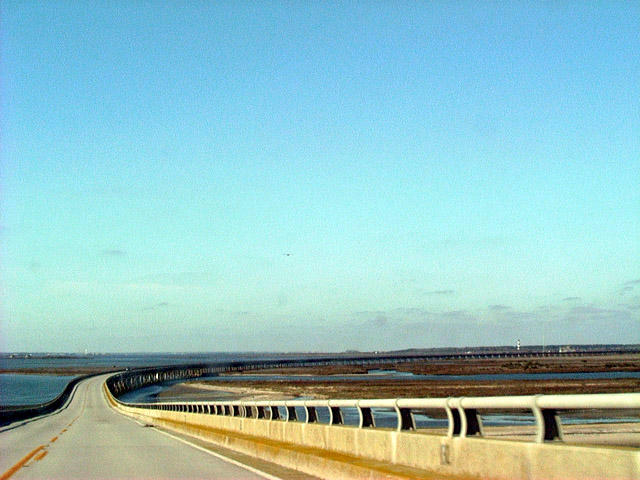 | Descending from the crest of the Bonner Bridge over North Point on NC 12 north. Walter Slough and Herring Shoal Island were visible in the distance. 12/16/01 |
- "State puts N.C. 12 back together." The News & Observer (Raleigh, NC), October 6, 2011.
- "New bridge over the Oregon Inlet opens to traffic." Ocracoke Observer (NC), February 25, 2019.
- "Ribbon-Cutting April 2 for Basnight Bridge." Coastal Review Online (Newport, NC), March 26, 2019.
Photo Credits:
12/26/00, 04/01/01, 12/16/01 by AARoads
Page Updated 09-23-2019.