NY 25 originates on the Ed Koch Queensboro Bridge joining Lenox Hill in Manhattan with Hunters Point in Queens. The state route extends 104.47 miles east from New York City to Orient Point at the northeastern end of Long Island.
Through Queens, NY 25 lowers from the Queensboro Bridge onto Queens Boulevard at NY 25A (Jackson Avenue / Northern Boulevard). Queens Boulevard leads the route east through Sunnyside, Elmhurst, Rego Park and Forest Hills. NY 25 crosses I-678 (Van Wyck Expressway) south of the Kew Gardens Interchange between Jackie Robinson Parkway and Hillside Avenue. Hillside Avenue takes NY 25 east from Briarwood to Jamaica Estates, Holliswood and Queens Village.
NY 25B continues Hillside Avenue east to Bellerose Manor and North New Hyde Park in Nassau County while NY 25 angles southeast along Braddock Avenue onto Jamaica Avenue along the New York City line at Floral Park. Continuing into Nassau County, NY 25 follows Jericho Turnpike to New Hyde Park, Garden City Park and Minneola.
Through Westbury, NY 25 parallels Northern State Parkway. The two highways converge with Interstate 495 (Long Island Expressway) in the town of Oyster Bay. NY 25 shifts north of the L.I.E. at Jericho, while Northern Sate Parkway does at Plainview. The two cross into Suffolk County east to West Hills and South Huntington. Northern State Parkway concludes at NY 454 south of NY 25 at Commack. NY 25 continues east from Commack to Smithtown, Lake Grove and Riverhead, where it meets the east end of the Long Island Expressway.
|
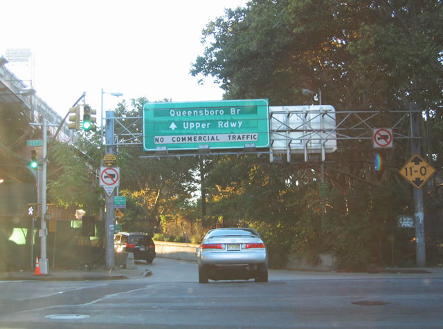
| Queens Plaza (NY 25) west at 21st Street and the entrance for the Ed Koch Queensboro Bridge Upper Roadway. 10/03/04 |
|
| The ramp joining the Queensboro Bridge from Queens Plaza N at 21st Street loops onto the cantilever span above 22nd Street. 10/03/04 |
|
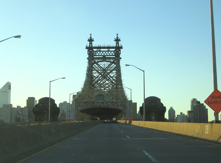
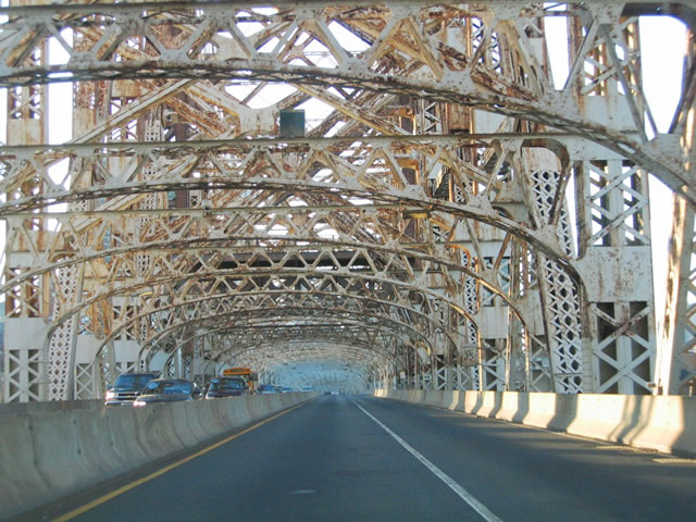
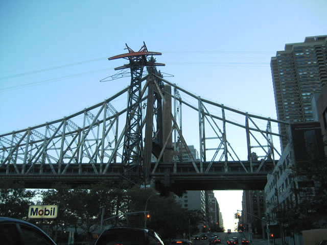
| The upper roadway of the Ed Koch Queensboro Bridge accommodates four overall lanes. The lower deck partitions between a single lane and a pair of dual lane roadways and a multi use path. 10/03/04 |
|
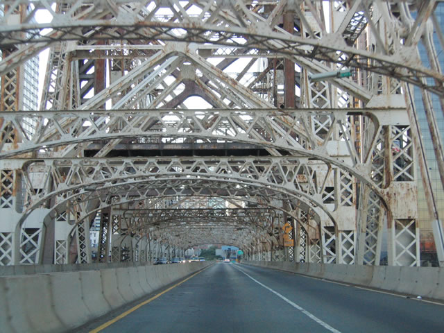
| Opened on March 30, 1909, the Queensboro Bridge cost $20 million to build.1 10/03/04 |
|
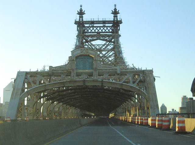
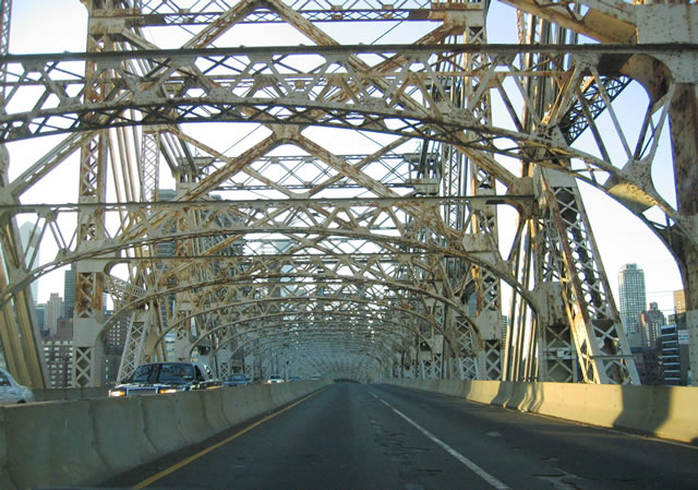
| Measuring 1,182 feet in length, the main cantilever for the Queensboro Bridge represents the 12th longest in the world.1 10/03/04 |
|
| The Ed Koch Queensboro Bridge consists of two cantilever spans joined by a 630 foot span over Blackwell's Island. Including the approaches, the bridge overall is 7,449 feet in length.1 10/03/04 |
|
| The Queensboro Bridge was renamed to honor Ed Koch in 2011. Koch served as a Congressman (1969-77) and later as Mayor of New York City (1978-89).1 10/03/04 |
|
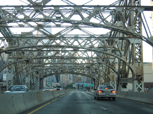
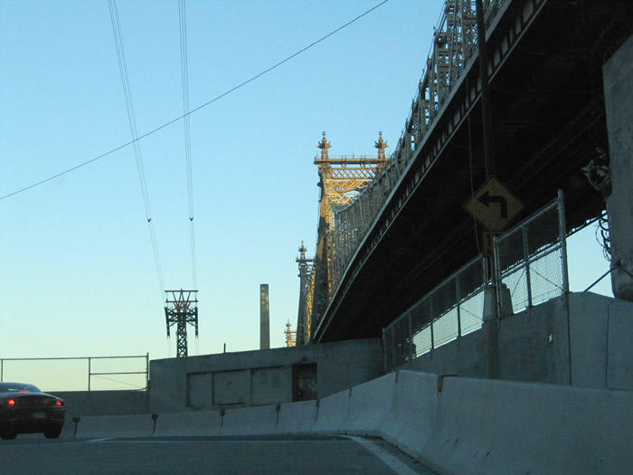
| The Queensboro Bridge lowers between E 59th/60th Streets with a flyover joining the Upper Roadway with E 62nd Street between 1st and 2nd Avenues. 10/03/04 |
|
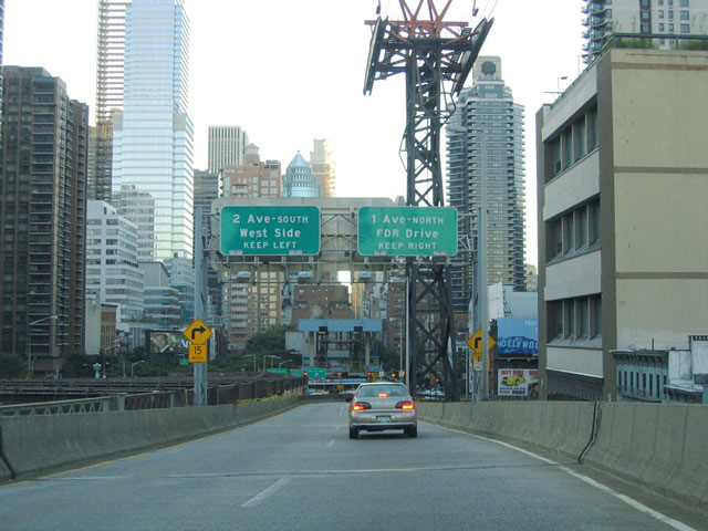
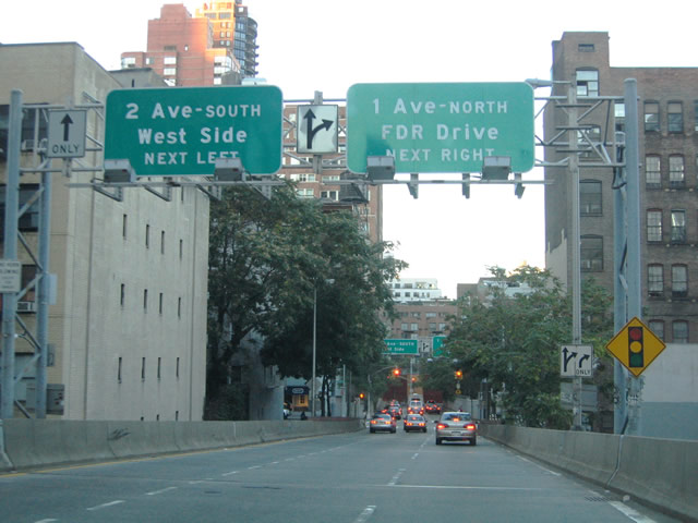
| E 62nd Street leads two tenths of a mile east from the Queensboro Bridge off-ramp to Franklin D. Roosevelt (FDR) Drive north to Uptown. The entrance ramp for FDR Drive south departs from E 63rd Street via York Avenue. 10/03/04 |
|
| The Queensboro Bridge upper roadway ramp extends north to E 63rd Street west. E 62nd Street flows east from 5th Avenue at Central Park. 10/03/04 |
|
| E 62nd Street east at 1st Avenue. 1st Avenue heads north from below the Ed Koch Queensboro Bridge to Lenox Hill and the Upper East Side. 10/03/04 |
|
| York Avenue passes below the Queensboro Bridge and Roosevelt Island Tramway at E 60th Street. The tramway connects Manhattan with nearby Roosevelt Island on the East River.1 10/03/04 |
|
| The former E 60th Street on-ramp to FDR Drive north adjacent to the Queensboro Bridge. This ramp was reconfigured as a pedestrian bridge (John Finley Walk). 10/03/04 |
Photo Credits:10/03/04 by AARoads and Carter Buchanan
Connect with:
Interstate 278
Interstate 295
Interstate 495 - Long Island Expressway
Interstate 678
Route 25A
Page Updated 03-15-2020.