|
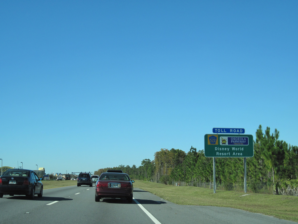
| Osceola Parkway connects with Florida's Turnpike at a diamond interchange west of Buena Ventura Lakes. 05/22/20 |
|
| Florida's Turnpike heads south to St. Cloud, West Palm Beach and Golden Glades in Miami-Dade County. Northward the toll road joins Kissimmee with Orlando, Clermont and I-75 south of Ocala. 05/22/20 |
|
| The northbound entrance ramp joins Florida's Turnpike ahead of the Orange County line and SR 417 (Central Florida GreeneWay). 05/22/20 |
|
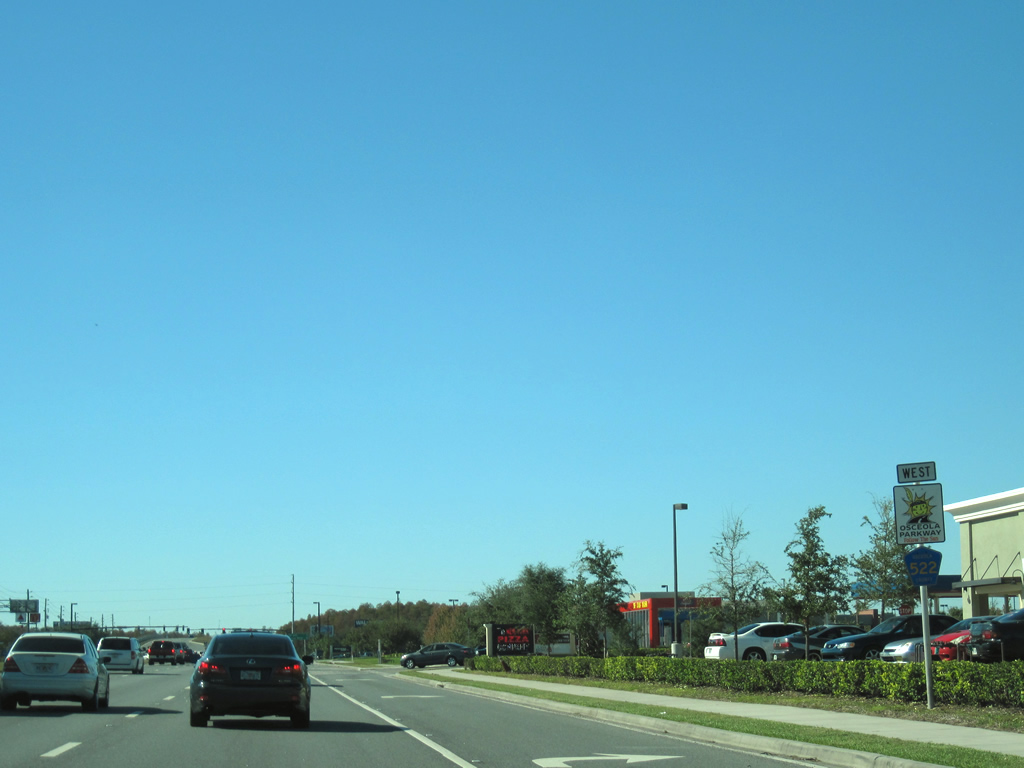
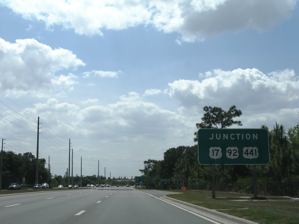
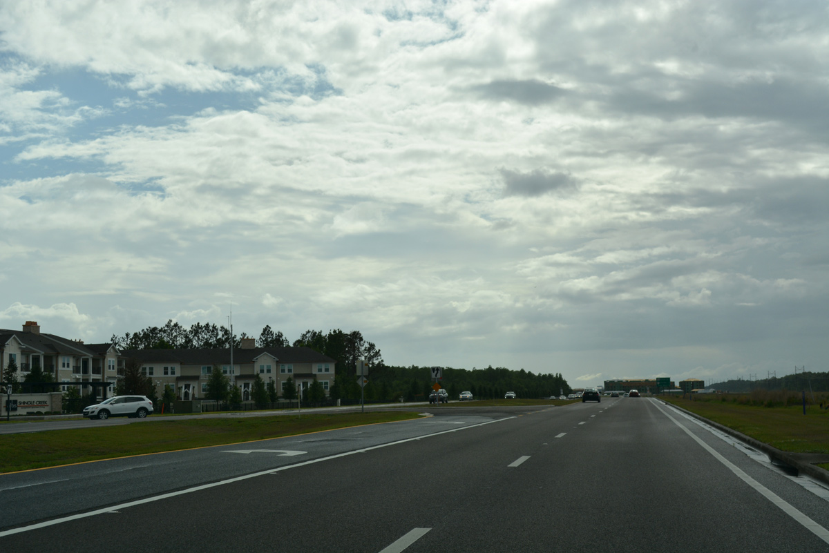
| West of Florida's Turnpike, CR 522 (Osceola Parkway) transitions into a commercial corridor as it heads toward U.S. 17-92-441 (Orange Blossom Trail). 12/04/10 |
|
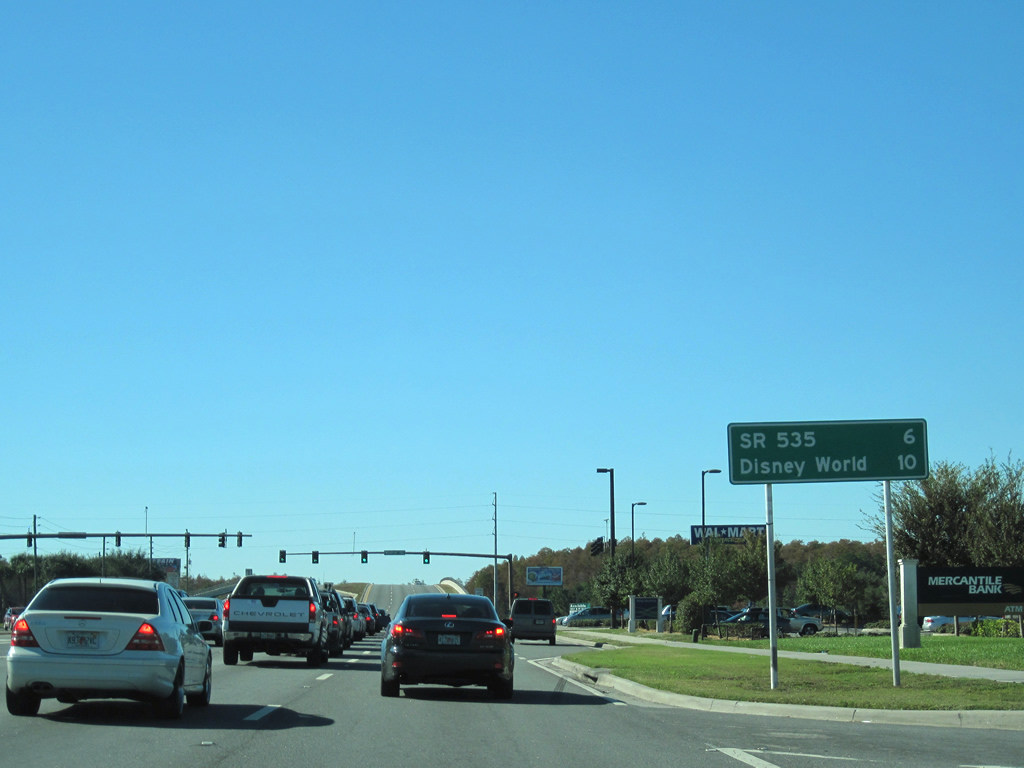
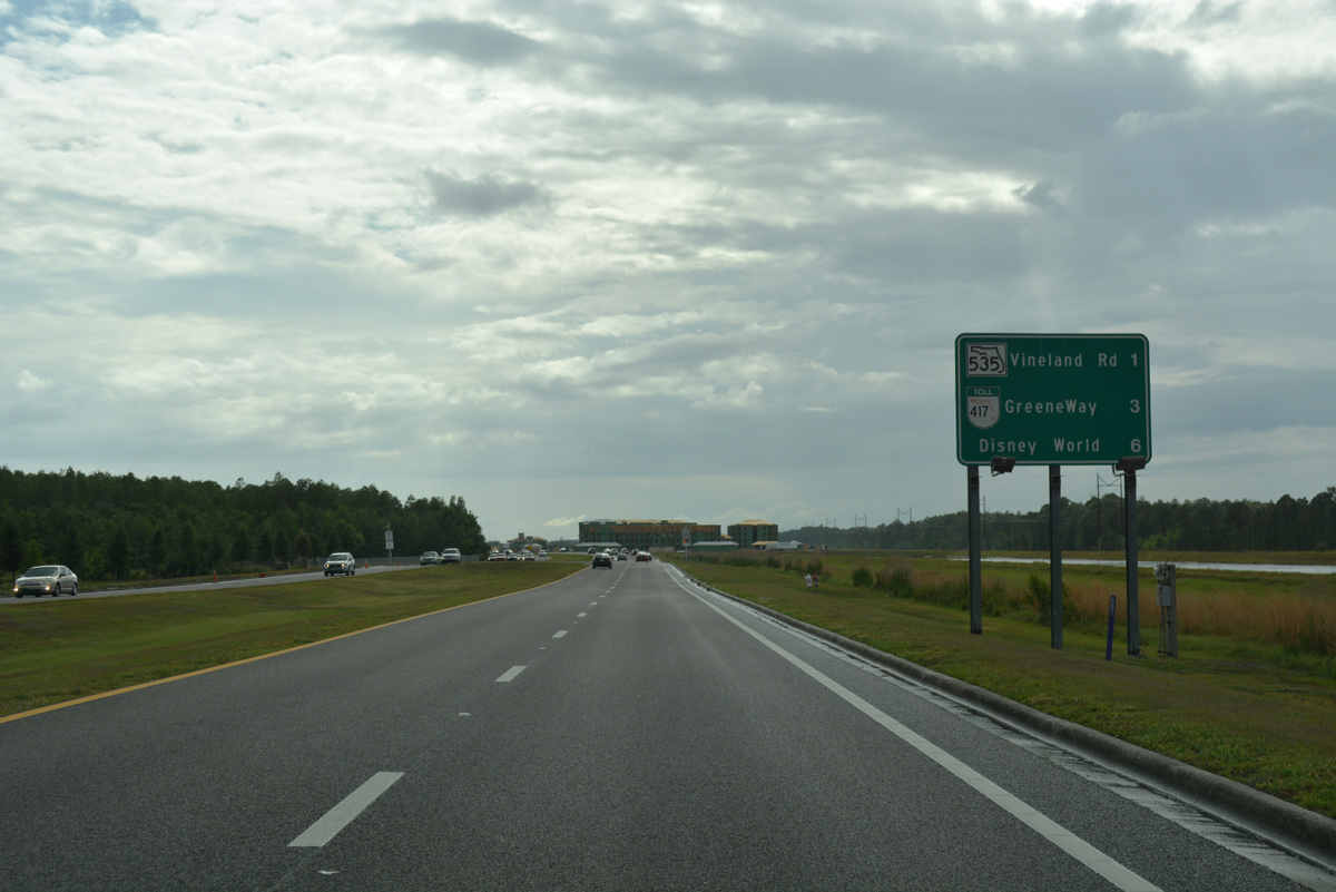
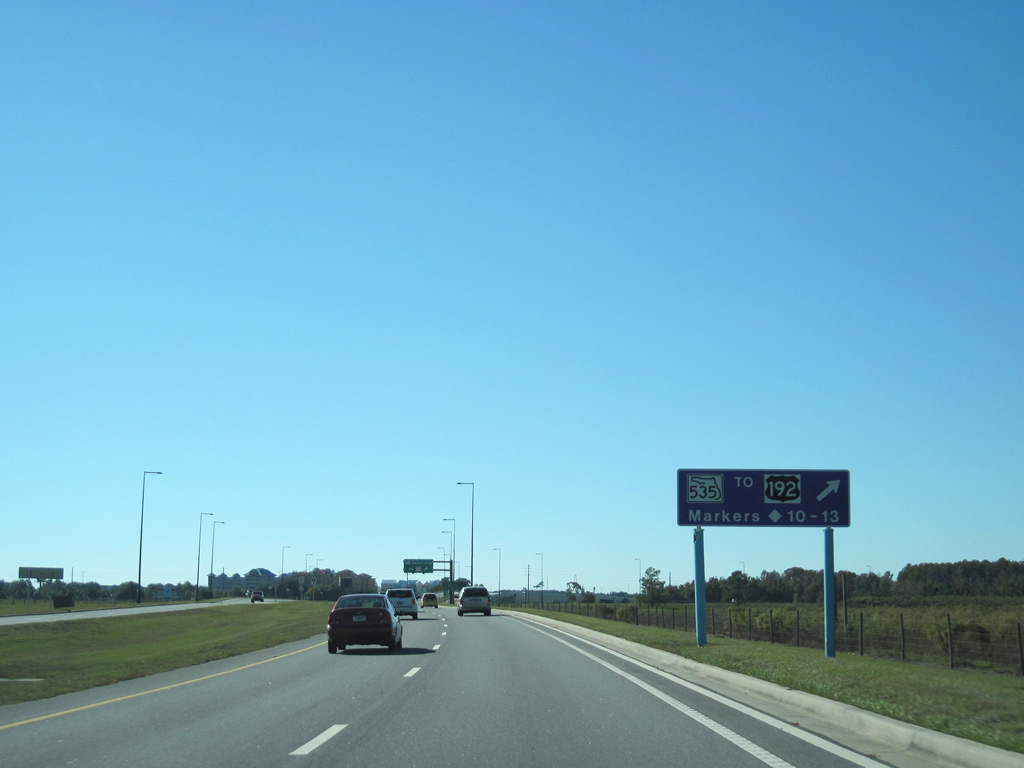
| An interchange with SR 535 (Vineland Road) lies six miles ahead while motorists will reach the Disney World Resort complex in 10 miles. Forthcoming Michigan Avenue links Osceola Parkway with U.S. 192 & 441 and Downtown Kissimmee. 12/04/10 |
|
| Osceola Parkway spans the CSX Railroad line ahead of the intersection with Orange Avenue (unsigned CR 527). Orange Avenue travels north from CR 522 into the Meadow Woods suburban development in south Orange County. 12/04/10 |
|
| Some distance signs posted along Osceola Parkway include metric units for European tourists headed to Walt Disney World. This overhead assembly stands along CR 522 west between Orange Avenue and Old Dixie Highway (CR 527) south. 05/03/08 |
|
| Old Dixie Highway meanders two miles south from Osceola Parkway through residential areas of Kissimmee east of U.S. 17-92-441 (Orange Blossom Trail). The alignment is unsigned CR 527. 12/04/10 |
|
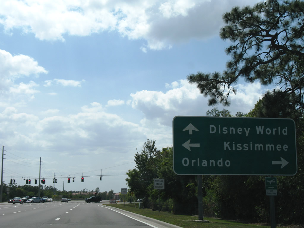
| U.S. 17-92-441 (Orange Blossom Trail) provide a direct route toward Downtown Kissimmee, where they split at U.S. 192 (Vine Street). Northward Orange Blossom Trail (OBT) enters the Hunters Creek area of unincorporated Orange County. 05/03/08 |
|
| Travelers destined for Walt Disney World should remain along Osceola Parkway west to World Drive. Orange Blossom Trail (U.S. 17-92-441) does not provide the fastest route to Orlando, but do eventually reach the city north of Pine Castle. 05/03/08 |
|
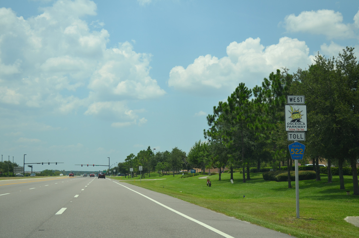
| A guide sign alerts motorists of the approaching toll portion of Osceola Parkway ahead of Centerview Boulevard. The tolled section commences west of Flora Boulevard. 12/04/10 |
|
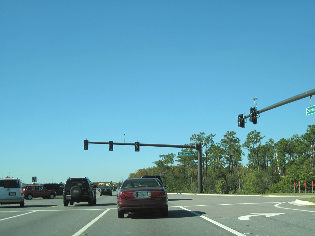
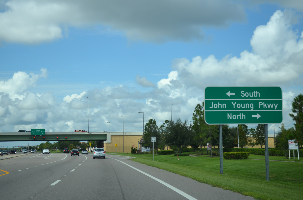
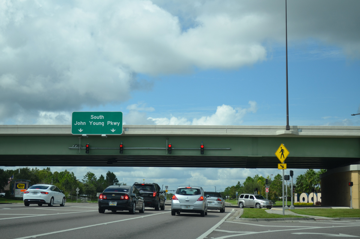
| Centerview Boulevard stems west from U.S. 17-92-441 (OBT) through Crosslands Shopping Center to intersect Osceola Parkway at the succeeding traffic signal. The boulevard continues west to nearby John Young Parkway. 12/04/10 |
|
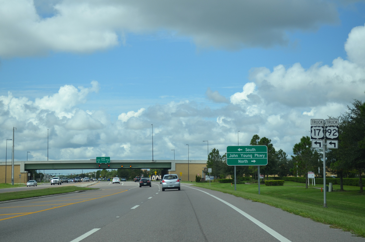
| The truck route for U.S. 17 south & 92 west circumventing central Kissimmee overlays CR 522 (Osceola Parkway) west to John Young Parkway (CR 525) south. 10/01/15 |
|
| Construction through the end of 2010 upgraded the Osceola Parkway intersection with John Young Parkway (unsigned CR 525) to a single point urban interchange (SPUI). John Young Parkway comprises a busy four to six lane arterial linking CR 522 with Hunters Creek in south Orange County, and central Kissimmee at U.S. 17-92-192 (Vine Street). 10/01/15 |
|
| John Young Parkway crosses over Osceola Parkway. The arterial continues north to west Orlando, both as CR 423 and SR 423, to SR 434 near Rosemont. Going south, John Young Parkway becomes a part of U.S. 17/92 leading away from Kissimmee. 10/01/15 |
|
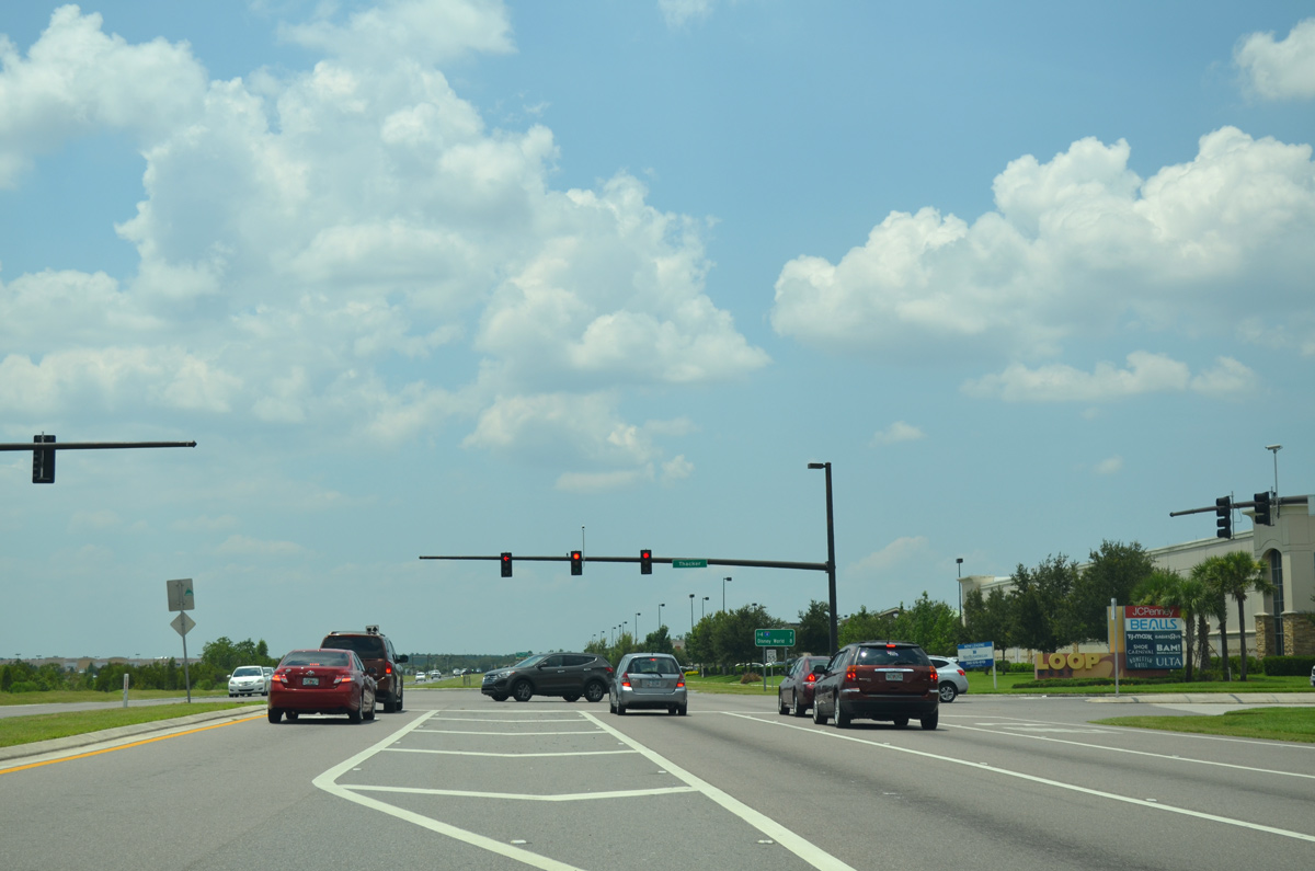
| Leaving the exchange with John Young Parkway (CR 525), Osceola Parkway (CR 522) approaches The Loop Shopping Center's south entrance. 07/31/14 |
|
| Thacker Avenue arcs northeast between The Loop and The Loop West Shopping Centers back to John Young Parkway near the Orange County line. 07/31/14 |
|
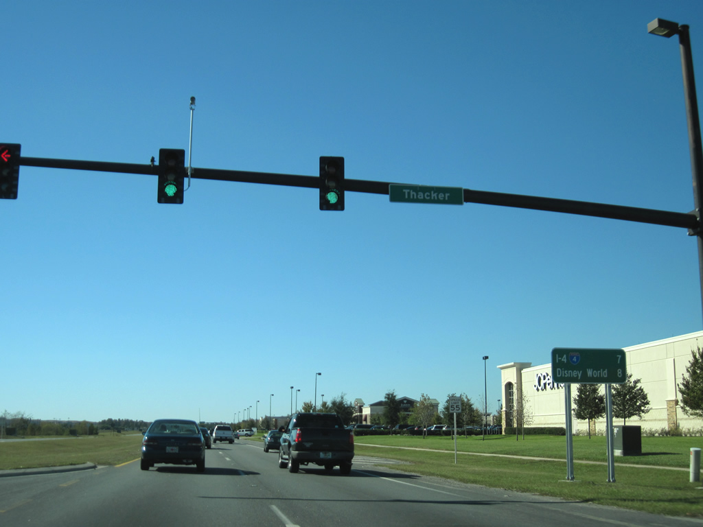
| Distance sign posted seven miles from Interstate 4 and eight miles from the entrance to Walt Disney World on Osceola Parkway west at Thacker Avenue. 12/04/10 |
|
| The Osceola Parkway main line toll plaza lies 0.75 miles west of this sign posted at the second entrance to the Loop West Shopping Center. 12/04/10 |
|
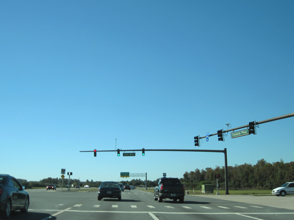
| Dyer Boulevard connects Osceola Parkway with Carroll Street to the south while bordering Loop West Shopping Center northeast to Thacker Avenue. 12/04/10 |
|
| CR 522 reassurance marker posted after Dyer Boulevard. A trailblazer for Osceola Parkway was once posted here as well. 05/05/18 |
|
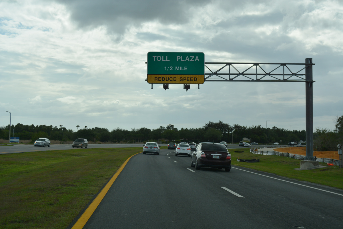
| Westbound motorists approach Flora Boulevard as Osceola Parkway curves northwest toward the mainline toll plaza one half mile ahead. Flora Boulevard provides the final egress point prior to the toll collection point. 05/05/18 |
|
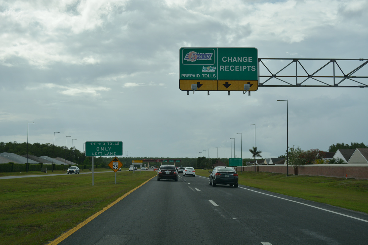
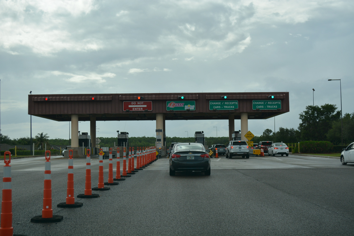
| The Osceola Parkway mainline toll plaza partitions into two lanes for cash collection and one lane dedicated for drivers with prepaid toll transponders (EPass and SunPass). 05/05/18 |
|
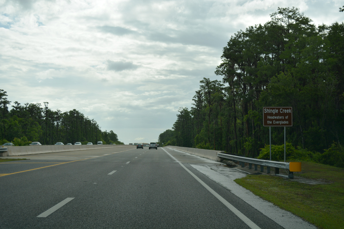
| Osceola Parkway curves westward again ahead of the span across Shingle Creek. Headwaters forthe Everglades in south Florida, Shingle Creek flows south and east from adjacent Orange County into Lake Tohopekaliga. 05/05/18 |
|
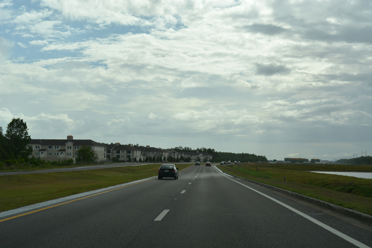
| Osceola Parkway advances west from Shingle Creek to Osceola Trail Road and the 2017-built Altis at Shingle Creek town home community. 05/05/18 |
|
| West from Osceola Trail Road, CR 522 continues one mile to the split diamond interchange with SR 535 (Vineland Road) and North Poinciana Boulevard. 05/05/18 |
|
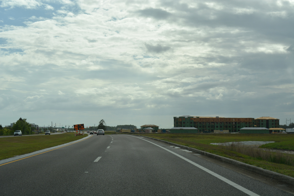
| The previously uninterrupted stretch along Osceola Parkway west leading to SR 535 (Vineland Road) was initially developed with the Storey Lake Resort development to the south, and with Sunrise City Plaza starting in 2016 to the north. 05/05/18 |
|
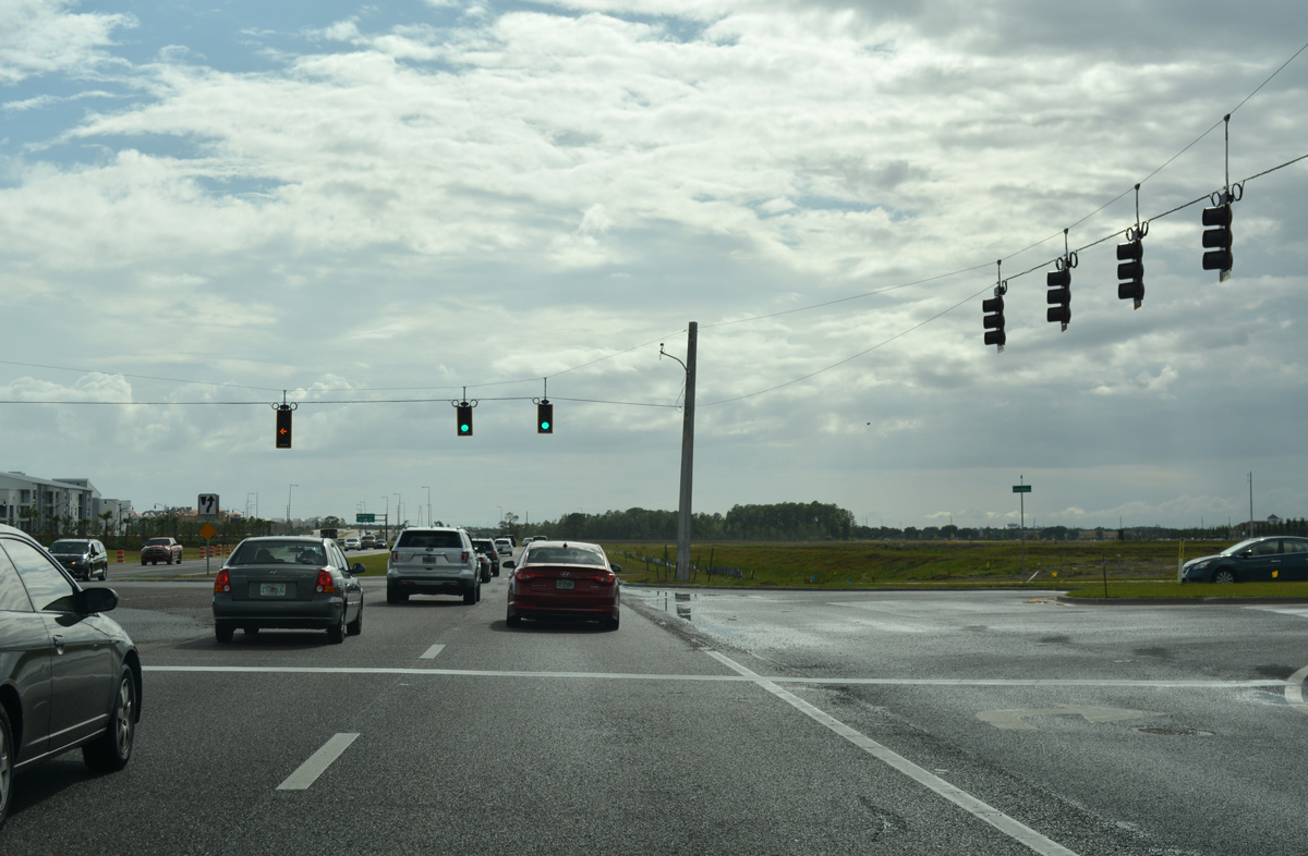
| Storey Lake Boulevard north and Sunrise Boulevard east tie into CR 522 at a signalized intersection. Traffic lights were installed by May 2018. 05/05/18 |
|
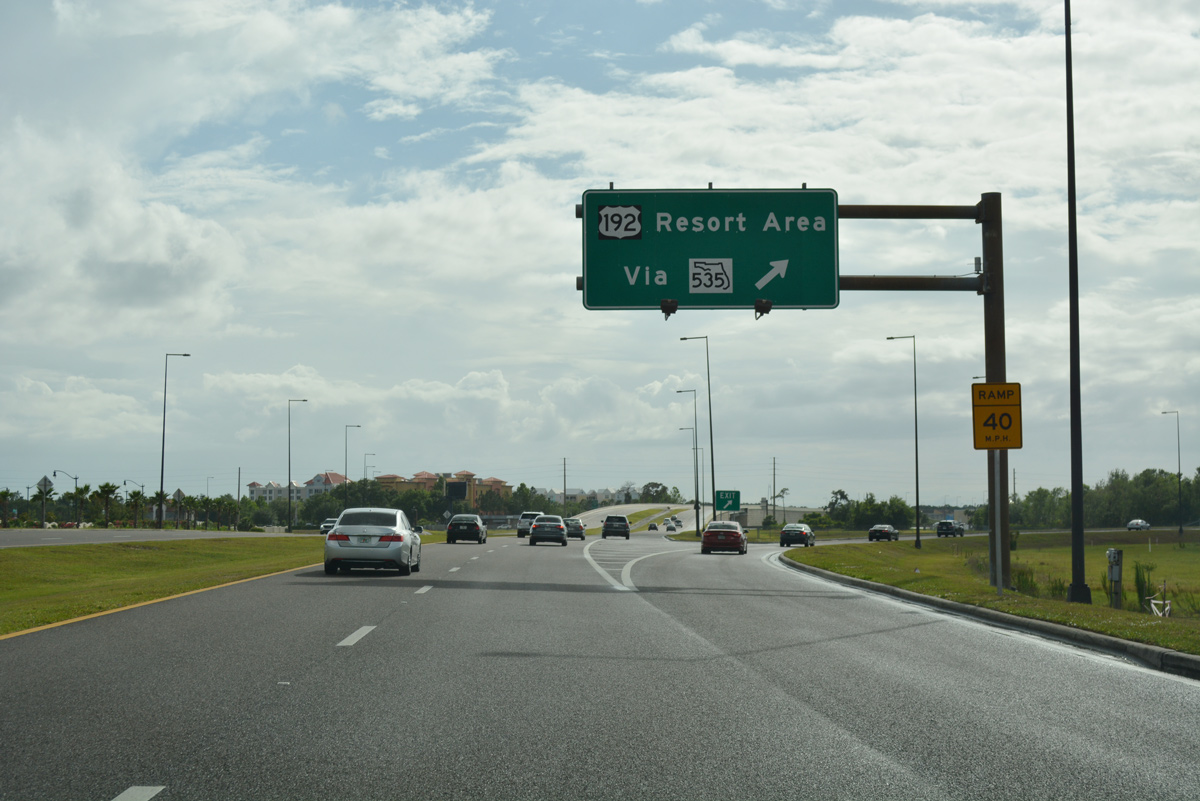
| SR 535 (Vineland Road) originates a half mile south of Osceola Parkway at U.S. 192 (Irlo Bronson Memorial Highway). The arterial route extends northwest to Lake Buena Vista and South Apopka Vineland Road at Interstate 4.
This sign was removed by 2018. 12/04/10 |
|
| Westbound at the off-ramp for North Poinciana Boulevard south to SR 535 (Vineland Road) and north to Sunrise City Plaza. Poinciana Boulevard winds southward to U.S. 17/92 near Intercession City and from there as one of two main routes to the Poinciana community from the north. 05/05/18 |
|
| Osceola Parkway borders the Indian Wells subdivision as it continues west from the North Poinciana Boulevard on-ramp. An at-grade turn connects CR 522 west with Images Circle south to an adjacent condo community here as well. 05/05/18 |
|
| Osceola Parkway elevates over Polynesian Isle Boulevard en route to Interstate 4 in three miles and the main entrance into Walt Disney World in four miles. 05/05/18 |
|
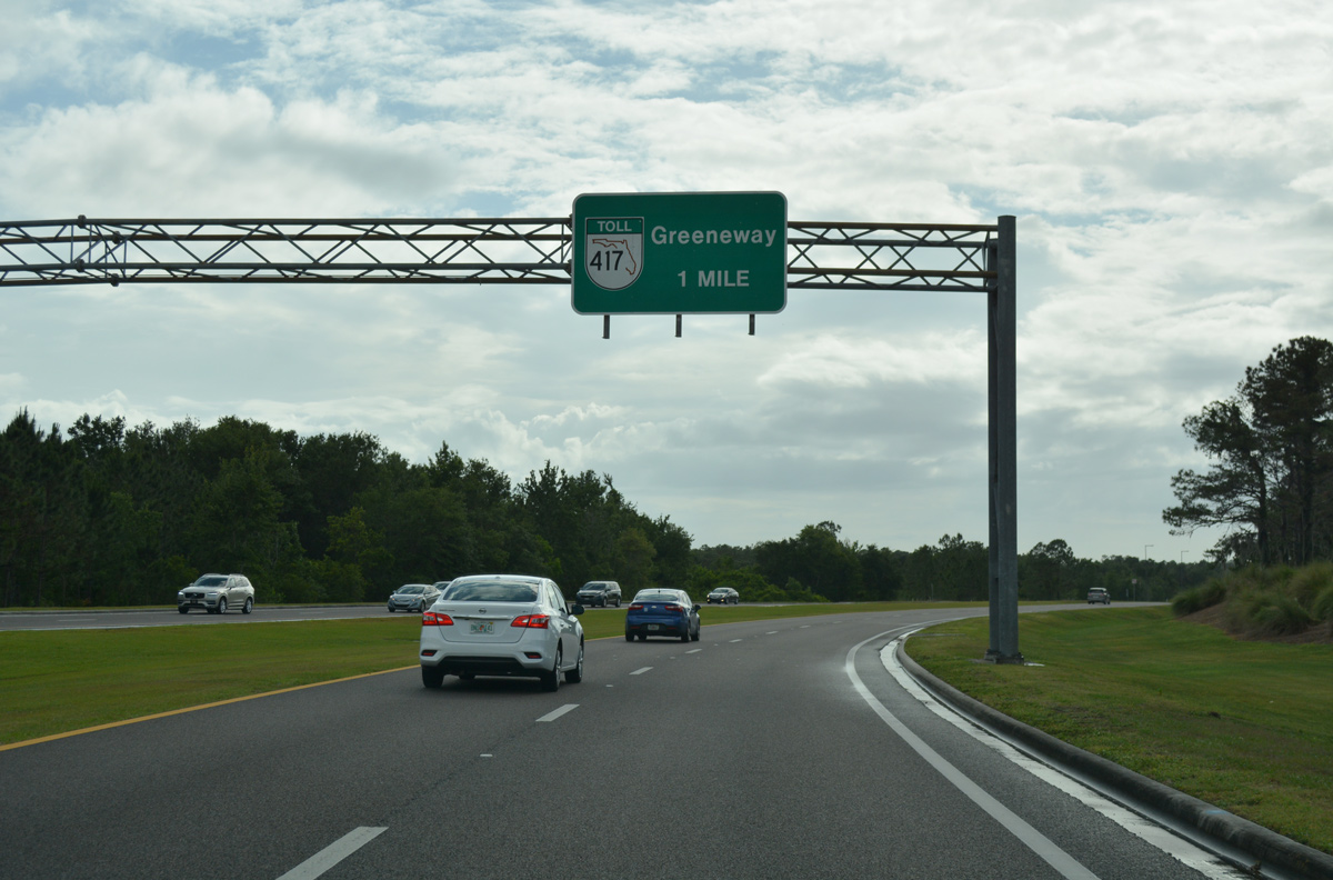
| Osceola Parkway advances one mile west to SR 417 (Central Florida GreeneWay). 05/05/18 |
|
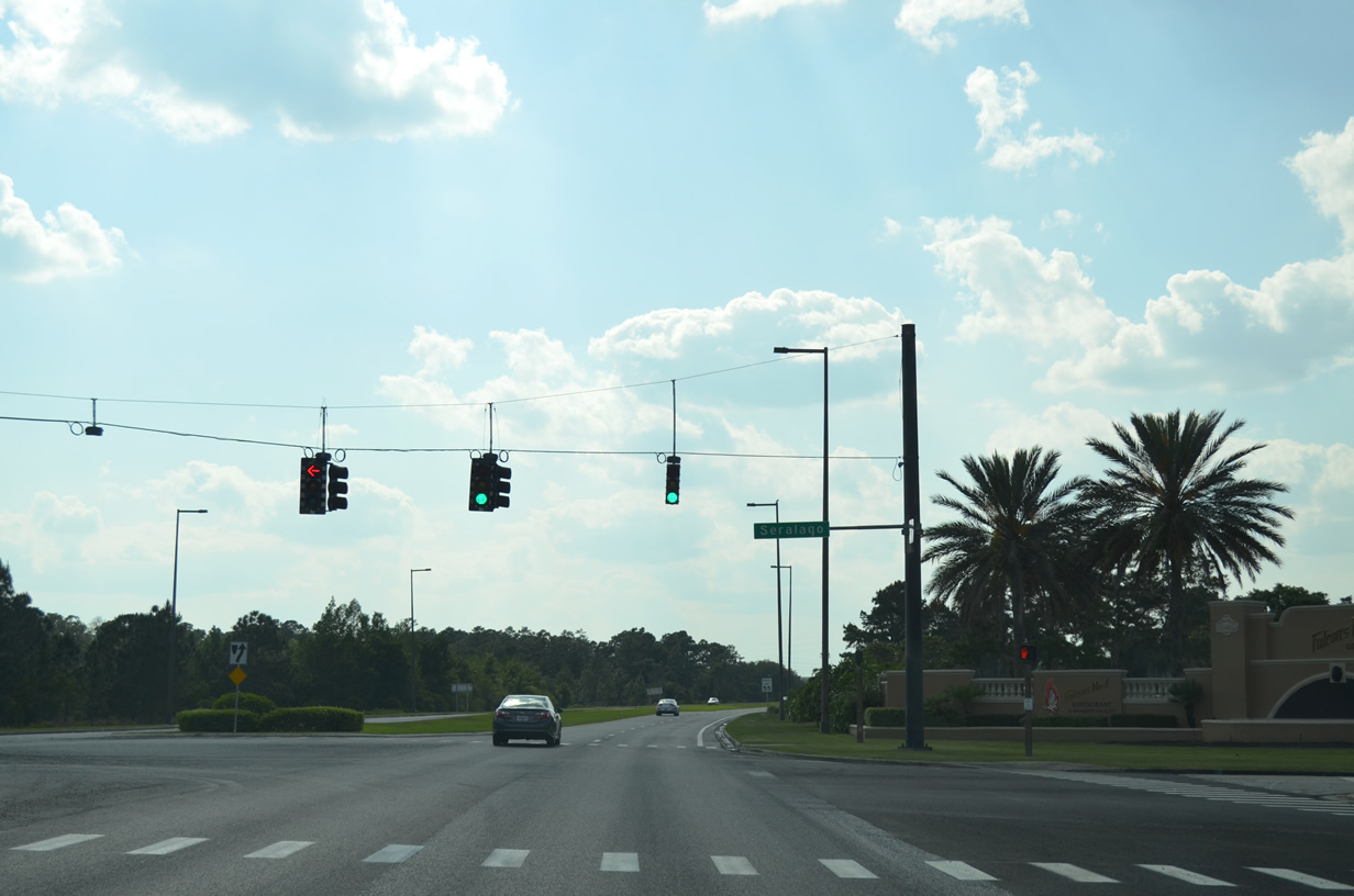
| Forthcoming Seralago Boulevard connects County Road 522 with parallel U.S. 192 (Irlo Bronson Memorial Highway) and the various resorts and attractions lining the east-west thoroughfare. 05/05/18 |
|
| A signal operates on Osceola Parkway at Seralago Boulevard south to U.S. 192. Seralago Boulevard spurs north into Falcons Fire Golf Club. 04/26/14 |
|
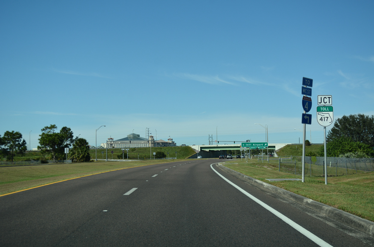
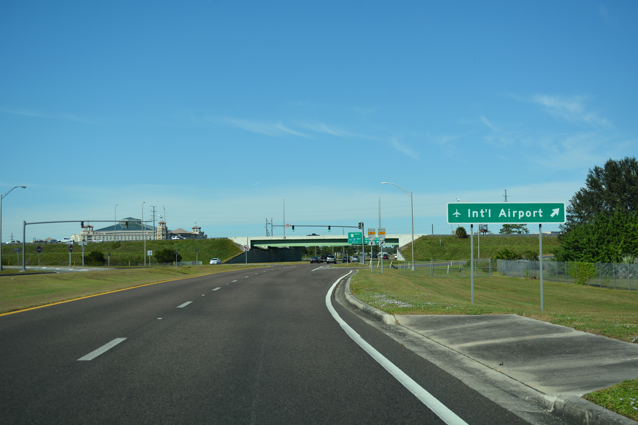
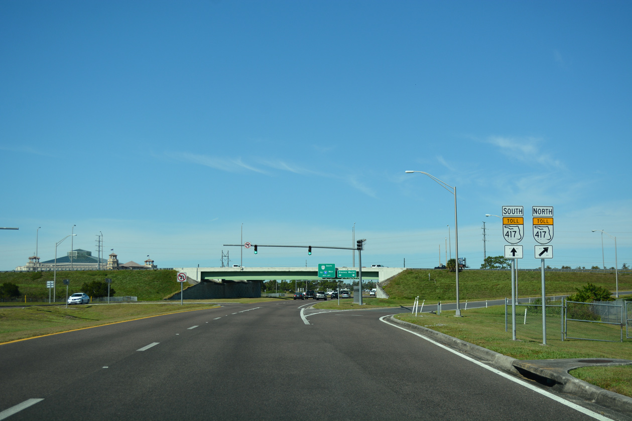
| Osceola Parkway reaches the parclo interchange with SR 417 (Central Florida GreeneWay). The tolled expressway offers drivers an additional alternative to reach Interstate 4 west to Tampa. 11/03/18 |
|
| SR 417 leads east to Orlando International Airport (MCO) and north to the eastern suburbs of the greater Orlando area and Sanford. 11/03/18 |
|
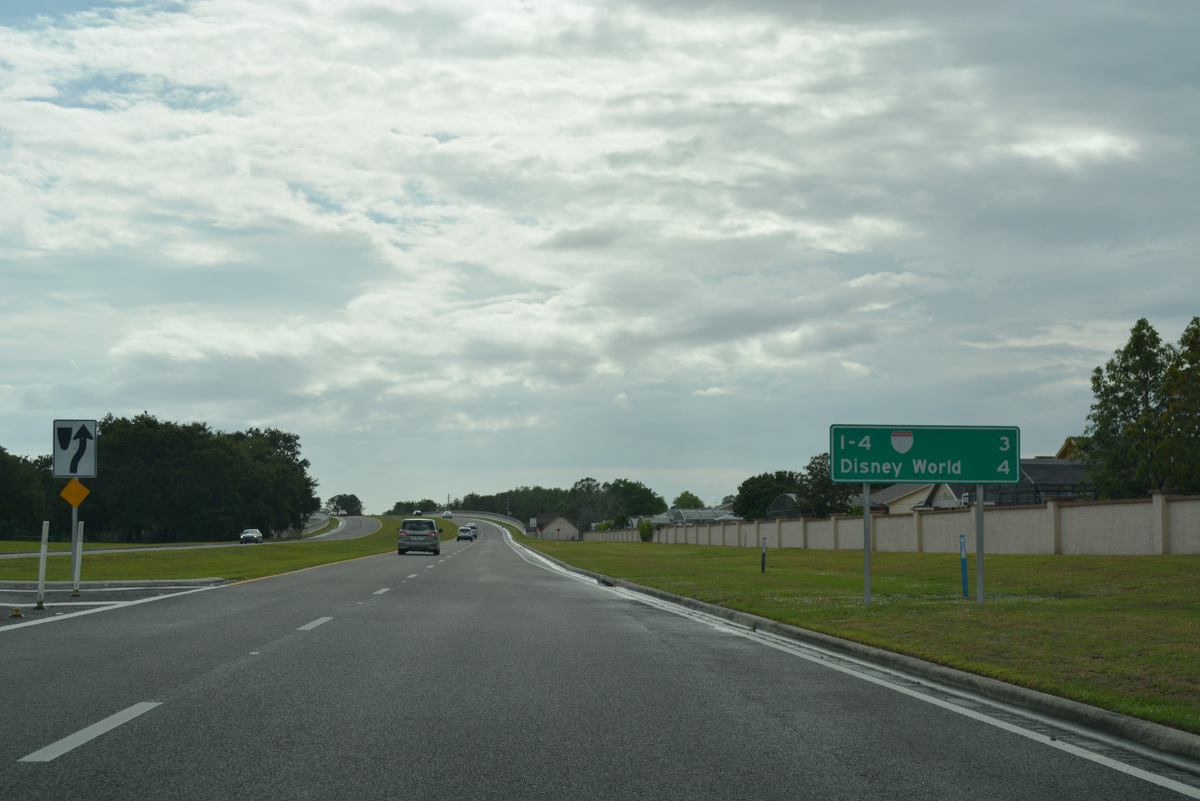
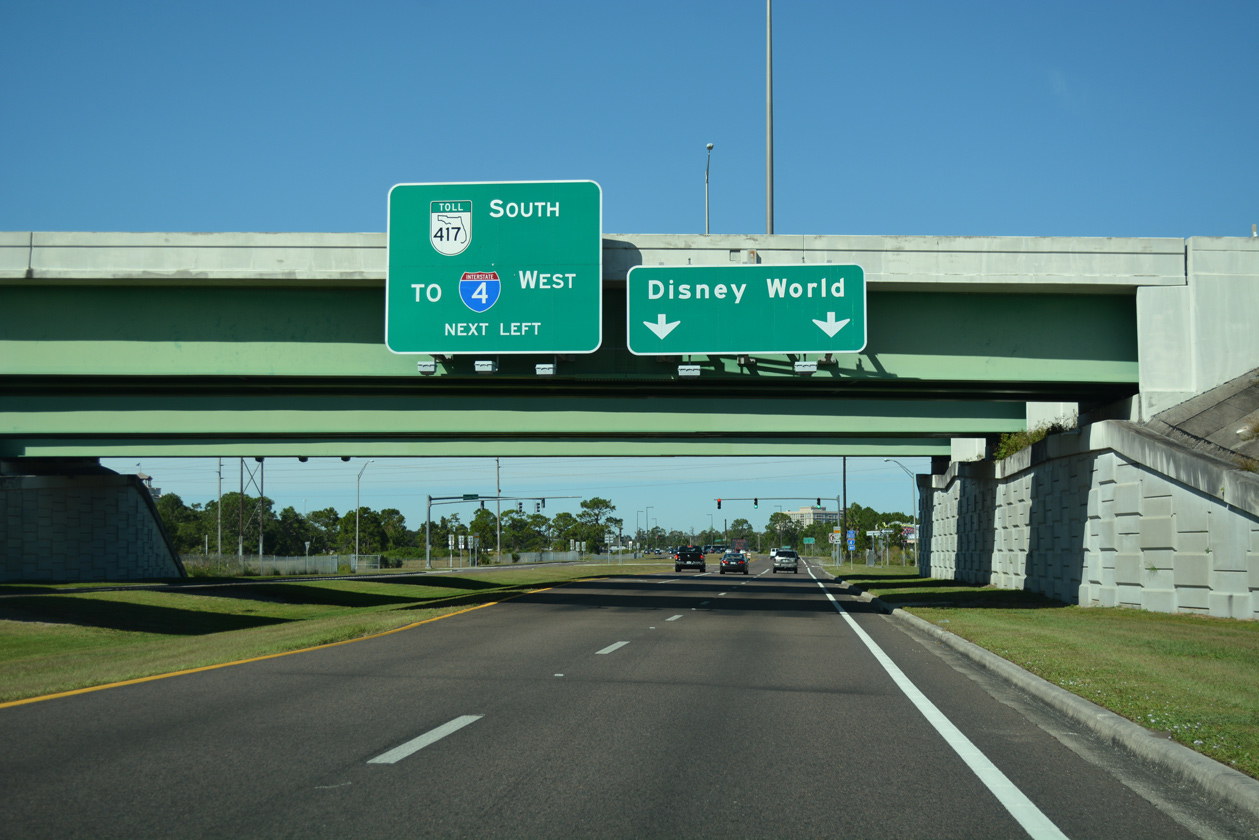
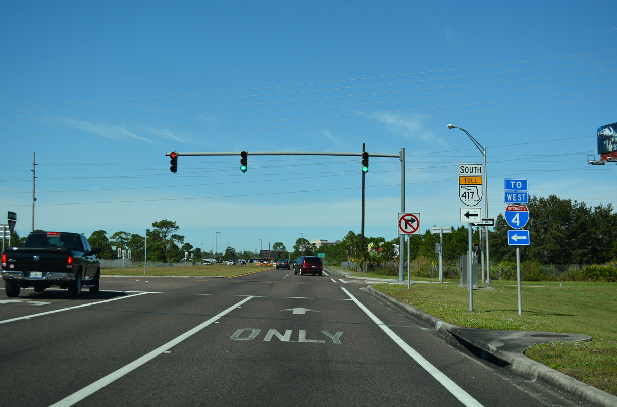
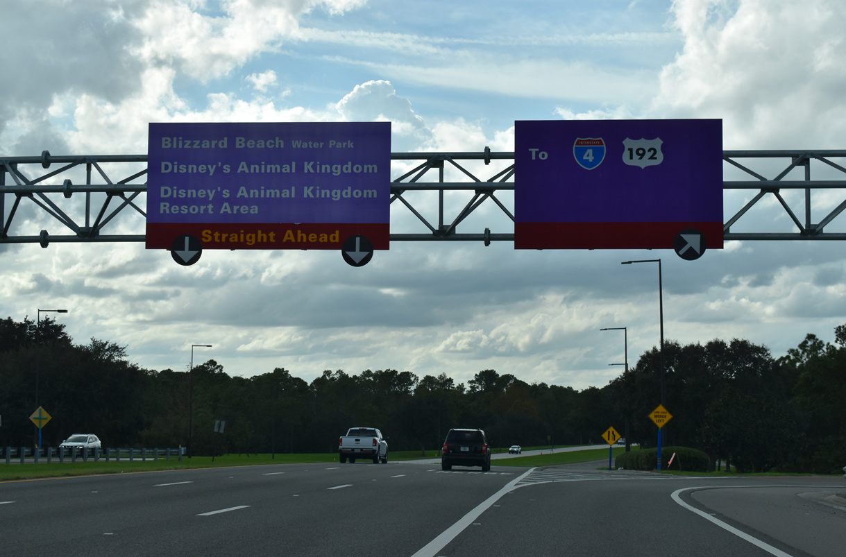
| Passing under the mainlines for the Central Florida GreeneWay, Osceola Parkway progresses west 0.8 miles to meet I-4 directly, and from there into the Disney World Resort. 11/03/18 |
|
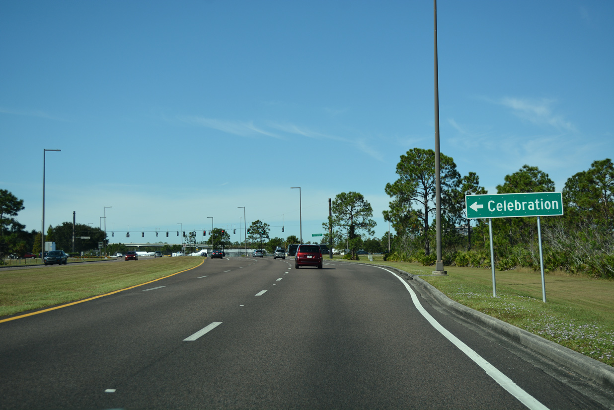
| SR 417 travels 4.9 miles southwest from Osceola Parkway through Celebration to eventually end at I-4 beyond World Drive. 11/03/18 |
|
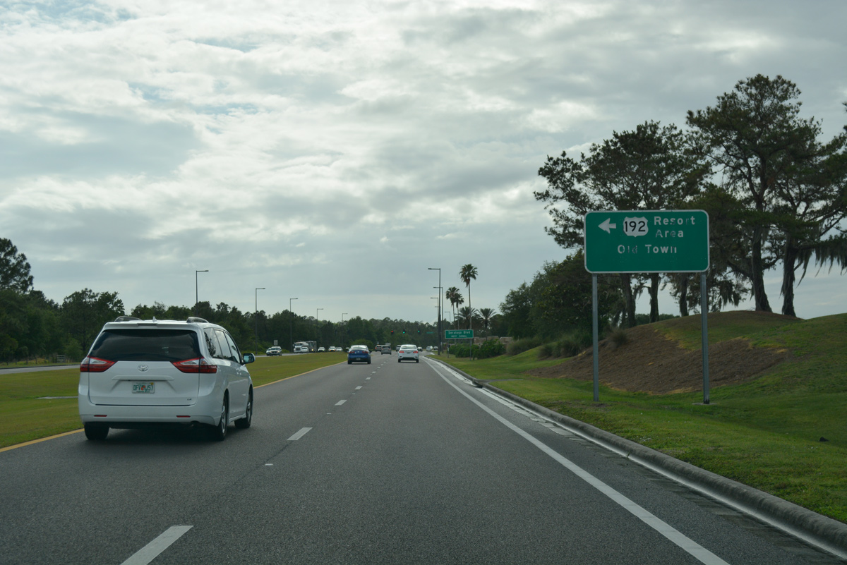
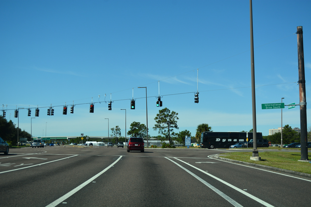
| Situated between the ramps for SR 417 and Interstate 4 is the signalized intersection with International Drive South. International Drive South is an unconnected extension of International Drive arcing southwest from SR 535 (Vineland Road) to U.S. 192 near Old Town amusement park and Celebration. 11/03/18 |
|
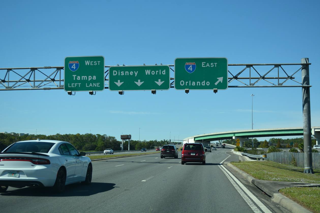
| Osceola Parkway enters a directional cloverleaf interchange with Interstate 4 just west of Gaylord Way. Departing next is the ramp for I-4 eastbound to other area attractions and Orlando. 11/03/18 |
|
| A flyover shuttles motorists from Osceola Parkway east to I-4 east above the traffic signal connecting I-4 east with CR 522 east. 05/03/08 |
|
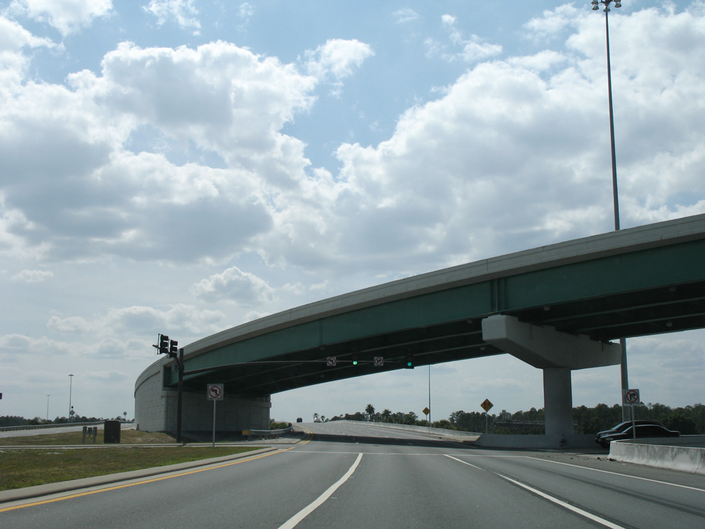
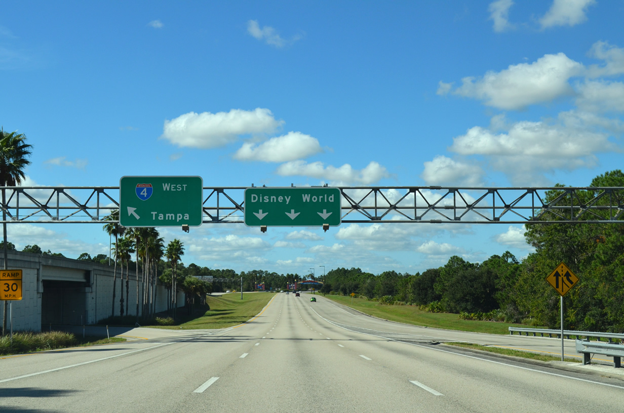
| A left exit slips under Osceola Parkway eastbound for Interstate 4 west to Lakeland and Tampa. Three lanes continue Osceola Parkway west into the Walt Disney World Resort complex. 11/23/13 |
|
| Completion of the interchange along Osceola Parkway at Victory Way in 2019 added a fourth lane westbound lane from I-4 to the new Hollywood Studios flyover ramp. 01/29/22 |
|
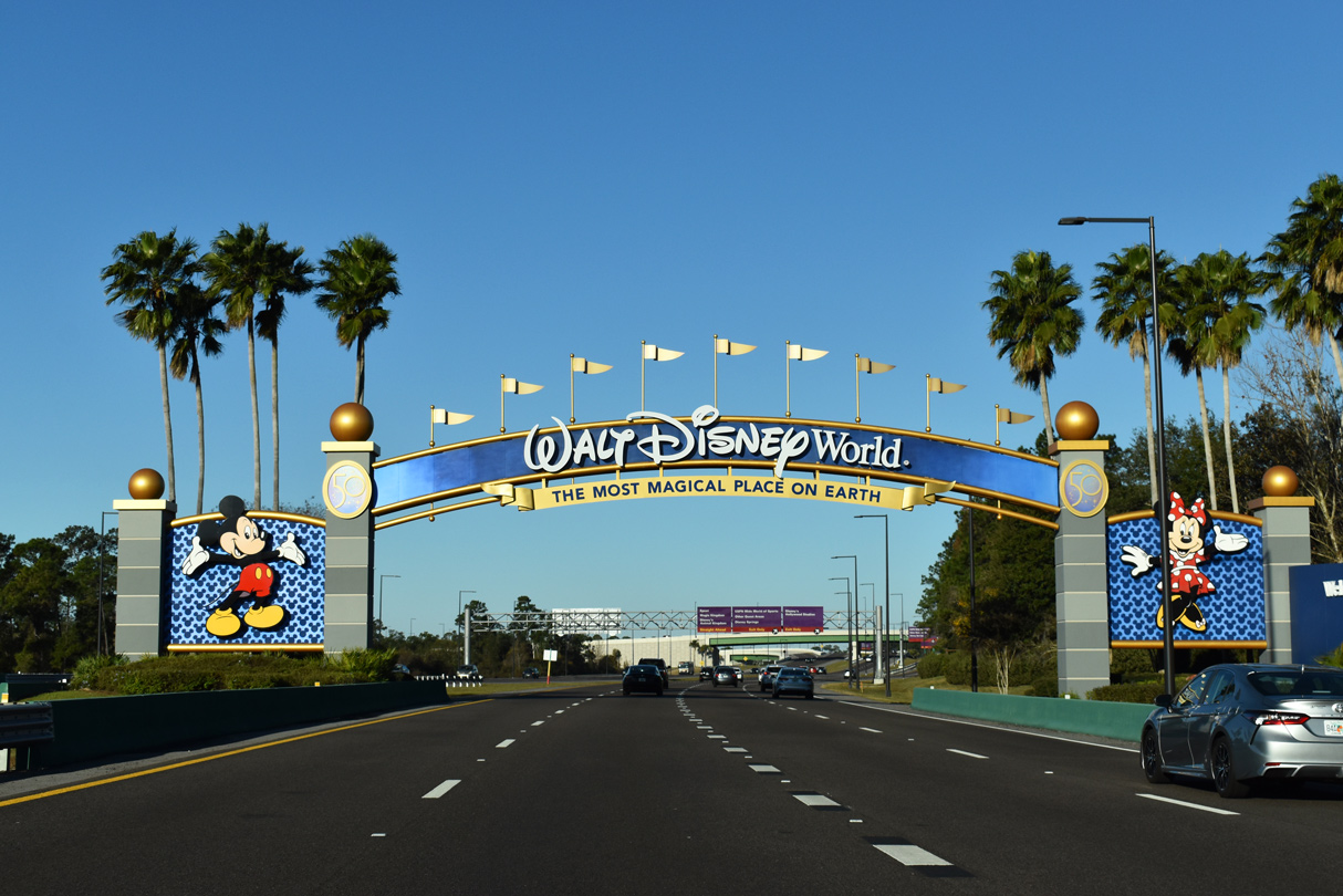
| Motorists drive under the archway entrance of the Walt Disney World Resort along Osceola Parkway west. Identical archways appear at entrance points along Epcot Center Drive west, Western Way east and World Drive north. 01/29/22 |
|
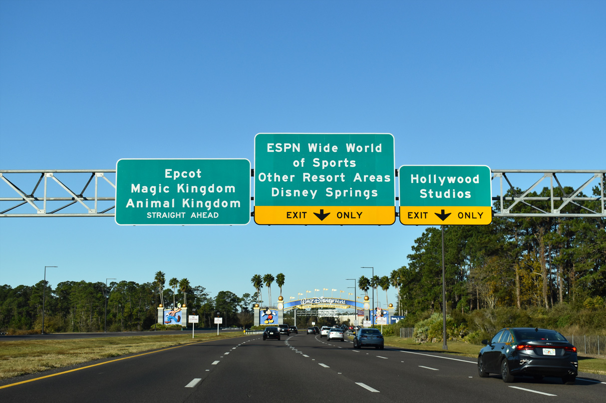
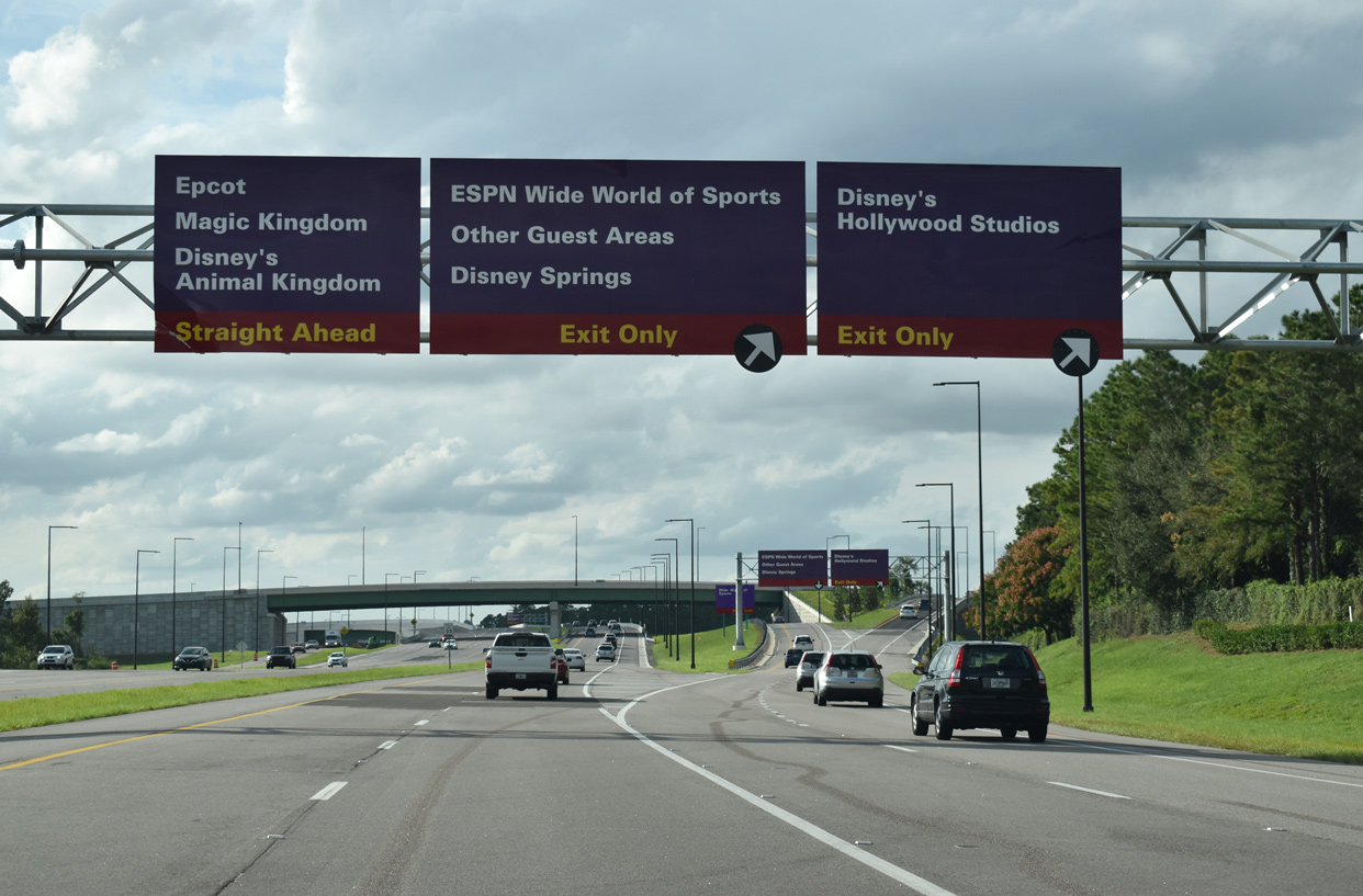
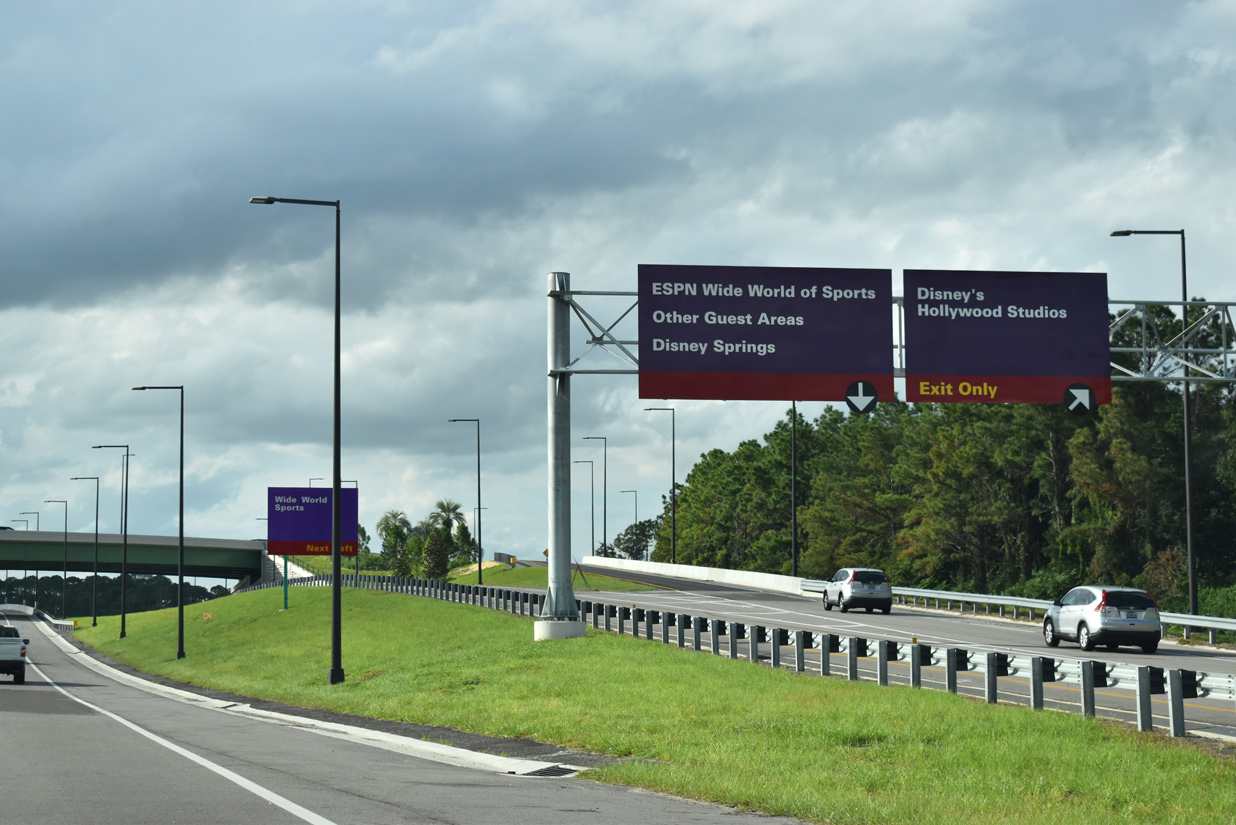
| Victory Way provides guests access to the Wide World of Sports complex and the Disney Springs shopping and entertainment complex. The Wide World of Sports complex is home to the 9,500 seat Champion Stadium, Jostens Center and Hess Fields. 11/02/19 |
|
| The single point interchange at Victory Way and directional ramps for the new entrance Disney's Hollywood Studios replaced a signalized intersection along Osceola Parkway. Victory Way extends north to the Art of Animation and Pop Century resorts. 11/02/19 |
|
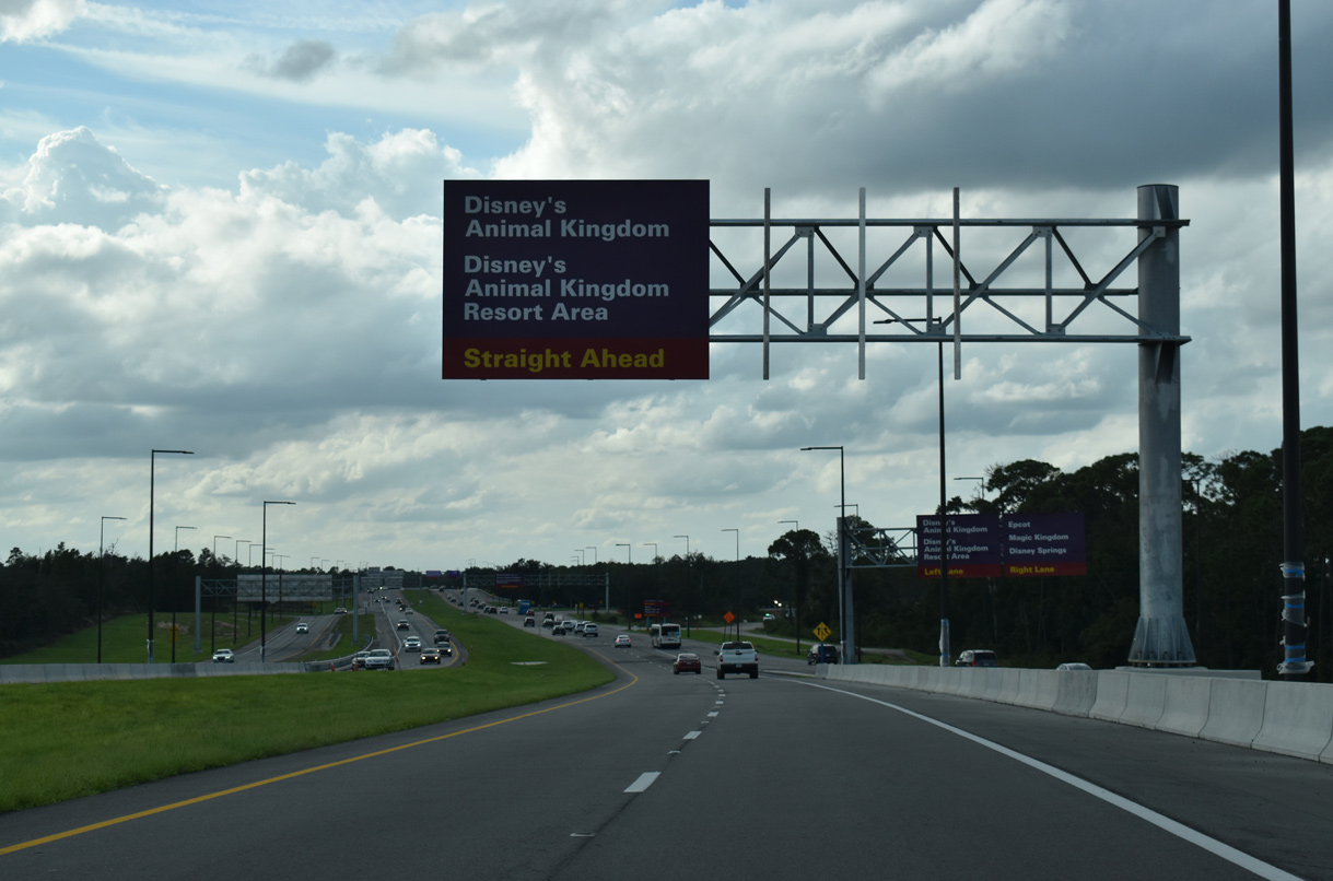
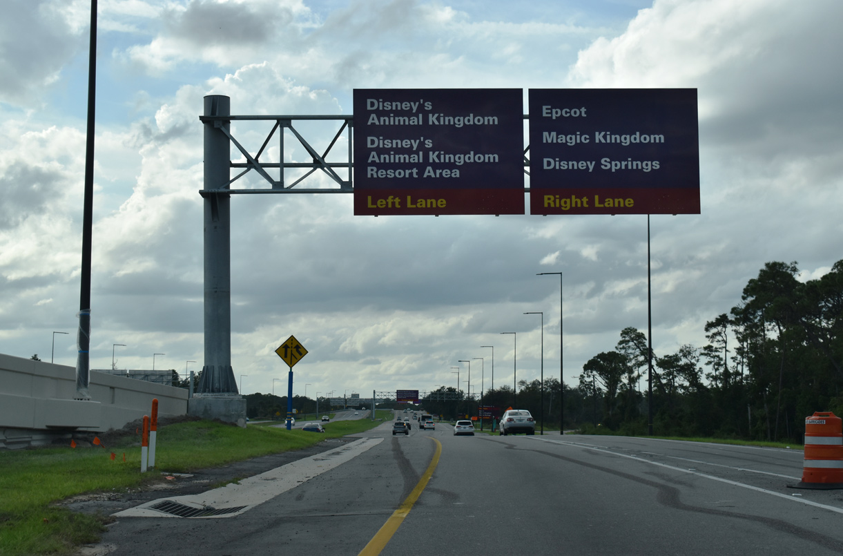
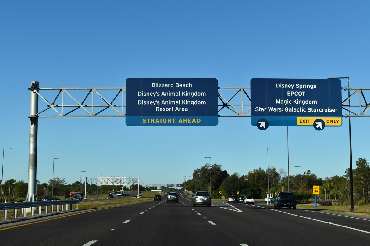
| Osceola Parkway continues westward from Victory Way through the Disney World Resort complex toward the Animal Kingdom resort area, which includes Blizzard Beach Water Park, Animal Kingdom theme park and the Animal Kingdom Lodge. 11/02/19 |
|
| Forthcoming World Drive connects motorists to the remaining theme parks within the Disney World Resort as well as providing an alternative to reach Disney Springs. 11/02/19 |
|
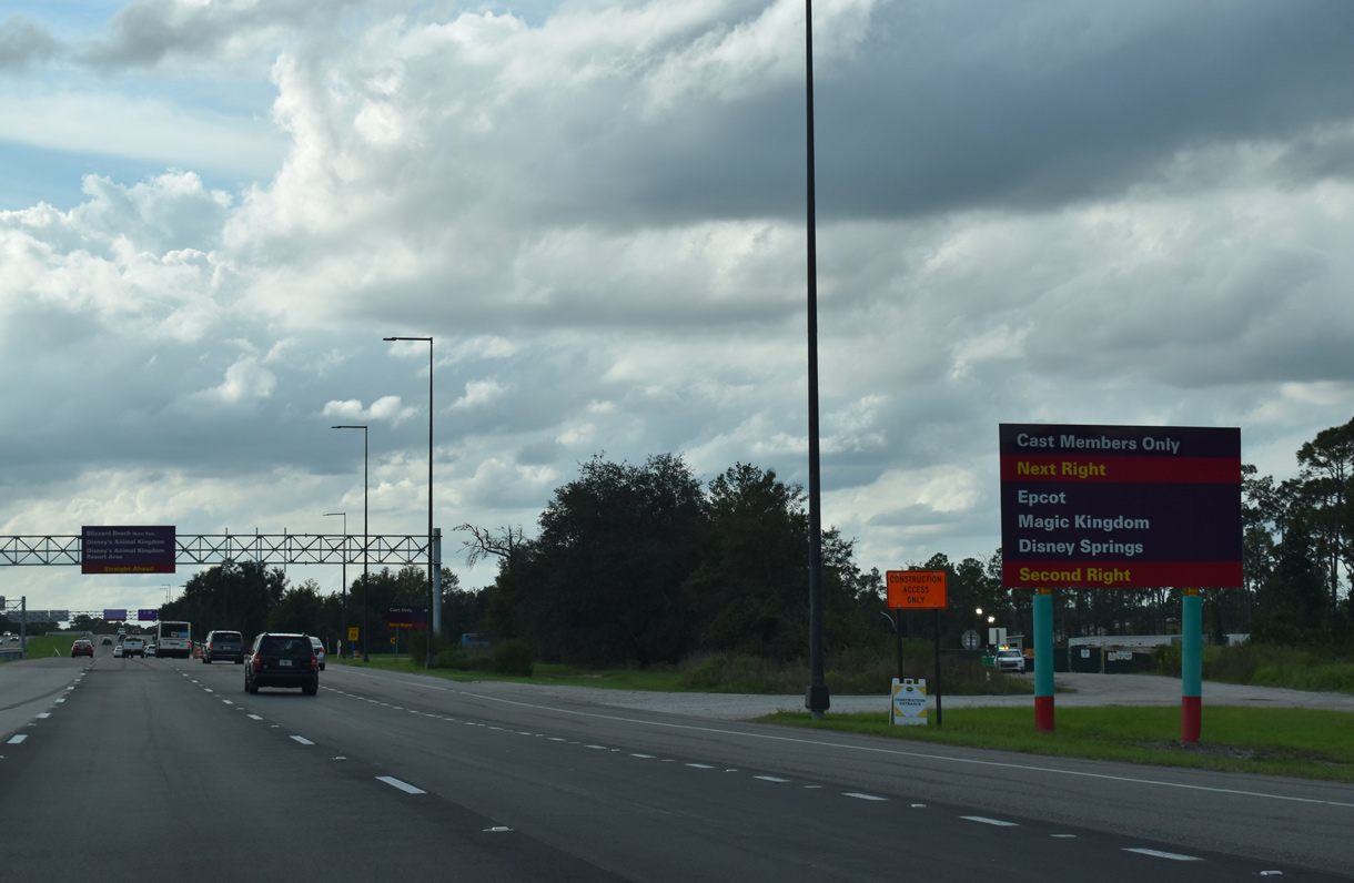
| The previous ramps to Disney's Hollywood Studios from Osceola Parkway and adjacent World Drive were repurposed into a cast member (employee) entrance. 11/02/19 |
|
| A full cloverleaf interchange joins Osceola Parkway with World Drive near the Star Wars: Galactic Starcruiser hotel resort. World Drive extends north to the Magic Kingdom and Disney's Contemporary Resort.
Guide signs throughout the complex are being updated using blue instead of the iconic purple that originated in the 1990's. 01/29/22 |
|
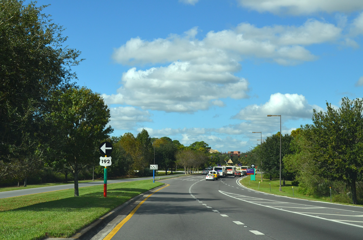
| A loop ramp ties into a c/d roadway along World Drive south ahead of U.S. 192. World Drive joins Walt Disney World with Interstate 4 at Celebration. 11/02/19 |
|
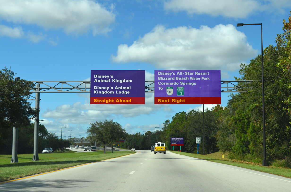
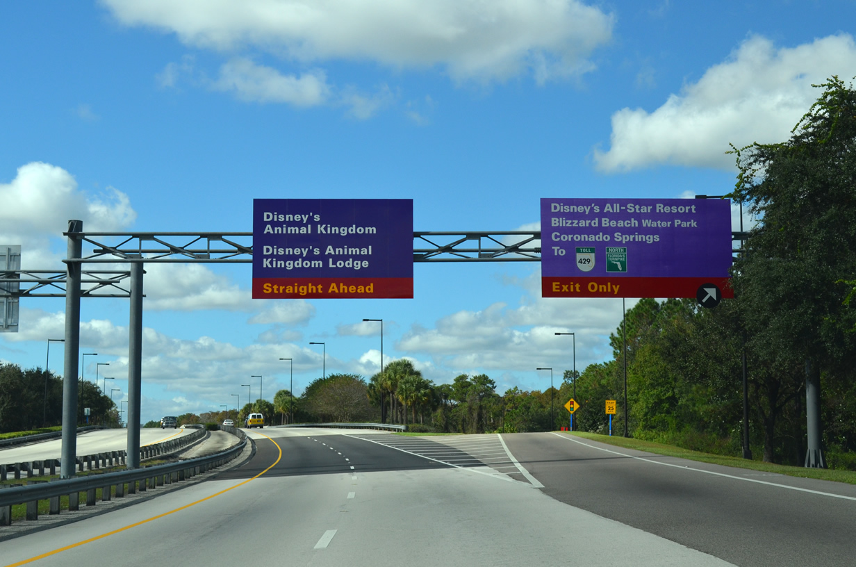
| The upcoming exchange with Buena Vista Drive takes motorists to the All-Star Resort and Coronado Springs. Buena Vista Drive arcs northeast from Osceola Parkway toward Hollywood Studios, various resorts and eventually Disney Springs. 11/23/13 |
|
| Osceola Parkway continues toward the main parking gate for Animal Kingdom theme park and the Animal Kingdom Lodge beyond Buena Vista Drive. Western Way leads northwest from W Buena Vista Drive to SR 429 (Western Beltway). SR 429 runs immediately west of the Disney World Resort complex, connecting with Florida's Turnpike near Winter Garden to the north and I-4 to the south. 11/23/13 |
|
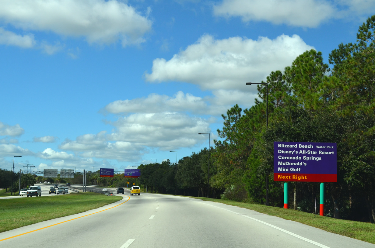
| Buena Vista Drive north leads to Blizzard Beach and the Winter Summerland miniature golf course. Featuring numerous themed buildings based on movies, music and sports, the All-Star Resort lies just south of Osceola Parkway. 11/23/13 |
|
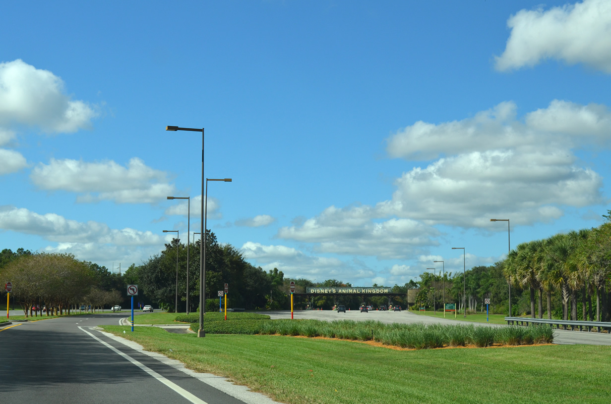
| Crossing Reedy Creek, Osceola Parkway approaches the main parking gate for Animal Kingdom. 11/23/13 |
|
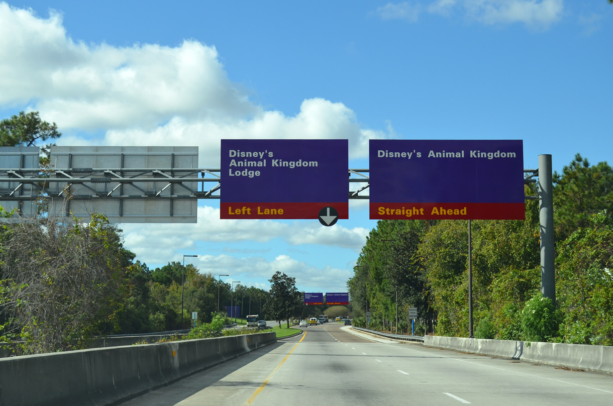
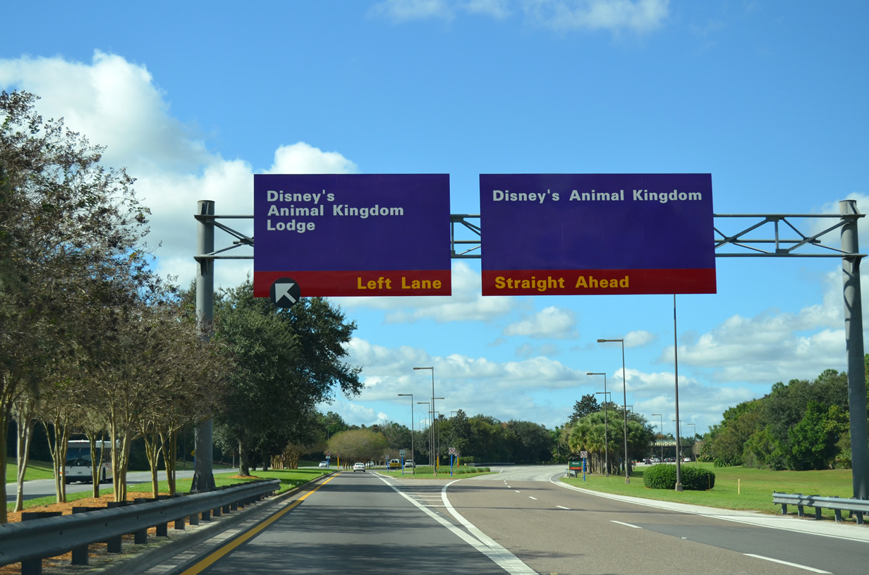
| Two lanes depart for Animal Kingdom theme park as one lane continues toward Sherberth Road and Animal Kingdom Lodge. The fourth and largest amusement park within the Disney World Resort complex, Animal Kingdom opened to guests in 1998 and is themed around animal conservation. 11/23/13 |
|
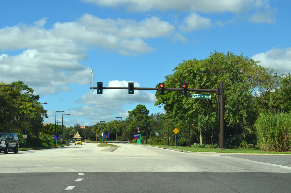
| Osceola Parkway makes its final approach to Sherberth Road. Sherberth Road provides a connection between Osceola Parkway and U.S. 192 south of the Disney World Resort complex. 11/23/13 |
|
| The entrance to Animal Kingdom Lodge lies directly ahead as Sherberth Road heads south from the west end of Osceola Parkway. 11/23/13 |
05/03/08, 12/04/10, 11/23/13, 04/26/14, 07/31/14, 10/01/15, 05/05/18, 11/03/18, 11/02/19, 05/22/20, 01/29/22 by AARoads
Page Updated 05-29-2020.