

Measuring 19.35 miles in length, SR 317 runs across the city of Chattanooga to Collegedale, Apison and southwestern Bradley County. Split into two segments, the western 4.78 mile branch follows Bonny Oaks Drive east from SR 17 between the Ashwood and Cherokee Woods neighborhoods in Chattanooga to U.S. 11/64 (Lee Highway) at Silverdale. An implied 1.51 mile long overlap with I-75/U.S. 11-64 joins SR 317 on Bonny Oaks Drive with the eastern leg along Apison Pike. SR 317 continues from Summit along Apison Pike to Southern Adventist University, Collegedale Municipal Airport and across Pine Hill Ridge. The state route dog legs north along Tunnel Hill Road and Weatherly Switch Road from Lebanon Ridge tp o Maroon Gap across Lead Mine Ridge. SR 317 concludes east of Weatherly Switch and Red Clay Ridge at SR 60 (Dalton Pike).
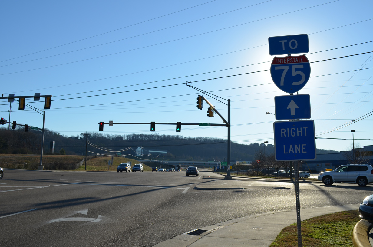
SR 317 (Bonny Oaks Drive) ties into U.S. 11/64 (Lee Highway) 0.20 miles from a six-ramp parclo interchange with Interstate 75.
01/20/13
U.S. 11/64 (Lee Highway) to the parallel I-75 southwest from SR 317 at Silverdale to Hickory Valley and the Shepherd community.
01/20/13
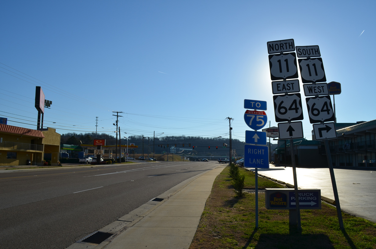
U.S. 11/64 overtake Bonny Oaks Drive 0.20 miles from SR 317 at Lee Highway to join I-75 northbound.
01/20/13
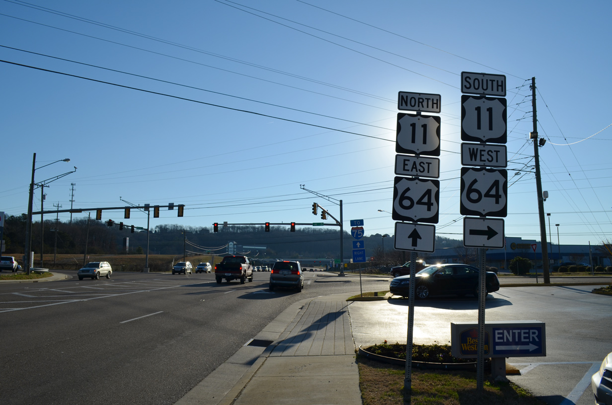
U.S. 11/64 separate from I-75 south and follow Bonny Oaks Drive 0.20 miles west to SR 317 at Lee Highway.
01/20/13
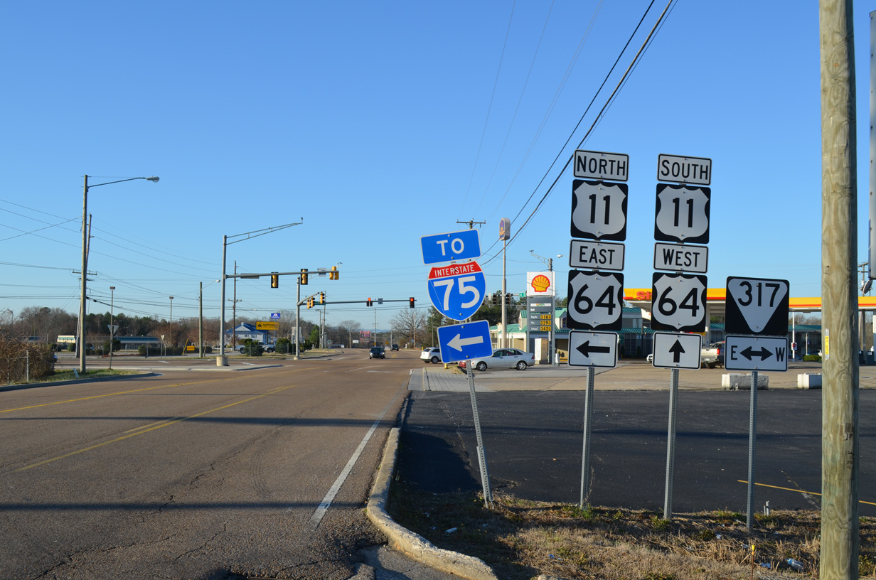
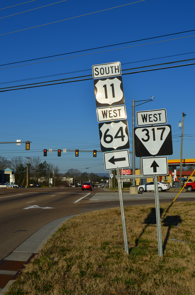
Lee Highway south at SR 317 and the southward turn of U.S. 11/64 from Bonny Oaks Drive.
01/20/13
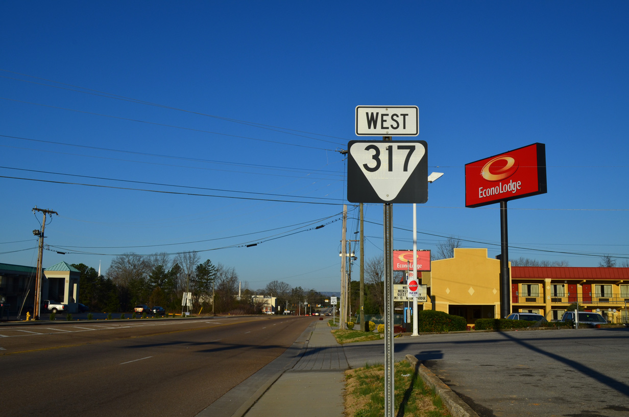
SR 317 extends Bonny Oaks Drive west from U.S. 11/64 (Lee Highway) at Silverdale.
01/20/13
Photo Credits:
01/20/13 by AARoads
Connect with:
Interstate 75
U.S. 11
U.S. 64
Page Updated 08-21-2020.