
An overview of the roads and freeways serving the Tri-Cities of Washington.
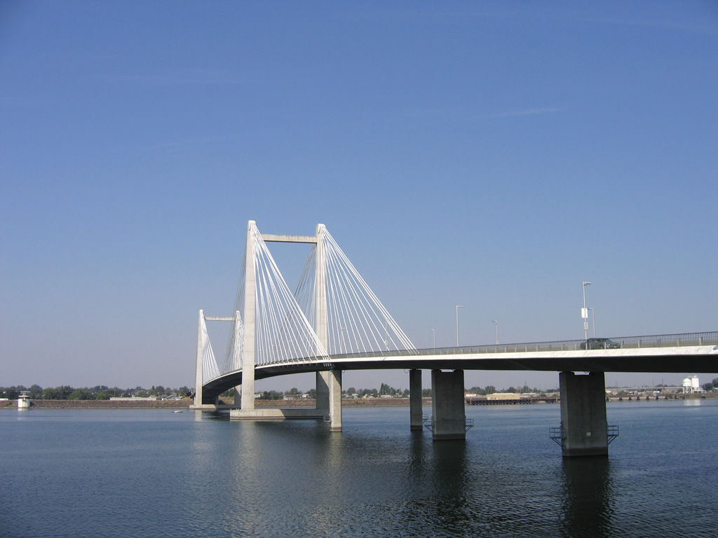
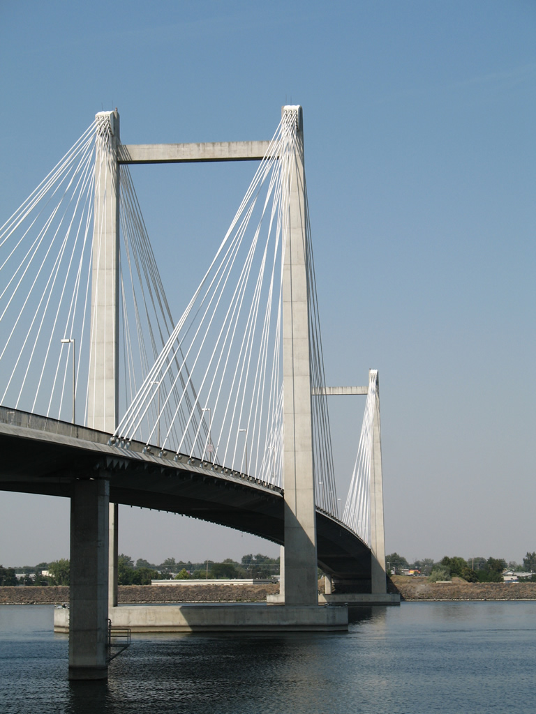
Washington State Route 397 spans the Columbia River across the Ed Hendler Bridge. Locally known as the Cable Bridge, the span was the second largest concrete cable-stayed bridge in the world. 08/28/06
Interstates

Guides:
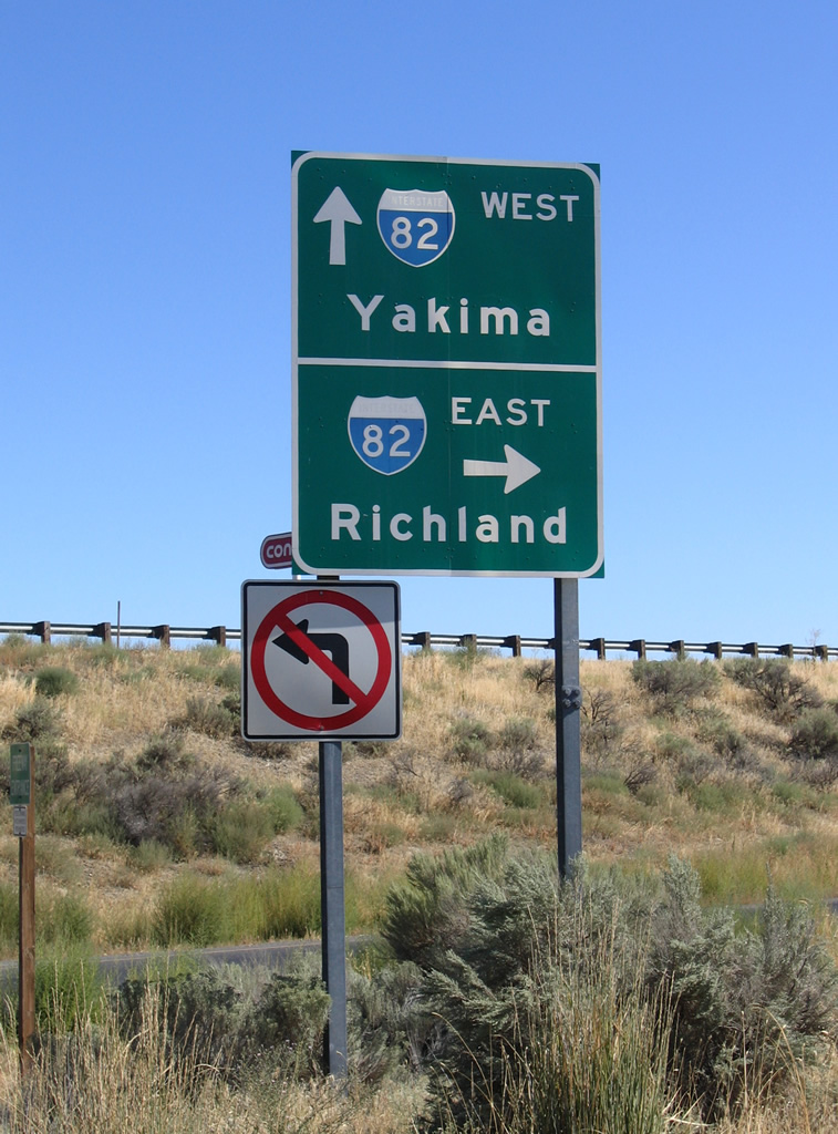
Interstate 82
Interstate 82 was originally touted to run through Richland and Pasco of the Tri-Cities and along the east side of the Columbia River to Wallula. Changes were made in July 1969 to route the freeway west of the area en route to Umatilla, Oregon with the provision that the Tri-Cities be joined with I-82 via a freeway spur (Interstate 182).
Today Interstate 82 remains vastly rural, carrying four lanes from Horse Heaven Hills to Benton City and Kiona on the western outskirts of Kennewick and Richland. U.S. 395 and U.S. 12 share stretches of the freeway.

Guides:
Interstate 182
Interstate 182 travels 15.19 miles from Interstate 82 at Goose Gap through Richland and Kennewick. The freeway doubles as U.S. 12 for its entire length. Completed in 1986, the route provides a high-speed route to Yakima Valley from the Tri-Cities.
U.S. Highways

Guides:
U.S. 12
U.S. 12 follows all of Interstate 82 east from Yakima to Interstate 182 at Goose Gap. Interstate 182 dually carries U.S. 12 signage through Richland and Pasco, with U.S. 12 joining its original alignment from Lewis Street southeast to Burbank, Attalia Station and Wallula.
The surface route of U.S. 12 utilized Lewis Street west to 10th Avenue and the Green Bridge across the Columbia River. Turning westward through Downtown Kennewick, U.S. 12 used Columbia Drive to Columbia Park Trail and Kennedy Road west. When Interstate 182 was completed by 1986, U.S. 12 was relocated to share pavement with the freeway.
Green Bridge
The Green Bridge, otherwise known as the Benton-Franklin Inter-County Bridge, opened on October 21, 1922 with private funding. The 23-foot wide span doubled as the Yellowstone Trail and was tolled until June 1931. U.S. 410 utilized the span until 1967 and U.S. 12 from 1967 until it closed on September 16, 1978, when the adjacent Cable Bridge was completed. The bridge sat unused for ten years until its demolition.

Historic U.S. 410
U.S. 410 was replaced wholly through the Tri-Cities in 1967 with the western extension of U.S. 12 to the Pacific coast. The route utilized the U.S. 12 path along the Columbia River with U.S. 395 from Wallula to the Green Bridge between Pasco and Kennewick. The SR 240 freeway from Columbia Drive in Kennewick to Richland carried U.S. 410 to Columbia Park Trail and Kennedy Road through West Richland and Benton City.

Guides:
U.S. 395
U.S. 395 follows Interstate 82 north from Umatilla, Oregon to Exit 113 at Kennewick. Turning northeast, the US Route follows a four-lane arterial through to the Blue Bridge across the Columbia River into Pasco. A brief overlap with Interstate 182 & U.S. 12 connects the U.S. 395 freeway from the Blue Bridge with the expressway leading northeast to Ritzville.
Historically, U.S. 395 shared pavement with U.S. 410 / 12 along the east side of the Columbia River from Wallula northward to Lewis Street in Pasco. Following North 4th Avenue, U.S. 395 joined Oregon Street for an exit of Pasco. When Interstate 82 was completed in 1985, U.S. 395 shifted from the eastern alignment to an overlap with the freeway and current alignment.
State Routes


Guides:
State Routes 12 / 14
SR 12 began in Kennewick and ran southward to Plymouth and westward along the Columbia River to U.S. 97 at Maryhill. The state route was renumbered to SR 14 when U.S. 12 was extended west over U.S. 410 in 1967. SR 12 utilized Bofer Canyon Road north over Horse Heaven Hills to Southridge Boulevard and Union Street through south Kennewick. Completion of Interstate 82 overtook the original SR 14 alignment, resulting in the truncation of route to Exit 131 near Plymouth.

State Route 224
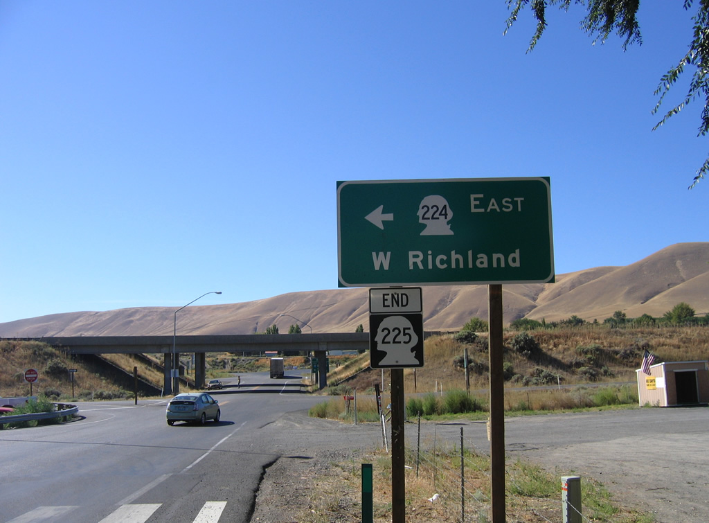
Washington State Route 224 was commissioned in January 1964 from U.S. 410 near Kiona to SR 240 at West Richland. The south end of the route was extended by 1973 over former U.S. 410 and U.S. 12 to Interstate 82 at Exit 96.1
| SR 224 east |
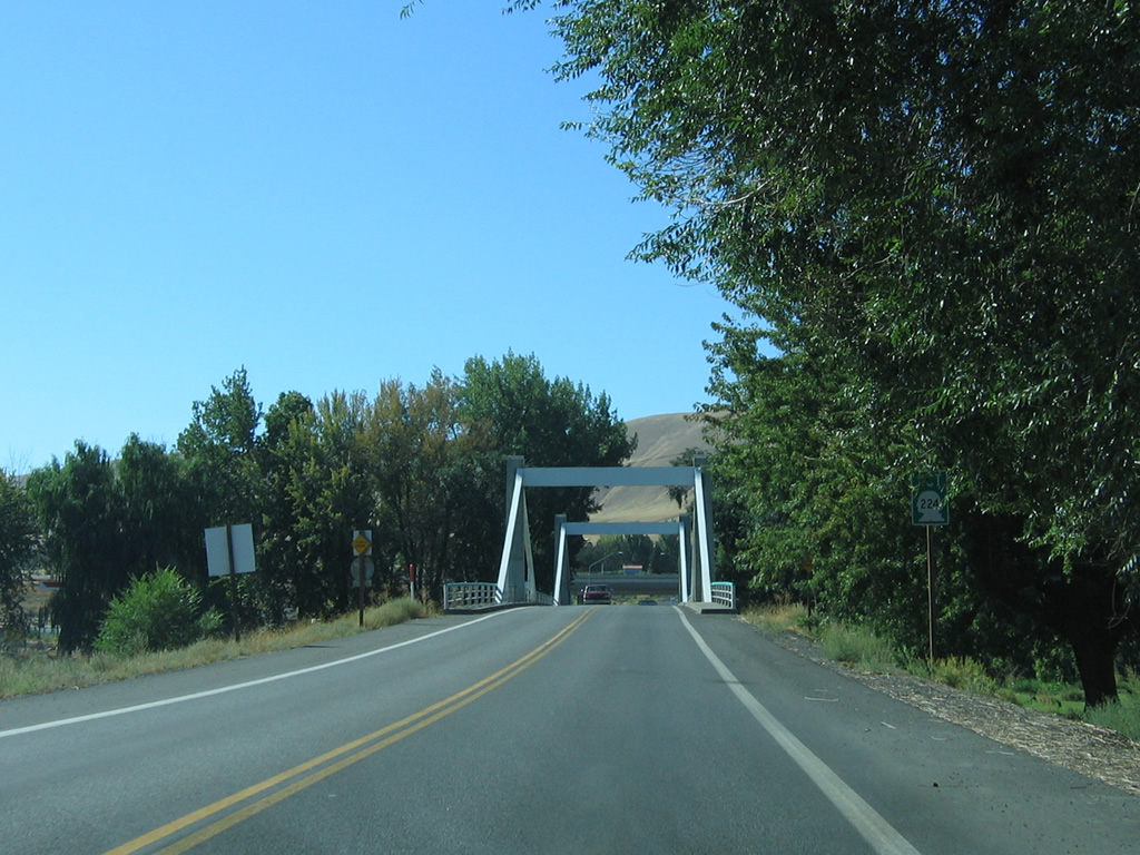
  | Webber Canyon Road ties into the Exit 96 diamond interchange of I-82/U.S. 12 at Benton City to form the eastbound beginning of SR 224. 08/31/06 |
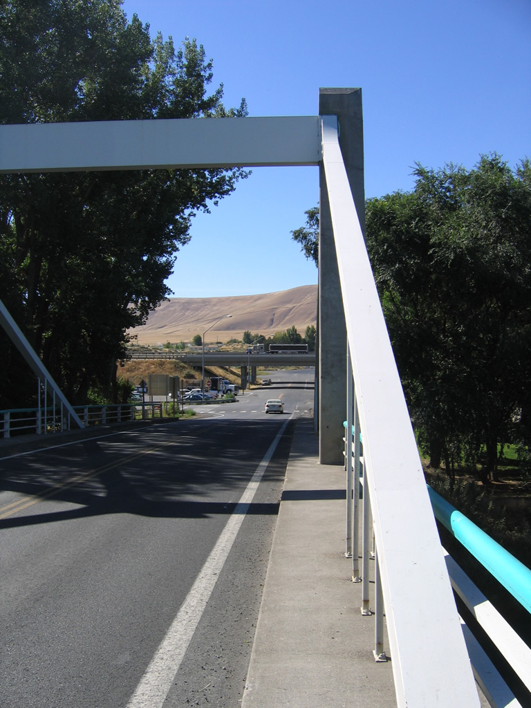
 | SR 224 (1st Street) passes under I-82/U.S. 12 and reaches the westbound on-ramp to Yakima Valley. 08/31/06 |
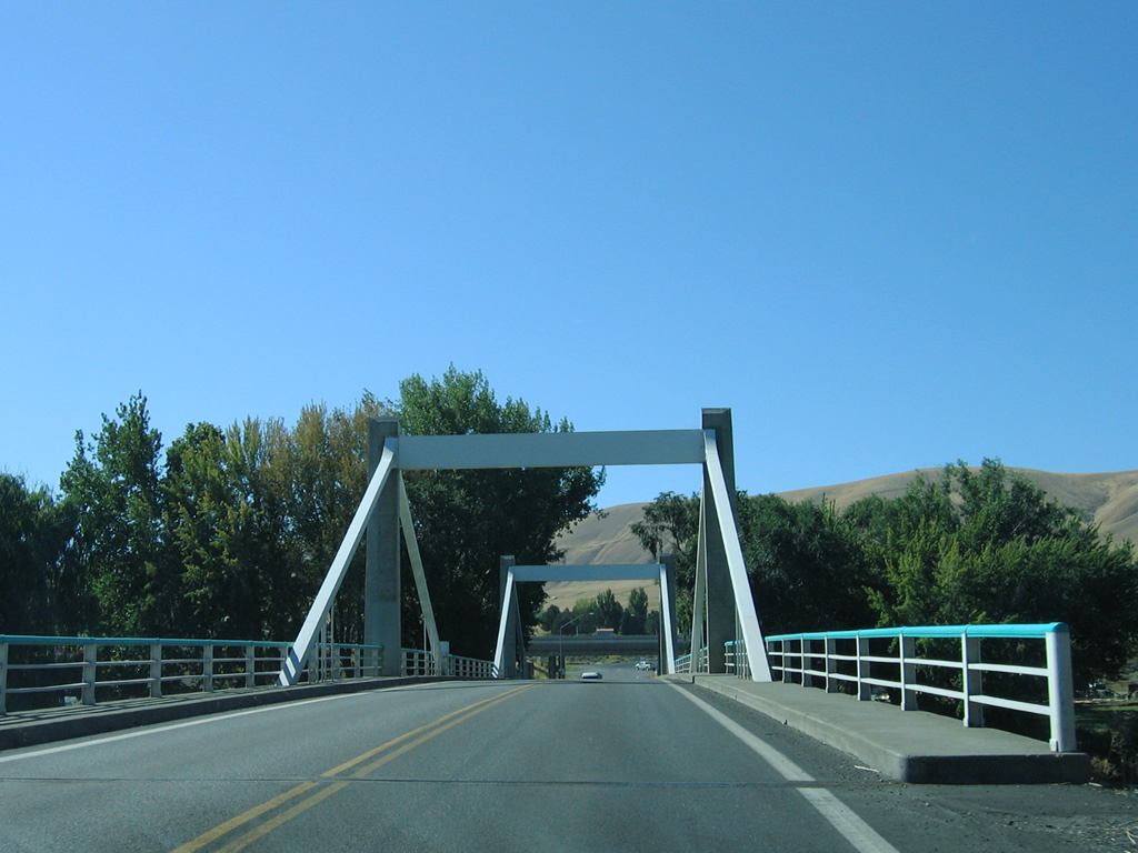
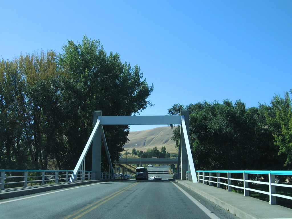
 | Adjacent to Interstate 82 is the split of SR 225 (1st Street) north from SR 224 (Kennedy Road) east. SR 224 continues 10.06 miles east to West Richland and SR 240 in Richland. 08/31/06 |
| SR 224 west |
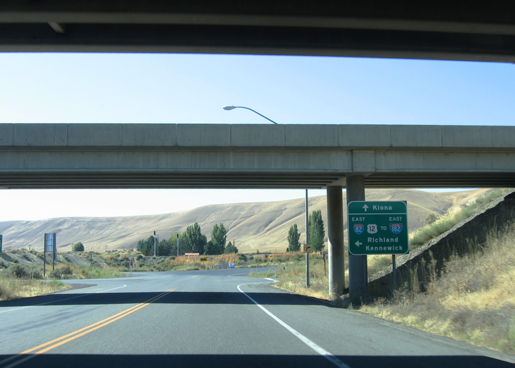 | SR 224 overtakes SR 225 along 1st Street in Benton City and quickly ends at the eastbound on-ramp to I-82/U.S. 12. Weber Canyon Road begins and ascends Horse Heaven Hills. 08/31/06 |

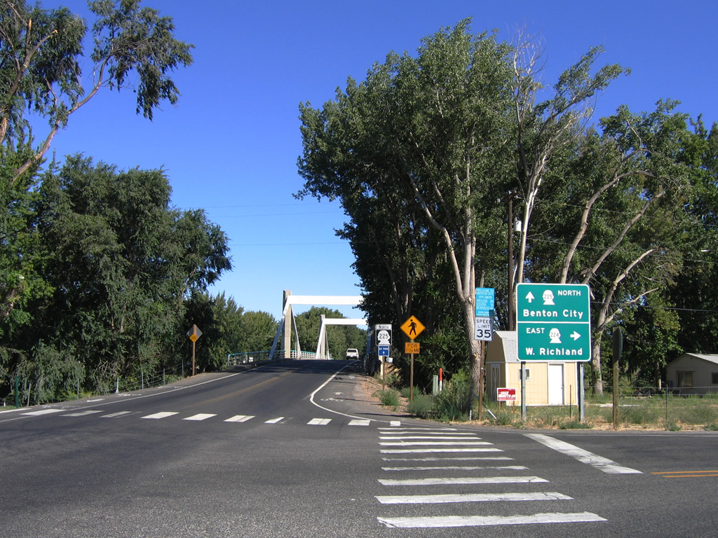
State Route 225
Washington State Route 225 travels 11.32 miles from SR 224 in Benton City to SR 240 at Horn Rapids. The state route was commissioned in 1992.2
| SR 225 north |
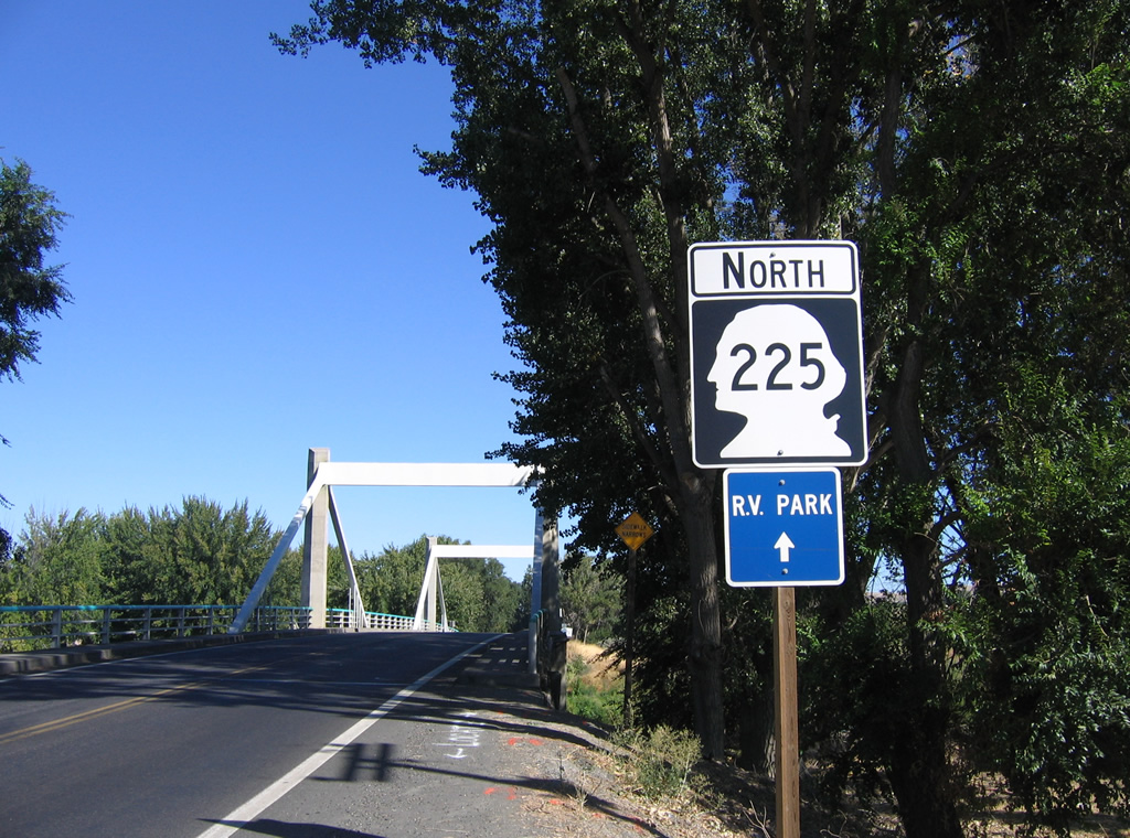 | The first shield of SR 225 resides just beyond the split with SR 224 (Kennedy Road). 08/31/06 |
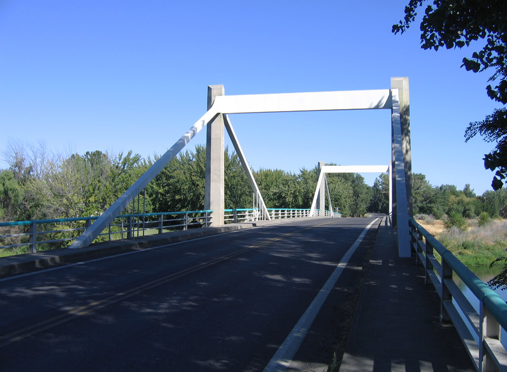  | SR 225 (1st Street) spans the Yakima River on the Benton City - Kiona Bridge. The 400 foot long steel box girder bridge opened in 1957 and is on the National Register of Historic Places. 08/31/06 |
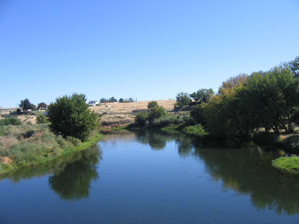 | Facing east from the Benton City - Kiona Bridge over the Yakima River. SR 224 travels just above the east banks of the waterway. 08/31/06 |
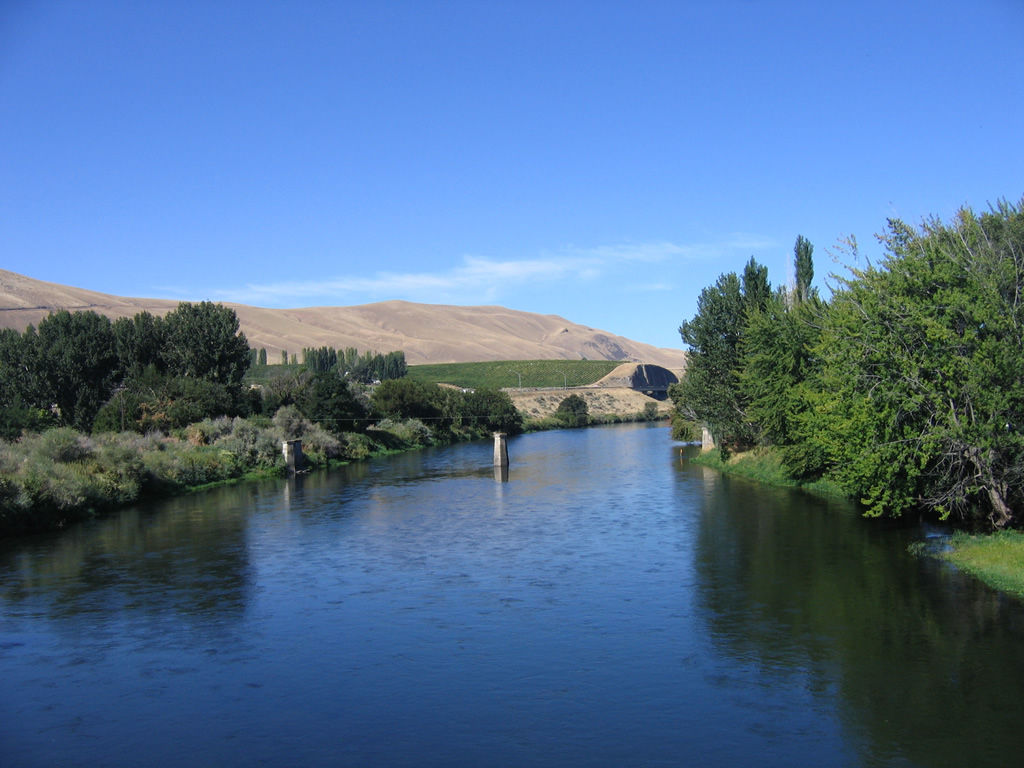 | Remnant bridge supports remain in place just west of the SR 225 Yakima River span. A cut reveals the path of I-82/U.S. 12 beyond the river bend. 08/31/06 |
| SR 225 south |
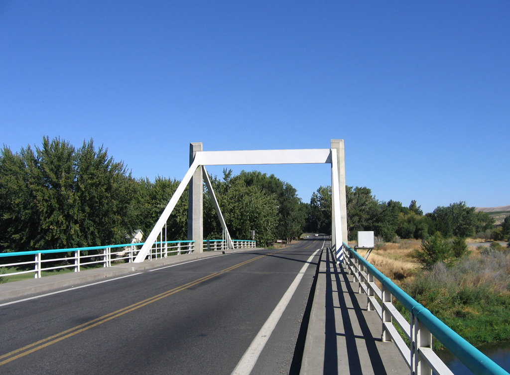
 | SR 225 (1st Street) approaches both the Benton City - Kiona Bridge and SR 224 (Kennedy Road). 08/31/06 |
   | A steel box girder bridge carries SR 225 motorists across the Yakima River. The 400' span opened to traffic in 1957. 08/31/06 |
 | SR 225 ends at the SR 224 turn from Kennedy Road onto 1st Street adjacent to I-82/U.S. 12 (Exit 96). SR 224 joins Benton City with West Richland and Richland on a 10 mile course. 08/31/06 |

State Route 240
Designated in 1964, SR 240 joins the Tri-Cities with Hanford Reservation and SR 24 at West Hanford Gate. Completion of Interstate 182 through Richland resulted in a relocation of SR 240 to follow the freeway between Exits 4 and 5. The state route was extended with the relocation of U.S. 12 onto I-182, following the former U.S. 12 freeway to U.S. 395 in Kennewick.3

State Route 397
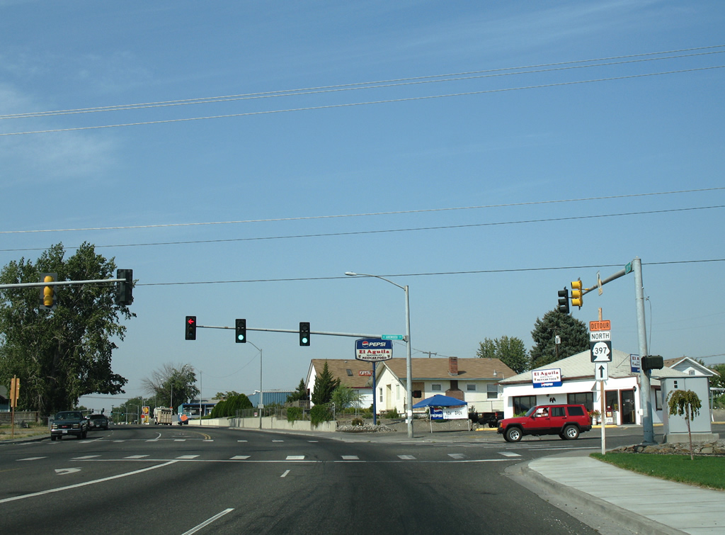
SR 397 originally ran from Pasco southeast to Finley, a route first signed in 1992. The route was extended westward in July 2009 over the I-82 to SR 397 Intertie roadway completed in October 2008 between Finley and Exit 114.4
| SR 397 north |
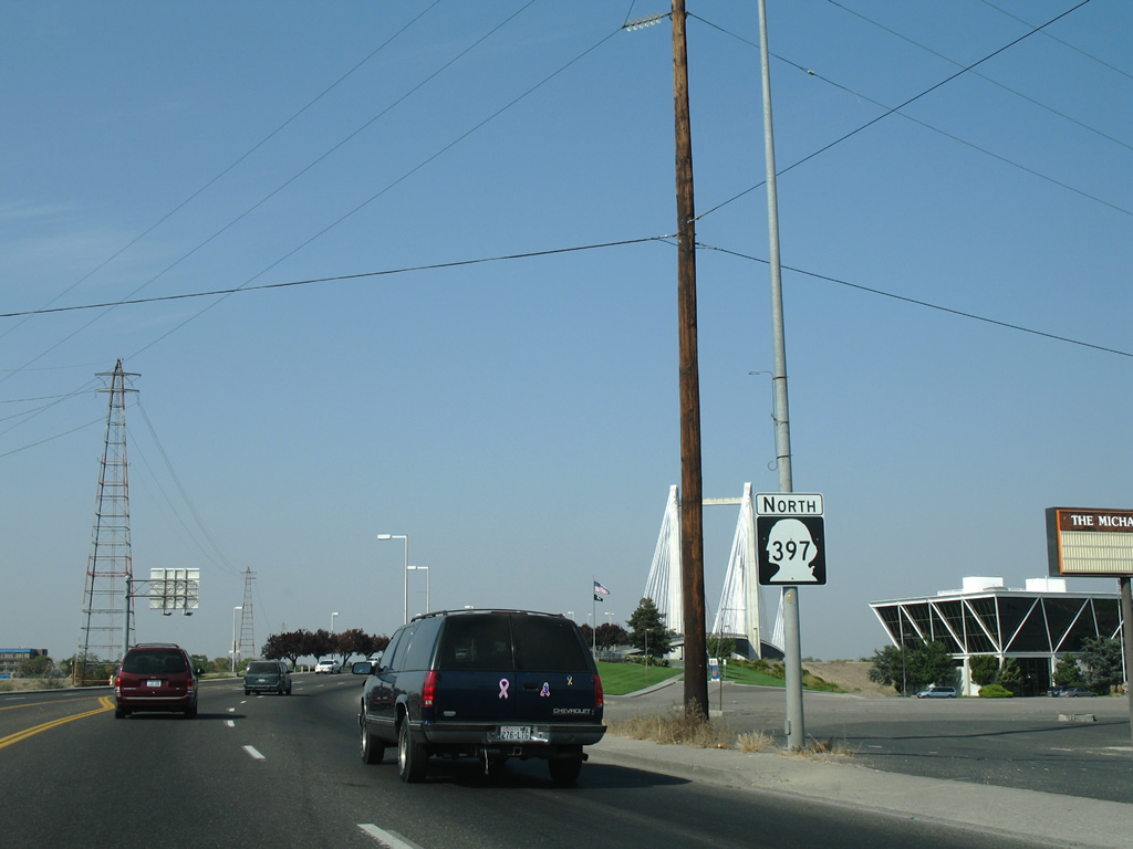 | SR 397 reassurance shield posted after Columbia Drive as the state route passes by the Vietnam Veterans Memorial. 08/28/06 |
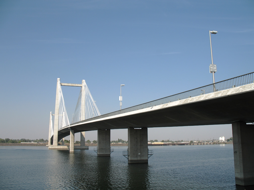
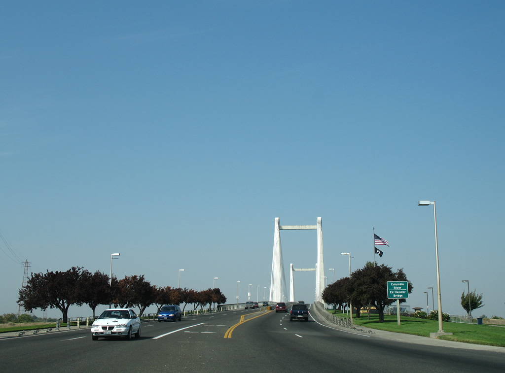 | Approaching the cable-stayed Ed Hendler Bridge (Cable Bridge) on SR 397 north. 08/28/06 |
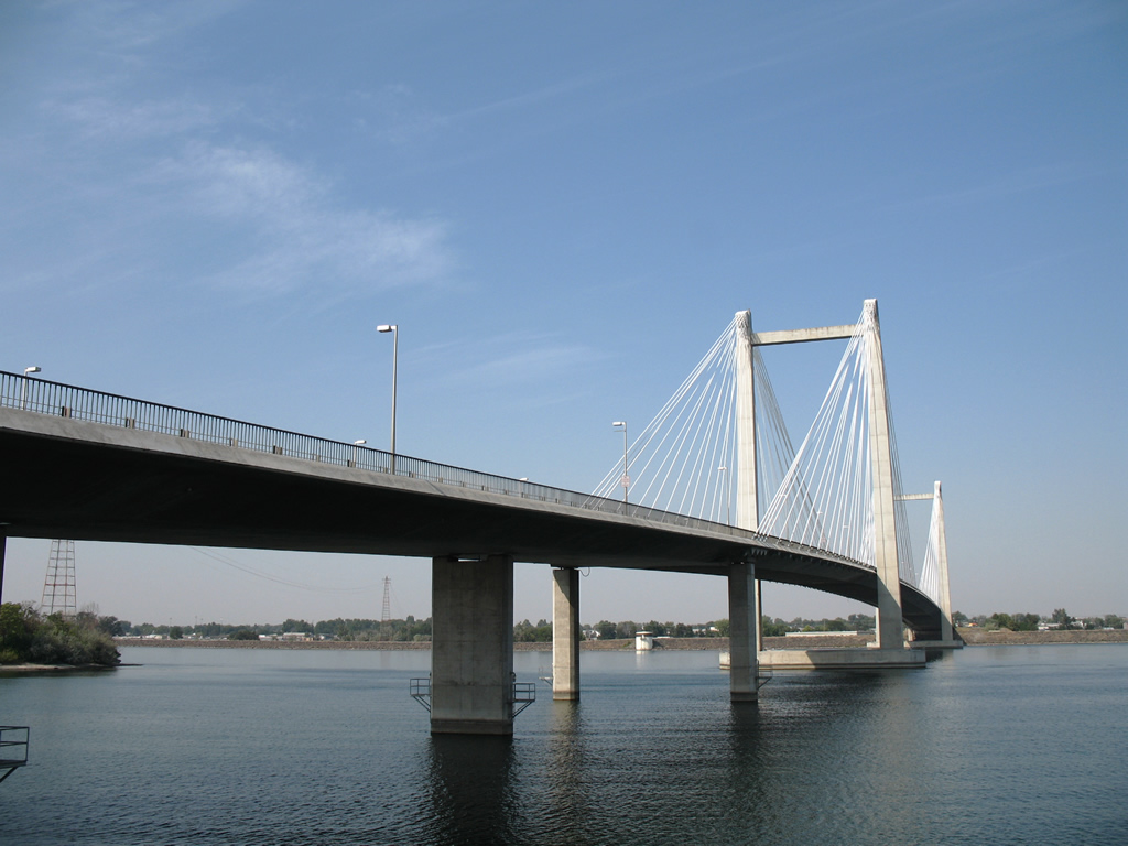
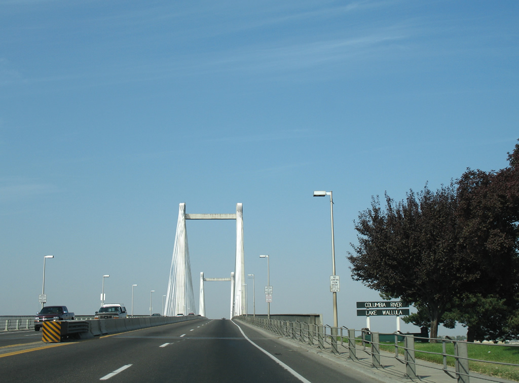 | The Cable Bridge carries SR 397 north from Kennewick to Pasco across Lake Wallula of the Columbia River. 08/28/06 |
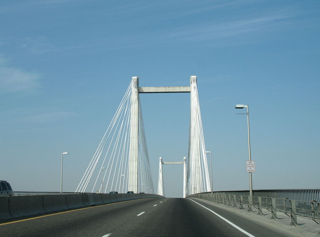 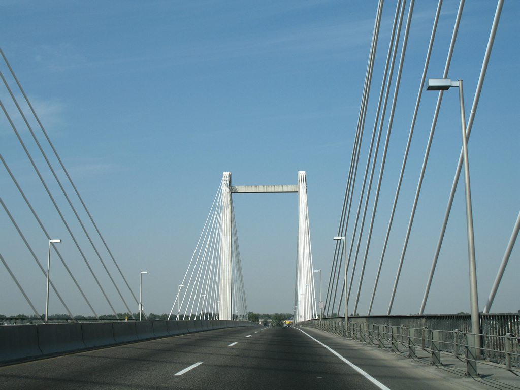 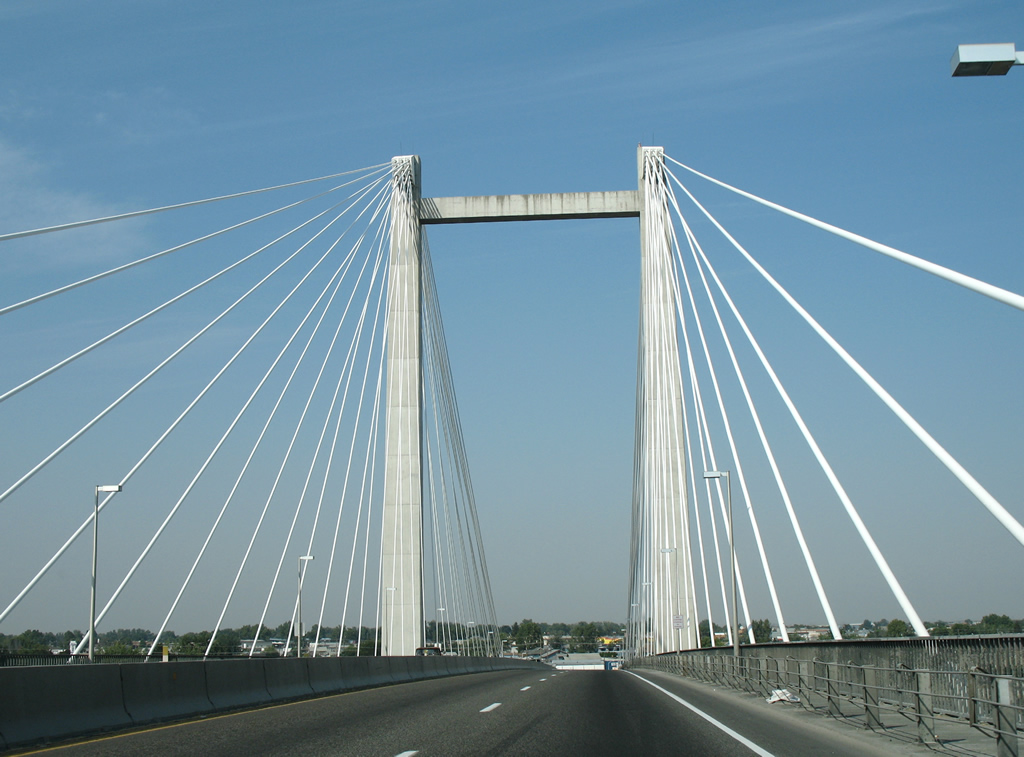 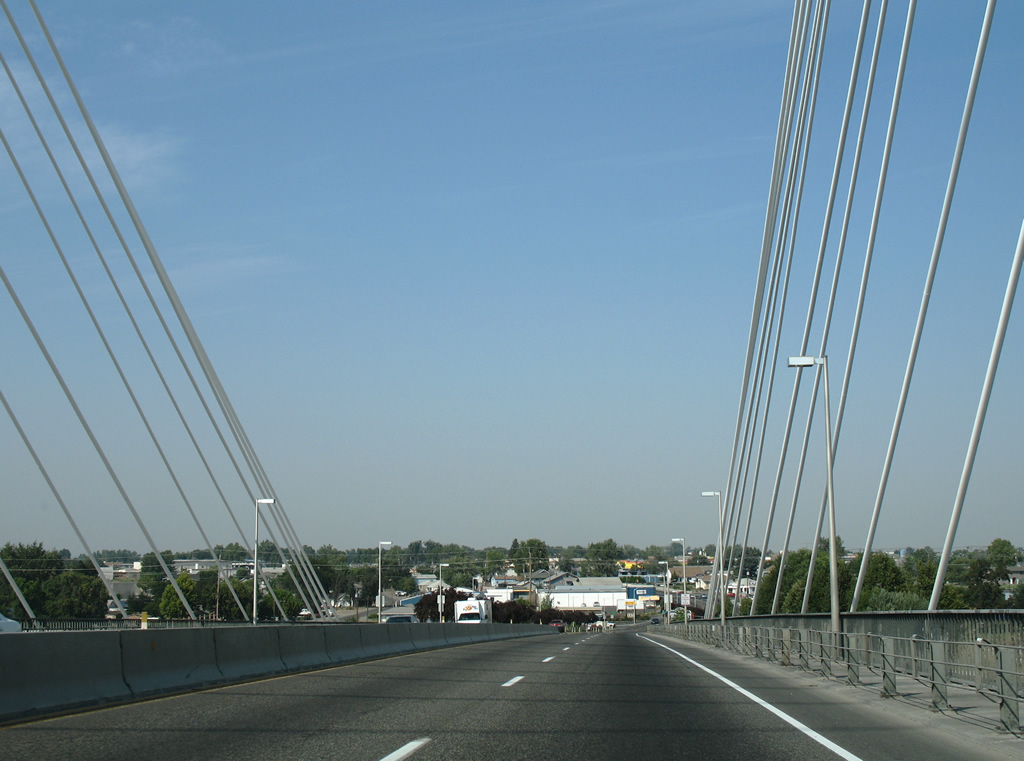 | The Cable Bridge carries four overall lanes and sidewalks along both directions of SR 397. The 80-foot wide bridge utilizes a 2,503-foot continuous girder. 08/28/06 |
 | SR 397 touches down at the South 10th Avenue intersection with West Ainsworth in Pasco. The state route turns eastward and follows Ainsworth to South Oregon Avenue. 08/28/06 |
| SR 397 south |
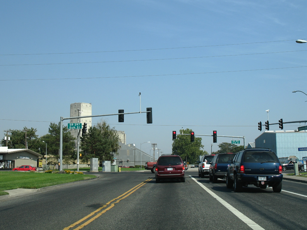
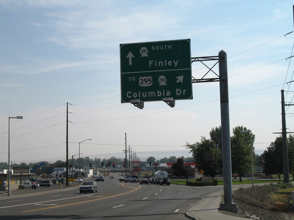 | SR 397 south leaves the Cable Bridge for Gum Street at the ramp to Columbia Drive west. Columbia Drive leads through the city center to the interchange between SR 240 and U.S. 395 at the Blue Bridge south end. 08/28/06 |
| SR 397 scenes |
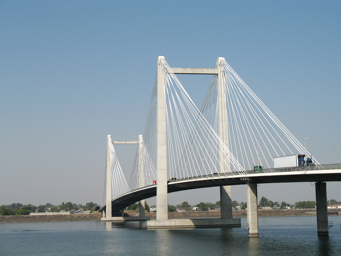   | The Cable Bridge cost $23 million to build and was dedicated on September 16, 1978. Officially renamed in September 1995, the Ed Hendler Bridge honors the Pasco businessman and politician that spearheaded efforts for its construction. Lighting was added to accent the cables in 1998. 08/28/06 |
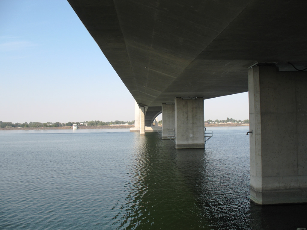
  | An observation platform juts outs over the Columbia River from an adjacent multi-use path to provide these views east of the Cable Bridge. The pier utilizes an original support from the old Pasco-Kennewick Bridge. That bridge was demolished in 1990.1 08/28/06 |
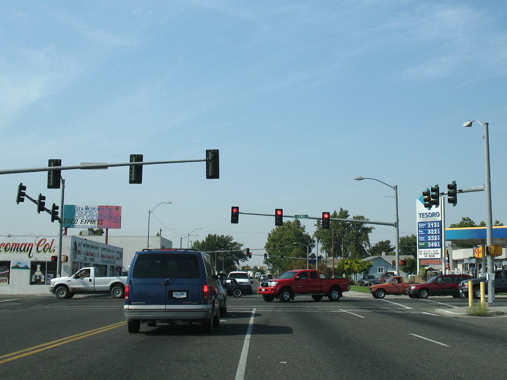
Tri-Cities Street Scenes
 | South 10th Avenue northbound at Lewis Street in the city of Pasco. Lewis Street joins the city center with the Blue Bridge to Kennewick. 08/28/06 |
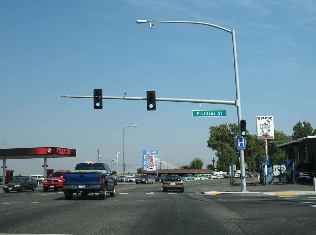 | Columbia Drive ventures east from the SR 240 and U.S. 395 interchange through the center city of Kennewick. Many businesses line the boulevard between the Blue Bridge and SR 397 (Gum Street). Pictured here is the intersection with Fruitland Street. Fruitland Street links downtown with Columbia Park, a pastoral area along the river, west of U.S. 395. 08/28/06 |
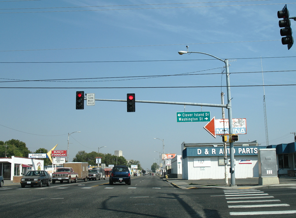
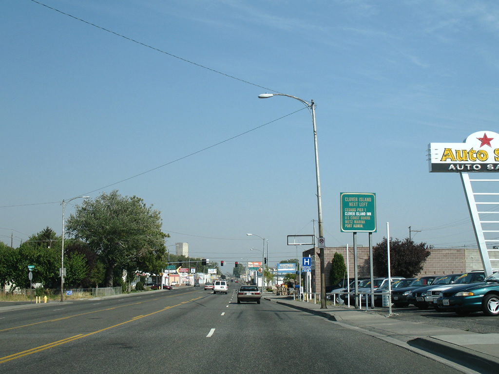 | Approaching the Columbia Drive traffic light with Clover Island Drive north and Washington Street south. A city-installed sign outlines the points of interest on the Clover Island. 08/28/06 |
 | Washington Street continues Clover Island Drive south from Columbia Drive to West 27th Avenue. 08/28/06 |
 | Columbia Drive motorists reach SR 397 (Gum Street) at the south end of the Cable Bridge. SR 397 links Kennewick with Finley to the south and the Pasco city center to the north. 08/28/06 |
 | Westbound Lewis Street at South 20th Avenue. 08/28/06 |
 | Lewis Street westbound defaults onto U.S. 395 southbound at the Blue Bridge. A partial "Y" dumps traffic onto the left side of the freeway. 08/28/06 |
Sources:
- State Route 224 (Mark Bozanich).
- State Route 225 (Mark Bozanich).
- State Route 240 (Mark Bozanich).
- State Route 397 (Mark Bozanich).
- Cable Bridge. Wikipedia.
Page updated October 10, 2011.