|
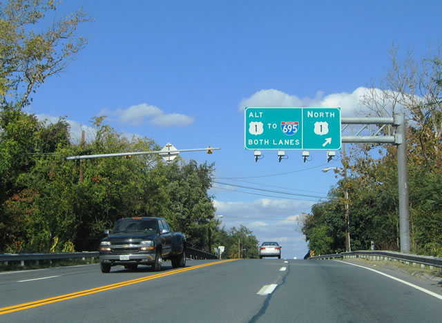
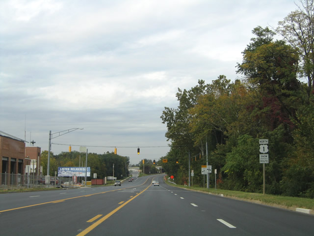
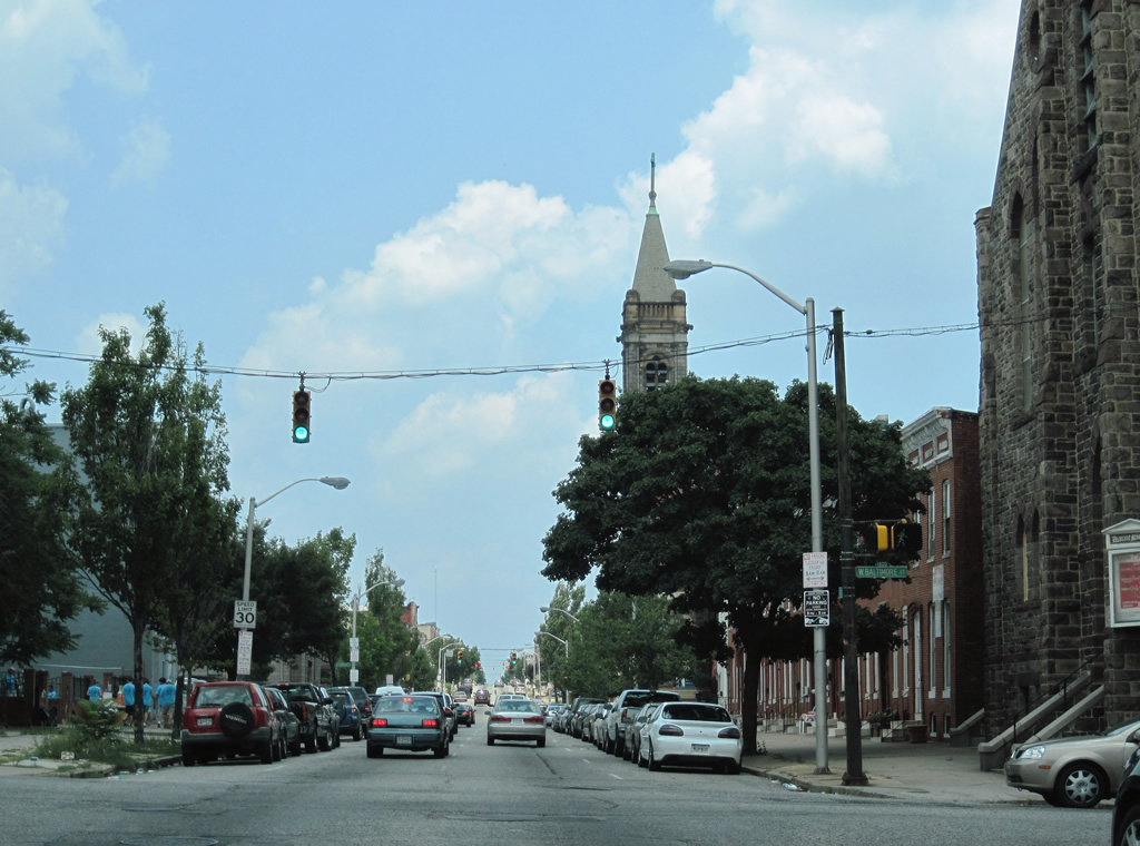
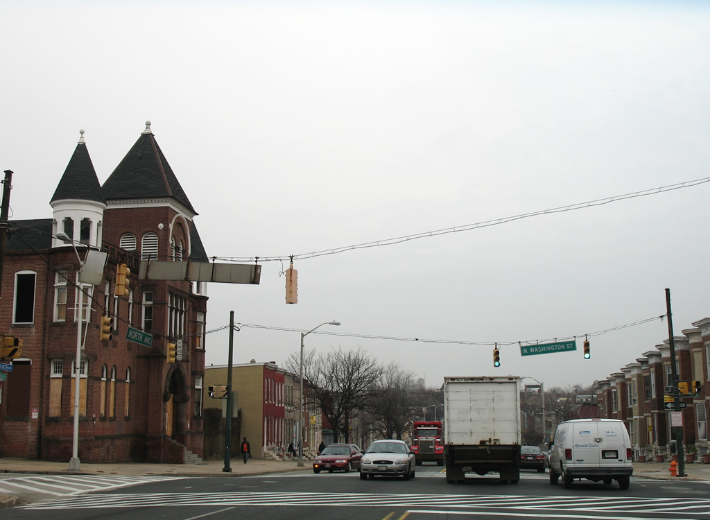
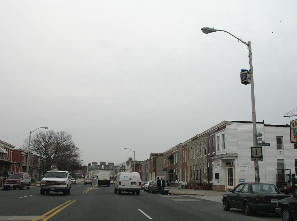
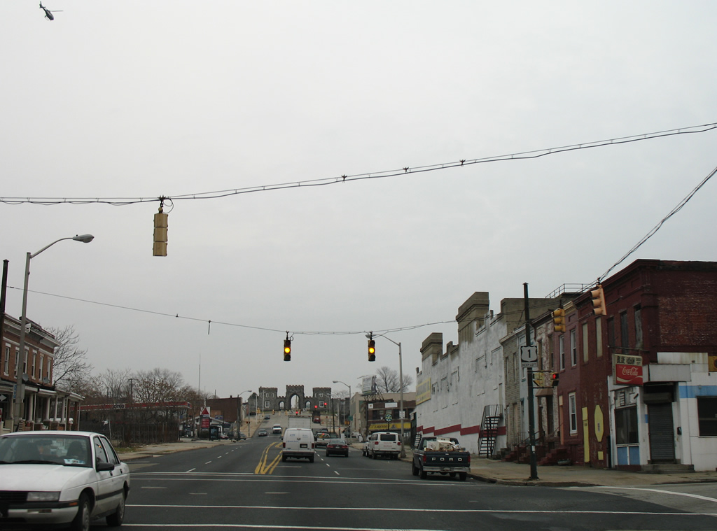
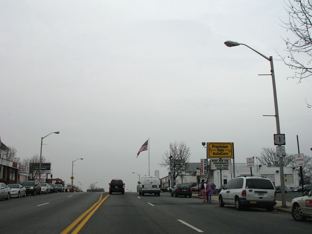
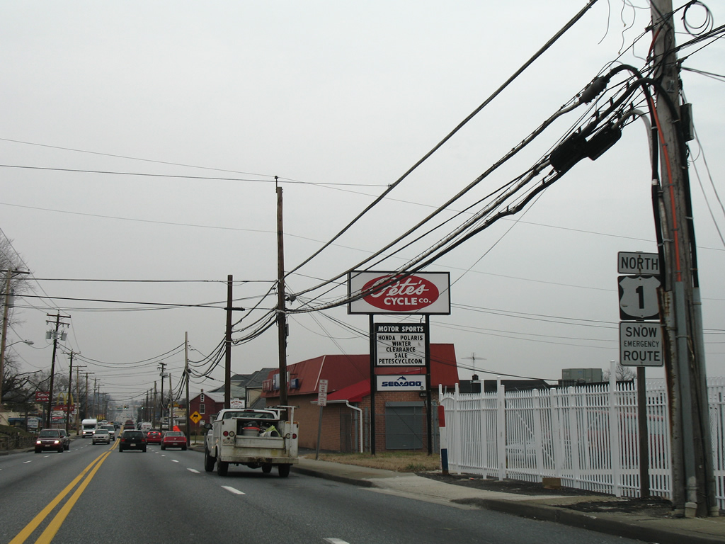
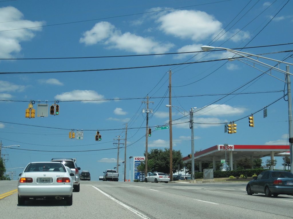
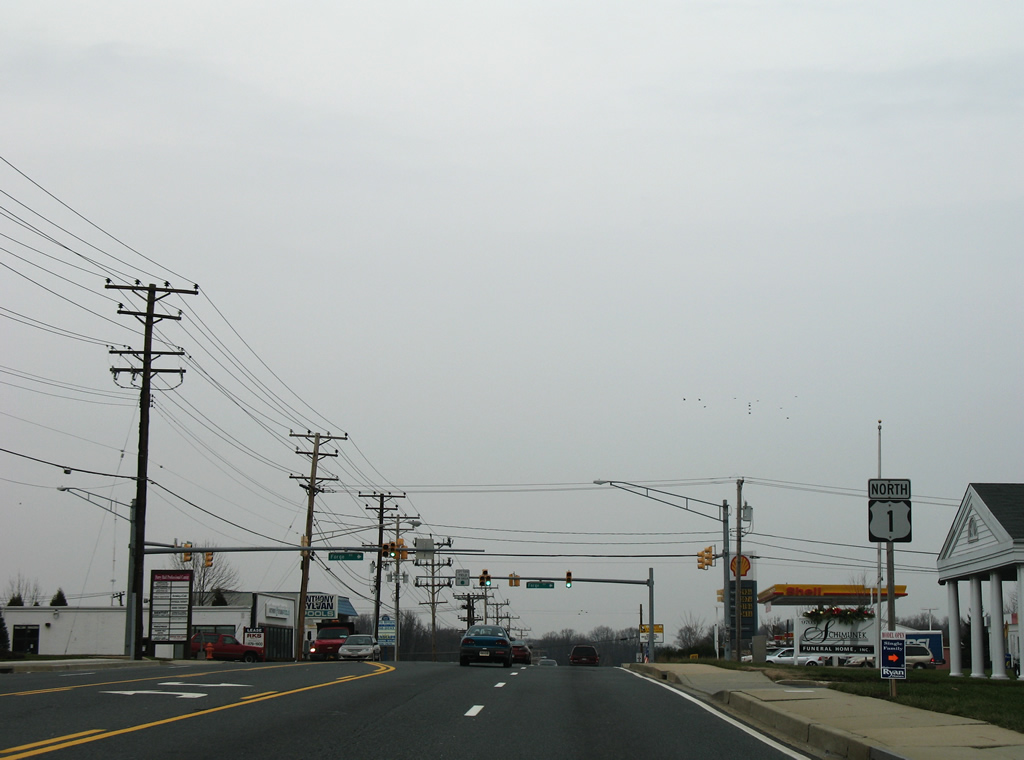
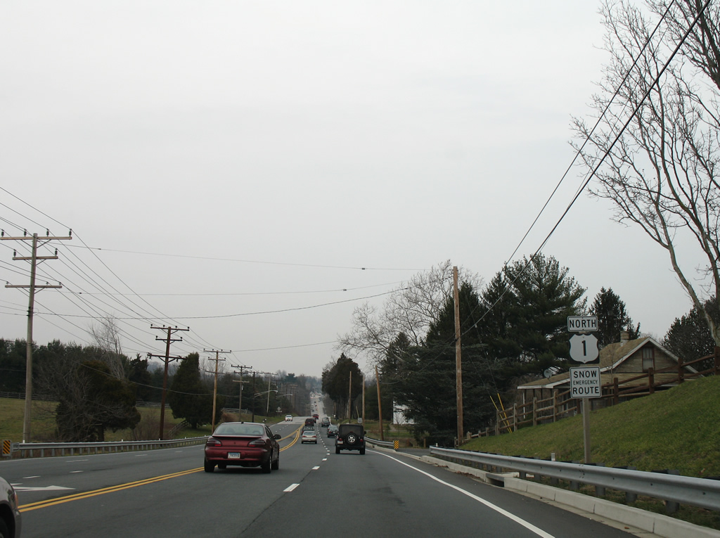
| A six-ramp parclo interchange joins U.S. 1 (Washington Boulevard) with the MD 100 freeway. MD 100 connects the Howard County suburbs near Columbia with northern Anne Arundel County and Interstate 97. 07/02/10 |
|
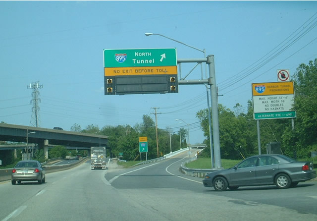
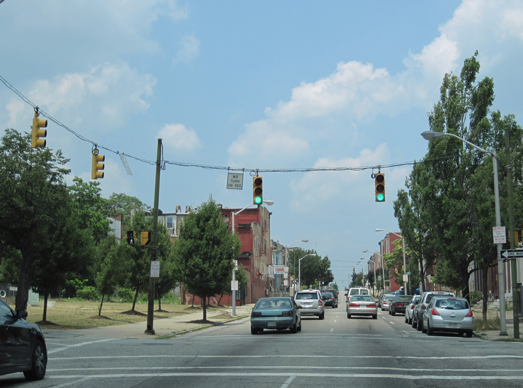
| U.S. 1 (Washington Boulevard) sees a wye interchange with the Harbor Tunnel Thruway (Interstate 895) near the Howard / Baltimore County line. Access to Interstate 895 northbound is provided to northbound travelers for the Baltimore Harbor Tunnel and points east of downtown. There are no off-ramps between U.S. 1 and the Tunnel toll plaza. 06/02/03 |
|
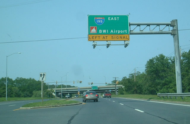
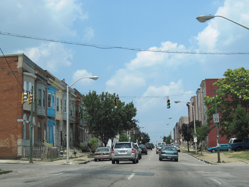
| U.S. 1 (Washington Boulevard) meets I-195 just north of I-895. A folded diamond interchange joins the two highways just beyond the Patapsco River and Baltimore County line. I-195 replaced MD 166 (Metropolitan Boulevard) between the University of Maryland Baltimore Campus and U.S. 1. 06/02/03 |
|
| Interstate 195 constitutes a four mile freeway spur between Interstate 95 and the terminal of Baltimore-Washington International Airport. The freeway sees interchanges with MD 170, MD 295 (Baltimore-Washington Parkway), and U.S. 1 (Washington Boulevard) in between. 06/02/03 |
|
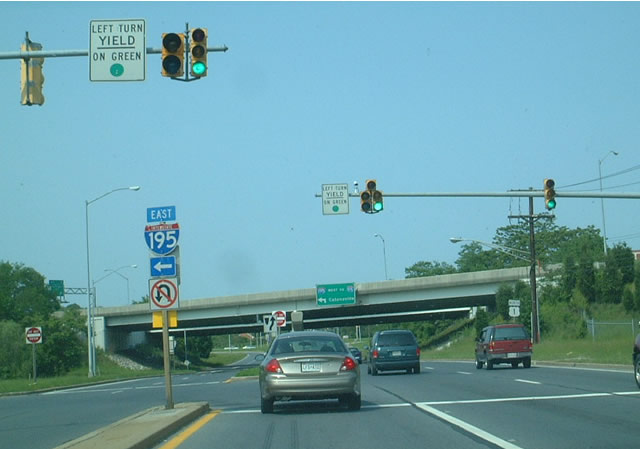
| U.S. 1 passes underneath Interstate 195 ahead of the westbound on-ramp to Interstate 95, UMBC, and Catonsville. Interstate 195 continues north of Interstate 95 to MD 166 (Rolling Road) ahead of its intersection with MD 372 (Wilkens Avenue). 10/10/04 |
|
| Northbound reassurance marker posted along Washington Boulevard as the four lane highway departs its interchange with Interstate 195. Interstate 195 opened in 1990 to join the MD 166 and MD 45 freeway spurs between U.S. 1 and MD 295. 10/10/04 |
|
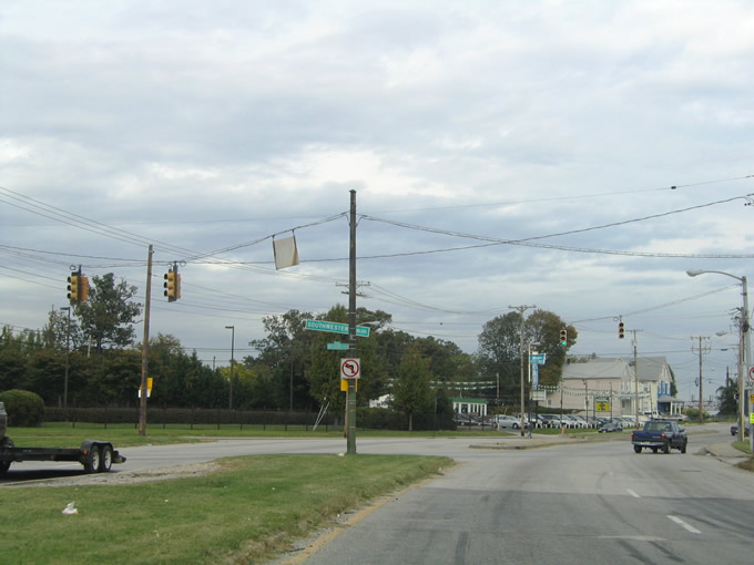
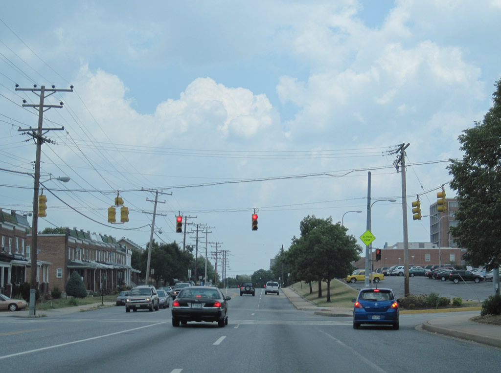
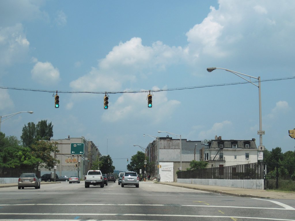
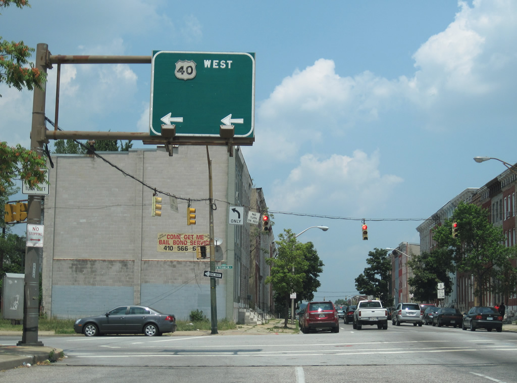
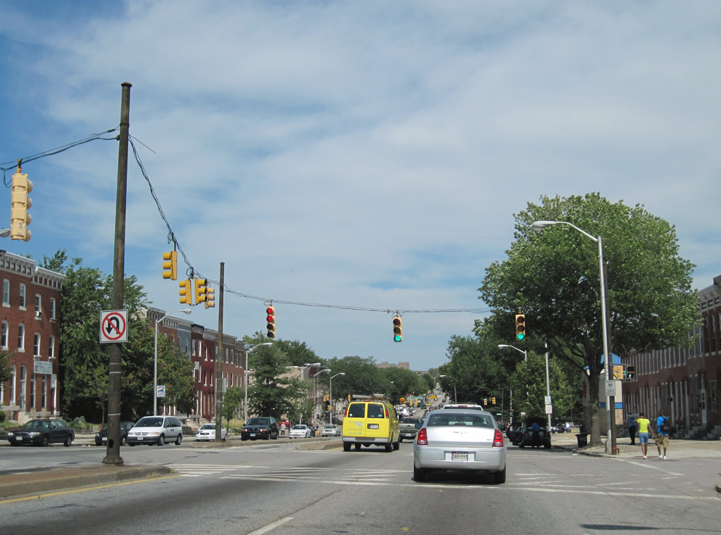
| U.S. 1 splits with U.S. 1 Alternate just north of Interstate 195. U.S. 1 Alternate continues Washington Boulevard northward to Halethorpe and Caton Avenue in southwest Baltimore. U.S. 1 meanwhile turns north onto Southwestern Avenue to Arbutus and Oaklee Village in Baltimore city. All traffic to Interstate 695 should take U.S. 1 Alternate as there is no direct access from Southwestern Boulevard. 10/10/04 |
|
| A wye interchange separates U.S. 1 & U.S. 1 Alternate near the confluence of two railroad lines. Traffic to Southwestern Avenue northbound departs Washington Boulevard for Arbutus to the right. 10/10/04 |
|
| Southwestern Boulevard begins as a three-lane roadway with a continuous center turn lane. Pictured here is a U.S. 1 northbound shield posted between the split with U.S. 1 Alternate and the Francis Avenue over crossing. A railroad line parallels the northbound side of Southwestern Boulevard to the city line. 10/13/04 |
|
| U.S. 1 (Southwestern Boulevard) northbound at the Interstate 95 over crossing. There are no ramps between the two highways in Arbutus. 10/13/04 |
|
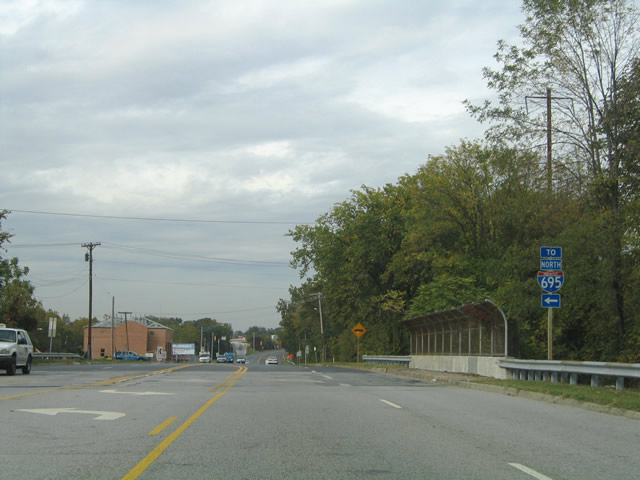
| There are also no ramps from U.S. 1 onto the Baltimore Beltway as well. Traffic destined for Interstate 695 northbound however may take Linden Avenue northwest to Leeds Avenue north for the Exit 12A on-ramp. U.S. 1 (Southwestern Boulevard) passes over Sulphur Spring Road with no direct access at the intersection with Linden Avenue. 10/13/04 |
|
| Continuing north on Southwestern Boulevard at the Arbutus Co. 35 fire station. The off-ramp (Exit 12) from I-695 east to U.S. 1 south lies ahead. 10/13/04 |
|
| U.S. 1 passes underneath Interstate 695 and continues northward toward the Baltimore city line. 10/13/04 |
|
| Leeds Avenue kisses U.S. 1 (Southwestern Boulevard) north of Interstate 695. Motorists can turn southward onto Leeds Avenue for its on-ramp to Interstate 695 north (inner loop) from Southwestern Boulevard northbound. 10/13/04 |
|
| U.S. 1 northbound at the Leeds Avenue turn-off. Southwestern Boulevard divides ahead with a tree-lined median on the approach to Oaklee Village in Baltimore city. 10/13/04 |
|
| Once in the city of Baltimore, Southwestern Boulevard and U.S. 1 quickly intersect MD 372 (Wilkens Avenue). The US Route overtakes the surface arterial from the state highway as it turns east toward Saint Agnes Hospital. The signalized intersection between Wilkens Avenue and Southwestern Boulevard represents the eastern terminus of MD 372. 10/13/04 |
|
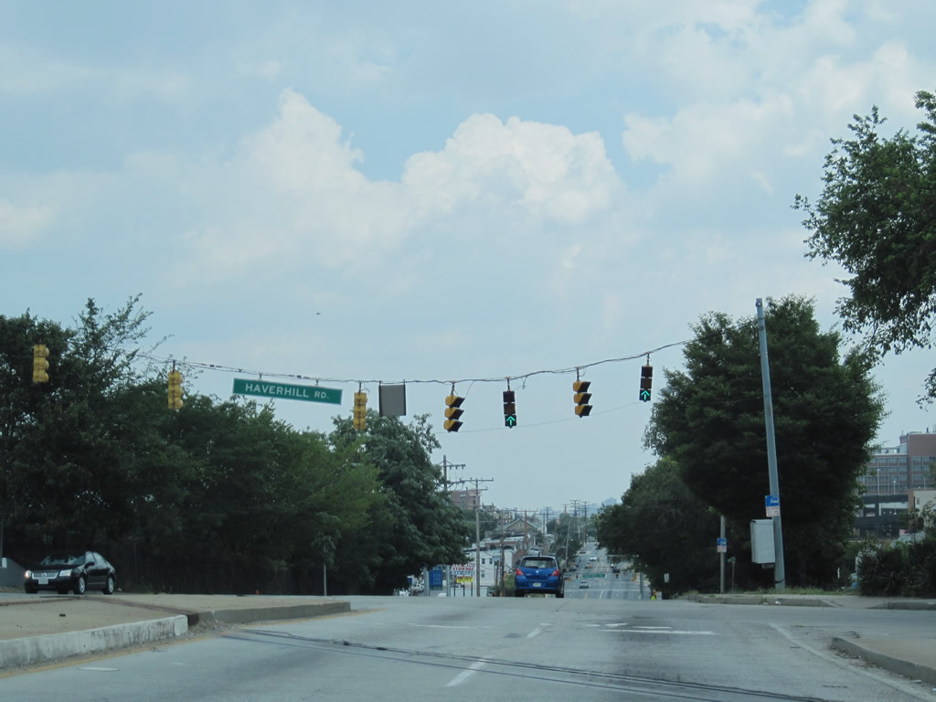
| U.S. 1 passes over a set of Amtrak lines and intersects Haverhill Road. Haverhill Road leads south from Wilkens Avenue to Benson Avenue and the Violetville neighborhood of Baltimore. 06/27/10 |
|
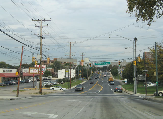
| Traveling east along Wilkens Avenue (U.S. 1 north) to the intersection with Pine Heights Avenue. Pine Heights Avenue flows north from Benson Avenue to U.S. 1. An older strip mall ties into the traffic light to the left. 10/13/04 |
|
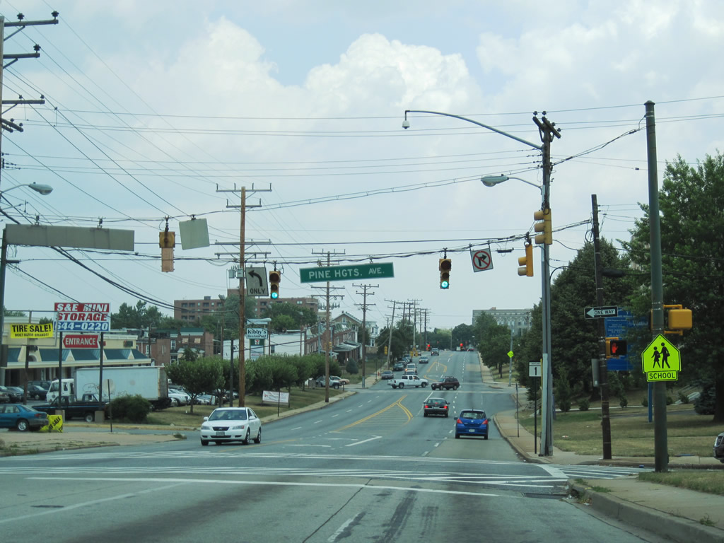
| Six years after the previous photo was taken, not much has changed at the intersection of U.S. 1 (Wilkens Avenue) and Pine Heights Avenue. However an erroneous MD 1 shield was added at the southeast corner of the intersection. This shield replaced an older-style U.S. 1 shield by 2010. 06/27/10 |
|
| A short distance east of Pine Heights Avenue is the signalized entrance to adjacent St. Agnes Hospital. 06/27/10 |
|
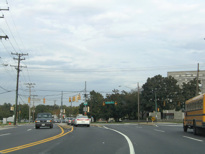
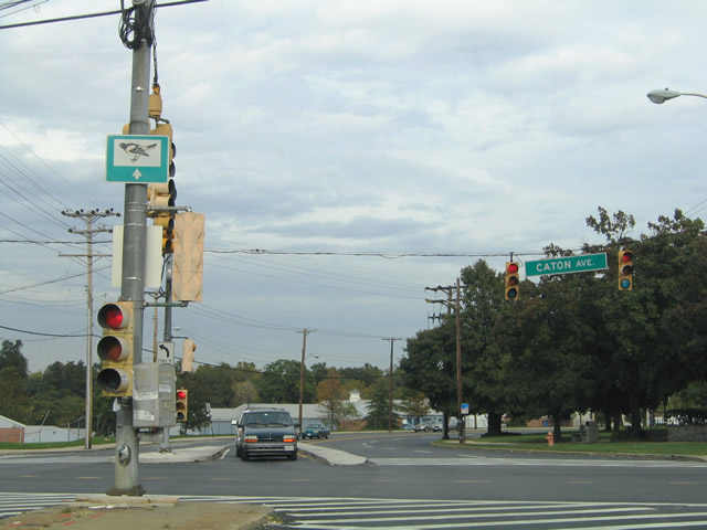
| U.S. 1 Alternate returns to U.S. 1 via Caton Avenue northbound. Washington Boulevard transitions into Caton Avenue at the intersection with Patapsco Avenue at the Baltimore city line. From there Caton Avenue migrates northward to U.S. 1 (Wilkens Avenue) and beyond to MD 144 (Frederick Avenue) at Hilton Parkway. 10/13/04 |
|
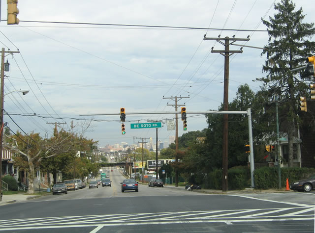
| Wilkens Avenue reduces from five to four lanes as it enters the intersection with Desoto Road. A traffic light replacement project, one of many during the fall of 2004, was underway at the U.S. 1 intersection with Desoto Road. This replacement resulted in the installation of a photocop.
Desoto Road ventures southeast to Exit 50 of Interstate 95 and the Morrell Park neighborhood of the city. 10/13/04 |
|
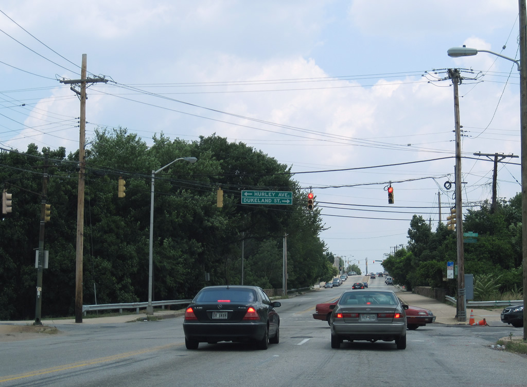
| U.S. 1 intersects Dukeland Street south to Cross Roads Industrial center and Hurley Avenue north ahead of Gwynns Falls. 06/27/10 |
|
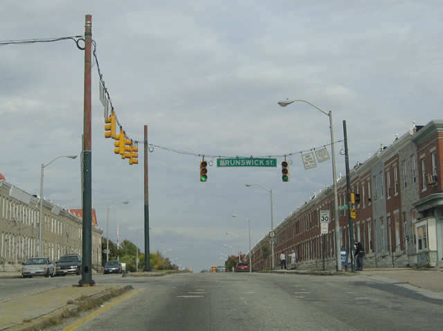
| U.S. 1 (Wilkens Avenue) northbound crosses Gwynns Falls Creek and transitions into a residential neighborhood lined with row homes. Row homes are prevalent throughout most of west Baltimore along narrow streets. Pictured here is the intersection with Brunswick Street. Use Brunswick Street north four blocks to MD 144 (Frederick Avenue). 10/13/04 |
|
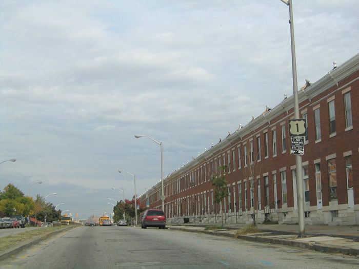
| Wilkens Avenue divides again east of Gwynns Falls Creek. This reassurance shield appears northbound between Brunswick Street and Millington Avenue. 10/13/04 |
|
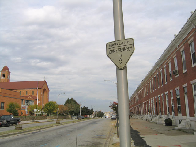
| An original Maryland John F. Kennedy Memorial Highway trailblazer remains in place along U.S. 1 (Wilkens Avenue) northbound between Brunswick Street and Millington Avenue. These signs directed motorists to the disjointed Interstate 95 before the 1985 completion of the Fort McHenry Tunnel. The present day JFK Memorial Highway features no unique trailblazer. 10/13/04 |
|
| Millington Avenue flows south from MD 144 (Frederick Avenue) to end just south of U.S. 1 (Wilkens Avenue) at the Carroll community of Baltimore. 06/27/10 |
|
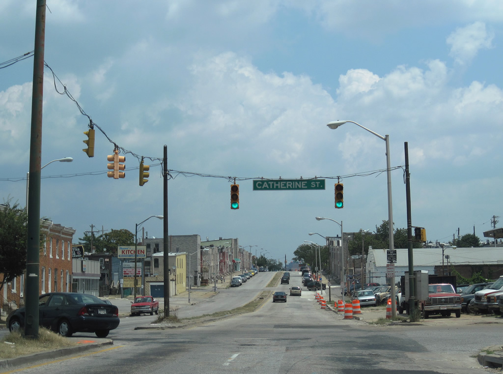
| A mix of 30" and 42" traffic signals govern the movements between U.S. 1 (Wilkens Avenue) and Catherine Street one block east of Millington Avenue. 06/27/10 |
|
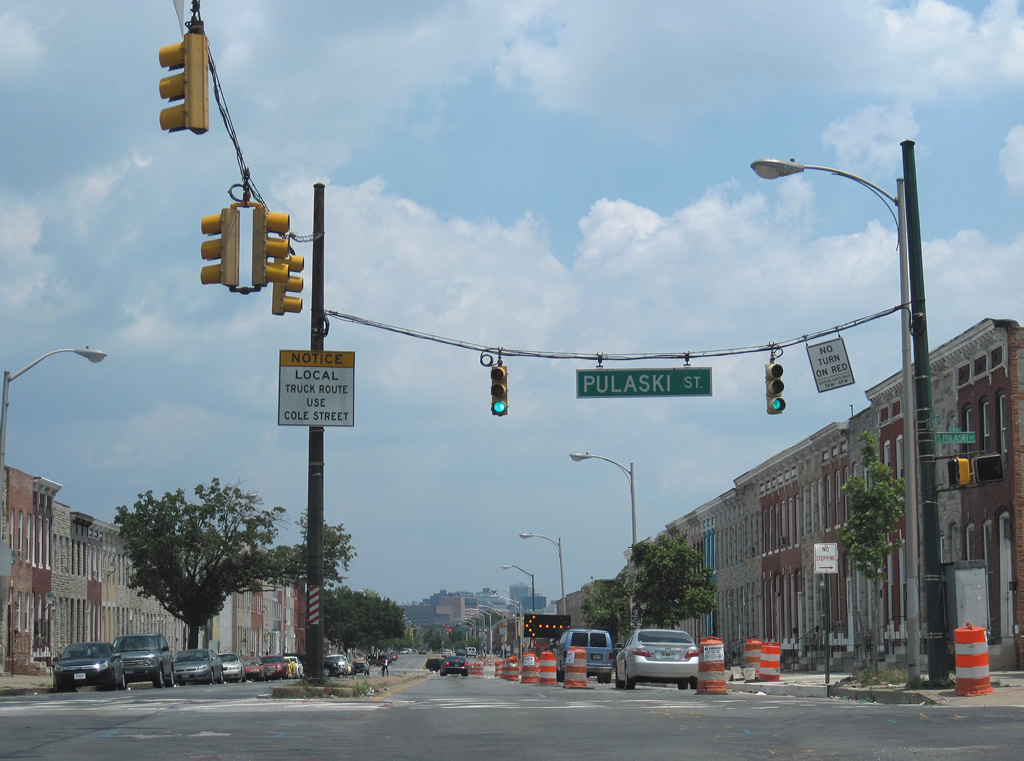
| A set of 30" signals at the Wilkens Avenue intersection with Pulaski Street. A small advisory sign indicates that the local truck route continues east along Cole Street. Cole Street splits from Wilkens Avenue east of Monroe Street to S. Stricker Street. 06/27/10 |
|
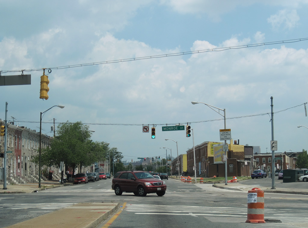
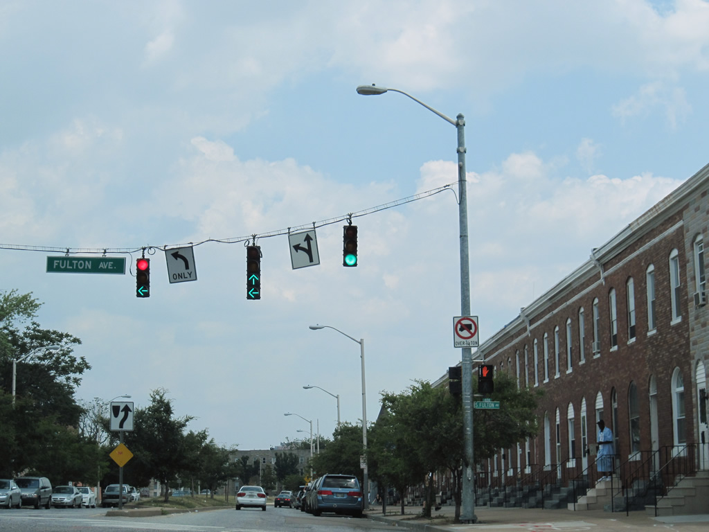
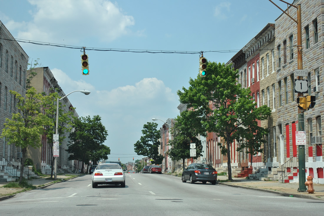
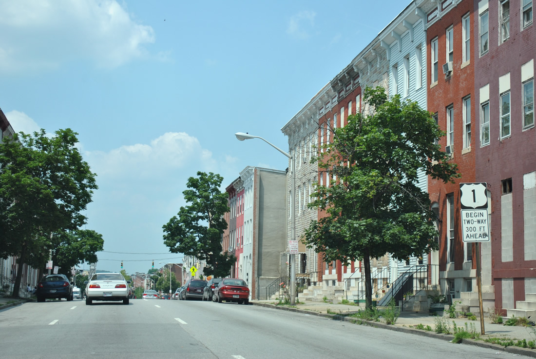
| U.S. 1 (Wilkens Avenue) northbound at Monroe Street near Caroll Park. Two things are worth mentioning roadwise at this intersection. First, U.S. 1 splits into separate components with southbound following Monroe Street and northbound following Wilkens Avenue two blocks east to Fulton Avenue northbound. Second, Monroe Street represents the original alignment of both U.S. 301 and MD 3. U.S. 301, and later MD 3, began here and traveled south along Monroe Street to Baltimore-Annapolis Blvd (MD 648 - Annapolis Road). U.S. 301 became MD 3 when the US Route was given a new alignment via MD 71 along the Eastern Shore. MD 3 was truncated with the completion of Interstate 97 through Glen Burnie. 06/27/10 |
|
| A second Maryland John F. Kennedy Memorial Highway trailblazer remains in place on U.S. 1 (Wilkens Avenue) northbound between Addison Street and S. Fulton Avenue. Wilkens Avenue continues a short distance to Mount Street and Ramsay Street before ending. The old trailblazers directed motorists east onto Ramsay Street (Cole Street east for trucks) to Carey Street south and Washington Boulevard north. 06/27/10 |
|
| U.S. 1 turns onto Fulton Avenue northbound from Wilkens Avenue eastbound. Fulton Avenue begins two blocks to the south at Eagle Street. Note the traffic light with both a red ball and a green arrow illuminated. U.S. 1 travels the one way street couplet of Monroe Street & Fulton Avenue between Wilkens Avenue and North Avenue west of downtown Baltimore. 06/27/10 |
|
| Fulton Avenue varies between two and three lanes as it carries U.S. 1 through west-central Baltimore. Pictured here is the signalized intersection with Pratt Street. Pratt Street comprises the eastbound direction of MD 144 from Frederick Avenue to U.S. 1. The street continues beyond the east end of MD 144 into downtown Baltimore. 06/27/10 |
|
| Lombard Street is an important part of the downtown Baltimore traffic flow. However west of Martin Luther King, Jr. Boulevard, the east-west street downgrades in importance as a residential thoroughfare to U.S. 1.
Lombard Street westbound intersects Fulton Avenue in this scene, becoming a part of MD 144 (unsigned) west to Frederick Avenue at Payson Street in the process. MD 144 represents older alignments of U.S. 40 from Baltimore west to Cumberland. 10/13/04 |
|
| The confluence of Hollins Street, Frederick Avenue, and Fulton Avenue (U.S. 1 north). Frederick Avenue enters the intersection at a diagonal and is one way leading to Fulton Avenue from both directions. Hollins Street radiates outward from Fulton Avenue perpendicularly at the same intersection. Frederick Avenue represents the original routing of U.S. 29 and U.S. 40 Alternate from U.S. 1 west to Catonsville and Ellicott City. 06/27/10 |
|
| One block north of the historic northern terminus of U.S. 29 is the intersection with Baltimore Street. Baltimore Street provides an east-west through route between Hilton Parkway and Martin Luther King, Jr. Boulevard. 30" signals govern the movements between the two city streets. 06/27/10 |
|
| Fayette Street flows west from the University of Maryland at Baltimore and Poppleton to intersect U.S. 1 (Fulton Avenue) in this scene. Some older maps tout Fayette Street as U.S. 40 Alternate through central Baltimore. 06/27/10 |
|
| Midway between Baltimore Street and U.S. 40 (Mulberry & Franklin Streets) on U.S. 1 (Fulton Avenue) northbound at Lexington Street. 06/27/10 |
|
| U.S. 1 (Fulton Avenue) north at Saratoga Street, west of Franklin Square. 06/27/10 |
|
| U.S. 1 (Fulton Avenue) northbound at Mulberry Street eastbound. Mulberry Street (former U.S. 40 east) parallels the depressed Interstate 170 freeway between Pulaski Street and Greene Street. Completed in 1979, the former Interstate 170 freeway opened as the first link of the downtown spur from Interstate 70. By the early 1980s it was clear that Interstate 70 would never be built within the city of Baltimore, so in 1983 the freeway became part of the U.S. 40 corridor. Mulberry Street comprises the eastbound frontage street of the highway. 06/27/10 |
|
| Original button copy overhead dating from the 1979 completion of the Interstate 170 freeway. This sign directs U.S. 1 (Fulton Avenue) northbound motorists onto Franklin Street westbound for U.S. 40 west. The blank space below the U.S. 40 shield was intended for "Interstate 170 west". U.S. 40 departs the former Interstate 170 freeway below and merges with Franklin Street at Pulaski Street, two blocks to the west. From there U.S. 40 continues west to Edmondson Avenue and Gwynns Falls Park. 06/27/10 |
|
| Northbound reassurance marker for U.S. 1 posted at the Fulton Avenue intersection with Franklin Street. Franklin Street (former U.S. 40 west) constitutes the westbound frontage street of the U.S. 40 freeway between Greene and Pulaski Streets. 06/20/12 |
|
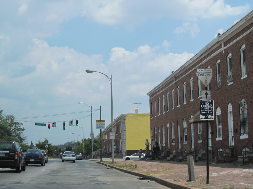
| U.S. 1 continues another 14 blocks north to North Avenue (U.S. 40 Truck) from U.S. 40. Fulton Avenue meanwhile switches to two way traffic at Edmondson Avenue, one block north of Franklin. 06/20/12 |
|
| Fulton Avenue gains a grassy median between Edmondson Avenue and MD 26 (Pennsylvania Avenue). While carrying two way traffic from this intersection northward, U.S. 1 remains split between Fulton Avenue north and Monroe Street south. 06/20/12 |
|
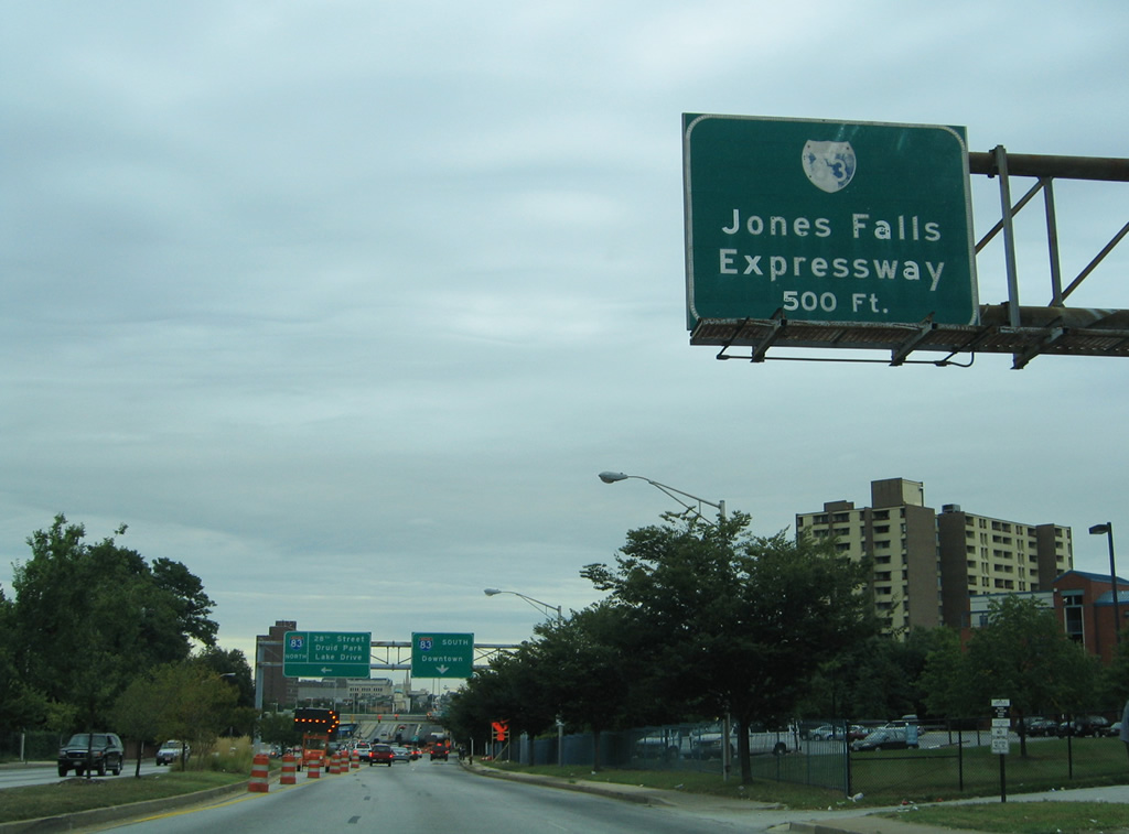
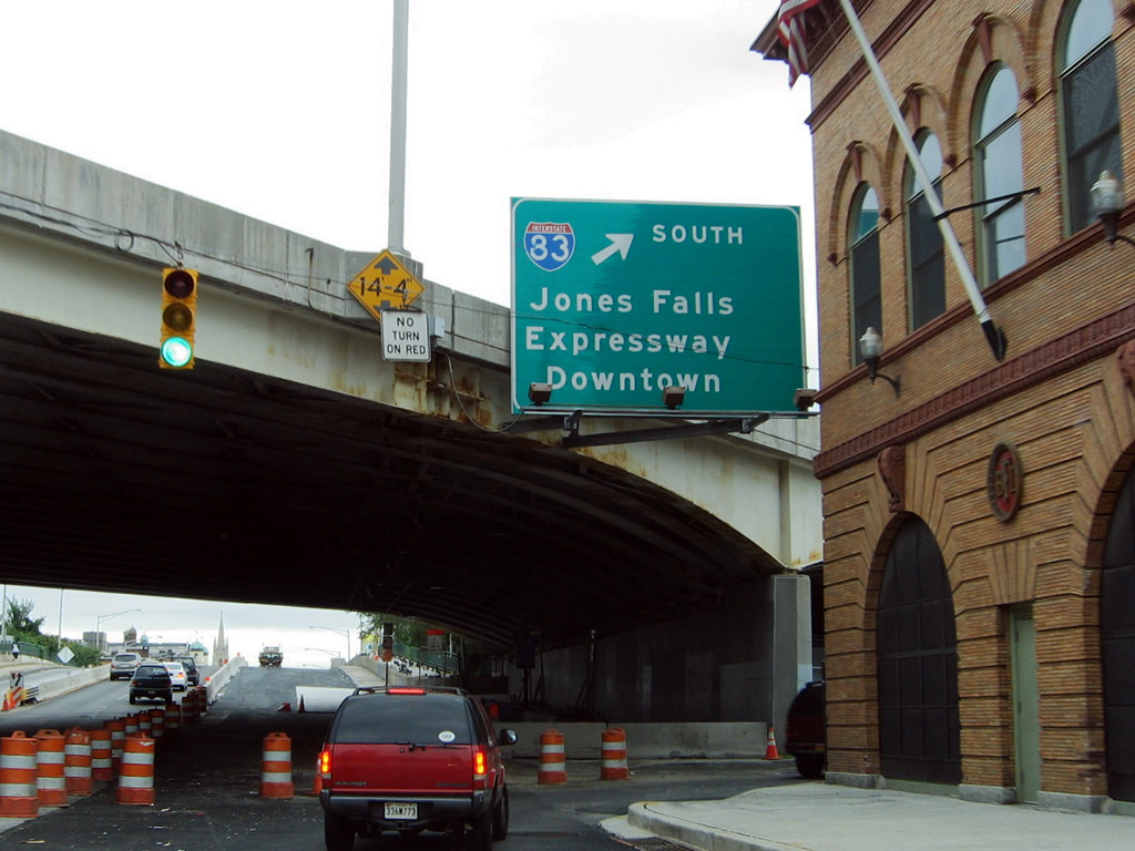
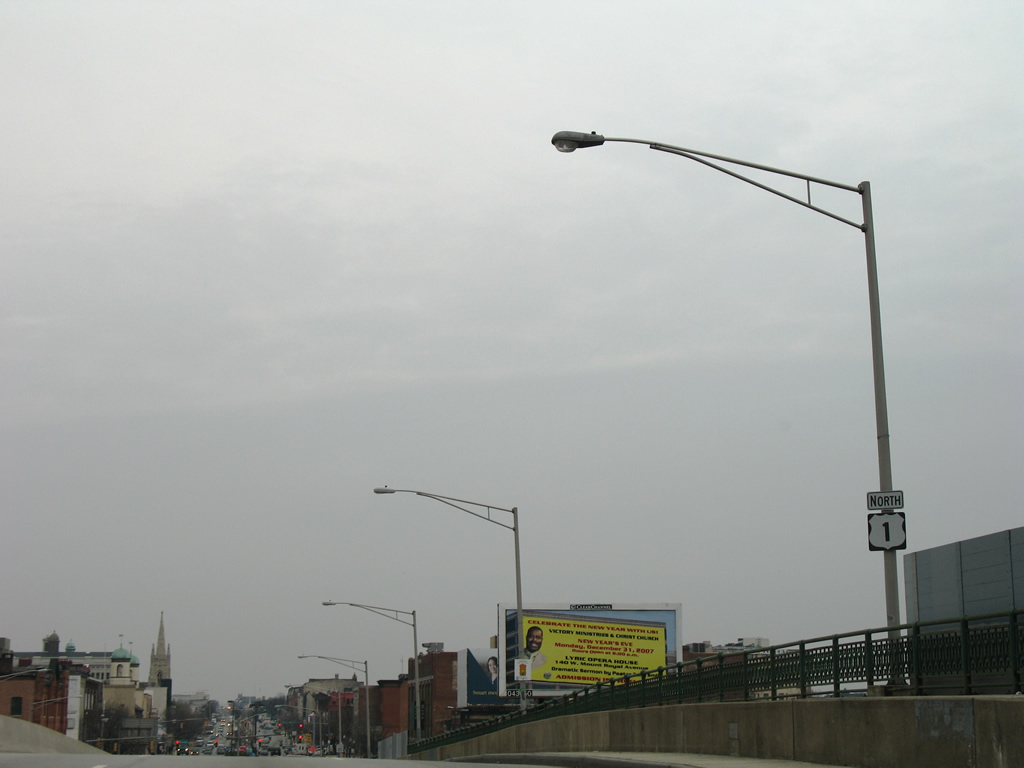
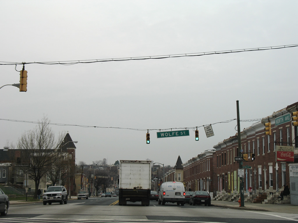
| U.S. 1 joins U.S. 40 Truck along North Avenue from Monroe Street & Fulton Avenue east to Belair Road. The six lane surface boulevard heads east between Bolton Hill and Druid Hill Park to Interstate 83 (Jones Falls Expressway) at Mount Royal Avenue. 08/27/05 |
|
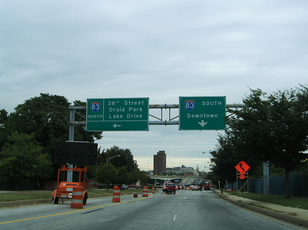
| The northbound on-ramp to the Jones Falls Expressway also provides connections to Exit 7 of Interstate 83 to Druid Park Lake Drive west and West 28th Street east to Johns Hopkins University. Mount Royal Avenue angles southeast from U.S. 1 at Interstate 83 to the University of Baltimore and Mount Vernon. 08/27/05 |
|
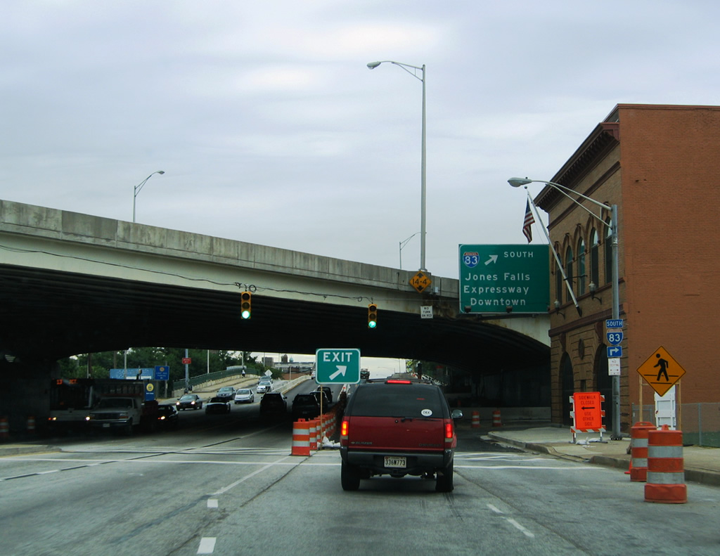
| Just east of Mount Royal Avenue is the southbound on-ramp to Interstate 83 to downtown. 08/27/05 |
|
| Interstate 83 lines the east side of the central business district and ends as President Street south to Fells Point. 08/27/05 |
|
| Lowering toward Howard Street, U.S. 1 (North Avenue) drivers see a northbound reassurance marker. 12/28/07 |
|
| Howard Street ventures north from Mount Vernon to John Hopkins University, crossing U.S. 1 (North Avenue) at this traffic light. 12/28/07 |
|
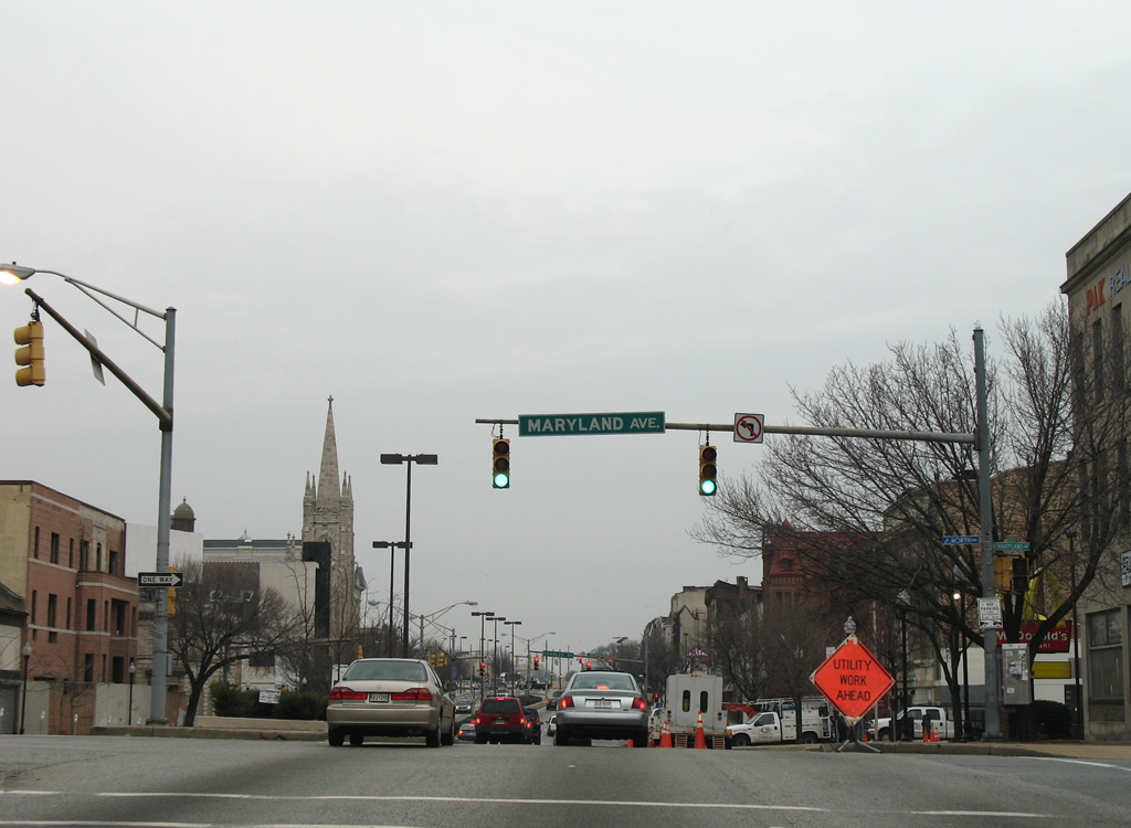
| Maryland Avenue flows south to Falls Road at the adjacent MD 25 split into Lafayette and Lanvale Streets. The street passes over Interstate 83 to the University of Baltimore and Mount Vernon. 12/28/07 |
|
| Charles Street represents unsigned MD 139 north from U.S. 1 (North Avenue) to Johns Hopkins University. The state route travels 7.88 miles to Exit 25 of the Baltimore Beltway at Lutherville. 12/28/07 |
|
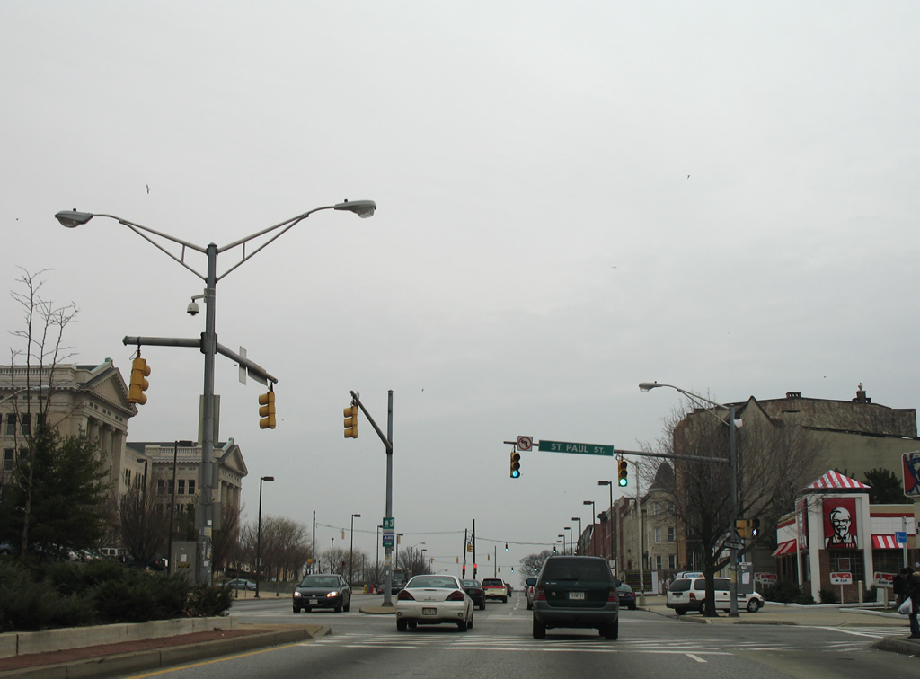
| St. Paul Street crosses U.S. 1 two blocks east of Charles Street and doubles as unsigned MD 139 south from Guilford to North Avenue. Where MD 139 ends, MD 2 begins and continues St. Paul Street south into downtown Baltimore. 12/28/07 |
|
| Like MD 139, MD 2 also partitions into a one way street couplet. Calvert Street carries the northbound direction of the state highway from Pratt Street at the Inner Harbor. MD 2 stretches 80.56 miles south from Baltimore to Solomons Island in Calvert County. 12/28/07 |
|
| Meeting U.S. 1 at the next traffic light is Guilford Avenue. Guilford Avenue travels south to The Fallsway and Mt. Royal Avenue and alongside Interstate 83 to the central business district. 12/28/07 |
|
| Northbound U.S. 1 (North Avenue) at Barclay Street. 06/30/10 |
|
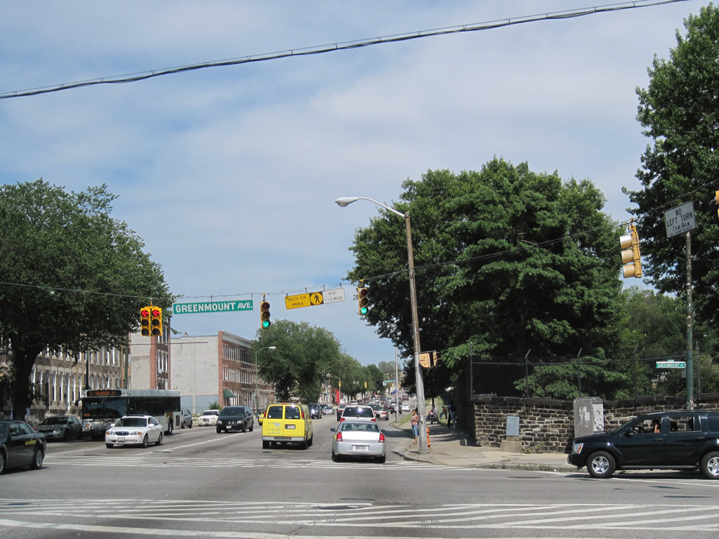
| Greenmount Avenue travels north from Ensor Street to become MD 45 at U.S. 1 (North Avenue). The state route follows all of old U.S. 111 from Baltimore north to the Pennsylvania state line. 06/30/10 |
|
| U.S. 1 travels alongside Greenmount Cemetery from MD 45 (Greenmount Avenue) to Ensor Street. North Avenue loses the concrete median and reduces to four overall lanes. The reassurance marker here was not retained when the street light to which it was attached was replaced. 12/28/07 |
|
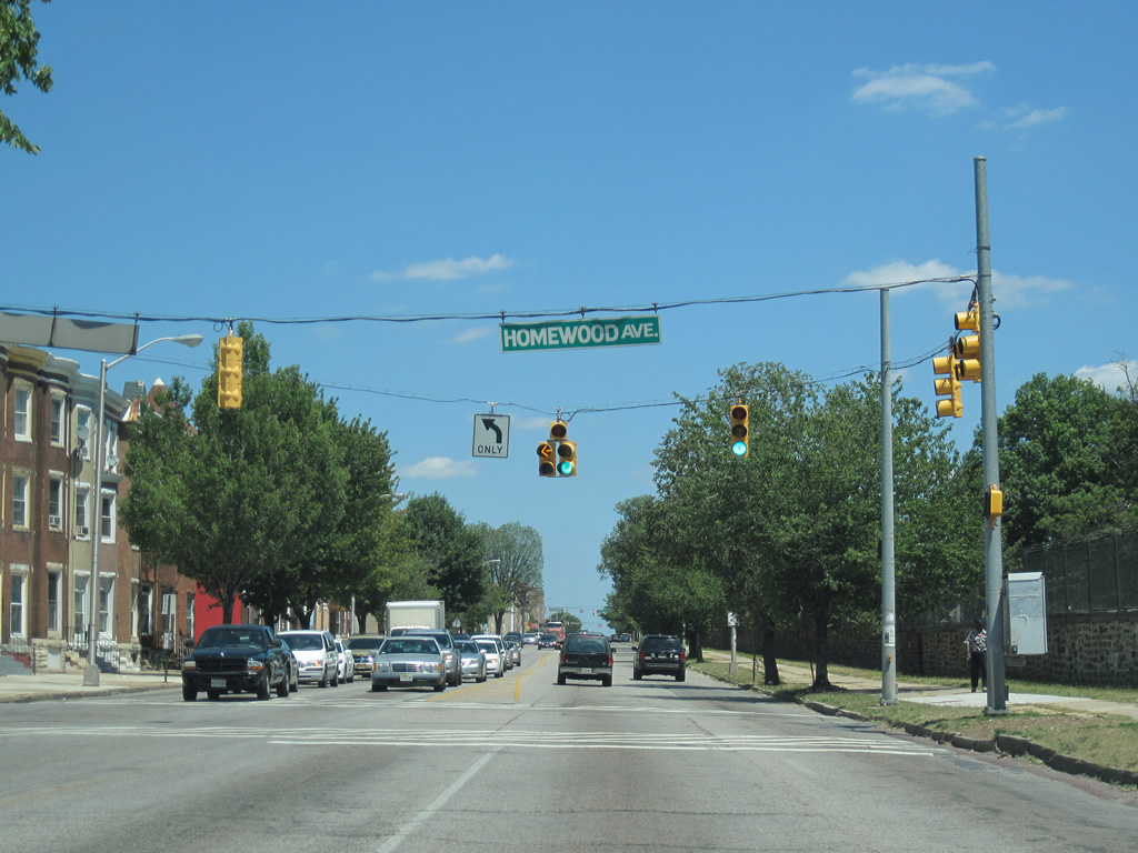
| Homewood Avenue links U.S. 1 (North Avenue) with 25th Street. 07/02/10 |
|
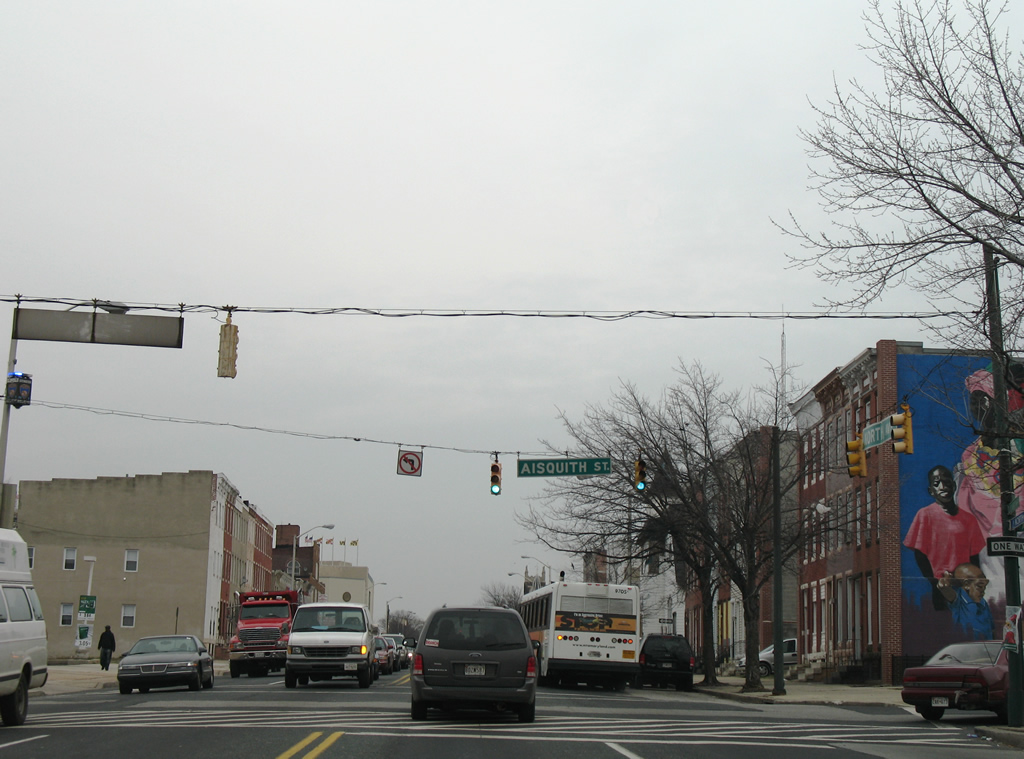
| Aisquith Street provides part of a through route for motorists on Harford Road south to Ensor Street and downtown. Harford Road intersects U.S. 1 at the adjacent intersection but flows northbound only from Biddle Street to North Avenue. 12/28/07 |
|
| MD 147 begins at U.S. 1 (North Avenue) and travels Harford Road northeast to Clifton Park, Herring Run Park, Hamilton and Parkville outside the city limits. The state route totals 18.81 miles to U.S. 1 & U.S. 1 Business outside Bel Air in Harford County. 06/30/10 |
|
| Bond Street flows north from Madison Street to end at this traffic light with U.S. 1 (North Avenue). 06/30/10 |
|
| Broadway constitutes a divided parkway south to Johns Hopkins Hospital, Washington Hill and Fells Point and northeast to MD 147 (Harford Road) at Bonaparte Avenue. 06/30/10 |
|
| Wolfe Street (south) and Washington Street (north) provide a through route between U.S. 1 and Fleet Street near Fells Point and Canton. Washington Street becomes St. Lo Drive to Lake Clifton Eastern High School and Clifton Park. 12/28/07 |
|
| Chester Street travels north to Sinclair Lane and south to Butchers Hill from U.S. 1 (North Avenue). 12/28/07 |
|
| U.S. 1 prepares to leave North Avenue for Bel Air Road. A shield assembly at Collington Street advises motorists to keep left for the transition. 12/28/07 |
|
| Patterson Park Avenue begins one block to the north and travels south to Collington Square, Patterson Park and Canton from U.S. 1 (North Avenue). 12/28/07 |
|
| A small guide sign references U.S. 40 Truck, the companion of U.S. 1 along North Avenue, onto Bel Air Road. U.S. 40 Truck continues with U.S. 1 to Erdman Avenue (MD 151). 12/28/07 |
|
| Gay Street stems northeast from Broadway to become Bel Air Road at U.S. 1 (North Avenue). North Avenue ends two blocks to the east at Rose Street and the entrance to Baltimore Cemetery. 12/28/07 |
|
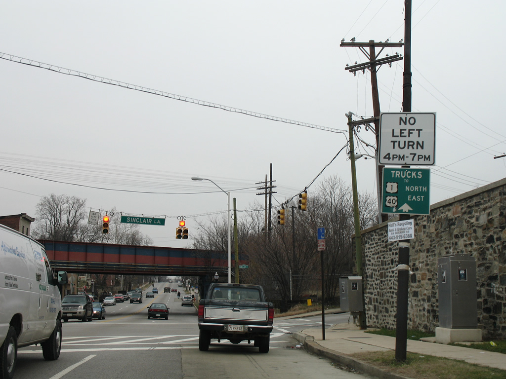
| Another small guide sign reflects the truck route of U.S. 1 north & U.S. 40 Truck east at Sinclair Lane. This sign acts as the nonexistent reassurance shield for U.S. 1. Sinclair Lane constitutes an east-west through street to Moravia Road and Frankford Avenue at Goodnow Hill. 12/28/07 |
|
| Northbound travelers pass under two sets of CSX Railroad tracks and see a reassurance marker posted as Bel Air enters the Belair-Edison community. 12/28/07 |
|
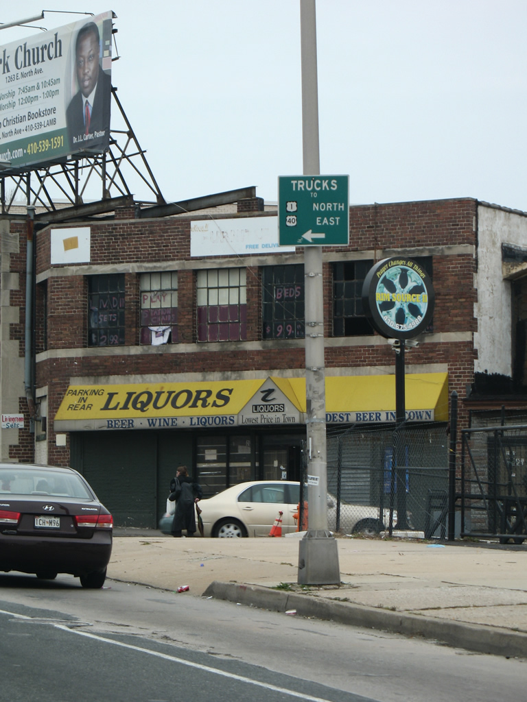
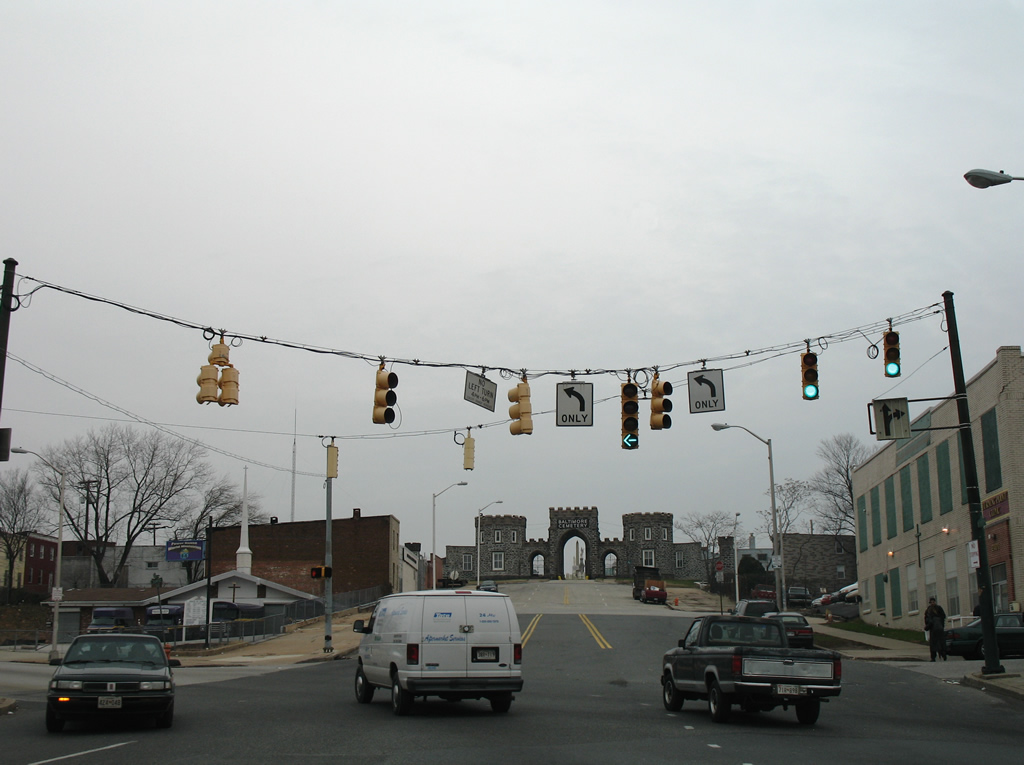
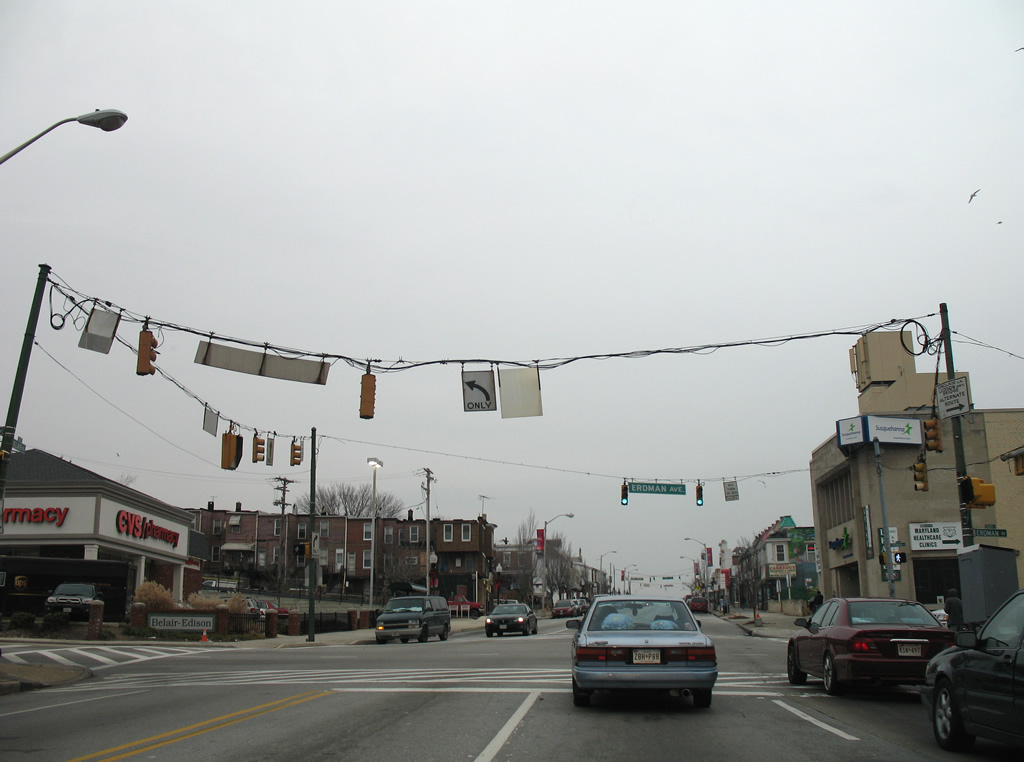
| Continuing alongside Clifton Park, U.S. 1 enters a signalized intersection with Erdman Avenue. Beginning here is MD 151, a 10.80 mile route from Baltimore south to Sparrows Mill. U.S. 40 Truck, equally unsigned as MD 151 here, follows Erdman Avenue south to a three quarter cloverleaf interchange with U.S. 40 (Pulaski Highway). 12/28/07 |
|
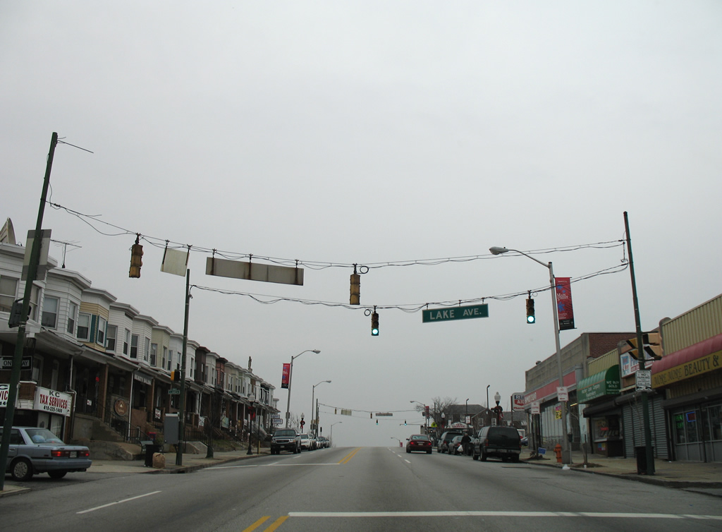
| U.S. 1 (Bel Air Road) enters a short commercial strip from MD 151 (Erdman Avenue) to Brendan Avenue. A pedestrian signal hangs above the intersection with Lake Avenue. 12/28/07 |
|
| U.S. 1 crests at Brendan Avenue and then lowers to cross Herring Run. 12/28/07 |
|
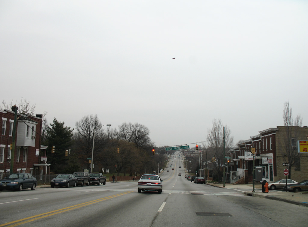
| Chesterfield Avenue lines Herring Run Park northwest from U.S. 1 (Bel Air Road) to MD 147 and Lake Montebello. 12/28/07 |
|
| Herring Run Park comprises a riparian park surrounding Herring Run in east Baltimore. U.S. 1 cuts across a small portion of the park and spans the Run on a 1925-built bridge. 12/28/07 |
|
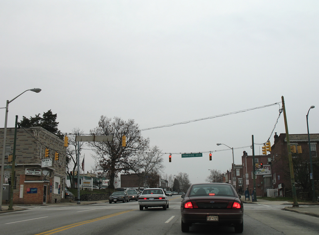
| Ascending from Herring Run, U.S. 1 (Bel Air Road) intersects Parkside Drive and leaves Herring Run Park. 12/28/07 |
|
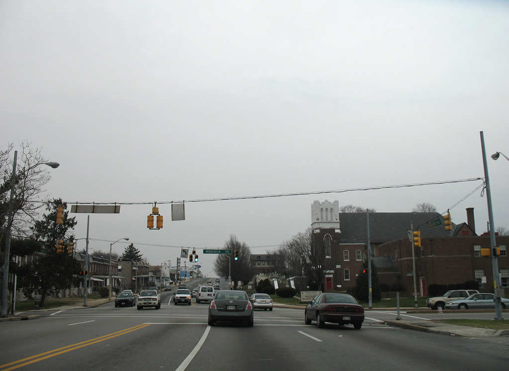
| Moravia Road provides part of an arc through northeastern Baltimore, continuing Cold Spring Lane east of Morgan State University to Interstates 895 (Harbor Tunnel Thruway) and 95 near the city line. 12/28/07 |
|
| Reassurance shield for U.S. 1 north posted after Moravia Road at the Gardenville section of the city. 12/28/07 |
|
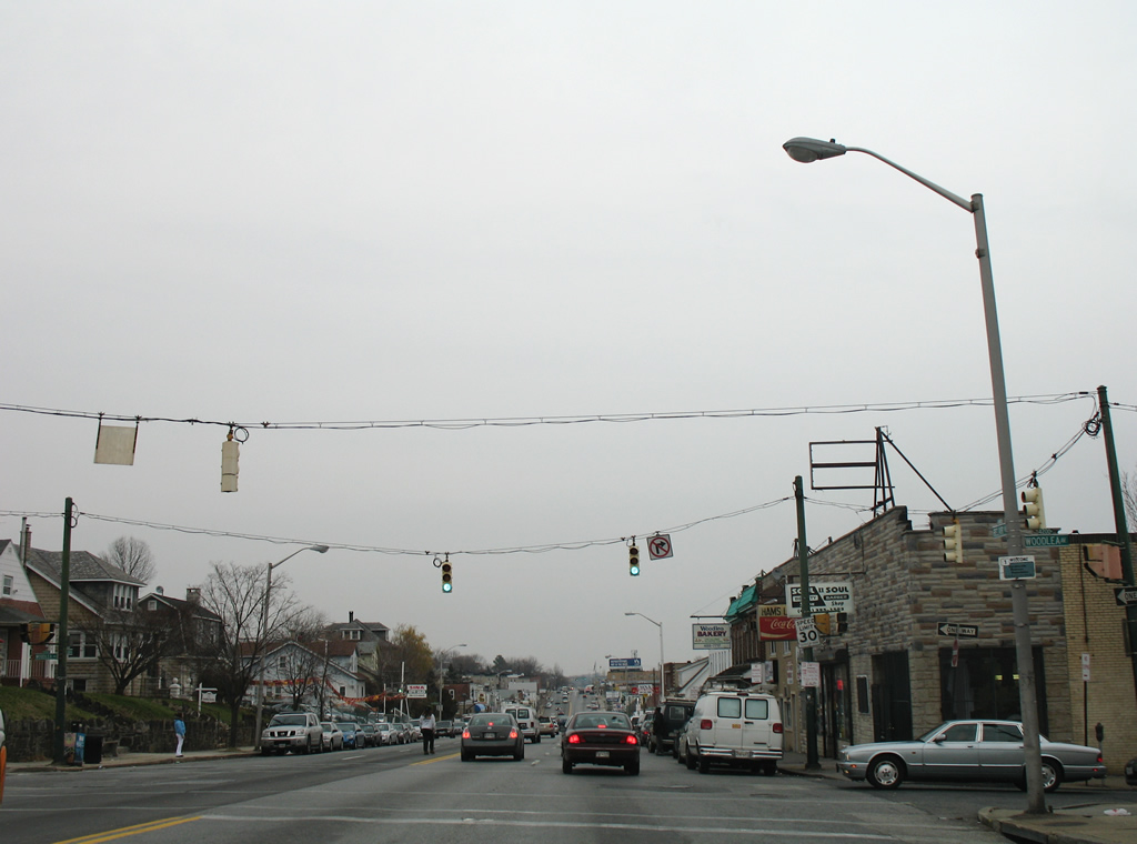
| Woodlea Avenue joins residential areas of Gardenville with Bel Air Road. The avenue flows north into U.S. 1. 12/28/07 |
|
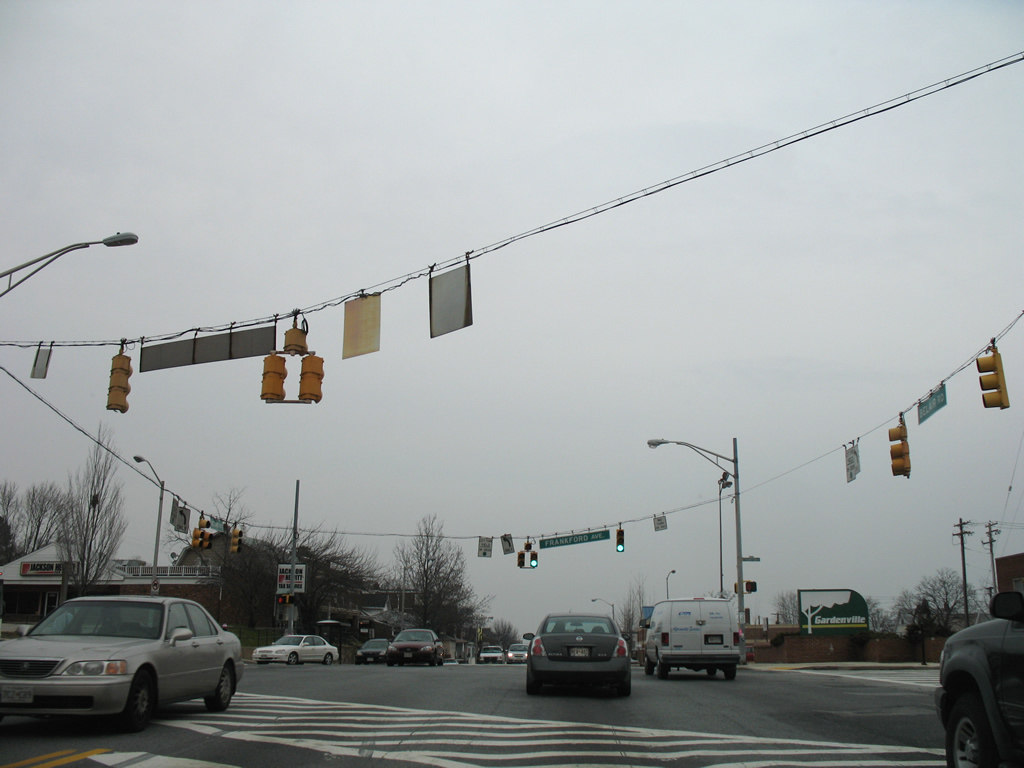
| Frankford Avenue, like Moravia Road, provides a north-south through route to U.S. 40 (Pulaski Highway) and MD 147 (Harford Road) at Lauraville. 12/28/07 |
|
| U.S. 1 becomes more commercialized as it approaches the Baltimore city line. A reassurance shield resides after the intersection with Montana Avenue. 12/28/07 |
|
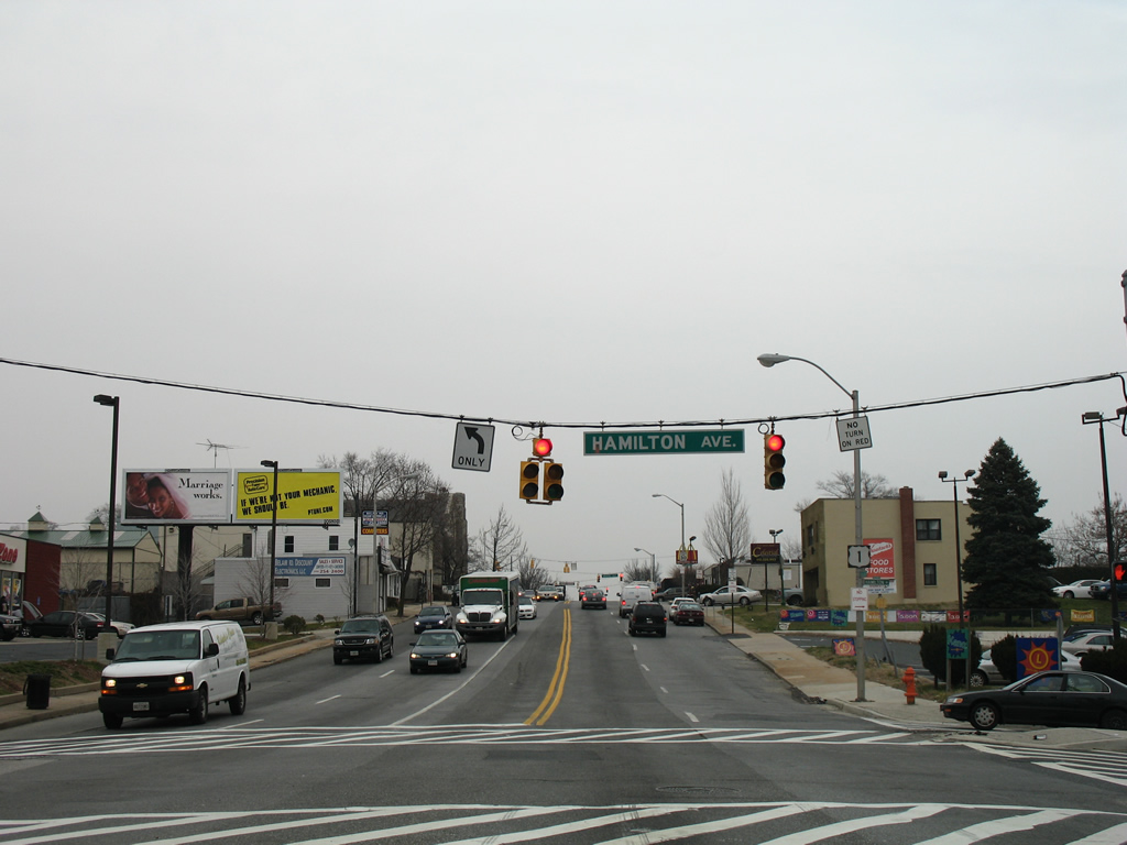
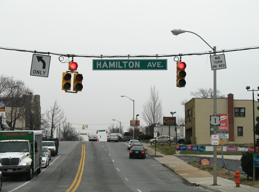
| Hamilton Avenue meanders east from U.S. 1 (Bel Air Road) to Rosedale outside the city and northwest to Lauraville. 12/28/07 |
|
| Another U.S. 1 shield follows the Bel Air Road northbound intersection with Hamilton Avenue. 12/28/07 |
|
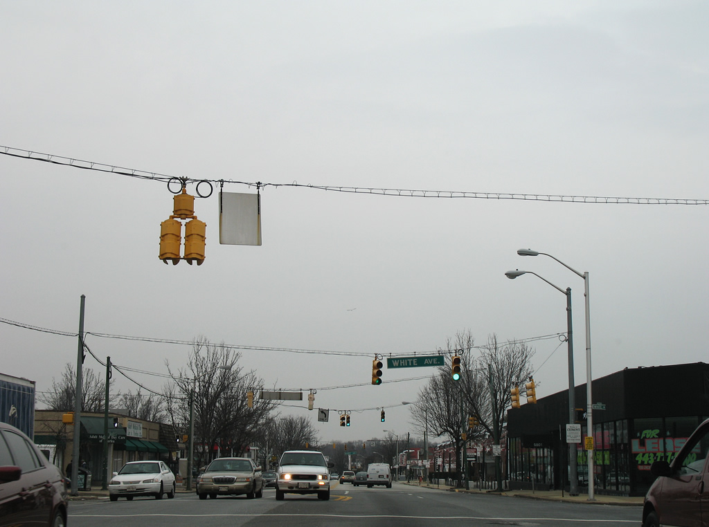
| White Avenue provides a through route east to Hazelwood Avenue and Golden Ring Road to the suburbs of Kenwood and Golden Ring. 12/28/07 |
|
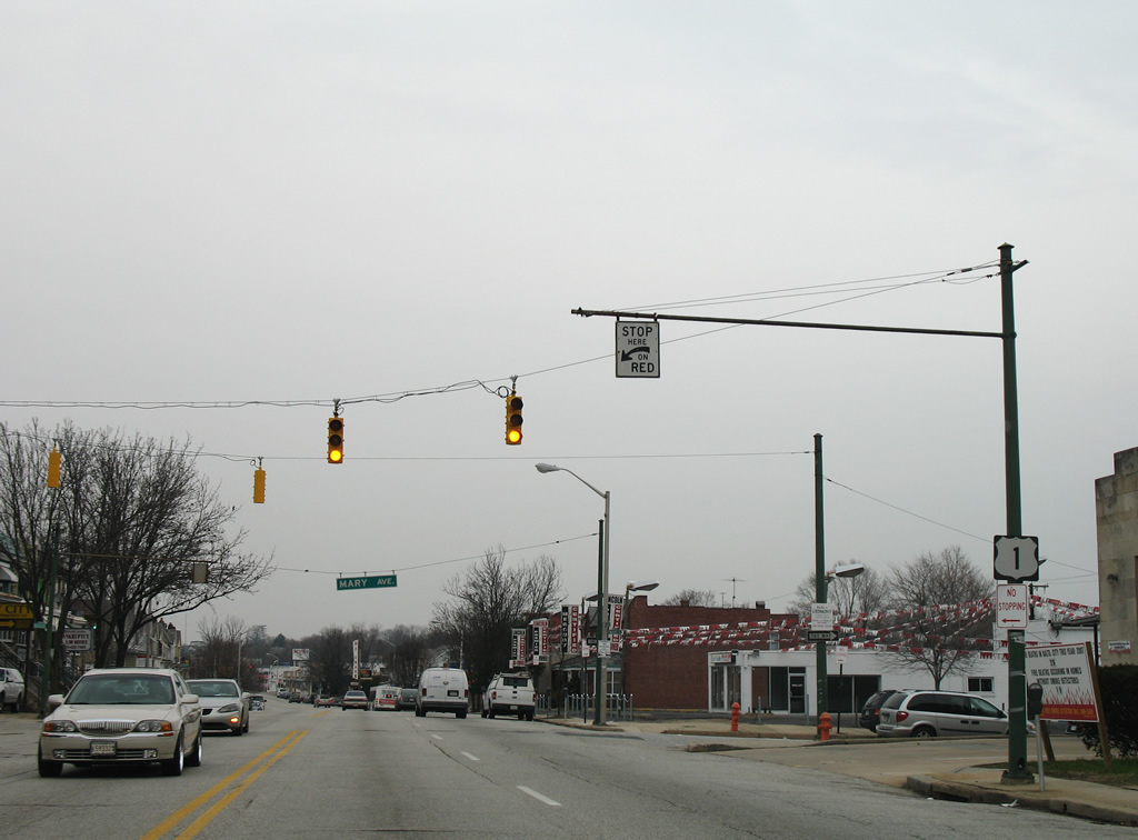
| Signage remains consistent for U.S. 1 north with another shield posted at Mary Avenue opposite the Company 54 fire station. 12/28/07 |
|
| An older style shield for U.S. 1 lines Bel Air Road ahead of a shopping center traffic light near Powell Avenue. 12/28/07 |
|
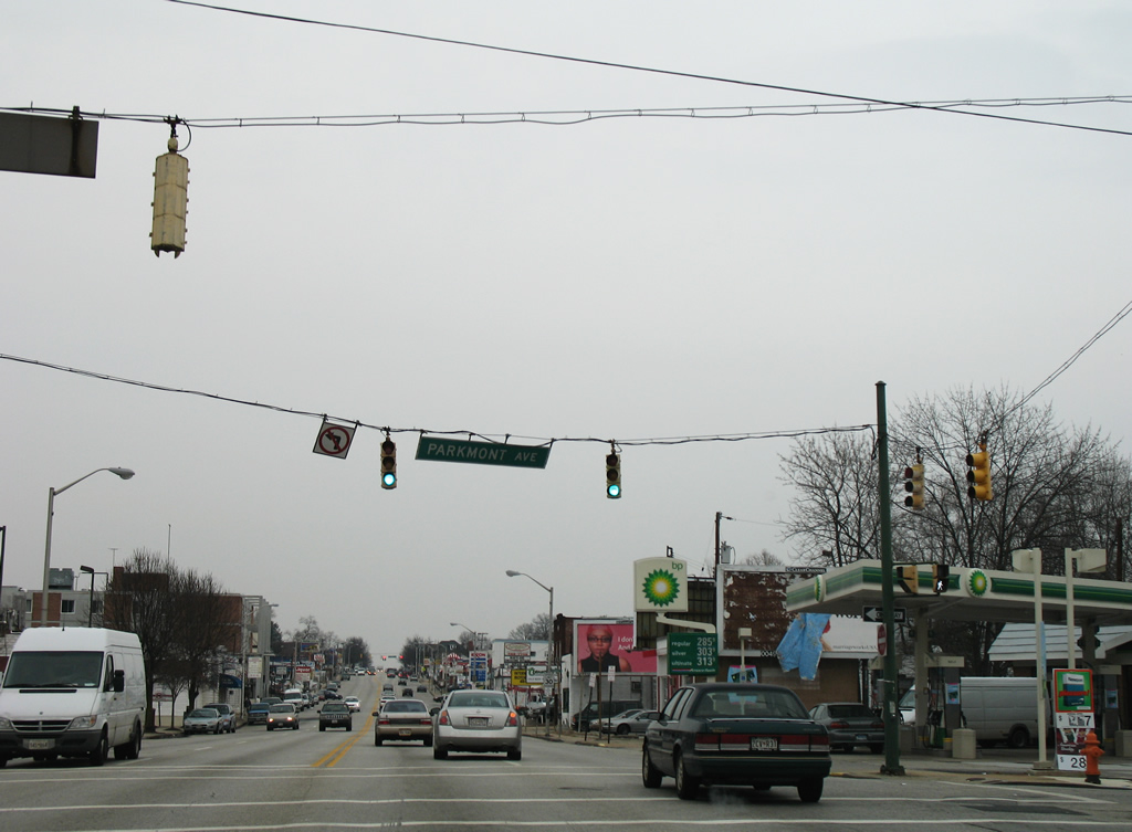
| Parkmont Avenue west and Powell Avenue east provide the main streets into the Belmar community east of U.S. 1 (Bel Air Road). 12/28/07 |
|
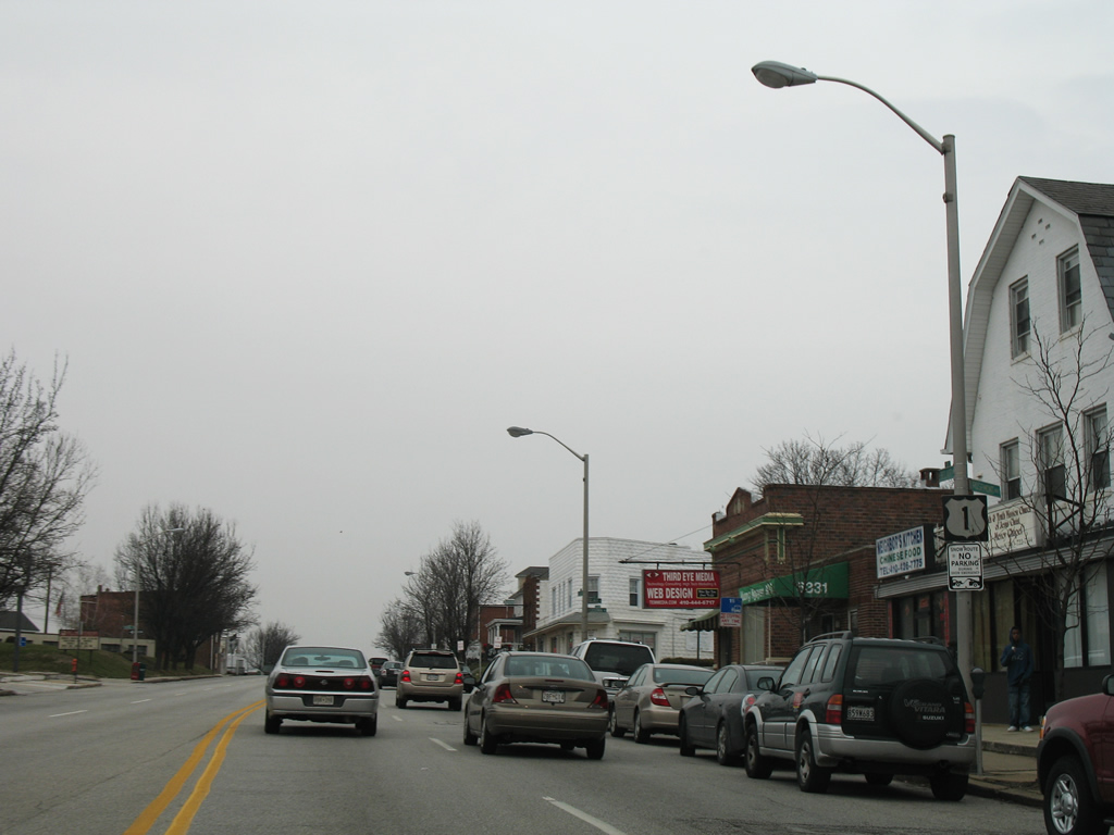
| Commercialized frontage continues to represent the landscape of Bel Air Road as U.S. 1 enters the Belgravia community. 12/28/07 |
|
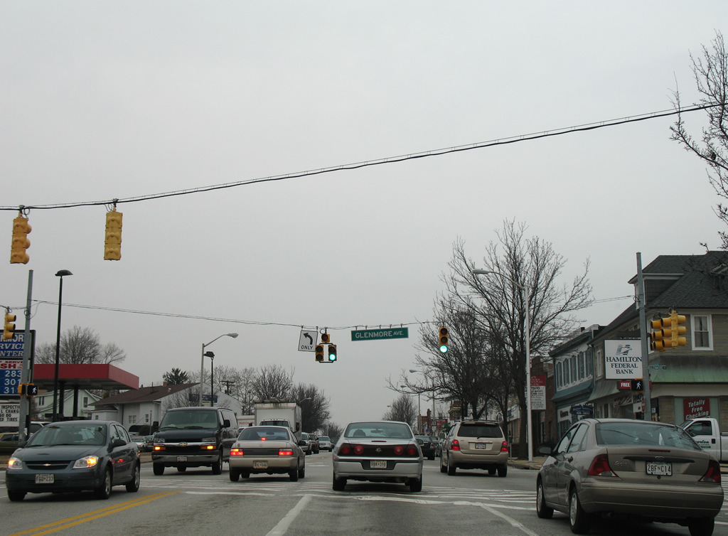
| Glenmore Avenue heads west from Belgravia to Hamilton and MD 147 (Harford Road) and east to a dead end at Belmar Park. 12/28/07 |
|
| Continuing northeast from Glenmore Avenue on U.S. 1 (Bel Air Road) north at Rosemont Avenue south. 12/28/07 |
|
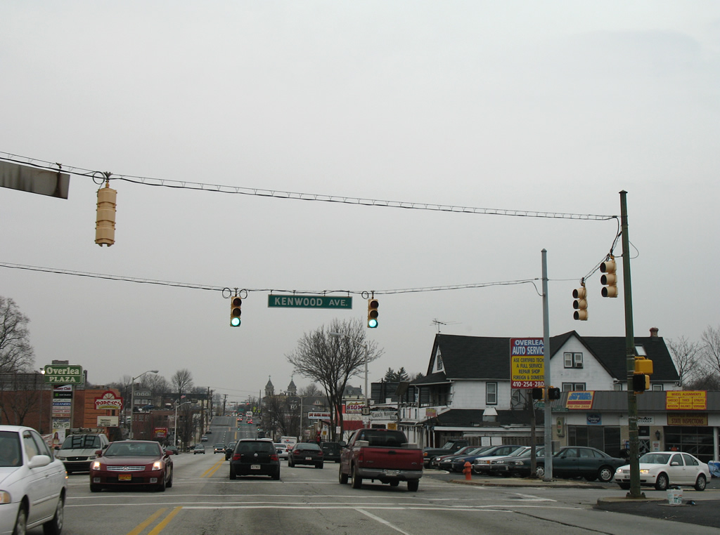
| Kenwood Avenue stems east from U.S. 1 at Belgravia to Overlea in Baltimore County. MD 588 follows the road southeast from Brookwood Avenue to Golden Ring Road and U.S. 40 (Pulaski Highway). 12/28/07 |
|
| The final U.S. 1 shield within the city of Baltimore adheres to older specifications. 12/28/07 |
|
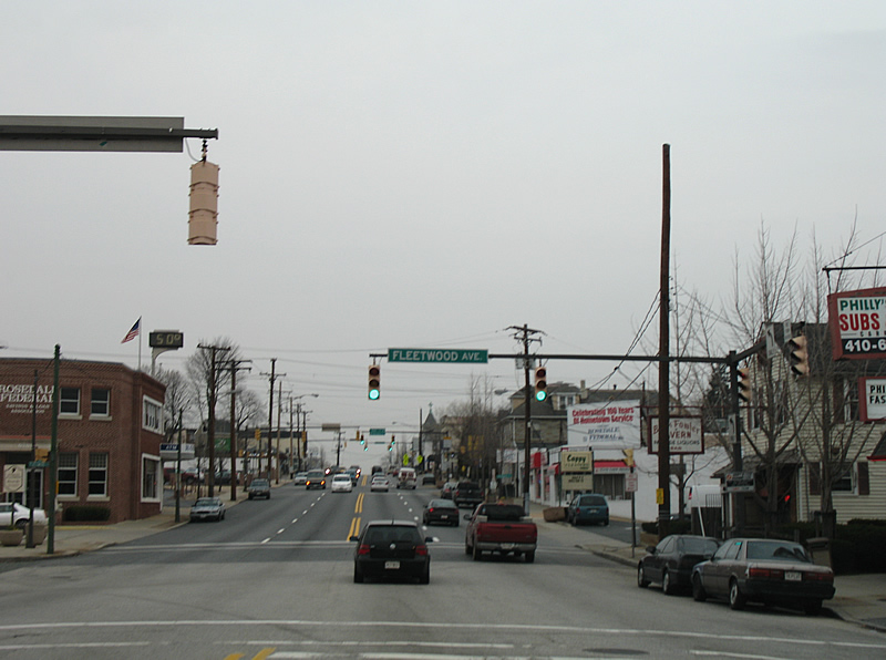
| U.S. 1 exits the city of Baltimore at Fleetwood Avenue. The pavement changes and so does the traffic signal assemblies. 12/28/07 |
|
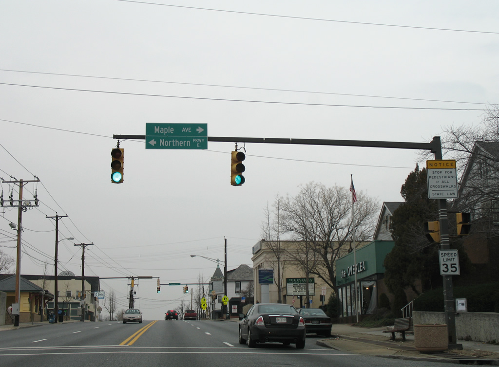
| Northern Parkway begins at U.S. 1 in Overlea and encircles northern Baltimore to Mount Washington, Pimlico, and MD 26 (Liberty Heights Avenue). 12/28/07 |
|
| One block further north on U.S. 1 (Bel Air Road) in Overlea at Overlea Avenue, a short residential street flowing east. 12/28/07 |
|
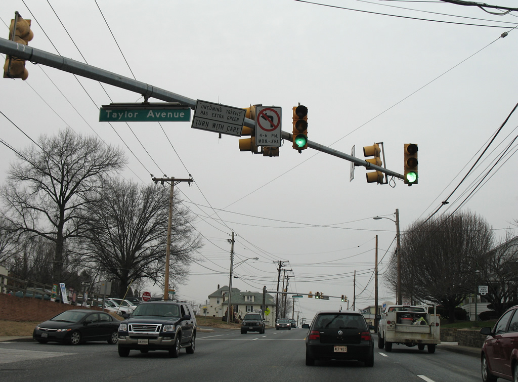
| Taylor Avenue joins Overlea with Parkville via the northeast corner of Baltimore city. The road becomes Goucher Boulevard west of MD 542 (Loch Raven Boulevard) en route to Towson. 12/28/07 |
|
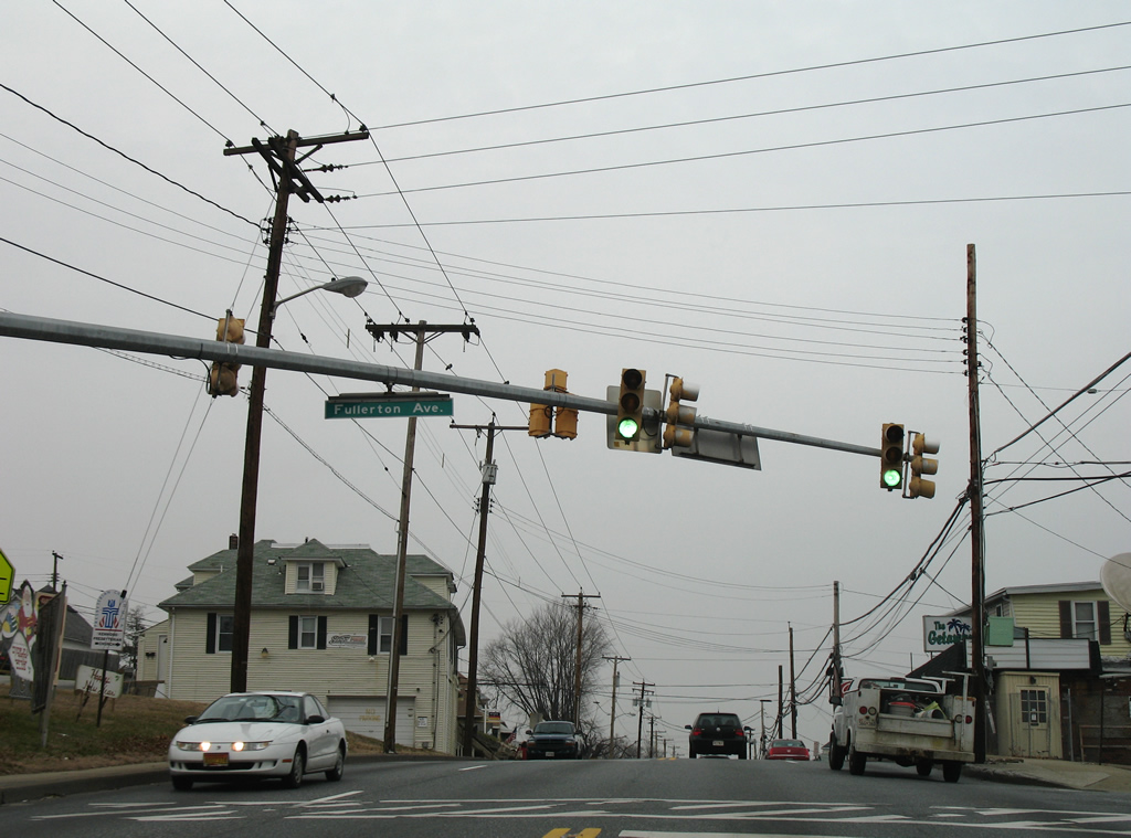
| Fullerton Avenue provides a cut off between U.S. 1 (Bel Air Road) and Kenwood Avenue at Overlea. 12/28/07 |
|
| An older MDSHA-standard shield for U.S. 1 follows on Bel Air Road after Fullerton Avenue. 12/28/07 |
|
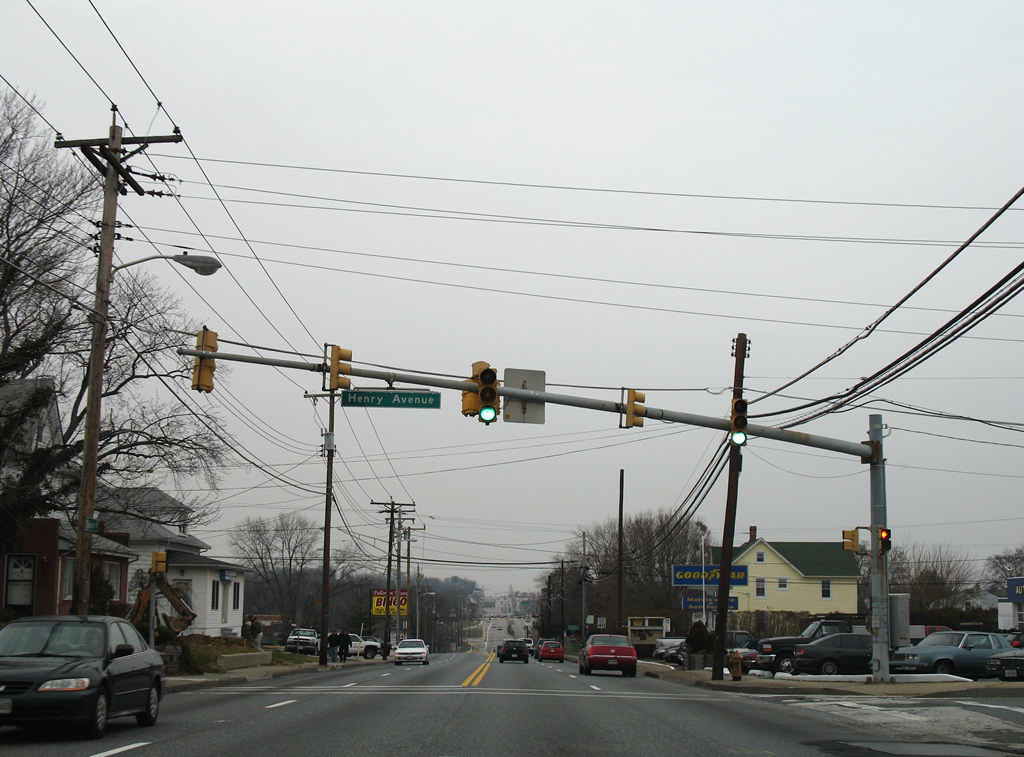
| Henry Avenue connects U.S. 1 with the Linhigh residential area west of the Baltimore Beltway. 12/28/07 |
|
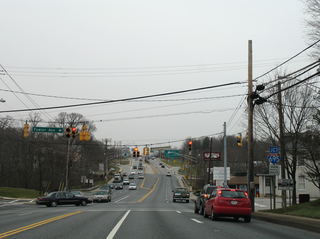
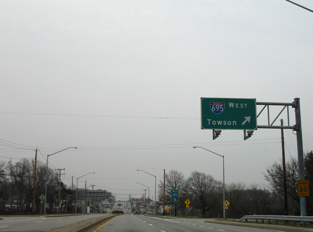
| U.S. 1 (Bel Air Road) widens briefly into a four lane divided highway between Fowler Avenue and Rossville Boulevard to accommodate movements to Interstate 695. 12/28/07 |
|
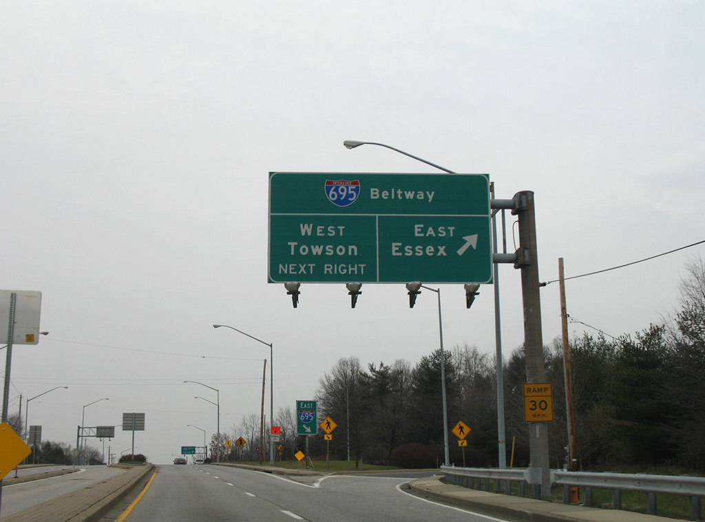
| A cloverleaf interchange joins Interstate 695 with U.S. 1 (Bel Air Road) between Overlea and Fullerton. The beltway travels south to Interstate 95, Essex, and Dundalk from U.S. 1. 12/28/07 |
|
| Interstate 695 curves northwest to Parkville, Carney and Towson from U.S. 1. 12/28/07 |
|
| Leaving Interstate 695 behind, U.S. 1 (Bel Air Road) enters a heavily commercialized area centered around Rossville Boulevard. 12/28/07 |
|
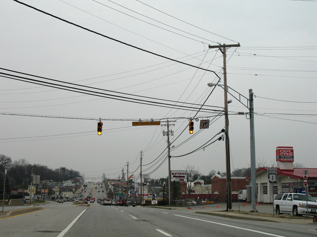
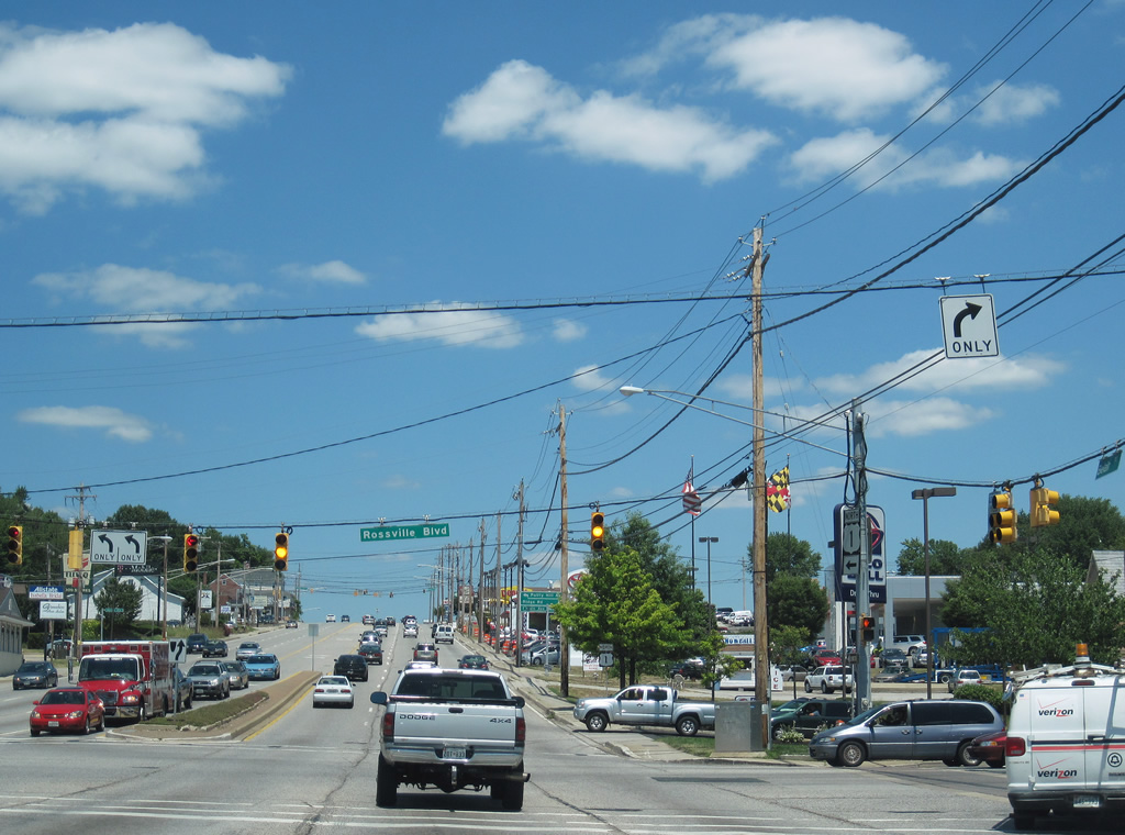
| Rossville Boulevard shadows Interstate 695 to the east from Fullerton and U.S. 1 south to U.S. 40 at Rossville. North of U.S. 1, the road connects with Putty Hill Avenue to MD 147 at Parkville. 07/02/10 |
|
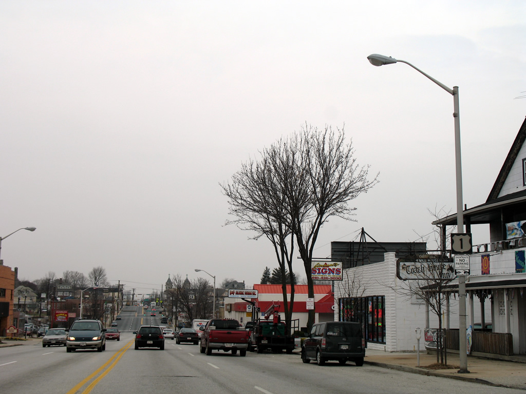
| Heavily congested U.S. 1 (Bel Air Road) rises through Fullerton. 12/28/07 |
|
| Putty Hill Avenue east and Ridge Road west come together at U.S. 1 (Bel Air Road) at the next traffic light. Putty Hill Avenue does not directly connect with the road west from Rossville Boulevard and instead acts as a local connector to Walter Boulevard. 07/02/10 |
|
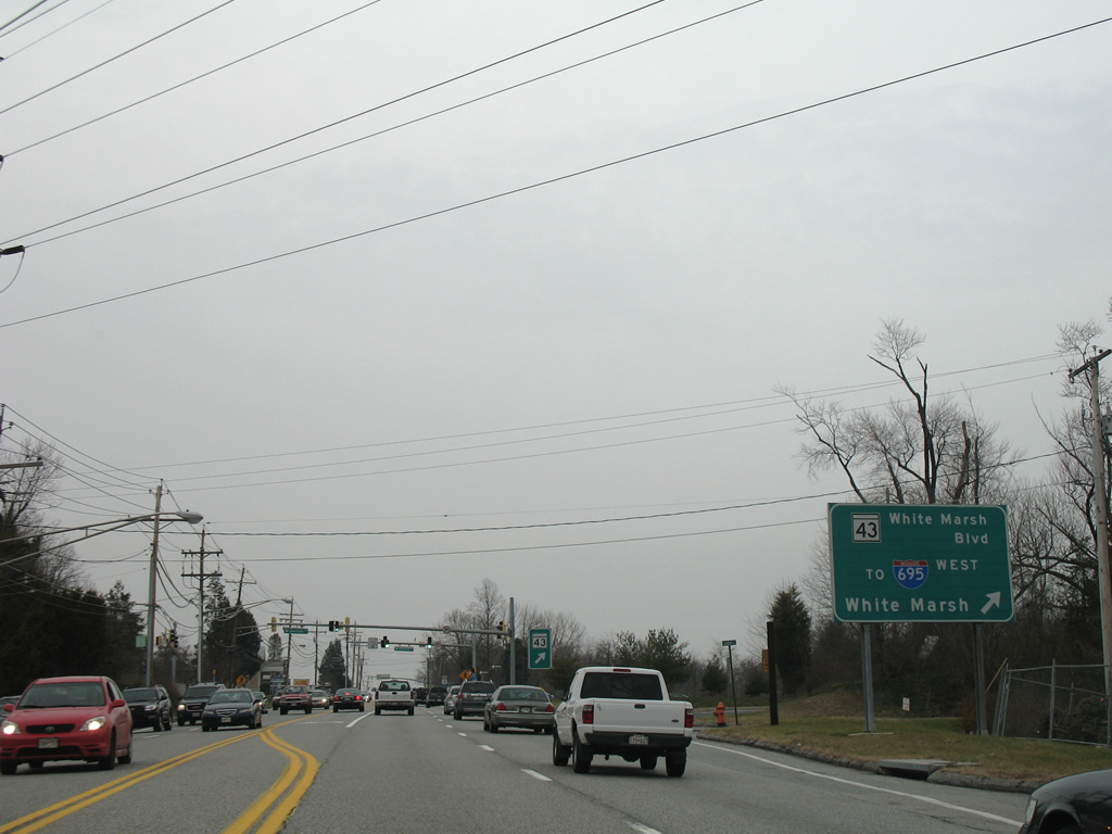
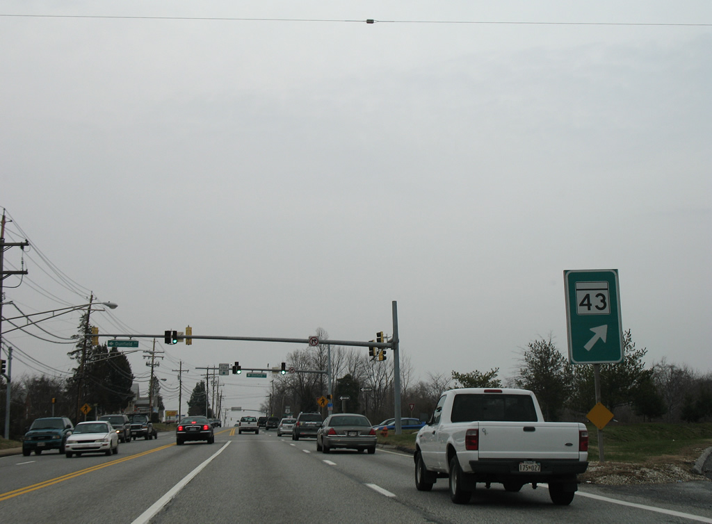
| U.S. 1 passes over MD 43 (White Marsh Boulevard). Separate connector ramps join U.S. 1 north and south independent of one another to MD 43. MD 43 constitutes a controlled-access arterial west to Exit 31C of Interstate 695 and east to Interstate 95 and U.S. 40. 12/28/07 |
|
| MD 43 originally only traveled as a freeway between U.S. 40 (Pulaski Highway) and Interstate 95 (Exit 67). An extension west to Interstate 695 was touted as a freeway, but built as a surface route in 1994. A further extension southeast opened by 2006, continuing White Marsh Boulevard south to MD 150 (Eastern Boulevard). 12/28/07 |
|
| Leaving the confluence with MD 43 (White Marsh Boulevard) on U.S. 1 north near Necker. 12/28/07 |
|
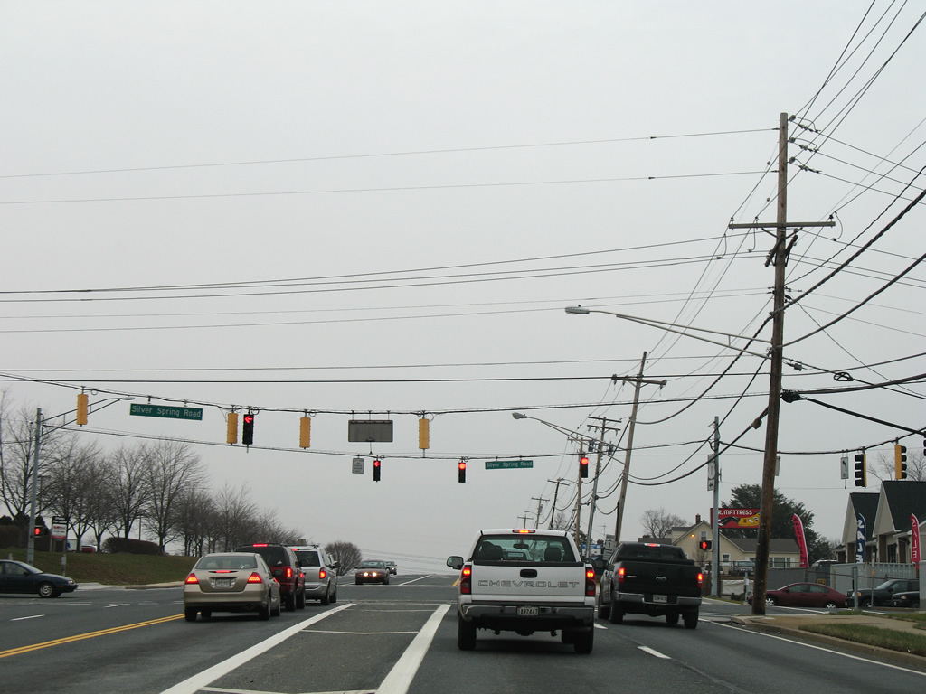
| Silver Spring Road leads south from Joppa Road and U.S. 1 at Necker to an area north of MD 43 and White Marsh Mall. 12/28/07 |
|
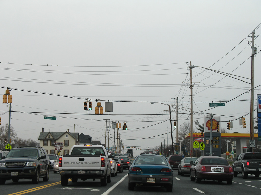
| Five lanes of U.S. 1 (Bel Air Road) enter the congested Perry Hall area and intersect Ebenezer Road east and westbound Joppa Road. 12/28/07 |
|
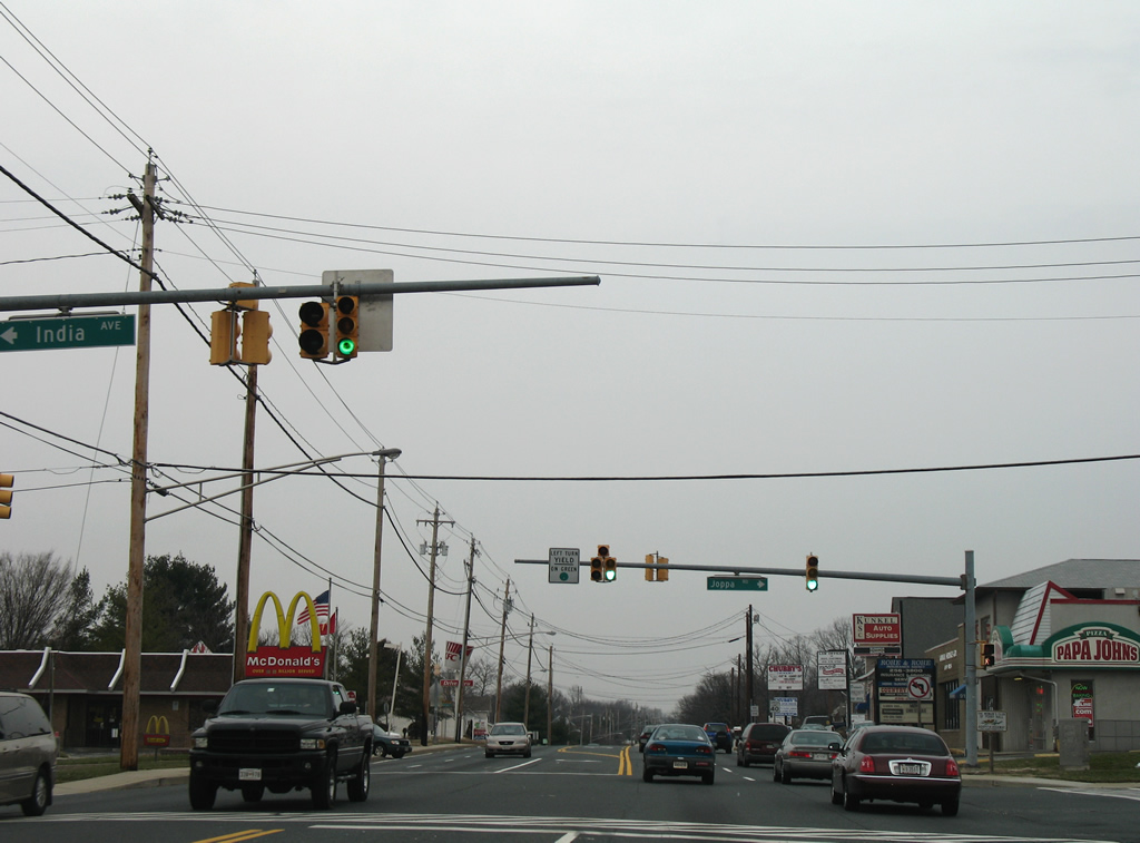
| Joppa Road continues east from U.S. 1 (Bel Air Road) through a myriad of residential subdivisions to end at MD 7 (Philadelphia Road), east of Interstate 95. 12/28/07 |
|
| Chapel Road provides a cut off to Joppa Road southeast from U.S. 1. 12/28/07 |
|
| U.S. 1 bisects Northview Shopping Center and Perry Hall Marketplace at the next northbound shield assembly. 12/28/07 |
|
| U.S. 1 enters Germantown and intersects Forge Road east. Forge Road serves a handful of neighborhoods east to its end at Interstate 95. 12/28/07 |
|
| A reprieve of the suburban landscape is a welcome sight for northbound drivers along U.S. 1 after Forge Road. Bel Air Road reduces back to four lanes and lowers to Gunpowder Falls State Park. 12/28/07 |
|
| U.S. 1 bottoms out at the crossing over Gunpowder Falls at the Gunpowder Falls State Park Central Area and the Big Gunpowder Trail. 12/28/07 |
|
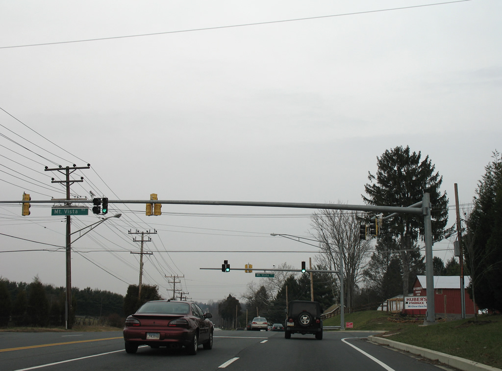
| U.S. 1 leaves Gunpowder Falls State Park and next meets Mount Vista Road at a signalized intersection. Mt. Vista Road heads north to Mountvista (MD 147) and east to Raphel Road, south of Upper Falls. 12/28/07 |
|
| Continuing northeast from Mt. Vista Road toward Kingsville on U.S. 1 (Bel Air Road) north. 12/28/07 |
|
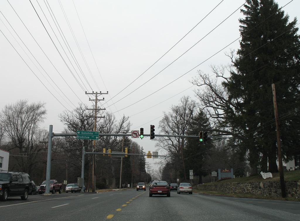
| Entering Kingsville, U.S. 1 splits with Jerusalem Road east to Gunpowder Falls State Park ahead of the traffic light with Bradshaw Road south and Sunshine Avenue north. Left turns are prohibited to Sunshine Avenue north from U.S. 1 north. Instead motorists must use Jerusalem Road to Bradshaw Road north to make the movement. 12/28/07 |
|
| Sunshine Avenue arcs northwest to MD 147 (Harford Road) at Fork, opposite Fork Road. Bradshaw Road sinks southeast to Upper Falls and MD 7 at Bradshaw. 12/28/07 |
|
| Leaving Kingsville and Bradshaw Road, northbound drivers see the next U.S. 1 shield. 12/28/07 |
|
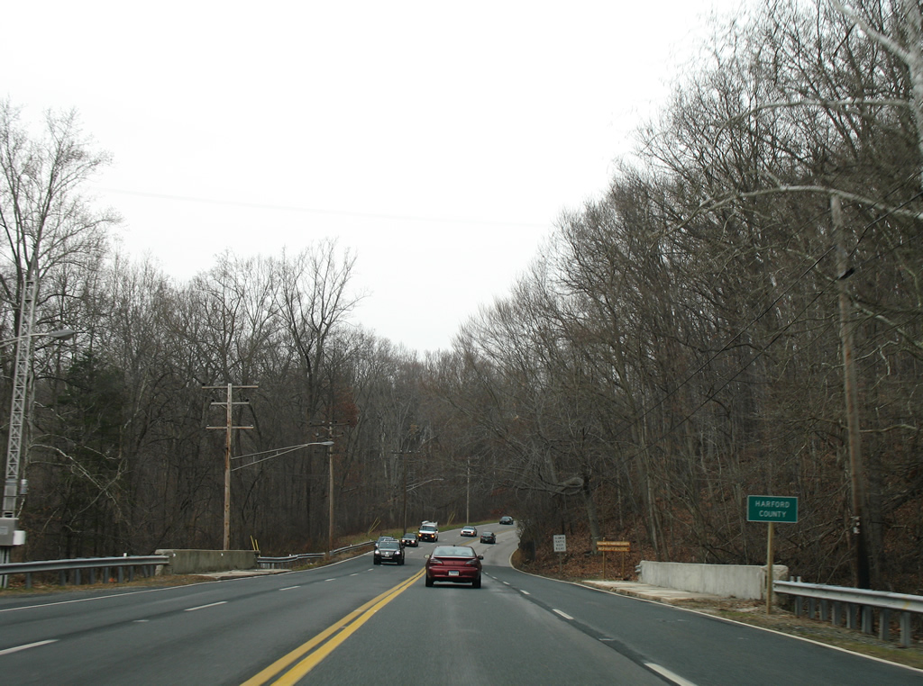
| U.S. 1 enters another unit of Gunpowder Falls State Park and crosses Little Gunpowder Falls into Harford County. 12/28/07 |
06/02/03, 10/10/04, 10/13/04, 08/27/05, 12/28/07, 06/27/10, 06/30/10, 07/02/10, 06/20/12 by AARoads
Page Updated 07-14-2012.


 North
North