|
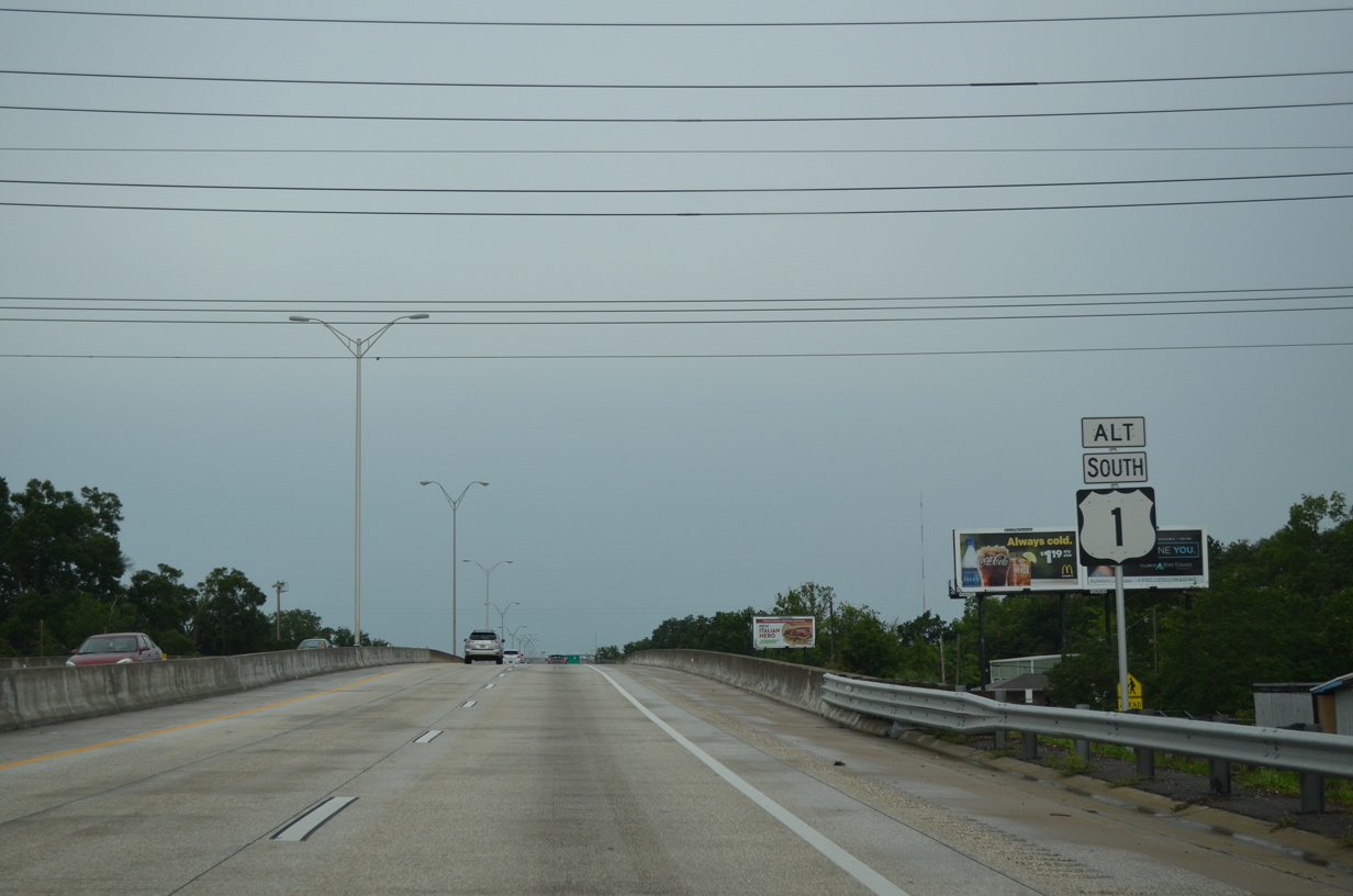
| The first reassurance marker for U.S. 1 Alternate stands between the slip ramps taking U.S. 1 north to Main Street (U.S. 17) and eastbound motorists onto MLK, Jr. Parkway from Pearl Street. 06/16/16 |
|
| Passing over Main Street (U.S. 1/17), Martin Luther King, Jr. Parkway separates with the slip ramp to 19th and Liberty Streets. 06/16/16 |
|
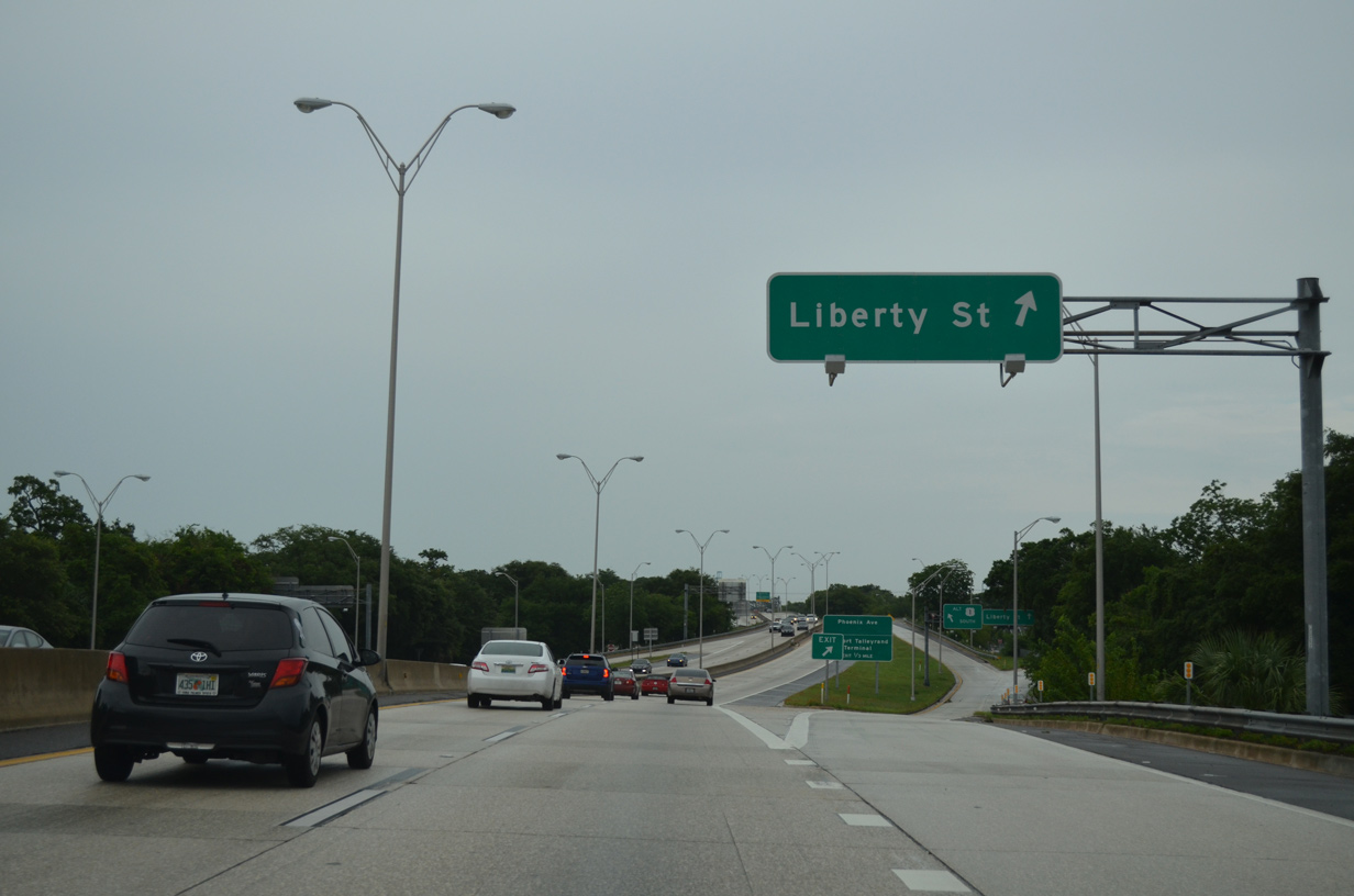
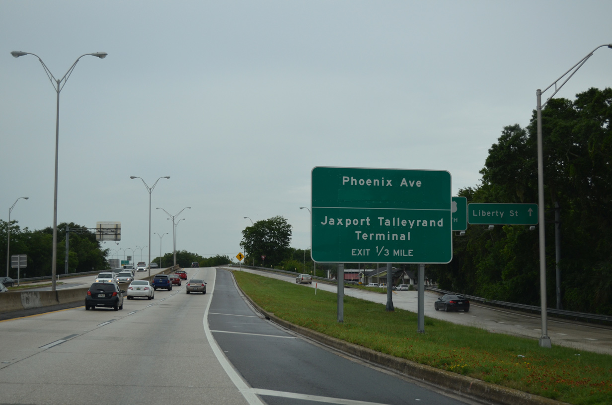
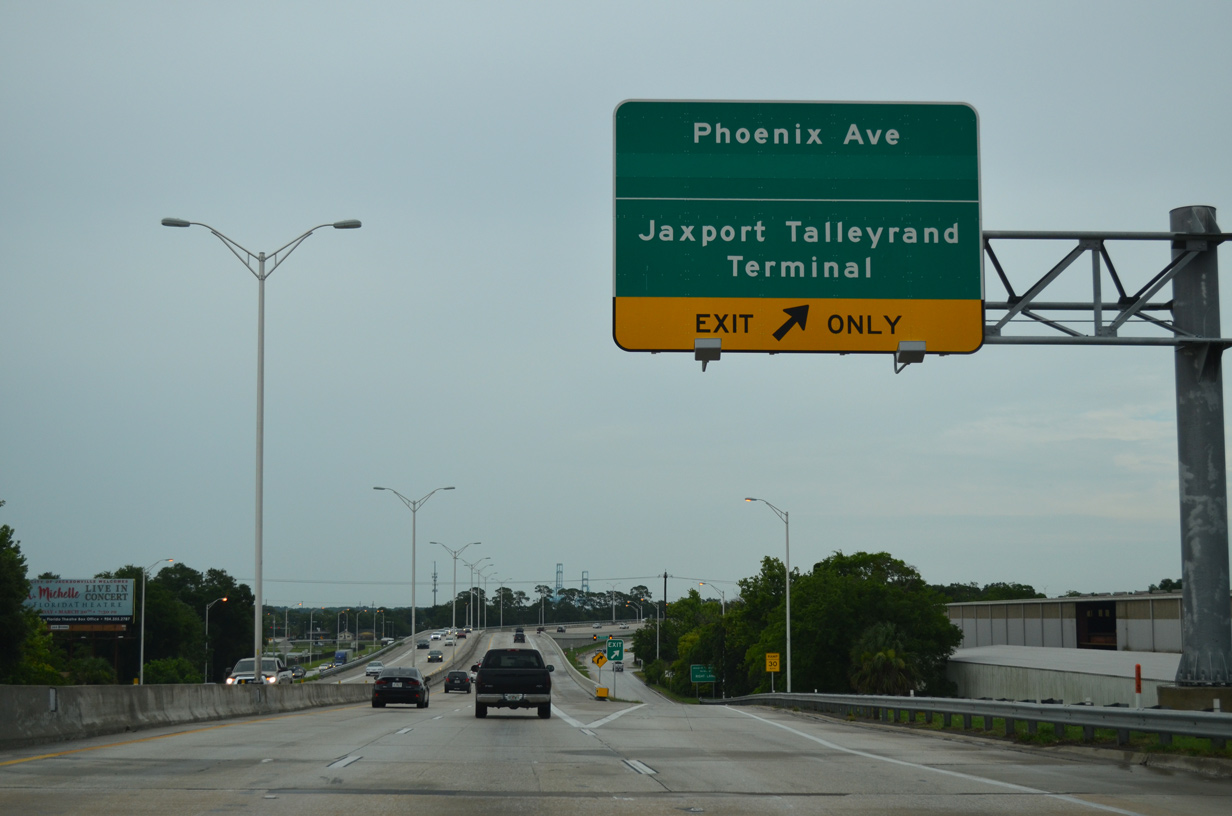
| U.S. 1 Alternate kinks southward ahead of the Liberty Street underpass. Continuing east by the Phoenix neighborhood, the next off-ramp departs in one third of a mile for Phoenix Avenue and the 21st Street connector. 06/16/16 |
|
| The diamond interchange with Phoenix Avenue was redesigned as part of the 21st Street Interchange Project between November 2011 and March 2014. Construction added new directional ramps east from Phoenix Avenue to 21st Street to improve access to the nearby Jaxport Talleyrand Terminal. 06/16/16 |
|
| A significant realignment improved the geometry of the U.S. 1 Alternate southward turn from parallel 21st Street. 06/16/16 |
|
| Martin Luther King, Jr. Parkway runs south along Haines Street to Midtown. Two slip ramps depart over the next mile for the adjacent service road. A third ramp was previously located at 13th Street as well. It was removed during the 20th Street Interchange Project. 06/16/16 |
|
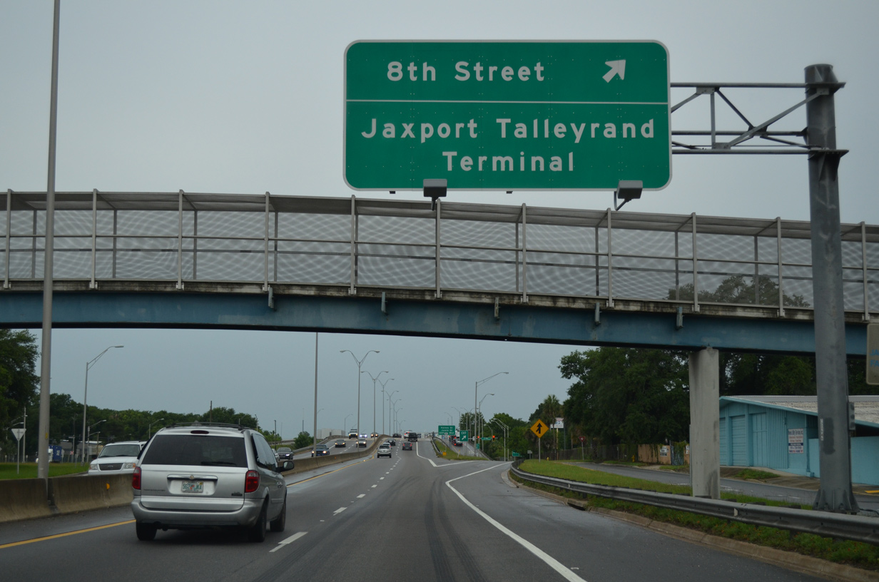
| U.S. 1 Alternate separates the Phoenix and Fairfield neighborhoods to a modified diamond interchange with 8th Street. 06/16/16 |
|
| The second U.S. 1 Alternate reassurance shield appears along southbound at the 11th Street underpass. 06/16/16 |
|
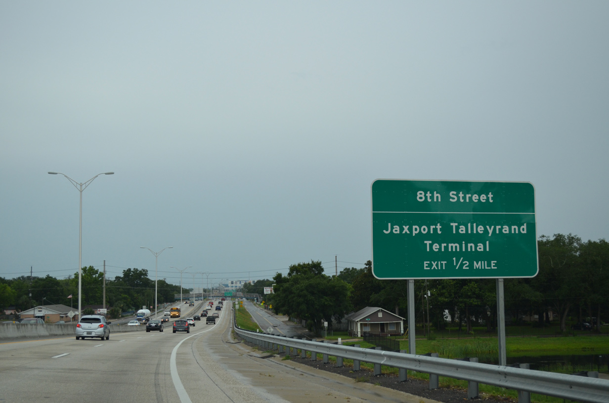
| A pedestrian bridge spans MLK, Jr. Parkway by an elementary school as motorists depart U.S. 1 Alternate south for Haines Street south to 8th Street. 8th Street ends ten blocks to the east at Talleyrand Avenue by the Jaxport Terminal. 06/16/16 |
|
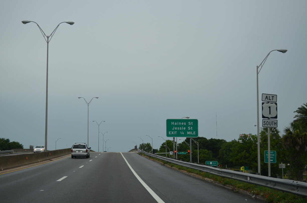
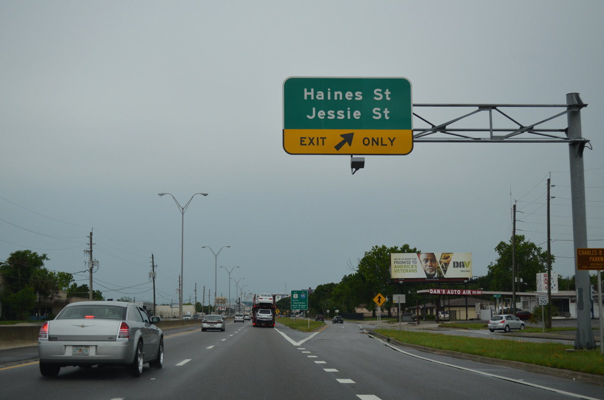
| South from 8th Street, U.S. 1 Alternate advances to the East Jacksonville community and a slip ramp for Jessie Street. 06/16/16 |
|
| Jessie Street connects the East Jacksonville residential street grid with industrial areas east of MLK Parkway. 06/16/16 |
|
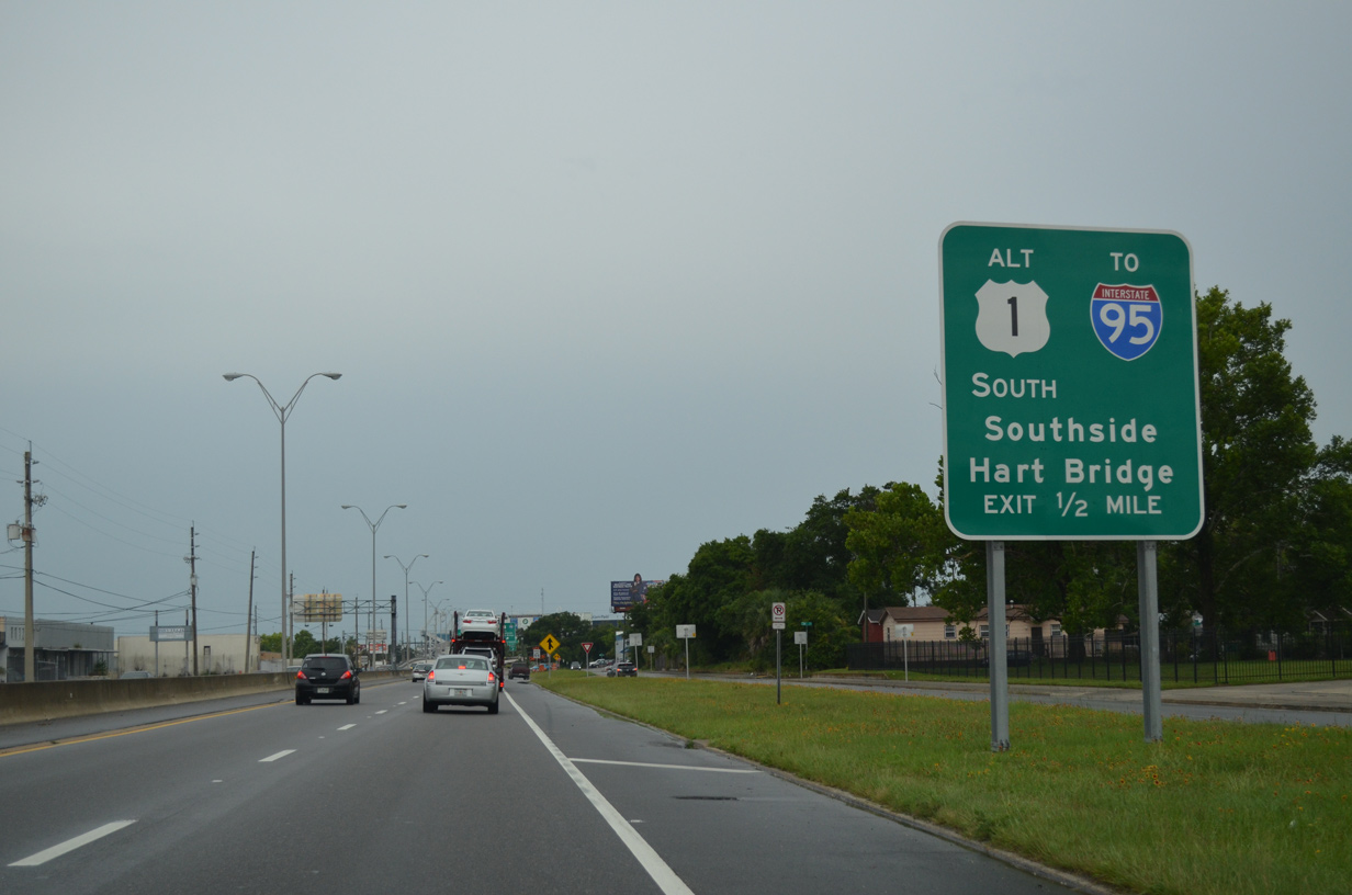
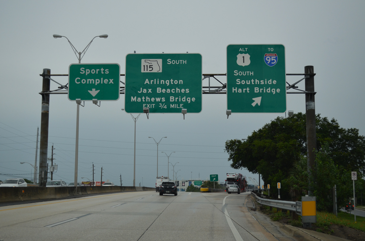
| Just a half mile remains before U.S. 1 Alternate splits with Martin Luther King, Jr. Parkway (SR 115) for the Hart Bridge Expressway. The Hart Bridge links Midtown with Southside, Jacksonville while SR 115 spans the Mathews Bridge east from Midtown to Arlington. 06/16/16 |
|
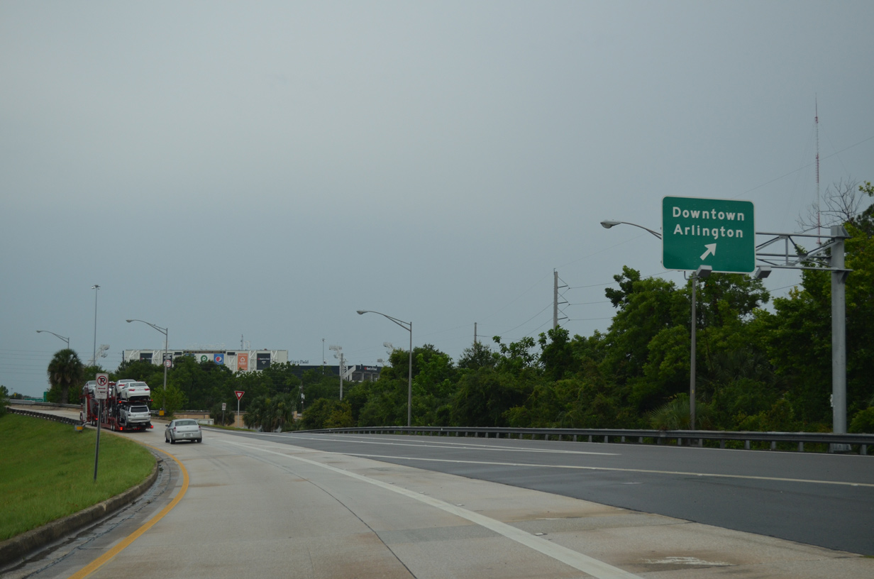
| U.S. 1 Alternate branches southeast from a wye interchange as SR 115 extends MLK, Jr. Parkway south to the Arlington Expressway and TIAA Bank Field. 06/16/16 |
|
| A final slip ramp ties adjacent Haines Street south with U.S. 1 Alternate as the Hart Bridge Expressway elevates to pass over SR 115. 06/16/16 |
|
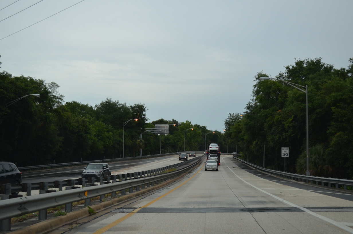
| The Hart Bridge Expressway advances south with just two lanes into Midtown Jacksonville. 06/16/16 |
|
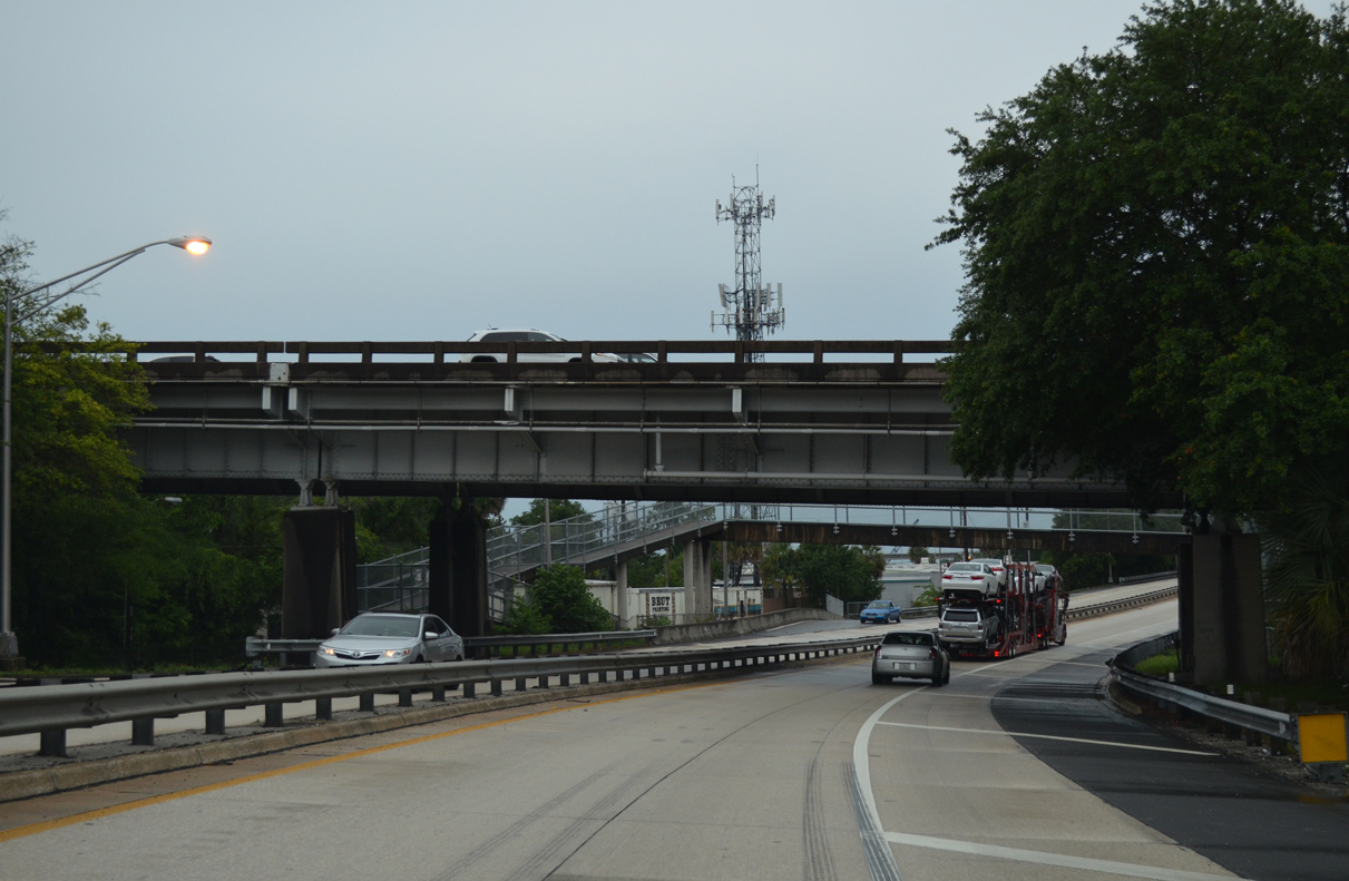
| Passing under the Mathews Bridge (SR 10A/115) west bridge approach on U.S. 1 Alternate south. 06/16/16 |
|
| U.S. 1 Alternate shifts onto the Hart Bridge beyond the entrance ramp from Duval Street by TIAA Bank Field. 06/16/16 |
|
| A wye interchange joins Gator Bowl Boulevard / former SR 228 east with U.S. 1 Alternate south. 06/16/16 |
|
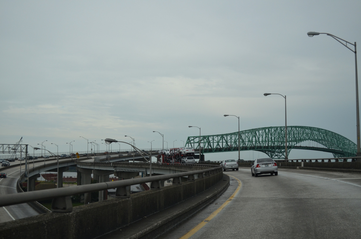
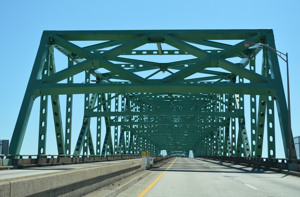
| Curving east, U.S. 1 ALT navigates along a high flyover above the Commodore Point industrial onto the continuous steel through truss bridge spanning the St. Johns River. 06/16/16 |
|
| The Isaiah D. Hart Bridge opened to traffic on November 2, 1967 at a cost of $8.8 million. 06/16/16 |
|
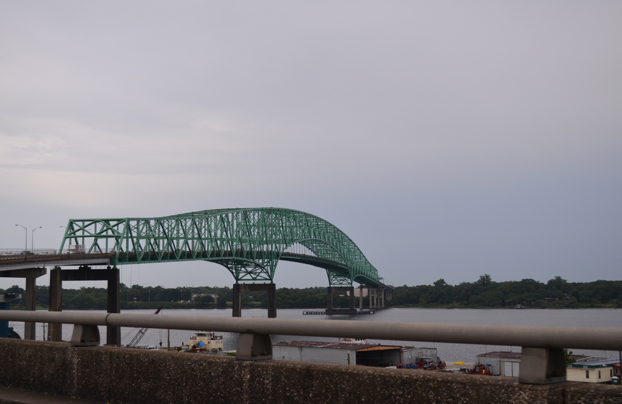
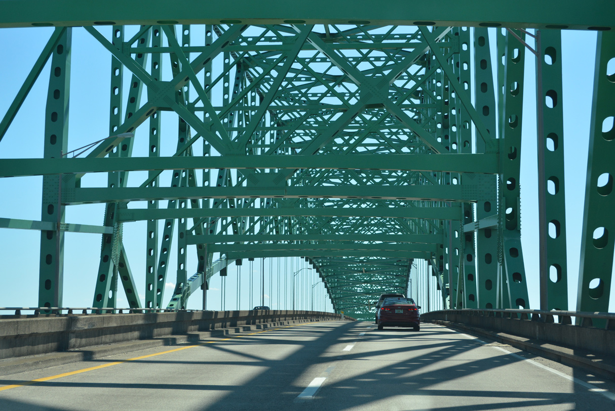
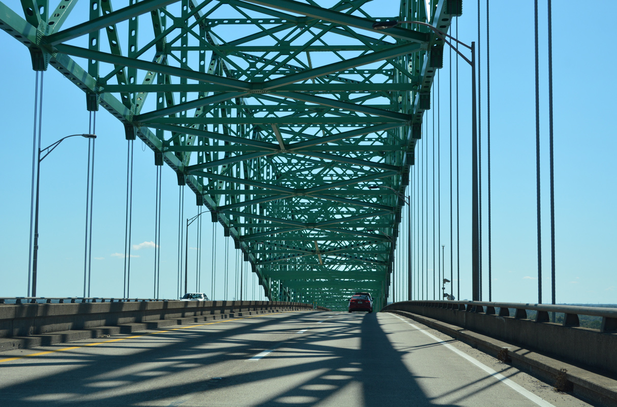
| Angling southeast, the Hart Bridge takes U.S. 1 Alternate / SR 228 southeast to Empire Point. The bridge is 3,844 feet long.1 10/16/22 |
|
| The four lane span across the St. Johns River was tolled until 1989. 10/16/22 |
|
| The Hart Bridge travels 141 feet above the main navigation channel of the river. 10/16/22 |
|
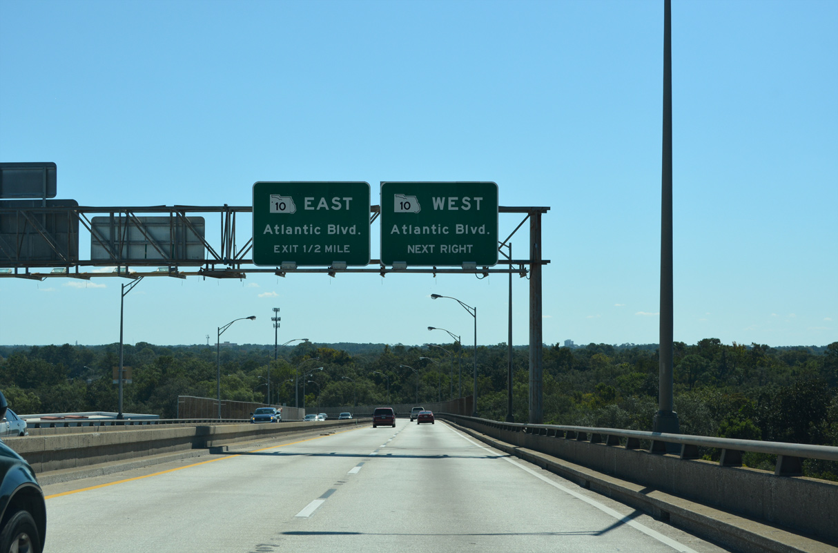
| A six-ramp parclo interchange with SR 10 (U.S. 90 Alternate) west to St. Nicholas and east to Oak Haven ties the south end of the Hart Bridge. 10/16/22 |
|
| SR 10 (Atlantic Boulevard) converges with U.S. 90 in 1.1 miles, becoming the hidden counterpart of the route west to Pensacola. 10/16/22 |
|
| A wide area of concrete remains from where the Hart Bridge toll plaza was located north of Atlantic Boulevard. 10/16/22 |
|
| Signs in both directions of the Commodore Point Expressway omit the U.S. 90 Alternate designation for Atlantic Boulevard. U.S. 90 ALT forms an L-shaped route with SR 10 and SR 115 (Southside Boulevard) to the northeast of Beach Boulevard. 10/16/22 |
|
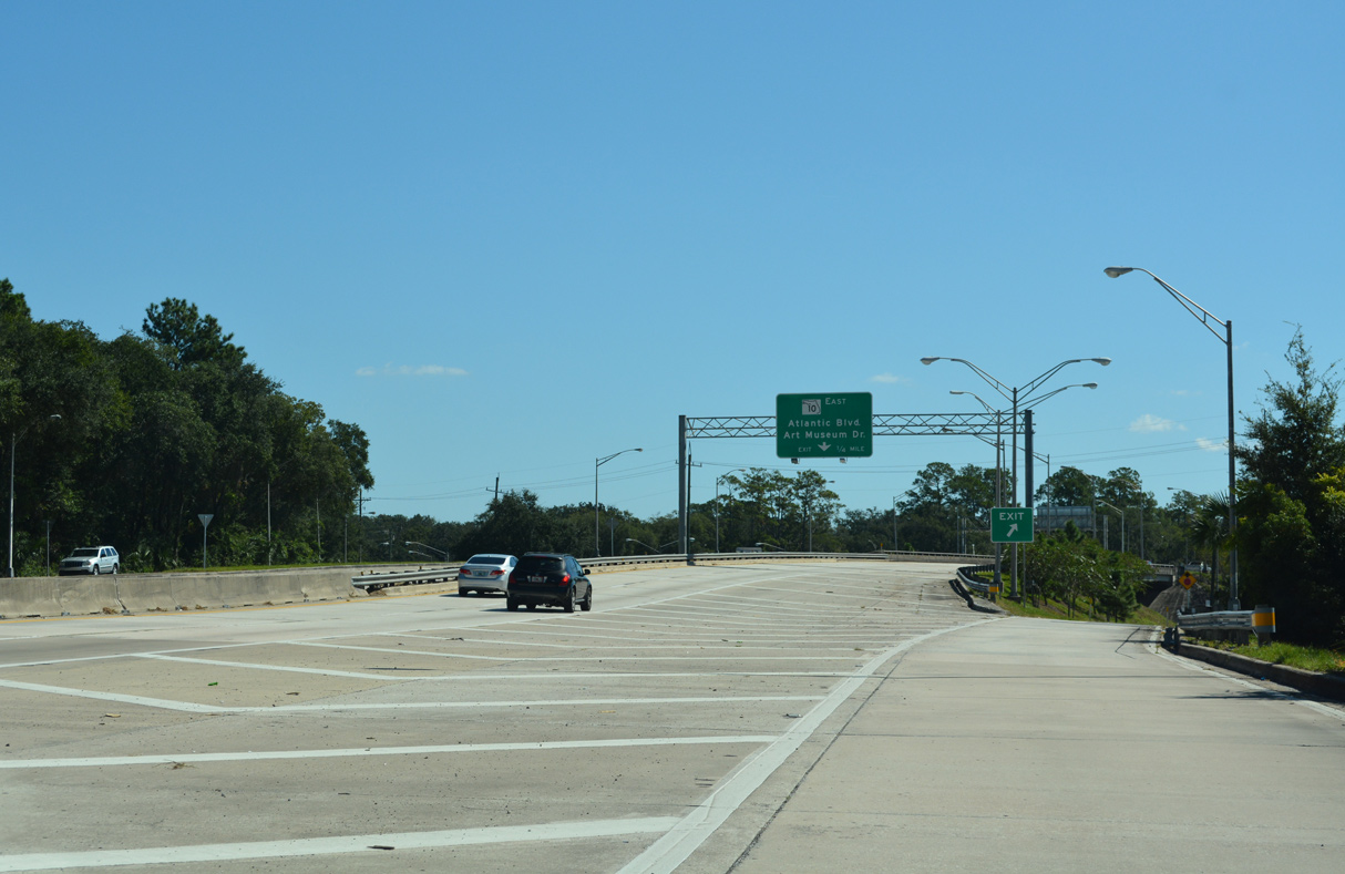
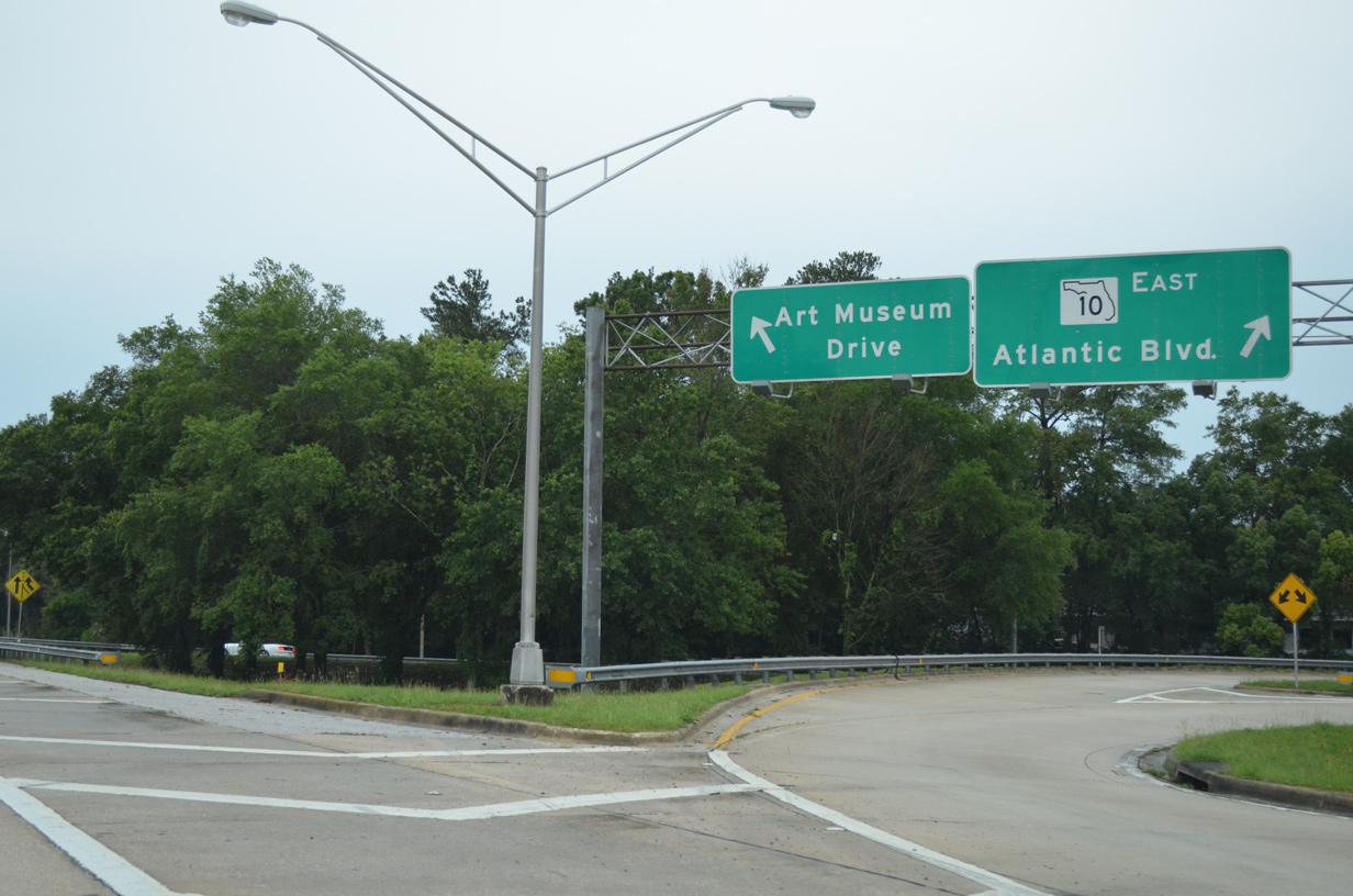
| U.S. 1 Alternate arcs southwest onto Emerson Expressway in one half mile. Departing first is the two pronged ramp for SR 10 (Atlantic Boulevard) east and Art Museum Drive. 06/16/16 |
|
| A busy arterial route, Atlantic Boulevard (SR 10) travels 13.5 miles east to 3rd Street (SR A1A) at the cities of Atlantic and Neptune Beaches. Art Museum Drive parallels U.S. 1 Alternate south by Midtown Centre office park to the exchange between Emerson Expressway and U.S. 90 (Beach Boulevard). 06/16/16 |
|
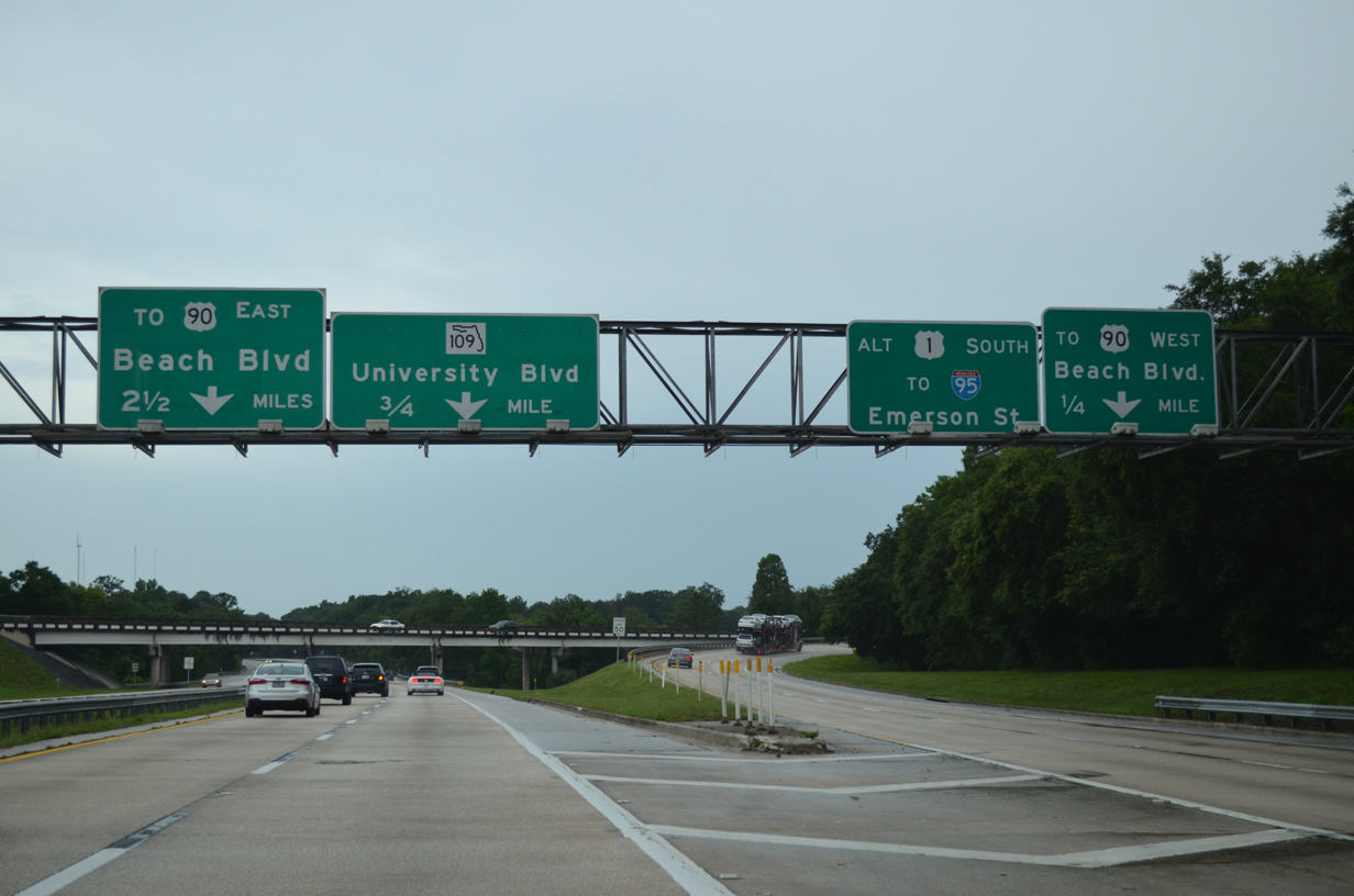
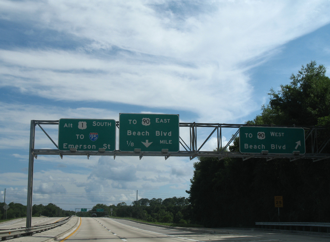
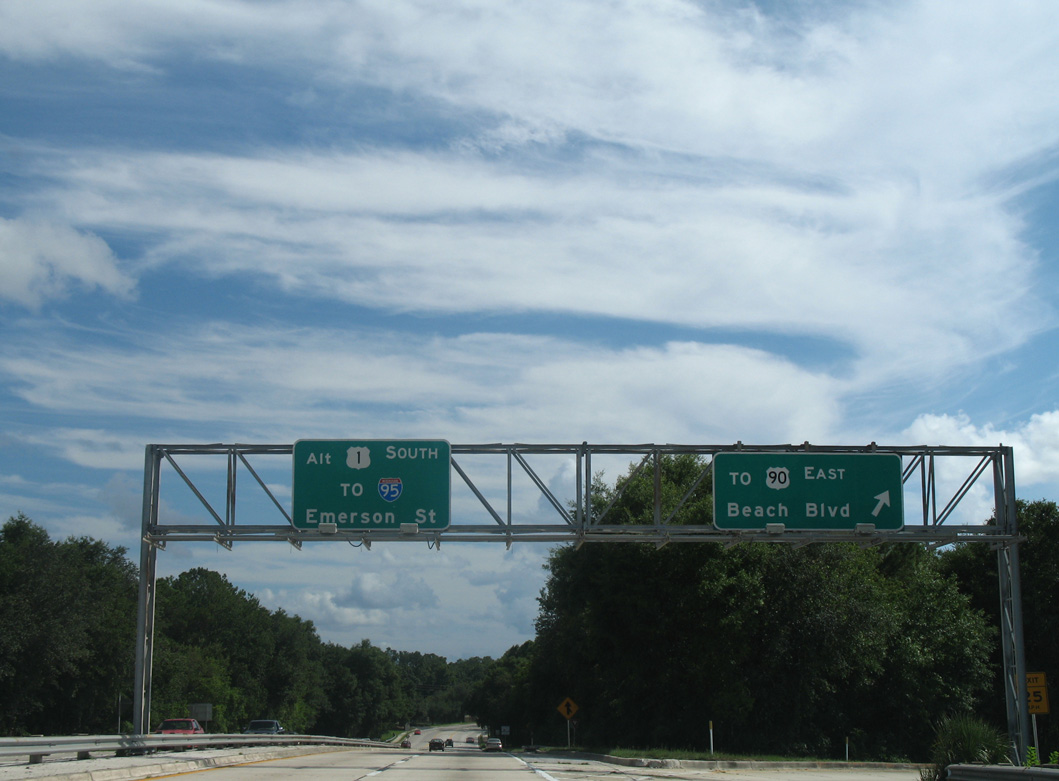
| Southbound U.S. 1 Alternate splits with unsigned SR 228 at a wye interchange. The Commodore Point Expressway extends another 2.3 miles to U.S. 90 (Beach Boulevard) east toward Jacksonville Beach while U.S. 1 Alternate arcs southwest 1.81 miles to U.S. 1 (Philips Highway). 06/16/16 |
|
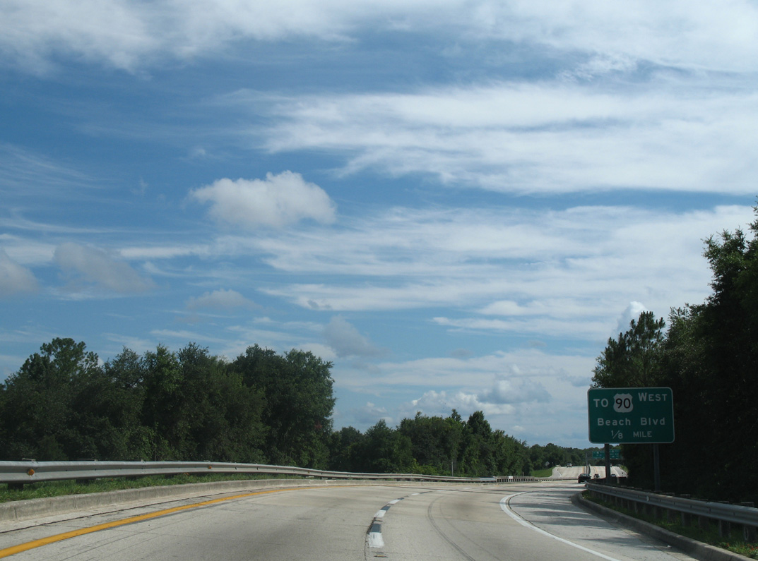
| Curving south over Little Pottsburg Creek, U.S. 1 Alternate (Emerson Expressway) almost immediately reaches the westbound off-ramp to U.S. 90 (Beach Boulevard). 07/04/06 |
|
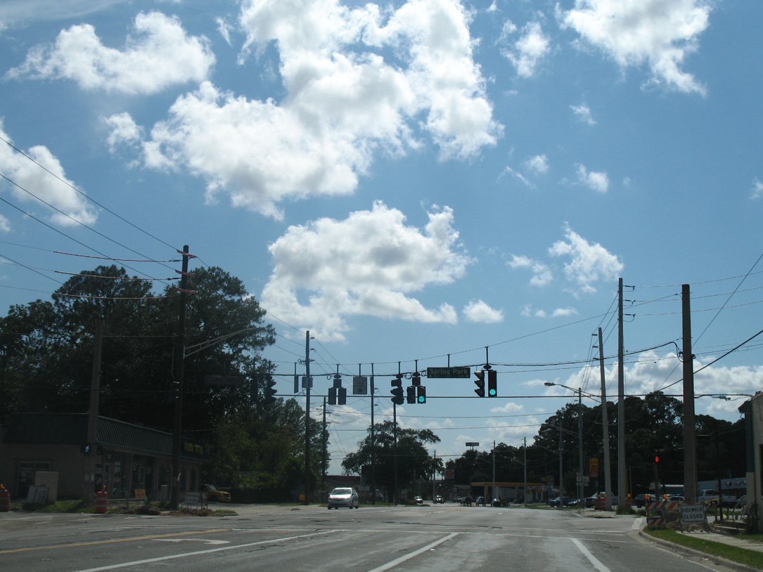
| U.S. 90 constitutes a five lane boulevard west from the six-ramp parclo interchange with U.S. 1 Alternate to the Spring Park community. 07/04/06 |
|
| U.S. 90 east follows a slow moving commercial boulevard east to the end of SR 228 at Hogan. The cross-state route ends at Jacksonville Beach (SR A1A) in 13.5 miles. 07/04/06 |
|
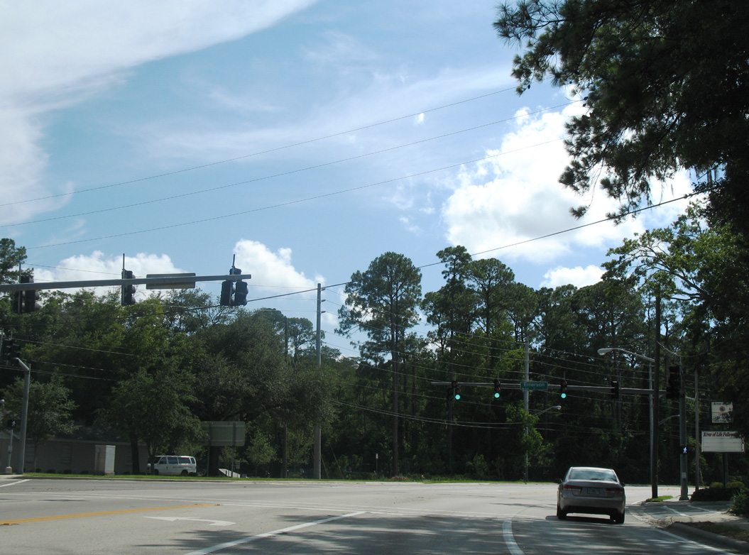
| A local stretch of Emerson Street arcs southwest from Spring Glen Road and ties into the south end of Emerson Expressway. 07/04/06 |
|
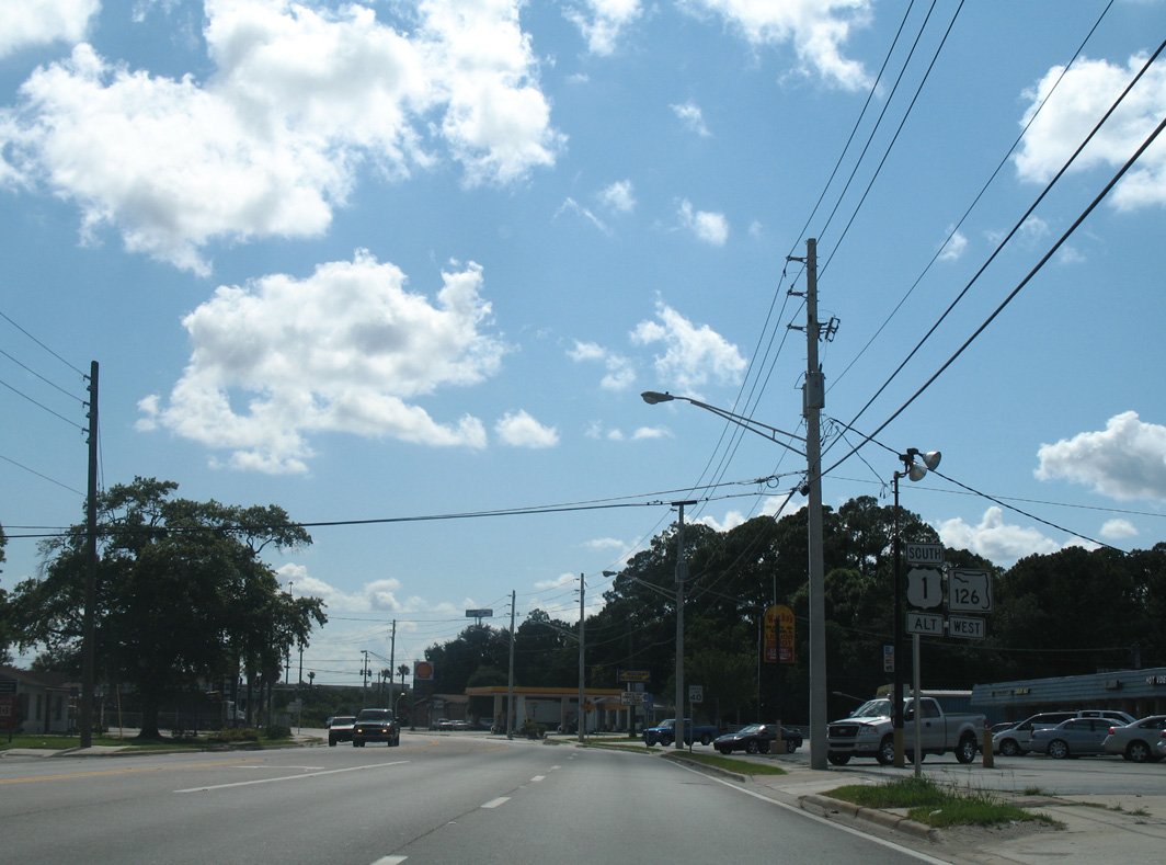
| Emerson Street takes U.S. 1 Alternate/SR 126 west to Englewood and Interstate 95. 07/04/06 |
|
| Spring Park Road is a residential through road joining the Englewood and Spring Park neighborhoods southward from U.S. 90 (Atlantic Boulevard). 07/04/06 |
|
| Shields for U.S. 1 Alternate south / SR 126 west appear for the first time along Emerson Street west of Spring Park Road. 07/04/06 |
|
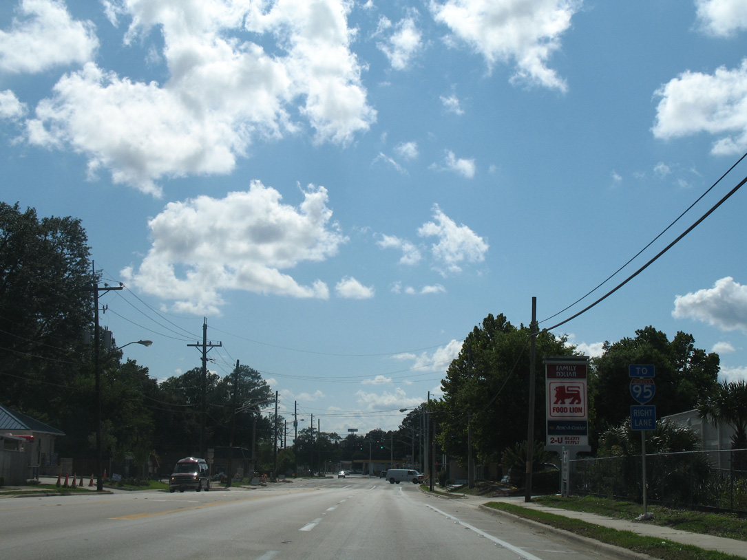
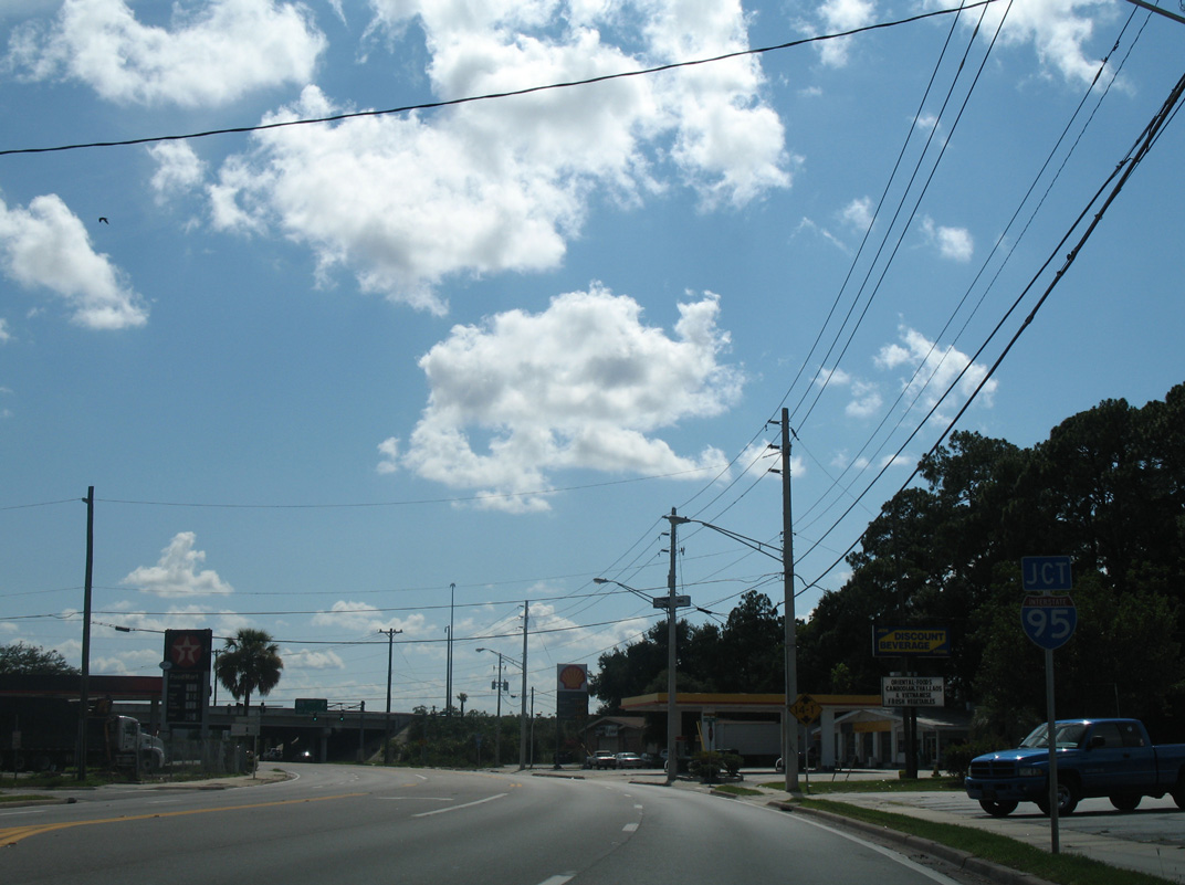
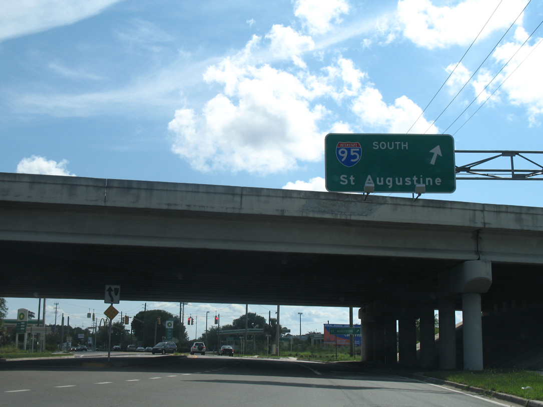
| A commercialized stretch of Emerson Street leads into the parclo interchange with Interstate 95. 07/04/06 |
|
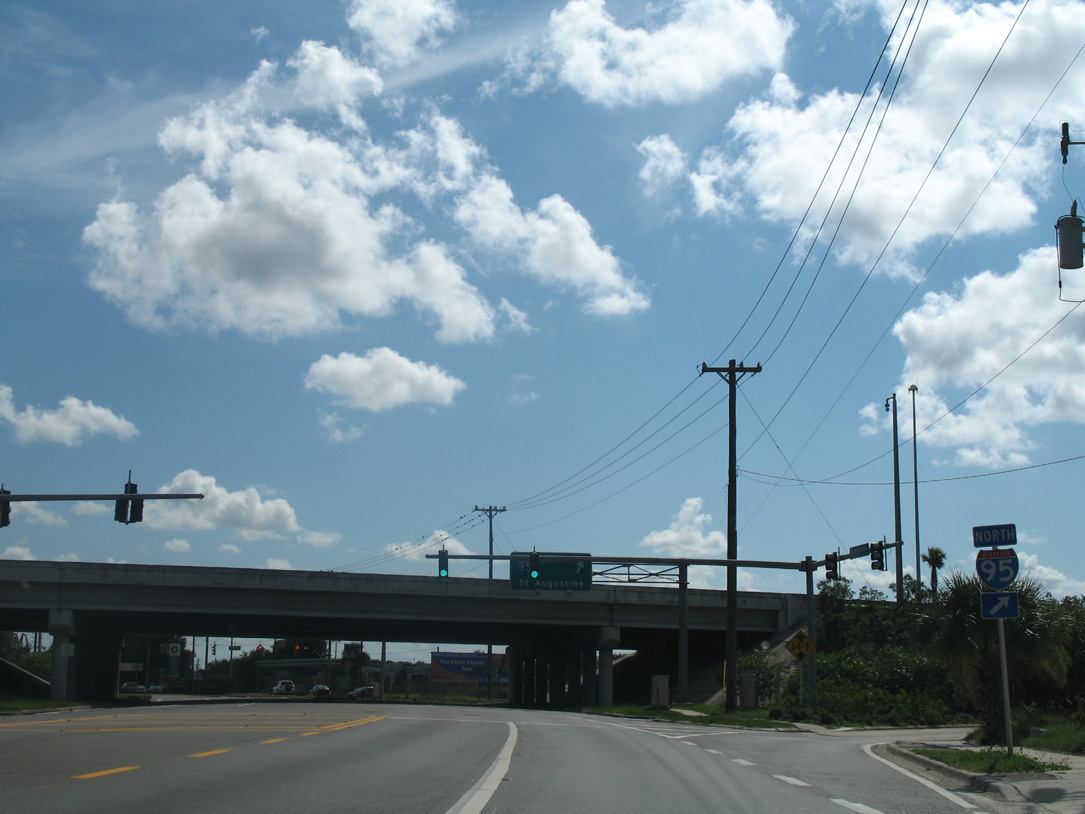
| Interstate 95 north leads motorists back toward Downtown Jacksonville. The freeway splits with U.S. 1/90 for the Main Street Bridge in 2.4 miles. 07/04/06 |
|
| St. Augustine lies 35 miles to the south via Interstate 95 from U.S. 1 Alternate/SR 126. Most FDOT District 2 signs for Interstate 95 were changed to reference Daytona Beach as the southbound control city. 07/04/06 |
Page Updated 10-22-2020.