
U.S. 15 travels 231.15 miles through the state of Virginia from south of Clarksville near John H. Kerr Reservoir to the Upper Potomac River across from Point of Rocks, Maryland. The bulk of U.S. 15 in the Old Dominion is a rural highway. Within Northern Virginia, U.S. 15 combines with U.S. 29 for 19.02 miles between Culpeper and Opal. U.S. 17 joins the two routes for 7.53 miles north from Opal to Warrenton. U.S. 15/29 continue another 7.13 miles northeast from their business routes at Warrenton to the western outskirts of suburban Gainesville.
U.S. 15 Virginia Guides
U.S. 15 enters Virginia 6.08 miles south of U.S. 58 Business at Clarksville in Mecklenburg County. U.S. 15 overlaps with U.S. 58 Business for 1.72 miles while U.S. 58/SR 49 bypass the town across a high level span over John H. Kerr Reservoir.
SR 49 turns northwest alongside U.S. 15, 1.60 miles from Clarksville en route to Chase City. U.S. 15 remains parallel to the Roanoke River into Charlotte County, where the highway turns northward to SR 92 at Barnes Junction and U.S. 360 north of Wyliesburg. U.S. 15 joins U.S. 360 for 16.12 miles along an expressway to Keysville.
Separating with U.S. 360, U.S. 15 continues north into Prince Edward County to Worsham, Kingsville and U.S. 460 outside Farmville. U.S. 15 bypasses the Prince Edward County seat with U.S. 460, 4.1 miles west along a freeway.
Heading north from U.S. 460, U.S. 15 traverses rural areas of Buckingham County to Sheppards, Pleasant Valley by Wills Mountain and U.S. 60 at Sprouses Corner. Shifting northeast from U.S. 60, U.S. 15 passes through the town of Dillwyn en route to Alpha by Buffards Mountain, Gold Hill, Arvonia and into Flyvana County across the James River.
SR 6 combines with U.S. 15 northeast for 1.99 miles from Weber City through Fork Union to Dixie. U.S. 15 branches north from SR 6 to Carysbrook, the Rivanna River at Palmyra, Wildwood and Hunters. U.S. 15 meets U.S. 250 just across the Louisa County line at Zion Crossroads.
An array of commercial development lines U.S. 15 north from a diverging diamond interchange (Exit 136) with Interstate 64 to the Spring Creek Golf Club community. North beyond Camp Creek, U.S. 15 runs across areas of farmland to SR 22 (Louisa Road) at Boswells Tavern.
Heading toward the town of Gordonsville, U.S. 15 and U.S. 33 combine for 1.59 miles along Martinsburg Avenue and Main Street to a roundabout with SR 231 (Gordon Avenue). U.S. 33 continues west to Barboursville while U.S 15 angles northeast past Merry Mountain, Scott Mountain and Gibson Mountain toward the Orange County seat of Orange.
U.S. 15 (Madison Road) passes through Downtown Orange along a commercialized three lane boulevard. Advancing north from the town, U.S. 15 spans the Rapidan River into Madison County en route to Five Forks and Locust Dale. Shifting east again, U.S. 15 crosses Crooked Run into Culpeper County, then bee lines northeast to U.S. 29 at Culpeper.
Beyond the 34.05 mile long overlap with U.S. 29, U.S. 15 runs along the west side of Gainesville to a DDI (Exit 40) with Interstate 66 at Haymarket. Expanded to a four lane arterial, U.S. 15 continues by the Dominion Valley Country Club golf course community and numerous other subdivisions north to SR 234 at Woolsey.
North from Woolsey, U.S. 15 transitions back into a rural two lane highway to U.S. 50 at Gilberts Corner in Loudon County. U.S. 15 remains rural to Oatlands and Mountain Gap. Heading toward the town of Leesburg, U.S. 15 expands to four lanes again by suburban development to the expressway bypass along SR 7.
U.S. 15 joins SR 7 east to Market Street, where the Leesburg Bypass downgrades to a controlled access, at-grade arterial. Leaving the Leesburg town limits, U.S. 15 Business rejoins U.S. 15 west of the Potomac River. U.S. 15 continues across agricultural areas east of Catoctin Mountain to Lucketts. Following a series of S-curves, U.S. 15 crosses the Upper Potomac River into Maryland at Furnace Mountain.
 South South |
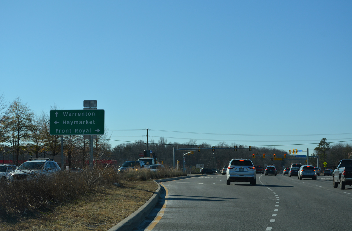
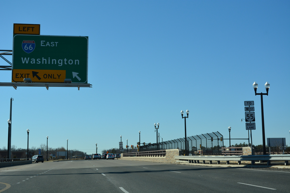 | U.S. 15 (James Madison Highway) curves southwest into a diverging diamond interchange (DDI) with Interstate 66 at Gainesville. 12/27/22 |
 | The DDI with Interstate 66 opened to traffic on January 28, 2017. The exchange at Exit 40 was previously a diamond interchange. 12/27/22 |
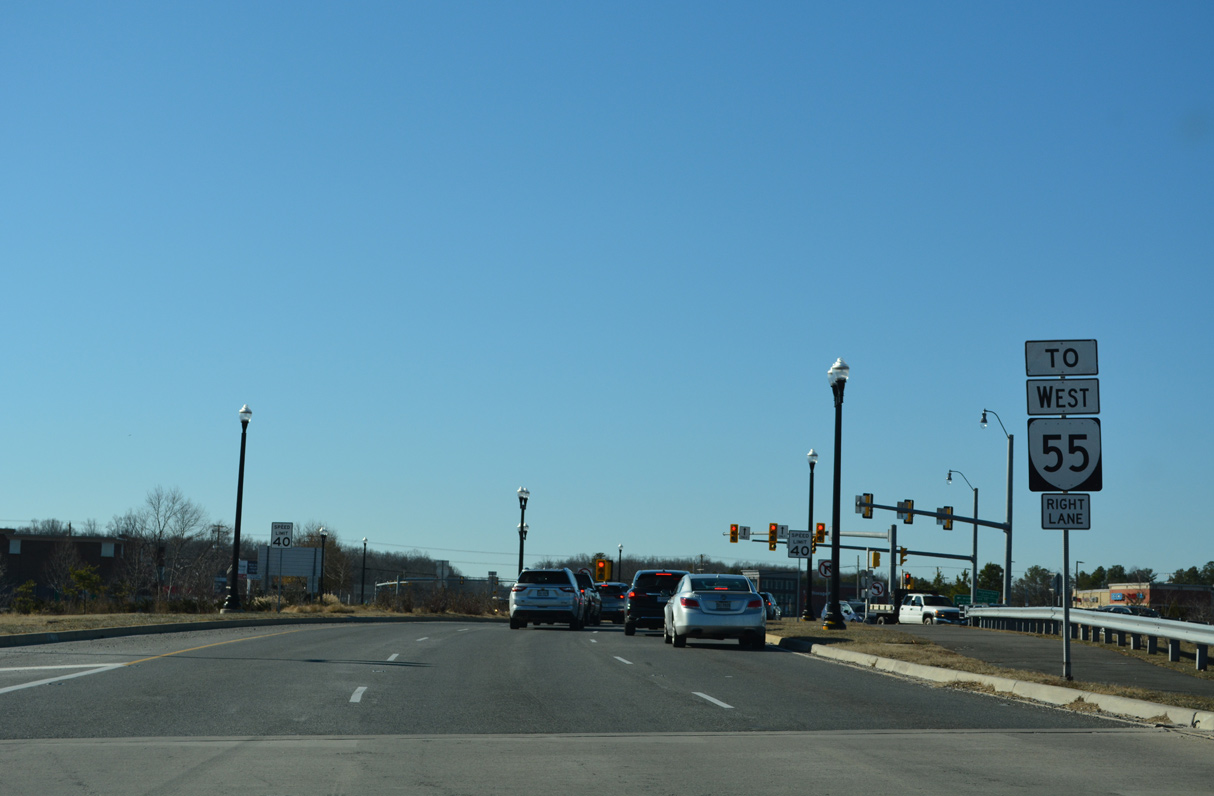
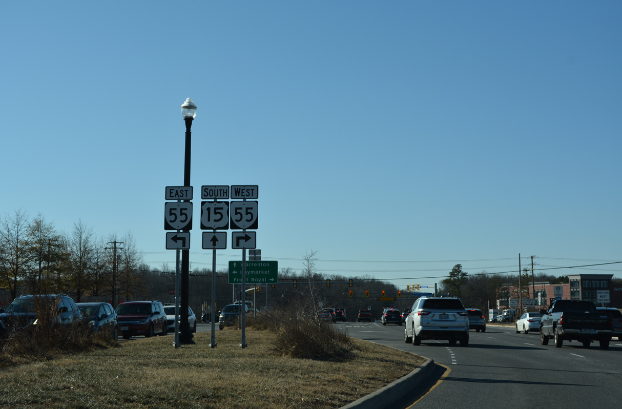 | SR 55 parallels Interstate 66 east to U.S. 29 in Gainesville along Washington Street and west to Broad Run and The Plains along John Marshall Highway. 12/27/22 |
 | SR 55 travels 65.19 miles west from Gainesville to Marshall, Front Royal, Strasburg and the West Virginia state line alongside U.S. 48. 12/27/22 |
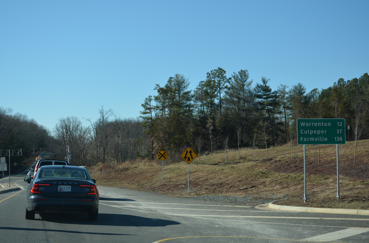 | South of SR 55 at Haymarket, U.S. 15 (James Madison Highway) crosses a Norfolk Southern Railroad line. Farmville is 135 miles to the south along U.S. 15-460 Business. 12/27/22 |
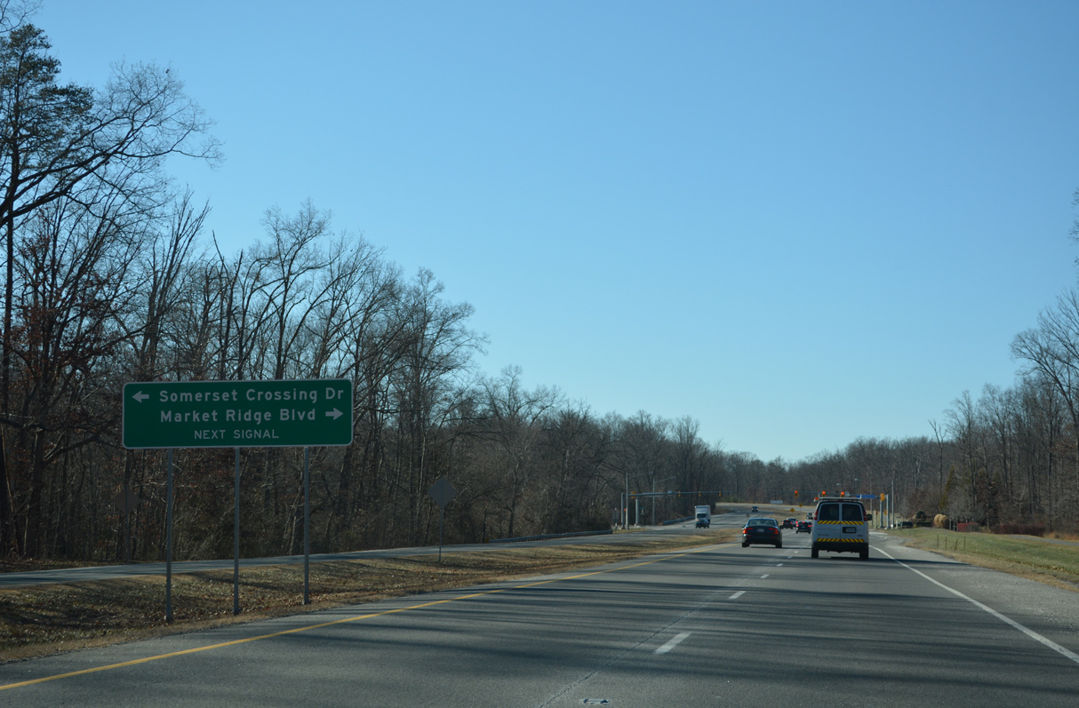 | The succeeding traffic light along U.S. 15 south is at Somerset Crossing Drive east and Market Ridge Boulevard west to the Villages of Piedmont development. Somerset Crossing Drive east to Old Carolina Road was constructed in 2019/20. 12/27/22 |
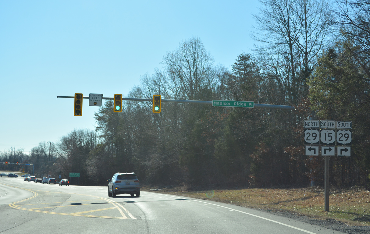
 | Madison Ridge Place intersects U.S. 15 just north of U.S. 29 from the Madison Crescent mixed use development. 12/27/22 |
 | U.S. 15 combines with U.S. 29 (Lee Highway) southwest from Gainesville to Warrenton and Culpeper. 12/27/22 |
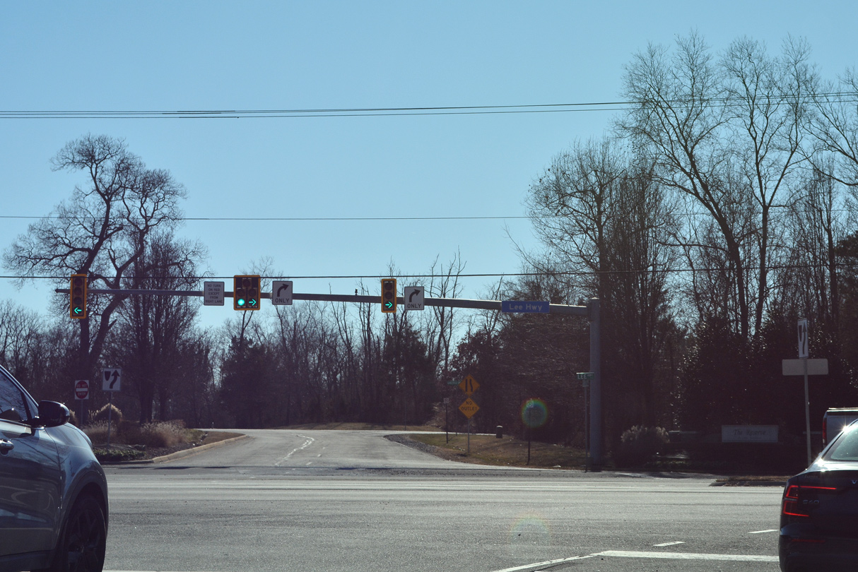 | Arrow Leaf Turn ties into the intersection joining U.S. 15/29 from The Reserve at the Lake Manassas subdivision. U.S. 29 heads east to the commercial center of Gainesville at SR 55. 12/27/22 |
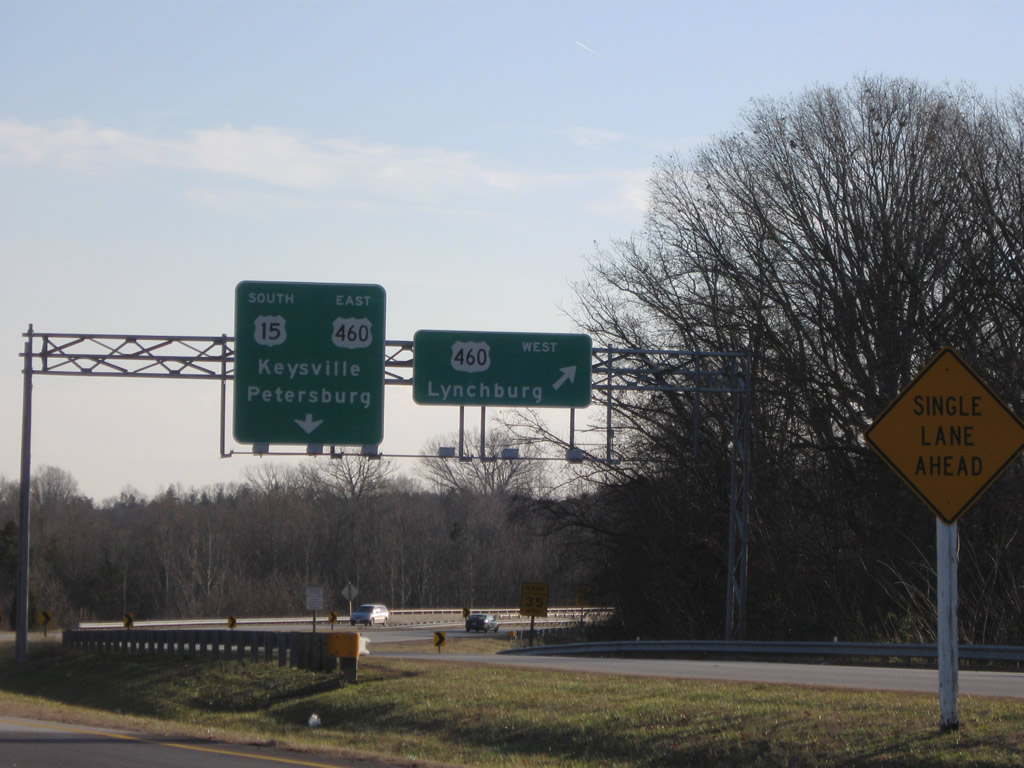 | U.S. 15 (Sheppards Road) combines with U.S. 460 (Prince Edward Highway) at a trumpet interchange south of U.S. 15-460 Business (W Third Street) outside Farmville. U.S. 15/460 follow a freeway bypass to the east. U.S. 460 continues west to Appomattox and Lynchburg. 12/21/08 |
Photo Credits:
12/21/08, 12/27/22 by AARoads
Connect with:
Interstate 64
Interstate 66
U.S. 17
U.S. 29
U.S. 33
U.S. 58
U.S. 60
U.S. 250
U.S. 360
U.S. 460
U.S. 522
Page Updated 02-12-2023.