|
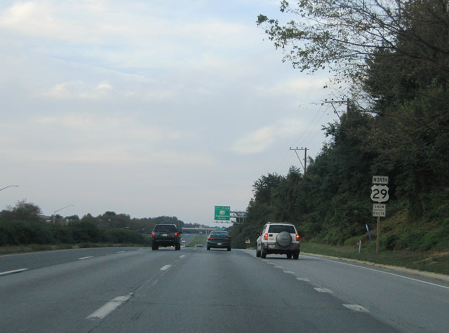
| U.S. 29 (Columbia Pike) leaves an at-grade intersection with Old Columbia Road and approaches the first Howard County interchange (MD 216). 08/27/05 |
|
| MD 216 (Scaggsville Road) crosses paths with U.S. 29 at Scaggsville. A folded-cloverleaf interchange utilizing roundabouts between the ramps, Scaggsville Road, and local development facilitates movements between the two highways. 08/27/05 |
|
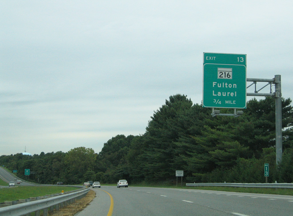
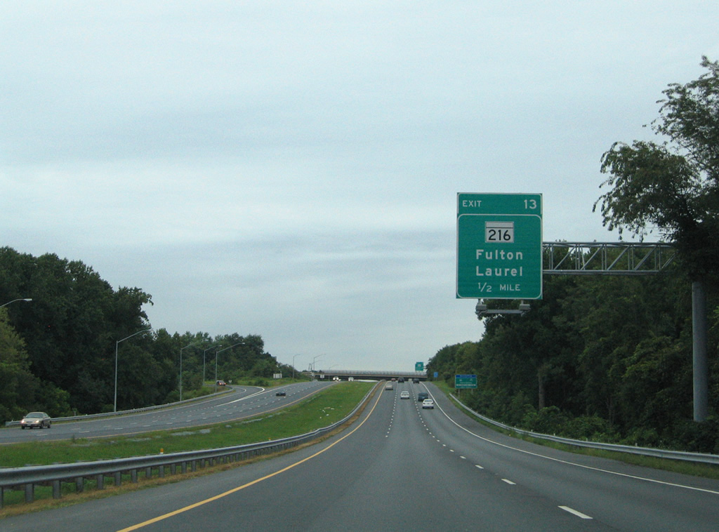
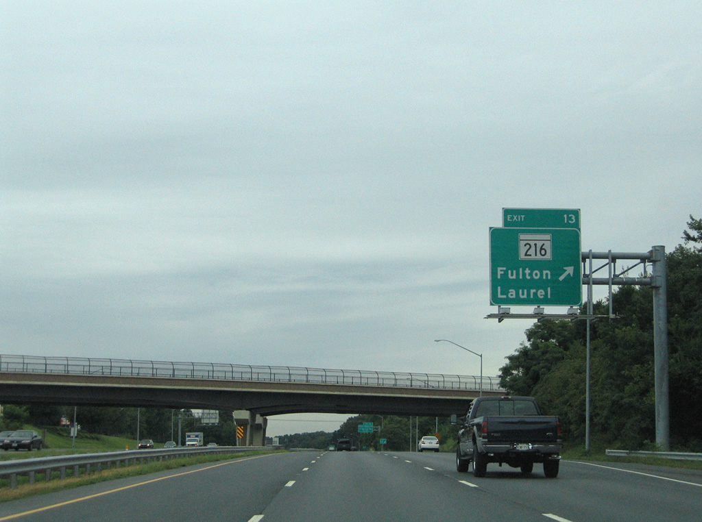
| Exit 13 departs U.S. 29 (Columbia Pike) northbound for MD 216 (Scaggsville Road). MD 216 stretches 9.06 miles east from MD 108 at Highland to MD 198 in Laurel. Fulton lies just west of Scaggsville via the state route. 08/27/05 |
|
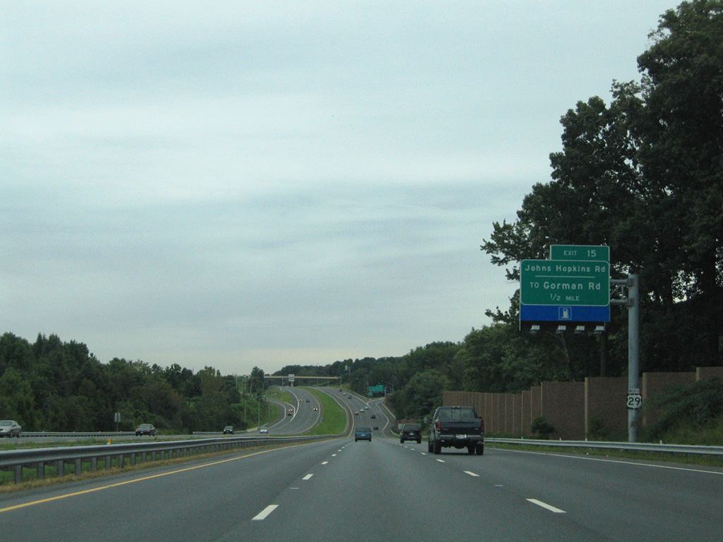
| Exit 15 consists of a parclo interchange between U.S. 29 (Columbia Pike) and John Hopkins Road. The exit serves the adjacent Johns Hopkins Applied Physics Lab. 08/27/05 |
|
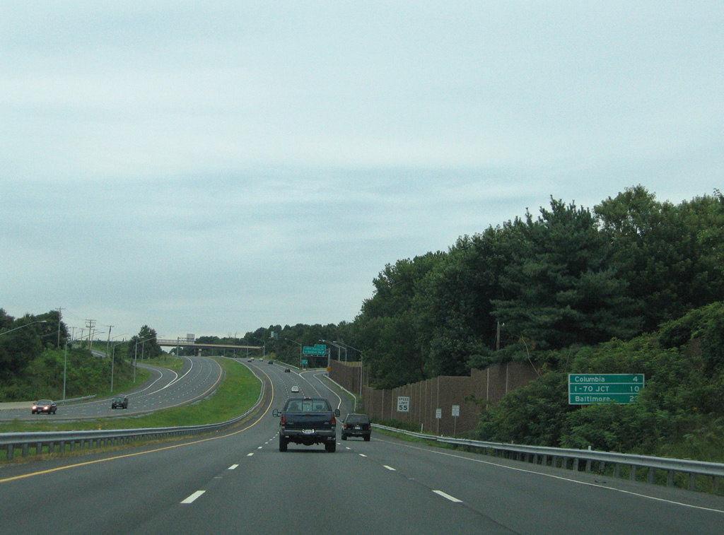
| A non-freeway style distance sign lists the distances to Columbia, Interstate 70, and Baltimore as U.S. 29 lowers to cross Hammond Branch. 08/27/05 |
|
| Continuing north one mile to meet MD 32 (Exits 16A/B) on U.S. 29 north ahead of the Patuxent River. 08/27/05 |
|
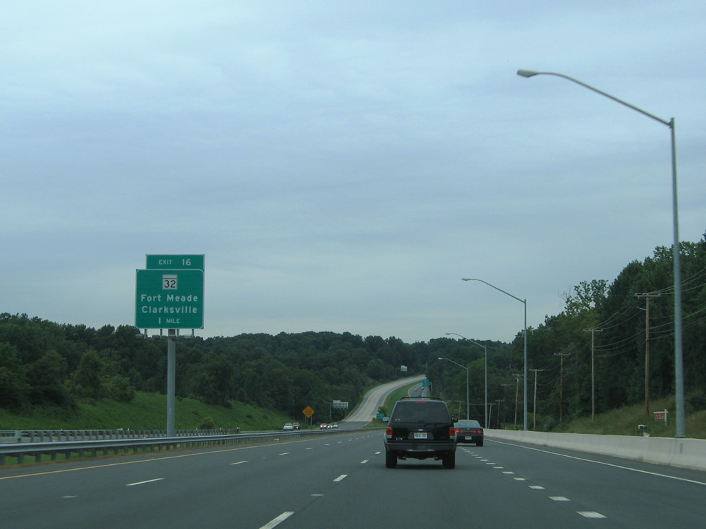
| MD 32 constitutes a 22 mile freeway from Heritage Highlands to the west and Fort Meade and Interstate 97 to the east. U.S. 29 meets the freeway in one half mile, but first sees an at-grade intersection with Rivers Edge Road. 08/27/05 |
|
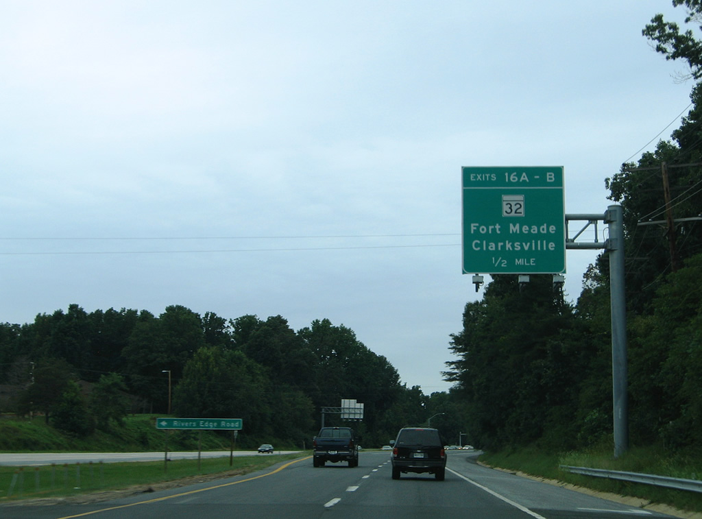
| Rivers Edge Road provides the only access to a subdivision bound by U.S. 29 and MD 32 to the north and east. Traffic lights govern the protected turn onto Rivers Edge Road west from a segregated lane from the northbound mainline. A merge lane follows to provide north return access to the freeway from the same intersection. 08/27/05 |
|
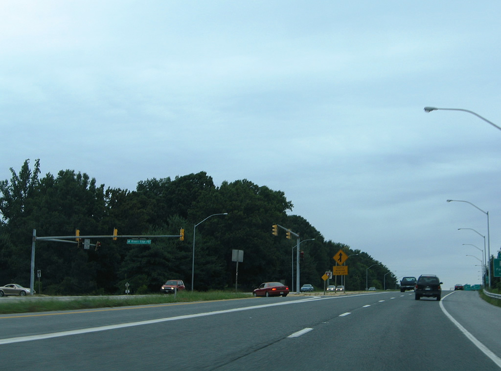
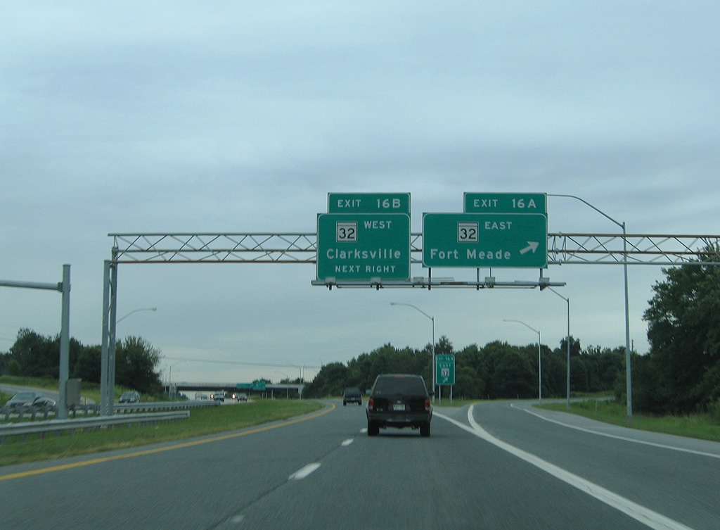
| Northbound U.S. 29 at Exit 16A onto MD 32 east. MD 32 travels between the suburban communities of Owen Brown and Kings Contrivance on the 3.2 mile drive to Interstate 95 near Savage. 08/27/05 |
|
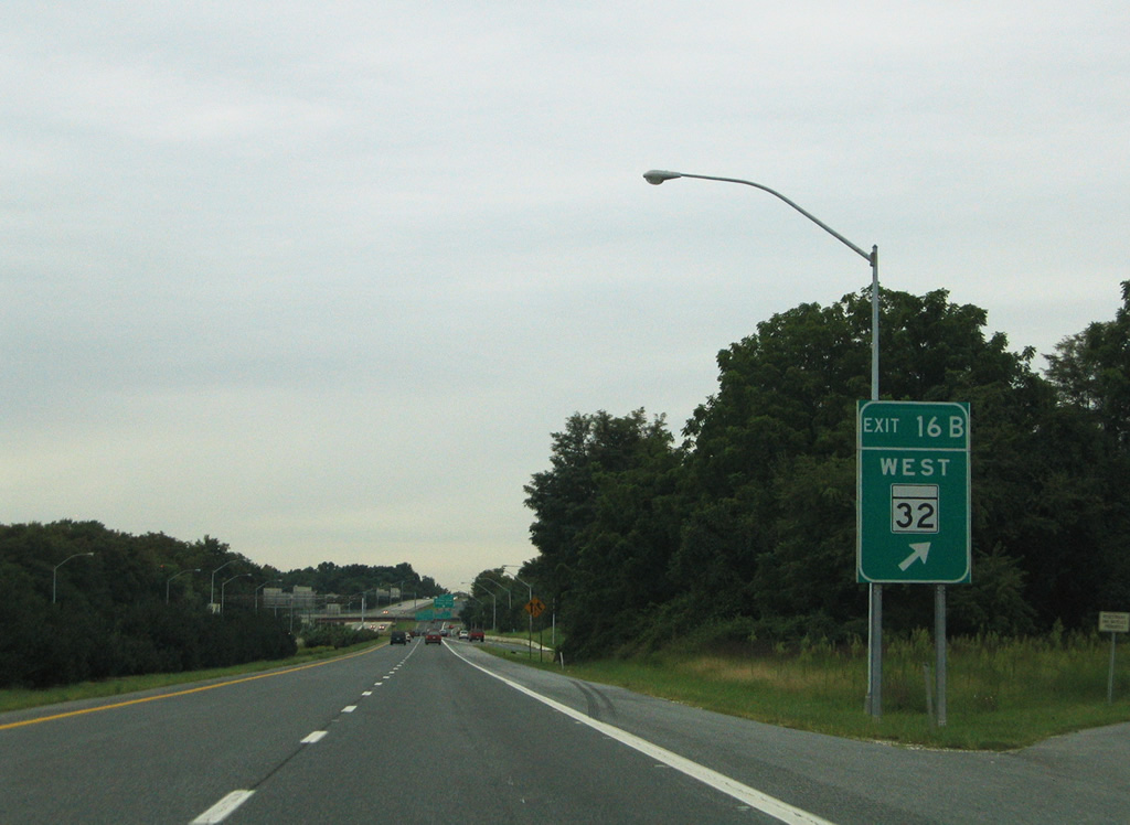
| Exit 16B departs from the cloverleaf interchange of U.S. 29 (Columbia Pike) onto MD 32 west to Clarksville, West Friendship (Interstate 70) and Sykesville. 08/27/05 |
|
| MD 32 continues as a freeway four miles to MD 108 near Heritage Heights. 08/27/05 |
|
| U.S. 29 (Columbia Pike) northbound approaches the Exit 17 folded diamond interchange with Seneca and Shaker Drives. 08/27/05 |
|
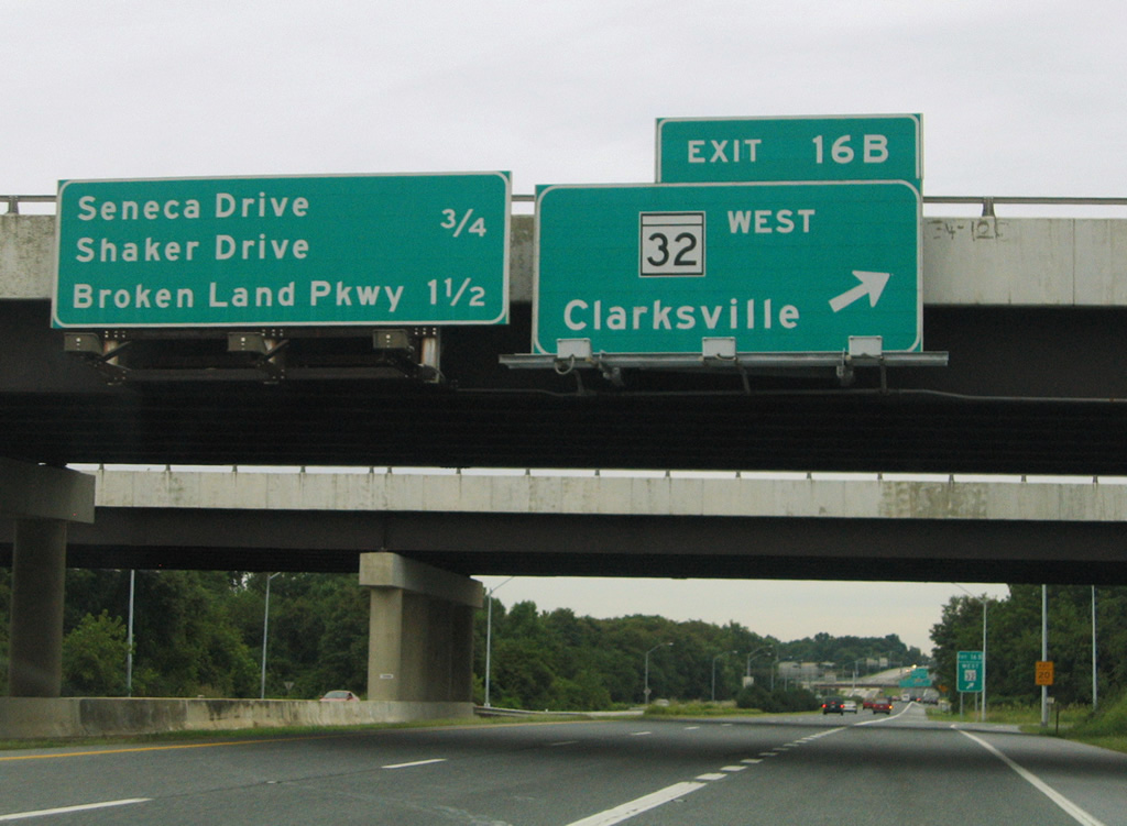
| Shaker Drive snakes northwest from Eden Brook Drive and MD 32 to the intersection with Seneca Drive at Exit 17. Seneca Drive serves residential areas of Atholton and Hickory Ridge within the immediate vicinity of Columbia Pike. 08/27/05 |
|
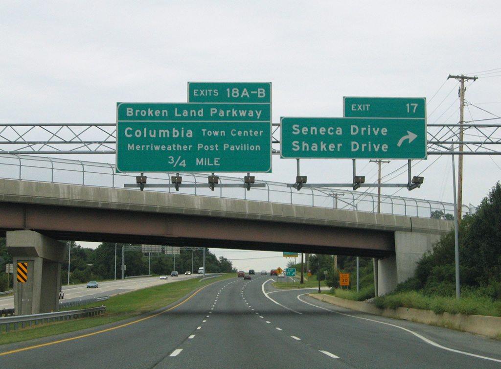
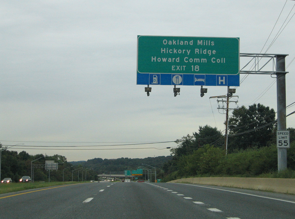
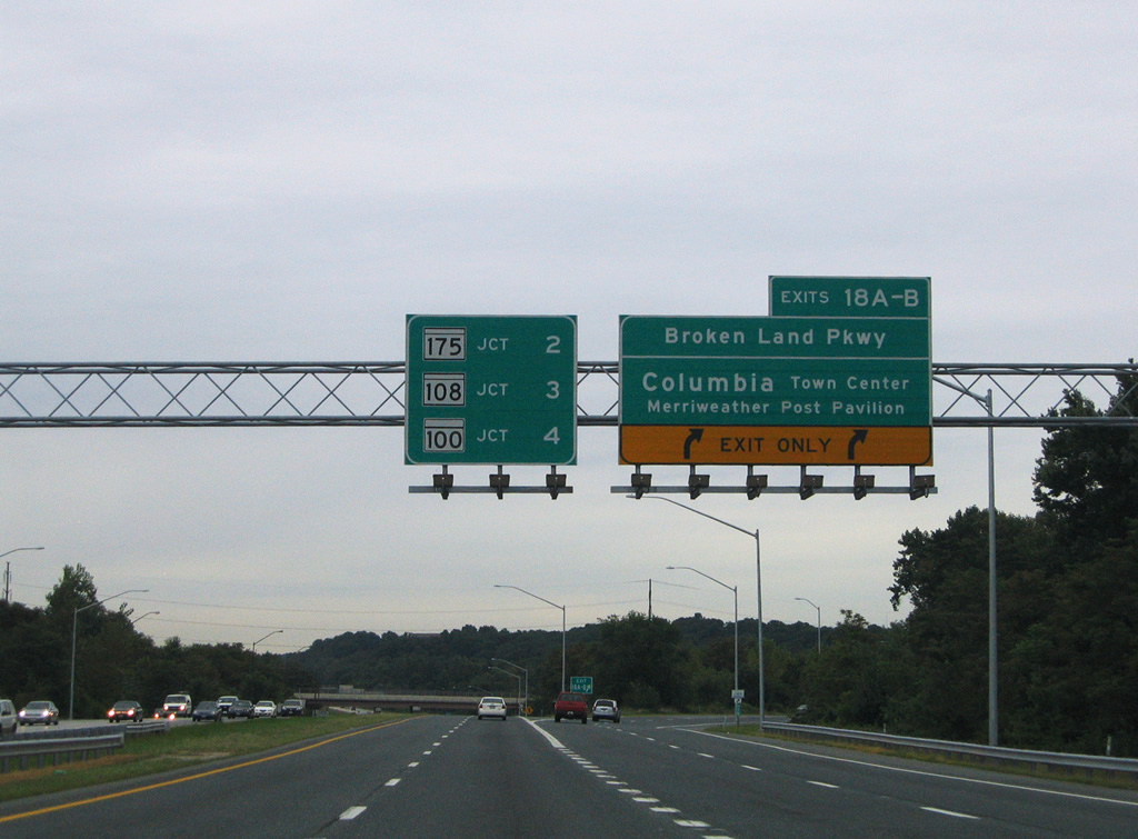
| Broken Land Parkway, like Shaker Drive, also travels northwest from the MD 32 freeway to meet U.S. 29 (Columbia Pike). Use Exit 18 for the Merriweather Post Pavilion, Oakland Hills, Hickory Ridge, and Howard Community College. A directional cloverleaf interchange joins the two highways in one half mile. 08/27/05 |
|
| A two lane ramp departs U.S. 29 (Columbia Pike) northbound for Broken Land Parkway. Exit 18 partitions into separate ramps for Broken Land Parkway north to the Columbia Town Center and south to Owen Brown. 08/27/05 |
|
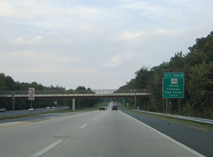
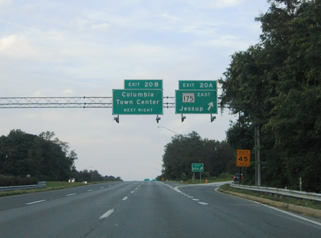
| U.S. 29 (Columbia Pike) continues north from Broken Land Parkway to MD 175 (Exits 20A/B) to the northeast of Columbia. MD 175 (Little Patuxent Parkway) constitutes an east-west surface arterial between Columbia and Jessup. 09/25/04 |
|
| MD 175 travels 17.01 miles east from U.S. 29 (Exit 20) to MD 3 (Crain Highway) at Millersville. The state highway serves the nearby communities of Oakland Mills and Long Branch on the eastward drive to Interstate 95 at Waterloo. Little Patuxent Parkway continues west from Columbia Pike to Wilde Lake. 09/25/04 |
|
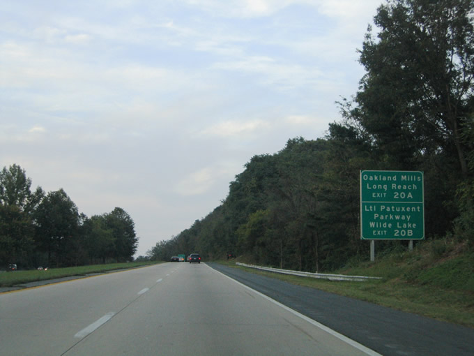
| Exit 20A departs U.S. 29 in a half mile for MD 175 (Little Patuxent Parkway) east. MD 175 has interchanges with Snowden River Parkway, Columbia Gateway Drive and I-95 at Exit 41. 08/27/05 |
|
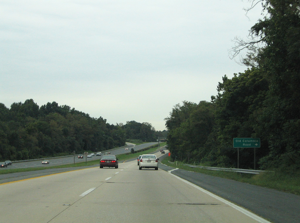
| An at-grade intersection connects U.S. 29 (Columbia Pike) with Old Columbia Road. Old Columbia Road constitutes a short frontage road along the northbound side of the freeway. The old road serves three homes that are not otherwise accessible. 08/27/05 |
|
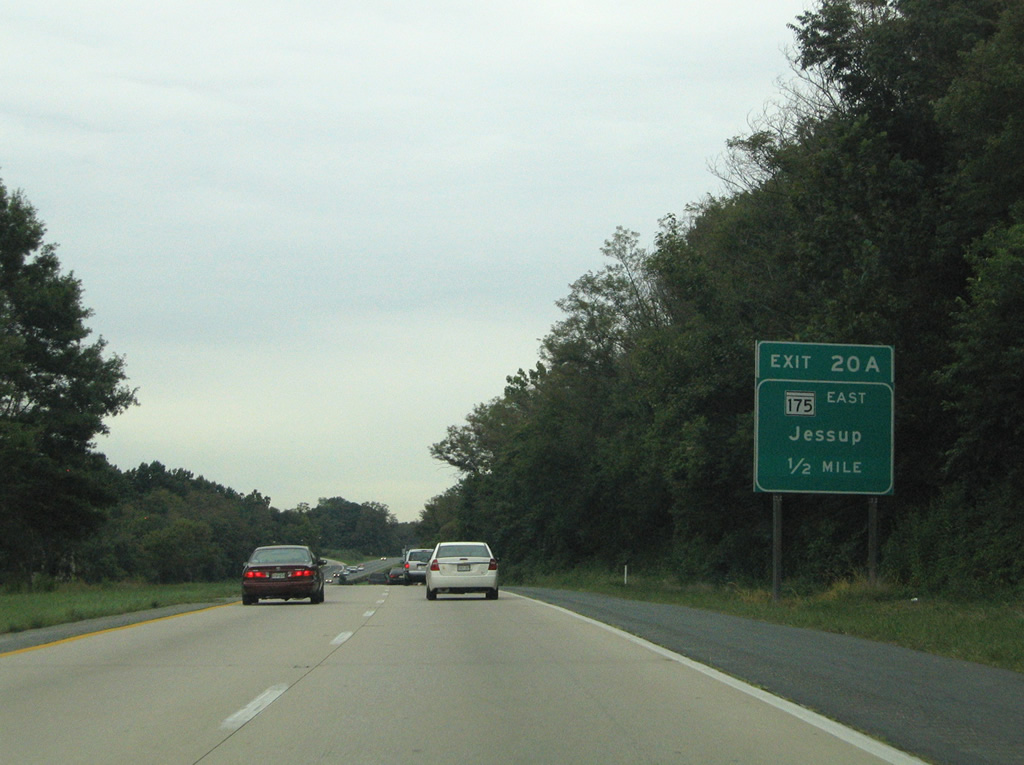
| Exit 20A departs U.S. 29 (Columbia Pike) northbound for the eastbound beginning of MD 175 (Little Patuxent Parkway). MD 175 reaches the Anne Arundel town of Jessup eight miles to the east. Oakland Mills lies nearby at the crossroads with Thunder Hill Road. 09/25/04 |
|
| A cloverleaf interchange facilitates the movements between U.S. 29 and Little Patuxent Parkway. The parkway continues west from Columbia Pike to Wilde Lake, Governor Warfield Parkway, and the The Mall in Columbia. Governor Warfield Parkway stems southwest from the mall area to the Columbia Town Center. 09/25/04 |
|
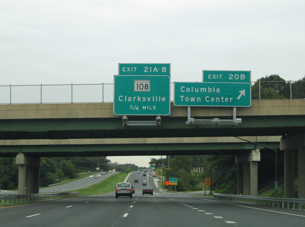
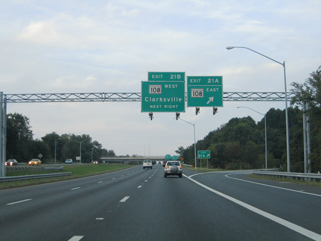
| U.S. 29 northbound travels a short distance between MD 175 and the cloverleaf interchange with MD 108 (Exits 21A/B). Pictured here is a northbound reassurance shield. All Maryland freeways double as snow emergency routes, and are generally signed as such on reassurance shield assemblies. 09/25/04 |
|
| MD 108 (Old Annapolis Road / Clarksville Pike) meets U.S. 29 at Exits 21A/B near Columbia Hills. The east-west highway arcs 34.23 miles between MD 27 at Damascus and MD 175 near Waterloo. MD 108 meets the west end of the Patuxent Freeway (MD 32) at Clarksville 6.3 miles to the west. 09/25/04 |
|
| Another at-grade intersection lies along U.S. 29 (Columbia Pike) northbound with Diamondback Drive. Diamondback Drive constitutes a residential street between the northbound freeway and Mellonbrook Road. 08/27/05 |
|
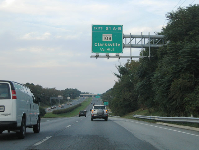
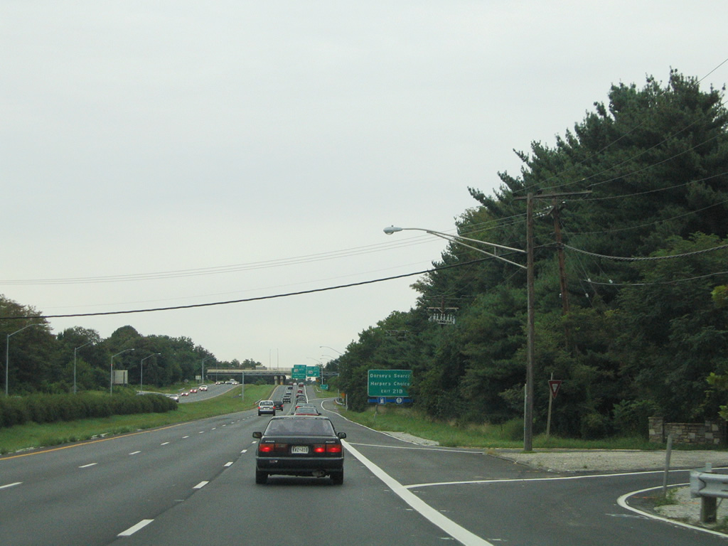
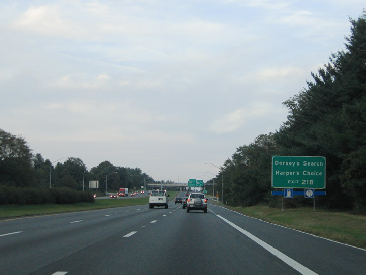
| MD 108 (Clarksville Pike) westbound serves the Dorsey's Search and Harper's Choice communities via Exit 21B. Clarksville Pike also serves Centennial Park and Elioak to the west. 09/25/04 |
|
| Northbound at the Exit 21A off-ramp to MD 108 (Old Annapolis Road) eastbound. MD 108 widens through the interchange with U.S. 29 near Columbia Hills. The state route continues southeast to Waterloo Road near Long Reach en route to MD 175 at Waterloo. 09/25/04 |
|
| Exit 21B loops onto MD 108 (Clarksville Pike) westbound for Elioak and Clarksville. Use Clarksville Pike for Centennial Lane north for Centennial and Font Hill. Eliots Oak Road joins MD 108 with the town of Columbia to the south. 08/27/05 |
|
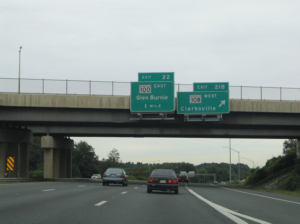
| Traffic merging onto U.S. 29 northbound from MD 108 forms an auxiliary lane for the Exit 22 off-ramp to MD 100. MD 100 constitutes a 22.05 mile long freeway between U.S. 29 east to MD 177 (Mountain Road) near Lake Shore and Jacobsville in Anne Arundel County. 08/27/05 |
|
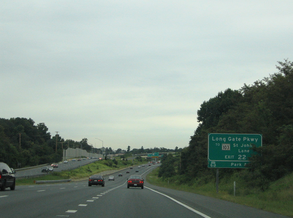
| There is no direct access from U.S. 29 northbound onto MD 103 (Montgomery Road). Therefore drivers bound for MD 103 can use the Exit 1A interchange of MD 100 to Long Gate Parkway to access Montgomery Road and the adjacent park and ride lot. MD 103 parallels MD 100 between St. John's Lane and to Dorsey near the Anne Arundel County line. 08/27/05 |
|
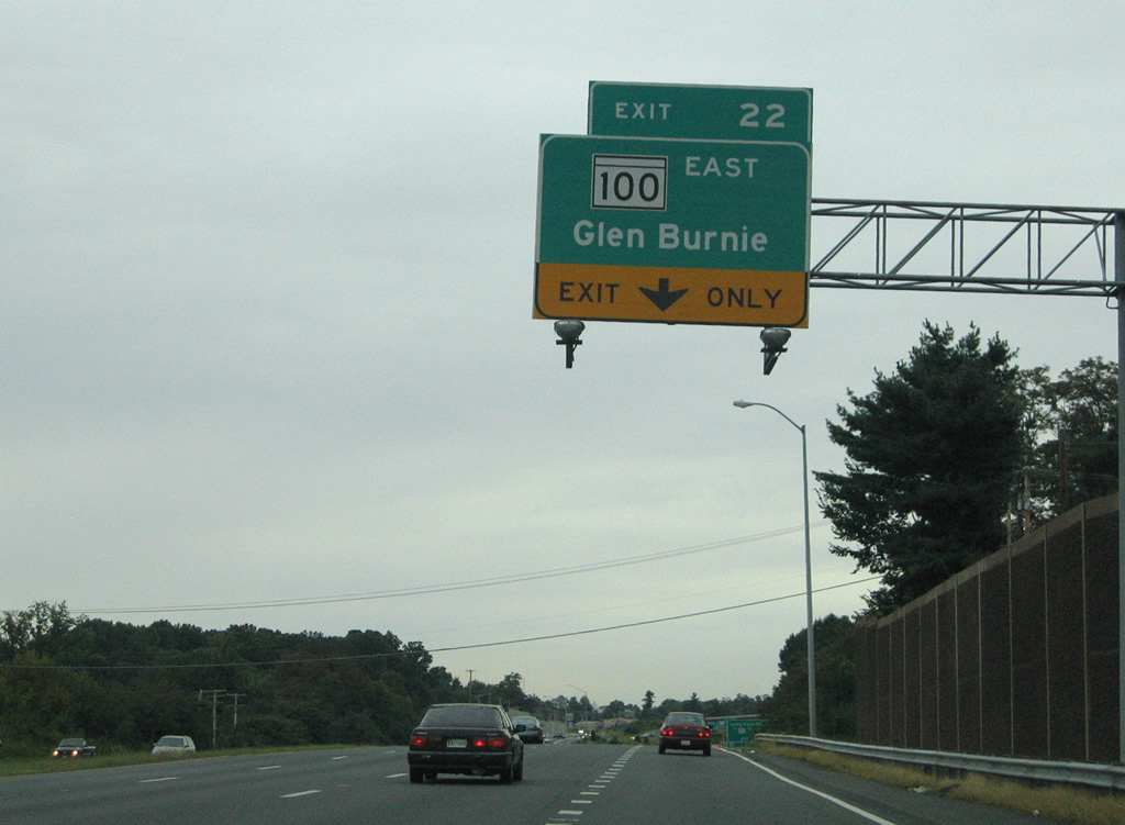
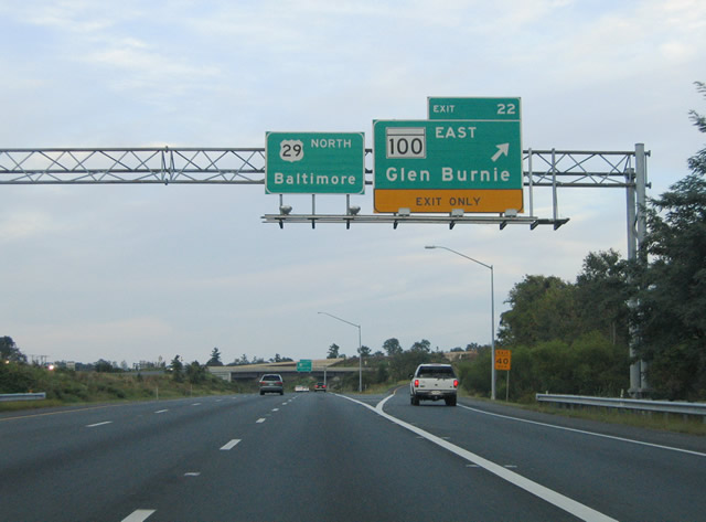
| U.S. 29 northbound at the Exit 22 ramp departure for MD 100 eastbound. MD 100 ventures southeast from U.S. 29 through the suburbs of Howard and Anne Arundel Counties to Southgate and Pasadena. The freeway opened to traffic fully in the late 1990s between U.S. 29 and Interstate 95. Use MD 100 east for Baltimore-Washington International Airport and Glen Burnie. 09/25/04 |
|
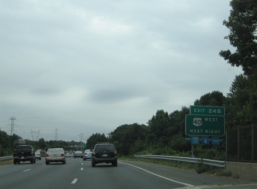
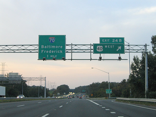
| The 1.50 mile overhead for U.S. 40 (Exits 24A/B) appears within the directional interchange (Exit 22) with MD 100. U.S. 40 (Baltimore National Pike) meets U.S. 29 just south of Interstate 70 near Ellicott City. 09/25/04 |
|
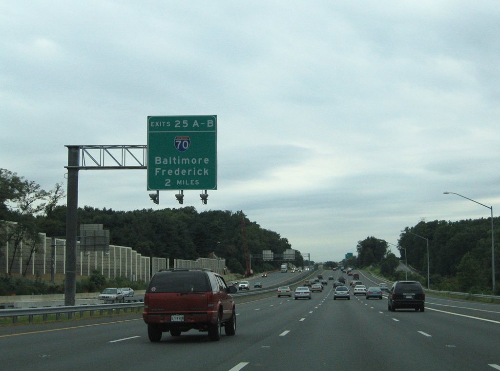
| Two miles south of the directional cloverleaf interchange with Interstate 70 (Exits 25A/B) on U.S. 29 northbound. Toll House Road forms a northbound side frontage road from Old Columbia Pike to Frederick Road (MD 144). MD 100 traffic merges onto the freeway ahead of the forthcoming exchange with U.S. 40. 08/27/05 |
|
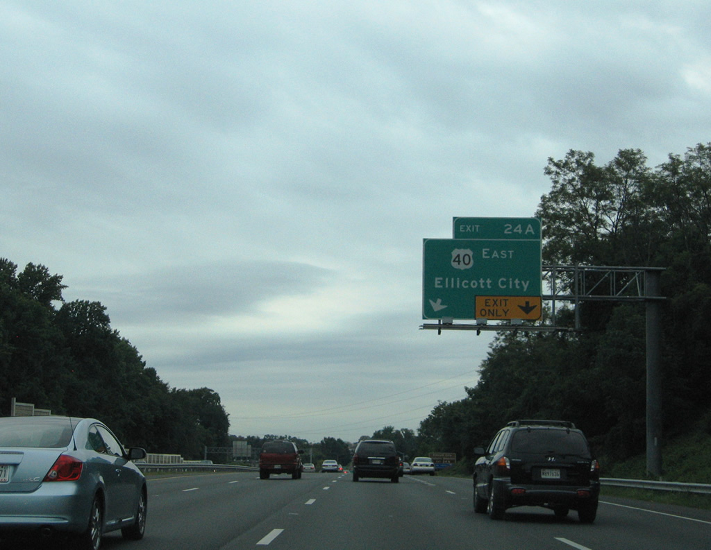
| A wye interchange connects U.S. 29 northbound with U.S. 40 east via Exit 24A. Originally U.S. 29 and 40 shared pavement eastward along Frederick Road from Ellicott City into Baltimore. That alignment lasted until 1949, leaving Frederick Road as a local road or as MD 144. 08/27/05 |
|
| U.S. 29 passes over Frederick Road at the Exit 24A ramp departure for U.S. 40 (Baltimore National Pike). U.S. 40 enters Ellicott City east of U.S. 29 before crossing Patapsco Valley State Park at the Baltimore County line. U.S. 40 continues east from there to Catonsville and Westview before entering the city of Baltimore along Edmondson Avenue. 08/27/05 |
|
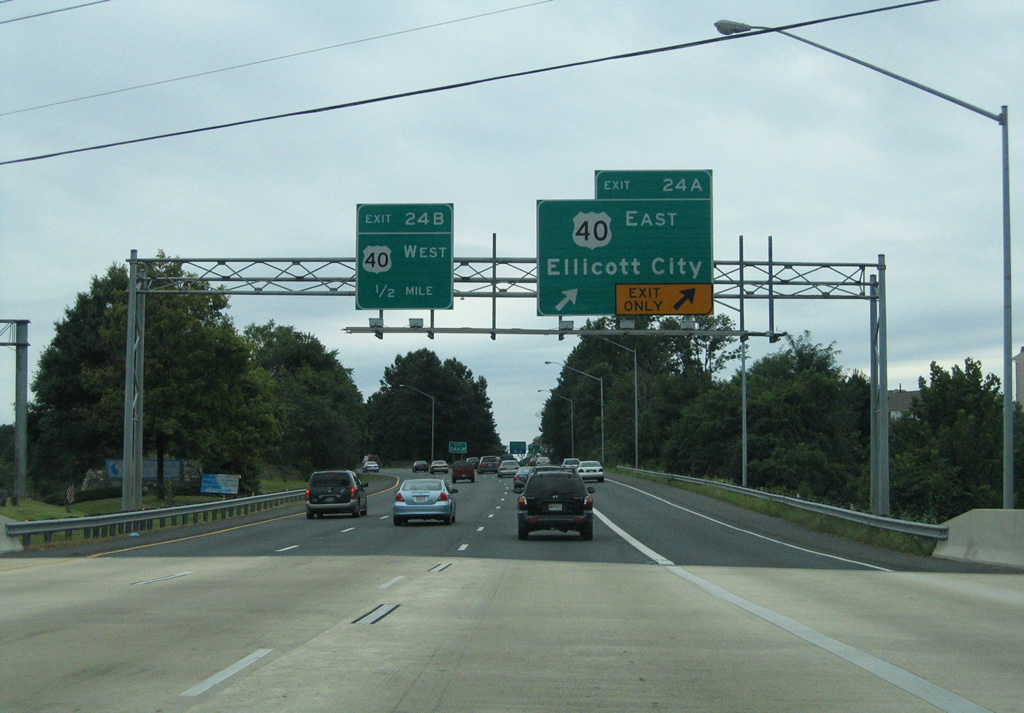
| U.S. 29 continues northward to the Exit 24B loop ramp onto U.S. 40 (Baltimore National Pike) westbound. U.S. 40 maintains four lanes through the communities of Valley Mede and Pine Orchard before merging with Interstate 70 at Exit 82. 08/27/05 |
|
| U.S. 40 leaves it original alignment for Interstate 70 three miles to the west. MD 144 follows Frederick Road (original U.S. 40) west from there through Mayfield, West Friendship, Cooksville, and Lisbon to Mount Airy in Frederick County. U.S. 29 continues northward to meet Interstate 70 in one mile otherwise. 09/25/04 |
|
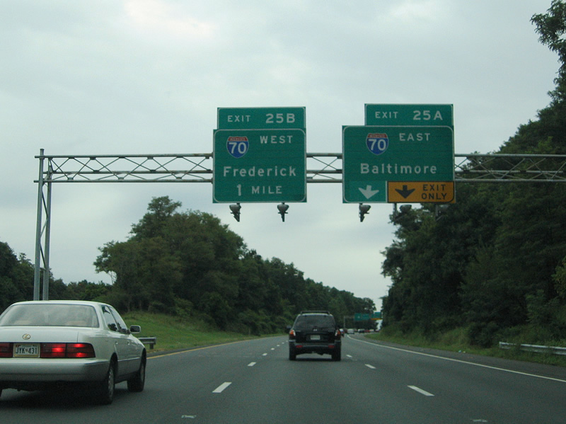
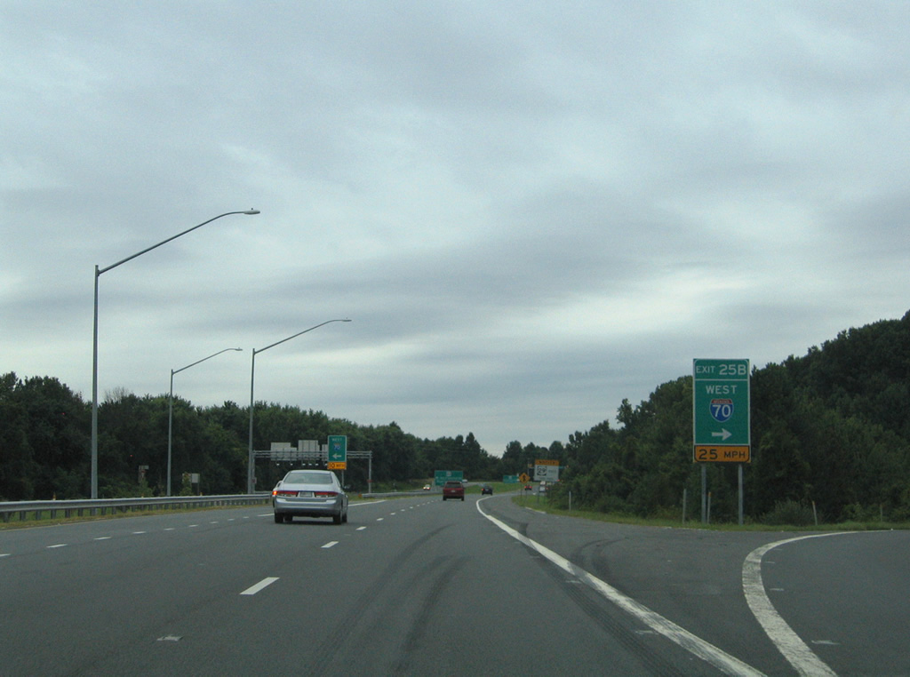
| Directional ramps shuttle U.S. 29 northbound travelers onto Interstate 70 east and Interstate 70 westbound motorists onto U.S. 29 south. This setup is like the U.S. 40 interchange to the south, with a standard cloverleaf configuration handling the remaining movements between the two highways. Exit 25A links Columbia Pike with the final seven miles of Interstate 70 east to the city of Baltimore. 08/27/05 |
|
| Exit 25A branches eastward from U.S. 29 (Columbia Pike) northbound onto Interstate 70. Interstate 70 interchanges the Baltimore Beltway (Interstate 695) three miles to the east near Woodlawn. The freeway tapers down to a park and ride lot three miles east from there at Security Boulevard (Exit 94) and Leakin Park. 08/27/05 |
|
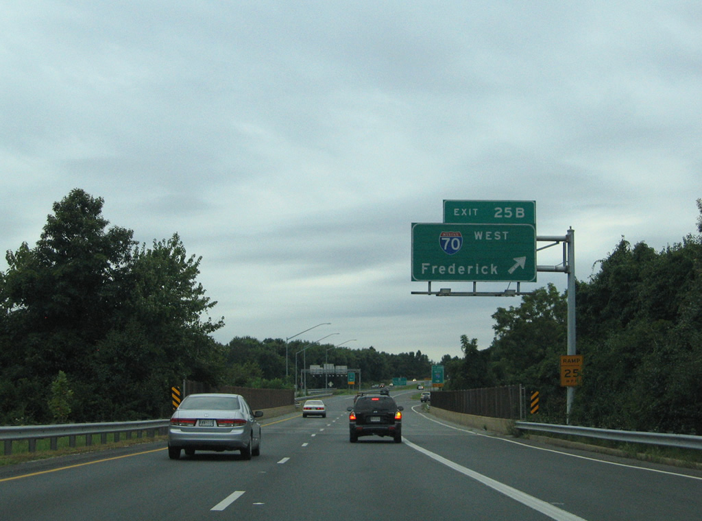
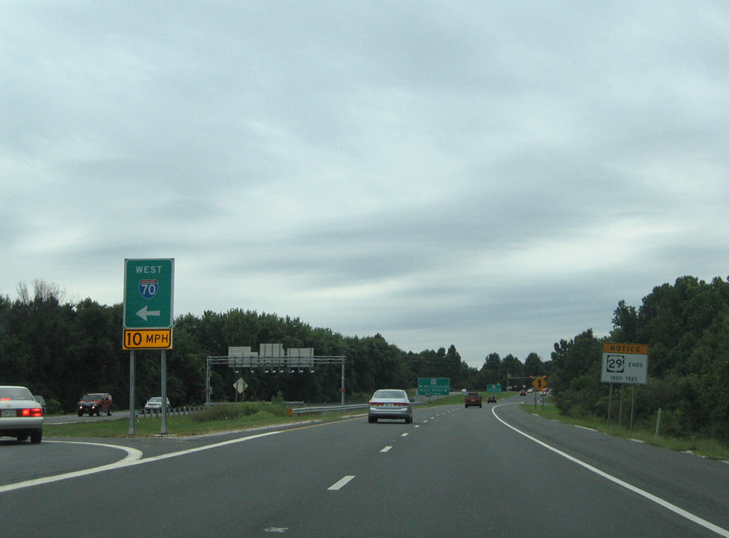
| U.S. 29 passes over Interstate 70 ahead of the Exit 25B loop ramp onto westbound. Interstate 70 continues 31 miles west to Frederick and 55 miles to Hagerstown. 08/27/05 |
|
| A left turn across U.S. 29 south provides a second opportunity to access Interstate 70 west from U.S. 29 north beyond the Exit 25B loop ramp. 08/27/05 |
|
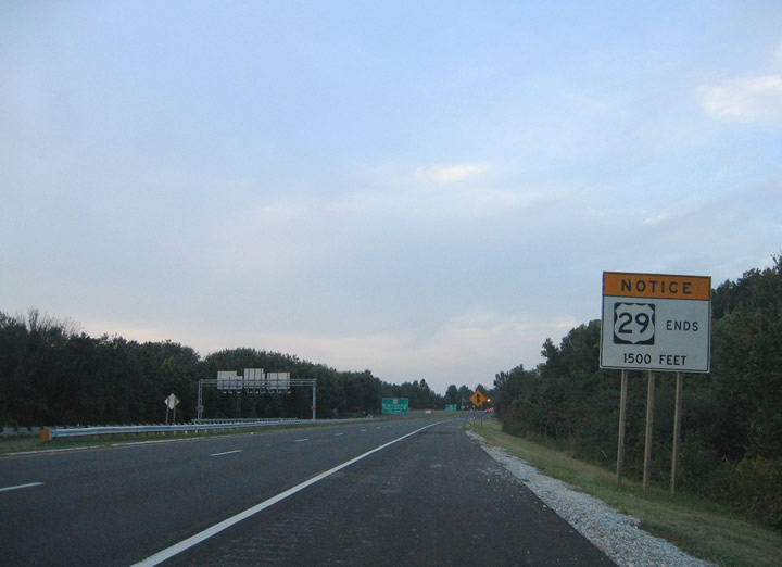
| An end advisory sign precedes the north end of U.S. 29 where the route meets MD 99 (Old Frederick Road / Rogers Avenue). 09/25/04 |
|
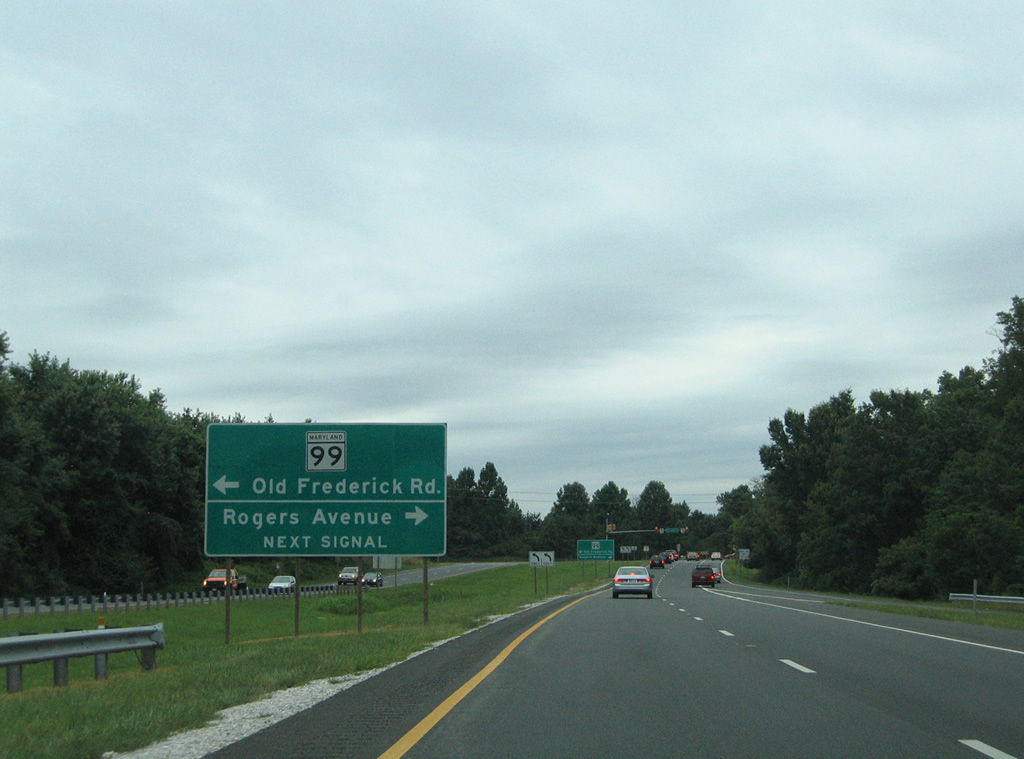
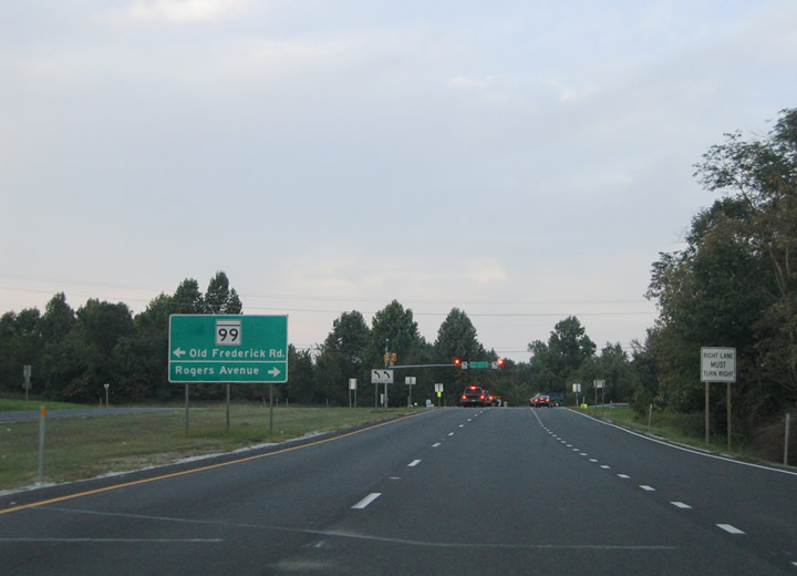
| MD 99 guide sign for the upcoming intersection with Old Frederick Road and Rogers Avenue. MD 99 constitutes the former U.S. 40 alignment west from Baltimore. Originally U.S. 29 turned eastward onto Old Frederick Road into Baltimore city. 08/27/05 |
|
| A second guide sign advises motorists merging onto U.S. 29 (Columbia Pike) northbound from Interstate 70 west for the intersection with MD 99. MD 99 travels 7.57 west from U.S. 29 to MD 32 (Sykesville Road) at Slacks Corner. Rogers Road turns southeast to meet another segment of Old Frederick Road and U.S. 40 at Ellicott City. 09/25/04 |
|
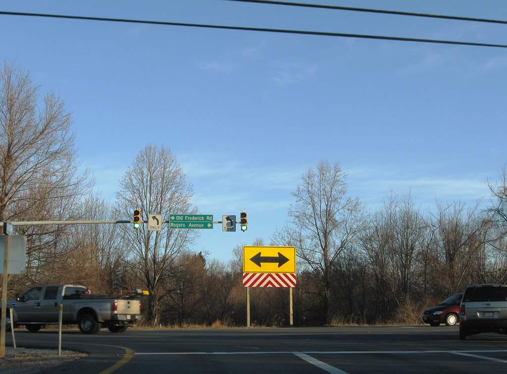
| U.S. 29 concludes at MD 99 (Old Frederick Road) and Rogers Avenue. The southern terminus of U.S. 29 is located 1036 miles and eight states away at Pensacola, Florida. 12/30/08 |
Page Updated 03-23-2011.

 North
North