|
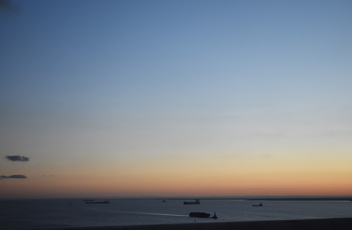
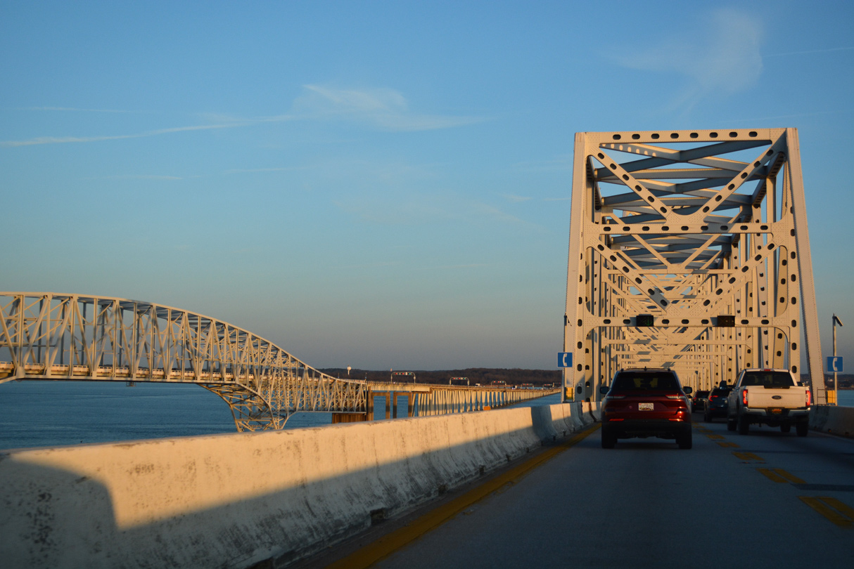
| Chesapeake Bay south of the William Preston Lane, Jr. Memorial Bridge. 12/17/20 |
|
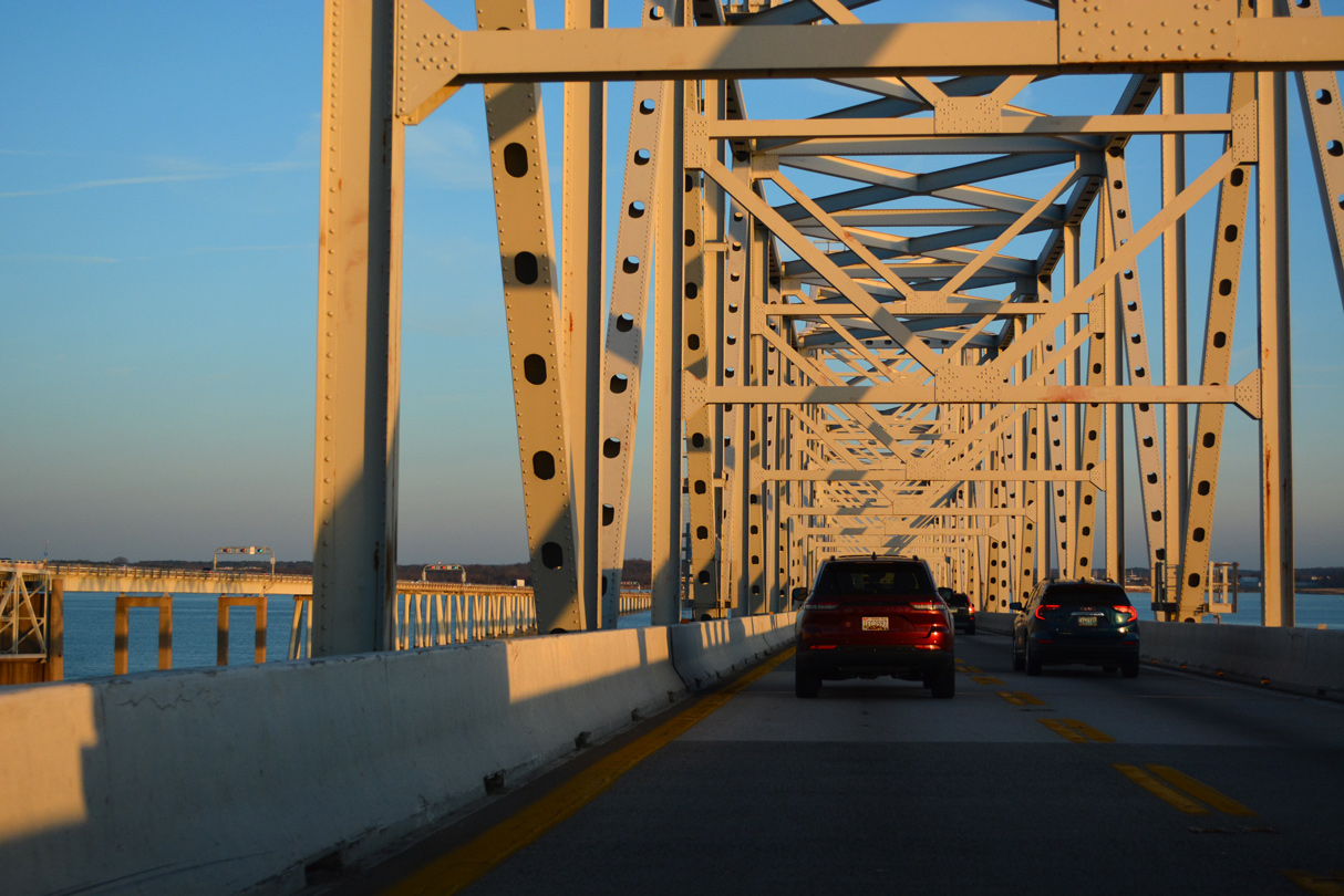
| During construction, accidents, reverse traffic flow and other events, lanes may be periodically closed or traffic redirected onto the opposite span or split between both spans. 12/21/22 |
|
| The respective bridge clearances above Chesapeake Bay are 186 feet for the eastbound bridge and 200 feet for the westbound span.1 12/21/22 |
|
| The westbound bridge across Chesapeake Bay cost $148 million and opened on June 28, 1973.1 12/21/22 |
|
| The original bridge opened to traffic on July 30, 1952 at a cost of $45 million.1 12/21/22 |
|
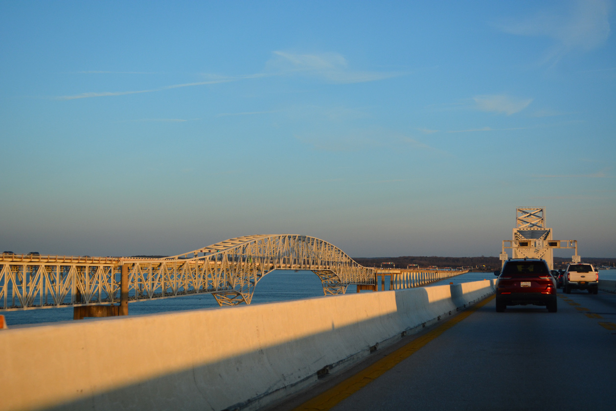
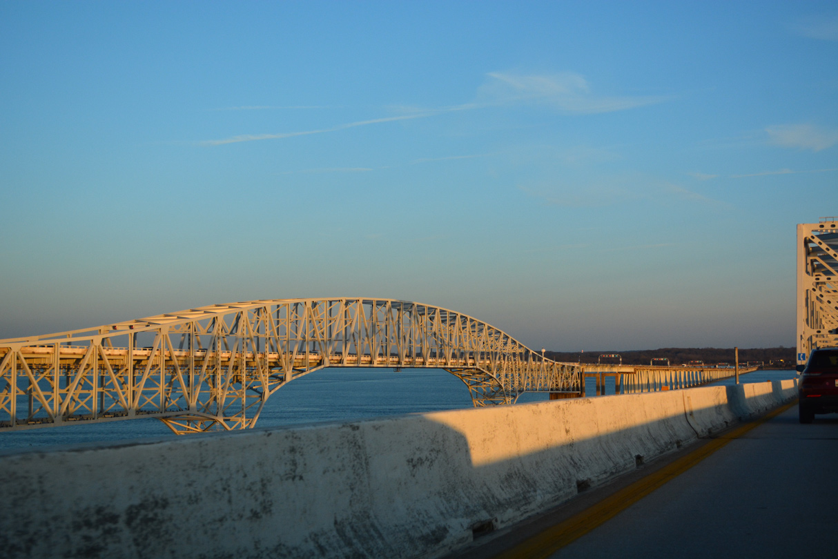
| Lowering toward Stevensville along the William Preston Lane, Jr. Memorial Bridge. 12/21/22 |
|
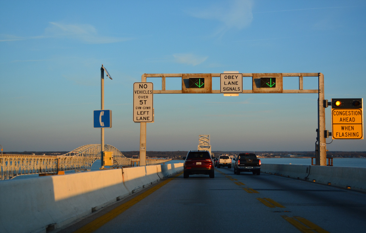
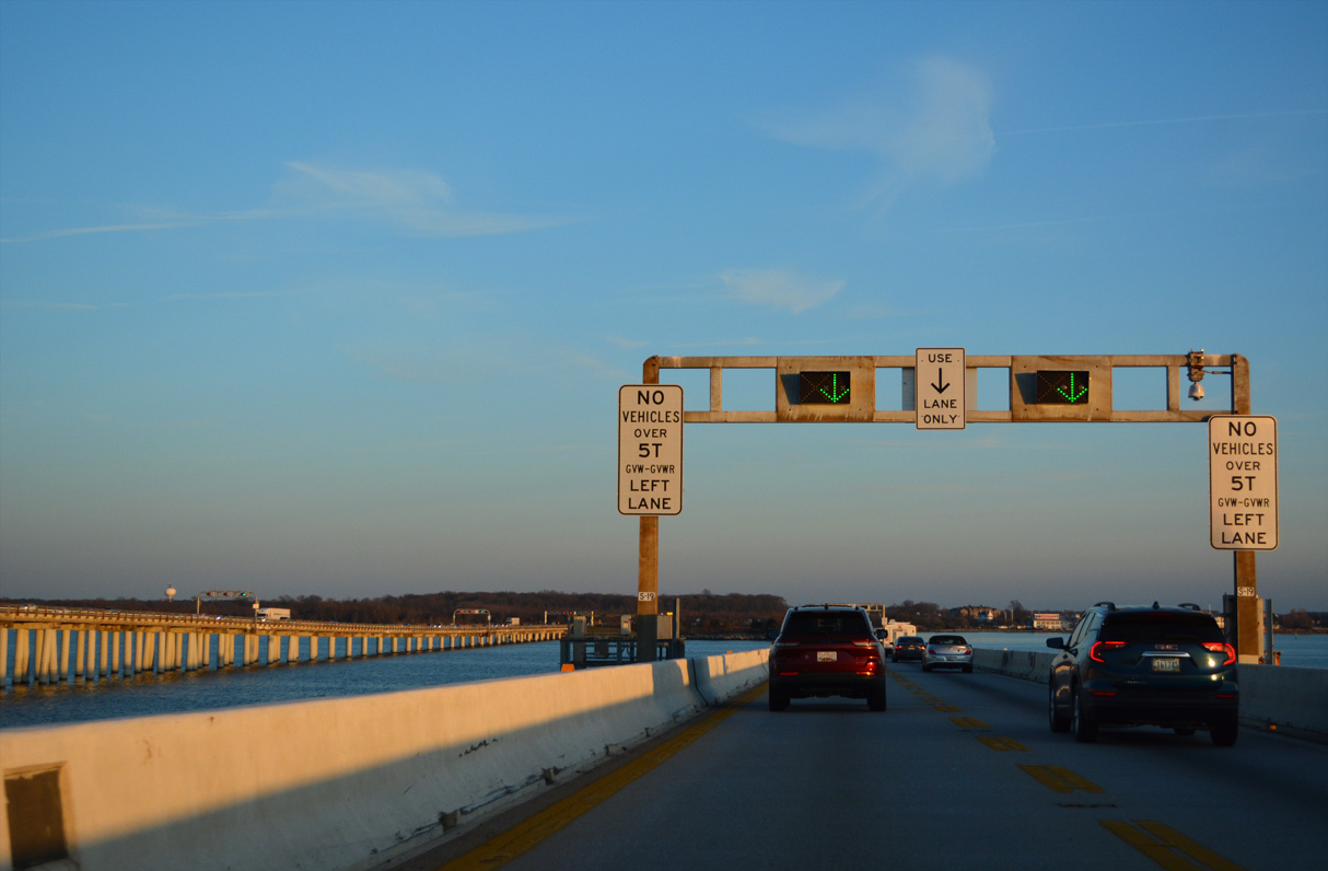
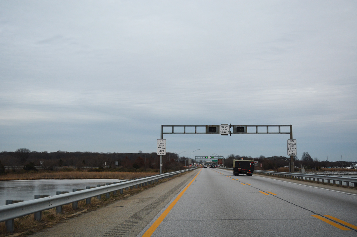
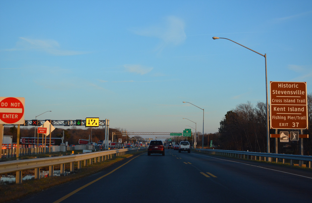
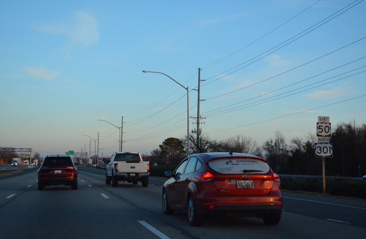
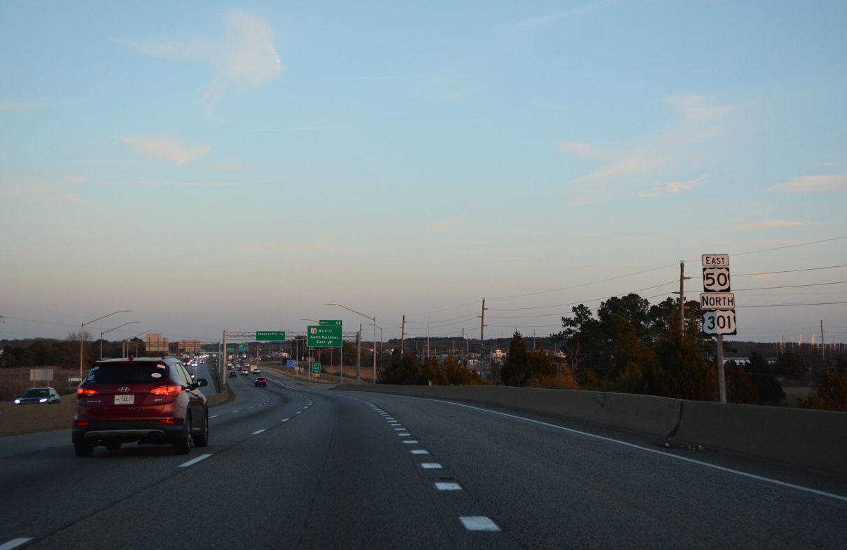
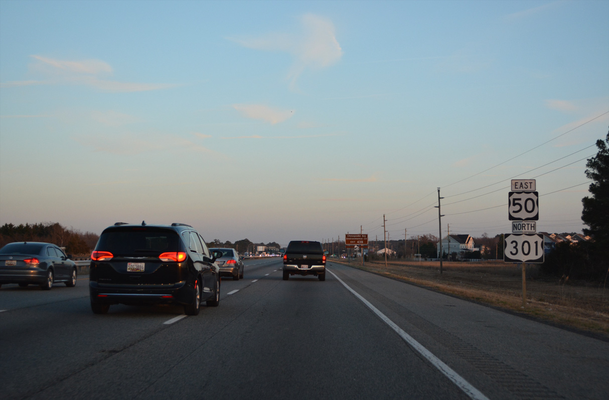
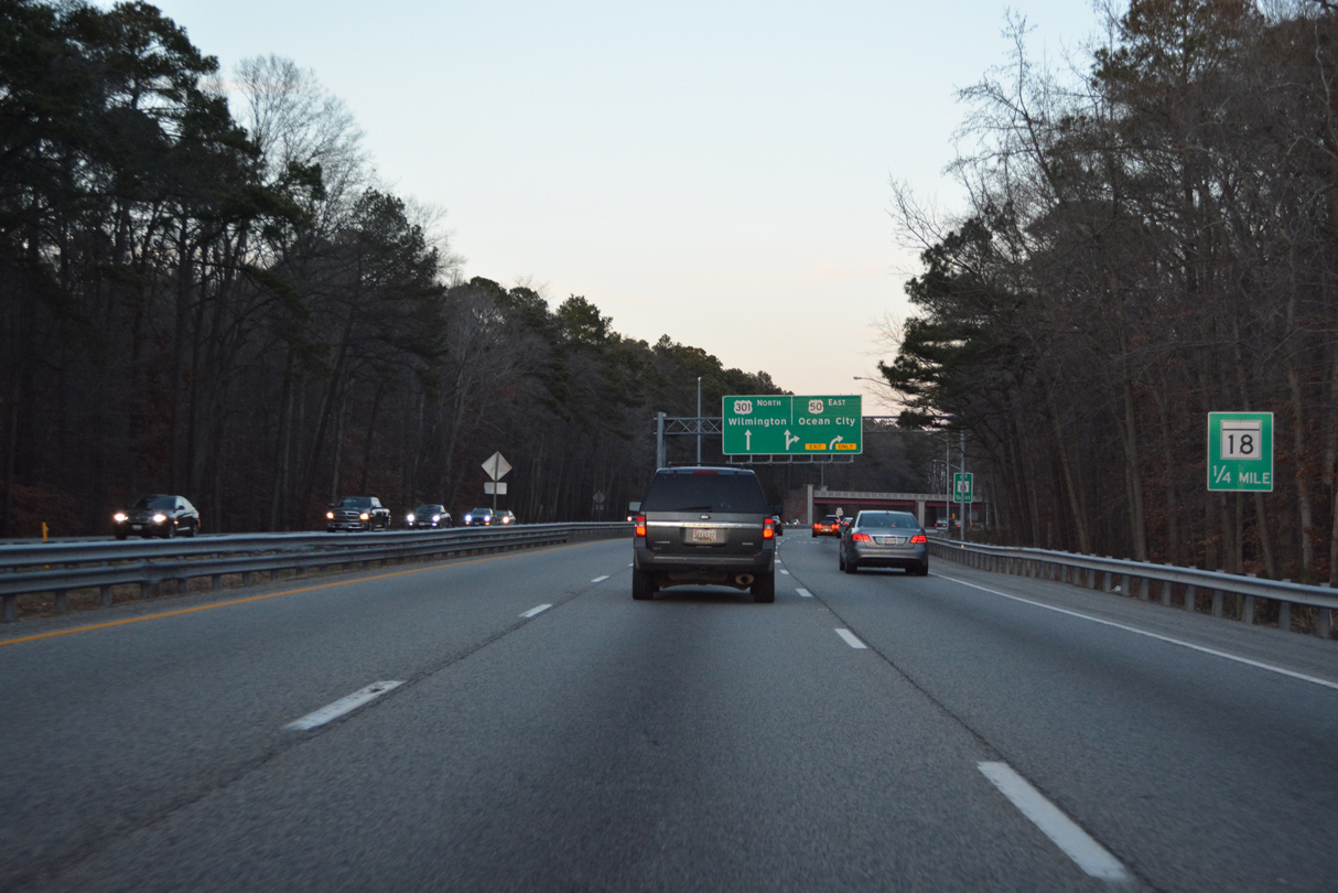
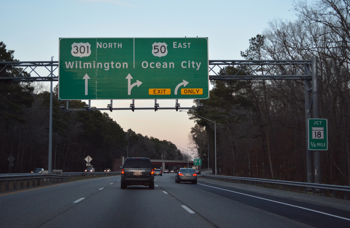
| U.S. 50 east / U.S. 301 north reach Kent Island beyond the final two sets of lane control signals. 12/16/16 |
|
| Ramps at the east end of the Bay Bridge are used during contraflow operations. Queen Anne's County is a part of Maryland's Eastern Shore, which differs culturally and geographically from the rest of the state. 12/21/22 |
|
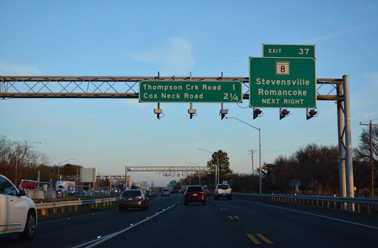
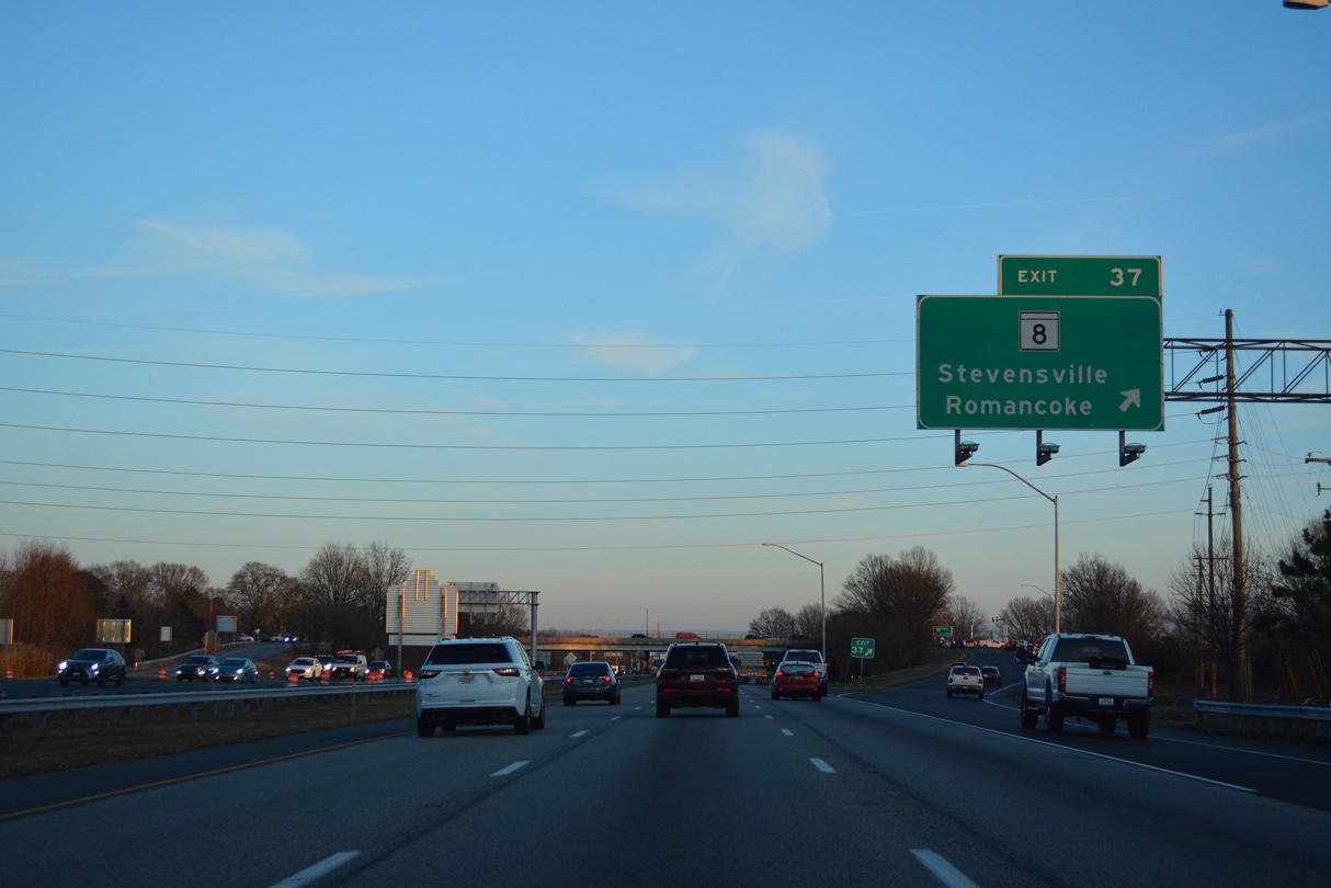
| U.S. 50/U.S. 301 expand to six lanes ahead of the diamond interchange (Exit 37) with MD 8 (Romancoke Road south / Business Parkway north) at Stevensville. 12/21/22 |
|
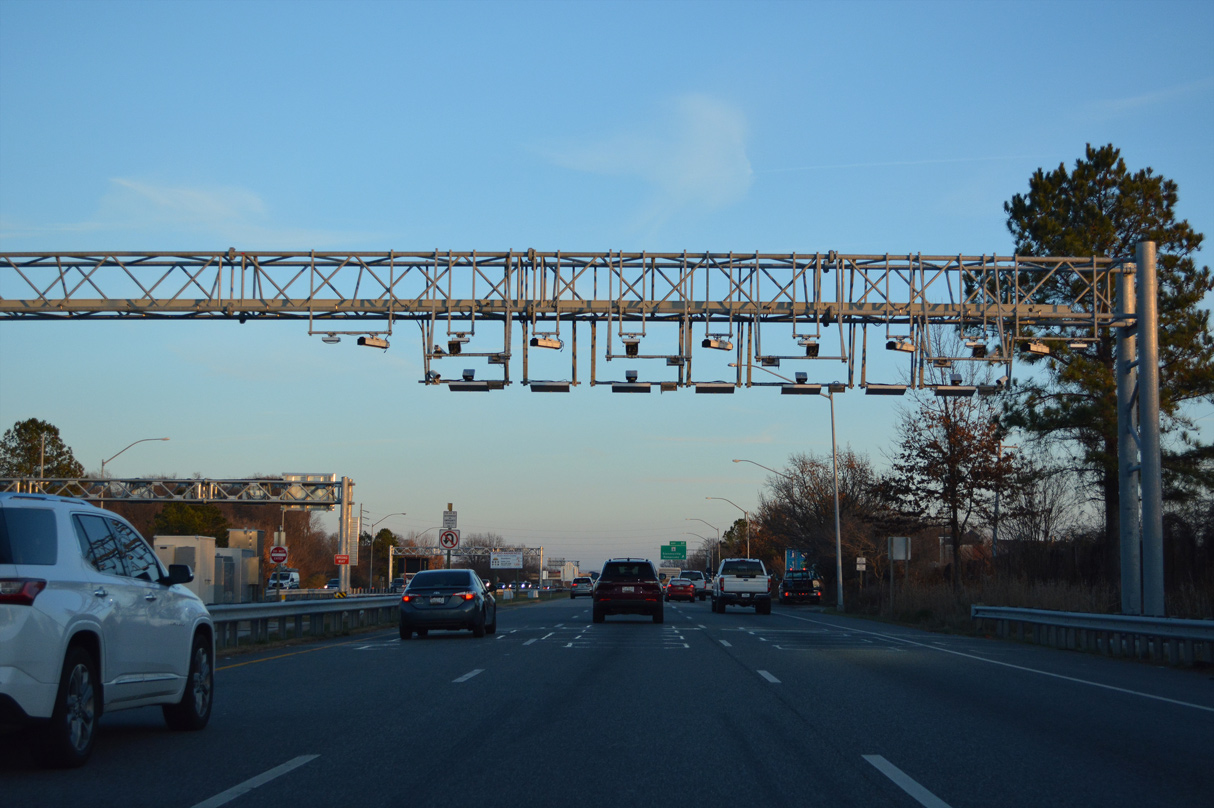
| The all electronic toll (AET) gantry for the Chesapeake Bay Bridge precedes Exit 37 along U.S. 50/301 eastbound. 12/21/22 |
|
| MD 8 constitutes an 8.29 mile long route from Romancoke to the south and nearby MD 18 (Main Street). MD 18 overtakes Business Parkway north to Love Point Road and Love Point. 12/21/22 |
|
| U.S. 50/301 continue another 8.6 miles from Stevensville to Queenstown. 12/21/22 |
|
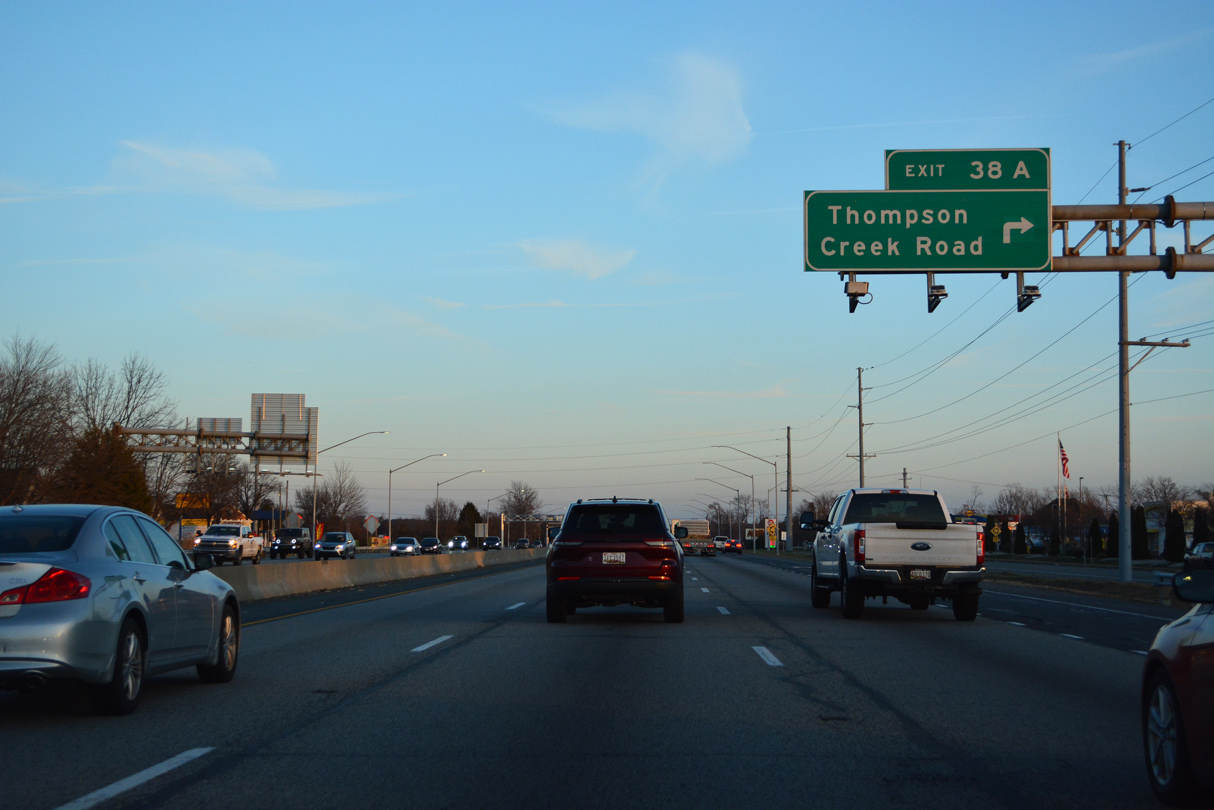
| Thompson Creek Service Road (MD 835) runs along the south side of U.S. 50/301 east from MD 8 (Romancoke Road) to Thompson Creek Road south at Exit 38 A. 12/21/22 |
|
| RIRO ramps at Exit 38 A tie into a roundabout with Thompson Creek Road (unsigned MD 835). 12/16/16 |
|
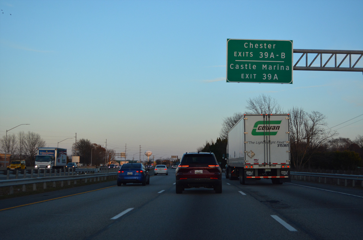
| Eastbound U.S. 50/301 spans Cox Creek ahead of the RIRO ramps at Exit 39 A with Cox Neck Road south at Chester. 12/21/22 |
|
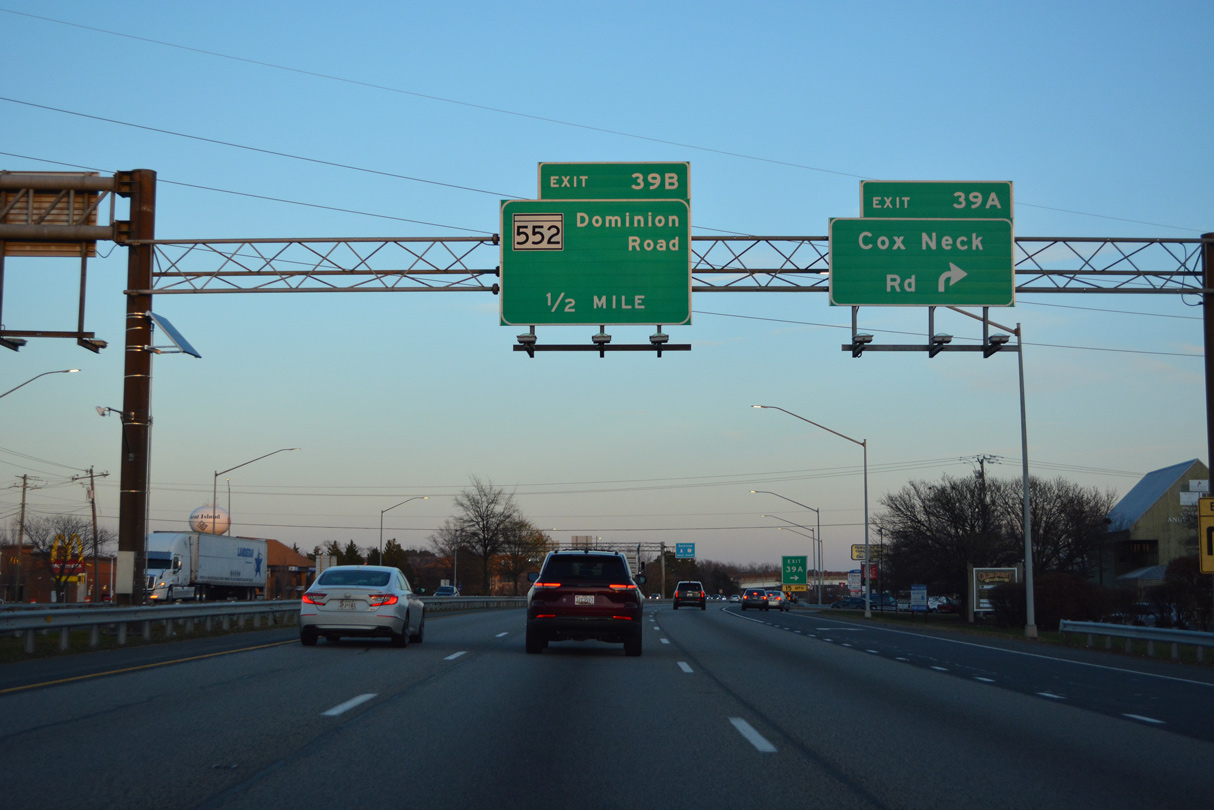
| Both Exits 39 A and 39 B serve the community of Chester. Postal Road parallels U.S. 50/301 east from Cox Neck Road to become MD 18 (Main Street) ahead of MD 552 (Dominion Road) south. MD 18 crosses the freeway northwest to Castle Marina Road. 12/21/22 |
|
| Cox Neck Road stems south from Exit 39 A to the Kent Island Research Wildlife Management Area and Turkey Point on Eastern Bay. 12/21/22 |
|
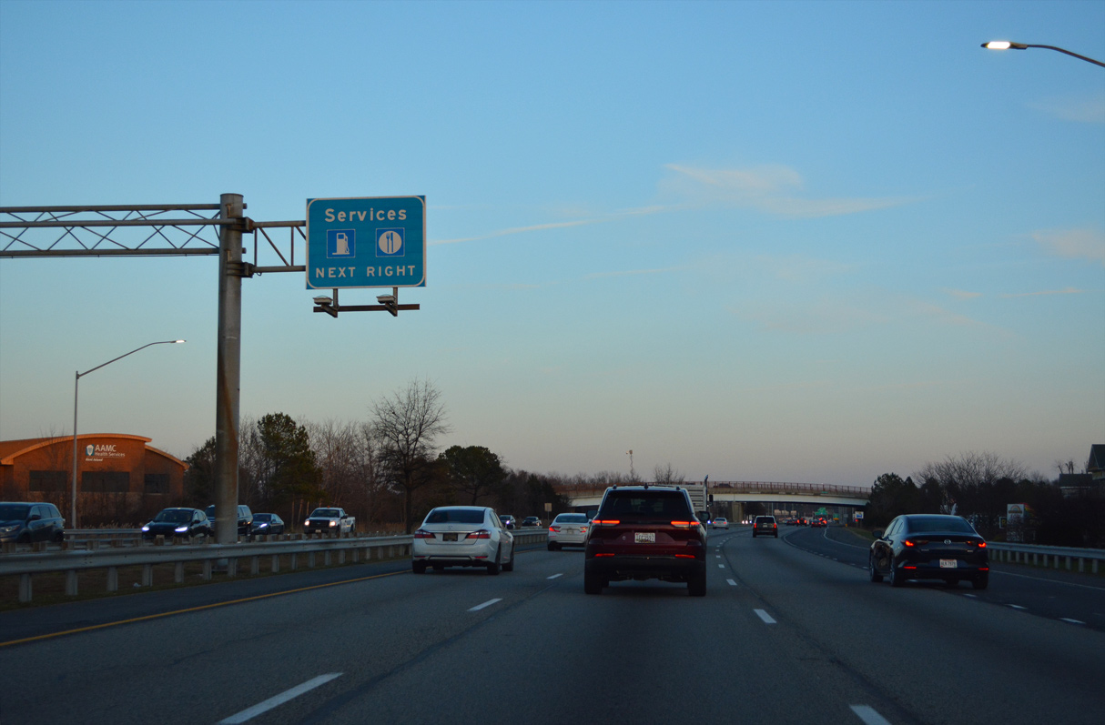
| An array of traveler services line parallel Main Street (MD 18B). 12/21/22 |
|
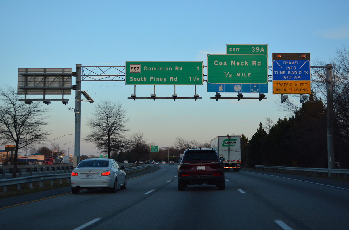
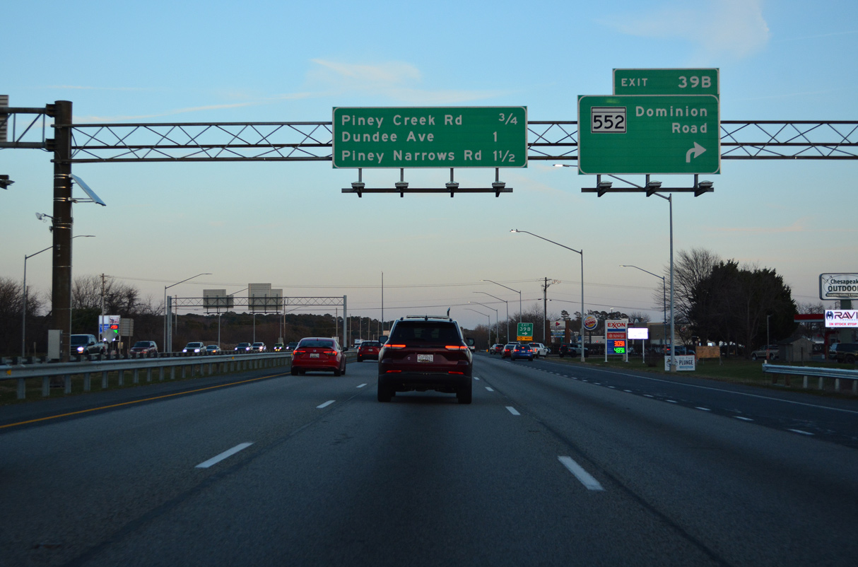
| Exit 39 B forms the southbound beginning of MD 552 (Dominion Road), a 2.19 mile long route to Little Creek Road at Dominion. 12/21/22 |
|
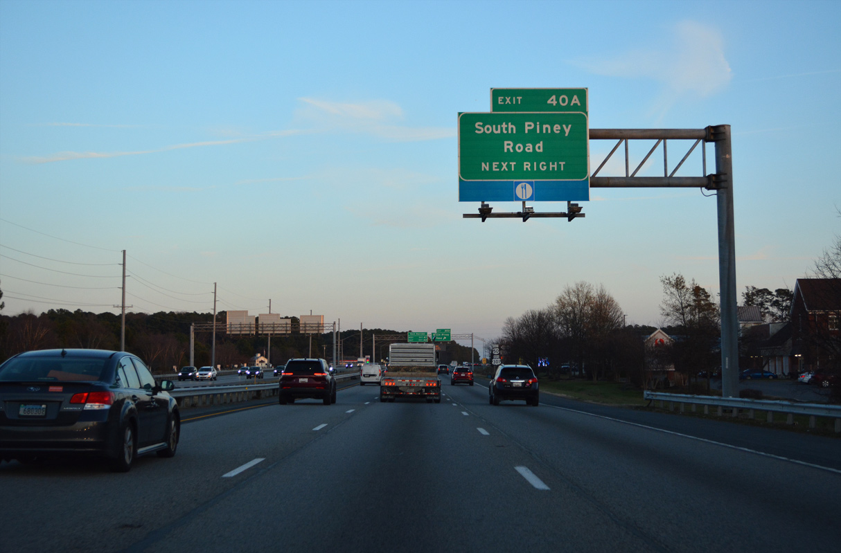
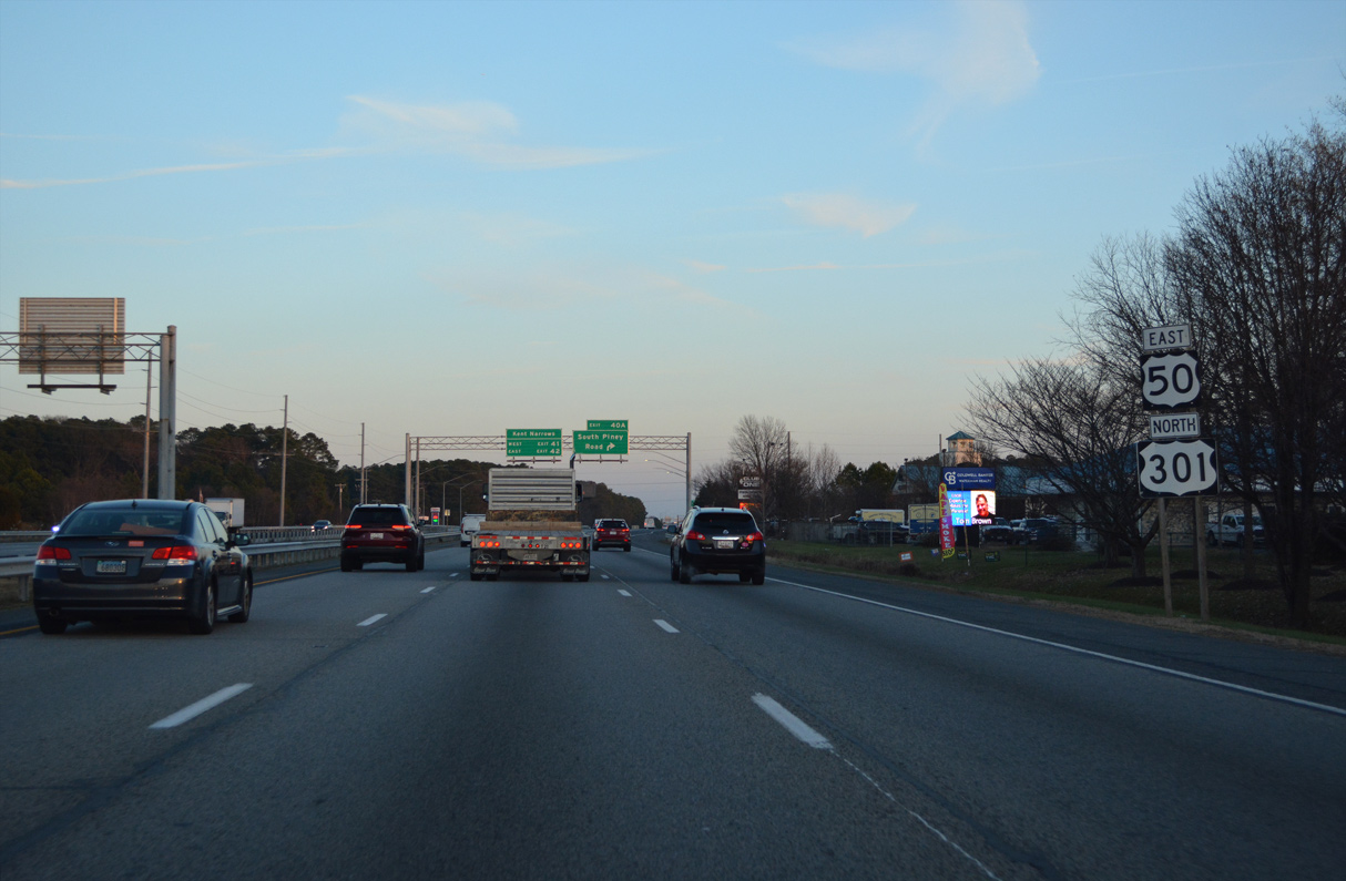
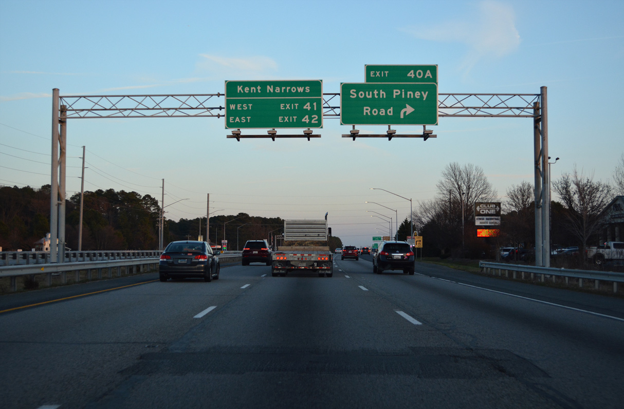
| South Piney Road links U.S. 50/301 with MD 18 (Main Street) east of Chester. 12/21/22 |
|
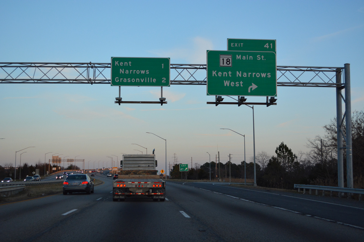
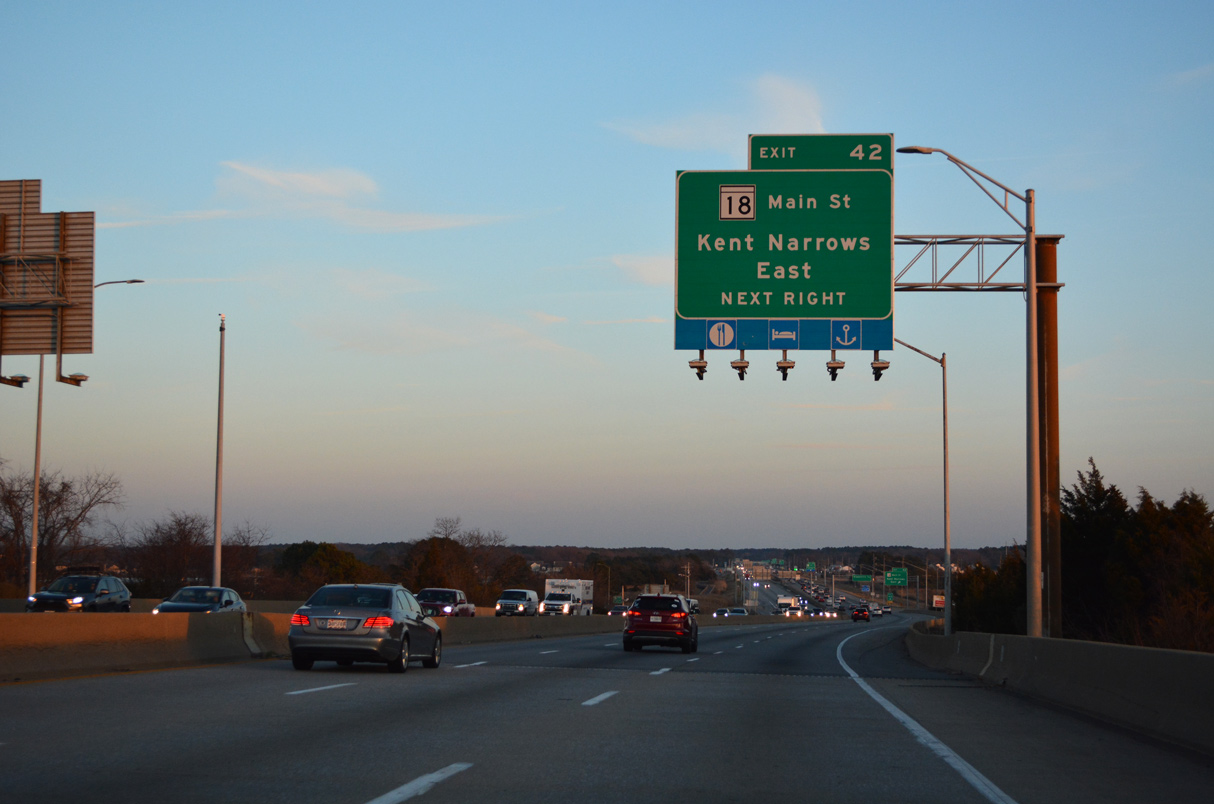
| Eastbound U.S. 50/301 at the RIRO ramps (Exit 40 A) with South Piney Road to MD 18. U.S. 50/301 advance east to Kent Narrows and the final Kent Island interchange. 12/21/22 |
|
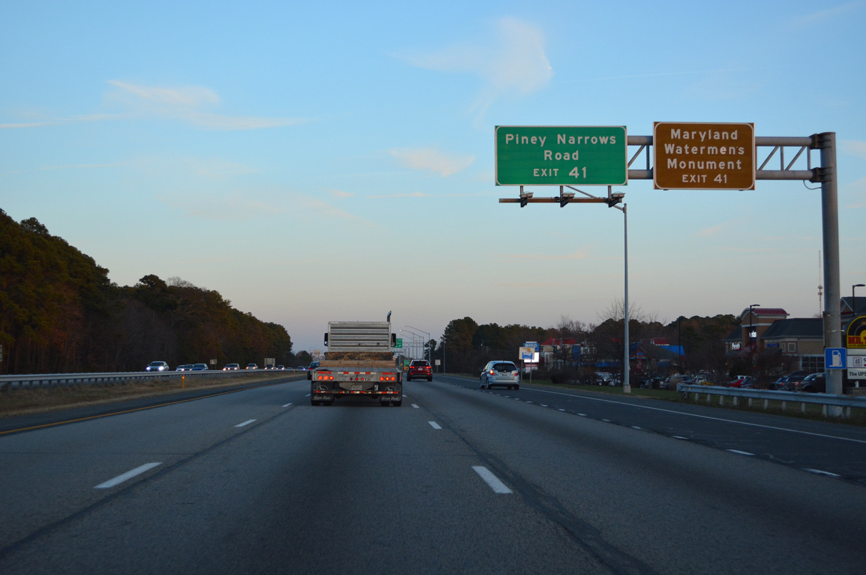
| Pine Narrows Road and MD 18 (Main Street) are joined by an under crossing east of forthcoming Exit 41 near Kent Narrows. 12/21/22 |
|
| Dundee Avenue comprises a local connector 0.28 miles south from Exit 40 B to MD 18 (Main Street) west of Piney Creek. 12/21/22 |
|
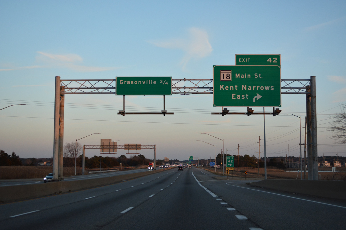
| U.S. 50 east / U.S. 301 north cross Piney Creek and enter a folded diamond interchange (Exit 41) with MD 18 (Main Street) and Piney Narrows Road. MD 18 runs east alongside the freeway across the Kent Narrows Bridge, which was built in 1951. 12/21/22 |
|
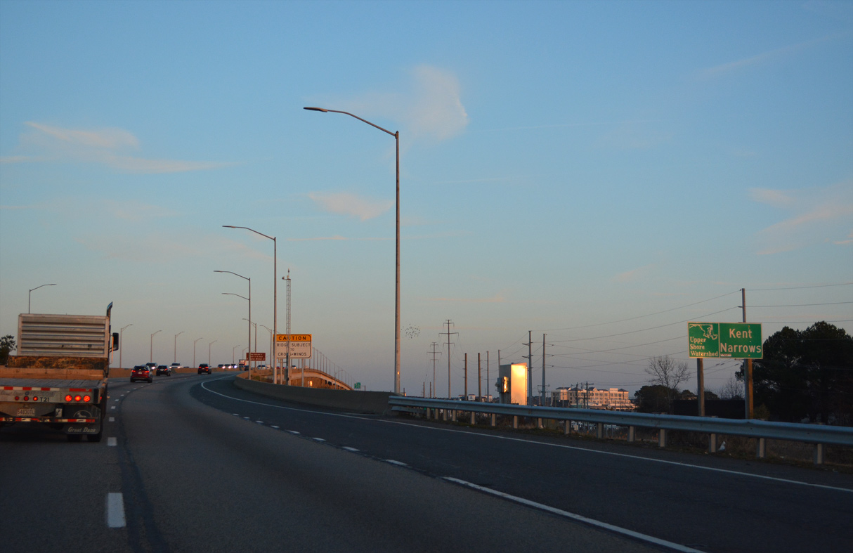
| U.S. 50/301 (Blue Star Memorial Highway) cross a high rise span over Kent Narrows. This bridge was completed in 1990. 12/21/22 |
|
| Kent Island Narrows separate Kent Island from the rest of Queen Annes County. 12/21/22 |
|
| Kent Island Narrows flows between the Chester River to the north and Prospect Bay to the south. 12/21/22 |
|
| RIRO ramps follow Kent Narrows with MD 835 (Seward Marina Road) south and MD 835G (Kent Narrows Road) to the north. 12/21/22 |
|
| MD 835 (Seward Marina Road) comprises a 0.13 mile link from Exit 42 to MD 18 (Main Street). Kent Narrows Road is MD 835 Segment G from U.S. 50/301 westbound 0.40 miles to Kent Narrows Way. 12/21/22 |
|
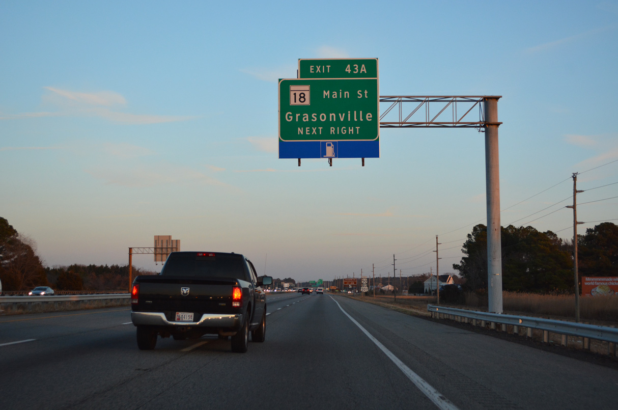
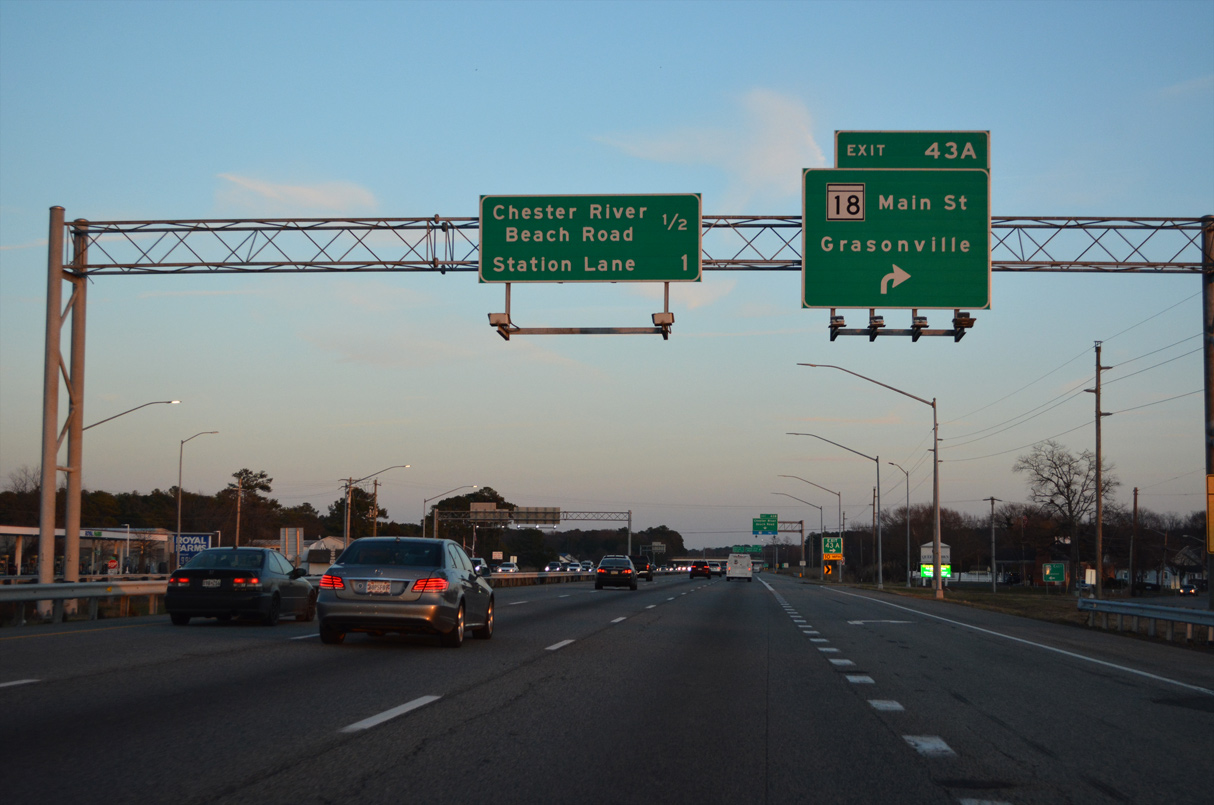
| Continuing east, U.S. 50/301 meet MD 18 (Main Street) directly at Exit 43 A ahead of Grasonville. 12/21/22 |
|
| MD 18 (Main Street) bends southward to Grasonville from Exit 43 A. Exit 43B also provides access to Grasonville via Chester River Beach Road (MD 18V) south to Main Street. 12/21/22 |
|
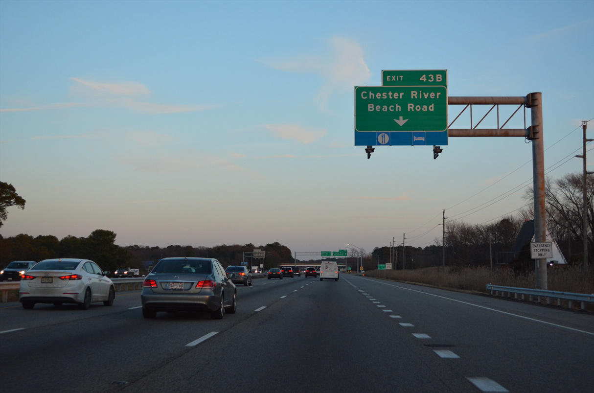
| An auxiliary lane opens along U.S. 50/301 east to Exit 43 B. MD 18 Segment V overlays Chester River Road 0.65 miles north from MD 18 to VFW Avenue (MD 18W) and Loblolly Way. 12/21/22 |
|
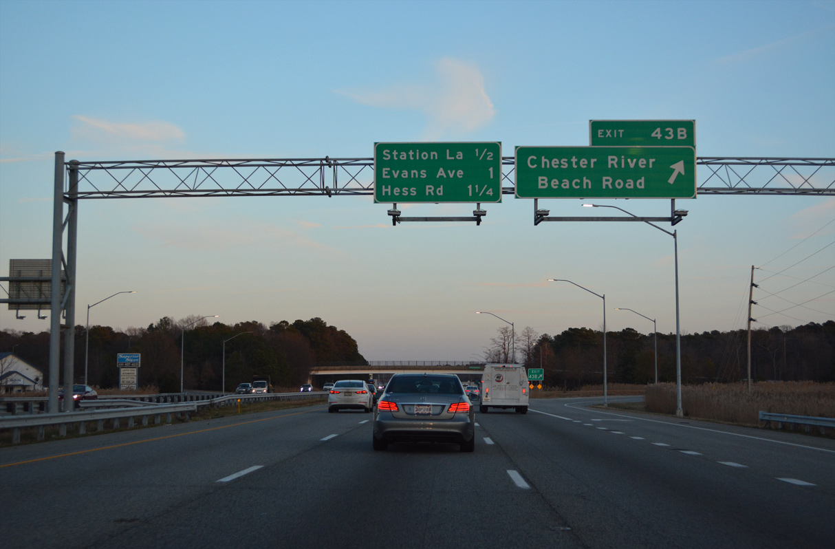
| A parclo interchange joins U.S. 50/301 with Chester River Road at Exit 43 B. Chester River Beach Road spurs north to Chester River Drive by Stony Bar Bluff. 12/21/22 |
|
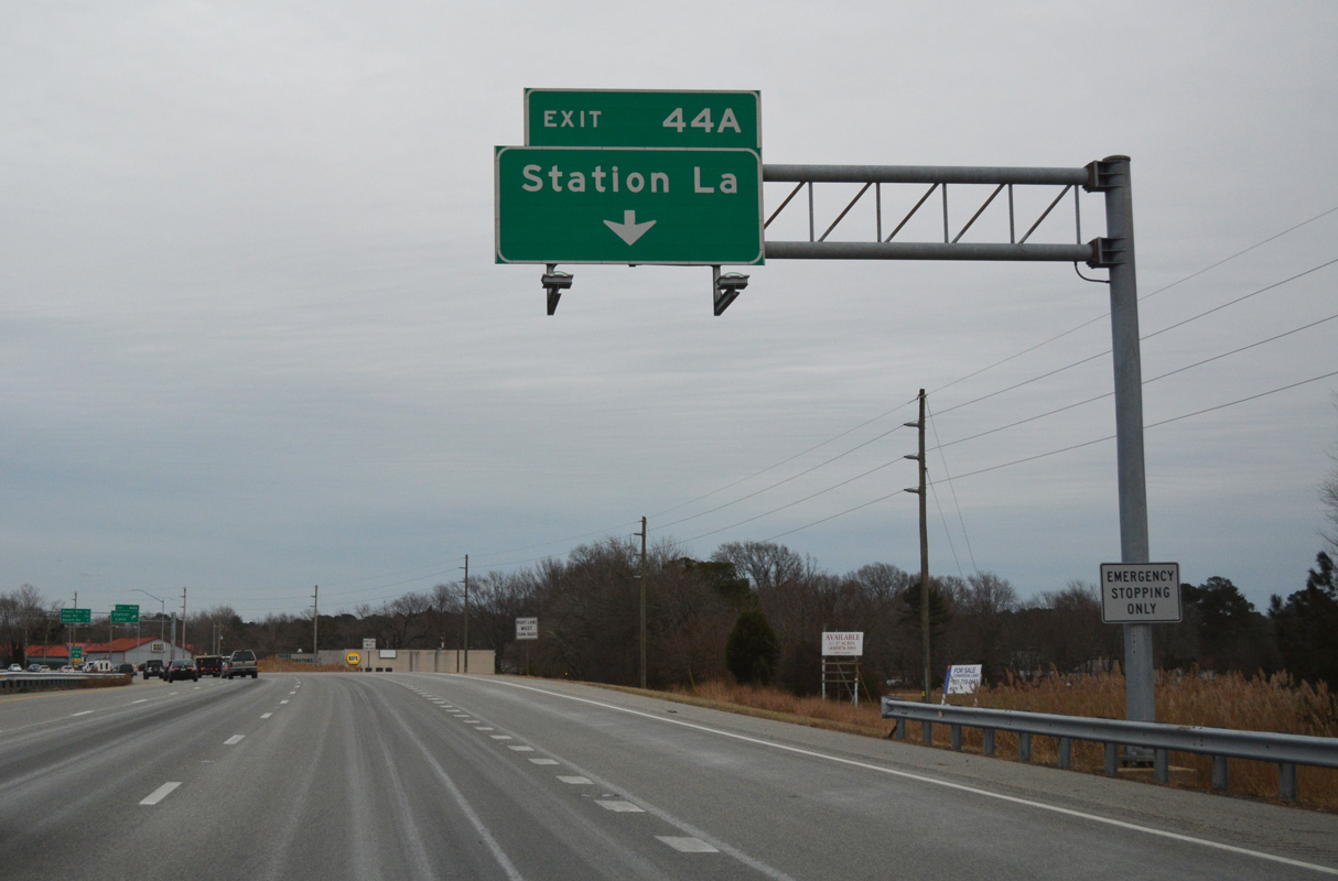
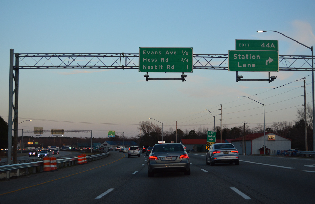
| Exit 44 A follows with Station Lane south to MD 18B (Main Street) in Grasonville. 12/16/16 |
|
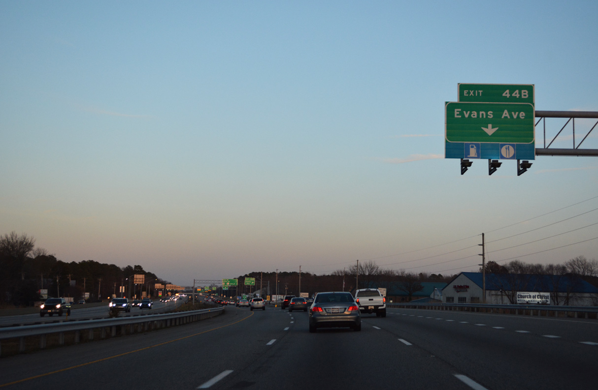
| Station Lane leads 0.16 miles south from the RIRO ramps at Exit 44 A to MD 18B. Evans Avenue replicates the connection between U.S. 50/301 and Main Street in Grasonville at Exit 44B. 12/21/22 |
|
| U.S. 50/301 (Blue Star Memorial Highway) pass by Winchester Creek just ahead of Exit 44 B. Winchester Creek Road (MD 835H) runs along the north side. 12/21/22 |
|
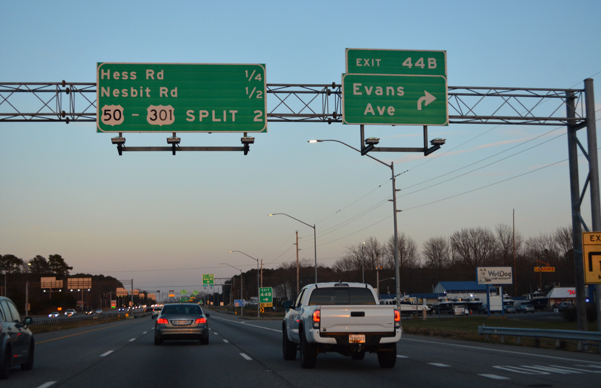
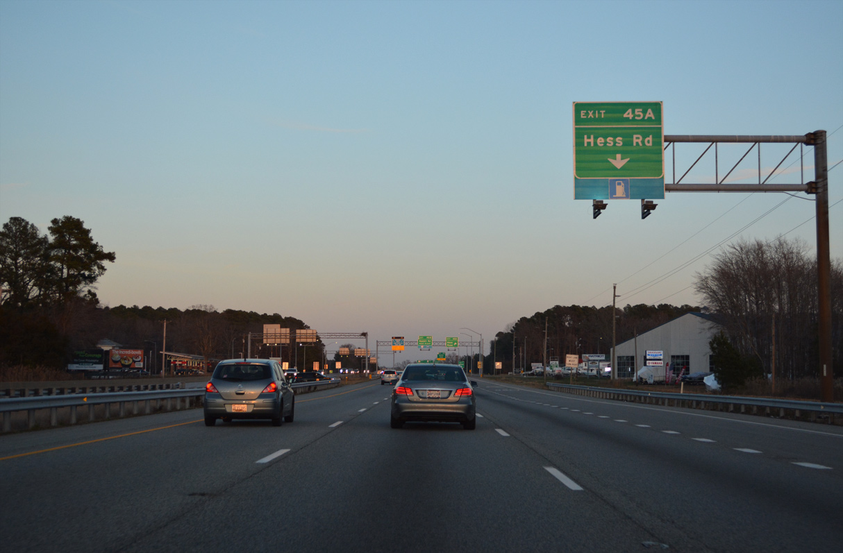
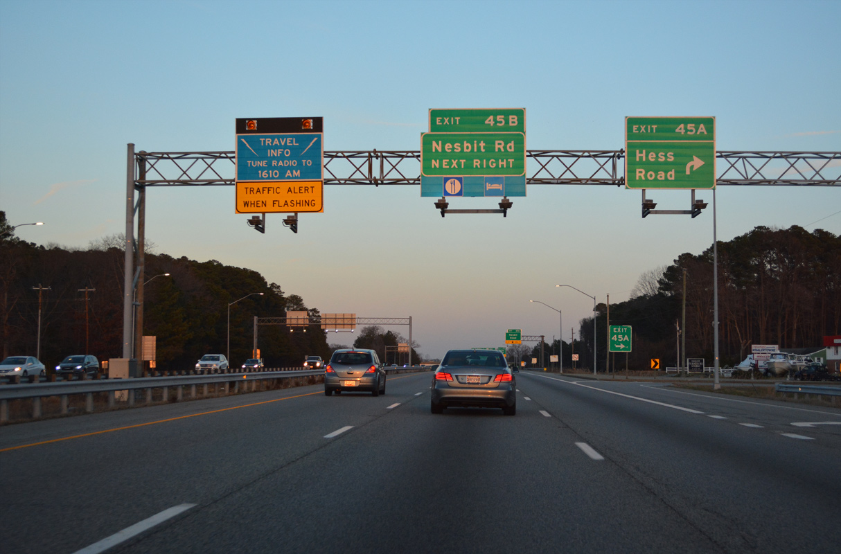
| Eastbound at the RIRO ramps (Exit 44 B) with Evans Avenue. Exit 45 A to Hess Road and Exit 45 B to Nesbit Road follow in quick succession. 12/21/22 |
|
| Hess Road (MD 835K) branches 0.32 miles northeast from Evans Avenue to U.S. 50/301 at Exit 45 A. 12/21/22 |
|
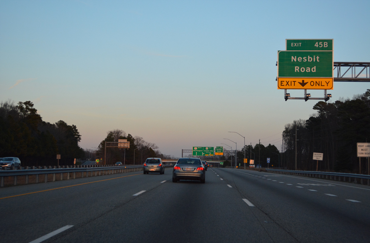
| A modified diamond interchange (Exit 45 B) with Nesbit Road (MD 835 Segment K) follows the RIRO ramps with Hess Road.E 12/21/22 |
|
| Nesbit Road connects U.S. 50/301 with MD 18 (Main Street) south from Exit 45 B. 12/21/22 |
|
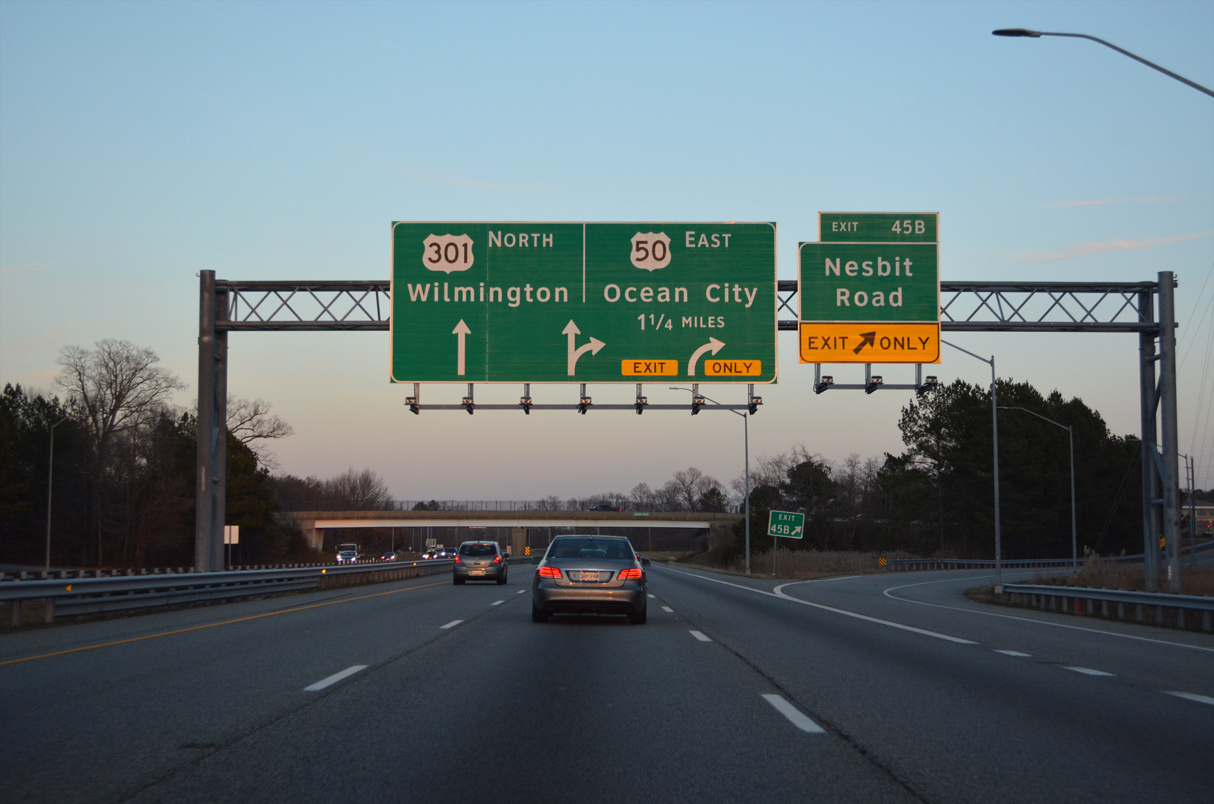
| Northward from Exit 45 B, Nesbit Road (MD 835K) leads to Winchester Creek Road (MD 835J) and Blackbeards Bluff along the Chester River. U.S. 50/301 part ways next in 1.25 miles. 12/21/22 |
|
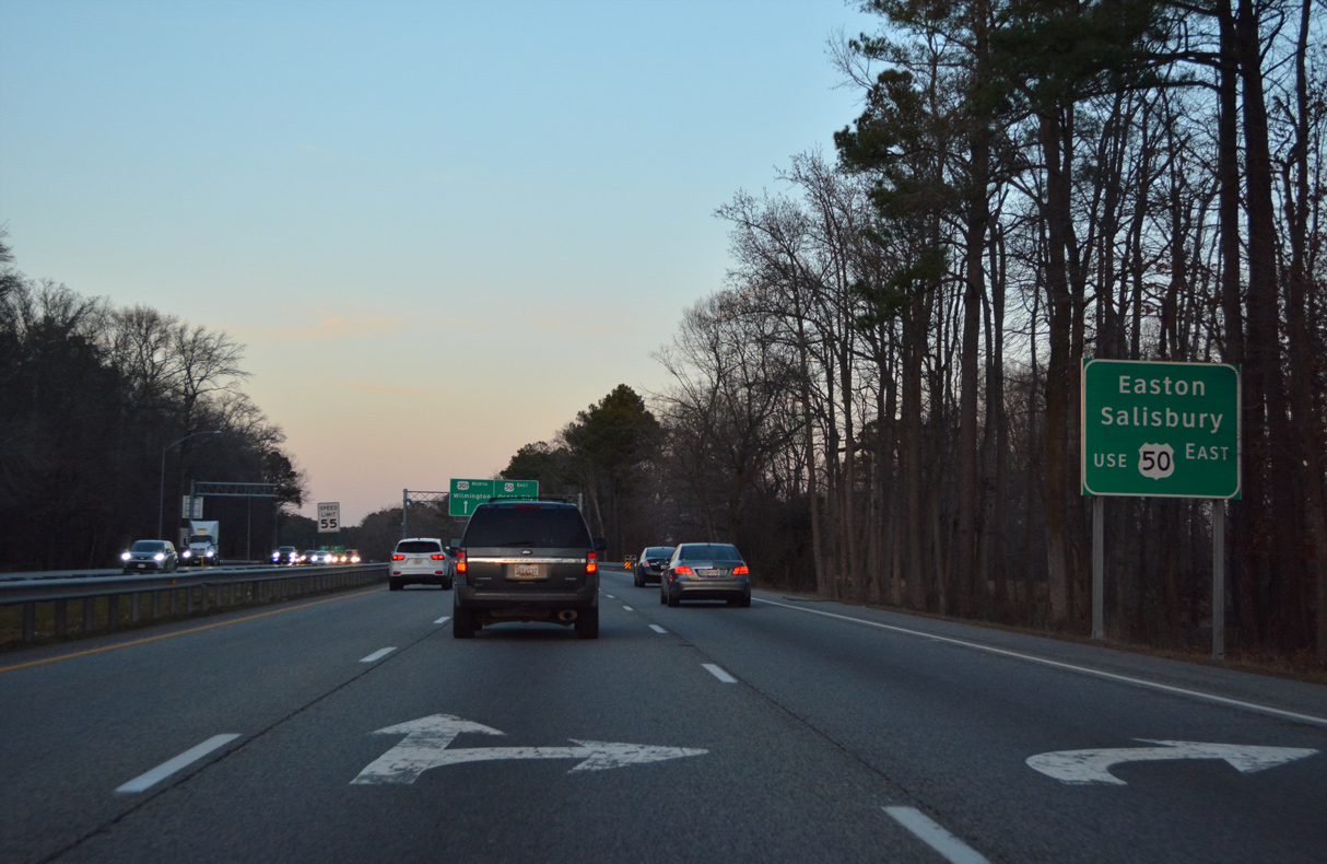
| U.S. 50 turns south from Queenstown to the resort town of Ocean City through the Eastern Shore population centers of Easton and Salisbury. 12/21/22 |
|
| U.S. 301 continues northward from the wye interchange with U.S. 50 at Queenstown to Middletown, Delaware as an expressway. U.S. 50 arcs south to Wye Mills en route to Cambridge. 12/21/22 |
|
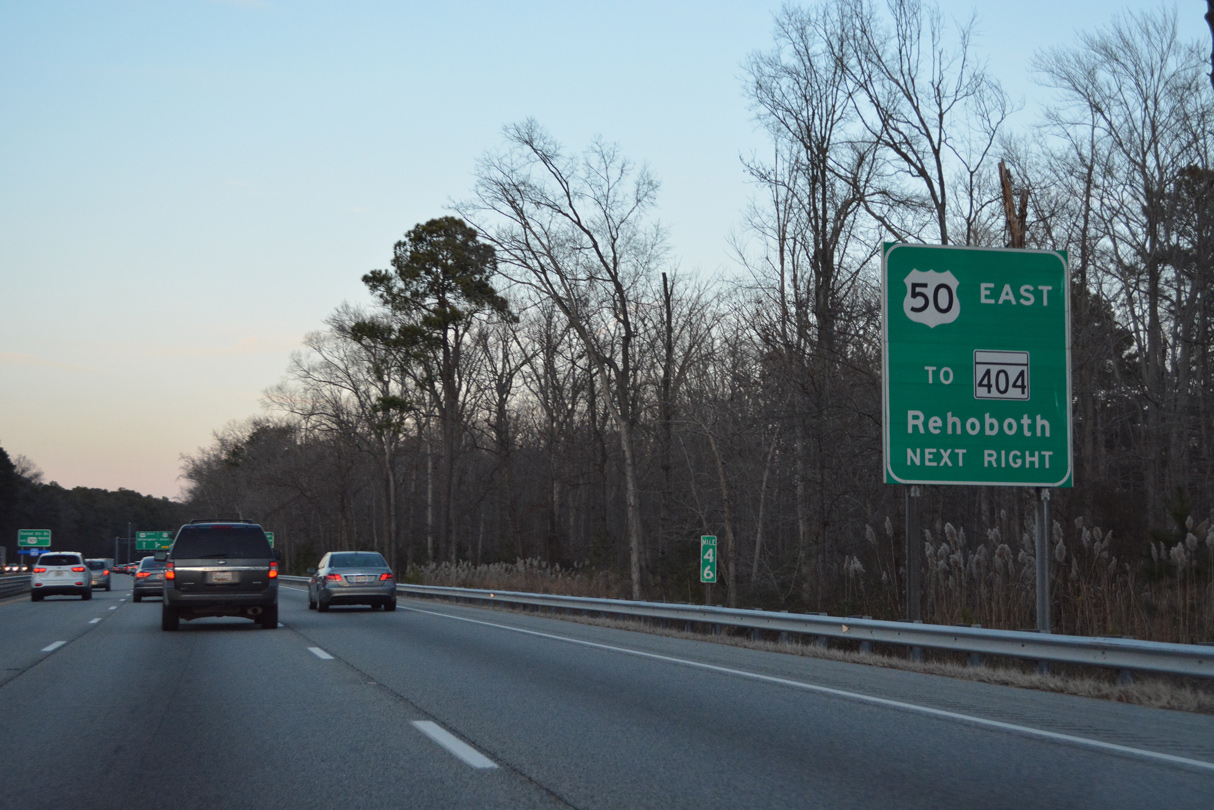
| Travelers bound for Rehoboth Beach on the Delaware coast are directed to remain along U.S. 50 east to MD 404 east near Wye Mills. MD 404 comprises a multi state route with SR 404 through Denton, Bridgeville and Georgetown, Delaware. 12/21/22 |
|
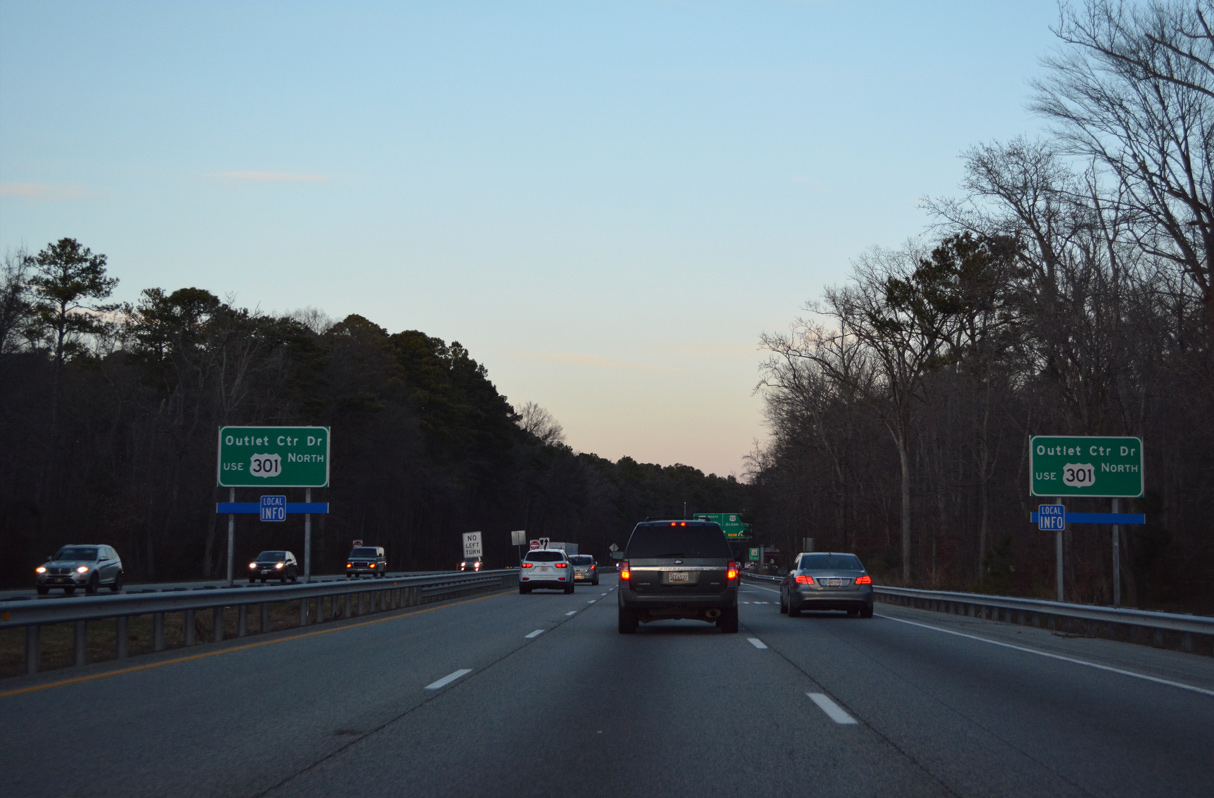
| The Queenstown Premium Outlets lie between U.S. 50 (Ocean Gateway) and U.S. 301 off MD 18 (Main Street) and MD 656 (Friels Road). 12/21/22 |
|
| MD 18 (Main Street) intersects U.S. 50 (Ocean Gateway) just east of the split with U.S. 301. MD 18 dog legs north from the Queenstown Premium Outlets at MD 656 (Friel Road) into Queenstown. 12/21/22 |
|
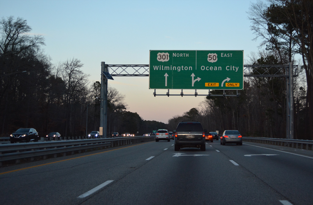
| U.S. 50/301 separate after a 32.5 mile long overlap. U.S. 301 north travels toward Centerville, Church Hill and Millington, eventually concluding at SR 1 near St. Georges, Delaware. U.S. 50 ends at MD 528 in Ocean City. 12/21/22 |
Page Updated 01-12-2023.

 East
East  North
North