|
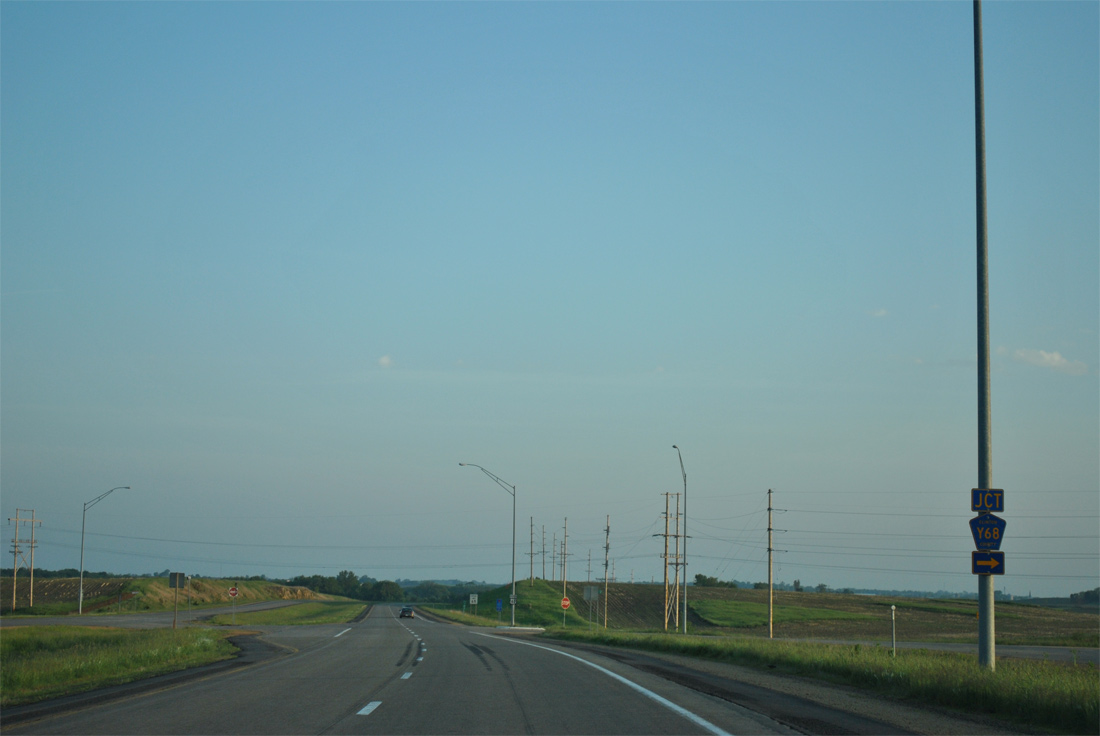
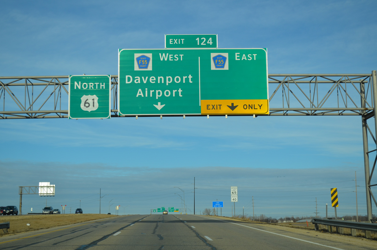
| Leaving Interstate 80, U.S. 61 gains an auxiliary lane to the six-ramp parclo interchange (Exit 124) with Scott County Route F55 (90th Street). 01/01/15 |
|
| Exit 124 joins the U.S. 61 freeway with County Road F55 (90th Street) at Mt. Joy and Davenport Municipal Airport (DVN). 01/01/15 |
|
| A two lane off-ramp departs U.S. 61 north for CR F55. The county road runs along 210th Street east to Utica Ridge Road (CR Z16), Crombie and the northern extent of the Bettendorf city limits. 01/01/15 |
|
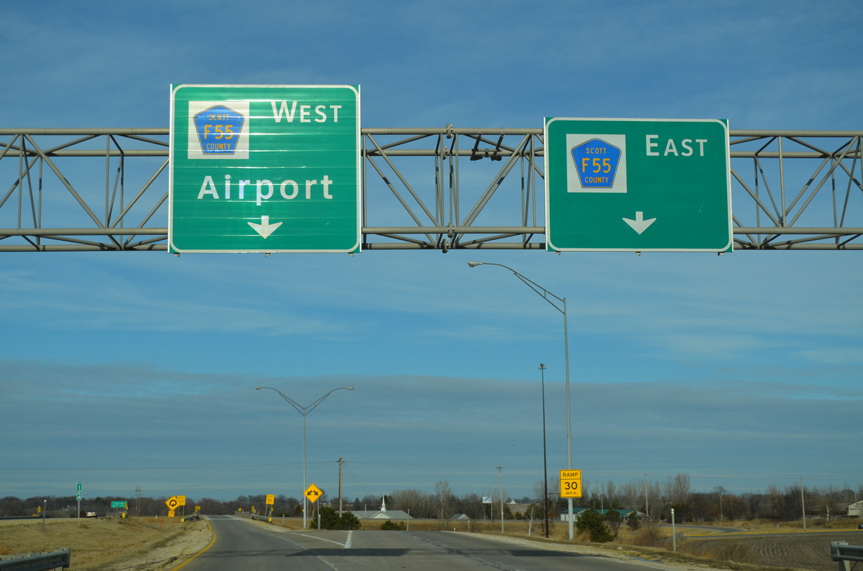
| Exit 124 partitions into a loop ramp for the airport to the west and 90th Street east to Scott Park Road. Scott Park Road leads north from nearby as the old alignment of U.S. 61 to Park View and Scott County Park. 01/01/15 |
|
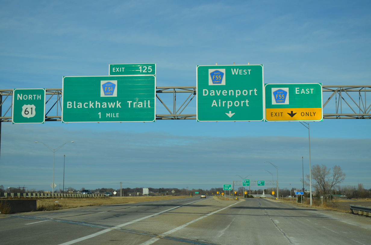
| U.S. 61 enters the city of Eldridge at the crossing of Crow Creek just north of Exit 124. 04/01/16 |
|
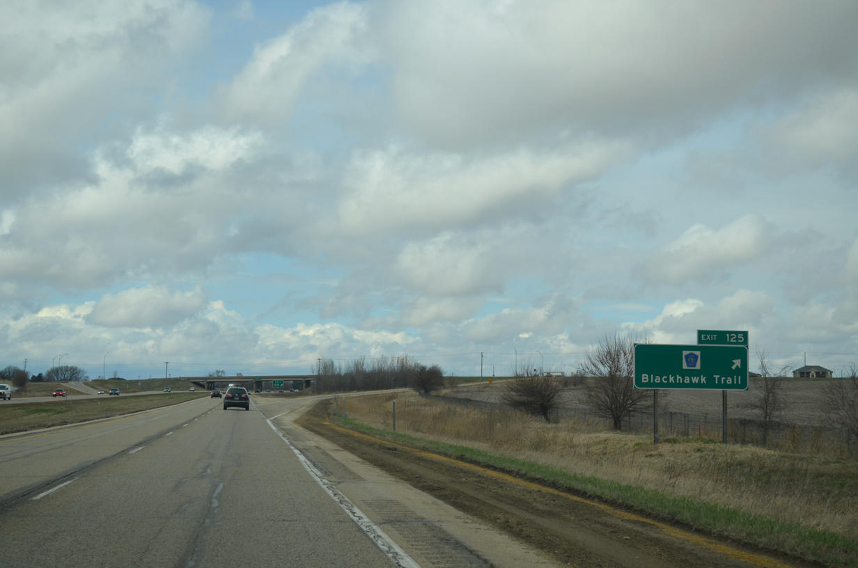
| A diamond interchange (Exit 125) follows with CR F51 (Blackhawk Trail). Blackhawk Trail links U.S. 61 with CR Y64 (1st Street) to the west and Scott Park Road (former U.S. 61) to the east. 04/01/16 |
|
| U.S. 61 turns due north ahead of the 230th Street / Lincoln Road overpass. 04/01/16 |
|
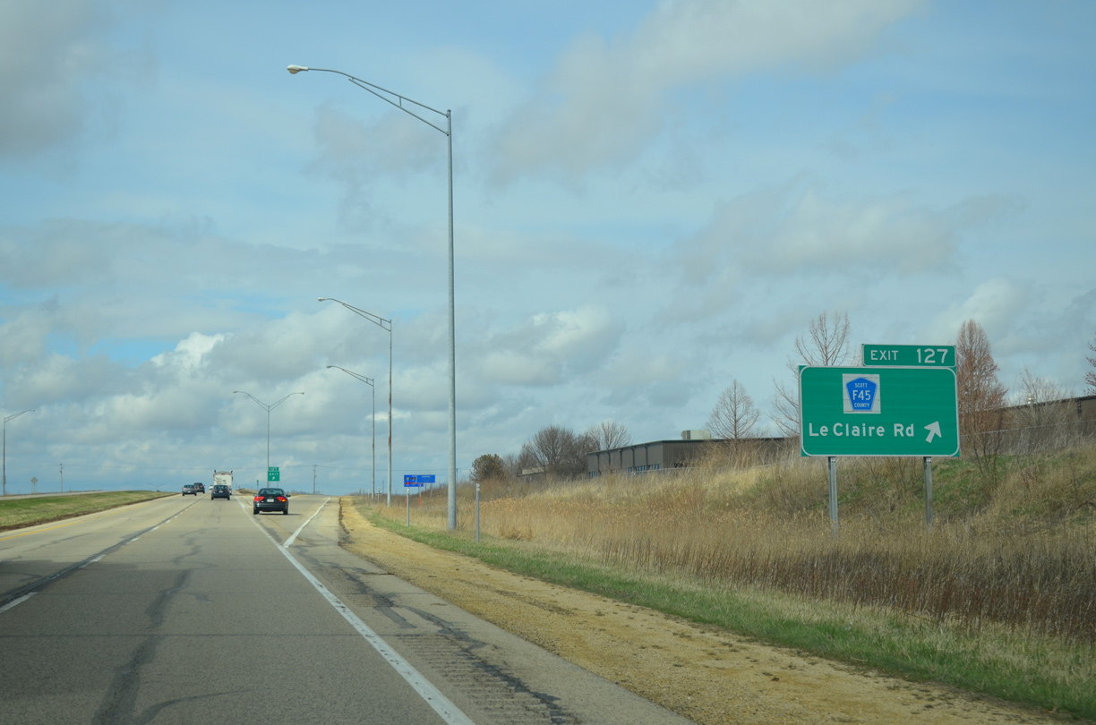
| One mile south of the diamond interchange (Exit 127) with CR F45 (Le Claire Road) on U.S. 61 north. 04/01/16 |
|
| Le Claire Road represents the north / south divide across the Eldridge street grid to the west. East from U.S. 61 and an adjacent industrial park, County Road F45 becomes 240th Street en route to County Road Z30. 04/01/16 |
|
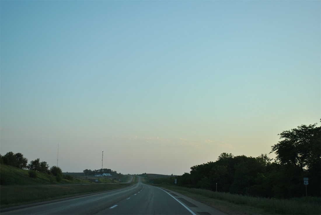
| Heading north from Eldridge, U.S. 61 continues as a rural freeway three miles to Long Grove and 12 miles to DeWitt. 05/08/10, 05/30/11 |
|
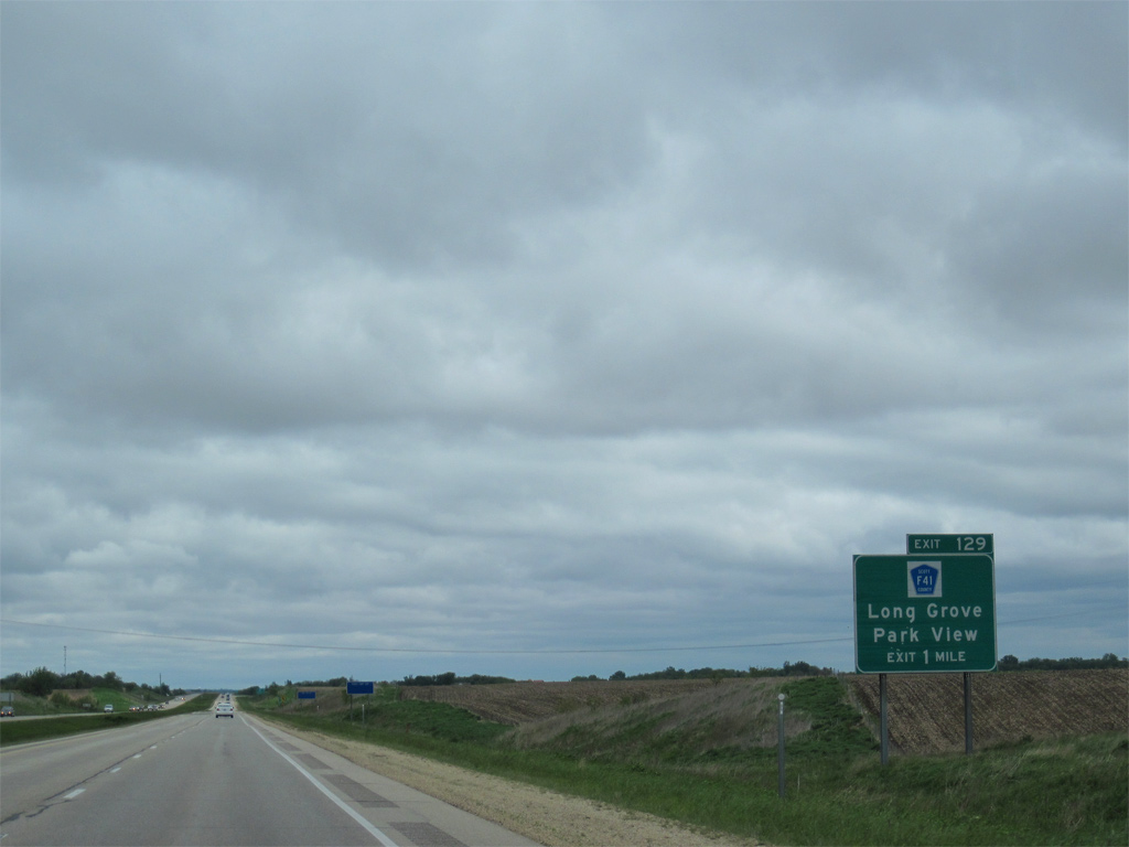
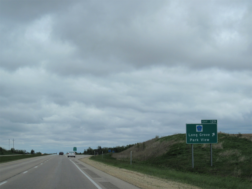
| Scott County Route F41 (267th Street) meets U.S. 61 at a diamond interchange (Exit 129) in one mile. 05/08/10 |
|
| CR F41 travels three quarters of a mile east to Scott Park Road (old U.S. 61) at Grove Road and the community of Park View. West from Exit 129, the county road enters the city of Long Grove ahead of 1st Street and CR Y64. 05/08/10 |
|
| U.S. 61 parallels McDonald Creek on the mile north from Exit 129. 05/30/11 |
|
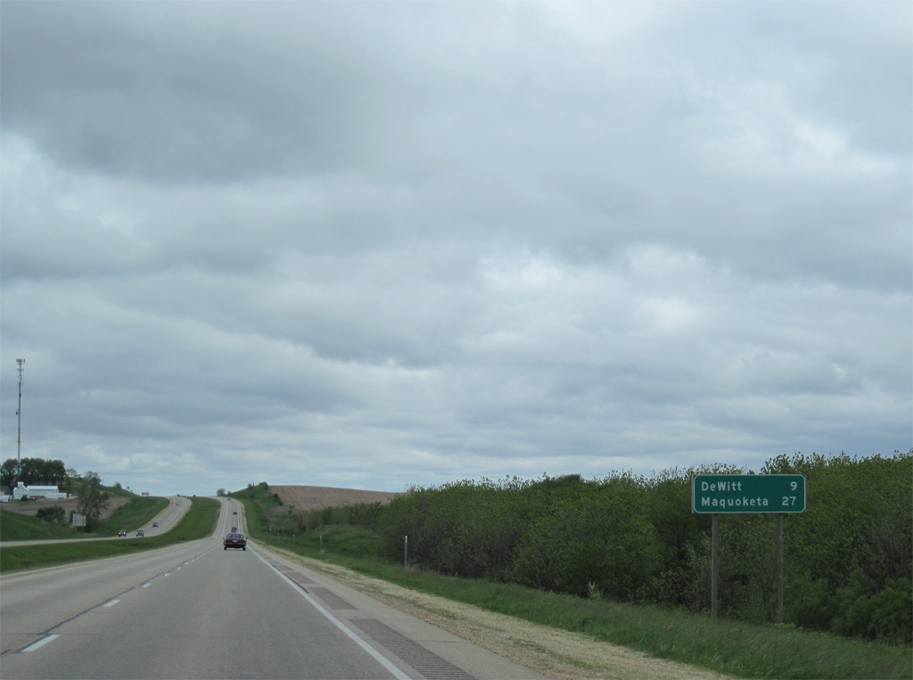
| An eight mile exit less stretch leads U.S. 61 north from Long Grove to DeWitt. Maquoketa, the Jackson County seat is the next major population center beyond DeWitt in 27 miles. 05/08/10 |
|
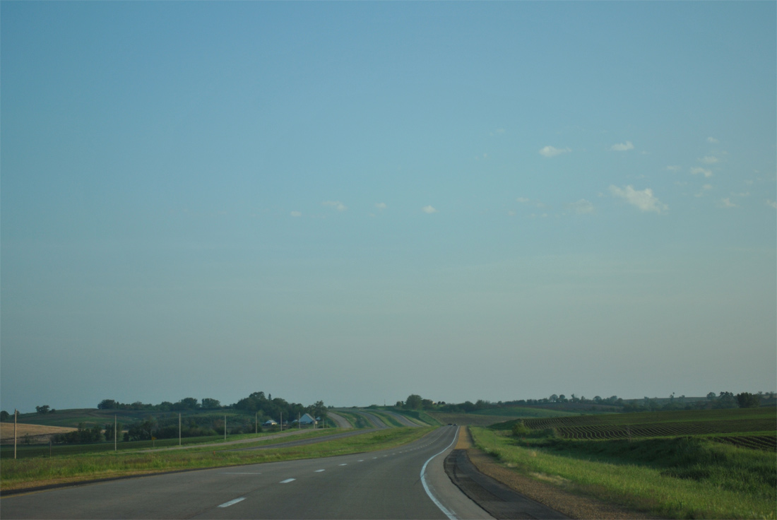
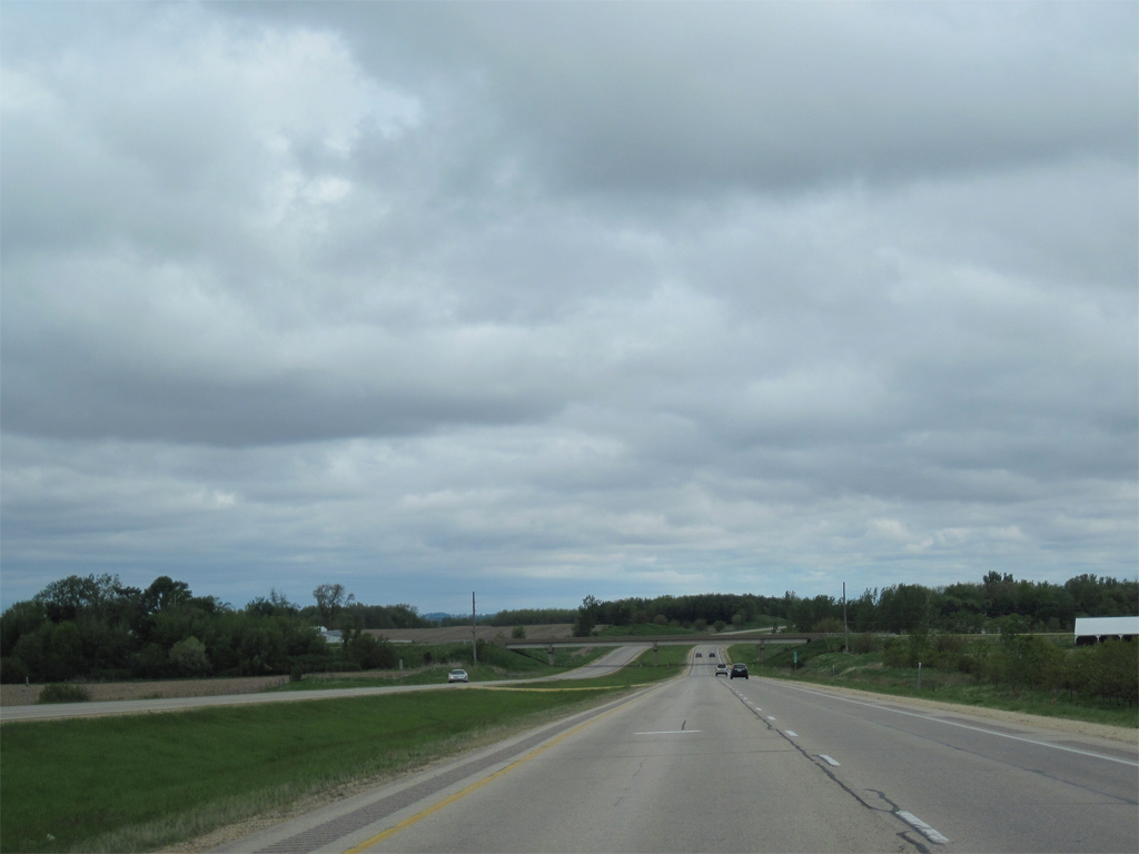
| U.S. 61 advances north through rural scenery with low traffic counts (16,700 vehicles per day recorded in 2010) into the Wapsipinicon River valley. 05/08/10, 05/30/11 |
|
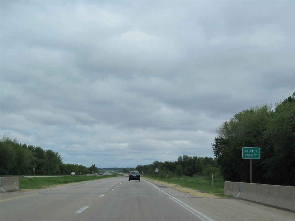
| The Clinton County line follows the Wapsipinicon River east from near Big Rock across the U.S. 61 freeway to the Mississippi River. 05/08/10 |
|
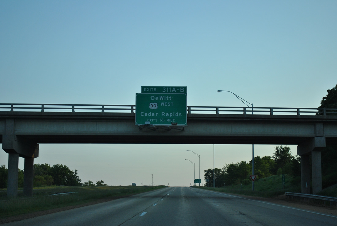
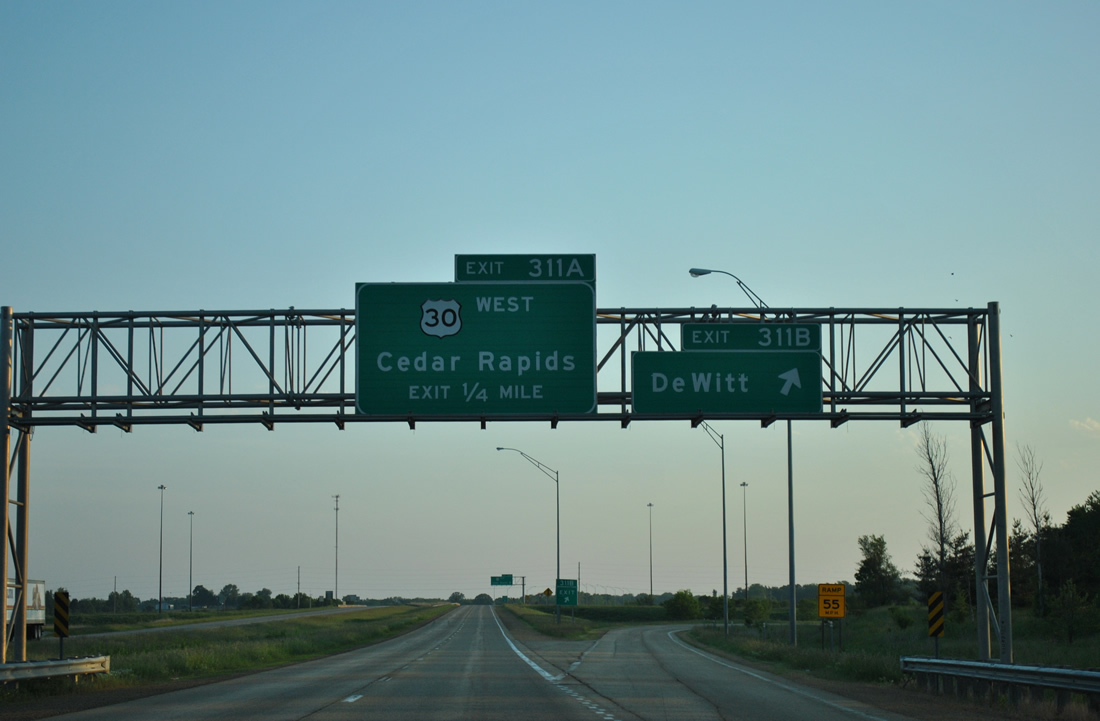
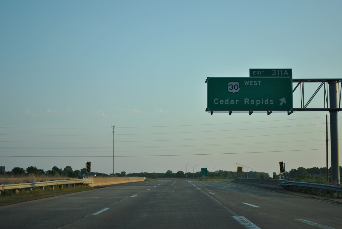
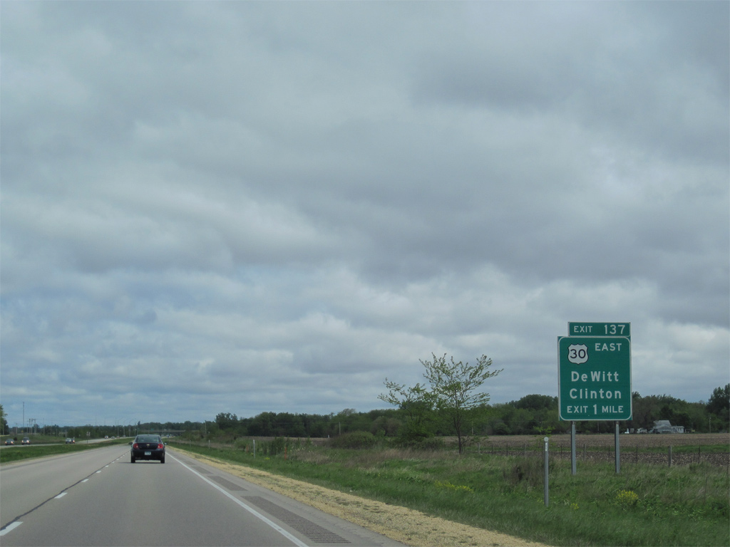
| U.S. 30 west comes together with U.S. 61 north by the city of DeWitt in one mile. U.S. 30 bypasses the city to the south along a freeway to 6th Avenue (former U.S. 61). 05/08/10 |
|
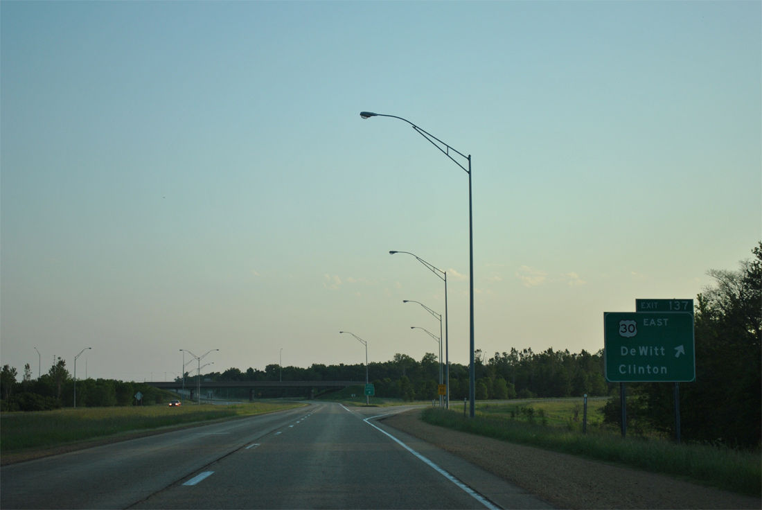
| Exit 137 departs U.S. 61 north at a trumpet interchange for U.S. 30 east. U.S. 30 runs east along a four lane divided highway 17 miles to converge with U.S. 67 in the city of Clinton. 05/30/11 |
|
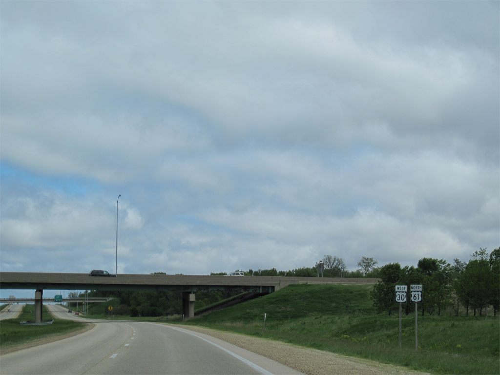
| U.S. 30 west joins U.S. 61 north for a mile overlap to 11th Street in west DeWitt. 05/08/10 |
|
| U.S. 30 separates with U.S. 61 a half mile beyond the Lake / 252nd Street overpass at a cloverleaf interchange with 11th Street east to Downtown DeWitt. Exit numbers reflect the U.S. 30 mileage to Nebraska. 05/30/11 |
|
| Reassurance markers posted for U.S. 30 west and U.S. 61 north at the Silver Creek and Union Pacific Railroad under crossing. 05/08/10 |
|
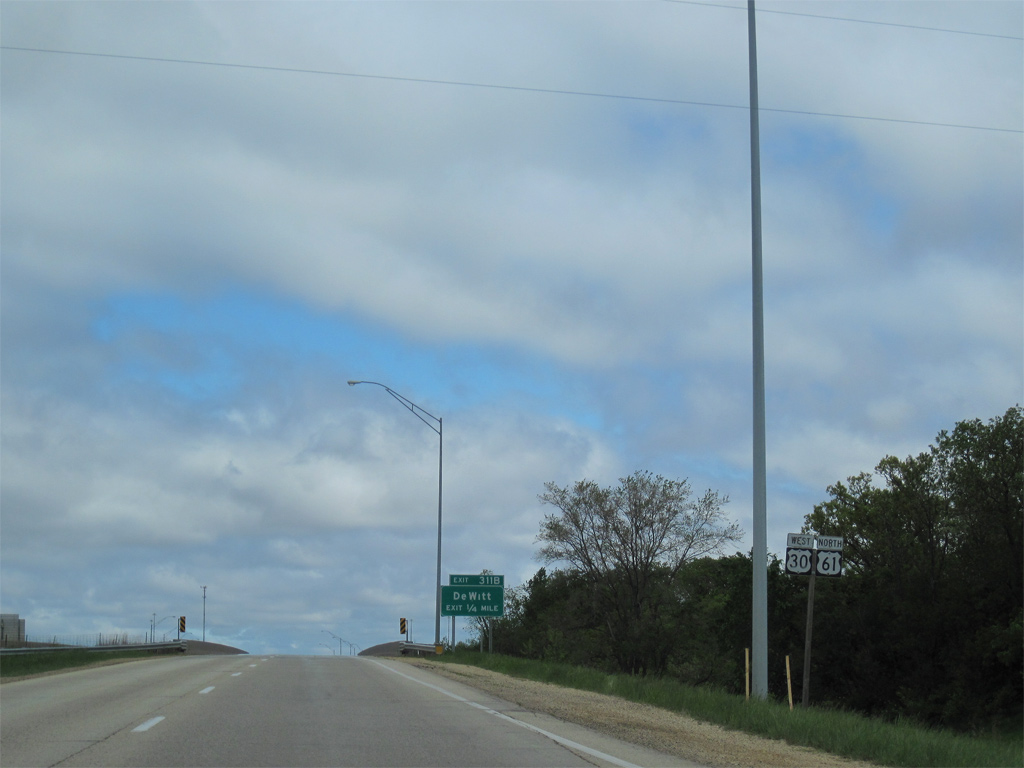
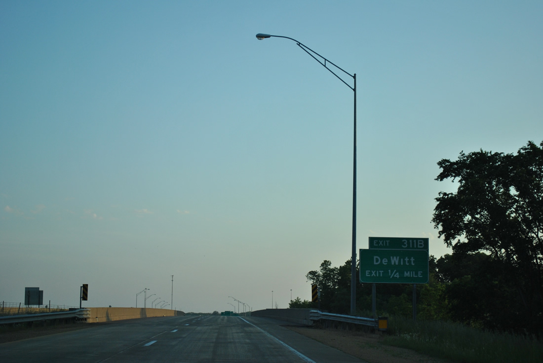
| Exit 311 A departs next for 11th Street (former U.S. 30) east into DeWitt. U.S. 30 shifted from 11th Street through DeWitt and 245th Street east of Dewitt in 1975 on freeway and expressway alignments.3 05/30/11 |
|
| A number of traveler services line 11th Street east from U.S. 30/61 to the DeWitt street grid. Exit 311B follows as a loop ramp for the continuation of U.S. 30 west to Grand Mound, Calamus and Wheatland in western Clinton County. 05/30/11 |
|
| U.S. 30 travels with just two lanes from County Road Y62 (260th Avenue), just west of U.S. 61, to Lisbon and Mount Vernon. West from there, the highway upgrades to expressway and freeway standards to Cedar Rapids. 05/30/11 |
|
| U.S. 61 lowers into a forested valley to cross Silver Creek again beyond DeWitt. 12/21/09 |
|
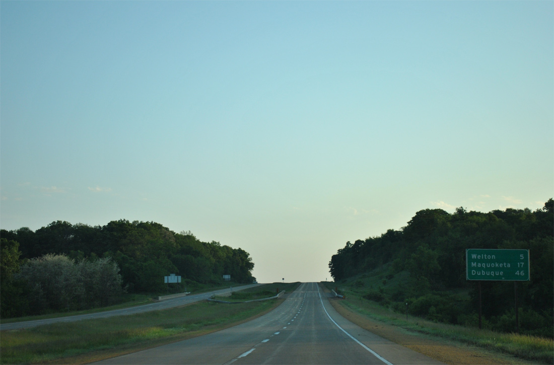
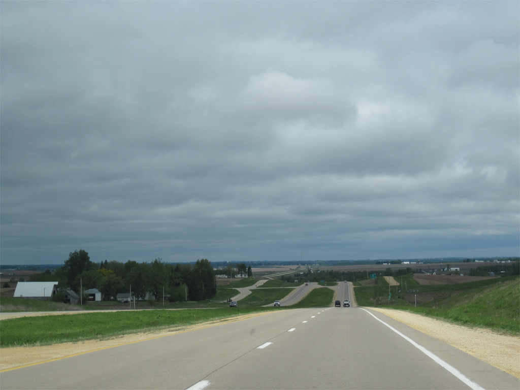
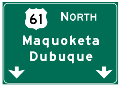
| Maquoketa is 17 miles to the north with Dubuque debuting at 46 miles out on U.S. 61 distance signs. 05/30/11 |
|
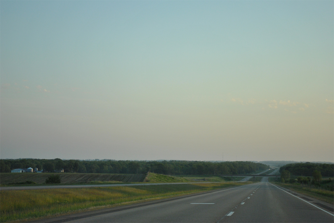
| Farm land reappears north of Silver Creek alongside U.S. 61. 05/08/10 |
|
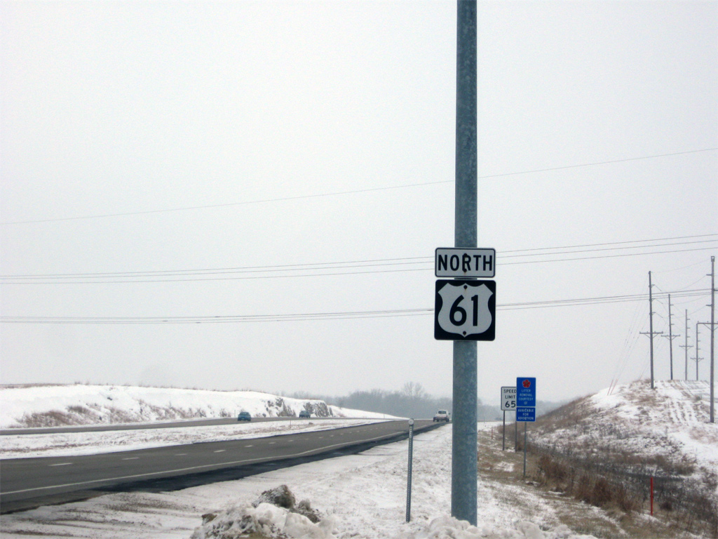
| Clinton County Route Y68 (218th Street) represents old U.S. 61 leading north from DeWitt. The county road bends northwest to 212th Street, with the U.S. 61 expressway overtaking much of the original path to Welton. 05/30/11 |
|
| U.S. 61 marker posted at 212th Street and County Road Y68. Sections of the old two lane U.S. 61 remain in place north from here as service roads for adjacent residences and farms. 12/21/09 |
|
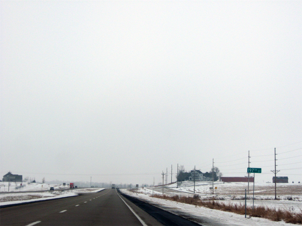
| 197th Street leads east from U.S. 61 across farm land to 270th Avenue. A portion of old U.S. 61 spurs north from the local road to a residence as 195th Street stems west to 240th Avenue. 12/21/09 |
|
| Clinton County Route E63 (190th Street) provides access to south Welton via Old Highway 61 / Main Street to the west. 05/30/11 |
|
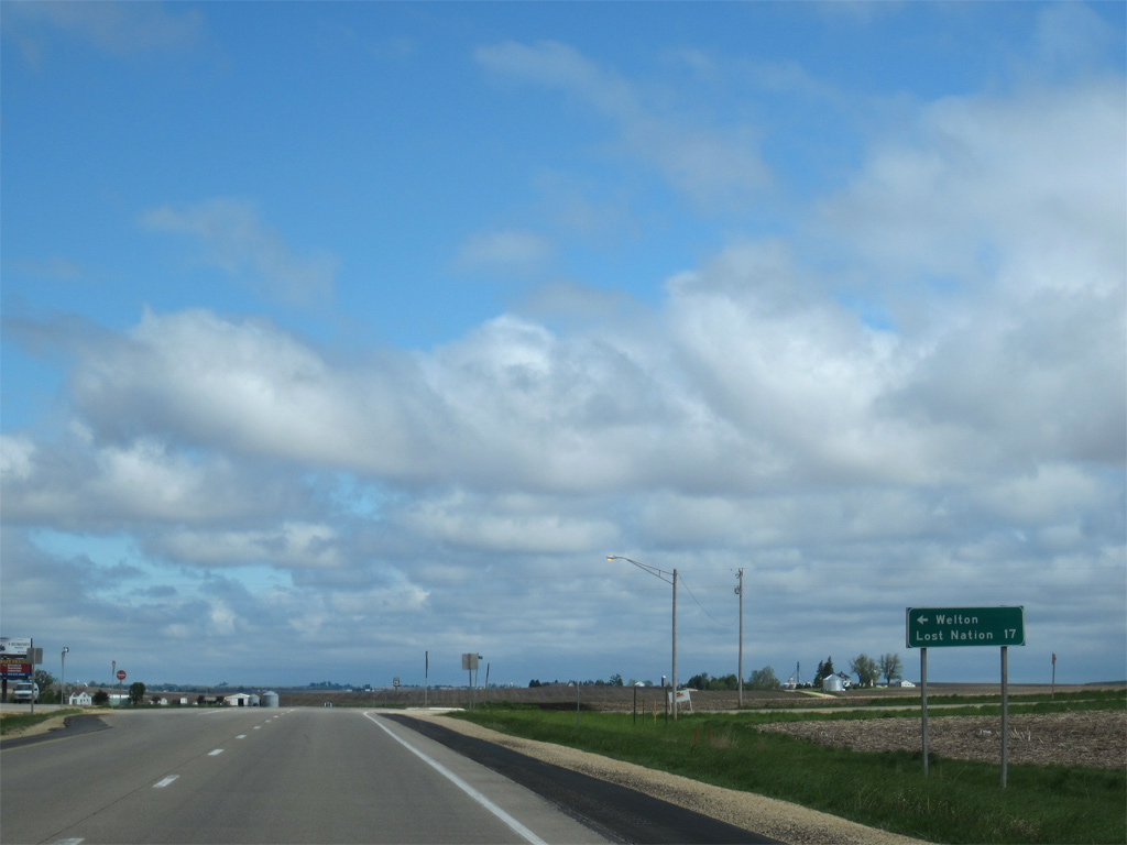
| West from Welton, CR E63 continues to Bliedorn and Toronto. Connections with CR Y34 lead motorists north to the Iowa 136 and the city of Lost Nation in 17 miles. 05/08/10 |
|
| U.S. 61 bypasses Welton just to the east between County Road E63 and 260th Avenue. Welton was home to 165 per the 2010 census. 05/30/11, 05/08/10 |
|
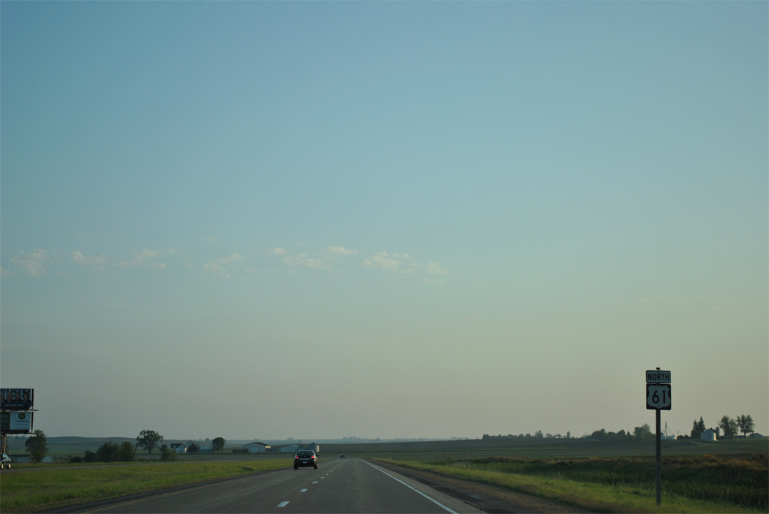
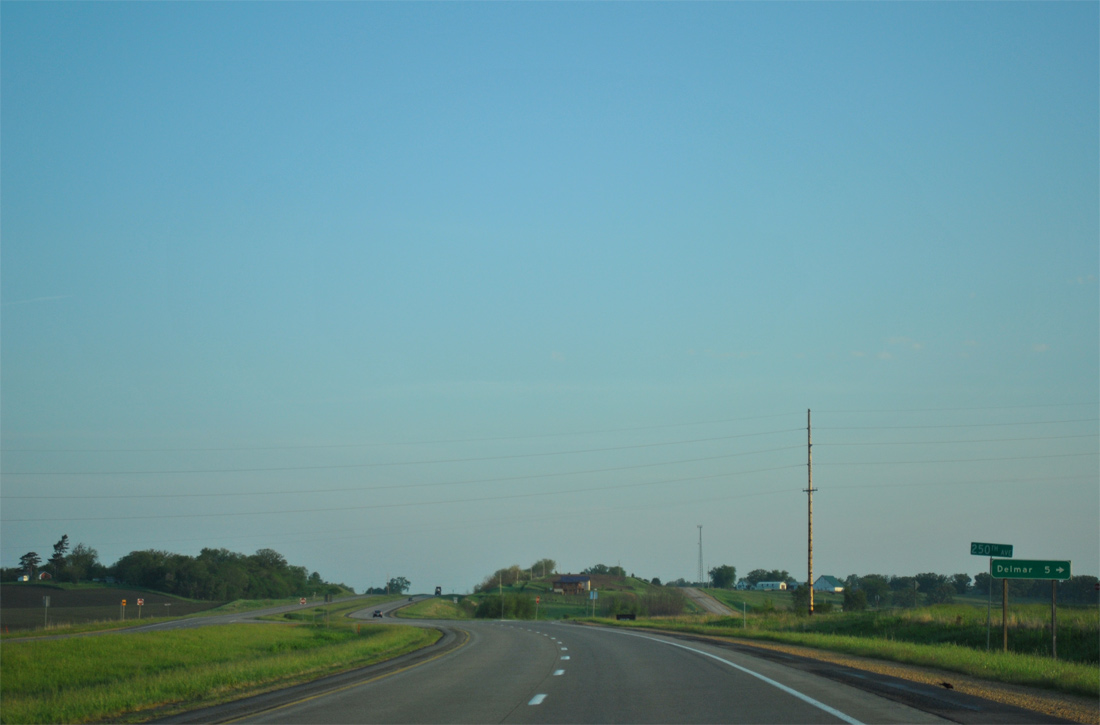
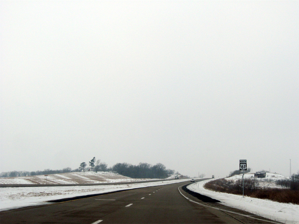
| 250th Avenue (Clinton County Route Y60) leads north from U.S. 61 five miles to the city of Delmar. 05/30/11 |
|
| A section of old U.S. 61 loops northwest from 250th Avenue to serve a handful of residences along the east side of the expressway. 12/21/09 |
|
| Old Highway 61 parallels the west side of U.S. 61 ahead of Deep Creek and 150th Street in this scene. 05/30/11 |
|
| Old Highway 61 ends at 140th Street as a continuous route from the south. Two sections of the former route spur north and south from forthcoming 130th Street to serve a homestead in each direction. 05/08/10 |
|
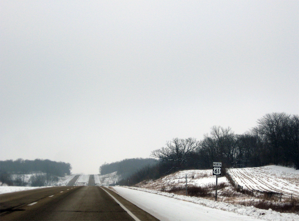
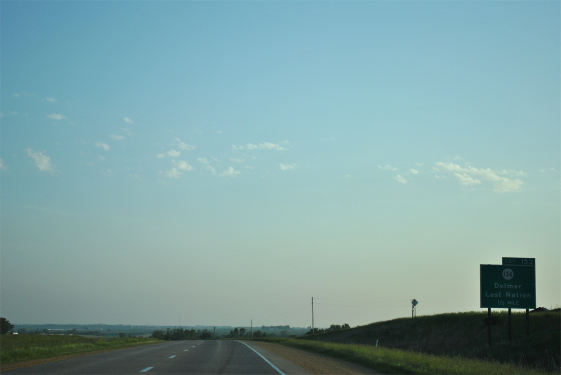
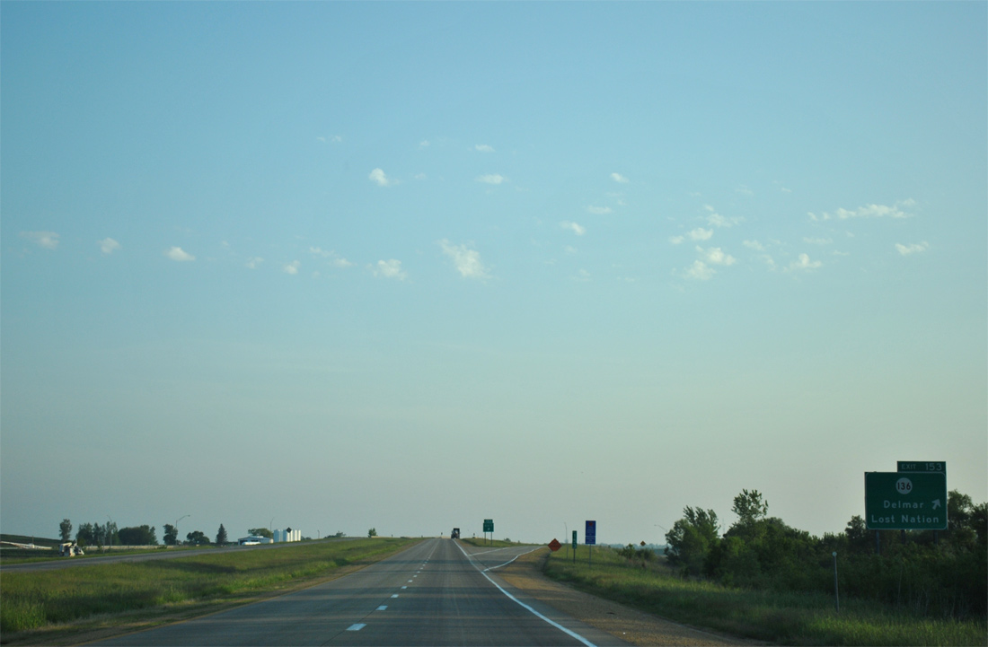
| Iowa 136, a 98 mile route between U.S. 52 at Luxemburg and the Mississippi River at Clinton, crosses paths with U.S. 61 at a diamond interchange (Exit 153) in one mile. 05/30/11 |
|
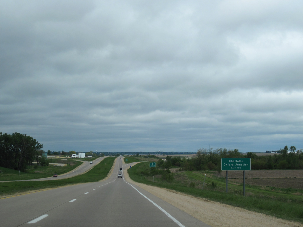
| Iowa 136 meanders 44 miles across northern Clinton County, passing through the small cities of Delmar, Charlotte and Goose Lake to the east. Oxford Junction lies 17 miles to the west in southeast Jones County, where the state highway turns northerly to Wyoming and Cascade. 05/08/10 |
|
| Exit 153 parts ways with U.S. 61 north for Iowa 136. Lost Nation is nine miles to the west and Delmar three miles to the east. Iowa 136 forms a multi state highway with Illinois Route 136 east to Fulton, utilizing the Lyons-Fulton Bridge across the Mississippi. 05/30/11 |
|
| U.S. 61 is a full freeway north from Iowa 136 to Iowa 64 in Maquoketa. This stretch of highway was upgraded between 1996 and 1999.1 12/21/09 |
|
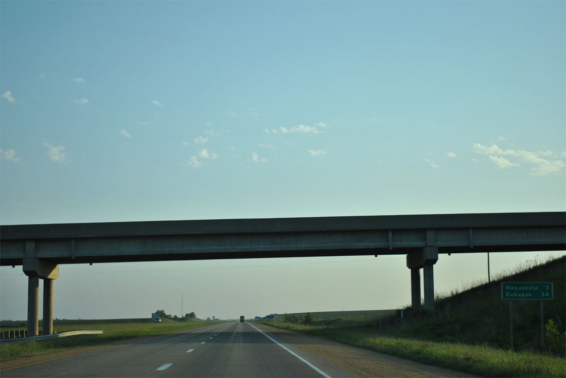
| Downtown Maquoketa is three miles and Dubuque 34 miles beyond the 110th Street over crossing. 05/30/11 |
|
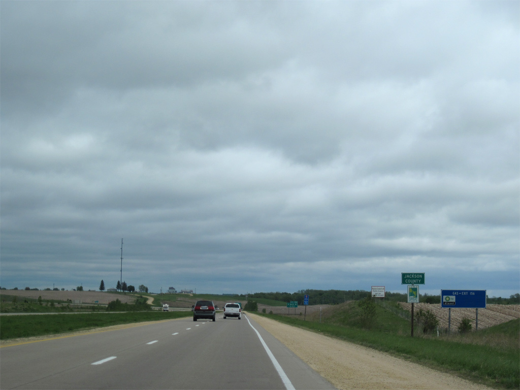
| U.S. 61 enters Jackson County. Formed on December 21, 1837, the county was named after President Andrew Jackson.3 Nearly 20,000 called the county home in 2020. 05/08/10 |
Page Updated 03-10-2017.

 North
North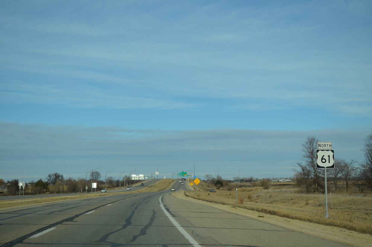

 West
West