|
| U.S. 83 north & 84 west enter the far southern side of Abilene by Kirby Lake and proceed north to a large interchange with SL 322 to the east side of the city and U.S. 83 Business north toward Downtown. This junction is named for local civic leader Sam Waldrop, owner of Waldrop's Fine Furniture and Abilene mayor pro tem. 09/23/07 |
|
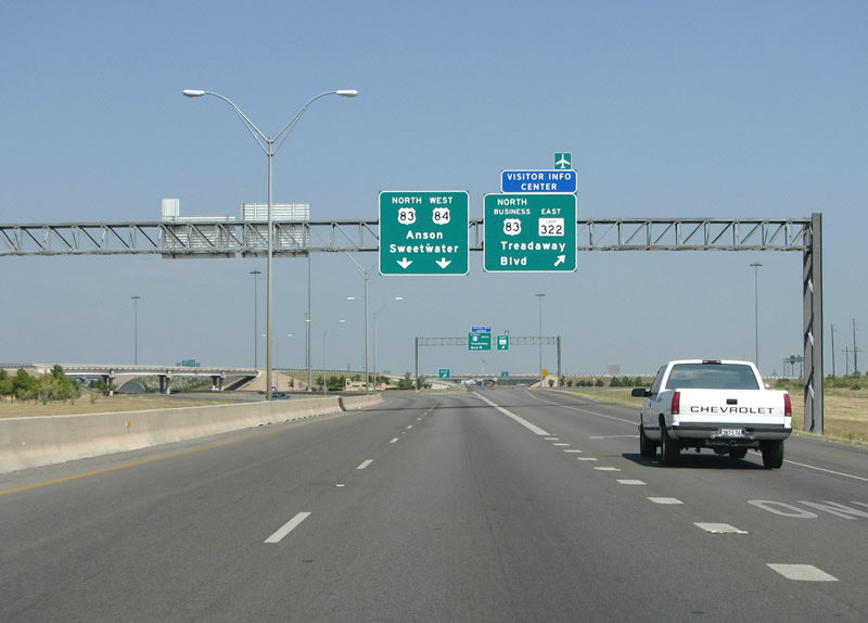
| Traffic partitions for Loop 322, a northeastern freeway providing the fastest route to IH 20 on the north side of town. With a population of over 170,000 - the Abilene area mainly spreads north and south, with Loop 322 and U.S. 83/84 comprises the main arteries in those directions. 09/23/07 |
|
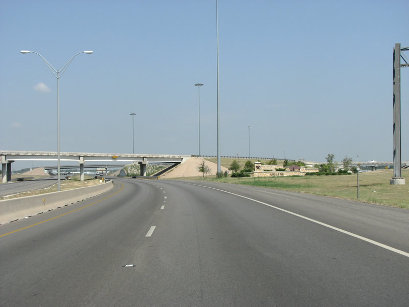
| U.S. 83 Business splits with U.S. 83/84 at a wye interchange preceding the cloverleaf with SL 322. As is popular in many places, Abilene erected a welcome sign here with the name of the city and some landscaping. 09/23/07 |
|
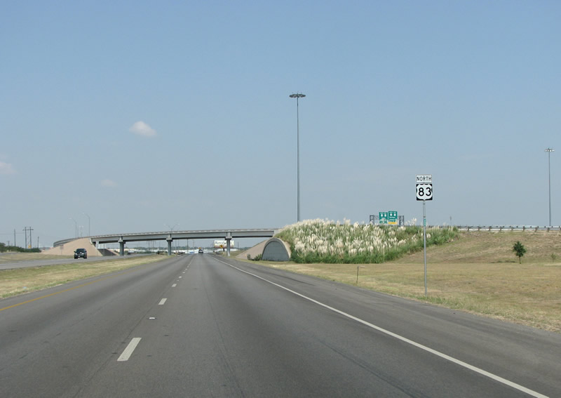
| A northbound reassurance marker stands ahead of the entrance ramp from SL 322 south. 09/23/07 |
|
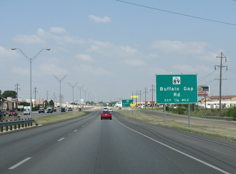
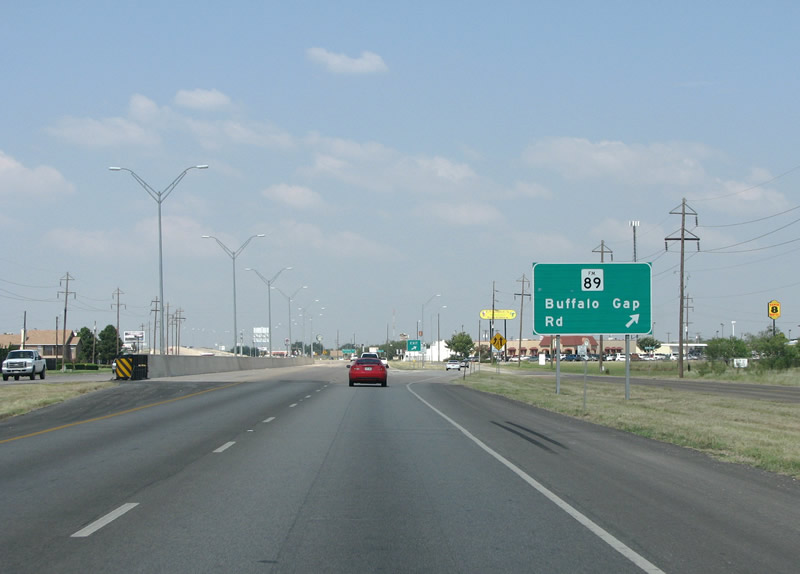
| FM 89 is the first exit in the city headed northbound. This diamond interchange connects with FM 89 / Buffalo Gap Road. Heading toward the community of Buffalo Gap, this is the old route southwest out of town. Sitting in the Callahan Divide - a gap in the hills that divides the Colorado and Brazos River basins, Buffalo Gap is a historic "old west" style heritage village. 09/23/07 |
|
| U.S. 83/84 north at FM 89 in Abilene. This is an important intersection for Abilene, as the regional mall and many other major retailers and restaurants are located nearby. Traffic gets busy at this exchange on weekends and during the holiday shopping season. 09/23/07 |
|
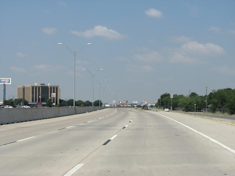
| The four lane, rural-style roadway expands to a six lane urban freeway with a concrete barrier median at Buffalo Gap Road. Originally built in the late 1960s, the highway is called the Winters Freeway locally. 09/23/07 |
|
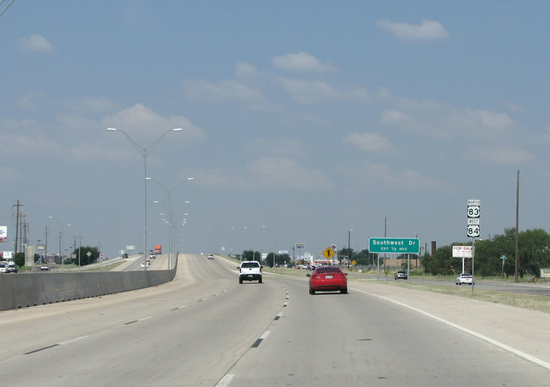
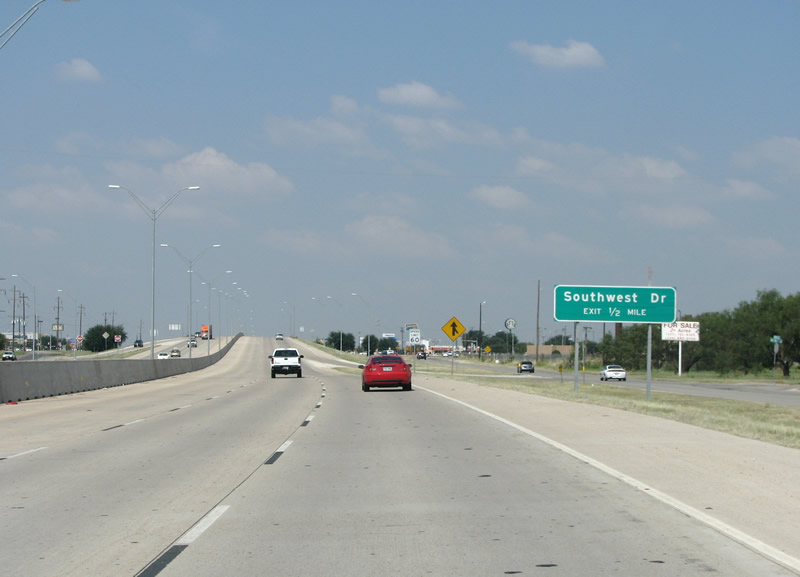
| Southwest Drive is the next exit headed north. During reconstruction of the freeway in 2003, several ramps were relocated or removed from the old freeway design. Local groups held meetings with TxDot to complain about the lack of ramps. Residents were frustrated that they had to spend most of their time on the frontage roads rather than the freeway itself - while TxDot explained that the freeway was primarily built for through-traffic. 09/23/07 |
|
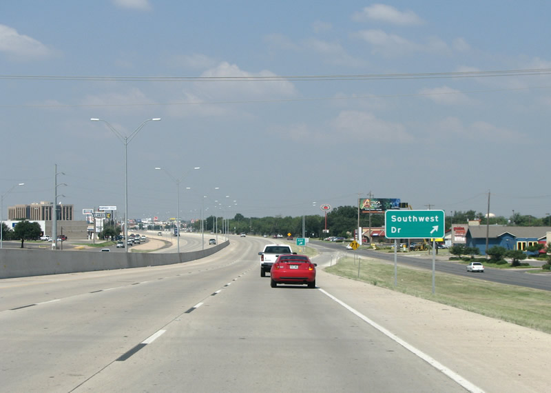
| Southwest Drive connects the central area of Abilene with the many sprawling subdivisions on the southwest side of the city. The economy of Abilene is varied and is centered on the energy industry, cattle, cotton, other agriculture, and Dyess Air Force Base. 09/23/07 |
|
| The reconstruction of the Winters Freeway was proposed in 1998 and completed in 2004. In addition to widening the road and removing some ramps, other ramps were changed from a merge-on-freeway configuration to a merge-on-frontage-road configuration. 05/31/03 |
|
| Advancing north from Southwest Drive on U.S. 83/84. Rather than being named for a person, the Winters Freeway was so named because of the U.S. 83 destination of Winters. 09/23/07 |
|
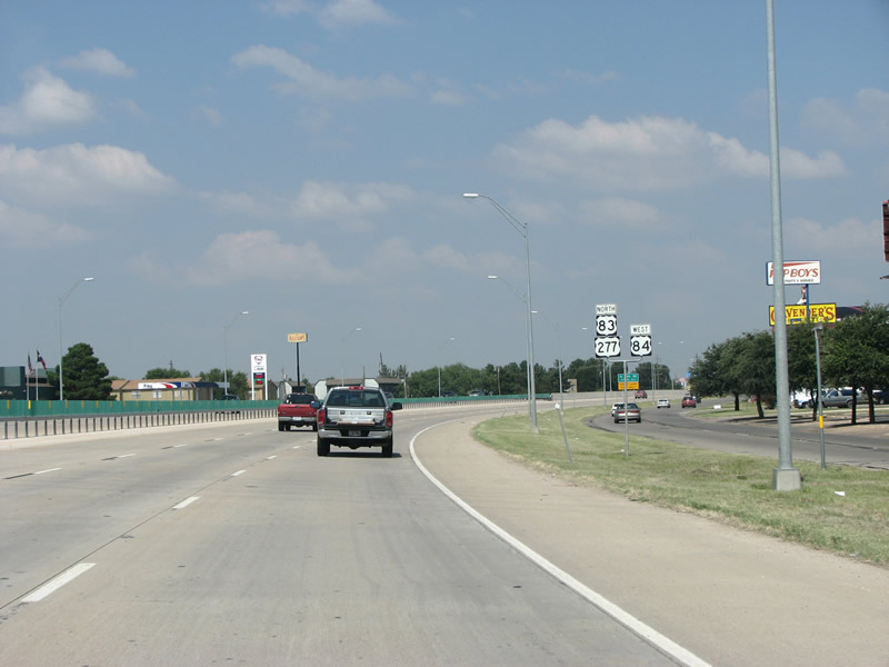
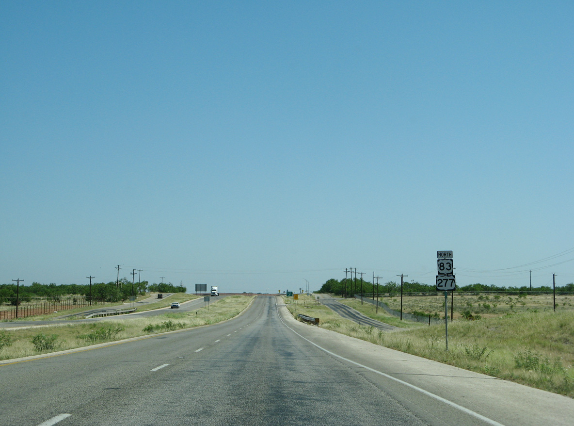
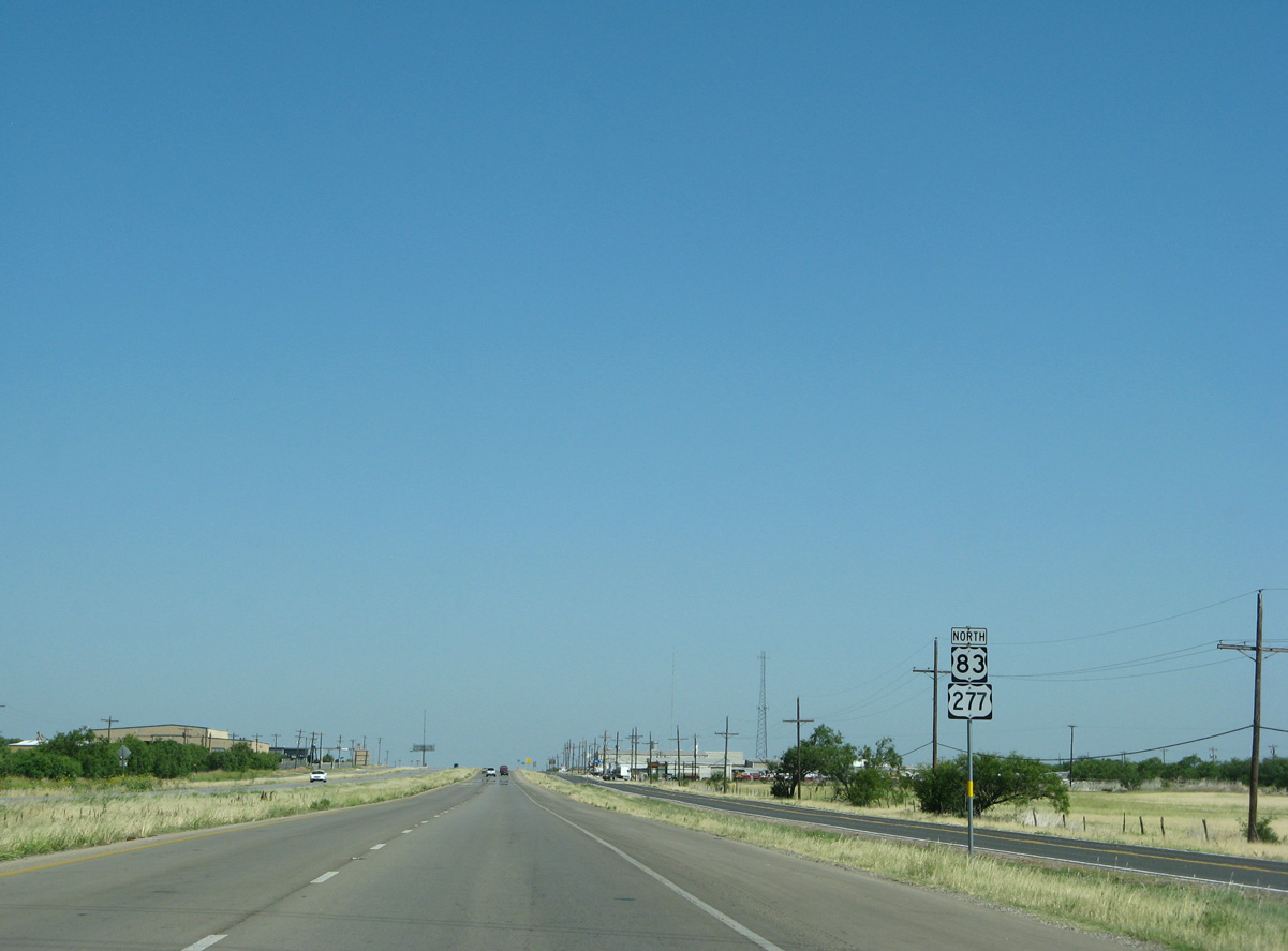
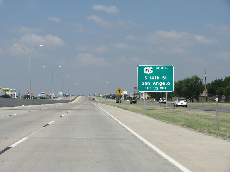
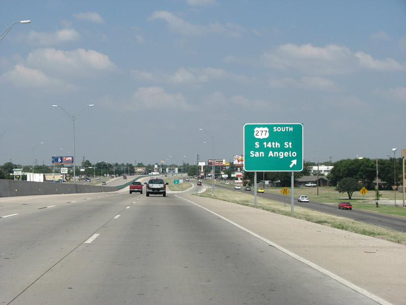
| U.S. 277 converges with U.S. 83/84 in one half mile at 14th Street. 09/23/07 |
|
| U.S. 277 connects Oklahoma City with points southwest, and eventually the Mexican border. Its route through Texas is mostly rural, and it never meets a major metropolitan area in the state. 09/23/07 |
|
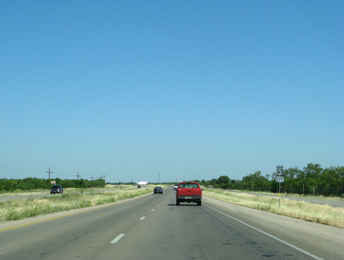
| U.S. 277 combines with U.S. 83 north & 84 west as the freeway curves around the west side of Abilene. 09/23/07 |
|
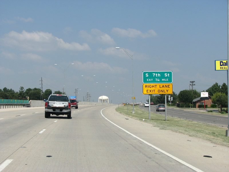
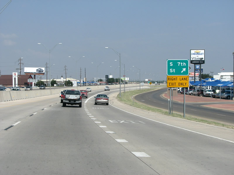
| The succeeding exit at S 7th Street signals the end of the six lane concrete roadway with a lane drop. 09/23/07 |
|
| U.S. 83/84/277 northbound at S 7th Street in Abilene. This exchange represents the northern limit of the $12 million reconstruction project finished in 2004. 09/23/07 |
|
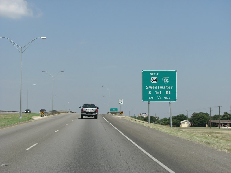
| Business Loop I-20 (S 1st Street) serves Downtown Abilene in one half mile. U.S. 84 leaves the overlap with U.S. 83 and resumes a westerly heading the Air Force Base and other large employers. Until 1993, this sign would have shown U.S. highway 80 instead of BL 20. Despite the long time decommissioning of U.S. 80, some locals still refer to the road as "Highway 80". 09/23/07 |
|
| The folded diamond interchange with Business Loop I-20 and the departing U.S. 84 at S 1st Street is abutted by the UP Railroad to the north. Abilene, originally settled in the 1880s, was primarily a railroad town and a center for cattle transport. 09/23/07 |
|
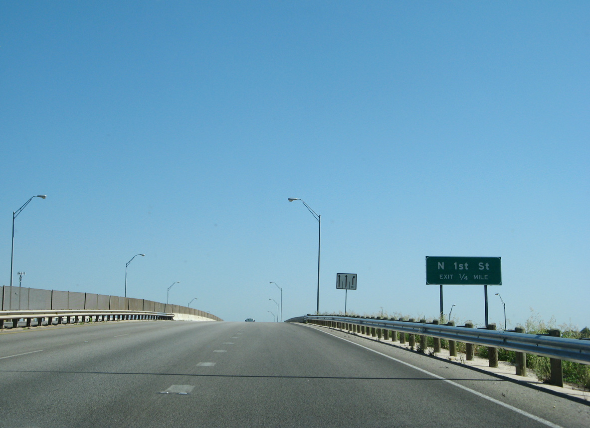
| U.S. 83/277 north span S 1 Street, the UP Railroad, and N 1St Street ahead of the second folded diamond interchange. 06/14/08 |
|
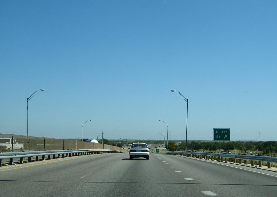
| U.S. 83/277 northbound at N 1st Street. This street mainly serves industrial areas on the west side of town. 06/14/08 |
|
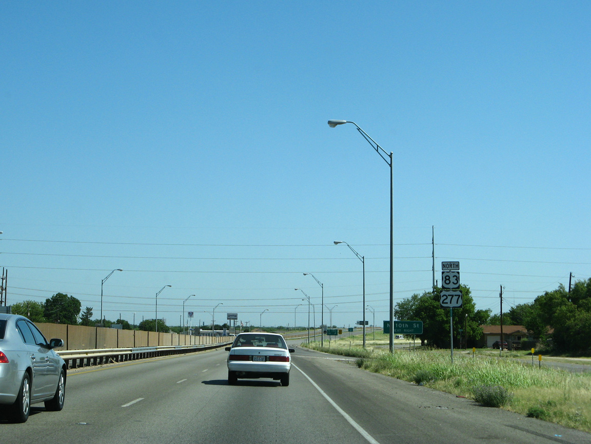
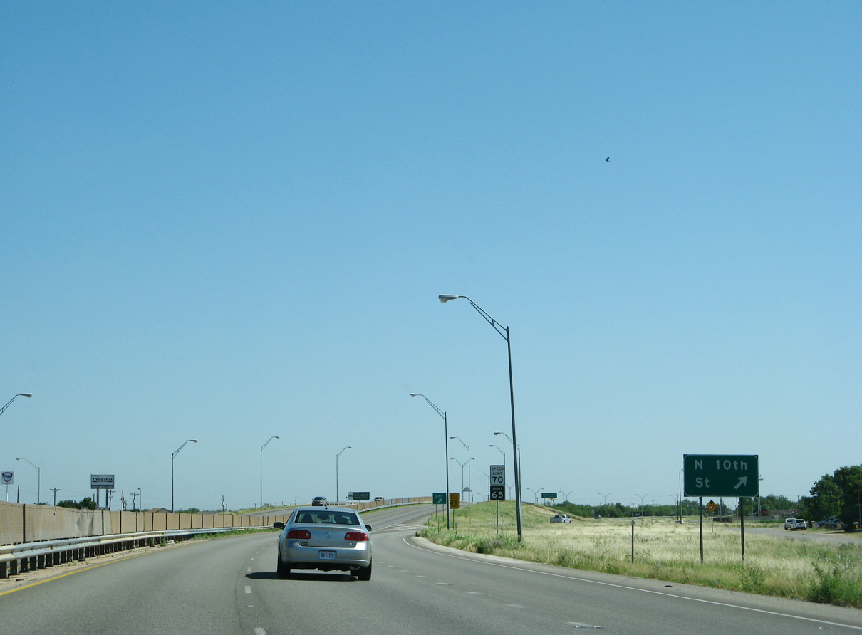
| U.S. 83/277 enter a diamond interchange with N 10th Street just beyond of the N 1st Street entrance ramp. 06/14/08 |
|
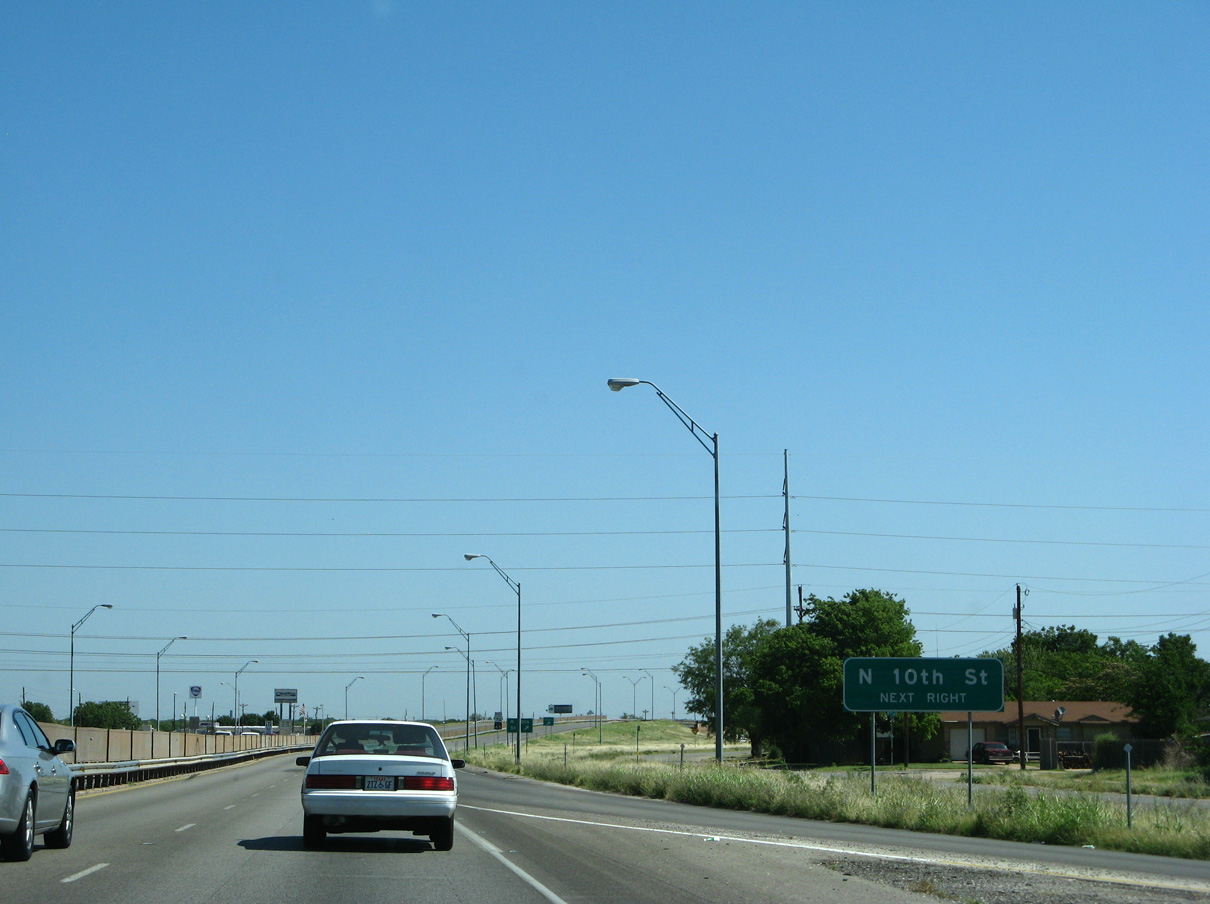
| N 10th Street joins the Winters Freeway with Abilene's north-side residential areas. 06/14/08 |
|
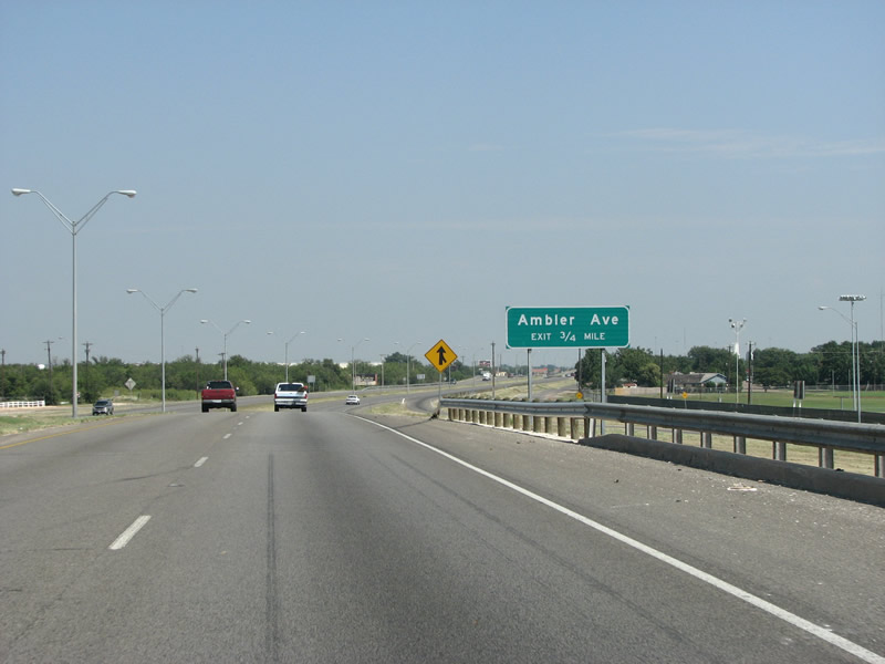
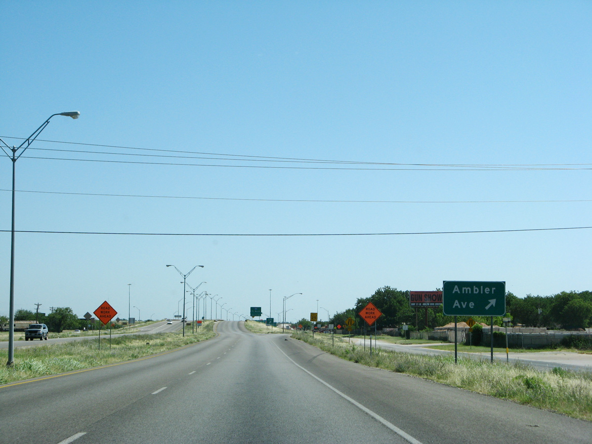
| Bending more to the east, U.S. 83/277 (Winters Freeway) continue 0.75 miles to Ambler Avenue. Ambler Avenue was the location of a popular streetcar line from 1908 to 1931. During those years many of Texas' smaller cities had multiple streetcar lines. 09/23/07 |
|
| Northbound reassurance markers in an industrial area just south of Ambler Avenue by a tributary of Elm Creek. 09/23/07 |
|
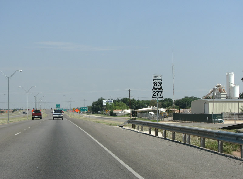
| U.S. 83/277 north at Ambler Avenue in Abilene. Abilene has a history in culture and movie roles. The city played a part in Richard Kelly's 2007 film Southland Tales, where it was notably destroyed by a nuclear attack. 06/14/08 |
|
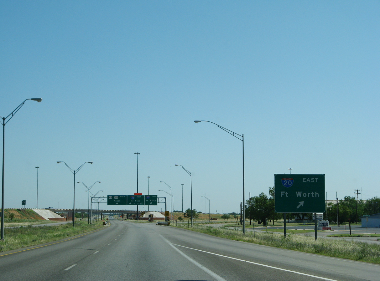
| Dallas and Midland/Odessa are absent from guide signs for IH 20. The first IH 20 sign appears along the Winters Freeway at the Ambler Avenue underpass. 09/23/07 |
|
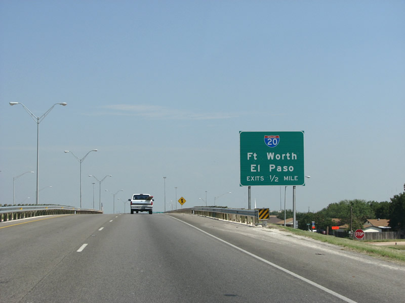
| Construction work was underway in 2007-08 at IH 20 to widen and reconstruct this interchange to have better turning radii and additional collector distributor lanes. The project was the first of many to widen and rebuild IH 20 through Abilene. 06/14/08 |
|
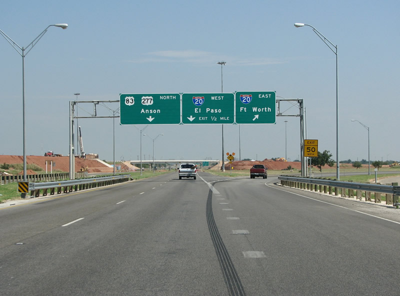
| U.S. 83/277 northbound at IH 20 on the northwest side of Abilene. IH 20 extends 283 miles west to IH 10 near Kent and 137 miles east to the split with IH 30 into Fort Worth. 09/23/07 |
|
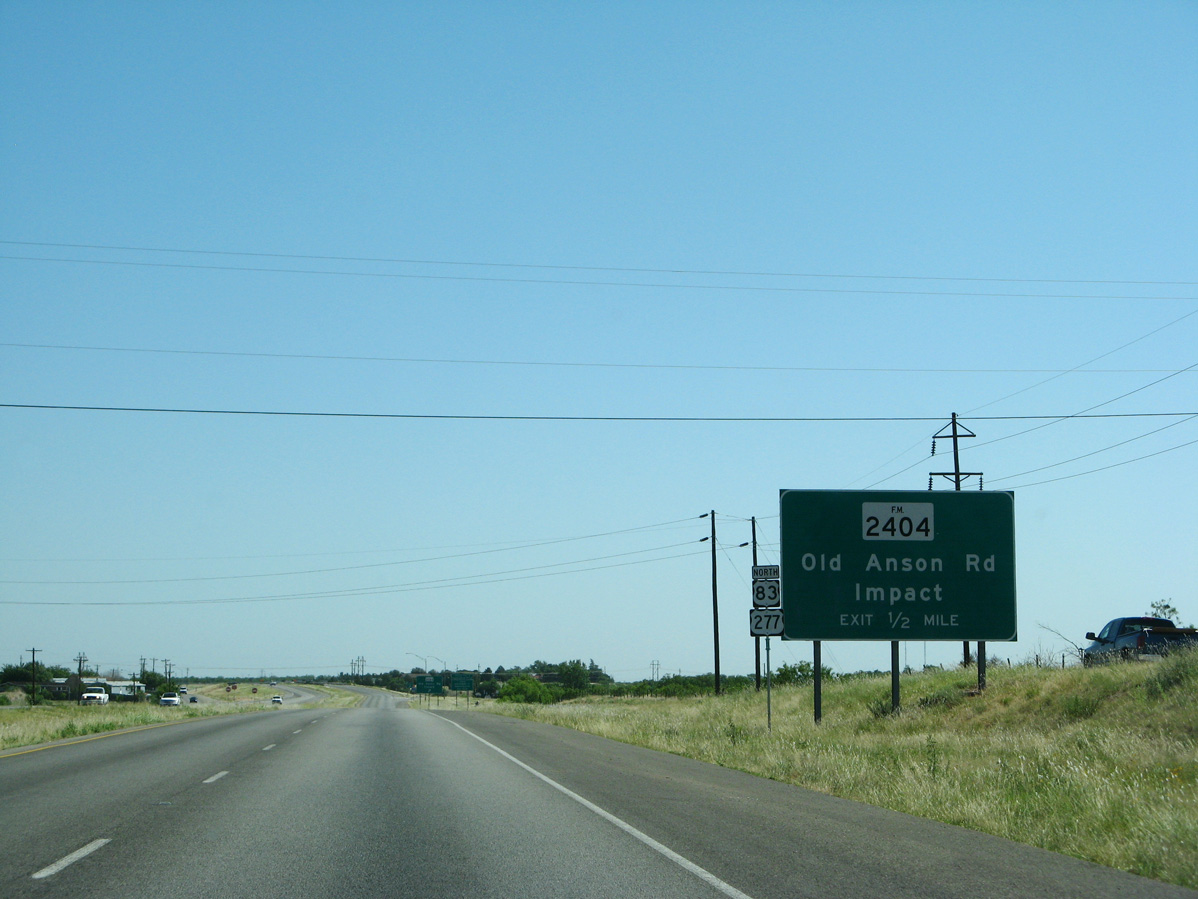
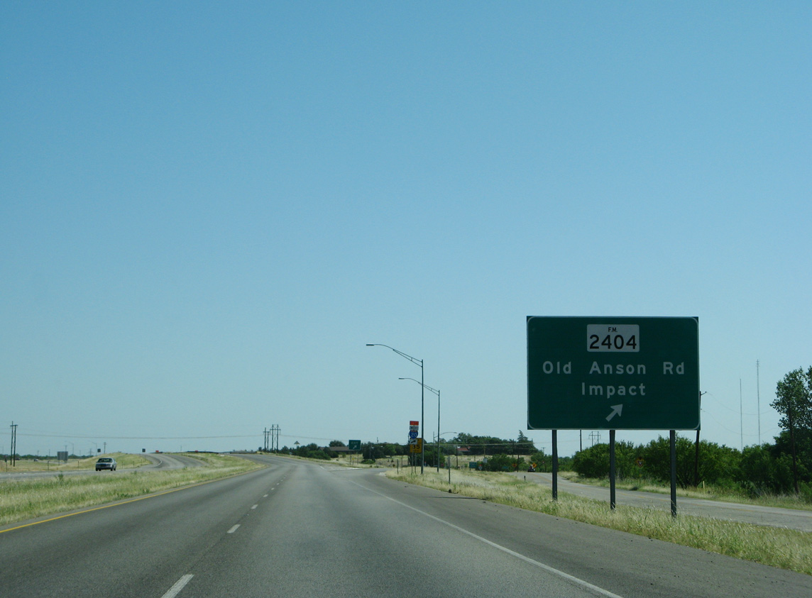
| Old Anson Road angles northwest from IH 20 to a diamond interchange with U.S. 83/277 (Winters Freeway) at FM 2404. 06/14/08 |
|
| FM 2404 extends 8.69 miles northwest into Jones County, ending at FM 605 near Hodges. The village of Impact lies just off Old Anson Road to the east. 06/14/08 |
|
| Confirming markers for U.S. 83/277 north posted after the entrance ramp from FM 2404 and Old Anson Road. 06/14/08 |
|
| A slip ramp joins the U.S. 83/277 frontage road ahead of Summit Road east in north Abilene. 06/14/08 |
|
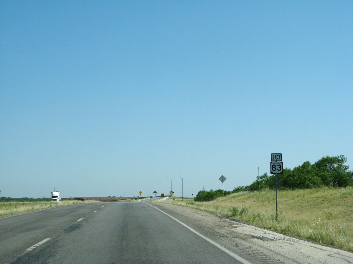
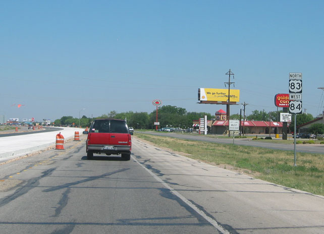
| U.S. 83 Business (BU-83D) through Abilene returns to U.S. 83 via Pine Street. 06/14/08 |
|
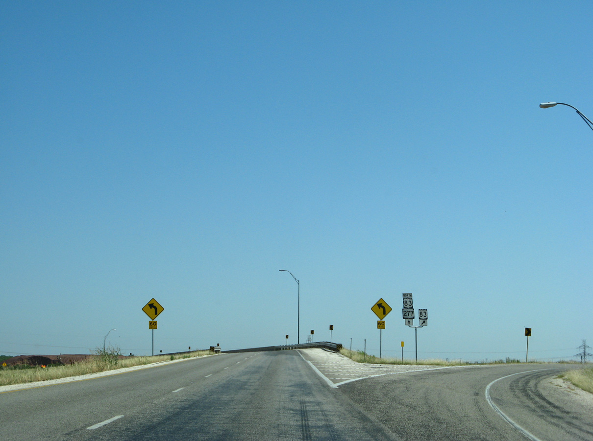
| U.S. 83/277 overtake the ending U.S. 83 Business at a wye interchange. BU-83D measures 10.37 miles through Abilene. 06/14/08 |
|
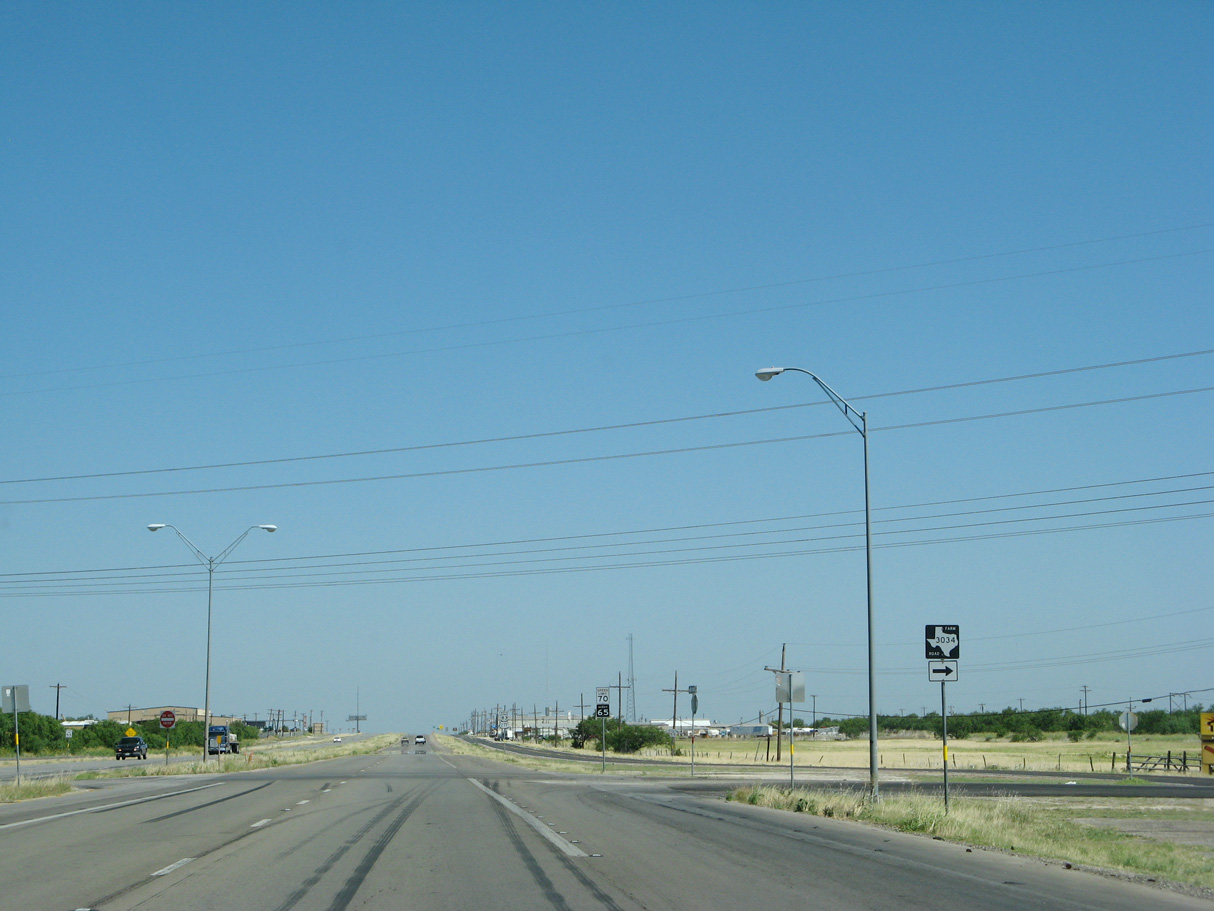
| Crossing into Jones County, U.S. 83/277 north transition into an at-grade highway and intersect FM 3034. 06/14/08 |
|
| FM 3034 (Beltway North) constitutes a 2.22 mile long connector east from U.S. 84/277 to the Abilene Regional Landfill and FM 600 north by Lake Fort Phantom Hill. 06/14/08 |
|
| U.S. 83/277 advance northwest from FM 3034 to an industrial area at North Abilene. 06/14/08 |
Page Updated 07-29-2019.

 North
North 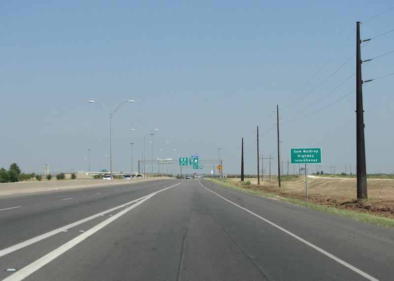
 North
North