|
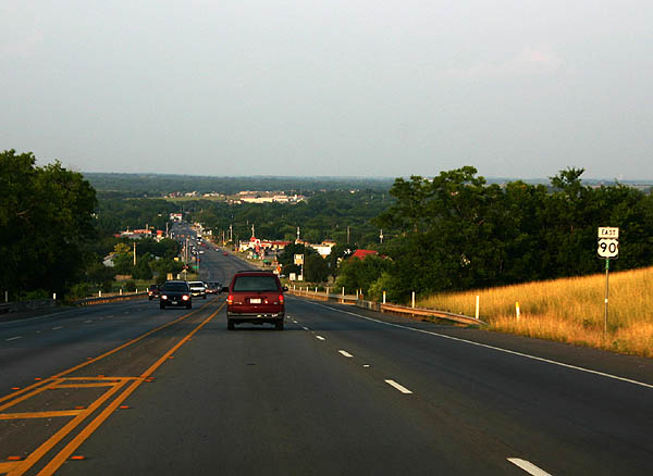
| Eastbound U.S. 90 descends 120 feet from FM 1343 across Medina Canal into the city of Castroville. 05/27/05 |
|
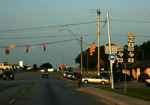
| Continuing from the Castroville business district, U.S. 90 spans the Medina River east to FM 471 north at Lower Lacoste Road. The northern branch of FM 471 forms a 12.61 mile loop to Riomedina, Cliff and Loop 1604 on the Far West Side of San Antonio. 05/27/05 |
|
| FM 471 branches southeast from a one mile, implied overlap with U.S. 90 to LaCoste and FM 2790 south to Lytle. 05/27/05 |
|
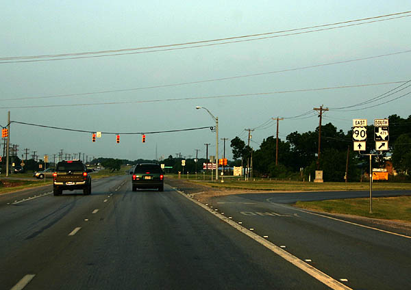
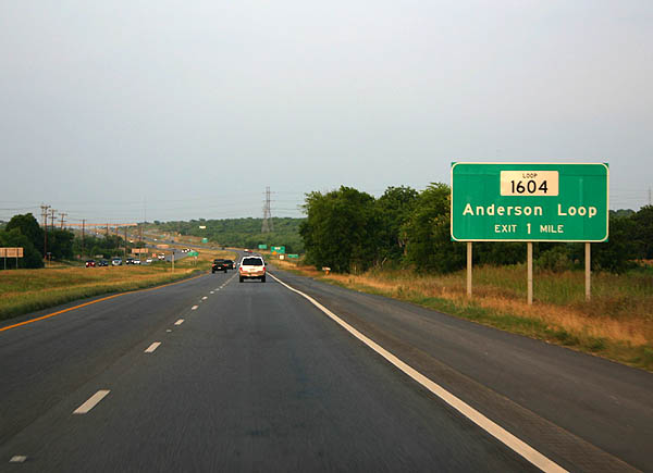
| U.S. 90 upgrades to a freeway at the cloverstack interchange with SL 1604 (C.W. Anderson Loop). SL 1604 is also a freeway north from U.S. 90 to the Northwest Side of San Antonio. The loop south downgrades to a two lane highway ahead of Macdona. 05/27/05 |
|
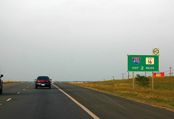
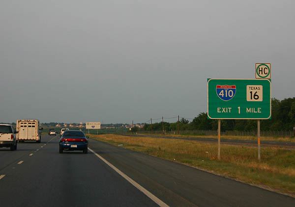
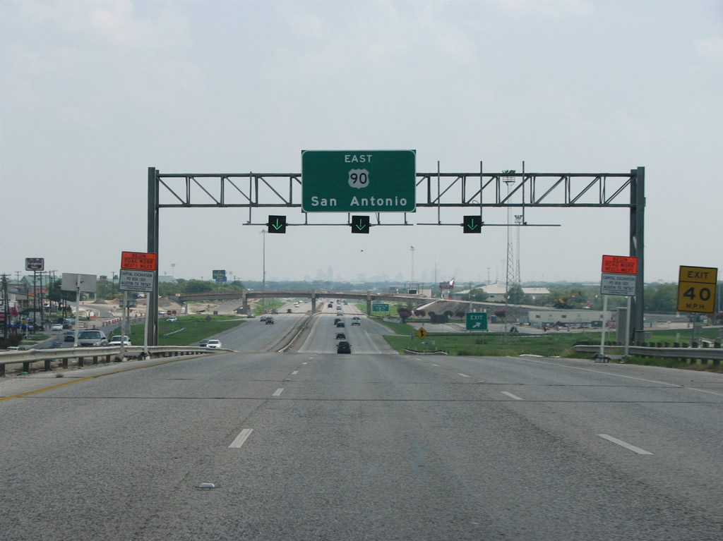
| U.S. 90 meets IH 410 and SH 16 in two miles. A cloverleaf interchange originally joined the two freeways. Long range plans rebuild the exchange to a full systems interchange. 05/27/05 |
|
| State Loop 1604 encircles the San Antonio metropolitan area along a 94.22 mile course south to Elmendorf, east to Schertz and north to Shavano Park. 05/27/05 |
|
| IH 410 and SH 16 overlap north to Leon Valley and southeast to South San Antonio. Exits along the U.S. 90 are freeway are unnumbered. 05/27/05 |
|
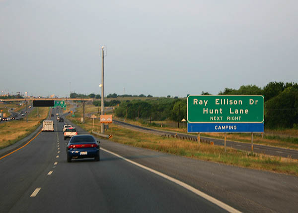
| U.S. 90 proceeds east from SL 1604 along the northern perimeter of Lackland Training Annex to Hunt Lane and Ellison Drive just ahead of IH 410. 05/27/05 |
|
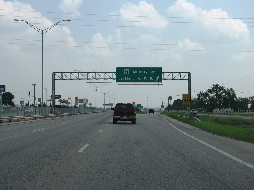
| Continuing east from IH 410, U.S. 90 (Cleto Rodriguez Freeway) meets SL 13 (Military Drive), the primary freeway access point for Lackland AFB. This also marks the end of SL 13, the city's original loop. SL 13 road runs east along the south side of San Antonio and then north along the east side of the city. Historically a full loop, the northern portion was upgraded into a freeway that eventually became part of IH 410. 08/31/08 |
|
| A slip ramp follows the exit for Loop 13 to Enrique M. Barrera Parkway (Old Highway 90). The skyline of San Antonio can be seen on the hazy horizon. This section of U.S. 90 opened in 1968 and is named for Cielo Rodriguez, the first Hispanic medal of honor recipient. 08/31/08 |
|
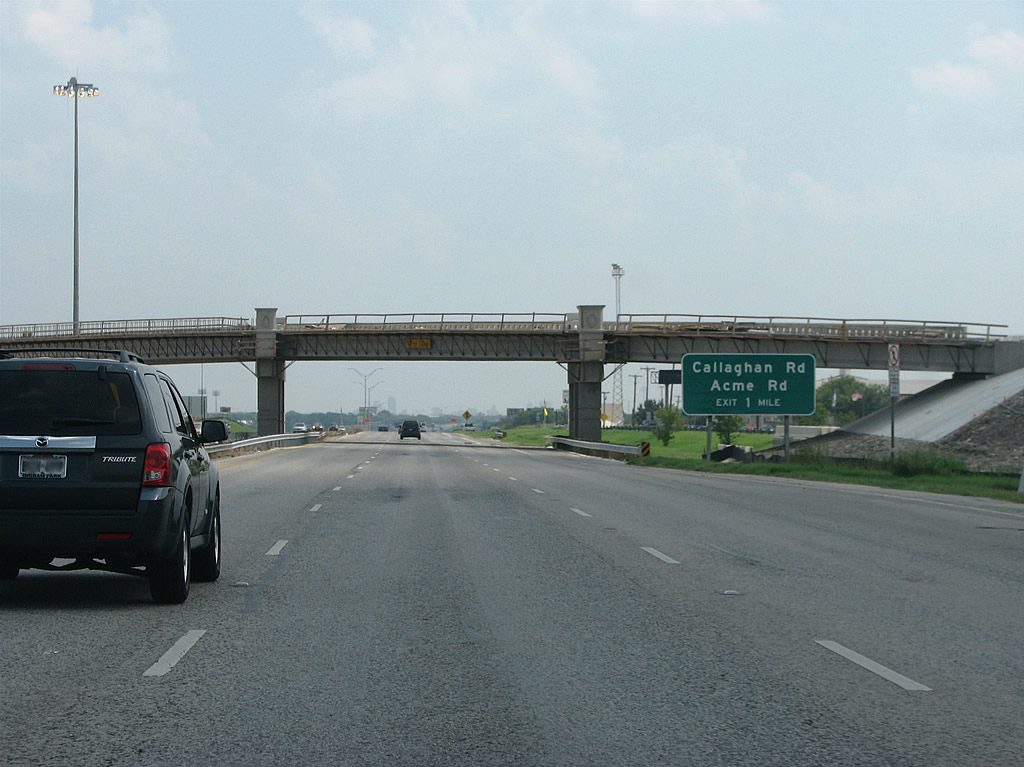
| Enrique M. Barrera Parkway branches northeast along old U.S. 90 from this overpass to the Inner West Side of San Antonio. U.S. 90 advances east across Leon Creek one mile to a diamond interchange with Callahan Road. 08/31/08 |
|
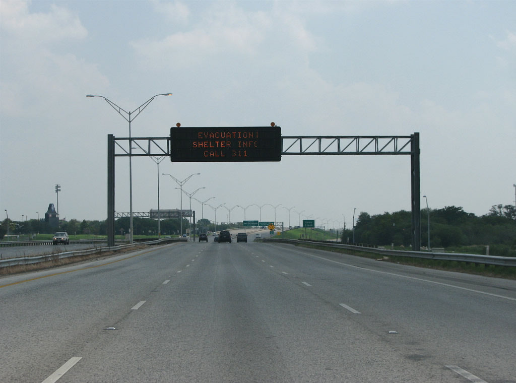
| Nelson W. Wolff Municipal Stadium, home of the San Antonio Missions minor league baseball team, appears on the north side of U.S. 90 beyond a VMS assembly preceding Callaghan Road. When this photo was taken, the dynamic sign displayed information for evacuees of Hurricane Gustav, which was hitting the gulf coast of Louisiana at the time. 08/31/08 |
|
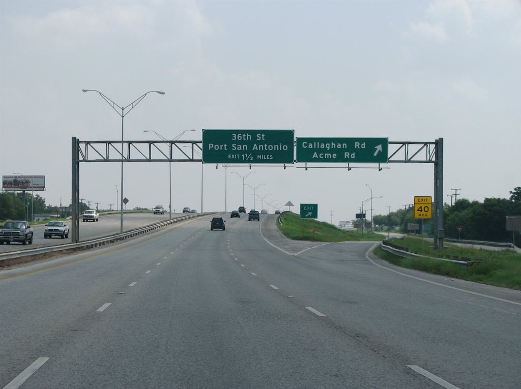
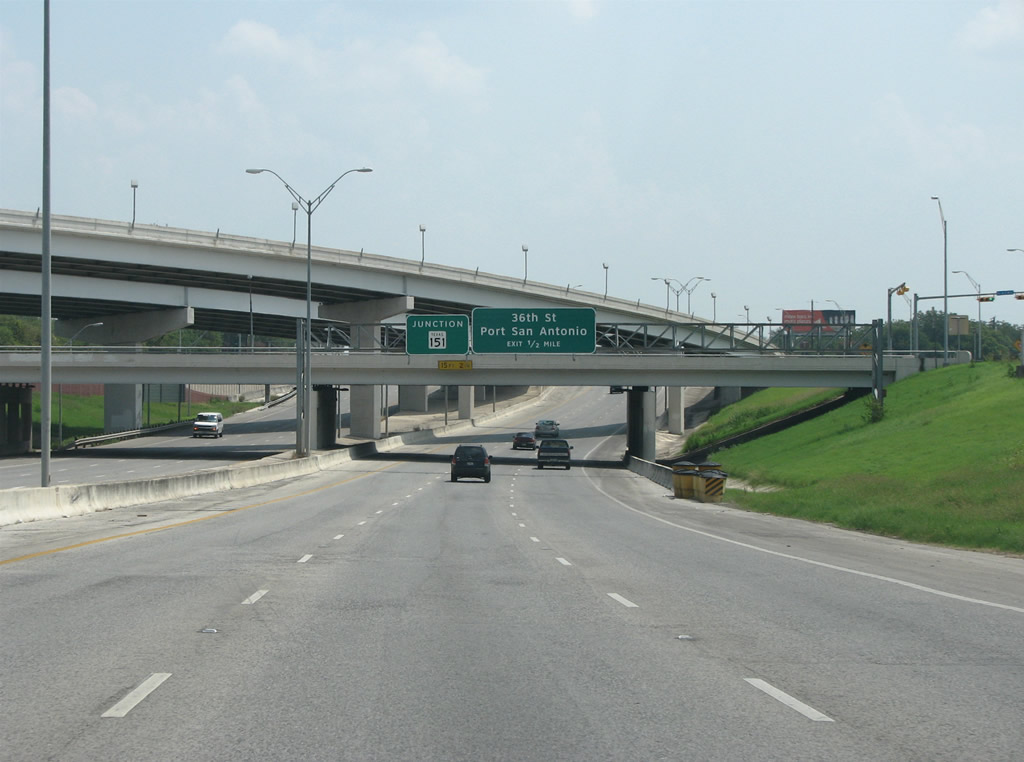
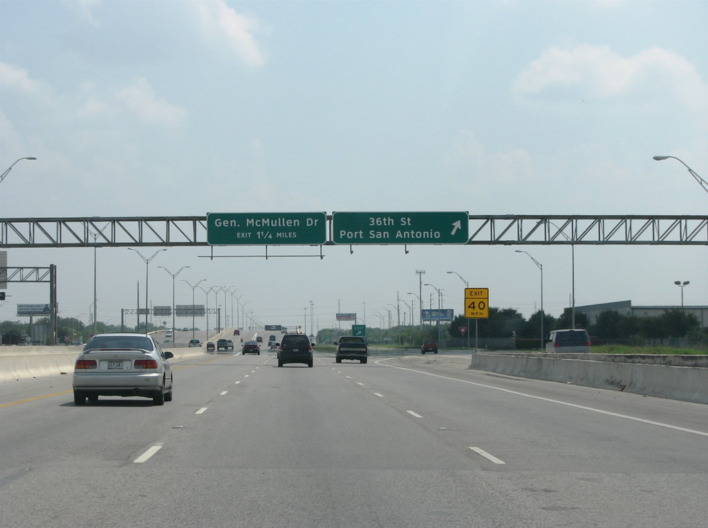
| Callaghan Road runs north to Leon Valley and northeast to IH 410. Signs for the ensuing exit to 36th Street were changed to reflect Port San Antonio, the replacement name of the former Kelly AFB. The Air Force Base closed in 1995 and it was renamed in 2007. 08/31/08 |
|
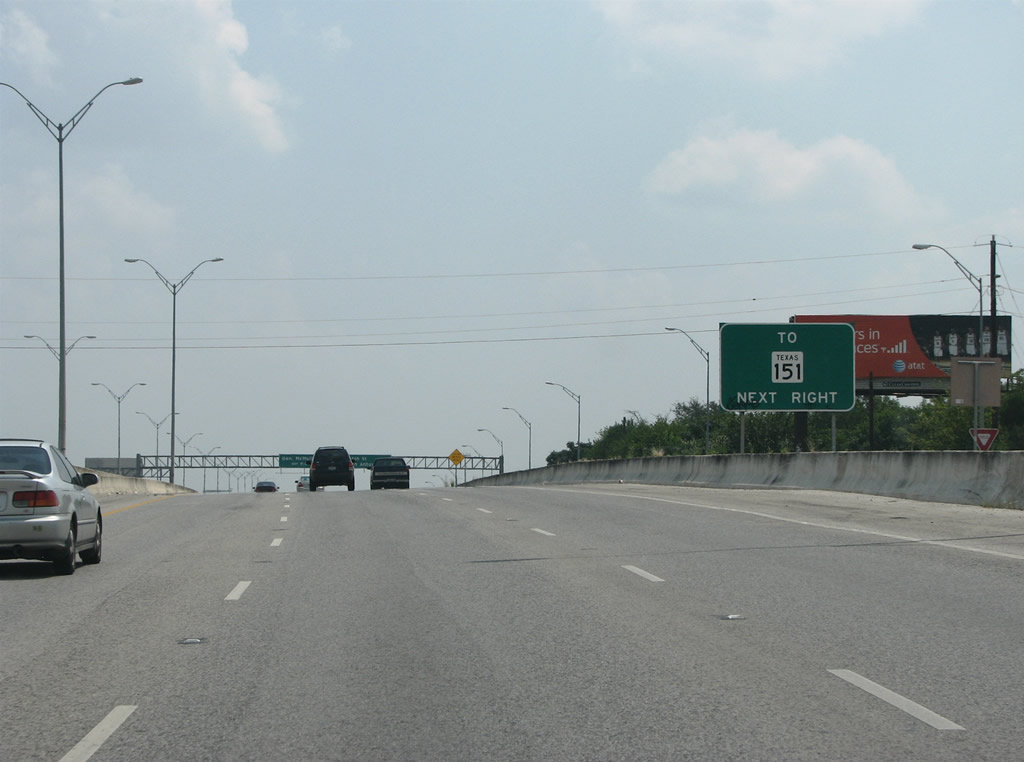
| SH 151 (Raymond E. Stotzer, Jr. Freeway) merges with U.S. 90 east of Callaghan Road. The wye interchange with SH 151 at U.S. 90 at Acme Road opened in 1987, when the SH 151 freeway was built westward. 08/31/08 |
|
| There is no direct access to SH 151 from U.S. 90 east. Instead motorists are directed to depart for 36th Street and use the U-turn ramp for the Stotzer Freeway westbound. 08/31/08 |
|
| U.S. 90 east reaches the 36th Street off-ramp. Port San Antonio spreads to the south of here. Companies such as Boeing, Lockheed Martin and Pratt & Whitney have facilities there. Port area renovation included construction of residences, retail and office space. 08/31/08 |
|
| With the advent of traffic from SH 151 and Port San Antonio, the eastbound U.S. 90 roadway expands to five lanes. The freeway was rebuilt through here in 1991 and expanded to accommodate port traffic. 08/31/08 |
|
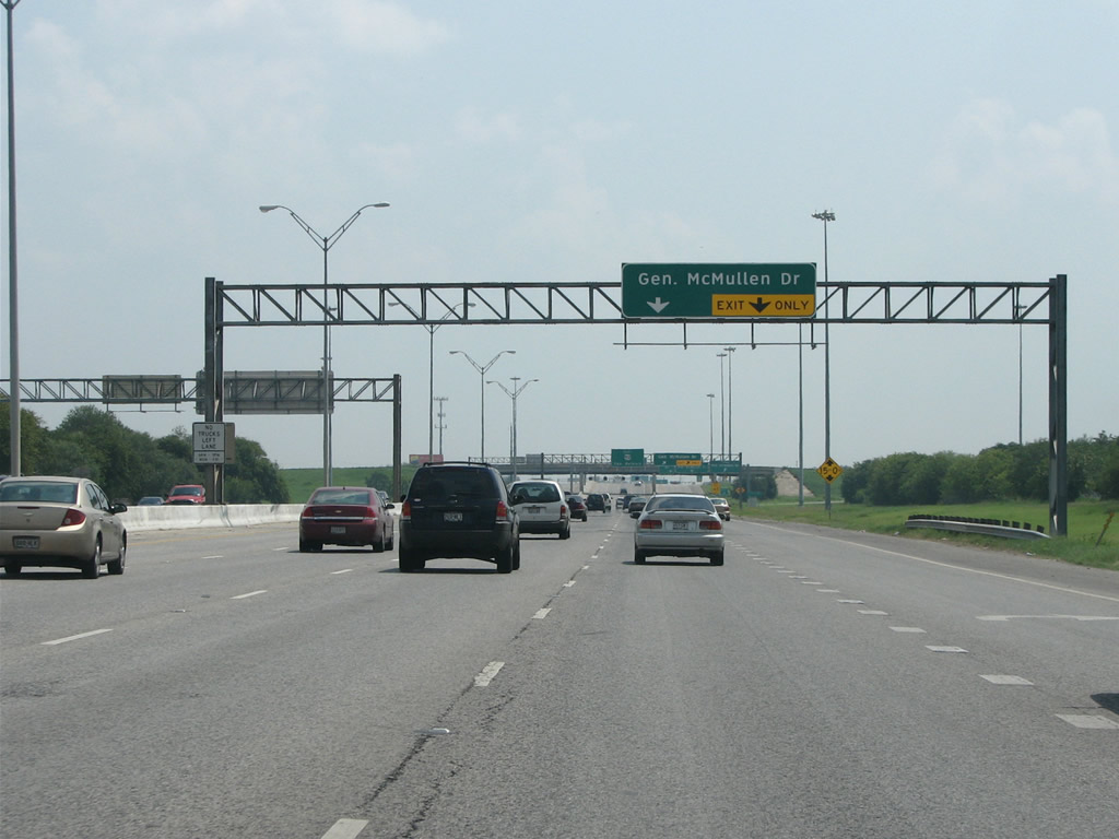
| The succeeding interchange along U.S. 90 east is with General McMullen Drive. The exchange here is a cloverleaf, with a direct connection ramp from U.S. 90 westbound to McMullen Dr south. 08/31/08 |
|
| A c/d roadway separates for General McMullen Drive. The arterial was named for General Clements McMullen of the US Army. The general worked with the city to build a "super arterial" to connect Kelly AFB with the north side of the city. Work started on the road in 1954, and at the time San Antonio did not have any major routes connecting the south and north sides of town. The route was originally called Stephenson Road, but was renamed for the general in honor of his efforts in getting the road constructed. 08/31/08 |
|
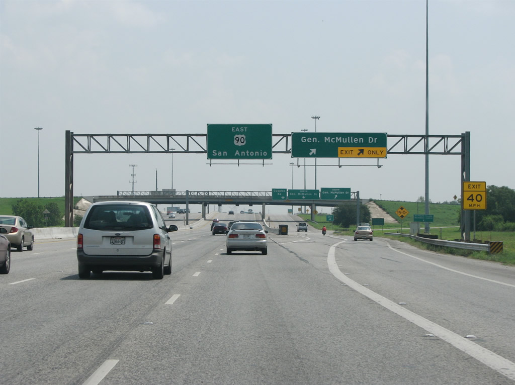
| Advancing east from McMullen Drive, U.S. 90 travels two miles to the systems interchange with the Downtown San Antonio Interstates. 08/31/08 |
|
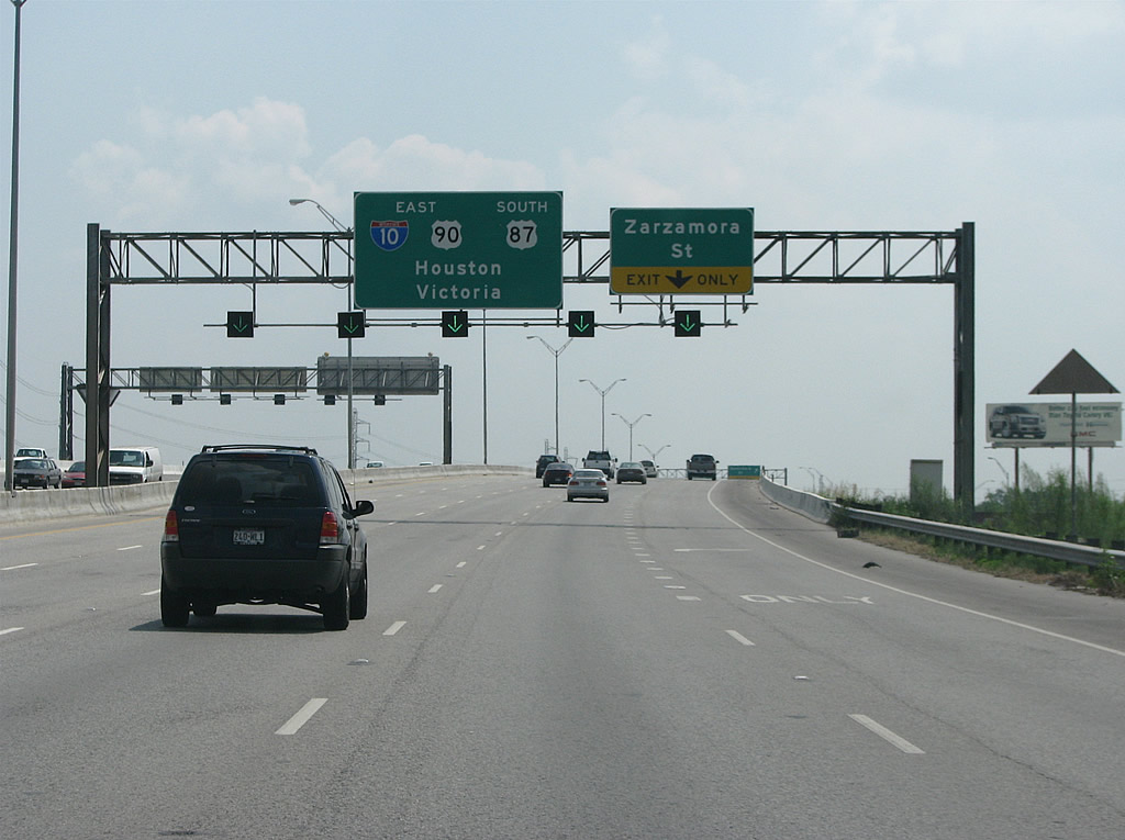
| An entrance ramp joins U.S. 90 east from Cupples Road ahead of the UP Railroad and SS 371 underpass and the exit for Zarzamora Street. U.S. 90 feeds directly onto IH 10 east to Houston and U.S. 87 south toward Victoria in two miles. 08/31/08 |
|
| Zarzamora Street is an arterial route along south to the Tierra Linda community and IH 35 and north to the Prospect Hill and Woodlawn Lake neighborhoods west of Downtown. Merging below the departing off-ramp is Spur 371, which runs 1.80 miles northeast from the old air force bases. 08/31/08 |
|
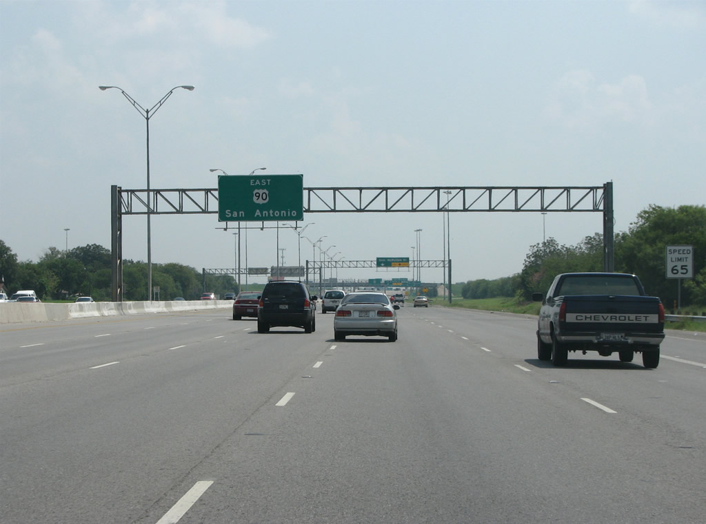
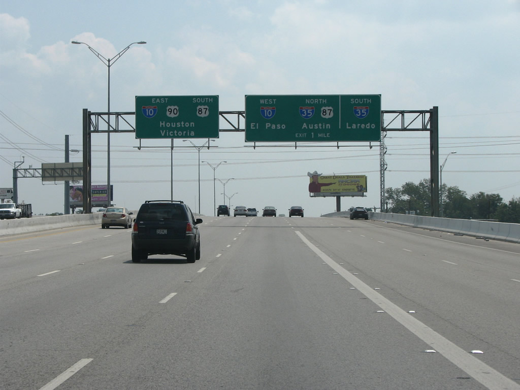
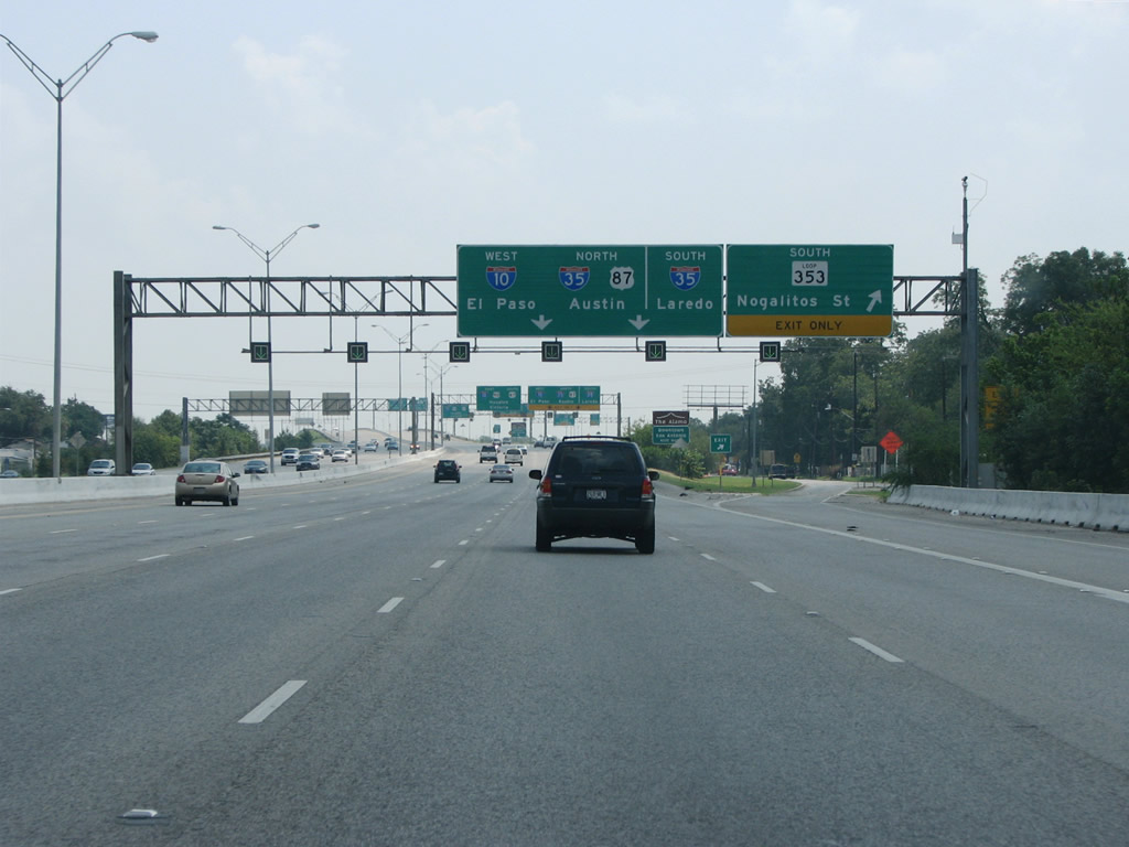
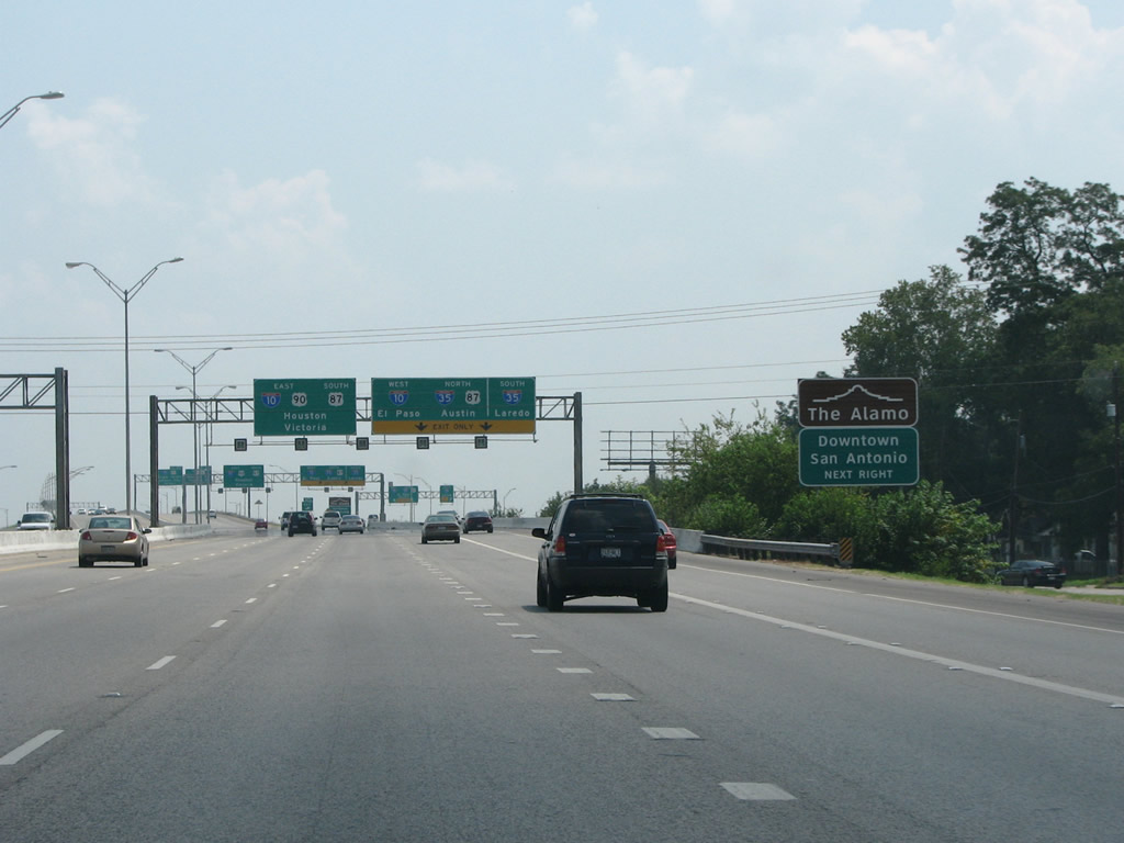
| U.S. 90 widens by two lanes east from the wye interchange with SS 371 to the four level interchange with IH 10, IH 35 and U.S. 87. U.S. 87 overlaps with IH 10 northwest to Comfort en route to San Angeo and east with IH 10/U.S. 90 to Roland Road. IH 35 south joins San Antonio with Laredo and Mexico. 08/31/08 |
|
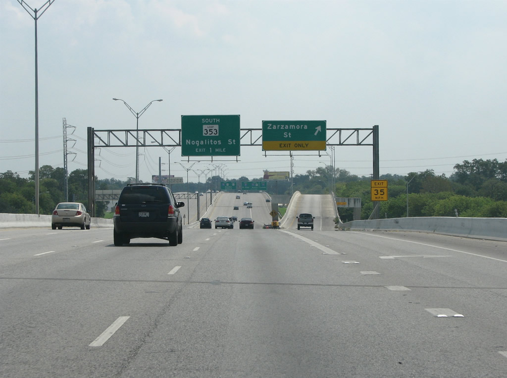
| The freeway balloons to 12 lanes east of Zarzamora and keeps ten of them east of the Loop 353 exit. Nogalitos Street runs primarily along the south side of San Antonio, the area with the highest concentration of Mexican Americans. Loop 353 was signed as US 81 until the 1960s, when the US highway was merged with then new IH 35. 08/31/08 |
|
| Motorists headed from the east end of the Cleto Rodriguez Freeway to The Alamo and Downtown San Antonio are directed onto IH 35 northbound. The distinctive Alamo wayfinding signs are posted along every Downtown freeway for one of the city's most popular tourist attractions. 08/31/08 |
|
| U.S. 90 continues east onto IH 10 to Seguin but loses its distinctiveness. IH 10 and U.S. 90 commingle eastward across Texas, the Gulf Coast and Jacksonville, Florida. 08/31/08 |
Page Updated 07-11-2019.


 East
East