|
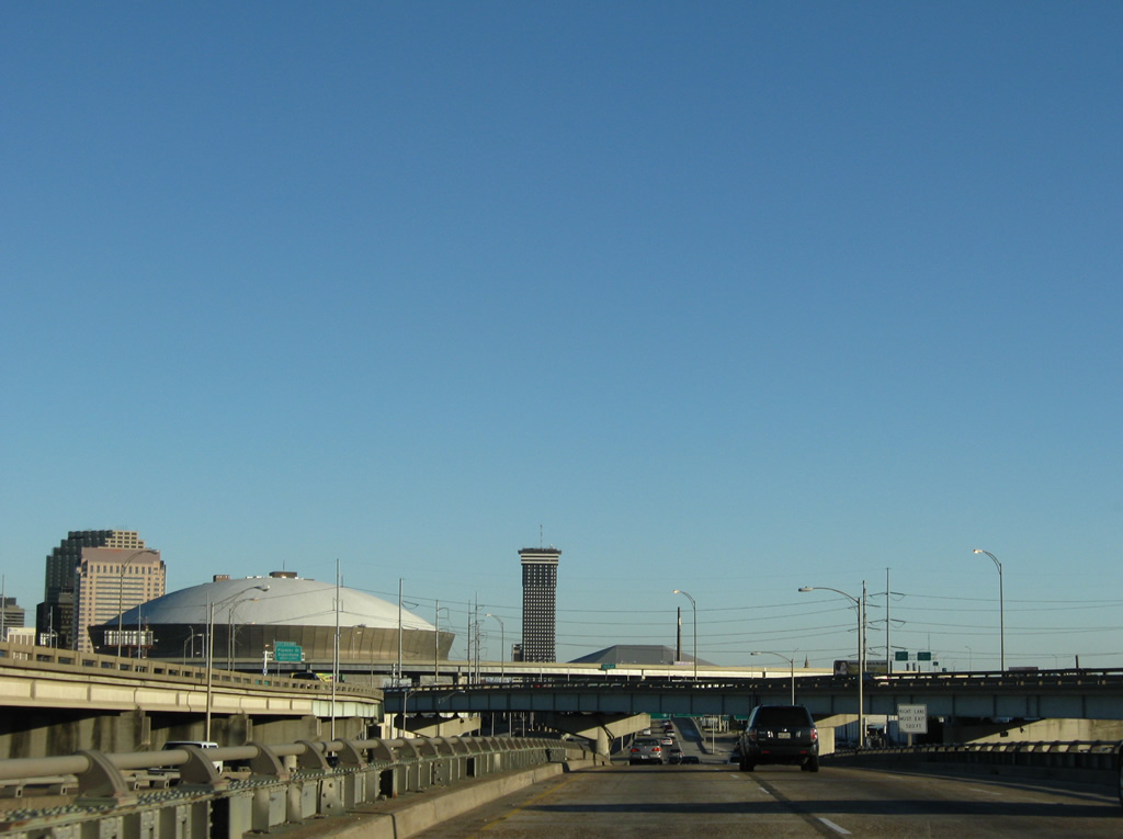
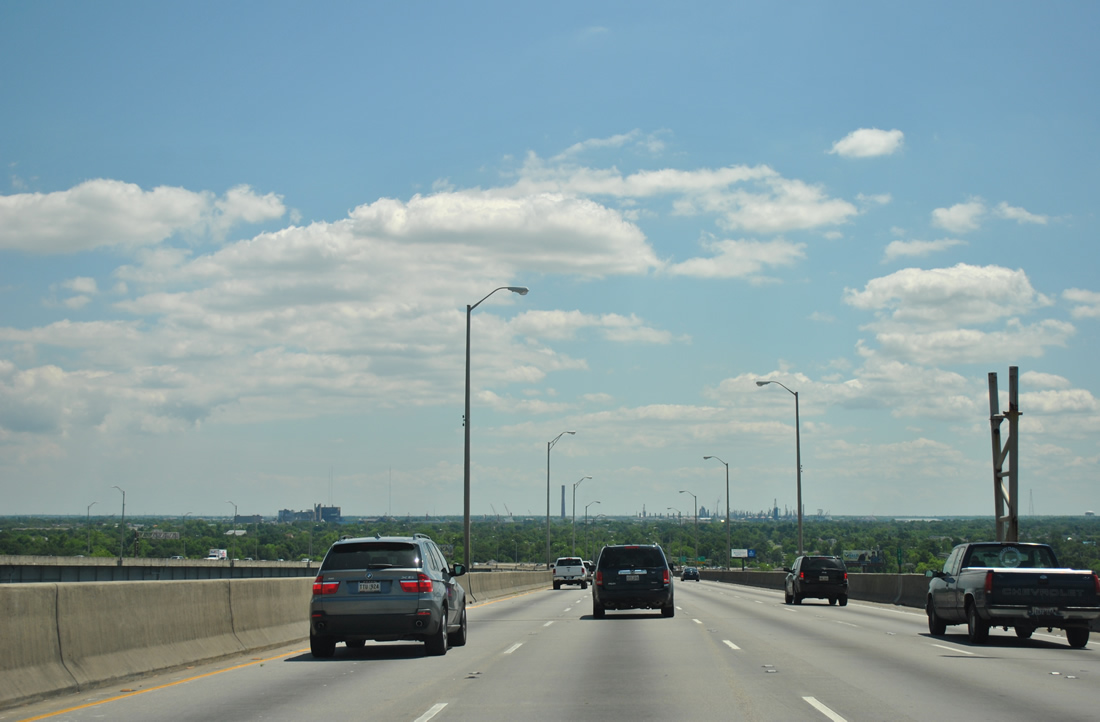
| U.S. 90 Business continues the Pontchartrain Expressway southeast from Interstate 10 to the Crescent City Connection bridge. The freeway first descends below the Interstate 10 eastbound mainline near the New Orleans Superdome. 11/19/08, 04/20/12 |
|
| Interstate 10 motorists bound for U.S. 90 (Claiborne Avenue) eastbound travel the beginning of U.S. 90 Business briefly. U.S. 90 travels in the shadows of the Interstate 10 viaduct between Tulane Avenue and Poydras Street along Claiborne Avenue. West of Poydras Street, U.S. 90 emerges and continues southwest to the Broadmoor and Carrollton neighborhoods of west New Orleans. 04/20/12 |
|
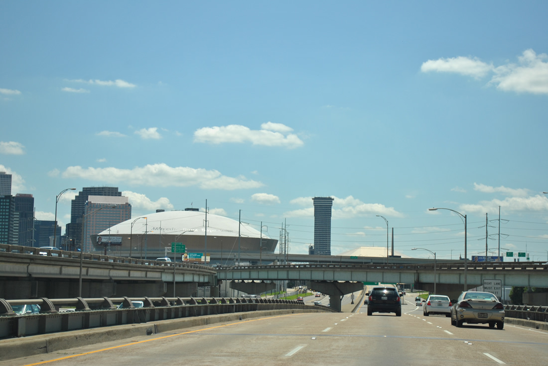
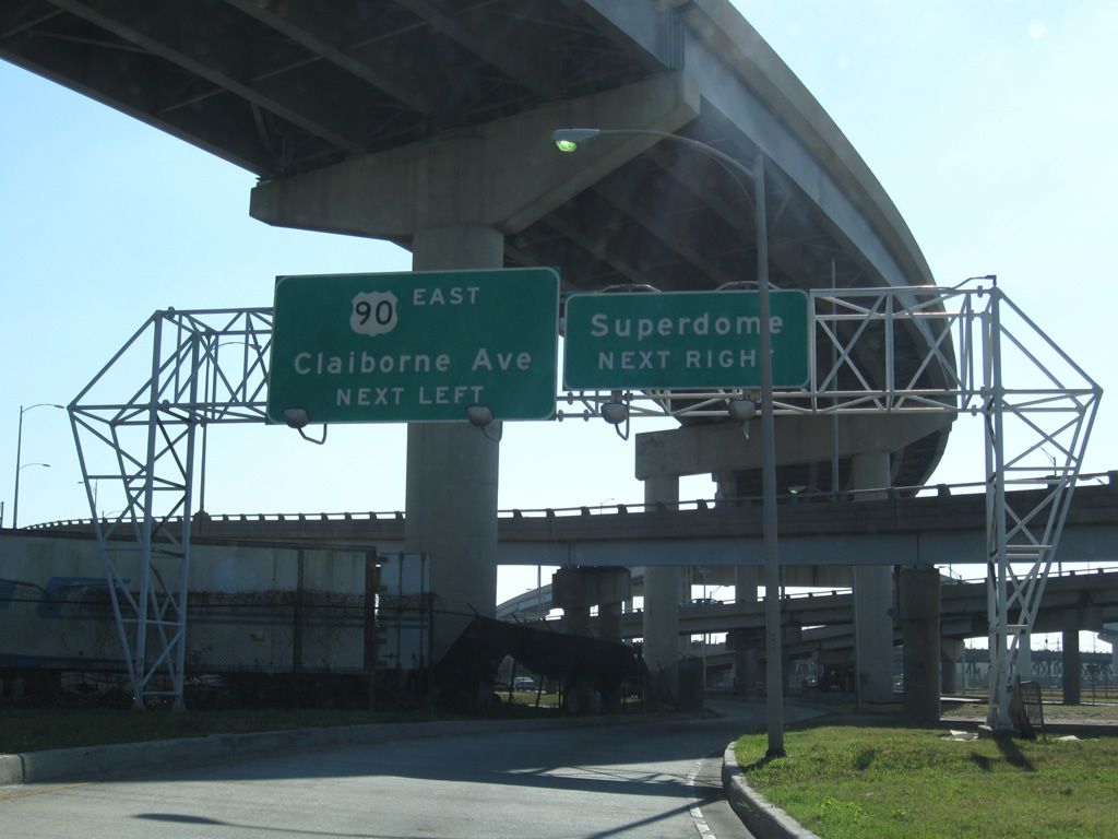
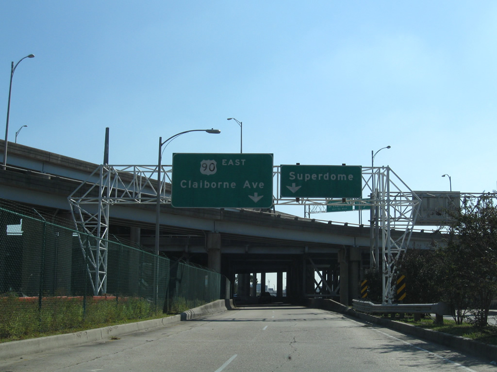
| Following the U.S. 90 off-ramp to the split for Claiborne Avenue. Traffic bound for the Superdome follows the eastbound Claiborne Avenue ramp. Tulane University is reached via U.S. 90 west to Audubon Boulevard. 11/20/08 |
|
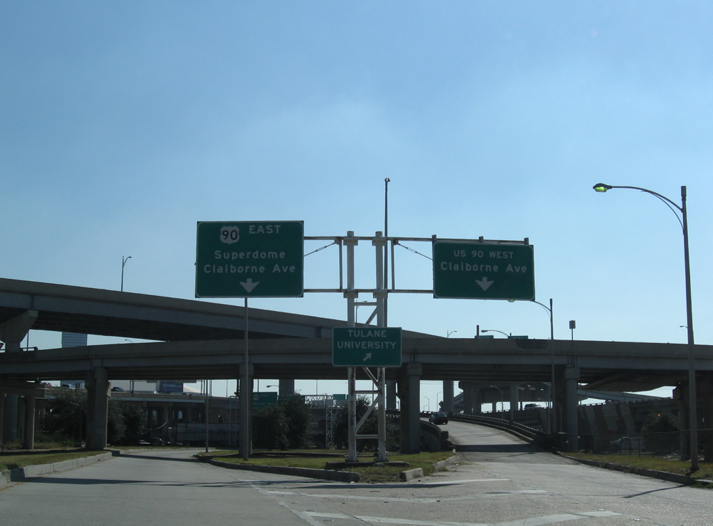
| The ramp to U.S. 90 east winds under the Pontchartrain Expressway viaducts and splits into ramps for Claiborne Avenue east and Stadium Drive at the Superdome. Claiborne Avenue travels initially above the area street grid before lowering below Interstate 10 at Gravier Street. 11/20/08 |
|
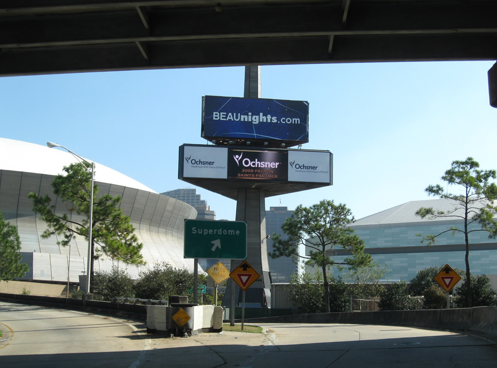
| The Superdome off-ramp connects with West Stadium Drive at Girod Street. New Orleans Arena (home of the NBA New Orleans Pelicans) lies across the street. 11/20/08 |
|
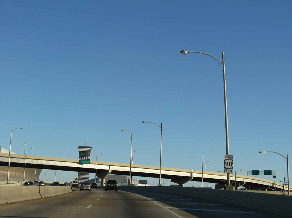
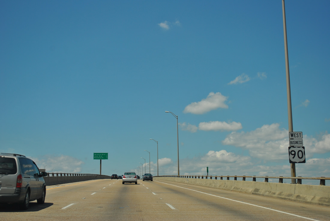
| The first reassurance marker for U.S. 90 Business lies ahead of the Interstate 10 westbound flyover to the Pontchartrain Expressway southbound. 11/19/08 |
|
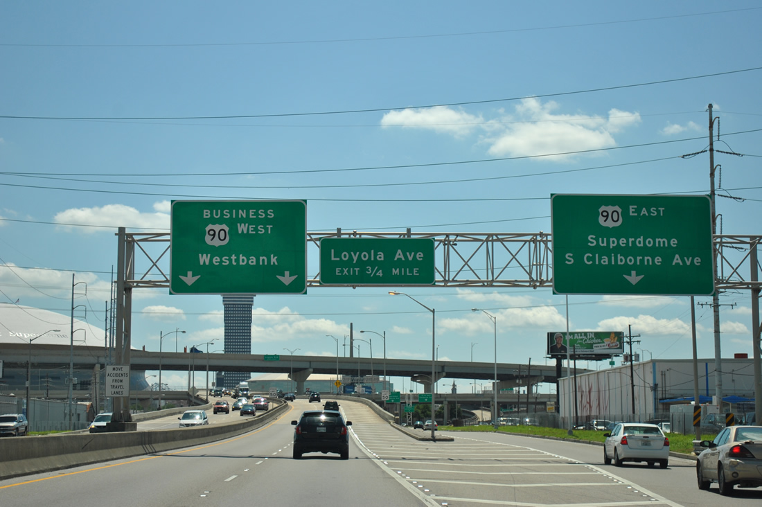
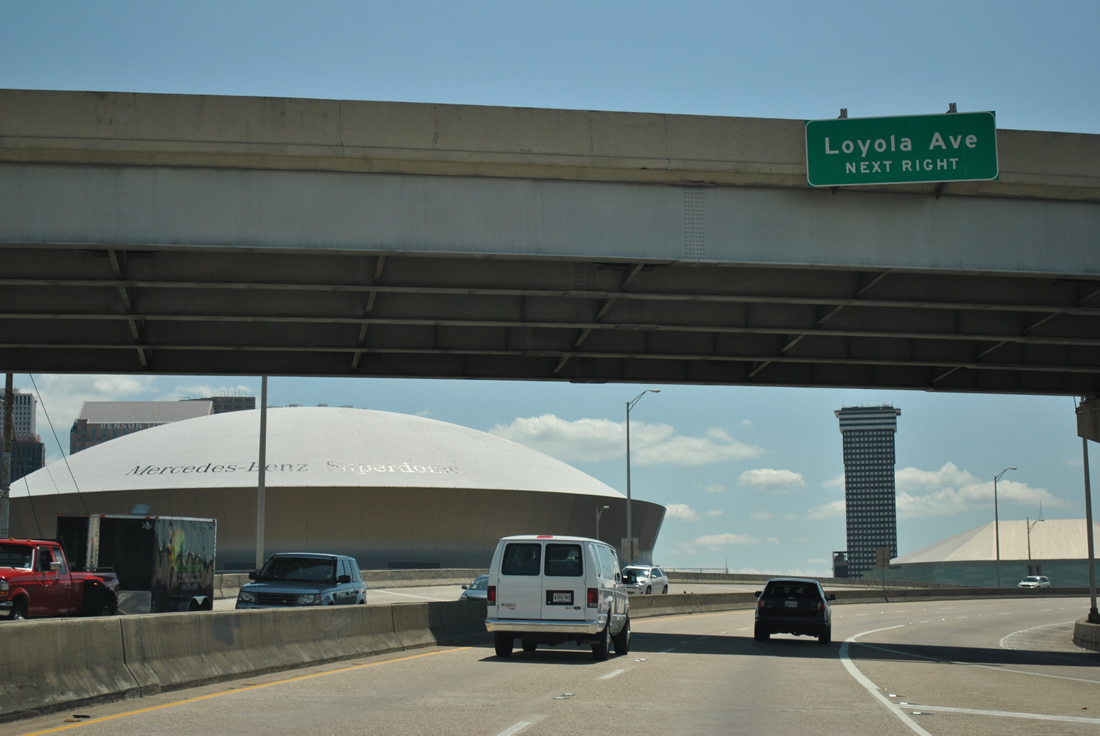
| The next off-ramp joins U.S. 90 Business with Loyola Avenue adjacent to the Mercedes-Benz Superdome (renamed on October 23, 2011). Loyola Avenue continues Simon Bolivar Avenue northeast to the Warehouse District and Downtown. 04/20/12 |
|
| U.S. 90 Business eastbound at the Loyola Avenue off-ramp. Loyola Avenue constitutes a divided arterial from between Earhart Boulevard and Simon Bolivar Avenue northward to the intersection of Elk Place and Tulane Avenue. 04/20/12 |
|
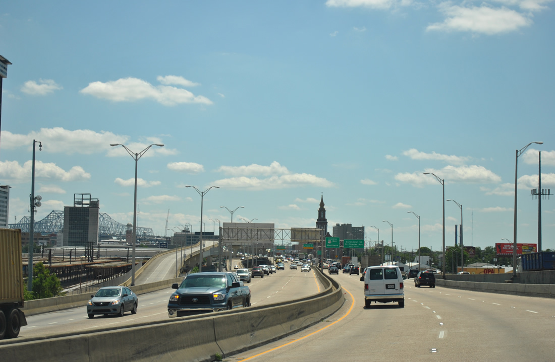
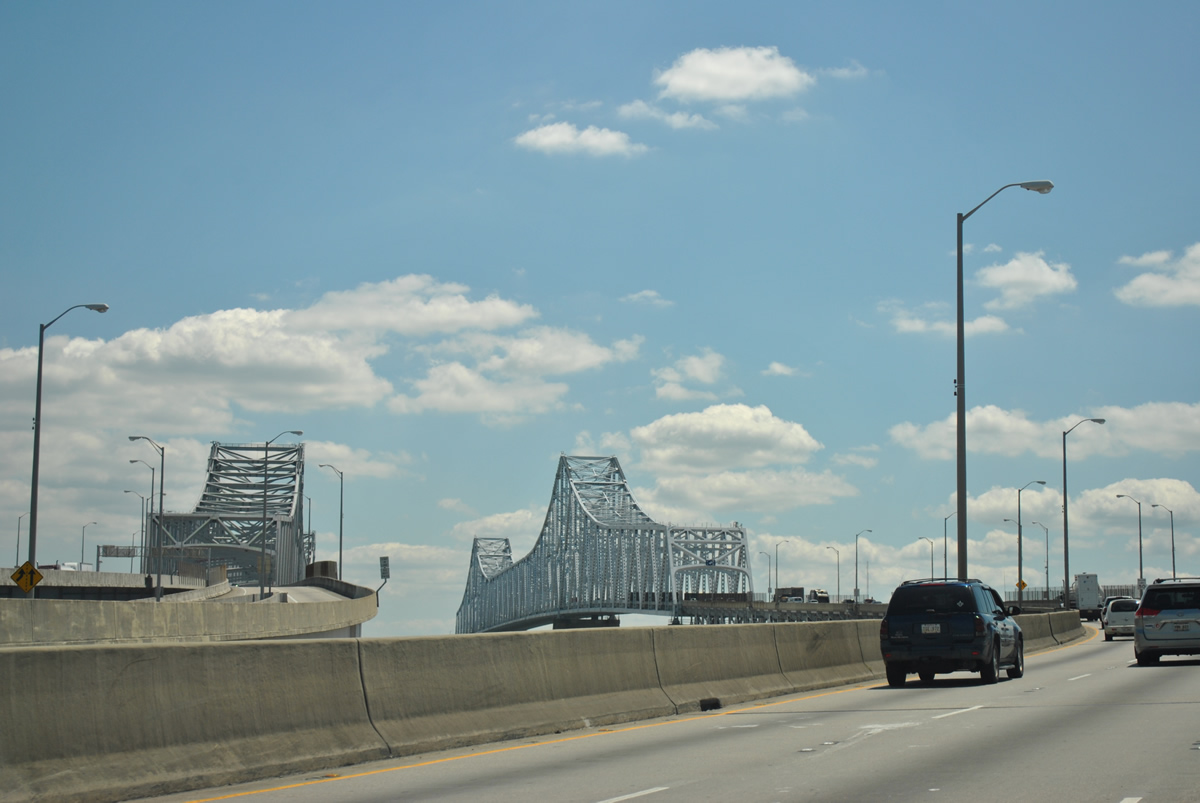
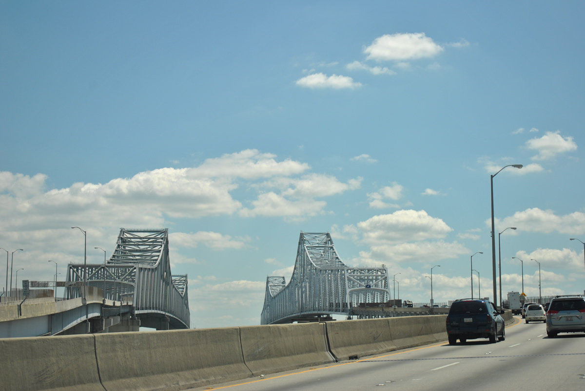
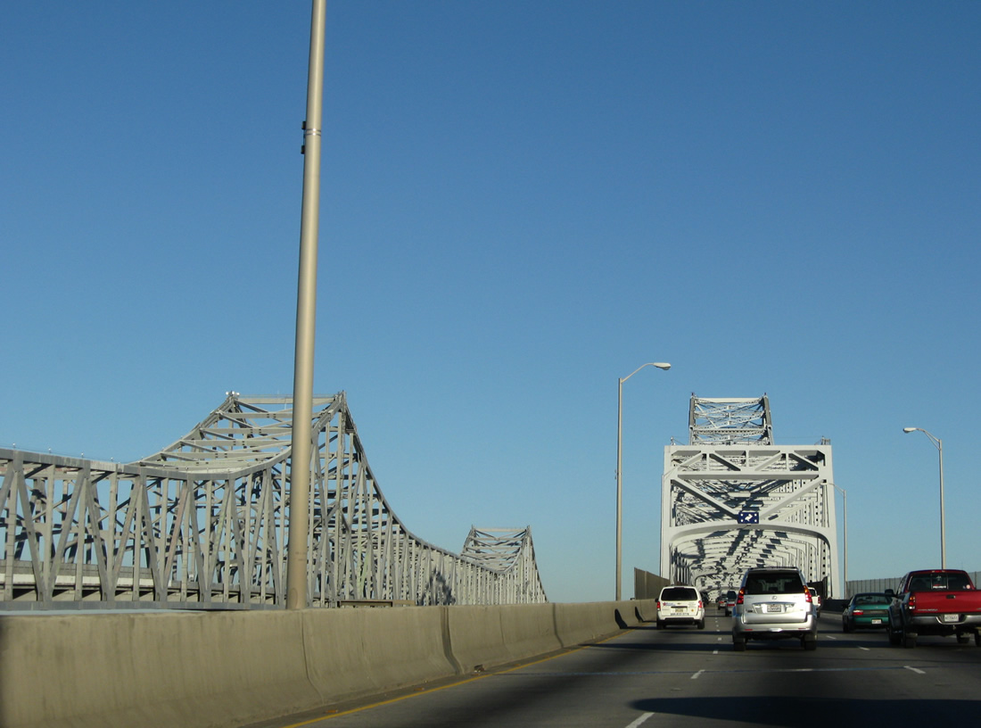
| Looking southward at the western edge of the central business district, beginning of the reversible HOV-2 elevated lanes, and the Crescent City Connection and Greater New Orleans Bridges. 04/20/12 |
|
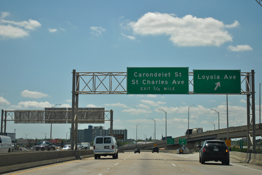
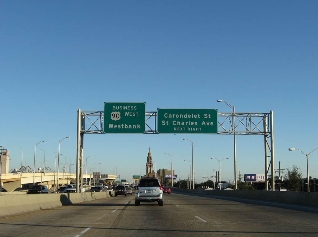
| The second to last New Orleans central business district off-ramp descends onto the eastbound frontage road ahead of Carondelet Street and Saint Charles Avenue. 11/19/08 |
|
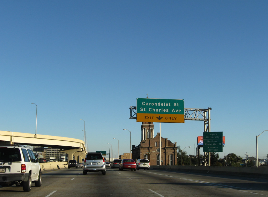
| The right lane defaults onto the Carondelet Street and Saint Charles Avenue off-ramp. These two streets travel east to Canal Street and the French Quarter through the heart of the business district. Beyond Canal Street, Carondelet Street becomes Bourbon Street and Saint Charles Avenue becomes Royal Street. 11/19/08 |
|
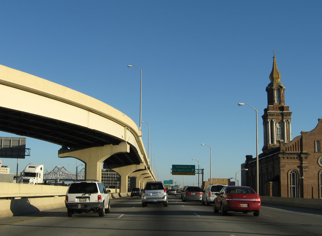
| The reversible HOV-2 roadway moves overhead and lines the middle of U.S. 90 Business to the Crescent City Connection as St. John the Baptist Catholic Church rises prominently along the west side of the elevated lanes. 11/19/08 |
|
| The Exit 12 off-ramp descends onto the eastbound frontage road above Baronne Street. A trolley line follows Saint Charles Avenue from the Garden District southwest of the freeway to adjacent Lee Circle and Canal Street. 11/19/08 |
|
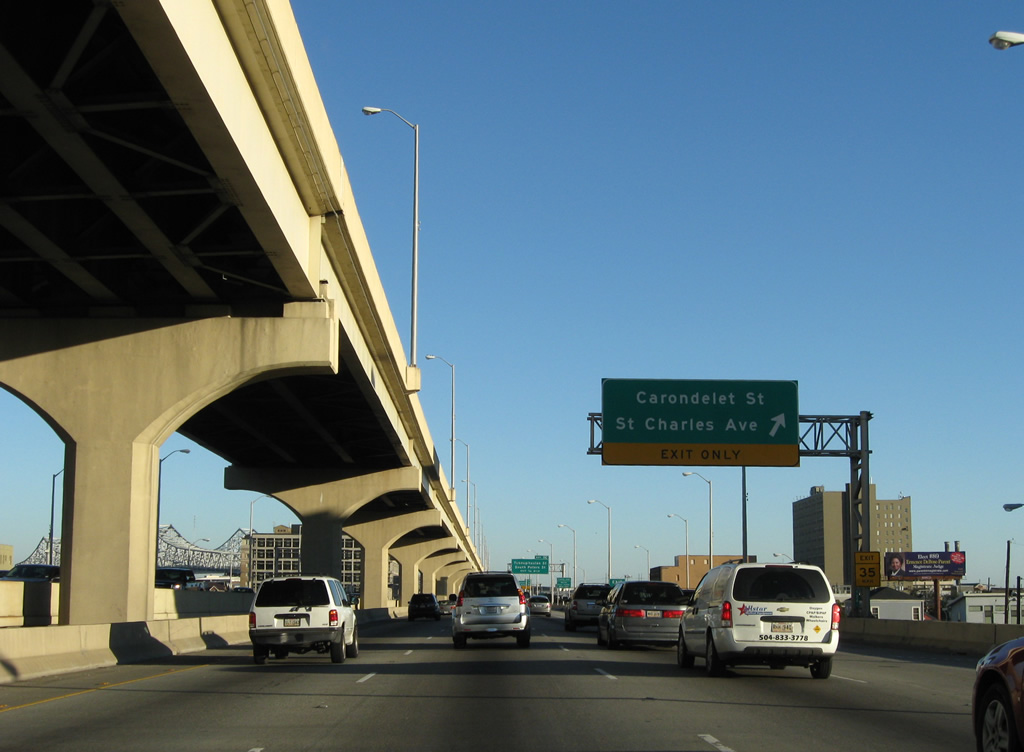
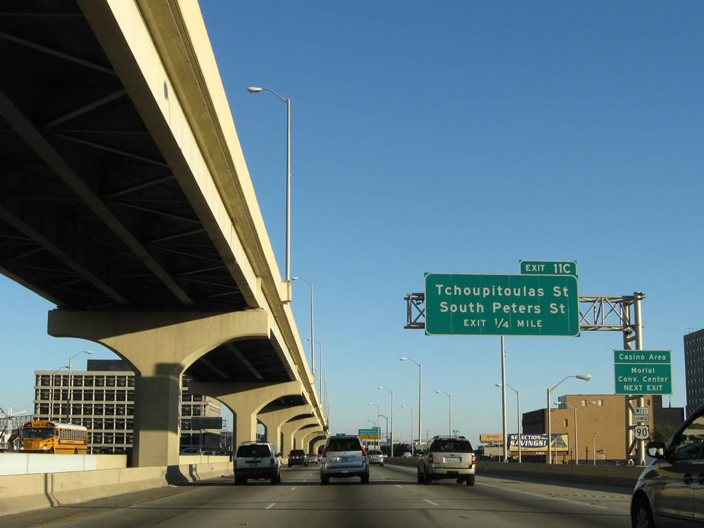
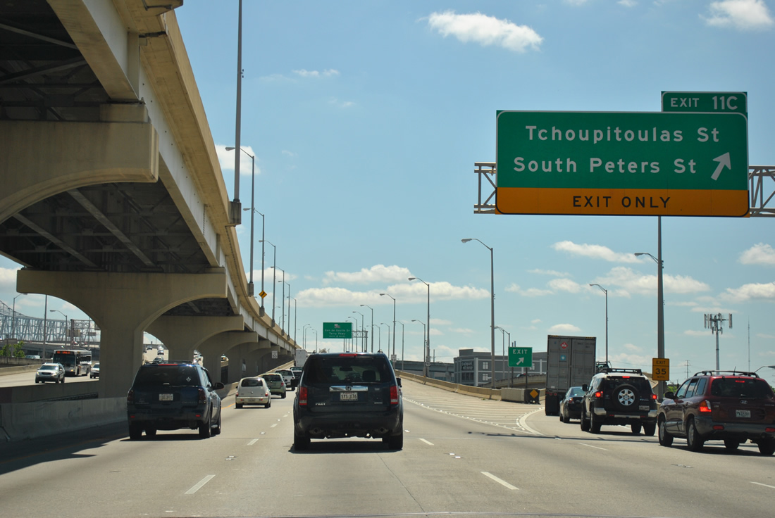
| Exit 11C for Tchoupitoulas Street, Peters Street and Convention Center Boulevard departs next. Traveling above is the HOV-2 reversible viaduct that emanated from ramps at Loyola Avenue and Magnolia Street. The roadway was created during the 1990s rebuilding of the Pontchartrain Expressway. 11/19/08 |
|
| The final Pontchartrain Expressway exit descends onto Calliope Street one block ahead of Tchoupitoulas Street and two blocks from Saint Peters Street. Numbered in 2003, Exit 11C serves the Mississippi Riverfront and the Ernest N. Morial Convention Center. 11/19/08 |
|
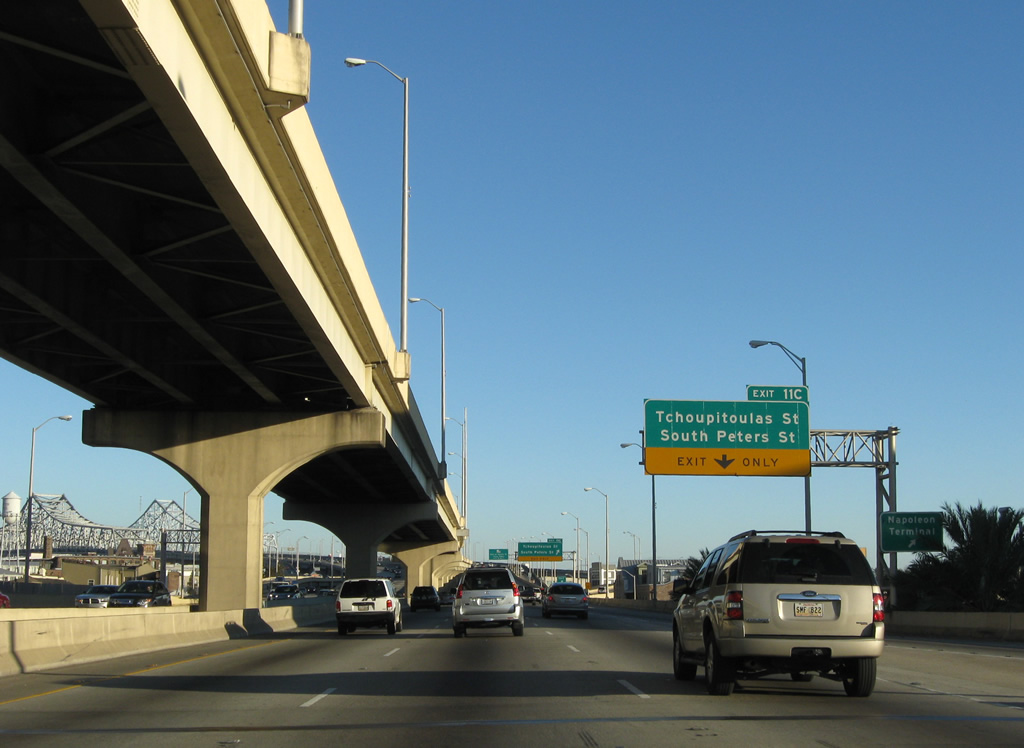
| Exit 11C leaves U.S. 90 Business eastbound for Tchoupitoulas Street and Peters Street north to the Harrah's Casino New Orleans. Calliope Street, below the freeway viaduct, ends at Convention Center Boulevard along the Mississippi River. 04/20/12 |
|
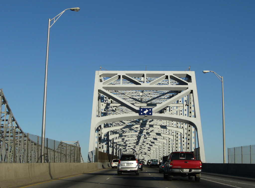
| U.S. 90 Business reassurance marker posted as the Pontchartrain Expressway reaches the Crescent City Connection approach. 04/20/12 |
|
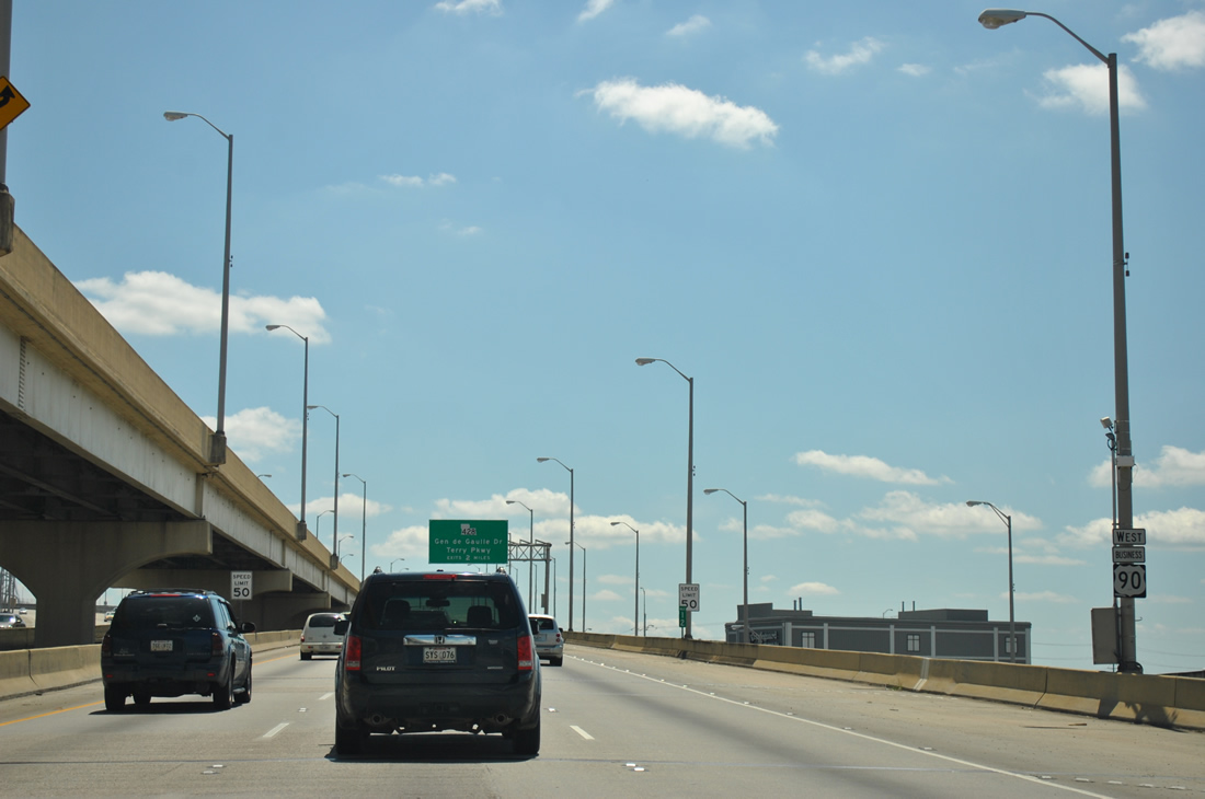
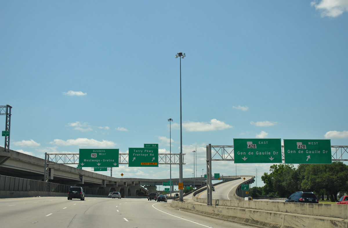
| Two mile overhead for the first interchange of the Westbank Expressway, that with LA 408 (General Degaulle Drive). U.S. 90 Business becomes the Westbank Expressway at the south end of the Crescent City Connection bridge.
The HOV-2 roadway above ends beyond the Crescent City Connection toll plaza. 11/19/08 |
|
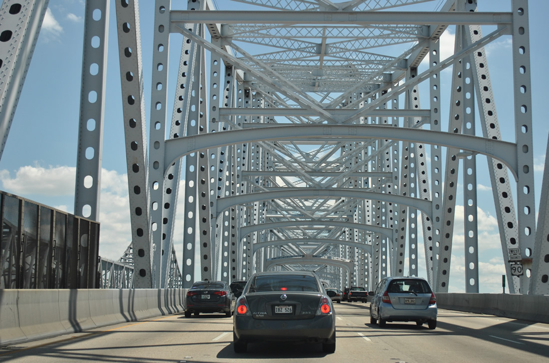
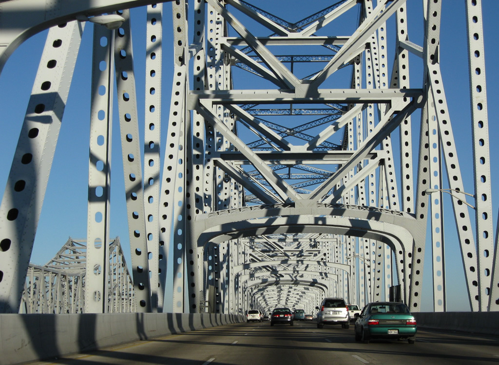
| U.S. 90 Business westbound crossing the Crescent City Connection bridge high above the Mississippi River. The crossing represents the southernmost bridge to span the world's third longest river. The (eastbound) Crescent City Connection opened to traffic on September 30, 1988. The (westbound) Greater New Orleans Bridge opened April 15, 1958. 04/20/12 |
|
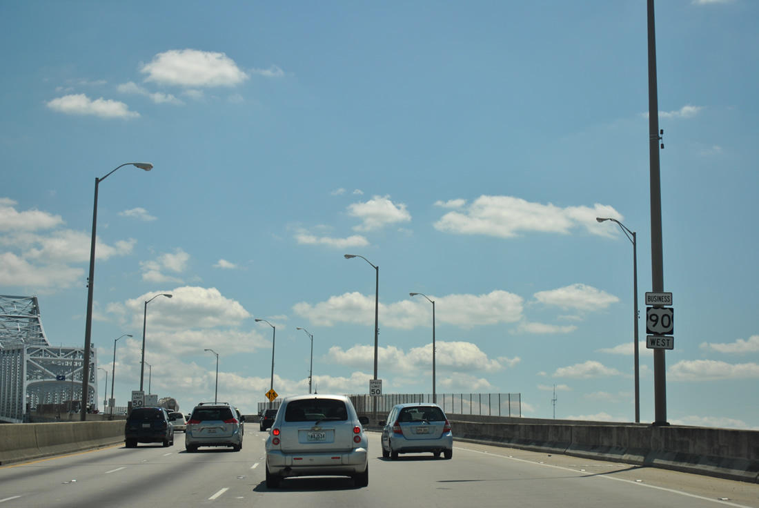
| An on-ramp joins the Crescent City Connection westbound from Tchoupitoulas Street north ahead of this reassurance marker. 04/20/12 |
|
| Prior to May 2013, a $1 toll was levied on all passenger vehicles traveling in the eastbound direction. The HOV-2 reversible roadway utilizes the westbound bridge to cross between New Orleans and Gretna. A two year repainting project on the Greater New Orleans Bridge took place between 2002-04. 11/19/08 |
|
| Four lanes of U.S. 90 Business continue over the Mississippi River. The span briefly enters the northern wedge of Jefferson Parish before touching down near the Algiers section of New Orleans. 04/20/12, 11/19/08 |
|
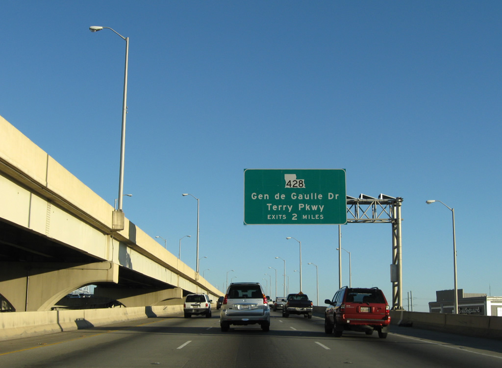
| Descending toward Algiers and the Jefferson Parish seat of Gretna. LA 428 intersects the freeway in 0.75 miles. The state highway travels underneath of the bridge via Franklin Avenue before turning east onto Burmaster Street to General De Gaulle Drive. 10/22/03 |
|
| The one half mile sign for Exit 9B was blown down by Hurricane Katrina leaving a support post behind. Along the horizon is the Mobile Oil Corporation Chalmette Refinery. 04/20/12 |
|
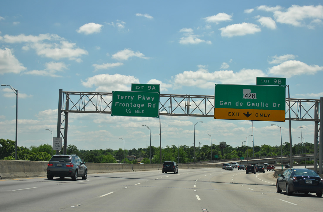
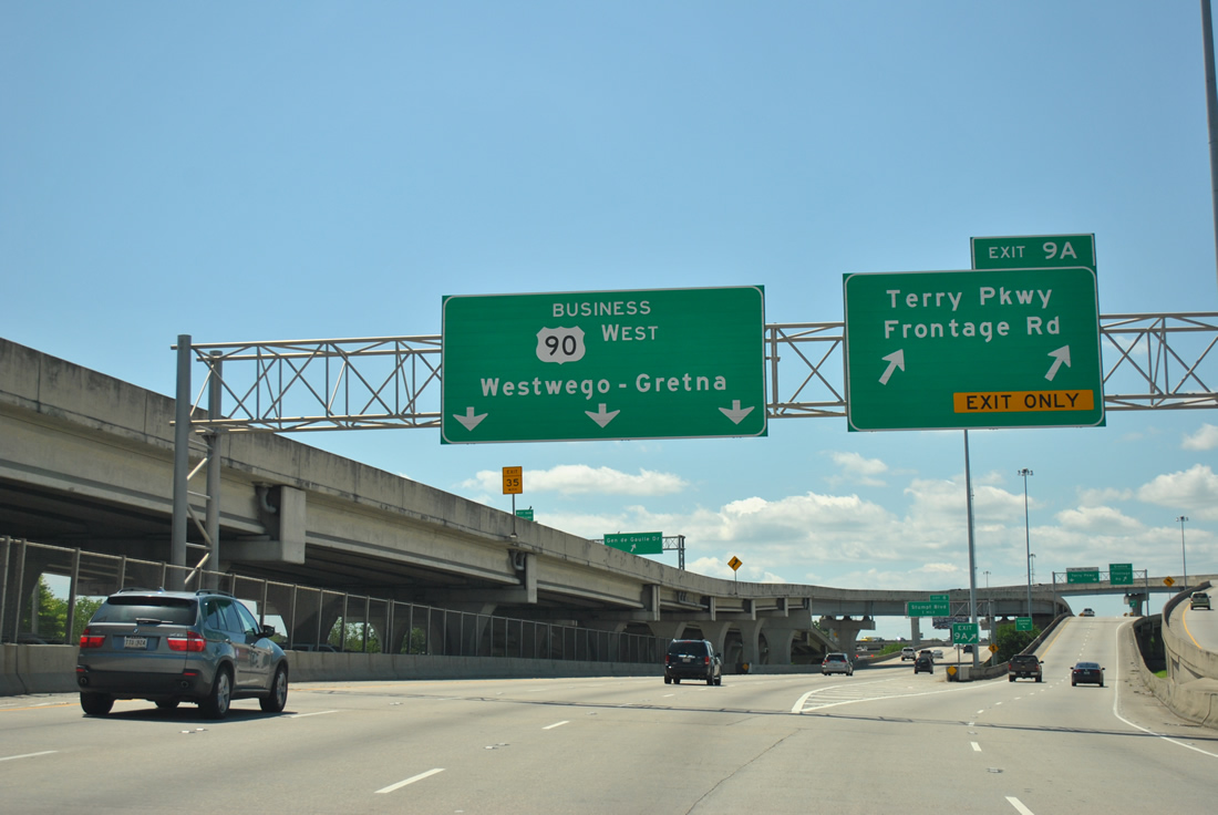
| Exit 9B departs ahead for LA 428 (Burmaster Street west / General De Gaulle Drive east) ahead of the wye interchange (Exit 9A) with Terry Parkway south. 04/20/12 |
|
| U.S. 90 Business westbound touches down just east of L.B. Landry Avenue at the Exit 9B ramp departure for LA 428 (General De Gaulle Drive). General De Gaulle Drive comprises main arterial between the West Bank Expressway through southeast New Orleans.
Exit 9B departs next for the westbound beginning of the Westbank Expressway frontage road system. The ramp also serves Terry Parkway, a north-south arterial between Oakwood Center mall and LA 23 (Belle Chasse Parkway). 04/20/12 |
|
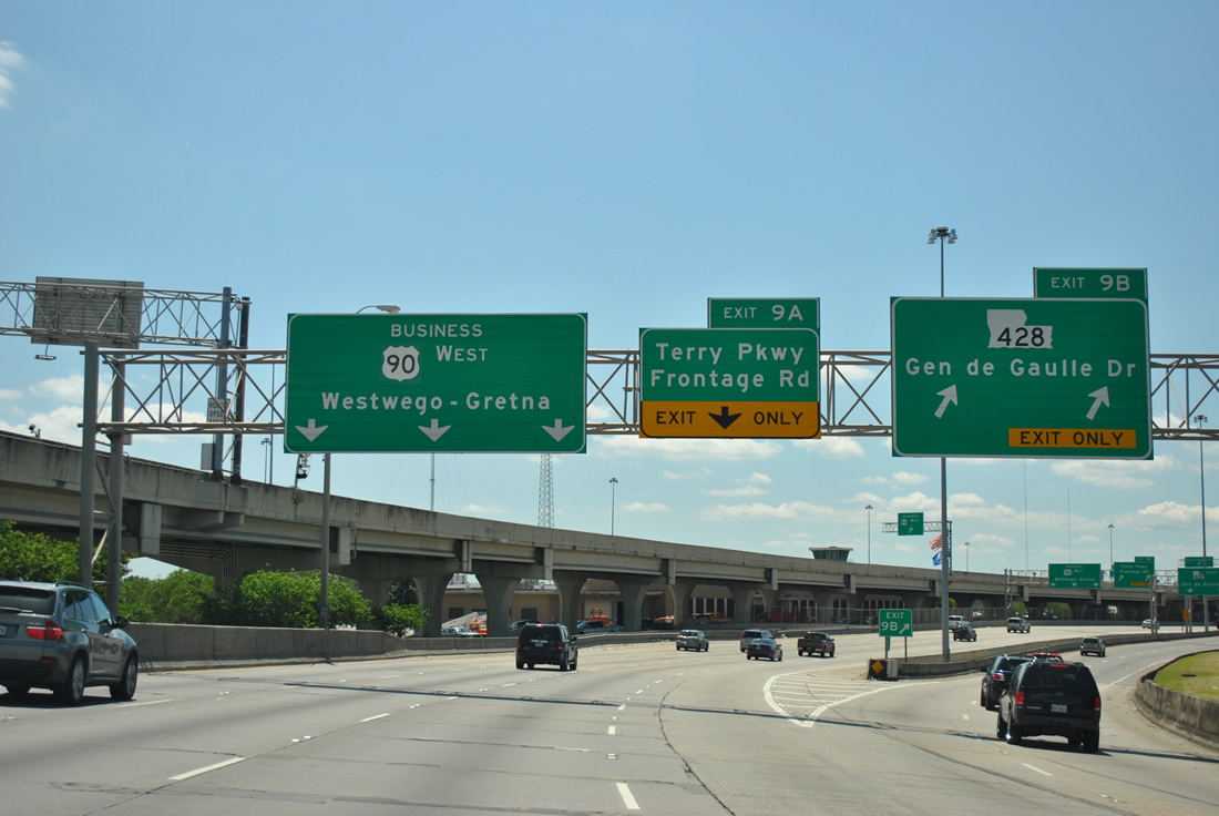
| The Exit 9B off-ramp partitions between east and westbound. Traffic to General De Gaulle Drive eastbound utilizes a high flyover over the U.S. 90 Business mainline ahead. LA 428 loops through southeast New Orleans, Terrytown, and Gretna along a 8.96 mile path. The state highway ends to the south at LA 23 (Belle Chase Highway) and to the east on General Meyer Avenue at LA 407 (Woodland Drive). 04/20/12 |
|
| Exit 9A follows quickly as a two-pronged ramp to the Westbank Expressway frontage road west and Terry Parkway south. U.S. 90 Business sees a frontage road system throughout its freeway portion. 04/20/12 |
|
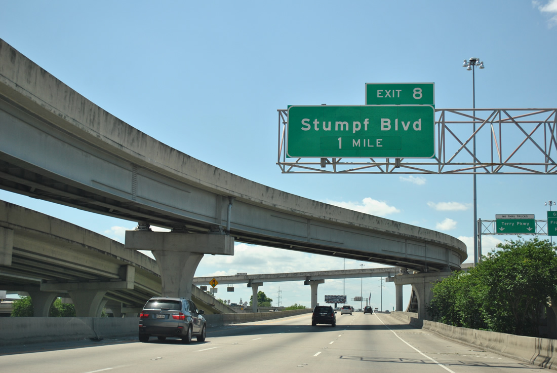
| The one mile guide sign for Stumpf Boulevard resides within the tangle of ramps to LA 428. Stumpf Boulevard comprises a divided surface arterial between LA 466 (5th Street) and Whitney Avenue nearby. 04/20/12 |
|
| The Westbank Expressway departs the city limits of New Orleans and enters both Jefferson Parish and the city of Gretna. 04/20/12 |
|
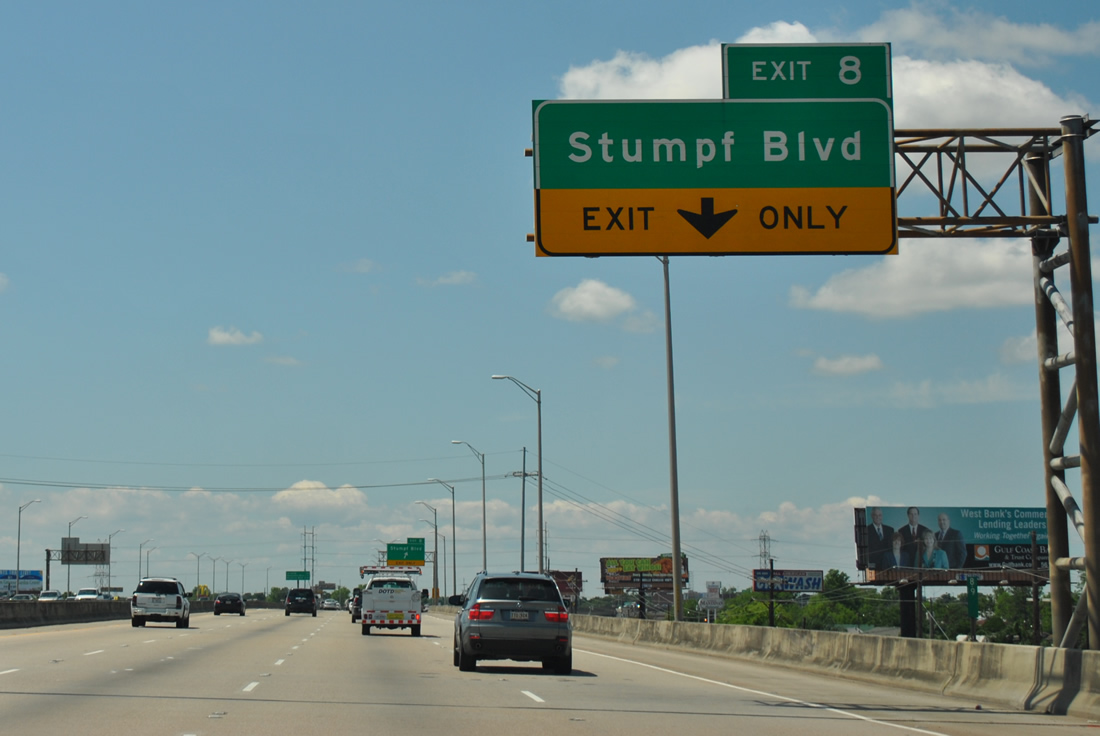
| The 0.50 mile overhead for the Exit 8 junction with Stumpf Boulevard. Stumpf Boulevard travels south from LA 466 (5th Street) to Terrytown. 04/20/12 |
|
| Turning southwesterly, the Crescent City Connection and downtown New Orleans comes into view. 11/19/08 |
|
| Drivers merging onto the freeway from Terry Parkway form an auxiliary lane for Stumpf Boulevard (Exit 8). The Westbank Expressway overall varies between six and eight lanes with the advent of auxiliary lanes. 04/20/12 |
|
| Exit 8 departs U.S. 90 Business west to descend and merge onto the westbound frontage road ahead of its intersection with Stumpf Boulevard. LA 23 intersects Stumpf Boulevard just north of the Expressway via Franklin Avenue. 04/20/12 |
|
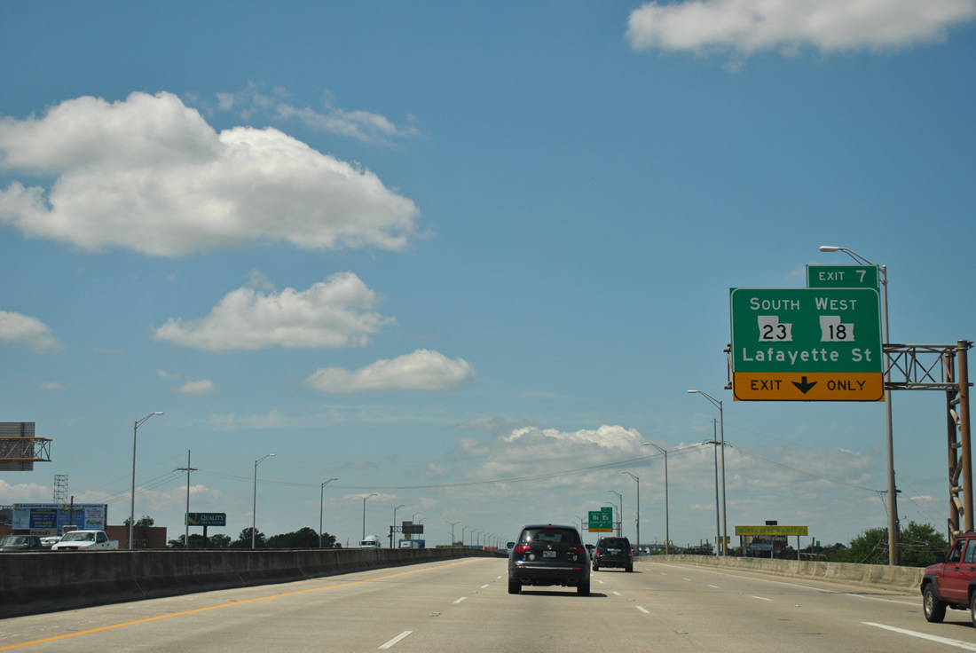
| Next in line for westbound travelers is LA 23 (Belle Chasse Highway) and LA 18 (Lafayette Street) west. Interchange sequence sign are placed periodically throughout the Westbank Expressway routing. 04/20/12 |
|
| The Westbank Expressway kinks more westerly from Stumpf Boulevard, continuing to follow the periphery of the Mississippi River to Harvey, Marrero and Westwego. 04/20/12 |
|
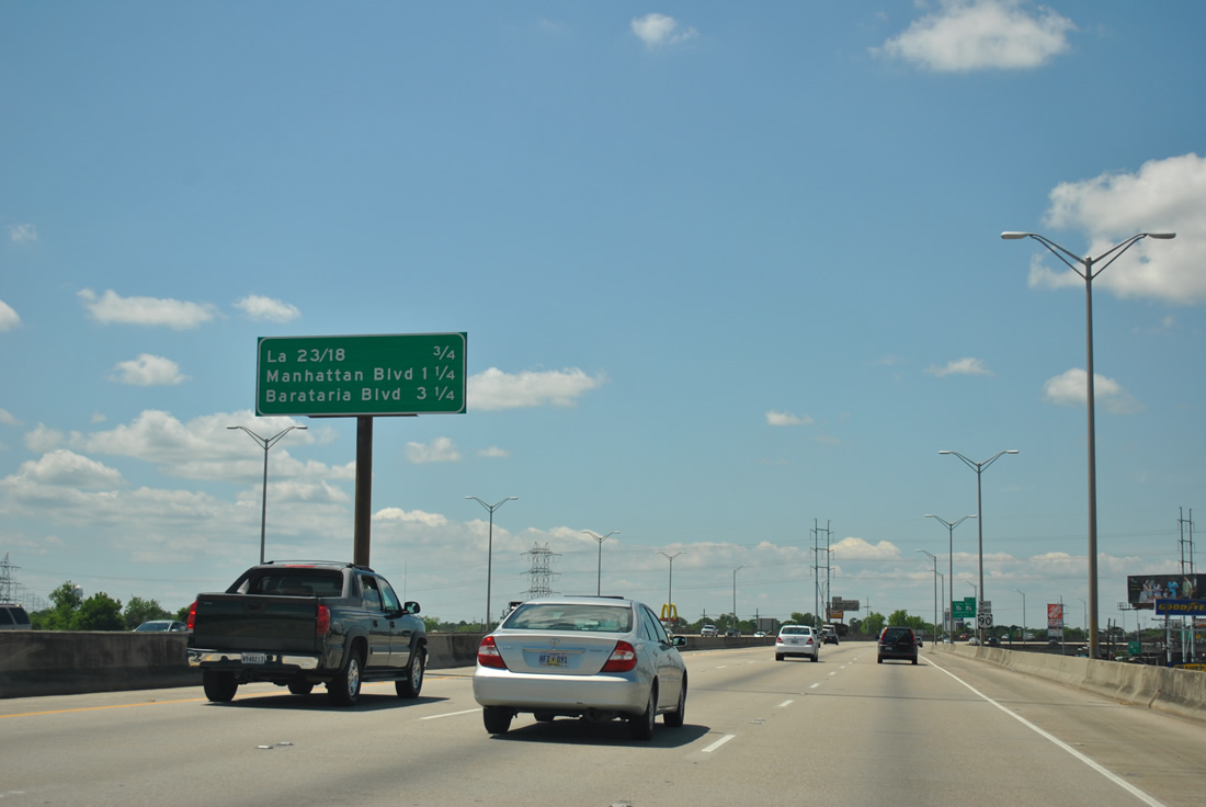
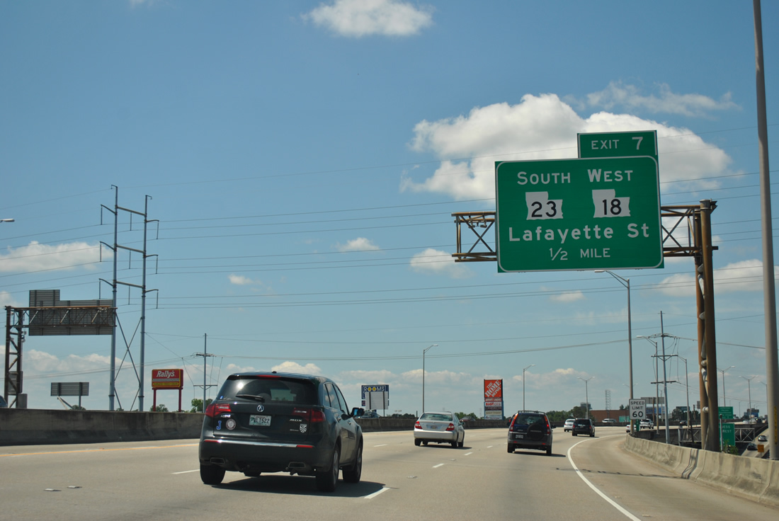
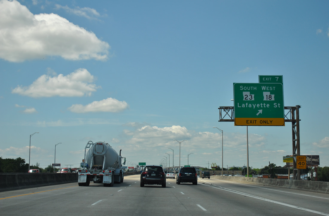
| One half mile ahead of the diamond interchange (Exit 7) joining U.S. 90 Business with Lafayette Street. Lafayette Street carries LA 23 southward five blocks to the beginning of Belle Chase Highway. The state highway travels through the Belle Chase Tunnel to Belle Chase and N.A.S. New Orleans.
LA 23 travels the original LA 1 from the New Orleans metropolitan area to Venice in Plaquemines Parish. The roadway represents the farthest south one can drive parallel to the Mississippi River. 04/20/12 |
|
| The east end of LA 18 is at the junction of U.S. 90 Business and Lafayette Street. LA 18 follows Lafayette Street northward eight blocks to 5th Street, where it meets the west end of the 0.85 mile long LA 466. LA 18 along 4th and 5th Streets follows original LA 2 and U.S. 90 through Gretna, Harvey, Marrero and Westwego. 04/20/12 |
|
| Westbound at the Exit 7 ramp departure onto the adjacent westbound frontage road. 04/20/12 |
|
| U.S. 90 Business leaves Gretna and enters the Harvey vicinity en route to Marrero and Westwego. The next three exits join the freeway with north-south arterials. 04/20/12 |
|
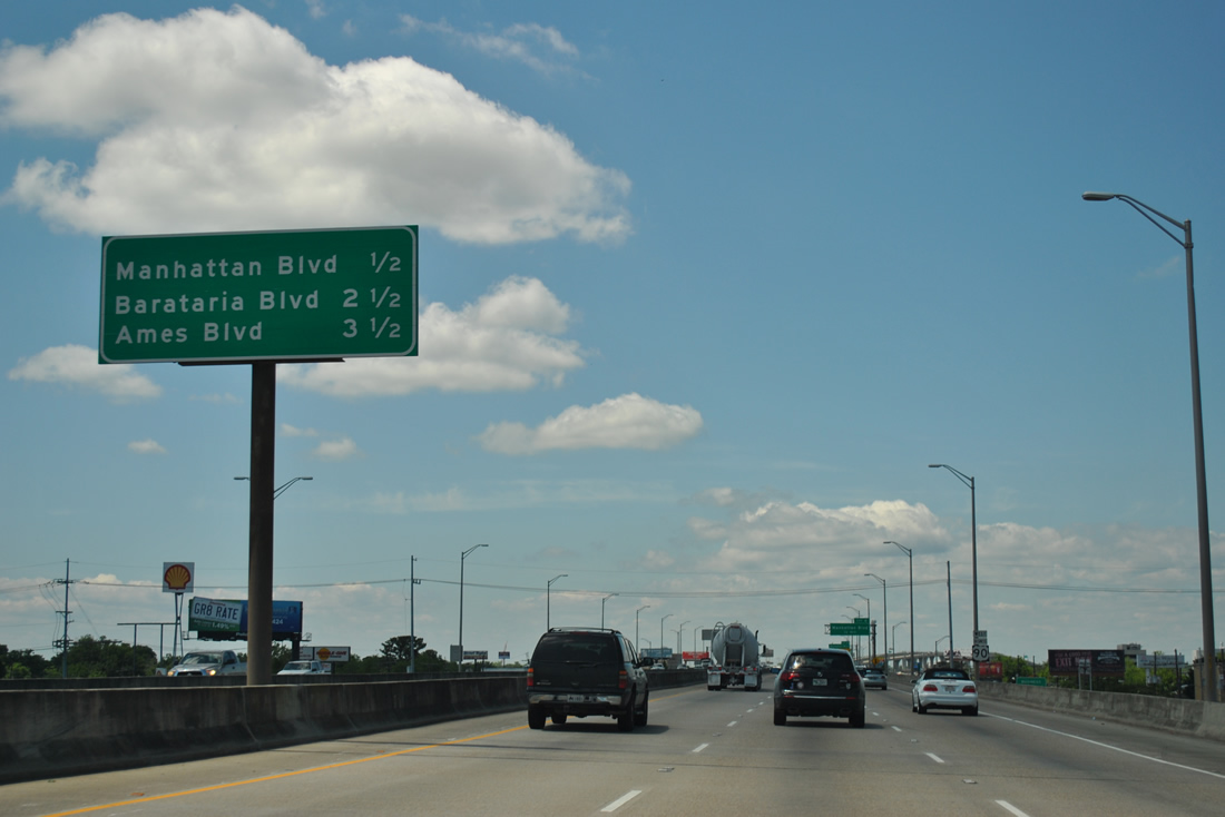
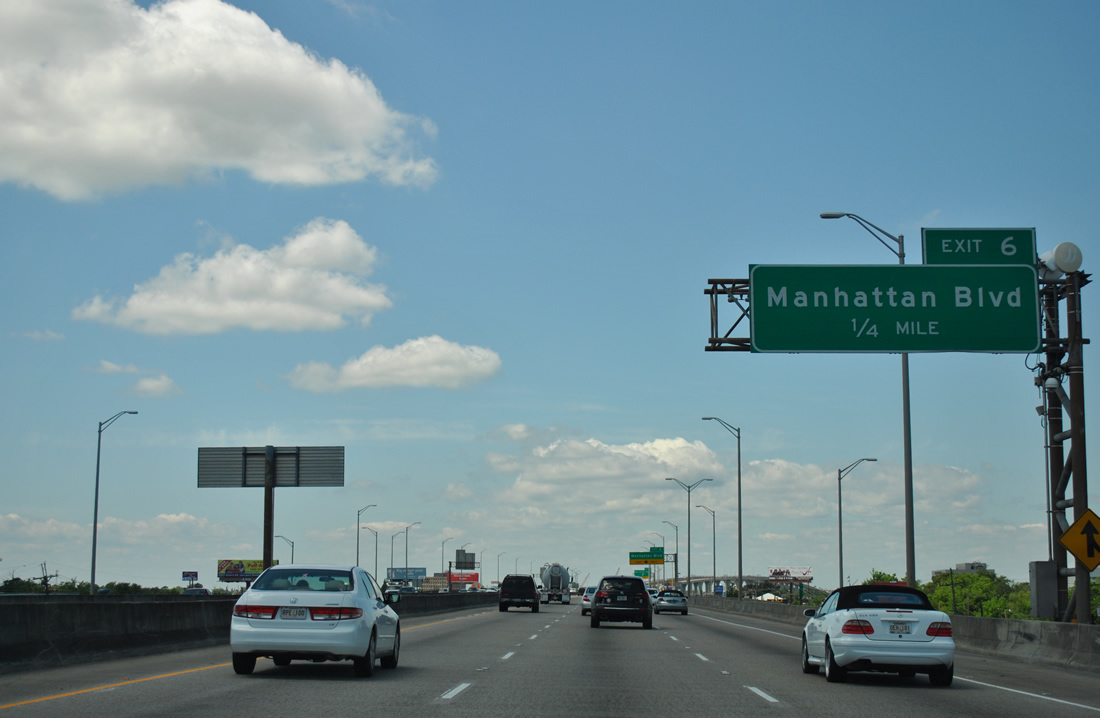
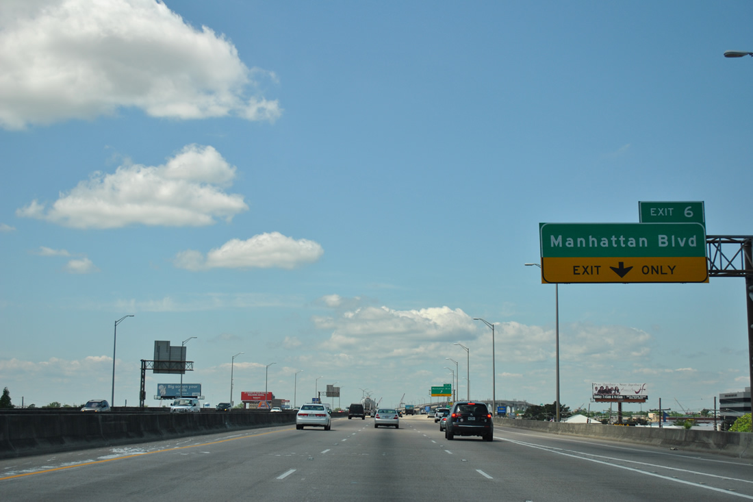
| Exit 6 provides access to Manhattan Boulevard via the parallel frontage roads. 04/20/12 |
|
| Manhattan Boulevard provides a north-south arterial between LA 18 (4th Street) and Lapalco Boulevard. The surface boulevard serves both the communities of Gretna and Harvey. 04/20/12 |
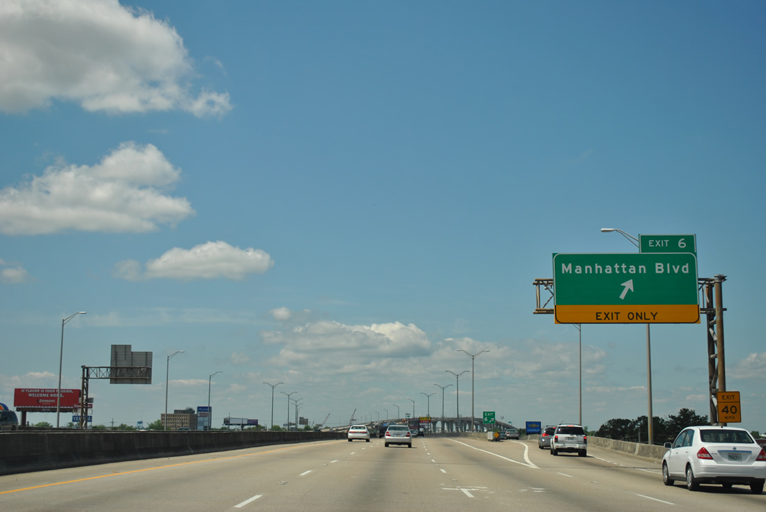
|
| U.S. 90 Business westbound at the Exit 6 ramp departure to Manhattan Boulevard. Motorists bound for Peters Road or the Harvey Tunnel should use Exit 6. The Harvey Tunnel represents the original crossing of the Harvey Canal ahead. Peters Road (LA 3017) parallels the waterway southward from LA 18 to Engineers Road in Plaquemines Parish. 04/20/12 |
|
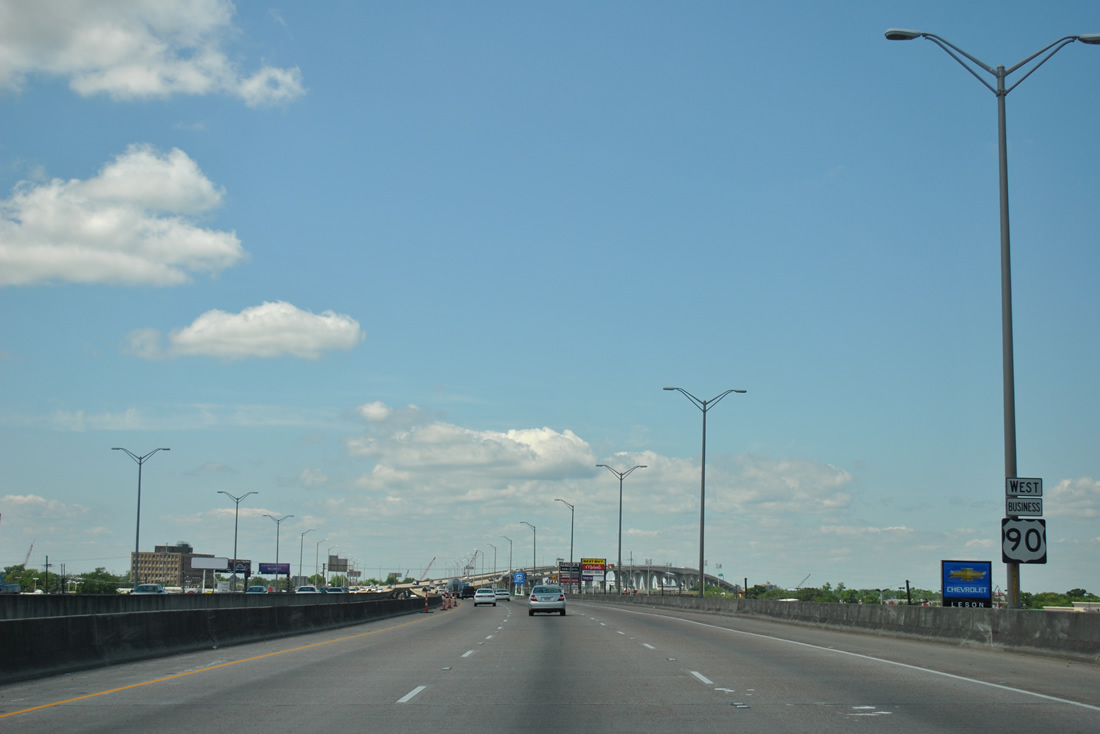
| A six lane high-level bridge spans the Harvey Canal above the Harvey Tunnel between Harvey and Marrero. 04/20/12 |
|
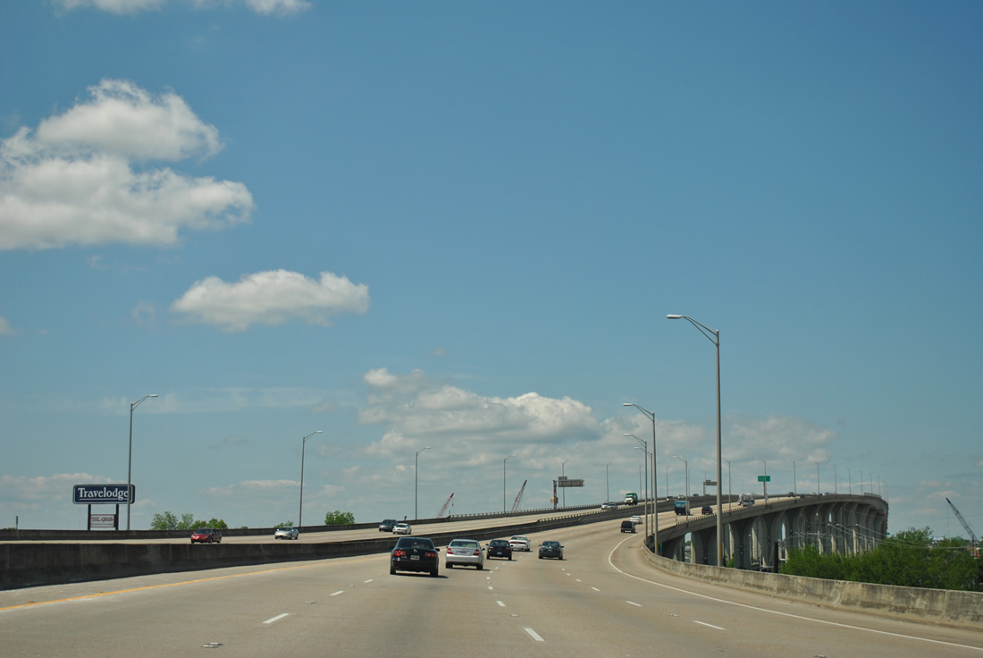
| Cresting over the Harvey Canal Bridge, motorists see an interchange sequence sign listing the distances to Exits 4B, 4A, and Westville Drive, all serving the community of Marrero. 04/20/12 |
|
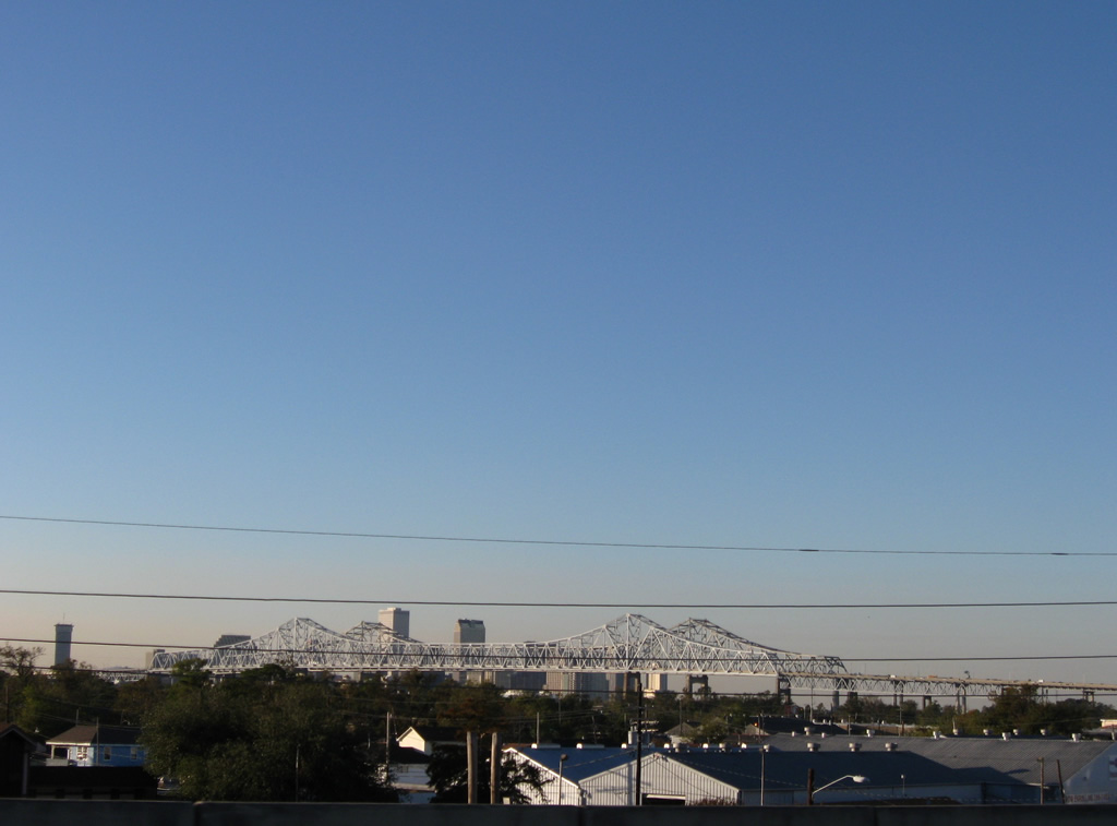
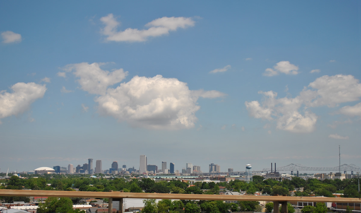
| A fantastic view of the New Orleans city skyline unfolds from the peak of the Harvey Canal Bridge. 04/20/12 |
|
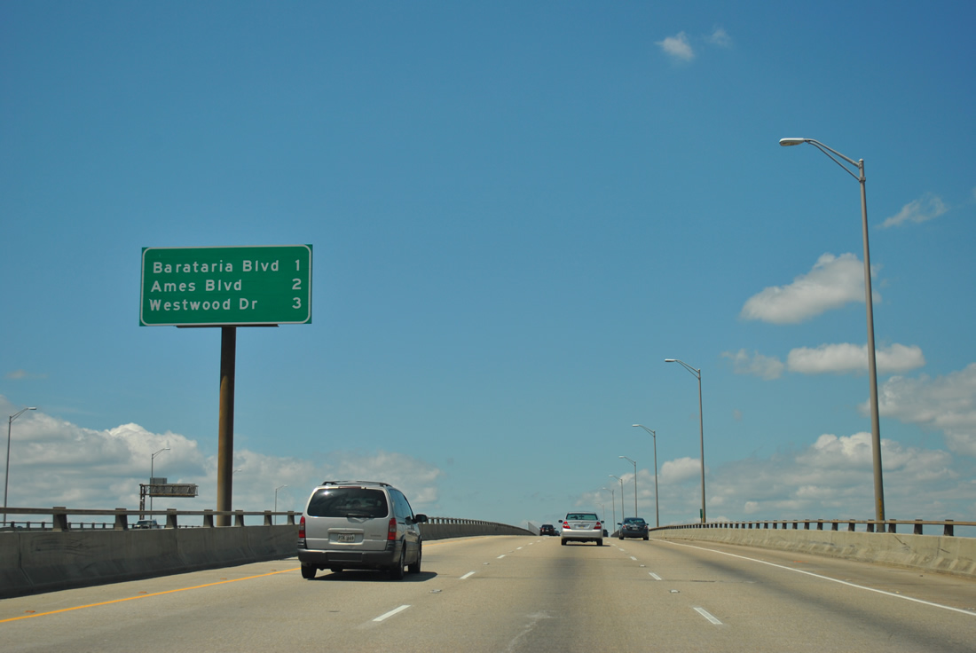
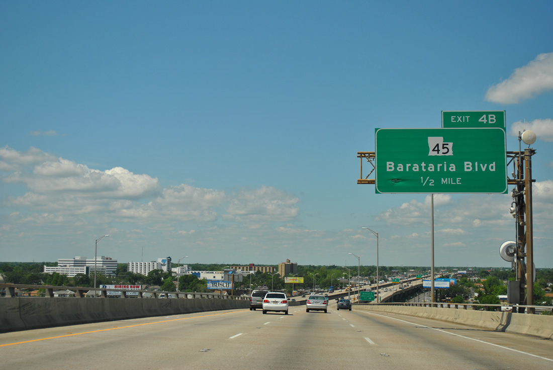
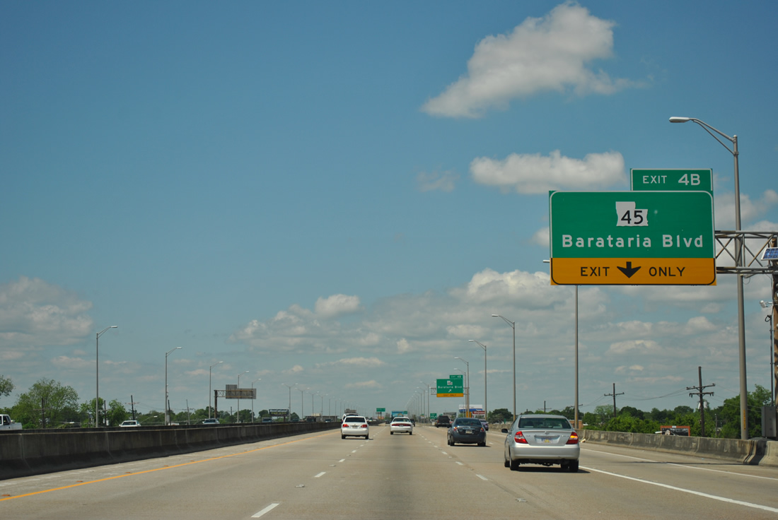
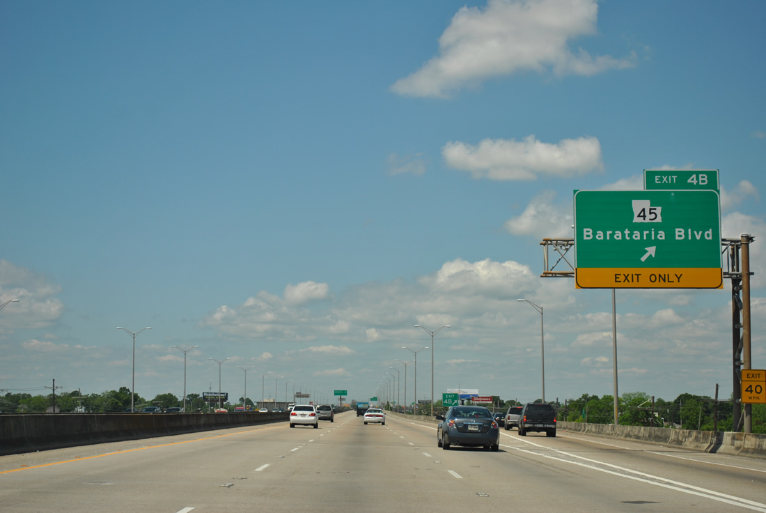
| U.S. 90 Business westbound continues from over Harvey Canal into Marrero between the Manhattan Boulevard exit and Exit 4B with LA 45 (Barataria Boulevard). Barataria Boulevard carries the state highway from LA 18 southward to the Jean Lafitte N.H.P. and Preserve. LA 45 travels 24.09 miles between Marrero and a point one mile south of Lafitte. 04/20/12 |
|
| Exit 4B descends onto the westbound frontage road ahead of Avenue D, a north-south arterial between LA 18 (4th Street) and West Jefferson Medical Center. 04/20/12 |
|
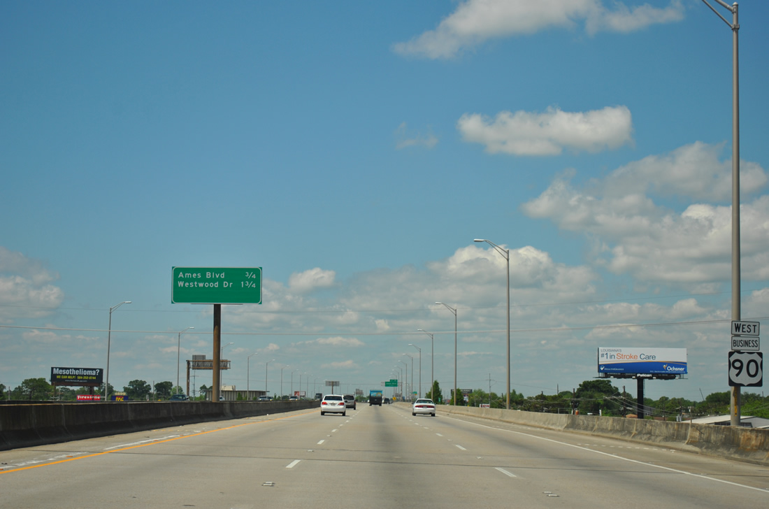
| Drivers bound for LA 45 (Barataria Boulevard), Avenue D and other points in Marrero depart U.S. 90 Business westbound at Exit 4B. LA 45 ends two blocks to the north at LA 18 (4th Street). 04/20/12 |
|
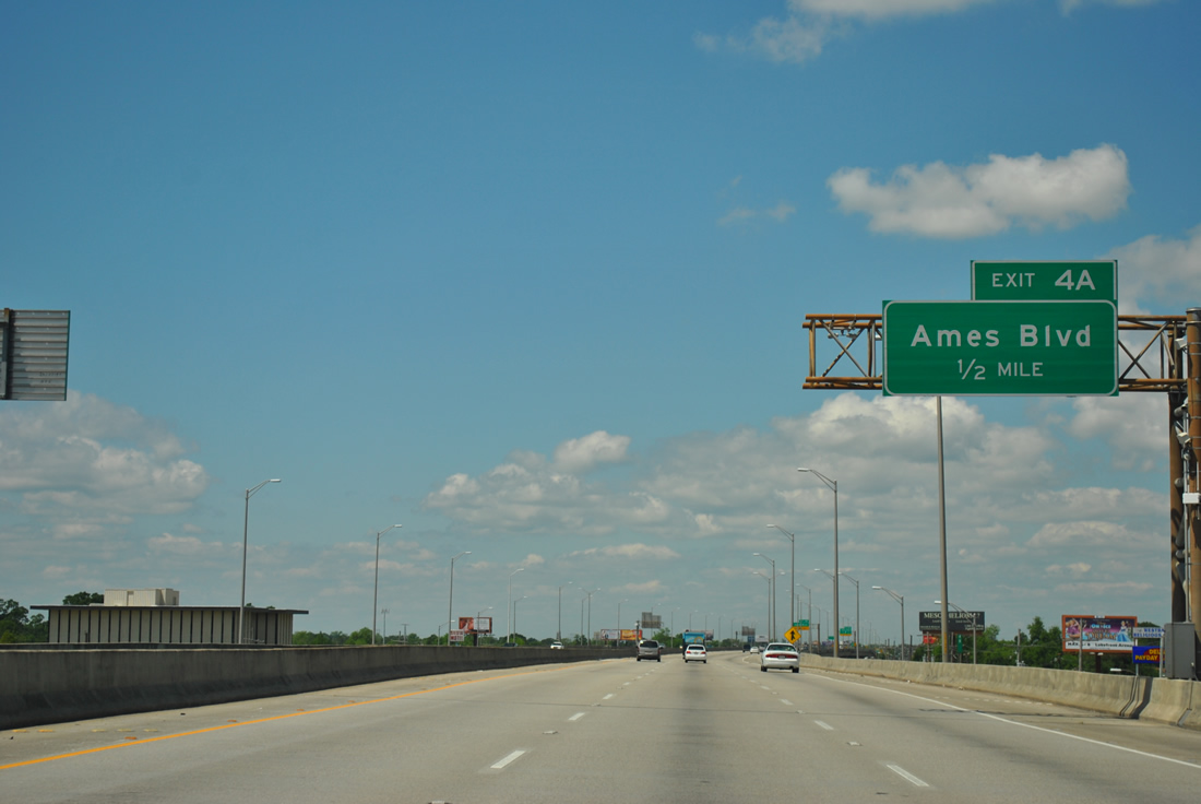
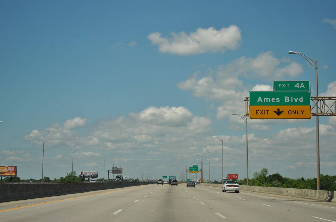
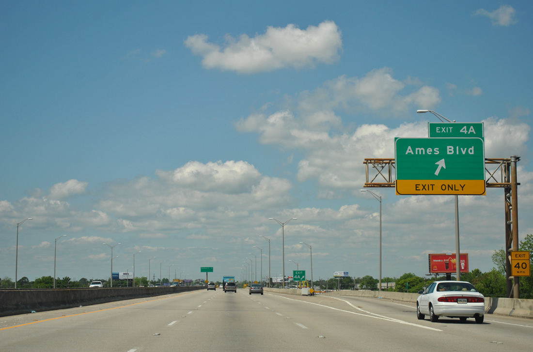
| U.S. 90 Business westbound reassurance shield and interchange sequence sign posted ahead of the half diamond interchange for Ames Boulevard (Exit 4A). 04/20/12 |
|
| The final exit at present for the Westbank Expressway is that of Exit 4A with Ames Boulevard. Ames Boulevard begins at Estelle and ends at LA 18 (4th Street) in Marrero. 04/20/12 |
|
| One quarter mile ahead of the Exit 4A off-ramp onto the westbound frontage road for Ames Boulevard. 04/20/12 |
|
| U.S. 90 Business westbound at the Ames Boulevard off-ramp (Exit 4). 04/20/12 |
|
| The freeway reduces to four lanes ahead of its transition onto the adjacent frontage roads. 04/20/12 |
|
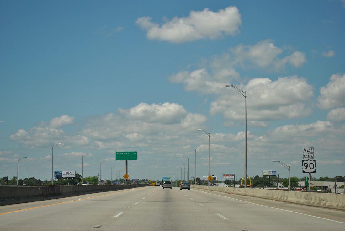
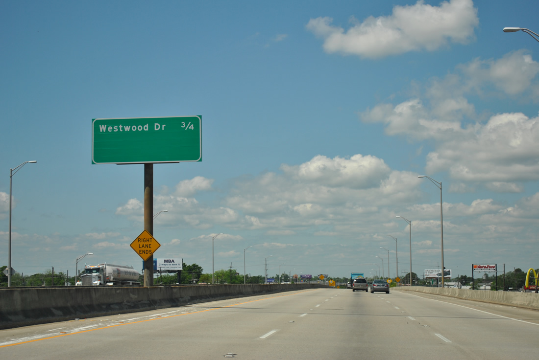
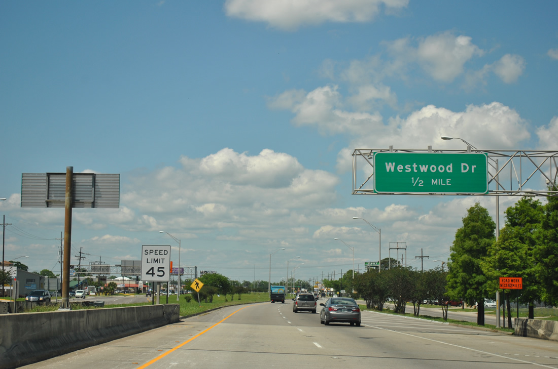
| Westwood Drive is the lone entry on the final interchange sequence sign along U.S. 90 Business westbound. 04/20/12 |
|
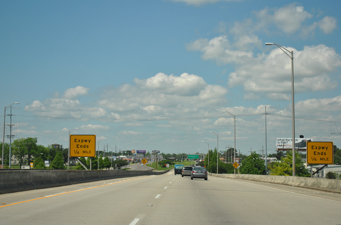
| A pair of expressway ends signs advise motorists of the freeway end for the Westbank Expressway. 04/20/12 |
|
| An overhead is placed for the upcoming intersection with Westwood Road. The north-south surface road travels between Lapalco Boulevard and LA 18 (4th Street). 04/20/12 |
|
| A wide grassy median lies between the east and westbound roadways of U.S. 90 Business for the eventual freeway continuation west. The Westbank Expressway is relegated to the frontage roads west to its merge with U.S. 90 at Avondale otherwise. The new Interstate 49 travel lanes are proposed to continue the existing freeway format west of Ames Boulevard upon completion. 04/20/12 |
|
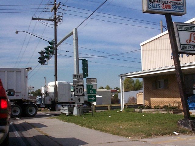
| U.S. 90 Business continues from Westwood Road at-grade to the terminus with U.S. 90 near Avondale. Pictured here is the southern terminus of LA 18 Spur (Louisiana Street) at Westwego. The spur route ends at LA 18 (4th Street) 0.66 miles to the north. 11/12/99 |
Page Updated 09-11-2012.

 West
West